Some of the snowmelt flowing in the Blue River as it joins the Colorado River near Kremmling, Colo., will reach the Lower Basin states. Dec. 3, 2019. Credit: Mitch Tobin, the Water Desk
Click the link to read the opinion piece on The Salt Lake Tribune website (Bruce Babbitt and Brian Richter). Here’s an excerpt:
Water managers and political leaders are attempting to stave off [water] bankruptcy by juggling water balances among the reservoirs, by holding back and delaying water releases and by looking to cloudless skies for relief that is not coming. As the crisis deepens these short-term patches will no longer suffice. The only way to secure the future is to devise a long-term plan to balance our accounts, to withdraw and use only that amount of water that the river provides each year. For a long-term sustainable plan, the states will need to build upon existing drought response measures agreed to in 2019, called the Drought Contingency Plan (DCP). The DCP has two parts: one governing the Lower Basin states of California, Arizona and Nevada and another for the Upper Basin states of Colorado, Utah, Wyoming and New Mexico.
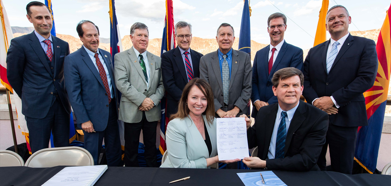
Signing ceremony for the Colorado River upper and lower basin Drought Contingency Plans. Back Row Left to Right: James Eklund (CO), John D’Antonio (NM), Pat Tyrell (WY), Eric Melis (UT), Tom Buschatzke (AZ), Peter Nelson (CA), John Entsminger (NV), Front Row: Brenda Burman (US), and from DOI – Assistant Secretary of Water and Science Tim Petty. Photo credit: Colorado River Water Users Association
The Lower Basin DCP sets out a schedule for California, Arizona and Nevada to achieve balance by reducing their use by 1.4 million acre-feet each year. To date these three states are less than halfway toward that target, having reduced withdrawals from Lake Mead by only 533,000 acre-feet each year. The DCP delays the remaining cuts by allowing the three states to continue depleting reserves in Lake Mead until the lake level approaches dead pool, at which point both power production and downstream releases are in jeopardy. The time for taking these risks, wagering that drought relief will soon arrive, is over. The Lower Basin states must agree to a definite timeline for making the remaining reductions.
The Upper Basin is even farther behind. The Upper Basin states have yet to set reduction targets, or even to agree on a procedure for making cuts.
Meanwhile the crisis deepens at Lake Powell, where waters have fallen to a level that threatens both power production and the integrity of the dam structure itself. A recent analysis by the Utah Rivers Council (“A Future on Borrowed Time”) demonstrates that Upper Basin states are presently diverting 500,000 acre-feet per annum more water than can be sustainably withdrawn under existing rules. If the Upper Basin states cannot soon reach agreement on necessary reductions, all options must be on the table. The federal Bureau of Reclamation has the regulatory authority to intervene to reduce water deliveries to federal irrigation projects in the Upper Basin states. Such an intervention in water allocation decisions, normally left to the states, would be unprecedented and unwelcome, but these are times that call for forceful action.
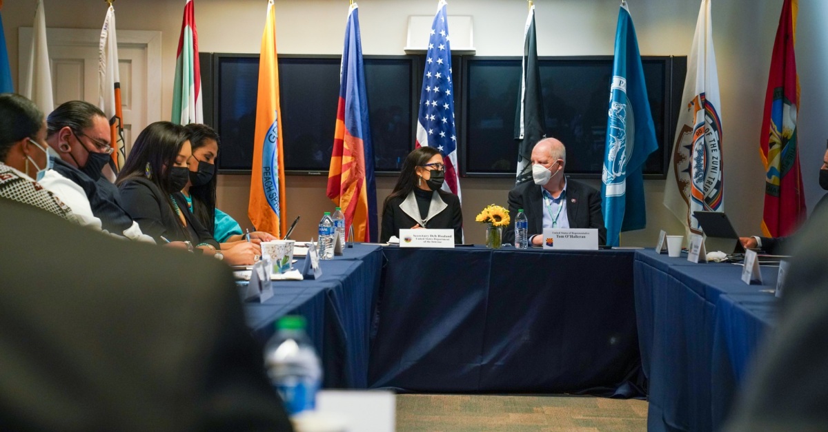
In remarks at the National Congress of American Indians 2022 Mid Year Conference today, Secretary of the Interior Deb Haaland announced the launch of the first-ever Secretary’s Tribal Advisory Committee (STAC).
The STAC, which was announced as part of the 2021 White House Tribal Nations Summit, will ensure Tribal leaders have direct and consistent contact and communication with the current and future Department officials to facilitate robust discussions on intergovernmental responsibilities, exchange views, share information and provide advice and recommendations regarding Departmental programs and funding that impact Tribal Nations to advance the federal trust responsibility.
“Tribes deserve a seat at the decision-making table before policies are made that impact their communities. Tribal members who are joining the first-ever Secretary’s Tribal Advisory Committee will be integral to ensuring Tribal leaders can engage at the highest levels of the Department on the issues that matter most to their people,” said Secretary Haaland. “I look forward to continued engagement and ensuring that the Department honors and strengthens our nation-to-nation relationships with Tribes.”
The STAC is composed of a primary Tribal representative from each of the 12 Bureau of Indian Affairs Regions (BIA), and one alternate member from each region. The members are appointed on a staggered term for up to two years. The Secretary, in consultation with the Assistant Secretary for Indian Affairs, will designate one member of the STAC to serve as chairperson.
The members of the STAC, listed by BIA Region, are below:
Alaska Region
Primary member: Robert Keith; President, Native Village of Elim
Alternate member: Gayla Hoseth; Second Tribal Chief for the Curyung Tribal Council
Eastern Region
Primary member: Kelly Dennis; Councilwoman, Shinnecock Indian Nation
Alternate member: Stephanie Bryan; Tribal Chair, Poarch Creek Indians
Eastern Oklahoma Region
Primary member: Gary Batton; Chief, Choctaw Nation of Oklahoma
Alternate member: Del Beaver; Second Chief, Muscogee (Creek) Nation
Great Plains Region
Primary member: Dionne Crawford; Councilwoman, Sisseton-Wahpeton Oyate for the Lake Traverse District
Alternate member: Cora White Horse; Councilwoman, Oglala Sioux Tribe
Midwest Region
Primary member: Whitney Gravelle; President, Bay Mills Indian Community
Alternate member: Michelle Beaudin; Councilwoman, Lac Courte Oreilles Band of Lake Superior Chippewa Indians of Wisconsin
Navajo Region
Primary member: Jonathan Nez; President, Navajo Nation
Alternate member: Daniel Tso; Council Delegate, Navajo Nation
Northwest Region
Primary member: Kat Brigham; Chair of the Board of Trustees, Confederated Tribes of Umatilla Indian Reservation
Lees Ferry, located 15 miles downstream of Glen Canyon Dam is the dividing line between the upper and lower Colorado River basins. Photo/Allen Best
Click the link to read the article on the Big Pivots website (Allen Best):
The Colorado River Basin has suffered a handful of extended, deep droughts. We’re in one of them. But as bad as the current drought is, leaving reservoirs far more empty than full, new evidence has emerged of an even worse drought. It occurred 2,000 years ago.
“The new findings should “help water managers plan for even more persistent and severe droughts than previously considered,” said Subhrendu Gangopadhyay, the lead author of the study that was published in Geophysical Research Letters. Gangopadhyay is principal engineer for the Water Resources Engineer and Management Group at the Bureau of Reclamation.
September 21, 1923, 9:00 a.m. — Colorado River at Lees Ferry. From right bank on line with Klohr’s house and gage house. Old “Dugway” or inclined gage shows to left of gage house. Gage height 11.05′, discharge 27,000 cfs. Lens 16, time =1/25, camera supported. Photo by G.C. Stevens of the USGS. Source: 1921-1937 Surface Water Records File, Colorado R. @ Lees Ferry, Laguna Niguel Federal Records Center, Accession No. 57-78-0006, Box 2 of 2 , Location No. MB053635.
The definition of average used by the team of researchers was the average of flows recorded at Lees Ferry since 1906. This location below Glen Canyon Dam is the official dividing line between the lower Colorado River Basin and the upper basin. The latter is where nearly all of the river flows originate, more than half in Colorado.
The new research finds that compared to the current 220-year drought in the Colorado River, with only 84% of average water flow, it was surpassed by a 22-year period in the second century, when the average water flow was 68% of average.
Farview Reservoir Mesa Verde NP
Paleoclimatologists have long known of severe droughts in the Colorado River. One occurred in the late 16th century, about the time Spanish colonists were staking claims in the Southwest, and others occurred midway through the 12th century, and again in the late 13th century, about the time the ancestral Pueblo were vacating cliff dwellings in Mesa Verde.
This new study stretches the record deeper into the past.
“This new finding suggests that the range of natural hydroclimatic variability in the Colorado River is broader than previously recognized, setting a new bar for worst-case scenario from natural variability alone,” the study concludes.
In other words, Mother Nature could deliver even worse.
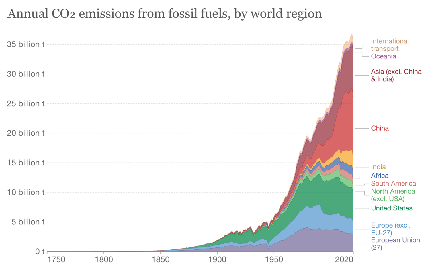
Annual CO2 emissions from fossil fuels, by world region
That’s not even including the effect of artificial heating of the atmosphere caused by accumulating greenhouse gases. Previous studies have calculated that a third to a half of the reduced precipitation is due to global warming.
New tree ring studies in Alaska help shed light on climate-change impacts to forests.
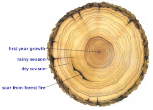
Paleoclimatologists have a variety of tools for establishing precipitation of past centuries. Tree rings reflect growing conditions, especially precipitation. Wider bands correspond with more moisture, narrower rings less.
These tree ring studies have been catalogued at many areas. For example, one of the researchers in the current study, Connie Woodhouse, then affiliated with the University of Colorado at Boulder but now with the University of Arizona, has studied Douglas fir trees near Eagle among many other places.
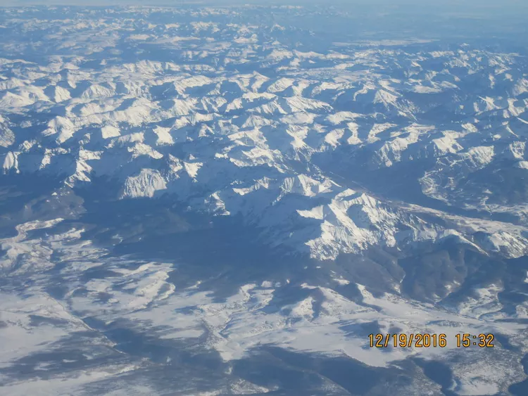
San Juan Mountains December 19, 2016. Photo credit: Allen Best
Prominent in this study was research conducted in the San Juan Mountains southwest of Alamosa, near the former mining site of Summitville. It is not in the Colorado River Basin but it does reflect the climate in the San Juan Mountains, which provides a tributary for the Colorado River. That particular site showed a severe drought in the second century, the driest in the last 2,250 years.
For this study, tree rings were not enough. There were just a few fragments. “Tree-ring records are sparse back in the second century,” said Woodhouse. “However, this extreme drought event is also documented in paleoclimatic data from lakes, bogs, and caves.”
Researchers also used statistical method called grid-point reconstructions.
The take-away, once again, is that the natural drought could lift from the Colorado River Basin next year. Or it could deepen.
As for the aridification caused by greenhouse gases in the atmosphere, we’re likely stuck with that even if a miracle occurs and the world figures out how to stop the production of carbon dioxide and other gases.