Click the link to read the article on The Denver Post website (Conrad Swanson). Here’s an excerpt:
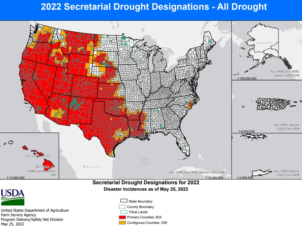
That patch, east of Steamboat Springs, covers a portion of southwest Jackson County and a sliver of Larimer County’s western border, accounts for just 1% of the state’s area, Drought Monitor data indicates. But it’s a start. The rest of the state still ranges in between “abnormally dry” and an “exceptional drought,” but recent rain and snowfall this week began nibbling away at those massive swathes of dry land…
Snowpack conditions in northern Colorado improved this week after a bout of storms, according to data collected by the U.S. Department of Agriculture’s Natural Resources Conservation Service.
Scott Hummer sent the photos below via email yesterday.
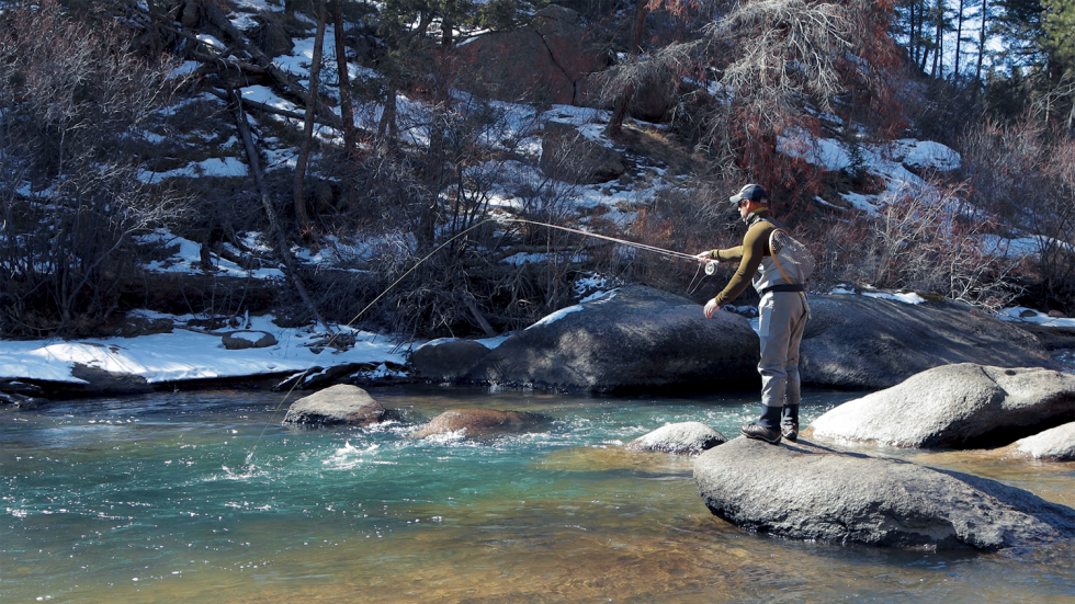
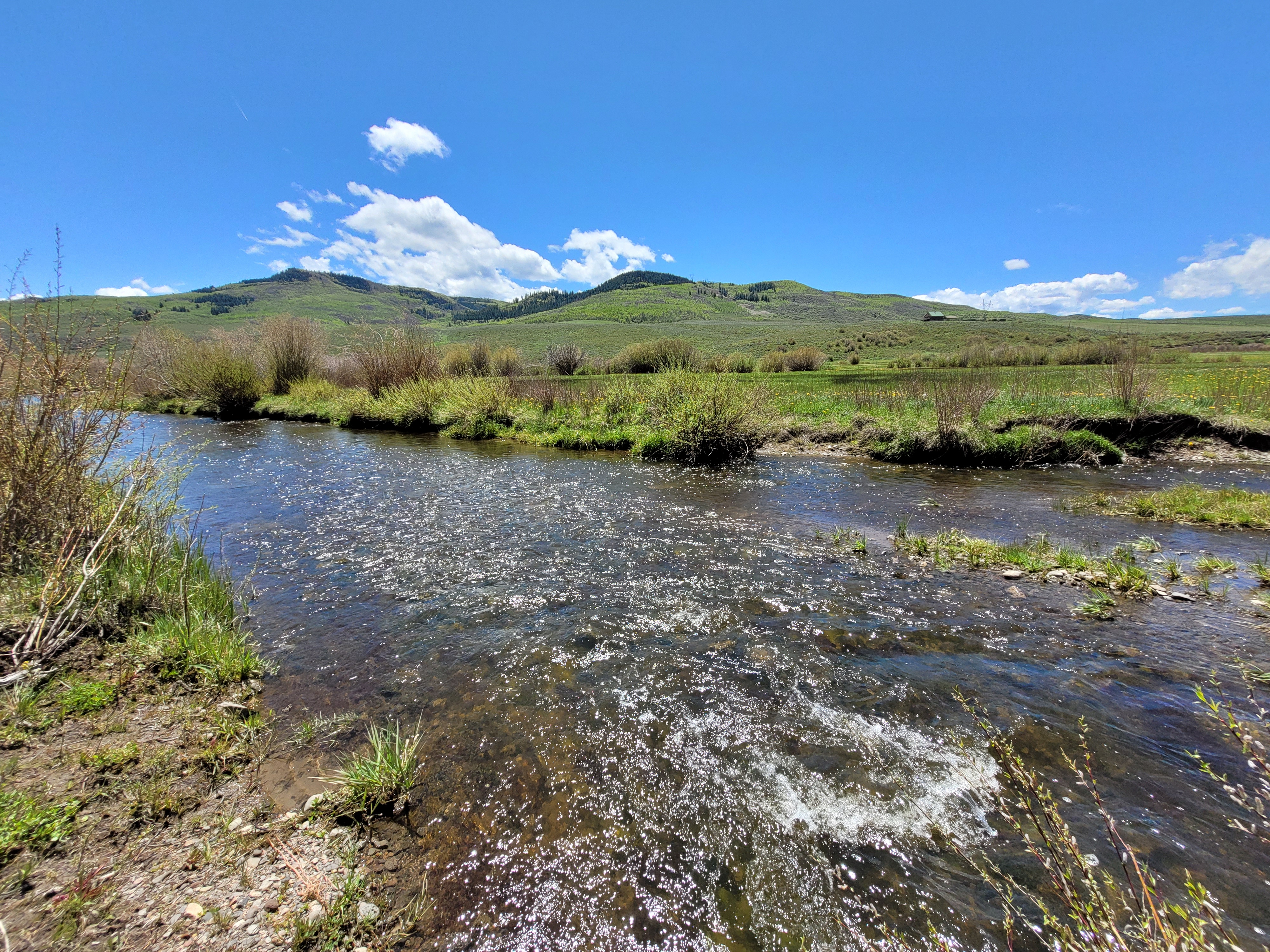
Yampa River below North Side Ditch… 6-1-22 30 CFS & Dropping. Photo credit: Scott HummerYampa River below Oakton Ditch 6-1-22. Photo credit: Scott Hummer
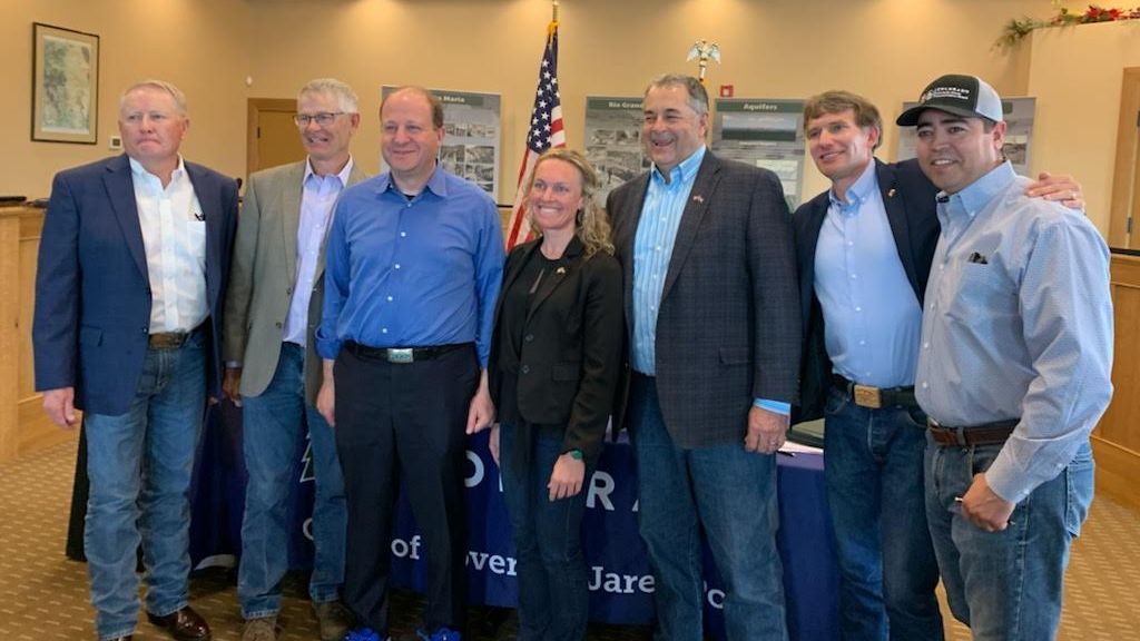
Colorado’s land, water, wildlife and forests saw increased funding, programs and support that will save Coloradans money and protect our great outdoors as the Colorado Department of Natural Resources outlined its 2022 legislative successes and accomplishments.
“The 2022 legislative session saw new investments and resources for Colorado’s land, water, forests, and people,” said Dan Gibbs, Executive Director, Colorado Department of Natural Resources. “Working with our legislative champions and Governor Polis we were able to secure $60 million in federal stimulus funds to help farmers and ranchers in the drought stricken and groundwater resource constrained Republican River and Rio Grande River basins. We have new funding and resources for wildlife highway crossings, forest mitigation and watershed projects, new state parks, outdoor recreation, water projects and orphaned wells, and increased support for our backcountry search and rescue crews, among other accomplishments. We greatly appreciate the support of legislators, the Governor, local governments and many in the nonprofit community who championed more support for Colorado’s outdoors, water, forest and lands. These programs will help save Coloradans money as we build off our reduced state parks pass program through the Keep Colorado Wild pass and protect our natural resources. We look forward to moving quickly on these important policies and resources to benefit all Coloradans.”
Highlights Include:
Relief for Farmers and Ranchers in the Republican and Rio Grande Basins – SB22-028: Appropriates $60 million from the Economic Recovery and Relief Cash Fund to accelerate progress on meeting groundwater sustainability deadlines in the Rio Grande and Republican river basins in coordination with the Division of Water Resources, the Rio Grande Water Conservation District and the Republican River Water Conservation District.
Safe Crossings For Colorado Wildlife And Motorists – SB22-151: Creates the Colorado Wildlife Safe Passage Cash Fund to provide funding for projects that provide safe road crossings for connectivity of wildlife and reduce wildlife-vehicle collisions, and allocates $5 million to help the Colorado Department of Transportation leverage federal dollars to build more wildlife highway crossings in consultation with Colorado Parks and Wildlife. This will help drivers save money, make our roads safer and protect our iconic wildlife.
Investments in our Parks and Recreation to meet Demand for Coloradans Love of Outdoors and our State Parks – HB22-1329 : Appropriates $5.9 million and new staff for CPW to advance the goals of the Future Generations Act to improve wildlife populations, increase the number of fish stocked, maintain parks and wildlife areas and respond to the impacts of rapid population growth and increasing outdoor recreation. The bill also appropriated $860,000 for CPW’s Colorado Outdoor Regional Partnerships Program and $515,000 to work with partners to develop Colorado’s next state park at Sweetwater Lake.
New Support for Backcountry Search and Rescue Teams: SB22-168: Responds to the needs of nearly 2,800 backcountry search and rescue (BSAR) responders by providing $1 million to support BSAR volunteers, including providing mental health programs, and allows search and rescue volunteers (and their beneficiaries) to receive educational benefits if they are injured, or if they die while on a search and rescue incident.
Creating an Enterprise to Clean up Orphaned Oil and Gas Wells – SB22-198: creates the Orphan Wells Mitigation Enterprise Fund to clean up old oil and gas well sites, reducing pollution and providing cleaner air for Coloradans. The landmark bipartisan legislation creates an enterprise to collect mitigation fees to fund the plugging and reclamation of orphaned oil and gas wells.
Increase Colorado’s capacity to enhance watershed health and wildfire mitigation: HB22-1379: invests $20 million of American Rescue Plan Act funding in the Colorado State Forest Service’s Healthy Forest, Vibrant Communities fund to conduct wildfire mitigation work to protect watersheds, the Colorado Water Conservation Board to fund grants in the Watershed Restoration Grant Program, to the Department of Natural Resources to enhance its Colorado Strategic Wildfire Action Program, and in technical assistance and local-capacity to secure federal funding for projects that promote watershed and forest resilience.
Innovative Turf Replacement Initiative – HB22-1151: directs the Colorado Water Conservation board to provide $2 million for state matching funds for turf replacement programs to promote water-wise landscaping to protect our water.
Improve State Tree Nursery to Create more Climate Resiliency – HB22-1323: provides $5 million for improvements to the Colorado State Forest Service’s tree nursery to substantially increase its capacity to provide low-cost, native and climate-adapted trees; to build climate-resilient watersheds and forests; and to enhance carbon storage to meet the state’s climate mitigation goals.
Protecting and Investing in Colorado’s Wildlife – HB22-1329: includes an additional $1 million in general funds for CPW to support voter approved wolf reintroduction and management activities. Because of this support, funding for wolf reintroduction will not come from revenues from hunting or fishing license sales.
The Colorado River from Navajo Bridge below Lee’s Ferry and Glen Canyon Dam. The proposed Marble Canyon Dam would have been just downstream from here. Jonathan P. Thompson photo.
Reading and listening to accounts of running the Colorado River and its tributaries before the dams came can be heartbreaking because it reminds us of all that has been lost. Imagine what Tiyo, the Hopi boy who piloted a cottonwood raft from somewhere in Glen Canyon to the Sea of Cortez long, long ago, saw on his journey. Consider the experiences of John Wesley Powell, E.C. La Rue, Emery Goodridge, Bert Loper, and, albeit not on a boat, Everett Ruess. Those experiences cannot be duplicated, even in some modern form. Where once ran water wild and free, now are still and stagnant reservoirs held back by giant, concrete monoliths.
But sometimes when I read old papers about the Colorado River Basin, I become grateful, as well, knowing that it could have been a heck of a lot worse. Such is my experience recently as I’ve made my way through the 1946 Bureau of Reclamation report titled: The Colorado River: A Natural Menace Becomes a National Resource1.
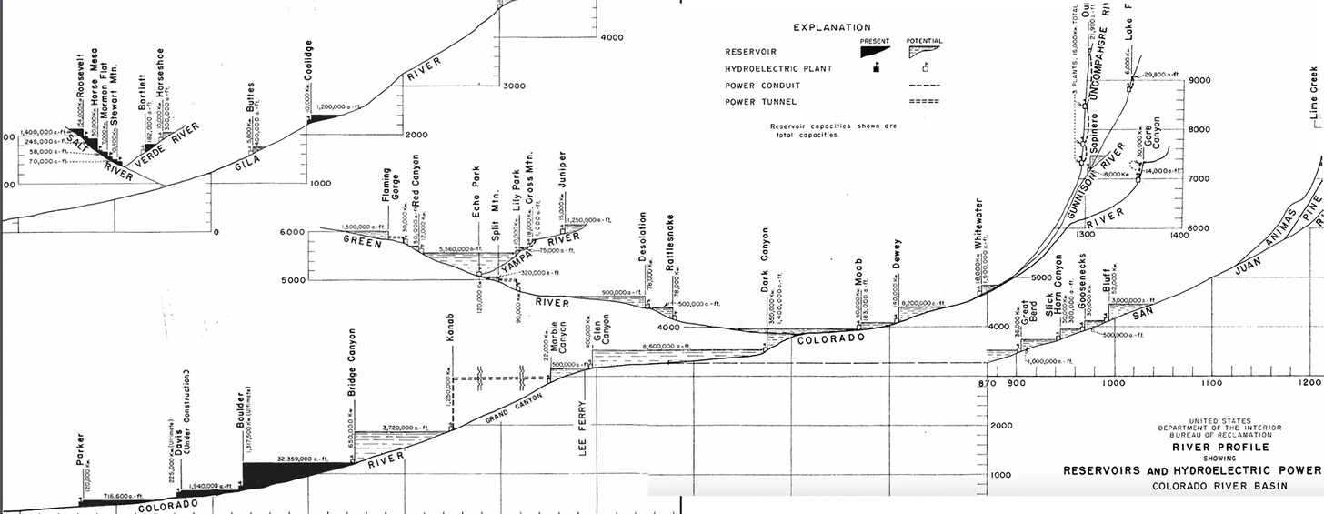
The rather off-putting name, aside, the 300-page report is a fascinating read, chock full of information about population in the Basin, industries, and so forth. But it’s also a blueprint for plumbing the Colorado River system, from the headwaters to the Sea of Cortez, with diversions, dams, canals, hydropower plants, tunnels, and trans-basin exports. That’s the insane part.
As I read the report, instead of envisioning all that had been lost to development, I imagined what the West would look like had the water buffalos realized all of their dam dreams. It’s scary. Nary a mile of river would have remained unaltered. They had plans for dams in the Grand Canyon, in Glen Canyon, in Cataract Canyon; on the Green and the Yampa; in Echo Park and in the Goosenecks of the San Juan; and, perhaps most byzantine, the Animas-La Plata project (which I’ll get to in a moment). But first, a little sampling of potential projects:
The Glen Canyon Project: The proposal is similar to what was eventually realized. Notable quote from the report: “This lake would have unusual recreational opportunities.”
Dark Canyon Project: This dam would have been on the Colorado River a few miles above the current Hite bridge and the reservoir would have inundated all of Cataract Canyon and stretched to the edge of Moab and almost to Green River.
The Moab Project: A dam on the Colorado just upstream from Moab with a reservoir stretching all the way to the Dewey Bridge.
Dewey Project: A dam on the Colorado three miles downstream from its confluence with the Dolores River. The 8.2 million acre feet reservoir would have extended 55 miles up the Colorado and 20 miles up the Dolores and would have inundated Cisco. From the report:
“The town of Cisco, population 53, lies entirely within the reservoir site but if relocated on the reservoir shore line and on both a railroad and transcontinental highway, it should have ample opportunity to become a resort center.”
Echo Park Project: A dam on the Green River 3.5 miles below its confluence with the Yampa with a lake that would inundate Dinosaur National Monument. This is the reservoir David Brower and the Sierra Club—with help from the coal industry, which didn’t want more hydroelectric competition—were able to stop.
Bluff Project: A dam on the San Juan River just below Comb Wash. It would have put the town of Bluff under about 100 feet of water.
Goosenecks Project: A 500,000 acre foot reservoir with hydroelectric dam some 43 miles downstream from Bluff.
Slick Horn Canyon Project: Another San Juan River dam, probably just below Slick Horn Canyon.
This diagram showing some of the madness … er, proposed dams … is best viewed at http://LandDesk.org.
And now for the big doozy: The Animas-La Plata Project in Southwestern Colorado. Now, I know some of you will think, Here he goes, talking about the Animas River again. And, yeah, I get it. But as crazy as all of the aforementioned proposals are, this one was more complex and convoluted and involved than any of the others.
From 1946 “Menace” report, USBR. Credit: The Land Desk
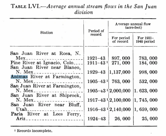
The Animas-La Plata project was first conceived of in the early 1900s. It was intended to move water from Animas River to the “Dry Side” in the La Plata River watershed, about a dozen miles west of the Animas. The Dry Side has oodles of fertile, flat farmland, but not enough water to irrigate it; the Animas Basin has relatively reliable and abundant flows of water, but not a lot of farmable land. The A-LP would provide “supplemental water for 24,700 acres of insufficiently irrigated land in the La Plata River Basin and a full supply for 86,300 acres of new land in that basin and adjacent areas, including 25,500 acres under the Monument Rock project on the Navajo Indian Reservation.”
You might think this would be simple: Just tunnel through the divide between the two watersheds and send the water through. But that’s not nearly as fun as building nine reservoirs, miles of canals and tunnels and conduits, and a handful of hydropower plants. Here’s the rundown:
An aqueduct would be built near Silverton to catch water from Mineral Creek and Cement Creek and deliver it to the 54,000 acre feet Howardsville Reservoir on the Animas upstream from Silverton. From there, a pressure conduit would send water to a 12 megawatt power plant in Silverton.
A dam on the Animas at Whitehead Gulch, about four miles below Silverton. Silverton Reservoir would only be about three miles long (and would not inundate Silverton, but would flood the railroad tracks), as its main purpose is for hydropower production and to divert water through a tunnel to the Lime Creek drainage, where …
… another dam would be built, presumably just above the confluence with Cascade Creek. In addition to the water from Silverton Reservoir, the Lime Creek Reservoir would also get “unregulated inflows from Cascade Creek through a collection conduit and tunnel.” And, from Lime Creek another tunnel would lead back through the West Needles to a power plant on the Animas River w/ a static head of 1,155 feet and installed capacity of 40 megawatts. Wow.
The dam for the 140,000 acre feet Teft Reservoir would be on the Animas River somewhere below Tefft (the proper spelling) Spur (close to the Cascade Wye). Maybe it would be in the Rockwood Gorge, but I’m not sure. Water would back up into Cascade Creek and, most likely, would inundate Needleton. The railroad tracks would be underwater.
The main project canal—the one that takes water over to the La Plata—would begin at or just below Teft Dam and go along the west side of the Animas River, intercepting the flows of Hermosa, Junction, and Lightner Creeks, along with storage releases from …
… Hermosa Park Reservoir (25,000 acre feet) on Hermosa Creek. That would add an interesting twist to skiing the backside of Purgatory. Ice skating, anyone?
Whether the canal would skirt Durango, or would cross higher ground west of Durango is not clear. But somehow it would wend its way westward, and would “cross the Animas-La Plata Divide northeast of Fort Lewis College and extend across the La Plata River Valley to the Dry Side. It would continue southwest along the Mancos-La Plata Divide to the head of Salt Creek,” which in turn would serve the …
… Monument Rocks Reservoir (20,000 af) and project lands below it, located north of Shiprock.
Long Hollow Reservoir (14,000 af) would be “connected the La Plata River by inlet and outlet canals.” Another canal from Long Hollow would irrigate the McDermott-Farmington Glade area near Colorado-New Mexico state line. (Note: This is the only component of the 1946 plan that got built).
State Line Reservoir (32,000 af) would straddle the State Line on the La Plata River. A canal would lead from there to the southwest to …
… Meadows Reservoir (11,400 af).
The Land Desk’s rendering of the 1946 description of the proposed Animas-La Plata Project in Southwest Colorado. Legend: Pink Box=Dam; Blue Line=River/Creek; Green Line=Canal; Dotted Black-Orange Line=Tunnel.Lake Nighthorse and Durango March 2016 photo via Greg Hobbs.
The Animas-La Plata Project ultimately was built, but it looks nothing like this. It’s a single off-stream reservoir, Lake Nighthorse, filled with water pumped uphill from the Animas River. A small amount of water is piped westward, but it doesn’t make it to the Dry Side. In fact, the water—much of which belongs to the Ute Mountain Ute and Southern Ute Tribes—mostly is just sitting there, providing a nice place for Durangoans to cool off on hot summer days. There currently is no mechanism for delivering the water to the tribes. Long Hollow Reservoir was also constructed later, but separately from the A-LP.
Excerpt from the 1946 “Menace” report. Credit: The Land Desk
Most of the other projects on the water buffalo wishlist didn’t come to fruition, either, and Cisco, Utah, won’t be a lakeside resort town anytime soon.
The Land Desk is about to take the old Silver Bullet on the road to do some reporting. You know how we fund this stuff? With your subscriptions! We got no ads, no corporate sponsors, no fancy grants — just you (which is a lot). So, yeah, the Bullet is pretty darned fuel efficient, but still with gas prices these days? We sure could use your help. Thanks! — Subscribe