Coalition offers help to parched #ColoradoRiver — @COWaterTrust #COriver #aridification

Here’s the release from the Colorado Water Trust (Dana Dallavalle Hatlelid):

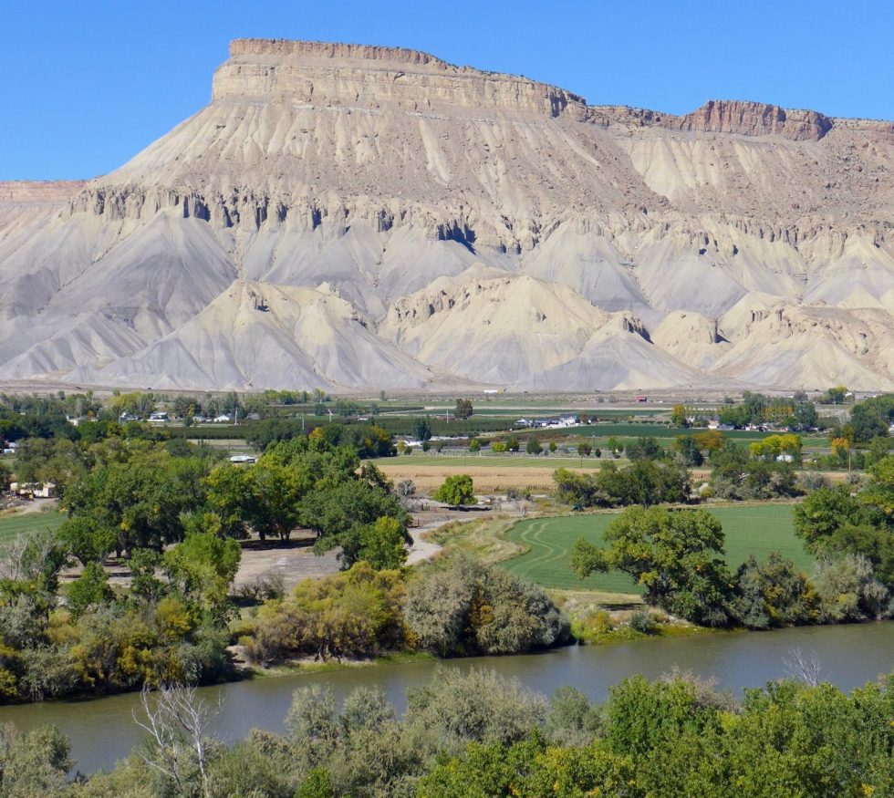
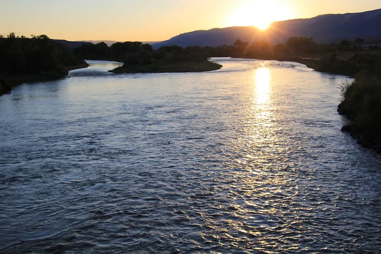
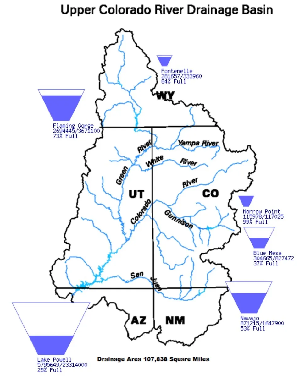
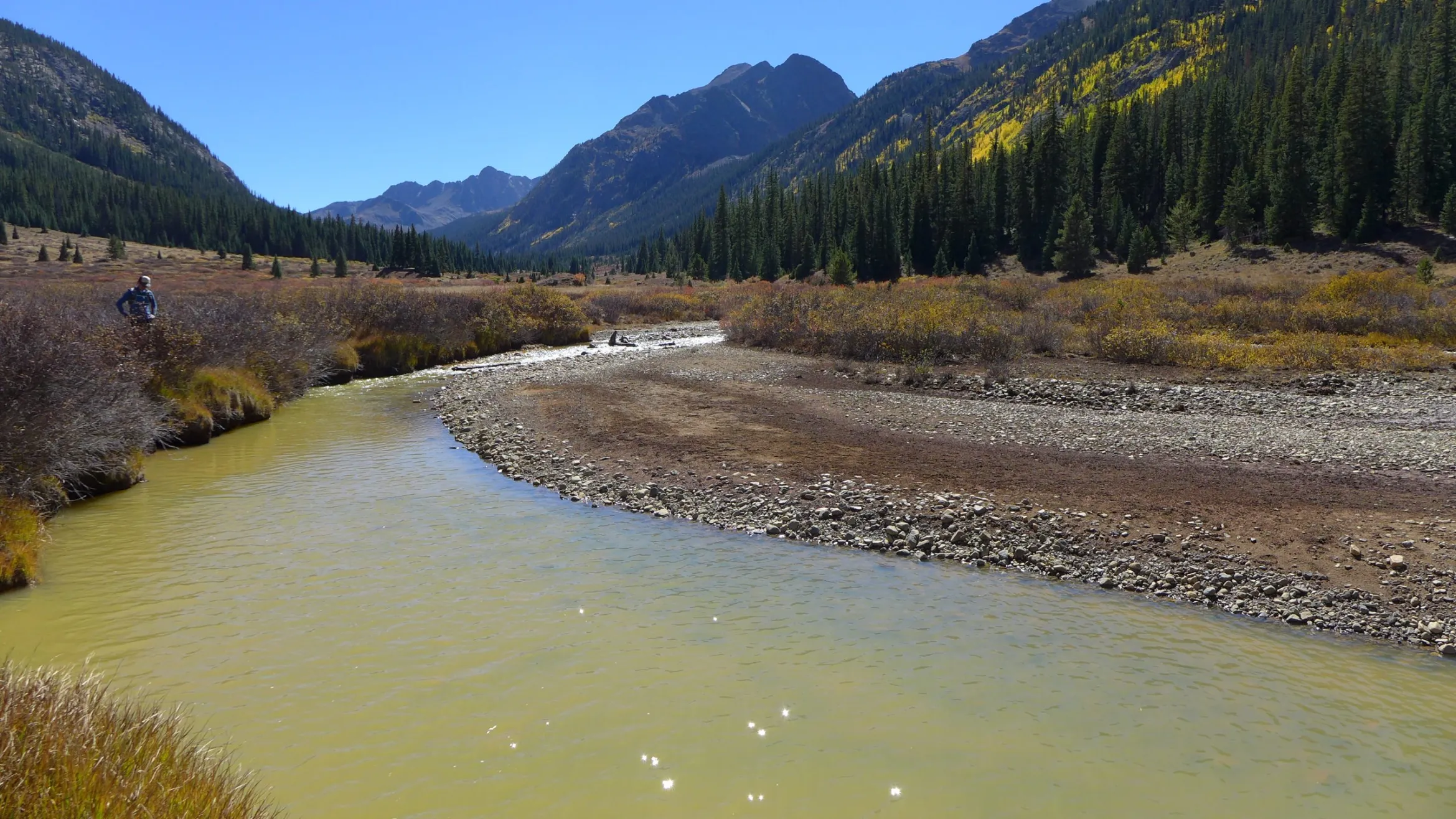
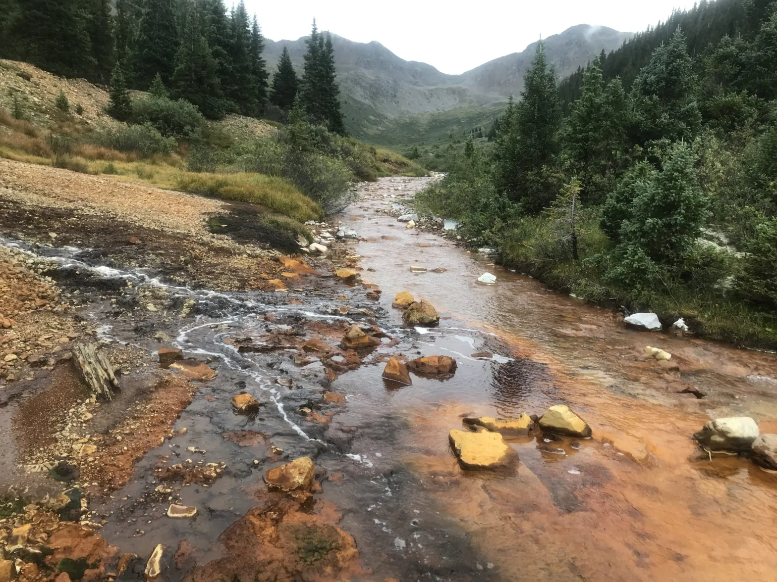
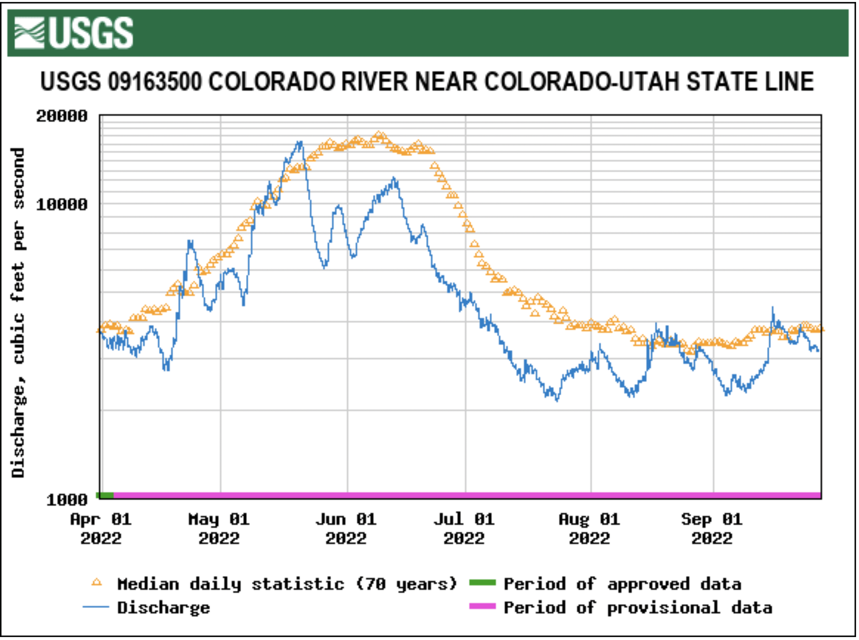
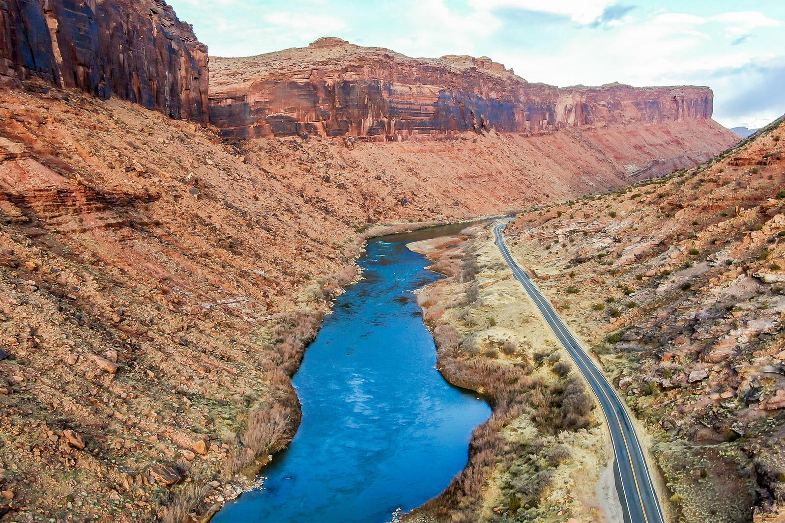
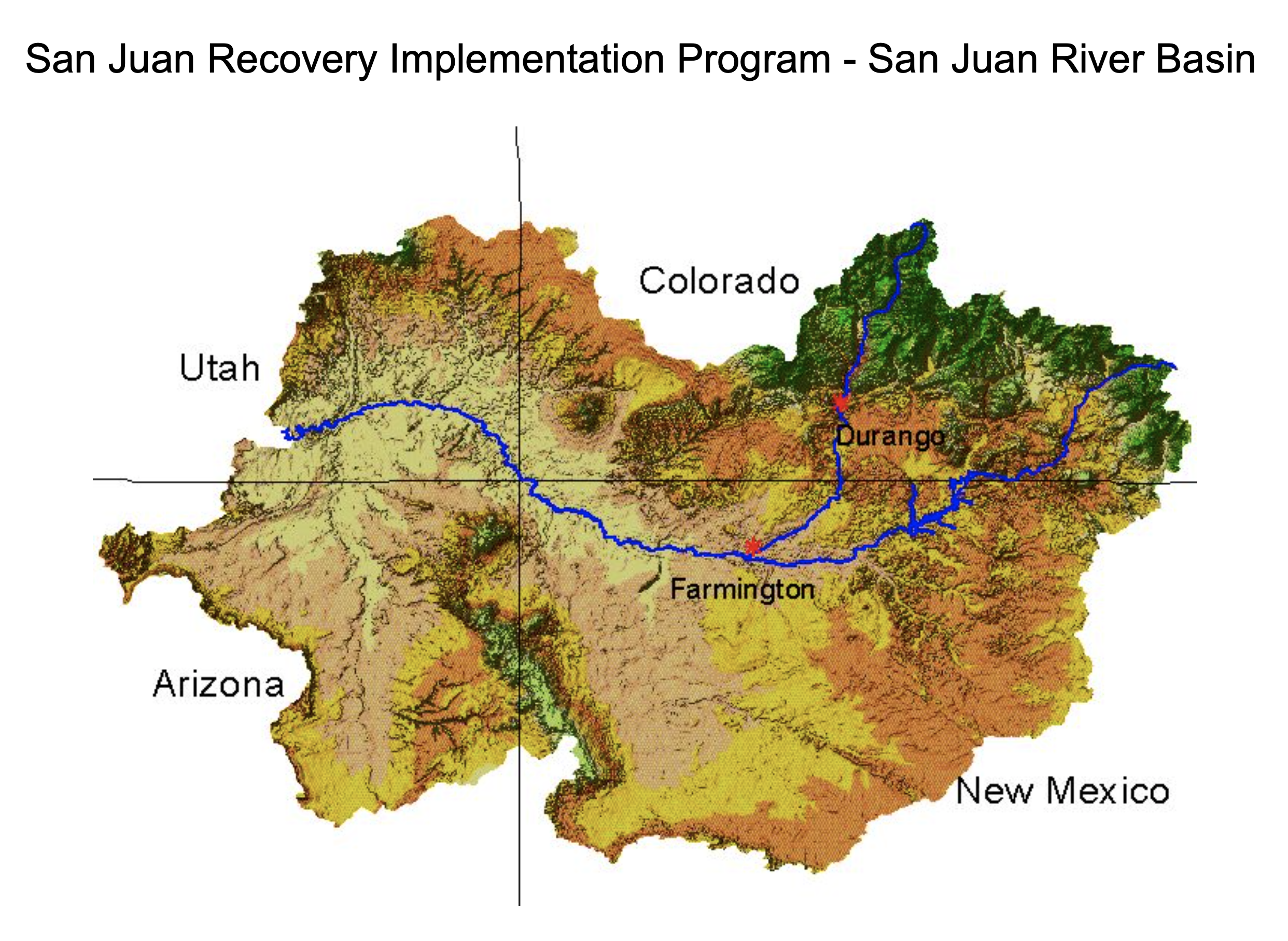
Responding to drought and summer long low-flow conditions on the Colorado River, a coalition of groups and funders led by Colorado Water Trust is restoring water to the river. Colorado Water Trust deliveries began 9/25/22 and continue at a 150 cfs (cubic feet per second) rate. That rate will drop to 100 cfs over the weekend and continue through 10/20/22, most likely tapering to 50 cfs on 10/11. Division of Water Resources confirmed they will administer Colorado Water Trust’s water to the 15-Mile Reach based on average monthly flows being below the Upper Colorado Endangered Fish Recovery Program’s 810 cfs target. Total water restored will be 4500 acre-feet (1.46 billion gallons). The hard work and generosity of our partners enabled us to provide the needed water supply just in time to keep the river flowing at healthier levels in designated critical habitat, including the 15-Mile Reach just east of Grand Junction.

Philanthropic and funding partners include Western Colorado Community Foundation, Lyda Hill Philanthropies, Intel Corporation, Bonneville Environmental Foundation, Nite Ize, and the National Fish and Wildlife Foundation.

Fryingpan River downstream of Ruedi Reservoir. Photo credit Greg Hobbs

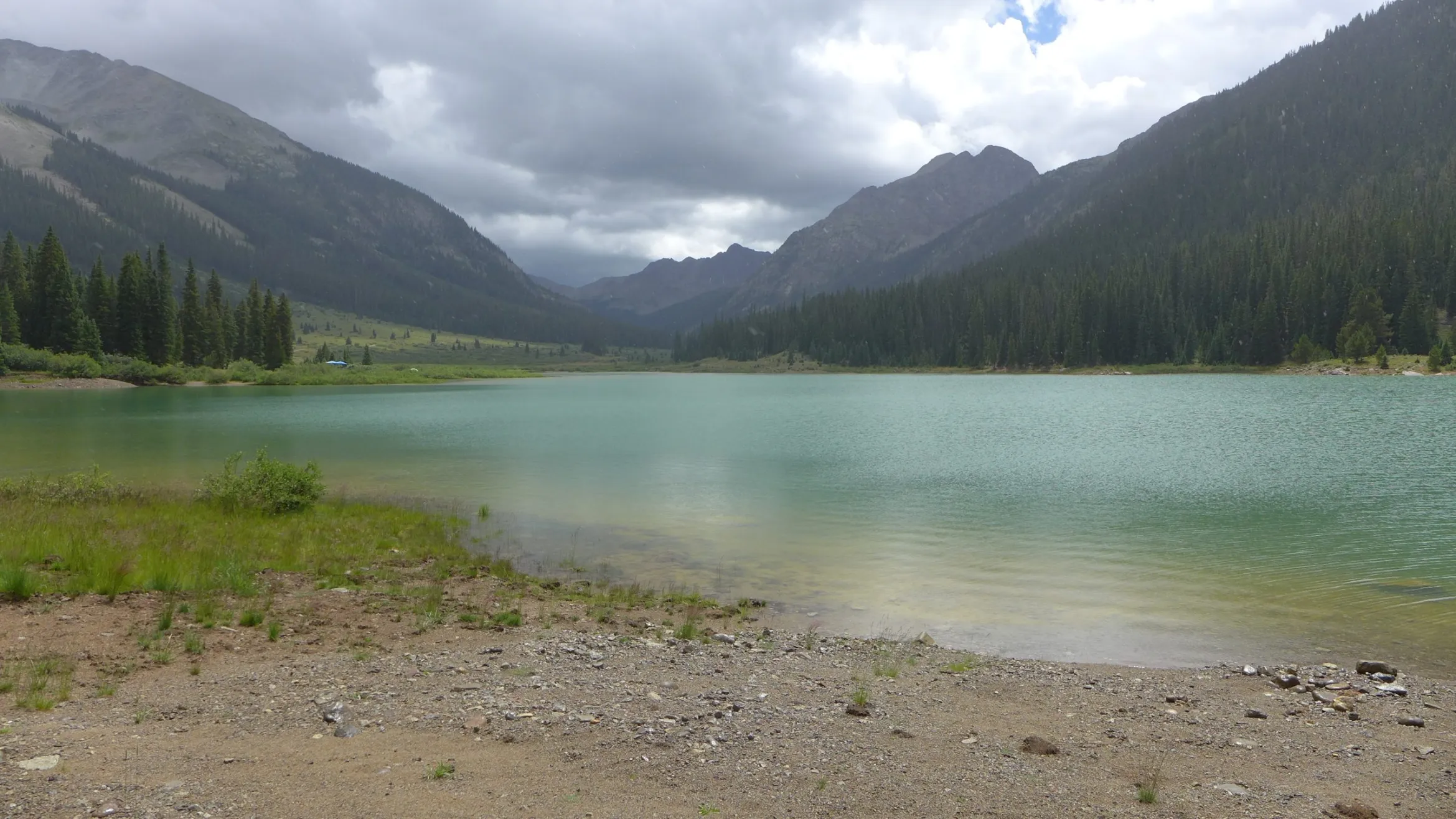
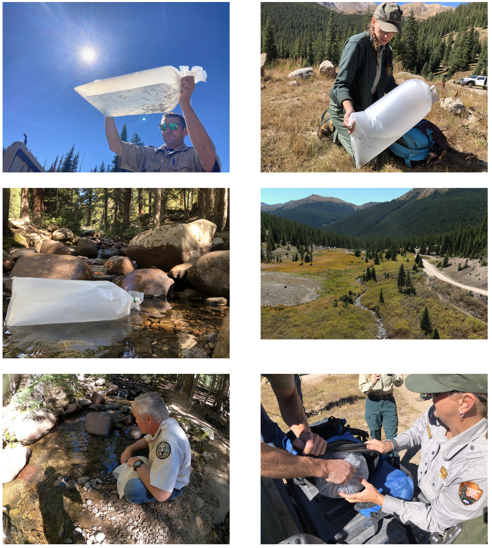
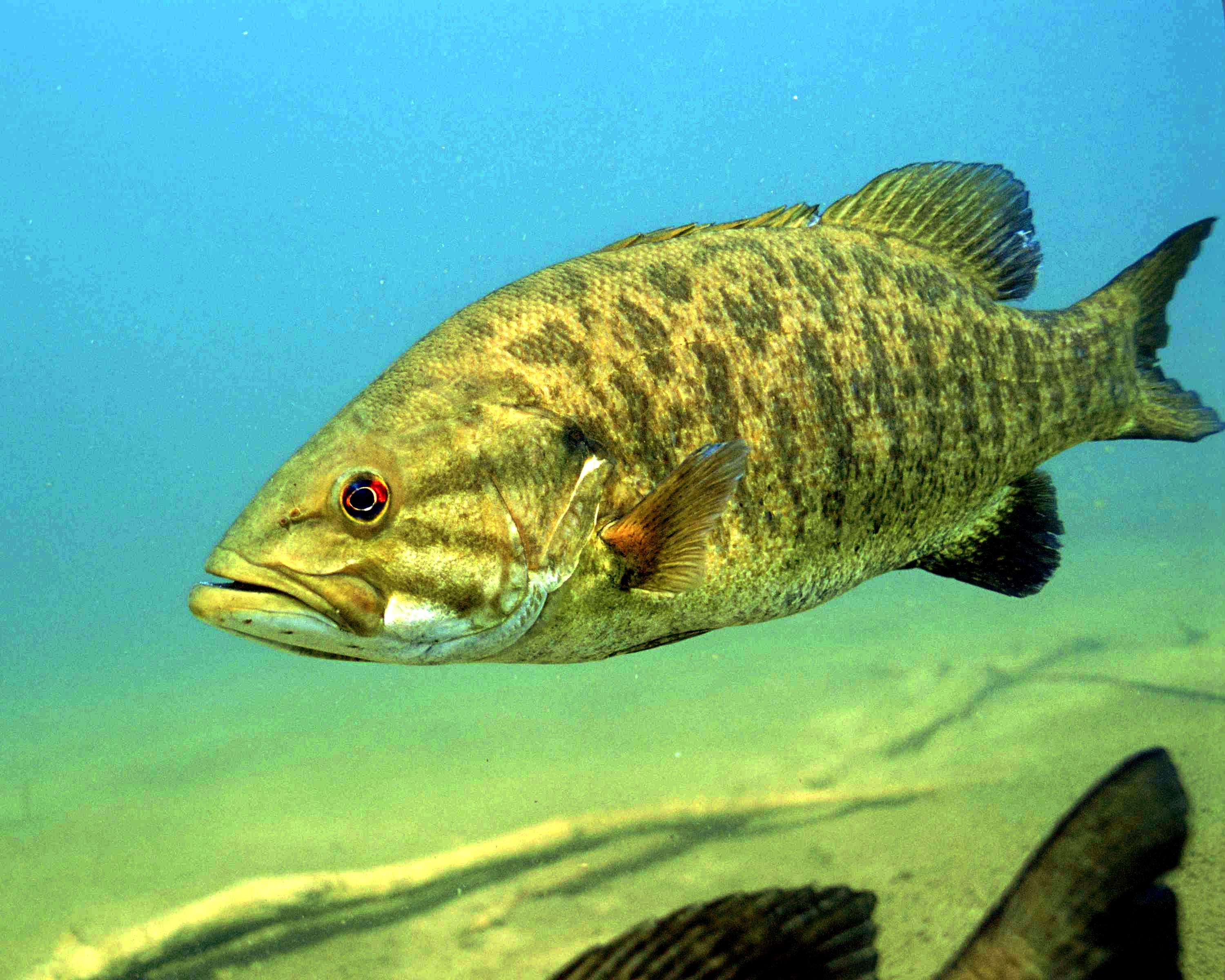
Colorado Water Trust and the Upper Colorado River Endangered Fish Recovery Program have arranged for a release of water from Ruedi Reservoir to the Fryingpan, Roaring Fork, and Colorado rivers. The water will be designated for improving flow conditions for endangered fish in the 15-Mile Reach. The flows will support four species of endangered and threatened fish, including the Colorado pikeminnow, humpback chub, bonytail, and razorback sucker, as well as indirectly supporting agricultural water deliveries and the regional recreational economy.

“The corporations and individuals that stepped up to allow us to make these large additions to the Colorado’s flow are the community-minded heroes of this drought year. In the future, ever more creative ways will have to be found to share the water that Nature gives us, with each other and with Nature itself,” says Andy Schultheiss, Executive Director of Colorado Water Trust. “As we continue to experience the impacts of a changing climate, we will have to find ways to adapt to the new paradigm.”

Colorado River in Grand Junction. Photo credit: Allen Best

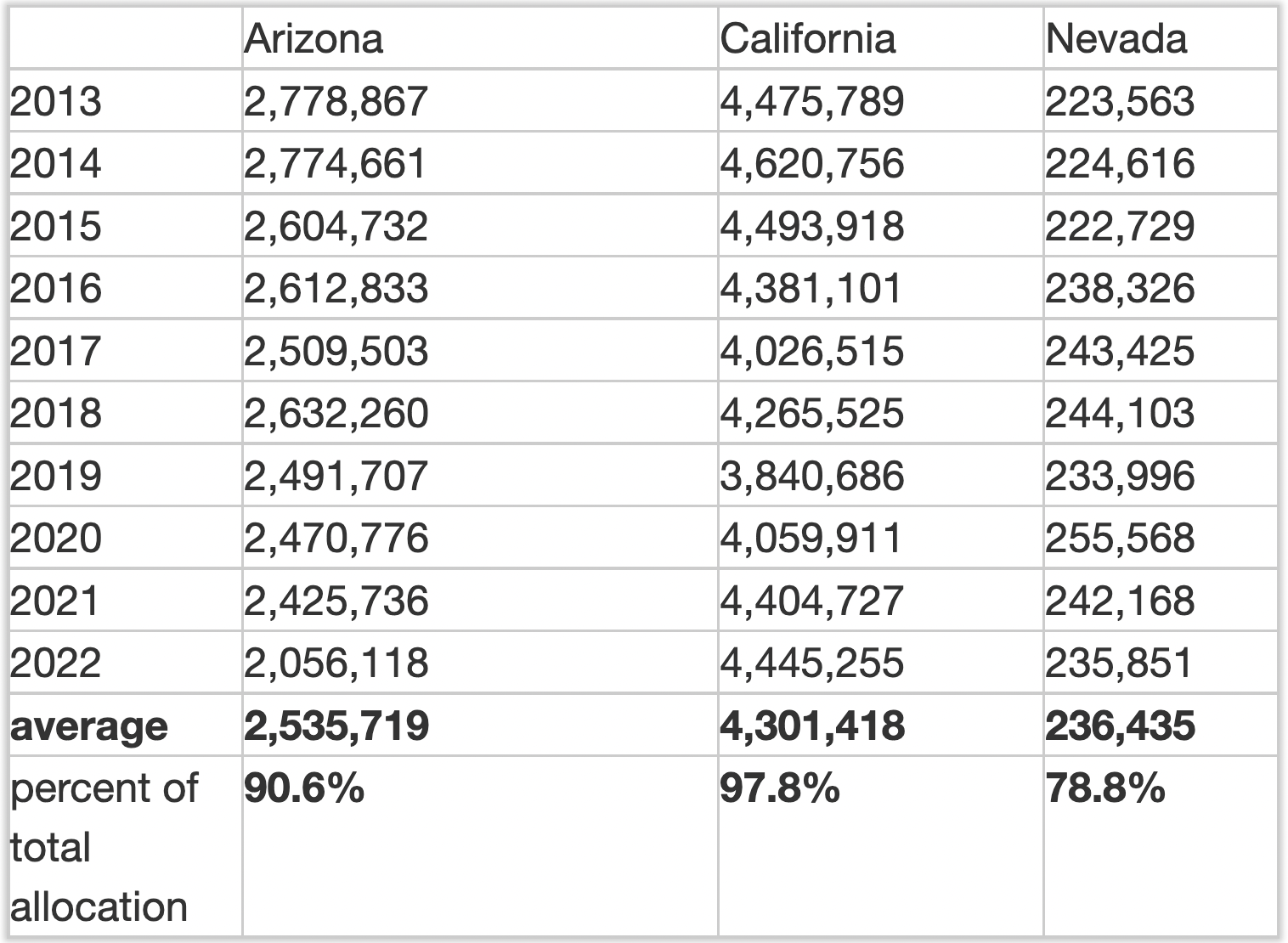
Between 2019 and 2021, Colorado Water Trust delivered over 6028 acre-feet of water to the Colorado River (nearly 2 billion gallons). In a typical year, Colorado Water Trust works closely with Grand Valley Water Users Association and Orchard Mesa Irrigation District to identify when there is available capacity in the Grand Valley Power Plant for hydropower generation. This year, thanks to partial support from Colorado Water Trust, the Grand Valley Power Plant is undergoing much needed reconstruction. Until the new plant is complete, Colorado Water Trust will designate the water released for endangered fish protection and not hydropower generation at the Power Plant. Colorado Water Trust also works closely with the Upper Colorado River Endangered Fish Recovery Program to determine when the 15-Mile Reach needs supplemental water most to support the fish.

Orchard Mesa Irrigation District and Grand Valley Water Users Association have been collaborating with the Colorado Water Trust and their contributing partners for the last several years. Our partnership helps those of us in the Grand Valley and 2200 other water diverters maintain the Endangered Species Act compliance. We look forward to our continued collaboration with the Colorado Water Trust,” says Mark Harris of Grand Valley Water Users Association.

“Intel commends the Colorado Water Trust for their important work to support the health of the Colorado River,” says Fawn Bergen, Intel’s Corporate Sustainability Manager. ”Intel’s support for this project brings us closer to our goal of reaching net positive water by 2030, and we are proud to help sustain this vital habitat; a healthy river supports healthy communities.”

We are extremely grateful to the Colorado Water Trust for providing releases to support endangered fish during another challenging water year. These releases will improve habitat in the 15-Mile Reach during an especially stressful time of year,” says David Graf, Instream Flow Coordinator for the Upper Colorado River Endangered Fish Recovery Program. “The Recovery Program has shown that collaborative conservation can enhance populations of endangered fish while also meeting water user needs. These efforts by the Colorado Water Trust, Orchard Mesa Irrigation District, and Grand Valley Water Users demonstrate that with creative thinking and hard work, partnerships can find solutions that support humans and the environment.”

Map of the Roaring Fork River drainage basin in western Colorado, USA. Made using USGS data. By Shannon1 – Own work, CC BY-SA 4.0, https://commons.wikimedia.org/w/index.php?curid=69290878

The Roaring Fork Conservancy also helps to inform Colorado Water Trust of conditions on the Fryingpan and Roaring Fork Rivers so that releases will complement flows on the stream sections between Ruedi Reservoir and the Colorado River. This year, the water released from Ruedi Reservoir will serve a few purposes before it supports the health of endangered, native fish in the Colorado River in the 15-Mile Reach. The water will bring flows in the Fryingpan River closer to their average, and will cool water temperatures on the Roaring Fork River.

ABOUT COLORADO WATER TRUST: Colorado Water Trust is a statewide nonprofit organization that works collaboratively with partners all across Colorado on restoring flow to Colorado’s rivers in need using solutions that benefit both the people we work with and our rivers. Since 2001, we’ve restored 16.8 billion gallons of water to 588 miles of Colorado’s rivers and streams.

Reclamation awards construction contract for initial segment of Arkansas Valley Conduit: #Boone Reach Contract 1 connects six miles of pipeline to the eastern end of #Pueblo Water’s system #ArkansasRiver

Arkansas Valley Conduit map via the Southeastern Colorado Water Conservancy District (Chris Woodka) June 2021.

From email from Reclamation (Elizabeth Smith):

The Bureau of Reclamation awarded the inaugural contract of the Arkansas Valley Conduit (AVC) to WCA Construction LLC, for $42,988,099.79. This contract funds construction of the first Boone Reach trunk line section, a 6-mile stretch of pipeline that extends from the eastern end of Pueblo Water’s system toward Boone, Colorado.

The AVC project will use Pueblo Water’s existing infrastructure to treat and deliver AVC water from Pueblo Reservoir to a connection point east of the City of Pueblo along U.S. Highway 50. The water will be either Fryingpan-Arkansas Project water or from participants’ water portfolios, not from Pueblo Water’s resources. Work under this contract will begin in spring of 2023. This section is expected to be completed in 2024.

“Now more than ever, people in the Arkansas River Valley understand the immense value of the Fryingpan-Arkansas Project and the Arkansas Valley Conduit,” said Jeff Rieker, Eastern Colorado Area Manager. “We look forward to the day when these residents can open the faucet and know that their drinking water is safe and healthy.” As the AVC project moves forward, under existing agreements, Reclamation will construct the trunkline, a treatment plant and water tanks while the Southeastern Colorado Water Conservancy District will coordinate with communities to fund and build AVC delivery pipelines. Eventually, the AVC will connect 39 water systems along the 130-mile route to Lamar, Colorado.

The AVC is a major infrastructure project that, upon completion, will provide reliable municipal and industrial water to 39 communities in Southeastern Colorado. The pipelines will bring water from Pueblo Reservoir to Bent, Crowley, Kiowa, Otero, Prowers, and Pueblo counties. It is projected to serve up to 50,000 people in the future (equivalent to 7,500 acre-feet per year).

John F. Kennedy at Commemoration of Fryingpan Arkansas Project in Pueblo, circa 1962.

The AVC was authorized in the original Fryingpan-Arkansas Project legislation in 1962 (Public Law 87-590). The AVC would not increase Fry-Ark Project water diversions from the Western Slope of Colorado; rather, it was intended to improve drinking water quality.

Currently, many people in the areas that will be served by the AVC rely on groundwater supplies that may be contaminated by naturally occurring radionuclides, such as radium and uranium, or use shallow wells that contain harmful microorganisms and pollutants. Alternatives for these communities consist of expensive options such as reverse-osmosis, ion exchange, filtration, and bottled water. 

This contract continues many years of hard work by Reclamation, Southeastern, Pueblo Water and other project partners to improve the lives of residents and provide opportunities for economic development and job creation.

If you have any questions or need more information, please contact Anna Perea, Public Affairs Specialist at the Bureau of Reclamation’s Eastern Colorado Area Office, at (970) 290-1185 or aperea@usbr.gov. If you are deaf, hard of hearing or have a speech disability, please dial 7-1-1 to access telecommunications relay services.

Map of the Arkansas River drainage basin. Created using USGS National Map and NASA SRTM data. By Shannon1 – Own work, CC BY-SA 4.0, https://commons.wikimedia.org/w/index.php?curid=79039596

Register Now for Fall Symposium Set for November 15, 2022 –@Northern_Water

Map of the Colorado-Big Thompson Project via Northern Water

From email from Northern Water:

Registration has opened for Northern Water’s Fall Symposium, set for 9 a.m. to 3 p.m. Tuesday, Nov. 15, at the Embassy Suites in Loveland.

Northeastern Colorado water users will hear from multiple speakers about challenges facing the Colorado River and the intricacies of land use and water planning in times of water scarcity. A theme throughout the Symposium will highlight change and how best to adapt.

Additional presentations at the event will include a look ahead at reinvesting in our forests and protecting our source watersheds, as well as offer brief updates on the Chimney Hollow Reservoir Project and the Northern Integrated Supply Project. 

Registration is now open on our website. Spaces fill quickly for this event, so we encourage you to register no later than Nov. 1. This symposium is a great opportunity to invite your co-workers and industry professionals to learn more about the latest water challenges in our region. Doors will open at 8 a.m. for check-in and to allow attendees to network.  

If you have any questions, please email events@northernwater.org.

Forest fires impacting snowpack and compounding Western water woes — #Colorado State University

The Cameron Peak Fire burns on the ridge between Beaver Creek and the south fork of the Cache la Poudre River one mile east of Colorado State University’s Mountain Campus, in mid-October. Photos: William A. Cotton/CSU Photography

Click the link to read the release on the Colorado State Univeristy website (Jennifer Dimas):

Snowpack is a victim of increasing western wildfires, causing some regions to have less peak snow accumulation and reducing the number of days snow is on the ground, according to new Colorado State University research.

In burned forests, trees no longer block as much energy from the sun and burned timber sheds soot making snow melt quicker in the late snow zone of mountain ranges – the highest area where snow is deepest and lasts the longest. Less snow could mean less water for a region that relies heavily on mountain snowpack for water supply, according to researchers.

Burned areas were snow-free earlier

At the highest elevations, burned areas were snow-free up to 14 days earlier than in nearby unburned areas and in lower elevations, snow-free dates occurred 27 days sooner, according to research conducted by Stephanie Kampf, professor in the Department of Ecosystem Science and Sustainability in the Warner College of Natural Resources at Colorado State University. Kampf is the lead author on the study, “Increasing wildfire impacts on snowpack in the western U.S.,” published Sept. 19 in the Proceedings of the National Academy of Sciences.

“We found that wildfire area has been increasing in many of the snowiest parts of the West, including the Sierra, Nevada, Cascades, and Rockies,” Kampf said.

Smoke from the Mullen Fire on Sept. 30, 2020. (InciWeb)

Significant increases in wildfire in the west (punctuated by 2020 when more than 10 million acres burned) has compounded western water issues. In the Southern Rockies, site of the East Troublesome Fire, Cameron Peak Fire and Mullen Fire in 2020, the area burned in the late snow zone exceeded the total burned area over the previous 36 years combined. In other regions, like the Arizona-New Mexico mountains, wildfire activity has shifted from low snow zones to early/middle snow zones.

“The energy balance has been fundamentally altered,” said Dan McGrath, assistant professor in the Department of Geosciences at Colorado State and co-author of the study, explaining why burned areas become snow-free earlier. “These impacts can persist for a decade or longer.”

Early melting can lead to water shortages later

Steven Fassnacht, professor of snow hydrology and fellow at Colorado State’s Cooperative Institute for Research in the Atmosphere (CIRA), co-authored the study.

“Snow melting anywhere between two to four weeks earlier can create additional problems for water managers because it puts water in streams and rivers sooner,” Fassnacht said. “That water is often needed later in the season.”

Post-fire impacts will vary regionally, depending on the amount of sun impacting the snowpack energy balance. Mountain regions in Arizona and New Mexico could have greater fire impacts due to increased shortwave radiation at lower latitudes.

A shorter snow season can also reduce the productivity of the forest ecosystem and its carbon sequestration as drier conditions can inhibit vegetation recovery, causing fire impacts to the snowpack to last for decades.

Lands in Northern Water’s collection system scarred by East Troublesome Fire. October 2020. Credit: Northern Water

Click the link to read “Wildfires are burning higher in the West, threatening water supplies” on The Washington Post website (Joshua Partlow). Here’s an excerpt:

Two years ago, a wildfire started burning in Colorado’s Arapaho National Forest. Fanned by high winds and parched conditions, the East Troublesome fire raced up the slopes of the Rocky Mountains, at one point crossing over the Continental Divide amid 12,000-foot-tall peaks. It would become the second largest wildfire in state history, and it happened to start on the same October day that another fire to the northeast, the Cameron Peak fire, would be crowned Colorado’s largest ever fire. Beyond their size, the two massive 2020 blazes represented prime examples of a troubling trend as our atmosphere warms: wildfires are burning at higher altitudes in the major mountain ranges of the West, including in areas that are normally cloaked in deep snows in winter…

Sampling snow at different elevations in the burned area from the big Colorado fires of 2020, the authors found that snow melted up to nearly a month earlier in charred areas compared to non-burned forests nearby. They attributed this in part to a dynamic that has been documented in earlier studies — particularly by Portland State University professor Kelly Gleason — where ash and soot from the fire scar blows over snow, darkening it and causing it to absorb more energy and melt quicker. Using historic wildfire maps and snow records, the authors also found that between 1984 and 2020 wildfires have burned 70 percent of what they call “late snow zones” — areas that don’t typically melt until May or later — in western mountains. More forest burned in 2020 in these areas than in the previous 36 years combined, [Dan McGrath, co-author Stephanie Kampf and colleagues at Colorado State University] found.

Western Slope #water advocates reflect on 2022 water year — The Summit Daily #ColoradoRiver #COriver #monsoon2022 #aridification

Upper Colorado River Basin Drought Monitor map September 27, 2022.

Click the link to read the article on the Summit Daily website (Eliza Noe). Here’s an excerpt:

Summit County and northwest Colorado saw an encouraging summer, but drought conditions persist throughout much of the Colorado River Basin

Brendon Langenhuizen, director of technical advocacy for the Colorado River District, said that this water year has been “fairly close to normal.” 

Last night’s storm (July 30, 2021) was epic — Ranger Tiffany (@RangerTMcCauley) via her Twitter feed.

“We’re still in a drought. There’s still dry conditions,”  he said. “I want to stress that it has improved, and I think a lot of that has been in part due to those monsoons.”

Westwide SNOTEL basin-filled snowpack map April 29, 2022 via the NRCS.

He said that snowpack for the Colorado River headwaters was decent for 2022, but temperatures were higher than usual as well. A good monsoon season finished off the water year, he added, and the three main water basins on the Western Slope — the Yampa-White, the Colorado headwaters and the Gunnison — had similar conditions, which is unique. In general, Langenhuizen added, the Western Slope started off really dry, trending toward the driest kind of snowpack that the region has had. Then, a snow-filled December came around Dec. 9 to Jan. 9, where snowstorm systems kept coming and pushed all of the region well above average for snowpack. Shortly after there was another drought of snow. That lasted all the way through most of February. After that, the region started to get some snow again and it turned out to be an average to below average year, he said…

Brad Udall: Here’s the latest version of my 4-Panel plot thru Water Year (Oct-Sep) of 2021 of the Colorado River big reservoirs, natural flows, precipitation, and temperature. Data (PRISM) goes back or 1906 (or 1935 for reservoirs.) This updates previous work with @GreatLakesPeck. Credit: Brad Udall via Twitter

“We have lots of interesting challenges ahead of us on the Colorado River as water users,” Marti Whitmore, president of the board of the Colorado River District, said. “There are no easy solutions. If there were, we’d already have found them. It’s really important that as we move forward to address our challenges that we make sure we have off effects that we spend time carefully considering the potential implications and ramifications and try to avoid unintended consequences.”

Bills to create year-round water committee, explore #water storage via snowmaking head to #Colorado capitol — @WaterEdCO #2023coleg

Colorado state capitol building. Photo credit: Allen Best/The Mountain Town News

Click the link to read the article on the Water Education Colorado website (Larry Morandi):

The Colorado General Assembly’s Interim Water Resources and Agriculture Review Committee recommended two bills for consideration next session, which will begin in January 2023, at its third and final meeting on Sept. 22. One would change the committee from an interim to a year-round committee, and the other would create a task force to explore the use of snowmaking by ski areas as an alternative form of water storage.

Joint Water Committee

George Washington addresses the Continental Congress via Son of the South

The committee unanimously recommended a bill that would change its status from an interim committee — limited to meeting after the legislature adjourns each session — to a year-round committee that would meet at least four times each year. Its purposes would remain the same: “contributing to and monitoring the conservation, use, development, and financing of the water resources of Colorado for the general welfare of its inhabitants; identifying, monitoring, and addressing Colorado agriculture issues; and reviewing and proposing water resources and agriculture legislation.” And its make-up would not change: 10 members, with five appointed by the president of the Senate and two by the minority leader; and five appointed by the speaker of the House of Representatives after consultation with the minority leader.

In proposing the bill, Sen. Cleave Simpson, R-Alamosa, said he was responding to a “sense of urgency, and really approaching almost emergency status in the state about water issues.” He pointed to “challenges from Nebraska on the South Platte, [and] declining reservoirs in the Colorado River system” that would benefit from giving the committee “the ability to meet as needed throughout the course of the year.”

High-Altitude Storage

The committee also unanimously recommended a bill that would create a seven-member task force to study and report back on the feasibility of using high-altitude snowmaking to serve as water storage. Task force members would include the state engineer, two state legislators, a representative of the ski industry and one from the whitewater rafting industry, an engineer with experience in high-altitude hydrology, and staff from the U.S. Forest Service. If the bill passes, the task force would meet no later than Nov. 1, 2023, and report its findings and any recommendations to the committee by June 1, 2024.

Snowmaking. Photo credit: Allen Best

At an earlier committee meeting in August, Rep. Hugh McKean, R-Loveland, said he had been mulling the concept of an alternative water storage system and this approach “would allow ski resorts to blow other people’s water as snow up into the high woods to extend the snowmelt by 30-45 days and literally allow them to create storage up high as snow.” He thought this could be a “transformative way of storing water in the state of Colorado that does some things for an industry we depend on, and does some things to delay water coming down, in some cases, until we really need it.”

In introducing the bill, Rep. McKean acknowledged that “this is intended to be a conversation” to explore whether the idea makes sense. He was looking for the task force to help determine if “there is a financial and logistical way of increasing storage at high altitude.”

Other Issues

The committee had seven other bills before it but all were withdrawn by their sponsors, citing the need for additional work. Among those receiving testimony was a bill that would restrict a homeowners association from unreasonably requiring the use of either rock or turf grass on more than a certain percentage of a homeowner’s landscape and providing an option for drought-tolerant plantings on the rest of the property. Another bill would provide legal protections and financial incentives to treat nontributary water that is “developed,” or brought to the surface, as a byproduct of oil and gas operations for other beneficial uses.

Larry Morandi was formerly director of State Policy Research with the National Conference of State Legislatures in Denver, and is a frequent contributor to Fresh Water News. He can be reached at larrymorandi@comcast.net.

Beavers: Nature’s Architect — Emily Fairfax

A beaver lodge nestled amidst aspen and willow in the high Sierras.

#Drought news (September 29, 2022): Rainfall of an inch or more in parts of #Colorado and #NE and over 2 inches in parts of #KS, and contraction of D0-D1 occurred along parts of the #RioGrande

Click on a thumbnail graphic to view a gallery of drought data from the US Drought Monitor website.

Click the link to go to the US Drought Monitor website. Here’s an excerpt:

This Week’s Drought Summary

Two upper-level weather systems danced across the contiguous U.S. (CONUS) during this U.S. Drought Monitor (USDM) week (September 21-27). One partner of the pair was an upper-level low pressure trough which twirled from the West Coast to the northern Plains then migrated to the Northeast. The other partner was a high pressure ridge. As they did a kind of do-si-do, the ridge swung from the southern Plains to the western CONUS. Other players danced at the periphery – Hurricane Fiona moved across the Canadian Maritime Provinces, spreading rain over New England at the beginning of the week, while Hurricane Ian brought rain and wind to southern Florida as it bore down on the state just as the week ended. The high pressure ridge brought hot temperatures to the southern states at first, then to the West later in the period. The trough generated a storm track across the northern states, then sent a large cold front into the Southeast as the period ended. Monsoon showers joined in over the Southwest in these waning days of summer. The end result was a weekly precipitation pattern that was wetter than normal over parts of the West, southern Plains, Great Lakes, Northeast, and southern Florida. The rain missed large parts of the West, which received little to no precipitation, and much of the Plains, Mississippi to Ohio Valleys, and Southeast to Mid-Atlantic states were drier than normal as well. Temperatures for the week averaged warmer than normal over the southern Plains to Lower Mississippi Valley and across parts of the Southwest and Northwest. The week ended up cooler than normal from the northern Plains to Northeast and into parts of the Southeast. The hot temperatures and continued dry conditions, especially in the South, further dried soils. According to the U.S. Department of Agriculture (USDA), national topsoil moisture rated very short to short (dry or very dry) reached 54%, a high for the year to date and very close to the recent maximum of 56% achieved on October 18, 2020. This is the third year in a row that a peak greater than 50% has occurred. Drought and abnormal dryness contracted where it rained in the Southwest, Northeast, and southern Florida. Drought and abnormal dryness expanded where it didn’t rain, including the Northwest, Great Plains to Mississippi Valley, and Mid-Atlantic states…

High Plains

Half an inch or more of rain fell across parts of North Dakota and Wyoming, with locally an inch or more in parts of Colorado and Nebraska and over 2 inches in parts of Kansas. But most of South Dakota had less than a fourth of an inch of rain as did large parts of Nebraska and Wyoming. More than 70% of the topsoil moisture was short or very short in Kansas, Nebraska, South Dakota, and Wyoming, according to USDA statistics, with the numbers 67% in Colorado and 54% in North Dakota. According to media reports, heat and drought limited forage production in Nebraska and other drought-stricken areas, forcing cattle producers to weigh hay supplies against herd size for the winter. Many growers chopped drought-damaged crops for silage. D0-D2 were pulled back in a few parts of Wyoming, D0-D3 were trimmed in parts of Kansas and Colorado where the heaviest rains fell, and D3 was deleted in western South Dakota. But drought or abnormal dryness expanded in other parts of the High Plains region states, including North Dakota (D0-D2), Colorado (D0-D1), Nebraska (D2-D3), South Dakota (D0-D4), and Kansas (D0-D2 and D4)…

Colorado Drought Monitor one week change map ending September 27, 2022.

West

Monsoon showers dumped half an inch to locally 2+ inches of rain over parts of the Four Corners states, while a Pacific weather system gave parts of the northern Rockies half an inch to locally 2+ inches of precipitation. A few spotty areas of California, Nevada, Oregon, and eastern Montana received locally half an inch of precipitation. The rest of the West was dry. Low streams, dry soils, and a combination of hot temperatures with little to no rain prompted expansion of D0 across coastal Washington and Oregon. These conditions contributed to ponds drying up in central to eastern Washington where D1 expanded. In Oregon, most large reservoirs nearly empty to less than 10% full due to the prolonged dry weather. USDA reports indicated 95% of the topsoil moisture was short or very short in Montana, with the values 71% in Oregon and 65% in Washington. D0-D3 expanded in central to eastern Montana. Above-normal rain during this year’s monsoon season has resulted in contraction of drought in the Four Corners states. The rains this week contracted D1-D2 in Arizona and New Mexico. But 5 to 20 years of drought have brought many large reservoirs to very low levels, including Lake Powell which was still only 25% full and Elephant Butte which was 5% full. It will take several years of above-normal precipitation, and springtime melt of many winters of heavy mountain snowpack, to bring these reservoir levels back up…

South

About half an inch of rain fell across a few parts of Texas, Mississippi, and Tennessee, but otherwise the South region was dry this week. Hot and mostly dry conditions were observed this past week especially across the Arkansas-Louisiana-Texas area, with near record high temperatures recorded each day as readings neared the century mark. This marks nearly the third straight week with near cloud-free conditions, with below normal relative humidity for this time of year yielding high evaporation rates. Grounds have quickly dried out over much of the area, which has yielded an increased frequency of small wildfires especially across eastern Texas and portions of southeastern Oklahoma. In southeast Oklahoma, hydrological impacts were increasing as Broken Bow Lake was over 11 feet below conservation pool stage, with Pine Creek Lake down about 5 feet. USDA reports indicated 91% of the topsoil short or very short of moisture in Oklahoma. Rapid drying of soils has occurred in Arkansas, with the USDA statistic exploding from 40% on September 11 to 58% on September 18 and reaching 88% on September 25. According to news reports, fierce heat and drought in Arkansas have limited hay and grass growth; August rains allowed farmers to grow some hay, but farmers still do not have enough to get through the winter. Dried ponds, cracked earth, and no forage (pasture) for farm animals were common, especially in western Arkansas. D0 spread across much of Louisiana, Mississippi, and western Tennessee, with D0-D3 growing in Arkansas and D2-D4 expanding in Oklahoma. D0-D4 expanded in parts of northern, eastern, and central Texas, while contraction of D0-D1 occurred along parts of the Rio Grande River…

Looking Ahead

During the two days after the Tuesday morning cutoff time for the USDM, Hurricane Ian made landfall across Florida and an upper-level trough moved across the Northeast, with these systems bringing rain to these areas, while another Pacific trough moved into the Pacific Northwest. Dry high pressure dominated most of the rest of the CONUS. For the period September 29-October 4, the Pacific trough will move across the Pacific Northwest and northern to central Rockies, giving these regions 0.5-1.5 inches of rain with locally up to 2 inches. The remnants of Ian will be drawn over the Southeast, spreading a large area of 1-5 inches of rain across the Southeast to Mid-Atlantic states, with locally over 10 inches in parts of Florida. Ian’s rain will stretch into the eastern Tennessee Valley and southern New England, where up to an inch of rain is expected. Little to no precipitation is forecast for the rest of the CONUS where high pressure ridging will dominate. Temperatures are predicted to be warmer than normal in the West to Great Plains and cooler than normal in the Southeast to Mid-Atlantic states. For the period October 4-12, odds favor above-normal precipitation across most of Alaska and in the Four Corners states, with below-normal precipitation over the Alaska panhandle, northern portions of the West, and much of the Plains to East Coast. The West and Alaska panhandle are expected to get wetter as the period progresses. Odds favor warmer-than-normal temperatures for most of Alaska and most of the CONUS, except the period may begin cooler than normal along the East Coast.

US Drought Monitor one week change map ending September 27, 2022.

Who’s really using up the water in the American West? — Vox

Hint: water scarcity in the Western US has more to do with our diets than our lawns. Subscribe and turn on notifications 🔔 so you don’t miss any videos: http://goo.gl/0bsAjO The Western United States is currently battling the most severe drought in thousands of years. A mix of bad water management policies and manmade climate change has created a situation where water supplies in Western reservoirs are so low, states are being forced to cut their water use. It’s not hard to find media coverage that focuses on the excesses of residential water use: long showers, swimming pools, lawn watering, at-home car washes. Or in the business sector, like irrigating golf courses or pumping water into hotel fountains in Las Vegas. But when a team of researchers looked at water use in the West, they uncovered a very different story about where most Western water goes. Their findings may hold the solution to dwindling water supplies in the West.

Check out the video above to learn more, and take a look at the study that this story is centered on: https://core.ac.uk/download/pdf/32306…

Lead study author Brian Richter wrote this post on common misconceptions about water scarcity: https://www.sustainablewaters.org/hey…

For Vox coverage on water management policies on the Colorado River, which we weren’t able to cover in this story: https://www.vox.com/2022/9/23/2335709…

For coverage on just how bad the current drought is: https://www.nytimes.com/2022/02/14/cl…

For more coverage of the rotational fallowing program in the Palo Verde district in California: https://www.latimes.com/environment/s…

Check out Our World in Data for data on meat and dairy production and consumption across the world: https://ourworldindata.org/meat-produ…

Cheerful delusions about the #ColoradoRiver — @BigPivots #COriver #aridification #overdrawn22

Sunset on the Colorado River at Silt September 2022. Photo credit: Allen Best/Big Pivots

Click the link to read the article on the Big Pivots website (Allen Best):

We really would rather be getting news about another Super Bowl triumph or the end of the 55-year drought in Denver Nuggets championships. But the Colorado River is rapidly nearing total disfunction. It is the story du jour.

Rivers and streams on Colorado’s Western Slope chattered excitedly with runoff during mid-September after several days of rain, softening landscapes that had turned sullen after another hot summer.

The water was a blink of good news for a Colorado River that needs something more. It needs a long, sloppy kiss of wetness.

Hard, difficult decisions have almost entirely lagged what has been needed during the last 20 years of declining reservoir levels and rapidly rising temperatures. Hope has lingered stubbornly. After all, every batter has slumps. And maybe next winter and spring it will snow hard and long in Colorado, source of 60% of the river’s water, instead of getting unseemly warm come April and May, as has mostly been the case.

This glass half-full hopefulness has left the two big reservoirs, Mead and Powell, at roughly 25% of capacity. To prevent worse, the smaller savings accounts near the headwaters – Navajo Reservoir in New Mexico, Blue Mesa in Colorado, and Flaming Gorge on the Utah-Wyoming border – have been pilfered. Little remains to be tapped.

Even threats from the Bureau of Reclamation this year failed to spur definitive action. “We can’t keep doing this,” said Andy Mueller, general manager of the Glenwood Springs-based Colorado River Water Conservation District, a major water policy agency for the Western Slope.

Difference from average temperature in the top 300 meters (~984 feet) of the tropical Pacific between June 7 and August 1, 2022. A deep pool of cooler-than-average water (blue) spread eastward and will continue rising to the surface in coming months, feeding the current La Niña. Animation by NOAA Climate.gov, based on data from NOAA Climate Prediction Center.

Recently at the River District’s annual seminar in Grand Junction, Brendon Langenhuizen offered no hope for recovery this coming year. It will be the third La Nina in a row, he pointed out, likely producing above-average temperatures and hence below-average precipitation.

Even so-so precipitation comes up as something less. Yampa River Valley snowpack last winter was 84% of average; runoff lagged at 76%. The Gunnison River watershed figures were even worse; snowpack of 87% yielding runoff of 64%.

Dry soils have sopped up moisture, and then there is the heat. The last 12 months have been among the six warmest years in the last century in Colorado, said Langenhuisen, a water rights engineer. Summer rains the last two years have helped. Still, the reservoir levels drop, the seven basin states so far unable to agree on cuts that would match demand with supply.

It’s tempting to accuse the states of being caught up in century-old thinking. After all, they nominally operate under provisions of the 1922 Colorado River Compact. They have taken steps but they insufficiently acknowledge the shifting hydrologic reality. Instead of delivering an average 20.5 million acre-feet, as the compact assumed, the river has delivered 13 million acre-feet in the 21st century. In the last few years, it’s been worse yet, about 12 million acre-feet.

How low can it go? Mueller talked about learning to live within 9 million acre-feet, as some climate scientists have warned may be necessary. Climate scientists have built up some credibility as their forecasts have been, if anything, a tad conservative.

A scientist I talked with in Grand Junction suggested potential for an even starker future. What if the river delivers just 7 million acre-feet a year for the next two or three years?

One of my acquaintances, a county official on the Western Slope, recently confided weariness with the now familiar narrative of “drought, dust, and dystopia” on the Colorado River. Understood. We all want to see the Broncos and Avs win. More instructive may be the Denver Nuggets, who are now in a 55-year championship drought.

We will need to sort through what grasses we want and can afford, both in residential settings and in pubic areas, such as Colorado Mesa University, above. That will extend to grasses grown to feed livestock. Top, the Colorado River at Silt, Colo. on Sept. 17. Photo/Allen Best

Jim Lochhead, chief executive of Denver Water, likens the situation on the Colorado River to a bank account that has been drawn down. “And we’re looking at a zero balance with no line of credit,” he said this week at the Colorado Water Center conference in Fort Collins.

What is needed? From a perspective in Colorado, Lochhead argues for a stronger, more assertive federal role. Lochhead was for many years a lawyer based in Glenwood Springs who represented Colorado in river issues.

Map credit: AGU

Everybody that depends upon Colorado River water from northeastern Colorado to Los Angeles and San Diego will have a role, he says. Denver for example, wants to crowd out grass from medians and incentivize turf removal.

Lower-basin states use about twice as much as the upper basin states, and there the cuts must be more radical. Lochhead wants to see the federal government, through the Bureau of Reclamation, more assertively force the lower-basin states to make those hard decisions. Federal authority over water entering Lake Mead has been upheld by the U.S. Supreme Court, he points out, and he suggests the agency may use that power after the November election.

The broad theme will be reducing water used for low-value grasses. That takes in suburban lawns but also the water-greedy grasses grown for livestock, including corn and alfalfa. Hard choices, but they must be made. What more warning do we need?

Brad Udall: Here’s the latest version of my 4-Panel plot thru Water Year (Oct-Sep) of 2021 of the Colorado River big reservoirs, natural flows, precipitation, and temperature. Data (PRISM) goes back or 1906 (or 1935 for reservoirs.) This updates previous work with @GreatLakesPeck. Credit: Brad Udall via Twitter

Half of world’s bird species in decline as destruction of avian life intensifies — The Guardian

A Vermilion Flycatcher along the Laguna Grande Restauration Site in Baja California, Mexico. Photo: Claudio Contreras Koob

Click the link to read the article on The Guardian website (Phoebe Weston). Here’s an excerpt:

State of the World’s Birds report warns human actions and climate crisis putting 49% in decline, with one in eight bird species under threat of extinction

The State of the World’s Birds report, which is released every four years by BirdLife International, shows that the expansion and intensification of agriculture is putting pressure on 73% of species. Logging, invasive species, exploitation of natural resources and climate breakdown are the other main threats.

Globally, 49% of bird species are declining, one in eight are threatened with extinction and at least 187 species are confirmed or suspected to have gone extinct since 1500. Most of these have been endemic species living on islands, although there is an increase in birds now going extinct on larger land masses, particularly in tropical regions. In Ethiopia, for example, the conversion of grassland to farmland has caused an 80% decrease in endemic Liben larks since 2007. Just 6% of bird species globally are increasing.

Since 1970, 2.9 billion individual birds (29% of the total) have been destroyed in North America. The picture is just as bleak in other parts of the world – since 1980, 600 million birds (19%) have been destroyed in Europe, with previously abundant species such as the common swift, common snipe and rook among those slipping towards extinction. Europe’s farmland birds have shown the most significant declines: 57% have disappeared as a result of increased mechanisation, use of chemicals and converting land into crops. In Australia, 43% of abundant seabird species have declined between 2000 and 2016.

Dr Stuart Butchart, chief scientist at BirdLife International, said: “We have to stop these declines and start getting on track for recovery. Our future, as well as the world’s birds, depends on it. If we continue to unravel the fabric of life, we’re going to continue to place our own future at threat.”

New Poll Reality Check for Republicans — The Buzz

Click the link to read the post on The Buzz website (Floyd Ciruli):

A new poll from Colorado’s Fox news outlet shows Democrats still dominating the top races for senate and governor.

U.S. Senator Michael Bennet is 10 points ahead of GOP challenger Joe O’Dea, 46 percent to 36 percent with 14 percent undecided. Less surprising, Governor Jared Polis is 17 points ahead of Republican nominee Heidi Ganahl.

This poll is especially damaging for O’Dea, who was hoping for polls showing a close post-Labor Day race to attract the money and attention he needs to pull off an upset. Bennet is not yet over 50 percent but he’s winning the unaffiliated vote by 15 points.

The challenge is that both Republican candidates are still not well known by the voters and Democrats have a significant financial advantage in the races. The advertising, much of it negative, is just beginning.

Agencies looking into #water quality on Lincoln Creek: Mine drainage could be a cause of recent issues — @AspenJournalism #RoaringForkRiver

Lincoln Creek is one of several drainages that flow into Grizzly Reservoir, a collection pool for Twin Lakes Reservoir and Canal Company. Drainage from defunct upstream mines may be partly responsible for the water’s yellow color. Photo credit: Heather Sackett/Aspen Journalism

Click the link to read the article on the Aspen Journalism website (Heather Sackett):

State, local and federal agencies are working to figure out what is causing changes to the waters and streambed of Lincoln Creek.

In recent days, the water in Lincoln Creek below Grizzly Reservoir has turned a milky green color and a sediment — yellow in some places, white in others — has settled on the streambed. The water flowing into the reservoir from upper Lincoln Creek ran yellow on Saturday.

According to Andrew Wille, a concerned citizen and educator who has done a field study in the area, the discolored stream is not totally unusual.

“I would say (Lincoln Creek above the reservoir) is always like that, but it might be a little worse this year,” said Wille, who is also a member of Pitkin County’s Healthy Rivers board but clarified he was not speaking on the group’s behalf.

What is unusual, Wille said, is that the issue extends below the reservoir to the water flowing down Lincoln Creek to its confluence with the Roaring Fork River.

“I was just kind of concerned and upset it made its way into the Roaring Fork,” he said.

Prior to mining, snowmelt and rain seep into natural cracks and fractures, eventually emerging as a freshwater spring (usually). Graphic credit: Jonathan Thompson

A culprit could be defunct mines in the area, where prospectors mined gold, silver, lead and copper in the early 1900s. It includes the well-known Ruby Mine near the ghost town of the same name.

Bryan Daugherty, an environmental health specialist with Pitkin County, took samples of the water in the creek last week.

“It could be that we have had significant weather up there and it has opened up some of the channels or something that expose more of the mining waste,” Daugherty said. “We just don’t have a great answer as to why it looks different than it has in the past years.”

Officials may have more answers after Tuesday, when a team of water quality experts from different agencies, including the U.S. Environmental Protection Agency, the Roaring Fork Conservancy and others, are scheduled to test the waters of Lincoln Creek. It is part of an ongoing water quality monitoring program.

Water from the Ruby Mine adit — which is the mine’s opening — mixes with water from Lincoln Creek in late August. Defunct mines in the area could be affecting water quality downstream. CREDIT: ANDRE WILLE

Mines could be a cause

Jeff Graves, program director for the Colorado Inactive Mine Reclamation Program, said the Ruby Mine was brought to his attention last year when there was a fish die-off in Grizzly Reservoir. His agency, the Colorado Division of Reclamation, Mining and Safety, joined other agencies in water quality sampling in early summer. Those results are not back yet.

But Graves said the problem may not be caused solely by the Ruby Mine.

“There’s obviously some legacy mining up there; that includes the Ruby Mine,” he said. “But there’s also a significant geologic component unrelated to mining. So there are a couple different things going on that we need that sampling data back to clarify what the actual cause of any potential problems are downstream.”

Graves estimated there are about 400 mines across Colorado that are discharging into waterways and potentially creating a water quality issue downstream. He said there has not been any reclamation done on the Ruby Mine and that it would not have fallen under any regulatory authority at the time it was mined around the turn of the 20th century.

Grizzly Reservoir will be drained next summer for a rehabilitation project on the dam, tunnel gates and outlet works. The reservoir serves as the collection bucket for water from the surrounding drainages before it’s diverted through the Twin Lakes Tunnel to the Front Range. CREDIT: HEATHER SACKETT/ASPEN JOURNALISM

Much of the water collected in Grizzly Reservoir from the high mountain drainage of Lincoln Creek is sent through the Twin Lakes Tunnel under the Continental Divide to be used in Front Range cities. Colorado Springs Utilities owns the majority of the water from the Twin Lakes system, which represents the city’s largest source of West Slope water and about 21% of its total supply.

Twin Lakes Reservoir and Canal Company Manager Bruce Hughes said on Monday that the Twin Lakes system was operating normally, which at this time of year means not diverting to the Front Range and instead letting the water from Grizzly Reservoir flow down Lincoln Creek.

Graves said in general, the environmental concerns associated with mines involve aquatic life like fish and the bugs they eat. The orange color of the water and stained streambed is from iron; the white is from aluminum, he said.

“Generally speaking, there is very little human health concerns associated with the sites,” he said. “Most of the time, it is aquatic life concerns and the specific concern is zinc. Fish are very intolerant to high levels of dissolved zinc in the water.”

As of Saturday [September 24, 2022], there were still plenty of fish swimming in Grizzly Reservoir.

Aspen Journalism covers rivers and water in collaboration with The Aspen Times. This story ran in the Sept. 27 edition of The Aspen Times.

Map of the Roaring Fork River drainage basin in western Colorado, USA. Made using USGS data. By Shannon1 – Own work, CC BY-SA 4.0, https://commons.wikimedia.org/w/index.php?curid=69290878

Federal Water Tap — Circle of Blue

Mapa de los Estados Unidos de Méjico, by John Distrunell, the 1847 map used during the negotiations of the Treaty of Guadalupe Hidalgo. Public domain.

Click the link to read the article on the Circle of Blue website:

At a conference in Santa Fe, federal officials outlined steps they are taking to respond to critically low reservoirs in the Colorado River basin.

The Interior Department is preparing now in case next year is another hydrological dud.

Officials are setting up the paperwork for releasing even less water from Lake Powell than anticipated. According to operating guidelines, 7 million acre-feet will flow out of the reservoir in 2023. If water levels recede to the point that hydropower generation is endangered, Interior could throttle back those releases, as it did this year.

Interior is also studying structural modifications that would allow for the release water from Powell when the reservoir is low, a move that environmental groups in the basin have called for.

Ute Mountain Ute Tribe installs hydroelectric generators for farm operation — The #Cortez Journal #ActOnClimate

South of Hesperus August 2019 Sleeping Ute Mountain in the distance. Photo credit: Allen Best/The Mountain Town News

Click the link to read the article on the Cortez Journal website (Jim Mimiaga). Here’s an excerpt:

Technology tied into irrigation pipelines will provide power for 7,600-acre farm and Bow and Arrow Brand corn mill

The kinetic energy that irrigation water produces as it surges through pressurized pipe on the Ute Mountain Farm and Ranch Enterprise is wasted as it is reduced to operate the center-pivot sprinkler system. Now, that precious power can be captured and used. The Ute Mountain Farm and Ranch Enterprise decided to capture the dissipated energy through a series of small hydroelectric power plants placed on irrigation lines that serve center-pivot sprinklers on the 7,700-acre farm southwest of Towaoc.

This summer, the tribe started up its first hydroelectric generator on an irrigation line for a field prepped for winter wheat on the farm, which has 110 center pivots. Two more generators are installed on nearby field irrigation lines and are staged to begin operations. By 2024, the tribe will have 10 hydropower plants capturing the energy from the pressurized pipes, which drop in elevation from the nearby Towaoc Highline Canal…

On the farm, nondescript buildings that house the turbines, piping, generators and electrical panels hum and whistle with the sounds of renewable energy. Water from the irrigation line surges into the turbine at more than 200 pounds per square inch as it drops 220 feet in elevation from the nearby Towaoc Highline Canal, engineers said. The plant captures 18 kilowatts of energy from the flow but leaves enough water pressure to power the center pivot. Once all online, electricity produced from all 10 plants covers electricity costs for the farm and the adjacent Bow and Arrow Brand corn mill.

Ute Mountain Ute Tribe area map via USBR/Ten Tribes Partnership Tribal Water Study

Poll: How worried are Utahns about the Great Salt Lake?: Results show a majority are concerned about declining lake levels — The Deseret News

Satellite photo of the Great Salt Lake from August 2018 after years of drought, reaching near-record lows. The difference in colors between the northern and southern portions of the lake is the result of a railroad causeway. The image was acquired by the MSI sensor on the Sentinel-2B satellite. By Copernicus Sentinel-2, ESA – https://scihub.copernicus.eu/dhus/#/home, CC BY-SA 3.0 igo, https://commons.wikimedia.org/w/index.php?curid=77990895

Click the link to read the article on the Deseret News website (Amy Joi O’Donoghue). Here’s an excerpt:

A Deseret News/Hinckley Institute of Politics poll went out in the field Sept. 3-21 and asked 815 registered Utah voters how they feel about the lake. Of those surveyed, 80% said they are concerned about the lake, while 19% said they are not concerned and another 1% said they didn’t know.

In a separate question posed about the possibility of Utah lawmakers dedicating more resources — dollars — to mitigate declining lake levels, 73% of those registered voters say they are up for that, 19% would disapprove and another 8% said they didn’t know.

The Native Three — #Colorado Parks & Wildlife #ColoradoRiver

Colorado Parks and Wildlife’s aquatic research scientists have embarked on multiple projects to protect the three fish species native to the Upper Colorado River Basin (Flannelmouth Sucker, Bluehead Sucker and Roundtail Chub). This video, ‘The Native Three’ helps tell that story.

Towards a Deeper Equity in the #Colorado Water Plan — Water for Colorado #COWaterPlan

The difference between the terms equality equity and liberation illustrated. Credit: Shrehan Lynch https://www.researchgate.net/publication/340777978_The_A-Z_of_Social_Justice_Physical_Education_Part_1

Click the link to read the post on the Water for Colorado website (Jared Romero and Beatriz Soto):

Water impacts every aspect of life in Colorado, and therefore impacts every Coloradan. Ensuring equitable access to clean, safe drinking water as well as healthy and accessible outdoor spaces is essential. Colorado’s Water Plan, developed in 2015 and currently undergoing an update, is open for public comment through the end of September. This is a critical civic engagement opportunity, and an opportunity for everyone to make their voices heard in ensuring that the plan rises to meet the challenges facing our communities and water supplies at this moment. Historically excluded and misrepresented communities such as Latinos, communities of color, tribal nations and low-income Coloradans want and need to be a part of the solutions to combat climate change and water insecurities.

We commend the state on translating the entire draft to Spanish, providing translation during public listening sessions, and working towards justice, but more is needed. Equity language is used throughout, but the plan doesn’t actually specify who is leading this work or how it will be accomplished.

When the Water Plan and state officials speak of equity, it needs to be more actionable and have a greater focus on accountability. To that end, the state must include a concrete plan to work with a larger range of voices. One way to achieve this would be through the hiring of a Chief Equity, Diversity and Inclusion Officer or similar role within the Colorado Water Conservation Board (CWCB) to develop trust with historically underrepresented communities and ensure equity is being advocated internally in all of the areas they list it in the plan. 

Eighteen months ago, the CWCB— the state body guiding the development of the water plan and its update — created the Water Equity Task Force with a stated mission to shape a set of guiding principles around equity, diversity and inclusion that could help inform the update to the Colorado Water Plan. While this group accomplished its “task,” we encourage the CWCB to follow the lead of CDPHE, which established its Environmental Justice Advisory Board, and create a Water Equity Advisory Board, in addition to a Chief Equity, Diversity and Inclusion Officer. This board would help guide implementation of the five recommendations that came from the Task Force in addition to actions outlined in the Draft Plan such as an interagency environmental justice mapping working group and increasing grant funding access, among others. Given the diversity of residents in Colorado there’s a need, and role, for providing guidance around addressing equity, diversity, and inclusion in how our state’s water supply is being managed now as we prepare for a future with less available water for all.

Decision making spaces for how our water supply is managed would benefit from an increase in racial, gender, and other forms of diversity. It is essential that governing bodies accurately represent the population they serve. For example, groups like the nine Basin Roundtables have made progress toward being more diverse and inclusive but are still predominantly white and male — if meaningful progress toward greater racial equity and inclusivity are to be fully realized, it must begin at the highest level. While we support mention of equity, diversity, and inclusivity in the identified action of supporting the long-term stability and impact of Basin Roundtables, we encourage state officials to go beyond even that. Specifically, CWCB should include collaboration with partners such as CDPHE’s Environmental Justice Advisory Board, Great Outdoors Colorado, the CPW Colorado Outdoor Equity Board among others to develop a strategy and implementation plan for creating greater racial diversity and inclusivity in decision making spaces such as Basin Roundtables and the CWCB Board of Directors. However we want to emphasize that diversity of membership without addressing inclusion and equity will only result in further disenfranchisement. 

Beyond leadership and management at the state level, guidance around policymaking and water-related legislation must also be reviewed through the lens of equity. For example as the state works to implement HB22-1151, a bill incentivizing the removal of high-water turf from municipal landscapes, efforts to reduce outdoor irrigation need to be managed from a variety of perspectives to ensure healthy communities, attractive Colorado-appropriate landscaping, places to recreate, ecosystem benefits (e.g., pollinators), and cooling impacts of vegetation.  Ornamental — and often thirsty — landscaping such as lawns can be a privilege of wealth, with lower income neighborhoods often lacking these amenities. As we work to replace non-functional turf with low water use landscaping we must consider all types of neighborhoods and levels of income and accessibility to programs. To ensure equitable access, the legislation was written so that all Coloradans, including those that live in rural areas or communities without existing turf replacement programs, have access to funds for turf removal.  When designing the program criteria, the CWCB could look at prioritizing funding or reducing matching fund requirements for communities that have a greater makeup of underserved or underrepresented individuals according to the US 2020 census data.

In addition to considering turf replacement through an equity lens, it is equally important to think about what equity looks like in new development. Colorado is an incredibly fast growing state, and more communities are updating their landscape regulations to ensure that new development is less water intensive. The city of Aurora, for example, is limiting turf in new construction to reduce the water demands of its growth. Just like with turf replacement, we must consider new landscape regulations through an equity lens and think through whether those new landscape regulations will increase the cost of development and housing, or if only affluent developments can follow the regulations in a way that looks nice and functions as a healthy ecosystem (e.g., manicured xeric landscapes with state-of-the-art irrigation systems versus only mulch, gravel or other non-living materials). These landscape regulations must be crafted in a way that achieves the overarching goal — using less water — while benefiting all Coloradoans or at a minimum not disproportionately impacting some Coloradoans.  CWCB should add equity and greatest impact scoring criteria to their grants similar to the Justice 40 Executive Order so the result is that funding is intentionally going towards projects that provide the greatest impact to historically underinvested communities and conserving water. Equity must be part of that consideration so that additional unintended consequences such as additional heat islands are not created and our most vulnerable communities are not left behind.

Water for Colorado has developed a series of recommendations for the state to consider as they finalize the draft update. Our recommendations for equity, diversity, and inclusion fall amongst the top of those, and we are asking residents to help elevate the Coalition’s priorities by signing onto our petition. But, much more is needed to elevate diverse voices throughout Colorado and how our water supply is managed. For example, attend a local Basin Roundtable meeting either in person or virtually, provide a public comment at the upcoming CWB Board of Directors meeting on September 20 and 21st in Durango, and/or participate in the Water 22 Pledge.

Jared Romero is Director of Strategic Partnerships for the Theodore Roosevelt Conservation Partnership.  He earned a Ph.D. in Biomedical Sciences from Colorado State University-Fort Collins and his master’s in Applied Natural Science from Colorado State University-Pueblo. He has worked in various aspects of conservation, ranging from boots-on-the-ground work as a wildland firefighter to research in ecological toxicology to experience as an educator and administrator. Most recently, Romero spearheaded the development of One Health education and research at Boise State University. The One Health initiative focuses on the interconnected relationship of animal, human and environmental health through engaged collaborative thinking and complex problem-solving. He is a native of the San Luis Valley in Colorado. His love for the outdoors stems from his time camping, hunting, and fishing in the Rocky Mountains with family and friends.

Beatriz Soto is Director of Protégete for Conservation Colorado. Beatriz has been at the intersection of community building, social justice and working towards a stable climate for the past two decades. She is a LEED certified architect that worked on a variety of energy related projects, from Net-Zero affordable housing to high performance straw bale homes, sustainable developments in the pacific coast of Mexico, as well as providing professional trainings with the US and the Mexican Green Building Councils. She is former Director of Defiende Nuestra Tierra for The Wilderness Workshop, also a co-founding member of Voces Unidas de las Montañas, first non-profit organization in the central mountain region, made up of Latinx leaders that helps create opportunities for Latinos to speak and advocate for themselves. Beatriz is based in Carbondale, CO.

The #ColoradoRiver at the end of #water year 2022: a status report — InkStain #COriver #aridification

Click the link to read the post on the InkStain website (John Fleck):

I don’t see how this ends well.

Most of the major players – the ones that matter, anyway, by which I mean Arizona, California, and the federal government – appear boxed in by constraints they can’t seem to overcome, while the water in the Colorado River’s big reservoirs is circling the drains.

Arizona’s giving up a lot of water right now, and it’s hard to see how they solve their in-state politics and give up more without California coming up with substantial cuts of its own. Meanwhile California’s internal politics have so far constrained it from coming up with meaningful contributions. This may change soon, but the numbers being discussed may not be enough to move the needle as far as it needs to move. And the federal government seems torn between tough immediate actions and placing responsibility on the states to come up with a plan to save themselves.

Last week’s Water Education Foundation Colorado River symposium in Santa Fe was striking.

It’s an invitation-only event, and I’m not sure what the ground rules are, so I’ll treat it as a sort of “Chatham House Rules” thing.

I will say this. I moderated a panel. Harsh words were exchanged. I was kind of an asshole as I tried to get people to say the quiet parts out loud. But right now, we need to be saying the quiet parts out loud, because the water is circling the drains.

obligatory cracked mud photo (Mead is, like, 40 feet lower right now than when I took this). Credi: John Fleck

THE STATUS OF THE RESERVOIRS

Lake Mead will end water year 2022 next Friday [September 30, 2022] with a surface elevation ~1,044 feet above sea level, down 1.8 million acre feet from a year ago.

Lake Powell will end the year at somewhere around elevation ~3,529, down 1.5 million acre feet from a year ago.

Flaming Gorge Reservoir, which must now be in the end-of-water-year mix because of the way Reclamation and the states have begun moving water around like pawns on the Upper Basin chess board, will end the year at elevation 6,013, down 300,000 acre feet from last year.

Credit: USBR

Absent action by water users to use less, next year’s not-all-that-farfetched possibilities (by which I mean the Bureau of Reclamation’s latest “minimum probable” forecast) has Powell dropping below minimum power by the end of 2023 – and staying there. Absent downstream action by water users to use less water, Mead drops to 1,016 by the of water year 2023.

Credit: USBR

If the federal government holds water back in Powell to prevent the need to use the dam’s bypass tubes, that drops Mead even farther.

For those not steeped in the numbers, this is cracked-mud, five-alarm fire bad.

2022 Water Use

Source: USBR, Lower Colorado River Basin water use forecast, retrieved 9/25/2022

Californians are touchy about these numbers, specifically the observation that they’re taking more than their full allocation this year, even as the reservoirs are tanking. They point out that in recent years they have used significantly less than their allocated 4.4 million acre feet, banking unused water in Lake Mead as a hedge against drought. Which they’re suffering now, massively. Which is true, and fair to point out.

So, for completeness sake, here are the three Lower Basin states’ annual take on Lake Mead going back a decade.

I point this out as a native Californian, and with love for my California friends. The laws and policies we have developed allow – even encourage! – this. The doctrine of prior appropriation was designed to remove water from our rivers for “beneficial use”, emptying them in the process. California played a masterful game over the 20th century to ensure the priority of its water rights and the federal largesse needed to put the water to use.

But understand, please, why everyone else in the basin is glaring at you: you have a larger allocation than everyone else, and you’ve been reducing your use less than everyone else. The law gives your water use priority over others in the basin, but that doesn’t make it feel any fairer to the rest of us as everyone is being asked to cut back to save the shrinking river on which we all depend.

BOXED IN

So where do we go now?

Despite the failure of the basin states to come up with a plan to reduce water use in 2023, and the unwillingness or inability of the federal government to impose one, the mass balance problem has not changed. The “protection volumes” – the amount of cutbacks needed next year and every year thereafter for the foreseeable future – are still huge. If the 2023 water year is similar to the last three, water users need to cut 2 million acre feet just to hold the reservoirs where they are and protect Lake Mead and Lake Powell from dropping to critically low elevations, according to the Bureau of Reclamation’s modeling.

Never mind about refilling.

According to a piece by Jake Bittle at Grist, California is working on a deal among the water users that would cut something – it’s not entirely clear what, Bittle references a range of 350,000 to 500,000 acre feet. This is super interesting in part because of the context – this is California going it alone. Yay for voluntary cuts! But it’s hard to see how the largest user on the system agreeing to cuts of that size gets us anywhere close to 2 million acre feet. But given the water politics within California, it’s also hard to see how California cuts more, at least voluntarily. Imperial Irrigation District is rightly demanding action on the Salton Sea, which has been shrinking as a result of past Imperial cutbacks. (Less irrigation means less percolation and runoff into the Sea. Bad air quality, bad mojo, as the Sea shrinks.) Getting Imperial farmers (and others, but Imperial’s the big player) to accept cutbacks voluntarily will have a big price tag. Forcing the cuts will almost certainly lead to litigation.

That leaves Arizona in a box. They’ve already cut nearly 800,000 acre feet this year, which is huge. There’s more water to be had in Yuma – again, for a price – but it’s hard to see Arizona coughing up more water absent California cutting more deeply. Where’s the fairness in that?

All the rest of us – Nevada, and the states of the Upper Basin – can do is look on in horror. I’ve been critical of the Upper Basin states for not agreeing to kick in some water, and I still think we’re going to have to do that sooner or later. But we’re only using ~4 million acre feet a year, on average, of our 7.5 million acre foot allocation. At this point, any savings we can muster are small relative to the use by California and Arizona. And given the Lower Basin states’ inability to come up with a plan, anything we do add to the system right now will just drain out the bottom in continued overuse.

Which leaves the federal hammer.

According to a press release last week, which (oddly?) came from the Department of Interior rather than the Bureau of Reclamation, Interior is preparing for the possibility that it may need to reduce releases from Glen Canyon Damn in 2023. (See Kuhn, Fleck, and Schmidt on this question.) This echoes something Reclamation said in August.

That would have the effect of further dropping Mead as Reclamation’s engineers scramble to protect Glen Canyon Dam.

Interior is also:

“Preparing to take action to make additional reductions in 2023, as needed, through an administrative process to evaluate and adjust triggering elevations and/or increase reduction volumes identified in the 2007 Interim Guidelines Record of Decision.”

I do not know what that means. I do not know if it is different from what Reclamation said in August, that the agency will:

“Take administrative actions needed to further define reservoir operations at Lake Mead, including shortage operations at elevations below 1,025 feet to reduce the risk of Lake Mead declining to critically low elevations.”

Folks in the federal government are frankly boxed in as well – between Lower Basin users unwilling or unable to cut use enough on their own to save themselves, with constraints imposed by a sincere attempt to be more inclusive of Tribal interests than the federal government has ever been, with the crazy problems of the Salton Sea hovering over any attept to rein in the basin’s largest water user, with the international challenge of including Mexico in the coming decisions, and with a crucial mid-term election looming.

So far, those constraints have prevented the federal government from getting specific about the threats – at least in public.

It’s hard to look at all these constraints, the boxed-in-ness – on Arizona, on California, on the federal government – and not see dead pool looming.

Absent a big snowpack, I don’t see how this ends well.

Nathan Elder, water supply manager for Denver Water, in April 2019, standing in a snowpit dug to gauge the snow’s temperature, depth,

The #Wyoming State Engineer to present options for #ColoradoRiver Basin #water crisis September 27, 2022 #COriver #aridification

Pine Street, Pinedale, Wyoming – Looking East. By Tarabholmes – Own work, CC BY-SA 4.0, https://commons.wikimedia.org/w/index.php?curid=110540227

Click the link to read the article on the WyoFile website (Distin Bleizeffer):

The state’s top water authority will outline Wyoming’s role in the ongoing Colorado River Basin water crisis, including voluntary conservation and efficiency programs, at a public meeting [September 27, 2022] in Pinedale.

Though Wyoming declined to commit specific volumes to the U.S. Bureau of Reclamation’s call for 2023 water savings, the state’s water users in the Green River drainage — a tributary of the Colorado River — will likely be called upon to voluntarily curb water consumption in coming years, according to the State Engineer’s Office.

Wyoming Drought Monitor map September 20, 2022.

SEO officials will provide information about ongoing drought conditions, Wyoming’s rights and obligations under the Colorado River Compact and options to “prepare ourselves to not only mitigate impacts to our water users, but to potentially help offset negative impacts to the rest of the system,” Wyoming senior assistant attorney general for the SEO’s water division Chris Brown said.

The meeting will be from 2-5 p.m. Tuesday at the Sublette County Public Library.

Why it matters:

Two decades of drought exacerbated by human-caused climate change has sapped the Colorado River Basin water system that serves some 40 million people across the West and in Mexico. The two largest reservoirs in the system, Lake Powell and Lake Mead, shrank to historic lows this summer, threatening hydroelectric power production.

This “teacup” diagram displays reservoir storage levels as of Sept. 21, 2022. (Bureau of Reclamation)

There’s simply not enough water in the system to fulfill the water allotments divvied among stakeholders by the 1922 Colorado River Compact, and the situation is expected to get worse, according to federal officials.

“Every sector in every state has a responsibility to ensure that water is used with maximum efficiency,” Interior Department Assistant Secretary for Water and Science Tanya Trujillo said in a prepared statement. “In order to avoid a catastrophic collapse of the Colorado River System and a future of uncertainty and conflict, water use in the Basin must be reduced.”

Among other strategies, Wyoming plans to resume participation in the federal System Conservation Program, which pays water users to curb consumption, according to the Wyoming State Engineer’s office. Congress recently re-appropriated funding for the program, while the Inflation Reduction Act includes some $4 billion for efforts to modernize Colorado River Basin infrastructure and water management practices. Another $8.3 billion from the bipartisan Infrastructure law is available to address water and drought challenges throughout the U.S.

View below Flaming Gorge Dam from the Green River, eastern Utah. Photo credit: USGS

History

To help make up for shrinking water levels in Lake Powell, the Bureau of Reclamation tapped Flaming Gorge Reservoir on the Wyoming-Utah border for an extra 125,000 acre-feet of water in 2021 and an extra 500,000 acre feet this year. Water levels at the reservoir are expected to drop by 15 feet total this fall.

As one of three “upper basin” states, Wyoming’s plays an integral role in supplying water to the Colorado River system. Agriculture accounts for most of Wyoming’s water use in the system. However, Wyoming’s total water contribution mostly depends on seasonal climate and precipitation, Wyoming State Engineer Brandon Gebhart contends.

Those conditions have become more erratic, especially as average temperatures at Wyoming’s highest elevations — where seasonal snowpack serves as a “water bank” — warm at an alarming rate.

Wyoming rivers map via Geology.com

It is time for the federal government to further reduce Glen Canyon Dam releases — InkStain #ColoradoRiver #COriver #aridification

A 2022-23 forecast fraught with risk for the Colorado River Basin

Click the link to read the post on the InkStain website (Eric Kuhn, John Fleck, and Jack Schmidt):

With most forecasts pointing toward another below-average winter of precipitation in the Rocky Mountains in 2022/2023 and with total basin-wide reservoir storage now less than 20 maf (less than 17 months of supply at the rate water has been consumed in the basin since 2000), it is time for the federal government to announce immediate, major reductions in Lake Powell releases for the coming water year (October 1, 2022, to September 30, 2023).

The importance of this leadership by Interior is pressing, because discussions among the basin states to cut their 2023 consumptive uses are at a stalemate and the Bureau of Reclamation is struggling to move the negotiation process along. An announcement by Interior, made no later than the 2022 Colorado River Water Users meeting in December, should set the annual release from Lake Powell for Water Year (WY) 2023 at approximately 5.5 million acre-feet (maf), 20% less than the 7.0 maf releases in water year 2022 and more than 30% less than the long-term release of 8.23 maf. Reductions in monthly releases to accomplish this objective ought to begin in January 2023.

In a news release Thursday, and in conversations at the Water Education Foundation’s Colorado River symposium this week in Santa Fe, officials with the Department of Interior and the Bureau of Reclamation suggested this option is already on the table. And Lower Basin water managers, doing the math for themselves, are already bracing for the possibility. A formal announcement, soon, would thus come as no surprise.

With last year’s decision to only release 7.0 million acre-feet in WY2022 (the water year that ends on September 30), the Secretary of the Interior has already determined that she can and will take actions to protect power generation and the structural integrity of Glen Canyon Dam. We believe it is now time to take bold action and further reduce Lake Powell releases for the following reasons:

First – The winter forecast justifies an immediate reduction in releases. It is now clear that we’re headed for a La Nina three-peat at least through most of the winter. While there is still a lot of uncertainty, too many forecasts are pointing to a warm, dry winter for most of the Colorado River’s watershed, especially the Rocky Mountains. This warm and dry winter outlook means it’s time to focus on the likelihood that inflows to Powell will probably be similar to Reclamation’s present minimum probable forecast made in its 24-month study.

Second – The projections of the current 24-month study’s minimum probable forecast justify a drastic reduction in releases. Given the dry and warm winter forecasts, basing 2023 reservoir operations on the minimum probable forecast should be considered responsible water-supply management. Based on the latest projections made by Reclamation, storage in Lake Powell would drop to elevation 3469’, only ~2.7 maf of storage above the dead pool, and well below the 3490’ elevation below which hydroelectricity cannot be generated. Keeping the storage level above 3525 ft may not be possible, but an infusion of 2 maf of storage into Lake Powell through a combination of Drought Operations (DROA) deliveries from Flaming Gorge reservoir and reduced releases to Lake Mead would increase the probability of maintaining Lake Powell slightly above 3510 ft, a 20-ft (1 maf) cushion above minimum power pool elevation.  Recognizing recent cautions from Jim Prairie (the UC Region’s lead modeler) that there may only be two years of DROA releases left in Flaming Gorge, a 500,000 af delivery combined with a 1.5-maf reduction in releases from Glen Canyon Dam would be a wise strategy that would leave Reclamation with the flexibility to make one more Flaming Gorge DROA delivery in 2024, if necessary.

Third – A 5.5-maf release would create clear markers to evaluate the impacts of the additional Lower Basin cuts on storage in Lake Mead and show what is necessary to preserve power generation at both Hoover and Glen Canyon Dams. Such an action would show the urgent need for additional system cuts to preserve both Lake Mead and total system storage. A reduction in the annual release by 1.5 maf would drive Lake Mead below elevation 1000 ft, but releases of only 5.5 maf would also be likely to keep Lake Powell above minimum power pool. At the end of WY2023, Lake Mead active storage would fall to 3.7 maf (~elevation 988 ft). Assuming a resumption of 7 maf-Glen Canyon Dam releases in WY2024, Lake Mead storage would drop to elevation ~965-970 ft in July 2024, close to its minimum power elevation of 950’.  Under this scenario, both reservoirs would have only about a 20 ft cushion over minimum power pool elevation, but power generation at both dams would be preserved, albeit at a minimal level.

There are obvious tradeoffs between the reduction of Lake Powell releases to our suggested 5.5 maf and the imposition of additional reductions in Lower Basin consumptive uses. Reduction of Lake Powell releases to 6.0 million acre-feet in WY2023 would be the largest release that ought to be considered for the coming year, because such a release would only increase storage about 20 ft. Reducing releases to 5.5 maf or even 5 maf would be much wiser, but even these radical policies may only be enough to “tread water.” Recovering system storage is likely to take several more years of reduced releases from Lake Powell that might include additional years when annual releases are as low as 5 maf.

Fourth – If the forecast of a dry winter proves to be in error and more precipitation comes in late winter 2023, Reclamation can increase the annual release during the spring.  Reclamation has the flexibility to increase annual releases back to 7.0 maf/year (or more under the possible, but unlikely, event of a big year).  Ideally, if the Lower Basin has a plan in place to cut an additional 1.5-2.0 maf of its uses, the benefits of such an increase in Powell releases later in the water year could also be redirected to recovering storage in Lake Mead.

Fifth – A 5.5-maf release in WY2023 could leave the Upper Basin with a future compact deficit that would force resolution of the long-standing dispute over the Upper Basin’s 1944 Treaty obligation to Mexico. The ten-year flow at Lee Ferry for 2013-2022 will be about 85.5 maf, but under our proposed scenario of a 5.5 maf release in WY2023 and a continuation of the Millennium Drought, the ten-year total release would be less than 82.5 maf by 2025 or 2026. Further, as the 9-maf years from 2015-19 fade into the past, the running ten-year tally could stay well below 82.5 maf through the end of the decade.

Denver Water CEO Jim Lochhead has labeled this 82.5 maf metric as the basin’s first hydrologic “compact tripwire.” This observation is based on the Lower Division States’ view that under the 1922 Compact, the Upper Division States have an annual obligation to contribute 50% of the 1944 Treaty delivery to Mexico every year (normally 750,000 af, but a little less when Mexico takes a shortage) plus the 75 maf non-depletion obligation. The Upper Division States, of course, disagree, taking the position that the 750,000 af release for Mexico is a “luxury”, not a requirement under the 1922 Compact. Their view is that their Lee Ferry obligation is no more than 75 maf every ten years.

The Upper Division States’ position, however, puts their post-Compact uses at considerable risk!  If the basins are unable to reach a compromise and turn to litigation instead and the Supreme Court rules in favor of Arizona, Nevada, and California or even finds a middle ground, it’s quite likely that the Upper Division States could end up owing a lot of water or money or both. The Upper Division states would be wise to consider resolving their Mexican Treaty obligation as a part of the post-2026 guidelines negotiations.  Having an effective Upper Basin demand management program (or functional alternative) in place will almost certainly be a part of any negotiated settlement.

Summary If the WY 2023 runoff turns out to be below average, as many forecasts now suggest, maintaining Lake Powell storage elevation above minimum power pool with a reasonable cushion will require a combination of (1) another DROA release from Flaming Gorge Reservoir and (2) a significant reduction of the WY 2023 Lake Powell release to well below 7 maf. At this point, using the most probable 24-month forecast which uses an optimistically wet (1991-2020) hydrologic baseline and totally ignores the available winter forecasts, simply obfuscates reality, and creates obstacles to finding the needed cuts. Using the minimum probable forecast to set the 2023 annual release sooner than later would add both clarity and urgency to the stalled task at hand – finding the necessary additional cuts needed to stabilize and recover the system. Using the minimum probable forecast is a “no regrets approach.”  If the forecast improves, an upward adjustment of annual releases is an easy and welcome fix. The opposite, a downward adjustment made in spring 2023, would create more havoc.

There are associated issues that Reclamation ought to begin to consider immediately.  What would be the impact to the Grand Canyon ecosystem of a 5.5-maf annual release?  How should monthly flows be distributed under such a low annual release? How should the present invasion of smallmouth bass in Grand Canyon be managed under very low annual releases? What might be the impact on commercial river running in Grand Canyon in 2023? How should the ever-increasing temperatures of Powell releases be managed?  These are all questions that need to be addressed in fall 2022 so that our recommendations can be implemented in January 2023.

We’ve suggested the 5.5 maf figure based on the September 24-month study. By November or December, the minimum probable forecast may dictate a different release number.

Whatever that number is, Reclamation should consider letting the basin know as soon as reasonably possible.

– Jack Schmidt is Janet Quinney Lawson Chair in Colorado River Studies, Center for Colorado River Studies, Watershed Sciences Department, Utah State University

– John Fleck is Writer in Residence at the Utton Transboundary Resources Center, University of New Mexico School of Law; Professor of Practice in Water Policy and Governance in UNM’s Department of Economics; and former director of UNM’s Water Resources Program.

– Eric Kuhn is retired general manager of the Colorado River Water Conservation District based in Glenwood Springs, Colorado, and spent 37 years on the Engineering Committee of the Upper Colorado River Commission. Kuhn is the co-author, with Fleck, of the book Science Be Dammed: How Ignoring Inconvenient Science Drained the Colorado River.

Driving Electric Vehicles — NREL

Electric vehicles (EVs) are an important part of our transition to a clean energy future … and they are fun to drive! In this video, you’ll learn how driving an EV is different than a gasoline vehicle, and how to make the most of your ride. Find out more about electrifying your fleet at https://www.energy.gov/eere/femp/elec….

Reclamation announces funding opportunity for Tribal #water projects

Many Indian reservations are located in or near contentious river basins where demand for water outstrips supply. Map courtesy of the Bureau of Reclamation.

Click the link to read the release on the Reclamation website (Chelsea Kennedy):

The Bureau of Reclamation is making up to $4 million available for Tribes and Tribal organizations in their efforts to develop, manage, and protect tribal water and related resources. Each selected Tribal project is eligible to receive up to $400,000.

The funding opportunity is available at www.grants.gov by searching for funding opportunity number R23AS00016. Applications are due on December 14, 2022, at 4 p.m. MDT.

The funding is through Reclamation’s Native American Affairs Technical Assistance Program. Funds will be provided by grant or cooperative agreement.

Funding is exclusively limited to federally recognized Tribes or Tribal organizations located in Washington, Oregon, Idaho, Montana, North Dakota, South Dakota, Nebraska, Wyoming, California, Nevada, Utah, Colorado, Kansas, Oklahoma, Texas, New Mexico, and Arizona.  Federal, state, and local governments, as well as individuals, are not eligible to apply.

Reclamation’s Native American Affairs Technical Assistance Program provides technical assistance through cooperative working relationships and partnerships with Tribes and Tribal organizations.  To learn more, please visit the program website.

Alfalfaphobia? In which I play the role of Colorado River Tsar–and defend the vilified crop — @Land_Desk

Golf course at Page, Arizona, with Glen Canyon Dam and the diminished Lake Powell in the background. Jonathan P. Thompson photo.

Click the link to read the article on The Land Desk website (Jonathan Thompson):

In recent weeks I’ve written a piece or two about alfalfa. My thesis: As the biggest single water user in the Colorado River Basin, the crop must play an equally large role in contributing to the cuts necessary to keep the river from drying out. I know, it doesn’t seem like a hot-button topic. I mean, it’s just hay, after all.

Just hay? Yeah, well, you’ve obviously never heard the famous Mark Twain quote that he never said: Whiskey is for drinking and hay is for rolling in! Oh no, that was Benjamin Franklin who said that, or maybe Abe Lincoln. Anyway. Water may be for drinking, but hay is clearly for fighting over, or so it seems from the reactions to my journalistic foraging.

I’ve been lambasted—and praised—for being an alfalfa basher and for vilifying the crop. Alfalfa farmers have sent me semi-defensive e-mails listing the attributes of alfalfa. The Family Farm Alliance put out an op-ed decrying alfalfa-focused “crop-shaming” (which probably wasn’t directed toward me, but still). One guy pilloried me for saying an outright ban on alfalfa wasn’t the answer. Another sent me cautionary examples of what happens when you “buy and dry” a place. I have not been accused of alfalfaphobia, yet, but if I get canceled, that most likely will be the reason.

But I’ve got no beef with alfalfa. And, as I’ve said before, my calls for alfalfa to step up to the water-consumption-cutting plate have nothing to do with the economic, societal, or nutritional value of alfalfa. In fact, I value alfalfa much more highly than golf courses, swimming pools, fountains, lawns, urban growth, or crops grown for, say, ethanol production.

Brad Udall: Here’s the latest version of my 4-Panel plot thru Water Year (Oct-Sep) of 2021 of the Colorado River big reservoirs, natural flows, precipitation, and temperature. Data (PRISM) goes back or 1906 (or 1935 for reservoirs.) This updates previous work with @GreatLakesPeck. Credit: Brad Udall via Twitter

Just to remind you all of what we’re up against: The Colorado River’s collective users have consumed more water—between 13 million and 14 million acre-feet per year—than is actually in the river—averaging around 12.4 million acre-feet and falling—for the last two decades or so. They’ve been able to do this by draining the savings accounts known as Lake Mead and Lake Powell. Now the time of reckoning has come: Drain the reservoirs any further and they’ll no longer be able to produce hydropower and the dams’ structural integrity could be compromised. At least 2 million acre-feet must be cut to stop the deficit spending, and more than that to start building back some savings—if the river doesn’t continue dropping. But Colorado River water officials warn that the river’s flow could end up averaging just 9 million acre-feet in coming decades, a scary thought, indeed.

In other words, we—the folks who rely on the Colorado River Basin—finally must acknowledge that we live in a desert, and we finally are being forced to live within our means. And with this in mind, I wrote that alfalfa is a “good place to start” when looking for places to cut water use. I didn’t really mean that, though. Farming less alfalfa (or just irrigating it less) must be a big piece of a solution to Colorado River woes, but it’s probably not the place to start cutting.

If I were the Supreme Water Tsar here’s what I’d do before fallowing alfalfa:

Lake Powell Pipeline map via the Washington County Water Conservancy District, October 25, 2020.

– Scrap plans for the Lake Powell PipelineAaron Million’s pipeline and other additional diversions. These folks want to suck more water out of a diminishing system while everyone else is frantically looking for ways to use less water. It’s insane. Utah thinks it has the right to do this because it isn’t using its full allocation from the Colorado River Compact. That doesn’t work. Not only was the Compact based on flawed—and fabricated—numbers, but it has been rendered obsolete by climate change. The only new uses of Colorado River water should be to honor tribal water rights, including those that have not yet been quantified or settled.

Sunrise Denver skyline from Sloan’s Lake September 2, 2022.

– Mandate 10% or greater cuts in overall water use for all urban areas. Las Vegas (of all places) shows that this is not only possible, but can be done without much pain. It had its water use limited by its relatively puny allocation from the Colorado River and managed, through water recycling, conservation, banning ornamental lawns, plugging leaks in the city plumbing system, and so forth, to lessen overall water consumption even while it added population.

Photo credit: VisitTucson.com

– Cities can cut waste with what I call progressive water rates and Tucson calls “increasing block rates.” The idea is the same: As consumption increases, so does the per-unit rate. Under my system, every household would get its first 8,000 gallons per month free (this is a little more than the average two-person household in Tucson uses, which is still a bit excessive, in my opinion). The second 8,000 gallons would cost $50; the third $100; the fourth $200; and so on. This would incentivize conservation—a thrifty family might never pay a water bill—and penalize gluttony. Kim Kardashian’s monthly water bill would add up to hundreds of thousands of dollars, as it should.

– Seems to go without saying, but: No more new cities in the desert.

– Avoid “buy & dry” water transfers that take water from agriculture to enable cities to grow.

– Allow only dryland golf (and parks and fields and lawns). Sure, you can have your golf course or lawn in the desert, but you can’t irrigate it. Maybe you play on the dirt, maybe on gravel, maybe on artificial turf, but we can’t afford to continue wasting water (and dumping pesticides and fertilizers) to turn the desert green. It takes about 3 million gallons of water per acre to keep grass alive in the desert—about twice what alfalfa uses. And yes, I know that many golf courses use groundwater or recycled water and so aren’t taking it directly from the Colorado River system. But that’s irrelevant. If that water wasn’t used on a golf course it could go to something far more valuable (and yes, I am crop shaming).

Surfing in the desert? Hell no! This thing was proposed for the Coachella Valley—home to over 100 golf courses, oodles of swimming pools, and lakeside housing developments—where water use is as high as 475 gallons per capita per day, one of the highest anywhere. It’s time to cut Coachella off. Oh, and Lake Las Vegas? Yeah, no.

The Las Vegas Wash(Opens another site in new window) is the primary channel through which the Las Vegas Valley’s excess water returns to Lake Mead. Contributing approximately 2 percent of the water in Lake Mead, the water flowing through the Wash consists of urban runoff, shallow groundwater, storm water and releases from the valley’s four water reclamation facilities. Photo credit: Southern Nevada Water Authority

– More water recycling. I know, it sounds gross, especially when you label it “toilet to tap.” Thing is, we do it already, all of the time. Las Vegas treats its wastewater, dumps it back into Lake Mead, then sucks it back out to use as drinking water. Durango treats all of its sewage and wastewater, dumps it into the Animas River, and downstream users such as Aztec and Farmington then pull it out of the river, treat it and drink it.

The San Juan Generating Station in mid-June of this year. The two middle units (#2 and #3) were shut down in 2017 to help the plant comply with air pollution limits. Unit #1 shut down today and #4 will shut down on Sept. 30 of this year. Jonathan P. Thompson photo.

– Ditch fossil fuels. Most thermal power plants, i.e. those fired by coal or natural gas, guzzle massive amounts of water for steam generation and cooling. The San Juan Generating Station in New Mexico consumes about 5.8 billion gallons per year. Altogether, the daily consumptive water use of power plants in Colorado River Basin states is about 145 million gallons, which amounts to about 162,000 acre-feet per year. Extracting natural gas also uses huge amounts of water: A single hydraulic fracturing job consumes and sullies millions of gallons of fresh water. In fact, a new study found that installing rooftop solar on a single California household could avoid enough fossil fuel generation to save some 53,000 gallons of water. (I’ll be doing an energy-water nexus Data Dump soon!).

– Monitor, regulate, and limit groundwater pumping in Arizona (and anywhere else it’s not regulated). Irrigation water in some of the driest parts of Arizona come from groundwater wells that are not monitored or regulated or counted against Colorado River allocations. The Fondomonte Farms alfalfa fields in La Paz County, for example, are irrigated with groundwater. The alfalfa is then shipped to Saudi Arabia where it feeds dairy cows. Groundwater and surface water are connected. It’s time to stop ignoring that fact.

In March 2021, Electrek reported that scientists published a feasibility study about the benefits of erecting solar panels over canals. That study is about to become a reality when a pilot project breaks ground in California. Photo credit: Electrek

– Cover the canals with solar panels, which will not only generate electricity without using more water, but will also reduce evaporation from the canals. The Central Arizona Project, alone, loses about 16,000 acre-feet—or 5.2 billion gallons—per year to evaporation.

Agriculture is the main economic venture on CRIT’s reservation, where a range of crops like alfalfa, cotton and sorghum thrive in the rich soil along the banks of the Colorado River. (Source: CRIT)

– Grow less cotton in the desert. Cotton uses about 75% as much water as alfalfa, which makes it among the thirstiest crops out there. Arizona farmers harvested over 127,000 acres of cotton last year, and regularly exports between $100 million and $200 million worth each year, mostly to China, India, and Vietnam, where it’s made into clothing and shipped right back to the U.S.

Add all of those cuts up and, well, you probably still don’t get the 2 million or 4 million or even 6 million acre-feet of cuts that are necessary. That’s the catch: All the cities, golf courses, power plants, and desert surfing lagoons combined don’t add up to more than a few million acre-feet of water use. So even drying them all up wouldn’t get us to where we need to be.

That leaves us with agriculture in general—which accounts for 70% to 80% of the consumptive use of Colorado River water—and alfalfa and other hay crops, specifically, which together drink up the largest portion of the agricultural sector’s share. There are a number of reasons so much alfalfa is growing in the West. For one thing, there’s demand for it: dairy cattle eat it, beef cattle eat it, rabbits eat it, horses eat it, sometimes even people eat it.

One of my cousins grows alfalfa in southwestern Colorado, and he sent me a list of other virtues of the leafy legume:

– Alfalfa root nodules fix nitrogen from the air and deep roots bring up minerals, adding fertility to the root zone of grasses and other crops.

– It is a perennial crop, especially in the west. With decent care and good luck, a stand will be very productive for 5 good years. Most people in Southwestern Colorado keep theirs for 10 years. I am now re-planting 20 acres after 25 years of haying and grazing. I rotated through triticale and sorghum-sudan grass cover crops. 

– I have the largest acreage of alfalfa under certified organic management in the county. My customers can use their manure in their garden without fear of persistent herbicides.

– Alfalfa is an excellent crop to rotate with potatoes and barley in sustainable fashion. The Rockey brothers of Center, Colorado, are masters at that.

– Alfalfa is drought tolerant. If irrigation is not available, it will come back luxuriantly if and when the water returns. Experienced growers of alfalfa-orchard grass mixtures that have had limited irrigation the last few years have noticed the grass dying out.

– The issue with drought and Alfalfa longevity is in an open winter. Root crowns dry out, split, and become infected when the ground is bare and desiccated.

– I am considering planting sainfoin, it may have a better reputation among your readers. (Editor’s note: sainfoin is an alfalfa-like crop with a fancier name).

I suspect that cutting off water to every alfalfa field in the Colorado River Basin would achieve the necessary cuts on its own—if it were even possible on a logistical or political level. But it would also wreak economic havoc, rip up the cultural fabric of rural areas, cause beef and dairy prices to skyrocket, and possibly lead to another dust bowl. Just as the cuts to overall water consumption must target the biggest consumers, so too should the effort to save water by fallowing alfalfa focus on the biggest alfalfa fields, such as those in southern California and Arizona.

Crop map of the Imperial and Palo Verde Irrigation Districts in southern California. The districts are the first and fifth largest single water users in the Lower Colorado River Basin. Pink = alfalfa. Source: Aaron Smith, Cropland Data Layer

And even then, “buying and drying” can have unintended consequences, as my friend pointed out. He suggested I check out Crowley County, in eastern Colorado, to see how the practice can play out. Back in the 1970s, Crowley County had 50,000 acres of irrigated crops. But in the ensuing decades the burgeoning metro areas on the Front Range, in need of water to irrigate vast monoculture crops of McMansions, went to the farmers and bought out their water rights. Now only a couple thousand acres in the county are irrigated, and it shows: Thousands of acres of former fields are invasive-weed-choked dust patches. With the ag economy in shambles, the county courted prisons to employ folks who didn’t up and leave.

So, yes, alfalfa needs to play a big role in averting the desiccation of the Colorado River system. And no, saying that is not vilifying alfalfa or crop-shaming or anything of the sort. It’s simple math. But perhaps before we fallow thousands of acres of alfalfa fields we should have a viable replacement in place—an agricultural just transition of sorts that goes beyond merely paying folks not to grow things. Maybe the hay can be replaced by less-thirsty crops, such as corn or beans or grapes or even solar panels. Maybe new industries can be established to fill the economic void. Maybe less-thirsty varieties of alfalfa can be developed.

I’m just glad I’m not the water tsar and I sure as heck don’t envy the folks that have to make the decisions about where and how to make these cuts. It’s not easy. I’m okay to just try to illuminate the topics in the best way I can. And maybe it’s working. I received a note from a Washington, D.C., PR person the other day saying how interesting she found one of my recent articles on alfalfa. Then she added: “I didn’t even know we still farmed alfalfa.”

Yampa River. Photo credit: Yampa River Integrated Water Management Plan website

Reclamation will spend billions to boost #drought-stricken #ColoradoRiver system — KUNC #COriver #aridification

The Colorado River flows through fields of crops in Southern California. New water conservation plans from the Bureau of Reclamation could use money from the Inflation Reduction act to pay farmers and ranchers to temporarily pause some water use, an effort to boost levels in the nation’s largest reservoirs. Photo credit: Ted Wood/The Water Desk

Click the link to read the article on the KUNC website (Alex Hager). Here’s an excerpt:

The U.S. Bureau of Reclamation announced new measures in response to the ongoing dry conditions, unveiling plans to use a chunk of the $4 billion it received as part of the recently-passed Inflation Reduction Act. That money will be used for what the agency refers to as “short-term conservation,” to remove water-intensive grass in cities and suburbs, and to upgrade aging canals. A detailed breakdown of that spending has not yet been released. Multiple sources close to the situation told KUNC that the bulk of Reclamation’s $4 billion will go to projects in the Colorado River basin, with the majority going to “system conservation.” That could include buying water from the agriculture sector to boost water levels in the nation’s largest reservoirs. That funding will likely be doled out as part of a voluntary program in which farmers and ranchers can make a pitch to the federal government, offering to pause growing in exchange for payments of $300 to $400 per acre-foot of water, sources told KUNC. Those payments are expected to be temporary, mainly focused in the river’s Lower Basin states, and may someday give way to more permanent, higher-value federal payments in exchange for water…

Reclamation previously tested system conservation efforts in a pilot program that ran from 2014 to 2019, but has not implemented similar water buybacks at large scale since. Earlier this year, states in the river’s Upper Basin urged the federal government to revive system conservation work.

“I personally have a hard time believing that we’re going to see a massive change in reservoir levels as a result of system conservation by itself,” Koebele said. “This might be sort of a program that helps states establish their own programs for longer term system conservation. That said, we’re in such a dire situation that almost anything in the short term can help.”

A field of produce destined for grocery stores is irrigated near Yuma, Ariz., a few days before Christmas 2015. Photo/Allen Best – See more at: http://mountaintownnews.net/2016/02/09/drying-out-of-the-american-southwest/#sthash.7xXVYcLv.dpuf

Kimery Wiltshire, president of Confluence West, a group of water leaders around the region, said she was struck by the words “seek” and “encourage” that Reclamation used in regards to water conservation, adding that voluntary measures would not do much, especially if payouts to growers are relatively low. By comparison, a group of farmers near Yuma, Arizona recently proposed a water conservation plan in which they would be paid about $1500 per acre-foot of water saved, according to Axios.

“Unfortunately, I don’t think that what they’re proposing is going to get us to where we so desperately need to go, very quickly,” Wiltshire said. “Frankly, what Interior really can’t do a whole heck of a lot about is getting to the underlying causes. We don’t have the demand management that we need. We’re consuming too much water. We need to go to significantly less thirsty crops than what we’re growing right now.”

Colorado River Allocations: Credit: The Congressional Research Service

#YampaRiver Rendezvous recap — Steamboat Pilot & Today #GreenRiver #ColoradoRiver #COriver #aridification

Coyote Gulch on the Yampa River Core Trail August 24, 2022.

Click the link to read the article on the Steamboat Pilot & Today website (Suzie Romig). Here’s an excerpt:

…after years of drought conditions in Colorado, any lingering optimism for a return to previous patterns of rain showers most afternoons in the High Country is not a realistic outlook. Water managers now need to use the most conservative, lower water flow predictions to manage shrinking water resources effectively, said Andy Rossi, general manager of the Upper Yampa Water Conservancy District…

The annual volume of water in the Yampa River Basin was 1.5 million-acre-feet in the early 1900s but now is 1.12 million-acre-feet, Rossi noted. Rossi compared the two consecutive years from 2011 and 2012 as one example of water projection difficulties. During the wetter 2011 at the Fifth Street river gauging station in downtown Steamboat, the flow on June 7 was 4,780 cubic feet per second compared to 305 CFS on the same date in 2012. Last week, at the same gauging station, the natural river flow contributed only half of the flow because approximately 50% of the flow was from storage releases from Stagecoach Reservoir, he said…

Although precipitation levels in the Yampa River Basin historically include highly variable ups and downs, data shows an “incredibly sharp recent decrease in precipitation” that led to five of the lowest water inflows into Stagecoach Reservoir during the past 10 years, Rossi said. From 2010 to 2021, the annual precipitation in Routt County dropped by 5.26 inches, he said…

Community members were urged to learn more about local water issues and to review the final version of the Yampa Integrated Water Management Plan that was released earlier this month available online at the Yampa-White-Green Basin Roundtable website at YampaWhiteGreen.com

Yampa River Basin via Wikimedia.

How to Negotiate for Peace, Resilience, and Environment on the #ColoradoRiver: Audubon’s letter to address historically low water supplies #COriver #aridification

Colorado River near Moab, Utah. Photo: Mitch Tobin/WaterDesk.org

Click the link to read the article on the Audubon website (Jennifer Pitt):

Audubon is deeply concerned about current Colorado River conditions, a crisis in the making for birds and people. Current government modeling shows the potential within the next 24 months, there could be a “day zero” scenario where reservoir water supplies fall so much that major dams are unable to reliably release water. This puts communities and wildlife at risk. We recently responded to the U.S. Bureau of Reclamation’s (USBR) request for comments on their upcoming process to establish new rules for Colorado River management (“pre-scoping for post-2026 Colorado River Reservoir Operational Strategies for Lake Powell and Lake Mead Under Historically Low Reservoir Conditions”), making the case for good governance that will increase Colorado River Basin resilience to climate change with improved outcomes for people and nature.

The Colorado River is legendary for supporting the growth of the American West, to the point where today it supplies 40 million people and underpins an economy exceeding $1 trillion. However, thirty sovereign Tribes that have been in the basin since time immemorial have not been included in management discussions, and in many cases do not have access to their Colorado River water rights.

Map of the Colorado River drainage basin, created using USGS data. By Shannon1 Creative Commons Attribution-Share Alike 4.0

The river and its tributaries are also the foundation of life in the region, essential in supporting more than 70 percent of all wildlife. The riparian forest that lines the waterways of the Colorado River Basin provides critical habitat for birds, including 400 species along the Lower Colorado River alone. Scores of dams and diversions have altered river flows, resulting in invasive shrubs that have replaced native trees and diminished habitat value. With less native habitat available, at least six breeding bird species that rely on the Colorado River Basin, including the Bell’s Vireo, Summer Tanager, Yellow-breasted Chat, Yellow Warbler, Southwestern Willow Flycatcher, and Western Yellow-billed Cuckoo, have experienced significant population declines.

Immediate water conservation is needed to prevent the near-term crisis, but the conditions driving the crisis are not expected to abate, pointing to the need for structural changes in Colorado River management. To achieve structural changes in such a complex and high stakes setting will require USBR and all Colorado River stakeholders—the Tribes, states, local governments, water users, and environmental and recreational interests—to view the basin as a whole and work collaboratively to define solutions. Here’s what Audubon wants to see (for a more complete discussion, see our letter):

– Transparency

– Inclusivity

– Prioritization of Mexico’s role in Colorado River management

– A broad purpose and need for the federal rulemaking, to ensure it serves the full range of stakeholders, not just water rights holders

– Sound science

– Honest evaluation and communication about available reservoir water supplies

– Decision-making that anticipates uncertain future conditions

– Management that avoids crises

– Priority given to water supply reliability

– Evaluation of the difference between water shortages and voluntary, compensated reductions in water use

– Increased flexibility in Colorado River management

– Priority given to environmental water needs and environmental justice

– Consideration for how management options will interact with other responses to conditions on the Colorado River

Downloadable Resources

 nas_2026_guidelines_pre-scoping_comments.pdf

One of the two Twin Otter aircraft used by the Airborne Snow Observatory mission to study snowpack in the Western U.S. Credit: NASA

Interior Department Announces Next Steps to Address #Drought Crisis Gripping the #ColoradoRiver Basin #COriver #aridification

Lake Mead. Photo credit: U.S. Department of Interior

Click the link to read the release on the Department of Interior website. (release below):

As the worsening drought crisis continues to impact communities across the West, senior leaders from the Department of the Interior are outlining new and urgent actions to improve and protect the long-term sustainability of the Colorado River System.  

Secretary of the Interior Deb Haaland, Deputy Secretary Tommy Beaudreau, Assistant Secretary for Water and Science Tanya Trujillo and Bureau of Reclamation Commissioner Camille Calimlim Touton are attending the Colorado River Symposium in Santa Fe, New Mexico, this week to highlight steps the Department is taking and propose new actions to prevent the System’s reservoirs from falling to critically low elevations that would threaten water deliveries and power production. 

“The prolonged drought afflicting the West is one of the most significant challenges facing our country. As a 35th generation New Mexican, I have seen firsthand how climate change is exacerbating the drought crisis and putting pressure on the communities who live across Western landscapes,” said Secretary Deb Haaland. “We must work together to make the tough choices necessary to chart a sustainable future for the Colorado River System on which more than 40 million people depend. As we move forward, we will do so with key guiding principles, including collaboration, equity and transparency. I am committed to bringing every resource to bear to help manage the drought crisis and provide a sustainable water system for families, businesses and our vast and fragile ecosystems.”  

The actions being discussed this week build on those announced in August 2022 as part of the Bureau of Reclamation’s release of the Colorado River Basin August 2022 24-Month Study, which sets the annual operations for Lake Powell and Lake Mead in 2023. Those previously announced actions specified that Lake Powell will operate in the Lower Elevation Balancing Tier in water year 2023 and Lake Mead will operate in its first-ever Level 2a Shortage Condition in calendar year 2023 requiring reduced allocations and water savings contributions for the Lower Basin States and Mexico.  

The Department is focused on the need for continued collaboration and partnerships across the Upper and Lower Basins, with Tribes, and with the country of Mexico. The agency’s approach will continue to seek consensus support and will be based on a continued commitment to engage with diverse stakeholders to ensure all communities that rely on the Colorado River will provide contributions toward the solutions. The Department is also preparing for administrative actions necessary to ensure that the Colorado River System can sustainably deliver vital water supplies, power and other services. 

Executing on Efforts Already Underway 

During the Symposium, which brings leaders together from across the Basin, the Department leaders are outlining steps that Reclamation is taking to facilitate ongoing efforts to conserve water and protect the System. The severity of this moment requires action now as we chart a more sustainable, resilient and equitable future for the Basin.  

Department efforts include:

  • Ensuring that the Lower Basin states continue to work on developing voluntary measures and agreements to conserve water and finalizing those agreements as soon as possible. They also highlighted the need for ongoing collaboration with the Upper Basin states to develop additional conservation agreements and operational adjustments. 
  • Working with the Upper Basin states to support their five-point plan, including:   
    • development of their demand management plans   
    • reauthorization of System Conservation 
    • investment in improved monitoring and reporting infrastructure 
    • encouragement of strict water management and administration  
    • and development of a 2023 Drought Response Operations plan  
  • Making unprecedented investments in drought resilience and water management from President Biden’s Bipartisan Infrastructure Law, the Inflation Reduction Act and existing programs like WaterSMART as quickly and efficiently as possible.  

As we move forward with implementing ongoing efforts, the Department will focus on the strategic investments needed to improve the efficiency of water delivery systems that result in conservation and, ultimately, in reduced demands on the Colorado River’s shrinking supplies. 

Taking Action to Protect the System 

Department leaders will continue to affirm that action must be taken now to reduce water consumption across the Basin in light of critically low water supplies and dire hydrological projections. As the agency moves forward, it will continue to do so by utilizing the best available science, data and technology. 

These actions include: 

  • Initiating an administrative process to address operational realities under the current 2007 Interim Guidelines while we continue to develop alternatives for sustainable and equitable operations under the new guidelines.  
  • Moving forward with administrative actions needed to authorize a reduction of Glen Canyon Dam releases below seven million acre-feet per year, if needed, to protect critical infrastructure at Glen Canyon Dam. 
  • Preparing to manage elevations in Lake Powell by implementing emergency drought operations. 
  • Preparing to take action to make additional reductions in 2023, as needed, through an administrative process to evaluate and adjust triggering elevations and/or increase reduction volumes identified in the 2007 Interim Guidelines Record of Decision.  
  • Accelerating ongoing maintenance actions and studies of the bypass tubes at Glen Canyon Dam to analyze the feasibility of possible modifications to increase water delivery capacity during low reservoir levels. 
  • Ensuring that water use determinations for the Lower Basin satisfy appropriate beneficial use standards during this time of historically low reservoirs, including taking into consideration fundamental human health and safety requirements. 
  • Assessing how to account for and allocate system losses due to evaporation, seepage, and other losses.  

Additionally, as the process for developing new guidelines for Colorado River System operations is underway, Department leaders emphasized the need to develop clear alternatives that can sustain the System and work to provide reliable, sustainable and equitable water and power supplies in the coming decades.  

Implementing President Biden’s Inflation Reduction Act 

Department leaders outlined the framework under consideration for the funds as part of the Inflation Reduction Act, which includes $4 billion in funding specifically for water management and conservation efforts in the Colorado River Basin and other areas experiencing similar levels of drought. 

The Department will establish, among other funding mechanisms, a two-step process to solicit short-term conservation contributions and longer-term durable system efficiency projects.  

Longer-term projects could include initiatives such as canal lining, re-regulating reservoirs, ornamental and non-functional turf removal, salinity projects and other infrastructure or “on the ground” activities. Projects could also be related to aquatic ecosystem restoration and impacts mitigation, crop water efficiency, rotational fallowing, and marginal land idling.   

The Bureau of Reclamation will hold listening sessions on September 30, 2022, to hear directly from states, Tribes, water managers, farmers, irrigators and other stakeholders about implementation of this historic funding from the Inflation Reduction Act. 

Reclamation awards $73 million construction contract for continued progress on the Navajo-Gallup Water Supply Project’s San Juan Lateral

What the Tsé Da’azkání Pumping Plant and Tó Ałts’íísí Pumping Plant will look like during construction. Credit: USBR

Click the link to read the release on the Reclamation website:

The Bureau of Reclamation today announced the award of a $73,056,845 contract to Archer Western Construction of Phoenix, Arizona, to convey reliable drinking water to Navajo communities and the city of Gallup in northwest New Mexico. This award marks significant progress toward the completion of the Navajo-Gallup Water Supply Project.

These areas currently rely on a rapidly depleting groundwater supply of poor quality to meet the demands of more than 43 Navajo chapters, the southwest area of the Jicarilla Apache Reservation, and the city of Gallup. The NGWSP consists of two main pipeline systems: the San Juan Lateral and the Cutter Lateral. This contract award is for the Tsé Da’azkání Pumping Plant and Tó Ałts’íísí Pumping Plant on the San Juan Lateral. These drinking water pumping plants are two of 13 water transmission pumping plants on the San Juan Lateral.

“This is a significant milestone for the Navajo-Gallup Water Supply Project and illustrates the Department of the Interior’s commitment to Tribal and rural communities,” said Assistant Secretary for Water and Science Tanya Trujillo. “We are excited to leverage the resources in President Biden’s Bipartisan Infrastructure Law to make further investments that ensure that clean, safe drinking water is a right in Tribal communities.”

Both plants will be located in the Navajo Sanostee Chapter in New Mexico’s San Juan County and will operate in concert with the other pumping plants on the San Juan Lateral, pumping San Juan River water that has been treated to Safe Drinking Water Act requirements at the San Juan Lateral Water Treatment Plant to the north and delivering to downstream communities to the south. Each plant will have four equally sized pump and motor units with a combined capacity of approximately 51.5 cubic feet per second, or 23,100 gallons per minute. Work under this contract will begin this fall with groundbreaking in early 2023 and completion expected by the fall of 2025.

“Reclamation is pleased to begin construction on the Tsé Da’azkání and Tó Ałts’íísí pumping plants,” said Reclamation Commissioner Camille Calimlim Touton. “With the Cutter Lateral delivering water to Navajo homes and construction of the San Juan Lateral now more than 50% finished, this construction contract continues our progress toward meeting the United States’ obligation to the Navajo Nation under the nation’s water rights settlement agreement on the San Juan River Basin in New Mexico, where over a third of households still haul drinking water to their homes. That importance has been underscored by our pandemic experience. A good water supply is essential to public health and safety.”

The Tsé Da’azkání and Tó Ałts’íísí pumping plants will further the progress of the NGWSP. When the full project is completed, it will include approximately 300 miles of pipeline, two water treatment plants, 19 pumping plants and multiple water storage tanks. Construction on the Cutter Lateral is complete and water deliveries are currently being made to eight Navajo communities and soon to the southwestern portion of the Jicarilla Apache Reservation, serving 6,000 people or 1,500 households.

This contract continues many years of hard work by Reclamation, the Navajo Nation and other project partners constructing the NGWSP to improve the lives of residents and provide opportunities for economic development and job creation.

Navajo-Gallup Water Supply Project

Governor Polis Announces #Colorado Parks & Wildlife’s Discovery of Greenback Cutthroat Naturally Reproducing in Ancestral Waters of their Native #SouthPlatteRiver Drainage

Stocking Greenback cutthroat trout September 22, 2021. Photos credit: Colorado Parks & Wildlife

Click the link to read the release on Governor Polis’ website:

After more than a decade of intensive efforts to rescue the greenback cutthroat trout from the brink of extinction, Colorado Parks and Wildlife announced Friday it has discovered that the state fish is naturally reproducing in Herman Gulch, one of the first places the agency stocked it in its native South Platte River drainage.

This is a huge breakthrough by CPW’s aquatics team considering that in 1937 the greenback cutthroat trout was considered extinct. For decades, it was believed only two native cutthroat – the Colorado River and Rio Grande – had survived while the greenback and yellowfin had succumbed to pollution from mining, pressure from fishing and competition from other trout species.

Cutthroat trout historic range via Western Trout

In 2012, CPW confirmed that tiny Bear Creek, on the southwest edge of Colorado Springs and in the Arkansas River drainage, was home to an unlikely population of wild greenback cutthroat trout. Outside their native range, the fish are believed to have been brought to Bear Creek from the South Platte Basin in the late 1800s for a tourist fishing enterprise. 

The discovery triggered a massive effort by CPW and the Greenback Recovery Team – a multi-agency group of state and federal aquatic researchers and biologists – to protect the 3½-mile stretch of water holding the only known population of naturally reproducing greenbacks.

After a decade of work to protect and reproduce greenbacks, the Herman Gulch discovery marks a major milestone.

“While we will continue to stock greenback trout from our hatcheries, the fact that they are now successfully reproducing in the wild is exciting for the future of this species. This is a huge wildlife conservation success story and a testament to the world-class wildlife agency Coloradans have in Colorado Parks and Wildlife. Colorado’s ecological diversity strengthens our community, supports our anglers, and our thriving outdoor recreation economy,” said Gov. Jared Polis. “CPW’s staff and our partner agencies have worked for more than a decade to restore this beloved state fish, and today’s news truly highlights the success of the work.

The governor’s thoughts were echoed by officials throughout CPW.

“The bedrock mission of Colorado Parks and Wildlife is to perpetuate the wildlife resources of the state,” said CPW Acting Director Heather Dugan. “This is a tremendous example of CPW fulfilling its mission. I am so proud of all the aquatic researchers, biologists, hatchery staff, volunteers and partner agencies who helped achieve this milestone of naturally reproducing greenback cutthroat trout. 

“Despite more than a decade of setbacks and frustrations, CPW staff worked as a team across departments and across regions, stayed focused on the goal and now we gave this great news. It’s a great day.” 

Front-line aquatic researchers and biologists celebrated the news.

“It’s just great to see all the hard work everyone has put in to save these fish is starting to pay dividends,” said Kevin Rogers, CPW aquatics researcher who has devoted much of his career to rescuing the greenbacks. “This is just another affirmation that our conservation practices work and that we can save species on the brink.”

In the years since the 2012 confirmation of greenbacks in Bear Creek, CPW has worked with its partners including U.S. Forest Service to protect and improve the creek habitat and the surrounding watershed and to develop a brood stock –  a small population of fish kept in optimal conditions in a hatchery to maximize breeding and provide a source of fish for the establishment of new populations in suitable habitats.

Each spring, CPW aquatic biologists have strapped on heavy electro-fishing backpacks to painstakingly hike up Bear Creek to catch greenbacks and collect milt and roe – sperm and eggs.

Then, they use the milt to fertilize all the roe in a makeshift lab on the banks of the creek. All the spare greenback milt collected is then raced to the Leadville National Fish Hatchery to fertilize eggs from the greenbacks in its brood stock. In 2014, an additional broodstock was started in Zimmerman Lake, near the headwaters of the Cache la Poudre River and thus within the greenback’s native South Platte basin.

Mount Shavano Hatchery. Photo credit: Colorado Parks & Wildlife

All fertilized eggs are then sent to the CPW Mount Shavano Hatchery in Salida where they are kept in a greenback isolation unit where conditions are carefully controlled to allow the maximum number of eggs possible to hatch.

In 2016, CPW began stocking the greenback fry that hatch from those eggs into Herman Gulch west of Denver. Stocking into other streams in the South Platte drainage soon followed. Today, fledgling greenback populations exist in four South Platte basin streams. But only the fish in Herman Gulch have existed long enough to reach adulthood and begin reproducing.

CPW and its partner agencies in the Greenback Recovery Team and others including Trout Unlimited have carried bags of greenback fry miles up steep mountain trails every summer since trying to get them into water where they might reproduce. The agency tried different age classes and sizes each year over a three-year period.

“The news of the natural reproduction of greenback cutthroat trout in Herman Gulch is truly monumental,” said Josh Nehring, CPW’s assistant aquatic section manager who previously was senior aquatic biologist in the Southeast Region and oversaw efforts to protect the lone greenback population in Bear Creek.

“CPW aquatic biologists in the Southeast Region have worked incredibly hard to protect and preserve the only known population of greenbacks in Bear Creek,” Nehring said. “Our hatchery staff along with our federal hatchery partners overcame immense obstacles to be able to replicate the species in captivity. Now to see them on the landscape in their native habitat replicating on their own is a huge sense of accomplishment for everyone involved.”

The news of reproducing greenbacks in Herman Gulch was never a sure bet. And over the years CPW aquatic biologists even feared they could lose the population in Bear Creek. There was intense pressure from increased recreation on adjacent trails and traffic on a road that parallels the creek, delivering sediment into Bear Creek. 

There were flash floods that could have wiped out the rare trout. Invasive and aggressive brook trout remain a constant threat to move upstream and outcompete the greenbacks. And there have even been wildfires that have erupted in the forests that surround the creek.

Worst was a survey conducted by CPW aquatic biologist Cory Noble in the fall of 2020 that showed a troubling decline in the greenback population in Bear Creek with no reproduction that year. Noble launched even greater efforts to modify the habitat to reduce the influx of sediment, to patrol for invasive brook trout and to monitor the population by less stressful techniques using underwater cameras.

While Noble worked on Bear Creek, a long list of his CPW aquatic colleagues were spending countless hours and piling up miles hiking high-country streams in the gritty work of identifying host creeks, preparing them for greenbacks and then hauling them miles in heavy backpacks to be stocked.

“As our colleagues worked to protect the Bear Creek population and successfully raise them in our hatchery, our Northeast Region biologists were on the ground building a wild brood source at Zimmerman Lake and searching for just the right habitats where we could remove non-natives, safely stock the greenback and protect them from other threats and give them the best chance to survive and reproduce,” said Jeff Spohn, senior aquatic biologist in the Northeast Region.

Leading that effort was Boyd Wright, aquatic biologist in Fort Collins, who has dedicated the past decade to returning wild populations of greenbacks to their native range in the South Platte Basin.

Like Noble on Bear Creek, Wright and his team hauled heavy electro-fishing backpacks up Herman Gulch and the other stocking sites to study the fish they had stocked. After some disappointments, just a few days ago they made a stunning discovery: they documented greenbacks up to 12 inches long and found fry.

“Our team of field technicians literally high-fived right there in the stream when we captured that first fry that was spawned this year,” Wright said. “When moments later we captured a one year old fish produced in 2021, we were truly beside ourselves.”

“After many years of hard work and dedication, it is extremely satisfying to see our efforts paying off.”

It’s news the entire agency had waited to hear for a long time: greenback cutthroat trout that were naturally reproducing in Herman Gulch.

“This is a great achievement for the recovery of greenback cutthroat trout,” said Noble, the Colorado Springs-based aquatic biologist who has shouldered daily responsibility for the greenbacks in Bear Creek. “It is really rewarding to see that all of CPW’s hard work is paying off.”

Similar relief was voiced by Bryan Johnson, hatchery manager at Mount Shavano Fish Hatchery in Salida. Johnson, a 20-year CPW hatchery veteran, has endured 10 years of frustration trying to find the right combination of water temperatures and genetic combinations just to get greenbacks to survive in the hatchery, much less in the wild.

“This represents a lot of years and a lot of hard work and a lot of disappointment along the way,” Johnson said. “Frankly, we have low survival rates in the hatchery compared with other strains of cutthroat. We started the broodstock in 2008 and here it is 2022 and we’re finally seeing the first natural reproduction. We’ve gone through a lot to get these fish back on the landscape.”

Just this week, Johnson and staff were bagging greenback fry at 4:30 a.m. so he could drive them 11 hours up gravel roads to a new reintroduction site. There, he handed off the fish to the Northeast Region team led by Kyle Battige, aquatic biologist from Fort Collins.

“This is just the start,” Johnson cautioned. “We need more. We’ve only got a few places where we have greenbacks  on the landscape. But it’s awesome to see natural reproduction in Herman Gulch.”

Harry Crockett, CPW’s native aquatic species coordinator and chair of the Greenback Recovery Team, said he’s confident the news of natural reproduction in Herman Gulch will be followed by even better headlines.

“We found a greenback that was born in Herman Gulch that was already a year old,” Crockett said. “This indicates successful reproduction both this year and last, plus overwinter survival. This is important because trout that survive to one year are likely to live even longer.

“And with more of these reintroductions going, we expect to find more reproduction in more places in the coming years.”

Opinion: #Colorado is failing on #climate goals. What did you expect? The transportation sector is the state’s biggest greenhouse gas emissions source. And it’s the area in which the state is most falling short — Colorado Newsline

Smoke from the massive Hayman Fire could be seen and smelled across the state. Photo credit to Nathan Bobbin, Flickr Creative Commons.

Click the link to read the article on the Colorado Newsline website (Quentin Young):

A new progress report on Colorado’s greenhouse gas emission reductions shows the state is not on track to meet key goals. And anyone could have seen it coming.

The goals are set by statute, yet state officials haven’t taken climate action with sufficient seriousness to do right by the law, let alone public health and the planet. One hopes the new report inspires urgent action, though state officials have approached the climate emergency with a maddening combination of strong rhetoric and weak action for years.

Colorado residents will pay the price.

State lawmakers three years ago enacted House Bill 19-1261, a landmark achievement that requires the state to reduce greenhouse gas pollution compared to 2005 levels by goals of 26% by 2025, 50% by 2030 and 90% by 2050. As part of the effort to meet those targets, the Colorado Air Quality Control Commission in 2020 established a regime to track and ensure progress on emission reductions. It set targets for a handful of sectors that are to blame for the most emissions, including electricity generation, oil and gas production, transportation, and residential and commercial building energy use.

The state has since made some notable strides toward hitting the targets. State law now requires electric utilities to file clean energy plans and work to reduce emissions. While renewable energy is becoming much cheaper to produce, and market forces rather than state action has much to do with the green transition, Colorado’s last coal plant is expected to close by the beginning of 2031, and utilities in the state are expected to see a roughly 80% reduction in emissions by 2030.

In 2019, the state adopted a zero-emission vehicle standard that requires an increased percentage of cars available for sale in Colorado to be electric-powered. The modest measure, which does not require drivers to actually buy electric cars, is expected to boost from 2.6% three years ago to 6.2% in 2030 the proportion of zero-emission vehicles sold in Colorado.

Officials recently enacted standards that require state and local transportation planners to meet a series of greenhouse gas reduction targets. And during the most recent legislative session, the General Assembly enacted a package of climate-friendly measures, the largest climate investment being a $65 million grant program to help school districts buy electric buses.

But for every climate advance in Colorado there’s often a planet-threatening failure.

As Newsline’s Chase Woodruff reported last year, the administration of Gov. Jared Polis abandoned one of its own top climate-action priorities, an initiative called the Employee Traffic Reduction Program, which would have required big Denver-area businesses to reduce the number of their employees commuting in single-occupant vehicles. The initiative was dropped following “intense opposition from business groups and conservatives, many of whom spread misinformation and conspiracy theories,” Woodruff reported.

Earlier this year the administration frustrated environmentalists again when it delayed adoption of an Advanced Clean Trucks rule, which would impose emissions standards on medium- and heavy-duty vehicles.

This is all aligns with the governor’s insistence on a “market-driven transition” to renewable energy and a preference for voluntary industry action.

Is it any surprise then that the transportation sector accounts for Colorado’s most grievous instance of greenhouse gas negligence? What makes this especially troubling is that, with all those internal combustion engines buzzing around Colorado roads, transportation is the state’s single largest source of greenhouse gas emissions.

“Additional strategies for reducing emissions from the transportation sector will be needed” to meet state targets, the recent progress report concludes.

Emissions from transportation in Colorado have in fact grown in recent years, contributing greatly to the state’s overall off-track status.

The average temperature in Colorado keeps trending up. Denver this year experienced its third-hottest summer on record. The city’s four hottest summers have occurred in the last 10 years, and 3 of 4 of its hottest summers have occurred in the last three years.

Climate change is contributing to the aridification of the Southwest, it’s depleting water resources and it’s fueling more frequent and ferocious wildfires. It’s killing people, and it’s getting worse.

Polis, a Democrat, sits in the governor’s chair, so he shoulders the most responsibility, but Republicans would no doubt exacerbate the crisis were they in his position. Heidi Ganahl, the Republican nominee for Colorado governor, recently released her proposed transportation policy, which is almost entirely about investing in highways and almost exhaustively dismissive of climate change.

State officials, to safeguard the wellbeing of present and future generations of Coloradans, must take urgent steps to meet the 2025 emissions reduction targets. The progress report shows they’re failing to do so.

Credit: Colorado Climate Center

Aspinall Unit operations update (September 24, 2022): 340 cfs in Black Canyon #GunnisonRiver #ColoradoRiver #COriver #aridification

Black Canyon July 2020. Photo credit: Cari Bischoff

From email from Reclamation (Erik Knight):

Releases from the Aspinall Unit will be decreased from 1350 cfs to 1250 cfs on Saturday, September 24th. Releases are being decreased due to the cooler and wetter conditions that have decreased demand at the Gunnison Tunnel. The actual April-July runoff volume for Blue Mesa Reservoir came in at 68% of average. 

Flows in the lower Gunnison River are currently above the baseflow target of 890 cfs. River flows are expected to remain above the baseflow target for the foreseeable future. 

Pursuant to the Aspinall Unit Operations Record of Decision (ROD), the baseflow target in the lower Gunnison River, as measured at the Whitewater gage, is 890 cfs for September. 

Currently, Gunnison Tunnel diversions are 1050 cfs and flows in the Gunnison River through the Black Canyon are around 340 cfs. After this release change Gunnison Tunnel diversions will be around 950 cfs and flows in the Gunnison River through the Black Canyon will still be near 340 cfs.  Current flow information is obtained from provisional data that may undergo revision subsequent to review. 

On the #ColoradoRiver, growing concern for trout and chub — The Associated Press #COriver #aridification

Colorado River from Lee’s Ferry. Photo credit. Gonzo fan2007 – Own work, CC BY-SA 4.0, https://commons.wikimedia.org/w/index.php?curid=3631180

Click the link to read the article on the Associated Press website (Brittany Peterson). Here’s an excerpt:

Key Colorado River reservoirs Lake Powell and Lake Mead are both only about one-quarter full. The continued drop, due to overuse and an increasingly arid climate, is threatening the fish and the economies built around them…since late August, the water temperature at Lees Ferry — the site of a world-famous trout fishery — has risen above 70 degrees seven times. That might be idyllic for a summer dip under the blazing Arizona summer sun, Gunn said, but approaches peril for the beloved sport fish. A few degrees higher can be lethal. To make matters worse, when temperatures rise, the amount of oxygen dissolved in the water falls, making it tough for fish to even breathe.

The Colorado River from Navajo Bridge below Lee’s Ferry and Glen Canyon Dam. The proposed Marble Canyon Dam would have been just downstream from here. Jonathan P. Thompson photo.

As the reservoir drops, it sends warmer water with less oxygen into the river below the dam. Should that water reach 73 degrees, [Terry] Gunn said his family’s guide service could start calling off afternoon trips…

Detailed underwater photo of Smallmouth Bass Micropterus dolomieu. By Engbretson Eric, U.S. Fish and Wildlife Service – http://www.public-domain-image.com/public-domain-images-pictures-free-stock-photos/fauna-animals-public-domain-images-pictures/fishes-public-domain-images-pictures/bass-fishes-pictures/detailed-underwater-photo-of-smallmouth-bass-fish-micropterus-dolomieu.jpg, Public Domain, https://commons.wikimedia.org/w/index.php?curid=24858275

Just a few miles north of Lees Ferry and its trout fishery there’s another threat — nonnative predatory smallmouth bass. They’re supposed to be contained in Lake Powell. But this summer they were found in the river below the dam. Smallmouth bass already wreaked havoc on native fish way upriver where the government spends millions of dollars each year to control the predators. They were held at bay in Lake Powell because Glen Canyon Dam has served as a barrier for them for years — until now. The reservoir’s recent sharp decline is enabling these introduced fish to shoot through the dam and edge closer to the Grand Canyon, where the biggest groups of humpback chub, an ancient, threatened, native fish, remain.

Highline Lake mussel find means years of inspections for departing boats — The #GrandJunction Daily Sentinel

Zebra and Quagga Mussels

Click the link to read the article on the Grand Junction Daily Sentinel website (Dennis Webb). Here’s an excerpt:

Colorado Parks and Wildlife staff found an adult zebra mussel at the popular Grand Valley boating destination on Wednesday during routine invasive-species sampling, and said Friday that two of its experts independently confirmed the identification of the mussel, including through genetic confirmation…This is the first-ever discovery of an adult zebra or quagga mussel in Colorado. Both are native to Europe and pose concern because they quickly reproduce and spread to new waters, clogging pipes and other infrastructure with their shells and posing ecological impacts as they filter out and eat plankton, threatening the aquatic food chain and fisheries.

In May of 2018, USGS Hydrologic Technician Dave Knauer found a batch of zebra mussels attached to the boat anchor in the St. Lawrence River in New York. (Credit: John Byrnes, USGS. Public domain.)

Colorado has had intensive protocols in place in an attempt to keep the two species out of the state. On occasion larval-stage mussel “veligers” have been found in some state reservoirs or lakes, but fortunately in all those cases, the mussels never established themselves in those water bodies, all of which are now considered negative for them. Under the precautionary protocols followed in Colorado whenever there is a single confirmed instance of either mussel being present at any age in a water body, however, boats leaving Highline will now be subject for three years to mandatory inspection, and if necessary decontamination, to prevent the mussel from spreading elsewhere. If three years pass without further detections, the measures can be dropped.

Environmental Commitments Reach Beyond Chimney Hollow Reservoir — @Northern_Water

Credit: Northern Water

Click the link to read the article on the Northern Water website:

Before dirt was moved at Chimney Hollow Reservoir in 2021, Northern Water implemented several environmental improvements nearby as part of our commitment to offset any environmental impacts of the new reservoir. A section of the Little Thompson River in Berthoud, and a second section north of Lyons, both decimated by the 2013 flood, received compensatory mitigation including the repair of natural channels and replanted vegetation. An area in west Loveland along the Big Thompson River, also impacted by the flood, had a diversion structure removed, the natural channel restored, and cottonwood and willow trees replanted. 

The Big Thompson Watershed Coalition, Windy Gap Firming Project participants, AloTerra Restoration Services, ERO Monitoring and the Northern Water Municipal Subdistrict identified sites, completed restoration at each, and began the monitoring and reporting phase which are required as part a permit granted under Section 404 of the Clean Water Act. Water resource projects that result in impacts to Waters of the United States, such as Chimney Hollow Reservoir, are required to obtain such a permit before altering or impacting a project site. While a steadfast objective of the Chimney Hollow Reservoir Project is to minimize environmental impacts, some are unavoidable. To compensate for this, Section 404 allows project participants to identify and enhance other areas in need of restoration.  

These improvements have already had positive impacts on water flows, ecological health and fisheries and we expect the Army Corps of Engineers will sign off soon that the restoration projects were successfully completed. 

New research reveals how critical forests are to drinking #water supply — USFS

Map credit USFS from the paper “Quantifying the Role of National Forest System and Other Forested Lands in Providing Surface Drinking Water Supply for the Conterminous United States

Click the link to read the guest column on the USFS website (Cynthia West):

Acting Deputy Chief Dr. Cynthia West, Research and Development

Record heat waves and drought are not only leading to more frequent and intense wildfires but are also putting one of life’s most valuable resources at risk: the water we drink.   

Quantifying the Role of National Forest System and Other Forested Lands in Providing Surface Drinking Water Supply for the Conterminous United States (GTR-WO-100), a new Forest Service research report, describes how extensively public drinking water systems rely on national forests and grasslands.

Access to high-quality water will be a defining feature of the 21st century. Water use per person has been declining for decades; however, a variety of factors are contributing to overall greater water demand, including population growth, increased demand for irrigated food crops, and impacts from drought and climate change. At the same time, warming will result in a reduction of water available to all ecosystems, including forested ecosystems. Maintaining the health and extent of current forests will be key to providing consistent water supplies into the future.   

I’d like to highlight a few key messages from the report that demonstrate how critical national forests are to our drinking water supply in the lower 48 states. In the West, national forests and grasslands supply drinking water to almost 90% of the people served by public water systems. Similarly, national forests and grasslands in the west comprise 19.2% of the total land area but contribute 46.3% of the surface water supply. Some western cities, like Aspen, Colorado, and Portland, Oregon, are over 90% dependent on national forests alone for their drinking water.

In the East, drinking water is still provided by forested lands, though these are mostly privately owned forests. Over a century of research has demonstrated that forested lands provide the cleanest and most stable water supply compared to other land types. Within the lower 48 states, over 99% of people who rely on public drinking water systems receive some of their drinking water from forested lands. 

This is the first report to assess the contribution of individual national forests and grasslands to surface drinking water supplies while also accounting for inter-basin water transfers—networks of pipelines and canals that divert water from its source to high-need areas. Inter-basin transfers can be an important source of drinking water, particularly for western cities. The Los Angeles area, which serves 7.1 million people, receives over 68% of its water supply from forested lands in California and Colorado.

By showing where our drinking water comes from at a fine scale, this report supports implementation of USDA’s Wildfire Crisis Strategy, the Bipartisan Infrastructure Investment and Jobs Act, and the Inflation Reduction Act. The actionable information provided in this report will help land managers to prioritize forests and watersheds for hazardous fuels reduction, watershed management and restoration treatments.

I’m excited to see how this  data helps land managers and policy makers in their efforts to protect communities from wildfire while maintaining clean and reliable drinking water.

Editor’s Note: Provide feedback about this column, submit questions or suggest topics for future columns through the FS-Employee Feedback inbox.

Aspen trees in autumn. Photo: Bob West via the Colorado State Forest Service.

Assessing the U.S. #Climate in August 2022 : Third-Warmest Summer on Record for the Lower 48 — NOAA

Click the link to read the article on the NOAA website:

Key Points:

– The average temperature of the contiguous U.S.  in August was 74.6°F, which is 2.5°F above average, ranking eighth warmest in the 128-year record. Generally temperatures were above average and/or record-warm across much of the U.S.

– The contiguous U.S. monthly average minimum temperature was record warm for the second month in a row during August. CaliforniaOregonWashingtonNevada and Idaho each ranked warmest on record for August nighttime temperatures.

– The meteorological summer (June-August) average temperature for the Lower 48 was 73.9°F,  2.5°F above average, ranking as the third-warmest summer on record.

– August precipitation  for the contiguous U.S. was 3.04 inches, 0.42 inch above average, ranking in the wettest third of the historical record.  Precipitation  was above average across parts of the Midwest, West, southern Mississippi Valley and Plains. Precipitation was below average across portions of the central and northern Plains, Northwest and parts of the northern Atlantic coastline.

– The National Weather Service deemed heavy rainfall episodes in southern Illinois, Death Valley National Park, and Dallas, TX as 1,000-year events. While extensive flooding occurred with the heavy rain, some of these events helped to reduce the severity of the drought across portions of the West and southern Plains.

– For the first time since 1997, there was no storm activity reported in the North Atlantic basin during the month of August.

– The wildfire season appears to be waning across Alaska but is still going strong across the West and southern Plains. Across all 50 states, more than 6 million acres burned from January 1 through August 31, 2022.

– According to the August 30 U.S. Drought Monitor report, 45.5 percent of the contiguous U.S. was in drought. Severe to exceptional drought was widespread from the Great Basin to the Pacific Coast, across portions of the central and southern Plains, and parts of New England.

Other Highlights:

Temperature

For the month of August, WashingtonOregonIdahoNew JerseyConnecticutRhode IslandMassachusetts and New Hampshire ranked warmest on record. In addition to this record warmth, near-record temperatures were widespread in the West and other parts of the Northeast. California had its second warmest August, with five additional states experiencing a top-five warmest August on record.

Summer temperatures  were above average across most of the contiguous United States. TexasMassachusetts and  Rhode Island  ranked second warmest while seventeen additional states across the West, South and Northeast ranked among their warmest 10 summer seasons on record.

For the January-August period, the average contiguous U.S. temperature was 55.4°F, 1.5°F above average, ranking in the warmest third of the record. Temperatures were above average from Oregon to the Gulf Coast and from the Gulf to New England. Florida ranked fourth warmest and California ranked fifth warmest on record for this period. Temperatures were below average across parts of the Upper Midwest.

The Alaska statewide August temperature was 50.1°F, 0.6°F above the long-term average. This ranked among the middle one-third of the 98-year period of record for the state. Temperatures  were above average across much of eastern Alaska, Panhandle region, Kodiak Island and portions of the Kenai Peninsula. Temperatures were below average across portions of northwest Alaska.

The  Alaska summer temperature  was 52.1°F, 1.6°F above the long-term average, ranking in the warmest third of the record for the state. Temperatures were above average across most of the state with the Northwest and areas along the Arctic near average for the season. 

The Alaska January-August temperature was 31.2°F, 2.5°F above the long-term average, ranking in the warmest third of the record for the state. Above-average temperatures  were observed across much of the state with portions of the North Slope, West Coast and eastern interior regions experiencing near-average conditions for this eight-month period.

Precipitation

Record rainfall events during the month of August contributed substantiallyto the record-wet August for Mississippi as well as the third-wettest August for Nevada and Louisiana. Conversely, a lack of precipitation received during the month resulted in Nebraska  ranking second driest while Kansas had its seventh-driest August on record. 

The U.S. summer precipitation total was 8.18 inches, 0.14 inch below average, ranking in the middle third of the June-August record. Precipitation  was  above average along the West Coast, much of the Southwest, Midwest, lower Mississippi Valley and northern New England for the season.  Precipitation during June-August was below average across the Great Plains, southern New England, and other portions of the East Coast. Arizona  ranked seventh wettest while Nebraska  ranked third driest for the summer season. 

The January-August precipitation total for the contiguous U.S. was 19.68 inches, 1.03 inches below average, ranking in the driest third of the historical record.  Precipitation  was above average across parts of the northern Plains, Midwest, and much of the southern Mississippi, Tennessee and Ohio valleys. Precipitation was below average across much of the West, central and southern Plains and parts of the Northeast during the January-August period. California ranked driest on record while Nebraska ranked fifth driest and Nevada ranked seventh driest for this eight-month period.

Alaska had the 10th-wettest August in the 98-year record. Much of the state was wetter-than-average, with portions of eastern Alaska and lower Panhandle experiencing near-average conditions during the month. Homer recorded its wettest August and Anchorage ranked third-wettest on record.

For the summer season, precipitation ranked in the wettest third of the record for Alaska with wetter-than-average conditions observed in the North Slope, West Coast and southern portions of the state, with parts of the Northeast interior drier than average for the season. 

The January-August precipitation ranked 10th-wettest on record for Alaska, with above average precipitation observed across all but the central and northeast Interior and Aleutian regions.

Other Notable Events

Several notable flooding events, considered “1,000-year” rainfall events by the National Weather Service, occurred during the month of August:

– On August 2, parts of southern Illinois were drenched by 8 to 12 inches of rain in a 12-hour period. An area south of Newton, Illinois, recorded 14 inches of rainfall over the same period.

– On August 5, Death Valley National Park received 1.70 inches of rain, an unprecedented amount of rainfall for the area, resulting in substantial flooding and damage, and trapping visitors and staff members. This event broke the previous all-time 24-hour rainfall record of 1.47 inches recorded on April 15, 1988. 

– On August 22, parts of Dallas, Texas saw more than 13 inches of rainfall within 12 hours. The governor declared a disaster for 23 Texas counties, including Dallas, after storms caused damage and devastating flash flooding. 

On September 1, the Great Salt Lake, the largest saltwater lake in the Americas and eighth largest in the world, recorded its lowest water level since records began in 1847. 

August had no storm activity in the North Atlantic basin, with 2022 becoming only the third year, along with 1961 and 1997, since 1950 to have no activity during the month.

Drought

According to the August 30 U.S. Drought Monitor report, about 45.5 percent of the contiguous United States was in drought, down about 5.9 percent from the beginning of August. Drought conditions expanded or intensified across portions of the Northeast, central and northern Plains, Northwest and Hawaii. Drought contracted or was eliminated across portions of the Southwest, southern Plains, central to lower Mississippi Valley, Great Lakes, parts of the Northeast and Puerto Rico. Drought covered 93.95% of the state of Hawaii – the largest extent ever recorded for that state.

Monthly Outlook

According to the August 31 One-Month Outlook  from the Climate Prediction Center, much of the West to the Midwest and from the Midwest to the East Coast, as well as southeast Alaska, have the greatest chance of receiving above-normal temperatures in September, whereas the greatest chance for below-normal temperatures is projected to occur across portions of the southern Plains. Portions of the Southwest, Gulf Coast, Southeast and the Panhandle of Alaska are projected to have the greatest chance of above-normal precipitation, while the greatest chance for below-normal precipitation is expected to occur from Northwest to the Great Lakes and into New England. Drought is likely to persist across much of the West, central Plains, and Hawaii with some improvement and/or drought removal likely from the Southwest to the southern Plains, as well as across portions of Puerto Rico. Drought development is likely across small areas of the central and northern Plains, portions of the Mid-Atlantic and Hawaii.

According to the One-Month Outlook issued on September 1 from the National Interagency Fire Center, Hawaii and portions of the Northwest, Oklahoma and the Northeast have above normal significant wildland fire potential during September.

Legal agreement results in EPA taking action on deadly smog pollution in #Denver, other cities — Wild Earth Guardians

Denver smog. Photo credit: NOAA

Click the link to read the release on the Wild Earth Guardians website (Jeremy Nichols):

Affected areas in Colorado, Connecticut, Texas, New Jersey, and New York are home to nearly 40 million people

As a result of a lawsuit brought by a coalition of environmental groups, today the U.S. Environmental Protection Agency downgraded four areas across the country from a “serious” to a “severe” rating for their smog pollution. This downgrade in the ratings triggers more protective measures to reduce smog pollution.

The four areas, including the Denver Metro area, have some of the nation’s worst air quality. EPA downgraded the areas because their ground-level ozone pollution—commonly called smog—continues to exceed the levels that are safe for human health, wildlife, and plants.

“Recognizing that these areas have a severe smog problem marks an important step forward in reducing this pollution,” said Ryan Maher, an environmental health attorney at the Center for Biological Diversity. “Now it’s time for concrete plans to fix it.”

Smog pollution is linked to human health problems like asthma attacks, cardiovascular problems, and even premature death. Those most at risk include older adults, children and people who work outdoors. The harm smog does to plants can damage entire ecosystems and reduce biodiversity.

“For the more than 3.5 million people living in the Denver Metro and North Front Range region of Colorado, today’s finding gives new hope for clean air,” said Jeremy Nichols, climate and energy program director for WildEarth Guardians.  “Now it’s up to Governor Polis and his administration to do the right thing and finally clean up this smoggy mess and restore healthy skies along Colorado’s Front Range.”

The four environmental groups sued the EPA in March 2022 after the agency missed its deadline to reclassify these areas from a serious to a severe rating for smog. The agreement resulting from this lawsuit required EPA to finalize the ratings for these four areas by today: the Dallas-Fort Worth and Houston-Galveston-Brazoria areas in Texas; the New York City metro areas of Connecticut, New York, and New Jersey; and the Denver-Boulder-Greeley-Fort Collins-Loveland area in Colorado.

“The 37 million people who live in these areas with unsafe levels of toxic pollution deserve clean air and immediate federal action,” said Kaya Allan Sugerman, director of the Center for Environmental Health’s illegal toxic threats program. “Today’s victory will help protect these communities from the dangers of this pollution.”

Under this agreement, EPA must also determine whether the smog ratings for Ventura County and western Nevada County in California need to be downgraded by December 16, 2022.

The downgraded ratings finalized today are part of the environmental groups’ ongoing effort to compel the EPA to protect human health and the environment from smog pollution in accordance with the requirements of the Clean Air Act.

Smoggy day in Denver, August 11, 2022.

Other Contact

Ryan Maher, Center for Biological Diversity, (781) 325-6303, rmaher@biologicaldiversity.org , Kaya Allan Sugerman, Center for Environmental Health, (510) 740-9384, kaya@ceh.org , Ilan Levin, Environmental Integrity Project, (512) 637-9479, ilevin@environmentalintegrity.org

Navajo Dam operations update (September 22, 2022): Bumping down to 500 cfs #SanJuanRiver #ColoradoRiver #COriver #aridification

Map credit: USBR

From email from Reclamation (Susan Novak Behery):

In response to wet weather and increasing flows in the critical habitat reach, the Bureau of Reclamation has scheduled a decrease in the release from Navajo Dam from 650 cubic feet per second (cfs) to 500 cfs for today at 12:00 PM.

Releases are made for the authorized purposes of the Navajo Unit, and to attempt to maintain a target base flow through the endangered fish critical habitat reach of the San Juan River (Farmington to Lake Powell).  The San Juan River Basin Recovery Implementation Program recommends a target base flow of between 500 cfs and 1,000 cfs through the critical habitat area.  The target base flow is calculated as the weekly average of gaged flows throughout the critical habitat area from Farmington to Lake Powell. 

#Climate Prediction Center outlooks through March 31, 2023 #snowpack

During the fall season water managers in the Colorado River Basin start looking at the outlooks from the Climate Prediction Center. This is particularly important in the Upper Basin where 90% of the river flows come from snowpack accumulation. Weather patterns this year will be influenced by a third La Niña in a row.

Here are the typical outcomes from both El Niño and La Niña for the US. Note each El Niño and La Niña can present differently, these are just the average impacts. Graphic credit: NWS Salt Lake City office

The southern tier of the CONUS trends drier in La Niña winters. Thankfully, La Niña influences in the Upper Basin (Colorado, Utah, and Wyoming) are mixed and snowfall can be ample in these headwater states.

So what is the Climate Prediction Center forecast through December 31, 2022? Here are the precipitation, temperature, and drought outlooks and it looks like much of the last year warm and dry. However, if you look at the Colorado River in Colorado drought is expected to re-develop in the headwaters there.

I said we’d look at the outlooks through March 31, 2022 so here you go.

The outlook through March 31, 2023 is mostly “Equal chances” which tells us that the CPC is leaning on history and the current La Niña.

This is the Upper Colorado River Basin dilemma — we won’t know how much water we have in our largest reservoir (the snowpack) until next Spring and actual streamflow until the end of the Summer runoff season.

#Drought news (September 22, 2022): D1 and D2 expanded in parts of #Colorado, and D3 expanded in southeast #Wyoming

Click on a thumbnail graphic to view a gallery of drought data from the US Drought Monitor website.

Click the link to go to the US Drought Monitor website. Here’s an excerpt:

This Week’s Drought Summary

An upper-level ridge dominated the central contiguous U.S. (CONUS) during this U.S. Drought Monitor (USDM) week (September 14-20). It was bracketed by an upper-level trough which moved out of the Northeast early in the week, and a Pacific upper-level trough that moved into the West as the week progressed. Pacific weather systems moved across the northern states between the troughs. This pattern resulted in above-normal precipitation across much of the West and parts of the Northeast. Fronts associated with the Pacific systems triggered showers and thunderstorms across parts of the central and northern Plains to Mid and Upper Mississippi Valley. For the rest of the CONUS, a large dry air mass covered much of the southern Plains and East throughout the week. Rain occurred along a stationary front draped across Florida that was associated with the southern edge of the air mass, but for much of the South, Southeast, Mid-Atlantic, and Midwest regions it was a dry week. Temperatures averaged warmer than normal across the Plains to Great Lakes, and cooler than normal across much of the West, Southeast, and northern New England. A tropical system brought heavy rain to Puerto Rico and the Virgin Islands. Drought or abnormal dryness expanded or intensified across northern parts of the West, from the central and northern Plains to the Mid- and Upper Mississippi Valley, and over parts of the Mid-Atlantic coast. Drought or abnormal dryness contracted where it rained, especially in parts of Florida, New Mexico, and the Northeast, in a swath from Iowa to Illinois, and across Puerto Rico…

High Plains

Parts of the High Plains region had rain while other parts were dry. Up to two inches fell locally in parts of several states. Especially dry areas occurred in parts of the Dakotas, Montana, Kansas, and Colorado. The lack of rain was accompanied by unusually hot temperatures regionwide, which increased evapotranspiration and accelerated the drying of soils. The drying soils and dry ponds and waterholes led to extensive expansion of D0-D2 in North Dakota and Montana, and D0-D4 in South Dakota and Kansas. Groundwater levels are low with wells in Wichita, Kansas, going dry. According to media reports, a water emergency developed in Caney, a town in southeast Kansas, when water stopped flowing over the Little Caney River’s dam; there are 6 weeks of water supply left. D1 and D2 expanded in parts of Colorado, and D3 expanded in southeast Wyoming while other parts of the state saw contraction of D0 and D1. Nebraska also had some contraction of D2, but expansion of D1-D3 in other parts of the state. According to USDA statistics, all states in the region had half or more of the topsoil moisture short or very short of moisture. In Nebraska and Kansas, three-fourths of the pasture and rangeland was in poor to very poor condition, while the value was 50% for Colorado, 55% for South Dakota, and 58% for Montana…

Colorado Drought Monitor one week change map ending September 20, 2022.

West

Pacific weather systems dropped locally 2 or more inches of rain across parts of central and northern California, and over local areas of the Great Basin and southern New Mexico. Half an inch or more of precipitation occurred over large parts of the interior West. Other parts, especially much of Washington, Oregon, northern Idaho to northwestern Montana, and southern California to parts of New Mexico, were dry this week. Groundwater continues low and many reservoirs were still very low to near record low. The water levels in most reservoirs in New Mexico are well below average. The August 2022 total combined end-of-month storage of 12 large reservoirs in the state ranked among the three smallest August totals since 1990. The precipitation that fell this week did little to make up deficits that have built up over the last 5 years, so little improvement was made on this week’s map over the areas that received precipitation. One exception was southern New Mexico and adjacent Arizona, where D1-D3 contracted in the wetter areas this week that have also benefited from a wet monsoon season. In northern parts of the West region, D0 was added to western Washington and northwest Oregon where streams were low, very warm temperatures increased evapotranspiration and continued to dry soils, and precipitation was below normal for the last 3 months. D1 expanded in northern Idaho where several indicators reflected the dry conditions of the last 3 months, and several dozen large wildfires continued to blaze. According to USDA statistics, all of the states in the region except California, Nevada, and Arizona had half or more of their topsoil moisture short or very short of moisture…

South

A few areas of the Gulf Coast and western Texas received up to half an inch of rain this week, but the South region was, for the most part, dry with no rain falling. Moderate and severe drought contracted slightly in a couple spots in southern Texas, and abnormal dryness and moderate drought expanded in a couple other areas of the Lone Star State and abnormal dryness expanded in Tennessee. But the biggest changes occurred in Oklahoma and Arkansas. D1-D4 expanded in Oklahoma and D0-D2 expanded in Arkansas. Soils continue to dry and groundwater and stream levels are low. According to U.S. Department of Agriculture (USDA) statistics, 82% of Oklahoma’s topsoil moisture is short to very short of moisture (dry to very dry). The only drier years in mid-September in data going back to 2010 were 2011 and 2012, which were very bad drought years. All states in the region except Louisiana and Mississippi had half or more of the topsoil moisture short or very short of moisture. Almost 70% of the pasture and rangeland in Oklahoma was in poor to very poor condition. Ponds in Oklahoma are drying up and 63% of the cotton crop is in poor to very poor condition…

Looking Ahead

A strong upper-level low pressure system will move across the northern half of the CONUS during September 22-27 while high pressure generally dominates the southern half of the country. By the end of the period, the upper-level circulation pattern will consist of a ridge over the West and a trough over the East. This scenario will result in above-normal temperatures in the West and South with below-normal temperatures in the Northeast. Half an inch or more of precipitation, locally up to 2 inches, is forecast to fall from the Four Corners states to the northern Rockies and eastward to the central and northern Plains, as well as across parts of the Great Lakes, much of the Northeast, and over southern Florida. Half an inch or less is expected over Oregon, the Mid to Upper Mississippi Valley, the Tennessee Valley to Appalachian chain, and Mid-Atlantic Coast. Little to no precipitation is predicted for Washington, California, and Nevada in the West, across the southern Plains to Southeast, and over parts of the Midwest. For September 28-October 5, the western ridge and eastern trough pattern is expected to persist. Odds favor warmer-than-normal temperatures across the West to Mississippi Valley and the Alaskan panhandle, with cooler-than-normal temperatures from the Northeast to southern Appalachians and over southwest Alaska. The circulation pattern will likely result in below-normal precipitation from the Pacific Northwest to Northeast, across the Great Plains to Mississippi Valley, and over the Ohio Valley as well as western Alaska. Odds favor above-normal precipitation over the coastal Southeast, the eastern half of Alaska, and a small area in the Four Corners states.

US Drought Monitor one week change map ending September 20, 2022.

Wolf Creek reservoir project to have additional public engagement: BLM overseeing process — @AspenJournalism #WhiteRiver

A view looking down the Wolf Creek valley toward the White River. The proposed off-channel dam would stretch between the dirt hillside on the right, across the flat mouth of the valley, to the hillside on the left. CREDIT: BRENT GARDNER-SMITH/ASPEN JOURNALISM

Click the link to read the article on the Aspen Journalism website (Heather Sackett):

U.S. Bureau of Land Management officials have decided to increase the opportunities for members of the public to weigh in on a controversial reservoir project in northwest Colorado with an additional round of public engagement. 

Members of the BLM’s Northwest Resource Advisory Council last week expressed support for early public engagement on the Wolf Creek reservoir project between Meeker and Rangely in Rio Blanco County. This will be an extra opportunity for interested people to get involved, in addition to the scoping, public comment and protest periods of the normal National Environmental Policy Act permitting process.

Some pointed out that the Wolf Creek project is sure to get lots of scrutiny and, perhaps, national attention, especially with the current spotlight on the declining reservoirs of the Colorado River system. RAC member Jeff Comstock, who represents the Moffat County Natural Resources Department, said he is very much in support of additional public sessions.

“Moffat, myself, most of your collaborators … have always been requesting public involvement prior to Notice of Intent,” Comstock told BLM staffers at the Thursday meeting in Glenwood Springs. “I am a big supporter of having those meetings.”

The project applicant, the Rio Blanco Water Conservancy District, is proposing an off-channel reservoir with a dam 110 feet tall and 3,800 feet long, with water that will be pumped from the White River. In January 2021, the district secured a water right for 66,720 acre-feet, which can be used for municipal purposes in the downstream town of Rangely, for mitigation of environmental impacts, for recreation, for fish and for wildlife habitat. 

The BLM is overseeing the NEPA process because the federal agency would need to amend its resource management plan and grant a right of way to build Wolf Creek reservoir since the project site is on BLM land. The formal NEPA process is on a tight timeline, and once the BLM issues the Notice of Intent, it has two years to enter a Record of Decision on whether to allow the right of way. The additional public engagement may delay the start of this timeline, but it is unclear by how long. 

This map shows the location of the proposed Wolf Creek reservoir in northwest Colorado. The BLM is moving forward with an additional early public engagement process, prior to the NEPA permitting process, on the Wolf Creek Reservoir project.

Grave concerns

[Two] people who oppose and have concerns about the reservoir project spoke during the public comment portion of the meeting. Matt Rice, Southwest regional director at environmental group American Rivers, encouraged BLM staff to focus on as much public participation as possible.

“We have grave concerns about this project,” Rice said. “As everybody is aware, the Colorado River is in crisis. … This project is going to be extremely controversial.” 

[…]

Deirdre Macnab, whose 4M Ranch is adjacent to the reservoir site, also spoke and gave her reasons for opposing the project. She said a new reservoir in the proposed location would lead to water loss through evaporation.

“Now is not the time to facilitate new reservoirs in hot, dry, desert areas,” she told RAC members. “Consider the ramifications of this proposal for future generations and just say no.”

Securing the water right for the project took longer than the conservancy district expected because for five years, Colorado’s top engineers at the Department of Water Resources argued the project was speculative because Rio Blanco could not prove a need for the water. The water right was eventually granted after years of back and forth in water court, and the decree came after an 11th-hour negotiation right before the case was scheduled to go to trial. The water right gave Rio Blanco the amount of water it was seeking, but it does not allow the district all the water uses that it initially wanted, including for irrigation or Colorado River Compact compliance.

The project has received $330,000 from the Colorado River Water Conservation District and $4 million from Rio Blanco County to fund the permitting phase. 

What the additional public engagement will look like remains unclear. BLM staff will now refer the project to their Collaborative Action and Dispute Resolution Program to figure out the best strategy. 

“One thing we want to avoid is just doing what we typically do for scoping twice,” said Heather Sauls, BLM project manager and planning and environment coordinator. “Whether we would have public meetings or workshops to talk about focused topics, I don’t know the answers to that yet.”

Rio Blanco Water Conservancy District General Manager Alden Vanden Brink was unavailable for comment. 

The BLM plans to create a webpage about the project. Those who want to join the mailing list and get alerts about future public-engagement opportunities can email BLM_CO_Reservoir@blm.gov

This story ran in the Sept. 21 edition of The Aspen Times and the Summit Daily.

White River Basin. By Shannon1 – Own work, CC BY-SA 4.0, https://commons.wikimedia.org/w/index.php?curid=69281367

Tribal breakthrough? Four states, six tribes announce first formal talks on #ColoradoRiver negotiating authority — @WaterEdCO #COriver #aridification #overdrawn22

Click the link to read the article on the Water Education website (Jerd Smith):

Colorado and three other Upper Colorado River Basin states have, for the first time in history, embarked on a series of formal meetings to find a way to negotiate jointly with some of the largest owners of Colorado River water rights: tribal communities.

The states, which include New Mexico, Utah, Wyoming and Colorado, began meeting with six tribes several weeks ago, according to Rebecca Mitchell, director of the Colorado Water Conservation Board who also represents Colorado on the Upper Colorado River Basin Commission.

The tribes are the Jicarilla Apache Nation in New Mexico, the Navajo Nation in New Mexico and Utah, the Ute Indian Tribe of the Uintah and Ouray Reservation, and the Paiute Tribe in Utah, as well as Colorado’s Ute Mountain Ute Tribe, based in Towaoc, and Southern Ute Indian Tribe, whose lands lie in and around Ignacio.

“We have four Upper Basin states and the six Upper Basin tribes, 10 sovereigns, in the room together saying that the table that is set is not the table that works for all, and we are going to create our own table. They are really focused on solutions and being part of the burden and part of the success,” Mitchell said.

The six tribes are among 30 tribal communities in the seven-state Colorado River Basin, which, combined, have paper water rights to roughly 25% to 30% of the river’s flows, more than 3.2 million acre-feet of water.

Graphic credit: Chas Chamberlin/Water Education Colorado

The news came Sept. 16 at the Colorado River District’s Annual Seminar in Grand Junction. The river district represents 15 counties on Colorado’s West Slope and is responsible for policy and managing the river within those boundaries.

For more than 100 years, modern water management in the American West has been conducted by the federal and state governments, without formal tribal leaders.

Under Western water law, water has to be measured, its historical use rates certified, and it has to be diverted so that it can be put to beneficial use. Tribal water rights are treated differently. Tribes’ water rights date back to the time when the reservations were created, based on a law that was applied retroactively – many reservations were established before the law existed and so the amount of water they received was never quantified or adjudicated. For this reason, many tribes have had to settle their water rights within the state or states where their reservation lies— some of those negotiations remain unsettled. Many tribes have never measured their water use and, even among those tribes with quantified water rights, many have never had the money to build the dams, pipelines and reservoirs that allow them to put the resource to use.

Roughly 60% of the water the tribes legally possess has never been developed or integrated into the region’s hierarchy of water rights, though they are often some of the oldest, according to tribal estimates.

Daryl Vigil, Jicarilla Apache Nation Water Administrator, said tribal leaders want the federal government to create a new framework to right past wrongs and establish a process for tribes to participate in critical river negotiations.

For too long, he said, “The policy-making process has been left up to the seven basin states and the federal government. We want to speak on behalf of our own water. We’ve heard a whole lot about scarcity and pain,” he told the Grand Junction audience of roughly 400 people. “And we know a whole lot about that. We’re asking, we’re demanding participation because it is a basic human right.”

During the past five years, as the Colorado River has sunk deeper into crisis, the tribes have begun working together and asserting their right to negotiate with federal, state and local water agencies to determine how their water will be used, how badly needed tribal water systems can be built, and how tribes can be fairly compensated for the water that has long been used by others.

Despite increased public pressure to recognize the tribes’ water rights and to include them in critical negotiations and decision-making processes, they continue to be shut out, including in the most recent talks over how to achieve the 2 million to 4 million acre-feet of cuts that U.S. Bureau of Reclamation Commissioner Camille Touton ordered back in June in order to keep lakes Mead and Powell operating.

Another set of critical talks set to begin in the near future still has no mechanism for including the tribes. These are talks that will determine how to operate the river well into the future, after the current framework for river operations, known as the 2007 Interim Guidelines, expires at the end of 2026. Tribes were not included in the talks leading up to the 2007 agreement either.

Lorelei Cloud, a member of the Southern Ute Tribal Council, said traditional water users in the Colorado River Basin won’t survive unless tribal waters are legally recognized, developed and put to use by tribes and other users in the basin.

“We are a sovereign government. We should be considered just as a state would be. If you think that we shouldn’t be involved, then don’t include our 30% allocation for anyone else’s use … We need to be included in every one of these conversations. My reservation was established in 1868. We are first in time first in line. You cannot discount us,” she said.

Jerd Smith is editor of Fresh Water News. She can be reached at 720-398-6474, via email at jerd@wateredco.org or @jerd_smith.

Native land loss 1776 to 1930. Credit: Alvin Chang/Ranjani Chakraborty

What does the Inflation Reduction Act mean for rivers — @AmericanRivers

Colorado River “Beginnings”. Photo: Brent Gardner-Smith/Aspen Journalism

Click the link to read the article on the American Rivers website (Eric Boucher):

On August 16, 2022 President Biden signed into law the Inflation Reduction Act, which will provide an estimated $369 billion to tackle climate change over the next decade. That’s a big number, but what does it mean for rivers?  

Overall, this is a bold step forward, as it provides a significant investment that would cut carbon emissions by 40% by 2030, and provides over $30 billion in financial assistance for green house gas reduction projects. In a country like the U.S. where passing climate change legislation can be difficult, these investments could be game- changing.  

Here are some key provisions:  

Drought Response  

$4 billion for water infrastructure modernization projects, as well as projects to reduce harmful effects of drought on rivers and inland water bodies. This comes in three main forms:  

Water users would be compensated for voluntary reductions that are made in water deliveries.  

Conservation projects to help bolster water levels in the Colorado River system would receive funding support.  

Environmental restoration projects to mitigate damage from drought con- ditions will be a central priority. The funds, to be administered by the U.S. Bureau of Reclamation over the next four years, could be used to pay farmers, rural districts and others to fallow crops and in- stall efficient watering technology, or to pay for other voluntary water reductions in the Lower and Upper Colorado Basins, which combined provide drinking water and irri- gation to nearly 40 million people across seven states and Mexico.  

Tribal Nations  

$12.5 million through FY 26 for near-term drought relief actions to mitigate drought impacts for Indian tribes that are impacted by the operation of a Bureau of Reclama- tion water project.  

$220 million for tribal climate resilience and adaptation programs, and $10 million for fish hatchery operations and maintenance programs at the Bureau of Indian Affairs.  

Conservation and Climate Resilience  

$3 billion in grants to states, tribes and municipalities and community-based nonprofit organizations for financial and technical assistance to address clean air and climate pollution in disadvantaged communities.  

$3 billion in investment to help reduce air pollution and carbon emissions at and surrounding our nation’s ports. Most of our nation’s ports continue to use antiquated diesel technology that pollutes our air, harms our planet, and is not fuel efficient.  

$250 million for wildlife recovery and to rebuild and restore units of the National Wildlife Refuge System and state wildlife management areas. Restored habitat will mit- igate the impacts of climate-induced weather events and increase resiliency, benefit- ting wildlife and surrounding communities.  

$2.6 billion for NOAA to assist coastal states, the District of Columbia, Tribal Gov- ernments, local governments, nonprofit organizations, and institutions of higher edu- cation to become more prepared and resilient to changes in climate.  

$190 million for high performance computing capacity and research for weather, oceans and climate.  

$50 million for NOAA to administer climate research grants to address climate challenges such as impacts of extreme events; water availability and quality; impacts of changing ocean conditions on marine life; improved greenhouse gas and ocean carbon monitoring; coastal resilience and sea level rise. This research will provide the science that Americans need to understand how, where, and when Earth’s conditions are changing.  

$12 million to the U.S. Fish and Wildlife Service to develop and implement recov- ery plans under Section 4(f) of the Endangered Species Act of 1973. Section 4(f) of the Endangered Species Act requires the Secretary to develop and implement recov- ery plans for listed species.  

$250 million to carry out projects for the conservation, protection and resiliency of lands and resources administered by the National Park Service (NPS) and the Bureau of Land Management (BLM).  

$250 million to carry out conservation, ecosystem and habitat restoration projects on lands administered by the NPS and BLM.  

Environmental Justice  

$1.5 billion to plant trees, establish community and urban forests, and expand green spaces in cities, which combats climate change and provides significant community benefits by increasing recreation opportunities, cooling cities, lowering electric bills, and reducing heat-related death and illness.  

$50 million for investments in Urban Parks through grants to localities for acquisi- tion of land or interests in land, or for development of recreation facilities to create or significantly enhance access to parks or outdoor recreation in urban areas.  

$397.5 million for programs aimed at building resilience across Tribal govern- ments and communities by providing support to transition electrified homes to re- newable energy sources and provide renewable energy to homes without electricity; address drinking water shortages and provide financial assistance for drought relief; maintain and operate hatcheries; and fund Tribal climate resilience and adaptation programs.  

$550 million to ensure disadvantaged communities have the resources needed to plan, design, and construct water supply projects, particularly in communities and households that do not currently have reliable domestic water supplies.  

$1 billion to improve Energy Efficiency or Water Efficiency or Climate Resilience of Affordable Housing, that help covers the cost of energy efficiency upgrades.  

$1.9 billion to support efforts to improve walkability, safety, and affordable transportation access, including natural infrastructure and stormwater management improvements related to surface transportation in disadvantaged areas. 

Energy  

$260 billion in new and extended clean-energy tax credits meant to incentivize energy companies and public utilities to produce more solar, wind and hydropower energy.  

It also expands or creates a host of new environmental tax credits for electric vehicles, residential and commercial buildings, certain manufacturing, and carbon sequestration.  

Wildfire Protections and other Forestry improvements  

$5 billion to protect communities from wildfires while combating the climate crisis and supporting the workforce through climate-smart forestry, including:  

$2.15 billion for National Forest System Restoration and Fuels Reduction projects  

$1.8B for hazardous fuels reduction projects on National Forest System land within the wildland-urban interface  

$200M for vegetation management projects on National Forest System land 

$100M for environmental reviews by the Chief of the Forest Service  

$50M for the protection of old-growth forests on National Forest System land and to complete an inventory of old-growth forests and mature forests within the National Forest System  

Plus $2.75 billion for investing in climate-smart forestry to boost carbon sequestration and another $1.5B to provide grants for tree planting and related activities.

New Poll Shows Americans Strongly Support Clean Water Act on 50th Anniversary — Walton Family Foundation

Kayakers on the Cuyahoga River in downtown Cleveland, Ohio. Photo: Erik Drost (CC BY 2.0)

Click the link to read the release on the Walton Family Foundation website (Mark Shields):

The Walton Family Foundation, in collaboration with Morning Consult, released new polling today showing that at least seven-in-ten adults nationally have a favorable opinion of the Clean Water Act (CWA). This comes with the Supreme Court set to hear oral arguments in October about whether certain waters can be protected under the Clean Water Act in the case of Sackett v. Environmental Protection Agency (EPA). The poll, released as UN Climate Week gets underway, shows Americans strongly prefer that the federal government maintains water standards. The EPA is the top choice of Americans to set standards to protect the rivers, lakes and streams that provide drinking water from pollution — and 68% think it is very important the EPA has the authority to protect clean water through the Clean Water Act.

“Clean water and the Clean Water Act continue to unite Americans,” said Moira Mcdonald, Environment Program Director of the Walton Family Foundation. “We all believe that water is vital to every aspect of our lives — from our health to the economy to our ecosystems–and that we must continue to have strong laws that protect this vital resource. Americans do not want to roll back clean water standards, because they want to trust that drinking water is safe.”

Key findings from the poll include:

95% of Americans say that protecting the water in our nation’s lakes, streams and rivers is important. Further, 79% want to strengthen or maintain current standards, while just 8% want to relax them.

88% agree that it is important that the EPA has the authority laid out in the Clean Water Act – such as restricting pollution entering our waters and limiting the destruction or physical damage to lakes, rivers, wetlands, streams and other waterways.

– After a brief description of Sackett v. the Environmental Protection Agency, 75% of adults are supportive of protecting more waters and wetlands under the Clean Water Act.

89% of adults would be concerned if polluters no longer had to meet water requirements before adding waste into streams or wetlands and 88% would be concerned if the permit requirement to make a permanent physical change to a water body was removed in some cases. 

Adults want more safety standards for water releases from factories and industrial processes (69%), municipal drinking water (68%) and drinking water in their community (67%).

Polling Methodology:

This poll was conducted between August 26th – 27th, 2022 among a sample of 2,210 Adults. The interviews were conducted online and the data were weighted to approximate a target sample of Adults based on gender, age, race, educational attainment, and region. Results from the full survey have a margin of error of plus or minus 2 percentage points.

Romancing the River: The #ColoradoRiver Compact at 100 — Sibley’s Rivers #COriver #aridification

Glen Canyon Dam just upstream from Lee’s Ferry where the Upper Basin ends and the Lower Basin begins. Photo credit: Simon Morris Creative Commons

Click the link to read the article on the Sibley’s Rivers website (George Sibley):

We’ve been exploring the Colorado River Compact here – which, like Oliver Wendell Holmes’ ‘wonderful one-hoss shay’ has now lived almost ‘one hundred years to the day’ – the commissioners signed off on it November 24, 1922.  The century mark is a good place to pause and pull back for a larger perspective on something like a multi-state agreement and see what it has and hasn’t actually accomplished – but without losing sight of the romantic vision of conquest that drove the Compact’s formation, back in the early decades of the Anthropocene Epoch when reorganizing the prehuman world was still fun.

In the last post here, we looked at the ‘major purposes’ cited in the first article of the Compact: the first listed purpose, ‘to provide for the equitable division and apportionment of the use of the waters of the Colorado River System’ in order ‘to remove causes of present and future controversies’ (fourth purpose); and the final listed purpose, ‘to secure the expeditious agricultural and industrial development of the Colorado River Basin.’

That fifth purpose, to facilitate the expeditious development of the Basin, was the main reason the seven state representatives had convened with a federal representative: they all wanted to get about the development of the river’s waters, the desire to take on Frederick Dellenbaugh’s ‘veritable dragon’ supported by rational reasons such as flood control and storage. In order to achieve that expeditious development, however, it was necessary to achieve the Compact’s first stated purpose: an equitable division and apportionment of the development and the water required – or cutting to the chase for most of the seven states: making sure that fast-growing Southern California did not get most of the water for its racehorse development.

After failed efforts to make specific seven-state divisions of the use of the River’s water, the expedient solution they settled on was to divide the river in two, around the mostly uninhabited canyon region: an Upper Basin including the four states above the canyons (Colorado, New Mexico, Utah and Wyoming), and a Lower Basin of the states below the canyons (Arizona, California and Nevada). It was their clear intent that each basin would get half of the river’s water for consumptive use, with the states in each basin working out an equitable division among themselves of their half, in their own good time. 

Eugene Clyde LaRue measuring the flow in Nankoweap Creek, 1923. Photo credit: USGS via Environment360

It may have worked out better, had they stopped there – a 50-50 division of whatever water the river produced, with each basin responsible for half of whatever water might eventually by allotted to Mexico where the river ended. But California insisted on a specific quantification of the two shares because they were already using a substantial amount and didn’t want to over-appropriate. After much discussion and good and bad advice, the commissioners settled on 15 million acre-feet (maf) as a reasonable average flow, between the Bureau of Reclamation’s optimistic 16.5 maf and the less optimistic 13 maf of USGS scientists studying the river.

The commissioners have been chided – castigated – for settling on the 15 maf quantity, which was shown to be overly optimistic within a couple of decades. But they could have countered the criticism by asking why, if their numbers were so bad, had the states not reassembled to correct them? 

Frequently in their meetings, there was either frustration or resignation at how little they knew about the river and its flow history. Chairman Hoover summarized that oft-expressed concern in their 21st meeting: ‘[W]e make now, for lack of a better word, a temporary equitable division, reserving a certain portion of the flow of the river to the hands of those men who may come after us, possessed of a far greater fund of information; that they can make a further division of the river at such a time, and in the meantime, we shall take such means at this moment to protect the rights of either basin as will assure the continued development of the river.’ (Italics added) In other words – we can work out the details down the road when we know more; meanwhile, let’s build dams and canals. They built into the Compact, in Articles III, VI, and IX, procedures for those ‘possessed of a far greater fund of information’ to reconsider the Compact to better fit the emerging reality of the River and its flows. 

I should note that the commissioners, Anthropocene romantics, actually believed that future generations would reassemble to address the distribution of surplus flows. They anticipated a larger river in the future – if not provided by nature, then by the engineers who would bring in more water from larger rivers that had a surplus. This is the ‘romance of the Colorado River’ – the romance of the Anthropocene. 

California’s commissioner McClure accepted the lower 7.5 maf/year figure because it moved along the process leading to stymying the veritable dragon with a big dam for storage of the river’s annual flood. But Arizona’s commissioner, W.S. Norviel, was not happy with any aspect of the two-basin division since it left Arizona competing with California for a diminished quantity of water, a mere half of the river, for which the bigger state already had plans in the process. He was essentially – on orders from economic forces in the state he represented – in a defensive posture, protecting Arizona’s right and capacity to become another California with no interference from the Upper Basin states. Most of the commissioners were patient with Norviel, but frustration was occasionally vented, as when the New Mexico commissioner observed that ‘we are absolutely and utterly up in the air because none of us knows what it is Mr. Norviel really wants.’

Arizona Rivers Map via Geology.com.

What it came down to – what satisfied Mr. Norviel enough to reluctantly sign the Compact – was the concession by the Upper States that Arizona’s tributaries to the Colorado River mainstem would not be counted as part of the Lower Basin’s 7.5 maf/year. This is obscurely codified in the Compact as the mysterious statement in Article 3(b): ‘In addition to the [7.5 maf] apportionment, the Lower Basin is hereby given the right to increase its beneficial consumptive use of such waters by one million acre-feet per annum’ (with no additional responsibility for that accruing to the Upper Basin).

No rationale for this ‘gift’ is to be found in the minutes of the meetings, but it would be naive to think that everything of importance happened in the formal transcribed meetings. Bishop’s Lodge had a comped bar and restaurant, and there were undoubtedly informal meetings, over breakfast and lunch and well into the evenings, and in hotel-room Basin caucuses, as well as phone exchanges with interested parties back home.

Colorado River Allocations: Credit: The Congressional Research Service

Upper Basin depletions today also include two-thirds of a million ace-feet in out-of-basin diversions to the South Platte, Arkansas, and Rio Grande rivers and the Salt Lake region. Such diversions could conceivably be a black hole into which another million or two acre-feet could be poured, but users in the natural Upper Basin are organized enough now to put very expensive conditions on future out-of-basin diversions – as Denver Water and Northern Water have learned, on ‘firming projects’ for two relatively small diversions into the South Platte for which they already had conditional rights.  The Upper Basin states assumed the worst – an unconditional delivery obligation – and have been almost obsessively diligent about keeping the ten-year running average well above 75 maf. Even today, through two decades of aridification, the ten-year average remains in the 85-90 maf range, although the long-term trend in the running average is downward, bringing closer the day when that big question must be answered…

The mysterious or obfuscatory passages of the Compact to one side, however – a larger question, for me at least, is whether the division of the Colorado River into two basins was a good idea for the long term. 

As Utah’s commissioner Caldwell observed in the next to last meeting, ‘I think for a practical matter we are almost making two rivers out of one in the Colorado River, to meet a practical situation.’ The ‘practical situation’ was the need for an interstate agreement on the consumptive use of the River’s water ‘to secure the expeditious agricultural and industrial development of the Colorado River Basin,’ and the two-basin concept achieved that. 

But the effect over the century has been ‘almost making two rivers out of one,’ rather than developing one river with two basins. The Upper Colorado River is a ‘natural’ river, accumulating its flows from many mountain tributaries that almost all start with snowmelt above 8,000 feet in elevation and gradually conjoin to funnel into the canyon region. The Lower Colorado River is practically a reverse of that, with a single source emerging from the canyon reservoirs and gradually being diverted into canals and smaller ditches and pipes until it has been literally all spread out in southwestern desert destinations.

The clear intent of the Compact commissioners was that these two rivers would be created equal (‘to remove causes of present and future controversies’), but they failed to deliver that in the language of the Compact. Despite some wiggle room provided by the ten-year running average, the Upper Basin was clearly going to bear most of the burden of nature’s extremes like drought, while the Lower Basin was assured under the Compact of a relatively consistent flow of water from storage regardless of what happened in the Upper Basin.

The separation into ‘two rivers’ was enhanced with the construction of Glen Canyon Dam and Powell Reservoir just above Lees Ferry the basin division point; there was no further need for the Lower River to be concerned at all with the occasional dry spell in the Upper River; their portion plus the Upper River’s share of Mexico’s portion (8.23 maf/year) was always there – plus the unused Upper River ‘surplus’ which the Bureau kept sending them, enabling all manner of bad habits in the Lower River.

The problem with ‘making two rivers from’ the Colorado River is a failure to take into account the basic nature of a ‘desert river.’ Around 85 percent of the water for the entire Colorado River Basin originates in the Upper River above 8,000 feet elevation. And around 65 percent of that water is consumed by the Lower River (whose water ‘originates’ in the bubbling ‘spring’ of spent water from Glen Canyon Dam’s power turbines). Yet the Lower River is charged with no responsibility for maintaining and improving the source of its water. The back-and-forth fussing and complaining today between the two basins is evidence of a two-river split, in which the problems of flow lie mostly in the Upper River, and means for addressing those problems ($$$) are mostly untapped in the Lower River’s users.

The Compact commissioners undoubtedly did the best they could with the knowledge they had – and the romantic vision they tried to carry forward in more rational terms: they were primarily out to get about the task of unleashing the Industrial Revolution on Frederick Dellenbaugh’s ‘veritable dragon.’ But their own words in the transcriptions, as well as the ‘reform’ clauses in the Compact itself, indicate that they intended for the Compact to be a ‘living document,’ changing as we learned more about the river. 

Why have the Compact’s critics not delved into the document’s weak points and unforeseeable challenges? Some elements of the so-called ‘Law of the River’ – which we’ll explore soon – have attempted to either chip away at the challenges, or to circumvent them. But the tasks of correcting the arithmetic and addressing the two-river questions can no longer be kicked down the road – like Holmes’ one-hoss shay, the Compact could fall apart at a hundred years to a day.

Republished with permission.

How the drought killing #Kansas corn crops could make you pay more for gas and beef — High Plains Public Radio #ActOnClimate #KeepItInTheGround

Kansas Drought Monitor map September 13, 2022.

Click the link to read the article on the High Plains Public Radio website (David Condos). Here’s an excerpt:

Drought is taking its toll on western Kansas cornfields this year. And all that dead corn could mean higher prices for products that depend on the state’s grain supply, such as ethanol-infused gasoline and corn-fed beef.

Fewer than seven inches of rain have fallen this year in the area he farms between Dighton and Scott City — nearly one foot below the historical average…Across western Kansas, vast swaths of brown, shriveled corn plants succumbed to the oppressive weather before reaching more than a couple of feet tall. Others grew ears with no kernels or no ears at all. Some of Ramsey’s stalks that stretched to six-feet-tall on July rains withered down to nothing under the late summer sun. The harvests from these western Kansas cornfields typically fuel billion-dollar industries, such as feeding cattle. But with so little corn to go around this year, those industrial customers are paying a premium to ship grain in from other states just to keep their operations running…

Dan O’Brien, a Kansas State University agricultural economist based in Colby, said that number has roughly doubled. Prices had already been creeping up since Russia invaded Ukraine — another major corn exporter — and now thanks to the drought-fueled shortage, the price in western Kansas is around $8 per bushel…The lack of local corn supply is already pushing Kansas cattle and ethanol companies to bring in grain by rail from places like Iowa, Illinois and Ohio. That’ll inflate corn prices across the Midwest, as local corn-dependent industries in those states suddenly have to compete with more buyers from Kansas. But it’ll especially hurt Kansas. O’Brien estimates it’ll cost Kansas industries an extra $1 per bushel to ship in corn from other states…

In the short term, O’Brien expects the corn crunch to push meat and ethanol prices up. Beef prices had fallen recently as the drought forced livestock owners to sell off more of their cattle. But even those higher prices might not be enough to keep corn-dependent companies profitable in western Kansas.

Photo credit: Bob Berwyn

Water levels in the Ogallala aquifer — the primary water source for most of western Kansas — have been declining for decades since the dawn of irrigated farmland. Estimates show that if pumping trends continue, more than two-thirds of the water under Kansas will be gone within 40 years.

Ogallala Aquifer. Credit: Big Pivots

Douglas County again meets about San Luis Valley water project: Commissioner says more information to come — The Douglas County News Press

The sandhill cranes are back in the San Luis Valley (2020) on their spring migration. Photo credit: Colorado Parks & Wildlife

Click the link to read the article on the Douglas County News Press website (Elliot Wenzler). Here’s an excerpt:

Four months after announcing they wouldn’t use federal COVID-19 funds on the proposal from Renewable Water Resources, or RWR, the commissioners heard a legal update on the project from the county’s outside counsel, Steve Leonhardt, Sept. 13. Leonhardt, who recently met with RWR, provided advice and a piece of “work product” for commissioners to review…

In May, Laydon made the decisive vote not to use a portion of the county’s $68 million in American Rescue Plan Act money on the proposal. However, he said he was still interested in continuing to look at the project.  Since then, the county has continued to pay Leonhardt to talk with RWR…

Commissioner George Teal, a longtime supporter of the plan, said during the Sept. 13 meeting that Leonhardt’s advice reflects the current legal and political setting and that things could change in the decades it would take for the project to come to fruition…

Opponents of the plan have come from across the political spectrum, including Rep. Lauren Boebert, Gov. Jared Polis, Sen. Cleave Simpson, R-Alamosa and both U.S. senators. 

Supermoon over the San Luis Valley August 11, 2022. Photo credit: Chris Lopez/Alamosa Citizen

Click the link to read the “Monday Briefing” on the Alamosa Citizen website (Chris Lopez):

Speaking of the November election, Douglas County Commissioner Abe Laydon is up for re-election in a race against Democratic challenger Kari Solberg. Should he win – and expectations are that he will in a county that trends toward local Republicans – expect Douglas County to make another full-court press on a deal with Renewable Water Resources. A renewed push, despite clear public opposition including from Douglas County residents, relies on Laydon being re-elected to the three-member board of commissioners, since it is a split public body with Commissioner Lora Thomas staunchly opposed to the idea of exporting water from the San Luis Valley and Commissioner George Teal a key ally of RWR. Laydon needs to win re-election for RWR to move forward. Upcoming campaign finance reports will show how big a bet RWR’s Bill Owens, Sean Tonner and other water exportation enthusiasts have placed behind him.

Part II

You’ll recall Douglas County decided not to use its federal COVID relief money to invest in RWR, but rather told its staff and water attorneys it has hired to negotiate and to continue working with RWR on the proposal. The deal was never dead – Douglas County simply took it off its public agenda while staff and attorneys worked on the plan with RWR’s Bill Owens and Sean Tonner. Earlier this month, on Sept. 13, Steve Leonhardt, the lead water attorney hired by Douglas County, met in executive session with the three commissioners to update them on his ongoing talks with Owens and RWR. Once November passes, and should Laydon win, expect Douglas County to again make its case for why its way of life in the suburbs of metro-Denver is more critical to the future of Colorado than the agriculture and environmental assets of the San Luis Valley and the health of the Upper Rio Grande Basin.

Forest fires impacting #snowpack and compounding Western #water woes — #Colorado State University #ActOnClimate

Researchers from CSU examine snowpack during snowmelt on Trail Ridge Road in Colorado in 2018. Photo: Steven Fassnacht/CTU

Click the link to read the article on the Colorado State University website (Nik Olsen):

Snowpack is a victim of increasing western wildfires, causing some regions to have less peak snow accumulation and reducing the number of days snow is on the ground, according to new Colorado State University research.

In burned forests, trees no longer block as much energy from the sun and burned timber sheds soot making snow melt quicker in the late snow zone of mountain ranges – the highest area where snow is deepest and lasts the longest. Less snow could mean less water for a region that relies heavily on mountain snowpack for water supply, according to researchers.

At the highest elevations, burned areas were snow-free up to 14 days earlier than in nearby unburned areas and in lower elevations, snow-free dates occurred 27 days sooner, according to research conducted by Stephanie Kampf, professor in the Department of Ecosystem Science and Sustainability in the Warner College of Natural Resources at Colorado State University. Kampf is the lead author on the study, “Increasing wildfire impacts on snowpack in the western U.S.,” published Sept. 19 in the Proceedings of the National Academy of Sciences.

“We found that wildfire area has been increasing in many of the snowiest parts of the West, including the Sierra, Nevada, Cascades, and Rockies,” Kampf said.

Significant increases in wildfire in the west (punctuated by 2020 when more than 10 million acres burned) has compounded western water issues. In the Southern Rockies, site of the East Troublesome Fire, Cameron Peak Fire and Mullen Fire in 2020, the area burned in the late snow zone exceeded the total burned area over the previous 36 years combined. In other regions, like the Arizona-New Mexico mountains, wildfire activity has shifted from low snow zones to early/middle snow zones.

“The energy balance has been fundamentally altered,” said Dan McGrath, assistant professor in the Department of Geosciences at Colorado State and co-author of the study, explaining why burned areas become snow-free earlier. “These impacts can persist for a decade or longer.”

Steven Fassnacht, professor of snow hydrology and fellow at Colorado State’s Cooperative Institute for Research in the Atmosphere (CIRA), co-authored the study.

“Snow melting anywhere between two to four weeks earlier can create additional problems for water managers because it puts water in streams and rivers sooner,” Fassnacht said. “That water is often needed later in the season.”

Post-fire impacts will vary regionally, depending on the amount of sun impacting the snowpack energy balance. Mountain regions in Arizona and New Mexico could have greater fire impacts due to increased shortwave radiation at lower latitudes.

A shorter snow season can also reduce the productivity of the forest ecosystem and its carbon sequestration as drier conditions can inhibit vegetation recovery, causing fire impacts to the snowpack to last for decades.

A #ColoradoRiver veteran moves upstream and plunges into the #drought-stressed river’s mounting woes — Water Education Foundation #COriver #aridification

Click the link to read the article on the Water Education Foundation website (Nick Cahill):

Chuck Cullom, executive director of the Upper Colorado River Commission. (Source: Upper Colorado River Commission)

Western Water Q&A: Chuck Cullom, a longtime Arizona water manager, brings a dual-basin perspective as top staffer at the Upper Colorado River Commission

With 25 years of experience working on the Colorado River, Chuck Cullom is used to responding to myriad challenges that arise on the vital lifeline that seven states, more than two dozen tribes and the country of Mexico depend on for water. But this summer problems on the drought-stressed river are piling up at a dizzying pace: Reservoirs plummeting to record low levels, whether Hoover Dam and Glen Canyon Dam can continue to release water and produce hydropower, unprecedented water cuts and predatory smallmouth bass threatening native fish species in the Grand Canyon. 

“Holy buckets, Batman!,” said Cullom, executive director of the Upper Colorado River Commission. “I mean, it’s just on and on and on.”

Cullom is keeping tabs on the river’s rapidly growing list of issues while guiding the Upper Basin states of Colorado, Wyoming, Utah and New Mexico in talks with other water users on how to save a river system that is crashing under the weight of drought and climate change. Demand continues to greatly outstrip supply and now state officials, water users and tribes are hurrying to craft a new drought plan and avoid intervention from the federal government.

The Upper Basin has proposed a plan built around paying users to reduce water consumption. Though it doesn’t include mandatory cuts for water users, Cullom and the commission have made it a focal point of their negotiations with the Lower Basin.

Cullom spent the last two decades viewing issues on the river through a Lower Basin lens, managing drought strategies and mitigation plans for the Central Arizona Project. Now, in his first year at the commission, Cullom has the chance to use his dual-basin perspective to help the seven states and 30 federally recognized tribes hash out ways to divide the river, which continues to shrink swiftly.  

In an interview with Western Water, Cullom explains the importance of communicating effectively on the river, why the Upper Basin’s five-point plan doesn’t require mandatory water cuts or offer potential savings amounts and the push to make the Lower Basin responsible for evaporation losses at Lake Mead.

WESTERN WATER: How has your previous experience in the Lower Basin prepared you for your current position as you switch your focus to the significant challenges facing the Upper Basin?

CHUCK CULLOM: One of the things that I learned over the course of my experience in the Lower Basin was that while we may want to isolate issues or challenges in one basin or another, we are tied together. So that was very important as I transitioned from Lower Basin to Upper Basin, recognizing that while we may want to isolate the issues between Upper and Lower, they cascade in both directions.

I understood early on that the Lower Basin perspective on how the system operates is different and unique from the Upper Basin. Water uses and management in the Upper Basin reflect and are driven by annual hydrologic circumstances, meaning that the hydrology and inflows that occur influence water management decisions year over year. Whereas the Lower Basin relies principally on storage in Lake Powell and Lake Mead. When your perspective is so distinct and different, you have to be very careful about what you say and how you say it.

The Colorado River is about 1,400 miles long and flows through seven U.S. states and into Mexico. The Upper Colorado River Basin supplies approximately 90 percent of the water for the entire basin. It originates as rain and snow in the Rocky and Wasatch mountains. Credit USGS.

WW: Can you expound on the difficulty of communicating on such a large river system? 

CULLOM: I had an experience in the early days of the system conservation pilot program in Arizona. The words we were using to describe how we were managing our uses, while useful and appropriate for what we were doing internally to Arizona, was offensive and inappropriate for the Upper Basin because it implied things that weren’t true. And the Upper Basin folks thoughtfully reached out and communicated directly … and then we figured out how we were going to work together. When you experience the world differently because you’re upstream or downstream of Glen Canyon Dam, communication becomes very important.

And it’s the same with tribal engagement. … The Upper Division [Basin] commissioners met with the tribal leaders for the six Upper Basin tribes and had a very thoughtful, frank and open discussion about the importance of working collaboratively on interstate Colorado River issues and what is helpful and unhelpful in that context. And it was a very useful conversation. 

WW: In moving from the Lower Basin to the Upper Basin, has anything involving the Colorado River surprised you? How has your perspective changed?

CULLOM: One thing that surprised me is that the technical capacity in the Upper Basin is on par and in some instances higher than what I anticipated; it exceeds some of the capacity in the Lower Basin. Folks up here are super smart, super talented and lots of modeling expertise is engaged every day.

WW: In June, Reclamation Commissioner Camille Calimlim Touton called on the seven Basin states to devise a plan to reduce use of the river to protect Lake Powell and Lake Mead. She also indicated that all users will have to take cuts. Are Upper Basin states preparing to take cuts? And how might these cuts play out?

CULLOM: I don’t think the question is about are we prepared, it’s how effective our actions will be. The magnitude of contributions in the Upper Basin is limited by the tools we have, the hydrologic and geographic circumstances and what happens in the Lower Basin. So, for the five-point plan to be effective, it needs significant actions in the Lower Basin. But we are moving forward with our plan with the expectation that everyone will contribute in a meaningful way.

Lake Powell’s decline is seen in these photos of Glen Canyon Dam taken a decade apart. On the left, the water level in 2010; on the right, the water level in 2021. (Source: Bureau of Reclamation)

WWWhat is the goal of the Upper Basin’s five-point plan and what has been the response from Reclamation or the Lower Basin?

CULLOM: The plan includes tools that lead to additional conservation in the Upper Basin on top of what is inflicted by hydrology in dry years, plus contributions that have been made through the 2019 Drought Response Operating Agreement.

The one criticism that we’ve received is “why didn’t you quantify your system conservation program?” We didn’t know if we would have funding and support from Reclamation and we didn’t know what the appetite of water users would be to take on even more reductions. So we didn’t think it would be appropriate to speculate on what we might achieve as an aspiration; we’re focused on delivering results rather than projecting what might be. 

Two of the Lower Basin states (California & Arizona) have questions, Nevada is supportive and Reclamation has expressed support and provided resources to help us implement the plan.

WW: The five-point plan talked about reviving work on a demand management plan that was supposed to be part of the 2019 Drought Contingency Plan (DCP). Earlier this year, the Colorado Water Conservation Board halted work on such a plan because, it said, Colorado was much further ahead on investigating the concept than the other Upper Basin states (New Mexico, Utah and Wyoming). Is demand management a viable concept for the Upper Basin and what’s been done?

CULLOM: Colorado’s so-called pause on demand management is not that. The interstate work through the commission is continuing and will be completed in the fall and it will provide a report by the end of the year. I think Colorado was indicating that they had enough information and didn’t need any additional consultants or studies as they complete their own homework.

WW: How can Congress and the federal government help in facilitating a plan to keep the river system from crashing?

CULLOM: Congress has been very helpful. They passed the DCP and they passed the Inflation Reduction Act funding. We’re appreciative and trying to put that funding to very good use.

For the long-term perspective, Commissioner Touton identified tools that she is going to explore and develop and potentially implement in the Lower Basin, including appropriate accounting for evaporation and [transmission] losses. There’s about 1.2 million acre-feet of water that is unaccounted for in the Lower Basin that contributes to the imbalance between supply and demand. And the impact of that imbalance is higher releases from Glen Canyon Dam at a time when Glen Canyon Dam is in jeopardy. We support her efforts to try and bring the Lower Basin system into balance just like the way the Upper Basin accounts for evaporation and transmission losses. We think the secretary has significant authority to do that.

WW: With aridification shrinking the river supply and the disparity in use between the two basins, do you think re-apportioning the river is a serious possibility in the future?

CULLOM: I don’t think it’s warranted or helpful.

WW: In the short term or it’s just a concept that’s just absolutely not in play?

CULLOM: Well, folks can want to talk about it but trying to reconfigure [river apportionments] right now seems like you would create more uncertainty than you’re trying to resolve. In addition, there are the folks who would be most at risk from that conversation in underserved communities and tribes. There are significant tribal water rights that are confirmed but undeveloped.

I think there is significant room for flexibility to adapt to the ongoing drought and for aridification, climate change or whatever you want to call a hotter, drier future. And we need to work within the within the regulatory framework we have because otherwise it becomes a discussion about brute political force rather than what the system needs collectively.

WW: Looking ahead to the renegotiation of the 2007 Interim Guidelines, what are some of the main priorities for the Upper Basin?

CULLOM: We absolutely need a new set of rules. Extending rules that are under stress is not, I don’t believe, a viable option. A significant goal for the next set of rules is to bring the Colorado River uses into balance. By uses I mean including evaporation and losses. We need to bring the system depletions into balance with the available supply every year and rebuild the resiliency in the system by replacing the depleted storage. I think that’s the framework that the Upper Basin is seeking to explore.

Reach Writer Nick Cahill at ncahill@watereducation.org, and Editor Doug Beeman at dbeeman@watereducation.org