John Tracy is the current director of the Colorado Water Center, and has previously served as the director of the Texas Water Resources Institute.
The U.S. Bureau of Reclamation announced Tuesday that two states plus Mexico will have a reduced supply of water for 2023 as the Colorado River basin enters a Tier 2 shortage for the first time in its recorded history.
The effort to conserve water comes as water levels in two of the river’s largest reservoirs – Lake Mead and Lake Powell – reach historic lows, stoking concerns about their respective dams’ ability to provide power. Meanwhile, roughly 40 million people in seven states rely on the Colorado River for water.
The latest federal restrictions come after the states that use the Colorado River failed to reach an agreement about how to reduce consumption in the long-term. Those conversations will continue – and could lead to changes to the 100-year-old Colorado River Compact.
“We’re almost to the breaking point where someone will have to suggest that the compact needs to be looked at, or all the states involved will have to decide, ‘we need to adjust our water usage every year because there’s no more water coming down the basin,’” said John Tracy, the director of the Colorado Water Center. “That’s the reality.”
He spoke to SOURCE about what the latest restrictions mean, what will happen next and Colorado State University’s role in researching water in the West. Read the full Q&A below:
What’s the significance of the Bureau of Reclamation declaring the current situation on the Colorado River a Tier 2 shortage, and why should we care?
There are a lot of different economies on the Colorado River that have been predicated on diverting water and carrying it long distances to cities, industries and agricultural production facilities. That’s been going on for 100 years.
If all of a sudden that water were shut off, it would be bad news for the region’s water supply. The most obvious city in that basin that would be impacted is Las Vegas, but there are other communities that would also have problems.
Being able to have certainty about how much water is available allows a wide range of communities and economic centers to prepare and work to allocate water resources between cities and for industries.
On top of that, the Colorado River is a huge power producer, so making sure the hydroelectric turbines keep flowing in the basin is a big deal. If the water levels drop below a certain point and are unable to produce power, there are cities like Las Vegas that simply can’t operate.
The U.S. government is reducing the water supply for Nevada, Arizona and Mexico. What does the crisis mean for the state of Colorado?
This gets into an interesting question, because in the U.S., the Constitution leaves decisions on water management up to individual states. The Colorado River Compact set the rules for who gets water when.
Where the federal government became involved is with the dams, and the two really big ones on the Colorado River are the Hoover Dam and the Glen Canyon Dam. Both are downstream from Colorado, so the decisions about reductions in releases there won’t have much of an impact here.
The only thing that might have some impact are instances where individual diverters enter into voluntary agreements to let water go downstream.
What can the federal government do to fix the situation?
Reclamation only has the authority to manage the facilities that they own, and that’s the Colorado River reservoirs. They can’t tell a state or irrigation district what to do. They can enter into agreements with water users, or can reduce releases from their facilities, but they have no regulatory authority on individual water users.
That’s why it’s up to the states to negotiate, and the document the Bureau of Reclamation released on Tuesday essentially says, “we’re going to punt this to next year and hope for a wet winter.”
It’s not the major cutback that’s needed. Instead, it’s trying to bring the lower states back into the allocations that were originally agreed upon by the Colorado River Compact 100 years ago. The federal government is hoping to get people to live by the agreement, and is hoping for a wet winter that will make the situation less urgent.
With climate change and the record drought, is there time to wait for a wet winter?
It’s one of those situations where you look at it via basic numbers. In essence, the Colorado River Compact from 100 years ago was predicated on a whole lot more water being available in the river than what really exists.
Climate change has made this worse and the timing worse, and it’s something we’ll have to live with in the future. So, you either do something really big, dealing with multiple states and the politics and interest groups involved, or you do year-to-year adjustments and see what happens.
What happens if no action is taken?
The solution will put itself into place. Reclamation has an obligation to keep the hydropower going for the electric grid, and if we don’t have a good winter and the water levels continue to drop, they’ll be in a position where they’ll have to reduce flows to the lower states.
It will be up to the U.S. Bureau of Reclamation to choose to either reduce hydropower production or the allocations to the lower states, because there will be no water to allocate.
This year, the Bureau said, “we can manage, but we’re right on the cusp.” But if the situation worsens, no action will not be a possibility and decisions will have to be made.
How is the Colorado Water Center furthering the scientific understanding of what’s happening in the Colorado River Basin?
There are various elements to it. You have Senior Water and Climate Scientist Brad Udall researching the climate change impacts on the Colorado River and beyond, and he has been providing very insightful basic science to inform policy makers about what they’ll have to deal with.
He’s been very important in moving this discussion forward to the point that it’s clear a crisis is coming.
Senior Water Policy Scholar Jennifer Gimbel is working to educate people on the Colorado River, and not just the physical nature, but how it impacts the seven states that utilize it. She’s teaching a graduate-level seminar course (GRAD 592) this semester focusing on the Colorado River Basin.
Research Scientist and Extension Specialist Perry Cabot is calculating water usage, and specifically helping policy makers understand how much water is utilized by crops and how much returns to rivers. He’s been collaborating with a wide variety of scientists across the West.
The Colorado Water Center is also doing lots of work to help policy makers understand the physical situation of the Colorado River, the history of the Compact, the water use in the basin and the science behind the drought’s impact.
What we don’t do is get into the discussion of where any agreement should go. We’re at the point where something’s got to give, and it will be interesting to see what happens, but that’s up to the policy makers and federal agencies responsible for the river.
To put it succinctly, our role is understanding the science and making sure everybody’s educated on the science.
Click the link to read the column on the AZCentral.com website (Joanna Allhands). Here’s an excerpt:
Opinion: If the feds won’t force action, how can the rest of us save a rapidly deteriorating Lake Mead and Lake Powell? These 5 things might help.
How are we supposed to save Lake Mead and Lake Powell now? Eight weeks of negotiations didn’t get us anywhere near the 2 million to 4 million acre-feet of additional water conservation that must happen in 2023 to keep the nation’s two largest reservoirs on life support. The federal Bureau of Reclamation, which oversees operation of the lakes, declined to offer any additional deadlines for new plans, after the seven states that receive Colorado River water were unable to agree on anything. It also backed away from the threat it made in June of dictating cuts if states couldn’t save enough water. For now, all actions are voluntary. That’s a mistake.
But if these are the cards we’re dealt, what needs to happen now?
1. No more kicking the can
2. This requires sacrifice. Say it
3. Everyone must do their part
4. Agree to a basic framework
5. Pressure Reclamation to do its job
I won’t pretend that any of the above will magically lead to a deal. In fact, many folks in the water world think progress is dead until Reclamation makes another credible threat of unilateral action.
But the bureau is doing the opposite.
Every action it outlined last week was either something Reclamation is already doing – such as potentially re-engineering the dams to flow water at lower lake levels – or something that could take months to work out with states voluntarily – like asking the Lower Basin to account for evaporation and system losses, nearly 1.2 million acre-feet of water that we currently pretend doesn’t exist.
A hummingbird clearwing moth visits a wild bergamot flower.
Click the link to read the article on the USFWS website (Mara Koenig):
Careful planning is essential to creating a successful pollinator garden. Follow these easy steps to make sure you have everything covered before you make your investment.
Choosing your location
While flowering plants can grow in both shady and sunny locations, consider your audience. Butterflies and other pollinators like to bask in the sun and some of their favorite wildflowers grow best in full or partial sun with some protection from the wind.
Identifying soil type and sunlight
Take a look at your soil – is it sandy and well-drained or more clay-like and wet? You can turn over a test patch or check out the soil mapper for your county to learn more. Your soil type and the amount of sunlight it gets will help determine the kinds of plants you can grow.
Choosing your plants
Research which varieties of milkweed and wildflowers are native to your area and do well in your soil and sunlight conditions. Native plants are the ideal choice, because they require less maintenance and tend to be heartier. Find a nursery that specializes in native plants near you – they’ll be familiar with plants that are meant to thrive in your part of the country. It’s essential to choose plants that have not been treated with pesticides, insecticides or neonicotinoids. You’ll also want to focus on selecting perennials to ensure your plants come back each year and don’t require a lot of maintenance.
Remember to think about more than just the summer growing season. Pollinators need nectar early in the spring, throughout the summer and even into the fall. Choosing plants that bloom at different times will help you create a bright and colorful garden that both you and pollinators will love for months!
Seeds vs. plants
Once you’ve identified your plant species, you’ll need to decide whether to use seeds or start with small plants. While both are good options, your choice will depend on your timeline and budget. Seeds are more economical, especially for larger gardens, but will require more time. If you’re using seeds, plan on dispersing them the fall or late winter ahead of your summer growing season. This gives the seeds time to germinate. Nursery-started plants cost more, but will generally give you a quick return on your investment and bring pollinators into your yard during the same growing season.
Planting your garden
Purple prairie clover, purple coneflower and yellow coneflower in a native pollinator garden at Horicon National Wildlife Refuge in Wisconsin.
When you’re ready to start planting, you’ll need your seeds or plants along with essentials like gardening tools to break the soil as well as extra soil or compost and mulch.
Prepping your garden
If you’re converting an existing lawn, you’ll need to remove grass and current plant cover and turn your soil to loosen it up. If you’re planning on using raised beds or containers, there are a lot of pre-made options available, as well as simple designs to build your own. No matter where you decide to plant your garden, you’ll want to add nutrient-rich compost or soil to improve the success of your garden.
Planting your seeds or flowers
When you’re using seeds, keep in mind that they will need time to germinate, so fall and late winter are ideal times to get started. In the fall, disperse seeds and cover with soil. In the late winter, scatter seeds over the snow. The sun will heat up the seeds and help anchor them into the snow. The melted snow provides moisture that will help the seeds germinate.
If you’re starting with small plants, make sure you follow frost guidance to avoid putting your plants in too early. Dig holes just big enough for the root system, then cover and reinforce the roots with soil or compost. Add mulch to reduce weed growth.
Wait, watch, water and weed
It may take some time, but you will eventually see butterflies and other pollinators enjoying your garden. Make sure to weed and water your garden to keep it healthy. Keep in mind that it may take a couple seasons for milkweed to start producing flowers.
We wish you the best of luck with your pollinator garden. Thank you for making a difference for butterflies, bees and other pollinators!
Katharine Hayhoe in Jackson in August 2022. (Mike Koshmrl/WyoFile)
Click the link to read the article on the WyoFile website (Mike Koshmrl):
Katharine Hayhoe, The Nature Conservancy’s chief scientist, wants Wyoming residents to discuss climate change in present-day terms that connect to people and the things they love.
“We need to talk about things that are relevant to us: my family, my home, my job,” Hayhoe, a climate scientist, told an audience at the Jackson Hole Center for the Arts last week. “We need to talk about it in a way that directly connects the dots between things that we already care about, like having water, like agriculture and food.”
Hayhoe, from Dallas, Texas, has an academic background in the physical sciences: She earned a PhD in statistical climate change modeling from the University of Illinois at Urbana-Champaign and has 125 peer-reviewed papers under her name. She’s professionally segued into the social sciences and climate change communication, and in the process has grown into something of a climate action celebrity. Shifting messaging away from unmitigatable doom-and-gloom disasters people associate climate change with today is a thrust of her new book, “Saving Us: A Climate Scientist’s Case for Hope and Healing in a Divided World.”
Hayhoe traveled to Wyoming for a two-day The Nature Conservancy event dubbed, “Hope in Action: Wyoming’s Response to Climate Change.” Ahead of her public talk, she sat down with WyoFile to discuss policies, communication and climate change’s ecological implications in the Northern Rockies. This interview has been edited for readability.
WyoFile: The name of The Nature Conservancy’s event that brought you here implies that Wyoming has a response to climate change. In your view, what is that response?
Katharine Hayhoe: What we’re actually going to be talking about — which is really phenomenal — is how there are so many different people doing so many different things in Wyoming. People feel like climate action is a giant boulder, sitting at the bottom of an impossibly steep cliff, and there’s only a few hands on it, trying to push it up that cliff, and it’s not budging an inch. Almost anywhere, including Wyoming, when you look around at all the different organizations and people who already have their hands on that giant boulder, you realize it’s already at the top of the hill and that it’s already rolling down the hill in the right direction. And it just needs more hands on it, and it will get going faster and faster.
WF: When you say all these different people starting to push the boulder, are you talking about nongovernmental organizations and voluntary actions? Because in terms of policy, Wyoming has not prioritized reducing its carbon footprint through incentives or commercially viable technologies.
KH: Policy in red states like Texas, where I live, and Wyoming is probably one of the last things that’s going to change. All too often we look to state or federal policy as the benchmark of action, and up until very recently people have been extremely discouraged by looking at federal policy, because it’s been basically nothing. Under the Trump administration, [the former president] famously announced the withdrawal of the United States from the Paris Agreement. But at the same time, there was a group of organizations, companies, cities, states, tribal nations, universities, churches — called, “We are still in” — and they amounted to, at that time, over half of U.S. carbon emissions. They included organizations like the city of Houston, which is the home to the oil and gas industry in the United States. They were still in on the Paris Agreement.
WF: In terms of responding to climate change, should some of Wyoming’s role be using our incredible federal lands as a proving ground for climate adaptation projects?
KH: Not only adaptation, but mitigation, too. Nature-based solutions, which include managed grazing, regenerative agriculture — these are types of solutions that are not only adaptation solutions, but they’re also mitigation solutions as well. These are the types of solutions that The Nature Conservancy invests, supports and studies from a scientific perspective. A lot of what drew me to TNC is those nature-positive solutions that have benefits today in terms of making us more drought resistant, or more heat resistant or more well-rounded in the face of a changing climate. Those are the types of solutions that I think it’s very important to lean into, as well as clean energy solutions in a lot of rural areas. We have a lot of sun, a lot of wind, all the way from North Dakota down to Texas, all the way through the red states.
WF: Wyoming’s about half federal land. Do you think that federal land should play a big role in the renewable energy future in the United States? And how do we find a balance between renewable energy development and preserving what is probably most prized by the people who live here, which are wildlife values?
KH: Prioritize previously disturbed land, not unique, pristine ecosystems where we’re going to put up a bunch of wind turbines and solar panels. Prioritize the places that have already been disturbed and where the habitat that has already been destroyed — the places that can already be repurposed.
Because its stored water has been in demand in drought-ridden Idaho, Jackson Lake, pictured, never reached 50% full in 2022. (Mike Koshmrl/WyoFile)
WF: Because some climate-change policies are not politically palatable here, what are some initiatives that might help Wyoming be more action-oriented in response to climate change?
KH: I would make a bit more general point, which is that it matters what you call it. You don’t have to call it a climate policy. In terms of policies, Build Back Better was a good example, because who wouldn’t want to build back better? The Inflation Reduction Act is a good title, because who doesn’t want to reduce inflation? We should really be focusing on what people have in common and what they agree on, and then building out a policy for that. And if it addresses climate resilience and climate mitigation at the same time, that’s an extra win.
WF: Based on what you’ve learned from TNC research staff in Wyoming, what is something about the impacts of climate change in the Northern Rockies that every Wyoming resident should know?
KH: The most important thing for any Wyoming resident to know — and in fact, for really anyone to know — is that climate change is already affecting you here, and now. It is not a future issue and is not a distant issue. It is already quite literally affecting the air you breathe through bigger and more devastating wildfires, and the smoke they cause. It is already affecting the cost of things that you pay for, and the availability of those things through extreme weather events that are disrupting our supply chain. It is already very likely affecting insurance costs, if you pay for insurance on your home, because large insurance companies are picking up the bill for disasters that might be happening here or that might be happening on the other side of the country. It is already affecting the environment in which you live. We are already seeing spring coming earlier, we are seeing snowpack decreasing. We are also seeing more frequent and more-severe extreme weather events. And we’re seeing this seesaw, going back and forth, from flood to drought that is having a devastating impact not just on ecosystems and lake levels, but on the economies of towns where people you know live.
WF: You’re talking about some things people should know about climate change, but many people here don’t believe in it. Yale University research shows that Wyoming is neck and neck with West Virginia, leading the nation in terms of climate change skepticism. In your mind, is it urgent to change that and educate residents?
KH: It’s urgent because what’s at stake is civilization as we know it. A wildfire doesn’t knock at your door and say, excuse me, ‘Who did you vote for in the last political election?’ before it burns down your house. We’re all at risk — every single one of us — and we already have every reason we need to care. But for many people, they’ve become convinced that the cure is worse than the disease and that weaning ourselves off fossil fuels will be worse than just dealing with the impacts of climate change. What’s going to overcome that is not hammering people with science that we’ve known since the 1850s, but rather showing them that there are solutions that have benefits today. Solutions that put money in their pockets.
WF: Based on what you know of climate change research here in the Northern Rockies, where are the holes? What is an impact that we likely have coming that we don’t understand well enough and we need to really dig into?
KH: The interconnectivity of our systems, that is where the wildcards lie. That is where the surprises, both positive and negative, lie. OK, we can have bad floods, it could take out that road. But what are the cascading impacts of that road being taken out on the local economy? On peoples’ jobs and business. Understanding that connectivity is so important.
Mike Koshmrl reports from Jackson on state politics and Wyoming’s natural resources. Prior to joining WyoFile, he spent nearly a decade covering the Greater Yellowstone Ecosystem’s wild places and creatures… More by Mike Koshmrl
Expected improvements in TX and the Gulf Coast were counteracted by small degradations across other regions like the Northwest and Plains. 48% of the Lower 48 is short/very short, same as last week.
Irrigation Leader: Does that mean you acquire these rights [with water rights owners willing to cut deals] and then deliver them to the Colorado Water Conservation Board?
Andy Schultheiss: While that was the original intention, we don’t always deliver the rights to the board. Sometimes, we just cut deals with water users to allow more water to stay in rivers. However, we usually go through the board, because it is the only entity that is legally allowed to hold the water for environmental use.
Irrigation Leader: Where do you get the funds to purchase those rights?
Andy Schultheiss: The money comes from a variety of sources, including corporations, private donors, and the Water Conservation Board itself. Our staffing and various other operational costs are covered by funds from private donors and foundations.
Irrigation Leader: How do instream flow rights differ from other water rights?
Andy Schultheiss: Instream flow rights keep water in rivers and streams rather than taking it out for some consumptive use. They typically apply to a few miles of a river and are designated for sections of rivers where Colorado Parks and Wildlife determines that extra flow will be valuable for the fish and other wildlife that rely on it. The beauty of these rights is that they don’t differ from other water rights: They are regular water rights that were created by an act of the Colorado legislature in the early 1970s. Water rights for consumptive uses have existed since the 19th century, so instream flow rates came late to the scene. That means they’re junior rights, and when there isn’t enough water, which is often the case, they don’t get satisfied. That’s where the acquisition and repurposing of older rights comes in.
Irrigation Leader: Do similar instream flow rights exist in other states?
Andy Schultheiss: Colorado’s water rights system is more advanced and legally developed than those of other mountain West states. One other western state that has a highly developed system like Colorado’s is California.
Irrigation Leader: Is the mechanism you use to acquire these rights as simple as going out to the market, finding a right, and buying it?
Andy Schultheiss: We almost never buy a right in fee simple. For example, there was recently a ranch for sale for around $8 million near Rocky Mountain National Park, and more than half the property’s value was water. Buying that water outright, especially a senior right like that one, is beyond most people’s capacity. For a nonprofit like ours, a purchase like that is usually not in the cards, so we often lease a water right instead. Essentially, we buy the use of that senior right to use for one season or perhaps for half a season, or we cut deals with irrigators and ask them to not irrigate for a month or two during the year and compensate them for that. There’s often a framework and agreement that lasts more than 1 year, but the decision to run a project in any given year is always up to the water right owner.
The planet has accelerated its revolt against us and still we tend our lawns, one part of Earth we can control. Society falters, resources dwindle and, still, lawns…
“It contributes nothing,” says M.J. Veverka about her lawn, which she’s watered and weeded and mowed for 31 years — and for what? The lawn is static, nonfunctional, tedious. Last year Veverka filled in her backyard pool, removed the surrounding lawn and enlisted Mattei’s company to turn the space into an oasis of native plants, a “homegrown national park,” in the words of a grass-roots movement for regenerating biodiversity. Veverka so loves the backyard — which is now an evolving work of horticultural art and a functioning component of the surrounding ecosystem — that she wants to do the same thing with her front yard.
Forty million acres: The entire state of Georgia couldn’t contain America’s total lawnage. And we pour 9 billion gallons of water on landscapingevery day, according to the Environmental Protection Agency. Meanwhile the Southwest United States is enduring a megadrought; the past two decades constitute its driest period since the year 800. California Gov. Gavin Newsom declared a drought state of emergency in October. In a world thirsty for water, lawns are a sneaky siphon…
But lawn has become a liability — or in some cases an asset, on the condition of its removal. California’s main water utility is paying customers between $2 and $5 for each square foot of living turf that they remove. Last year Nevada outlawed certain types of lawn; rather, the state legislature prohibited the use of water from the dribbling Colorado River to feed certain types of “nonfunctional turf,” which in southern Nevada slurps up to 12 billion gallons of water every year (more than 10 percent of the state’s usage of the river). The law created a committee to sort “functional” turf from “nonfunctional”; discussions were had about how to categorize “pet relief” areas and “wedding lawns at golf courses.”
Shortly after the Bureau of Reclamation announced that conditions at Lake Mead had deteriorated to a “Tier 2a” shortage condition, ADWR Director Tom Buschatzke and Central Arizona Project General Manager Ted Cooke released a statement outlining Arizona’s efforts to help stabilize the troubled Colorado River system.
ADWR and CAP “came to the table prepared to take significant additional reductions beyond those required under the 2007 Guidelines and the Drought Contingency Plan with the expectation that others would need to do likewise, as no one state can do it alone,” the two water leaders wrote on August 16.
Their declaration came in the wake of a stunning statement in June by Bureau of Reclamation Commissioner Camille Touton, who said the Colorado River States would need to come up with a plan to leave at least an additional two million acre-feet of water in the system, on top of all other conservation measures already undertaken, by mid-August.
In testimony before a Senate panel on June 14, the Commissioner said that if the Basin States failed to come to agreement within the two-month timeframe, the federal government would “protect the system.”
In their August 16 statement, Buschatzke and Cooke said that over the subsequent two months they had put together an “aggressive proposal” to reach that 2-4 million acre-foot threshold:
“Arizona and Nevada put forward an aggressive proposal that would achieve two million acre-feet of reductions among the Lower Basin and Mexico in 2023 and beyond. That proposal was rejected.”
Director Buschatzke and General Manager Cooke released their statement in the wake of the failure of the seven Colorado River Basin states to provide the Department of the Interior with a united plan to help stabilize Lake Mead and Lake Powell.
Noting that Arizona already has left 800,000 acre-feet in Lake Mead in the current year alone, Buschatzke and Cooke concluded that “it is unacceptable for Arizona to continue to carry a disproportionate burden of reductions for the benefit of others who have not contributed.”
At the same time, they reaffirmed Arizona’s commitment “to work toward a comprehensive plan that assures protection of the system through equitable contributions from all water users.”
Director Buschatzke expressed his appreciation for the Commissioner’s commitment to taking action to defend the vital river system:
“By her comments today, the Commissioner has rendered it clear that the powerful impact of a decades-long drought and a changing climate requires us now to do much, much more, and to do it quickly,” he said.
Arizona and others in the Colorado River Basin have conserved substantial volumes of water since 2014. Taken together, those efforts have resulted in an additional 70 feet of elevation at Lake Mead.
On August 16, the Bureau of Reclamation released its August 24-Month Study of anticipated conditions on the river system, which resulted in the first-ever declaration of a “Level 2a Shortage Condition.”
The Bureau projected an elevation of 1,047.61 feet at Lake Mead at the start of the 2023 Water Year. That falls within the Drought Contingency Plan elevation band of 1,045 and 1,050 feet, which stipulates required shortage reductions and water savings contributions for the Lower Basin States and the Republic of Mexico.
For Arizona, a Tier 2a shortage condition means that the State will have to leave a total of 592,000 acre-feet of its 2.8 million acre-foot annual allocation in Lake Mead. That represents an increase of 80,000 acre-feet over the amount that Arizona has left in Lake Mead in 2022 under a Tier 1 condition.
The 2-4 million acre-foot cuts sought by Commissioner Touton come in addition to the Tier 2a cutbacks, which are the result of long-standing shortage agreements among the Colorado River States – agreements that in the current emergency have proved insufficient to the task of stabilizing the river system.
Colorado River “Beginnings”. Photo: Brent Gardner-Smith/Aspen Journalism
Click the link to read the article on the Montrose Daily Press website (Katharhynn Heidelberg). Here’s an excerpt:
Among the compact’s provisions, the Upper Basin is required to release 75 million acre-feet on a 10-year rolling average, equating to about 7.5 million acre-feet a year.
But years of parched conditions have made that tough and the dispute between the Upper and Lower Basins over who needs to do more to conserve the water has only grown…
“It is a reality that the Lower Basin is using more water than they’re entitled to. That is a reality. We are using less water than we are entitled to (in the Upper Basin),” Bennet said.
“At the end of this, we need a solution that works for the entire Colorado River Basin. I believe that’s a solution that should be negotiated among the states … and then backed up by the federal government.”
The western United States is, famously, in the grips of its worst megadrought in a millennium. The Colorado River, which supplies water to more than 40 million Americans and supports food production for the rest of the country, is in imminent peril. The levels in the nation’s largest freshwater reservoir, Lake Mead, behind the Hoover Dam and a fulcrum of the Colorado River basin, have dropped to around 25% of capacity. The Bureau of Reclamation, which governs lakes Mead and Powell and water distribution for the southern end of the river, has issued an ultimatum: The seven states that draw from the Colorado must find ways to cut their consumption — by as much as 40% — or the federal government will do it for them. Last week those states failed to agree on new conservation measures by deadline. Meanwhile, next door, California, which draws from the Colorado, faces its own additional crises, with snowpack and water levels in both its reservoirs and aquifers all experiencing a steady, historic and climate-driven decline. It’s a national emergency, but not a surprise, as scientists and leaders have been warning for a generation that warming plus overuse of water in a fast-growing West would lead those states to run out.
I recently sat down with Jay Famiglietti, the executive director of the Global Institute for Water Security at the University of Saskatchewan, to talk about what comes next and what the public still doesn’t understand about water scarcity in the United States. Before moving to Canada, Famiglietti was a lead researcher at NASA’s water science program at the Jet Propulsion Laboratory in Pasadena, California, and a member of the faculty at the University of California, Irvine. He pioneered the use of the Gravity Recovery and Climate Experiment satellites to peer into the earth’s mass and measure changes in its underground water supplies. The Colorado River crisis is urgent, Famiglietti said, but the hidden, underground water crisis is even worse. We talked about what U.S. leaders either won’t acknowledge or don’t understand and about how bad things are about to get.
Our conversation has been edited for length and clarity.
Let’s start with the Colorado River because it’s in the news. The federal government has put some extraordinary numbers out there, suggesting water users cut between 2 and 4 million acre-feet of water usage starting this year — roughly 40% of the entire river’s recent flow. How could that possibly happen?
It’s going to be really hard. We’re looking at drastically reduced food production and the migration of agriculture to other parts of the country and real limits on growth, especially in desert cities like Phoenix. My fear is that groundwater will, as usual, be left out of the discussion — groundwater is mostly unprotected, and it’s going to be a real shit show.
Remind us how that happens. States and farmers cut back on the Colorado River, and California and Arizona just start pumping all the water out of their aquifers?
Yeah. This started with the drought contingency plan [the 2018 legal agreement among the states on the Colorado River]. Arizona had to cut nearly 20% of its Colorado River water. To placate the farmers, the deal was that they would have free access to the groundwater. In fact, something like $20 million was allocated to help them dig more wells. So, it was just a direct transfer from surface water to groundwater. Right away, you could see that the groundwater depletion was accelerating. With this latest round, I’m afraid we’re just going to see more of that.
Some of that groundwater actually gets used to grow feed for cattle in the Middle East or China, right? There’s Saudi-owned agriculture firms planting alfalfa, which uses more water than just about anything, and it’s not for American food supply. Do I have that right?
There’s been other buyers from other countries coming in, buying up that land, land grabbing and grabbing the water rights. That’s happening in Arizona.
What about in California? Groundwater depletion has caused the earth to sink in on itself. Parts of the Central Valley are 28 feet lower today than they were a century ago.
California passed the Sustainable Groundwater Management Act in 2014, which mandated an extraordinarily long time horizon: two years to form the Groundwater Sustainability Agencies and then five years for each GSA to come up with its sustainability plan. So that’s now: 2022. And then 20 years to come into sustainability. My fear is that the slow implementation will allow for too much groundwater depletion to happen. It’s sort of the same old, same old.
But could it work?
I don’t think we’re talking about sustainability. I think we’re talking about managed depletion. Because it’s impossible to keep growing the food that we grow in California. It’s agriculture that uses most of the groundwater. The math just isn’t there to have sustainable groundwater management. If you think of sustainability as input equals output — don’t withdraw more than is being replenished on an annual basis — that’s impossible in most of California.
Will we run out of water? Are we talking about 10 years or 100 years?
Yes. We are on target to. Parts of the Central Valley have already run out of water. Before SGMA, there were places in the southern part of the valley where I would say within 40 to 50 years we would run out or the water is so saline or so deep that it’s just too expensive to extract. SGMA may slow that down — or it may not. I don’t think the outlook is really good. Our own research is showing that groundwater depletion there has accelerated in the last three years.
Then what happens? What does California or Arizona look like after that?
It looks pretty dry. Even among water users, there’s an element that doesn’t understand that this is going to be the end for a lot of farming. Farmers are trying to be really efficient but also magically want the supply of water to be sustained.
We focus on the big cities like Phoenix and Las Vegas, but it’s farms that use 80% of water. They grow crops that provide huge amounts of the winter fruits and vegetables and nuts for the entire country. Is there any way that farming in California and Arizona can continue even remotely close to how it is today?
I don’t think so. It has to drastically change. We’ll need wholesale conversion to efficient irrigation and different pricing structures so that water is better valued. We’ll need different crops that are bred to be more drought tolerant and more saline-water tolerant. And we’ll probably have a lot less production.
What does that mean for the country’s food supply?
This is the big question. I don’t want to be flippant, but people don’t understand the food-water nexus. Do we try to bring more water to the southern high plains, to Arizona, to California, because if the food system’s optimized, maybe that’s the cheapest thing to do? Or does agriculture move to where the water is? Does it migrate north and east? It’s not just food production. What about the workers? Transportation? If we were to move all of our agriculture to northern California, into Idaho, into North Dakota over the next decade, that’s a major upheaval for millions and millions of people who work in the ag industry.
It’s really interconnected, isn’t it? The nation essentially expanded West beginning in the 19th century in order to build a food system that could support East Coast growth. The Homestead Act, the expansion of the railroads, was partially to put a system in place to bring stock back to the meat houses in Chicago and to expand farming to supply the urban growth in the East.
I don’t think a lot of people really realize that, right? When I go to the grocery store in Saskatoon, my berries are coming from Watsonville, California. The lettuce is coming from Salinas, California.
Farmers in the West are fiercely independent. So, in California, Arizona, do they lose the ability to choose what to plant?
Right now, there’s freedom to plant whatever you want. But when we look out a few decades, if the water cannot be managed sustainably, I don’t actually know. At some point we will need discussions and interventions about what are the needs of the country? What kind of food? What do we need for our food security?
Let’s discuss California. Its governor, Gavin Newsom, has advanced a lot of progressive climate policies, but he replaced the water board leader, who pushed for groundwater management across the state, and last month the agency’s long-serving climate change manager resigned in protest of the state’s lax water conservation efforts. What does it mean if a liberal, climate-active governor can’t make the hard decisions? What does that say about the bigger picture?
There has been a drop off from the Jerry Brown administration to the Newsom administration. Water has taken a step lower in priority.
Is that a sign that these problems are intractable?
No. It’s a sign that it’s just not as high a priority. There are tough decisions to be made in California, and some of them won’t be popular. You can see the difference between someone like Brown, who was sort of end-of-career and just like, “Screw it, man, I’m just going to do this because it needs to be done,” and someone like Newsom, who clearly has aspirations for higher office and is making more of a political play. We’re not going to solve California’s water problem, but we could make it a lot more manageable for decades and decades and decades. (Newsom’s office has rejected the criticism and has said the governor is doing more than any other state to adapt to climate change. On Aug. 11 his administration announced new water recycling, storage and conservation measures.)
Water wars. It’s an idea that gets batted around a whole bunch. Once, negotiating water use more than a century ago, California and Arizona amassed armed state guard troops on opposite banks of the Colorado River. Is this hyperbole or reality for the future?
Well, it’s already happening. Florida and Georgia were in court as was Tennessee. There’s the dispute between Texas and New Mexico. Even within California they’re still arguing environment versus agriculture, farmers versus fish, north versus south. Sadly, we’re at a point in our history where people are not afraid to express their extreme points of view in ways that are violent. That’s the trajectory that we’re on. When you put those things together, especially in the southern half or the southwestern United States, I think it’s more of a tinderbox than it ever has been.
That’s hopeful.
You’re not going to get any hope out of me. The best you’re going to get out of me is we can manage our way through. I don’t think we’re going to really slow global change. We have to do what we’re doing because we’re talking about the future. But a certain number of degrees warming and a certain amount of sea level rise is already locked in, and all that’s happening in our lifetimes. The best you’re going to hear from me is that we need to do the best we can now to slow down the rates of warming that directly impacts the availability of water. We’re talking about the future of humanity. I think people don’t realize that we’re making those decisions now by our water policies and by our climate change policy.
When people think about water, they think of it as a Western problem, but there’s water shortages across the High Plains and into the South, too.
I don’t think most people understand that scarcity in many places is getting more pronounced. Nationally, let’s look at the positives: It’s a big country, and within its boundaries, we have enough water to be water secure and to be food secure and to do it in an environmentally sustainable way. A lot of countries don’t have that. That’s a positive, though we still have the same problems that everyone else has with increasing flooding and drought. What I really think we need is more attention to a national water policy and more attention to the food, water and energy nexus. Because those are things that are going to define how well we do as a country.
What would a national water policy look like?
It recognizes where people live, and it recognizes where we have water, and then it decides how we want to deal with that. Maybe it’s more like a national water/food policy. Moving water over long distances is not really feasible right now — it’s incredibly expensive. Does the government want to subsidize that? These are the kind of things that need to be discussed, because we’re on a collision course with reality — and the reality is those places where we grow food, where a lot of people live, are running out of water, and there are other parts of the country that have a lot of water. So that’s a national-level discussion that has to happen, because when you think about it, the food problem is a national problem. It’s not a California problem. It’s not a Southern, High Plains, Ogallala, Texas Panhandle problem. It’s a national problem. It needs a national solution.
Is this a climate czar? A new agency?
Something like that. We’re failing right now. We’re failing to have any vision for how that would happen. In Canada, we’re talking about a Canadian water agency and a national water policy. That could be something that we need in the United States — a national water agency to deal with these problems.
In the Inflation Reduction Act we finally have some legislation that will help cut emissions. There’s plenty of other talk about infrastructure and adaptation — seawalls and strengthening housing and building codes and all of those sorts of things. Where would you rank the priority of a national water policy?
It’s an absolute top priority. I like to say that water’s next, right after carbon. Water is the messenger that’s delivering the bad news about climate change to your city, to your front door.
We don’t usually mix concern over drought with concern over contamination, but there was a recent study about the presence of “forever” chemicals in rainfall and salt washing off the roads in Washington, D.C., and contaminating drinking water. Can these remain separate challenges in a hotter future?
It doesn’t get discussed much, but we’re seeing more and more the links between water quality and climate change. We’ve got water treatment facilities and sewers close to coasts. During drought, discharge of contaminants is less diluted. The water quality community and the water climate communities don’t really overlap. We’ve done a terrible job as stewards where water is concerned.
Globally, what do you want Americans to think about when they read this?
The United States is kind of a snapshot of what’s happening in the rest of the world. There’s no place we can run to. Things are happening really, really fast and in a very large scale. We as a society, as a country or as a global society are not responding with the urgency, with the pace and the scale that’s required. I am specifically talking about rapid changes that are happening with freshwater availability that most people don’t know about. The problems are often larger than one country. A lot of it is transboundary. And we’re just not moving fast enough.
News flash.
Around the world the water levels have just continued to drop. In the Middle East or India. In fact, they’re getting faster. It’s actually a steeper slope.
So, the Colorado River is the least of our worries.
Globally? It’s not even as bad as the others. Arizona doesn’t really show up as much compared to some of these places.
Lake Mead at Hoover Dam, January 2022. Jonathan P. Thompson photo.
This story is published in collaboration with High Country News.
Amid historic drought in the Colorado River Basin, the Gila River Indian Community is taking a drastic step to protect their own water resources. In a statement last week, Governor Stephen Roe Lewis announced the tribe—located just south of Phoenix—would stop voluntarily contributing water to an important state reservoir. “We cannot continue to put the interests of all others above our own when no other parties seem committed to the common goal of a cooperative basin-wide agreement,” the statement reads.
Since 2021, Lake Mead, a crucial water supply for the region, has been boosted by voluntary water contributions from the Gila River Indian Community and the Colorado River Indian Tribes. The Colorado River is a crucial source of water in the West, supplying water to 40 million people across seven states and Mexico. For years, tribes and communities in those states have received river water based on a complex allocation system, but last week, the federal government announced historic water cuts that will force Arizona, the most impacted state, to reduce water withdrawals from the Lake Mead reservoir by 21 percent next year. Lake Mead’s levels are currently at a historic low of about 27 percent capacity.
By contributing their water to Lake Mead at affordable rates, the Gila River Indian Community was essentially subsidizing Arizona’s water supply while sacrificing an opportunity to sell that water at higher rates or put it to use on the reservation for agriculture or other industry. Now, facing cuts and other communities not willing to make sacrifices for the collective good, Gila River is putting its foot down. According to the statement, the lack of progress toward a sustainable water management plan left the tribe with no choice but to store the water independently rather than supporting the state water supply. “We are aware that this approach will have a very significant impact on the ability of the State of Arizona to make any meaningful commitment to water reductions in the basin state discussions,” Lewis said in the statement.
Meanwhile, the Colorado River Indian Tribes, which has also been contributing some of its water to help keep Lake Mead’s levels up, has opted to continue storing water in the reservoir. In a press release, chairwoman Amelia Flores reiterated her tribe’s commitment to an ongoing fallow and farming plan for their water allotments in response to the cuts. In other words, Colorado River Indian Tribes is sticking to a plan that forfeits the opportunity to maximize their agricultural and water revenues. “We recognize that the decades-long drought has reduced the water availability for all of us in the Basin,” Flores said. “We continue to conserve water and develop ways to use less water as we adjust to higher temperatures, more wind and less precipitation.”
These two decisions illustrate the difficult choices facing the thirty federally recognized tribes in the Colorado River Basin. Because tribes are sovereign governments, their water rights are determined with the federal government, rather than via the state, like cities and towns. Water rights allow tribes to maintain agricultural self-sufficiency, restore and steward the land, and support their communities. But to actually use their water, tribes face a unique set of challenges including inadequate infrastructure that limits some from accessing their water allocations. And for tribes still fighting to have their rights recognized, the ongoing shortage may make their battle even harder. As the region prepares for the cuts, tribes are working to ensure they have a voice during ongoing water management negotiations.
A sign shows where Lake Mead water levels were in 2002 Justin Sullivan/Getty Images
A 1908 Supreme Court decision established that tribes have the right to draw from the rivers that pass through their reservations in order to enable their self-sufficiency. But in its ongoing colonization of the West, the federal government filled the needs of white settlers before those of Indigenous nations. Through the Bureau of Reclamation, founded in 1902, hundreds of dams and reservoirs were constructed to divert millions of gallons of water from the Colorado River and other waterways to serve the growing settler populations of the West. Between 1980 and 2000, the basin was thriving, with water levels at its reservoirs nearly at full capacity. But even after two decades of drought, the unprecedented 27 percent reservoir capacity took officials by surprise. The Lower Colorado River Basin, one of the Bureau’s 6 water regions, consists of the Mountain and Southwest states as well as much of Southern California and is where tensions between individual states and tribes around water conservation policies are coming to a head.
Twenty-two tribes in the basin have secured recognized water rights and allocations, which they reclaimed through a mix of legislation, settlement, and court decisions. These allocations total around 3.2 million acre-feet per year, which represents roughly a quarter of the river’s annual supply. Arizona’s total allocation is less than 3 million acre-feet per year. The Department of the Interior tasked Basin States and Tribes to come up with a voluntary water conservation plan to add 2 to 4 million more acre-feet of water to stabilize the Colorado River and its two largest reservoirs, Lake Mead and Lake Powell.
But according to a July 22 letter to Tanya Trujillo, Assistant Secretary for Water and Science at the Department of the Interior, leaders from fourteen tribes in the Colorado River Basin argued that they were not being adequately consulted by either states or the Department of the Interior on a viable conservation plan.
The letter cites the federal government’s legal obligations to tribes, notably an executive order issued by President Clinton in 2000 that requires federal departments and agencies to consult with tribal governments when planning policies that impact their communities. “We should not have to remind you – but we will again – that as our trustee, you must protect our rights, our assets, and people in addition to any action you take on behalf of the system,” the letter said.
Nora McDowell is the former chairwoman of the Fort Mojave Indian Tribe and member of the Water and Tribes Initiative. She says that tribes have been forced to follow state and federal decisions about water use, even though tribes have successfully managed the river since time immemorial. She believes it is time for tribes to have a greater voice in conservation plans. “We always have been marginalized or not even consulted,” McDowell said of the ongoing conservation planning. “But the difference here is that we have the rights to that water.”
But twelve tribes are still fighting to get all of their water rights recognized. And as competition for water grows even fiercer, these tribes are left in an even more precarious position.
“The problems have existed for a long time on the river and the current situation is just exacerbating them and making it that much more fraught to try to negotiate water settlements,” Jay Weiner, water counsel for the Tonto Apache Tribe, which currently is in settlement negotiations, said. “There are political incentives for non-Indian water users essentially to try to put obstacles in the way of tribal development because otherwise that water is coming out of someone’s bucket.”
At least six cities in Arizona have declared water shortages because of the drought. And with water at dangerously low levels in both Lake Mead and Lake Powell, tribal water—whether in the form of voluntary contributions like the Colorado River Indian Tribes continues to make, or in the form of undeveloped tribal water rights—will play an important role in the region’s water supply. Because all water users have to cut back in response to the drought, tribes attempting to reclaim their water rights face negotiators reluctant to part with any water at all. Weiner, who also serves as water counsel for the Quechan Indian Tribe, says that the ongoing shortage has only further complicated ongoing settlements, “because as a practical matter right now, water rights users in the basin rely on those unquantified or undeveloped tribal water rights.”
A woman siphons water into a bucket on the Navajo Nation. RJ Sangosti/MediaNews Group/The Denver Post via Getty Images
Meanwhile, even tribes with recognized water rights face an uphill battle to fully take advantage of their water allocations. Some tribes simply lack the necessary piping infrastructure for either farming or drinking water, are too geographically spread out, or have had their water resources contaminated by extractive industry.
On May 27, 18 years of negotiations came to a close when Congress passed a bill granting the Navajo Nation 81,500 acre-feet of water annually from Colorado River Basin sources within Utah. Yet it is estimated that between 30 percent and 40 percent of households on the Navajo Nation, spanning territory in Utah, Arizona, New Mexico and Colorado, do not have running water. It is unclear how much these new water cutbacks will impact development of critical infrastructure for the Navajo, which will take years.
Nora McDowell of the Fort Mojave Indian Tribe believes it will take a collective effort to ensure a sustainable future for the Colorado River and water access in the region. That effort will require major changes to water management and tribes’ role in it. “It’s a critical time right now and people need to wake up and see what we’re dealing with,” she said. “We can’t keep doing what we’ve been doing for the last 100 years.”
Xcel Energy proposes to close two of its coal-fired generating units at Comanche, indicated by smokestacks at right. The stack at left, for the plant completed in 2010, provides energy for a portion of Aspen and for the Roaring Fork and Eagle valleys. In the foreground is the largest solar farm east of the Rocky Mountains at its opening. Photo/Allen Best
But there’s a problem that looms for the [Jim Bridger] coal plant operator and the customers that rely on it for electricity. This water is piped here from the Green River, a tributary of the rapidly shrinking Colorado River. Now, amidst a decades-long drought and a shortage of water downstream across the Southwest, future conservation in the basin could mean industrial users like Jim Bridger see their water shut off, says Wyoming State Engineer Brandon Gebhart.
“They would be likely the first one shut off. Unless they were able to find a different source of water, we would have to just shut off their water and not allow them to divert,” Gebhart says.
The western U.S. hasn’t been this dry for more than 1,200 years, but 30 western coal plants continue to suck up 156 million gallons a day of the region’s scarce water, according to the Energy Information Administration. Now the very plants whose emissions help drive climate change are at risk of shutdowns, because the water they need to operate has fallen to unprecedented levels. Some utilities are already sending warnings, telling federal regulators that the drought could threaten coal plant operations. But there’s uncertainty at the state level over which officials are responsible for managing drought risk to power plants and the threat of brownouts and blackouts.
Old coal plants like Jim Bridger have for decades been critical to the grid, says David Eskelsen, spokesman for Rocky Mountain Power, a division of PacifiCorp, which operates the Wyoming plant. “With all the concerns about the use of fossil fuels, climate change, and the use of water in this way,” Eskelsen says, “that has to be balanced against the role that these particular power plants play in the stability of the regional transmission system.” But rising water scarcity in the West means the stability of coal plants like Jim Bridger is no longer a sure thing, says Joe Smyth, research manager at the Energy and Policy Institute, a utility watchdog group.
“If you don’t have water to cool it, you can’t run it, right? Like it’s not a minor risk. It is a very disruptive event,” he says, “If you’re not aware of those risks, then you are not really operating your power plants responsibly.”
It appears that not all, but most people have avoided floating the Upper Slate River during the time the Great Blue Herons were hatching and raising their young this spring and summer. According to Western Colorado University associate professor of wildlife and conservation biology Pat Magee, the voluntary avoidance of the heron rookery through July 15 was successful and as a result, 38 chicks were counted this summer. The number of floaters, especially stand up paddleboarders (SUPs), using the Upper Slate in the early summer appears to have decreased over the last three years as a result of education and awareness.
While as of this week there was still one active nest with three large and nearly flight-ready chicks, the Great Blue Heron colony is now largely gone for the summer and the voluntary period to avoid that stretch of the Slate ended in mid-July. As of early August, two nests remained active in the “lower colony” area and one of those contained three chicks. Three chicks were also counted in one nest located in the “middle colony” area and all four nests observed in the “upper colony” were done for the season by August 6.
Magee said it appears that two new nests were added to the overall colony in 2022…
Crested Butte Land Trust stewardship manager Peter Horgan said that that the community in general definitely seems to understand the situation and is respecting the no-float period. “The recommendation and request to voluntarily avoid floating the upper stretch of the Slate River past the Great Blue Heron rookery was largely honored during the 2022 floating season,” he said. “We want to express our appreciation to river users for respecting wildlife by waiting until after July 15 to float.”
On August 23, 2022 Sen. John Hickenlooper joined several representatives from Northern Water, as well as officials from the Natural Resources Conservation Service, U.S. Forest Service, National Park Service, Bureau of Land Management, Bureau of Reclamation, Colorado State Forest Service and Grand County at C Lazy U Ranch, from an overlook that offered a vantage point of Willow Creek Reservoir. Photo credit: Northern Water
Since fire crews were able to contain and control the East Troublesome Fire in late 2020, land managers have recognized the challenges that will confront the region for years to come: debris flows and limited forest regrowth.
On Aug. 23, Sen. John Hickenlooper joined several representatives from Northern Water, as well as officials from the Natural Resources Conservation Service, U.S. Forest Service, National Park Service, Bureau of Land Management, Bureau of Reclamation, Colorado State Forest Service and Grand County. The group of 20-plus held discussions at C Lazy U Ranch, from an overlook that offered a vantage point of Willow Creek Reservoir and the surrounding area, which is one of the most impacted portions within the burn scar.
Properties northwest of Willow Creek Reservoir on Colo. Highway 125 have seen numerous instances of debris flows following monsoon rains in 2021 and 2022, which have frequently led to road closure.
Sen. Hickenlooper toured the area in the wake of the passage of the Inflation Recovery Act, which earmarks funds for projects that will enhance climate-resilience of forests and watersheds. Stakeholders had an opportunity to showcase examples of collaborative initiatives that align with the intent of the Act such as the C-BT Headwaters Partnership and the Kawuneeche Valley Ecosystem Restoration Collaborative. Funding for projects in the area will benefit the ecosystem, as well as downstream properties, infrastructure and water users downstream of the affected lands.
Hickenlooper’s staff produced this video following last week’s stop in the East Troublesome burn area, featuring an interview with the senator from the C Lazy U Ranch site, in which he talks about how some of this funding will be put to use.
Several of Colorado’s water experts on [August 18, 2022] noted that the federal government’s plan for tackling dwindling Colorado River reservoirs is “light” on the next steps but that the river’s condition also offers opportunities to boost resiliency among Western states.
“It’s a dismaying time, but one full of opportunity,” said attorney James Eklund of Sherman & Howard, formerly the director of the Colorado Water Conservation Board and Colorado’s representative on the Upper Colorado River Commission. The federal government relied on the states to come up with a plan, a strategy that didn’t work, he said, but he quickly added that the Inflation Reduction Act signed earlier this week by President Joe Biden includes $4 billion to combat drought in the West.
Eklund took part in a panel on “The Future of Colorado Water: Scarcity and Opportunity” hosted by Colorado Politics and The Denver Gazette. The other panelists were Troy Eid, an attorney with Greenberg Traurig and one of the West’s leading expert on tribal laws, including water; Jennifer Gimbel, a Terry J. Stevinson Fellow with the Common Sense Institute and formerly principal deputy assistant secretary for water and science at the Department of the Interior; Jennifer Pitt, director of the Colorado River Program at the National Audubon Society; and, Don Brown, former commissioner of agriculture for Colorado.
The generous monsoon season along the Upper Basin of the Colorado River has been a relief to those who remember recent summers suffocated by wildfire smoke in the American West. But according to Brad Udall, senior water and climate research scientist at the Colorado Water Institute and director of the Western Water Assessment at Colorado State University, the relief we’re feeling now is a sign of bigger problems for years to come.
“Next year’s runoff will be really interesting to see what happens, it will be a test of this theory of depleted soil moisture,” Udall told a packed room at the Betty Ford Alpine Gardens Education Center on Aug. 19. The theory he referenced examines how the recent precipitation affects the trending drought conditions, drying reservoirs and the lowering state of the Colorado River…
No longer calling it a ‘drought’
Merriam-Webster defines “drought” as “a period of dryness especially when prolonged.” According to Udall, we are beyond treating the Colorado River crisis as something that will soon pass, or ever will.
“This isn’t a drought, it’s something else,” he said. “Myself and other scientists are trying to use a different term: Aridification.”
Aridification is defined as “the gradual change of a region from a wetter to a drier climate.” According to Udall, it also means “declining snowpacks, it’s earlier runoff, it’s a shorter winter, it’s more rain, less snow, it’s higher temps. It’s drying soils, it’s severe fires, it’s forest mortality, it’s a warm, thirsty atmosphere.” The atmosphere, and the role it plays in our water cycle, is part of the reason for Udall’s skepticism throughout a rainy August.
“This atmosphere, as it warms up it actually wants to hold more moisture. That’s part of also the driving force of why these soils are drier,” Udall said.
Enter rising temperatures, which make soil harder, plants thirstier and standing water evaporate more quickly, and the formula for runoff becomes offset. According to Udall, not only does a hotter climate affect the return we get from our water cycle, but it also explains why flooding can still occur, and even be exacerbated, in drought-stricken areas.
“This warm, thirsty atmosphere is why we get more floods, because when the atmosphere sets up to generate rainfall, it actually has more water vapor in it,” he said.
The extra water vapor is also problematic when calculating snow runoff, which is another issue state climatologists have been trying to decode in the face of shorter winters. “I want to talk about 85 percent of snowpack turning into 30 percent of runoff,” Udall said. “You’d think 85 percent snowpack would turn into 85 percent runoff or 60 percent, it doesn’t anymore … when the snow goes to melt, more of it goes into the atmosphere than runs off into the river.”
“Early season runoff is more nourishing and summer precipitation dries up quickly,” he added, “which is why low runoff in March and April isn’t remedied enough by summer precipitation, though it does help with the next year’s runoff.”
According to Udall, as temperatures rise and aridification evolves, the region will see its deserts grow as its most important river shrinks. “The world’s deserts are about 30 degrees north or 30 degrees south of the equator, this is a known aspect of how our climate system works,” he said. “Basically, we get high pressure that descends over thirty degrees latitude. What we think happens is when the climate warms, that high pressure actually moves upward, so in our case, the desert just to the south of us is moving our way.”
[…]
Udall also has a heightened sense of faith in how Colorado is managing its situation. “In general, Colorado of all the Western states has its act together more than any other state. Why is that? Because our water rights system is slightly different, and for better or worse, we put in place a system that has a whole set of separate water rights codes and attorneys that specifically practice in water and engineers that specifically practice in water … so we have records and data and court decrees, we know where our water is used, who owns it, how it’s used … and in that is a system that at least gives us the data to make good decisions.”
Brad Udall: Here’s the latest version of my 4-Panel plot thru Water Year (Oct-Sep) of 2021 of the Colorado River big reservoirs, natural flows, precipitation, and temperature. Data (PRISM) goes back or 1906 (or 1935 for reservoirs.) This updates previous work with @GreatLakesPeck.
The Yamcolo Reservoir was conceived by ranchers of the Upper Yampa River Basin and the Toponas Basin in the early 1960’s to alleviate frequent shortages of crucial irrigation water. Photo credit: The Upper Yampa Water Conservancy District
Click the link to read the article on the Steamboat Pilot & Today website (Dylan Anderson). Here’s an excerpt:
U.S. Senator Michael Bennet, D-Colorado, says it will be “months, not years” before billions of dollars meant for water infrastructure, forest health and drought mitigation will start to have an impact in places like the Yampa Valley. In a speech at Colorado Water Congress in Steamboat Springs on Tuesday, Aug. 23, Bennet touted money for water in the bipartisan infrastructure bill passed at the end of last year, as well as drought-focused dollars in the Inflation Reduction Act signed by President Joe Biden last week…Democrats have heralded the Inflation Reduction Act as the biggest investment ever to address climate change.
“The No. 1 reason the Colorado River is providing less water every year is climate change,” Bennet said. “Between the voluntary (Yampa River) closures and the threat of mandatory closures, Steamboat’s economy faces a stark new reality. The same is true for Colorado’s $46 billion outdoor recreation sector and our $47 billion agriculture sector.”
[…]
Bennet said he believes many of these cuts need to come from the lower end of the basin, which includes Arizona, California and Nevada…The money in the Inflation Reduction Act is specifically meant to purchase or save water to be left in the river and prop up the nation’s largest reservoirs.
U.S. Highway 287 runs through the future site of Glade Reservoir. The Larimer county Board of County Commissioners approved the 1041 Land Use Permit for NISP in September, 2020. Photo credit: Northern Water
Click the link to read the article on the Fort Collins Coloradoan website (Sady Swanson and Jacy Marmaduke). Here’s an excerpt:
Crews began conducting rock and soil assessments in June at the site of the planned Glade Reservoir, north of Ted’s Place on U.S. Highway 287. The assessments will give Northern Colorado Water Conservancy District officials site-specific geotechnical and geological information that will inform the design and construction of the Glade Reservoir dam.
The assessment work is expected to continue through November, according to a Northern Water news release. This work includes:
– Digging a 1,000-foot-long trench at the main dam site to test materials and drill the foundation
– Building a test pad of embankment material types
– Producing aggregates and rock fill from quarries and investigating material characteristics
This work is being done ahead of the project’s anticipated approval by the U.S. Army Corps of Engineers, which is expected to make its final determination this year. If that happens, construction could start as early as 2023 with completion expected by 2028.
Tuesday night [August 16, 2022] , City Council passed the first reading of a graywater ordinance that would allow for graywater systems to be installed in the city, moving Fort Collins closer to its goals of improved water preservation and efficiency. The move also allows council to check off one of its 31 priorities, which included allowing graywater. Graywater is water collected only from bathroom sinks, laundry room sinks, bathtubs, showers or laundry machines after its first use. Across Colorado in areas that use graywater, it can then be repurposed for one of two second uses — either for flushing toilet water or below-ground irrigation, per Regulation 86, the state rule that dictates graywater usage.
However, in Fort Collins the only allowable second use would be toilet flushing because of existing water rights in the region. Local regulations from Northern Water, which manages Colorado Big Thompson water that flows to Fort Collins, prevent graywater from being used for below-ground irrigation but allow it for toilet flushing.
If passed on second reading — which will likely occur in September, according to Mariel Miller, Fort Collins Utilities’ water conservation manager — the ordinance will create a voluntary program in which residents and businesses can apply for a permit to use graywater for their flushing starting Nov. 1.
The big climate law that Congress just enacted will go a long way toward meeting Mr. Biden’s goal [of cutting GHG emissions]. Coupled with other policies and with trends in the marketplace, it is expected to cut emissions by something like 40 percent. But the law — even assuming it survives Republican attacks and defunding attempts over the coming years — does not fully redeem Mr. Biden’s pledge. How can America get the rest of the way toward meeting his 50 percent goal?
The answer is in all of our hands. Many of us are already trying to help as best we can, perhaps by nudging the thermostat a degree or two, by driving or flying less or by eating differently. These actions are useful, but they are not enough. The public must make the transition from green consumers to green citizens and devote greater political energy to pushing America forward in its transition to a clean economy. How? The answers may be as close as your city hall or county commission. Your local school board — yes, the school board — has some critical decisions to make in the next few years. Opportunities to make a difference abound in your state Capitol.
The reason the public needs to speak up is simple. What Congress just did was, in a nutshell, to change the economics of clean energy and clean cars, using the tax code to make them more affordable. But it did not remove many of the other barriers to the adoption of these technologies, and a lot of those hurdles are under the control of state and local governments.
Consider this: Every school day, millions of Americans put their children on dirty diesel buses. Not only are the emissions from those buses helping to wreck the planet on which the children will have to live, but the fumes are blowing into their faces, too, contributing to America’s growing problem with childhood asthma. It is now possible to replace those diesel buses with clean, electric buses. Has your school board made a plan to do so? Why isn’t every parent in America marching down to school district headquarters to demand it? Electric buses are more expensive right now, but the operating costs are so much lower that the gap can be bridged with creative financing. A school board that is not thinking hard about this and making plans for the transition is simply not doing its job.
Here is another example. The power grid in your state is under the control of a political body known as a public utilities commission or public service commission. It has the legal authority to tell electric companies what power plants they are allowed to build and what rates they can charge. By law, these boards are supposed to listen to citizens and make decisions in the public interest, but the public rarely weighs in. We once needed special state laws to push utilities toward renewable energy, but Congress just changed the ground rules. With wind and solar farms becoming far more affordable, every utility in America now needs to re-examine its spreadsheet on how it will acquire power in the future. The public utility commissions supervise this process, and they are supposed to ensure that the utilities build the most affordable systems they reasonably can. But too many utilities, heavily invested in dirty energy, still see clean energy as a threat. They are going to drag their feet, and they will ply their influence with state government to try to get away with it. Citizens need to get in the faces of these commission members with a simple demand: Do your jobs. Make the utilities study all options and go for clean power wherever possible.
One more example: The conversion to electric cars has begun, but as everyone knows, we still don’t have enough places to charge them, especially for people on long trips. State governments can play a major role in alleviating this bottleneck. Under Gov. Jared Polis in Colorado, the state is investing hundreds of millions of dollars to build charging stations, with poor neighborhoods included. Other states can do the same, and citizens need to speak up to demand it.
If you live in a sizable city or county, your local government is probably slowing down the automotive transition, too. These governments buy fleets of vehicles for their workers, and this year most of them will once again order gasoline-powered cars. Why? Because that’s what they’re used to doing. Citizens need to confront the people making these decisions and jolt them from their lethargy.
It seemed inevitable that the dwindling Colorado River would be divvied up by the federal Bureau of Reclamation. On June 14, BuRec gave the seven states in the Colorado River compact just 60 days to find a way to cut their total water usage by up to 4 million acre-feet. No plans emerged.
But surprisingly, BuRec’s August 16 press release imposed no new cuts on states, instead affirming cuts mandated under 2007 and 2019 agreements. Nevada and Mexico took minor losses and Arizona emerged as the first big loser.
BuRec said Arizona must cut 592,000 acre-feet “because of the concession it made back in 1968 to California to get the Central Arizona Project online,” says University of Wyoming law professor Jason Robison. That concession meant the 1.4 million acre-feet capacity of the Central Arizona Project has junior water rights. In a shortage — like now — the Central Arizona Project, except for tribal water rights, could be cut to zero, a blow to cities and agriculture.
Here’s a question the Upper Basin states seem inclined to ask: If the 1922 Colorado River Compact parceling out the river’s water is the law, shouldn’t California face major cuts? After all, California’s huge allotment of 4.4 million acre-feet lately equals the entire consumption of the four Upper Basin states, and its allotment is also junior to almost 1 million acre-feet of tribal water.
Thanks to a 1931 seven-party agreement, California established a pecking order of priority for each of its water users. Massive districts such as Palo Verde and the Imperial Valley have priority over the Metropolitan Water District, which brings drinking water to 19 million people in Los Angeles and Southern California. The state has a structure, but no plan for serious savings.
For the Upper Basin states, says University of Wyoming Law professor Jason Robison, “It’s more nuanced. But there’s significant federal authority to run those (BuRec) Upper Basin reservoirs,” though none are very large.
Where might other water cuts be found? Colorado’s 1876 constitution ranked municipal water over agriculture, making it tough to dry up cities like Colorado Springs or Aurora, even though their water rights are junior. But residents might see incentives for tearing out lawns, along with programs for water reuse and much higher water rates.
In rural Colorado, there isn’t much water available to conserve. The largest irrigation district in the Upper Basin, the 500,000 acre-feet Uncompahgre Valley Water Users Association, already took a150,000 acre-feet cut this year because of a light snowpack.
“The runoff just isn’t there,” says General Manager Steve Pope.
Pope, as well as many others in agriculture, views a desert city like Phoenix — which grew on the false promises of reliable water — as an existential threat to farming communities.
“Are we going to water a field that produces some sort of a crop, or do we water a golf course or a median?” asks Pope. “What’s the benefit of a lawn?”
What the federal government can’t touch for now is any Upper Basin irrigation project created before the signing of the Colorado River Compact in 1922. In Colorado, a spreadsheet compiled by the state’s Division of Water Resources tells what projects, by date, risk losing water. Some Western slope irrigators are vulnerable because the water rights they’re using were bought by municipalities only recently, intending them for future growth.
Many Colorado irrigators on private ditches are lucky to have so-called “perfected” rights dating from the late 1800s. To snag water from these irrigators, it’s likely to be all carrot and no stick. But rather than taking payments for not irrigating, says Pope, “we would be more concerned with system efficiency and improvements.”
The Inflation Reduction Act provides $4 billion to Colorado River water users for just this kind of conservation. Meanwhile, Colorado is the only Upper Basin state that seriously tested paying irrigators to fallow their land or reduce irrigation by half. But ceasing to irrigate farms involves risks. After a couple of dry years hay fields can bounce back, landowners report, but anything more than that leaves bare dirt and dust in the air.
For now, BuRec seems to be following its plans and hoping for the best, which means emergency cuts might be drastic. As John Weisheit of Utah-based Living Rivers sees it, BuRec made a mistake when it told the seven Basin states of the Colorado River to find 2 to 4 million acre-feet to do without.
“The cuts,” he says, “should go even deeper, up to 6 million acre-feet. The need is to that point.”
Dave Marston is the publisher of Writers on the Range, writersontherange.org, an independent nonprofit dedicated to spurring lively conversation about the West.
Lake Granby and the Front Range Mountains. The snowpack is Colorado’s largest reservoir and total water can only be estimated. Photo credit: The Water Desk
Click the link to read the article on the National Public Radio website (Luke Runyon). Here’s an excerpt:
…a recent deadline for a plan to conserve an unprecedented amount of water came and went without many specifics from either the states or the federal government on how to achieve the cutbacks…With the deadline now passed, and lingering uncertainty about where those cutbacks will come, some of the region’s leaders are calling for the federal government to take charge. Even though the federal government has yet to deliver on its threat to intervene, it could still happen, [Andy] Mueller said. The call for cuts was clear and came with specifics – 2 to 4 million acre-feet in cuts across the watershed. But the threat of what happens if the states can’t get there remains unclear.
“If you don’t know what that threat is, it’s really hard to be motivated to take action,” Mueller said.
Aversion to federal intervention runs deep along the Colorado River. Some state leaders say the federal government should simply run the dams, and not wade into policy-making. Others doubt the forcefulness of federal authorities to mandate cutbacks, most of which are entirely untested. As the river’s scarcity crisis has deepened in recent years, others in the basin are beginning to crave federal leadership.
“There was a deadline that came. It passed. Nothing happened,” said John Entsminger, general manager of the Southern Nevada Water Authority, which serves the Las Vegas metro area. “I think it would be much more effective if the federal government actually, in writing, articulates a plan.”
When it became clear the states were not going to reach an agreement ahead of the deadline, he pleaded with federal officials to take the reins and make hard decisions about where some of the cuts need to come from. This tension between the states and the federal government only works as a motivator when state leaders believe a federal crackdown might really happen, he said.
“The states have never accomplished anything meaningful without a credible federal threat,” Entsminger said.
Click the link to read the article on the CSU Extension Pueblo County website (Sherie Shaffer):
We have been getting a lot of questions lately from homeowners wanting to replace their lawns with more water wise, and beneficial plants. This is a fantastic trend, seeing as how water is a very limited resource, and that lawns do not have much to offer to our native pollinators.
If lawn replacement has been on your mind, here are some things to think about. The first thing to consider is, how much of your lawn are you actually using? Looking into lawn replacement does not have to mean getting rid of all lawn but reducing your lawn to the areas that are being used. Children use lawns to run and play, as do pets. Keeping lawn areas that are being used is great, but if you have lawn areas that are not being used, you may want to consider replacing them with something else.
Once you identify areas of lawn that you would like to replace, the next step is getting rid of the lawn. There are a few options. One option is to cover the areas of undesired lawn with a thick layer of newspaper or cardboard for about 2 months. This will suffocate the lawn and kill it leaving you with a blank slate. You can also till the area several times over a period. A quicker, albeit less environmentally friendly way of getting rid of the lawn would be to use a nonselective herbicide. If you go this route, be sure to read the label and follow all instructions. Never apply herbicides to flowering plants being visited by pollinators (such as dandelions) and avoid spraying when it is windy or over 80° F to avoid drift, which could harm desirable plants.
Once the lawn is gone, I would suggest looking into getting a soil test. If you are going to put in the effort to plant something new and beautiful, you may as well see what is going on in your soil and what you can do to make it optimal for your new plants. If you don’t want to get your soil tested, you can simply add some plant-based compost and mix it in with the native soil. This will help with soil texture, which will improve drainage and moisture retention.
Now for the exciting part, what should you plant?? If you want to keep the same type of look as your lawn, you can go for a groundcover plant. Creeping thyme, Veronica, creeping jenny, sedum, or oregano are some low growing options that you can investigate. A whole list of water wise groundcovers can be found here: https://extension.colostate.edu/topic-areas/yard-garden/xeriscaping-ground-cover-plants-7-230/.
The Master Gardener help line is open Mondays, Wednesdays, and Fridays from 9 am to 11 am and 2 pm to 4 pm if you would like to seek further advice on replacing your lawn from a trained volunteer.
In other news, the board discussed the water demand study recently conducted by Wilson Water Group on behalf of the San Juan Water Conservancy District (SJWCD) and raised concerns about its accuracy. In particular, board members questioned its emphasis on recreational water needs; its findings concerning potential population growth in the area, which several board members suggested were too high; and its methods for estimating water demand, which board members suggested exaggerate potential water demand in the area by projecting that relatively fixed sources of water use, such as the golf course or water leaks in the PAWSD system, would increase with population growth. Hudson, who brought the matter to the board’s attention, suggested that he could create a summary of the concerns raised about the study and submit it to the SJWCD, which is currently requesting public comment on the water study.
However, after discussion of how this would be accomplished before the SJWCD public comment period ends on Aug. 30, the board instead decided to individually submit concerns and comments about the study to the SJWCD.
John McClow, left, moderates a panel on the Colorado River at the Colorado Water Congress summer conference in Steamboat Springs Thursday. From left: Becky Mitchell, director of the Colorado Water Conservation Board and commissioner of the Upper Colorado River Commission; Gene Shawcroft, Colorado River Commission of Utah; Tom Buschatzke, director, Arizona Department of Water Resources. CREDIT: HEATHER SACKETT/ASPEN JOURNALISM
No strong action from feds and no agreement among states
Water managers in recent weeks have put forth plans for conservation aimed at addressing the water-scarcity crisis on the Colorado River. But the proposals, which are vague and voluntary and lack goals with numbers, will probably do little to get additional water into the nation’s two largest reservoirs with the urgency officials say is needed.
In June, federal officials said the seven Colorado River basin states had to conserve an additional 2 million to 4 million acre-feet and threatened to take unilateral action if the states didn’t come up with a plan within 60 days.
But the deadline came and went without a basinwide deal or drastic action by the U.S. Bureau of Reclamation, except to implement the next round of cuts already agreed to by the states in the 2019 Drought Contingency Plan. As of Friday, there was still no plan from the lower basin states — California, Nevada and Arizona — on which upper basin water managers say the bulk of the responsibility to conserve rests.
Golfers take shots on the green lawns of the City Park Golf Course in central Denver on Sept. 28 2020. Denver Water has signed an MOU to the Bureau of Reclamation committing to reducing water use.CREDIT: LINDSAY FENDT / ASPEN JOURNALISM
Cities say they will reduce
On Wednesday, a group of seven municipal water providers — Aurora Water, Denver Water, Pueblo Water, Southeastern Colorado Water Conservancy District, Colorado Springs Utilities, Southern Nevada Water Authority and Metropolitan Water District of Southern California — sent a letter and memorandum of understanding to the Bureau of Reclamation pledging to be part of the solution by reducing their water consumption. They committed to expand water-efficiency programs and reduce nonfunctional turf grass by 30%.
The move was praised by environmental conservation group Western Resource Advocates as a good first step.
But the MOU does not include a specific amount of water savings from the municipalities. And although some urban water providers in the basin have been using less water in recent years even as their populations grow, it’s unclear if the new commitments will result in them diverting less from the Colorado River.
“They weren’t able to put numbers, they weren’t able to put dates, we don’t know how much they can actually save, but I’m glad they are saying we want to be part of the solution,” said John Berggren, a water policy analyst with WRA.
Berggren said any success of the measures will depend on the scale.
“If all these providers really scaled up their programs … with millions of dollars and dozens of staff, in a year or two, we could see fairly decent savings,” he said.
Even if the municipalities do conserve water, the amount of water they command is relatively small. Agriculture uses about 80% of the Colorado River’s allocation; in the state of Colorado, it’s roughly 86%.
Please see the links below for the August 23rd, 2022 Navajo Unit Meeting Summary and Slides. The next meeting is scheduled for January 17th, 2023 at 1:00 PM and is currently planned as an in-person meeting with a virtual/phone option, though stay tuned for changes. Details will follow. Please let me know if you have any questions or concerns.
Click the link to read the article on the NOAA website (Nat Johnson):
It’s been a scorching summer in much of the US, but no state has sizzled more than Texas. Does this summer’s unusually persistent La Niña bear some of the responsibility for the extreme heat? In this blog post, we’ll try to figure that out!
Map of the contiguous United States showing how the average temperature for May–July 2022 ranked in the historical record. Temperatures were well above average across the southern tier and northeastern United States, especially in eastern New Mexico and Texas, where many county records were broken. Map from NOAA National Centers for Environmental Information.
ENSO impacts on summer US climate: concurrent versus delayed
Back in May of 2015, when the ENSO Blog was still in diapers, Tony Barnston wrote about the expected impacts of El Niño on the US summer climate. Tony’s message about El Niño also holds for La Niña: the summer impacts of La Niña are mostly weak or insignificant in the US. Like El Niño, the impacts of La Niña are stronger in the hemisphere experiencing winter.
Temperature and precipitation patterns that are typical of La Niña during (top) Northern Hemisphere winters and (bottom) summers. Map by NOAA Climate.gov, based on originals from the Climate Prediction Center. Larger images and maps for El Niño are available in this post.
One of the main reasons for the weak U.S. summer influence is the changing of the prevailing winds in summer, including a weaker and more northward-shifted North Pacific jet stream compared to the winter. These changes make it more difficult for ENSO’s (ENSO = El Niño-Southern Oscillation, the whole La Niña and El Niño system) tropical showers and thunderstorms to trigger the cascade of impacts that extend into the US and other Northern Hemisphere locations.
So, is that the end of the story? If yes, what a short and boring blog post this month! Don’t worry, there is more to the story. The preceding discussion focuses on the concurrent impacts of La Niña on US climate. But what if there also is a delayed impact?
To show you what I mean, the maps below show two ways of looking at the influence of La Niña on early summer (May-July) temperature anomalies in the US. (Usually, anomaly means the difference from the long-term average, but here I’m showing the departure from the trend, so I have removed the effect of long-term warming.) The map on the left shows May-July temperature patterns for years when La Niña was underway over the same period. The map on the right shows the May-July temperature patterns for years when La Niña had occurred the preceding winter (December – February).
Average May–July surface air temperature anomalies (° C) for (left) concurrent La Nina events, defined as La Niña occurring in the same May–July period, and (right) previous winter La Niña events, defined as La Niña occurring in the previous December–February. Anomalies are defined as the difference from the long-term trend, and all La Nina events from 1951-2022 are analyzed. When La Niña was underway from May–July, the western third of the U.S. was cooler than average (blue), while most of the rest of the country was warmer than average (red). The strongest warming (darkest red) was spread across the Upper Midwest. When La Niña occurred during the preceding winter (December–February), the warming signal was strongest over the Southern Plains. NOAA Climate.gov image, based on temperature data from GHCN CAMS.
The left map shows that when La Niña is underway from May-July, the central US, especially in the northern High Plains, is a little warmer than average. But the signal is weak, especially in the Texas region that experienced the most extreme heat in 2022. In the right map, on the other hand, we see a much stronger relationship between warmer-than-average Texas early summers and La Niña conditions occurring in the previous winter. That means that Texas summer temperatures have a stronger relationship with previously occurring La Niña conditions than with concurrent conditions! What’s the deal with that?
Don’t underestimate the scrappy land!
The atmospheric processes that connect weather conditions in the tropics to conditions in the higher latitudes, including the US, take shape over a few days to a couple of weeks at most (1), so the reason for a delayed temperature response to La Niña likely isn’t rooted in the atmosphere. A more likely culprit is the land surface, specifically the soil moisture conditions. When the soil is unusually dry in the late spring and summer, incoming sunlight quickly heats up the ground because there is less water to cool the surface through evaporation. The overheated land heats up the atmosphere. Consequently, summer hot extremes in Texas and many other locations around the globe (2) are often preceded by unusually dry soil moisture conditions.
May–July temperature anomaly averaged over the Texas region for every year from 1951-2022 (y-axis) versus the precipitation anomaly fro that region over the previous December–April (x-axis). Winters (December–February) classified as La Niña (blue dots) tend to be clustered in the upper left portion of the plot, indicating that La Niña winters tend to bring dry winters and springs and warm early summers to Texas. The red line indicates the linear fit for all years, confirming that dry Texas winters and springs generally lead to warm early summers. Anomalies are defined as departures from the long-term trend. The Texas region is defined as all land grid points from 28°N–36°N and 94°W–104°W. NOAA Climate.gov image, with temperature data from GHCN CAMS and precipitation data from NOAA’s Precipitation Reconstruction over Land (PREC/L).
The graph above helps us to put the puzzle pieces together. The dots show the relationship between cool-season precipitation in Texas for each year from 1951–2022 (horizontal axis) and the early summer temperatures (vertical axis). The farther right a dot is, the wetter the winter was; the farther left, the drier it was. The higher a dot is, the hotter the summer was, and the lower a dot is, the cooler it was. Blue dots are years when La Niña was underway in December-February.
Two important features in this plot stand out: (1) La Niña winters tend to bring dry winters and springs to Texas (more blue dots on the left of the graph than the right), consistent with what we know about La Niña’s effect on US winter climate and (2) dry winters and springs tend to bring warmer-than-average summers (on the left side of the graph, there are more dots near the top than the bottom), consistent with the soil moisture effects described above (3). This summer met both criteria, with a persistent La Niña and very dry conditions in the winter and spring. So, one of the main reasons for La Niña’s delayed effects on Texas summer temperatures likely relates to the reduced winter-spring rainfall and the resulting soil moisture deficits that lead to increased heating in summer.
But just one piece of the puzzle
It’s important to keep in mind that the typical influence of La Niña, which is the focus here, is just a small fraction of the Texas temperature anomaly that occurred this year. In the Texas region I focus on in the above plot, the May – July temperature in 2022 was about 2.1 °Celsius (3.8 ° F) above the 1991-2020 average. The average influence of the preceding La Niña conditions is only about 0.3 °C (0.5 ° F), so a big part of the extreme heat that occurred this year must also relate to other factors, which could include global warming due to increasing greenhouse gases, the particular details of this year’s sea surface temperature evolution in the tropical Pacific and elsewhere around the globe (4), and random weather variability. Nevertheless, a La Niña winter is likely a consistent factor in many of the hottest Texas summers (5).
This example is a reminder that the impacts of ENSO on our climate are not always immediate, especially in the summer. Snapshots of the tropical Pacific climate are useful, but consideration of its evolution in time is even more valuable.
Footnotes
The main exception to this rule is with processes that involve interaction between the troposphere and stratosphere, which could take a couple of months, but these do not occur during the summer season.
Other regions strongly influenced by soil moisture deficits include the Intermountain West, parts of the eastern US, much of South America, Southern and Eastern Europe, Australia, China, Japan, and the southern tip of Africa. Check out this study to learn more.
For those of you who are sticklers of statistical rigor, the Pearson correlation coefficient between the Texas December – April detrended precipitation anomalies and the May – July detrended temperature anomalies shown in the scatter plot is -0.39. This confirms a statistically significant connection relationship between Texas winter-spring precipitation and early summer temperature according to standard measures of statistical significance.
One way that climate scientists attempt to get a more complete picture of how sea surface conditions influenced the climate is by running climate models that isolate the effects of observed global sea surface temperature and possibly sea ice anomalies. These simulations are frequently called “AMIP” simulations, in reference to the Atmospheric Model Intercomparison Project. The scientists often run many different simulations with identical sea surface conditions but with slightly perturbed atmospheric initial conditions, like with standard weather or seasonal climate forecasts, so that the average of all simulations washes out the noise of chaotic weather variability and isolates the impact of the sea surface conditions on the climate.The NOAA Climate Prediction Center routinely runs these sorts of AMIP simulations as part of their near real-time attribution of seasonal climate anomalies. For example, if you check out slide 16 of their May – July 2022 attribution, you will see a figure on the top right that shows the results of their AMIP simulations. This figure seems to indicate a temperature pattern like the pattern I show in this post but stronger in amplitude. This would suggest that the effects of the sea surface temperature anomalies this year may have been stronger than the typical or averaged La Niña effects illustrated in this post.
If you are interested in the attribution of recent seasonal climate anomalies, then that CPC website is one of the Internet’s hidden gems!
For example, this study examined the 10 most severe extreme heat waves in Texas since 1979 and found that 8 out of 10 were preceded by conditions consistent with La Niña, that is, anomalously cold conditions in the central and eastern equatorial Pacific.
John McClow, Rebecca Mitchell, Gene Shawcroft, Tom Buschatzke at the Colorado Water Congress 2022 Summer Conference.
Click the link to read the article on the Nevada Independent website (Daniel Rothberg). Here’s an excerpt:
The Colorado River remains in an unfolding and worsening crisis. Demand far exceeds supply. Long-term drought, worsened by climate change, has meant less water refilling the river’s large reservoirs as water users have continued to overtap them. Lake Mead, outside of Las Vegas, is the grim evidence, where, at 27 percent full, old boats have washed ashore in what can feel like an apocalyptic scene. The math is unavoidable: Without cuts, the reservoir will keep dropping…
Yes, some cuts went into effect for Nevada, Arizona and Mexico. Yet it’s important to note that these cuts were already planned for, accounted for and agreed to in several deals struck over the past 15 years.The cuts are not negligible; Arizona will have its apportionment reduced by 21 percent, and Nevada’s apportionment will be trimmed by 8 percent. Still, the cuts are not nearly enough to stop the rapid decline of reservoirs like Lake Mead and Lake Powell...
The reality is that, even with the original deadline passing, there is reason for the states to cut more — and act this year. Without action, Lake Mead will continue to drop, risking a major (and in some places, the only) water supply for users downstream in Arizona, California and Mexico. Only Nevada, with its “third straw,” can take water from Lake Mead if the reservoir drops below what is known as “dead pool,” a threshold at which water cannot pass through Hoover Dam. If the large-scale cuts are deferred any longer, it means more uncertainty for all water users.
‘Innovative thought and hard work’ have helped with sustainability
State Engineer Kevin Rein said his current description of the Upper Rio Grande Basin is “actually quite good” and acknowledged in a recent interview with the Alamosa Citizen the efforts of San Luis Valley farmers to restore sustainability to the river system.
Rein also recognized in an email QA the ongoing challenges in Subdistrict 1 of the Rio Grande Water Conservation District and with the unconfined aquifer. The Valley has two aquifers, the confined and unconfined, and Rein had characterizations of both based on the state’s rules and regulations governing the Upper Rio Grande.
The State Engineer will curtail water wells as part of the Colorado Division of Water of Resources’ daily administration of surface water and groundwater in the Valley. His views then of the Upper Rio Grande Basin carry significant weight with water users up and down the Rio Grande.
“My description of the current state of the Upper Rio Grande Basin (that portion of the basin within Colorado) is actually quite good. The water users have responded to the implementation of the Groundwater Rules, which brings about balance to the use of the water sources in the Basin.” said Rein.
“I can’t downplay the frequency of the ‘bad water years’ and the fact that persistent drought has impacted both surface water users and groundwater users; that impact is felt across the Basin.” – Kevin Rein, director of the Colorado Division of Water Resources. Photo credit: Alamosa Citizen
He said he expects the $30 million earmarked for the Valley through the Groundwater Compact Compliance Fund sponsored by State Sen. Cleave Simpson of Alamosa will help Subdistrict 1, in particular, with efforts to retire more irrigated acres.
San Luis Valley farmers will talk until the cows come home about the critical work they’ve done to help restore the confined and unconfined aquifers of the Upper Rio Grande Basin. Rein, director of the Colorado Division of Water Resources, acknowledges as much.
“It has taken a lot of innovative thought and hard work from a lot of people in the Basin to achieve that,” he said. “These administration tools allow us to manage our water in good water years and bad water years. Add to that, we are in compliance with our interstate compact on the Rio Grande with Texas and New Mexico.”
To be clear, the Upper Rio Grande is far from being called a healthy river – particularly the unconfined aquifer, which runs west from the Alamosa and Saguache county lines in Subdistrict 1 of the Rio Grande Water Conservation District, and provides water to the lush potato and alfalfa fields that largely drive the Valley’s agricultural economy.
In a Q&A exchange with Alamosa Citizen, Rein gave further context to how efforts from the Valley’s farming and ranching community are paying dividends, but with a lot more work and sacrifice to come.
SLV WATER: Find more coverage of Valley water issues HERE
Too many groundwater wells permitted by the state and two-plus decades of drought have taken a toll.
“I can’t downplay the frequency of the ‘bad water years’ and the fact that persistent drought has impacted both surface water users and groundwater users; that impact is felt across the Basin,” Rein said.
“It’s in the context of this climatic trend of reduced water supplies that the struggle to achieve sustainability in the unconfined aquifer is an acute issue,” he said. “Subdistrict No. 1 has a standard, as required by state statute and articulated in their current Plan of Water Management, that is very specific in terms of an aquifer storage level and the need to achieve that level within a specified time.
“While the Subdistrict has taken steps to meet that goal during the last decade, the current drought and the associated reduction in available surface water has impacted the Subdistrict’s ability to recover the aquifer. This is not new information for the members of the Subdistrict and I believe that meeting the current goal within the specified time would require measures more drastic than the Subdistrict anticipated 11 years ago.”
The unconfined aquifer is specific to Subdistrict 1, and it’s the farmers and ranchers in that area of the Valley who have asked Rein and the state Division and Water Resources for more time to meet the state’s sustainability requirements. Subdistrict 1 board of managers recently submitted an amended plan of water management that would see farm operators pumping only the amount of their natural surface water. For farms that have no natural surface water, they would be forced to purchase surface-water credits from a neighboring farm with excess surface water or potentially watch their fields dry up.
“The published data showing levels of aquifer storage in the unconfined aquifer of Subdistrict #1 indicates that the aquifer is not at the level that must be met by 2031 according to Subdistrict No. 1’s current Plan of Water Management,” Rein said. “The Division of Water Resources is in discussion with Subdistrict No. 1 regarding their efforts to achieve sustainability and a revised POWM (Plan of Water Management). To allow for a fair and constructive discussion with the Subdistrict, I will limit my comments at this time to just say that we are developing feedback for their consideration.”
The only other unconfined subdistrict in the Rio Grande Basin is the Trinchera Subdistrict, and “it too is having difficulty with sustainability of the aquifer in its area,” Rein said. “Currently the Trinchera Subdistrict is significantly curtailing the production of wells in order to build the aquifer level back up to a point where full production will again be allowed.”
As for the confined aquifer, Rein said artesian pressures associated with the confined aquifer are currently at levels consistent with the state’s Groundwater Rules for all of the confined aquifer subdistricts except Subdistrict 4, the San Luis Creek subdistrict. Subdistrict 4, he said, is taking steps to reach sustainability by limiting pumping in that area.
“Therefore, at this time, almost all subdistricts are operating in a sustainable environment in regard to the confined aquifer,” he said.
Simpson, who is the general manager of the Rio Grande Water Conservation District, took that to mean “we’re not pumping any more today than we pumped in 1978 to 2000.” The state’s definition for sustainability of the confined aquifer is “allow the pressures in the confined aquifer to exist as they did 1978 to 2000.”
Through the signing of SB22-028, the Groundwater Compact Compliance Fund sponsored by Simpson in the state Senate, another $30 million will be made available to help the Rio Grande Water Conservation District purchase and retire additional groundwater wells to reduce the number of irrigated acres even more. Rein expects Subdistrict 1 to benefit.
“Funding and authorization from SB22-028 is available to help the Subdistrict retire more irrigated acreage that currently relies on groundwater from the unconfined aquifer and the Subdistrict is also considering an amended Plan of Water Management to set a standard and put processes in place to achieve true sustainability. With these positive steps, I’m optimistic that the Subdistrict can successfully address their challenges.”
Jennifer Gimbel received the 2022 Aspinall Water Leader of the Year award first thing on Thursday morning. She has had a long and important career in water in Colorado and nationally.
During her acceptance speech she said, “It’s been a long time since my voice was shaking at the microphone. I’ve been so lucky. My resume looks good but my retirement doesn’t. We have a mission, we’re in the national news now, so let’s take advantage of that.”
Thursday’s final session was a panel moderated by John McClow, featuring Tom Buschatzke (Arizona), Colby Pelligrino (Nevada), Rebecca Mitchell (Colorado), and Gene Shawcroft (Utah). The panelists detailed efforts by their states in 2022 to deal with the 22 year drought in the Colorado River Basin.
Rebecca Mitchell had this to say:
“We need to make sure that cuts will actually benefit the system with enhanced measurement. We are committed to continuing the strict admin. of water rights. Colorado is continuing to move on all parts of the 5-point plan. We can’t lose sight of our goals.”
Record-breaking rainfall led to aggressive improvements in drought conditions across parts of the South. The heavy rainfall and flooding led to communications outages at the National Weather Service office leaving climatologists without access to important data and tools needed to fully analyze the effect of this event. The magnitude of this event meant prioritizing improvements on this week’s map in these areas and in the Southwest, where the Monsoon season remains active. Drought expanded in the Northwest was warm, dry conditions continued across the region. The Midwest, Southeast, and Northeast saw a mix of improvements and degradations…
Warm, dry conditions continued across the region. Moderate drought (D1) expanded in western South Dakota and northeast Wyoming where rainfall deficits of near 3 inches over the last 90 days dried out soils, lowered streamflow, and stressed vegetation. Additional analysis across the High Plains next week is likely to result in increasing drought severity across parts of the region due to persistent dry weather…
Colorado Drought Monitor one week change map ending August 23, 2022.
An active monsoon season in the Southwest led to improvements to drought conditions. Precipitation has improved many drought indicators including soil moisture, streamflow, and well data. Moderate drought (D2) improved in northern and southern Arizona. Moderate (D2) and extreme (D3) drought improved in southern and eastern New Mexico. Extreme drought (D3) improved in Utah and Nevada. Additional improvements are expected next week as the effect of the recent rainfall continues to be analyzed. To the north, Idaho and Montana saw an expansion to abnormally dry areas. Persistent warm, dry weather is likely to lead to additional degradations as soils continue to dry and vegetation suffers…
This week’s storm event led to broad 1 and 2-category improvements across large parts of the South. All states in the region show improvements. Rainfall close to the data cut off time (Tuesday at 8:00 a.m. EDT), data communications issues caused by the flooding, and lags in the hydrologic system in response to rainfall events means that the full impact of this storm on drought conditions is not yet apparent. Analysis will continue next week as more data become available. A few impressive statistics include the following. According to National Weather Service records, prior to this week’s event, the Dallas-Fort Worth Area went 67 days without measurable precipitation, the second longest streak on record going back to 1898. The August 21-22, 24-hour total of 9.19 inches tied for the second highest 24-hour total. The Texas State Climatologist noted that the largest flood control rain gauge total was 15.16 inches!…
Looking Ahead
The National Weather Service Weather Prediction Center (valid August 25 – August 28) calls for rainfall over parts of the South, the Southwest, the Northern Rockies, Upper Midwest, and Northeast. Meanwhile, dry weather is expected to continue across the drought-stricken areas of the Pacific Northwest, California, the Central Great Basin, and Central Plains. Moving into next week (valid August 30 – September 1), the forecast calls for more rain across Texas, Oklahoma, and much of the eastern half of the CONUS. At 8 – 14 days, the Climate Prediction Center Outlook (valid September 1 – September 7) calls for above normal temperatures across the West, High Plains, Upper Midwest, East Coast, and interior Alaska. Below normal temperatures are predicted across southeast New Mexico, Texas, and Southern Oklahoma. Below normal precipitation is favored across much of the northern tier of CONUS. Above normal precipitation is favored for the southern tier, from New Mexico eastward.
US Drought Monitor one week change map ending August 23, 2023.
Colorado and San Juan River Endangered Species Program: Julie Stahli, U.S. Fish and Wildlife Service
This map shows the snowpack depth of Castle and Maroon valleys in spring 2019. The map was created with information from NASA’s Airborne Snow Observatory, which will help water managers make more accurate streamflow predictions. Jeffrey Deems/ASO, National Snow and Ice Data Center
Colorado Airborne Snow Measurement Group: Taylor Winchell, Denver Water
Water ‘22: Jayla Poppleton, Water Education Colorado
Denver Water crews dug up old lead service lines from customers’ homes for years of study that led to the utility’s Lead Reduction Program. Photo credit: Denver Water.
Eliminating Lead in School Drinking Water Facilities: Mike Beck, CO Water Quality Control Division
Winchell told the attendees that, “ASO is an extremely powerful #climate adaption tool.”
He’s right, stationarity is dead so Colorado needs to incorporate new strategies for measurement of snowpack and that is exactly what the ASO technology provides.
Along the winding rural highways and forested watersheds of northern Colorado, the paths of Colorado’s two U.S. Senate candidates intertwined on Tuesday at a series of events that put a spotlight on the all-important Colorado River Basin and what fate awaits it in an age of catastrophic climate change.
Standing atop the dam at Windy Gap Reservoir in Grand County, Democratic Sen. Michael Bennet joined state and local officials in a groundbreaking ceremony for the Colorado River Connectivity Project, a mile-long diversion aimed at improving the flow and ecological health of the Colorado River as it runs west from the Continental Divide. Nearly 40 million people across the western U.S. get their water from the Colorado River or its tributaries, which make up a basin that drains westward from high in the Rocky Mountains through seven states and into Mexico.
“More than ever, the future of the Colorado River is in doubt,” Bennet told a small crowd assembled under a tent beside the river. “You know what’s happening. Climate change is bearing down on us, and it means less snowpack and more evaporation. Flows are down 20%. Farmers are fallowing their fields. Outfitters are wondering if they’ll have a business in five years.”
GET THE MORNING HEADLINES DELIVERED TO YOUR INBOX
SUBSCRIBE
Windy Gap is among the first reservoirs to dam the Colorado River as it flows down from its headwaters on the west side of Rocky Mountain National Park. Since the dam’s construction in the 1980s, conservation groups have raised alarm about the damage it’s done to the river’s ecosystem, blocking the passage of fish while letting through sediment that muddies the river downstream.
The $27 million diversion project, funded with federal dollars from the Natural Resources Conservation Service as well as private donations, will dredge a new channel for the river alongside the reservoir. Advocates like Mely Whiting, an attorney with conservation group Trout Unlimited, say the diversion will restore habitats, improve stream flows and “prepare the headwaters of the Colorado River for a much hotter and drier future.”
Bennet passed the microphone to a string of dignitaries that included Becky Mitchell, director of the Colorado Water Conservation Board, and Brad Wind, general manager of Northern Water, the utility that owns and operates the Windy Gap Reservoir.
Another key player in the project, meanwhile, observed proceedings from the back, joining in the applause while posing for photos: Joe O’Dea, Bennet’s Republican challenger in Colorado’s closely-watched 2022 Senate race. The first-time candidate is the CEO of a Denver-based construction company, Concrete Express Inc., which was tapped by the CWCB last year as the Windy Gap project’s general contractor. Clad in a hardhat and a safety vest, O’Dea arrived shortly before the groundbreaking and departed shortly after.
We have a crisis … If you look at graphic depictions of the Colorado River — it is dramatic. This is serious.
– Dennis Yanchunas, of Northern Water
O’Dea, who has consistently pitched his candidacy as a crusade against what he calls “reckless spending” by the federal government, wrote on Twitter Tuesday that the project — for which CEI has been paid $348,000 to date for design work, according to CWCB records, ahead of a projected $22 million construction phase — was an “incredible public, private partnership that promotes the health and vitality of the Colorado River.”
“It was good to see Sen. Bennet and other leaders from around the state there today,” O’Dea said.
Following the event, a campaign staffer for O’Dea denied an interview request, claiming a Newsline reporter was “biased” but repeatedly refusing to specify any substantive objections to Newsline’s reporting. Throughout the race, O’Dea and his campaign have repeatedly refused to answer questions regarding the candidate’s positions on climate change.
In June, O’Dea told an interviewer that he believes “there’s still a debate” to be had about the causes of global warming — a claim at odds with the overwhelming scientific consensus that fossil fuel emissions and other anthropogenic factors account for virtually all of the planet’s observed temperature increase since 1850.
A map of the planned Colorado River Connectivity Project, which will restore one mile of the river along the south bank of the Windy Gap Reservoir near Granby. (Northern Water)
‘A very dark and foreboding time’
Dennis Yanchunas has worked in water management for over 30 years. He currently serves as president of Northern Water’s municipal subdistrict, which provides water to six Front Range municipalities via the Windy Gap Reservoir and the Colorado-Big Thompson Project, a “transmountain” diversion of water from the west side of the Continental Divide to the east.
Speaking at Tuesday’s groundbreaking event, he called the new plans for Windy Gap “a beacon of light in what is otherwise right now a very dark and foreboding time along the entire Colorado River.”
“We have a crisis,” Yanchunas said in an interview. “If you look at graphic depictions of the Colorado River — it is dramatic. This is serious.”
As the West’s water woes continue to worsen, federal officials last week ordered a series of emergency measures to further cut 2023 water allotments from Lake Mead along the Nevada-Arizona border, after the seven Colorado River Basin states missed a deadline for a voluntary agreement.
The “megadrought” that has gripped the Colorado River Basin since 2000 is the most severe dry spell the region has experienced in at least 1,200 years. Nearly half of the severity of the drought can be attributed to the rising temperatures caused by climate change, researchers say.
“There are two possible new normals,” wrote scientists with the Colorado River Research Group in 2018. “First is a continuation (and likely acceleration) of the current drying trend and the accompanying increase in variability … A second, and better, new normal would be to establish regional hydrologic conditions at a steady new level — a step change — that results from the stabilization of atmospheric greenhouse gas concentrations at some new equilibrium.”
“It is time for water managers to both adapt for the profound changes the future holds and to advocate within the political sphere for a reduction in greenhouse gas emissions,” the researchers added.
A ‘bathtub ring’ of mineral deposits left by higher water levels is visible at the drought-stricken Lake Mead on June 24, 2022, in the Lake Mead National Recreation Area, Arizona. (Mario Tama/Getty Images)
Bennet and O’Dea followed the groundbreaking at Windy Gap with separate appearances at the annual convention of the nonprofit Colorado Water Congress in Steamboat Springs.
In an appearance that lasted 20 minutes, O’Dea touched only briefly on the climate crisis, and did not clarify what he believes the causes to be.
“What has raised the stakes and added to the complexity of solving our water challenges is the climate change,” O’Dea told the crowd. “There is no doubt that the climate is getting warmer and drier. Layer on to that rapidly growing populations in Colorado, and what you get is one hell of a policy dilemma.”
An hour later, Bennet spoke at length about the impacts of climate change and Democrats’ passage of a $370 billion package of clean-energy spending aimed at reducing greenhouse gas emissions.
“I was here several years ago to ring the alarm on how climate change threatened the future of western water, and since then, matters have only gotten more challenging,” Bennet said. “The people in our state, on the Front Range and the West Slope, are deeply worried about what’s happening to the quality of their lives.”
“One of the best moments that I have had in this job,” he added, “is when I called my oldest daughter, Caroline, and told her that we had finally done something on climate — that we’ve finally done something to make it a little bit better for her generation, right when they really had started to give up hope.”
The clean-energy provisions in Democrats’ Inflation Reduction Act could help reduce total U.S. greenhouse gas emissions by about 40% by 2030, according to independent estimates. Such reductions are likely to help stave off the worst-case scenarios for global temperature increases, but still fall short of the scale and pace of action that scientists say would do the most to limit the most catastrophic impacts of warming.
Colorado Sen. Michael Bennet takes questions from the audience at the Colorado Water Congress in Steamboat Springs on Aug. 23, 2022. (Chase Woodruff/Colorado Newsline)
‘Collaboration and innovation’
Echoing the position held by many of Colorado’s municipal and agricultural water interests, both Bennet and O’Dea called on “lower basin” states like California, which use a higher proportion of the basin’s water, to cut back first, and praised Colorado water users for their successful conservation efforts. But they offered starkly different visions of the role the federal government has to play in managing the West’s drought crisis.
O’Dea emphasized the role of “collaboration and innovation” in solving water supply problems, rejecting the “heavy hand” of the federal government. He has railed against the Inflation Reduction Act, telling Axios that he “didn’t see anything in there that I like.”
The bill, signed into law by President Joe Biden earlier this month, includes not only substantial tax credits and subsidies for clean energy but also $4 billion in funding for Western drought resiliency projects, a result of last-minute negotiations to secure Arizona Sen. Kyrsten Sinema’s support.
“We were able to get the language that we needed,” Bennet told the Water Congress. “In drafting that language, we spent hours on the phone with Colorado water leaders to make sure it worked for our state.”
As water managers both in Colorado and downriver continue their high-stakes negotiations — not only over short-term cuts but major revisions to the 100-year-old Colorado River Compact ahead of a 2026 deadline — Bennet said the fight to safeguard the West’s water future is only just beginning.
“We have to keep going,” he said. “We have to build on the historic progress that we’ve made — by making sure this funding gets to the right projects and lifts up the hard work of our state and local leaders, by fighting to defend Colorado’s seat at the table in the American West, and by continuing to push for more investment. Because we know this is only a down payment on what’s required.”
SUPPORT NEWS YOU TRUST.
DONATE
Colorado Newsline is part of States Newsroom, a network of news bureaus supported by grants and a coalition of donors as a 501c(3) public charity. Colorado Newsline maintains editorial independence. Contact Editor Quentin Young for questions: info@coloradonewsline.com. Follow Colorado Newsline on Facebook and Twitter.
Colorado needs more reservoir storage and ways to manage urban growth in order protect its water supplies, prominent politicians said Tuesday at a major gathering of water officials in Steamboat Springs.
“Water is central to our livelihoods and its increasing scarcity is a challenge of the first order for everyone who calls the American West home,” said Joe O’Dea, a Republican challenging incumbent Democratic Sen. Michael Bennet for one of Colorado’s U.S. Senate seats.
O’Dea spoke, along with Bennet, Gov. Jared Polis, and republican gubernatorial candidate Heidi Ganahl at the Colorado Water Congress’s summer convention. The Colorado Water Congress is a statewide association that represents water districts, utilities, environmental groups and tribal communities.
“You can’t solve our problem without talking about storage. We know this region is getting drier and large-scale weather events are coming at unpredictable times,” O’Dea said. “That makes it all that more important to store water resources whenever they do appear.
“But we need a more rational process to approving them. Chatfield took the better part of 23 years to permit a single common sense project. Environmental review and public comment are central to good decision making, but they shouldn’t take decades,” O’Dea said.
O’Dea was referring to the successful effort to convert some of the space in the federally owned Chatfield Reservoir southwest of Denver for storage rather than simply flood control, which was its mission when it was built in the 1960s.
Gov. Jared Polis, too, pointed at climate change as a key driver that will shape how Colorado and other states manage their water supplies in the coming decades.
“Over the past two decades we have faced forces that threaten our access to water. The chronic, extreme drought, the changing nature of precipitation across the West. These pressures threaten water security, not just of our farms, cities and rivers, but the entire region,” Polis said.
“As a headwaters state, our resources flow to 18 states and Mexico. The entire region relies on Colorado to be a good steward. We’re proud of that responsibility and we take that responsibility very seriously,” he said.
To fulfill that responsibility within and outside the state’s borders, Polis called for more major investments in water sustainability, citing as an example the $60 million that Colorado lawmakers approved this year to fallow land in the Rio Grande and Republican River basins to improve aquifer health and ensure the state can meet its obligations to deliver water to New Mexico and Texas, which also rely on the Rio Grande, and Kansas, which relies on the Republican River.
“As we look to the future of our state, we need to understand the connectedness of water to the many challenges we face,” Polis said. “We are facing consistent growth in Colorado. But we can’t afford the water profile of exurban sprawl. We need to grow in a sustainable way,” he said, citing the need to develop more housing that reduces Coloradans’ per capita water use.
Republican gubernatorial candidate Heidi Ganahl also called for more water storage and promised to limit federal intervention in Colorado’s water affairs, including negotiations over how to reduce water use among the seven states that rely on the Colorado River. These include the Upper Basin states of Colorado, New Mexico, Utah and Wyoming, and the Lower Basin states of Arizona, California and Nevada.
“The Upper Basin states have done just fine working through water issues. But expanding water storage is a must … and we must go in a different direction [regarding federal permitting requirements],” Ganahl said, adding that she would push the federal government to streamline water project approval processes.
She also criticized the Colorado Water Plan, a multi-million dollar collaborative effort by the Colorado Water Conservation Board to ensure the states’ major river basins are able to plan for and secure the water they need. Ganahl said it was too expensive and bureaucratic and that the current work to update the plan, first approved in 2015, “misses the mark. As governor I would simply work to develop more water.”
Bennet urged the conference attendees to look ahead and continue the hard work that has already been done.
“The conditions are as dire as we’ve seen, and we have a very difficult negotiation in front of us,” he said. “The people in this room have stepped up and made sacrifices,” he said. “But we know temporary Band-Aids are not going to cut it. All parties have to live with what the Colorado River can provide. This is an opportunity to make decisions that will strengthen the West for the next 100 years and fulfill our responsibility to the next generation.”
Political pollster Floyd Ciruli said that so many candidates spoke at the water conference was an indicator of the national attention that Western water shortages are generating, and he gave the politicos credit for providing on-point suggestions for what could be done.
“All four of these candidates were ready for today,” Ciruli said. “All of them talked about water.”
Jerd Smith is editor of Fresh Water News. She can be reached at 720-398-6474, via email at jerd@wateredco.org or @jerd_smith.
Large water providers from across the Colorado River Basin announced today a commitment to substantially expand existing efforts to conserve water, reduce demands and expand reuse and recycling of water supplies.
The agreement includes water providers in both the upper and lower basins of the Colorado River, stretching from Colorado’s Front Range to Las Vegas and Los Angeles. The providers invite other utilities in the basin to join in the commitment to increasing water-use efficiency and reducing the demand for water.
The agreement comes amid a two-decade drought on the river that affects 40 million people who rely on it for drinking water, agriculture, power production, landscape irrigation, recreation and more. Demands for water in the basin have exceeded available supply, reducing storage levels in lakes Mead and Powell to critically low levels.
The water providers are outlining their commitments in a Memorandum of Understanding that was delivered to Bureau of Reclamation Commissioner Camille Touton today. Some providers have committed to pursuing the MOU’s intent while awaiting final approval through their various governing boards.
“We are developing prudent municipal water conservation actions that every community that relies on the Colorado River should be using,” water providers said in the letter to Touton. Moving forward, “We will describe the steps our organizations will take now and codify our commitment to continued effort as we work to ensure our river and the communities it serves continue to thrive. We sincerely hope our commitment to action inspires other stakeholders that share the river to do the same.”
Specifically, the agreement will focus on several key areas as pathways to cutting water use, including:
Develop programs to replace non-functional or passive cool weather turf grass (grass that serves primarily a decorative role and is otherwise unused) with drought- and climate-resistant landscaping, while maintaining vital urban landscapes and tree canopies where appropriate.
Increase water reuse and recycling programs where feasible.
Continue and expand conservation and efficiency programs to accelerate water savings.
“Achieving the protection storage volumes needed to preserve water and hydropower operations within the Colorado River basin cannot be met by a singular country, basin, state, or water use sector,” continued the letter to BOR. “While municipal water use represents only a small fraction of total Colorado River water use, progress begins with one and then many until we are all moving in the same direction.”
While not all the conservation strategies under consideration may make sense for each community, utilities say the agreement demonstrates the commitment that municipal water providers have not only to coordinating and collaborating on strategies to conserve and manage water demands, but to also help protect the Colorado River system.
“The water supply challenges we are facing on the Colorado River are accelerating at an alarming pace. Everyone who relies on the Colorado River must take bold and immediate action to reduce their use on this vital water source,” said Adel Hagekhalil, general manager of the Metropolitan Water District of Southern California. “This agreement represents our commitment to working with our municipal partners on the river to come up with innovative, collaborative approaches to better manage our Colorado River supplies and promote a more sustainable future for our communities.”
“With climate change and aridification affecting the entire Basin, improving the health of the Colorado River system requires a swift and collective effort of all water users — in all sectors — to reduce water use and implement actionable strategies, policies and programs to protect this vital resource and balance water supplies with demands,” said John Entsminger, Southern Nevada Water Authority general manager.
“Climate change and overuse of the Colorado River have put us squarely within the crisis we long saw coming. The bottom line now: We all need to work on solutions, no matter our individual impacts on river flows,” said Jim Lochhead, CEO of Denver Water. “While we have long been a conservation leader, Denver Water has consistently said it is prepared to do even more, and the commitments contained in this agreement reflect our readiness to take further important steps to keep more water in the Colorado River Basin.”
“Water issues in the arid west are accelerating,” stated Aurora Water General Manager Marshall Brown. “Aurora is embracing these conservation pathways through Colorado’s largest potable reuse system, an aggressive turf replacement rebate program and a new ordinance that prohibits nonfunctional turf in new developments. We’re doing what needs to be done to ensure a reliable water supply for our community in unpredictable times and we challenge other municipalities to do the same.”
“Colorado Springs Utilities is committed to conservation programming that ensures a clean, reliable water supply for years to come. Building on our customers’ successful 41% reduction in per capita use since 2001, we continue to pursue and implement water efficiency and reuse initiatives that support our vibrant community and make wise use of this valuable resource,” said Colorado Springs Utilities CEO Aram Benyamin.
“The Southeastern Colorado Water Conservancy District supports the efforts of the Upper Colorado River Commission (UCRC), the State of Colorado, and municipal and agricultural water providers in the basin, to collaborate in bringing the system into balance,” said Jim Broderick, executive director of the district.
The next coordination meeting for the operation of the Aspinall Unit is scheduled for Thursday, August 25th, 2022, at 1:00 pm.
The meeting will be held virtually via BOR WebEx. The WebEx link is included below along with the option to call in by phone.
The meeting agenda will include a review of hydrology and operations since the April meeting as well as discussion of the weather outlook and planned operations for the fall and winter.
Handouts of the presentations will be emailed out prior to the meeting.
Coyote Gulch on the Yampa River Core Trail August 24, 2022.
Day 1 included an introduction to the The Headwaters of the Colorado Project from Pat O’Toole, a rancher on the Little Snake River near the Colorado/Wyoming border. An interesting note: He irrigates from ditches that divert in both states.
East Troublesome Fire. Photo credit: Northern Water
The Pre-conference workshop on forest and watershed health was killer. So much good work is being done across Colorado but of course due to decades of neglect the watersheds are in terrible shape and prone to the massive wildfires we have witnessed since 2000.
It was cool to hear about efforts at mitigation and restoration. There was a palpable excitement about the funding bills passed by Congress and signed by President Biden (with nearly universal non-support by Republicans) in the last 14 months including the recent $4 billion that the USBR scored for aridification relief in the Colorado River Basin. Molly Pitts drove home the need for a thriving forest products industry as part of the solution but she pointed out the need for trained workers, saying that you don’t put an inexperienced worker into a million dollar piece of equipment and turn them loose on the forest.
Much of the afternoon was a chance for the politicians running in the November election. Michael Bennet, Jared Polis, Joe O’Dea, and Heidi Ganahl all spoke. The final act was an election analysis by Floyd Ciruli.
Here’s the link to the conference web page and the agenda. Here’s the link to the Twitter fest. Note that the conference tag I’m using, #cwc2022, is shared by others.
Click on the image to enlarge. Credit: The Nature Conservancy
The Yampa River Core Trail runs right through downtown Steamboat. Photo credit City of Steamboat Springs.
I’m at the Steamboat Grand gearing up for the conference. Click th link to go to the conference website. Here’s the agenda.
I wonder if we’ll be chatting about the Colorado River?
I rode the Yampa River Core Trail from my campsite W. of town. It is a delight and a great way to get going in the morning.
Brad Udall: Here’s the latest version of my 4-Panel plot thru Water Year (Oct-Sep) of 2021 of the Colorado River big reservoirs, natural flows, precipitation, and temperature. Data (PRISM) goes back or 1906 (or 1935 for reservoirs.) This updates previous work with @GreatLakesPeck.
Carbondale rancher Bill Fales says that in 47 years of ranching in the Roaring Fork Valley, he’s never sees hay production as dismal as in 2020. “I used to think that one of the advantages of ranching here is we had a really stable climate,” he says. Photo credit: Laurine Lasalle/Aspen Journalism
In July, Cold Mountain Ranch and the Colorado Water Trust penned an agreement they hope will improve the Crystal River’s streamflow in dry years. The contract compensates the Ranch owners, Bill Fales and Marj Perry, for adjusting the timing of their water diversions when late summer flows dip.
The Crystal River has its headwaters in the Maroon Bells-Snowmass Wilderness, but as the river descends through the wide pastures above the Town of Carbondale, more than 30 agricultural diversions, representing around 300 cubic feet per second (cfs) of water rights, pull water from the Crystal and its tributaries to irrigate around 4,800 acres of land. In drought years, which are becoming more frequent, sections of the Crystal River run dry.
Created by Imgur user Fejetlenfej , a geographer and GIS analyst with a ‘lifelong passion for beautiful maps,’ it highlights the massive expanse of river basins across the country – in particular, those which feed the Mississippi River, in pink.
“A river is like a circulatory system,” says Alyson Meyer Gould, staff attorney & policy director for the water trust, “if you have a point where the circulatory system doesn’t work, it can have negative effects both upstream and downstream.”
A 2016 report on the Crystal River found there are specific stretches of the lower Crystal River that are most impaired, primarily after major ditches divert water from the river and before their return flows rejoin the Crystal downstream. This change to the river’s hydrology can impact water temperature, habitat quality and habitat availability, diminishing the ecosystem.
Cold Mountain Ranch is right next to one such beleaguered section of the Crystal River. The property has been in Marj Perry’s family since 1924. A cow-calf operation, the ranch irrigates several hundred acres for pasture and hay, utilizes grazing permits on nearby public lands and leases pasture nearby. In a typical year, Fales flood irrigates from early May through early October, moving water via ditches around his property in a three-week cycle. Fales gets two cuttings of hay, and spring and fall pasture with their water rights.
Under the new six-year agreement with the Colorado Water Trust, when river flows dip to 40 cfs or below, Cold Mountain Ranch will decide whether to enact the diversion coordination agreement. The ranch will be paid a $5,000 signing bonus for entering the updated agreement, an acknowledgment of the time and effort required to negotiate such a contract.
In addition to the bonus, for each cfs per day — up to 20 days total per year in up to five years — that they don’t divert during the contract period, they will be paid $250. The agreement will lift when flows hit 55 cfs. If the ranch is able to enact the agreement for their maximum decreed flow rate for the 100 potential days in the agreement, they could be paid $150,000 over five years.
Says Fales, “It’s the right thing to do. I’m not sure it’s a perfect thing to do, but I try not to let perfect be the enemy of the good. We’ll try it, we’ll see if it works and see what we learn from it.”
This is the second time that Cold Mountain Ranch and the Colorado Water Trust have entered such an agreement. The first ran from 2018 to 2020 but was never implemented. In 2018, flows in the Crystal were so low that “there was not enough water available to result in significant benefits instream,” according to the water trust. In 2019, flows were high enough that the threshold was never met. In 2020, heat and drought meant the ranch couldn’t afford to give up any water and still grow the hay and pasture they needed to feed their cows.
Helms Ditch irrigated acreage. Credit: Colorado Water Trust via Aspen Journalism
The water for this agreement will come from the Helms Ditch, which can divert up to around 6 cfs. In late summer this can be about 30% of the ranch’s available water. About half those rights were adjudicated in 1903 and the other half in 1936, making the diversion significantly more senior than the environmental instream flows on the river, which date to the 1970s. Cold Mountain Ranch uses water from three ditches, but the Helms Ditch is not shared with any neighbors, which makes it an easier candidate for an agreement with the water trust.
Crystal River rancher Bill Fales stands at the headgate for the Helms Ditch, with Mount Sopris in the background. As part of an agreement with the Colorado Water Trust, Fales could be paid to reduce his diversions from the ditch when the river is low. CREDIT: HEATHER SACKETT/ASPEN JOURNALISM
One barrier to in-stream water conservation is the fact that water voluntarily left in the river can simply be diverted by another user downstream. In this case, the agreement is designed to alleviate drought stress on a concise stretch of stream, an area that in the dry year of 2012 was completely dewatered. If the water stays in the river for as little as a mile or two, it can make a big difference. As Heather Tattersall Lewin, director of science and policy at the Roaring Fork Conservancy explains, “As little as 6 cfs can make a difference in temperature resiliency, the existence of a cool pool versus a shallow riffle, or the ability for a fish to move from pool to pool or not.”
This agreement with Cold Mountain Ranch is not the only one of its kind for the Colorado Water Trust. In 2012, when much of the state was in a severe drought, there were insufficient laws in place to protect water users who wanted to conserve. In 2013, the Colorado Legislature passed Senate Bill 13-19, allowing some water users to temporarily reduce their water use without jeopardizing their legal rights. Without that protection, a water user who conserved could legally be considered to be abandoning their valuable rights to water, a rule often referred to as “use it or lose it.”
Willow Creek via the USGS
Senate Bill 13-019 was first used by the Colorado Water Trust and a rancher on Willow Creek in 2016. Willow Creek is a tributary of the Colorado River southwest of Rocky Mountain National Park. The rancher had noticed Willow Creek sometimes ran dry during the late summer months and reached out to the water trust. That agreement has been used to restore flows in 2016, 2021 and 2022. According to the water trust, “The project restores a fairly small amount of water to the stream, but because there are no other diverters immediately downstream, that additional water helps to keep Willow Creek connected to the Colorado River.” This style of agreement has since been drawn up by the water trust for four other projects, including Cold Mountain Ranch.
Climate change is impacting both the supply and timing of flows in streams like the Crystal River. Average peak runoff is moving to earlier in the season, extending the amount of time in late summer when streams run low. Warmer temperatures make the soil thirstier, so more snowmelt gets absorbed by the land instead of turning into runoff, even when snowpacks are typical, increasing the frequency of low-flow years.
“The Colorado Water Trust sees diversion agreements as one of many tools in the toolbox to improve flows in Colorado Rivers in the face of climate change,” says Blake Mamich, water transactions coordinator for the water trust.
For some water users, dry years will make changing their diversions more challenging — many agricultural water users on the Crystal River and its tributaries already experience water shortages in dry years. But, continues Mamich, “these agreements may be advantageous to agricultural producers in sub-optimal production years, as a way to diversify income while supporting the health of the river.”
Agriculture represents the majority of water use in Colorado, so ranchers and farmers will need to be part of any major water conservation strategy. But it’s not as simple as just buying agricultural water rights. Farms and ranches around the state are a significant part of the state’s economy and lifestyle — permanently drying them up can have profound negative effects on local communities.
That’s why the water trust is trying these voluntary and temporary agreements, hoping to find a solution that benefits both the environment and agriculture. But, in the quest to improve flows around the state, the water trust uses many statutory tools to get more water in rivers, including purchasing and leasing water rights, creating agreements around the timing of reservoir releases, and more.
The Crystal River widens and becomes shallower just before it passes under the southern bridge into River Valley Ranch. A group of local organizations is working to restore both the stream and the banks. CREDIT: WILL GRANDBOIS / ASPEN JOURNALISM
For the Crystal River, water from Cold Mountain Ranch is just a start. The Crystal River Management Plan cites a need for 25 cfs during severe drought to meet goals for maintaining the ecosystem. The agreement between the water trust and the ranch will, at most, contribute 6 cfs for just 20 days of the year. To continue to build the river’s resilience in the face of climate change, Mamich says it will likely take a combination of various tools, from new infrastructure to additional diversion agreements with more water rights holders in the watershed.
Olivia Emmer is a freelance journalist based in Carbondale, Colorado. She can be reached at olivia@soprissun.com.
Climate experts say summer nights have gotten warmer. One study found the average minimum temperature in the United States has gotten warmer by 2.5 degrees over the last 50 years. For farmers, this means crops and livestock could suffer. This summer, warm nights hurt Kansas farmers and ranchers. Thousands of cattle were killed in June and the corn crop is doing poorly…
Since 1970, the average minimum temperature across the United States has gotten warmer by 2.5 degrees, according to a study by Climate Central. Dennis Todey, director of the USDA’s Midwest Climate Hub, said that in the Midwest low temperatures have changed more than high temperatures over the past century…This is largely driven by moisture in the atmosphere. Cloud cover is causing more and faster warming at night than during the day. In the Midwest, much of this moisture comes from the Gulf of Mexico and from “corn sweat” — evapo-transpiration of corn takes moisture out of the soil and puts it into the atmosphere…
Dairy farmers are also using soaker systems to provide added cooling effects. Research on dairy cooling has shown that shade in combination with intermittent showering and forced air movement is a very effective method of cooling dairy cows, thereby reducing the production losses experienced during hot, humid weather conditions. Recent research at Kansas State University has shown that the application of water with low-pressure sprinklers cools cows more efficiently than fans alone. Photo credit: Avity Science
For dairy ranchers, heat abatement includes using sprinklers and fans to cool down the cows. Warm nights can change the schedule for that…
Map credit: The HIgh Plains Regional Climate Center
High overnight temperatures can also negatively impact crops such as corn, wheat, rice, and barley. Warmer overnight temps increase the crops’ respiration, leading to increased water use. Crops may also use carbon that’s usually used to develop grain cells, which can mean a lower yield. For corn, it’s particularly dangerous when warm nights occur during the pollination stage, said Mark Licht, an extension cropping specialist with Iowa State University. Cooling off at night during this stage helps produce higher yields, so the timing of those high overnight temperatures makes a difference…Chip Redmond said warmer temperatures hitting Kansas in July was especially bad timing. The conditions were dry and cloud cover led to warm nights during the silking stage.
A burnt sign on Larimer County Road 103 near Chambers Lake. The fire started in the area near Cameron Peak, which it is named after. The fire burned over 200,000 acres during its three-month run. Photo courtesy of Kate Stahla via the University of Northern Colorado
Two years after the Cameron Peak Fire started Aug. 13, 2020, its aftermath continues to plague residents in the burn scar and Larimer County, emotionally and financially. The 112-day fire had a perimeter encircling nearly 209,000 acres, making it the state’s largest recorded wildfire. It destroyed more than 460 structures…Since then, flash floods over scorched mountainsides laden with millions of dead trees and tons of sediment have killed six people, damaged more homes, washed away roads and culverts, and heavily impacted water supplies for the cities of Fort Collins, Loveland and Greeley. And that has left those living in the once-idyllic mountains west of Fort Collins frustrated and questioning the recovery response.
“Fire happens once and it’s done, but the floods keep going on,’’ said Tim Fecteau, whose property in the Upper Buckhorn Canyon and home he hand-built more than 40 years ago is sandwiched between scars left by the 2012 High Park and 2020 Cameron Peak fires…
From Tim and Betsy Fecteau’s mountain getaway perched above the single-lane dirt road Boogie Woogie Way, the view across Buckhorn Canyon to Crystal and Lookout mountains was for decades a mosaic of lush aspens and pines.
Ash and silt pollute the Cache la Poudre River after the High Park Fire September 2012. Photo credit: USDA
That ended in 2020, when the Cameron Peak Fire roared across the ridgeline, claiming all but a handful of homes and charring the mountainsides as far as the eye can see. Soon thereafter and continuing until recently, rains that would have been welcomed now cast a pall because of repeated flash floods. The National Weather Service has issued 31 flash flood warnings for the Cameron Peak burn scar so far this year. Last year, it issued 36 such warnings over the entire year. The 67 flash flood warnings issued since the fire far exceeds the 39 issued the two years after the High Park Fire, which burned more than 87,000 acres, and is more than were issued in the 15 years previous to the Cameron Peak Fire.
July was the fifth wettest July in the past 128 years, according to the National Oceanic and Atmospheric Administration’s National Integrated Drought Information System (NIDIS), with 3.05 inches more precipitation than average. 2022 to date is the 55th wettest year in the past 128 years according to the NIDIS, with 0.1 inches more precipitation than average.
The NIDIS also indicates that the levels of drought in the county have declined significantly from July and early August, with 36.2 percent of the county being affected by drought, down 1 percent from last week and 64 percent from last month.
River report
Stream flow for the San Juan River on Aug. 17 at approximately noon was 134 cubic feet per second (cfs), according to the U.S. Geological Service National Water Dashboard. This is down from a nighttime peak of 168 cfs at 7:45 p.m. on Aug. 16. These numbers are down from last week’s reading of 237 cfs at noon on Aug. 10.
This page features images and footage shot with a GoPro camera during a pilot-only Lighthawk flight above Lake Mead and Hoover Dam, along the Colorado River near Las Vegas, Nevada July 29, 2020. Photo credit: The Water Desk
Click the link to read the article on the KUNC website (Luke Runyon). Here’s an excerpt:
The seven states that rely on the river blew past an August 16 deadline without a plan to conserve 2 to 4 million acre-feet of water. They were given that task by officials with the Bureau of Reclamation and from within the Interior Department. The agency’s models show that amount is what is necessary to keep the river’s biggest reservoirs — lakes Mead and Powell — from reaching critical levels.
“Our common deadline is as soon as possible,” said Tanya Trujillo, the Interior Department’s assistant secretary for water and science, on Thursday. “While we’re working on those shorter term efforts, we’re also at the same time trying to continue working on those longer term strategies.”
Federal officials announced they would be implementing a series of water cutbacks for Arizona, Nevada, and Mexico in 2023. Those cuts were previously agreed to under the 2019 Drought Contingency Plan and the 2007 Interim Guidelines.
In a statement, the Bureau of Reclamation said it would be considering “other operational actions to establish flexibility” in the river’s Upper Basin and Lower Basin operations at facilities the agency owns and operates, but didn’t elaborate further on what those actions might be.
A year after being passed, a new state law that increases the financial benefits of conservation easements has reinvigorated efforts, at unprecedented rates, of people who want to protect their land from development.
In Colorado, a conservation easement is a voluntary agreement with a property owner in which the owner agrees to limit development on the land for the preservation of scenic views, wildlife habitat and watersheds, among other values that benefit the public. While an agreement to limit development can devalue the full potential of a property, in return, the property receives a tax advantage. One such recent success story is a property known as “Weaselskin,” south of Durango on Florida Mesa, just off Highway 550. For years, the property owner, Jennifer Thurston, tried to get the land placed under a conservation easement, but the 50% tax credit just didn’t make the deal financially feasible. But the passage of HB 1233 pushed the project over the finish line. Now, 180 acres of farmland and piñon-juniper forest, an area critical for wildlife and home to untold numbers of Native American ruins, is protected under a conservation easement. And, the move is just the first of a multi-phase project to protect the larger Weaselskin property.
“We could have quit or stopped,” Thurston said. “But I said, ‘I will do this.’ Hopefully, we’ll serve as a model to show other property owners conservation easements can happen and not feel like you’re giving away the value of the land in the process.”
A vital role
In the late 1990s, Colorado started offering conservation easements, recognizing private lands play a vital role in the protection of open space and ecologically important areas, and to promote the heritage of Colorado’s rural landscape. But it wasn’t until the early 2000s that it became more popular as an option for preservation…Conservation easements, too, can take many forms. In 2016, the James Ranch family placed the bulk of its 420-acre property in the Animas Valley into a conservation easement to ensure the property continues to provide local meat and produce. In 2021, more than 700 acres northeast of Durango were conserved, mainly to protect the city of Durango’s water supply. And most recently, a Native American ruin site called Haynie, northeast of Cortez, received the designation. But the one common (and required) theme to properties that qualify for a conservation easement: they must have some public benefit quality…
But it’s not just the tax credit that’s persuading them. More than ever, landowners are feeling a sense of urgency to protect open space amid the influx of people moving to Colorado and extreme development pressures in the wake of the pandemic. James Reimann, conservation director for Montezuma Land Conservancy, which covers Dolores, Montezuma and western San Miguel counties, said he’s received six calls in just the past two weeks…Much like in La Plata County, [James] Reimann said landowners in his region want to protect their farms or ranches from development. Some hope to pass the land onto their children or the next generation. Others simply want to conserve the landscape for views or wildlife habitat.
After Southwestern states failed to cut a deal, the Interior Department took it easy on them.
With drought pummeling the Southwest and the country’s most important reservoirs scraping bottom, the Department of the Interior announced that the seven states that rely on it must reduce the water they pull from the Colorado River next year.
The announced cuts are unprecedented. They are also a small fraction of what the federal government says is needed to keep the Colorado River system from collapsing.
Here’s what you need to know.
It was a messy process to get here. The Colorado River, which stretches from the Rocky Mountains to the Gulf of California in Mexico, provides water for 40 million residents of the Southwest; major cities, including Phoenix and Las Vegas; more than two dozen tribal nations; and some of the most productive, important agricultural fields in the world. The demand far exceeds the supply of a river that has been dwindling for years due to climate change-induced drought.
Farm fields in Arizona, where irrigation pumps are partly powered by Glen Canyon Dam. (Source: Water Education Foundation)
In June, the Bureau of Reclamation, the Interior Department agency that manages water infrastructure in the Western U.S., told the seven states involved — the “Upper Basin” states of Colorado, New Mexico, Utah and Wyoming, and the “Lower Basin” states of Arizona, California and Nevada — to cut back substantially on the water they collectively use. Otherwise, the agency warned, it would impose drastic cuts anyway.
However, the states failed to cut a deal. And on Tuesday, Interior Department officials declined to follow through on their threat, leaving a big question mark about how the federal government intends to address an increasingly dire situation.
Yes, there will be some cuts, but those cuts are meager. In a press release, the Interior Department described its response on Tuesday as an “urgent action” to protect the system. But the restrictions it announced were far less severe than what it had threatened in June.
Signing ceremony for the Colorado River upper and lower basin Drought Contingency Plans. Back Row Left to Right: James Eklund (CO), John D’Antonio (NM), Pat Tyrell (WY), Eric Melis (UT), Tom Buschatzke (AZ), Peter Nelson (CA), John Entsminger (NV), Front Row: Brenda Burman (US), and from DOI – Assistant Secretary of Water and Science Tim Petty. Photo credit: Colorado River Water Users Association
Also, these cutbacks were already on the books. All seven states had already agreed to them in a 2019 drought plan, which laid out cuts for the Lower Basin if Lake Mead sank low enough to trigger a “Tier 2” shortage. That happened for the first time ever on Tuesday.
The reductions fall hardest on Arizona, which will lose 592,000 acre-feet in 2023 — 21% of its annual allotment (this figure includes an existing cutback from last year). Nevada will lose about 25,000 acre-feet, and Mexico will lose 104,000 acre-feet, or 7% of its annual portion. But California, another Lower Basin state, will not lose any of its water — for now. It will begin losing water at the next shortage level.
The Las Vegas Wash(Opens another site in new window) is the primary channel through which the Las Vegas Valley’s excess water returns to Lake Mead. Contributing approximately 2 percent of the water in Lake Mead, the water flowing through the Wash consists of urban runoff, shallow groundwater, storm water and releases from the valley’s four water reclamation facilities. Photo credit: Southern Nevada Water Authority
By contrast, in June the federal government requested a total of 2 million to 4 million acre-feet of cutbacks to ensure safe water levels in Lake Powell and Lake Mead. But with the federal government unwilling to act on its threat, it’s not clear how — or whether — the basin will be able to cut that water use.
Brad Udall: Here’s the latest version of my 4-Panel plot thru Water Year (Oct-Sep) of 2021 of the Colorado River big reservoirs, natural flows, precipitation, and temperature. Data (PRISM) goes back or 1906 (or 1935 for reservoirs.) This updates previous work with @GreatLakesPeck.
Things are bad and will get worse. There’s less water in the basin than ever. The past 20 years have been the Southwest’s driest in 1,200 years, according to an academic paper published earlier this year in Nature Climate Change. This “megadrought,” as scientists call it, has reduced rainfall, diminished snowpack and dried out riverbeds across the region.
Tuesday’s announcement coincided with a regularly released 24-month study on water-level projections for Lake Powell and Lake Mead. Both reservoirs are languishing at just over a quarter full — an all-time low.
In a statement, the Interior Department described the conditions as “critically low.” The agency’s own study suggests things will get worse — and do so quickly. By January, Lake Powell is projected to sit just 32 feet above the “minimum power pool,” the level at which Glen Canyon Dam can no longer operate its giant turbines to produce electricity. This spring, the Bureau of Reclamation held back water in Lake Powell that was meant for Lake Mead, in order to prevent this calamity. This will likely happen again, as well as releases from reservoirs upstream of Lake Powell. But such short-term solutions cannot make up for the plain fact of not enough water to go around.
These turbines at Lake Powell’s Glen Canyon Dam are at risk of becoming inoperable should levels at Powell fall below what’s known as minimum power pool due to declining flows in the Colorado River. Photo courtesy U.S. Bureau of Reclamation.
Long-standing acrimony between states derailed the negotiations — and could prevent future fixes. There’s a long-standing tension between the Upper and Lower Basin states. The Lower Basin tends to use far more water than its northern partners, notably in the massively productive agricultural sectors of Arizona and Southern California. As a whole, more than 70% of the Colorado River’s water goes to agriculture. The Upper Basin historically has used less than its legal allotment, though several states have suggested they intend to change that.
Well before the federal government’s deadline, there were grim reports of conflict and negotiating stalemates among the states and other stakeholders. A Los Angeles Times dispatch described the process as “tense and acrimonious.”
Finger-pointing has ensued. In a terse letter released on Monday, John Entsminger, the general manager of the Southern Nevada Water Authority, criticized the negotiating process. “Despite the obvious urgency of the situation, the last sixty-two days produced exactly nothing in terms of meaningful collective action to help forestall the looming crisis. … Through our collective inaction, the federal government, the basin states and every water user on the Colorado River is complicit in allowing the situation to reach this point.”
On Tuesday, federal officials encouraged more talks. But will their outcome be any different?
From the 2018 Tribal Water Study, this graphic shows the location of the 29 federally-recognized tribes in the Colorado River Basin. Map credit: USBR
The laws and policies that govern the Colorado River have systematically excluded the basin’s 30 sovereign tribal nations. This exclusion has been a persistent fact dating back to the original Colorado River Compact of 1922.
Tribal governments in the Southwest hold the rights to between 22% and 26% of Colorado River water each year, according to a 2021 policy paper from the University of Colorado Boulder law school. Several tribes have ongoing water-right disputes, which, if resolved in their favor, would increase that figure.
Many tribes do not take their full annual allotment owing to insufficient infrastructure and funding, the paper noted.
The recent cuts come as the basin is renegotiating the laws that govern the river. The current set expires in 2026. The outcome of these negotiations — made more difficult by river’s dwindling flow — will determine who gets water and how much of it for years to come.
Colorado River Basin tribal governments have long sought to be recognized as equal partners in this process, but the negotiations over Tuesday’s cutbacks suggest that problems persist. In a letter to the Interior Department in late July, a coalition of 14 tribes said that they were “largely in the dark about what is being discussed” regarding the cutbacks.
“There has been no meaningful discussion with Basin Tribes,” the letter declared. “We should not have to remind you — but we will again — that as our trustee, you must protect our rights, our assets, and people.”
Nick Bowlin is a correspondent at High Country News. Email him at nickbowlin@hcn.org.
In response to continued forecast precipitation, the Bureau of Reclamation has scheduled a decrease in the release from Navajo Dam from 650 cubic feet per second (cfs) to 500 cfs for tomorrow, August 19th, at 4:00 AM.
Releases are made for the authorized purposes of the Navajo Unit, and to attempt to maintain a target base flow through the endangered fish critical habitat reach of the San Juan River (Farmington to Lake Powell). The San Juan River Basin Recovery Implementation Program recommends a target base flow of between 500 cfs and 1,000 cfs through the critical habitat area. The target base flow is calculated as the weekly average of gaged flows throughout the critical habitat area from Farmington to Lake Powell.
Precipitation again varied widely across the Lower 48 this week, which is not unusual during the summer. Across the interior West, monsoon rains were not as intense as last week, but remained heavier than normal. Several times the normal amount soaked most areas in the western half of the Four Corners Region, much of Nevada, southeastern California, reaching as far north as southeastern Oregon and Wyoming. Other areas receiving widespread heavy rains (and thus some improvement from recent dryness) included Deep South Texas and northwestern Nebraska. Parts of Deep South Texas recorded over 10 inches of rain, and 2 to 3 inches were common across northwestern Nebraska. Elsewhere, relatively narrow swaths of moderate to heavy rain dampened parts of the middle Mississippi Valley, Upper Midwest, and Great Lakes Region. Meanwhile, a broken pattern of moderate to heavy rain covered roughly the southeastern quarter of the contiguous 48 states. The higher amounts were in the 2 to 3 inch range though some small, highly-isolated areas recorded a bit more. In contrast, light precipitation at best fell on the Northeast, which teamed with abnormally high temperatures to induce significant and widespread intensification. Other areas observing light rain at best included part of the Upper Midwest, the north-central and south-central Plains. Conditions were seasonably dry along the West Coast…
Light rainfall at best fell on Kansas and farther north across the Dakotas. In contrast, heavy precipitation augmented by intrusions of monsoonal moisture covered large areas from Colorado and Wyoming eastward into western Nebraska. Dryness and drought eased in these areas, with improvement most widespread across the southern half of Wyoming and in the Colorado High Plains. Precipitation in these areas generally exceeded an inch, with 2 to 4 inches falling on several areas from southeastern Wyoming into northwestern Nebraska. Outside of the band of heavy precipitation that brought some improvement to Nebraska and adjacent areas, little or no rain fell on central and southern Kansas, and across most of the Dakotas, with South Dakota recording less rainfall than areas to the north. As a result, dryness persisted or intensified in these areas. Most of the Dakotas and the eastern tier of the Region measured near or below half of normal for the last 3o days, with several patches across the central Dakotas and southeastern Kansas receiving 25 percent of normal or less. In sharp contrast, most areas from central Wyoming through eastern Colorado and western Nebraska reported 150 to locally over 300 percent of normal since mid-July…
Colorado Drought Monitor one week change map ending August 16, 2022.
Ample rains from the North American Monsoon continued through mid-August. Seven-day totals of 1 to 3 inches – with isolated higher amounts – fell across southwestern New Mexico and Arizona northward through much of the central and eastern Great Basin, and the western half of Utah. As a result, several large areas of improvement were noted this week, with the heaviest rains and most widespread improvement covering Arizona. After an extended period of serious drought, the heavy rains have prompted broadscale improvement in monsoon-affected areas. Two-category improvements over the past 4 weeks have occurred in areas recording the heaviest rainfall. Meanwhile, drought and dryness have been changing in the opposite direction across the northern tier. Most notably, abnormal dryness and moderate drought have been expanding across central and western Montana due to deficient precipitation and well above normal temperatures, while intensification has been slower and covers smaller areas in Idaho and Washington. Most of the Pacific Coast states have been dry and periodically hot as well, but this is their dry season, so totals are not far removed from normal…
Last week’s precipitation – though variable – followed the same general pattern as the precious week. Heavy rains drenched much of the eastern reaches of the Region while lesser amounts and localized deterioration were noted farther west. On significant exception was Deep South Texas, where heavy to intense rainfall brought significant improvement to areas of abnormal dryness and drought. Amounts exceeding 2 inches were widespread south of a line from Webb and LaSalle Counties eastward through San Patricio County, and amounts of 5 to locally over 10 inches drenched areas north of the Mexican border counties. This prompted nearly universal 1-category improvements on the Drought Monitor, with small areas of 2-category improvement where rainfall was heaviest. Extreme drought (D2) or worse are now confined to areas north and west of Duvall County. Elsewhere, increasing rainfall brought additional improvement to the Lower Mississippi Valley and Tennessee, but amounts were generally below-normal from central Texas northward through Oklahoma. Enough rain fell on central and northern Texas to keep areas of deterioration small, but little rain fell from the Red River (South) into northern Oklahoma, where larger areas of intensification were observed. Broad areas of exceptional drought (D4) still cover much of a large area from the southern Texas Panhandle southeastward toward the Gulf Coast. Over the last half-year, rainfall deficits of 8 inches to locally over a foot have affected areas of central Texas near and south of Dallas/Fr. Worth to the Gulf Coast…
Looking Ahead
The next five days could see heavy rainfall and improvement across a large part of northern Texas and southern Oklahoma eastward along the Arkansas/Louisiana border. Amounts of 2 to 3 inches are expected to be widespread here, with small areas south of the Texas Panhandle and in southeastern Oklahoma expecting over 4 inches of rain. Farther west, the robust monsoon looks to continue unabated. Between 2 and 4 inches are expected over southern sections of the Four Corners Region. But monsoon moisture is not expected to bring tropical moisture and heavy rainfall north of the central Rockies. Farther east, the rest of the southern tier of states are expected to get near or above an inch of rain, with bands of heavier rainfall expected in the Carolinas, southeastern Georgia and the central Gulf Coast. Much of the Upper Midwest and northern Ohio Valley should get several tenths to nearly 2 inches of rain, although the highest totals should be highly isolated. In stark contrast, little or no rain is expected over the contiguous states to the north and west of Kansas. In New England, where dryness has been intensifying rapidly, only a few tenths of an inch of rain are forecast in the areas of moderate to extreme drought along and near the I-95 corridor. Well above average temperatures will exacerbate dryness from the central Rockies northward and westward. Five-day average temperatures could exceed +9 deg. F above normal over the Great Basin and northern Intermountain West. Meanwhile, the southern tier of states – where heavy precipitation is expected – are forecast to average at least 3 deg. F below normal. Temperatures will be close to normal elsewhere, though they could sneak a few degrees above normal in part of New England.
For August 23-27, Odds favor a continuation of above normal temperatures from the Great Basin northward to Canada and westward to the Pacific Coast. In addition, enhanced chances for above-normal temperatures cover the Northeast, the eastern mid-Atlantic region, the immediate south Atlantic Coast, and Florida. Subnormal temperatures are favored from the southern half of the Rockies eastward through the central Plains, middle Mississippi Valley, lower Ohio Valley, and interior Southeast. At the same time, above-normal precipitation is at least slightly over a large area covering the desert Southwest, Intermountain West, Rockies, central and southern Plains, the lower half of the Mississippi Valley, the Ohio Valley, the lower Midwest, Appalachians, and most of the Eastern Seaboard from Georgia through southern Maine. The best chances for abnormally heavy rain extends from northeastern Texas and eastern Oklahoma northeastward through the Tennessee and adjacent Ohio Valleys.
US Drought Monitor one week change map ending August 16, 2022.
Lake Mead at Hoover Dam, January 2022. Jonathan P. Thompson photo.
Click the link to read to read the article on The Land Desk website (Jonathan Thompson):
THE NEWS: “Today [August 16, 2022] is a very important day for the Colorado River Basin. We are facing unprecedented challenges.” So said Tanya Trujillo, Assistant Secretary for Water and Science at the Interior Department, at an Aug. 16 press conference, setting the stage for the federal government to dive in and mandate drastic water use cuts to stem a crisis on the Colorado River. Instead, Interior Department officials merely dipped their toes into the diminishing waters, which is my weak, metaphorical way of saying that they stopped well short of making the draconian cuts, even though the states blew by a deadline to do it themselves.
Graphic credit: The Land Desk
THE CONTEXT: On Nov. 9, 1922, the seven Colorado River Basin states (without any input from the dozens of tribal nations in the Basin) signed onto the Colorado River Compact, which divvied up the river’s waters between the Lower Basin (Arizona, California, Nevada) and the Upper Basin (Colorado, Wyoming, Utah, New Mexico). At the time the signers believed an average of 16.4 million acre feet (maf) of water flowed through the river naturally each year, giving 15 maf for the states to divide up (the extra would go to Mexico).
The Upper Basin states would allow an average of 7.5 maf per year (75 maf every ten years) to flow to the Lower Basin, theoretically allowing the Upper Basin states collectively to withdraw the same amount. The Upper Basin divided their share up by percentages, with Colorado getting the most (51.75% or 3.9 maf), New Mexico getting the least (11%, or 840,000 acre feet), and the others falling in between. Down south California got 4.4 maf; Arizona 2.8 maf; and Nevada 300,000 acre feet.
From the 2018 Tribal Water Study, this graphic shows the location of the 29 federally-recognized tribes in the Colorado River Basin. Map credit: USBR
Although the 30 tribal nations in the Basin were not included in negotiations, the Compact does specify that the agreement does not affect the substantial tribal water rights recognized by the 1908 Winters v. United States Supreme Court decision. That means the tribes’ share of the water would come from the states’ portions.
Over time it became more and more clear that there wasn’t nearly as much water in the river as folks previously believed. Sure, during good years (the 1980s), there could be as much as 25 million acre feet flowing into Lake Powell. But the next year flows might plummet to 10 maf. At first this wasn’t a problem. The reservoirs, acting like big, murky savings accounts, were doing their job. During good years the river deposited water into the accounts and built up enough savings to get the states through several bad years, when the states could draw down their savings, allowing the Upper Basin States to pull out their allotted amount while still sending 7.5 maf downstream.
But there was a problem—two of them, really. First, the river started shrinking. In 1999 the Colorado River Basin entered the driest 23 year period on record, with the dry years getting dryer and outnumbering the wet years, which weren’t as wet as they once were. Yet the collective users of the water didn’t curb consumption during lean years. Instead, they actually used more water—far more than the skies and the river delivered, thereby depleting the savings accounts known as Lakes Powell and Mead.
Lake Powell now is only 27% full (and dropping), the Basin’s storage system is at 34% of capacity, and both Lake Powell and Lake Mead are in danger of losing hydropower production capacity—which leads to all sorts of other problems—in the next couple of years if conditions don’t improve or the users don’t make substantial cutbacks. Last year a Tier 1 shortage was declared, requiring Arizona to cut its Colorado River withdrawals by just over 500,000 acre feet, and water managers took additional measures to prop up Lake Powell. That wasn’t enough.
That’s why, on June 14, Bureau of Reclamation Commissioner Camille Calimlim Touton called on the Colorado River Basin states to come up with 2 to 4 million acre feet in additional cuts within 60 days—or else. The deadline came and went days ago, and the states reportedly are nowhere near the necessary targets. Utah hasn’t even withdrawn its proposal to suck additional water out of the system via the proposed Lake Powell pipeline.
“… the last sixty-two days produced exactly nothing in terms of meaningful collective action to forestall the looming crisis,” wrote the Southern Nevada Water Authority’s John Entsminger in a strongly worded letter to the Interior Department. “The magnitude of the problem is so large that every single water user in every single sector must contribute solutions to this problem regardless of the priority system.” Entsminger essentially begged the feds to step in and turn off some taps. (Read the whole letter by clicking the tweet below).
SNWA General Manager John Entsminger delivered this letter today to the Department of the Interior and Bureau of Reclamation. pic.twitter.com/1ZwW5rXcc3
— Southern Nevada Water Authority (@SNWA_H2O) August 15, 2022
But if that was the sort of decisive action that some observers expected and hoped for in [August 16, 2022’s] press conference, they went away disappointed. The Interior Department promised “urgent action” yesterday. But when reporters asked the officials whether or not they were actually mandating cuts, Touton said they were “starting the process” and emphasized the need for a “consensus solution,” but remained vague as to what any of that means.
That’s not to say the feds are doing nothing. They will implement Tier 2a restrictions on the Lower Basin states, meaning Arizona will have to cut withdrawals by an additional 80,000 acre feet (they are already down 512,000 af under Tier 1 cutbacks1) and Nevada by 25,000 acre feet. Of course, that’s not anywhere near the 2 million to 4 million that’s needed. Also, the Bureau of Reclamation will continue to limit releases from Glen Canyon Dam to 7 maf (rather than the previous 7.5 maf) and will probably release more water from upstream reservoirs to shore up Lake Powell’s water levels.
Meanwhile, they will continue to work with the states and tribes to come up with a solution. Time’s running out. “Without prompt, responsive actions,” Trujillo said, “the Colorado River will face a future of uncertainty and conflict.”
Note that this graph is only for the Upper Basin consumptive use and losses.
Among those who will be disappointed in the lack of drastic cuts on the Colorado will be … Powellheadz? Yeah, the Lake Powell fan club (the best description of Powellheadz I could come up with) teamed up with the Blue Ribbon Coalition, a motorized off-road advocacy group, to call on all seven Colorado Basin states to significantly reduce withdrawals beginning next year. The goal? Refill Lake Powell (and Mead) to improve recreation. Seriously.
I guess you could say this is the antithesis to the Drain Lake Powell/Fill Mead First movement. Last week the groups released their policy proposal entitled, “Fill Lake Powell: The path to 3,588.” That number refers to the minimum surface level of the reservoir at which most boat ramps are usable and recreation is prime. That would mean raising the surface of the reservoir about 55 feet from the current level. To get there, the report finds, would require cutting water consumption by about 4 million acre feet per year, beginning ASAP.
Hmmm… Well. Okay. So, the states can’t even seem to come up with 1 million acre feet to cut in order to keep the entire Colorado River system from collapse, but they’re going to come up with 4 million acre feet so that folks can put their motorboats in the lake? Good luck with that!
NOTE: Arizona’s the biggest loser during shortages thanks to the Colorado River Basin Project Act of 1968. Congress agreed to pay for the Central Arizona Project, which carries water from the Colorado River across the desert to Phoenix and Tucson. In exchange, Arizona agreed to subordinate its water rights to California’s in times of shortage.
One of the big problems with bringing water from somewhere else is a false sense of security. When we live long distances from our water, we may not understand the limits of that supply or ecosystem- so conservation is less likely. Big day for the #ColoradoRiverhttps://t.co/nXPEFSsUNt
Dryland farming has never been easy. But in recent years, [Nate] Northrup has been battling a new challenge that would have baffled earlier generations: the wheat stem sawfly. It’s a pest that infests wheat stems at the base, flattening fields — usually just before the harvest. Northrup described a slow progression of sawflies infiltrating his wheat fields, starting in 2010.
“It used to be just a few swaths around the edges,“ he said. “And then, the next year following, it would just be entire fields, just laying on the ground.”
Adult wheat stem sawfly. Photo credit: Colorado State University
Last fall, Colorado farmers planted more than 2 million acres of winter wheat for the 2022 harvest. But persistent drought is hurting Colorado’s crop, and the sawfly infestation only worsens things.
Lodging cause by wheat stem sawfly. Photo credit: Colorado State University
The mature bugs emerge in the spring and lay their eggs in young wheat stems. As the wheat grows, so do the sawfly larvae, eating their way down to the bottom of the plant. Just as the wheat ripens and becomes ready for harvest, the larvae ripen and get ready to hibernate. It makes itself an overwintering chamber just above the root and, in the process, takes a final big bite at the base of the wheat stem, weakening it beyond repair. The first wind or sprinkling of rain topples the weakened stalks flat on the ground.
Dr. Erika Peirce is a postdoctoral researcher at Colorado State University who specializes in integrated pest management of the wheat stem sawfly, which, she is quick to point out, is not actually a fly.
“Contrary to the name. It’s actually a wasp,” she explained. She says sawfly may be a new pest, but the bug is not new to Colorado. “It was initially discovered in non-cultivated grasses – the grasses on the side of the road — in 1874 in Colorado. It only became a pest of winter wheat in Colorado in 2010.”
Peirce says the sawfly’s transformation from benign native insect to threatening pest happened because of a change in its lifecycle. Initially, adult sawfly timed their emergence to align with the growth of the non-cultivated grasses that were its native host. She explained that winter wheat develops earlier in the season than those native grasses.
“The sawfly, in order to use winter wheat, has to mature and emerge about 3 to 4 weeks earlier than they normally would for their native hosts,” she said.

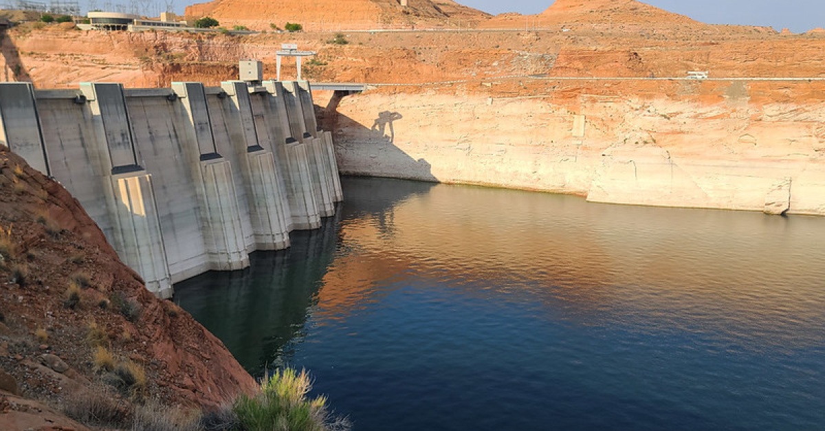


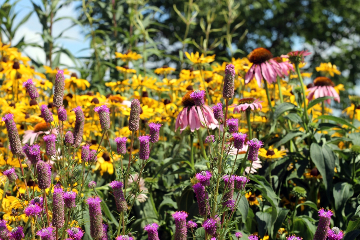
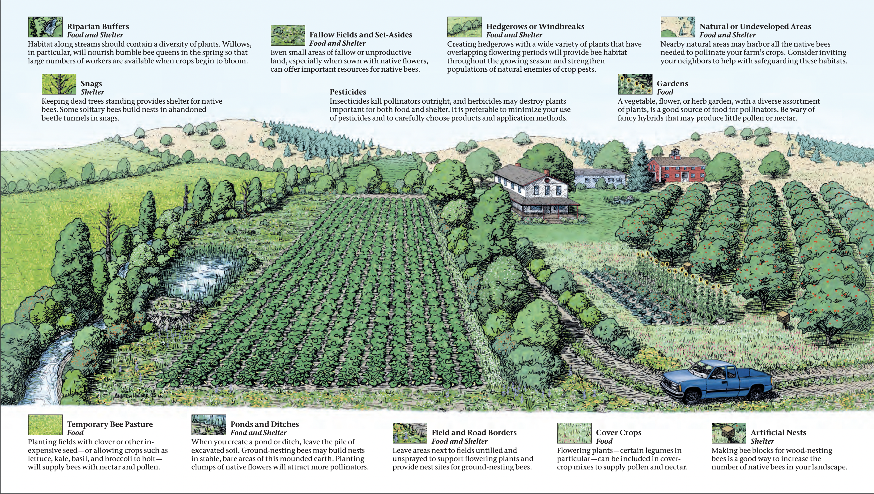
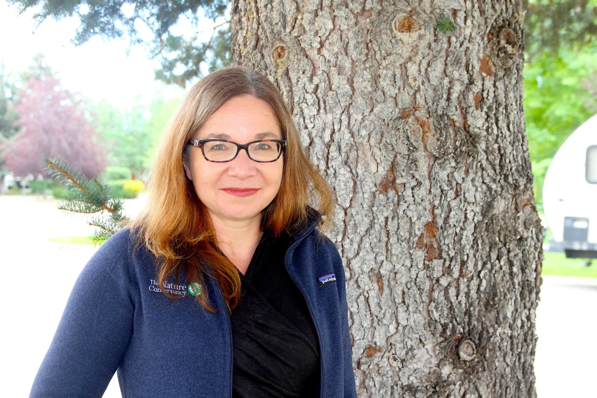
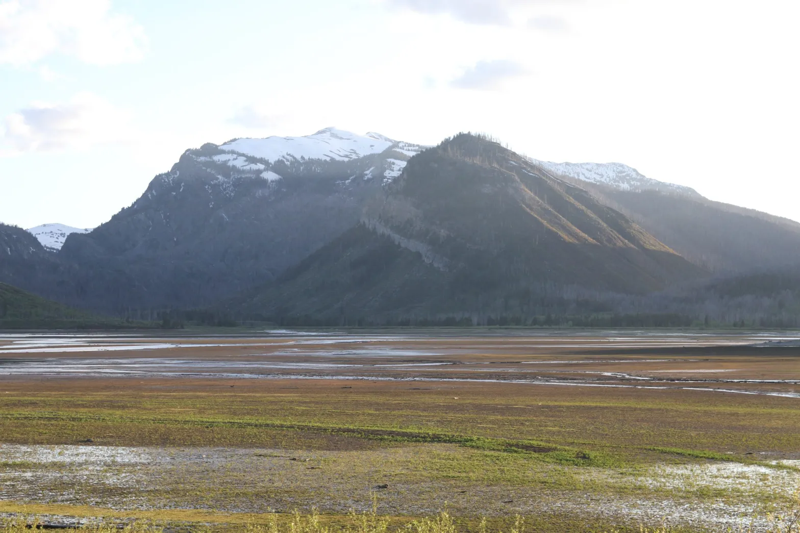
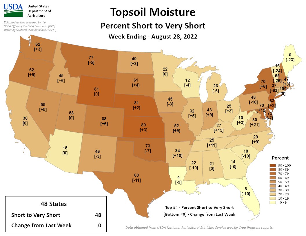


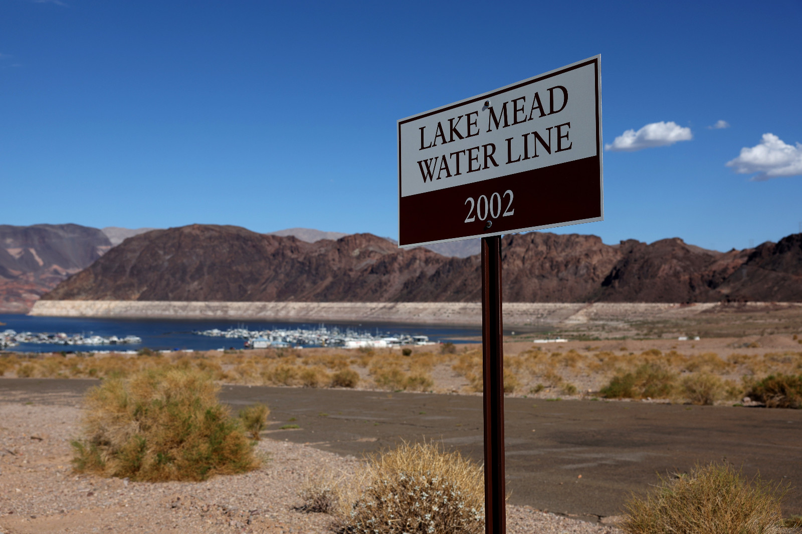
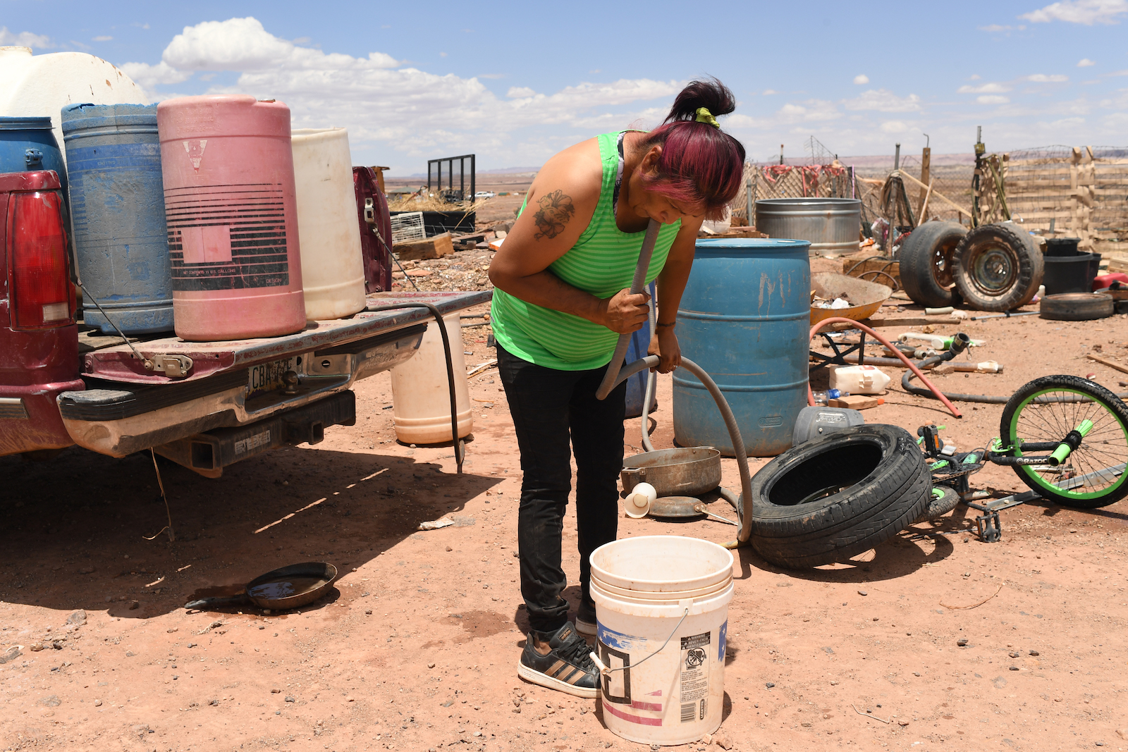
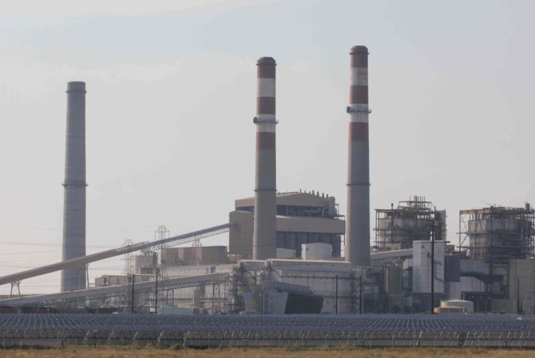
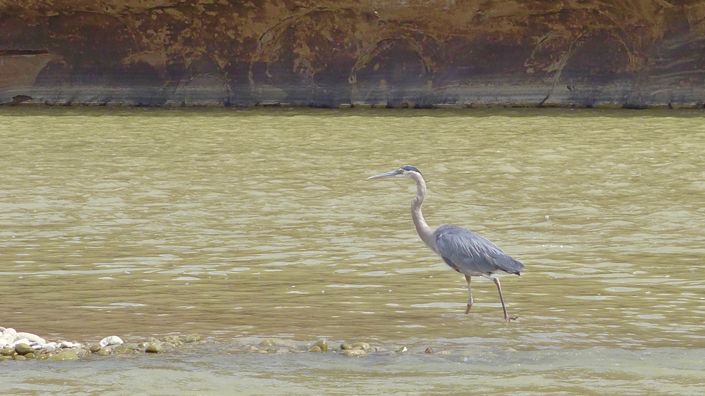
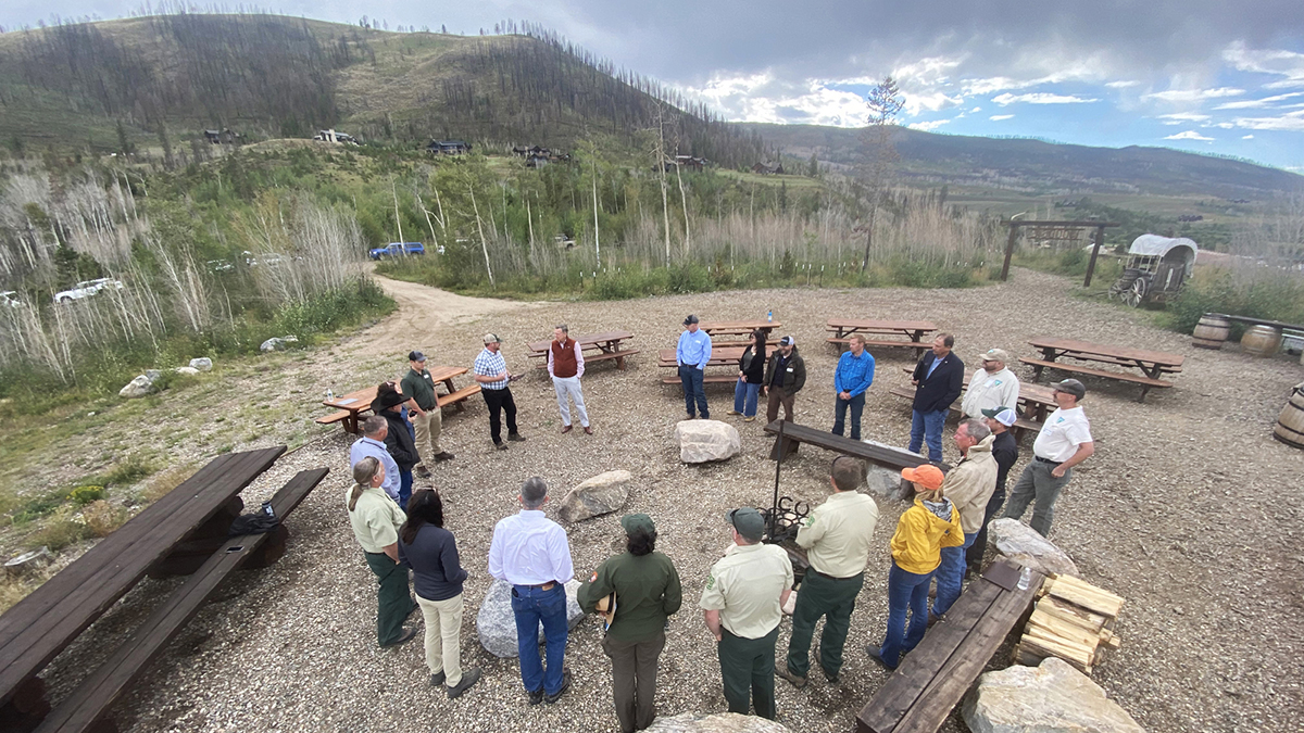


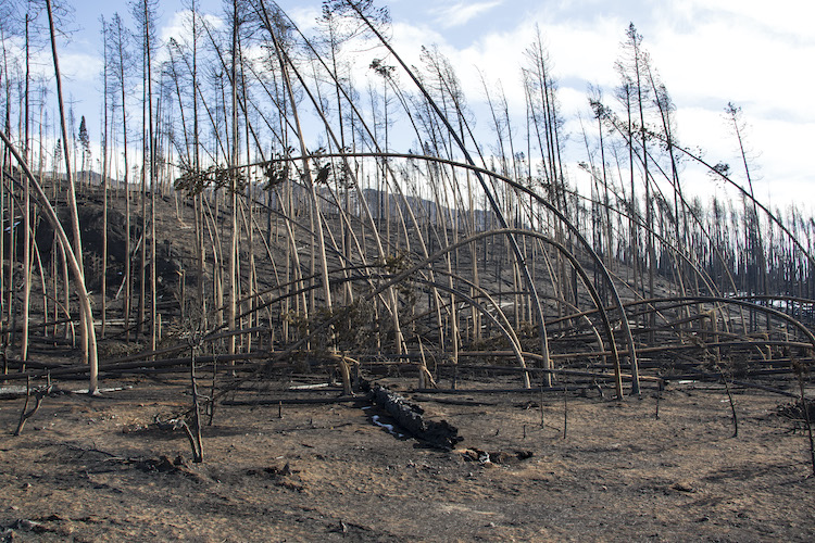


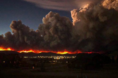


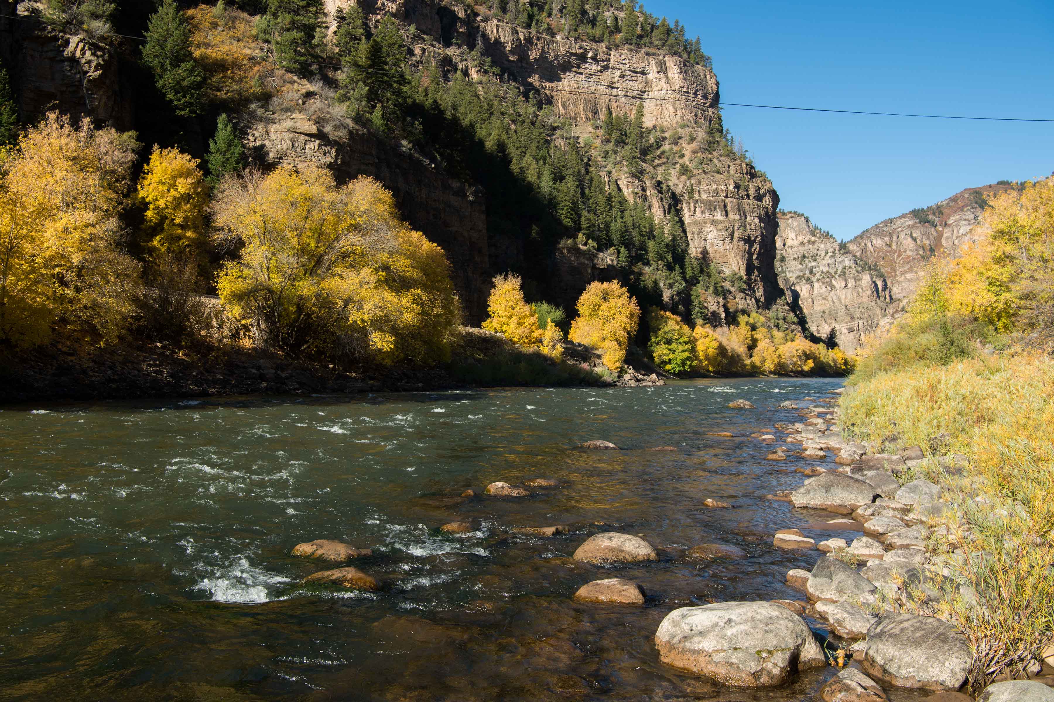

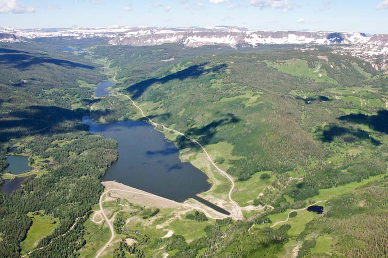


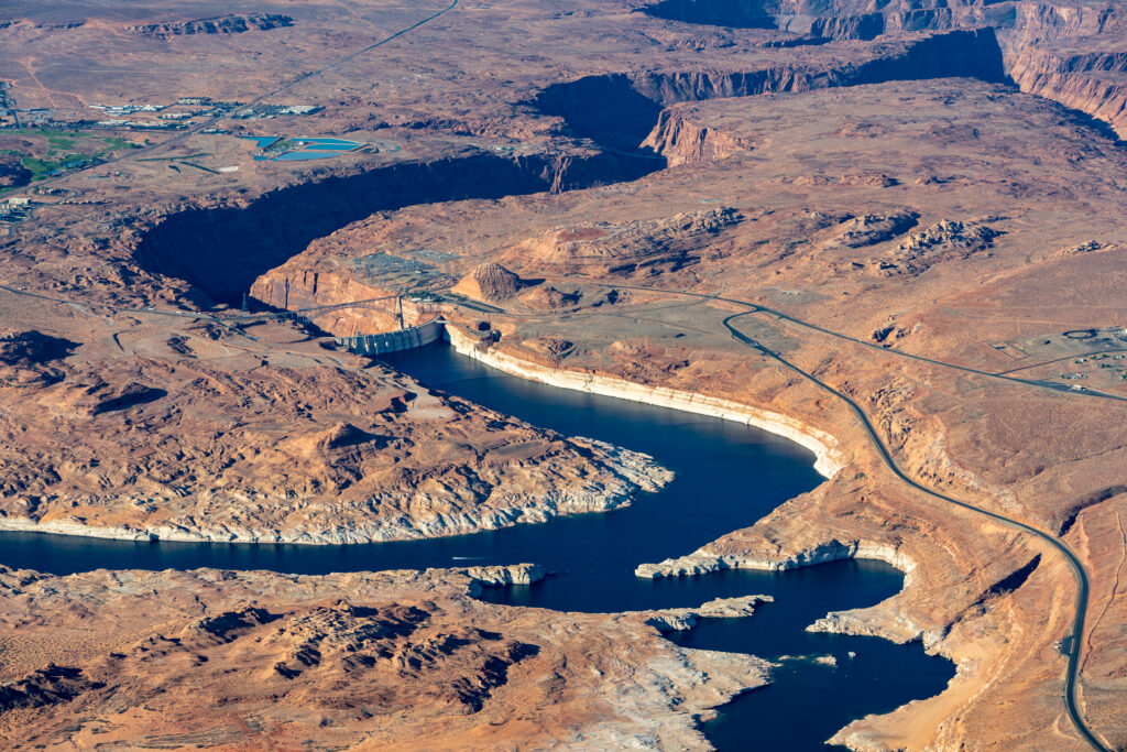
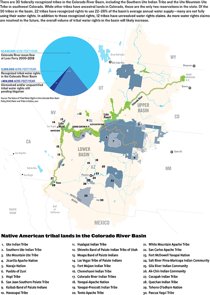
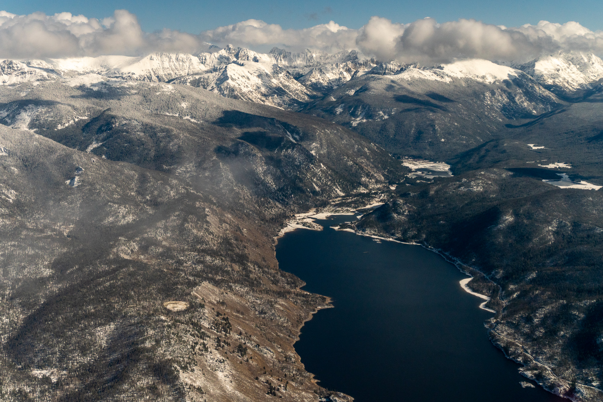


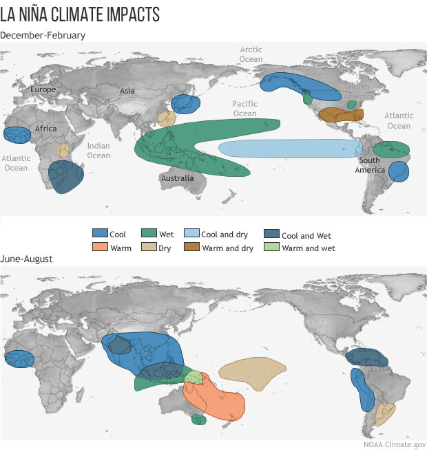
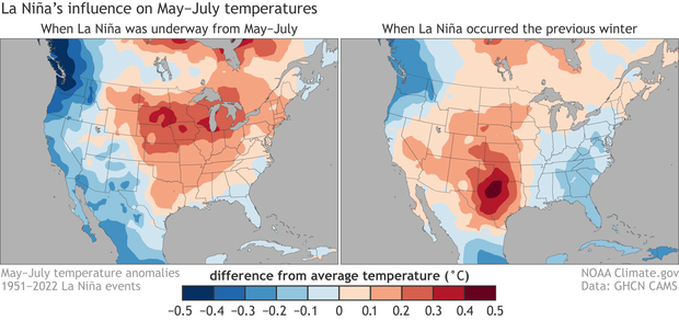
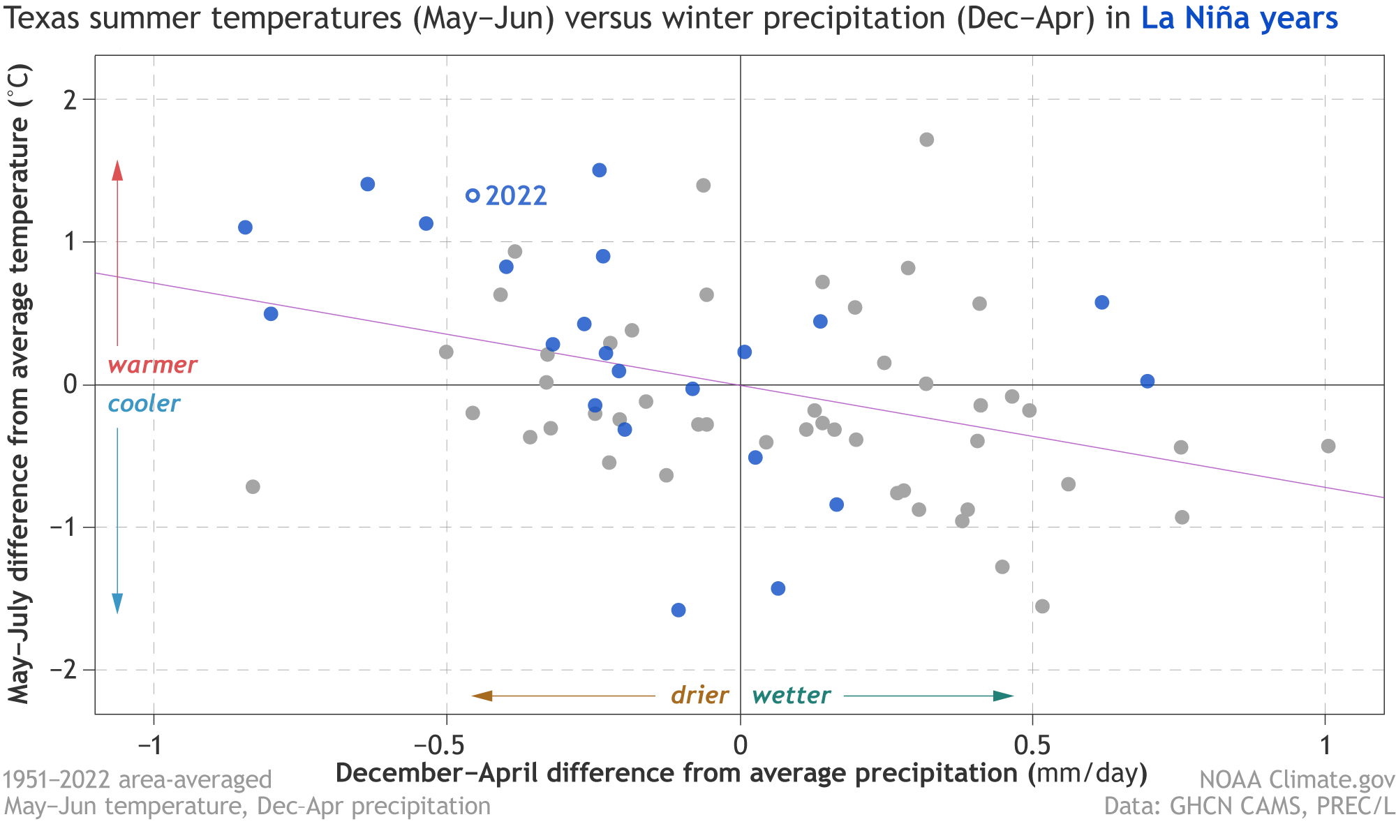
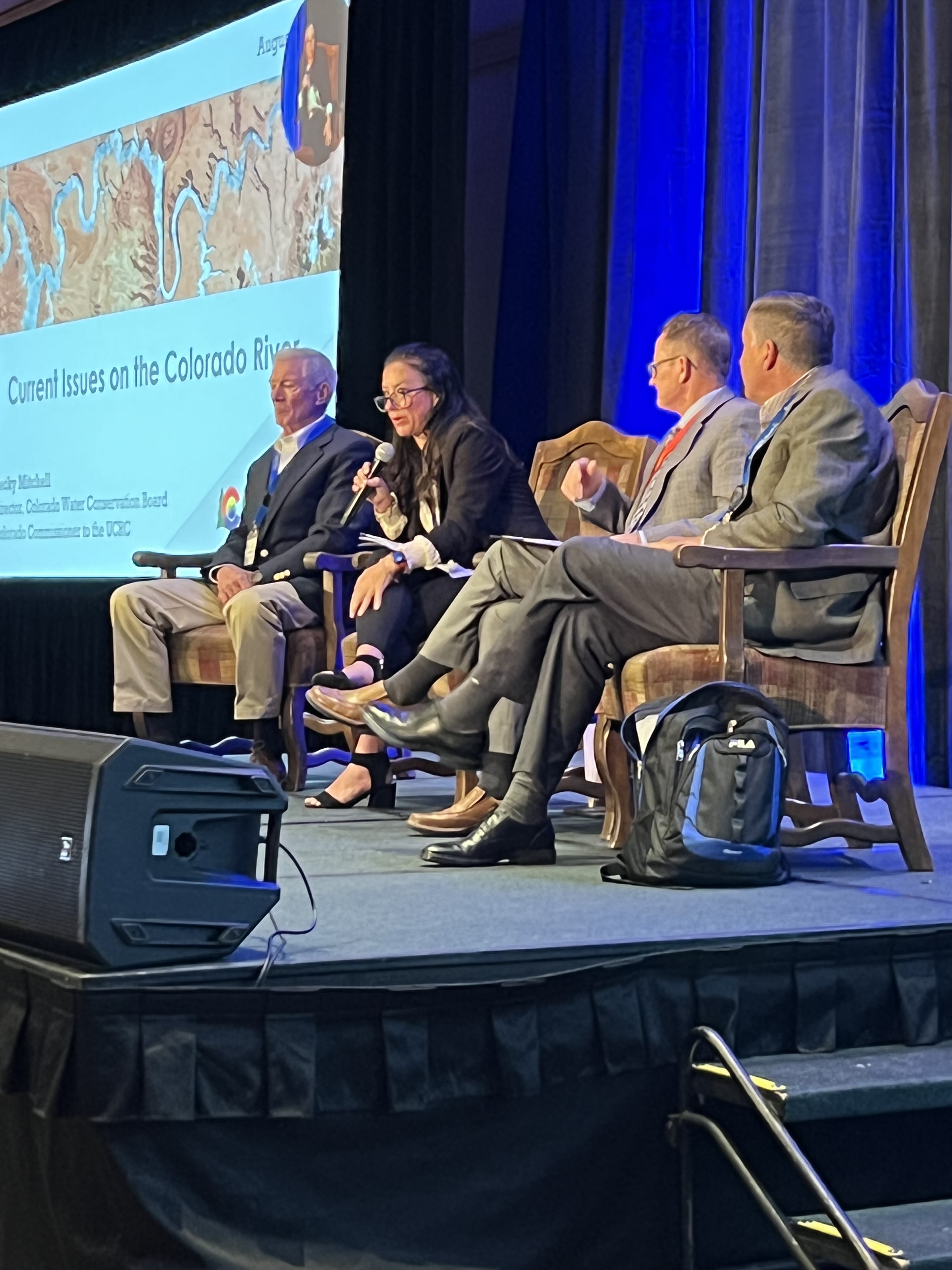
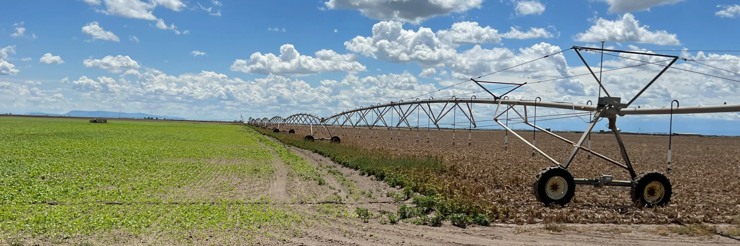


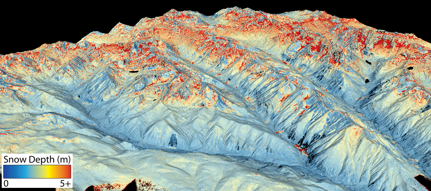


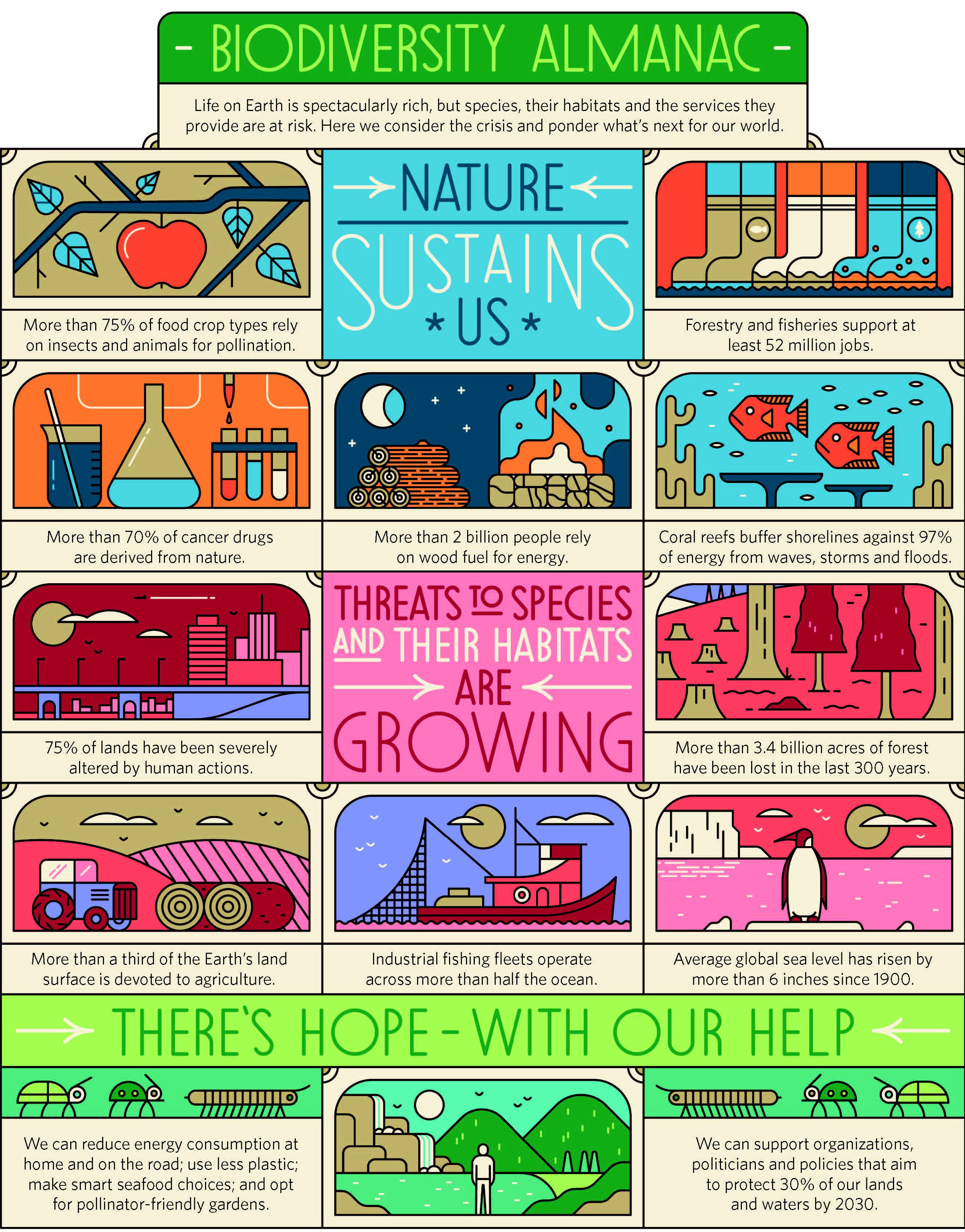


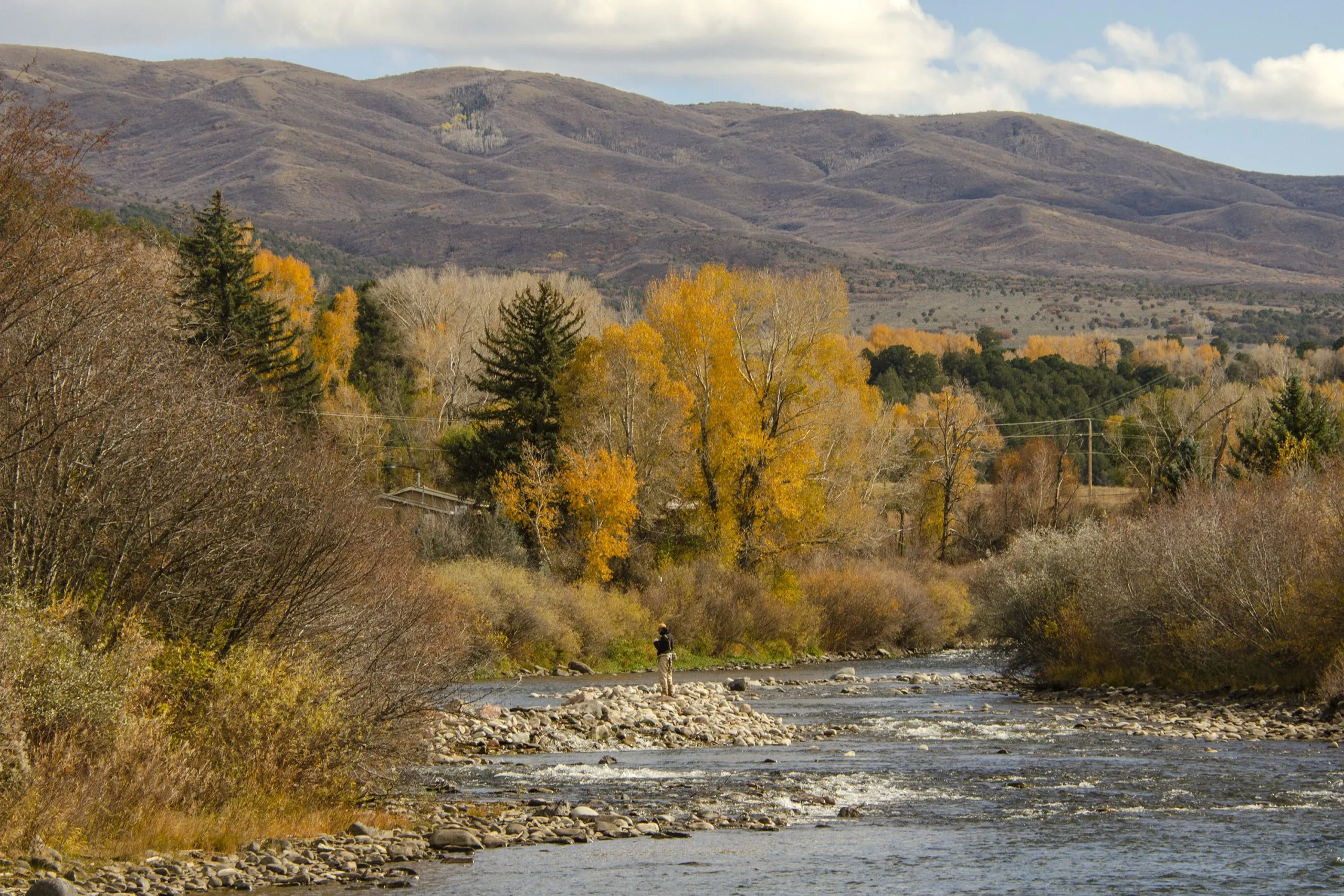


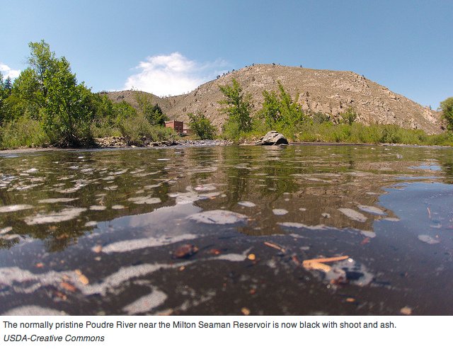

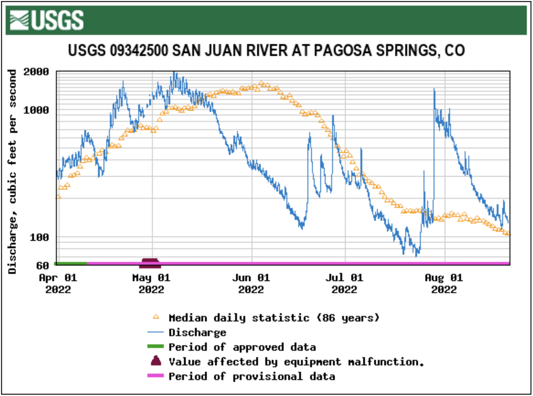
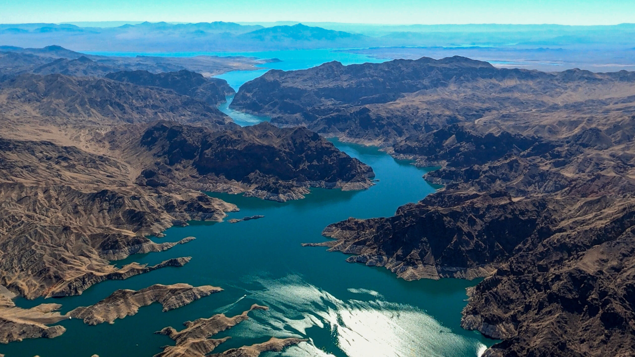
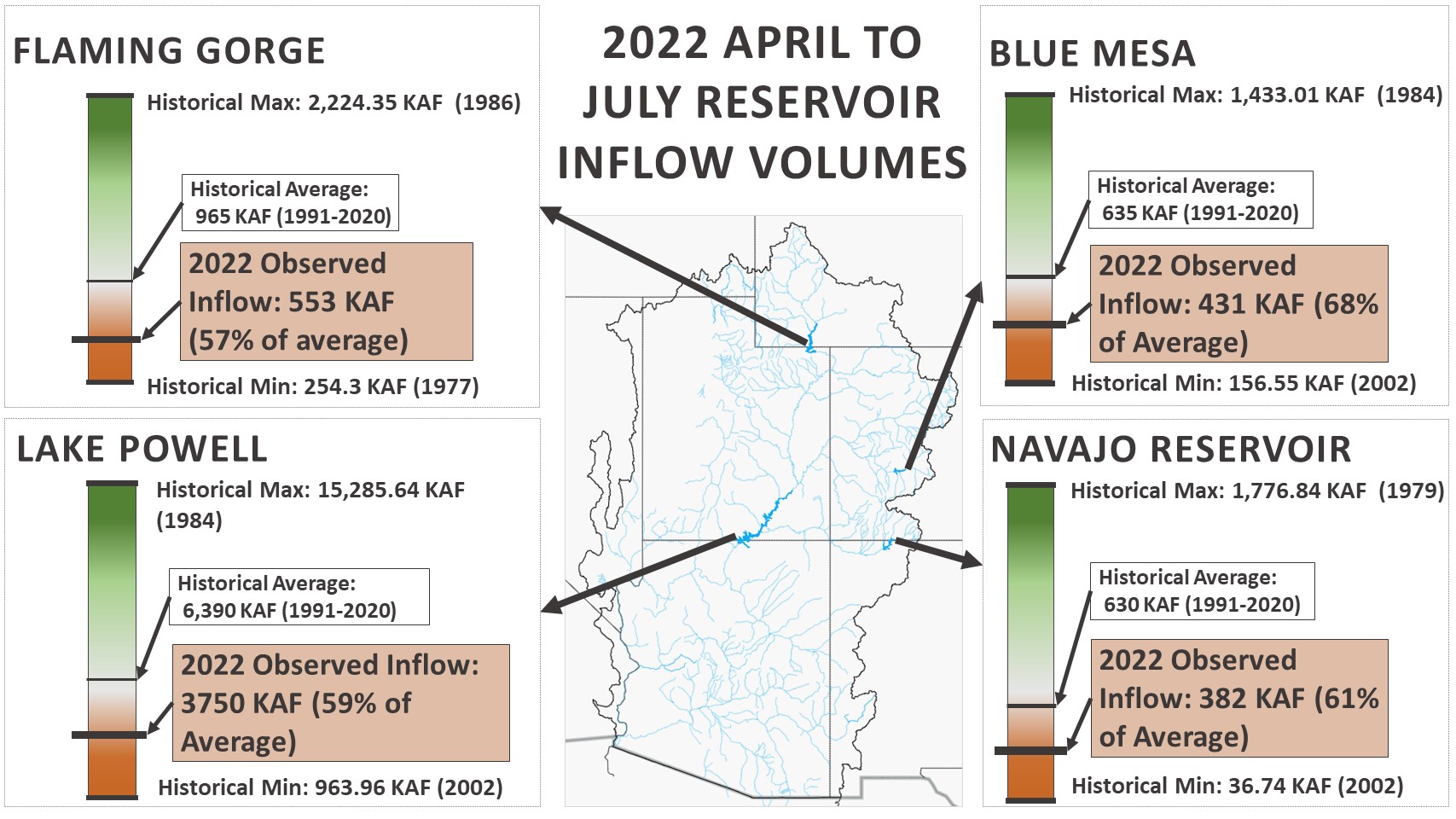
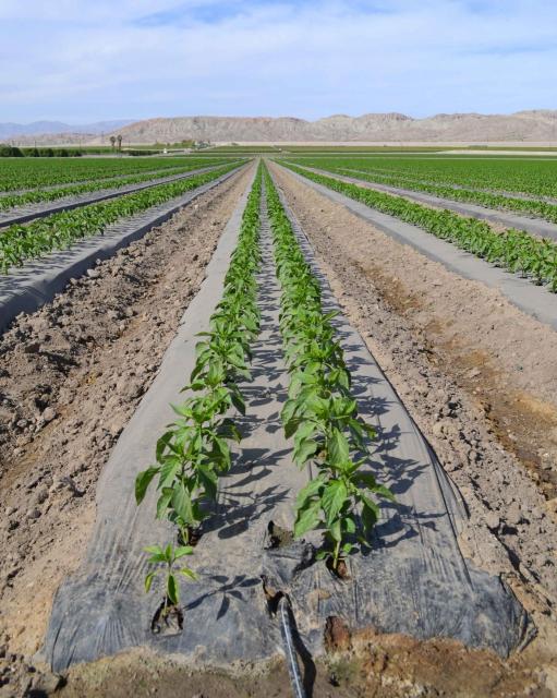
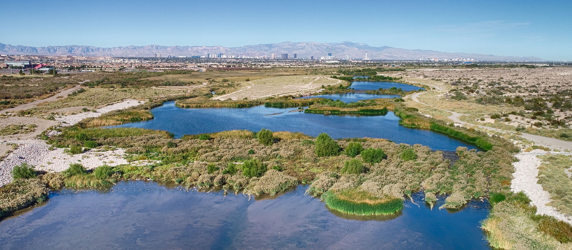


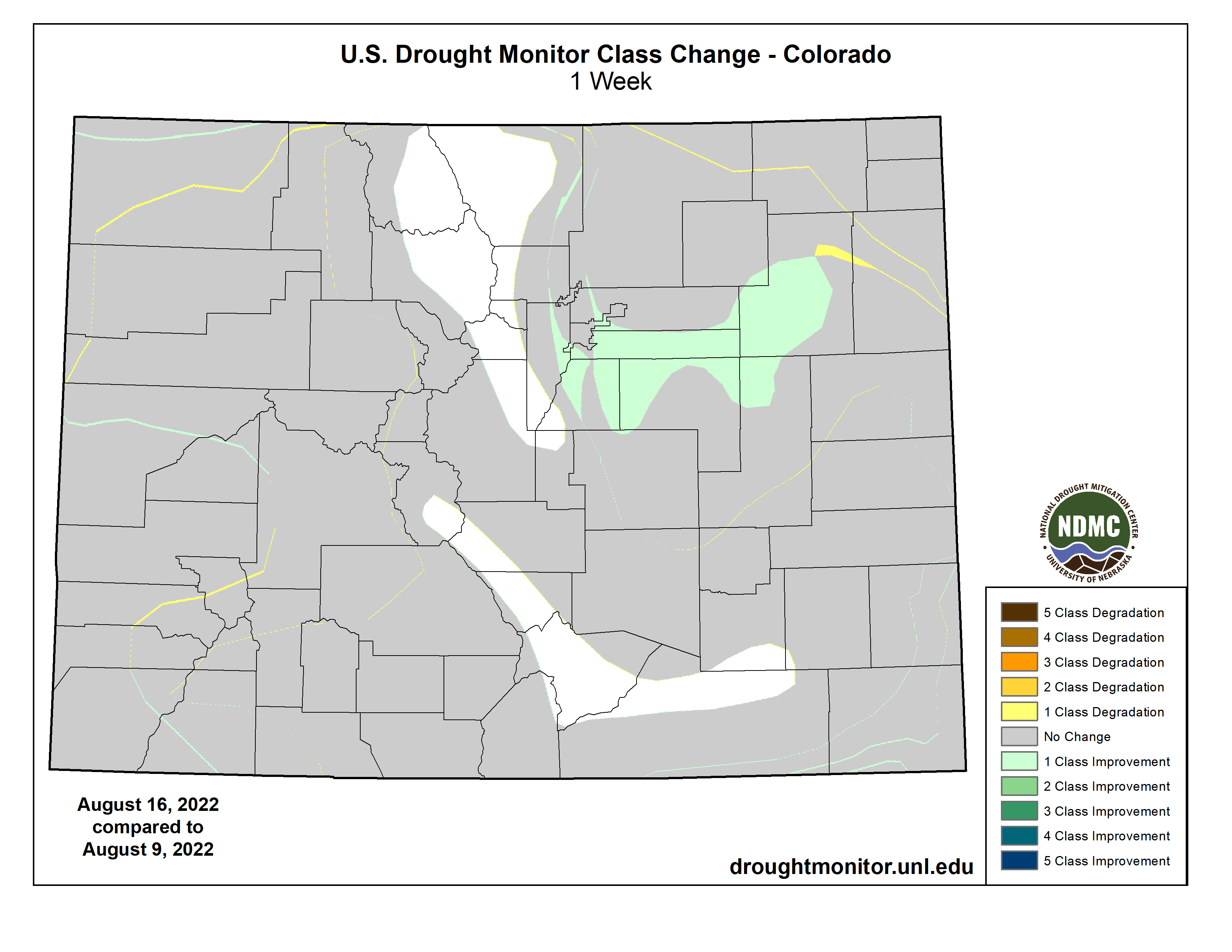
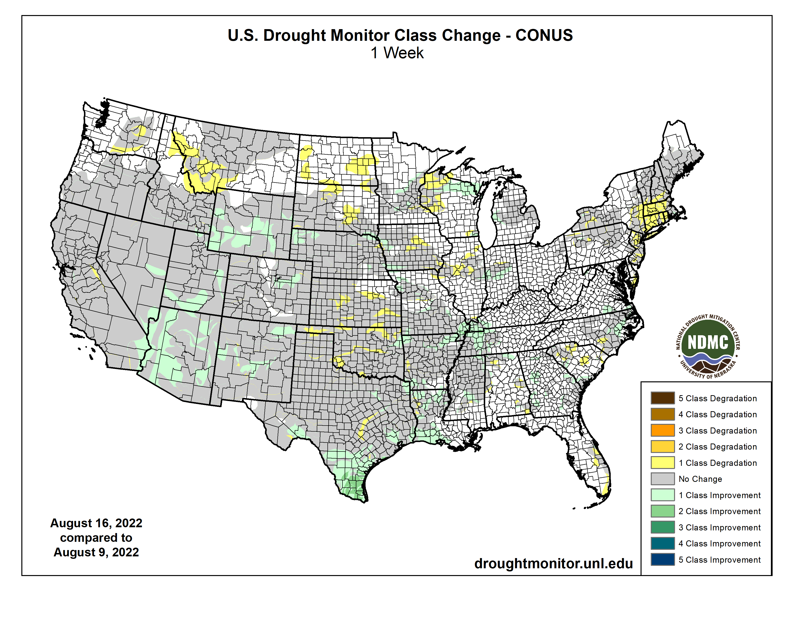
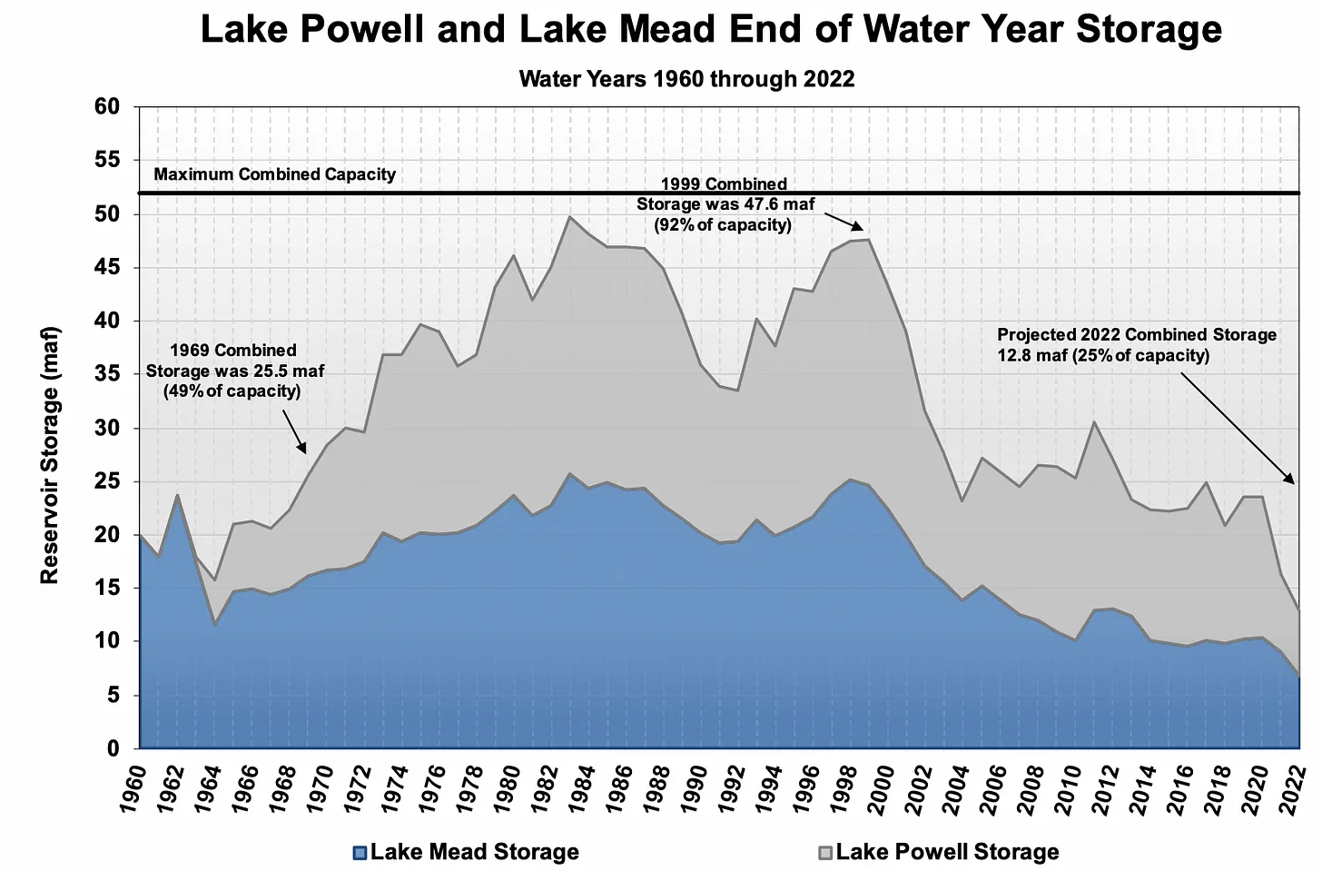

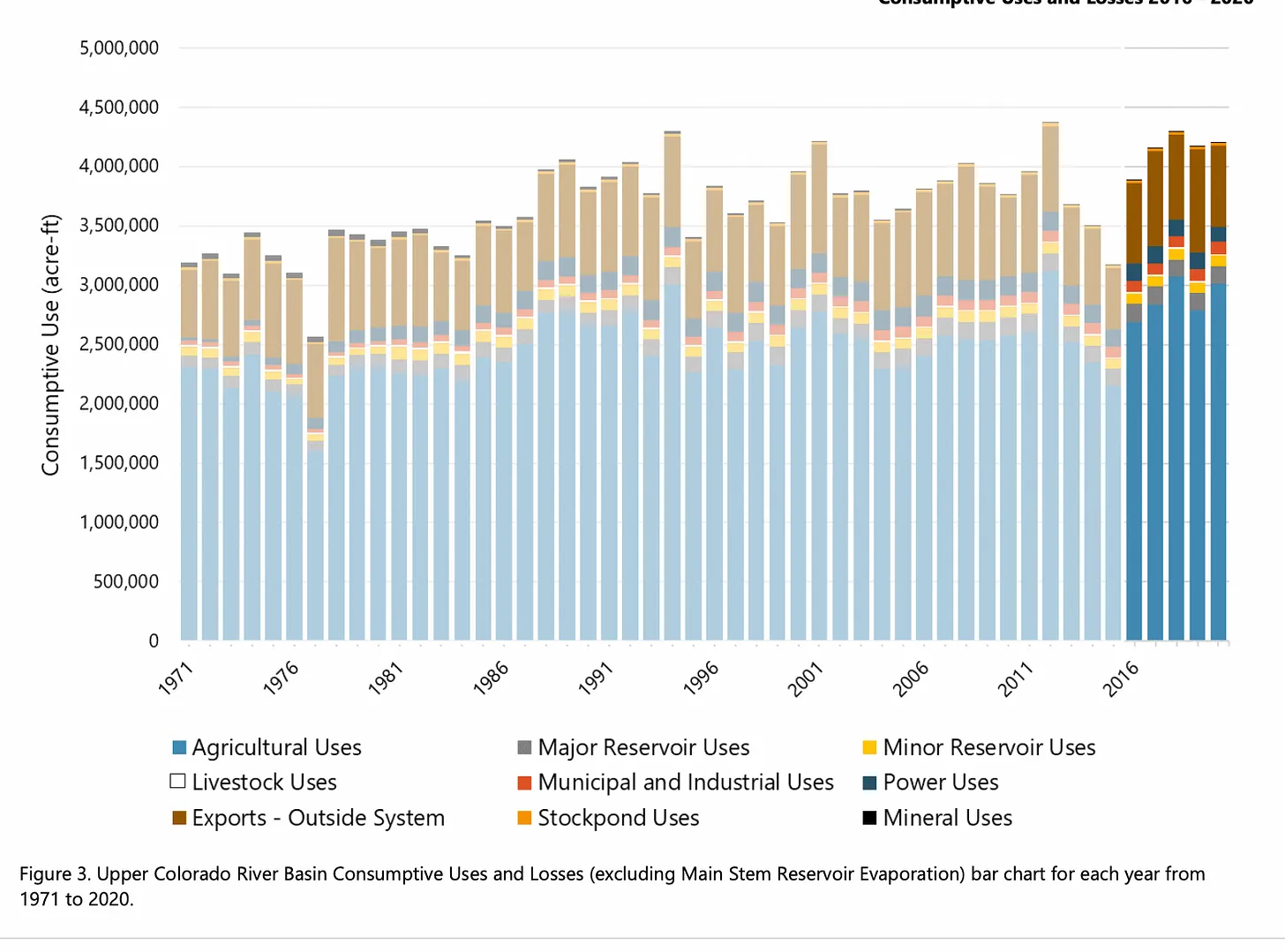

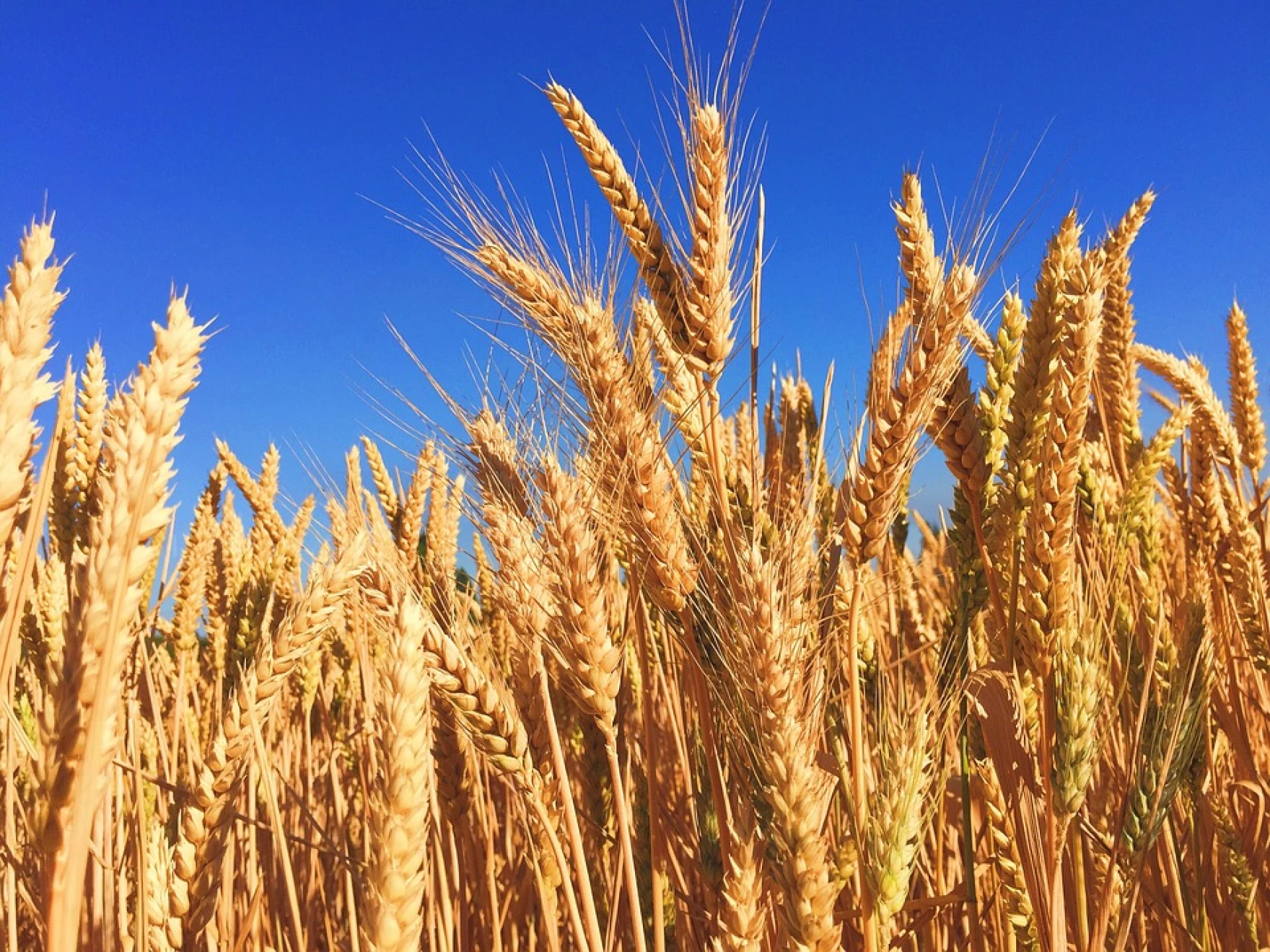
