The report, Emerging Technologies to Improve Water Resource Management in Colorado, was triggered by the passage of HB21-1268. This empowered experts at the Mortenson Center in Global Engineering at CU Boulder and CSU’s Colorado Water Center, in partnership with the Irrigation Innovation Consortium, also hosted at CSU, to address a critical question: How can we use tools to better understand and conserve our water resources to address the most pressing needs across the state?
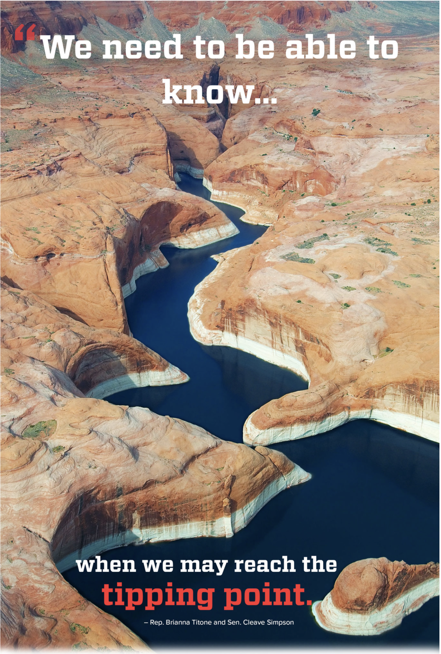
An ongoing megadrought in the western United States is stressing Colorado’s water resources. In July 2021, Lake Powell, which is fed by the Colorado River, reached its lowest level since it was filled in 1969.
To help focus the conversation around water conservation, support the efforts of legislators and spur innovation, the research team interviewed dozens of water experts statewide and surveyed nearly one hundred stakeholders across industries. The researchers assessed technologies like remote sensing, telemetry, digital water transaction platforms including blockchain, and advanced aerial observation platforms, such as high-altitude balloons and drones.
Their findings not only provide valuable insights to water conservation professionals, legislators and industry professionals looking to overcome barriers to tech adoption, but the report also paints a picture of how people in communities across the state could benefit from understanding the challenges around water management.
“Public perceptions … are integral to water management projects and can influence which projects receive funding,” write the researchers. “Studies consistently find that policymakers’ actions reflect public preferences and opinion.”
Drawing from real world successes
Beyond learning from statewide experts, the researchers also looked across the West for success stories. Their collection of case studies ranged from CSU’s educational efforts promoting irrigation conservation to a watershed management dashboard that optimizes economic and agricultural decisions in Southern Colorado, as well as advanced aerial observations using micro-balloons, comprehensive snowpack monitoring and more.
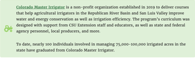
“The expansion of the immersive educational programs covered in this report, such as the Master Irrigator and Testing Ag Performance Solutions programs, provide producers with the knowledge to better understand the science behind these advanced technologies, access to incentives to help them adopt these technologies, and the development of a peer network to help them operate these advanced water management systems in a cost effective manner,” said John Tracy, director of the Colorado Water Center.
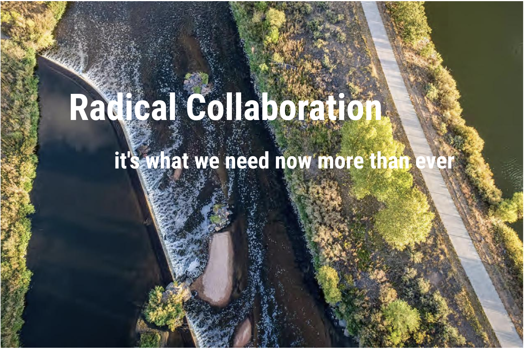
“A consistent theme when discussing these challenges was a desire to promote community and statewide collaboration in water management throughout Colorado.”
Click the link to read the article on the Craig Daily Press website (Amber Delay). Here’s an excerpt:
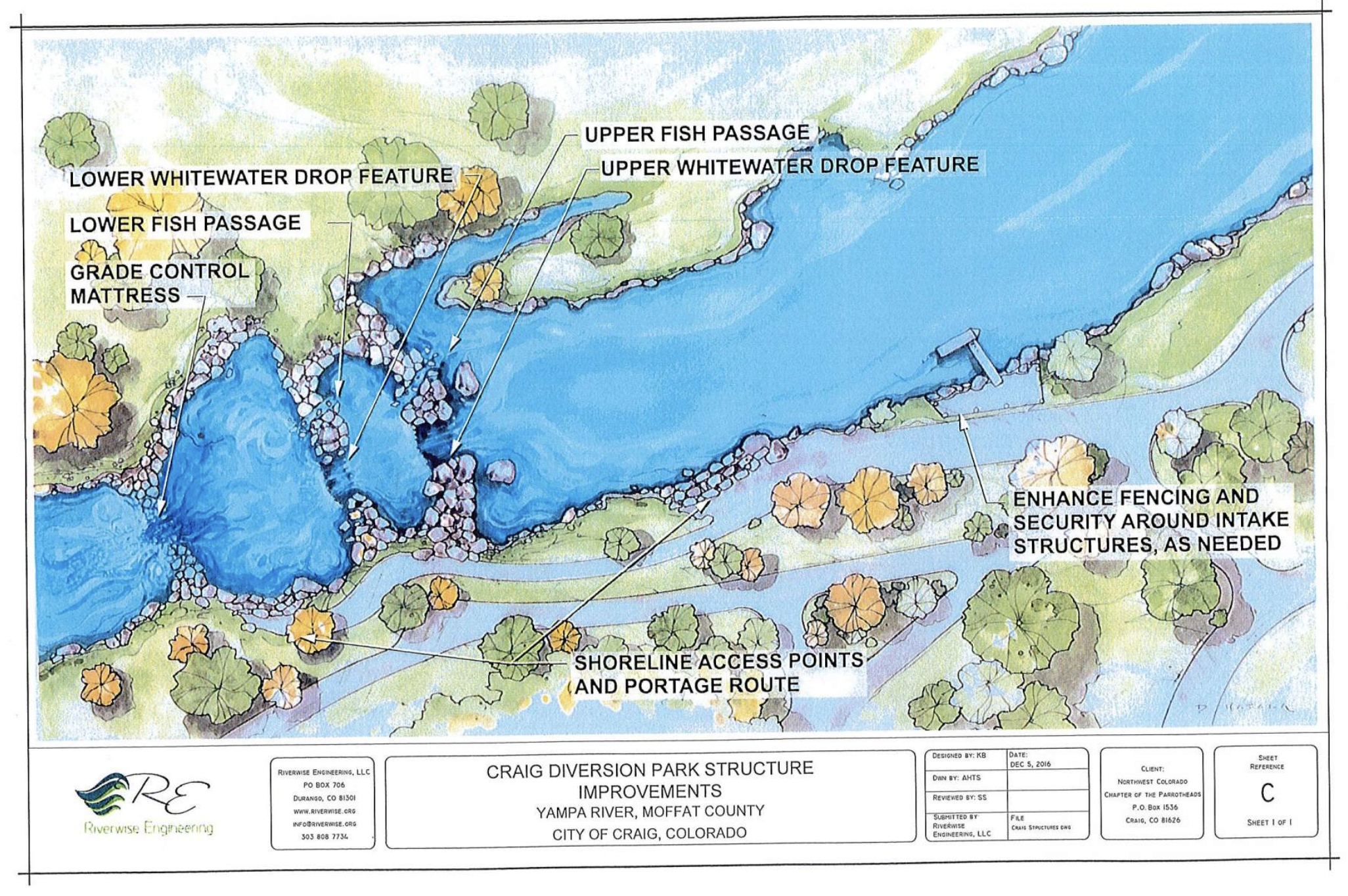
Craig has been awarded a $3.3 million Economic Development Administration Assistance to Coal Communities Grant for construction of the Yampa River Corridor Project. The corridor project is the result of a multi-year planning process with local agencies designed to stabilize and diversify the economy in Craig and Moffat County after the closure of the coal mines and power plant. The city and county collaborated to secure this federal funding for the project, which will upgrade the city’s water intake infrastructure, as well as add new visitor amenities along the river.
The EDA funding will support approximately 70% of the project costs, which were estimated at $4.6 million this year. Yampa River Corridor Project Manager Melanie Kilpatrick said that match partners have committed to the remainder of the project funding, and the only variable could be inflation, which has affected other projects over the years.
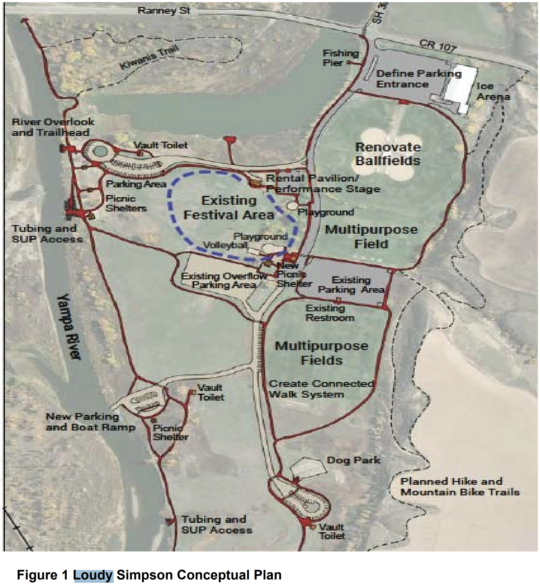
Loudy-Simpson Park improvements. Credit: Riverwise Engineering
The corridor project encompasses several improvements to Loudy Simpson Park, including a new concrete boat ramp, access road and parking area, as well as improving the existing diversion dam site with a whitewater park, access road, parking area and park amenities. According to a statement from Kilpatrick, the project fits into Craig’s master plan for parks, recreation, open space and trails. It also fits within the Moffat County Vision 2025 Transition Plan, which outlines proactive strategies to help the community transition from a coal-centered economy.
The goal of the EDA funding is to support economic resilience by diversifying the region’s economic base. The idea is that having an outdoor recreational amenity so close to town will attract more visitors to spend time in town, creating a ripple effect in the local economy. While visitors bring in tourism dollars, the employees who serve those tourists then spend money on other goods and services in town. There have been studies in other communities where similar projects have taken place to measure the economic impact of whitewater parks.
A 2006 study in Durango estimated that whitewater recreation created 33 jobs for $1 million in annual sales from tourist dollars.
In 2009, the University of Idaho estimated that a whitewater park in Cascade, Idaho, generated $8.2 million annually from this ripple effect.
A whitewater park in Truckee, Nevada, reported economic benefits ranged from $1.9 million to $4.1 million annually.
Good Vibes River Gear and the Craig RV Park, local employers whose businesses would directly benefit from growth in river tourism, have committed to adding over 30 new full-time employees. And it’s estimated that the project will create approximately 129 new jobs in both direct and adjacent industries…
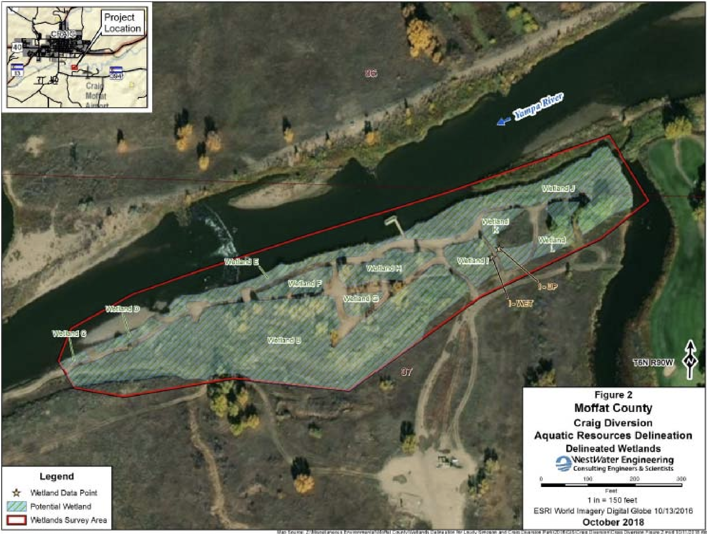
Credit: Riverwise engineering
Craig’s current city water intake diversion dam is a 200-foot wide and 10-feet high barrier made of concrete and rip rap boulders. Kilpatrick said in a statement that the existing diversion is in disrepair and needs to be updated. In its current condition, the diversion can also be a hazard for boaters, and it blocks passage for numerous fish species, several of which are federally listed endangered species. Replacing the current diversion dam with a natural channel design will allow the city to continue to draw its allotted water from the river and will improve boater safety and year-round fish passage.
“This sustains the city’s water supply in a fiscally responsible way. That’s hugely important to us,” Kilpatrick said. “We get improved fish passage, and healthier aquatic and riparian habitat. We get better access to the river. And we get the economic development associated with whitewater recreation.”
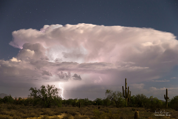
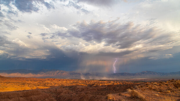
Arizona monsoon cloud with lightning striking the beautiful Sonoran desert in North Scottsdale. Photo by James Bo Insogna. Title: Arizona Monsoon Thunderstorm. Taken on August 15, 2016. Used under a Creative Commons license.
Click the link to read the article on the NOAA website (Emily Becker):
La Niña continues! It’s likely that the La Niña three-peat will happen: the chance that the current La Niña will last through early winter is over 70%. If it happens, this will be only the third time with three La Niña winters in a row in our 73-year record. ENSO (El Niño/Southern Oscillation, the whole La Niña and El Niño system) has the greatest influence on weather and climate during the Northern Hemisphere cold season, so forecasters pay especially close attention when it looks like ENSO will be active in the winter.
Hopelessly Devoted to You
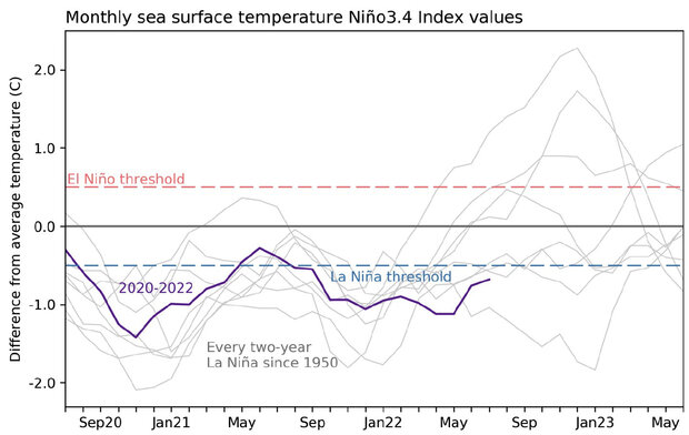
La Niña is present when the sea surface temperature in the east-central Pacific Ocean is at least 0.5 °C (0.9 °F) cooler than the long-term average, along with evidence of a stronger atmospheric circulation above the equatorial Pacific. In July, the sea surface temperature in the Niño-3.4 region of the tropical Pacific, our primary monitoring region, was 0.7 °C cooler than average (average = 1991–2020) according to the ERSSTv5 dataset. This makes 21 of the past 24 months with a deviation from average below -0.5 °C.
Three-year history of sea surface temperatures in the Niño-3.4 region of the tropical Pacific for the 8 existing double-dip La Niña events (gray lines) and the current event (purple line). Of all the previous 7 events, 2 went on to La Niña in their third year (below the blue dashed line), 2 went on to be at or near El Niño levels (above the red dashed line) and three were neutral. Graph is based on monthly Niño-3.4 index data from CPC using ERSSTv5. Created by Michelle L’Heureux.
We Go Together
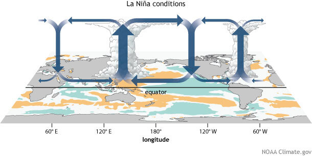
The average circulation of the atmosphere over the tropical Pacific—called the Walker circulation—makes a giant loop: rain and rising air over the very warm waters of the far western Pacific and Indonesia, west-to-east winds at high altitudes, descending air and drier conditions over the relatively cooler central/eastern Pacific, and the east-to-west trade winds near the surface. La Niña’s cooler-than-average central/eastern Pacific acts to strengthen this circulation, with more rain than average over Indonesia, less rain over the central tropical Pacific, and stronger upper-level and lower-level winds. In turn, those stronger low-level trade winds cool the surface further, and help to keep warm water piled up in the far western Pacific.
Generalized Walker Circulation (December-February) anomaly during La Niña events, overlaid on map of average sea surface temperature anomalies. Anomalous ocean cooling (blue-green) in the central and eastern Pacific Ocean and warming over the western Pacific Ocean enhance the rising branch of the Walker circulation over the Maritime Continent and the sinking branch over the eastern Pacific Ocean. Enhanced rising motion is also observed over northern South America, while anomalous sinking motion is found over eastern Africa. NOAA Climate.gov drawing by Fiona Martin.
July recorded all the expected strengthened Walker circulation features, including substantially stronger-than-average trade winds. The trade winds led to the cooler-than-average surface temperature strengthening over the month, a tendency we can see in the weekly measurements, which started July at -0.5 °C and ended at -1.0 °C. While the weekly anomaly is useful for monitoring current conditions, ENSO is a seasonal phenomenon, so conditions must remain for several months to qualify, and to affect global weather patterns. Michelle gets into this in more detail in her internet-ancient—but still entirely relevant—post.
Rock ‘n Roll Is Here to Stay
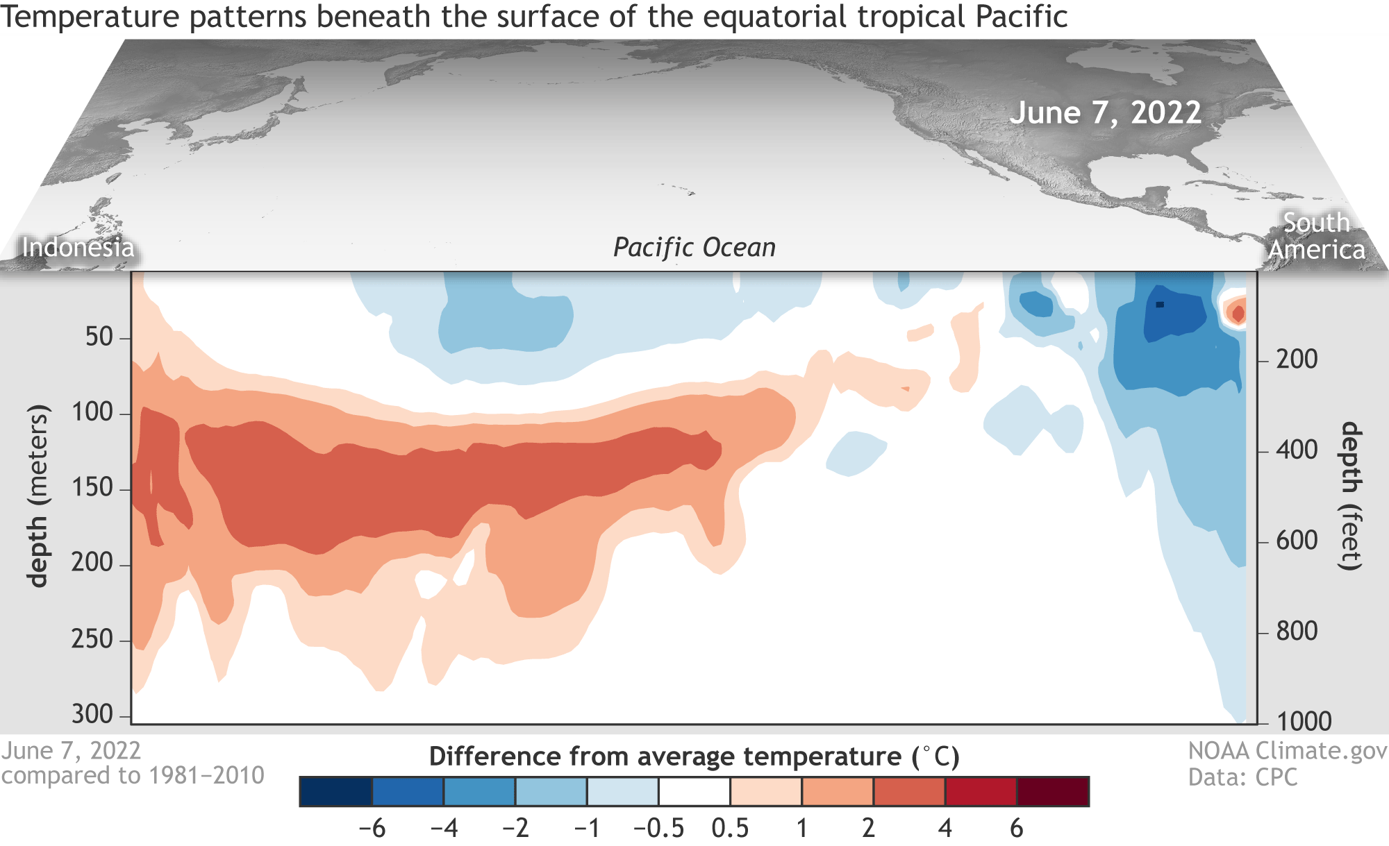
Another outcome of the stronger trade winds during July was the development of an upwelling Kelvin wave, cooler-than-average water that travels west-to-east under the surface of the equatorial Pacific. As the trade winds drag the surface waters westward, cooler water is drawn up from the deeper ocean.
Difference from average temperature in the top 300 meters (~984 feet) of the tropical Pacific between June 7 and August 1, 2022. A deep pool of cooler-than-average water (blue) spread eastward and will continue rising to the surface in coming months, feeding the current La Niña. Animation by NOAA Climate.gov, based on data from NOAA Climate Prediction Center.
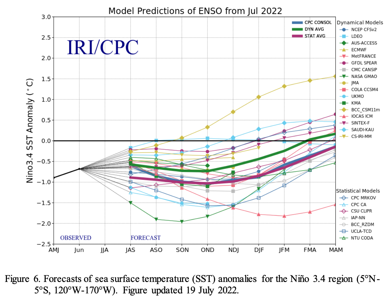
This upwelling Kelvin wave will provide a source of cooler water to the surface over the next couple of months, which in turn provides increased confidence to the short-term La Niña forecast. With most of our computer models predicting La Niña will last into the winter, forecaster probabilities are fairly confident through December–February.
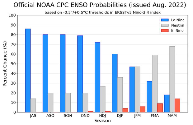
NOAA Climate Prediction Center forecast for each of the three possible ENSO categories for the next 8 overlapping 3-month seasons. Blue bars show the chances of La Niña, gray bars the chances for neutral, and red bars the chances for El Niño. Graph by Michelle L’Heureux.
Several models are predicting that La Niña will transition to neutral in January–March, and the forecast team provides even chances (47%) for either outcome (La Niña or neutral). It would be pretty rare for the event to terminate so early in the year. If La Niña does decay to neutral in January–March 2023, it would be only the 4th time in the 24 La Niña winters we have on record.
Greased Lightning
As I mentioned up above, La Niña’s greatest influence on weather and climate is during the winter. Also, of course, La Niña can be conducive to an active Atlantic hurricane season, something reflected in NOAA’s recent update to the outlook.
During summer, local processes are more important for determining weather patterns, including the North American Monsoon. This year, the Monsoon has contributed to some devastating floods, but also provided much-needed rain for the drought-stricken Southwest. I checked in with our consultants for the North American Monsoon post, Zack Guido and Mike Crimmins. They have an excellent podcast with tons of fascinating detail about the Monsoon, so check it out if your interest is piqued!
Rain and lightning over desert hills near Mesquite, Nevada, on August 30, 2021, during the summer monsoon. Photo by Flickr user John Getchel. Used under a Creative Commons license.
Mike had this to say about this year’s Monsoon:
“We just crossed through the typical middle of the season (early August), and the first half was really good for just about all of the Southwest. Over 80% of Arizona and New Mexico are observing near-average or better rainfall so far this season, and more than half of the region at above-average or better! The whole season started with some epic rains over New Mexico that helped end their record fire season, and the moisture and storms have kept coming ever since.
“This year has been interesting and different from last year’s very wet monsoon. Last year we had great monsoon moisture and two unusual large upper-level low pressure systems bring several days of widespread rain in July and August of last year. We haven’t really had anything big like that this year, just sustained deep moisture and the occasional wiggle in the upper-level flow to help organize precipitation into lines of storms from time to time. It has felt a bit more like a solid, active season that hasn’t needed any special tricks to stack up the precipitation totals across the region.”
The relationship between La Niña and the Monsoon is not strong , but I asked Mike if he could speculate a little. He had this to say:
“I am not sure of the influence of La Niña this year, but it certainly could be there. Some research on ENSO and the monsoon suggest that La Nña is correlated with an early start to the season in Arizona and New Mexico and wetter-than-average conditions through July. The signal then decays through August. This season follows that pattern, but I’m not sure of the causal links.”
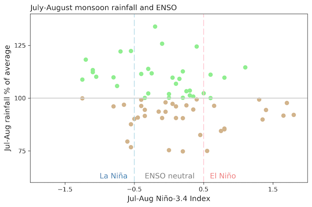
July–August rainfall anomaly averaged over North American Monsoon region for every year 1950–2019 (y-axis) versus Niño-3.4 index (x-axis). Wetter-than-average monsoons (green dots) are slightly more common during La Niña years, while drier-than-average monsoons (brown dots) are slightly more common during El Niño years. Monsoon region averaged over all land gridpoints, 20°N–37°N, 102°W–115°W. Data from Global Precipitation Climatology Centre (GPCC) and ERSSTv5. Figure by Emily Becker.
You’re the One That I Want
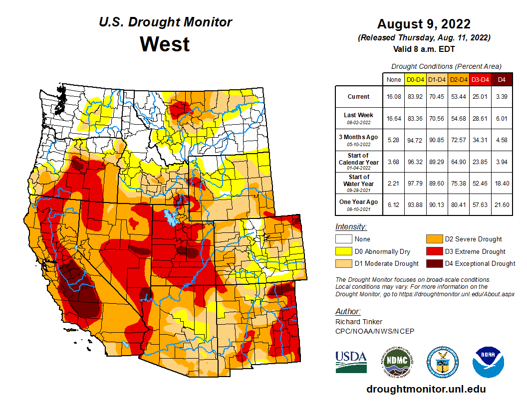
The Monsoon has helped with the Southwest drought, something Tom discusses in his recent coverage of the August climate outlook. However, La Niña often contributes to dry winters through the West, so we’re far from out of the woods, drought-wise. Stay tuned here—we’ll keep you up to date on all things ENSO.
Click the link to read the article on the Summit Daily website (Luke Vidic). Here’s an excerpt:
La Nina weather patterns are likely to continue into the winter according to the National Weather Service. La Nina was partially to blame for lower snowfalls through the month of December last year, and the pattern could return this year, although meteorologists say it’s too early to be certain…
For Summit County, a mountain environment nestled in the heart of the state, predicting precipitation from La Nina can be tricky, Boulder’s National Weather Service Meteorologist Bruno Rodriguez said.
“Realistically, it’s very hard to say what that means in terms of precipitation,” he said. Summit County should expect more accurate winter weather predictions closer to the winter season, he said. The combination of La Nina and the county’s location can create unpredictable outcomes. Last year’s lower December snowfall may not repeat this year.
The National Weather Service expects La Nina to taper between December and February. The probability of La Nina is at 86%, but the percentage is at 60% in December through February, the National Weather Service predicted. While a majority of North American Multi-Model Ensemble models suggest La Niña will transition to a neutral impact between January and March 2023, forecasters are split on this outcome resulting in equal forecast probabilities for that season, the National Weather Service reported. La Niña’s greatest influence on weather and climate is during the winter, but National Oceanic and Atmospheric Administration Emily Becker indicated the climate pattern could have a minor role in the monsoon season by possibly creating an earlier start in the southwest U.S. If La Nina does persist, it will be the third time the climate pattern has repeated for three years in a row in the 73 years the National Weather Service has tracked it. The climate pattern appears when the sea surface temperature in the east-central Pacific Ocean is cooler than the long-term average by at least 0.5 degrees Celsius.
“Despite the obvious urgency of the situation, the last sixty-two days produced exactly nothing in terms of meaningful collective action to help forestall the looming crisis,” Entsminger wrote. “The unreasonable expectations of water users, including the prices and drought profiteering proposals, only further divide common goals and interests. Through our collective inaction, the federal government, the basin states and every water user on the Colorado River is complicit in allowing the situation to reach this point.
“We are at the stage where basin-wide every drop counts, and every single drop we are short of achieving two to four million acre-feet in permanent reductions draws us a step closer to the catastrophic collapse of the system, as well as draconian water management practices to protect health and human safety that we have successfully staved off in the past through cooperation,” the letter says.
The letter comes two months after Bureau of Reclamation Commissioner Camille Touton told the seven Colorado River basin states — Nevada, California, Arizona, New Mexico, Utah, Colorado and Wyoming — to come up with a plan to use between 15 percent and 30 percent less water from the river next year, or risk the federal government deciding those cuts on its own. Those talks have fueled growing tensions between the states, further exposing the political divides between the lower basin states of Nevada, Arizona and California, where most of the Colorado’s waters are consumed, and the upper basin states that have historically stayed below their legal entitlements…
Entsminger said the proposal with the largest impact that he saw on the table came out to less than 1 million acre-feet in cuts — a proposal he said wasn’t actually firm and yet was still far short of the 2 million to 4 million acre-feet that Reclamation is calling for.
“I feel like we never really got started in a meaningful way,” Entsminger said of the negotiations. “The entire two months between the commissioner’s Senate testimony and today, I didn’t see what I would consider any realistic proposals put on the table to help stabilize the system.”
The upper basin states — Wyoming, Colorado, Utah and New Mexico — submitted a plan to the federal government in mid-July, but that proposal contained no mandatory reductions in water use for those states.
Colorado River “Beginnings”. Photo: Brent Gardner-Smith/Aspen Journalism
Click the link to read the guest article on the New York Times website (Daniel Rothberg). Here’s an excerpt:
…overuse and climate change have contributed to its reservoirs drying up at such a rapid rate that the probability of disastrous disruptions to the deliveries of water and hydroelectric power across the Southwest have become increasingly likely. Now the seven states that depend on the river must negotiate major cuts in water use by mid-August or have them imposed by the federal government.
Those cuts are merely the beginning as the region struggles to adapt to an increasingly arid West. The rules for operating the river’s shrinking reservoirs expire in 2026, and those seven states must forge a new agreement on water use for farmers, businesses and cities.
What’s worse, all of this is happening in a region that is one of the fastest growing in the United States, even as the signs of an impending crisis become more pronounced. Outside of Las Vegas, Lake Mead, the nation’s largest reservoir by volume, fed by the Colorado and three smaller tributaries, is nearly three-quarters empty and at its lowest level since April 1937, when it was first being filled. The 22-year downward trend is “a stark illustration of climate change and a long-term drought that may be the worst in the U.S. West in 12 centuries,” according to NASA’s Earth Observatory program.
A century of agreements, contracts and contingencies known as the Law of the River are meant to settle who gets water in times of scarcity. But this framework overestimates the availability of water; the legal rights to water held by the river’s users exceed the amount that typically flows into it. The law is also untested in key areas — for instance, the exact terms by which states along the upper reaches of the river must send water downriver for the states there to get their full allocation. All of this has created a great deal of uncertainty, and it’s hard to say how the federal government will go about reducing water allotments, if it comes to that.
As a result, the Colorado River is hurtling toward a social, political and environmental crisis at a pace that surpasses the Law of the River’s ability to prevent it. In a world of less water, everyone who uses the river must adjust.
Inevitably, every water user, from large irrigation districts to sprawling cities, has an argument for why it should not be cut. Arizona and California, which draw most of the water from Lake Mead, along with Nevada, make up the Lower Colorado River Basin. Their interpretation of the rules differs from how the Upper Basin states of Colorado, New Mexico, Utah and Wyoming see it. Together, those Upper Basin states use less water than their allotments allow but are eyeing more. The onus of any cuts, they argue, should fall on the downstream states. But federal officials have made clear they expect all states and users to compensate for the shortage.