Click the link to read the article on the Summit Daily website (Luke Vidic). Here’s an excerpt:
La Nina weather patterns are likely to continue into the winter according to the National Weather Service. La Nina was partially to blame for lower snowfalls through the month of December last year, and the pattern could return this year, although meteorologists say it’s too early to be certain…
For Summit County, a mountain environment nestled in the heart of the state, predicting precipitation from La Nina can be tricky, Boulder’s National Weather Service Meteorologist Bruno Rodriguez said.
“Realistically, it’s very hard to say what that means in terms of precipitation,” he said. Summit County should expect more accurate winter weather predictions closer to the winter season, he said. The combination of La Nina and the county’s location can create unpredictable outcomes. Last year’s lower December snowfall may not repeat this year.
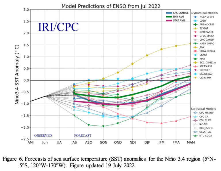
The National Weather Service expects La Nina to taper between December and February. The probability of La Nina is at 86%, but the percentage is at 60% in December through February, the National Weather Service predicted. While a majority of North American Multi-Model Ensemble models suggest La Niña will transition to a neutral impact between January and March 2023, forecasters are split on this outcome resulting in equal forecast probabilities for that season, the National Weather Service reported. La Niña’s greatest influence on weather and climate is during the winter, but National Oceanic and Atmospheric Administration Emily Becker indicated the climate pattern could have a minor role in the monsoon season by possibly creating an earlier start in the southwest U.S. If La Nina does persist, it will be the third time the climate pattern has repeated for three years in a row in the 73 years the National Weather Service has tracked it. The climate pattern appears when the sea surface temperature in the east-central Pacific Ocean is cooler than the long-term average by at least 0.5 degrees Celsius.

