The water replenishing the delta takes a circuitous path. A maze of irrigation infrastructure and long-neglected side channels delivers water to the 160-acre El Chaussé habitat restoration site, located 45 miles south of the U.S.-Mexico border in Baja California, and to downstream river segments. Photo: Claudio Contreras Koob
The Colorado River is revealing its secrets. For decades a World War II landing craft lay submerged 200 feet beneath Lake Mead’s surface — but now it’s beached, rusting in the sun. It’s become an unsettling marker of just how vulnerable the river is and how parched the Intermountain West has become.
The immediate impact of what’s being called the most severe mega-drought in 1,200 years, has been sharp cuts in the allocation of water to downstream users, with southern Nevada’s take slashed by seven billion gallons. Then there’s the fear that if Lake Mead’s water levels continue to fall, it may not be able to generate the power it now supplies to 1.3 million people in Nevada, Arizona and California.
Yet the diminished reservoirs tell another tale about the Colorado River, one of the world’s great plumbing systems, which enables downstream agriculture and sends potable water to an estimated 40 million residents. The story is that just where the river ends, at the Gulf of California, it has been slowly coming alive.
For decades, the United States sucked so much water from the Colorado that only a trickle, if that much, ever reached its desiccated, sprawling delta in Mexico. Once covering 9,650 square miles, the delta has shrunk to less than one percent of its original expanse. Human diversions wrung it dry.
It wasn’t always that way. In 1922, conservationist Aldo Leopold wrote about paddling a canoe through the delta’s green lagoons and marveling as “cormorants drove their black prows in quest of skittering mullets” and “mallards, widgeons, and teal sprang skyward in alarm.” When a troop of egrets settled on a far green willow, Leopold said they looked like a “premature snowstorm.”
Leopold’s lyrical vision had the misfortune a century ago of coinciding with the signing of the Colorado Compact, which sealed the delta’s fate. Approved by Wyoming, Colorado, Utah, New Mexico, Nevada, Arizona and California, the compact quantified the Colorado’s annual flow and set up the seven states to contend with one another to protect, if not expand, their individual shares. The compact turned the delta into a dust bowl.
For decades, environmental and tribal activists and nonprofit organizations protested the devastation that massive diversions to fill the Powell and Mead reservoirs produced in the delta’s once-flourishing human and biological communities. They pushed hard for remedies from both the U.S. and Mexican governments and the river-hugging state legislatures.
It wasn’t until 1993, when Bruce Babbitt became Secretary of the Interior under President Bill Clinton, that the political dynamic changed. Babbitt argued that the states must demonstrate how they intended to operate within their apportioned amount. If they failed to do so, he said, he would not approve surplus water, a threat particularly aimed at California, which routinely commandeered any surplus flow the other states didn’t use.
River activists immediately demanded that some of the water savings should head down to the delta. They got nowhere until 2014, when Mexico and the United States acted on their earlier commitment to sluice more water into the delta’s riparian habitats.
Since then, the two countries have periodically released water to mimic historic seasonal flooding. These tiny pulses of liquid energy, which constitute less than one percent of Los Angeles’ total annual water consumption, have had an outsized impact.
With restoration ecologists to guide the process, some wetlands have revived, small woodlands have flourished and native plants and animals have taken hold. Remote-sensing cameras recently spotted beavers gnawing on cottonwoods.
We don’t know how current drought-management solutions might cripple these recent interventions that brought the tail end of the river to life. Meanwhile, let’s recall Leopold visiting the delta where he watched burbling sandhill cranes circling overhead. The sight brought him joy as it made him feel he was joined with them in the “remote vastness of space and time.”
That’s a compelling affirmation that the Colorado River must be kept alive to its very end.
Char Miller
Char Miller is a contributor to Writers on the Range, writersontherange.org, a nonprofit dedicated to spurring lively conversation about the West. He is an environmental historian at Pomona College; his upcoming book is Natural Consequences: Intimate Essays for a Planet in Peril.
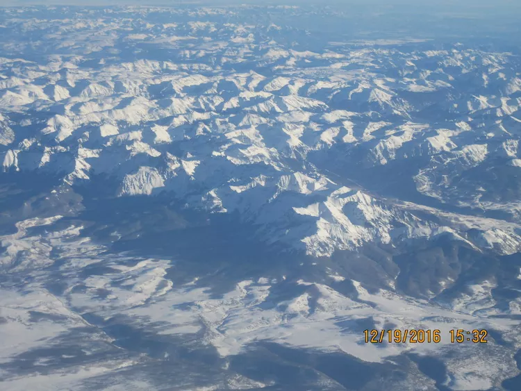
San Juan Mountains December 19, 2016. Photo credit: Allen Best
Click the link to read the article on the Pagosa Springs Sun website (Dorothy Elder). Here’s an excerpt:
The study’s first task was to identify municipal demand, and in doing so, the analysis provided population projection ranges for Archuleta County. Using a variety of sources, the ranges project that, in 2050, the population could be at 16,623 (low), 21,652 (medium) or 24,979 (high). In 2050, these ranges put municipal water demand at 4,208 acre-feet (low), 5,481 acre-feet (medium) or 6,323 acre-feet, calculated using a constant of 226 gallons per capita per day, which reflects the current demand.
[Wilson Water Group] also calculated demand needs in agriculture, environmental and recreation, using a variety of sources and data. Cumulatively, all of these demands (including municipal needs) were used to calculate different shortage scenarios and, ultimately, explore solutions for meeting these potential shortages. This included calculating potential reservoir sizes, which was met with contention at the event. The limiting factors in reservoir sizing are the legally and physically available water to fill the reservoir, the 50 cubic feet per second (cfs) filling constraint, and the demands driving reservoir releases, the analysis explains. The 50 cfs limit is based on the Dry Gulch Reservoir water right, and that the Dry Gulch environmental flow stipulations had to be met when the reservoir was filling, [Erin] Wilson explained…The recommendations for the reservoir size were 1,600 acre- feet to meet low demand and 10,000 acre-feet to meet mid-range demand. Wilson clarified these calculations are usable volume numbers, not the total volume of the reservoir…
Other highlights of the report include:
• Municipal water demands could more than double if the pace of population growth in Pagosa Area Water and Sanitation District’s area continues at current rates.
• Under historical climate conditions, agricultural demands are not expected to increase and may actually decrease due to urbanization.
• The two largest concerns affecting current and future water uses are earlier runoff and the potential for a catastrophic fire. Having storage to help capture earlier runoff could continue to be important in the future, and additional storage could provide redundancy and help mitigate the effects of a fire.
• Other alternatives, including stream restoration, fallowing and forest health, have the potential to improve streamflow and the SJWCD should continue to monitor on-going projects to see how the results could be applicable in the Upper San Juan Basin.
The public comment period is open until Aug. 31. Comments can be sent to comment.sjwcd@ gmail.com.
Wildfire is a phenomenon that has affected pretty much every vegetated environment on Earth for millions of years. However, during the past few decades, the planet has been experiencing extraordinary wildfire activity, with widespread devastation in diverse places such as the Mediterranean, North and South America, Southeast Asia, Australia and even Siberia. The current year has already shown troubling signs of massive fires – for example, Europe’s total burnt area for the 2022 fire season is four times greater than the 2006-2021 average, according to the European Forest Fire Information System (EFFIS).
In addition to causing direct damage to ecosystems and communities, wildfires also lead to enormous quantities of pollutants being emitted into the atmosphere. Globally, wildfire emissions upset the carbon cycle and the Earth’s radiation equilibrium; a phenomenon known asclimate forcing. They also influence temperature, clouds and rainfall, prompting air quality degradation and the subsequent death of around 300,000 people every year.
Despite the fact that catastrophic wildfires are rapidly intensifying and that their effects on people and the environment can be drastic, it is one of the most poorly understood processes in the Earth system. Given that wildfires emit greenhouse gases and aerosols (tiny smoke particles) that affect radiation in the atmosphere, it is expected with high confidence that they also result in disturbances to global and regional climate.
The limits of current models
However, the extent of such effects is highly uncertain. Models currently used for predicting the evolution of future climate, such as those participating in simulation experiments in support of the Intergovernmental Panel for Climate Change (IPCC) reports, either do not include a representation of wildfire effects or do so in a way that is not satisfactory. Without models that can accurately represent influences of climate change on wildfires, and, in turn, influences of wildfire-generated pollution on climate (i.e., fire-climate feedbacks), the future climate change predictions that we have available as a society might be suffering from significant biases.
Fire emissions do not only have the potential to influence long-term climate, but they can also alter short-term weather conditions in different parts of the globe. This is also a poorly understood scientific topic, despite the existence of some sporadic studies that have attempted to examine it.
A recent set of experiments by our team of climate scientists from the UK and Greece is shedding light on this question. The work involved a set of novel state-of-the-art climate model simulations of El Niño events, through which the impact of intense wildfire emissions over Equatorial Asia that have accompanied strong El Niño events in recent decades have been quantified.
Longer dry seasons in Asia
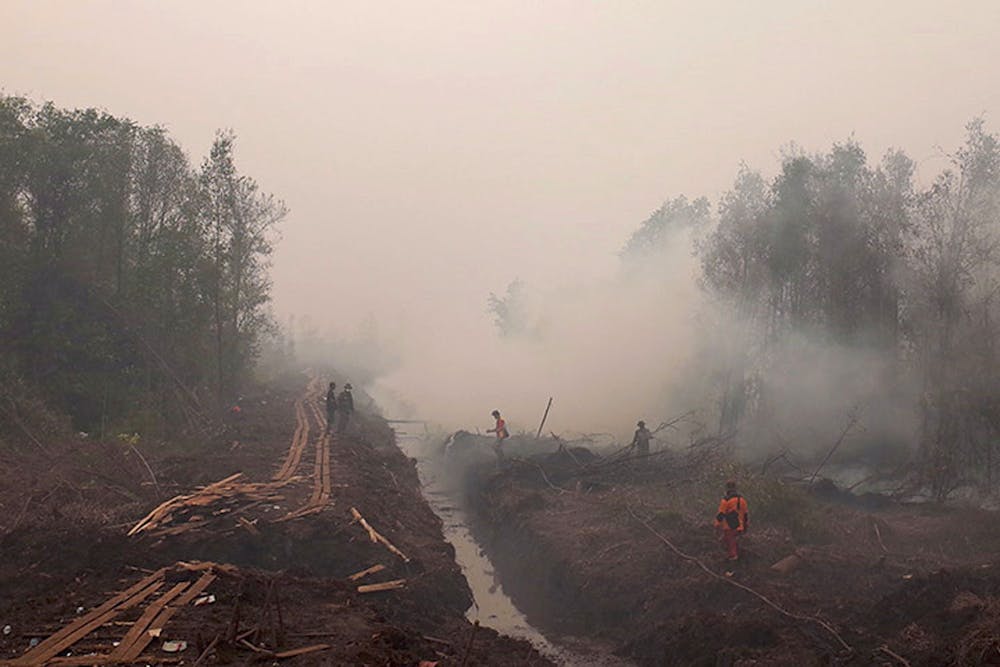
El Niño is a climate phenomenon with significant societal impact, altering weather patterns around the Pacific region, as well as in multiple regions across the globe. One consequence is a deeper and prolonged dry season in Equatorial Asia. During recent large El Niño events, such as in 1997 and 2015, this has combined with expanding agricultural land clearance to produce vast fires in peat-dominated areas. These are some of the largest fires on Earth, attracting both scientific and media attention due to the blanket of smoke they produce across the region lasting several weeks, impacting the health of millions of people.
The 2015 fire season in Indonesia left behind a smoky pall that reached around the globe. NASA/Flickr, CC BY
Previous literature has focused on the magnitude of these El Niño-driven smoke emissions and their serious health impacts. However, there has been surprisingly little research on the climate feedback of this transient but very large aerosol radiative forcing. The hypothesis of the new study is that these smoke emissions can drastically influence atmospheric conditions in the western Pacific and therefore modify the development of the El Niño phenomenon itself.
The study represents the first time that the impact of intense smoke emissions over Equatorial Asia have been investigated in full-complexity climate simulations. These allowed the researchers to compare the development of El Niño events with and without the presence of large wildfire emissions from Equatorial Asia, using the intense 1997 fire season as a test case.
Wildfires’ impact on El Niño
The findings suggest that the intense smoke emissions result in a strong lower atmospheric heating over Equatorial Asia, which enhances local convection (ascending motion of air), cloud concentration and rainfall over the Maritime Continent. This in turn shifts cloud cover westward in the Pacific, and significantly strengthens the “Walker circulation”, which is the typical pattern of air flow in the tropical lower atmosphere. This opposes the typical El Niño circulation in the Pacific (which is a weakening of the Walker circulation) and results in a negative feedback on the El Niño event itself. The researchers find that the El Niño event is weakened by around 22% on average due to the wildfire emissions that the El Niño event itself produces.
As well as being an indication of the climate impact that these exceptional El Niño-driven fire seasons in Indonesia can have, these findings also have clear implications for El Niño predictability. Including the impact of enhanced wildfire emissions during large El Niño events can significantly influence the progression and intensity of the El Niño itself. More generally, these findings pave the way for more such studies investigating the implications of fire-generated pollution for atmospheric circulation, rainfall, and temperatures, in a variety of world regions, both on short (weather) and on long (climate) timescales.
In addition to the scientific significance of this research, it also has the potential to significantly impact a variety of economic sectors and societal stakeholders. Better weather and climate forecasts resulting from an improved representation of wildfires in models is expected to lead to better-informed policy making, and to higher-quality weather/climate information available to businesses and to society as a whole.
Created in 2007 to help accelerate and share scientific knowledge on key societal issues, the Axa Research Fund has been supporting nearly 600 projects around the world conducted by researchers from 54 countries. To learn more, visit the site of the Axa Research Fund.