Click the link to read the update on the NIDIS website. Click through for the outlooks and state-based impacts and conditions. Here’s an excerpt:
Key Points
- Most of the Intermountain West experienced a cool and wet November.
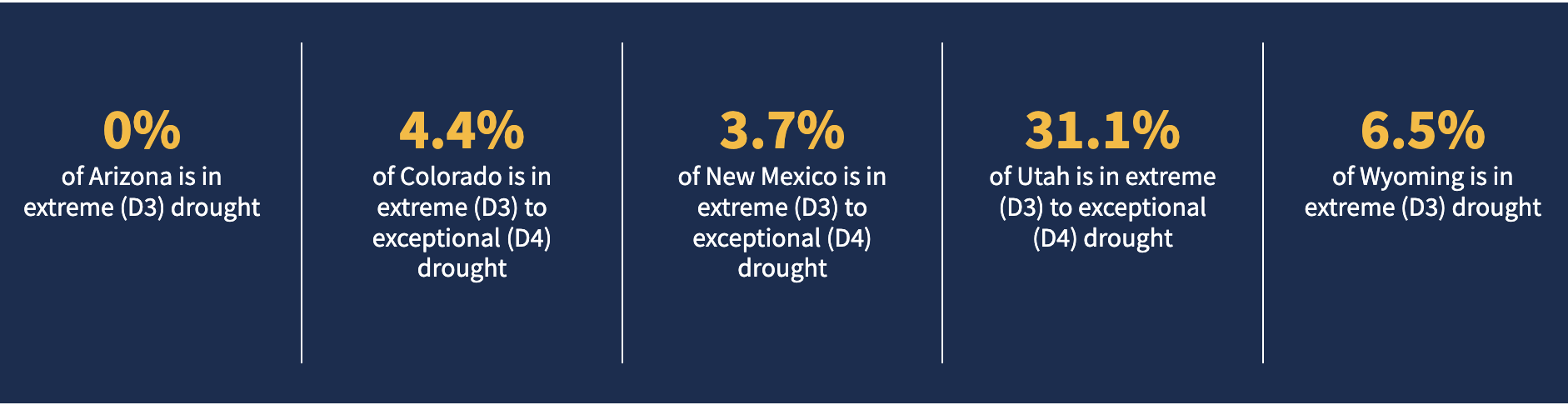
- Exceptional (D4) drought has dropped to less than 0.5% of the region, persisting in central Utah and far northeastern Colorado.
- The area in severe (D2) to exceptional (D4) drought is at its lowest in two years.
- NOAA’s seasonal outlook for January–March 2023 shows a warmer and drier-than-normal season ahead for the Southwest.
Current Drought Conditions and Outlook
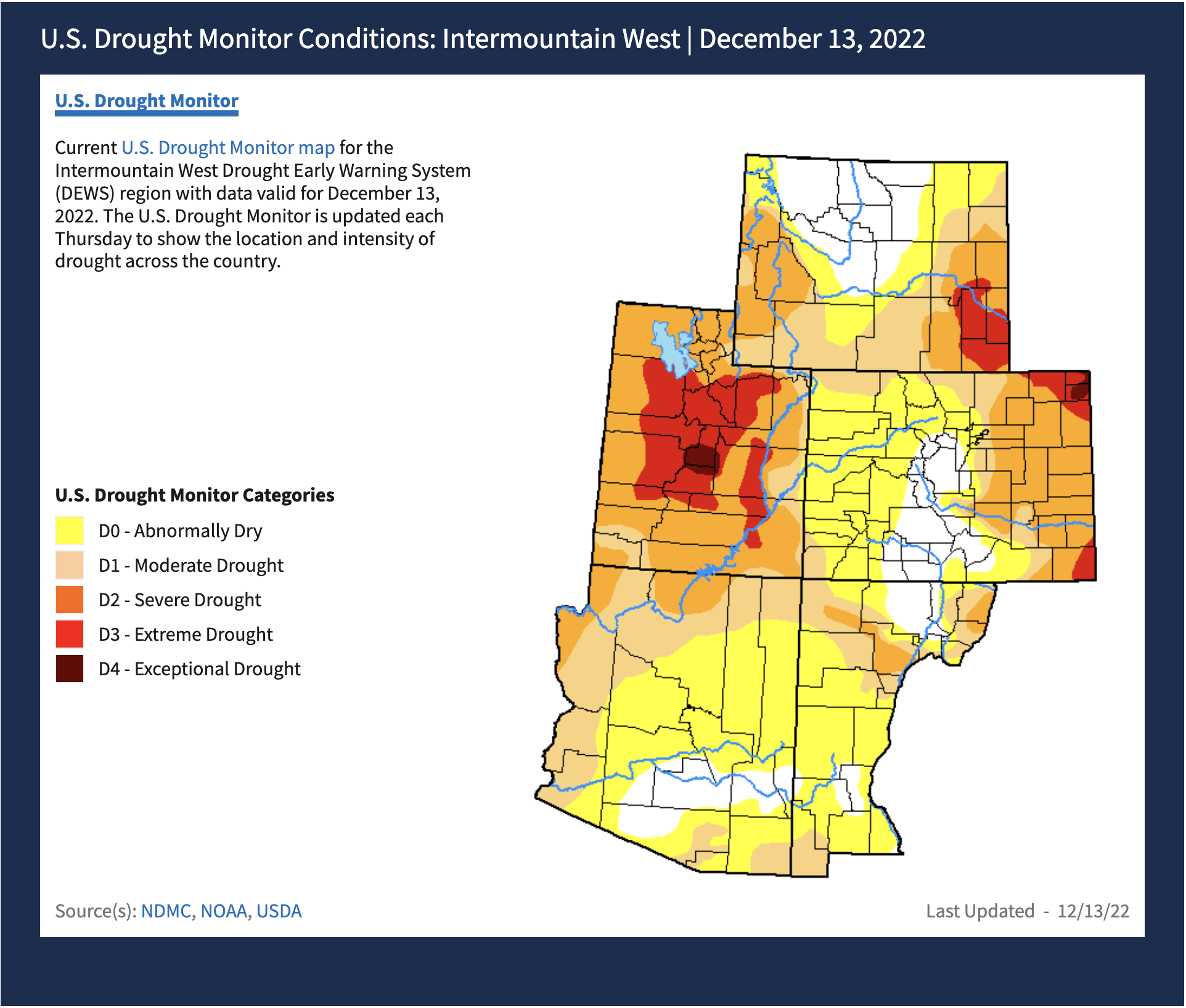
U.S. Drought Monitor Conditions
- Exceptional (D4) drought persists in central Utah and northeastern Colorado.
- 8% of the region is experiencing Extreme (D3) drought or worse, the lowest amount since August 2020.
- Extreme (D3) drought conditions have been in place in this region since May 2020.
- Moderate (D1) or worse drought has been in the region since August 2009.
November Temperatures and Precipitation
- November was another cooler-than-normal month for the Intermountain West.
- Statewide November monthly temperature rankings:
- Arizona: 15th coolest November and coolest since 2000
- Colorado: 29th coolest November and coolest since 2000
- New Mexico: 29th coolest November and coolest since 2000
- Utah: 14th coolest November and coolest since 2000
- Wyoming: 19th coolest November and coolest since 2003
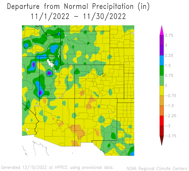
- Precipitation in November was generally average to below average across the Intermountain West, with the exception of the Great Basin and Wasatch regions of western and northern Utah.
Departure from Normal Temperature

Departure from Normal Precipitation
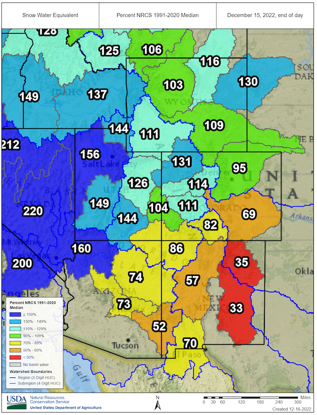
Snowpack
- Winter precipitation is essential for ameliorating drought in the Intermountain West. Winter snowpack acts as a natural reservoir that adds water to western rivers and streams during the spring melt.
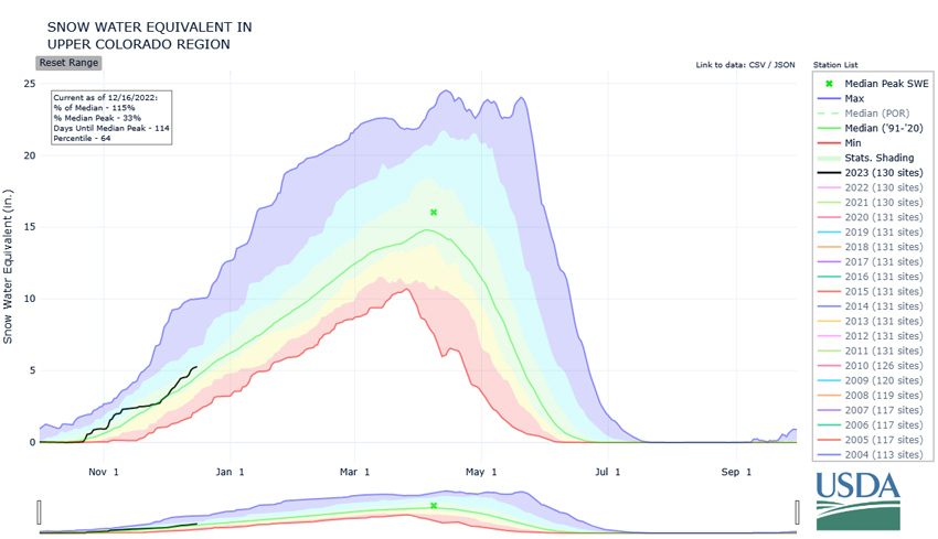
- As of December 15, the Upper Colorado River Basin had an average of 114% of normal snow water equivalent for this time of year. The lower Colorado River basin was at 118% of normal.
- Snowpack in New Mexico and eastern Arizona is below average for this point in the season; the snow water equivalent for the Rio Grande Basin is at only 69% of the 1991–2020 median.
- It’s too early in the season to anticipate the final snowpack for the year. For the Upper Colorado River Basin, the snowpack usually peaks around April 8 (118 days from the writing of this report).
Snow Water Equivalent Percent of Median: Intermountain West
Snow Water Equivalent in the Upper Colorado