
Click on a thumbnail graphic to view a gallery of drought data from the US Drought Monitor website.


Click the link to go to the US Drought Monitor website. Here’s an excerpt:
This Week’s Drought Summary
Another week with isolated precipitation and warmer-than-normal temperatures for much of the contiguous U.S. (CONUS) brought a mixture of degradations and some smaller areas of improvement. The Midwest, Northeast and Southeast generally saw one-category degradations near existing abnormally dry or drought areas. There was some improvement from Texas to West Virginia and northeastern Kansas into northwestern Illinois, which followed a band of beneficial precipitation that fell this week. The northern intermountain West saw minor improvements with isolated precipitation and decent snow (snow water equivalent). Washington saw some improvement along the eastern Cascades while abnormally dry conditions expanded southward into northwest Oregon. The Southwest and southern Plains saw extensive degradation. Another week with no precipitation continues drying out the region, with alarmingly low streamflows in some areas and high fire danger from south California into southern New Mexico. Many mountainous regions of the Southwest and into Utah and Colorado are showing abnormally low snowpack, leading to degradation in these areas…
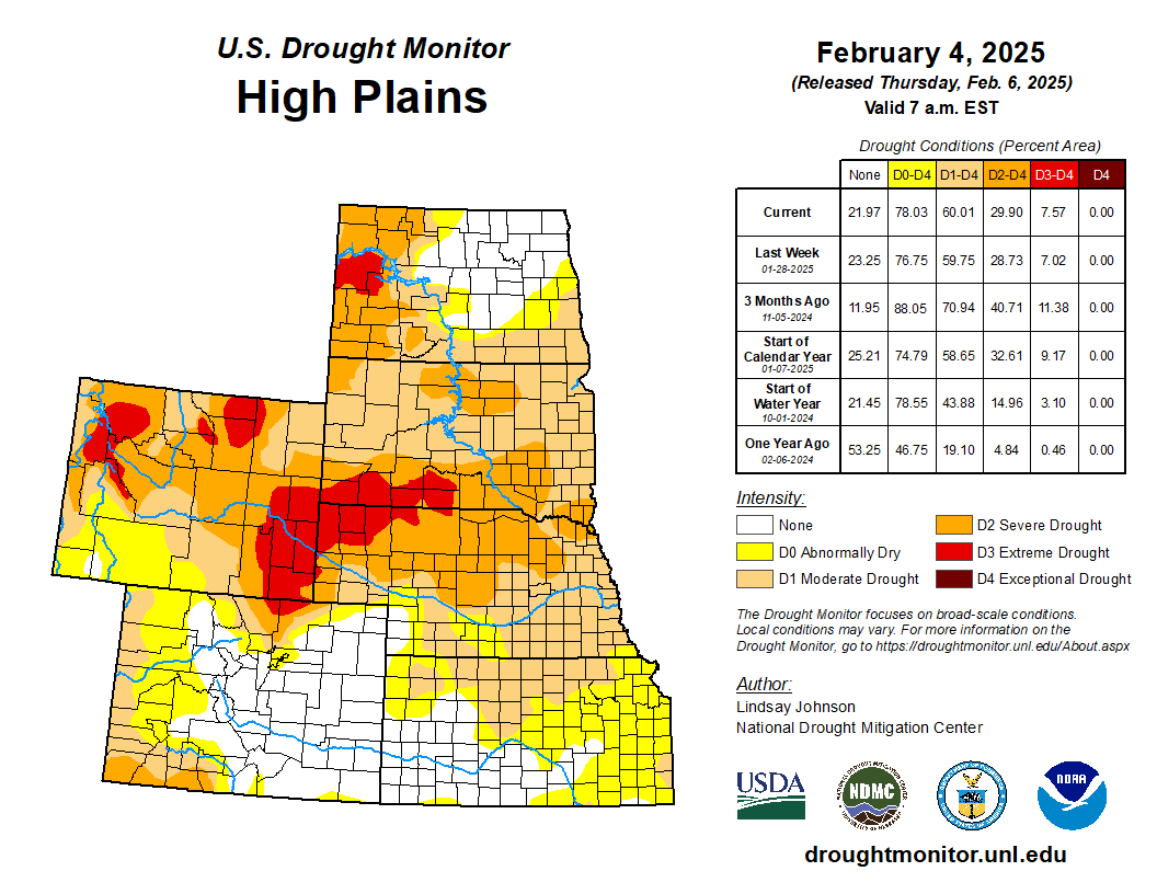
High Plains
Like much of the central part of the country, the High Plains were 5 to 10 degrees warmer than usual. Little precipitation led to minor improvements in southeast Nebraska, northeast Kansas and along the Wyoming Rockies. Due to prolonged dryness, South Dakota saw the expansion of severe drought in the north-central eastward and extreme drought in the southwest…
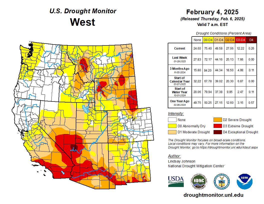
West
The Northwest saw below-normal temperatures while the rest of the Western states were near or above normal. The intermountain West saw temperatures of 5 to 10 degrees above normal. Precipitation fell along the western coast from Washington to northern California, central Idaho, and higher elevations in Montana and Wyoming. This precipitation, along with good snow water equivalents, aided dry and drought conditions in north-central Washington, northwest and northern Wyoming, and central Montana. Unlike the rest of the northwest, Oregon saw the expansion of abnormal dryness in the northwest. Despite precipitation, streamflow and soil moisture were below the 30th percentile, indicating abnormally dry conditions. The remainder of the West saw widespread degradations. Severe and extreme drought expanded in southern California into southern Nevada, Utah and Arizona. Exceptional drought was introduced in southern Nevada along the northwestern Arizona border. Conditions are alarmingly dry, with dry soil and high fire danger. Moderate drought and abnormally dry conditions expanded in central and northern Utah and western Colorado. One-category degradations continued into New Mexico, with abnormal dryness to extreme drought expanding across the state into west Texas…
South
Above-normal temperatures and the absence of this week’s precipitation led to widespread degradations across the Texas and Oklahoma panhandles, along the Red River and in central Oklahoma. Last week, a band of heavy rainfall fell, leading to improvements in central Texas, along the eastern edge of the Oklahoma-Texas border, along the Red River, and up into central and northern Tennessee. Outside the band of precipitation, Tennessee saw degradations in the West and along the Georgia and North Carolina borders….
Looking Ahead
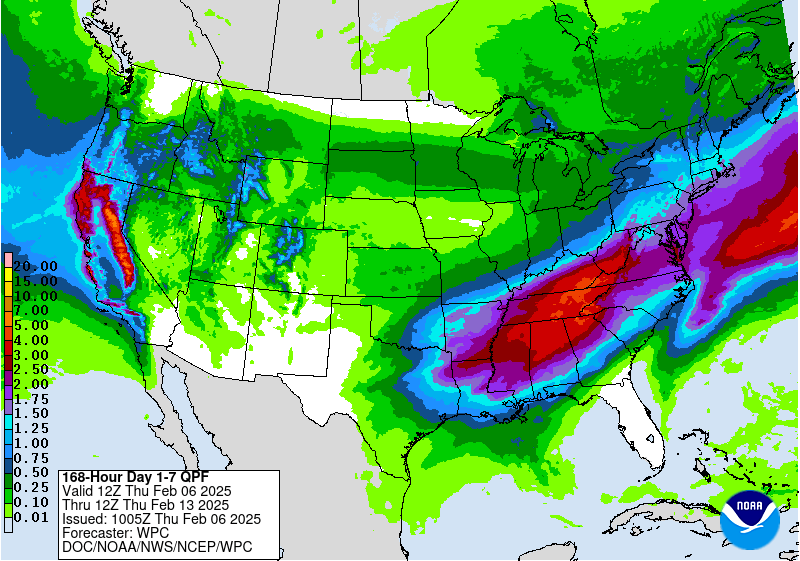
Over the next five to seven days, some coastal areas of the West could see precipitation from the Oregon Cascades into northern and central California. Other higher-elevation areas in the intermountain West are also expected to receive some precipitation. Precipitation chances appear good over the southern Plains and across much of eastern CONUS, with the heaviest expected in the Appalachian region. Areas from northern Louisiana into West Virginia could see 3 to 5 inches of precipitation. Dry conditions will continue in the Southwest and Central Plains.
The 6-10 day outlook shows the greatest probability of below-normal temperatures is in the northern Plains and across the U.S.-Canadian border. Below-normal temperatures are leaning toward below normal as far south as north Texas. The best chances of above-normal temperatures will be across the Southeast, with the greatest chance being in the Florida Panhandle. Hawaii is also likely to see above-normal temperatures. Alaska could experience below-normal temperatures in the Southeast and above-normal temperatures along the state’s western side. The greatest chances of above-normal precipitation are in the southern Appalachian region and the West in south Oregon and north California. The best opportunity for below-normal precipitation is in the central and northern Alaska interior.

Just for grins here’s a slide show of early February US Drought Monitor maps for the past few years.
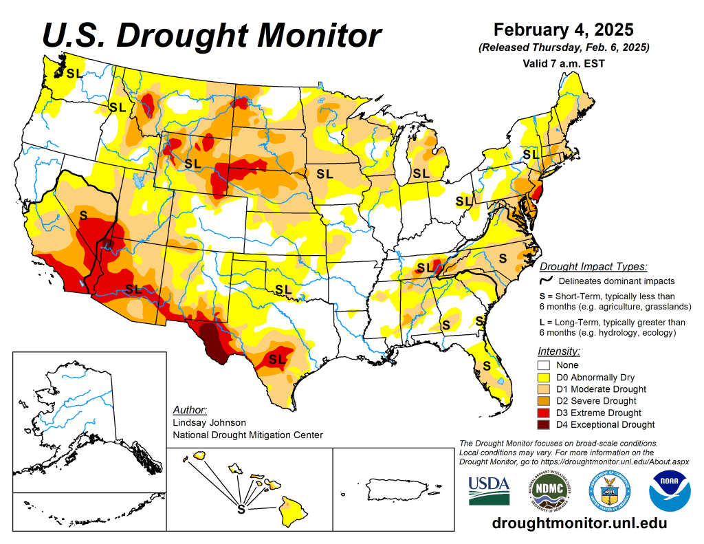
US Drought Monitor map February 4, 2025. 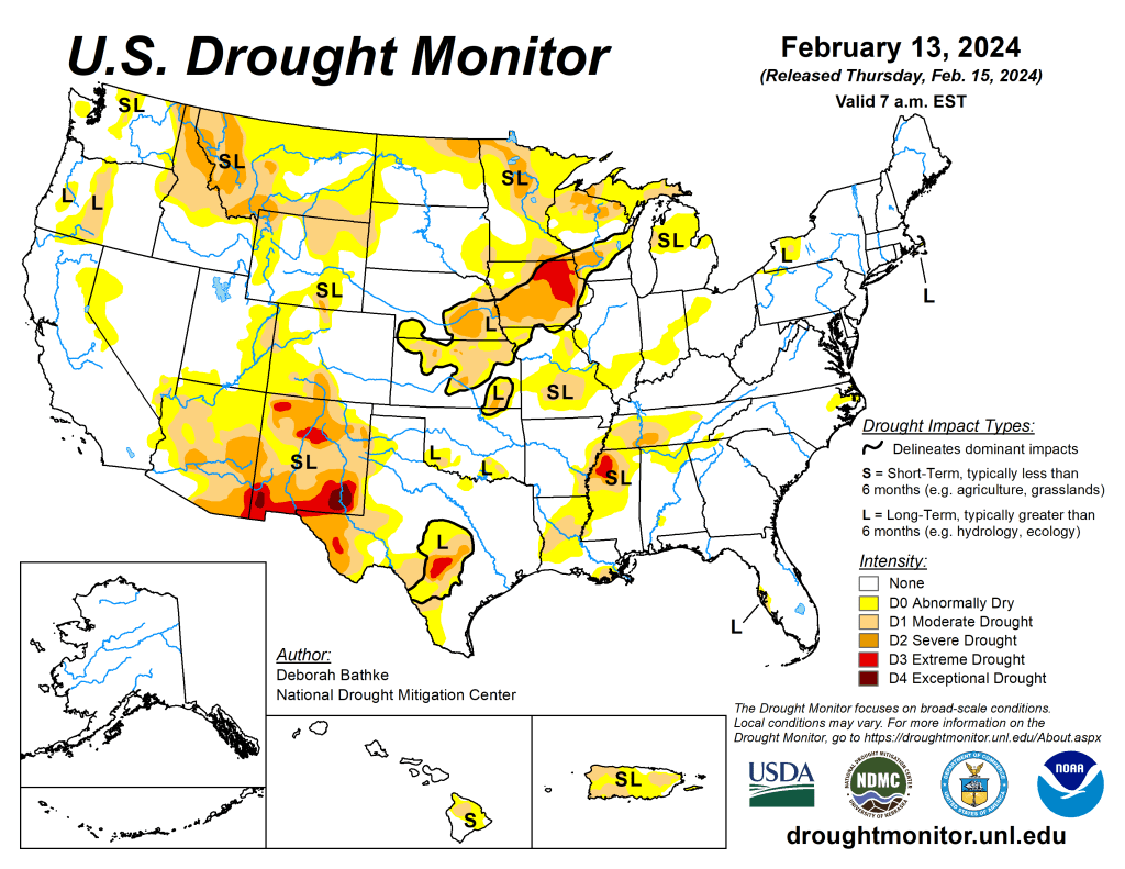
US Drought Monitor map February 13, 2024. 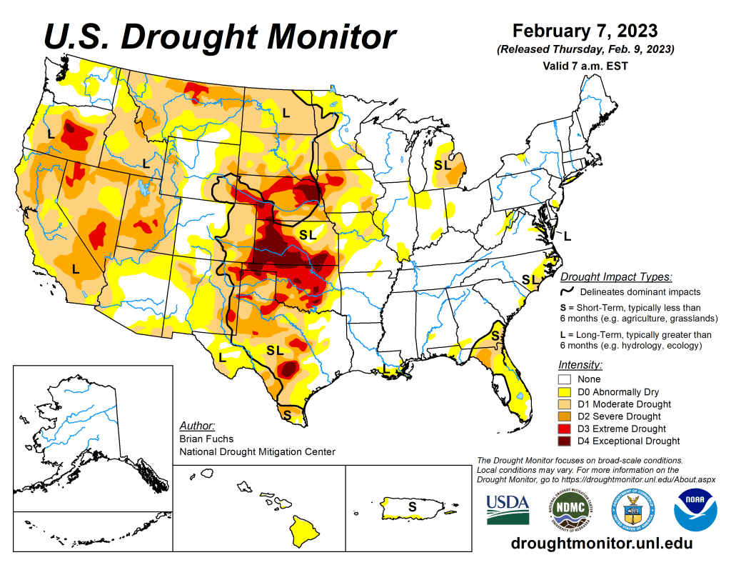
US Drought Monitor map February 7, 2023. 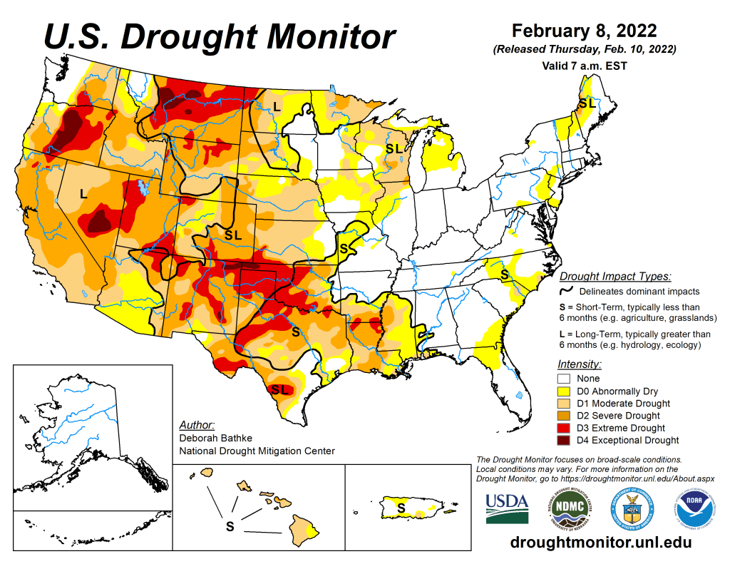
US Drought Monitor map February 8, 2022. 
US Drought Monitor February 2, 2021. 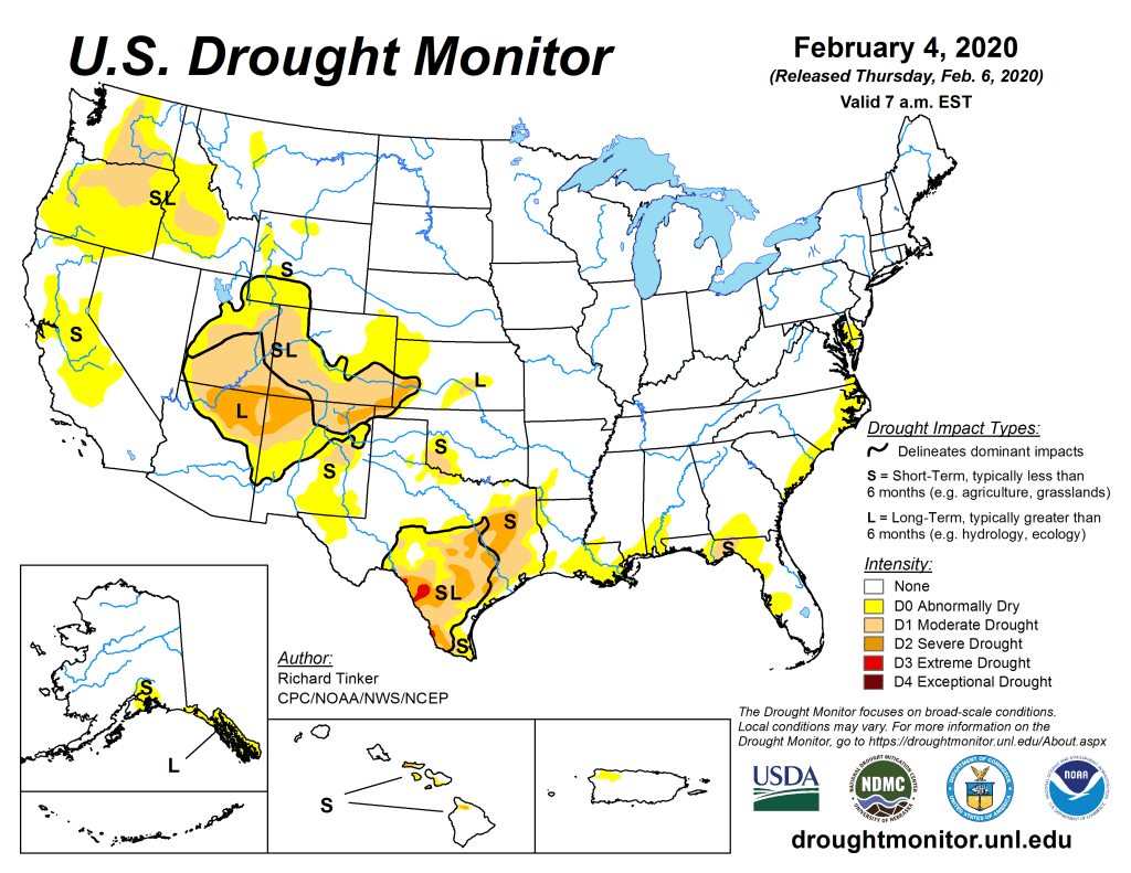
US Drought Monitor February 4, 2020. 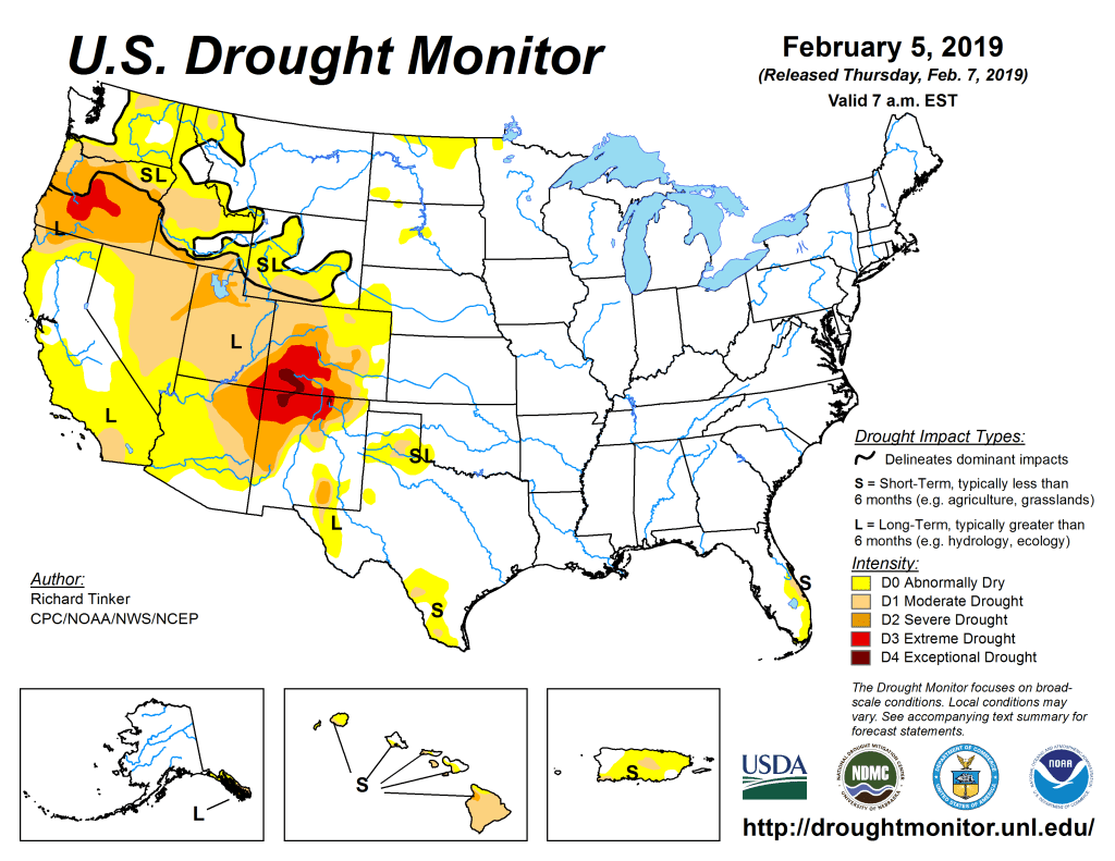
US Drought Monitor February 5, 2019. 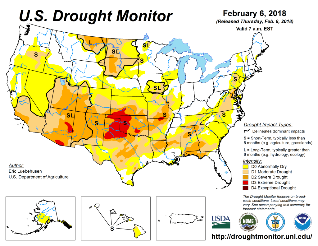
US Drought Monitor February 6, 2018. 
US Drought Monitor February 7, 2017. 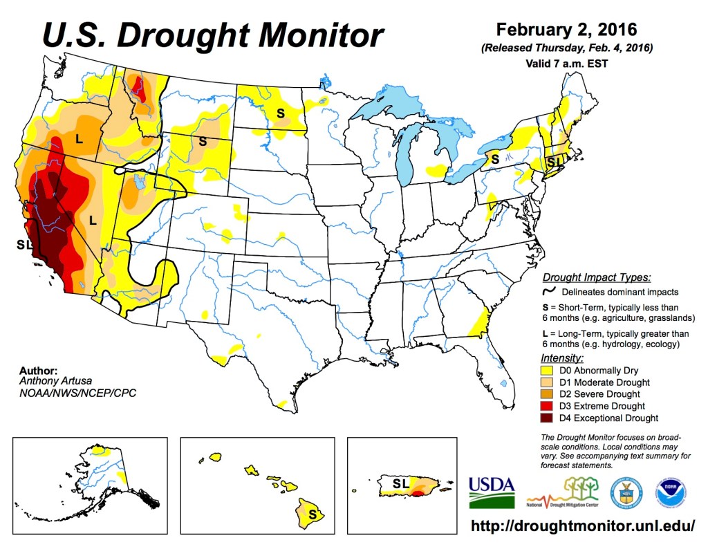
US Drought Monitor February 2, 2016 
US Drought Monitor February 3, 2015 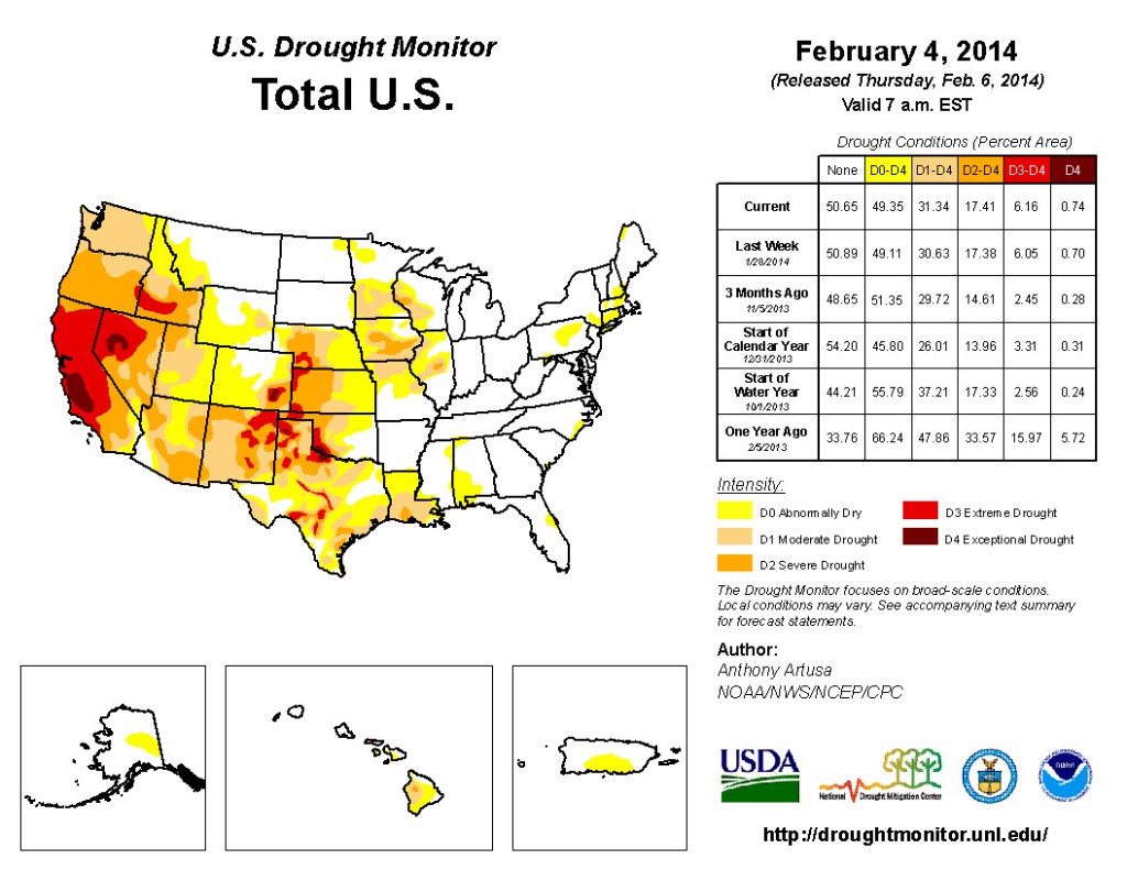
US Drought Monitor February 4, 2014 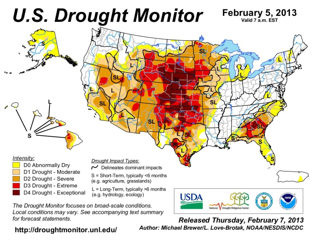
US Drought Monitor February 5, 2013 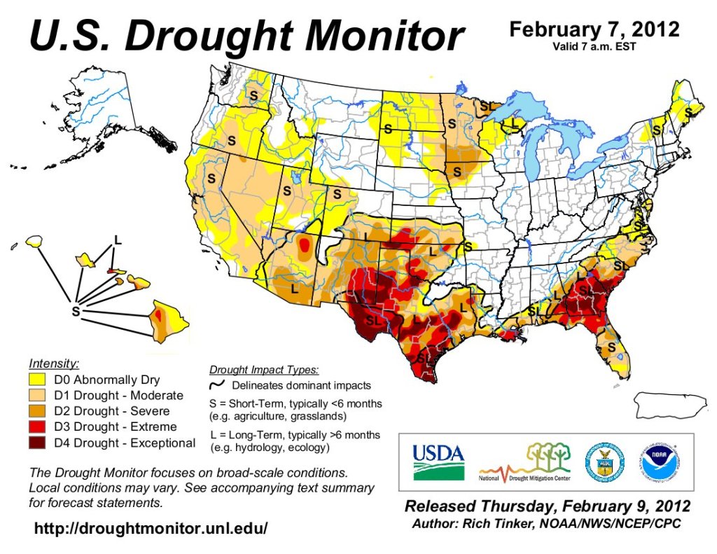
US Drought Monitor February 7, 2012 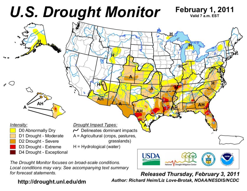
US Drought Monitor February 1, 2011 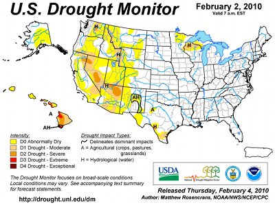
US Drought Monitor February 1, 2010