January 2025 – Surface air temperature and sea surface temperature highlights
Global Temperatures
January 2025 was the warmest January globally, with an average ERA5 surface air temperature of 13.23°C, 0.79°C above the 1991-2020 average for January.
January 2025 was 1.75°C above the pre-industrial level and was the 18th month in the last nineteen months for which the global-average surface air temperature was more than 1.5°C above the pre-industrial level.
The last 12-monthsperiod (February 2024 – January 2025) was 0.73°C above the 1991-2020 average, and 1.61°C above the estimated 1850-1900 average used to define the pre-industrial level.
*Datasets other than ERA5 may not confirm the 18 months above 1.5°C highlighted here, due to the relatively small margins above 1.5°C of ERA5 global temperatures observed for several months and differences among the various datasets.
Europe and other regions
The average temperature over European land for January 2025 was 1.80°C, 2.51°C above the 1991-2020 average for January, the second warmest after January 2020, which was 2.64°C above average.
European temperatures were most above the 1991-2020 average over southern and eastern Europe, including western Russia. In contrast, they were below average over Iceland, the United Kingdom and Ireland, northern France, and northern Fennoscandia.
Outside Europe, temperatures were most above average over northeast and northwest Canada, Alaska, and Siberia. They were also above average over southern South America, Africa, and much of Australia and Antarctica.
Temperatures were most notably below average over the United States and the easternmost regions of Russia, Chukotka and Kamchatka. The Arabian Peninsula and mainland Southeast Asia also had below-average temperatures.
Sea surface temperature
The average sea surface temperature (SST) for January 2025 over 60°S–60°N was 20.78°C, the second-highest value on record for the month, 0.19°C below the January 2024 record.
SSTs were below average over the central equatorial Pacific, but close to or above average over the eastern equatorial Pacific, suggesting a slowing or stalling of the move towards La Niña conditions. SSTs remained unusually high in many other ocean basins and seas.
Monthly global surface air temperature anomalies (°C) relative to 1850–1900 from January 1940 to January 2025, plotted as time series for each year. 2025 is shown with a thick red line, 2024 with a thick orange line, 2023 with a thick yellow line, and all other years with thin grey lines. Data source: ERA5. Credit: Copernicus Climate Change Service /ECMWF.
According to Samantha Burgess, Strategic Lead for Climate at ECMWF:
“January 2025 is another surprising month, continuing the record temperatures observed throughout the last two years, despite the development of La Niña conditions in the tropical Pacific and their temporary cooling effect on global temperatures. Copernicus will continue to closely monitor ocean temperatures and their influence on our evolving climate throughout 2025.”
January 2025 – Hydrological highlights
January 2025 saw predominantly wetter-than-average conditions over regions of western Europe, as well as parts of Italy, Scandinavia and the Baltic countries; heavy precipitation led to flooding in some regions.
Conversely, drier than average conditions established in northern UK and Ireland, eastern Spain, and north of the Black Sea.
Beyond Europe, it was wetter than average in Alaska, Canada, central and eastern Russia, eastern Australia, south-eastern Africa, southern Brazil, with regions experiencing floods and associated damage.
Drier than average conditions established in southwestern United States and northern Mexico, northern Africa, the Middle East, across Central Asia and in eastern China as well as in much of southern Africa, southern South America and Australia.
January 2025 – Sea Ice highlights
Arctic sea ice reached its lowest monthly extent for January, at 6% below average, virtually tied with January 2018.
In the Arctic region, sea ice concentration anomalies were well below average in the eastern Canadian sector, including Hudson Bay and the Labrador Sea, and in the northern Barents Sea.
Antarctic sea ice extent was 5% below average and thus relatively close to average compared to other recent years. This contrasts with the record or near-record values observed in 2023–2024.
In the Antarctic region, sea ice concentrations were above average in the Amundsen Sea and generally mixed in other ocean sectors.
More information about climate variables in January and climate updates of previous months as well as high-resolution graphics can be downloaded here.
Other useful links:
Answers to frequently asked questions regarding temperature monitoring can be found here.
Follow near-real-time data for the globe on Climate Pulse here.
More on trends and projections on Climate Atlas here.
Colorado River. For over 50 years, stakeholders throughout the Colorado River basin have worked to address challenges caused by salinity. Photo credit: Abby Burk via Audubon Rockies
Click the link to read the article on the Summit Daily website (Ali Longwell). Here’s an excerpt:
February 6, 2024
Since 1974, the seven Colorado River basin states — Arizona, California, Colorado, Nevada, New Mexico, Utah and Wyoming — have coordinated efforts to implement salinity control in the waterway as part of the Colorado River Basin Salinity Control Forum. The forum was created by the U.S. Congress, flowing funding through the Bureau of Reclamation to reduce the salt load in the river and research the issue…While salinity is naturally occurring, there are a few reasons that states and river stakeholders have long kept an eye on it.A baseline amount of salinity is OK. Too much salinity can have adverse effects on drinking water, water infrastructure and treatment, appliance wear, aquatic life, the productivity of certain agricultural crops (including wine grapes, peaches and other salt-sensitive products) and more. The U.S. Bureau of Reclamation estimates that salinity causes between $500 and $750 million annually in damages and could exceed $1.5 billion per year if future increases are not controlled…
Much of the Upper Basin geology — specifically Mancus and Mesa Verde shale formations — was created when it was covered by an inland sea, [David] Robbins added. Therefore, they contain salt deposits that through natural erosion and runoff, make their way to the rivers and downstream. In Colorado, natural salinity sources include the geothermal hot springs in Glenwood Springs; shale cliffs and evaporating salt deposits in the Eagle and Roaring Fork valleys; and the salt domes in Paradox Valley in Montrose County along the Dolores River. Human activity can also exacerbate challenges by accelerating the release of compounds from these natural geologic materials and increasing the salt load in the river and tributaries, according to the 2009 U.S. Geological Survey report. This includes activities like mining, farming, petroleum exploration and urban development. For example, with some agricultural irrigation practices, by adding more water to the soil that naturally contains salts, “increases the rate of dissolution above the natural signal,” [Dave] Kanzer said. The use of road salts — solid and liquid — to clear snow and ice can also lead to increased salt loads as the salt dissolves and makes its way into snowmelt and streams.
Click the link to read the article on the LandDesk.org website (Jonathan P. Thompson):
January 31, 2025
🌵 Public Lands 🌲
The Joe Lott-Fish Creek grazing allotment sprawls across nearly 78,000 acres of U.S. Forest Service land in western Utah. It contains a variety of ecosystems, ranging from arid juniper-piñon forests in the lower elevation sections that straddle I-70, to aspen and conifer glades, to 11,000-foot peaks, as well as several streams.
Until just over a decade ago, the primary grazing permittee was Missouri Flat LLC, which was allowed to run 744 cow-calf pairs on the land. Another rancher had a maximum herd of 40. The cattle were supported by 14 cattle ponds and troughs.
Sometime between 2013 and 2016, Missouri Flat’s permit was taken over by Pahvant Ensign Ranches. Over a period of about three years around the same time, the Fishlake National Forest upped the maximum number of cattle allowed to graze the allotment by 604, to a total of 1,388 cow-calf pairs, without notifying the public until 2021. The Forest Service said favorable conditions following the 2010 Twitchell Fire justified the increase, but they didn’t provide any scientific backing for the decision. Then, last April, the Forest Service approved a proposal to add 17 water troughs and 13 miles of new pipeline to the Pahvant Ensign allotment, granting the project a “categorical exclusion,” meaning it isn’t subjected to the usual environmental review.
“Functionally,” wrote Mary O’Brien, a botanist and longtime defender of public lands, ecosystems, and pollinators, “Joe Lott-Fish Creek Allotment is being transformed into a private ranch.”
O’Brien brought the story of the Joe Lott allotment to my attention several months ago. She wanted to show me, in part, that while environmentalists tend to focus on the Bureau of Land Management when pushing back on public lands livestock grazing, they shouldn’t forget that grazing is also widespread on Forest Service lands. And that the Forest Service is no better at managing it than the BLM.
I also find it to be a sort of snapshot of how public lands grazing — under any agency — has come to be the West’s untouchable sacred cow, something that neither Democrats nor Republicans dare to mess with or reform, no matter how obsolete the current regulations or how much harm is being done. I’m not just talking about the Biden or Trump administrations, either: This bipartisan inaction has been going on since the Taylor Grazing Act was passed in 1934.
When the white colonial-settlers invaded the Western U.S. in the 19th century, they brought along oodles of cattle and sheep. In some places, the settlers were even preceded by the giant herds of big-time cattle companies and their minders. A good portion of southeastern Utah, for example, was once blanketed by grass that reached an elk’s belly. But then the huge livestock operations, including New Mexico and Kansas Land and Cattle Company and the Carlisle outfit, brought in tens of thousands of head of sheep and cattle beginning in the 1870s. Before long the Hole-in-the-Rock Mormon settlers also got into the livestock business, pasturing their cows and sheep on Elk Ridge near the Bears Ears buttes.
By the 1890s, as many as 100,000 sheep and cattle were chomping their way across San Juan County, reducing large swaths of the formerly abundant grasslands to denuded, dusty, gullied, flash-flood-prone wastelands. Plus, the sheepmen and the cattlemen were constantly fighting over who got access to what portion of range, a conflict that had disastrous outcomes. At one point, allegedly out of spite, the Carlisle livestock concern turned out thousands of sheep on the upper branches of Montezuma Creek, Monticello’s source for drinking water. Bacteria from the sheep feces contaminated the water, leading to a typhoid outbreak in Monticello that killed eleven people.
This sort of free-for-all and its consequences was not unique to the region; it was being repeated all over the West. The destruction and chaos inspired the federal government to try to get a handle on things, and in 1891 Congress passed the Forest Reserve Act (which would later become the Forest Service), giving the president the authority to withdraw areas from the public domain where grazing and other activities would be regulated. In response to the typhoid outbreak, Monticello residents petitioned the feds to create a forest reserve in the La Sal and Abajo Mountains. This would become the Manti-La Sal National Forest.
That still left millions of acres in the virtually lawless public domain, where livestock operators continued to run cattle and sheep without restraint. Finally, in 1934 Congress passed the Taylor Grazing Act to “stop injury to the public grazing lands by preventing overgrazing and soil deterioration,” to impose order, and to stabilize the livestock industry. A new agency, the Grazing Service (which was merged with the General Land Office to become the BLM in 1946), would manage a permitting and fee system on about 140 million acres of land, mostly sagebrush country, in the arid West. The lands were divided into grazing districts, each of which had an advisory board mostly made up of ranchers within that district, thus giving it an element of home rule and easing concerns that the federal landlord was taking too much control.
Nearly 12 million animals were permitted to graze on Taylor Act land across the West that year, yielding just $1 million in revenue—meaning ranchers were paying, on average, just eight cents per year to fatten up each of their bovines or ungulates on taxpayer-owned grass. Seventy-five percent of the revenue went back to the states and grazing districts, where the advisory boards determined how it would be spent. Nearly all of the funds went to so-called range improvement projects, which ultimately benefitted the ranchers, such as killing predators and rodents and construction of stock trails and diversion dams.
Still, even though many ranchers were in denial regarding the true causes of the ruination of the range—they attributed it to drought—they were generally ambivalent towards the act because it imposed order on the chaos that resulted from competing uses of the public domain. But the good feelings would soon vanish as the cattlemen felt threatened by proposals to designate new national monuments on public lands, including on a 4.5-million-acre swath roughly following the Colorado River in southern Utah. Back then, after all, grazing was generally prohibited in national monuments and parks.
And in the mid-1940s, when the Bureau of Land Management endeavored to raise grazing fees, the National Wool Growers Association and the American National Livestock Association gathered in Salt Lake City and launched a revolt with the backing of Western lawmakers. They demanded not only that grazing fees be capped, and national monument and park designations be halted, but also that all of the lands governed by the Taylor Act be transferred to the states or privatized. It was an early version of the Sagebrush Rebellion that is now being repeated by Utah and Wyoming. In a 1947 Harpers column, Bernard DeVoto reminded his readers, “Cattlemen do not own the public range now; it belongs to you and me,” adding that because federal grazing fees were so much lower than those for private land, they amounted to a subsidy.
The land-grab legislation that grew out of this revolt died. And grazing fees were raised, jumping from the original five cents per animal-unit-month1 for cattle to eight cents. The revolt did halt the giant Utah national monument, however, and the BLM continued to bow to the demands of the livestock industry.
It looked like things might change in the 1970s, however, when Congress passed the Federal Lands Policy Management Act, or FLPMA, which required the BLM to manage public land for multiple uses, including recreation and conservation. And in 1977, then President Jimmy Carter named Cecil Andrus as Interior Secretary. Andrus came into office with a bang, noting in a 1977 speech: “The initials BLM no longer stand for Bureau of Livestock and Mining. The days when economic interests exercised control over decisions on the public domain are past. The public’s lands will be managed in the interest of all the people because they belong to all the people. For too long, much of the land where the deer and the antelope play has been managed primarily for livestock often to the detriment of wildlife.”
A sign on Cedar Mesa in Bears Ears National Monument illustrating the way one BLM field office sees livestock grazing. Photo courtesy of Rose Chilcoat.
And yet, public land grazing reform has been minimal, at best, in the ensuing five decades. The grazing fee, is only one small piece of the public lands grazing controversy, but it’s good proxy for the situation as a whole. In 1978, Congress established a formula for setting grazing fees, but also said they couldn’t drop below $1.35 per AUM (or $6.82 in 2024 dollars, if you were to adjust for inflation). While the fee climbed as high as $2.31 in 1981, it has remained at or near the minimum nearly every year since (in 2024 it was $1.35 once again). Nearly everyone agreed that the forage was worth far more than that, and the data made clear that fees would have to be substantially higher for the grazing program to pay for itself.
And yet, efforts to increase the fee and bring it in line with market rates have consistently flopped. The Clinton administration proposed upping the base charge to $3.96 per AUM (along with a host of other reforms). That sparked widespread outrage amongst ranchers and Western politicians, yet went nowhere. Obama wanted to tack an administrative charge on top of the regular fee. It never happened.
Early in its term, the Biden administration launched a review of and promised reforms to the public lands grazing program. For conservationists, this was an opportunity for the feds to re-implement environmental reviews before renewing lapsed grazing leases, to allow leases to be bought out and permanently retired, to use rangeland health to determine whether grazing can continue on a specific allotment, and to consider grazing’s impacts on climate change. While the administration made admirable moves to set aside public lands and regulate oil and gas drilling, it quietly smothered any effort to reform grazing.
Instead, the administration not only kept grazing fees at $1.35 during all four years, but it also included active grazing lands under its “30 by 30” program. And, in creating the management plans for Grand Staircase-Escalante and Bears Ears national monuments, it essentially leaves livestock grazing untouched. In fact, in the case of Bears Ears, the land may have had more protection from livestock before it became a monument. The same amount of land is available to grazing now, and the plan only makes vague prescriptions to manage grazing in a way that “ensures consistency with protection of monument objects.” It’s a good goal, but is totally subjective, and leaves plenty up to overworked monument managers and rangeland conservationists. That’s in spite of the fact that numerous studies have found that unfettered grazing not only damages soil, native plants, riparian areas, and wildlife habitat, but also takes a big toll on cultural and archaeological resources. If a national monument plan is not going to close all sensitive areas to grazing, it should at least set tangible, science-based minimum land health standards.
This same sort of willful ignorance of grazing’s impacts is repeated across BLM-managed national monuments, including Canyon of the Ancients in southwestern Colorado.
So why do politicians of all stripes bend over for these public lands ranchers? I suppose it could be that Big Beef is throwing around its financial and political heft and buying off policymakers in Washington D.C. Maybe. But I suspect the multi-administration inaction has more to do with culture and myth — the old Cowboy Myth, to be specific — and their leeriness of being seen as harming it.
There’s a widespread perception — which is partly accurate — that the folks grazing their cattle on public lands are small-time family farmers who are carrying on a multi-generational tradition and livelihood and producing the nation’s food — even though only about 2% of U.S. beef comes from public lands cows. They’re also sustaining a certain rural culture, i.e. cowboy culture.
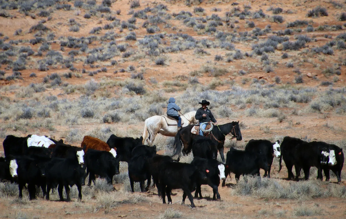
Running cattle in Bears Ears National Monument, where grazing will go on largely as it did before the monument was established. Jonathan P. Thompson photo.
Keeping federal grazing fees low, and regulations lax, is therefore a sort of social or cultural subsidy — socialism, if you will. It’s not meant to support the livestock industry, per se, or even food production. Rather, it supports a certain culture. A 1947 amendment to the Taylor Grazing Act appears to codify this concept, directing fees to be set partly according “to the extent to which such [grazing] districts yield public benefits over and above those accruing to the users of the forage resources for livestock purposes.” If you try to raise the fees to match private or state fees, you’ll make ranching too expensive for family ranchers, and make it an exclusive domain for the wealthy and corporations. If you look to make the program pay for itself, you’re monetizing public lands at the expense of rural culture and communities. Or so the argument goes.
For an Obama or Biden, who are already portrayed as coastal elites, to do anything that might be construed as damaging or stifling that culture or livelihood — or devaluing those “public benefits” — does not make for good optics. They instead have used their political capital to (hesitantly) push back against Big Oil, while trying to get folks to forget about grazing.
I’m all for this type of socialism, especially when it’s supporting family farmers, and for pushing back against the notion that public lands programs have to pay for themselves2. I also support the idea of considering public benefits above and beyond the value of the forage or anything else on public lands. But if you do, you also have to consider the public costs of whatever that use is, whether it’s a new trail, an oil and gas well, or a grazing lease renewal. And grazing’s costs on the land and climate can be every bit as high as an oil well or a surge in recreational use.
The Joe Lott-Fish Creek story I opened this piece with also demonstrates that the beneficiaries of the public lands grazing socialism and subsidies aren’t always struggling families. The biggest leaseholder on that allotment, Pahvant Ensign Ranches, is owned by the Ensign Group, which is in turn owned by the Freed and Robinson families. The Ensign Group is a Utah-based investment firm, whose stated mission is to “build and manage a portfolio of primarily real estate-based businesses that are profitable, durable, environmentally sensitive, and of high reputation in their respective fields.”
So, yes, we, the taxpayers, are subsidizing family farmers and ranchers. But our taxes are also helping out the Robinson-Freed families. They are the nation’s 33rd largest landholder, according to the Land Report, and own 350,000 acres in Utah, Idaho, and elsewhere, run more than 10,000 head of cattle, and hold grazing permits on more than 1 million acres of private and public lands.
1 The amount of forage required to feed a cow and her calf for one month.
2 If Elon Musk’s DOGE initiative is honest — and I’m not saying it is — it will seemingly have no choice but to kill the public lands grazing program, since it spends far more money on rangeland improvements (for grazers’ sake) than it brings in from grazing fees.