New USGS study shows carbon emissions declined on public land by nearly 20% since 2005 #ActOnClimate

Coal for the Craig units comes principally from two coal mines in Moffat County. Photo credit: Allen Best/Big Pivots

Click the link to read the release on the USGS website (Seth Amgott):

December 17, 2025

Reston, Va. — The USGS recently released a new report analyzing greenhouse gas emissions – including carbon dioxide (CO2), methane (CH4) and nitrous oxide (N2O) – associated with U.S. federal lands. 

Published as a follow-up to an earlier USGS 2018 report, it incorporates the latest data and methodologies, expanding the timeframe of analysis from 2005 to 2022 while providing updated estimates of ecosystem carbon emissions and sequestration.  

Given that U.S. federal lands are approximately 28% of the land in the United States, understanding both greenhouse gas emissions and sequestration on these lands is essential to informing land management practices that can mitigate greenhouse gas emissions. 

“More than a quarter of lands in the United States are federally-managed, and almost one-quarter of the nation’s greenhouse gas emissions come from federal lands. This report is key to understanding greenhouse gas emissions trends related to federal land and resource management,” said Dave Applegate, USGS Director. “USGS science informs the work of resource managers whether from the oil and gas industry or ecosystem restoration specialists on public lands.”

Details: Graph of estimated Federal lease-associated greenhouse gas emissions presented as a percentage relative to the 2005 initial year of the report. Sources/Usage: Public Domain. View Media

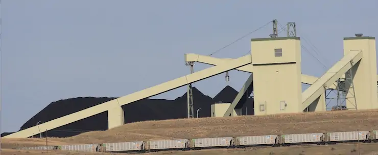
The first part of the report looks at emissions originating from the extraction and end use of fossil fuels from federally-managed rights, both below the land’s surface and offshore areas including the Gulf of Mexico and the Pacific outer continental shelf. The findings include:

  • On average, CO2 emissions from federal lands comprise about 21.8% of the U.S. total. 
  • Overall, greenhouse gas emissions associated with federal lands declined from 2005 to 2022. Combined greenhouse gas emissions (CO2, CH4 and N2O) in 2005 were 1368.2 million metric tons of CO2 equivalent, falling to 1118.9 of CO2 equivalent in 2022.  
  • The trend in declining emissions associated with federal lands mirrors the overall drop in emissions across the U.S. 
  • To date, peak fossil fuel production and emissions associated with federal lands both took place around 2009. Within the overall downward trend, there was an increase from 2020 to 2022. 

“It is too early to tell if the increase after 2020 was just a short-term anomaly related to the pandemic, when emissions dipped and then rebounded, or if emissions will continue to trend upwards,” said Matthew Merrill, USGS research geologist and lead author of the report.

The second part of the report provides an in-depth analysis of how ecosystems on federally-managed surface lands both emitted and sequestered greenhouse gases from 2005 to 2021. 

Using the latest scientific methods, researchers found that ecosystems provided less of an offset than previously thought. In the original report looking at the years 2005 to 2014, ecosystem offsets were originally reported at 15%, but newer estimates using data from 2005 to 2021 show the average annual offset was just 1.4%. 

While federal ecosystems functioned as net carbon sinks in 11 out of 17 years studied, climate factors such as drought and increased wildfires contributed to net emissions during six of the years studied. Combustion emissions reached nearly three times the historical average during wildfires in 2020 and 2021. In years of low fires, such as 2019, the offset reached as high as 31.5%.

The report, “Federal Lands Greenhouse Gas Emissions and Sequestration in the United States: Estimates for 2005–22” and data release are available online.

#Colorado #Snowpack Shows Modest Accumulation After a Dry January — NRCS

El Diente Peak. Photo credit: NRCS

Click the link to read the release on the NRCS website:

February 1, 2025

January brought drier than normal conditions across Colorado, leading to declines in snowpack percentages and streamflow forecasts. Statewide snow water equivalent is 90 percent of median, with the combined San Miguel-Dolores-Animas-San Juan basin seeing the most significant decline.


Denver, CO – February 7th, 2025 – After a strong early season, January brought drier than normal conditions throughout most of the state, leading to a decrease in snowpack percentages and decreased streamflow forecasts. As of February 5th, statewide snow water equivalent (SWE) is at 90 percent of median, 5 percent lower compared to early January, reflecting a muted accumulation period. January precipitation continues at below normal levels at 77 percent of median an improvement from December’s 69 percent of median. Water year to date precipitation as of February 1st is below normal at 91 percent. The January storm cycle was largely uneventful with modest accumulations. The average SWE delta from January 1 to February 6th is 2 inches with the highest SWE delta at the Tower SNOTEL showing 7.9 inches of SWE for this period. Compared to this time last year most basin snowpack conditions are slightly higher with the exception of the combined San Miguel-Dolores-Animas-San Juan River basin at 66 percent of median SWE, a 10 percent drop from this time last year. Reservoir storage remains relatively unchanged, with 94 percent of median statewide as of the end of January. This is a slight decline from 100 percent of median this time last year. Reservoir inputs and outputs have remained steady and no significant changes are expected until spring runoff begins. Streamflow forecasts have decreased since January, now at 89 percent of median, down from 98 percent at the start of the year. This reflects the persistent dry conditions through January. 

January saw significant temperature swings statewide. A sharp cold spell in mid-January set new record lows. This was followed by record high temperatures in late January and early February. Snowpack and streamflow forecasts will remain sensitive to upcoming storm activity, particularly in southern basins where conditions have continued to decline. Near term conditions from NOAAs 6-10 day outlook suggest mid-February may bring increased precipitation statewide, however January’s deficits could limit overall recovery. 

Looking ahead, there are still roughly two months, give or take, until peak SWE, depending on location. Late season storms can still have significant impact and upcoming precipitation plays an important role in shaping spring runoff. To stay informed, water users can explore Basin Reports for precipitation, SWE, reservoir storage and streamflow data at the basin level (Basin Reports). For real time, station specific data, the RG Lite Tool offers a mobile friendly way to track SNOTEL data from standard SNOTEL elements to extended sensor data including soil moisture where available (RG Lite Tool). 

Figure 1: Snow water equivalent (SWE) on January 1st and February 1st, 2025. SWE values declined across most basins through January. The combined SMDASJ basin seeing the most significant decline. The South Platte was the only major basin to experience a slight increase moving from 99 to 105 percent of median. Credit: NRCS
Figure 2: Percent Change in Snow Water Equivalent (SWE) from January 1st to February 1st 2025. The percent change in SWE across Colorado highlights the continued impact of below normal precipitation throughout January 2025. Again the most significant SWE reduction is observed in the SMDASJ, dropping 25%. Credit: NRCS
* San Miguel-Dolores-Animas-San Juan River basin * *For more detailed information about January mountain snowpack refer to the February 1st, 2025 Colorado Water Supply Outlook Report. For the most up to date information about Colorado snowpack and water supply related information, refer to the Colorado Snow Survey website.

The February 1, 2025 #Colorado Water Supply Outlook is hot off the presses from the NRCS

Click the link to read the report on the NRCS website. Here’s an excerpt: