
Click the link to read the article on The Denver Post website (Elise Schmelzer). Here’s an excerpt:
February 11, 2025
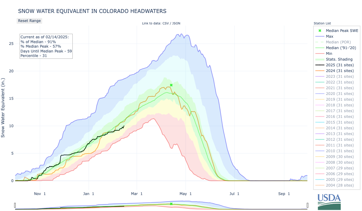
Snowpack across Colorado ranges from close to normal levels near the Colorado River headwaters, outside Grand Lake, to troublingly low along the state’s southern border. The pattern of snow conditions worsening from north to south is also visible across the broader mountain west — where snowpack is near normal in the most fortunate places and drastically below normal in the southern tail of the Rocky Mountains…

The drought across much of the mountain west follows a year when many states recorded some of their warmest average temperatures in the last 130 years. 2024 was Colorado’s fourth-warmest year in that time period, and it was the second-warmest year for New Mexico and Utah and the third-warmest year for Arizona and Wyoming…
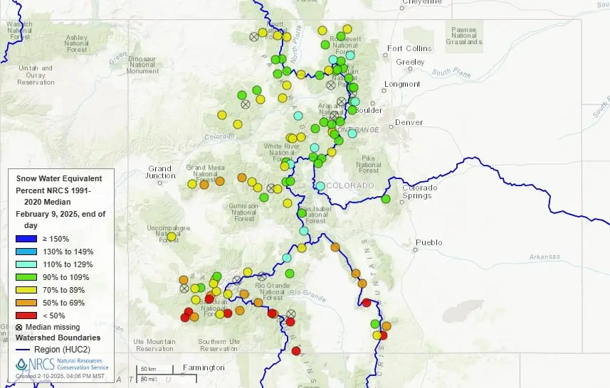
Statewide, the snowpack is at 82% of the median between 1991 and 2020. Snowpack in the mountains from near Rocky Mountain National Park to the ranges in the south near Aspen, Silverthorne and Buena Vista are generally sitting at near-to-above normal. Mountains farther south and west, however, remain much more dry. A snow observation station near Mancos is recording snowpack at 31% of normal — the lowest in the state.
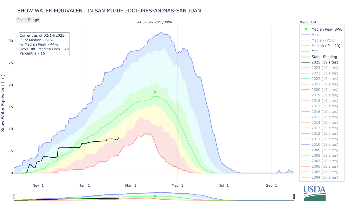

In southwest Colorado, snowpack in the San Miguel, Dolores, Animas and San Juan basins is at only 61% of median. The Upper Rio Grande Basin, similarly, sits at 64% of median.