May 6, 2023 – Volunteers with the National Renewable Energy Laboratory’s (NREL’s) ESCAPES (Education, Stewardship, and Community Action for Promoting Environmental Sustainability) program lend a hand to Jack’s Solar Garden in Longmont, Colo. Bethany Speer (left) goes back for more while Nancy Trejo distributes her wheelbarrow load to the agrivoltaic plots. (Photo by Bryan Bechtold / NREL)
Click the link to read the article on The Denver Post website (Alexa St. John). Here’s an excerpt:
October 6, 2025
Worldwide solar and wind power generation has outpaced electricity demand this year, and for the first time on record, renewable energies combined generated more power than coal, according to a new analysis. Global solar generation grew by a record 31% in the first half of the year, while wind generation grew by 7.7%, according to the report by the energy think tank Ember, which was released after midnight Tuesday London time. Solar and wind generation combined grew by more than 400 terawatt hours, which was more than overall global demand increased in the same period, it found. The findings suggest it is possible for the world to wean off polluting sources of power — even as demand for electricity skyrockets — with continued investment in renewables including solar, wind, hydropower, bioenergy and geothermal energies.
“That means that they can keep up the pace with growing appetite for electricity worldwide,” said Małgorzata Wiatros-Motyka, senior electricity analyst at Ember and lead author of the study.
At the same time, total fossil fuel generation dropped slightly, by less than 1%.
“The fall overall of fossil may be small, but it is significant,” said Wiatros-Motyka. “This is a turning point when we see emissions plateauing.”
The firm analyzes monthly data from 88 countries representing the vast majority of electricity demand around the world. Reasons that demand is increasing include economic growth, electric vehicles and data centers, rising populations in developing countries and the need for more cooling as temperatures rise. Meeting that demand by burning fossil fuels such as coal and gas for electricity releases planet-warming gases including carbon dioxide and methane. This leads to more severe, costly and deadly extreme weather.
Water sits low behind Glen Canyon Dam near Page, Arizona, on November 2, 2022. A new report calls for urgent changes to Colorado River management, including modifications inside the dam. Alex Hager/KUNC
Click the link to read the article on the KUNC website (Alex Hager):
October 1, 2025
This story is part of ongoing coverage of the Colorado River, produced by KUNC in Colorado and supported by the Walton Family Foundation. KUNC is solely responsible for its editorial coverage.
A new report from a coalition of environmental nonprofits is calling for changes to Colorado River management and urging policymakers to act more quickly in their response to shrinking water supplies.
The report’s authors stress a need for urgent action to manage a river system that they say is “on the cusp of failure.”
“We are looking at serious, chronic shortages,” said Zach Frankel, executive director of the Utah Rivers Council. “And we don’t just mean one day in a couple of decades. We could see a crash on the Colorado River as soon as two years from now, or less.”
A crash, they said, could mean water levels so low in the nation’s largest reservoirs that major dams are rendered inoperable, leaving some cities and farms with less water than they are legally owed. To stave off that crash, the report includes nine recommendations, including calls for major cutbacks to water demand.
Its authors focused largely on three things: reducing water use, modifying the plumbing inside Glen Canyon Dam, and changing the process by which new rules for sharing water are decided.
State leaders throughout the Colorado River basin seem to agree that significant cutbacks are needed, but conversations about who exactly should make those cutbacks often devolve into finger pointing. The nonprofits behind this new report say each state needs to be more specific and come up with a “curtailment plan” about how it could use less water within its borders. They acknowledge that drawing up those cuts will likely be a complicated and painful process, but a necessary one.
“Yes, it’s bad, but there’s a path through it,” said Eric Balken, executive director of the Glen Canyon Institute. “The solution to this problem is actually simple. It’s not going to be easy, but it is simple. Don’t pull more water from the river.”
Their suggested approach also means hitting the brakes on new dams and diversions. The report tallied 30 proposals for new water development in the river’s Upper Basin states of Colorado, Utah, Wyoming and New Mexico. Now, its authors say, is not the time to stretch an already-strained river system even further.
The back of Glen Canyon Dam circa 1964, not long after the reservoir had begun filling up. Here the water level is above dead pool, meaning water can be released via the river outlets, but it is below minimum power pool, so water cannot yet enter the penstocks to generate electricity. Bureau of Reclamation photo. Annotations: Jonathan P. Thompson
The report’s second major proposal is to re-engineer Glen Canyon Dam, which holds back Lake Powell. The nation’s second-largest reservoir has dropped to record lows in recent years, and it’s currently about a quarter full. If water levels drop much further, they could fall below the intake for hydropower generators inside the dam. Further, they could drop below any pipes that allow water to pass through the dam. That could jeopardize the ability to send water to major cities downstream, like Los Angeles, Phoenix and Las Vegas.
In years when reservoir levels threaten to drop that low, federal water managers have shuffled water into Lake Powell from other upstream reservoirs. The new report says more permanent fixes, like the construction of new pipes inside the dam, are needed.
“Those reservoir levels are not a conspiracy,” Frankel said. “There’s not really any debate about whether there’s water in those reservoirs. A solution of, ‘Hey, let’s just keep the reservoirs higher and avoid having to deal with this epic plumbing challenge’ is absurd.”
The Colorado River flows through Grand County, Colorado on Oct. 23, 2023. A new report calls for states to plan for curtailments to water use as the river shrinks. Alex Hager/KUNC
The report’s authors did not mince words in their critiques of the current system for agreeing on new water management rules.
“We’re so far away from meeting the moment right now,” said Kyle Roerink, executive director of the Great Basin Water Network. “The moment might as well be on another planet.”
Negotiations about sharing the river are stuck. The current rules for managing Colorado River water expire in 2026, and the seven states that use it are on the hook to come up with new ones. Negotiators from those states have been meeting for years now, and don’t appear to be close to a deal despite mounting calls for new policies, a steadily shrinking river and a fast-approaching deadline.
“We’re so clearly not addressing the depth of challenge we’re facing,” Frankel said of the negotiators. “And what we’re asking is, is it because of the process?”
Under the current structure, the report’s authors say, those negotiations lack transparency. Environmental groups, farmers, city leaders, Native American tribes and others who will have to deal with the consequences of negotiators’ decisions have mostly been left on the outside looking in.
“What we want is honest debate and discussion,” Roerink said. “There’s not even a meaningful regulatory process going on where we can debate, scrutinize, vet, and provide meaningful ideas about how we’re going to manage the nation’s two largest reservoirs.”
The coalition of nonprofits that co-signed the report includes Glen Canyon Institute, Great Basin Water Network, Living Rivers, Utah Rivers Council and Save the Colorado.
Their work joins a number of similar calls for action that have been released in recent months. A September letter from former officials and academics said urgent changes are needed to protect Glen Canyon Dam. That same group released a memo in May calling for states to embrace some “shared pain” and agree on cutbacks.
Other outside groups – including a coalition of Native American tribes and a large collection of environmental nonprofits – have made their own suggestions for the next phase of river management. It is yet to be determined how or if their ideas will influence those closed-door negotiations.
Map of the Colorado River drainage basin, created using USGS data. By Shannon1 Creative Commons Attribution-Share Alike 4.0
The Colorado River District (CRD) hosted its annual Water Seminar on Friday [October 3, 2025], bringing together water leaders, politicians and city officials for a variety of discussions and activities. The seminar, titled “Across Divides”, was held at Colorado Mesa University, focusing on candid conversations and solution-focused dialogue to address water issues. The audience included agricultural producers, water providers, local and state government leaders, non-profit representatives, community members and CMU students.
“Over the course of today, we’ve leaned into the conference theme of ‘Across Divides.’ We’ve explored spaces where perspectives don’t always align, where there are divides in language, where there are divides in theory, where there are divides in practice,” said CRD Chief of Strategy Amy Moyer during her closing remarks…
The keynote address was given by CRD General Manager Andy Mueller, who discussed the challenges facing the Western Slope and Colorado River Basin as well as the work being done by the district and its local partners and the Shoshone water rights situation. He also discussed the impact of shrinking supplies and interstate pressures on Colorado…The “Lost in Translation: Interstate Divide” panel represented agriculture, drinking water, tribal nations and environmental interests from the Upper and Lower Basins, examining how the new supply-driven model proposal could shape the future of the Colorado River…
Moyer encouraged attendees to implement three actions in their lives to make sure the seminar leads to positive results.
“First, follow up with the contacts that you made with the people at your table, with the presenters here today…. Find somebody you haven’t had the chance to talk to,” she said. “The second thing is to apply one new idea that you learned from today, whether it’s in your personal life or your professional life…. Lastly, stay engaged with us at the Colorado River District. Look for the events and conversations that we hold throughout the year.”
A child amid the splish-splashes of water at Denver’s Union Station on June 21, 2025. Photo credit: Allen Best/Big Pivots
Click the link to read the article on the Big Pivots website (Allen Best):
October 2, 2025
New report says the story is not near as complicated as some would have you believe. It identifies nine areas of focus for using less water.
A few hours before I read a new Colorado River Basin report this week, I was at a neighborhood meeting in the metropolitan Denver municipality where I live. A sustainability plan is being worked up. The water component will encourage conservation.
I said that the messaging on this, unlike some other components of sustainability, should be relatively easy. After all, 75% of this municipality’s water arrives from the headwaters of the Colorado River through the Moffat Tunnel.
Udall/Overpeck 4-panel Figure Colorado River temperature/precipitation/natural flows with trend. Lake Mead and Lake Powell storage. Updated through Water Year 2024. Credit: Brad Udall
And most everybody at this point understands that the Colorado River is in trouble. For more than 20 years we have seen the photos of the bathtub rings of the reservoirs and the water levels far below. So many years have yielded below-average runoffs, a 20% reduction altogether in the 21st century. The number of broken hottest-ever temperature records have vastly dwarfed the coldest-ever records.
Understanding the intricate efforts to better align the political governance of the river with the physical reality is a far more difficult story to tell, but it has not been for absence of effort in Big Pivots and hundreds of other outlets. Scores of stories have been written in just the last month or more about the seeming inability of negotiators from the seven basin states to come to agreements in advance of a November deadline set by the federal government.
Now comes a new report, “There’s No Water Available,” from Great Basin Water Network and partners. It offers nine recommendations under the subtitle of “Commonsense Recommendations to Limit Colorado River Conflict.”
If longer-term drought is one component of the declined flows, the science is now firm that the warming climate is a reality that will remain and with it more erratic precipitation, surprising shifts in temperature, dry soils and many other factors. “It is clear that the future will be about adapting to hydrologic extremes. It is also clear that the water laws and hydraulic engineering developed in the 20th century did not foresee the realities we face today,” says the report.
Then there is this arresting statement:
“The supply-focused approaches during the last 120 years — i.e. encouraging use — has landed us in crisis. It’s time for a fresh, modernized approach. Nevertheless, we believe that the necessary change isn’t as complicated as people in power want us to believe.”
Simply put, say the authors from the Glen Canyon Institute, Sierra Club and other organizations, we must use less water. “We can do so in an equitable way that does not involve foot-dragging and finger-pointing.”
Who needs to budge? Well, almost everybody — the historically shorted Native Americans being the exception. “All parties currently using water must commit to using less water than they have in the past,” says the report.
The area around Yuma, Ariz., and California’s Imperial Valley provide roughly 95% of the vegetables available at grocery stores in the United States during winter months, February 2017, The report calls for more resilience built into agriculture. Photo credit: Allen Best/Big Pivots
Upper basin states — Colorado, New Mexico, Utah and Wyoming — come in for special mention. Perhaps it’s a negotiating tactic, but they have continued to maintain detailed estimates of how much more water they want to use. “Rather than planning on using more, we need states to plan on cutting,” says the report.
They call for all states to have curtailment plans. “Having a clear-cut understanding of what entities have to cut during shortages is something that’s already in place in the lower Basin. The upper basin must develop a similar system of cuts predicated on water availability and delivery obligations that consider downstream use and upper basin water availability.”
Andy Mueller, general manager of the Colorado River Water Conservation District, the lead water agency for much of Colorado’s Western Slope, made that call at the district’s annual meeting in 2024. Some agreed. See: “Heading for the Colorado River cliff.” Big Pivots, Oct. 20, 2024. However, Jim Lochhead, a former Western Slope resident and then Denver Water CEO, said he believed that the process of preparing for a compact curtailment was too difficult, too messy, until the clear need arrives. See: “Bone-dry winter in the San Juans,” Big Pivots, Jan. 28, 2025.
The upper basin states have argued that they never used the water allocated under the Colorado River Compact of 1922, while the lower-basin states did — and then some. Only lately have the lower-basin state tightened their belt. The upper basin states don’t want to be restricted — not, at least, to the same degree.
This position was explained in a forum during May by Becky Mitchell, Colorado’s representative in the negotiations. She talked about how the upper-basin had developed more slowly and still has not used its full allocation. See: “Sharing risk on the Colorado River,” Big Pivots, May 29, 2025.
“The main thing that we got from the compact was the principle of equity and the ability to develop at our own pace,” said Mitchell. “We shouldn’t be punished because we didn’t develop to a certain number.” The conversation, she added, is “what does equity look like right now?”
Upper-basin states want a willingness in this settlement for agreement that focuses on the water supply, not the demand, she said. “Common sense would tell you, maybe Mother Nature should drive how we operate the system.” That, she said, is the bedrock principle of the proposal from the upper division.
The Colorado River at Silt looked healthy in early June, and indeed runoff from the river’s headwaters in northern Colorado was near normal. The overall runoff, though, was far, far below average — what is becoming a new norm. Photo/ Allen Best
This new report rejects this “natural flow” plan. “Agencies do not yet have the means to quickly and accurately measure natural flow data, a measurement metric that tracks water as if there were no human usage and infrastructure. That’s because the basin at-large is missing key data points.”
The report also argues that any new dams and diversions need to be off the shelf, cities can do a better job of conservation, and Glen Canyon Dam needs work to allow it to be functional at lower water levels. The report also recommends making farms resilient to new realities.
Some elements of the Colorado River conversations have shifted dramatically. One of them is the new insistence of the last 10 years that the water rights of tribes be honored. Representatives of tribal nations now are almost always on the agenda at water conferences in Colorado. Twenty years ago? No, they were not. Lorelei Cloud, the chair of the Colorado Water Conservation Board since May, is a member of the Southern Ute Reservation.
Of the basin’s 30 tribes, 22 have recognized rights to 3.2 million acre-feet of Colorado River system water annually. That’s approximately 25% of the basin’s average annual water supply. Twelve tribes have still-unresolved claims. It is estimated that 65% of tribal water is unused by tribal communities (but in many cases consigned to other users). Junior users would be curtailed in order to honor those tribal rights, says the report.
The connection between declines in groundwater and surface flows is also part of a broader shift in the conversation. A May 2025 study that groundwater supplies in the Colorado River Basin are shrinking by nearly 1.3 million acre-feet per year. Excessive groundwater depletion had surfaced as a surrogate water supply to satisfy surface water deficits.
In the upper basin, half the water we see at the surface comes from groundwater, according to research from the U.S. Geological Survey. “This seminal USGS analysis underscores that as temperatures rise and evapotranspiration rates increase, there will be less groundwater entering surface water systems.”
There are obvious limitations to a short report, and I found the agriculture and municipal sections too shallow. The bibliography of sources, though, was quite valuable.
Will we see other reports of a similar nature in coming weeks and months? Quite likely. This conversation is far from over. In some ways, it’s just beginning.
Seven U.S. states and Mexico depend on the Colorado River, shown here in the Grand Canyon. But over the past century, the river’s flow has decreased by roughly 20 percent. (Bureau of Reclamation)
Click the link to read the article on the E&E News website (Jennifer Yachnin). Here’s an excerpt:
October 3, 2025
Scott Cameron will take over as acting head of the Bureau of Reclamation, shifting titles at the Interior Department while he maintains his role as the Trump administration’s lead official in negotiations over the future of the Colorado River. Interior Secretary Doug Burgum tapped Cameron for the role on Oct. 1, announcing the decision in a secretarial order that also updated other leadership roles recently confirmed by the Senate. The decision comes in the wake of President Donald Trump’s decision on Sept. 30 to withdraw his nomination of Ted Cooke, a former top official at the Central Arizona Project, to be Reclamation commissioner.
Colorado Governor Clarence J. Morley signing Colorado River compact and South Platte River compact bills, Delph Carpenter standing center. Unidentified photographer. Date 1925. Print from Denver Post. From the CSU Water Archives
Click the link to read the article on the InkStain website (Eric Kuhn, Anne Castle, John Fleck, Kathryn Sorensen, Jack Schmidt, and Katherine Tara):
October 6, 2025
As negotiators for the seven Colorado River Basin states rapidly approach Reclamation’s November deadline for providing a framework for a seven-state agreement for the Post-2026 Operating Guidelines for Lakes Powell and Mead, a larger threat looms. Reclamation’s recently released September 24-Month study minimum probable projection is consistent with our mass balance analysis of storage in the next year, solidifying the likelihood of critical conditions if the coming winter is dry. Reclamation’s latest analysis predicts that storage at Lake Powell would fall below the 3500-ft elevation as early August 2026 and might continue to be below this critical elevation until March 2028. As we noted in our recent white paper, Reclamation has committed to protecting Lake Powell from going below 3500 ft.
This projection of future conditions in the event of persistent dry conditions poses a conundrum—Reclamation could reduce releases from Powell to protect the 3500-ft reservoir elevation, but in doing so, low releases would most likely trigger the dreaded 1922 Colorado River Compact tripwire–the amount of water delivered from Lake Powell to Lake Mead during a 10-year period that is less than the threshold. The Lower Division states are likely to litigate if the 10-yr average wire is tripped. Under one prevailing interpretation of the Compact, Upper Basin states must not cause the 10-yr flow at Lee Ferry to be depleted to less than 82.5 MAF to deliver water to the Lower Basin and Mexico. As explained in a new white paper, there is a very real chance that the 10-yr running average will be 82.78 MAF, just a hair above the tripwire, one year from now. In alternate scenarios, the 10-yr running average would hit the tripwire in 2027 or 2028. If Reclamation exercises its authority to reduce Lake Powell deliveries to as low as 6 MAF, the tripwire is triggered even earlier. In the face of this imminent possibility, Basin States and the Federal Government must commit to an enforceable agreement to reduce their total consumptive Colorado River uses with an equitable sharing of the burden sufficient to justify a waiver of claims under the Compact for the duration of the agreement. The alternative is a deeply uncertain future for the Basin.
As of Sept. 5, crews had raised the dam by 60 feet. The project is designed to increase the water storage capacity of Gross Reservoir, which supplies water to 1.5 million people in the Denver metro area.
“Over the past two years, we’ve been working on the original dam to prepare it for the enlarged height and width,” said Casey Dick, Denver Water’s deputy program manager for the project.
“At the end of June, the concrete work reached the original crest, so now all the concrete placements are above the existing structure.”
A dump truck fills up with concrete at the top of Gross Dam. The trucks drive across the top of the dam and place the concrete in layers to raise the dam higher. Photo credit: Denver Water.
Once completed, Gross Dam will be 471 feet tall and around 2,000 feet wide.
As the dam has gone up, it has become easier to see some of the differences between the original dam, which was completed in the 1950s, and the newly renovated structure.
For instance, the original surface of the downstream side of the dam was smooth. Now, the downstream side of the dam is a series of stair steps. The steps were an integral part of the construction process and supported the trucks that deposited layers of concrete onto the original structure of the dam.
This picture was taken from roughly the crest of the original dam. The dam has been raised 60 feet as of Sept. 5. The new face of the dam features a stepped design, which was needed for the construction process. Photo credit: Denver Water.
The renovated dam will also take on a new shape.
“The original structure was built as a ’curved gravity’ dam,” Dick said. “Now, we’re taking advantage of that curved geometry in the middle portion of the dam to create what’s called a ‘thick arch’ dam in the center of the canyon.”
The middle section of the dam is arched to give the dam strength as water pushes up against the structure. Photo credit: Denver Water.
Arches are used in dam construction because the force of the water in the reservoir pushes up against the arch and into the canyon walls. This gives an arched dam more strength compared to a flat structure.
“We’ve also built what are called ’thrust blocks’ on the sides of the original dam,” Dick said. “These give the dam additional support by essentially extending the canyon walls upward to support the arch.”
The “thrust blocks,” highlighted in red, extend out from the canyon wall. The blocks provide additional strength where the arch of the dam meets the rock. Photo credit: Denver Water.
As work has risen above the original crest of the dam, workers have built formwork, or temporary molds, on both the upstream and downstream sides of the dam. The temporary structures hold the freshly placed concrete in the proper shape until it hardens and cures.
Workers build formwork, or temporary molds, on the top of the dam. The forms hold new concrete in place until it cures. Photo credit: Denver Water.
With the new added concrete added during the project, Gross Dam is now much steeper than the original structure. At the base, the dam is 300 feet thick, but it gets skinnier as it goes up. At the top, the dam will be just 25 feet thick. Crews have had to adjust to the smaller work area to maneuver their equipment as the project progressed.
Work to raise the dam will continue as late as possible into 2025, until weather conditions make it too cold to place concrete.
“We’d like to thank all the men and women out here from Kiewit-Barnard and the other contractors out here,” Dick said. “They are working around the clock and as fast as they can to complete this project.”
Roller-compacted concrete will be placed on top of the existing dam to raise it to a new height of 471 feet. A total of 118 new steps will make up the new dam. Image credit: Denver Water.
What happens on the Colorado River doesn’t stay on the Colorado River.
Indeed, the river system is not like a night on the Las Vegas Strip. When problems arise on the beleaguered system, the ancillary impacts ripple throughout the western U.S.
As water supplies shrink, the supply and demand imbalance on the river system poses questions about the long-term sustainability of communities across the west. The impacts span beyond cities in town in the Colorado River Watershed. Denver, Los Angeles, Albuquerque, and many others rely on the Colorado River even though they don’t live within the watershed. We are not yet ready for the consequences of prolonged inaction and ambivalence. We’ve lost 20 percent of flows since the turn of the 21st Century and poised to lose even more in the decades to come. Fixing the current imbalance has come at a high price to ratepayers and taxpayers, the environment, and the public trust. Further inaction will come at an even higher price.
We are working with a group of NGO partners to answer an important question
How do we prevent more conflict?
That is why we released a new report outlining nine recommendations for the river system.
1. No New Dams and Diversions
2. All States Need Curtailment Plans
3. We Need Better Accounting and Data
4. We Need to Fix Glen Canyon’s Antique Plumbing
5. Curtail Junior Users to Serve Tribes
6. Invest in Reuse and Limit Municipal Waste
7. Protect Endangered Species
8. Make Farms Resilient
9. Recognize Groundwater-Surface Water Connectivity
Please share far and wide and reach out with any suggestions. Perhaps no group better understands the far-reaching impacts on Colorado River scarcity than ours. The SNWA maintains a robust agricultural operation hundreds of miles away from the Colorado River in the high desert in the heart of the Great Basin. What will happen if Lake Mead keeps shrinking? They don’t own farms because they like beef and lamb, leather and wool.
The actions we take today will leave lasting marks on our watersheds for generations to come. Right now, the leaderships on the Colorado River System is lagging. We exist to equip communities with the knowledge to take action moving forward. As we await public participation opportunities for new Colorado River management guidelines, let’s prepare for the worst and hope for the best.
“America’s Data Centers Could Go Dark,” the subject line of the email read.
If only, I mused. I’m less worried about data centers going dark than about everything else going dark because of data centers. But whatever. That’s not what the PR person (or AI bot?) who sent the email was trying to say. They were there to ask, rhetorically: “Can Microreactors Save the Day?”They then offered to connect me with James Walker, CEO of a firm called NANO Nuclear Energy, who would then try to sell me on his KRONOS MMR™, described as a “compact, carbon free” way to power data centers.
There is a lot of hysteria around data centers these days. Folks like me are worried about how much energy and water they use, and the effect that might have on the grid, the climate, scarce water supplies, and other utility customers. Others are panicking over the possibility that the U.S. might fall behind in the AI race — though I have no idea what winning the race would entail or look like.
And, in our capitalistic system, where there is fear, there are myriad solutions, most of which entail building or making or consuming more of something rather than just, well, you know, turning off the damned data centers. The Trump administration would solve the problem by subsidizing more coal-burning, while the petroleum industry is offering up its surplus natural gas. Tech firms are buying up all the power from new solar arrays and geothermal facilities, long before they’re even built.
Perhaps the most hype, and the loftiest promises of salvation, however, involve nuclear power and a new generation of reactors that are smaller, portable, require less up-front capital, and supposedly not weighed down with all of the baggage of the old-school conventional reactors, which not only cost a lot to build, but also tend to evoke visions of Chernobyl, Three Mile Island, or Fukushima.
Yet for all the buzz — which may be loudest in the Western U.S. — it’s far from certain that this so-called nuclear renaissance will ever come to fruition. The latest generation of reactors may go by slick, newfangled names, but they are still expensive, require dangerous and damaging mining to extract uranium for fuel, produce waste, are potentially dangerous — and are still largely unproven.
Experimental Breeder Reactor II on the Idaho National Laboratory. The reactor was shut down and decommissioned in 1994. Now Oklo is building a new reactor, using similar technology, nearby. Jonathan P. Thompson photo.
Several years ago I visited Experimental Breeder Reactor I, located west of Idaho Falls. It has been defunct since 1963 and is now a museum, and a sort of time capsule taking one back to heady times when atomic energy promised to help feed the exploding, electricity-hungry population of the post-war Western U.S. and its growing number of electric gadgets (remember electric can openers?).
The retro-futuristic facility is decked out with control panels and knobs and valves and other apparatus that possess the characteristic sleek chunkiness of mid-century high-tech design. A temperature gauge for the “rod farm” goes up to 500 degrees centigrade, and if you look closely you’ll see a red button labeled “SCRAM” that, if pushed, would have plunged the control rods into the reactor, thereby “poisoning” the reaction and shutting it down. If you have to push it, you’d best scram on out of there.
I couldn’t help but get caught up in the marvels of the technology. On a cold December day in 1951, scientists here had blasted a neutron into a uranium-235 atom and shattered it, releasing energy and yet more neutrons that split other uranium atoms, causing a frenetically energetic chain reaction identical to the one that led to the explosions that annihilated Hiroshima and Nagasaki several years earlier. Mass is destroyed, energy created. Only this time the energy was harnessed not to blow up cities, but to create steam that turned a turbine that generated electricity that illuminated a string of lightbulbs and then powered the entire facility — all without burning fossil fuels or building dams.
This particular reactor was known as a “breeder” because its fuel reproduces itself, in a way. During the reaction, loose neutrons are “captured” by uranium-238 atoms, turning them into plutonium-239, which is readily fissionable, meaning it can be used as fuel for future reactions.
A diagram of the atomic fission and breeding process at Experimental Breeder Reactor-I in Idaho. The reactor began generating electricity in 1951. Jonathan P. Thompson photo.
At first glance it seems like the answer to the world’s energy problems, and two years after EBR-I lit up, Dwight D. Eisenhower delivered his 1953 “Atoms for Peace” speech. Nuclear energy would help redeem the world from the terrible scourge of atomic weapons, the president said; it would be used to “serve the needs rather than the fears of the world — to make the deserts flourish, to warm the cold, to feed the hungry, to alleviate the misery of the world.”*
Now, with Arizona utilities teaming up to develop and build new reactors; with Wyoming’s, Idaho’s, and Utah’s governors collaborating on their nuclear-powered “Energy Superabundance” effort; and with Oklo looking to build a modern version of EBR-I not far from the original, it’s beginning to feel like 1953 all over again. Only now the nuclear reaction promises to serve the needs of cyberspace rather than the real world — to make AI do your homework, to cool the server banks, to feed the Instagram feeds, to send out those Tik-Toks at twice the speed.
Advertisement from 1954.
Seven decades later, Eisenhower’s hopes have yet to be fulfilled.
It turns out a lot of people aren’t comfortable with the idea nuclear reactions taking place down the road, regardless of how many safety backstops are in place to avoid a catastrophic meltdown a la Chernobyl. Nuke plants cost a lot of money and take forever to build. They need water for steam generation and for cooling, which can be a problem in water-constrained places and even in water-abundant areas: Diablo Canyon nuke plant sucks up about 2.5 billion gallons of ocean water to generate steam and to cool the reactors, before spitting it — 20 degrees warmer — back into the Pacific. This kills an estimated 5,000 adult fish each year, along with an additional 1.5 billion fish eggs and fry and messes up water temperature and the marine ecosystem. And while nukes are good at producing baseload power (meaning steady, 24/7 generation), they aren’t very flexible, meaning they can’t be ramped up or down to accommodate fluctuating demand or variable power sources like wind and solar.
And then there’s the waste. The nuclear reaction itself may seem almost miraculous in its power, simplicity, and even purity.
But the steps required to create the reaction, along with the aftermath, are hardly magical. To fuel a single reactor requires extracting hundreds of thousands of tons of ore from the earth, milling the ore to produce yellowcake (triuranium octoxide), converting the yellowcake to uranium hexafluoride gas, enriching it to concentrate the uranium-235, and fabricating the fuel pellets and rods.
Each step generates ample volumes of toxic waste products. Mining leaves behind lightly radioactive waste rock; milling produces mill tailings containing radium, thorium, radon, lead, arsenic, and other nasty stuff; and enrichment and fabrication both produce liquid and solid waste. It has been about 40 years since the Cold War uranium boom busted, and yet the abandoned mines and mills are still contaminating areas and still being cleaned up — if you can ever truly clean up this sort of pollution.
Yet the reaction, itself, generates the most dangerous form of leftovers, containing radioactive fission products such as iodine, strontium, and caesium and transuranic elements including plutonium. This “spent nuclear fuel,” or radioactive waste, is removed from the reactor during refueling and for now is typically stored on site. Efforts to create a national depository for these nasty leftovers have failed, usually because the sites aren’t deemed safe enough to contain the waste for a couple hundred thousand years, or because locals don’t want it in their back yard. If it were to fall into the wrong hands, it could be used in a “dirty bomb,” a conventional explosive that scatters radioactive material around an area.
Plus, breeder reactors, especially, produce plutonium, which can then be used in nuclear warheads (India used U.S.-supported breeder technology to acquire nuclear weapons). That’s one of the reasons folks soured on the technology and the U.S. ended its federal plutonium breeder reactor development program in the 1980s. The other reasons were high costs and sodium coolant leaks (and resulting fires). After the EBR-I shut down in 1963, because it was outdated, the Idaho National Laboratory built EBR-II nearby. It was shut down and decommissioned in 1994.
Nevertheless, Oklo — one of the rising new-nuke stars — is touting its use of similar technology as the EBR-II, i.e. liquid-metal-cooled, metal-fueled fast reactor, as a selling point for the reactor it is currently developing at the INL.
The envisioned new fleet of reactors go by many names: SMRs, or small modular reactors, and advanced, fast, micro, or nano-reactors. Most of them can be fabricated in a factory, then trucked to or assembled on-site. Some are small enough to fit in a truck. They can be used alone to power a microgrid or a data center, or clustered to create a utility-scale operation that feeds the grid.
Their main selling point is that they require less up-front capital than a conventional reactor, that you can build and install one of these things for a fraction of the cost and a fraction of the time (once the reactors are actually licensed, developed, and produced on a commercial scale, which is still not the case).
A decade ago, companies like NuScale were also promoting them as ways to power the grid in a time of increasing restraints on carbon. Now that the feds are not only declaring climate change a “hoax,” but also forbidding agencies from even uttering the term, that no longer carries as much weight. Instead, almost every new proposal now is marketed as a “solution” to the data center “problem.” Google, Switch, Amazon, Open AI, and Meta are all looking to power their facilities with nukes, if and when they are finally up and running.
The new technology is not monolithic. Some are cooled in different ways, or use different types of fuel, but they all work on the same principle as old-school conventional reactors. As such, they also require the same fuel-production process, also have potential safety issues, and also create hazardous waste.
In fact, a 2022 Stanford study found that small modular reactors could create more, and equally hazardous, waste than conventional reactors per unit of power generated. The authors wrote: “Results reveal that water-, molten salt–, and sodium-cooled SMR designs will increase the volume of nuclear waste in need of management and disposal by factors of 2 to 30 {compared to an 1,100 MW pressurized water reactor}.”
The cost thing isn’t all that clear cut, either. The smaller reactors may be cheaper to build, but because they don’t take advantage of economies of scale, they are more expensive per unit of electricity generated than conventional reactors, and still can be cost prohibitive.
In 2015, for example, Oregon-based NuScale proposed installing 12 of its 50-MW small modular reactors at the Idaho National Laboratories to provide 600 MW of capacity to the Utah Associated Municipal Power Systems, or UAMPS (which also includes a handful of non-Utah utilities). In 2018 — after receiving at least $288 million in federal subsidies — NuScale upped the planned capacity to 720 MW, saying it would lower operating costs.
But what started out as a $3 billion project in 2015 kept increasing, so that even after it was ramped down to 421 MW, the projected price tag had ballooned to $9.3 billion in 2023 (still about one-third of the cost of the new Vogtle plant in Georgia, but with a fraction of the generating capacity). UAMPS’s collective members, realizing there were plenty of more cost-effective ways to keep their grids running, canceled the project later that year.
It kind of makes you wonder: Is this new wave of nuclear reactors solving the data center energy demand problem? Or are data centers’ energy-gobbling habits solving the nuclear reactors’ cost and feasibility problems?
I suspect it’s a little bit of both, with the balance swinging toward the latter. In that case, nuclear reactors are not alone: The Trump administration is using data center demand as the prime justification for propping up the dying coal industry.
Before the Big Data Center Buildup, utilities really had no need for expensive, waste-producing reactors — they could more cheaply and safely build solar and wind installations with battery storage systems for backup. If needed, they could supplement it with geothermal or natural gas-fired peaker plants.
But if data centers end up demanding as much power as projected (like 22,000 additional megawatts in Nevada, alone), utilities will need to pull out all the stops and add generating capacity of all sorts as quickly as possible, or they’ll tell the data centers to generate their own power. Either scenario would likely make small nukes more attractive, even if they do cost too much, and even if it means that data centers end up being radioactive waste repositories, too.
Another plausible scenario is that the tech firms figure out ways to make their data centers more efficient; that it’s more cost-effective (and therefore profitable) to develop less energy- and water-intensive data processing hardware than to spend billions on an experimental reactor that may not be operating for years from now.
What a novel concept: To use less, rather than always hungering for more and more and more.
Scientists secure jute netting over mulch on a newly planted section of the Ophir Pass fen in Colorado’s San Juan Mountains. Anna Marija Helt/High Country News
The resinous scentof Engelmann spruce wafted over a shallow, mossy pool surrounded by lush sedges near the 11,800-foot summit of Ophir Pass, in southwestern Colorado’s rugged San Juan Mountains. This type of wetland, known as a fen, forms when perennial water saturates the ground, limiting plant decomposition and allowing organic matter to accumulate as peat.
Just downhill, however, on that hot, sunny July day, another part of the fen was visible: a degraded area, bare soil exposed on a steep slope.
Peatlands — fens and bogs — are key climate regulators. (Bogs are maintained by precipitation, but fens, which, in North America, occur in the Northeast, Midwest and Mountain West, depend on groundwater.) Their peat retains plant carbon that would otherwise decompose and be released as carbon dioxide. Despite covering only about 4% of Earth’s land area, peatlands store a third of the world’s soil carbon — twice the amount trapped in forest biomass. “Fens are old-growth wetlands,” said Delia Malone, a recently retired field ecologist with the Colorado Natural Heritage Program. Some of Colorado’s fens are over 10,000 years old.
In relatively dry southern Colorado, they also provide a secondary round of water storage. The first round is Colorado’s snowpack, which, as it melts, feeds groundwater that fens’ spongy peat captures and later releases to dwindling waterways and drying landscapes after the snow is gone.
But the steep and degraded bare patch at Ophir Pass no longer functions. Where sedges, mosses, bog birch and other wetland species should be thriving, white PVC groundwater testing wells dot the ground, and heavy straw tubes called wattles reduce water and sediment runoff into the creek below.
“This is the steepest peatland we’ve ever tried to restore, as far as I know,” said wetland ecologist Rod Chimner, a professor at Michigan Tech. In the Rockies, fens lie at high elevations, which complicates restoration. Approximately 2,000 fens have been mapped so far in the San Juans, and about 200 need work. Chimner’s Ph.D. advisor, David Cooper, began restoring the area’s fens decades ago, and together they’ve literally written the book on mountain peatland restoration. Now, Chimner and staff from Mountain Studies Institute (MSI) — a local nonprofit research and education center — are restoring an ecosystem born from the last ice age but damaged by bulldozing in the 1970s.
Dams, road-building and other human activities harm Colorado’s fens, which can take 1,000 years to build just 8 inches of peat soil. The Ophir Pass fen is a rare iron fen, fed by groundwater rendered acidic by iron pyrite. The resulting chemistry supports unique plant communities — and leaves iron and other minerals incorporated in the peat or deposited in hardened layers. This fen was likely damaged by bog iron mining, which has degraded several iron fens in the San Juans.
Wattles on a steep degraded section of the fen. Anna Maria Helt/High Country News
Lenka Doskocil examines roots in peat that could be centuries old. Anna Maria Helt/High Country News
A restored pool flanked by sedges. Anna Maria Helt/High Country News
CLOUDS STARTED TO BUILD as workers used hand saws to extract plugs of sedge and soil from a healthy, already restored part of the fen. Like Goldilocks’ bed, the plugs have to be just right: Too large or too many, and digging them up disturbs the soil surface; too small, and they won’t survive transplantation. “As long as it has at least one rhizome, it will plant and spread,” said Lenka Doskocil, a research associate with MSI’s Water Program and Chimner’s graduate student. She split a plug, revealing rhizomes embedded in the rusty-brown peat, then nestled it into a bucket of plugs. Sometimes, workers plant nursery plugs or greenhouse starts from seeds collected in the area.
Chimner and Doskocil hauled the first bucket of plugs up to the bare patch, began digging small, regularly spaced holes, then gently inserted one sedge plug per opening. A stiff breeze provided relief as several other people joined in. “Take your time and do it right,” Chimner said encouragingly as he stepped back to observe. Otherwise, the plugs wouldn’t take.
Doskocil spotted an older plug protruding from the soil. But it wasn’t from rushed planting: Frost heave, a freeze-thaw cycle that thrusts soil upwards, had kicked it out of the ground, she said, tucking it back in. Frost heave complicates planting and breaks rhizomes, preventing nearby plants from colonizing bare soil. But Chimner’s past research has yielded a solution: Team members insulated the surface around each newly transplanted sedge with Excelsior, a shredded aspen mulch tough enough to withstand several winters. “We’re giving them little down jackets,” Chimner said.
A rhythm of extract-portage-dig-plant-mulch ensued as the iron-painted ridge of Lookout Peak towered to the north. A passenger yelled “thank you” from a truck descending the pass. Doskocil broke open a handful of peat, revealing roots that were hundreds of years old, if not older.
Planting the steepest quarter acre here has been difficult, and a 2021 fire didn’t help. “We’re kind of starting all over again” in that section, Chimner explained. They’re experimenting with direct seeding, which is common in wetland restoration, but challenging at the high-elevation site. “I’ve seeded here three times,” said Haley Perez, a community science program assistant with MSI.
Conservation biologist Anthony Culpepper, associate director of MSI’s Forest Program, gestured uphill toward what used to be a bare “Mars slope.” He listed the challenges: timing, winds that blow seeds away, variable winter and monsoonal precipitation, a short growing season, a sunbaked slope and animals that eat the seeds. Still, over many seasons and with multiple collaborators — several federal agencies, San Juan National Forest, Purgatory Village Land, the National Forest Foundation, San Juan Citizens Alliance and others — they’ve made great progress. That former Mars slope is now covered with mat-forming, soil-stabilizing wetland plants, including rare species.
The fen is wetter from strategic placement of wattles and check dams, wooden slats that slow surface water flow so that it soaks into the ground instead of running straight downhill. In turn, more groundwater has enabled transplantation and spread of thousands of plants. Much of the fen is now green, with mosses and other vegetation colonizing on their own. “This is the first time I’ve seen arnica at the site,” said Culpepper, who also noted the lack of invasives, a promising sign.
MSI takes an adaptive approach to restoration: Research guides planning and execution, and outcomes are carefully monitored to guide future work. That’s important in a region and state where rising temperatures and declining snowpack are predicted to lower water tables, which could disrupt new peat formation and even promote peat decomposition, potentially shifting some fens from carbon storage to carbon release. “How do we get our systems to a spot where they’re resilient enough to withstand the challenges that are going to continue to come?” asked Doskocil. MSI and its collaborators are working on it — at Ophir Pass; at Burrows Fen, a new project north of Silverton; and elsewhere throughout the San Juans.
Fat raindrops landed as the group debated whether to secure the mulch with a layer of jute netting. A wind gust decided it; they added the netting and then, just as the sun returned, trooped uphill to their vehicles to head home. Someone asked Chimner if he was satisfied with the day. “When I can look down and see all green, I’ll be satisfied,” he replied.
In Alaska’s Brooks Range, rivers once clear enough to drink from now run orange and hazy with toxic metals. As warming thaws formerly frozen ground, it sets off a chemical chain reaction that is poisoning fish and wreaking havoc on ecosystems.
Researcher testing murky waters in Alaska’s Brooks Range. (Photo: Taylor Rhoades)
As the planet warms, a layer of permafrost — permanently frozen Arctic soil that locked away minerals for millennia — is beginning to thaw. Water and oxygen creep into the newly exposed soil, triggering the breakdown of sulfide-rich rocks, and creating sulfuric acid that leaches naturally occurring metals like iron, cadmium, and aluminum from rocks into the river.
Often times, geochemical reactions like these are triggered by mining operations. But that is not the case this time.
“This is what acid mine drainage looks like,” said Tim Lyons, a biogeochemist at the University of California, Riverside. “But here, there’s no mine. The permafrost is thawing and changing the chemistry of the landscape.”
How the Salmon River looked prior to the permafrost thawing. (Patrick Sullivan/University of Alaska)
A new paper detailing the severity of the contamination has been published in the Proceedings of the National Academy of Sciences. Though the study focuses on the Salmon River, researchers warn that similar transformations are already underway across dozens of other Arctic watersheds.
“I have worked and traveled in the Brooks Range since 1976, and the recent changes in landforms and water chemistry are truly astounding,” said David Cooper, Colorado State University research scientist and study co-author.
Ecologist Paddy Sullivan of the University of Alaska first noticed the dramatic changes in 2019 while conducting fieldwork on Arctic forests shifting northward — another consequence of climate change. A pilot flying Sullivan into the field warned him the Salmon River hadn’t cleared up after the snowmelt and looked “like sewage.” Alarmed by what he saw, Sullivan joined forces with Lyons, Roman Dial from Alaska Pacific University, and others to investigate the causes and ecological consequences.
The research team on site in the Alaska wilderness. (Photo: Taylor Rhoades)
Their analysis confirmed that thawing permafrost was unleashing geochemical reactions that oxidize sulfide-rich rocks like pyrite, generating acidity and mobilizing a wide suite of metals, including cadmium, which accumulates in fish organs and could affect animals like bears and birds that eat fish.
In small amounts, metals aren’t necessarily toxic. However, the study shows that levels of metals in the river’s waters exceed U.S. Environmental Protection Agency toxicity thresholds for aquatic life. In addition, the iron-clouded waters reduce the amount of light reaching the bottom of the river and smother insect larvae eaten by the salmon and other fish.
While current metal concentrations in edible fish tissue are not considered hazardous to humans, the changes to the rivers pose indirect but serious threats. Chum salmon, a key subsistence species for many Indigenous communities, might struggle to spawn in gravel beds choked with fine sediment. Other species, such as grayling and Dolly Varden, may also be affected.
Hoof prints serve as reminders that river contamination affects more than fish. There are implications for whole ecosystems. (Photo: Taylor Rhoades)
“It’s not just a Salmon River story,” Lyons said. “This is happening across the Arctic. Wherever you have the right kind of rock and thawing permafrost, this process can start.”
Unlike mine sites, where acid drainage can be mitigated with buffers or containment systems, these remote watersheds might have hundreds of contamination sources and no such infrastructure. Once the chemical process begins, the only thing that can stop it is recovery of the permafrost.
“There’s no fixing this once it starts,” Lyons said. “It’s another irreversible shift driven by a warming planet.” [ed. emphasis mine]
The study, funded by the National Science Foundation’s Rapid Response program, highlights the potential danger for other Arctic regions. The researchers would like to help communities and land managers anticipate future impacts and, when possible, prepare for them.
“There are few places left on Earth as untouched as these rivers,” Lyons said. “But even here, far from cities and highways, the fingerprint of global warming is unmistakable. No place is spared.”
Colorado River headwaters-marker. Photo credit: Allen Best/Big Pivots
Click the link to read the article on the Big Pivots website (Allen Best):
September 28, 2025
Everyone knows about the Colorado River troubles. Even in the 1990s, the last time the river had enough water to reach the sea, problems were looming. Then came the 21st century with its mixture of severe drought, rising temperatures, and plunging reservoir levels.
You’ve likely read a few of the hundreds (and perhaps thousands) of stories that have been written about these diminishing flows and difficulty of the seven states and 30 tribes who share the river (along with Mexico) in reaching agreement about reduced uses. With a deadline of Nov. 11 looming to reach some basic agreement, the parties have not publicly retreated from their rigid talking points.
An ad hoc group of six Colorado River experts began assembling reports in 2025. They have been dubbed the Traveling Wilburys of the Colorado River Basin. Although several have previously served in various government roles, they report to no specific constituencies now. All save one are affiliated with academic institutions. They have freedom to speak the truth as they see it. They have no direct authority but they do have credibility.
In these white papers, they have consistently argued for the need to recalibrate expectations, to align demands with the water delivered by the shrinking Colorado River. They have not necessarily defined exactly how that is to be done. They argue for a shared burden.
Their position conflicts, to an extent, with the position of the four upper-basin states, who have never fully developed the 7.5 million acre-feet allocated to them in the Colorado River Compact of 1922 and insist that this allocation must be honored. Similarly, lower-basin interests have also continued to assert their rights to river entitlements.
Is this group of six having impact? That is hard to gauge, but observers and participants in Colorado River matters point to at least some small evidence that their thoughts and observations are showing up in take-away messages from meetings.
Big Pivots convened a conversation with several of the report authors on Sept. 18, a week after their latest report had been issued. In that report, (“Analysis of Colorado River Basin Suggests Need for Immediate Action,” Sept. 11, 2025) they took stock of the 24-month report from the Bureau of Reclamation that was issued in late August. That report delivered the numbers that collectively showed dramatically increased risk during the upcoming two years of the dams on the Colorado River becoming dysfunctional.
For reasons of expedience, the conversation was limited to three of the six individuals:
Eric Kuhn, who in 2018 retired from the Glenwood Springs-based Colorado River Water Conservation District after 22 years as general manager.
Eric Kuhn, who in 2018 retired from the Glenwood Springs-based Colorado River Water Conservation District after 22 years as general manager.
Anne Castle, a senior fellow at the Getches-Wilkinson Center for Natural Resources, Energy and the Environment at the University of Colorado Law School, who was the assistant secretary for water and science at the U.S. Department of Interior from 2009 to 2014 and the U.S. commissioner and chair of the Upper Colorado River Commission from 2022 to 2025. She had practiced water law for many years with Denver-based Holland & Hart.
John Fleck, the writer in residence at the Utton Transboundary Resources Center in Albuquerque since 2002 and before that directed the University of New Mexico’s Water Resource Program for five years. He was a journalist in his younger life.
Also contributing to the reports have been:
Jack Schmidt, director of the Center for Colorado River Studies at Utah State University, and former chief of the Grand Canyon Monitoring and Research Center of the U.S. Geological Survey;
Katherine Sorensen, of the Kyl Center for Water Policy at Arizona State University and former director of Phoenix Water Services; and
Katherine Tara, staff attorney for Utton Transboundary Resources Center at the University of New Mexico.
The conversation reported below has been tightened considerably and modified slightly to enhance clarity.
The three of you were among six authors of a report issued on September 11 that asked, “How close to the cliff’s edge we are in the Colorado River Basin?” How do you get six people in agreement to an answer for that question? What process do you use to produce these reports?
Eric Kuhn: When you focus on the data, coming to a similar conclusion about the future is actually quite easy. The (Bureau of Reclamation’s) 24-month study from August was out. It suggests that we’re closing in on the cliff. Jack Schmidt was very much involved in the numbers, the technical aspects. The message was easy. Getting agreement on the exact wording requires a little more patience.
John Fleck: Something that makes a process like this work with this group of people is that we all begin with a deeply shared understanding of how the system works and what those numbers mean. We don’t need to spend time learning about reservoir levels and the relationship between Powell and Mead. This is a group of people who already have a shared knowledge. [ed. emphasis mine]
In late May 2022, Lake Powell was declining after another year of low snow and high temperatures. By August, it was 26% full, the lowest it had been since waters had begun backing up behind Glen Canyon Dam in 1967. Photo/Allen Best
Anne Castle: I think we also share an overall goal of seeing a sustainable river system. We think that changes need to be made in an equitable way to match supply and demand, and that’s not happening. We all bring slightly different skills to the table and different experiences, which has improved the end product (the reports).
Fleck: One of the challenges in Colorado River governance is that you have many people who have a great deal of expertise who operate as employees of and advocates for a particular geography, for a particular community, especially those representing community or state water supplies.
Our group acts as citizens of the basin as a whole. Other people also see their role that way, especially folks in the federal government. But we have some freedoms that other people might not have in terms of being able to speak out publicly.
This is a third report since April by the same set of six authors. How did you come together?
Kuhn: Jack (Schmidt) is with the Center for Colorado River Studies. Jack and I co-authored white papers four and six among Jack’s series. That was now five years ago. Those papers are still very, very good. Because the supply-and-demand issue hasn’t been addressed, they’re still relevant. Jack and Anne go back a long way to when Jack was the head of the Grand Canyon research effort out of Flagstaff and Anne was assistant secretary of Interior. We’ve known each other for a long time. The new one is Katherine Tara, who just graduated a couple years ago from New Mexico law school and is now helping out John. So it was actually a pretty easy get together.
Fleck: We’ve all worked together in sort of twos and threes on books and papers.
Castle: John, Eric, Jack and I were having periodic meetings just to sort of talk through what was going on with the river and what the issues were. We were each doing our independent writing things. Jack and Eric and John had all worked with Katherine (Sorensen, of the Kyl Center for Water Policy at Arizona State University), and we wanted that lower basin expertise that Katherine has in spades.
We started to talk as a six-person group. In the spring, we decided the time was right for us to write something about the next set of guidelines. And that was the instigation for the report that we put out in April. See “Essential Pillars for the Post-2026 Colorado River Guidelines,” April 25, 2025.
All but one of the six of authors of these recent reports live in the upper basin states. I know you say that you do not have affiliations that tie you to a particular point of view. Still, does this tilt toward the upper basin dull some of your effectiveness?
Castle: I think, on the contrary, that the upper basin state principals would say that we tilt toward the lower basin because we haven’t adopted the positions that the upper basin principals have been taking.
Fleck: I have long been criticized here in New Mexico and by folks in the upper basin in general for always taking the side of the lower basin. I was born in California. One of my books was really lower basin focused. So I have a lot of connections and interest in the lower basin. It’s certainly the critique that we’ve received.
Kuhn: I agree. I think John and I wanted to take a basin perspective when we started writing our book (“Science Be Dammed: How Ignoring Inconvenient Science Drained the Colorado River”), but I acknowledge that after working for the Colorado River District for almost 38 years, that I do have an upper basin perspective on many things. In the recent papers, not much. My focus has been the entire basin.
Your reports have been very action oriented, and that is particularly true of this last one, where you call for drastic and immediate action. Are you seeing evidence that your work is having impact?
Castle: It’s getting attention. I don’t know if it’s resulting in action.
Fleck: One of our goals is to move conversations into the public arena that should be held in the public arena rather than in the sort of cloistered spaces in which a lot of Colorado River decision making is conducted. Katherine Tara, the newest member or youngest member of our group, talks about the need for a Colorado River C-SPAN, the need for broader public forums. And I think our work has contributed to forcing some issues and discussions into public.
I want to go back to something that Eric said at the outset. You said that you are of like mind, because you’ve all studied the data, and the data take you to the same conclusions. If that is the case with you having studied the data, what does that say about the broader basin discussion? If everybody has studied the data, should that not take everybody to the same conclusion?
Kuhn: The problem is that all the principals work for a governor or a board or constituents. The six of us all have focused on the data, and I think many, many of the journalists and many of the experts in the basin acknowledge the data. There’s still a culture among the major agencies and the states that supports a system that is unsustainable. We must reduce our uses to match the supply. But they all have constituencies and probably lawyers that tell them this is why it’s everybody else’s responsibility, not mine or not ours. We have yet to crack that culture that the basin must reduce water use — but not me.
Fleck: One of the things important about the book Eric and I wrote is in the title, ignoring inconvenient science, because we have a history in this basin of doing things for political expediency. Looking away from the most unpleasant scientific conclusions about the available water supply makes it easier for political actors to deal with their local and state constituencies. Because it’s hard to go to a community and say, “I’m sorry, there really is less water.” So, the political incentives are not aligned with responding to the science the way we think they should be, which is why we have to say these things that are really hard for a governor or governor’s representative to say.
Castle: Because we’re independent and do not answer to political constituencies, we have the ability and, frankly, the luxury of pointing to wherever the data takes us. The political incentives are almost diametrically opposed to doing the hard things that need to be done to balance what nature is supplying with what we’re using. One of the goals we’re pursuing is to educate a broader community about what the data shows and what conclusions that leads us to. That enables people to advocate to their own representatives for sensible solutions.
Do you have a bigger game plan in mind? Are you being reactive to events or do you have a strategy that goes beyond into like what we do in 2026, for example.
Fleck: Speaking for myself, I believe it is possible for us to continue to have communities that not only survive but thrive with less water if we find reasonable and equitable ways of sharing the burden of the impact of climate change across the entire West. My personal concern is that sort of parochial advocacy creates a winner- loser situation. Some community might win and not have to cut at all; another community could have disastrous cuts. That violates my basic notions of the moral framework that I have for thinking about what I want the future to look like.
Kuhn: My goal in this goes back to what John said about our book, which is paying more attention to the data and the science. We no longer have the luxury of ignoring the data and the science. Doing so will lead to an outcome that our constituents won’t like. We have to get over that hurdle. That has been my goal all along. More reliance on good data-based decision making.
The Rio Grande in New Mexico between Taos and Espanola. Photo/Allen Best
Are there lessons for the seven states in the Colorado River Basin from the recent Rio Grande settlement?
Kuhn: I think so. Going out on a limb, I think the lesson here is that even if there’s litigation in the Colorado River Basin, the negotiations are going to continue. The mediation is going to continue.
My view of this Rio Grande agreement from 30,000 feet and from a long way away was that the court-appointed special master pretty much forced them to reach an agreement. He kept pushing them to reach an agreement. They failed initially (and) at last succeeded.
So I think the lesson is, even if there’s litigation, there’s going to be continued discussions and negotiations. I question whether, without the litigation, New Mexico would have been willing to enter into the agreement that they have entered into. I think that the additional risk of the court case brought New Mexico to the table on several issues, but that’s just my view of it from a long way away.
Castle: A legal lesson learned from the Rio Grande experience is don’t ignore the objections of the feds.
Fleck: A related lesson I have taken is that we have a history of litigation in the Colorado River Basin that was very, very much conflict-based for more than a decade. But the Rio Grande experience shows that, while extremely unpleasant and extremely expensive, it was possible to manage this river. It’s my river, right? I’m in Albuquerque. On the Rio Grande, we’re able to manage this river during the time of litigation. It did force the parties into collaboration and compromise, however ugly and unpleasant the process may have been.
It makes me think litigation on the Colorado River would be a terrible idea. A collaborative solution is much preferred. But I also think that litigation might very well push us toward the collaborative solution anyway. My argument is let’s just do it now (without the expense and the heartache) because ultimately we will end up with the same thing. That is the lesson we might draw from the litigation on the Rio Grande.
A hay meadow along the Colorado River in Middle Park, near Kremmling. Photo/Allen Best
What is the most hopeful thing that you’ve heard or seen in the last year or two in the Colorado River Basin?
Fleck: I have been really impressed with the continued push toward permanent, relatively deep reductions in the Lower Colorado River Basin. They’re consistently coming in well below their 7.5 million acre-feet. They’ve been learning important lessons about how to approach that since the early 2000s when California was using more than 5 (million acre-feet) and had to cut back to 4.4. There’s a lot of built-up experience about how to go about reducing your water use.
And the communities are still thriving. Las Vegas’s water use reductions are stunning. You’re seeing significant reductions in the water flowing down the Central Arizona Project canal and really successful adaptations in the Imperial Valley. Over and over again we are seeing that when people have less water, they use less water, and communities can still thrive.
One thing that bothers me — which I wrote about in my book (“Water is for Fighting Over: And Other Myths about Water in the West”) over a decade ago — is this sort of limbic fear that we get, that a reduction in our water supply means the death of our community. We can, in fact, get by with less water
The significant reductions you’ve seen in the lower basin are clearly not enough. The reservoirs are still dropping. But it shows what is possible.
Castle: The action that I found most surprising and hopeful or constructive was the lower basin’s willingness to own the structural deficit. The lower basin stepped up and said, “we’re not negotiating this. This is what we’re going to do.” I think that was huge and I think it shows that there can be movement that kind of goes against the political expediency.
Kuhn: Another example is that California basically accepted a portion of the shortages. This happened a while ago. This happened back in 2018 or 2019. Under the 1968 law (that authorized the Central Arizona Project), Arizona was to absorb the shortages and not California. They basically realized that that agreement that was made in the ’60s was tying up the lower basin from being able to move forward. California compromised on that, at least for the moment. And I think that this willingness of California to go along with what else has happened in the lower basin shows progress. Where we haven’t made any progress is what I would call the crossing of the Lee Ferry divide. That’s going to take more effort.
Editor’s note: The Colorado River Compact distinguished between the upper basin and the lower basin, creating an artificial dividing line at “Lee Ferry,” a point just below Glen Canyon Dam. George Sibley, a water writer from Gunnison, along with others. have maintained that this artifice creates unnecessary problems. See: “Why not create the Colorado River Compact they wanted in 1922?”Sept. 1, 2025.
Fleck: We’ve just contradicted ourselves here, or at least I’ve contradicted myself. We talked about the political incentives that make it difficult to accept the reality of what the numbers are showing us, but we have just described a situation where, in fact, the political leadership, especially in Arizona, but also in California, and for a long time in Nevada, has been willing to accept this reality.
Partly, it’s just through a lot of long, hard learning, the realization by these communities that we took these steps to use less water. And we’re still okay, you know, we still have water in the fountain at the Bellagio (hotel in Las Vegas). We still have hundreds of thousands of acre-feet of irrigated ag land in the Imperial Valley. There’s less than there used to be, but there’s still a lot. There’s still a robust agricultural economy there. So, in fact, this runs counter to the notion that political incentives always lead you to ignoring convenient science, because there’s clearly evidence to the contrary.
Denver Water gains supplies from tributaries to the Colorado River in Grand County for diversion to metropolitan Denver. Photo/Allen Best
In your papers, you have consistently said that the water rights of the tribal nations must be honored. Can their claims on the river actually be resolved at this juncture? Or is there an irreconcilable conflict?
Castle: There are several reasons we’ve called attention to the Tribal rights. One is historically, Tribal rights and interests haven’t been front and center. The tribes have historically been left out of these kinds of high-level negotiations. But the fundamental reason, in my mind is the tribal water rights are part of the bargain that our federal government made with individual tribes in exchange for the relinquishment of some of their ancestral lands. They were promised a livable homeland. Part of a livable homeland is the amount of water necessary to fulfill the purposes of that land, and that’s a promise of the federal government.
Many tribes have quantified their water rights, so we know exactly how much that promise meant in terms of the amount of water that goes along with their reservation land. And it’s a different animal than all the other kinds of Western water rights. It’s important that we keep that in mind, that it is a different kind of promise. It’s a different kind of property right. And we can’t solve this supply and demand imbalance on the backs of the tribes.
Fleck: Anne talked about a promise made by the federal government. But that’s us. This is our promise. We are the people of this country, the people of the federal government, right? The federal government is a creature of us. This is our promise to those people. It’s not something that we as individuals in this particular state should get in a fight with the federal government over. We made this promise to those people and that’s important. I describe it as a legal and a moral obligation. Respecting the legal obligation is critical to making the books balance. It’s also this moral obligation.
Eric, I have a question for you. I know you have followed climate science very closely over the years. We’ve talked about it from time to time, the current state of the science. How would you describe that? I mean, there’s a lot of uncertainty. What we really don’t know, we can’t know until it happens. Nonetheless, if you were to summarize, what should that tell us about the Colorado River going forward?
Udall/Overpeck 4-panel Figure Colorado River temperature/precipitation/natural flows with trend. Lake Mead and Lake Powell storage. Updated through Water Year 2024. Credit: Brad Udall
Kuhn: There is a lot of uncertainty, but with time, we’re seeing a narrowing of that uncertainty. We’re in some would say the 25 years of a drought, others would say it started in the late 80s. We’re seeing a very distinct stepwise reduction in flows, natural flows at Lee Ferry, and we’re seeing temperatures increase. We have documented both.
I still think there’s going to be a lot of uncertainty when it comes to what happens in those rare, odd years where we have a real wet winter and you have atmospheric rivers that run into the San Juans or the central Rockies. We could end up with a big year, and that’s all a part of climate science.
But I think the message is pretty clear that it’s unlikely that river flows will return to what we thought there was historically, which was around 14 to 14.5 million acre-feet per year. That’s unlikely. And I know no one in the basin, including the current administration, based on comments from Mr. Cameron (Scott Cameron, acting assistant secretary for water and science, Department of the Interior), who thinks that it’s likely. We’re dealing with the river that we have today, and that means that the uncertainty around the climate science has narrowed, and we sort of understand the future of this river. As long as temperatures keep going up, we’re going to see aridification of the basin.
A final question, if you will abide it, and it’s kind of a big, sweeping question. It strikes me that it’s a really interesting journey that all three of you have been on during this shift in attitudes in the Colorado River Basin. I remember going to the Colorado River Water Users Association conference in Las Vegas maybe 15 years ago, and there were people from Los Angeles or wherever who were kind of dubious. This was drought. This wasn’t climate change. We don’t have to have fundamental change. That (attitude) has clearly dissipated. My question has to do with what has not changed. How have attitudes NOT changed?
Kuhn: People are still going to be very reluctant to give up what they believe was their entitlement. They’ll compromise; they’ll reach agreements. But Colorado, which is among the leaders when it comes to the public’s acknowledgement of the issues related with climate change, has yet to say we’re going to sacrifice any portion of our theoretical entitlement. But we all have to give up some of those theoretical claims. So the culture is still “protect our entitlement,” even though that entitlement was based on data and science that are no longer valid. Just the word entitlement is indicative of the problem.
Castle: A component of that problem is the failure to recognize that while I have a perfectly good legal argument about why I have this entitlement, there are other perfectly good legal arguments about why I don’t, and we haven’t made huge steps toward acknowledging that. There are lots of legal arguments and lots of good ones, but they can’t all carry the day. Like John says, there’s not enough water for all the lawyers to be right.
What remains of the Colorado River as it enters Mexico is diverted to the farm fields near Mexicali. Farther south, near San Luis Rio Colorado, this is what the riverbed looked like in February 2017. Photo/Allen Best
Music video by The Traveling Wilburys performing Handle With Care. (C) 2007 T. Wilbury Limited. Exclusively Licensed to Concord Music Group, Inc. http://vevo.ly/LGLafI
On [September 16, 2025] the Pagosa Springs Town Council voted to accept a new geothermal water rate study conducted by Roaring Fork Engineering. The town had sought the new rate study “to identify the revenue requirements to operate and maintain the geothermal system, given the recently identified capital projects … as the system has largely reached the end of its useful life,” the study states. The town, through a 2009 geothermal discharge contract with The Springs Resort, has leased water to the resort at what the lease calls “a fair market rate.”
Seven U.S. states and Mexico depend on the Colorado River, shown here in the Grand Canyon. But over the past century, the river’s flow has decreased by roughly 20 percent. (Bureau of Reclamation)
Western Water in-depth: After a thwarted quest to better predict the effects of drought and climate change, federal water managers are taking a radically different approach
After four years of contentious negotiations, the seven states that rely on water from the Colorado River are racing against the clock to reach agreement on a new long-term operating strategy for the river’s dams and reservoirs. They face a Nov. 11 deadline from U.S. Interior Department officials to signal whether they think a deal among them is likely.
This is a high-stakes moment on the Colorado: Some 40 million people, 5.5 million acres of farmland and a $1.4 trillion economy depend on water from the river. But the double whammy of climate change and a now-quarter-century-long drought has strained relationships between the seven states that share the dwindling river.
Over the past two decades, scientists, engineers and water managers have invested tremendous effort in trying to deduce what the future might bring. They have used reconstructions of climate patterns stretching more than 1,200 years into the past to understand natural variability, and turned to global models to better grasp the potential impacts of climate change.
A key player in the effort has been the federal Bureau of Reclamation, which is primarily responsible for operating the massive dam-and-reservoir system on the Colorado River. Its in-house research and computer modeling team has played a crucial role in bringing new science about climate variability and change to Colorado River water managers.
Even with that, though, water managers have been repeatedly blindsided after conditions on the river proved even worse than predicted. Two earlier rounds of negotiations, dating back to 2005, yielded a pair of “interim” operating agreements to help the states weather the drought. But the river’s flow has continued to deteriorate so rapidly that water managers have found themselves stuck in a perpetual scramble to buy themselves time before the river enters an all-out crisis.
“The policies weren’t robust enough, and we were in this Band-Aid mode,” says Carly Jerla, who heads Reclamation’s long-term planning process and was previously a leader on the research and modeling team. Everyone, she says, realized that “we need something else.”
As a result, Reclamation has quietly abandoned the effort to rely on best guesses about the river’s future via traditional modeling methods. Now, it’s bringing a radically different style of thinking to the negotiating table: Decision Making Under Deep Uncertainty, or DMDU.
The approach focuses on testing out operating strategies, with the help of artificial intelligence, that perform well against a far wider range of possible hydrologic scenarios than has ever been considered before — some of which no one on the river may anticipate or even be able to imagine. DMDU gives water managers a way to see how well their ideas fare, and to better understand how, and why, they might fail.
Scrambling to Stay Ahead of the Curve
Reclamation’s research and modeling team is based in Boulder, Colo., and works out of a nondescript University of Colorado building tucked between a city bus depot and an Audi dealership a mile from campus. The Reclamation team shares an office with the university’s Center for Advanced Decision Support for Water and Environmental Systems (CADSWES), which developed the software system used to model the Colorado.
The downstream face of Glen Canyon Dam, which forms Lake Powell, America’s second-largest water reservoir. Water is released from the reservoir through a hydropower generation system at the base of the dam. Photo by Brian Richter
Reclamation’s collaboration with CADSWES began in the mid-1990s, and was initially led by Terry Fulp, who would go on to serve as the agency’s regional director for the Lower Colorado River Basin. CADSWES provided modeling know-how, but it also served as a pipeline of talented grad students that its director, Professor Edie Zagona, would send Fulp’s way. Many of the most promising candidates wound up working for Fulp’s team, which operated with relative autonomy within Reclamation’s larger hierarchy.
“We kind of flew under the radar,” says Fulp, who retired in 2020. “We had a little bit of a notion that we were special. But we also didn’t want to be too special.”
As the team took shape, trouble was brewing on the river. The 1922 Colorado River Compact, which initially allocated the river’s water between the states, was based on an assumption that average annual flows on the river were 16.4 million acre-feet per year. Over the past century, however, that number has decreased by approximately 20 percent.
A dramatic wakeup call came in 2002, two years after the drought first took hold. Inflows to Lake Powell, one of the two main reservoirs on the river, were only about 25 percent of average, and water managers had the unnerving realization that the world might be changing in ways they couldn’t predict.
“We were walking into a complete unknown,” says Pat Mulroy, who at the time was the head of the Las Vegas-based Southern Nevada Water Authority. “You have to assume that a 2002 runoff is not an anomaly, but that it’s going to happen again, and it’s going to happen with greater frequency.”
In 2005, governors’ representatives from the seven states began to negotiate an operating strategy they hoped would give them a way to ride out the deepening drought. But they were treading into delicate territory.
Legal Minefields and Flawed Crystal Balls
The Colorado River is governed by a complex series of rules laid out not just by the Colorado River Compact, but by an amalgamation of subsequent laws, treaties, agreements and court decisions that are collectively known as the “law of the river.” That has set up fundamental tensions over how the river’s water is divided not just between individual states, but also — because of the Compact’s legal structure — between the Upper Basin states of Colorado, Utah, Wyoming and New Mexico and the Lower Basin states of California, Arizona and Nevada, as well as the U.S. and Mexico, which has its own share of the river’s water.
The Colorado River Basin spans seven U.S. states and part of Mexico. Lake Powell, upstream from the Grand Canyon, and Lake Mead, near Las Vegas, are the two principal reservoirs in the Colorado River water-supply system. (Bureau of Reclamation)
Numerous legal minefields lurk within the law of the river, ambiguous provisions about which various states deeply disagree. Among the thorniest are: What is the Upper Basin’s precise obligation to provide water to the Lower Basin downstream? What are the relative responsibilities of the Upper and Lower basins in ensuring that Mexico receives its legal entitlement to water? How does water that the Lower Basin uses from local tributaries factor into its Compact entitlement?
The negotiating effort that began in 2005 was an attempt to find creative ways to survive the drought while staying within the boundaries of the Compact. By avoiding those legal minefields, the states could capitalize on areas of mutual flexibility to meet everyone’s needs — or at least get as close as possible.
To figure out how to make it work, the states’ representatives and their technical support staff began relying on Reclamation’s research and modeling team in Boulder to calculate the probabilities of success or failure for various options they were considering. In 2007, the negotiating effort yielded a set of “interim guidelines” for Colorado River operations that would remain in effect until 2026.
During that process, Fulp and his colleagues had started using tree-ring based reconstructions of past climate history, together with computer projections of the possible impacts of climate change, to get a clearer sense of the future. But as the effort went on, the team’s members realized they had a problem: The results from the global climate models weren’t squaring with what they saw playing out in real time.
“The climate change projections in the Colorado didn’t map up with what we’ve been experiencing the last 10, 15, 20 years,” says Alan Butler, a research and modeling group chief on Reclamation’s Boulder team. “There was a disconnect.”
That disconnect only seemed to be getting worse. One set of climate projections, for instance, suggested that future flows on the Colorado could range from less than five million acre-feet a year to more than 45 million — twice as much water as came down the river in 1983 in a massive flood that nearly tore apart Glen Canyon Dam.
“That’s just a massive range,” says Nolie Templeton, a senior policy analyst for Central Arizona Project, which supplies water to cities like Phoenix and Tucson, as well as tribes. “If you get a five-million-acre-foot river, you’re going to be planning and adapting significantly differently than if the dam gets blown out because it’s 45.”
Jim Prairie, the other research and modeling group chief on Reclamation’s Boulder team, recalls a warning he got from a respected climate modeler in 2009: Global climate models are research, not decision-making tools. They were never intended to provide the kind of probability-based projections that water managers so desperately needed.
The team began to back off from its pursuit of long-term probabilities and search for a better approach.
Learning to Navigate Uncertainty
Humans are practically hardwired to look to past experience to anticipate what the future might hold. Yet the world is changing in ways that our lived experience is ill-suited to help us comprehend. Decision Making Under Deep Uncertainty is a broad conceptual approach to addressing that problem.
Robert Lempert is a principal researcher at the RAND Corporation, the Santa Monica-based think tank that made its name devising Cold War nuclear deterrence strategy for the military. He’s also one of the intellectual pioneers of DMDU, a concept that’s being increasingly applied to long-term policy and planning challenges where future conditions are tough to predict. DMDU has been used in fields ranging from infrastructure, energy and transportation planning to public health and global security, and has helped cut airlines’ fuel costs and carbon emissions, formulate pandemic responses and analyze the effectiveness of the federal government’s terrorism risk insurance program.
It is particularly suited to situations where decision makers cannot reach consensus about future conditions or when traditional forecasting methods prove inadequate — exactly the problem that Reclamation’s team found itself facing with the climate models.
“What the climate models really give us,” Lempert says, “is overwhelming scientific evidence that the stable planning environment we built the system on has disintegrated.”
Rather than trying to make a best guess about what’s probable, DMDU is laser focused on what’s possible. A DMDU analysis typically starts by generating a wide range of possible future scenarios — or, in the case of a river, future flows. Policy makers can then test potential operating strategies to see which perform reasonably well, or are most robust, against that range. Based on those results, the operating strategies can then be refined to make them even stronger.
Carly Jerla heads Reclamation’s long-term planning process for the Colorado River. (Water Education Foundation)
The process can also be used to identify vulnerabilities in the system and flag them with “signposts.” If system conditions begin approaching those danger zones, the people who depend on them can take up the challenge of devising contingency plans, or damage-control efforts, to stave off a descent into a full-blown water-supply crisis. Navigating those hazardous areas requires difficult choices, but flagging them up front — even if decision makers defer action on them to only when they absolutely have to be dealt with — allows for crucial wiggle room: They can still take some action in the face of uncertainty, even as they punt the really difficult questions to the future.
Lempert and other RAND researchers led much of DMDU’s conceptual development, and they occasionally crossed paths — and exchanged business cards — with members of Reclamation’s Boulder team. Then in 2009, when the team’s members began work on the Colorado River Basin Water Supply and Demand Study, a comprehensive look at the river’s next 50 years, they realized they needed help.
“We found ourselves buried in data,” says Jerla, who has headed the team since 2010. “And we were like, ‘Anyone got those RAND guys’ numbers to come dig us out of this mess?’”
A Brave New World
Even after the seven states reached agreement on the 2007 interim guidelines, the rapidly changing realities of the river forced them into a near-constant series of ongoing negotiations. In 2012, the Reclamation team brought RAND representatives to the meetings to familiarize the states’ technical staff with DMDU.
University of Colorado professors Edie Zagona and Joseph Kasprzyk have played a crucial role in Reclamation’s effort to bring advanced modeling and decision-making techniques to the Colorado River. (Water Education Foundation)
That effort — at least initially — wasn’t exactly a smashing success. The states’ water managers were flummoxed by RAND researchers expounding on abstract concepts from the world of decision science. And, Jerla says with a laugh, “I don’t know that any of usreally even understood what was happening.”
The partnership between Reclamation and RAND wound down after the Water Supply and Demand Study concluded. But the Reclamation team continued working to incorporate DMDU techniques into its research and modeling.
At Reclamation’s behest, Zagona, University of Colorado professor Joseph Kasprzyk and others on the CADSWES team took the Colorado River model and married it with an AI tool called a “multi-objective evolutionary algorithm” developed at Penn State. The algorithm — somewhat ominously named Borg — is a sort of computational supercharger that can create many potential operating strategies, test them out in the river model, and sort through them to find the ones that perform best.
Glen Canyon Dam has four bypass tubes, also referred to as river outlet works (ROWs) that can draw water from Lake Powell around elevation 3,370 feet, bypassing the powerplant and sending the water downstream.
In 2016, the Reclamation team began exploratory work with the Borg-enhanced software to see what it could do. The following year, Kasprzyk, Zagona and a graduate student named Elliot Alexander — who would quickly be hired on with the Reclamation team — used the augmented modeling package to find an operating strategy for Lake Mead, the other main reservoir on the Colorado, that outperformed the one the states had painstakingly negotiated for the 2007 interim guidelines.
But the operation of Lake Mead is just one, albeit very important, variable in the complex Colorado River system. The potential beauty of Borg was that it can combine many policy variables to identify strategies that perform well across multiple objectives in a wide range of hydrologic scenarios.
There’s a catch, however: Multi-objective strategies, practically by definition, demand constant compromise. Keeping the water level in Lake Powell as high as possible, for example, improves the odds of being able to continue generating hydropower at Glen Canyon Dam. But it simultaneously limits water deliveries to the downstream states of California, Arizona and Nevada, among other tradeoffs.
Still, Borg offered a little more. The “evolutionary” part of the algorithm gave it the ability to essentially breed well-performing operating strategies with each other — and even artificially induce mutations — to create new approaches that might perform even better.
Yet Borg sometimes showed a naughty streak.
“It would find a lot of mathematical solutions that maybe were optimal for a certain metric,” says Butler. “But then you’d look at them and you’d think: ‘That’s just absurd.’”
Rebecca Smith is Reclamation’s Lower Colorado Basin research and modeling team lead. (Photo courtesy of Rebecca Smith)
In one test, the team set Borg loose on a mission to minimize the frequency of water shortages over a 30-year model run. The algorithm diligently avoided implementing water-delivery cuts for as many years as possible, until Lake Mead dropped so low that water could not be released from the reservoir, resulting in a sudden, six-million-acre-foot cut to California, Arizona and Nevada — an amount roughly equal to those three states’ entire annual Colorado River water use.
Ultimately, both Reclamation and the state and local water managers would end up using Borg not to generate specific strategies for consideration, but to test strategies of their own devising. But the exploratory work with Borg helped create a virtual anvil on which they could hammer out their own strategies and see how they compared with the bigger world of possibilities — even though some of those might be absurd.
“Borg created this dartboard where, if we’re throwing darts, at least we know where they land,” says Rebecca Smith, Reclamation’s Lower Colorado Basin research and modeling team lead. “Without having that, we’re just saying: ‘I guess this is good’ — but we don’t know how much better we could do.”
Translating Science into Action
Meanwhile, the clock was ticking on the Colorado River. After six grueling years of negotiations, the states reached agreement in 2019 on a Drought Contingency Plan that added to the interim guidelines. But the entire package of agreements was set to expire in just another six years. And so, in 2021, the state negotiating teams started meeting informally again to develop what, after a decade and a half of workarounds, they hoped would be a longer-term operating strategy.
Nathan Bonham of Reclamation’s research and modeling team has played a key part in helping the agency refine its analyses of robustness and vulnerability on the Colorado River. (Water Education Foundation)
While that was happening, the Reclamation team tasked Nathan Bonham, a newly arrived University of Colorado doctoral student who would also eventually be hired by Reclamation, with refining the methods used to assess system vulnerabilities and the robustness of potential operating strategies. That work led to a public web tool, designed in collaboration with CADSWES and consulting firm Virga Labs, that would put the DMDU-inspired upgraded software package into the hands of the negotiating teams as well as water agencies and anyone else, like tribes and environmental groups, with an interest in the river’s future.
The effort to develop the web tool reached a blistering pace over six months in 2023. Smith and H.B. Zeff, another Reclamation engineer at the time, would upload massive numbers of simulations to Microsoft’s cloud of high-performance Azure computers and remotely babysit the models as they ran, only to discover that the computers were rebooting themselves to install updates in the middle of the night.
Despite such glitches, the upgraded software package went online in November 2023, just as the negotiating effort to develop a post-2026 operating strategy was kicking into high gear. Now, water users had a way to test the strategies they were considering against 8,400 possible hydrologic scenarios.
One of the biggest challenges is presenting such complex data in a way that allows negotiators to compare the tradeoffs between various operating strategies.
“I can crunch the numbers all day long,” says Bonham, “but there’s a whole other element of how do you present it visually?”
In the web tool, each strategy under consideration can be displayed on an interactive parallel-axis chart. To a first-time user, the charts look like twisted skeins of yarn on a loom gone haywire. But with familiarity over time, they become a window into possibility.
A web tool allows users to see tradeoffs between the “performance objectives” of various operational strategies, such as keeping water levels higher in Lake Mead and Lake Powell, minimizing water shortages to the Lower Basin states and maintaining conditions that will prevent invasive small mouth bass from entering the Grand Canyon. (Bureau of Reclamation)
Users of the web tool can adjust the relative importance of various “performance objectives”: water levels at lakes Mead and Powell; water releases from the Upper Basin downstream to the Lower Basin; potential water cuts to Lower Basin states; favorable conditions for native fish in the Grand Canyon. Then, at least theoretically, they can find strategies that help them meet the goals they most care about without adversely affecting the objectives of other users, whose buy-in they need for a real-world agreement.
The web tool’s vulnerability analyses also help identify the danger zones — like low river flows below which problems start to occur at particular points in the system — that would necessitate more extensive damage-control efforts.
“That puts some numerical context around it,” Prairie says, “to track not just a feeling, but actually a level of flow that the analysis shows is a point where you start to see failure.”
DMDU’s ability to accurately flag those hazards could also potentially help water managers better respond when conditions start getting really bad.
“If we can understand where (an operating strategy) falls short, and have also seen what is more effective if things get worse,” says Smith, “then we are more prepared to adapt.”
Crunch Time for a Deal
The governors’ representatives are now racing to meet the Nov. 11 deadline to notify the Interior Department whether they’re likely to reach agreement on a post-2026 operating strategy. Reclamation’s Boulder team has been busy helping them with on-the-spot modeling work.
The Central Arizona Project canal cuts through Phoenix. Photo credit: Ted Wood/The Water Desk
For water managers, DMDU is proving to be a mixed blessing — or a double-edged sword. It is helping illuminate and more quantitively delineate the hazardous areas in the river’s future. But it’s also pushing hard questions to the fore.
“It’s a totally different way to think about risk,” says Central Arizona’s Project’s Templeton. “Just by exploring all these potentials, we’re understanding that there are critical thresholds in our future that should prompt some decision-making. That definitely has resonated within our agency.”
The catch, she says, is that DMDU doesn’t provide an unequivocal path through those decisions; it only illuminates the tradeoffs.
“The DMDU approach doesn’t say ‘yes’ or ‘no’ to any of those,” she says. “It’s always: ‘It depends.’”
The algorithm is not going to find a super-strategy for the future — at least not one that all seven states can agree to.
“I think many people like the idea of being able to have a magic strategy. But on the ground, it’s not that simple,” says Laura Lamdin, a senior engineer with the Metropolitan Water District, which supplies urban Southern California. “Having the ability to quickly test a bunch of ideas as you try and incorporate some out-of-the-box thinking is valuable to creating those more handcrafted strategies.”
In the end, DMDU’s real utility may not lie in delivering miracle fixes, but simply in helping water managers better understand the ramifications of their decisions.
The negotiators for the states may be able to reach agreement on a less-than-perfect plan that still gives them the flexibility to deal with tougher questions as they arise. In fact, it seems likely that any operating strategy the states can agree on will follow the incremental approach they’ve taken so far. If that turns out to be true, DMDU could help bring a better-informed style of incrementalism to the effort to work through the problems on the river.
In that mode of problem-solving, the danger zones are critical. In one sense, they are the perilous realms where water gets really tight. Yet they also mark the legal minefields that the states have so carefully steered clear of throughout the negotiations since 2005.
“One of the big problems is there’s a lot of the Compact questions that have been put off for many, many, many years,” says J.B. Hamby, the California governor’s representative in the negotiations. “We’ve continued to dance around them — and (now) here we are dealing with them, but with really bad hydrology, which then puts these core questions to the test.”
Paradoxically, as punishing as the entire two-decade-long negotiating process has been, it has spurred an era of innovation on the river, opening the door to more flexible reservoir operations and what has grown to be a massive water banking and transfer program.
Viewed more optimistically, then, DMDU’s ability to mark the danger zones in a post-2026 operating strategy might also reveal places where there could be new opportunities for the states to cut even more of the incremental deals they’ve managed to make between themselves so far.
Tough Choices Lie Ahead
Still, nearly everyone at the negotiating table acknowledges that a hard reality lies behind all of this. Annual water use throughout the Colorado River Basin currently exceeds inflows by at least 3.6 million acre-feet. The only way to make the numbers work over the long term — to truly make the Colorado River system robust against a future in which the only certainty is that there will be far less water — is to reduce the total amount of water used throughout the entire basin.
The white “bathtub ring” behind Hoover Dam shows the decline in Lake Mead levels since the beginning of the Millennium Drought. (Bureau of Reclamation)
Depending on how big they are, water cuts could have enormous economic impacts. In fact, the biggest point of contention in the negotiation of the post-2026 operating guidelines is which states would take cuts, and how big they’d be. In 2024, California, Arizona and Nevada committed to collectively reducing their use by 1.25 million acre-feet a year — 20 percent of what they used that year — and proposed splitting additional cuts with the Upper Basin and Mexico up to a total of 3.9 million acre-feet.
For their part, Colorado, Utah, Wyoming and New Mexico have, at least publicly, been adamant about not taking any cuts. They argue that, without any large upstream reservoirs backstopping their water supplies, they’ve already been disproportionately affected by drought and climate change — and, because they’ve grown slower than their downstream counterparts, they’re still entitled to water under the Compact that they haven’t yet put to use.
Breaking through that stalemate is the key challenge negotiators now face, and by most accounts their prospects for doing so are dim. But regardless of whether they can resolve that impasse by November, the really hard questions may be coming sooner rather than later.
The research and modeling team’s analyses suggest that when the Colorado River’s 10-year average annual flow dips into the 12- to 13-million acre-foot range, a lot of things start going wrong. As it happens, the river’s flows over the past five years have fallen squarely within that range. And in September, an independent group of Colorado River experts released an analysisshowing that, without immediate reductions in water use, the amount of “realistically accessible storage” in Lake Powell and Lake Mead could essentially be exhausted by early 2027.
The 21st century Colorado River is a world of inescapable tradeoffs, and DMDU is, at root, a search for the least-bad strategy to which everyone can agree. But, Smith says, that kind of compromise comes with a big question: “Are we prepared to deal with the realities of whatever gets chosen?”
“That’s the thing about DMDU,” she adds. “It shifts when you have to make the call — but you do still have to make a call.”
Last week, Jeff Brigger, an executive with NV Energy, Nevada’s largest utility — and a Berkshire Hathaway subsidiary — told a gathering in Las Vegas that tech firms are asking the utility to supply up to 22,000 megawatts of electricity to support planned data centers.
That is an insanely enormous amount of generation capacity. It’s about two-and-a-half times NV Energy’s current peak demand of 9,000 MW, according to a Las Vegas Review-Journal story. It’s enough to power about 11 million homes. And it’s equivalent to the generating capacity of five Palo Verde generating stations, the nation’s largest nuclear power plant.
Brigger noted, correctly, that these are “unprecedented times” before going on to say that the utility is “excited to serve this load.” I bet they are. Not only does it mean selling a hell of a lot more of their product, but it will also require investing in new infrastructure in a massive way, for which they can then recover the costs, with a profit, from all of their ratepayers. Warren Buffet’s about to get even richer — so long as power line-sparked wildfires don’t drain his utilities of all their cash.
To its credit, NV Energy has largely moved away from coal generation, shutting down its heavily polluting Reid Gardner plant near Moapa and replacing it with battery storage and solar. It is in the process of shutting down its North Valmy coal plant, too, but instead of tearing it down, the utility will convert it to run on natural gas, adding to its already substantial fleet of the fossil fuel-burning facilities. It’s likely that a portion of that requested 22,000 MW will come from new methane-fired plants.
But a great deal of the new capacity will also come from solar power. NV Energy is currently constructing the $4.2-billion Greenlink West transmission line between Las Vegas and Reno. And it is seeking Bureau of Land Management approval for its Greenlink North line that will run along Highway 50, also known as the Loneliest Road in America. These lines will open up hundreds of square miles of public land to utility-scale solar development, with most or all of the power going to data centers in the Reno and Las Vegas areas.
Proposed path of the Greenlink North transmission project. Credit: BLM
Look, I’d much rather see a solar or wind facility than a coal or natural gas plant. No matter how you figure it, the environmental and human health toll from burning fossil fuels is far greater than solar or wind power. A solar plant doesn’t spew sulfur dioxide and mercury and arsenic into the air (and bodies of those nearby); nor will it explode catastrophically, as a natural gas pipeline did this week in southern Wyoming, damaging a freight train and sending up flames visible from Colorado. Coal mining and natural gas extraction often occurs on public lands, damaging the ecosystem, fragmenting wildlife habitat, and polluting the water.
So it’s one thing when a new giant solar installation leads to a fossil fuel generator being retired. Yet the Big Data Center Buildup’s energy needs are so high that utilities end up deferring coal and gas plant retirements, building more gas plants, and carpeting public lands with solar. As the Center for Biological Diversity’s Patrick Donnelly put it in an email: “Turns out the destruction of the desert for renewable energy isn’t about displacing fossil fuels, it’s about feeding the big tech machine.”
Of course, at this point it’s anyone’s guess whether those solar and wind installations are ultimately built. While some are already under development in Nevada along the Greenlink West line, the Greenlink North line has yet to garner BLM approval. And since it is intended to carry primarily solar-generated electrons, it could face added scrutiny from the Trump administration. Meanwhile, Trump’s “Big Beautiful Bill” wiped out federal tax credits for solar and wind, making new developments less feasible.
It’s somewhat surprising that data centers continue to flock to the Las Vegas area given the water constraints. Nevada has butted up against the limits of its 300,000 acre-feet (down to 279,000 under current restrictions) Colorado River allotment for years. That has forced the Southern Nevada Water Authority to crack down on water consumption by banning new lawns, limiting pool sizes, and putting a moratorium on commercial and industrial evaporative cooling systems like those used by many data centers in arid regions.
As long as the moratorium stays in place — a Nevada lawmaker unsuccessfully tried to ban the ban this year — it will force new data centers in the Vegas-area to use less water-intensive, but more energy-intensive, cooling methods1. Still, the Las Vegas data centers that began operating prior to the 2023 ban use a lot of water: more than 716 million gallons, or about 2,200 acre-feet2, in 2024, according to Las Vegas Valley Water data obtained and reported by the Review-Journal.
It’s a bit overwhelming, especially since it all came on so fast. I looked back through the news and noticed that just five years ago talk about data centers’ energy and water use was confined to a few cryptocurrency miners setting up shop in rural Washington to take advantage of cheap hydropower. While the impact was big locally, it wasn’t yet throwing utilities’ long-term plans into disarray. But here we are.
In other data center news, the Doña Ana County commissioners voted 4-1 to approve tax incentives for Project Jupiter, a proposed $165 billion data center campus in Santa Teresa in the southeastern corner of New Mexico. Once again it’s a situation in which the community and region need the economic benefits and diversity the campus offered, but which is also short on water. As such, it sparked both opposition and support.
You may wonder why a place would try to lure, welcome, or even allow data centers into their communities, given their hefty resource consumption.
Sometimes they don’t: Tucson’s city council recently rejected a proposed data center after local residents raised concerns about water and power use and a lack of transparency. (The developers re-upped their proposal for a site outside the city, but opponents aren’t backing down).
The answer, as is often the case, is for the economic shot in the arm they offer. These sprawling facilities each create hundreds of construction jobs, which offer relatively high wages (even if they are short lived). Then they need employees to operate the centers (although not nearly as many). And they pay property taxes.
Right now, Las Vegas and Nevada as a whole seem to need a little help, given that they are one of the nation’s biggest victims of Trumponomics. Visitor volume to Las Vegas was down 11% in June and 12% in July compared to the same months in 2024, with hotel occupancy rates also taking a big hit. The state has lost 600 federal government jobs since Trump took office. And it has shed a whopping 7,300 construction jobs since January. Ouch.
On a similar note, Wyoming’s mining and logging sector shed about 1,000 jobs since January, a 6% drop. That’s surprising, given that this includes coal and uranium miners and oil and gas workers, who are supposed to be the main beneficiaries of Trump’s “energy dominance” agenda. Go figure.
🗺️ Messing with Maps 🧭
Here’s one more from the USGS’s Guidebook of the western United States: Part E – The Denver & Rio Grande Western route, published in 1922. This map shows a segment of the Wasatch Front in Utah. I’ve also included a Google Earth image of the same area now. It’s remarkable to me because back then Salt Lake City was a small city that stood on its own; now it’s surrounded by a sea of sprawl. Salt Lake was a bit bigger then (or rather, the lake level was higher than it was when the Google Earth image was made; when the map was made in 1909 it was 4,203 feet, now it’s about 13 feet lower). And Bingham Canyon still was a canyon, with little towns in it, rather than the gaping hole known as the Bingham Canyon copper mine.
For the most part, President Donald Trump has done everything we feared the candidate would do and then some: following Project 2025 to a T, gutting environmental and public health protections, shredding the First Amendment (to the point of even losing Tucker Carlson), threatening political opponents, and generally embracing authoritarianism.
But when it comes to public lands, there is actually one act we expected the administration to do shortly after the inauguration, but that it hasn’t yet attempted: Shrinking or eliminating national monuments, especially those designated during the Clinton, Obama, and Biden administrations. Even after Trump’s Justice Department opined (wrongly, I’d say) that the Antiquities Act authorizes a president to shrink or revoke national monuments, the administration didn’t actually do it.
I suspect this is because they realize how deeply unpopular that would be. Sure, Trump’s first-term shrinkage of Grand Staircase-Escalante and Bears Ears national monuments may have garnered some support from a handful of Utah right-wingers, but they’d be behind him regardless. Meanwhile, it pissed off a lot of Americans who value public lands but might otherwise support Trump’s policies.
That’s not to say the national monuments are safe. It’s just that the administration seems to be intent, for now, to outsource their destruction to their friends in Congress. The House Republicans’ proposed budget, for example, would zero out funding for GSENM’s new management plan — a de facto shrinkage.
And now, Rep. Paul Gosar, a MAGA Republican from Arizona, has introduced bills that would nullify Baaj Nwaavjo I’tah Kukveni – Ancestral Footprints of the Grand Canyon National Monument and the Ironwood Forest National Monument northwest of Tucson. The former blocks new mining claims in an area that has been targeted for uranium extraction. And the latter, established by Bill Clinton in 2000, covers a 189,713-acre swath of ecologically rich Sonoran Desert near the gaping wound known as the Asarco Silver Bell copper mine. The national monument designation blocked new mining claims.
Interestingly enough, neither of the national monuments are in Gosar’s district, which covers the heavily Republican western edge of the state, so he won’t suffer from voter blowback if the legislation succeeds.
⛏️ Mining Monitor ⛏️
Congressional Republicans, with some Democratic support, are again trying to pass legislation that would allow mining companies to dump their waste on public lands.
The Mining Regulatory Clarity Act of 2025, introduced by Rep. Mark Amodei, R-Nevada, made it through the House Natural Resources Committee this week on a 25-17 vote. It would tweak the 1872 Mining Law to ensure that mining companies can store tailings and other mining-related waste on public land mining claims that aren’t valid, meaning the claimant has not proven that the parcels contain valuable minerals. This was actually the norm for decades until 2022, when a federal judge ruled that the proposed Rosemont copper mine in Arizona could not store its tailings and waste rock on public land. That ruling was followed by a similar one in 2023, leading mining state politicians from both parties to try to restore the pre-Rosemont Decision rules.
The bill would supplement Trump’s executive order from March invoking the Defense Production Act to expedite mining on public lands, and his “emergency” order that fast-tracks mining and energy permitting on public lands.
***
Photo credit: Jonathan P. Thompson/The Land Desk
IsoEnergy, the company that owns the controversial Daneros Mine just outside Bears Ears National Monument and the Tony M Mine,plans to begin exploratory drilling at its Flatiron claims in Utah’s Henry Mountain uranium district. Last year, the Canada-based company staked a whopping 370 lode claims on federal land. Along with two Utah state leases, this adds up to about 8,800 acres south-southwest of Mt. Hillers.
🛢️ Hydrocarbon Hoedown
A peer-reviewed study out of UCLA recently found that pregnant women living near the Aliso Canyon natural gas storage facility in Los Angeles during the sustained blowout of 2015 experienced more adverse birth outcomes than expected. Specifically, the prevalence of low birthweight was 45% to 100% higher than those living outside the affected area. This should concern not only folks living near Aliso Canyon (which is still operational), but also anyone who lives near an oil and gas well or other facility.
Aliso Canyon is a depleted oil field in the hills of the Santa Susana Mountains in northern LA. Southern California Gas pipes in natural gas, pumps it into the oil field, and stores up to 84 billion cubic feet of the fuel there. In October 2015, one of the wells blew out and for the next 112 days spewed a total of about 109,000 metric tons of methane, a potent greenhouse gas and the main ingredient of natural gas.
That’s bad. But also mixed into the toxic soup that erupted from the field were other compounds such as mercaptans including tetrahydrothiophene and t-butyl mercaptan, sulfides, n-hexane, styrene, toluene, and benzene. All really nasty stuff that you don’t want in your air, and that is often emitted by oil and gas wells. The authors write:
“The emissions of BTEX and other HAP compounds are of particular concern as even at levels below health benchmarks they have been linked to health effects, including neurological, respiratory, and developmental effects.”
That appears to have been the case with the Aliso Canyon blowout, where “low birth weight and term low birth weight was higher than expected among women living in the affected area whose late pregnancy overlapped with the disaster.”
It’s simply more confirmation that fossil fuel development and consumption can take a big toll on the environment, the climate, and the people who live in or near the oil and gas patch or associated infrastructure. And that limits on methane emissions are important, even if you don’t care about climate change.
***
Long-time Land Desk readers might remember my story about the Horseshoe Gallup oil and gas field and sacrifice zone in northwestern New Mexico. I wrote about how the area had been ravaged by years of drilling and largely unfettered development, how the wells had been sold or handed off to increasingly irresponsible and slipshod companies as they were depleted, and how that had left dozens of abandoned facilities, oozing and seeping nasty stuff, but were not cleaned up because state and federal regulators still considered them to be “active.”
The field is still there, along with most of the abandoned wells. But Capital & Main’s Jerry Redfern reports that some of the worst sites, including the NE Hogback 53, are being cleaned up. Well, sort of. The extensive reclamation of the well and the tank battery was started, only to be halted in May at the end of the state’s fiscal year. It resumed in July, and is expected to cost about $650,000.
This highlights the need for stronger enforcement and, most importantly, adequate reclamation bond requirements. At prices like that, cleaning up just the Horseshoe Gallup could cost tens of millions of dollars, and the taxpayer will be left to shoulder most of the bill.
🥵 Aridification Watch 🐫
Clarification: In Tuesday’s dispatch on the Colorado River and Lake Powell, I wrote that another dry winter would put “… the elevation of Lake Powell at 3,500 feet by this time next year. And, due to the infrastructure’s limitations, Glen Canyon Dam would have to be operated as a ‘run of the river’ facility.” That probably needs a bit more explanation.
One smart reader pointed out that even after the surface level of Lake Powell drops below minimum power pool, or 3,490 feet in elevation, the dam can still release up to 15,000 cfs from its river outlets. Technically, managers would not be forced to go to run of the river until the surface level dropped below 3,370 feet, which is known as “dead pool.”
However, the Bureau of Reclamation is very wary of relying on the river outlets, because they weren’t designed for long-term use and could fail under those circumstances. So, BoR is intent on keeping the water levels above minimum power pool so that all releases can go through the penstocks and the hydroelectric turbines. “In effect,” the authors of the paper wrote, “at least for the short term, the engineering and safety issues associated with the ability to release water through Glen Canyon Dam mean that the amount of water actually available for release from Lake Powell is only that which exists above elevation 3500 feet.”
So, as long as this is the case, the BoR will need to go to run of the river as soon as the elevation drops to 3,500 feet. I hope that helps clear things up!
🗺️ Messing with Maps 🧭
Today’s map is less about the map than it is about the publication it comes from, the USGS’s Guidebook of the Western United States Part E. the Denver & Rio Grande Western Route, published in 1922. This thing is super cool, and super detailed (it’s 384 pages long). It’s got some great photos and maps, like this one (click on the image to see it in larger size on the website).
Besides having a cool, hand drawn style, this map struck me because it was made prior to the reservoirs on the Gunnison River. And it shows how the railroad tracks used to go into the Black Canyon at Cimarron and continue along the river all the way to Gunnison (most of that section is now under water). I suppose I should have known that was where the tracks went, but it never really occurred to me before. Credit: USGS
Related to that map were these two photos illustrating the miracle of irrigation.
Projects in Utah’s Uinta Basin could significantly increase hazardous oil shipments through Colorado
Colorado, along with 15 other states, is poised to sue the federal government for ignoring endangered species regulations in a wide range of infrastructure projects on public lands. One of those projects, a controversial proposal to expand an oil shipping facility in Utah, would significantly increase hazardous rail shipments through Colorado.
Phil Weiser, Colorado’s attorney general, and the attorneys general of the other states provided in a July 18 letter to Trump administration officials a 60-day notice of their intent to sue. The notice expired last week.
The letter cites violations of the Endangered Species Act it says have occurred in pursuit of an executive order, called “Declaring a National Energy Emergency,” which President Donald Trump signed on his first day in office in January.
“The ESA and implementing regulations do not allow agencies to routinely avoid and delay implementation of the ESA’s protections of endangered species and their critical habitats in the manner you have directed and which your agencies are carrying out,” the letter says.
The letter was addressed to Trump, Secretary of the Interior Doug Burgum, Commerce Secretary Howard Lutnick and the directors of the U.S. Fish and Wildlife Service, U.S. Army Corps of Engineers and the National Marine Fisheries Service.
The letter lists pipeline, cable and mining projects in states from Washington to Illinois — including the Wildcat Loadout Facility Right-of-Way Amendment on U.S. Bureau of Land Management land near Price, Utah — that it says pose risks to listed endangered species or critical habitat for fish and aquatic mammals from rainbow trout to salmon to sturgeon to whales.
“The notice of intent to sue to enforce the ESA could be a basis for joining the lawsuit challenging the White House energy emergency executive order,” Weiser spokesman Lawrence Pacheco wrote in an email this month. “The attorney general, however, has not made a decision on joining the EO lawsuit.”
Pacheco did not provide additional information on when the endangered species litigation will be filed or how it will be announced.
“We announce all lawsuits that we join or file ourselves,” Pacheco said. “I don’t have any idea on timing.”
Sued by environmental groups
The Wildcat Loadout expansion, as first reported by Newsline in 2023, has been plagued by air quality violations and other matters related to Native American antiquities. It would allow crude oil producers in the Uinta Basin to vastly expand drilling and transportation, including by rail through Colorado. Another proposed project in the basin, the bitterly opposed Uinta Basin Railway, would allow for even greater oil shipments. When the U.S. Supreme Court in late May cleared the way for the 88-mile rail link project, proponents said their next step was “completion of the Endangered Species Act (ESA) process.“
The BLM in early July invoked Trump’s emergency declaration to complete an accelerated environmental review of the permit for the Wildcat facility, which could increase oil capacity on the main rail line through Colorado by up to 80,000 barrels a day. Combined with the expansion of other nearby facilities, it will allow for the trucking and transfer to rail of up to 75% of the oil proposed for the Uinta Basin Railway project.
The railway project, estimated to cost at least $2.4 billion to build, would allow for up to 350,000 barrels of oil per day — more than doubling U.S. oil-by-rail transport — to move in heated oil tankers for 100 miles along the headwaters of the Colorado River, under the Continental Divide at Winter Park and through Denver on their way to refineries along the Gulf Coast. Backers of the project are seeking low-interest U.S. Department of Transportation private activity bonds.
Eagle County and five environmental groups sued to overturn U.S. Surface Transportation Board approval of the railway in 2022. They were initially successfully, but the U.S. Supreme Court overturned a favorable 2023 federal appellate court decision. Eagle County has long sought more direct state involvement in litigation opposing the project.
In a press release following the Supreme Court ruling, Keith Heaton, director of Utah’s Seven County Infrastructure Coalition, which has been using taxpayer dollars to pursue the railway project, said, “It represents a turning point for rural Utah — bringing safer, sustainable, more efficient transportation options, and opening new doors for investment and economic stability. We look forward to continuing our work with all stakeholders to deliver this transformative project.”
The coalition is not a sponsor of the Wildcat Loadout project.
Asked for project updates and comment on the pending endangered species litigation, Melissa Cano, director of communications for the Uinta Basin Railway and the Seven County Infrastructure Coalition, replied in an email: “At this time, the coalition does not have additional information or updates to provide beyond what has already been made publicly available. What I do wish to stress is that the Uinta Basin Railway Project is moving forward.”
View of Shoshone Hydroelectric Plant construction in Glenwood Canyon (Garfield County) Colorado; shows the Colorado River, the dam, sheds, a footbridge, and the workmen’s camp. Creator: McClure, Louis Charles, 1867-1957. Credit: Denver Public Library Digital Collections
Click the link to read the article on the Aspen Times website (Ali Longwell). Here’s an excerpt:
September 20, 2025
The battle over one of the Colorado River’s oldest, non-consumptive water rights continued this week during a 14-hour Colorado Water Conservation Board hearing over whether the rights could be used for the environment. The Colorado River District is seeking to acquire the Shoshone water rights — tied to a hydropower plant on the Colorado River in Glenwood Canyon — from Xcel Energy for $99 million. The River District, a governmental entity representing 15 Western Slope counties, is proposing to add an instream flow agreement to the acquisition, which would allow a certain amount of water to remain in the river for environmental benefits. While the state’s water board — the only entity that can hold an instream flow water right in Colorado — was set to decide on the proposal this week, this was pushed to November after the parties agreed to take more time to reach a consensus on the proposal.
“The exercise of the Shoshone water rights impacts almost every Coloradan,”said Davis Wert, an attorney speaking on behalf of Northern Water.
Northern Water is contesting the instream flow agreement alongside Denver Water, Aurora Water, and Colorado SpringsUtilities. These providers rely on transmountain diversions from the Colorado River basin to supply water to their customers…While the hearing did include some back and forth, the entities west and east of the Continental Divide agreed on a few things during the hearing. First, adding an instream flow agreement to the Shoshone right will preserve and improve the natural environment. Second, they want to maintain the status quo on the Colorado River…Michael Gustafson, in-house counsel for Colorado Springs Utilities, said the provider did not oppose the change of the senior Shoshone water right for instream flow purposes “to provide for permanency of the historic Shoshone call and maintenance of the historical Colorado River flow regime…
With that, however, there were a few sticking points during the hearing: who should manage the instream flow agreement — and have the authority to make decisions on Shoshone calls — and how much water has historically been granted as part of the right. The historic flow regime has been highly contested between the parties but will ultimately be determined in the Colorado Water Court proceedings that will conclude the River District’s acquisition. Wert acknowledged this as the Front Range entities presented a historic use analysis that contrasted the preliminary analysis obtained by the River District…The Colorado River District’s proposed instream flow agreement includes a “co-management strategy,” while the contesting Front Range providers want the sole management authority to reside with the Colorado Water Conservation Board.
Oil and gas production on Bureau of Land Management land in Wyoming. The Trump Administration’s move to repeal a Biden-era conservation rule aligns with a greater push for energy production on public lands. Photo credit: Bureau Of Land Management
Click the link to read the article on the KUNC website (Rachel Cohen). Here’s an excerpt:
September 11, 2025
[President Trump’s] Administration is moving to repeal a major Biden-era rule that elevated conservation in federal land use decisions, paving the way for expanded energy production on public lands. The Public Lands Rule was among the Biden Administration’s signature efforts to protect and restore Bureau of Land Management (BLM) land in the face of climate change and increasing land fragmentation. The BLM is legally required to manage public lands for “multiple use” and “sustained yield” under the 1976 Federal Land Policy and Management Act, and also to maintain natural, cultural and historic resources for future generations. But critics say the agency prioritized extractive uses. The Public Lands Rule clarified that conservation could be an official use of the land, alongside grazing, oil and gas drilling, mining and logging. Among other things, it created a framework for leases focused on restoring or maintaining landscapes. In a press release Wednesday, Interior Secretary Doug Burgum announced the agency’s proposal to repeal the rule, saying promoting conservation in this way threatened to curtail traditional land uses.
“The previous administration’s Public Lands Rule had the potential to block access to hundreds of thousands of acres of multiple-use land – preventing energy and mineral production, timber management, grazing and recreation across the West,” said Secretary Burgum. “The most effective caretakers of our federal lands are those whose livelihoods rely on its well-being. Overturning this rule protects our American way of life and gives our communities a voice in the land that they depend on.”
The deadline is rapidly approaching for the Colorado River Basin states to come up with a plan for divvying up the river’s waters and operating its reservoirs and other plumbing infrastructure after 2026. But a team of experts1 warns that even if the states do make the November deadline — and it’s looking more and more likely they won’t — it won’t be soon enough to avert a crisis in the coming 12 months if the region experiences another dry winter.
Their analysis found that a repeat of the 2025 water year, which ends at the end of this month, will result in consumptive water use in the basin exceeding the Colorado River’s natural flow by at least 3.6 million acre-feet. That would potentially use up the remainder of the “realistically accessible storage” in Lake Mead and Lake Powell, constraining reservoir operations as early as next summer.
“Given the existing limitations of the river’s infrastructure,” they write, “avoiding this possible outcome requires immediate and substantial reductions in consumptive use across the Basin.”
The authors of the paper acknowledge that, despite a plethora of available data, it can be “difficult to see the water forest amid all the data trees.” Interpreting the data is rife with complexity, and translating snow water equivalents at hundreds of SNOTEL sites into streamflow forecasts is an uncertain science. However, it is abundantly clear that for the last quarter century, the collective users of the Colorado River have consumed more than the river offered, leading to a deep drawdown of the basin’s “saving accounts,” i.e. Lake Powell, Lake Mead, and a dozen smaller federal reservoirs.
As of Sept. 14, Lake Powell contained about 6.85 million acre-feet of water2, which is less than one-third of what was in the reservoir on the same date in 1999 (23.23 MAF). Lake Mead held about 8 MAF, or 32% of capacity. Equally striking is that in just the last year, Lake Powell has lost about 2.4 MAF of its water — or about 30 feet of surface elevation — to downstream releases and evaporation. The savings account is rapidly draining.
The authors assume that next year’s natural flow on the Colorado River will be the same as in 2025, or 9.3 MAF3, which they describe as a “realistic and conservative, but not overly alarmist, projection” based on the Bureau of Reclamation’s own forecasts. And, also based on Reclamation reports, they assume total Colorado River consumptive use in the U.S. and Mexico will be 12.9 MAF.
That makes for a deficit of 3.6 MAF that will have to come from the reservoirs’ dwindling storage, potentially putting the elevation of Lake Powell at 3,500 feet by this time next year. And, due to the infrastructure’s limitations and the Bureau of Reclamation’s desire to keep the reservoir from dropping below minimum power pool, Glen Canyon Dam would have to be operated as a “run of the river” (ROR) facility. That means it couldn’t release more water than is coming into the reservoir at any given time, severely reducing downstream flows in the Grand Canyon and causing an even more rapid drawdown of Lake Mead.
Crystal Rapid via HPS.com
Lava Falls: “This, I was told, is the biggest drop on the river in the GC. It’s 35 feet from top to bottom of the falls,” John Fowler. The photo was taken from the Toroweap overlook, 7 June 2010, via Wikimedia.
Lake Powell inflows this August totaled about 268,000 acre-feet, while releases were 761,000 acre-feet, meaning under the ROR scenario the monthly release volume would be cut by nearly 500,000 acre-feet. Even more alarming is that instead of sending between 9,000 and 12,000 cubic feet of water per second into the Grand Canyon, late summer streamflows below the dam could fall as low as 2,000 cfs, affecting aquatic life and making river running significantly less predictable (and more like the pre-dam days4, save for the amount of sediment in the water). I’d be curious to see Crystal rapid or Lava Falls at 2,000 cfs. Any insight on that one would be appreciated.
While this scenario could be delayed by essentially draining upstream reservoirs such as Flaming Gorge in Utah and Wyoming or Blue Mesa in Colorado, it would only offer a temporary reprieve. Two consecutive dry years would certainly render Glen Canyon Dam essentially useless, and leave Lower Basin users high and dry. Which leaves the folks relying on the river with a couple of choices: They can pray for a lot of snow and hope someone’s listening, or they can slash consumption significantly and rapidly.
Not just one, but two tornadoes hit San Juan County, Utah, over the weekend, and when I say tornadoes, I mean honest-to-god twisters of the kind you normally see in the Midwest, not in the Four Corners region. In fact, one of them wrecked three houses and damaged others in the Montezuma Creek area, according to a Navajo Timesreport, while another touched down south of Blanding and destroyed or damaged homes, trailers, and a hay barn. While there were no reports of human injuries, but an unknown number of pets and livestock went missing during the event.
The tornadoes were part of a series of late-season monsoonal storms that hit the region, bringing downpours, increasing streamflow, and leaving some mountain peaks white with a dusting of snow. The storms’ effects varied across the region. Flows in the San Juan River in Pagosa, for example, shot up from around 100 cfs to over 1,000 cfs in a matter of hours before falling back down again almost as rapidly, whereas the Animas River in Durango jumped up to almost 600 cfs and plateaued for a few days. It’s the latter, more sustained increase that could give Lake Powell a much-needed bump, although it won’t mean much without a lot of snow this coming winter.
It looks like AI generated this. It did not. That’s real life, as surreal as it may appear. Source: San Juan County Sheriff Facebook page.
***
Well this is a bummer: There’s no fruit in the Fruita Historic District orchards in Capitol Reef National Park this year.
The Gifford Homestead in Capitol Reef National Park. Jonathan P. Thompson photo.
The orchards sit in the lush valley of the Fremont River under the watch of desert varnished Wingate sandstone cliffs, and typically the trees produce cherries, plums, peaches, almonds, pears, apples, quince, walnuts, mulberries, nectarines, and apricotsthat are free for the picking. The folks at the Gifford Homestead store even make and sell outrageously good pies using said fruit (I think I may have eaten more than one pie last time I was there).
But this spring “an unusual warm spell began the bloom at the earliest time in 20 years,” according to Capitol Reef National Park’s climate webpage. “The warmth was interrupted twice by nights that plummeted below freezing. This temperature whiplash froze even the hardier blossoms, causing a loss of over 80% of the year’s fruit harvest. Climate change threatens this bountiful, interactive, and historical treasure.”
That sucks, but I have to say I’m pleasantly surprised that the National Park Service still has this sort of climate-related information on its website, and that it is even allowed to use the word “climate” these days.
😀 Good News Corner 😎
Yes, there are some bright spots in these dark times. One of them is shining out of California’s Central Valley, where the Turlock Irrigation District’s solar-over-canal installation is now online. The project is exactly what it sounds like: An array of photovoltaic panels spanning an irrigation canal. One portion is 20 feet wide, the other 110 feet, and the system has a capacity of 1.6 megawatts, which isn’t huge, but it’s enough to power pumps and other equipment.
A map of the Aqueduct route from the Colorado River to the Coastal Plain of Southern California and the thirteen cities via the Metropolitan Water District of Southern California.
The California installation follows a similar installation built by the Gila River Indian Community in Arizona last year. Both are scene as test cases that could open the door to much larger, utility-scale arrays.
The arrays not only generate power, but also shade the canals, reducing evaporation. Best of all, the canals are a low-conflict site for solar, and don’t require scraping any deserts of vegetation or messing up neighbors’ views, though it could restrict fishing — if looking to land a catfish or something from a cement-lined waterway is your sort of thing.
There’s really no reason all of the canals in California and Arizona couldn’t be covered with solar. Yes, there are transmission constraints, and some areas would have to remain uncovered for access and maintenance, but still. And while we’re at it, why not put the panels over parking lots and on top of big box stores and reclaimed coal mines and, well, you get the picture.
***
Also in the cool news department: Navajo entrepreneur Celesta Littleman’s Sunbeam Tours and Railway is working to convert the old electric railway that hauled coal from Black Mesa to the Navajo Generating Station into a track for zero-emissions electric rail vehicles for tourists, sightseers, and anyone else that wants to travel the scenic route.
1Analysis of Colorado River Basin Storage Suggests Need For Immediate Action, by: Jack Schmidt, Director of the Center for Colorado River Studies at Utah State University; Anne Castle of the Getches-Wilkinson Center at CU Boulder and former U.S. Commissioner of the Upper Colorado River Commission; John Fleck, Writer in Residence at the Utton Transboundary Resources Center at the University of New Mexico; Eric Kuhn, Retired General Manager of the Colorado River Water Conservation District; Kathryn Sorenson, of the Kyl Center for Water Policy at Arizona State University and former Director of the Phoenix Water Services; and Katherine Tara of the Utton Transboundary Resources Center.
2 This is the total amount of water backed up behind Glen Canyon Dam. But this is not all available for use due to the dam’s infrastructure and the need to keep the water level above minimum power pool so that water can continue to be released via the penstocks and hydroelectric turbines. There’s actually only about 2.7 million acre-feet of “realistically accessible storage” in Lake Powell and 3.6 MAF in Lake Mead (as of 9/1/2025).
3 This includes 8.5 MAF natural flow at Lees Ferry, plus about .8 MAF from springs and tributaries running into the river between Lees Ferry and Hoover Dam.
4 For months after the dam was first completed, managers released a relative trickle at times, with daily flows at Lees Ferry dropping as low as 700 cfs in 1963 and lower than 1,000 cfs on many occasions in the sixties. And prior to the Grand Canyon Protection Act of 1992, when minimum daily releases were implemented, managers sometimes released as little as 1,300 cfs from the dam at times to try to maintain reservoir levels.
From left, Hollie Velasquez Horvath, regional vice president for state affairs and community relations for Xcel, Kathy Chandler-Henry, president of the Colorado River Water Conservation District and Eagle County commissioner and Andy Mueller, general manager of the River District, at the kickoff event Tuesday [December 19, 2023] for the Shoshone Water Right Preservation Campaign in Glenwood Springs. The River District has inked a nearly-$100-million deal to acquire the water rights tied to the Shoshone hydropower plant in Glenwood Canyon. CREDIT: HEATHER SACKETT/ASPEN JOURNALISM
Over two days of hearings, Colorado water managers laid out their arguments related to one of the most powerful water rights on the Colorado River and who should have the authority to control it.
The Colorado River Water Conservation District plans to buy the water rights associated with the Shoshone hydropower plant in Glenwood Canyon from Xcel Energy and use the water for environmental purposes. To do so, it must secure the support of the Colorado Water Conservation Board. The CWCB is the only entity allowed to own instream-flow water rights, which are designed to keep a minimum amount of water in rivers to benefit the environment.
The CWCB heard more than 14 hours of testimony Wednesday and Thursday from the River District and its supporters, as well as the four big Front Range water providers — Northern Water, Denver Water, Aurora Water and Colorado Springs Utilities. All the parties agree that the water rights would benefit the environment.
But the Front Range parties object to certain aspects of the River District’s proposal that they say could harm their interests. They said this is not a water grab for more; their goal is to protect what they already have.
“Colorado Springs Utilities is not looking to gain additional water by the conversion of the Shoshone water rights for use as an instream flow,” said Tyler Benton, a senior water resource engineer with CSU. “Quite simply, Colorado Springs Utilities cannot afford to lose existing water supplies as our city continues to grow.”
The CWCB was supposed to have voted Thursday on whether to accept the senior water rights, which are for 1,408 cubic feet per second and date to 1902, for instream-flow purposes, but the River District on Tuesday granted a last-minute 60-day extension. The board is now scheduled to decide at its regular meeting in November.
Adding this instream-flow right would ensure that water keeps flowing west even when the 116-year-old plant — which is often down for repairs and is vulnerable to wildfire and mudslides in the steep canyon — is not operating, an occurrence that has become more frequent in recent years.
Critically, because the plant’s water rights are senior to many other water users, Shoshone has the ability to command the flows of the Colorado River and its tributaries upstream all the way to the headwaters. This means it can “call out” junior Front Range water providers with younger water rights who take water across the Continental Divide via transmountain diversions and force them to cut back. And because the water is returned to the river after it runs through the plant’s turbines, downstream cities, irrigators, recreators and the environment on the Western Slope all benefit.
Over two days of debate in a meeting room on the campus of Fort Lewis College, the parties went deep into the weeds of complicated technical aspects of the River District’s proposal, including the historic use of the water rights, the interplay of upstream reservoirs, detailed external agreements among the parties, state Senate documents and hydrologic modeling.
But these were all proxy arguments for the underlying implicit questions posed to the state water board: Who is most deserving of the state’s dwindling water supply and who should control it: the Western Slope or the Front Range?
The River District is pushing for co-management of the water rights with the CWCB. It would be a departure from the norm, as the CWCB has never shared management of an instream-flow water right this large or this important with another entity.
“Choosing not to accept these rights now or choosing to impose a condition that involves the lack of co-management of these rights with us means that you have chosen the opposers over the West Slope,” River District General Manager Andy Mueller told board members Wednesday. “It actually is a decision to side with one side of the divide.”
That Front Range water providers take about 500,000 acre-feet annually from the headwaters of the Colorado River is a sore spot for many on the Western Slope, who feel the growth of Front Range cities has come at their expense. These transmountain diversions can leave Western Slope streams depleted.
The board heard from a wide coalition of Western Slope supporters, including irrigators, water providers, elected officials, environmental advocates and recreation groups about how the Shoshone flows are critical to their rural communities, economies and culture. They also heard from Front Range water providers who reminded the board that their cities are an economic engine and home to some of the state’s best hospitals, institutions of higher education, biggest employers and important industries.
The Shoshone hydropower plant in Glenwood Canyon has one of the biggest and oldest nonconsumptive water rights on the Colorado River. The River District plans to buy it from Xcel Energy and add an instream flow water right, but it needs the cooperation of the state water board. CREDIT: HEATHER SACKETT/ASPEN JOURNALISM
Call authority
One of the most contentious issues that remains unresolved between the Western Slope and Front Range is who gets to control the Shoshone call and when the call is “relaxed.” Under existing but rarely used agreements, the Shoshone call can be reduced during times of severe drought, allowing the Front Range to continue taking water. According to the River District’s proposed draft instream flow agreement, the CWCB and River District would have to jointly agree in writing to reduce the call.
The River District and members of the coalition drew a line in the sand on this issue: The Western Slope must have some authority over the exercise of the Shoshone water rights. If control rests solely with the CWCB — meaning the Denver-based staff could control the call without input from the Western Slope which would be purchasing the rights at great expense — it would be a deal-breaker.
“That is the one sword that the West Slope is prepared to fall on,” Mueller said. “It would be a clearly undesirable outcome, from our perspective, not to have that partnership with the CWCB. I think we would be forced to walk away from the instream-flow process.”
Mueller added that if the deal falls apart, the River District would find another way to secure the Shoshone water rights for the Western Slope.
“Do I have other ideas? Do we have other mechanisms that we would then pursue to guarantee the perpetual Shoshone rights?” he said. “Yes, we do. None of them are as collaborative. None of them are as beneficial to the state as a whole.”
The parties also disagree on another major point: precisely how much water is associated with the water rights. But the issue is outside the purview of the CWCB and will be hashed out in a later water court process if the state agrees to move forward with the proposal.
The Front Range parties believe the River District’s preliminary estimate of the hydro plant’s historic water use is inflated and would be an expansion of the water right. Past use of the water right is important because it helps set a limit for future use. The amount pulled from and returned to the river must stay the same as it historically has been because that is what downstream water users have come to rely on.
Kyle Whitaker, water rights manager for Northern Water, said that if the River District insists on co-management of the call, it could make for an ugly water court process that has a chilling effect on cooperation among the parties.
“The most important issue for Northern Water is for the CWCB to retain the full discretion of the exercise of the Shoshone water rights for instream-flow purposes,” Whitaker said. “I can assure you that if any level of discretion on the exercise of the rights is not retained by the CWCB, it will force all the entities involved to drive towards a significantly lower historic-use quantification. We have to protect our systems.”
Board members implored the River District and Front Range parties to use the 60-day extension to come to an agreement over the call authority issue. CWCB Chair Lorelei Cloud asked Mueller if he could bring everybody from both sides together for a win-win agreement that protects the entire state.
“We can’t have another divide within the state of Colorado,” Cloud said. “And so I’m asking: Are you capable and willing to do that by November?”
Mueller promised the River District and Western Slope coalition would do everything in their power to reach an agreement. The River District granted the two-month extension, in part, so that the parties could attempt to negotiate a resolution. But ultimately, Mueller said, it’s not up to him.
“We have been engaged in very good faith efforts, and we have been putting offers on the table and listening to the needs of the Front Range and trying to create solutions for them,” he said. “But can I guarantee you that we will be responsible for getting all of those parties to agree? I can’t say that because I have no actual control or ability over the Front Range to make that happen.”
Dave Fosdeck climbs a hill of dirt surrounding an excavation at the site of a Chuza tank battery outside Farmington, New Mexico, in June. The orange staining in the hole is the result of years of leaking oil waste from the tanks and equipment that once sat here. Jerry Redfern
This story was originally published by Capital & Main and is republished here by permission.
Dave Fosdeck crested a dirt berm on the Hogback, a ridge of hills west of Farmington, New Mexico, when the scent hit him. “Whoa! It stinks!” he yelped. It was June, and he was there with two others to look at the cleanup operations around a battery of massive oil tanks that sat abandoned for years in this rolling, high-desert corner of New Mexico.
The berm surrounds a hole where a semi-buried tank the size of a backyard swimming pool once sat, collecting and leaking waste sludge from surrounding oil wells. Nearby is an even bigger but much newer hole where a cleanup crew had removed contaminated soil. The void wasn’t fully excavated but already was big enough to drop a small house in. The pit’s sides were stained orange and an even stronger petroleum smell rose from it.
For years, a separator, a semi-trailer-sized machine that split valuable oil from wastewater and other contaminants, sat here. And for years, that separator leaked those toxic compounds onto the ground, where they soaked in, leading to the orange, contaminated soil and foul air.
The two holes, the stink and a few massive piles of dirt were about all that remained of a facility — known as a tank battery — that treated oil from 30 nearby wells for decades. In addition to the separator and sludge pit, the site was home to seven cylindrical green tanks the size of small grain silos, a decades-old tanker truck with flat tires, several plastic barrels and dozens of ruptured, unlabeled, cube-shaped tanks leaking mystery chemicals. That’s mostly gone now, except for the white and yellow chemical staining on the ground where those cubical tanks leaked.
“I can’t believe they didn’t dig that all out,” Fosdeck said.
For a few years, all of this belonged to Chuza Oil, which went bust in 2018, leaving the wells, tank battery and other equipment to bake in the high desert sun. In 2022, Fosdeck, Mike Eisenfeld of the San Juan Citizens Alliance and local rancher Don Schreiber identified the remote site covered in abandoned wells and leaking equipment and began nagging federal and state officials to do something about it.
A view of the Chuza tank battery in 2023. It had been abandoned for years at this point and several unmarked plastic containers were clearly leaking. Jerry Redfern
This spot in the Hogback exemplifies a worrying, expensive trend in New Mexico’s changing oilfield remediation landscape, where well operators declare bankruptcy and abandon highly contaminated and dilapidated facilities for state and federal agencies to clean up. It’s a national trend that sweeps from the country’s first oilfields in Pennsylvania to the California coast.
Currently, New Mexico pays contractors as much as $165,000 to plug an old oil well, according to the Oil Conservation Division, the state’s primary oil and gas regulator. That’s $65,000 more than the Division reported paying just three years ago. A recent report by the state’s Legislative Finance Committee warns that New Mexico could be on the hook for up to $1.6 billion in cleanup costs in coming years from bankrupt oil and gas companies and rising plugging costs. (The report also gave the Oil Conservation Division a tongue lashing over “inconsistent cost control” in its oilfield remediation contracts.)
And while the report does talk about cleaning up tank batteries — and describes three very expensive examples — it doesn’t mention how many more may be lurking in the state’s oilfields, or what they could cost the state in the future.
Well plugging involves pulling old equipment out of the ground and scraping and flushing the wellbore before sealing it. So when a contractor arrives on site, often, “Nobody knows what they’re dealing with because it’s subsurface,” said Jason Sandel, the president of Aztec Well Servicing. Pipes rust. Pipes break. Wells might be shallower or deeper than recorded. After the pipe comes out, the contractor injects a series of cement plugs underground to keep oil, gas and other contaminants from migrating to water-bearing formations.
A tank battery has none of that, so at first glance cleaning one up looks like the easier task. But that’s not necessarily the case. The Chuza Oil tank battery site covers only about half an acre, and according to the Oil Conservation Division, the cleanup operation is on track to cost more than $650,000, much of that incurred because it was necessary to dig out and truck away the contaminated soil where the separator leaked at the remote location.
In mid-June, the cleanup clearly wasn’t finished. Orange barrier netting flapped in the wind around the pits, and the orange staining and gassy reek indicated more contaminated soil awaited removal. (Sidney Hill, public information officer for the New Mexico Energy, Minerals and Natural Resources Department, said that work stopped in May due to the end of the state’s 2025 fiscal year and resumed in July with the new fiscal year.)
Fosdeck, Eisenfeld and Schreiber have spent years tracking and highlighting problems in the oilfields around Farmington. Fosdeck, on his own, follows the paper trails of abandoned wells and other fossil fuel ventures. Schreiber and Eisenfeld rattle the cages of state and federal government officials to get oil, gas and coal sites cleaned up.
“This whole part of the equation — the cleanup part — has been neglected,” Eisenfeld said. That’s one of many reasons why he thinks digging for oil, gas and coal shouldn’t be done in the first place.
Randy Pacheco retired recently from a company that plugs and cleans up old well sites like Chuza’s, and before that he was dean of the School of Energy at San Juan College in Farmington, the state’s oilfield trade school. He visited the Hogback field with Fosdeck, Eisenfeld and Schreiber before the cleanup began. It wasn’t the worst thing he had ever seen, but, still, it was a mess.
“I think there’s people who have big aspirations to make a lot of money in the oil and gas industry and they end up purchasing these assets and then they don’t know what to do,” he said.
Even so, the site confounded him. “How would you get yourself in this kind of a mess?” he wondered about the abandoned equipment and dilapidated tank battery he saw. “Who’s selling them those dreams?”
Mike Eisenfeld, the energy and climate program manager at the San Juan Citizens Alliance, checks out a piece of abandoned equipment in the remains of the Chuza oilfield in June. Jerry Redfern
SOMETIMES THE DREAM sells itself.
Bobby Goldstein is best known for producing Cheaters, a COPS-style reality TV show of hidden cameras, secret lovers, slapped faces and shattered dreams.
“I’ve got a thousand episodes that run wild all over the world, every day, all day,” Goldstein said. Those episodes made him wealthy. In July, over a long, free-wheeling phone call, Goldstein explained in his smooth Texas patter how he, a Dallas lawyer and TV impresario, followed a dream to become an oil man and how that venture completely collapsed.
“I’ll never forget all this shit,” he said.
In 2010, Goldstein persuaded a couple of acquaintances to go into the oil business with him. They formed Chuza Oil — the name behind the Hogback mess — and, for a little less than $3 million, they bought Parowan Oil, a small company with some old wells and a tank battery near Farmington.
“[I] grew up around a bunch of rich brats whose families were big oil people,” he said. “They made the earth shake and I always thought, ‘Man, I wish I had some sense to do that.’ That opportunity came about, and I went on it.”
He continued, “I never was an oil man. I was a speculator, and for a minute there I looked real smart. … You see, I bought the land cheap, [and] oil rose and rose and rose.”
Goldstein said Chuza spent about $2 million redeveloping the oilfield infrastructure. “We made a vast improvement to the field so that it would be more efficient and more likely to be operational. So, over time, most all of those wells were working … I even moved to Santa Fe where I could be closer,” he said. “Shit, I bought a jet so I could fly out there direct in an hour and a half and be on that field. I was out there a lot.”
What happened next set the stage for the collapse of Chuza Oil and what became of the Hogback Field.
Goldstein said the company spent millions drilling two fracked wells, which involved ramming huge amounts of water, sand and chemicals into long, horizontal branches of a main wellbore to fracture the surrounding rock and loosen oil and gas trapped within.
Those wells produced for two months, but the oil was laden with paraffin. The naturally occurring, waxy hydrocarbon can slowly clog wells, in much the same way that cholesterol blocks arteries. In addition, the fracking loosened paraffin in Chuza’s other wells, fouling them as well, Goldstein said.
Then, a financial catastrophe: “The son of a bitch [partner] that was supposed to pay for the wells left us a $3 million unpaid bill with various creditors,” Goldstein said. “So not only did we have a fiscal issue going on, but we also had production issues and the company wound up into a Chapter 11,” he said.
“If everybody had listened to me on that field, we’d probably already sold it for $200 or $300 million. But people that have a little money think they know something, especially when they inherited it and never worked for it,” Goldstein said. “Those are the worst kind of idiots to have to deal with.”
After spending around $15 million to buy and expand the operation, Goldstein said Chuza Oil collapsed into years of bankruptcy litigation, foreclosure, 30 abandoned, paraffin-clogged wells and one messy tank battery.
“It was my Tom Sawyer experience,” Goldstein said. “I did something that I never had any background in, training for, education. And it was just a Wild West venture capital gamble.”
And if he made a show about the experience? “I would call it ‘Pricks and Jackasses Gone Wild,’” he said.
As for his former oilfield in New Mexico, Goldstein said, “I don’t really know what’s going on.” He was unaware that the wells had been plugged and the tank battery removed. In part, that’s because he’s no longer responsible.
One reason to set up a corporation is to protect its principals from fiscal fallout should the company fail. And in that, Chuza Oil succeeded: Bankruptcy protected Goldstein and the other partners from paying for the cleanup.
Chuza’s assets were on Navajo tribal trust land, managed by the U.S. government for the benefit of the tribe. The Bureau of Land Management managed those operations, making it responsible for the overall cleanup that began late last year.
Fosdeck, left, and Schreiber talk while standing next to an abandoned Chuza oil well west of Farmington, New Mexico, in 2023. The site is on tribal trust land and the warning sign is written in Navajo. Jerry Redfern
Federal regulations give the Bureau the ability to go after earlier but still extant owners to clean up well sites abandoned by recent owners. In this case, Chuza Oil was the last in a string of owners stretching back to the 1940s for some of the oldest wells. In the end, a Bureau spokesperson said Marathon Petroleum, BP America, Woodside Energy/BHP and Enerdyne plugged 23 Chuza wells they sold years ago. BLM asked the New Mexico Oil Conservation Division to plug five wells and deal with the tank battery — none of which had extant previous owners. The Bureau plugged the remaining two wells. The cost of the cleanup bypassed Goldstein and the bankrupt Chuza Oil entirely.
Goldstein wasn’t too wistful about his wells getting torn out and smoothed over. “I’m sure the Navajo are glad that all that shit’s gone. I don’t think they ever liked all that going on there and it’s a beautiful piece of land. It was really nice to be out there,” he said.
“Special experience for me,” he concluded.
THE CLEANUP OF Chuza Oil’s wells and tanks represents a nominal victory after years of work by Fosdeck, Eisenfeld, Schreiber and others to expunge the legacy of neglect from the northwest corner of the state. But the victory is small.
According to Oil Conservation Division numbers from the beginning of September, New Mexico has 70,000 oil and gas wells and 6,717 registered tank batteries. About 100 new wells are drilled each month. Eventually, all of those will have to be plugged, and the land returned to something resembling its natural state.
The Legislative Finance Committee report notes that over the past 20 years, operators themselves plugged 95% of nonproducing wells in New Mexico, as the law requires. The remaining 5% were declared orphaned wells and plugged by the Oil Conservation Division.
The report says there are around 700 orphan wells awaiting state plugging with another 3,400 inactive or low-producing wells that could be added to the list in the near future. Extrapolating forward, the report suggests New Mexico could be on the hook for up to $1.6 billion in cleanup costs over the coming years as more small companies declare bankruptcy before fulfilling their obligations to plug their wells and remove equipment.
New Mexico’s Oil and Gas Reclamation Fund — filled by a fraction of a tax paid by oil and gas producers — covers the costs of implementing the Oil and Gas Act, which defines how the industry can operate in the state. The fund also pays for plugging and reclamation costs of abandoned wells and facilities. Earlier this year, the fund had $66 million, its highest balance ever. The state has kept that much in the fund by paying for plugging operations with $55.5 million in recent federal grants, as well as forfeited financial assurances that well owners are required to carry but rarely cover the actual costs of cleanup. The Finance Committee report says that the state is eligible for another $111 million from the feds.
All told, it’s a long way from $1.6 billion.
“That is why the Reclamation Fund is not a substitute for adequate bonding and financial assurance from operators,” state Rep. Matthew McQueen (D – Galisteo) said. He thinks that the report’s $1.6 billion estimate is “scary enough,” but could be low. He said the report seems to expect a stable future for an industry with a notorious boom-and-bust cycle. “In a significant downturn, the State’s liability could skyrocket rapidly” as weak companies fold and abandon wells, he said.
Smaller companies are often the first to feel economic shocks, and the state has a lot of smaller oil and gas producers. In 2024, 326 companies reported producing 740 million barrels of oil to New Mexico’s Oil Conservation Division. Just 25 companies produced 92% of that total. The numbers are similar for natural gas production.
Fosdeck holds a methane detector as it lights up from a leak at an abandoned Chuza oil well in 2023. Schreiber shields the detector from the wind with his hat. Jerry Redfern
In the last legislative session, McQueen proposed a bill that would have kept well owners on the hook for remediation costs into the future if they sell wells to owners that go bankrupt — similar to what the federal government does. “It would cause the industry to self-police and make sure that any future operators had the wherewithal to properly remediate well sites,” he said. It didn’t pass.
McQueen also proposed legislation to weed out potential buyers without the money or know-how to run an oil production business, as well as so-called bad actors with histories of negligence or bankruptcy. That, too, didn’t pass.
The Finance Committee report recommends several procedural and definition changes, as well as creating a law allowing the Oil Conservation Division to disallow well sales if “the purchaser is unlikely to be able to fulfill its asset retirement obligations” — much like McQueen proposed. It also called for increasing the required financial assurances paid by oilfield operators for cleanup costs on low-producing wells, which are more likely to be orphaned.
However, the Chuza Oil assets wouldn’t have been subject to these proposed laws, because the wells and tank battery were on federal land not subject to state jurisdiction, despite the fact that the state ended up paying for the cleanup.
Ben Shelton, deputy cabinet secretary of the New Mexico Energy, Minerals and Natural Resources Department — the mothership to the Oil Conservation Division — said, “The report got a lot right, including identifying a need for [the Division] to be able to scrutinize transfers more closely in order to reduce the likely incidences of orphaned wells.”
Shelton said that the Division didn’t have an estimate for either the number of orphaned tank batteries or their average cleanup costs, but the oilfield cleanups of a trio of tank batteries were some of the most expensive the state paid for in the last couple of years, at $623,000, $5.1 million and $7.6 million. The estimated $650,000 Chuza Oil tank battery cleanup will eventually join the list.
As of publication, that months-long process wasn’t finished. And in the end, the cleanup around the Chuza Oil tank battery, while expensive and time-consuming, isn’t necessarily uncommon, according to Sandel at Aztec Well Servicing, which is cleaning up the site.
“There were many more yards of contaminated soil than expected. … But I don’t think that’s abnormal,” Sandel said. “I wouldn’t characterize it as outside the bounds at all.”
It’s not a surprise, but it’s a bit disappointing and maddening nonetheless: Trump and Interior Secretary Doug Burgum have officially moved to rescind the Biden-era Public Lands rule that aimed to put conservation on a par with other uses on federal land, such as energy development, grazing, mining, and recreation.
For a quick review, the main provisions of the rule are:
It directs the agency to prioritize landscape health in all decision making;
It creates a mechanism for outside entities (tribes, states, nonprofits) to lease public land for restoration projects, and allows firms to lease land for mitigation work to offset impacts from development elsewhere;
It clarifies the process for designating areas of critical environmental concern, or ACECs, where land managers can add extra regulations to protect cultural or natural resources.
And it directs the agency to incorporate Indigenous knowledge into decision-making, particularly when considering ACECs.
The rule was hailed by some conservationists as a “generation-defining shift” in public land management, and lambasted by Sagebrush Rebel-wannabes as a “misguided land grab meant to prevent oil and gas production … <and> … an attack on our ranchers and farmers that will end grazing on federal lands and will also prevent Coloradans from accessing their public lands.”
I would say it is neither of those things, and did and would do little if anything to block drilling or grazing, and certainly hasn’t stopped anyone from accessing public lands. After all, it’s been in effect for over a year, and I certainly haven’t heard of anyone taking any significant actions under it, and I bet Burgum hasn’t either. In the end, the rule is essentially a reminder to the BLM that their job is not just to bend over for corporate and extractive interests, but to actually care for the land that belongs to all Americans. It is simply reinforcing the multiple-use charge Congress set forth when it passed the Federal Lands Policy and Management Act back in 1976.
But Burgum’s and the Trump administration’s entire raison d’etre a la public land policy is to bend over for corporate and extractive interests, so I guess they’ve got to throw this rule out along with all of the other environmental protections.
📈 Data Dump 📊
By this time of year most hay farmers have had multiple cuttings, have scrambled to get the hay baled and bucked and under cover before the monsoon hits, and maybe sold a bunch. So I figured it was a good time to check in and see how hay exports are doing this year. The answer: Not so hot, at least compared to other years.
There are various reasons for this — exports from Colorado River Basin states, especially California, have been falling for the last couple of years, perhaps in part because some farmers are being paid to stop irrigating, which cuts into overall production. But Trump’s tariffs — and the retaliatory tariffs our trading partners hit back with — are certainly having an effect.
If you’ve wondered where your state’s hay is going and how much it’s worth, we’ve got the answer in this series of charts. I just included Colorado River states, and left out New Mexico, Colorado, and Wyoming because exports were negligible. Keep in mind that these figures are thousands of U.S. dollars, meaning that in 2022, for example, California exported just over $200 million worth of hay to China, alone. Also, this is for all types of hay, including alfalfa. But most exported hay goes to dairy cattle, and so is mostly alfalfa. And, finally, the scales are different for each state. California exports far more hay than anyone else.
On the tragic occasion of the tragic assassination of Charlie Kirk, the right-wing commentator, I point you to a piece I wrote last year after the attempt on then-candidate Donald Trump’s life. (Kirk was killed in Utah and lived in Arizona, making this a sort of Western story). The situation, the rhetoric, the players, and the reaction are so similar that to write about it again would be just to repeat myself. So here it is, removed from behind the paywall so even you free-riders can take a gander (but maybe you’ll consider upgrading to paid so you can see ALL the archives all the time!).
This historical photo shows the penstocks of the Shoshone power plant above the Colorado River. A coalition led by the Colorado River District is seeking to purchase the water rights associated with the plant. Credit: Library of Congress photo
State water officials debated a controversial proposal to use two powerful Colorado River water rights to help the environment, weighing competing interests from Front Range and Western Slope water managers.
Almost 100 water professionals gathered in Durango this week for a 14-hour hearing focused on the water rights tied to the Shoshone Power Plant, owned by an Xcel Energy subsidiary. Members of the Colorado Water Conservation Board were originally set to make their final decision on the proposal this week, but an eleventh-hour extension pushed their deadline to November.
Board members peppered presenters with questions during the hearing, weighing thorny issues like who has final authority to manage the environmental water right and how much water is involved.
Their decision could make a historic contribution to the state’s environmental water rights program and impact how Colorado River water will flow around the state long into the future.
“It’s pretty hard to anticipate all of the ways that ‘in perpetuity’ may play out,” said Greg Felt, who represents the Arkansas River on the board. “Building in representation for flexibility … is not a bad idea for an acquisition like this.”
The Shoshone Power Plant, next to Interstate 70 east of Glenwood Springs, has used Colorado River water to generate electricity for over a century.
Graphic credit: Laurine Lassalle/Aspen Journalism
In May, the Colorado River District, representing 15 counties on the Western Slope, shared a proposal to add another use to the water rights: keeping water in the Colorado River channel to help the aquatic environment.
The change requires approval from the Colorado Water Conservation Board, which runs the state’s environmental water rights program, and other entities like water court and the state’s Public Utilities Commission.
The Colorado River District wants to add the environmental use as part of a larger plan to maintain the “status quo” flow of water past the power plant, regardless of how long the power plant remains in operation.
Western Slope communities, farms, ranches, endangered species programs and recreational industries have become dependent on those flows over the decades.
“What we’re presenting here today is an offer of a historic partnership,” Andy Mueller, Colorado River District general manager, said. “We believe that this sets the state up for a truly collaborative future on the Colorado River.”
But any change to Shoshone’s water rights could have ripple effects that would affect over 10,000 upstream water rights, including those held by Front Range water groups, like Denver Water, Northern Water, Colorado Springs Utilities and Aurora Water.
These water managers and providers are responsible for delivering reliable water to millions of people, businesses, farms and ranches across the Front Range.
They raised concerns in the hearings about how their water supply could be impacted by the Western Slope’s proposal.
For board member John McClow, who represents the Gunnison-Uncompahgre River, one key question came down to authority.
“I just want to make sure we have adequate legal justification for doing what you suggest we should do,” McClow told CWCB staff during the hearing.
When the Colorado River is too low to meet Shoshone’s needs, its owner, Public Service of Colorado, a subsidiary of Xcel Energy, can call on upstream water users with lower priority water rights to cut back on using their water so that Shoshone has enough.
Whoever manages this “call” impacts thousands of upstream users, including Front Range providers.
Under the proposal, the Colorado River District will own the water rights. The district has an agreement with Xcel to buy the rights for about $99 million.
Generally, the Colorado Water Conservation Board is supposed to be the sole manager of environmental water rights under state law.
The Colorado River District says it should have a say, giving examples of other agreements with similar arrangements between the water board and water rights owners.
Northern Water said the state should have exclusive authority. This is the most important issue for the conservation district, Kyle Whitaker, water rights manager for Northern Water, said Thursday.
If the state agency hands over any amount of control, then the district would push for the water court to approve a smaller amount of water available to Shoshone. That would send less water to Western Slope communities.
If the River District controlled the environmental right, they could conceivably max out the amount of water passing by the power plant year-round, which would impact upstream water rights.
“We have to protect our systems under all future potentialities,” Whitaker said. “This will have a chilling effect on collaboration and cooperation amongst all involved and is likely to result in an outcome that is not only less desirable but also less beneficial to the Colorado River.”
The River District has said it plans to maintain these flows without changing how other water users are impacted.
For board members, this question of authority is just one of many sticky legal and management issues they have to weigh as they make a decision about the Shoshone water rights while tasked with representing the interests of the entire state.
“As far as I’ve been able to understand it, I agree with you about what the statute and the rules say we may do,” Felt told CWCB staff. “I believe we’re here to determine what we should do.”
Water from the Colorado River flows into the Central Arizona Project on August 5, 2025. Ted Cooke spent much of his career at the agency, and some water leaders worried that he would bring bias from that job into a new federal role. Alex Hager/KUNC
Click the link to read the article on the KUNC.org website (Alex Hager):
September 18, 2025
This story is part of ongoing coverage of the Colorado River, produced by KUNC in Colorado and supported by the Walton Family Foundation. KUNC is solely responsible for its editorial coverage.
The Trump Administration’s nominee to run the Bureau of Reclamation is withdrawing from the process. Ted Cooke, a longtime water manager in Arizona, said he was asked to step back by the White House.
Cooke had been nominated to serve as commissioner of the federal agency that oversees the Colorado River. He faced pushback from some politicians and water officials who worried that he might bring bias into the position.
“I was a political casualty,” Cooke told KUNC on Wednesday.
The seven states that use the Colorado River are stuck in tense talks about how to share its water in the future. They are split into two camps: the Upper Basin states of Colorado, Utah, Wyoming and New Mexico, and the Lower Basin states of Arizona, California and Nevada.
Negotiations ahead of a 2026 deadline appear to be making little progress, and federal water officials can help push states towards agreement. If they can’t reach a deal in time, the federal government can step in and make those decisions itself. After Cooke’s nomination in June, some policymakers in the Upper Basin quietly expressed concern that he might favor the Lower Basin during that process.
Top water officials in the Upper Basin were tight-lipped in their opposition, but multiple sources with knowledge of the situation told KUNC that Cooke would face a difficult path to confirmation.
In a June meeting, Utah’s top Colorado River negotiator, Gene Shawcroft, briefly touched on the Trump Administration’s pick to run Reclamation.
“I hesitate to use the word disturbing, but it is a little disturbing,” Shawcroft said. “That is concerning to us for a variety of reasons, and I’ll probably leave it at that.”
Water levels sit low in Lake Powell near Bullfrog, Utah on September 15, 2025. Negotiations to manage the shrinking reservoir and the rest of the Colorado River system may be more difficult without federal leadership. Alex Hager/KUNC
Cooke spent more than two decades working for the Central Arizona Project, which brings Colorado River water to the Phoenix and Tucson areas. Any new plan for managing the Colorado River is likely to include cuts to demand, and Cooke’s former employer is generally among the first entities to lose water under any plan for cutbacks.
Water experts around the region said he was a qualified expert, and Cooke himself denied that he would bring a bias to his new position.
A panel of officials from the lower basin states at the Colorado River Water Users Association in Las Vegas, on Dec. 13, 2018. From left, Thomas Buschatzke, director of the Arizona Department of Water Resources; Ted Cooke, General Manager, Central Arizona Project; Peter Nelson, chairman, Colorado River Board of California; and John Entsminger, General Manager, Southern Nevada Water Authority.
“I don’t really appreciate being pre-judged by folks saying, ‘oh he’s just going to be a Lower Basin or an Arizona partisan,’” Cooke told KUNC in June, shortly after his nomination. “I call that projection. If this is what someone else would do in my shoes, then I feel sorry for them. But it’s not necessarily where I’d be coming from.”
Cooke said he was recently contacted by a White House staffer who asked him to withdraw from the nomination process for a certain reason, but Cooke declined to share that reason.
“I’ve since learned from other folks that I know, and I know lots of people, that that reason was pretty much a BS reason to basically get me out of the running,” Cooke said. “Because there were certain objections that had been raised from some of the states with which I would be dealing.”
Cooke’s withdrawal means that the top federal Colorado River agency will remain without a permanent leader. The seat has already been vacant for eight months. That may make seven-state negotiations more challenging. State water leaders have saidthat the threat of federal action can make it easier to find agreement.
While the top Reclamation role goes unfilled, other federal water officials appear to be filling the gap. Scott Cameron, a longtime federal official who currently serves as the Department of the Interior’s acting Assistant Secretary for Water and Science, told a room of water experts in June that he was intimately involved with those seven-state talks.
As for Cooke, he said he plans to stay in the Colorado River space.
“If this door is shut, there’s lots of other open doors,” he said. “It’s disappointing, don’t get me wrong, but I’m not going to sulk or be mad or develop a resentment about it. Whatever happened, happened.”
Ted Cooke and Tom Buschatzke: Photo credit: Arizona Department of Water Resources
Click the link to read the article on the EENews.net website (Jennifer Yachnin). Here’s an excerpt:
September 17, 2025
The White House plans to pull back its nomination of a former a veteran Arizona water official to lead the Bureau of Reclamation, leaving the agency without permanent leadership nine months into President Donald Trump’s second term. Ted Cooke, a former top official at the Central Arizona Project, told POLITICO’s E&E News on Wednesday that he has been informed his nomination will be rescinded.
“This is not the outcome I sought, and I’ll leave it at that,” said Cooke in a message.
[President] Trump tapped Cooke to lead the agency in June, and the selection drew praise from both environmental advocates and some state officials who pointed to Cooke’s knowledge of the Colorado River Basin. The Senate Energy and Natural Resources had not yet considered Cooke’s nomination. Interior and Reclamation have been involved in negotiations for a new long-term operating plan among the seven states that share the Colorado River…Although it is not unusual for Reclamation to be without permanent leadership until late in the first year of a new president term, the Colorado River negotiations put more pressure on the White House to fill the post.
Cooke spent more than two decades at the Central Arizona Project before stepping down as its general manager in early 2023, which distributes Colorado River water to Maricopa, Pinal and Pima counties.
A new report finds that Lakes Mead and Powell, the nation’s largest reservoirs, could store just 9 percent of their combined capacity by the end of next summer.
Consumption of Colorado River water is outpacing nature’s ability to replenish it, with the basin’s reservoirs on the verge of being depleted to the point of exhaustion without urgent federal action to cut use, according to a new analysis from leading experts of the river.
The analysis, published Thursday [September 11, 2025], found that if the river’s water continues to be used at the same rate and the Southwest sees another winter as dry as the last one, Lakes Mead and Powell—the nation’s two largest reservoirs—would collectively hold 9 percent of the water they can store by the end of next summer. After enduring decades of overconsumption of the river’s water, the lakes would have just under 4 million acre feet of water in storage for emergencies and drier years when demand can’t be met. Every year, roughly 13 million acre feet is taken from the river for drinking water and human development across the region, with conservative forecasts estimating roughly 9.3 million acre feet of inflow next year.
The report is stark in its assessment of the situation: Current Colorado River levels require “immediate and substantial reductions in consumptive use across the Basin” or Lake Powell by 2027 would have no storage left and “would have to be operated as a ‘run of river” facility” in which only the inflow from the river could be released downstream.
“The River recognizes no human laws or governance structures and follows only physical ones,” the report’s authors wrote. “There is a declining amount of water available in the Colorado River system, primarily caused by the effects of a warming climate—longer growing seasons, drier soils, and less efficient conversion of the winter snowpack into stream flow. Although American society has developed infrastructure to store the spring snowmelt and make that water available in other seasons to more completely utilize the variable runoff, the Colorado River watershed produces only a finite volume of water, regardless of how many dams exist.”
The lifeblood of the American Southwest, the Colorado River’s water flows from Wyoming to Mexico, enabling the region’s population and economies to develop. The damming of the river has diverted water to booming metropolises like Los Angeles and Phoenix while also supporting the U.S.’s most productive agricultural areas and powering some of the its largest hydroelectric dams. In total, the river supplies seven states, 30 tribes and 40 million people with water.
The compact that divvied up the river’s water a century ago overestimated how much actually flowed through it, and climate change has diminished the supply even further. The melting snowpack that runs off mountains in the spring to feed the river has declined, shrinking the river and its storage reservoirs during decades of drought. The seven states that take Colorado River water are divided into two factions engaged in tense conversations about its future and how cutbacks should be distributed. Current guidelines for managing the river in times of drought are set to expire at the end of next year, and new ones are legally required to take their place, but negotiations between states, tribes and other stakeholders over the sharing of the necessary cuts in water usage are at an impasse.
But if current conditions persist, further cutbacks on the river won’t be able to wait until those negotiations are finished, the report’s authors find, and they urged the Department of the Interior “to take immediate action.”
“Let’s hope that we are all wrong and that it snows like hell all winter and runoff is wonderful and we buy ourselves some time and additional buffer,” said Kathryn Sorensen, director of research for Arizona State University’s Kyl Center for Water Policy and one of the report’s co-authors. “But of course, it never makes sense to plan as if it’s going to snow, and we have to deal with what is a realistic but not worst-case scenario and take responsible actions.”
Adding to the issue is the status of the infrastructure that enables the river to be diverted and stored for use. For example, the researchers write, it was thought that anything above what’s known as “dead pool”—a water level below the reservoirs’ lowest outlets that can pass water through the dams—was “active storage.” But testing last year from the Bureau of Reclamation, the federal agency overseeing the river and its dams, found that those outlets can only be safely used at water levels higher than previously thought and cannot be used for long durations.
Margaret Garcia, an associate professor at ASU’s School of Sustainable Engineering and the Built Environment, who was not a part of the study, said the analyses makes clear the “reality of dead pool is within sight” for the basin’s reservoirs, even without considering the possibility of having an extremely dry year.
She likened the reservoirs to having a savings account with a bank. “When you have a savings account, you have some time to scramble and figure things out,” Garcia said. “But if you’ve already drawn down your savings account and then [you’re laid off] and you never filled it back up at least a little bit, you’re in for a really tough situation.”
And just like a savings account, Garcia said, a reservoir isn’t much good if it can’t generate hydropower or store water.
Sorensen said the secretary of the Interior, Doug Burgum, has broad authority to act to protect critical infrastructure in both of the river’s basins. The question is what those actions should be.
“The solutions are there,” she said. “The solutions are known. They’re just extraordinarily painful to implement. “
State negotiators have worked this year to determine how to manage the river after 2026, Sorensen said, but the buffer of water stored in reservoirs “that we’re relying on to kind of get us through the negotiations and these difficult times is potentially much smaller than maybe was commonly understood.”
From left, Western States Ranches Agricultural Operations Manager Mike Higuera, Conscience Bay Research Program Officer Dan Waldvogle and Colorado State University researcher Perry Cabot. The three held a field day and ranch tour in August for other local ranchers to learn about water conservation and deficit irrigation. CREDIT: HEATHER SACKETT/ASPEN JOURNALISM
As reservoir levels continue to plummet at the end of another dismal water year, some agricultural water users are asking Colorado lawmakers to consider a bill next session that would make it easier for them to get credit for conserving water.
It would be the next step in creating a conservation pool in Lake Powell that the Upper Basin states could use to protect against water scarcity.
Over the past decade, Colorado, New Mexico, Utah and Wyoming have dabbled in programs that pay willing participants to use less water on a temporary basis. But so far, that saved water has flowed downstream unaccounted for. Changes to state laws would be needed to allow state officials to shepherd conserved water into a Lake Powell pool.
“Our message is simple: Protect Colorado agriculture by enabling voluntary, compensated water conservation without causing injury to other water users,” Dan Waldvogle told state legislators at an August meeting of the Water and Natural Resources Committee in Steamboat Springs. “Give us credit for the water we save and guarantee that conserved consumptive use is fairly and fully compensated … . The 2026 legislative session is our last best chance to take action and control our future.”
Waldvogle was speaking on behalf of the Colorado Farm Bureau and Rocky Mountain Farmers Union. He also works for Conscience Bay Co., a Boulder-based real estate investment firm that owns a cattle-ranching operation in Delta County known as Western States Ranches.
But allowing the state to shepherd conserved water resurrects old concerns for some on the Western Slope. They say it could open the state to speculators and interstate water markets, with Colorado water users selling their water to the highest bidder in the Lower Basin, which includes California, Arizona and Nevada.
“We’re saying you should not pass a standalone shepherding law or conserved consumptive use law that would allow and enable the state engineer to do that without having a thorough discussion with all stakeholders and encoding in legislation important sideboards and protections for our agricultural industry and our community,” Colorado River Water Conservation District General Manager Andy Mueller told lawmakers at the August meeting.
State Engineer Jason Ullmann said in an email that he does “not have authority to require water conserved through voluntary programs to bypass other Colorado water users’ headgates unless it is necessary to meet Colorado’s compact obligations.” The bypassing of other users’ headgate to deliver water to a point downstream is more commonly known as shepherding.
The General Assembly would need to pass legislation in order to give him that authority, many stakeholders believe.
Western States Ranches near Eckert enrolled some of its fields in the 2024 System Conservation Pilot Program. The ranch was paid about $278,000 to save about 550 acre-feet of water. CREDIT: HEATHER SACKETT/ASPEN JOURNALISM
The conservation conversation comes at a pivotal time for water users on the Colorado River, which remains wracked by drought and climate change. The most recent projections from the U.S. Bureau of Reclamation show water levels at Lake Powell potentially falling below the threshold needed to make hydropower by November 2026. The reservoir is currently about 28% full.
State Sen. Dylan Roberts, a Democrat who represents several Western Slope counties including Eagle, Garfield, Grand, Moffat, Rio Blanco, Routt and Summit and is the chair of the Water and Natural Resources Committee, told Aspen Journalism that as of now, no bill to address shepherding or future conservation programs is in the works in Colorado. But that may be because the seven states that share the Colorado River are still hashing out how reservoirs will be operated and how cuts will be shared when the current guidelines expire next year.
The potential path forward.
At the beginning of this summer, negotiators from the seven basin states agreed to a concept that would share water based on flows in the river and not on demands, but talks have since stalled. Federal officials have given the states a Nov. 11 deadline to come up with the outline of a deal.
“I remain fully committed to reaching consensus, but I want to be candid, especially with you all,” Becky Mitchell, Colorado’s lead negotiator, told lawmakers. “The discussions with my counterparts have been and continue to be challenging. I understand why this discussion is so challenging for our Lower Basin counterparts. They have developed a reliance on water that is above their apportionment that is simply not there.”
Colorado and the other Upper Basin states have been tiptoeing into voluntary conservation pilot programs since 2015, and the 2019 Drought Contingency Plan allowed for a 500,000-acre-foot conservation pool in Lake Powell. Late last year, Upper Basin officials offered up a 200,000-acre-foot pool in Powell as part of negotiations, and some type of future voluntary conservation program for the Upper Basin appears increasingly likely.
The System Conservation Pilot Program, which first ran from 2015 to 2018, was rebooted in 2023 and paid water users in the Upper Basin to cut back in 2023 and 2024. Over two years, the program doled out about $45 million to conserve just over 100,000 acre-feet of water across the four states.
A main criticism of the SCPP was that the conserved water was not tracked to Lake Powell, even though one of the program’s stated intents was to boost levels in the nation’s second-largest reservoir. In some cases, the water was probably picked up by a downstream water user, with no net gain to Lake Powell. This is the issue that new state legislation could remedy. Until now, the experimental conservation programs were allowed with temporary approvals from state officials.
“We want action,” Waldvogle said. “And I think the way I define action is for [lawmakers] to move forward in developing a program in order to really catalyze our communities into these discussions. To really develop all the sideboards necessary to have a program is going to take a longer time frame.”
Western States Ranches
Conscience Bay owns about 3,800 acres on parcels scattered throughout Delta County, 3,000 of which the company says are irrigated. About 3,200 of these total acres are clustered in Harts Basin near Eckert, making up the headquarters of the company’s reaching operation known as Western States Ranches. The ranch participated in the SCPP in 2024, with water to some fields shut off June 1 and others July 1. The ranch saved about 550 acre-feet, or 7% of its water, according to ranch managers.
Ranch representatives see participation in these early voluntary conservation programs as a way to have some control over their operations should water cuts become mandatory in the future. They say they are interested in innovative ways to adapt to water scarcity, and they partnered with Colorado State University scientists to study the effects on forage crops of taking irrigation off their fields that were enrolled in SCPP in 2024.
“We wanted to figure out how this is going to affect us, and if we are required to do this in the future, we want to have the knowledge to make good decisions,” said Mike Higuera, agricultural operations manager of Western States Ranches. “We assume that we are going to have to conserve water in this game.”
Western States Ranches in Delta County participated in the 2024 System Conservation Pilot Program. The ranch is working with Colorado State University researchers to learn what happens when water is removed from fields. CREDIT: HEATHER SACKETT/ASPEN JOURNALISM
Western States Ranches hosted an August field day in Eckert with the Western Landowners Alliance for other local farmers and ranchers to learn about drought-resilient ranching and share the findings from CSU researchers.
The ranch’s participation in SCPP has resurrected fears that the owners, who began purchasing the Delta County properties in 2017, are speculating — buying up land for its senior water rights and hoarding them for a future profit. With a water-conservation program in the Upper Basin all but guaranteed, some worry that Western States Ranches could be looking to profit off sending their water downstream.
The question came up at the August field day when a Paonia-area rancher said he had heard the ranch owners were speculators. Conscience Bay representatives have always denied that accusation.
“I can tell you there are a lot better ways to make money,” Higuera replied.
According to SCPP documents, the ranch was paid $278,372 for their water in 2024. Higuera said that amounted to about 10% of their revenue last year, with cattle sales making up the other 90%.
Colorado in recent years has tried to tackle the thorny issues of how to fairly roll out a conservation program while prohibiting speculation. Defining what speculation is and who is a speculator is slippery and hinges on determining the water rights purchaser’s intent — a nearly impossible thing to know or police with 100% certainty. The bottom line of the state’s existing anti-speculation policy is that water-rights owners must put that water to beneficial use.
Ultimately, a 2021 workgroup failed to find consensus about ways to strengthen protections against speculation and a drought task force failed to provide recommendations about conserved consumptive programs for lawmakers, underscoring the difficulty of protecting the state’s water without infringing on private property rights. Some agricultural producers balked at laws that could restrict their ability to make money by selling their land and associated water rights.
At the heart of speculation concerns is the fear of large-scale, permanent dry-up of agricultural lands. Mueller has long cautioned that conservation programs, if not done carefully, could disproportionately impact rural agricultural communities. Although SCPP was open to all water-use sectors, all of Colorado’s participants in SCPP in 2023 and 2024 were from Western Slope agriculture.
“Any program that we have must be designed for our state’s best ability to support the longevity of agriculture and the vitality of our communities, and we’ve got to be thoughtful and precise,” Mueller said.
This equipment in a field on Western States Ranches helps figure out how much water crops use. The ranch partnered with Colorado State University researchers to track what happens to a forage crop when water is removed mid-way through the irrigation season. CREDIT: HEATHER SACKETT/ASPEN JOURNALISM
Paying for programs
Another big question about Upper Basin conservation remains: How will it be paid for?
SCPP in 2023 and 2024 was funded with money from the federal Inflation Reduction Act. The bill that could have authorized SCPP again in 2025 is still stalled in the House. Over 2023 and 2024, the program doled out about $45 million to water users in the Upper Basin and saved about 101,000 acre-feet.
Without overhauling the West’s system of water rights, voluntary, temporary and compensated conservation programs are one of the only carrots to entice agricultural water users — who account for the majority of water use in the Colorado River Basin — to cut back. But they are expensive, and it’s unclear how future long-term conservation programs would be funded.
Colorado’s entire congressional delegation in early August sent a bipartisan letter to federal water managers, in an effort to shake loose $140 million in funding that was promised for projects addressing drought on the Western Slope in the final days of the Biden administration and then frozen by the Trump administration.
U.S. Sen. Michael Bennet, D-Colo., addressed the question at a Colorado Water Congress meeting in Steamboat Springs in August.
“We’re now not going to have a great federal partner for a while, I’m afraid, and we’re going to have to figure out how to rely on each other and do it in more imaginative ways than maybe we have in the past,” Bennet said.
Map of the Colorado River drainage basin, created using USGS data. By Shannon1 Creative Commons Attribution-Share Alike 4.0
They warn that humanity is just three years from overshooting the Paris Agreement’s 1.5°C target, with seas rising faster than ever. But the report also contains a little bit of good news.
The amount of heat trapped by climate-warming pollution in our atmosphere is continuing to increase, the planet’s sea levels are rising at an accelerating rate, and the Paris agreement’s ambitious 1.5°C target is on the verge of being breached, according to a recent report by the world’s top climate scientists.
“The news is grim,” said study co-author Zeke Hausfather, a former Yale Climate Connections contributor, on Bluesky.
A team of over 60 international scientists published the latest edition of an annual report updating key metrics that are used in reports of the Intergovernmental Panel on Climate Change, the leading international scientific authority on climate change.
Earth out of balance
Climate change is caused by variations in Earth’s energy balance – the difference between the planet’s incoming and outgoing energy. Nearly all incoming energy originates from the sun. The Earth absorbs that sunlight and sends it back out toward space in the form of infrared light, or heat. Greenhouse gases such as carbon dioxide absorb infrared light, and so increased levels in those gases trap more heat in the atmosphere, warming the planet’s surface and oceans.
The new report finds that as a result of this increasing greenhouse effect, Earth’s energy imbalance has been consistently rising every decade. In fact, the global imbalance has more than doubled just since the 1980s. And from 2020 to 2024, humans exacerbated the problem by adding about 200 billion more tons of carbon dioxide-equivalent greenhouse gases to the atmosphere.
This increase in trapped energy has continued to warm Earth’s surface temperatures. The new study estimated that at current rates, humans will burn enough fossil fuels and release enough climate pollution to commit the planet to over 1.5°C of global warming above preindustrial temperatures within about three more years, in 2028.
The most recent report from the Intergovernmental Panel on Climate Change, published in 2021, concluded that average temperatures had increased 1.09°C since the late 1800s. The new study updates this number to 1.24°C, driven largely by the record-shattering hot years of 2023 and 2024.
The paper also finds that global surface temperatures are warming at a rate of about 0.27°C per decade. That’s nearly 50% faster than the close to 0.2°C-per-decade warming rate of the 1990s and 2000s, indicating an acceleration of global warming.
Human-caused and total observed average global surface temperature increase since the Industrial Revolution. Created by Dana Nuccitelli with data by https://climatechangetracker.org/igcc from June 17, 2025.
That warming causes the water in the ocean to expand and land-based ice to melt, both of which contribute to rising sea levels. Since 1900, global sea levels have risen by nine inches, at an average rate of 1.85 millimeters per year. But the rate of sea level rise since 2000 has been twice as fast, at 3.7 millimeters per year. And over the past decade it’s risen faster yet, at 4.5 millimeters per year. In other words, sea level rise is also accelerating.
“Unfortunately, the unprecedented rates of global warming and accelerating sea-level rise are as expected from greenhouse emissions being at an all-time high,” University of Leeds climate scientist and the study’s lead author Piers Forster wrote by email.
Global mean sea level rise since the early 20th century, accelerating since the start of the 21st century. Created by Dana Nuccitelli with data by https://climatechangetracker.org/igcc from June 17, 2025.
A thin silver lining
Most, but not all, of the findings in the new paper are grim. For example, although humanity will almost certainly miss the more ambitious 1.5°C target in the Paris agreement, the study finds that its primary target of limiting global warming to 2°C remains within reach. At current emissions rates, 2°C global warming will be breached around midcentury, but that still leaves several decades to bring emissions down.
“Future emissions control future warming,” Forster said. “And if the world were to rapidly act on carbon dioxide and methane emissions, we could halve the rate of warming.”
The study identifies glimmers of hope that climate policies and solutions around the world could soon begin to move emissions in this direction.
“I think there is not much silver lining in the report per se given the apparent acceleration of warming,” Hausfather said in an email to Yale Climate Connections. “But I would note that global CO2 emissions have slowed notably over the past 15 years or so, and the cost of clean energy continues to fall. We are clearly moving away from the worst-case emissions scenarios, even if we are still heading toward potentially catastrophic warming of 3°C by 2100.”
China will be a key player in determining the future evolution of Earth’s climate. Because of its large population and rapid economic growth, China is responsible for nearly one-third of global climate pollution. But as the result of a rapid deployment of clean technologies, China’s emissions have begun to slightly decline over the past year.
“This is also the decade when global [greenhouse gas] emissions could be expected to peak and begin to substantially decline,” the report’s authors conclude. “Depending on the societal choices made in this critical decade, a continued series of these annual updates could track an improving trend.”
The Colorado River District is working to buy the water rights to the Shoshone hydroelectric power plant for $99 million from Xcel Energy to ensure they exist in perpetuity, due to their importance in helping assure a sizable amount of Colorado River water continues flowing downstream at times of low water levels rather than being diverted. It is pursuing an instream flow right to protect the flows associated with the rights at times when the plant isn’t operating, and so the flows will continue should the plant ever close.Heather Sackett/Aspen Journalism
Front Range utility giant Denver Water has thrown its support behind the effort by Colorado’s entire congressional delegation to get the Bureau of Reclamation to release previously announced drought-mitigation funding for 15 Colorado water projects, including $40 million to help acquire the Shoshone hydroelectric plant water rights on the Colorado River. In a Sept. 5 letter to the bureau’s acting commissioner, David Palumbo, and Scott Cameron, acting assistant Interior secretary for water and science, Denver Water CEO/Manager Alan Salazar voiced the utility’s support for the funding for 15 Colorado projects selected for the bureau’s Upper Colorado River Basin Environmental Drought Mitigation funding opportunity. The money is part of a category of funding also known as “Bucket 2” or “B2E.”
[…]
In the waning days of the Biden administration, the Bureau of Reclamation announced the Shoshone funding and tens of millions of dollars of funding for other water projects in the state. Among the other projects are about $25.6 million for drought mitigation in southwest Colorado, about $24.3 million for the Grand Mesa and Upper Gunnison watershed resiliency and aquatic connectivity project, $4.6 million for the Mesa Conservation District and Colorado West Land Trust to work on drought resiliency on local conserved lands, and $2.8 million for the Fruita Reservoir Dam removal project on Piñon Mesa. Most of that funding has been frozen under the Trump administration, although it did eventually agree to release nearly $12 million to the Orchard Mesa Irrigation District for water projects that were among the projects previously announced for funding…
Of particular interest particularly for West Slope water interests is the Shoshone funding. The Colorado River District is trying to close a $99 million deal with Xcel Energy to buy what are large and senior water rights associated with the plant in Glenwood Canyon. Those rights, due to their seniority, have helped protect flows into the canyon and downstream, and the river district wants to protect those water rights and their associated flows in cases when the plant isn’t operating, and should it eventually shut down. The federal funding is key to the fundraising effort to buy the water rights. The river district has proposed dedicating the Shoshone water rights to the Colorado Water Conservation Board for instream flow use, Salazar noted in his letter.
Please forgive me for being confused about the state of our nation, about the actions of our president, and about the reaction to it.
See, a decade ago, Western state politicians — particularly conservative Republicans and, if you will, Sagebrush Rebels — were up in arms, sometimes literally, about something they called “federal overreach.” In most cases, it referred to actions by the Bureau of Land Management and U.S. Forest Service that ranged from closing roads or prohibiting motorized vehicles in sensitive areas to attempting to round up cattle that had been grazing illegally on public land to arresting suspected pothunters to enforcing laws on federal land.
When a herd of assault-weapon toting self-proclaimed militia showed up at Cliven Bundy’s Bunkerville ranch in 2014, they were resisting federal overreach; when Phil Lyman led a flock of ATV riders down Recapture Canyon in Utah, he was protesting federal overreach; when Ammon and Ryan Bundy led the siege of the Malheur Wildlife Refuge in Oregon, they were protesting federal overreach.
In 2014, congressional Republicans even held a hearing on what they called “Threats, Intimidation, and Bullying by Federal Land Managing Agencies.” In this case, according to witnesses, “bullying” included enforcing the Endangered Species Act and failing to coordinate with the local sheriff.
Indeed, in 2011 Dennis Spruell, then-sheriff of Montezuma County, Colorado, threatened to arrest land management officials who dared to close roads across federal lands. He continued: “The sheriff is the ultimate law enforcement authority. I have an obligation to protect my county from enemies, both foreign and domestic. So if the federal government comes in and violates the law, it’s my responsibility to make sure it stops.”
A couple of years later, 28 Utah sheriffs wrote a letter to President Obama threatening violent revolt if he were to enact gun control. “No federal official will be permitted to descend upon our constituents and take from them what the Bill of Rights — in particular Amendment II — has given them,” they wrote. “We, like you, swore a solemn oath to protect and defend the Constitution of the United States, and we are prepared to trade our lives for the preservation of its traditional interpretation.”
All of which is a very wordy lead in to a question: Where the hell is the concern about federal overreach now?
The Trump administration is figuratively shredding the U.S. Constitution on an almost daily basis; masked federal ICE agents are terrorizing immigrants and citizens, alike; the administration is forcing utilities to keep operating coal plants; and not only has it sent the National Guard and even the Marines into Democratic-led cities unbidden in clear violation of states rights, but Trump himself declared “war” on an American city in a social media post. This makes a bit of BLM “overreach” look like child’s play.
If anything would warrant a response from the so-called militia, or the folks who oppose gun control because it would hamper their ability to resist tyranny, it would be this. Or so it seems. After all, sending the Marines to Los Angeles appears to have violated the Posse Comitatus Act, which makes it illegal “to employ any part of the Army of the United States, as a posse comitatus, or otherwise, for the purpose of executing the laws.” This Reconstruction-era law is often used by “constitutional” sheriffs and federal overreach crowd to bolster their positions.
So where’s Ryan Bundy and his pocket Constitution? Where are Richard Mack and the “constitutional sheriffs” and the folks that used to rail about posse comitatus? Where’s Phil Lyman, who repeatedly called the Obama administration and the BLM “despotic” for daring to increase protections on public lands and for sending in law enforcement officers to arrest folks who violated the Antiquities Act?
They are, it turns out, nowhere to be found. The reason is obvious: All of the “federal overreach” grievance was performative. An act based not on principle, but on false victimhood, on a sense of entitlement, on a selfish desire the liberty to do what they please, not for Liberty as a principle or creed. So long as ICE doesn’t come after them, their cattle, their guns, they don’t have any beef with federal overreach, no matter how egregious or harmful — especially if it’s done in the name of retribution and “owning the libs.”
But there is an exception, and a surprising one to me. Ammon Bundy, who led the armed takeover of the wildlife refuge in Oregon, told Mother Jones’ Stephanie Mencimer that he actually finds the military occupation of cities “very concerning.” I’ll admit I didn’t catch Mencimer’s story, which was published a month ago, until I was writing this piece, and was looking for possible Bundy reactions. Ammon told her he has been relatively subdued (he hasn’t occupied any federal facilities yet) in response to Trump because he’s got enough legal troubles as it is 1.
While I’m no supporter of Ammon Bundy, you got to hand it to him for his consistency. He rightly considers the ICE raids as an affront to the founding principles of the United States. And he points out — apparently referring to his one-time allies — “It has been my sad experience that most people will set principles, justice, and good aside to spite those whom they despise.” You got that one right. [ed. emphasis mine]
Sage Brush Rebellion folks, Recapture Canyon, Utah Photo credit: Jonathan P. Thompson
Like millions of people from around the globe, I watched the images of coup-pawns invading the U.S. Capitol on Jan. 6 with shock, rage, and sadness. But, like many others, I wasn’t surprised. After all, almost exactly five years earlier we had been transfixed and alarmed by another violent attack on an American institution, the occupation of the Malheur…
1 *Ammon Bundy was one of the few people to speak out against the Trump administration and FBI head Kash Patel for honoring the FBI agents who shot and killed LaVoy Finicum amid the Malheur occupation, and for fabricating the circumstances surrounding the incident.
As part of the sale, a new company is being formed by combining shares in two irrigation companies the Las Animas Consolidated Canal System and the Las Animas Consolidated Extension Canal, both in in Bent County. (Western Water Partnerships map)
Under the preliminary terms of the proposal, valued at more than $44 million, Xcel will sell 12,500 acre-feet of water to a newly formed irrigation company, 70% of which will be owned by farmers and 30% of which will be owned by Colorado Springs Utilities.
An acre-foot of water equals 326,000 gallons, enough to serve two to four urban households for one year, or enough to cover an acre of farmland with a foot of water.
The news comes as tensions continue to rise between farm interests in the Lower Arkansas River Basin and cities, such as Colorado Springs and Aurora, that continue to tap its water to supply growth.
Advocates say this new project may be an important new method for reducing those tensions by keeping farm water in the communities where it has historically been used.
The water sale is backed by a coalition that includes Xcel Energy, the Palmer Land Conservancy, farmers, and Colorado Springs Utilities. The planning work is funded by a $245,000 grant from the Colorado Water Conservation Board and additional support from Colorado Springs and Palmer.
“The new company means farmers will become owners,” said Jennifer Jordan, a spokesperson for Colorado Springs Utilities. “It also means the water will remain in the Arkansas Basin.”
Xcel bought the water back in the 1980s as part of a new coal-fired power plant project that never materialized. Since then, the power company has leased the water to farmers in the region under year-to-year contracts.
The decision to sell the water to farmers is an effort by Xcel to aid the community, according to Todd Doherty, a principal with Western Water Partnerships, which is coordinating the sale.
“Xcel is really wanting to leave this community as good as, or better off, than they found it,” Doherty said. “They could have sold the water to the highest bidder and walked away.”
Closing coal-fired power plants frees up water
Xcel officials did not respond to a request for comment. The power company is also involved in another, larger water sale on the Western Slope, where it has agreed to sell several hundred thousand acre-feet of water it owns on the Colorado River to local water districts and cities.
An appraisal placed the value of the water rights at $9,000 an acre-foot for municipal use and $1,250 an acre-foot for agricultural use, Doherty said. At those prices, the deal would be valued at $44.6 million.
Rebecca Jewett, president of the Palmer Land Conservancy, said the Las Animas project has the potential to create new tools to protect irrigated farm lands in Colorado. During the past 30 years, those lands have shrunk by 30% due to chronic drought, climate-related reductions in streamflows and municipal water purchases.
The state has tried for decades to find ways to keep farm communities whole and to protect their water supplies and economies. To do so, it has spent millions of dollars and crafted new laws that made it easier for farmers and cities to share water, largely through leasing deals. But farm economies have continued to suffer and farmers have called for better tools to protect their water.
Through the new company, farmers will control their water supplies and will be able to use their water each year. But some dry up of farmland will occur to provide 30% of the water to Colorado Springs, Doherty said.
Originally, some 6,500 acres were served by the irrigation systems that will now become part of a new consolidated ditch company. But because hundreds of acres of irrigated land on the system are no longer being used as farmers have left the system, the sale will likely require a dry up of just 100 new acres, once Colorado Springs Utilities begins taking its water out of the system. That will leave 4,100 acres still in production.
Farmer and rancher Glen Brown, president of the new company, said the intent of the sale agreement and the new company “is to keep the water in the valley. We’ve protected 70% of this water better than it has ever been protected before.”
But other growers in the valley remain concerned that this deal doesn’t provide enough long-term protection.
“If there is no perpetual tying of 70% of the water to the land, that would be a major concern of ours,” said Jack Goble, general manager of the Lower Arkansas Valley Water Conservancy District. “Who knows, when enough money is laid on the table 10 or 20 years down the road, unless it’s a perpetual agreement, what will happen.”
Doherty and Jewett acknowledge that the legal mechanism in place right now, which gives farmers majority control of the new company, might not prevent a future sale of the water if the farmers decided to do so themselves, but they say it would be extremely difficult to pull off.
“At Palmer, our ultimate goal is an unbreakable long-term tying of the water to the land,” Jewitt said, and she said more protections may be added before the final papers are signed early next year.
For now, Brown said, growers are ready to move forward with the purchase.
“Getting the water back on the ground is an opportunity that can’t be passed up,” he said.
House passes a water and energy spending bill for fiscal year 2026 that boosts Army Corps construction budget.
White House uses an illegal maneuver to retract an additional $3.2 billion in foreign aid.
With Congress having returned from summer break, committees will hold hearings this week on water infrastructure, AI, energy efficiency, permitting reform, and the state of federal forests.
And lastly, NOAA expands a national flood mapping project..
“Energy strength is national strength – fueling jobs, innovation, and resilience in every community – and no longer will traditional energy sources be punished for being affordable and reliable.” – Rep. Tom Cole (R-OK) in a written statement after the House passed a fiscal year 2026 spending bill for water and energy agencies. Cole did not mention the failures of natural gas plants in the winter storm in 2021 that forced multi-day blackouts in Texas and led to a number of deaths. Nor that solar photovoltaic is the cheapest source of new electricity in the U.S.
By the Numbers
$3.2 Billion: Foreign aid spending retracted by Donald Trump using a “pocket rescission” that withholds spending late in the fiscal year. The retracted funds are from USAID’s development assistance program, which is meant for poverty reduction. But the administration opposes spending on things like climate adaptation abroad. The Government Accountability Office, an independent watchdog for Congress, calls the pocket rescission an illegal maneuver.
News Briefs
2026 Budget The 2026 fiscal year is just over three weeks away, and Congress is making typical slow progress on the budget bills.
The bill increases the Army Corps construction budget by nearly 40 percent, to $2.55 billion. That is for waterway navigation, flood protection, and ecosystem restoration. It also adds 10 percent to the operations and maintenance budget.
Energy efficiency and renewable energy programs, however, were cut 47 percent.
The bill does not include the EPA, which is handled in a separate piece of legislation.
Not making the September 30 deadline and needing to pass a continuing resolution to keep the government running is the way Congress now works. According to Pew Research, the last year that a budget was completed on time was 1997.
Studies and Reports
Flood Maps Real-time and predictive flood maps from NOAA are now available for 60 percent of the U.S. population.
The mapping service provides a model-based picture of areas currently underwater from river flooding. It also forecasts the area that will be flooded in the upcoming five days.
Regions that are not yet depicted in the maps include the intermountain West and the northern Plains.
Irrigation Organizations The USDA’s Economic Research Service published a report on the structure of irrigation organizations in the country. These are a mix of Bureau of Indian Affairs projects, mutual companies, unincorporated mutuals, and special-purpose government units.
On the Radar
California Water Meeting On September 9, the Bureau of Reclamation will hold its quarterly public meeting to provide updates on the coordinated operation of the two big canals in the state: the State Water Project and the Central Valley Project.
The meeting will run from 1:00 p.m. to 3:00 p.m. Pacific. Join via Microsoft Teams using this link. The meeting ID is 262 767 956 444 and the passcode is f74jJg
House Hearings On September 9, a House Natural Resources subcommittee will hold a hearing on the nation’s federal forests.
Also on September 9, a House Energy and Commerce subcommittee will discuss energy efficiency standards for buildings. Republicans have criticized efficiency standards for both water and energy as a waste of money.
And also on September 10, a Transportation and Infrastructure subcommittee will hold a hearing on implementation of previous iterations of the Water Resources Development Act.
Senate Hearing On September 10, a Senate Commerce subcommittee will discuss the Trump administration’s AI plan. The witness is Michael Kratsios, director of the White House Office of Science and Technology Policy.
Federal Water Tap is a weekly digest spotting trends in U.S. government water policy. To get more water news, follow Circle of Blue on Twitter and sign up for our newsletter.
Screenshot from Kestrel Kunz’s presentation at the CRWUA 2023 Annual Conference.
Amid tense negotiations over the Colorado River’s future, Nevada leaders came together Thursday to focus on the state’s strategy to meet the climate and drought crisis threatening Lake Mead and the Hoover Dam.
Democratic Rep. Susie Lee, whose district falls within the boundaries of Lake Mead and half of the Hoover Dam, brought together regional water and hydropower leaders to highlight mounting needs the state faces during her third annual Southern Nevada Water Summit at the Springs Preserve.
Before water was piped from the Colorado River to Las Vegas, the burgeoning community relied entirely on groundwater from the Las Vegas Springs located on the site where the Springs Preserve now sits.
That water soon dried up after demand from the growing city depleted the aquifer. Now water managers are working to ensure Lake Mead – which provides nearly 90% of the city’s water – does not meet the same fate.
The summit comes at a critical time as states run against a mid-November deadline to reach a consensus on how the river and its reservoirs should be managed after current guidelines expire at the end of 2026. If states can’t reach a deal ahead of the deadline, the federal government will likely step in and make those decisions for them.
“The reality is it’s a really tough set of negotiations right now, so we’re meeting pretty regularly,” said Southern Nevada Water Authority Deputy General Manager Colby Pellegrino.
“There’s a lot of work that still needs to be done. We are nowhere close to agreement,” Pellegrino said.
Still, it’s an improvement from December when representatives from Lower Basin states — Nevada, Arizona, and California — and Upper Basin states — Colorado, New Mexico, Utah, and Wyoming — left a major water summit in Las Vegas without even speaking to each other.
Upper and Lower Basin states have largely quarreled over which portion of the basin should decrease its water use, and by how much.
States did come closer to a consensus after a breakthrough proposal in July to share the waterway based on the actual flow of the river, as opposed to projected flows and historical agreements. The proposal is still in play, said Pellegrino.
“I personally think it’s really good public policy for us to pursue something like that. It’s very responsive to current conditions. It does a decent job of creating some equity between the Upper Basin and Lower Basin,” Pellegrino said.
“But we’ve got a long way to go to see if we can agree on the details,” she continued.
Water flows in the Colorado River are shrinking due to climate change, and the reality of what that means for states reliant on the river is becoming more stark.
Earlier this month, federal officials announced they would continue water allocation cuts on the Colorado River for the fifth consecutive year following a persistent drought that’s drained Lake Mead.
Lake Mead’s elevation is currently at about 1,054 feet above sea level – 175 feet below what’s considered full. Based on water storage, the reservoir is at 31% of capacity.
Nevada is ahead of the game when it comes to preparing for those reductions, said Pellegrino.
Nevada receives less than 2% of Colorado River water each year, the smallest share of any state in the basin. Those limitations have forced Nevada to become a conservation pioneer.
Southern Nevada hasn’t used its full allocation of Colorado River water for years. Conservation efforts have helped Southern Nevada use 36% less water from Lake Mead than it did two decades ago, according to the Southern Nevada Water Authority (SNWA).
Even under the most severe water shortage, the Southern Nevada Water Authority would be able to access its share of the river thanks to major infrastructure projects, including Intake 3 — the ‘third straw’ — and the Low Lake Level Pumping Station.
“Our intake and our infrastructure allows us to deliver water to this valley even when water cannot be released from Hoover Dam,” Pellegrino said.
Other water infrastructure projects in Nevada have been funded by the Southern Nevada Public Land Management Act, which allocated 10% of revenue derived from land sales to the Southern Nevada Water Authority.
To date, SNPLMA has generated more than $368 million to fund Nevada’s water priorities and infrastructure needs. Pellegrino said SNWA will continue leveraging that funding to support water conservation, infrastructure upgrades, long-term drought planning, and environmental restoration.
Additional sources of federal funding have also been a major contributor to water conservation on the Colorado River, said Lee.
The congresswoman highlighted the Inflation Reduction Act, which included $4 billion in investments for drought mitigation along the Colorado River Basin. She also highlighted the Bipartisan Infrastructure Law which provided $141 million for water conservation projects in Southern Nevada, including funding for the Las Vegas Wash, which carries millions of gallons of treated wastewater to Lake Mead.
That funding allowed California, Arizona and Nevada to collectively reduce water use by at least 3 million acre-feet through the end of 2026, stabilizing Lake Mead for several years.
Another major issue created by lower water levels at Lake Mead is the loss of hydropower productivity. Hoover Dam generates half the power that it did in 2000 due to consistently lower water levels in Lake Mead.
If Lake Mead falls another 20 feet, Hoover Dam’s capacity to generate electricity would be slashed by 70% from its current level.
The break point for hydropower is 1,035 feet. At that level, 12 older turbines at Hoover that are not designed for low reservoir levels would be shut down. Only five newer turbines installed a decade ago would continue to generate power.
There is a way to fix the problem, said the Colorado River Commission of Nevada’s director of hydropower Gail Bates.
Replacing the 12 older turbines would maintain power generation even at low levels, however it would require significant investment.
“We’re really getting to the point where they’re urgently needed. Bad news is the cost. They cost about $8 million each to install. So it’s a very heavy investment,” Bates said.
During the summit, Lee and Sen. Catherine Cortez Masto said they are working together to advance the Help Hoover Dam Act, a bill that would unlock some $50 million in stranded funding for the dam from an orphaned federal account.
The funds had been set aside for pension benefits for federal employees, but advocates for the bill say Congress funds pension benefits through other means and that the funds could be spent on dam upgrades if the Bureau of Reclamation was given the authority to do so.
“The dam is turning 100 years old in 2035 and the Bureau of Reclamation is estimating that it will require about $200 million in upgrades. This is money that’s just sitting there stranded. It would be so good to free that up so we can make those investments,” Cortez Masto said.
Nevada Current is part of States Newsroom, a nonprofit news network supported by grants and a coalition of donors as a 501c(3) public charity. Nevada Current maintains editorial independence. Contact Editor Hugh Jackson for questions: info@nevadacurrent.com.
Map of the Colorado River drainage basin, created using USGS data. By Shannon1 Creative Commons Attribution-Share Alike 4.0
Lake Pleasant (pictured), located north of Phoenix, serves as the Central Arizona Project’s water storage reservoir, as well as being a popular recreational amenity. Water shortages are impacting Colorado River basin reservoirs such as Lake Mead in Nevada and Lake Powell, which stretches across northern Arizona and southern Utah. Environmental changes throughout the Southwest are presenting challenges to maintaining flows. Photo courtesy of Central Arizona Project
Arizona cities are joining together under one banner to advocate for Arizona in ongoing Colorado River talks…At a discussion on Wednesday, Phoenix Mayor Kate Gallego emphasized the need to get these negotiations right for the sake of Arizona’s future.
“For political reasons as well as drought, it [the river] is under threat, and we have to come together and tell the story of the really important work that we as the cities in the Central Arizona Project service territory are doing to protect our water,” Gallego said.
She is one of 23 Arizona mayors in the bipartisan coalition so far…The goal of the new Arizona coalition is to unite Colorado River water users and showcase the state’s ongoing water conservation efforts. Brenda Burman is the executive director of the CAP.
“I think when people have looked into our state from the outside, they haven’t seen us standing together. They’ve seen us making our own announcements, and that’s not how we feel, so we wanted to have a chance to be able to show it,” Burman said.
Burman said the coalition is only in its first phase and will expand to include other Arizona water users, like farms.
Extensive farmland receives irrigation water and 80 percent of the Arizona population receives municipal water through the Central Arizona Project, a massive distribution system in the state that Brad Udall’s father and uncle worked to establish. Accelerating evaporation in diversion systems such as this is a top concern resulting from climate change. Credit: Colorado State University
Can I just make a little confession: I don’t like constantly writing about the Republicans’ relentless attacks on Americans’ public lands, the agencies that oversee them, and the regulations designed to protect them. I’d much rather be delivering some good news, or pondering some historical mystery or old maps, or explaining the complicated workings of the Colorado River’s plumbing, the power grid, or oil and gas drilling.
And yet, the Trump administration and the GOP simply won’t let up, so neither can I. For those of you who come here for not-so-gloomy content, please stick around. The nightmare has to end sometime. Doesn’t it? (And just to be clear, much more heinous things are happening outside the public lands/environmental sphere like, you know, the loss of democracy and the rapid slide into authoritarianism — but this is the Land Desk, so I’ll stick to land coverage, mostly.)
The latest developments include:
In an unprecedented move, House Republicans this week voted to wield the Congressional Review Act to “disapprove” Bureau of Land Management Resource Management Plans in Alaska, Montana, and North Dakota. It is the first time the CRA — which allows Congress to revoke recently implemented administrative rules — has been used to eviscerate an RMP. That’s in part because RMPs are not considered “rules,” according to a January opinion by the Interior Department’s Solicitor. The Senate is expected to vote on the resolutions soon. These plans provide a framework for managing large swaths of land and authorize the BLM to permit mining, drilling, grazing, and other activities. They endeavor to balance the agency’s multiple-use mandate with environmental protections, guiding resource extraction and development away from sensitive areas and toward more appropriate ones, for example. They can take years to develop, and incorporate science, legal considerations, court orders, tribal consultation, and input from local officials and the general public.
Overturning the three RMPs in question would reopen: 2 million acres in Montana’s Miles City Field Office planning area to future coal leasing; 4 million acres to coal leasing and 213,000 acres to oil and gas leasing in North Dakota; and 13.3 million acres in Alaska’s Central Yukon planning area to oil and gas leasing and mining claims. The Alaska move would also revive the Ambler Access Project, a proposed 211-mile road through the Brooks Range foothills and the Gates of the Arctic National Park and Preserve that would provide mining companies access to copper and zinc deposits.
But it also throws management of these planning areas, covering some 30 million acres, into question. While the Miles City resolution only targets a court-ordered, coal leasing-specific amendment to the RMP, the others include the entire RMPs, and don’t say anything about whether the agency is supposed to revert back to the older — sorely outdated (the 2024 Central Yukon RMP replaced a 1986 version) — RMPs, or simply try to manage the land without RMPs (which they are not authorized to do). The CRA not only revokes the “rules,” but also bans the agency from issuing a rule in “substantially the same form.” That will severely limit the BLM in efforts to replace the revoked RMPs, and could hinder it from issuing any permits or authorizations at all.
Using the CRA in this way (as if RMPs were “rules”) also blows a cloud of uncertainty over every other RMP implemented since 1996, when the CRA was passed. First off, it makes other Biden-era RMPs subject to being revoked by Congress. More broadly, if Resource Management Plans are deemed subject to the CRA, wrote Interior Solicitor Robert Anderson in January, it would create “uncertainty as to whether post-1996 RMPs have ever gone into effect, which also raises questions as to the validity of implementation decisions issued pursuant to these plans …”
Prior to the House vote, 31 law professors and public land experts called on Congress to refrain from using the CRA to revoke RMPs. “The resulting uncertainty could trigger an endless cycle of litigation,” they wrote, “effectively freezing the ability of the BLM and other agencies to manage public lands for years, if not decades to come.”
The Interior Department has been on a bit of a tear recently, especially when it comes to blocking solar and wind projects and encouraging fossil fuel extraction, especially coal. Over the last month, the department has:
Fast-tracked the environmental impact statement for Canyon Fuel Company’s application to expand the Skyline Mine in Utah via lease modifications.
Approved Navajo Transitional Energy Company’s bid to expand its Antelope Coal Mine in the Powder River Basin to an additional 857 federal acres.
Moved forward with coal lease sales in Utah (the Little Eccles tract as requested by Canyon Fuel Company) and Montana (at the Navajo Transitional Energy Company’s Spring Creek Mine).
The Trump administration is moving to rescind the 2001 Roadless Rule, which limits new roadbuilding in parts of the National Forest that are currently roadless. It would open up nearly 45 million acres of public land to new roadbuilding and, by extension, new logging, mining, and drilling, including in the Tongass National Forest in Alaska. Colorado’s and Idaho’s state-specific roadless rules would be spared from this move. At least for now.
It’s important to remember that this rule didn’t and doesn’t shut down roads — of which there are already far too many criss-crossing our public lands — it just keeps new ones from being built. That’s important because roads are, well, pretty darned bad for forests and deserts and everywhere else.
Roads fragment landscapes, they enhance erosion, and liberate dust to be carried away by the wind, degrading air quality. Vehicles traveling on the roads leak oil and other nasty fluids, while also spewing exhaust and disrupting the natural sounds of the wild. A study found that a toxicant used to protect car-tires is winding up in streams, killing salmon. Most problematic: a backcountry road serves as a giant hypodermic syringe, injecting humanity and accoutrements deep into the backcountry, where they can do more damage to otherwise difficult-to-access, sensitive areas.
Interior Secretary Doug Burgum issued new restrictions on the Land and Water Conservation Fund yesterday, possibly hampering the program’s effectiveness.Still, it could have been worse.
Congress established the LWCF in 1964 to further conservation and enhance recreation by using offshore oil and gas drilling revenues to acquire private land in or near national parks, wilderness areas and forests, and then making it public. It has been popular with both parties, and in 2020, Congress passed the Great American Outdoors Act with bipartisan support, permanently funding the LWCF to the tune of $900 million annually and creating a separate account for national park and public lands maintenance. After the bill’s sponsor, Sen. Cory Gardner, R-Colo., showed Trump a photo of a spectacular parcel acquired by the fund in Black Canyon of the Gunnison National Park, the president agreed to sign the bill into law.
Initially Trump and Burgum wanted to divert hundreds of millions of dollars from the fund and use it to maintain infrastructure in national parks and other public lands. But they backed off, perhaps because they knew congressional Republicans would bear the brunt of the backlash. Instead, Burgum tacked a bunch of restrictions on how the funds can be used, which could slow or nix proposed land acquisitions.
A while back I mentioned the new surfing wave on the Animas River in Farmington and how that has been rendered un-surfable by low streamflows. I don’t have any good news to report on that, but I do have a link to a live webcam of the surf wave, which is pretty cool and a good way to check in on the lower Animas River from anywhere at anytime!
🤖 Data Center Watch 👾
Some readers have asked what they can do about data centers, AI, and their profligate energy and water use. There aren’t any easy answers. You can’t exactly boycott data centers unless you’re willing to remove yourself from the modern age. After all, virtually the entire digital world requires data centers to operate, including me sending you this newsletter. Abstaining from AI might be a little easier, except that you’re often using it without knowing, simply because the tech companies employ it as a default (try doing a Google search and you’ll see that the first result is usually an AI-generated answer; you can opt out by adding “-ai” after your search query, but you’re still using a data center).
I would recommend learning as much as you can about the technology and how much water and power each one uses. This piece from The Conversation provides a good breakdown of some of these things, and is a good place to start.
Here’s a crazy one: Texas firm BorderPlex Digital Assets is looking to build what they say will be a $165 billion data center complex in Doña Ana County, New Mexico. Holy frijole, that’s a lot of cash (all of the property in neighboring El Paso County is currently valued at $95 billion, according to El Paso Matters.
The developers are claiming Project Jupiter, as it’s called, would create 750 new jobs, use minimal amounts of water, and would be powered by a dedicated, on-site microgrid. But the details are sparse on exactly how they would cool the facilities (which is the where most of the water use comes from) and what their electricity generation sources would be. Solar? Natural gas? Nuclear?
Seems like these details should be made public before the county commissioners enter into a deal with the developers in which they would issue industrial revenue bonds and exempt the facility from property taxes in exchange for a $300 million payment. El Paso Matters has more on the plan.
The points and counterpoints are in: Colorado’s water heavyweights have laid out their arguments about the future of a powerful Colorado River water right ahead of a state hearing in mid-September.
A Western Slope coalition led by the Colorado River District and Front Range groups — Aurora Water, Colorado Springs Utilities, Denver Water and Northern Water — are debating a potential change to water rights tied to the Shoshone Power Plant in Glenwood Canyon. The influential water rights, owned by an Xcel Energy subsidiary, impact how water flows across the state.
The Western Slope wants to add an environmental use to the water rights, which currently allow Xcel to use the water for hydropower, mining, milling, manufacturing and other purposes. It’s part of the coalition’s broad plan to keep the Colorado River’s “status quo” flows at Shoshone Power Plant long into the future.
Front Range water managers and providers are concerned that their water supplies could be impacted, especially if the Colorado River District is overestimating the amount of water that should head west toward Shoshone, near Glenwood Springs, rather than east to growing Front Range cities.
Each side has insinuated that the other is swaying its estimate of past water use to send more water to their part of the state.
Graphic credit: Laurine Lassalle/Aspen Journalism
“We do not contest the environmental benefits. Protecting flows in Glenwood Canyon is valuable,” said Aurora Water in a rebuttal statement filed Friday. “Aurora’s participation in this hearing is not about securing any sort of ‘windfall,’ as some have wrongly alleged. That claim is baseless and pure projection. Our sole position is that Shoshone should be preserved as it has historically operated — no more, no less.”
Thirteen entities submitted rebuttal statements, totaling 367 pages,[to] the Colorado Water Conservation Board. It’s part of the state’s multistep review process in advance of the hearing at the board’s next meeting, Sept. 16-18.
For western Colorado communities, the Shoshone water rights impact their economies, quality of life and environments. Shoshone’s water rights are old enough that they have priority over other, more recent water rights in dry periods under state law. Over the past century, these communities have grown up relying on the power plant to send water westward — toward their farm diversions and rafting corridors — as it generates electricity.
For Front Range communities, the stakes are similar. Water providers rely on water from western Colorado to support growing cities, industries and farms. And in some cases, their water rights come in second to Shoshone’s under the “first in time, first in right” water administration system.
With high stakes on either side, Fresh Water News is breaking down some of the key questions in the debate.
What is an instream flow right?
An instream flow right is meant to help preserve the natural environment. In 1973, Colorado lawmakers allowed a state agency, the Colorado Water Conservation Board, to use water rights to keep water in rivers, streams and natural lakes through the Instream Flow Program.
At the time, Coloradans were concerned about stretches of streams that dried up when mountain runoff slowed while demand from humans — cities, farms and industries — continued. Shallower, slower streamflows impact habitat and food sources for native species while sometimes creating better habitat for their competitors.
The program aims to keep water in streams and natural lakes to reduce these impacts. Since 1973, the state has appropriated instream flow rights on nearly 1,700 stream segments covering more than 9,700 miles. In Shoshone’s case, the instream flow right would apply to a 2.4-mile stretch of the Colorado River between the point where Shoshone takes water out of the river and the point where it releases that water back into the river channel.
What’s this state-led process?
The state-led process will determine whether the water rights attached to the Shoshone Power Plant can be used to protect instream flows.
Colorado lawmakers designated the Colorado Water Conservation Board, a state water policy agency, as the sole entity that can own and operate instream flow rights. The agency’s board of directors is reviewing testimony, environmental analyses, and other materials as part of a standard, 120-day review process for proposed instream flow rights. The board is scheduled to make its final determination at its September meeting.
The Colorado River District kicked off the review period in May when it formally proposed adding an instream flow right to Shoshone’s water rights. Under the district’s proposal, the district would own the title to Shoshone’s water rights, but the state would manage it in perpetuity.
After the hearing, the proposed Shoshone environmental water right would also need to go through a water court process.
What is this “historical use” debate about?
In order to legally change Shoshone’s water rights to include environmental use, state officials need to know how much water has been used under Shoshone’s water rights in the past.
Shoshone’s 1905 water right allows the power plant to divert up to 1,250 cubic feet per second of water. A second, more recent, water right allows the plant to divert 158 cfs. But the amount of water that is actually used to generate power at Shoshone fluctuates or has paused because of facility maintenance.
Calculating past use is complicated. BBA Water Consultants, hired by the Colorado River District, looked at Shoshone’s operations from 1975 through 2003. The plant’s 29-year average historical use was 844,644 acre-feet, according to the consultants’ preliminary analysis.
They excluded years after 2003 because Shoshone had significant outages totaling 1,466 days over 19 years compared with 89 days during the study period.
Some Front Range water users say this estimate is too high or that more recent years should have been included.
Aurora Water said the Western Slope group used “cherry-picked data” and the historical use was closer to 538,204 acre-feet, a 36% difference.
Are there other disagreements?
In short, yes. The oft-repeated refrain in water deals is “the devil’s in the details.”
Colorado Springs Utilities raised concerns in its rebuttal about adding an environmental use to Shoshone’s more recent, or junior, water right, which currently allows water to be used for manufacturing and power generation. The Colorado River District’s plan would expand the junior right and potentially cause a water-administration ripple effect that would impact the utility’s water supplies.
Denver Water was concerned about historical use. It and Aurora Water also took issue with how the environmental water right would be owned and managed under the Colorado River District’s proposal. State lawmakers gave the CWCB exclusive authority to hold and use instream flow rights, but the River District’s plan encroaches on that authority by saying the district will hold the title, but the state agency will manage the right.
Northern Water shared many of these concerns, requesting that the state delay its decision.
For its part, the Colorado River District said everyone agrees on the main issue — adding an environmental use to the Shoshone water rights — but that the objectors “misstate the law” and are trying to distort the parameters of the state’s upcoming decision.
The district says the water court decides how much water is at stake, saying the water providers should leave “historical use” up to the court. It has also suggested the state stay neutral on the historical use amount.
This historical photo shows the penstocks of the Shoshone power plant above the Colorado River. A coalition led by the Colorado River District is seeking to purchase the water rights associated with the plant. Credit: Library of Congress photo
Colorado River “Beginnings”. Photo: Brent Gardner-Smith/Aspen Journalism
From email from the Arizona Department of Water Resources (Doug Maceachern):
September 2, 2025
It’s time to set the record straight regarding the negotiations among Arizona, California, Nevada, Utah, Wyoming, New Mexico and Colorado regarding the post-2026 Colorado River operations.
Amid the backdrop of prolonged drought and declining flows of the Colorado River, the seven states have the unenviable task of balancing the amount of water Mother Nature provides and the stressors related to the use of that water for 40 million people and millions of acres of farmland.
Udall/Overpeck 4-panel Figure Colorado River temperature/precipitation/natural flows with trend. Lake Mead and Lake Powell storage. Updated through Water Year 2024. Credit: Brad Udall
Discussions among the seven basin states continue, but finding common ground has been extremely challenging. The United States has told the seven basin states that if an agreement is not reached by November 11, 2025, they will move forward with an alternative. The terms and conditions of that alternative have not been disclosed. There is still an opportunity to avoid the path of federally imposed operating guidelines and the legal entanglements that would likely follow. But the clock is ticking.
However, Arizona, California, Nevada, and our partners in Mexico have not been idle. Over the last decade, we have reduced our water use so that the elevation of Lake Mead, the primary storage reservoir supplying water to our three states and Mexico, is over 100 feet higher because of those water-use reductions. That is over two trillion gallons of water. Arizona’s contribution to that success story? Nearly a trillion gallons of that total entirely on our own.
Those reductions have been painful, but they have not been enough to sustain the river. Moving forward, all seven states must do more.
That outcome requires bold thinking, sacrifice, and a willingness to share in protecting the Colorado River by all seven states that benefit from its bounty. The tool to achieve that goal is simple: reduce water use.
Arizona, California, and Nevada have put forth a Post 2026 operational proposal that requires mandatory, certain and verifiable water-use reductions of additional billions of gallons of water by the three Lower Basin states.
To the contrary, Colorado, Wyoming, Utah, and New Mexico have not agreed, nor have they proposed, any mandatory, certain and verifiable reductions in their water use. Not. One. Single. Gallon. Instead, they propose that water-use reductions needed to save the Colorado River come solely from Arizona, California and Nevada.
Map of the Colorado River drainage basin, created using USGS data. By Shannon1 Creative Commons Attribution-Share Alike 4.0
Rio Grande and Pecos River basins. Map credit: By Kmusser – Own work, Elevation data from SRTM, drainage basin from GTOPO [1], U.S. stream from the National Atlas [2], all other features from Vector Map., CC BY-SA 3.0, https://commons.wikimedia.org/w/index.php?curid=11218868
EPA withdraws a proposed rule to reduce wastewater pollution from slaughterhouses.
EPA will seek to cut federal protections for wetlands.
USDA will prepare an environmental impact statement for repealing the Roadless Rule that shields national forests and grasslands from logging and road building.
New Mexico and Texas agree to Rio Grande lawsuit settlement.
CBO reports on U.S. agriculture’s greenhouse gas emissions.
EPA proposes allowing Wyoming to manage its own coal-waste program.
Interior Department completes work on soil burn severity assessment for a large fire north of the Grand Canyon.
And lastly, the Department of Energy supports a feasibility study for what would be one of the country’s largest pumped storage hydropower projects.
“The seven states need to recognize that there is pain and sacrifice all over the place and try and get past that visceral perception and figure out what they can do to work together to provide water reliability for the 40 million people who depend on the Colorado River.” – Scott Cameron, senior adviser to the interior secretary, speaking at a meeting of the Glen Canyon Dam Adaptive Management Work Group on August 20. Cameron, who said he is “cautiously optimistic” about a seven-state deal on managing the river before the current operating rules expire at the end of next year, said the basin needs to look for strategies to reduce consumption and “to facilitate transfers and exchanges.”
By the Numbers
10 Percent: Share of U.S. greenhouse gas emissions generated by agriculture, according to a Congressional Budget Office report. The main pollutants in this total are nitrous oxide, a byproduct of fertilizer, and methane, which comes from livestock manure and cow burps.
$21 Million: Research and development funding from the Department of Energy for hydropower projects. The largest portion ($7.1 million) is to investigate the feasibility of a massive pumped storage hydropower project proposed for Navajo Nation land. Pumped storage toggles water between a lower and upper reservoir, a system that functions like a battery. New Mexico State University is the co-investigator for Carrizo Four Corners, the 1,500-megawatt pumped storage project that could provide 70 hours of energy storage, far more than the several hours of storage provided by the largest lithium-ion batteries.
News Briefs
Slaughterhouse Waste The Environmental Protection Agency will not strengthen wastewater discharge rules for meat and poultry producers. The rules were proposed during the Biden administration.
To justify the action, the agency cited its desire to lower food prices and reduce industry operating costs.
The Biden-era rule intended to reduce the volume of pollutants that enter waterways from some 3,879 slaughterhouses nationally. Those pollutants include nitrogen, phosphorus, organic matter, fecal coliform, and grease. They contribute to harmful algal blooms and low-oxygen dead zones in rivers, lakes, and coastal ecosystems.
A Narrow Wetlands Definition The EPA is preparing to release a rule by the end of the year that would shrink the number of wetlands with federal protection under the Clean Water Act, E&E News reports.
According to a slide presentation seen by E&E, the agency “would regulate wetlands only if they meet a two-part test: They would need to contain surface water throughout the ‘wet season,’ and they would need to be abutting and touching a river, stream or other waterbody that also flows throughout the wet season.”
The changes are in response to a 2023 Supreme Court ruling that provided narrower, but undefined criteria for determining which water bodies have federal protection.
Rio Grande Settlement By signing a settlement agreement, New Mexico, Texas, and the Justice Department are closer to ending a long-running dispute over water rights from the Rio Grande and the groundwater pumping that affects river flows, Inside Climate News reports.
“The settlement package includes new formulas to calculate how much water each entity is owed; an agreement for New Mexico to reduce groundwater depletion, and changes to the operating manual for the Bureau of Reclamation’s Rio Grande Project.”
Roadless Rule The U.S. Department of Agriculture is pushing ahead with its attempt to undo a 24-year-old rule that prevents logging and road building in “roadless” areas of national forests and grasslands.
Rescinding the Roadless Rule, which was adopted in the last month of the Clinton administration, will affect more than 44 million acres, mostly in 10 western states.
The department will prepare an environmental impact statement for its intent to repeal the rule. It argues that more local control over land management decisions are needed.
Comments are due September 19. Submit them via http://www.regulations.gov using docket number FS-2025-0001.
Studies and Reports
Dragon Bravo Fire Burn Severity An Interior Department team completed an evaluation of the soil burn severity of the Dragon Bravo Fire, which has burned across more than 149,000 acres north of the Grand Canyon.
The fire severely burned the soils on just over 2 percent of the acres. Another 26 percent was moderately burned. The most severe burns cook the soil, which increases surface runoff after storms. Erosion and downstream floods can be the result.
Emergency Alert System Improvements The Federal Communication Commission is beginning the process to assess and potentially upgrade the nation’s emergency alert systems that local agencies use to inform residents about natural hazards like floods and fires.
The commission is taking public comments through September 25. Submit them hereusing docket number 25-224.
Wyoming Coal Waste The EPA wants to grant more states the authority to regulate waste products from burning coal for electricity. Wyoming is the latest state to seek this power, called primacy.
The agency is proposing to approve Wyoming’s bid to oversee its coal ash permitting program.
A public meeting will be held October 30. Public comments on the proposed approval are due November 3. Details are in the above link.
Three states currently have primacy. North Dakota’s application is being reviewed.
Federal Water Tap is a weekly digest spotting trends in U.S. government water policy. To get more water news, follow Circle of Blue on Twitter and sign up for our newsletter.
Click the link to read the article on The Land Desk website (Jonathan P. Thompson):
August 26, 2025
🤖 Data Center Watch 👾
What I’m about to write is strange, even a little surreal, even to me. It seems over the top, hyperbolic, and alarmist, all things I try to avoid in my writing (unless I’m going for satire). But here it is: The Big Data Center Buildup is transforming the West (and other regions) as quickly and radically as the post-war Big Buildup of coal plants and other power infrastructure in the 1950s, ‘60s, and ‘70s.
See what I mean by hyperbolic? After all, data centers are just big box stores filled with walls of computer, processors, servers, and other equipment rather than cheap plastic items. How transformative could they really be?
Very, it turns out. As I’ve written here before, data centers use huge amounts of energy and water, and if they keep sprouting like weeds in business parks and rural areas, then they very well could not only hamper, but reverse the transition away from fossil fuels.
Tech bros will certainly say I’m being hysterical, and point to the latest estimates showing that each AI query uses a tiny fraction of the energy and water that a person consumes by doing other cyberspace activities or, for that matter, simply existing in modern times. Google, for example, says a “median” Gemini text query uses .24 watt-hours of electricity, which is about the same as watching 9 seconds of television, or microwaving for 1 second, or running a refrigerator for six seconds. And growing the beef for a single hamburger uses hundreds of times more water than hundreds of AI queries.
As far as I can tell, these figures are accurate. But what do they really tell us? I suppose we can feel a bit less guilty about succumbing to the temptation to use that iPhone AI thingy to identify something we photograph, or for asking ChatGPT to pen a song. It has no bearing, however, on what’s playing out on the ground, which is a sort of colonization of the power grid by larger and larger server farms.
I closely follow energy-related news as part of my job, and hardly a day goes by when I don’t encounter a story about the growing electricity demand from new data centers and utilities scrambling to keep up. Less than a decade ago, most Western utilities were expecting power consumption to plateau or even begin decreasing by now.
In 2018, for example, California utility regulators approved a plan to shutter Diablo Canyon’s two nuclear reactors in 2024 and 2025. Doing so would deprive the state’s grid of enough juice to power some 1.7 million homes. But Pacific Gas & Electric, the plant’s operator, figured it wouldn’t be a problem, since demand was expected to decline over time due to efficiency gains and more rooftop solar, and they could cover the rest with new renewables.
Instead, demand has increased substantially on PG&E’s grid since then, in large part due to new data centers in Silicon Valley, and it’s likely to continue to balloon over the next couple of decades. This forecast-blowing turnaround has prompted PG&E to toss out its old resource plans, work on acquiring more energy generation, and delay Diablo Canyon’s retirement for at least another five years. The pattern is being repeated all over the West with alarming regularity. It seems as if no place is safe from the invasion.
Some recent examples:
In late July, PG&E said it expects 10 gigawatts of new data center capacity to connect to its grid over the next ten years. Ten gigawatts, or 10,000 megawatts, is about one-fourth of the total demand on the California grid on a hot summer’s day, or equivalent to about five Diablo Canyons. It’s a crapload of power, in other words, and there’s no way they’re going to serve that kind of demand growth with just solar and wind, especially since a certain administration is doing all it can to stop all solar and wind from being built. It’s also notable because it’s a 20% increase in projected data center capacity since May.
NorthWestern Energy signed on to provide up to 1,000 MW of power — or nearly all of the utility’s generating capacity — to Quantica Infrastructure’s AI data center under development in Montana’s Yellowstone County. This would require the utility to either construct or purchase additional power, which could lead to higher rates for their existing customers. Now NorthWestern is proposing to merge with Black Hills Corp., another electricity and gas utility, saying the combined utility would be better positioned to meet rising power demand from, you guessed it, new data centers.
Xcel Energy expects to spend about $22 billion in the next 15 years to meet new data centers’ projected power demand in Colorado, potentially doubling or even tripling legacy customers’ rates. Also of concern: If the projections are overblown, Xcel could end up building a bunch of new generation that’s not needed, leaving the utility and its customers with a bunch of stranded assets.
Wyoming officials have worked to lure data centers and cryptocurrency firms to the state, and it seems to be working. Earlier this month energy firm Tallgrass proposed building an 1,800 MW data center, along with dedicated gas-fired and renewable power facilities, near Cheyenne. That adds to Meta’s facility in Cheyenne and the 1,200 MW natural gas-powered Prometheus Hyperscale data center under development in Evanston. Observers say electricity demand from these centers could transform the physical and regulatory utility landscape and potentially drive up costs for “legacy” customers.
New Mexico utilities are struggling to meet growing demand from an increasing number of data centers, while also complying with the state’s Energy Transition Act’s requirements for cutting greenhouse gas emissions.
Numerous companies are eyeing Delta, Utah, as a site for new data centers. This is in part because land is cheap there. But also because it is home to the Intermountain Power Project, a massive coal plant built during the Big Buildup. The plant is scheduled to be converted to run off natural gas and, ultimately, hydrogen, but Utah lawmakers want at least one of its units to continue to burn coal. They just need a buyer for the dirty power: Enter data centers. Fibernet MercuryDelta is looking to construct the 20-million-square-foot Delta Gigasite there; and Creekstone Energy plans to manage 10 gigawatts of capacity there, with power coming from coal, solar, and natural gas.
And Arizona’s largest utilities say demand from planned new data centers could increase total power load by 300% over current levels. Recently, Arizona Public Service announced it would keep burning coal at Four Corners Power Plant beyond its scheduled 2031 retirement to help meet this growing demand.
Sometimes the tech firms will purchase renewable power or build their own solar, wind, or geothermal facilities. But in most cases, they rely partly or wholly on fossil fuel generation, whether it’s from the grid — which is still largely dominated by natural gas and coal in many places — or from dedicated generators. While a lot of solar is still being added to the grid, it isn’t enough to keep up with rapidly growing demand. Plus, it may not last. The GOP phased out federal tax credits for wind and solar. And the Trump administration killed the Solar for All program that funded rooftop solar for lower-income households, and crippled the REAP program, which helps farmers install solar panels. Interior Secretary Doug Burgum has vowed to make it as difficult as possible to develop solar and wind on federal lands.
What that means is that we’re likely to see another Big Buildup for the cyber age. It will include single new data centers that span nearly 500 acres and consume more power than all of the homes of Montana and Wyoming combined. And it will include the generating facilities to run the servers and to keep them cool. In the absence of policies limiting fossil fuel burning and preventing cost shifts to existing customers, we’re all going to pay the price.
📸 Parting Shot 🎞️
Bullfrog Creek and the Little Rockies, Utah. Jonathan P. Thompson photo.
Under the 1922 Colorado Compact, the Upper Division states of Colorado, New Mexico, Utah and Wyoming share the river with the Lower Division states of Arizona, California and Nevada, with each Division apportioned 7,500,000 acre-feet of water annually. Over eighty percent of the water of the Colorado River originates as snowpack in the Upper Division, so sharing of the River’s flows is accomplished through Article 3.d of the Colorado Compact, which provides that the Upper Division States will not cause the flow of the river at Lee Ferry, which is in Arizona just below Lake Powell, to be depleted below an aggregate of 75,000,000 acre-feet for any period of ten consecutive years. Under a 1944 treaty, the Republic of Mexico is entitled to 1,500,000 acre-feet of Colorado River water each year. Lake Mead and Lake Powell, the largest reservoirs in the United States, hold Colorado River water for delivery to the states and Mexico and are operated under the authority of the Secretary of the Interior (Secretary) through the U.S. Bureau of Reclamation.
The U.S. Supreme Court’s ruling Arizona v. California, 373 U.S. 546 (1963) determined that Arizona entitled to divert 2.8 million acre-feet per year of Colorado River water in normal years. This is an important supply, constituting approximately 36% of Arizona’s total water use.
Glen Canyon Dam, which forms Lake Powell, was completed in 1963, and thereafter Lakes Powell and Mead were operated under guidelines finalized in 1970, called the Long Range Operating Criteria (LROC). In 2007, in response to several years of drought and declining reservoir levels, the Secretary, in collaboration with the Colorado River states and other stakeholders, adopted a new set of operating guidelines. The 2007 Guidelines were designed to help stabilize water levels in Lakes Powell and Mead, to provide certainty regarding shortage conditions and to incentivize conserving water in Lake Mead by providing flexibility in deliveries to certain entities through the creation of “assigned water” (also commonly known as “Intentionally Created Surplus”). The 2007 Guidelines expire on December 31, 2025 but its provisions generally remain in effect through the end of 2026. The 2007 Guidelines include three important aspects of Colorado River management that impact all who share the river. These are:
The amount of water the Secretary releases annually from Lake Powell into Lake Mead under different reservoir conditions.
Broadly speaking, the goal of these releases is to equalize the amount of water in Lakes Powell and Mead. Releases are based on water levels in Lake Powell relative to water levels in Lake Mead among other factors.1
2. The conditions under which the Secretary declares a shortage of Colorado River water in the Lower Division and of the amount of shortage assessed to each state.
A shortage is declared in the Lower Division when the U.S. Bureau of Reclamation annual August 24-Month Study projects that Lake Mead will be at or below elevation 1,075’ on the following January 1.
Arizona is shorted 320,000 acre-feet of water below Lake Mead elevation 1,075’ and above 1,050’ , 400,000 acre-feet of water below elevation 1,050’ and above 1,025’ and 480,000 acre-feet of water below elevation 1,025’. Nevada takes shortages at these levels proportional to its 300,000 acre-foot allocation and no shortages are defined at these reservoir levels for California’s allocation of 4.4 million acre-feet.
3. The terms under which entities can voluntarily create and hold volumes of assigned water in Lake Mead.
Assigned water is created and held in Lake Mead under the Secretary’s authority to allocate surplus water under Article II(B)(2) of the consolidated Supreme Court decree in Arizona vs California and via treaty with Mexico. It is assigned to and held by an individual entity separate from the priority system of water allocation to which all other water in Lake Mead available for delivery in the Lower Division is subject.2
As of 2024, the Central Arizona Water Conservation District, the Gila River Indian Community, the Colorado River Indian Tribes, the Metropolitan Water District of Southern California, the Imperial Irrigation District, the Southern Nevada Water Authority and the Republic of Mexico hold accounts of assigned water in Lake Mead.
Generally, water in Lake Mead available to but not ordered by one Colorado River contract entitlement holder can be ordered by another for delivery. Thus, for assigned water to be held in Lake Mead, several entities with contracts to Colorado River water must agree to forego their rights to order the same water over all of the years that the assigned water is held in Lake Mead. These entities signed a Forbearance Agreement in which they agreed not to order another entity’s assigned water under certain conditions. The Forbearance Agreement expires on December 31, 2025 but forbearance provisions for assigned water created through intentional conservation that exists as of that date continue through 2036 and through 2056 for assigned water created through other means.
Despite the efforts taken through the 2007 Guidelines, and due to chronic over-allocation of the river and continuing drought, water levels in Lakes Powell and Mead are at or near historic lows. To address continuing declines in water storage, various entities in Arizona, California and Nevada entered into several agreements including the 2019 Lower Basin Drought Contingency Plan, the 2021 500+ Agreement and the 2023 System Conservation Agreement. Through these agreements the states committed to:
Voluntarily leave specified volumes of water in Lake Mead as Drought Contingency Plan contributions 3 through the year 2026.
The voluntary contribution of water totals 192,000 acre-feet per year for Arizona between Lake Mead water levels below 1,090’ and above 1,045’ and totals 240,000 acre-feet per year below 1,045’.
The voluntary contribution of water totals 8,000 and 10,000 acre-feet per year for Nevada at these levels. California did not agree to voluntary contributions of water at Lake Mead water levels above 1,045’.
2. Through the year 2026, voluntarily leave some water in Lake Mead as unassigned water.
Unassigned water in Lake Mead belongs to no one entity and bolsters the supply of water available through the priority system to all Colorado River contract entitlement holders in the Lower Division (referred to as “System Conservation”).
The states agreed to leave approximately three million acre-feet of unassigned water in Lake Mead. The federal government paid various entities with entitlements to Colorado River water, such as municipal water providers, agricultural interests, Tribes and mining companies to leave this water in Lake Mead.
The Secretary agreed to take affirmative actions to create or conserve 100,000 acre-feet per annum or more of Colorado River system water to contribute to conservation of water supplies in Lake Mead.
For unassigned water to be left in Lake Mead, several entities with contracts to Colorado River water must agree to forego their rights to order the same water. However, in the case of System Conservation, the water is held in Lake Mead only in the year the conservation takes place and subsequently becomes available the next year for delivery through the priority system. A group of entities, including the Director of Water Resources on behalf of the State of Arizona, signed various forbearance agreements in which they agreed not to order another entity’s conserved water. In these cases, forbearance is only required in the same year in which the system conservation activity takes place. These agreements expire at the end of 2026.
If no new set of operational guidelines is in place, upon expiration of the 2007 Guidelines and the Forbearance Agreements:
Rules for annual releases of water from Lake Powell into Lake Mead revert to the guidelines set forth in the LROC.
Generally, annual releases from Lake Powell to Lake Mead are set at 8.23 million acre-feet as an objective subject to Secretarial discretion and other factors. Arguably the Secretary has more discretion under LROC to set annual releases than under the 2007 Guidelines, which more precisely define releases based on relative water levels in Lakes Powell and Mead.
2. The specified shortages assessed to Arizona and Nevada under the 2007 Guidelines become moot and shortage determinations revert to the Secretary’s authority, which has been broadly interpreted in times of shortage by the U.S. Supreme Court in its 1963 decision, Arizona v. California.
Under LROC, the Secretary has authority to “determine from time to time when insufficient mainstream water is available to satisfy annual consumptive use requirements of 7,500,000 acre-feet” after consideration of various factors.
• When insufficient water is available,
o Deliveries through the Central Arizona Project are cut to the extent necessary to meet the demands of more senior Colorado River rights or entitlement holders in Arizona, California and Nevada.
o If after these cuts there still remains insufficient water available to meet the demands of more senior Colorado River contract entitlement holders, the shortage provisions of Article II(B)(3) of the decree in Arizona v. California become effective, meaning that the rights of the Chemehuevi Indian, Cocopah Indian, Fort Yuma Indian, Colorado River Indian and Fort Mohave Indian Reservations are satisfied first, without regard to state lines, in order of their priority dates, and then present perfected rights are satisfied according to priority.
3. Some, but not all, forms of assigned water can no longer be created.
Creation of assigned water in Lake Mead through extraordinary conservation activities can no longer occur.
Creation of assigned water through importation of non-Colorado River system water and through certain tributary water into the Colorado River mainstem can continue to occur.
Creation of a special class of assigned water, called Developed Drought Supply, can continue to occur. Developed Drought Supply water can only be created during declared shortages and must be delivered in the same year it is created.
Rights to hold and deliver existing assigned water continue through 2036 for assigned water created through extraordinary conservation activities and through 2057 for assigned water used for Drought Contingency Plan contributions, and created through tributary water importation, non- Colorado River system water importation and Developed Drought Supply water.
Colorado River contract entitlement holders could theoretically continue to voluntarily leave water in Lake Mead as unassigned water, either compensated or not, but the expiration of the forbearance agreements means that another entity could simply order that same water for delivery.
Deliveries of Colorado River water to the Republic of Mexico are governed under a 1944 treaty and subsequent treaty minutes. Through various treaty minutes Mexico agreed to cuts to its deliveries under certain shortage conditions. These treaty minutes also allow Mexico to create assigned water in Lake Mead. The provisions regarding cuts to Mexican deliveries during shortage and the creation of Mexican assigned water expire at the end of 2026, though Mexico can continue to hold and request delivery of existing assigned water under generally the same terms and conditions that govern assigned water created by the Lower Division states through extraordinary conservation activities and used for Drought Contingency Plan contributions.
What Expiration of the 2007 Guidelines and the Forbearance Agreements Means for Arizona
Absent additional guidance from the Secretary or an agreement among the seven states that share the Colorado River, and assuming continued poor hydrology and runoff, water levels in Lakes Powell and Mead will continue to decline and Arizona can expect potentially very deep cuts to the Colorado River water imported into central Arizona via the Central Arizona Project. Eventually cuts could be deep enough to impact higher priority water users in Mohave, La Paz and Yuma Counties.
If less than 82,500,000 acre-feet of water is delivered to the Lower Division over any ten consecutive years, the United States and the Upper Division may have to contend with a legal demand from the Lower Division under Article 3.d of the Colorado Compact, which states that the Upper Division States “will not cause the flow of the river at Lee Ferry to be depleted below an aggregate of 75,000,000 acre-feet for any period of ten consecutive years.” The Lower Division asserts that the Upper Division is also responsible to deliver half of the obligation to Mexico, bringing the total ten-year obligation to 82,500,000 acre-feet. Under continued poor hydrology and runoff, it is likely that the ten-year consecutive total will fall below 82,500,000 in 2027. [ed. emphasis mine]
1 If Lake Powell were drawn down too far while Lake Mead remained relatively full, the risk that deliveries at Lee Ferry would be depleted below an aggregate of 75,000,000 acre-feet over ten consecutive years would increase, which would put the Upper Division at risk of failing to meet Colorado Compact requirements. At the same time, keeping Lake Mead relatively full avoids deep water shortages in the Lower Division. A goal of equalization between the reservoirs balances these risks.
2 Though, holders of Priority 1-3 entitlements would likely contest the Secretary’s authority to cut their deliveries while withholding assigned water from the priority system.
3 If assigned water is chosen as the form of DCP contribution, it remains recoverable above elevation 1,110 until 2057.
Udall/Overpeck 4-panel Figure Colorado River temperature/precipitation/natural flows with trend. Lake Mead and Lake Powell storage. Updated through Water Year 2024. Credit: Brad Udall
Hard times in the Colorado River region. A near-average snowpack dissipated into an inflow into Powell Reservoir of only 40 percent of average; dry soils in the headwaters and high deserts, and increased evaporation and plant transpiration in a warming world are taking big tolls. And the negotiators for the seven Basin states, trying to work out a river management plan to replace the failing current management strategies, with the 30 Indian nations and Mexico looking over their shoulders, are continuing to… negotiate. Trump’s Interior Department officials have given then until November to negotiate a draft plan for beyond 2026.
Projected Lake Powell end-of-month physical elevations from the latest 24-Month Study inflow scenarios.
Meanwhile the Bureau of Reclamation has issued its annual 24-month projection, and it has no good news. Its worst case scenario – the one everyone looks at – suggests that, barring a huge winter this year, Powell Reservoir might drop to the elevation at which it can no longer produce hydropower by late fall 2026 – at which point it cannot even make large deliveries downstream, because all the water would then have to go through four antique tubes never meant to carry that much water 24/7. This could undermine the best-laid plans of the negotiators, should they achieve a plan, with no ability to move sufficient water past Glen Canyon Dam until the reservoir filled back up to the power level. No plans have been announced for creating a Glen Canyon Dam bypass.
All the news dribbling out of the negotiations indicate that the negotiators persist in carrying forward the Colorado River Compact’s division of the river into Upper and Lower Basins. Do they not see that this is no longer necessary, or even desirable – nothing but a cause of conflict and contention?
When representatives from the seven Colorado River Basin states gathered in Washington in January 1922, six of the states knew what they wanted: they wanted a seven-way division of the consumptive use of the river’s waters that would transcend on the interstate level the appropriation doctrine all seven states adhered to intrastate.
They wanted this because southern California, the seventh state, was growing so fast, and already using so much of the river’s water, that the other six knew they would be losers in a seven-state horse race to appropriate the river’s water. The representatives all accepted the first-come first-served appropriation law as holy writ within their states, but saw its limits when looking at the whole river and the regional challenge of uneven development.
California sat down with the other six states because at that point, the other six states held a big card: California needed a interstate river to control floods and ‘rationalize’ the flow and distribution of the river’s water, rather than watching an uncontrolled flood of snowmelt ‘waste’ most of the water to the ocean. And California knew that Congress would provide for that big dam only if all seven states were sure they would have a share of the water, once the river was controlled. So California had to participate in setting long-term limits on itself in order to get what it needed in the short term.
But after several days of trying to work out that seven-way division, the compact negotiators gave up in frustration. Each negotiator had come with estimates of his state’s future water needs based on potentially arable land, mining-generated industry, possible urban development. Not really knowing what the future would bring did not dim their estimates at the turn of the 20th century, with the imperial impetus to ‘create our own reality’ just kicking into high gear. But by the time the seven negotiators had laid out their states’ envisioned water needs, the basin-wide total was half again even the Bureau of Reclamation’s rosiest estimates of Colorado River flows. And no one wanted to cut their estimates, go home to tell their governor and legislators he’d had to diminish the state’s envisioned future by a quarter or so.
Several of the frustrated negotiators thought they should abandon the whole idea of an interstate compact, but the federal representative and chairman, Herbert Hoover – himself an engineer eager to see the big dam built – persuaded them to stay with the idea for the rest of the year. They convened for some hearings around the west in the summer, and had a tour of the proposed big dam sites. But then Hoover and Colorado’s representative to the commission, Delph Carpenter, began circulating the idea of a two-basin division to break the impasse over the seven-way division, and Hoover was able to convene a November charrette to work until a compact was done.
Toward the end of an eleven-day marathon at a resort near Santa Fe, with 18 transcribed sessions and who knows how many informal barroom and hotel room caucuses, Chairman Hoover summarized their situation:
“We finally reached, in effect, this general conclusion as to the form of the compact, and that was that none of the figures and data in our possession, or within the possibility of possession at this time were sufficient upon which we could make an equitable division of the waters of the Colorado River [in perpetuity]…. [W]e make now, for lack of a better word, a temporary equitable division, reserving a certain portion of the flow of the river to the hands of those men who may come after us, possessed of a far greater fund of information; that they can make a further division of the river at such a time, and in the meantime we shall take such means at this moment to protect the rights of either basin as will assure the continued development of the river. (Text from the 12th of 18 transcribed November meetings, boldface added)“
That was the Colorado River Compact as seen in process by the commission chairman: ‘a temporary equitable division’ to be refined and finished when ‘a greater fund of information’ about both the river’s flows and the flow of the future was known. No one – with the probable exception of Delph Carpenter – was very happy with the Compact the commissioners took home to their states. Arizona refused to ratify it, and it took several years to get it through the other six state legislatures. But the U.S. Congress was actually somewhat eager to develop the river, making its desert lands available for development, and decided that six of the seven states on board was good enough. The Boulder Canyon Project Act was passed in 1928, and Hoover – then President – was able to launch construction of not just the huge Hoover Dam, but Parker Dam as the holding bay for the Metropolitan Water District’s 250-mile aqueduct, and the Imperial Dam and All-American Canal to carry water to the Imperial and Coachella Valleys – a major regional development that really set a course for the 20th century.
Enabling that, and what followed over the next four or five decades, did achieve the Compact goal to ‘secure the expeditious agricultural and industrial development of the Colorado River Basin,’ probably the major goal stated in its preamble (Article I) for most of those involved. But a century later we can say pretty definitely that its ‘temporary equitable division’ (still apparently regarded as permanent), has not achieved most of the other goals listed in the preamble. It did not ‘provide for the equitable division and apportionment of the use of the waters,’ either in the division between Basins explicit in Article III(a) nor in the relationship between the two Basins stated in Article III(d); it obviously did not ‘promote interstate comity’; and the two-basin division did not ‘remove causes of present and future controversies.’ If anything, the Compact created controversies with badly written sections like Article III(c) on the Mexican obligation, and Article III(d) on interbasin ‘obligations.’ (If you would like to review the Compact, you can find it here.)
More to the point – it is possible now to achieve what the 1922 commissioners originally wanted: an equitable seven-way division of the use of the river with a share for Mexico, which renders the two-basin ‘temporary division’ irrelevant and burdensome.
The seven-way division has been effected, not through interstate negotiation but through the ‘continued development of the river’; today, the seven states and Mexico all know, practically to the acre-foot, what has evolved as their share of the river as we have known it – the 14.6 million acre-foot average flow of the development period, the 1930s through the 1990s.
Allotments for the three Lower Basin states were set by the Boulder Canyon Project Act in 1929 as acre-foot portions of the Compact allotment of 7.5 maf, and confirmed by the Supreme Court in its 1963-4 Arizona v. California decision. Mexico received its share, 1.5 maf, in a 1944 treaty negotiated through the U.S. State Department. And the four Upper Basin states negotiated a compact for their share of the river in 1948 – by then known to be a variable quantity, usually less than the Compact’s allotment of 7.5 maf, so they divided their fluctuating share by percentages.
Native America in the Colorado River Basin. Credit: USBR
The ‘federal reserved rights’ of the Basin’s 30 Indian nations – barely given a ‘placeholder’ in the Compact – have been shoehorned in as state responsibilities through the 1952 ‘McCarran Amendment’ to a resource bill; this says that all federal reserved water rights, for all public lands as well as the Indian reservations, have to be adjudicated in the state water courts. The ‘equity’ of this is questionable; some states have only a few Indian nations; Arizona has 22 of them. Most of the Indian nations that have not already achieved some water rights are working on ‘settlements’ out of court, negotiating with those who have been using water for which the Indians had a prior claim (dating from the creation of their reservation) for water and money with which to develop the water they can get. The federal government puts up much of the money for the development of Indian water rights; there is still a long way to go in correcting this long-standing dereliction and shame, but there has been more activity in the past couple decades than in the previous century.
The point being – nearly everyone knows with some accuracy how much water they have had to use from the Colorado River – in the 20th century. Hardly anyone is happy with the resulting numbers, but we also all know that this is all the water there is – or was, in the 20th century. The river has been divided among the states and nations, de facto, if not yet de jure.
The structural deficit refers to the consumption by Lower Basin states of more water than enters Lake Mead each year. The deficit, which includes losses from evaporation, is estimated at 1.2 million acre-feet a year. (Image: Central Arizona Project circa 2019)
The alarming draw-down of the river’s major reservoirs in the early 21stcentury to date has been only partially caused by the ‘drought’ and permanent climate-related aridification. The bulk of the draw-down has been a ‘structural deficit’ stemming from the Lower Basin states’ blithe refusal to incorporate their ‘system losses’ – evaporation and transpiration, riparian losses, etc – and their portion of the Mexican share into their allotments, preferring to let the amenable Bureau release them as ‘surplus’ from Powell and Mead storage – a surplus that has not existed since the Central Arizona Project began to come on line after 1985, along with increased Upper Basin uses (still well below its ‘Compact allotment’). The Compact failed to include system loss provisions – probably around 12-14 percent of the water that flows from the headwaters snowpack.
The good news there is that, in the planning for river management beyond 2026, the Lower Basin states have agreed to absorb the ‘structural deficit’ and their share of the Mexican obligation into their river shares. The Upper Basin users have already absorbed their system losses by the time the Bureau moves Lower Basin water out of Powell.
It is not rocket science to lay out the seven-states-plus-Mexico division of the waters in a chart, a feat impossible in 1922, but largely accomplished de facto by the Compact’s century mark – a chart without any reference to the ‘temporary equitable division’ into two basins. If we were to eliminate the two-basin division form our future management plans, we would unload quite a lot of unnecessary baggage. We would be much closer to thinking of the Colorado again as one river, with one set of challenges for everyone, rather than this ‘Cold War’ between Upper and Lower.
The big challenge comes in trying to fit that division of the 14.6 maf river of 1930-2000 into the river we have today – ~12.5 maf, and dropping incrementally but steadily.
If we lived in a fair, just and moral universe, resolution of management guidelines for the future of the one river would just be a matter of applying basic high school math: if a state’s allotment (including a proportionate share of system losses) of a 14.6 maf river is X maf, what will be that state’s new allotment if the river’s volume drops to 12.5 maf? Or to 11.5 maf by 2050? Easy: you just convert the state’s allotment to a percentage of the 14.6 maf river, and multiply those percentages by 12.5 maf, or whatever the flow has dropped too. Do that for all users and, presto, there’s everyone’s new 21st-century allotment, learn how to live with it –
Wups. Uh-oh. One can already hear the ‘harrumphing’ firing up in the Imperial Valley: what about our senior water rights?! If you say we have to take the same cuts as everyone else, we’ll see you in court!
The Interior Department’s current acting assistant secretary for water and science, Scott Cameron, actually spoke to that eventuality or probability in a meeting of water mavens in Arizona: ‘Having senior water rights is a wonderful thing, but having senior water rights does not give you a free pass to ignore what’s happening in the greater community.’
What’s happening in the greater community is diminishing flows for everyone due to a warming, drying climate that is everyone’s and no one’s fault – a problem of a different order of magnitude from the issues the senior-junior appropriation doctrine developed to resolve. If Asst. Secretary Cameron’s perception (unusually perceptive from an official in the Trump administration) were to prevail as federal policy, it might facilitate a serious discussion in the arid West about how far and how high a body of law should be applied, that originated for working out squabbles between neighbors – with ‘first-come first-served’ the one-size-fits-all resolution. A resolution that is usually transcended locally in dry times with ‘gentlemen’s agreements’ to share the pain between neighbors who have also become friends.
Members of the Colorado River Commission, in Santa Fe in 1922, after signing the Colorado River Compact. From left, W. S. Norviel (Arizona), Delph E. Carpenter (Colorado), Herbert Hoover (Secretary of Commerce and Chairman of Commission), R. E. Caldwell (Utah), Clarence C. Stetson (Executive Secretary of Commission), Stephen B. Davis, Jr. (New Mexico), Frank C. Emerson (Wyoming), W. F. McClure (California), and James G. Scrugham (Nevada)
CREDIT: COLORADO STATE UNIVERSITY WATER RESOURCES ARCHIVE via Aspen Journalism
The westerners who convened for the 1922 compact commission wanted to suspend at the interstate level the appropriation doctrine they all adhered at home, for good reasons involving the uneven pace of regional development. We are now confronting a reduced volume of water for everyone, caused by a changing climate that is no one’s and everyone’s fault. Is this not a problem on a scale with the problem that convened a Compact commission a century ago to suspend – or more accurately, maybe, transcend – the appropriation doctrine at the interstate level?
Well – we keep getting news every day about the fairness, justice and morality of our small sector of the universe. Pray for rain; it’s more likely.
Map of the Colorado River drainage basin, created using USGS data. By Shannon1 Creative Commons Attribution-Share Alike 4.0
Colorado River “Beginnings”. Photo: Brent Gardner-Smith/Aspen Journalism
Click the link to read the article on the AZCentral.com website (Kate Gallego, Chad Franke, Tom Kiernan and Manuel Heart). Here’s an excerpt:
August 25, 2025
Key Points
The Colorado River, a vital resource for millions, has reached a critical tipping point, thanks to drought and overuse.
The river needs urgent, collaborative action and flexible solutions for long-term water security.
Failure to reach agreements risks costly litigation and uncertain outcomes.
Reservoirs like Lakes Mead and Powell are again approaching record lows, and every water user is being affected…Against this backdrop, we urgently need unified action. We must proactively adjust our plans given the Colorado River’s changing water supply. We must confront the crisis with urgency and collaboration to build a workable water future for the broad network of Colorado River interests. To succeed, comprehensive, forward-looking solutions must replace the current crisis-to-crisis management approach…
Solutions must be rooted in flexibility, innovation and cooperation — and acknowledge both the urgency of today’s water supply shortages and the need for long-term water reliability and resilience. Doing so will require the immediate development of durable agreements — not just between Upper and Lower Basin states, but also among the states, U.S. and tribes, and between the U.S. and Mexico — that re-balance water demands with the river’s shrinking supply…Creating comprehensive, forward-looking solutions also requires immediate engagement with tribes, water users and other stakeholders. Their input is needed to tailor flexible strategies that meet the needs of different water users across various basin geographies, including the mountain headwaters, the Colorado Plateau and the desert Southwest…Without such tools and agreements, the Colorado River’s future will be decided by the courts following litigation that inevitably breeds a failure of dialogue, delays progress and leads to costly, drawn-out battles. At the end of that road lies a loss of local control as well as uncertain and harmful outcomes to water users throughout the basin.
Glen Canyon Dam May 2022. Photo credit: Allen Best/Big Pivots
Click the link to read the article on the Big Pivots website (Allen Best):
August 18, 2025
The words “urgency” and “immediate action” were used by Trump administration officials on Aug. 15 in releasing the U.S. Bureau of Reclamation 24-month study for the Colorado River Basin.
The study sees a high probability of water levels of Lake Powell falling to within 48 feet of the minimum power pool by January. That elevation, 3,490 feet above sea level, is the reservoir’s lowest level at which hydroelectricity can be produced. That has not happened since soon after Powell began filling after completion of Glen Canyon Dam in 1966.
“This underscores the importance of immediate action to secure the future of the Colorado River,” said David Palumbo, acting commissioner for the agency.
Scott Cameron, the acting assistant secretary for water and science in the Department of Interior, had similar words of warning to the seven states that share use of the river.
“As the basin prepares for the transition to post-2026 operating guidelines, the urgency for the seven Colorado River Basin states to reach a consensus agreement has never been clearer,” said Cameron. “We cannot afford to delay.”
The announcement cited “unprecedented drought” but made no mention of climate change. This seems to be a theme. [ed. emphasis mine]
Cameron, at the Getches-Wilkinson Center’s annual water seminar in Boulder during June, talked for 24 minutes without once mentioning climate change. He even answered a question about climate change without using the phrase. He did seem to acknowledge it, saying that in the “real world” there is less water than before, “and that is probably not going to change a whole bunch.”
Might the situation be even worse than what Bureau of Reclamation has projected will be most likely?
A bias of optimism
On Aug. 14, a day before the bureau’s release of the 24-month study, John Fleck and others posted an analysis on Fleck’s Inkstain that warned the study would likely be overly optimistic.
The problem, explained Fleck and his co-authors, is that the “assumptions underlying the study do not fully capture the climate-change driven aridification of the Colorado River Basin.”
The precipitation received from October through July in the Colorado River Basin fits in with a theme that is best understood when coupled with rising temperatures, which produces greater evaporation and transpiration. Image/Western Water Assessment
The bureau uses a 30-year average in predicting what lies ahead. However, using the hydrology of the Colorado River Basin since the 1990s no longer provides the same usefulness in predicting what lies ahead during the next 24 months. The climate is changing too fast.
In that paper, Milley and his co-authors argued that human-induced climate changes were altering the means and extremes of precipitation, evapotranspiration, and the rates of runoff in rivers. As such, they contended, using the old models to guide water management no longer worked as well.
In their posting at Inkstain, Fleck and his coauthors — Anne Castle, Erick Kuhn, Jack Schmidt, Kathryn Sorensen and Katherine Tara — noted that the Bureau of Reclamation’s 24-month study a year ago found that the “most probable” level for Powell would be 3,593 at the end of July 2025.
It was 38 feet lower than the projection. It had been another so-so or worse winter and then an early, warm spring.
This, they said, illustrated the bias toward optimism in the models used by the agency. That bias had been detailed in a 2022 study of past projections by a team led by Jian Wang of the Utah State Center for Colorado River Studies.
“Most probable” in the Bureau of Reclamation projections occupied a band of 80% likelihood. The bureau also issues maximum and minimum probable scenarios.
Fleck and his team contend that the bureau’s “minimum probable scenario has become the most valuable in providing a reliable indicator of the future” for Colorado River flows.
This past winter was mediocre, near average snowfall in some basins but among the worst in the San Juans. Spring was warm or more in many places, and rains in July were almost entirely absent.
The preliminary estimated inflow into Powell for April through July was 41% of the average from 1991 through 2020, according to the bureau’s most-probable study. During July, runoff slipped to 12% of that 30-year average.
Might fortunes soon be reversed? Not likely in months ahead, said Fleck and his team. They noted this summer’s weak monsoon for most of the upper basin coupled with the seasonal outlook by the National Oceanic and Atmospheric Administration. Together, they point to a warmer and drier than average fall.
“It’s a good bet that this trend will continue at least through winter,” they wrote.
As it stands, levels in Lake Mead, downstream from Powell, will necessitate cuts in the lower-basin as required by several agreements reached between 2007 and 2019. Arizona is to see an 18% cut and Nevada a 7% cut in their annual apportionments. Mexico is to get 5% less than its annual allotment. In acre-feet, that’s 412,000 for Arizona, 21,000 for Nevada, and 80,000 for Mexico.
A new agreement
The big story continues to be what agreements the seven basin states can achieve in recognition of the inadequacy of past agreements given reduced flows.
Drought as conventionally understood is part of the story, but only a part. A 2017 study by Jonathan Overpeck and Brad Udall, “The 21st Century Hot Drought and Implications for the Future,”concluded that between a third and a half of reduced flows in the Colorado from 2000 to 2014 could be attributed to the rising greenhouse gas emissions. They spoke about “megadrought,” a word now common in Colorado River discussions, as is “aridification.”
This year has brought more studies that strengthen the evidence. Included is a study published just last week in Nature, that identifies new ways that the warming climate has altered the hydrology of Colorado and other southwestern states. See: “Why rain and snow skip the Southwest.”
In 2018, an agreement among the states was reached regarding how to deal with drought. It was universally recognized as an interim agreement, with a final agreement to be reached in advance of a 2026 deadline. That deadline is now close at hand.
That impending deadline was alluded to in the comments of the federal officials.
“Health of the Colorado River system and the livelihoods that depend on it are relying on our ability to collaborate effectively and craft forward-thinking solutions that prioritize conservation, efficiency, and resilience,” said Cameron, Interior’s undersecretary, in the Aug. 15 announcement.
In June, Cameron had called on the Colorado River Basin states to submit details of a preliminary operations agreement by mid-November and share a final seven-state proposal by mid-February 2026. The plan would be to reach a final decision in the summer of 2026 with implementation beginning in October 2026.
Non-government organizations issued statements also calling for the states to figure out a way forward.
“This is not just a crisis. It’s also a call to action to use remaining time wisely to replace our current, reactive, emergency-based management framework with new, long-term solutions,” said John Berggren, the regional policy manager for Western Resource Advocates. “We can’t litigate our way out — we must collaborate forward.”
For many months, all reports suggested that the four-upper basin states — who speak with one voice in these negotiations — and the three lower-basin states remained far apart. A story on June 27 in the Las Vegas Review Journal described the meetings as “tense” and “deadlocked.”
Wyoming, Utah and New Mexico along with Colorado constitute the upper basin. Arizona, Nevada and California make up the lower basin.
Becky Mitchell, Colorado’s representative in the negotiations, told a forum in Silverthorne covered by Big Pivots in May that hydrologic risk must be shared between the upper basin and the lower-basin states.
The Blue River flowing through Silverthorne just below Dillon Dam in May 2025. Photo/Allen Best
This sore spot has long festered. The Colorado River Compact of 1922 specified that the upper basin states “will not cause the flow of the river at Lee Ferry to be depleted” below an aggregate of 75 million acre-feet for any 10 consecutive years. The location is between Glen Canyon and the Grand Canyon.
But what if the river fails to deliver that much water? Upper basin states have delivered that volume so far, but that’s mostly because Wyoming, in particular, has not developed what was expected 100 yeas ago.
Those who had originally gathered in Santa Fe in 1922 to negotiate the compact had understood drought, but only as a temporary thing. They had no extensive long-term perspective — and chose to ignore what evidence was at hand, according to a 2019 book by Fleck and Kuhn, “Science be Dammed: How Ignoring Inconvenient Science Drained the Colorado River.”
Colorado’s beef and that of other upper-basin states has been that the two big dams on the river provided certainty for the lower-basin states to get water. However, the headwaters states have no certainty. They must live with what Mother Nature provides. They have balked at cutting water use to provide certainty for downstream states. They want the risk shared.
Natural flow proposal
In June came the first public word of what may have been a breakthrough. It is called the “natural flow proposal.” As explained by Tom Buschatzke, the director of Arizona Water Resources, to the Arizona Republic in a story on June 18, the idea is to focus less on who gets what and more on what the river can realistically provide.
“We do have to recognize what the hydrologic risks are to us,” he said after presenting the idea to a committee,” and we have to kind of find an equitable way to share those risks.”
That idea being discussed would employ a rolling three-year average of the natural flow of the river. Natural would be defined as the volume if there were no diversions and impoundments.
Buschatzke — a frequent visitor at the Colorado River forum sponsored by the University of Colorado’s Getches-Wilkinson Center each June — pointed out that the goal would be to spread the pain equitably, not equally. The lower basin would need more water than the upper basin, which has still to develop all the water allocated it in the 1922 compact.
“It is not 50-50,” he told represents at the June 17 meeting. “I won’t try to speculate on what the number might be.”
California uses the most water of any state in the Colorado River Basin, partly for its cities along the Pacific Coast but a substantial amount for agriculture in the Imperial Valley. Photo December 2015/Allen Best
A few weeks later, John Entsminger, Nevada’s representative in interstate talks, similarly was vague about details. “It’s not something where I can tell you what the score is in the third inning: the baseball game is still being played,” he told the Las Vegas Review-Journal. Details remain sparse, he added.
“Everybody’s pretty much accepted that we’ve got to come up with a new formula for dividing the river,” Mark Squillace, an environmental law professor at the University of Colorado, Boulder, told the Las Vegas newspaper. “The devil’s in the details about getting the numbers right.”
According to the best information that Big Pivots was able to obtain, there is still no agreement about what the percentage should be, although it is not 50-50.
Mitchell, Colorado’s representative on the Upper Colorado River Commission (and its acting chair), told the Review-Journal that the 2007 guidelines that provide the management map of the river’s operations “are not ustainable, because the water is just not there. It’s not in storage, and it’s not in the river.”
For a late-June story in Politico’s E&E, Mitchell described the natural flows idea as a math problem. “The concept under discussion is that Powell would release a certain percentage of volume of the average of the last few years of natural flows, as measured at Lee Ferry,” she said.
E&E described a more complex challenge.
“The theory — the premise of sharing the river based on how much water would travel downstream without dams or diversions or other human interventions — is actually a complex mathematical problem, rife with potential pitfalls and technical issues.”
This idea of basing releases from Lake Powell likely would take several years to implement. As such, it would not immediately impact levels in the reservoir.
As for the minimum power pool at Powell, that’s the level at which hydroelectricity can no longer be generated. Some 16 municipal and cooperative electrical utilities in Colorado get power from the dam. Those amounts tend to be smaller, about 5% or less, although important if the utilities are stretching to achieve decarbonization goals.
The greatest value of Glen Canyon is that if the Western grid has a blackout, the grid can be restarted with hydropower from the dam.
And too, the role of Congress
As administrator of the two big dams in the basin and several smaller ones, the federal government must figure out how to manage them consistently with the agreements among the states. It is also the formal administrator among the lower-basin states.
At the conference in Boulder, Cameron clearly said the federal government wants the states to figure out the solution. However, he also said that if the states cannot come to agreement, the federal government, as the administrator of the infrastructure, has authority to set policy, too.
And finally, he mentioned that the whole package may need to go to Congress, as was the case with the Colorado River Compact. It was approved in 1929. (Arizona had refused to endorse the compact until much later).
Map of the Colorado River drainage basin, created using USGS data. By Shannon1 Creative Commons Attribution-Share Alike 4.0
The Bureau of Reclamation recently released its August 24-month study of the Colorado River, its projected water supplies, and the effect on reservoir levels and water cutbacks. It’s a doozy that, according to the Bureau, reaffirms the “impacts of unprecedented drought,” and necessitates continued water-use reductions for Arizona, Nevada, and Mexico.
Thing is, it may actually be even worse than the feds predict.
Here’s the chart for Lake Powell, showing reservoir levels for July, and projected levels for the maximum, minimum, and most probable inflow scenarios. Check it out:
Projected Lake Powell end-of-month physical elevations from the latest 24-Month Study inflow scenarios.
A couple of details struck me right off the bat. The first is that in order for the maximum scenario to come to fruition, there would have to be a big surge of flow in the Colorado River upstream from Lake Powell in October, November, and December (see how the blue line departs from the others in October?), followed by a massively snowy winter. It’s possible, but seems pretty unlikely, given that inflows and water levels almost always drop in the fall and winter.
The second is that even in the minimum flow scenario, they are predicting that next year’s spring runoff will increase lake levels by about eight feet, whereas this year the runoff only boosted the level by four feet. So even the worst case scenario is better than the most recent reality. For the most probable scenario to work out, meanwhile, this coming winter would have to be far snowier than this past one — possible, but I wouldn’t bank on it.
Now, I don’t really know what I’m talking about here. But John Fleck, Anne Castle, Eric Kuhn, et al, most certainly do. And they wrote a piece warning that the Bureau of Reclamation’s forecasts historically tend toward the optimistic. “Whatever you see in Reclamation’s report of the ‘Most Probable’ reservoir levels for the next two years,” they write on Fleck’s Inkstain blog, “we must prepare for things to be much worse.”
They remind readers that last year, Reclamation predicted Lake Powell would most probably be up to 3,593 feet above sea level by the end of this July. In fact, it was at 3,555 feet (and has dropped another four feet since then). So, yeah, Rec was way the heck off, and it certainly wasn’t the first time. Fleck and company say this is because the study does not “fully capture the climate-change driven aridification of the Colorado River Basin.”
This all matters because Reclamation bases water deliveries and cuts on these studies. And if they have an “optimistic bias,” then it could affect planning, and may lead to Lake Powell’s levels dropping far faster than predicted, which could in turn lead to another “Challenge at Glen Canyon” a la 1983, albeit due to too little water rather than too much.
It has once again prompted the Utah Rivers Council, Glen Canyon Institute, and Save the Colorado to call for the feds to overhaul the river outlet tubes and provide a bypass outlet for Glen Canyon Dam that will allow water to be released safely when levels drop below the minimum power pool.
The back of Glen Canyon Dam circa 1964, not long after the reservoir had begun filling up. Here the water level is above dead pool, meaning water can be released via the river outlets, but it is below minimum power pool, so water cannot yet enter the penstocks to generate electricity. Bureau of Reclamation photo. Annotations: Jonathan P. Thompson
Thunderheads at sunset over the Four Corners Country. Jonathan P. Thompson photo.
It always began with a hot summer’s day in late July or early August. The sun beating down from a cloudless noontime sky, the high growl of lawnmowers harmonizing in the distance, the pungent smell of freshly cut grass. Stillness. Maybe a bit of loneliness, too, as the other neighborhood kids are off at their other parent’s house, or at summer camp, or whatever. Maybe my brother will take me fishing with him. Put the worm on the hook, toss it into the murky pool upstream from the bridge, grow impatient and decide to catch the little bullheads instead. Mottled sculpin, actually. The river’s low this time of year, low enough to drag an old log in and ride it downstream for a bit till it bucks us off and we scramble to stand up on the slippery rocks in the current, and that’s when we notice the sun is not so bright and look up to see towering thunderheads all billowy above Smelter Mountain and the breeze kicks up prickly sand and throws it at us and suddenly it’s not hot anymore and it’s time to get home before the rain and the lightning, even though our jeans and shirts and TG&Y sneakers are soaking wet already.
We jog through the park and up the hill and another block to the house and I stay out in the yard to await the storm. The wind bends the big maple and elm and ash trees, threatens to tear another branch off the old apricot, rushes through my hair. The sky, now, is dark grey, almost cobalt blue. A flash of lightning … one-one-thousand, two-one-thousand, three —- boom! It’s getting close. And then the first drop of rain hits my outstretched hand, big and cold, and I run onto the porch to revel in the petrichor and the tempest to come.
Butte and monsoon sky, Southeastern Utah. Jonathan P. Thompson photo.
It is the monsoon season in the Southwest, which, once upon a time, meant that a violent thunderstorm would arrive every afternoon, bringing huge amounts of precipitation in a short period of time, perhaps in the form of hail or sleet, leading to gully busters and flash floods and overflowing gutters and a spike in the river’s flow. Then the clouds would move on, the sun would return for the last hour or two of the day, and steam would rise from the pavement, giving the arid town a glimpse of sultriness.
It has always been my favorite time of year, especially in Durango and the Animas Valley. There’s just something about the combination of colors: The slate-blue sky against the desert-varnish-striped Entrada sandstone against the deep red Cutler and Chinle formation against the emerald green of irrigated hayfields. And the weird patterns the storms follow as they move through the valley. Downtown can be deluged, while just north or south of town stays bone dry.
Horses, sky, Ute Mountain. Jonathan P. Thompson photo.
But then, each part of the West is special during the monsoon: The mountains are downright frightening, especially when you’re rushing to summit a peak before the storm and you look over to see your companion’s hair standing on end. Canyon Country can be a blast, so long as you’re in an elevated area where you can watch the water spill off sandstone cliffs and race through sandy arroyos and you don’t have to drive back across that arroyo to get to work or something. And down in Tucson and Phoenix it often provides extra excitement in the form of dust clouds, then crazy lightning and thunder displays, followed by torrents that provide a bit of relief from the searing heat.
This year, however, the monsoon has so far failed to arrive. In fact, over the last decade or so, it seems to have been far less reliable generally than it was in my youth. Memory, however, is fallible, especially when it comes to recalling weather patterns from the distant and even not so distant past. So I checked the records, and they verify that I’m not totally fabricating things here.
Durango’s online records only go back to 2000, so they don’t do me much good. Instead, I relied on Mesa Verde National Park, which has records back to the 1920s (but tends to be drier than Durango). Based on a random sampling from each decade, it would appear that the monsoon nearly always delivers in parts of July and August, with normal monthly precipitation totals of 1.4” and 2.05” respectively. However, my memory of nearly daily storms was off: Even way back when I was a kid, it only rained every three days or so, sometimes less often. Meanwhile, the more recent past hasn’t been quite as bad as I thought. The July-August precipitation totals were below normal for six of the last ten years, and above normal during the other four. Not great, but not catastrophic.
Still, August is more than halfway over and the two month total so far is only .27” of precipitation, all of which fell in July.
Dark sky, road, ball. Jonathan P. Thompson photo.
***
The result, naturally, is lower-than-normal streamflows (which were already down due to the lack of snow last winter and above-normal temperatures). This isn’t only bad for us terrestrial water users, but also harms fish and other aquatic life, especially when accompanied by high water temperatures. The Yampa River in northwestern Colorado, for example, is running at just 56 cubic feet per second at the USGS’s Deerlodge Park gauge, which is not good. But more concerning is that the water temperature has been shooting up to 81° F during the day. Trout start to struggle at around 70°.
🫣 Correction 🙀
Remember the Monkeywrenching essay I wrote last week? I have been informed by a very reliable source, eyewitness, and possible accomplice — who will remain anonymous, of course — that I was wrong about my father and companions burning a single billboard near Silverton. Here’s how it really unfolded:
The Colorado River flows near Parker, Arizona on August 5, 2025. The Colorado River Indian Tribes want to give the river the same legal rights as a person, taking millennia of cultural values and putting them into law. Alex Hager/KUNC
Click the link to read the article on the KUNC website (Alex Hager):
August 20, 2025
This story is part of ongoing coverage of water in the West, produced by KUNC in Colorado and supported by the Walton Family Foundation. KUNC is solely responsible for its editorial coverage.
In far western Arizona, the dusty beige expanse of desert stretches as far as the eye can see. Under the baking summer sun, which regularly pushes temperatures above 110 degrees in the summer, even scrubby desert bushes can struggle to survive.
But in the middle of that desert, the Colorado River creates a striking strip of green.
The river winds through the valleys and deserts of the Southwest, carrying Rocky Mountain snowmelt hundreds of miles away, giving life to places like Parker, Arizona. It’s home to the Colorado River Indian Tribes – one of 30 federally recognized tribes in the Colorado River Basin, but one of the few whose land includes a stretch of the river itself.
“It’s our lifeblood,” said Dillon Esquerra, a member of the tribe who serves as its water resources director. “It’s who we are. It’s part of our identity.”
People in this community have deep cultural ties to the river that go back millennia. Many of those people, Esquerra said, have a close personal relationship with its life-giving water.
“We look at it as something that nurtures us,” he said, “So we have to protect it.”
Dillon Esquerra, water resources director for the Colorado River Indian Tribes, poses in the ‘Ahakhav Tribal Preserve near Parker, Arizona on August 6, 2025. “[The Colorado River] is our lifeblood,” he said. “It’s who we are. It’s part of our identity.” Alex Hager /KUNC
Now, the Colorado River Indian Tribes, often referred to as CRIT, is trying to take those long-held cultural ideas and put them into law. They are planning to establish legal personhood status for the Colorado River, giving it some of the same rights and protections a human could hold in court. No government, tribal or otherwise, has given these kinds of rights to the Colorado River before.
The effort comes at a critical juncture in the river’s future. Climate change means there’s less water in the river each year, and steady demand from cities and farms is stretching that supply thin. The region’s indigenous people have largely been shut outfrom decisions about its management, despite a long history of using — and living alongside — the river long before it was divided and allocated according to the laws of white settlers.
CRIT, in essence, is trying to work within those laws to get some representation for a river that it sees as a living, beleaguered individual.
People along the river
The people of CRIT are river people. It’s in their name. The traditional name of the Mohave, Hamakhav, means “people along the river.”
CRIT itself is a relatively modern construct, a reservation established by the U.S. government that puts four different ethnic groups under the umbrella of one tribal government. The tribe’s current reservation lands were originally occupied by the Mohave people, then the Chemehuevi. In the 1940s and 1950s, Hopi and Navajo people were relocated to the reservation from further north.
What many of those people share, especially those who grew up on CRIT’s riverside reservation, is a deep reverence for the Colorado River.
The Colorado River flows into Parker, Arizona on August 5, 2025. The river holds deep cultural importance to the people of the Colorado River Indian Tribes. “We’re supposed to be the stewards of these gifts from our creator,” said Anisa Patch, a tribal council member. Alex Hager/KUNC
In our culture, the river is precious,” said Anisa Patch, a member of the CRIT tribal council who is among those pushing for legal personhood status. “We’re supposed to be the stewards of these gifts from our creator. That’s what was taught to us by my grandmother, our aunts, our other relatives. It’s in the stories.”
Patch explained that personhood is a way to take those deeply-held cultural and spiritual values and put them into a lasting, enforceable code — one that will stay in writing across generations and changes in political leadership.
“We want to have a stake in the ground to stand firm on,” she said. “To say that you have to recognize this is something not just personal to us, but something of cultural significance, something of significance to life itself for a lot of people.”
A river at a crossroads
CRIT’s decision to declare personhood status for the Colorado River is a timely one.
The river is used by nearly 40 million people and a massive agriculture industry across seven states. That includes major cities like Denver and Los Angeles, as well as farms that send produce to grocery shelves across the nation. It has been cut and divided and redirected in ways that exemplify humanity’s attempts to defy the design of nature. The Colorado River is stored in reservoirs that represent historic feats of engineering. Its water is pumped hundreds of miles through tunnels and canals that carve through deserts and mountains.
With the river portioned out by a complicated web of physical and legal infrastructure, CRIT’s leadership worries that there isn’t much water left for the river itself, nor the plants and animals that rely on it.
“We’ve taken, we’ve taken, we’ve taken, we’ve taken from this river,” said Amelia Flores, CRIT’s chairwoman. “We’re not giving back. We’re not being reciprocal and giving back.”
The sun rises over a boat dock on the Colorado River near Parker, Arizona on August 6, 2025. Boaters visiting the Colorado River Indian Tribe’s land and riverside casino resort provide an economic benefit to the community. Alex Hager/KUNC
Right now, the Colorado River is at a crossroads. Policymakers are negotiating a new plan to share its water after the current rules expire in 2026, and they are facing calls to implement painful, permanent cuts to some areas’ water supplies.
A Supreme Court decree, Arizona v. California, recognized CRIT as having the most senior water rights on the lower Colorado River, and among the most senior in the entire basin. That means CRIT has some of the most legally untouchable water rights along the lower half of the Colorado River, making the tribe the last to face cutbacks in times of shortage.
Longstanding legal precedent means the fast-growing Phoenix area would likely be the first to face cutbacks. As that possibility settles in, cities and municipalities in the nation’s 10th-largest metro area are knocking on CRIT’s door, looking to lease some of the tribe’s water. The tribe’s land is about 130 miles west of Phoenix, straddling the Arizona-California border.
Tribal leaders said the new legal protections would serve two purposes: a symbolic one and a practical one. The first is about sending a message.
As those Phoenix-area cities come to do business with CRIT, those legal protections would force outside governments and water agencies to sign deals acknowledging the nuanced importance of the river.
“It’s not just going to be an economic transaction,” said John Bezdek, a water attorney employed by the tribe. “It’s going to be one that talks about the river, the needs of the community and how those are intertwined.”
Colorado River water flows through La Paz County, Arizona on August 6, 2025. The Central Arizona Project canal carries water from near the Colorado River Indian Tribes reservation to Phoenix and Tucson. Cities in the Phoenix area may look to the tribe in search of more water amid the threat of mandatory cutbacks to their existing Colorado River supplies. Alex Hager/KUNC
The second purpose, Bezdek said, is more practical.
Tribal council members are considering setting up a fund for the river, and anybody leasing water from the tribe would have to pay into it in order to do business. That money could be used for habitat restoration along the river, like improving wetlands, setting up ponds for migrating birds or expanding a nature preserve on the reservation. It could also boost tribal members’ access to the river by funding new parks or designated swimming areas.
The money could also be used to teach tribal youth about the importance of the Colorado River.
“We want to keep that essence alive as much as we can,” Flores said. “And if the essence is in this Western way of thinking, then so be it, because the next generation coming up may not have that cultural tie, that religious tie to the river.”
Beyond the Colorado River
While legal personhood for the Colorado River would be new, the idea of giving rights to an element of nature has been around for a while.
CRIT’s effort is part of the “rights of nature” movement, which has seen tribal and non-tribal governments around the world try to establish protections for the waters, lands and plants that are important to them.
Flores said the idea for Colorado River personhood came from a series of trips to New Zealand, where she canoed the Whanganui River with the indigenous Māori people. They achieved legal personhood for the river in 2017 after one of New Zealand’s longest-running court cases.
Cases like the Whanganui, and a handful of similar legal efforts in the United States, can provide some insights on what might happen with this historic rights of nature declaration on the Colorado River.
Amelia Flores, chairwoman of the Colorado River Indian Tribes, poses near the tribe’s government offices on August 6, 2025. Tribal leaders view legal personhood as a way to put their cultural values and reciprocal relationship with the river into law. Alex Hager/KUNC
Erin O’Donnell, a senior lecturer at the University of Melbourne in Australia, researches water law with a focus on the global rights of nature movement. O’Donnell said those rights can be a “powerful transformative process to shift human relationships with rivers,” but also a “sword that can cut both ways” by inciting legal backlash, especially in the U.S.
O’Donnell cited a 2019 case in which the city of Toledo, Ohio, established a “bill of rights” for Lake Erie, and was promptly sued by a farming corporation. Not long after, the bill of rights was struck down in court for being “unconstitutionally vague.”
“We have seen significant backlash in the United States,” O’Donnell said. “A real rejection of the idea that nature should have rights, and a kind of fear-based reaction that says, ‘I’m going to sue to dismantle these rights and make them invalid before they can be weaponized against me.’”
O’Donnell said that tribal rights of nature declarations are often perceived differently, though, because they are focused on humans’ relationship with nature, not just legal rights. In cases like CRIT’s, she said, granting legal personhood to a river can start to change the way that people outside the river think about its water and health.
“The most successful examples of rights of nature around the world have been the ones that are indigenous led,” O’Donnell said. “They tend to be the ones that get less backlash. Not necessarily no backlash, but certainly a lot less.”
New Zealand’s Whanganui River, which directly inspired CRIT’s legal push, O’Donnell said, is “an outstanding example of almost no backlash.”
Cars exit the Colorado River Indian Tribes reservation on August 5, 2025. Tribal leaders said they would use legal personhood rights to fund habitat improvements along the river and education programs for the community’s youth. Alex Hager/KUNC
The biggest questions about how CRIT’s declaration will play out have to do with how the river’s new rights will be deployed in court.
The Colorado River will only have legal personhood under CRIT tribal law, which only applies to the water that it has the legal right to use and lease.
So, if a faraway water user, outside of tribal land, does something to the river that impacts the stretch running through CRIT’s land, can they be sued? O’Donnell said that it depends a lot on how the new law is written.
Bezdek said CRIT does not plan to use legal personhood status to go after a person or entity that is harming the river outside of tribal lands, which would fall outside of tribal law.
But, O’Donnell said, creating legal personhood for the Colorado River could leave the door open to lawsuits. Another case in the U.S. gives us clues about how that might play out.
In 2018, the White Earth Band of Ojibwe in Minnesota recognized the rights of manoomin, or wild rice. Courts have mostly interpreted those protections narrowly and haven’t held faraway entities liable for harm to the water rice needs to grow. That example, O’Donnell said, shows it would be difficult for similar cases on the Colorado River to succeed.
New tools for an uncertain future
How CRIT’s plans will shape the broader debate over the future of the Colorado River remains to be seen. Tribes have largely been excluded from negotiations about sharing its water. Many of them have directly called for greater inclusion in today’s talks. For the most part, tribes still do not have a formal role in the state and federal discussions that will shape the river’s next chapter.
A personhood declaration may not directly change that, but one tribal law expert says it’s worth trying anyway.
”We have to recognize that what has happened to date hasn’t really worked, but the river is still in decline,” said Heather Tanana, a member of the Navajo Nation and a law professor at the University of Denver. “We’re still over-allocating and over-using, so turning to new ideas, new tools, definitely should be explored, and rights of nature is one of those.”
Tanana said rights of nature can change the way people think about the natural world at a time when the Colorado River faces complicated, unprecedented challenges.
d Dillon Esquerra, water resources director for the Colorado River Indian Tribes, watches water flow into an irrigation canal near Parker, Arizona on August 6, 2025. ““As far I’m concerned,” he said, “We’ve always looked at the river as a person.” Alex Hager/KUNC
Only one tribe in the U.S. has succeeded in giving rights of nature to a river. The Yurok tribe secured legal personhood for the Klamath River, which runs through Oregon and California. Amy Bowers Cordalis, a Yurok member and lawyer for the tribe, said it was a “100% good idea” for CRIT to pursue legal personhood.
“Tribal rights of nature is a really important step in bringing social, economic and environmental justice to tribes,” Cordalis said. “Because it is a declaration of the tribe’s relationships with the natural environment. It’s a critical step into bringing those values and rights into modern U.S. law.”
Cordalis said the Yurok Tribe’s personhood declaration has had impacts outside of the courtroom. Putting tribal wisdom and ecosystem health at the forefront of decision making gave people “tremendous hope.”
“However, CRIT decides to approach this,” Cordalis said. “If it’s consistent with their values, their sovereignty, the future they want to create, then it is a positive step in the right direction.”
While rights of nature may be a modern legal tool, the values they represent go back generations.
Dillon Esquerra, CRIT’s water resources director, stood amid the tall reeds and grasses of the ‘Ahakhav Tribal Preserve, a backwater of the Colorado River, where native plants and animals thrive across more than 1,200 acres of protected habitat. In the background, birds chirped and cooed. Under the water’s surface, fish flitted in and out of clustered aquatic plants.
“As far as I’m concerned we’ve always looked at the river as a person. It’s an entity,” said Esquerra. “It’s what we rely on to survive, you know. It is a person to us. It’s a living, breathing person.”
“It’s a really scary time to be living in the basin and trying to help with water management at a time where there’s so much fear and stress,” she said.
Directing the Colorado River Program, Hawkins will lead teams working within seven U.S. states, 30 tribal nations and Mexico. Programs range from on-the-ground conservation projects to basinwide policy issues and interstate negotiations.
Colorado water officials announced Wednesday a rough plan to figure out how the state would handle an unwelcome specter in the Colorado River Basin: forced water cuts.
Mandatory water cuts are possible under a 103-year-old Colorado River Compact in certain circumstances, mainly if the river’s 10-year flow falls too low. It’s a possibility that is one or two “bad years” away, some experts say.
Colorado, however, does not have a clearly defined plan, or regulations, for how exactly it would handle such forced water cuts. It’s time to start preparing, according to state engineer Jason Ullmann, Colorado’s top water cop.
Over the years, Coloradans on both sides of the Continental Divide have asked about these “compact administration regulations,” Ullmann told state lawmakers during the Water Resources and Agriculture Review Committee hearing Wednesday in Steamboat Springs.
“We’ve heard those questions,” Ullmann, director of the Division of Water Resources, said as hundreds of water professionals listened at the Colorado Water Congress Summer Meeting.
If the river’s flow falls below a 10-year rolling average of about 82.5 million acre-feet, the Lower Basin states — Arizona, California and Nevada — could demand that the Upper Basin send more water downstream based on the 1922 Colorado River Compact. In the water world, this is often called a “compact call.”
The Upper Basin states — Colorado, New Mexico, Utah and Wyoming — argue that the trigger is actually 75 million acre-feet because of a difference in legal opinions about how the basin states should meet their obligations to share Colorado River water with Mexico.
That 10-year average flow was forecast to be about 82.8 million acre-feet by September 2026. If the flow falls below the tripwire, it would cause a legal mire that could take years to sort out.
State officials said Colorado is in compliance and expects to remain so in the future. If a compact call ever happened, it would be a historic first for the Colorado River Basin.
Colorado officials would need to be able to send more water downstream. But the state doesn’t have regulations to say who cuts back, where the water comes from, when cuts happen or how it would track the water to make sure it would end up where it needed to go.
State officials have debated whether they should even have these discussions in light of larger basin negotiations over water use. Some people wanted to focus the state’s resources on the negotiations. Others feared that finding water supplies that could be cut would weaken the state’s stance that it has no extra water to spare.
Based on Ullmann’s remarks, the state is shifting its next course of action: many, many feedback meetings with communities.
This is pretty big news, said state Sen. Dylan Roberts, a Frisco Democrat, asking for more details about the timeline.
This winter and spring, state officials will reach out to key water user groups to host small listening sessions to hear their thoughts on the need for compact administration regulations, Ullmann said.
After that, the state will hold broader public meetings to get more input.
“It’s not something that we intend on doing in a vacuum,” Ullmann said. “It’s important for everybody in the state of Colorado that this would be a very transparent question.”
The state has already started on another key task when it comes to managing mandatory water cuts: improving how the Western Slope measures its water diversions.
“You can’t manage what you can’t measure,” Ullmann said.
Western Slope water users do already measure their use, but the measurements are not as advanced or consistent as in other river basins where Coloradans already curtail their use to meet interstate water sharing obligations, he said.
The state has already made progress on improving measurement rules and requirements in northwestern Colorado, southwestern Colorado and the Gunnison River area. Water diversions along the Colorado River in western Colorado are next up, a process that will wrap up in November.
Colorado could also adapt to the prospect of forced cuts by creating a “conservation pool,” like a savings account that could be tapped in the event of a compact call, according to other water experts who spoke to lawmakers.
Some pinned their hopes on the state’s Colorado River negotiators who have been charged with reaching a seven-state agreement for how to manage the basin’s major reservoirs after the current operating rules expire in 2026.
“We’re not going to have a compromise unless they [the Lower Basin] waive compact compliance threats. We just can’t enter into any agreement with that,” said Andy Mueller, general manager of the Colorado River District.
Those negotiations have been stalled over fundamental issues like how to cut back on water in the basin’s driest water years.
Colorado’s Colorado River Commissioner, Becky Mitchell, told lawmakers Wednesday that the discussions continue to be challenging. Negotiators have until November to share more information about a seven-state agreement with the federal government.
“Whether or not we reach a seven-state consensus, all of us will be forced to deal with this reality in one way or another,” Mitchell said. “But today, what we’re hearing from our counterparts is they may be unwilling to reduce their uses in some dry years. It appears they believe that this gap should somehow be filled by the Upper Basin water, using any means necessary.”
Click the link to read the article on the Colorado Politics website (Eugene Buchanan). Here’s an excerpt:
Tribal leaders are pushing for a seat at the negotiating table, where allocation and management of the Colorado River will be determined. The representatives from tribal nations joined a panel discussion called “Colorado River: The Emerging Role of Tribes in the 2026 Negotiations,” moderated by the Nature Conservancy’s Western Colorado Water Project Director Celene Hawkins, at the Colorado Water Congress in Steamboat Springs. During the panel, water executives from several of the 30 tribes relying on the Colorado River Basin’s water talked about their challenges and successes in managing the precious resource. While Native American Tribes hold significant water rights in the Colorado River Basin, their role in the system’s management is limited. Key hurdles, they said, include funding to implement water programs, infrastructure improvements, and water accountability…
“In the past, tribes have been treated as an afterthought when it comes to water issues and negotiations,” said Lisa Yellow Eagle. “But now we’re having open, honest dialogue.”
Native America in the Colorado River Basin. Credit: USBR
The Colorado River Water Conservation District spans 15 Western Slope counties. Voters across the district are considering a mill-levy increase that would raise the River District’s budget by $5 million, funding a variety of water-related projects.
Colorado River District/Courtesy image
The Colorado River District Board of Directors unanimously approved and adopted a new five-year strategic plan at its quarterly meeting on July 15–16, 2025. The new Strategic Plan outlines a clear vision and action-oriented roadmap for advancing the District’s mission to lead in the protection, conservation, use, and development of the water resources of the Colorado River Basin for the benefit of West Slope water users.
The newly adopted plan is the product of a year-long collaborative effort between the Board, staff, and strategic consultants. Through surveys, interviews, retreats, and intensive staff workgroup sessions, the plan identifies focused priorities and initiatives aligned with the evolving water challenges facing the West Slope.
“This plan is the result of close collaboration between our Board, staff, and consulting team, and it charts a strong course for the next five years,” said Marc Catlin, Board President of the Colorado River District. “It positions the River District to act as a leader, respond quickly to change, and deliver real, lasting benefits to West Slope communities.”
The new Strategic Plan is built around three key focus areas: Community Protection, Trusted Resource, and Recognized Leader on Colorado River Matters. It outlines goals and actionable steps to address the water needs of western Colorado in a hotter, drier future, protect water resources for agriculture and local communities that rely on them, and reinforce the River District’s role as a trusted, data-informed voice in water policy across the district and the basin. The plan also includes efforts to support core organizational services and retain staff, ensuring that essential day-to-day work continues alongside new strategic priorities.
“The Strategic Plan is a collaborative, working strategy that affirms our commitment to our constituents and communities,” said Amy Moyer, the District’s Chief of Strategy. “Implementation is already underway, and we’re building internal structures to ensure that the initiatives are aligned with the realities of Colorado’s water future.”
To support implementation, the River District plans to develop internal workgroups for each focus area and track progress through regular updates to the Board each July, with quarterly updates embedded into staff reports throughout the year. The River District extends its gratitude to the Board and all who contributed to the planning process. The complete 2025-2030 Strategic Plan is available at ColoradoRiverDistrict.org.

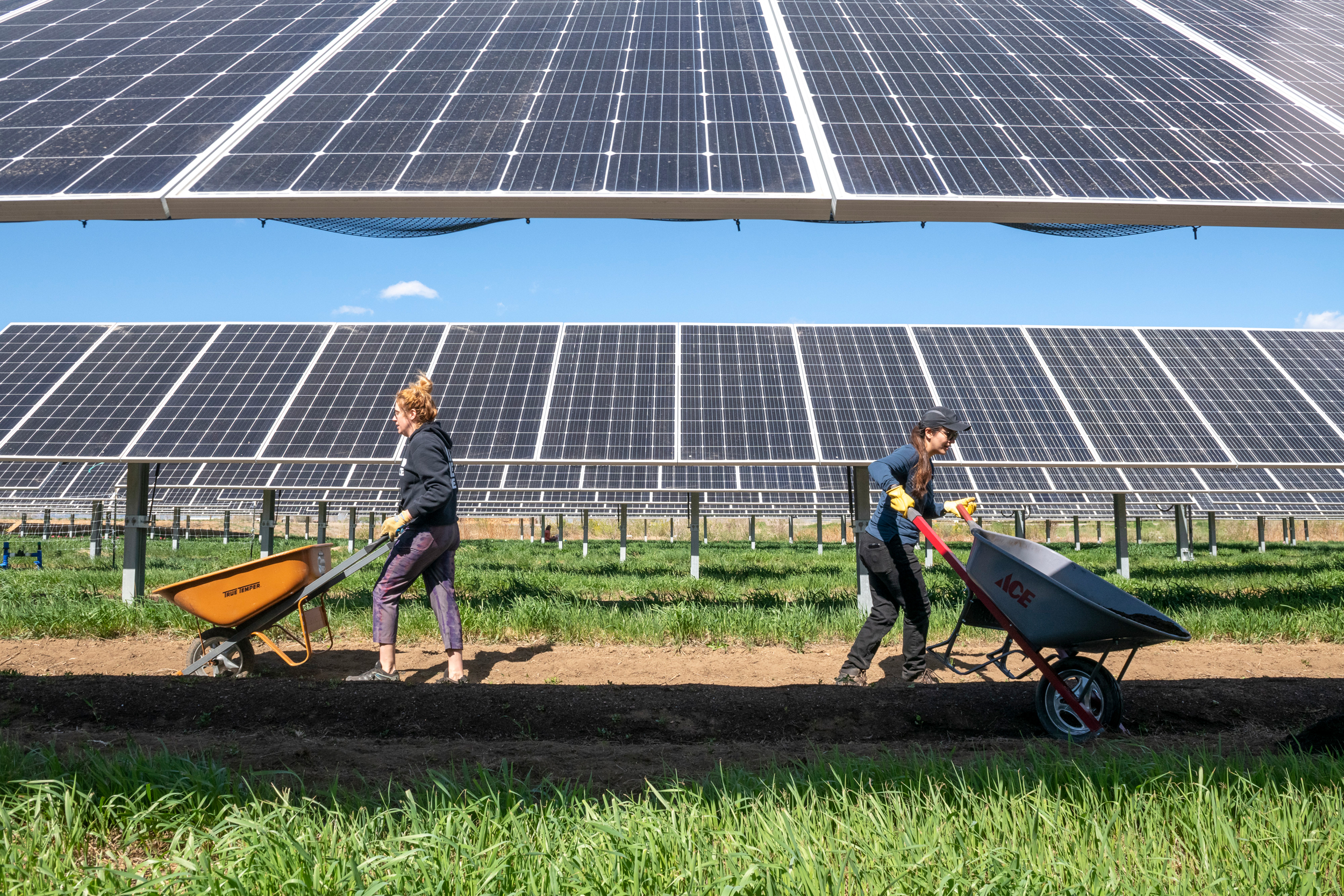


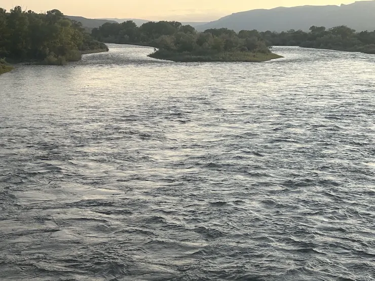


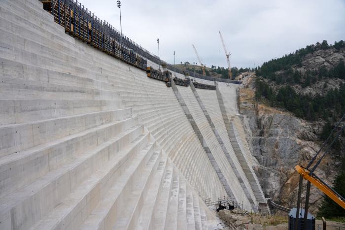
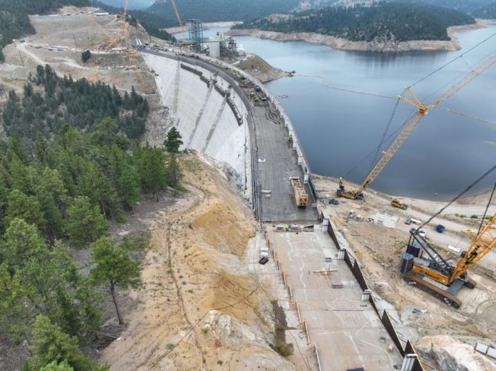
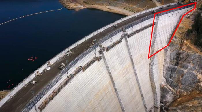


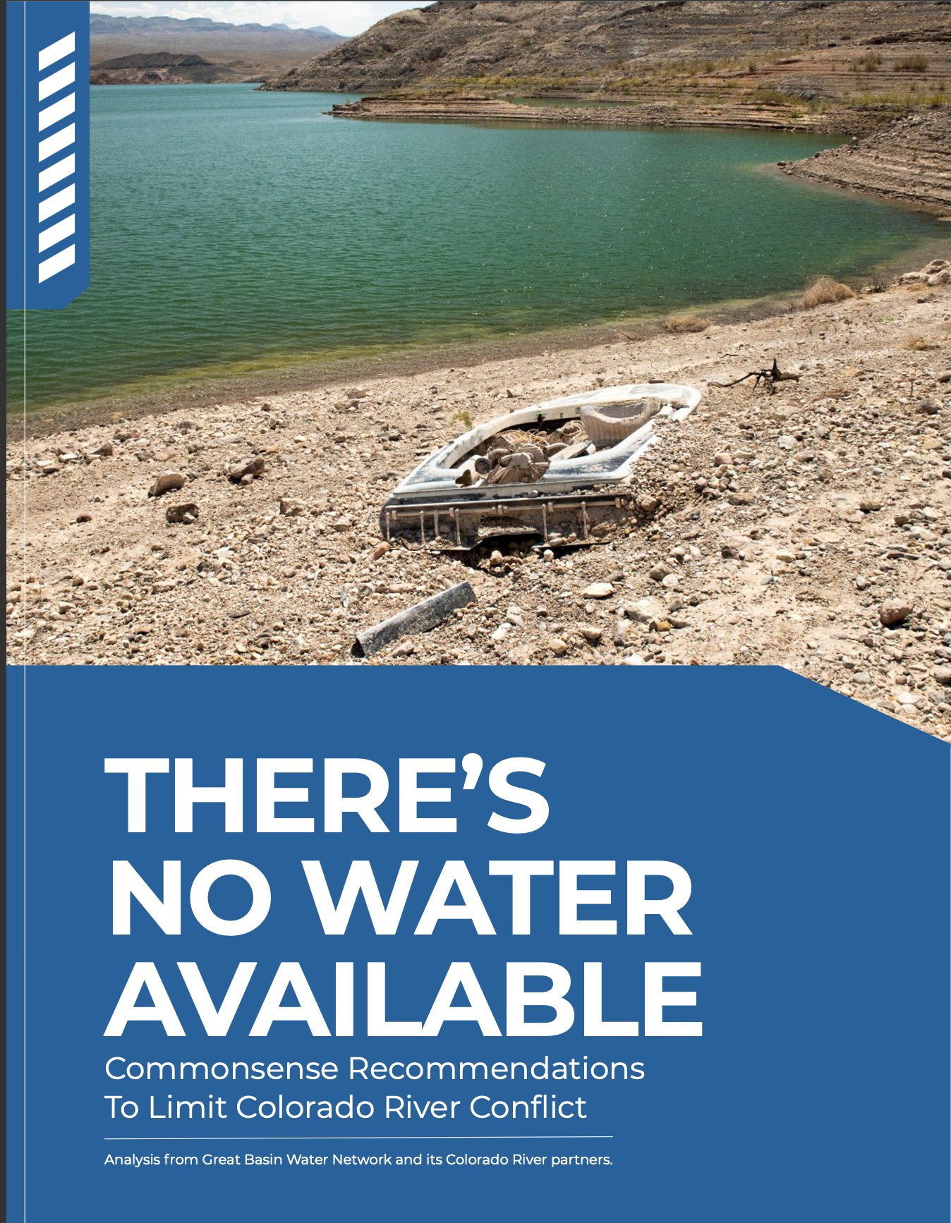


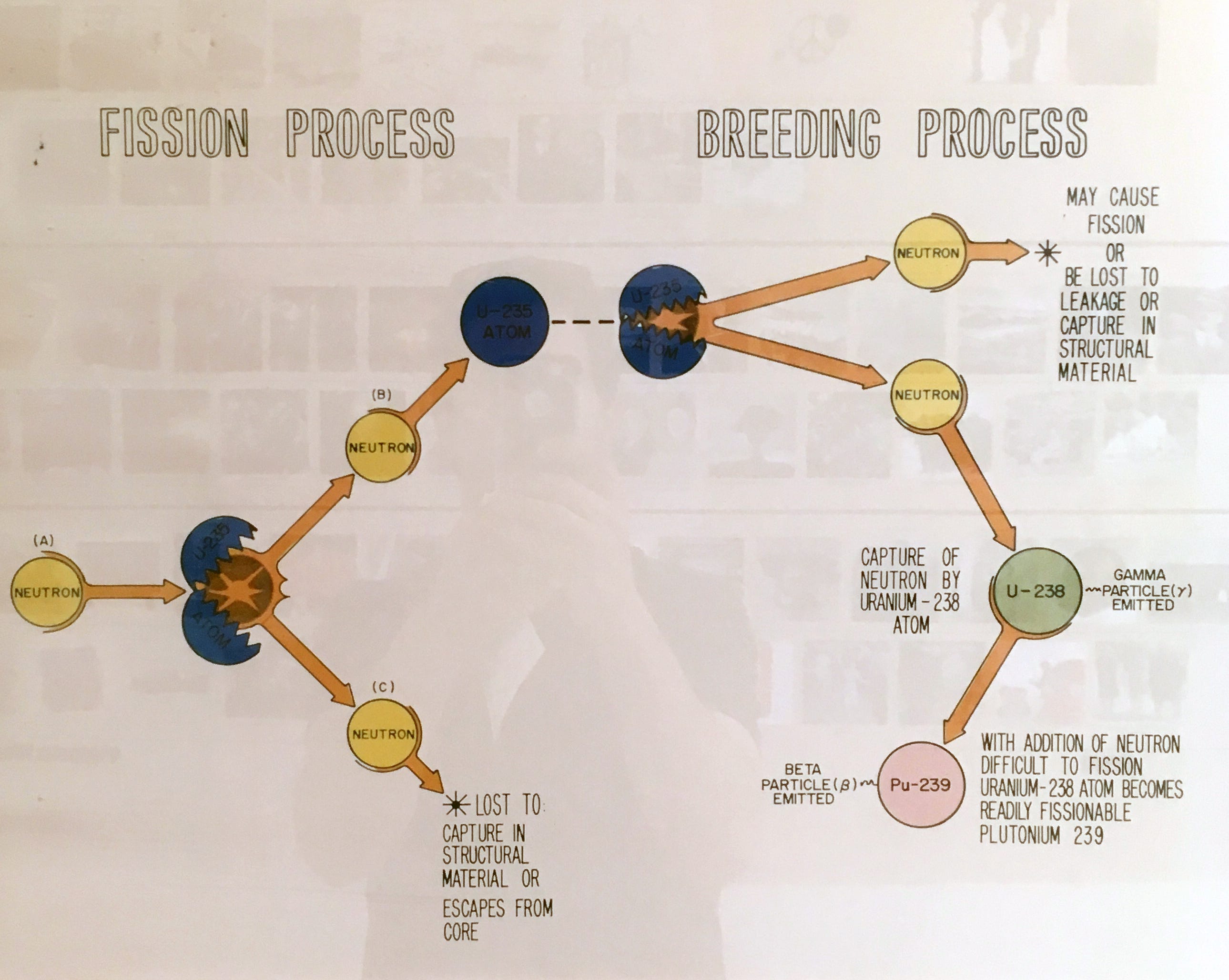
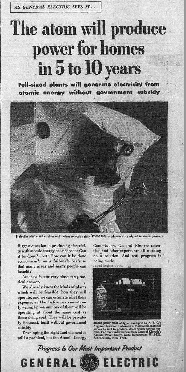
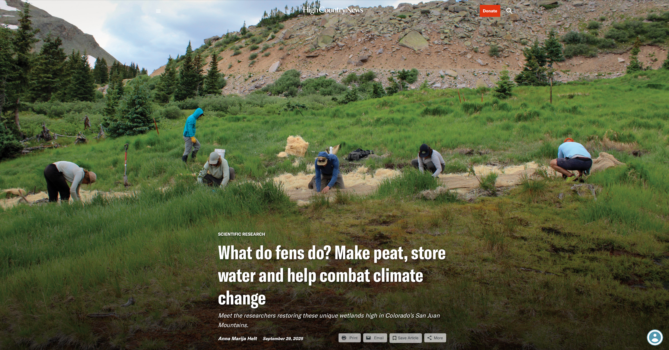
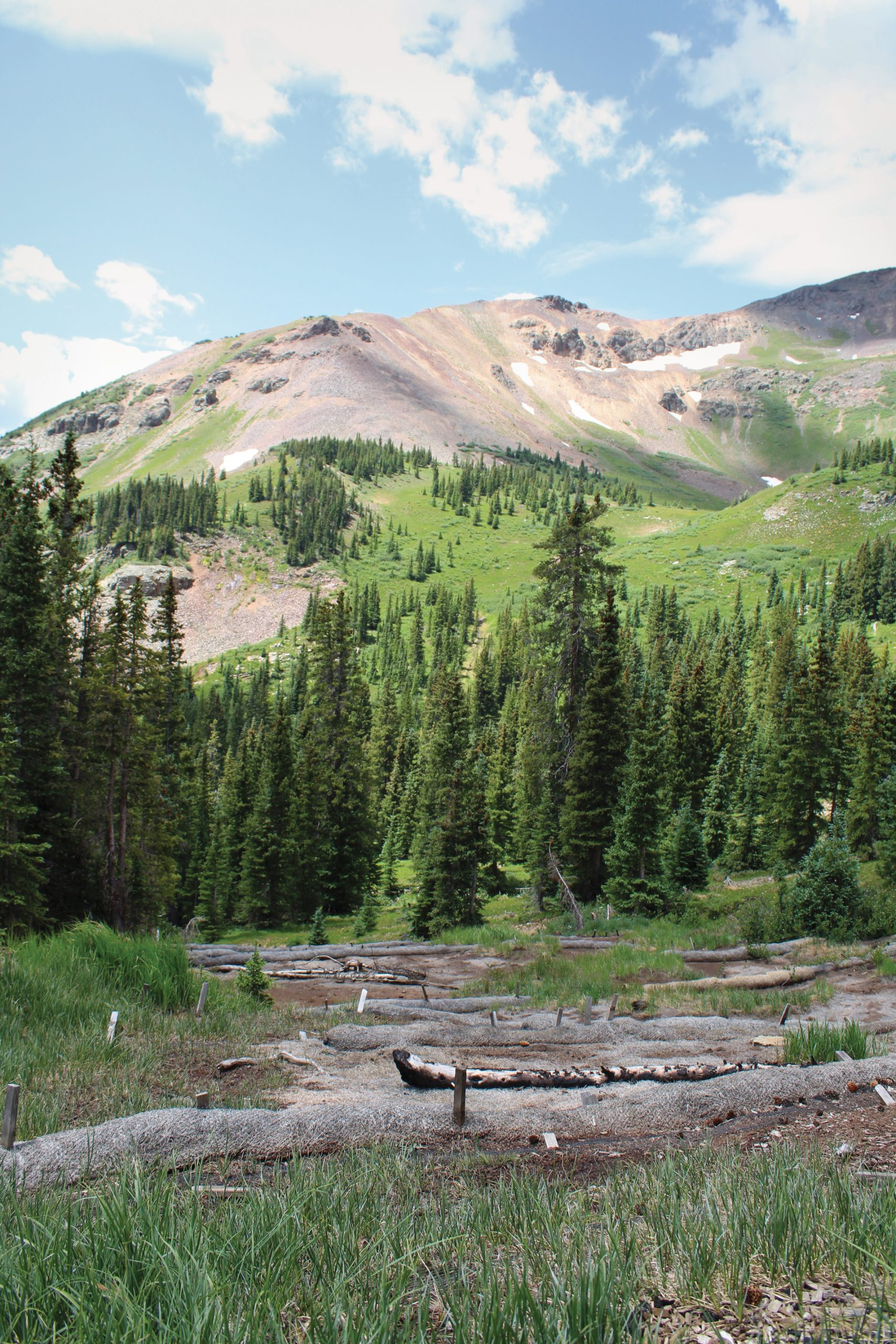


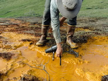


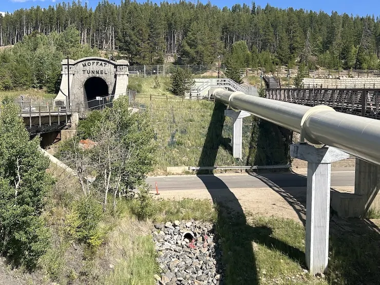
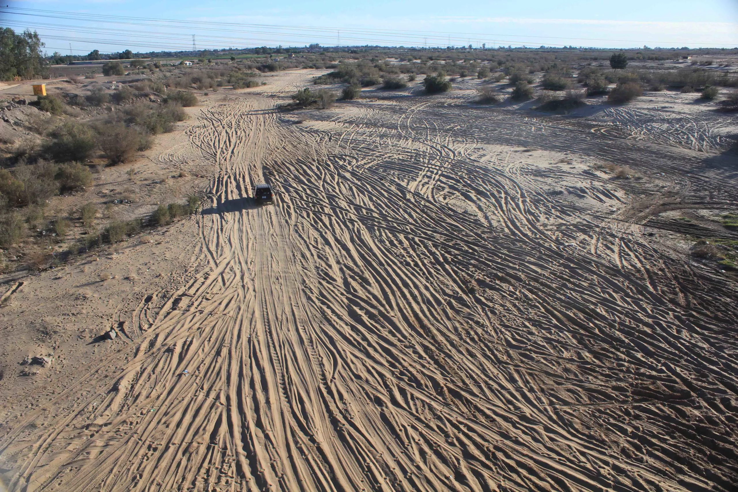


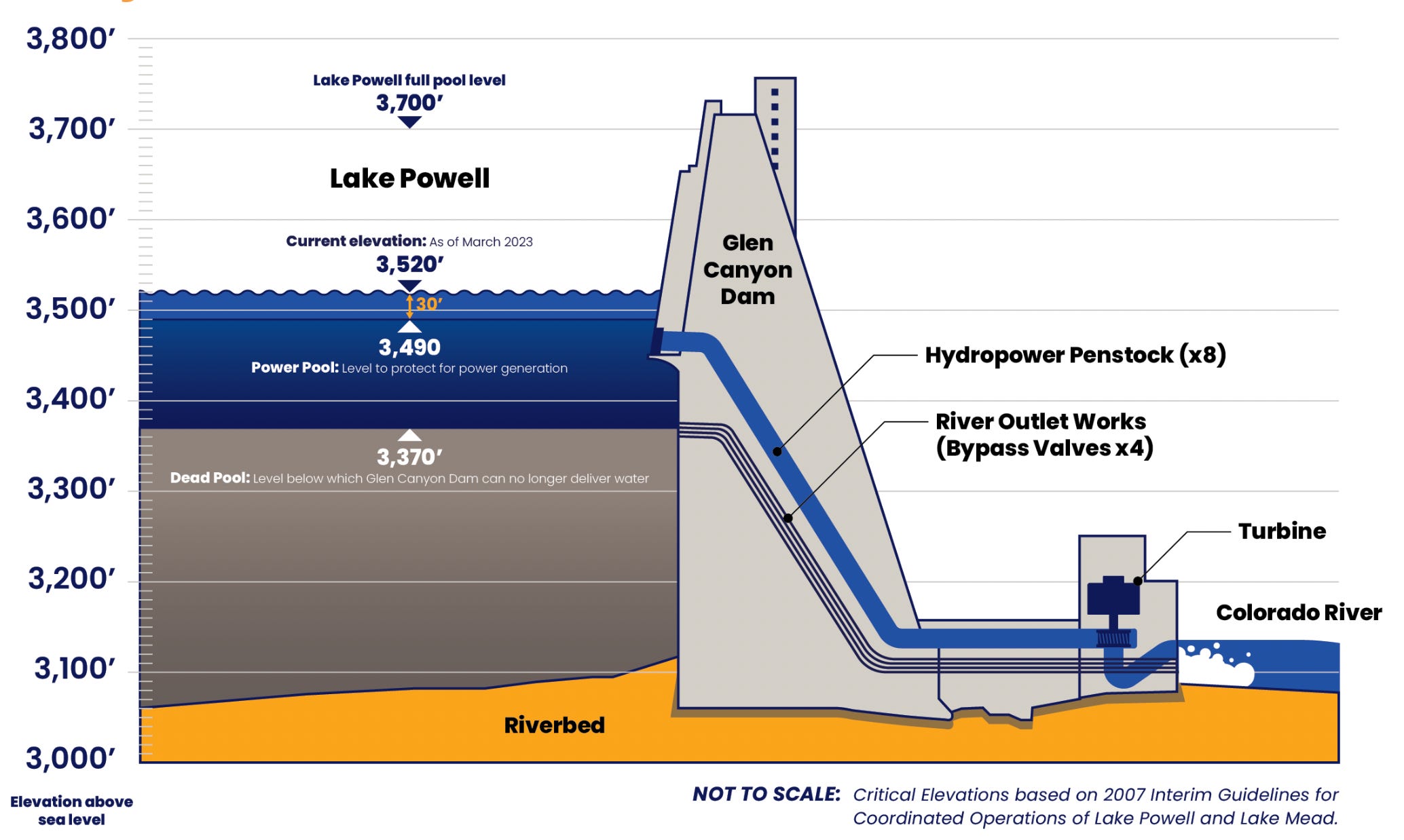


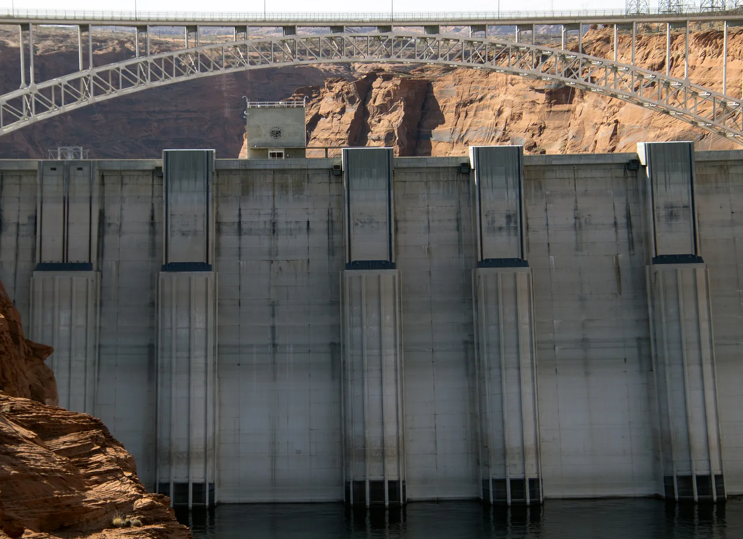


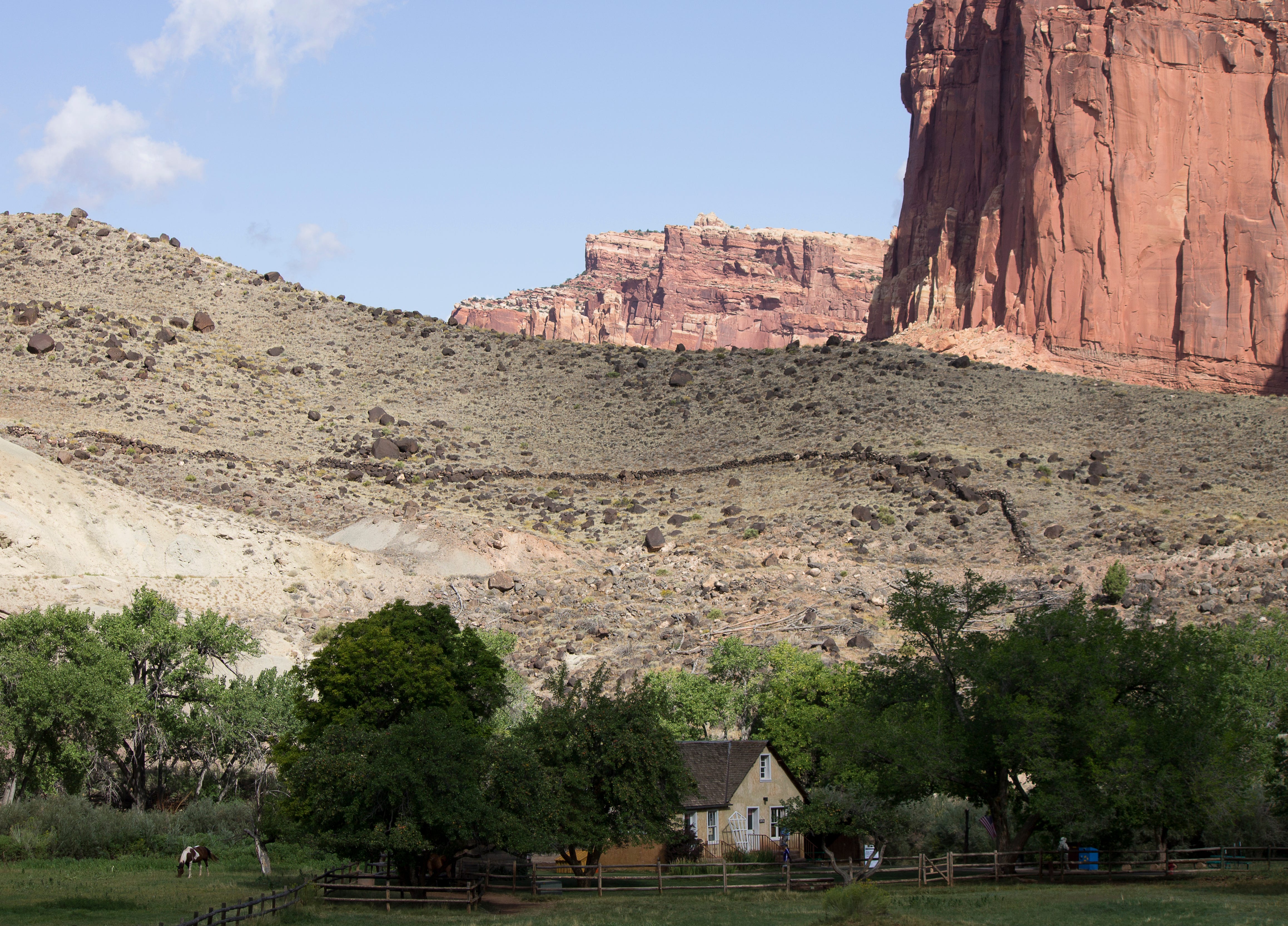


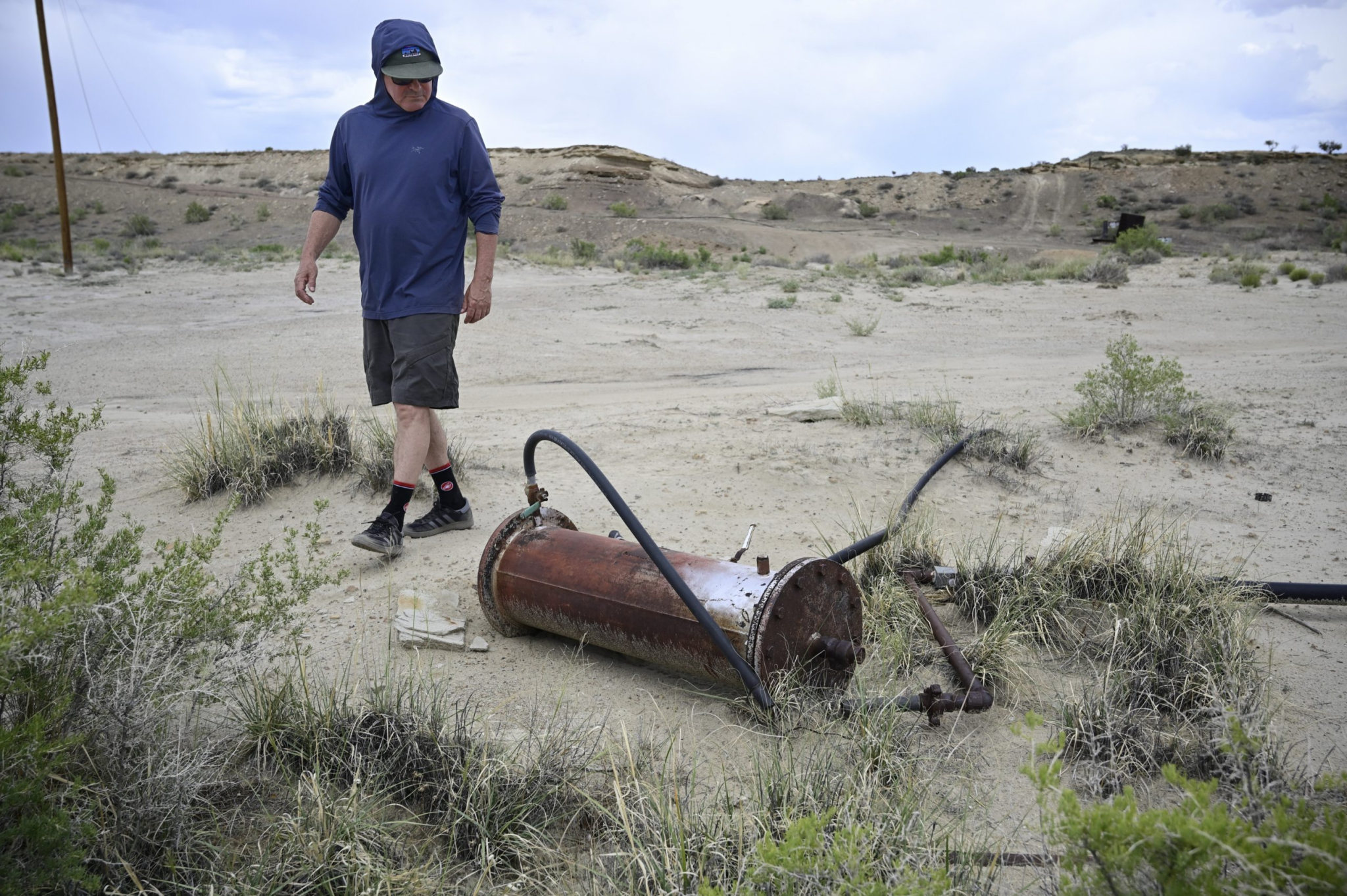


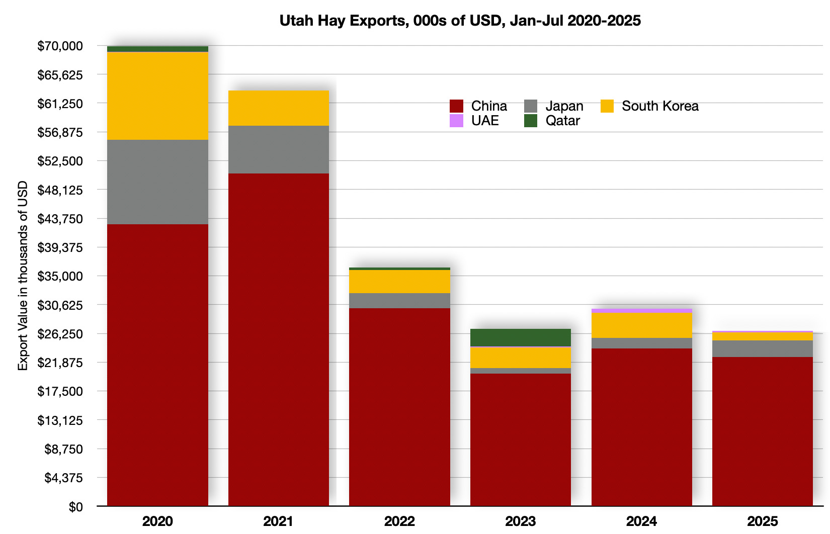
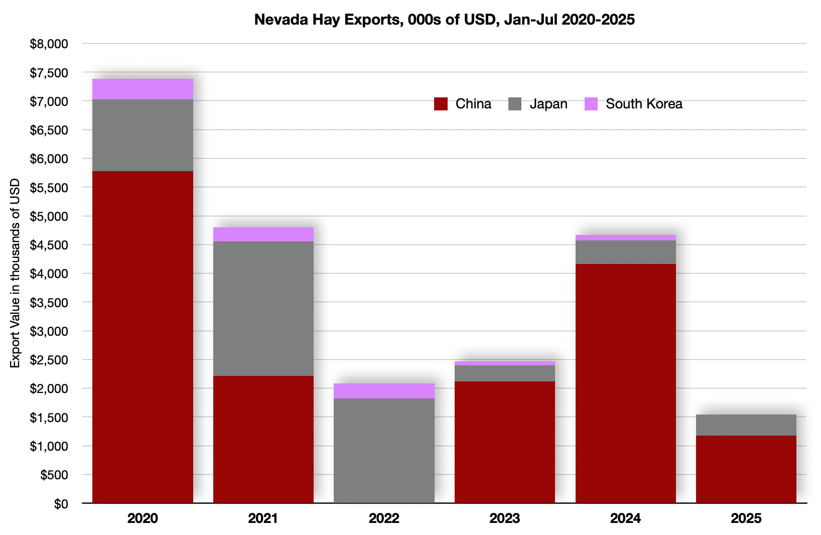


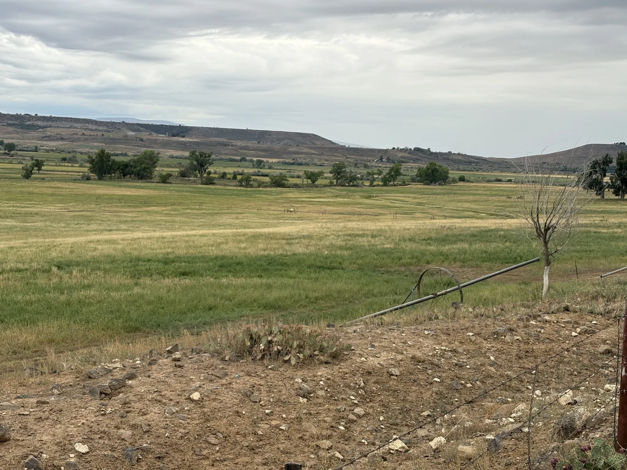


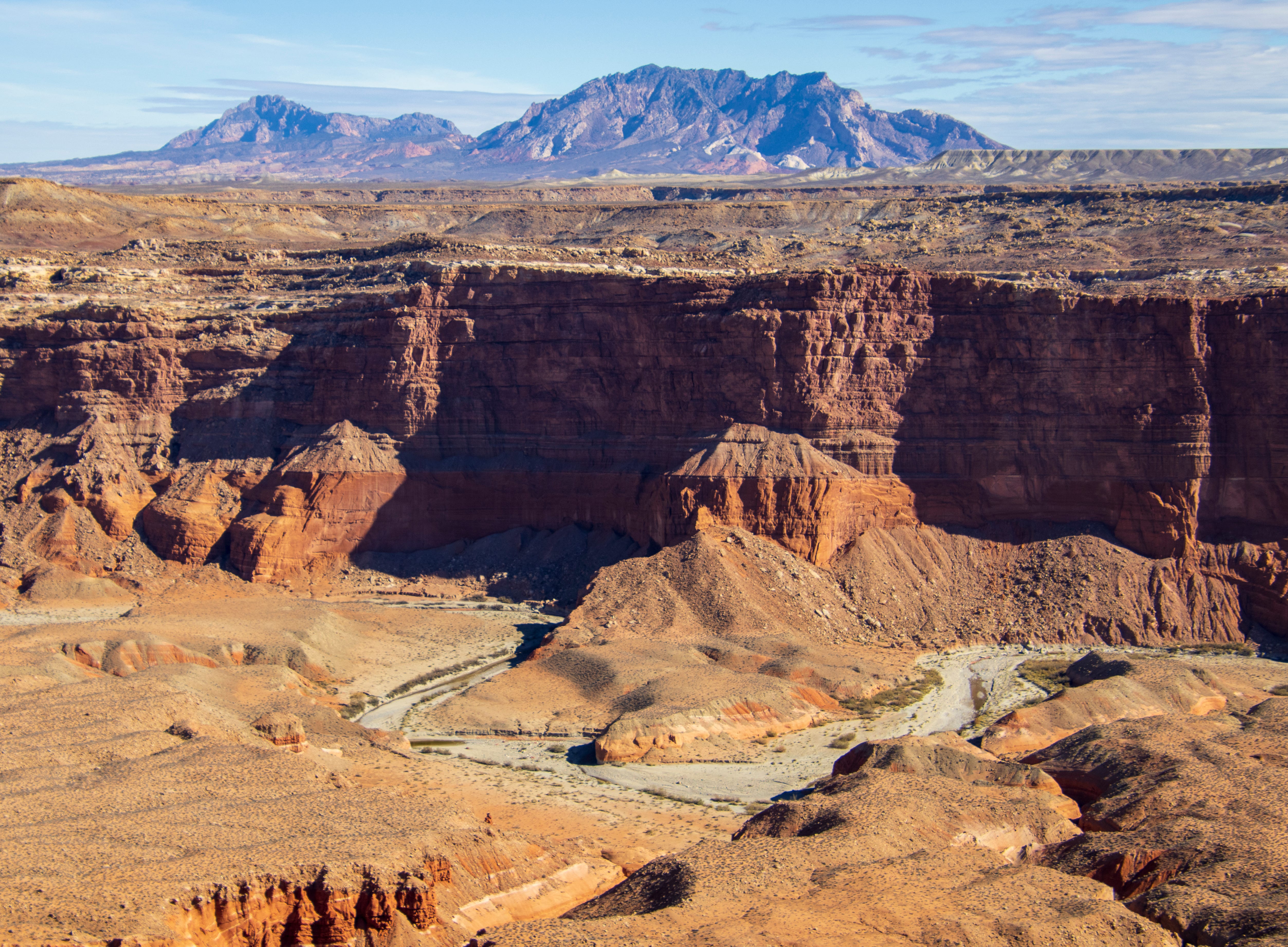


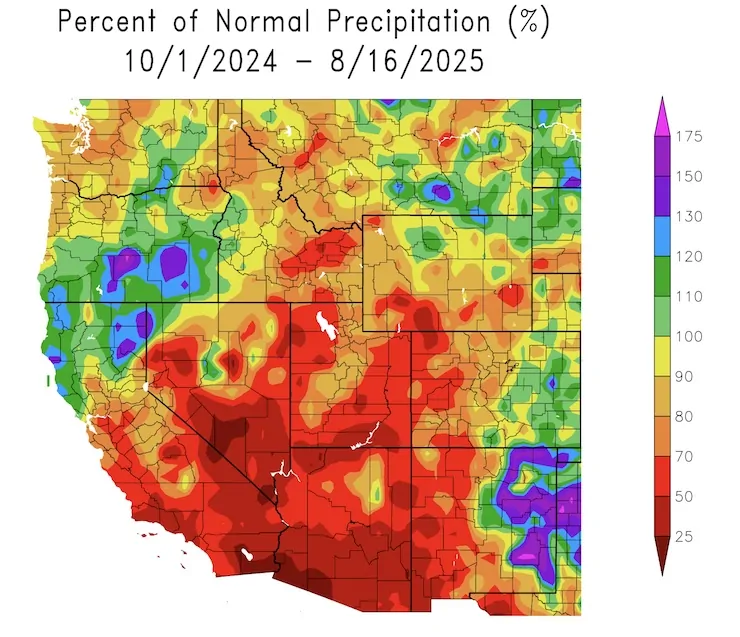


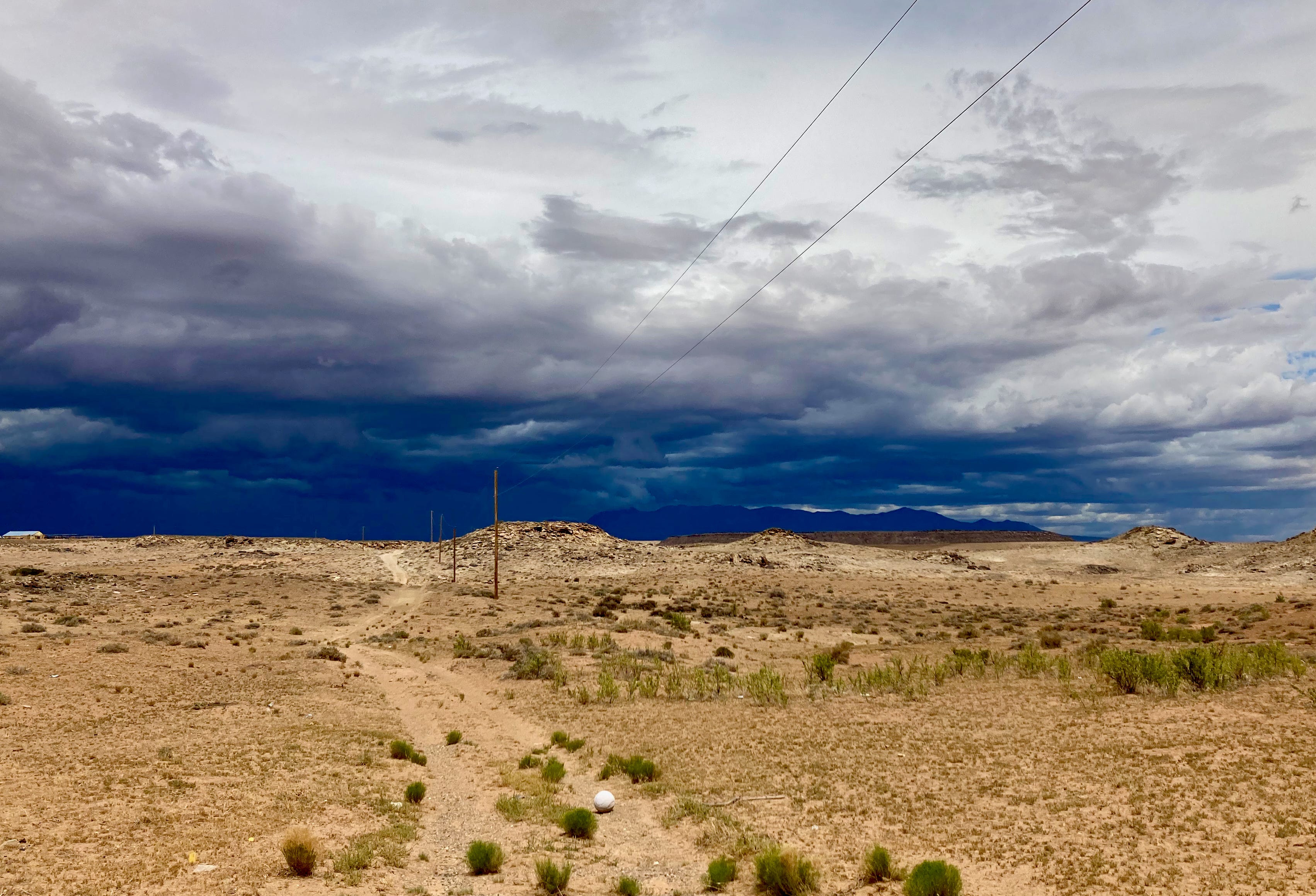
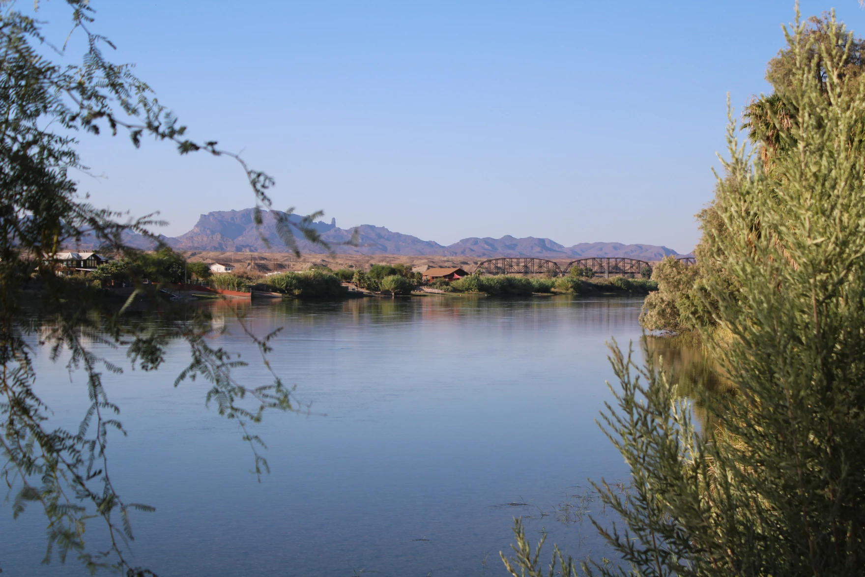
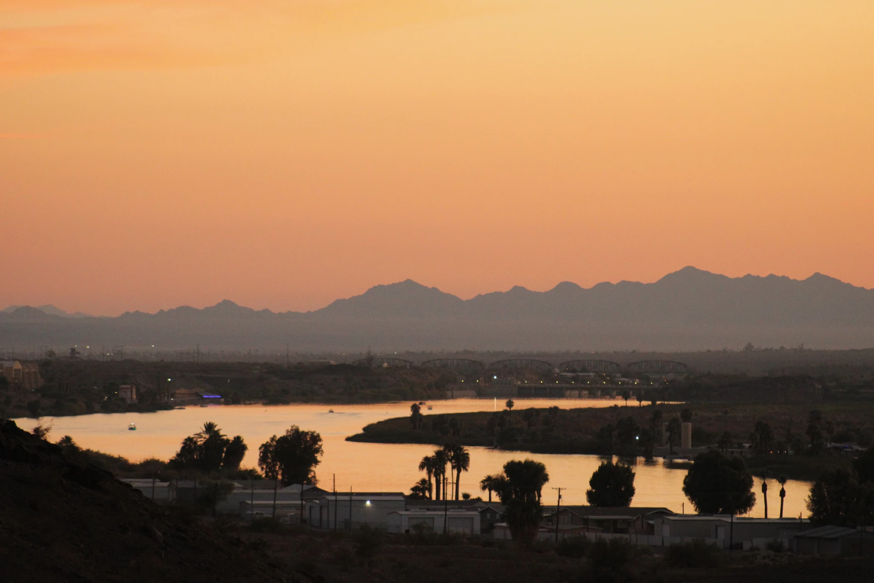

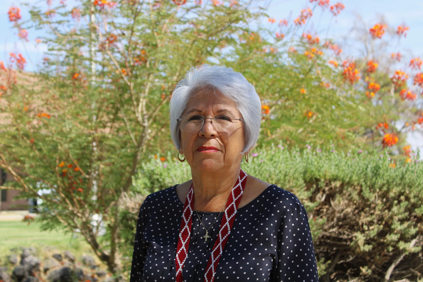
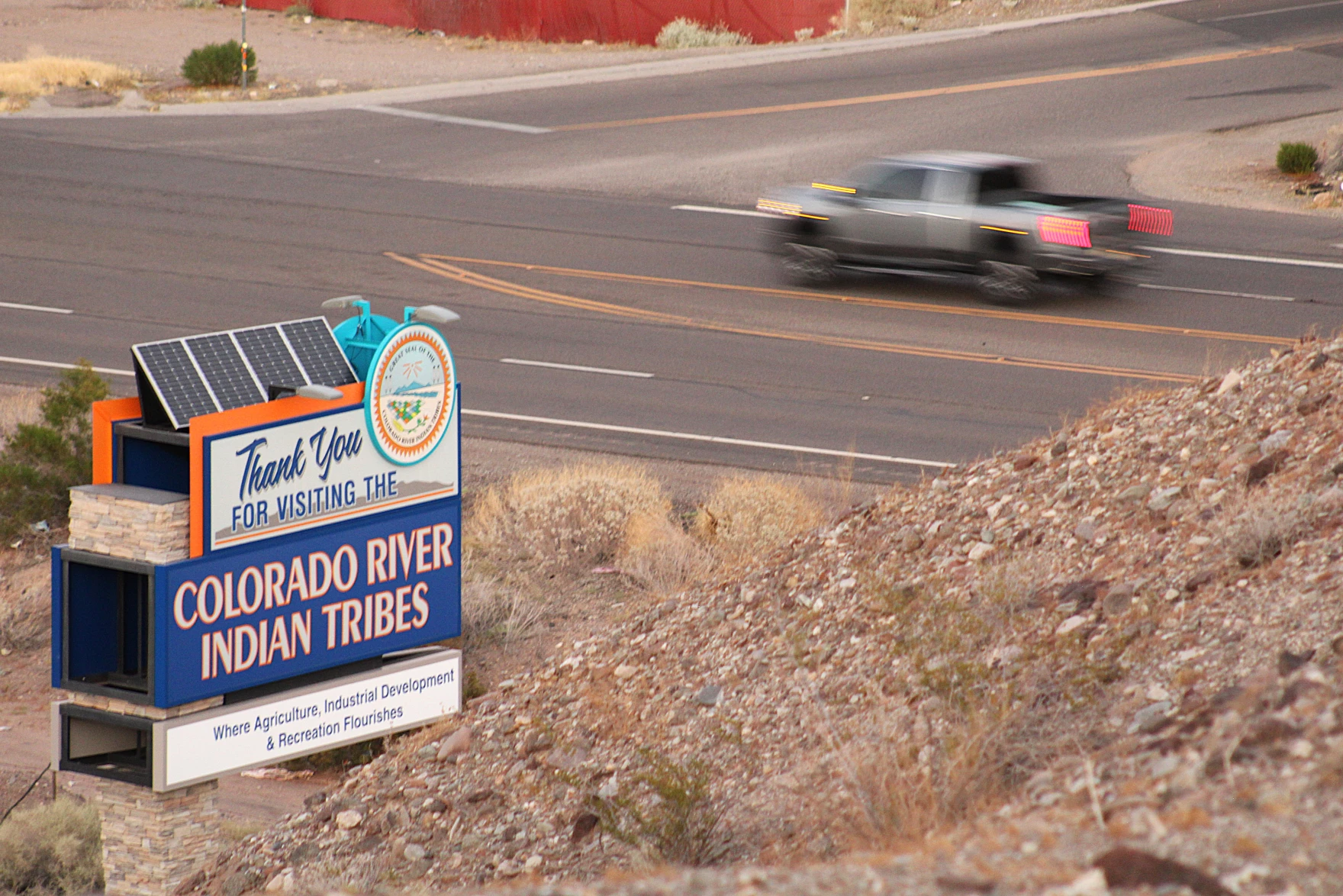
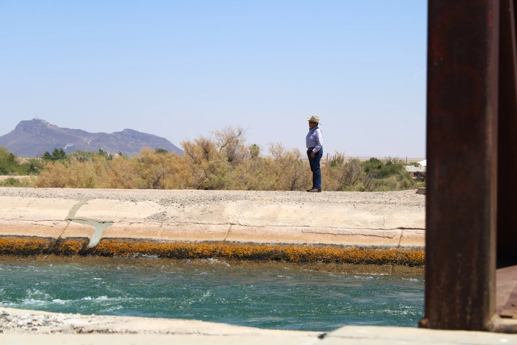
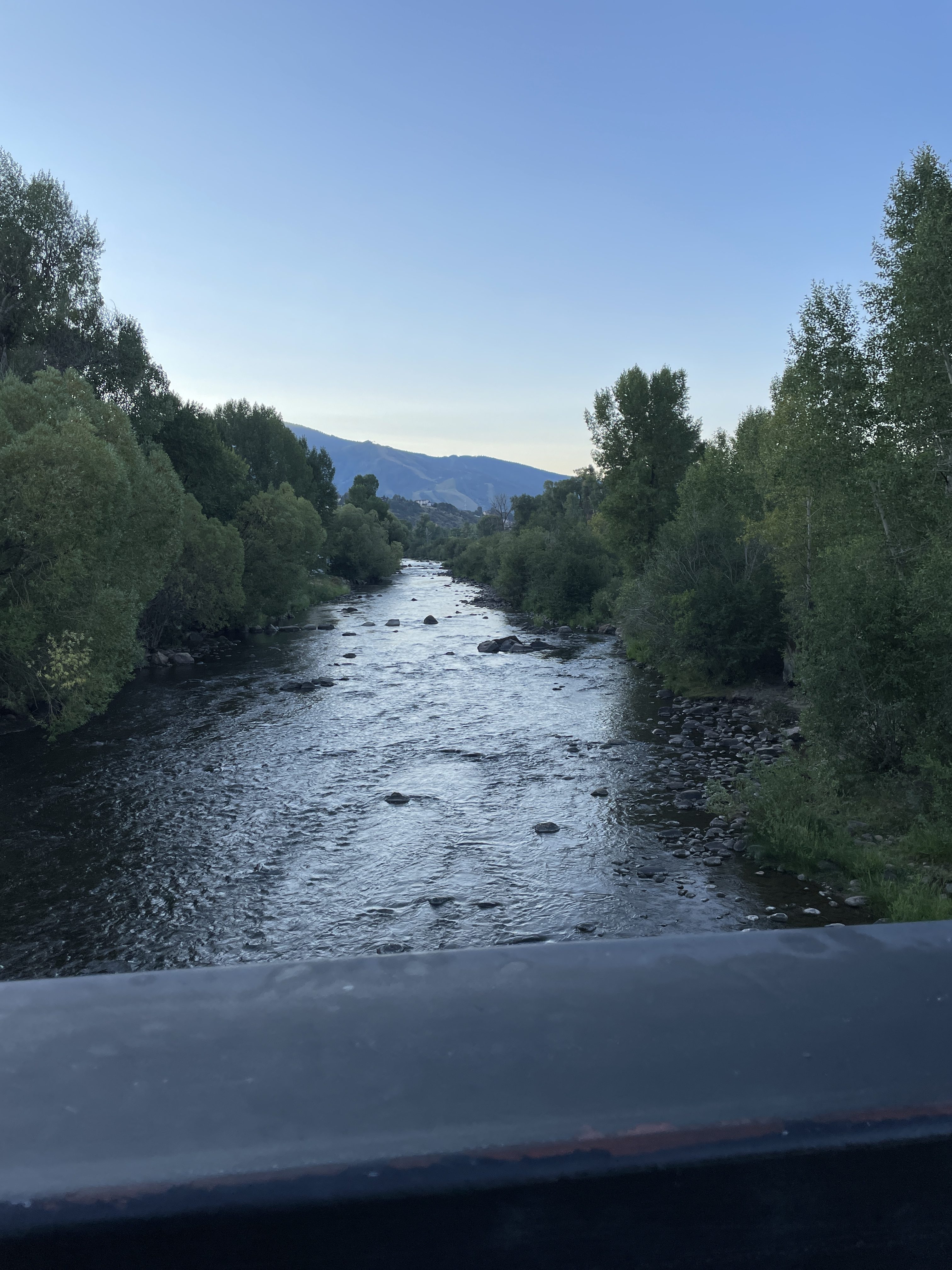

