Wildlife biologist Bill Vetter and Western Rivers Regional Program Manager with Audubon Rockies Abby Burk walk along an irrigation ditch in Grand County. An avian monitoring program aims to learn more about how birds use irrigated agriculture. CREDIT: HEATHER SACKETT/ASPEN JOURNALISM
Click the link to read the article on the Sky-Hi News website (Meg Soyars). Here’s an excerpt:
If the lake does drop lower than 3,490 feet, it is uncertain how much water, if any, will be delivered to the communities that rely on it. Lake Powell doesn’t only supply water to millions of Americans, it also provides power through turbines at the Glen Canyon Dam. Below 3,490 feet, the dam will not be able to provide hydropower. All Colorado Basin states receive power from the dam. Kirk Klancke, president of the Colorado River Headwaters Chapter of Trout Unlimited, explained that the emergency at Lake Powell may seem far removed from Grand County, but it’s closely connected. Forty million people, from Wyoming to Mexico, rely on water from the Colorado River, including every Grand County resident. When someone turns on the tap here, they are getting the same water that will eventually get sent down to Lake Powell for a California (or other regional) resident…
Klancke feels the Lower Basin is demanding too much water from Lake Powell, and this may decrease the water supply of Upper Basin states like Colorado.
“My concern for Grand County is that our water rights will be cut into to make up the difference,” he said. “I worry they might go after our agricultural rights first … and (agriculture) makes up a huge part of our economy.”
Rio Grande and Republican River would use funds to meet state groundwater sustainability, interstate compact compliance targets
COLORADO is moving toward putting $60 million into a new groundwater compact compliance fund for the Rio Grande and Republican River basins created and funded through a state senate bill drafted and championed by state Sen. Cleave Simpson of Alamosa.
The bill, Senate Bill 22-028, creates the Compact Compliance Fund that would be administered by the Colorado Division of Water Resources and would receive an appropriation of $60 million from Colorado’s share of federal COVID relief money from American Rescue Plan funding.
The bill, co-sponsored by Sen. Jerry Sonnenberg of Sterling, originally only established the fund, and then an amendment unanimously adopted Thursday by the Colorado House Agriculture, Livestock, and Water Committee added $60 million into it. The bill next will be heard by the House Appropriations Committee.
“Given the unanimous votes every step of the way, so far, I am hopeful the bill with the appropriation will become law in the next week or two,” Simpson told Alamosa Citizen. “The timing of the availability of federal dollars and the growing sense of urgency in both basins created a unique opportunity that will serve both of these communities well. Still some work to do, but things look very promising for both of these Colorado communities.
Rio Grande and Pecos River basins. Map credit: By Kmusser – Own work, Elevation data from SRTM, drainage basin from GTOPO [1], U.S. stream from the National Atlas [2], all other features from Vector Map., CC BY-SA 3.0, https://commons.wikimedia.org/w/index.php?curid=11218868
If the Compact Compliance Fund is adopted by the Colorado Legislature it would pay for efforts to meet groundwater sustainability targets in the Rio Grande Basin and interstate compact requirements for the Republican River Basin. Each basin would get an earmark of $30 million to pay for efforts like retiring groundwater wells and other conservation and water sustainability measures. The goal would be to spend all $60 million within the time constraints put on federal COVID dollars, whether it’s a 50-50 split or not.
The Republican River basin. The North Fork, South Fork and Arikaree all flow through Yuma County before crossing state lines. Credit: USBR/DOI
The threat to livelihood for farmers and ranchers and economic disaster for the regions tied to irrigated agriculture in the Rio Grande and Republican River basins was made loud and clear in the House Agriculture, Livestock, and Water Committee.
“These farmers and ranchers have done everything they possibly can,” said Marisa Fricke, one of the Rio Grande Water Conservation District’s program managers. “They grow produce for us and hay for our cattle.”
Farmers and ranchers in both basins have levied property taxes on themselves through the water conservation districts to pay for their efforts to help the Rio Grande and Republican River meet groundwater sustainability and interstate compact compliance goals set by the state. It has meant fallowing of crop fields, permanently retiring irrigated acreage, taking groundwater wells off line either temporarily or permanently, and compensating farmers and ranchers for their efforts to help offset loss from less irrigated acres.
State Reps. Marc Catlin and Dylan Roberts made impassioned pleas for including $60 million of the ARPA money into the compact compliance fund during their presentation of the bill in the House Ag committee. Both are House sponsors of the bill.
“This is an opportunity with these funds to say, ‘We’re with you,’” said Catlin of the risk farmers and ranchers take their sacrifices to address compact and sustainability issues on the Republican River.
“This is a great bill for the San Luis Valley and Republican River Basin,” said Heather Dutton, district manager of the San Luis Valley Water Conservancy District. “Colorado through COVID relief bills provide a once in a lifetime opportunity to invest in our communities. The imbalance between water use and supply is a critical issue facing Colorado and especially the basins highlighted in this legislation.”
Farmers in the San Luis Valley are looking to take even more drastic steps in their efforts to meet state targets on groundwater pumping and recharging of the Upper Rio Grande Basin’s unconfined aquifer. In Subdistrict 1 of the Rio Grande Water Conservation District, farmers are facing a new proposed amendment to the subdistrict’s Plan of Water Management that would tie the level of groundwater pumping allowed to the natural surface water of the property. Some farms in the subdistrict do not have natural surface water, in which case they would have to purchase water credits from a neighboring farm or pay an overpumping fee of $500 per acre-foot.
This concept keeps the system in balance by replenishing what has been withdrawn from the aquifer with surface water and allows the community within Subdistrict No.1 to work together through the exchange and sale of credits. In the event that more groundwater is withdrawn from the aquifer and not replenished an overpumping fee of $500 per acre-foot would be assessed, according to the proposed amendment to the subdistrict’s water management plan. Money collected by the conservation district from an over pumping charge would come back to the Subdistrict 1 community in the form of payments towards enrolling in water conservation programs, according to Fricke.
“For over a decade farmers and ranchers have worked to meet sustainability levels and have taxed themselves assessments for waters taken out of the aquifer,” Fricke told House ag committee members.
Eventually the water conservation districts would establish guidelines and the state Division of Water Resources would administer drawdowns of the fund. In the unlikely chance Rio Grande and Republican River water managers didn’t spend all $60 million, the money would revert to the division of water resources.
Future state appropriations to Compact Compliance Fund would hinge on executive and legislative budget priorities.
It’s a commonly known spot off County Road 17 between Del Norte and South Fork. Driving in you might see a blue heron standing off in the marsh and river rafters looking to get onto the Rio Grande at the very spot Colorado has been measuring the river since the summer of 1889 – June 1, 1889, to be precise.
This time of year, with any ice on the river gone and the weather warming, Jessie Jaminet comes every two weeks to the stream gaging station operated by Colorado Division of Water Resources to make sure everything is functioning for measurements that are closely watched by water managers up and down the Rio Grande. He was there this past week to get an early spring reading and when prompted for a prediction on this year’s flows said, “I think we’re probably going to be slightly below average from what I’ve seen.”
1934 and 1960. Credit: Alamosa Citizen
Average over the past decade has been 491,000 acre-feet of water; historically going back to 1889 the Rio Grande has an average measurement of 639,000 acre-feet, according to figures maintained by the state.
Jaminet, lead hydrographer for state water resources division 3, cautions that the river “changes daily right now.”
“Any storm that hits right now is a huge benefit for the whole system. People watch the snowpack numbers, but it really depends on what happens this time of year. Wet spring storms really benefit the system,” he said.
The Rio Grande gaging station near Del Norte is the highest profile gage station in the Upper Rio Grande Basin. That’s because it’s the gaging station the state uses to help determine how much water from the Rio Grande is available and will be delivered downstream into New Mexico and Texas as part of the three-state Rio Grande Compact.
Besides measuring lower-average acre-feet the past decade, another phenomenon has been occurring: an earlier peak to the river flow and then a quick dropoff, which means less water and shorter irrigation seasons downstream for New Mexico and Texas.
The stream gaging station operated by Colorado Division of Water Resources highway 17 between Del Norte and South Fork. Photo credit: Alamosa Citizen
“Historically the river would peak and we would maintain those flows for a while before we would fall into base flow conditions,” Jaminet said. Peak flow used to hit mid- to late-June and the Rio Grande would maintain itself through the summer. Now the state is seeing peak Rio Grande flows as early as late May and then drastic drop offs to the height of the river. It’s attributable to the aridification of the Valley floor from persistent drought and climate change.
Colorado’s obligations under the Rio Grande Compact is another aspect to the management of the upper basin of the river that water managers, irrigators, and outdoor recreationalists have to factor in when planning their own water usage.
“This is what we base pretty much all of our numbers on, this upper index here. Anything that passes this gage here we have to deliver a percentage of it downstream. This is why this is an important gage here,” said Jaminet.
He’s been working the measurements the past 15 years as part of his job with Colorado Division of Water Resources to operate and maintain the gaging stations along the Upper Rio Grande Basin. It’s not what he planned on doing for a career when he graduated from Mountain Valley High School in Saguache in 2001 and then the University of Wyoming, where he majored in rangeland geology and watershed management. But he’s learned and come to understand the importance of taking the river’s measurement, and the fact he grew up in the San Luis Valley makes him appreciate the work he does even more.
“This is a continuous record that we produce here,” he said of the Del Norte gaging station, pointing to the readings from 1890 through 2021. One of the most eye-popping historical figures is Oct. 5, 1911, when the Rio Grande was flowing at 18,000 cubic feet per second. The day Jaminet was at the gage station the river was moving at 519 cfs.
Most of the big diversions to the Rio Grande happen a bit farther downstream in Rio Grande and Alamosa counties, making the gaging station near Del Norte a natural location to determine the depth and velocity of the river.
A float sitting in a stilling well reads the height of the river. Photo credit: Alamosa Citizen
In the 1890s and early decades of the 1900s the state division of water resources would take a measurement of the Rio Grande twice a day and then daily as it kept improving the system. It eventually installed a continuous reader in 1983, and then in the summer of 1984 a satellite monitoring system was installed.
Now the gaging station takes a reading every 15 minutes and logs and transmits the data every hour to the Colorado Division of Water Resources website, where it’s tracked and followed by the three states party of the Rio Grande Compact. Fishermen and rafters will also monitor the web site to help them determine the best times to fish and float the river.
One of Jaminet’s responsibilities is to make sure the gaging station is calibrated and reading accurately. A float sitting in a stilling well reads the height of the river and then a rating table unique to the gaging station is applied to give an accurate measurement. In the winter months, with ice on the river, the measurements are more estimates.
Coming off a dry 2021, in January the Rio Grande was at its lowest point to start a year since Colorado began taking measurements 132 years ago. A cooler March and April have helped, but without significant summer rain, the Rio Grande will run dry again early in the summer irrigation season.
“If you go into the fall really dry, even if you get these big spring storms it seems like it just goes into the ground,” Jaminet said. “A lot of it is not making it to the river anymore.”
The measurements at the Rio Grande gaging station near Del Norte tell the story.
Jaminet makes regular checks on calibration. Photo credit: Alamosa Citizen
Colorado snowpack sub-basin filled map March 29, 2022 via the NRCS.
Click the link to read the article on the Craig Press website (Dylan Anderson):
The amount of water in the snowpack blanketing the Yampa River Basin started declining on Friday, March 25, potentially marking the earliest peak since 2017…Erin Light, engineer for the Colorado Division of Water Resources, has put the river under administration three of the last four years. At the Colorado River District’s State of the Yampa River event last week, she said 2022, so far, is tracking in line with other dry years over the last two decades.
This year’s snowpack is rivaling that of 2002 and 2012 — two of the driest years during the current 22-year drought that is the worst ever recorded, Light said…Snowpack is important, but precipitation in the spring and late summer is also a key metric, and it seems harder to come by…
The Yampa is one of most free flowing rivers in Colorado. Of the five main reservoirs feeding into the Yampa, Light estimated that at least two and maybe three of them won’t fill up this year. Stillwater Reservoir is the farthest upstream and was sitting at about 310 acre-feet when it was last measured in October. Light said there was water released last year for both agricultural purposes and for work on the dam. Farther downstream, Yamcolo Reservoir was about 45% full, and Stagecoach reservoir was 75% full as of late last week. Two reservoirs in the basin — Fish Creek Reservoir on Buffalo Pass, where Steamboat Springs gets much of its water, and Elkhead Reservoir near the Routt and Moffat county line — are both likely to fill, Light said.
Westwide SNOTEL basin-filled map March 29, 2022 via the NRCS.
Click the link to read the article on The Denver Post website (Conrad Swanson). Here’s an excerpt:
In short, the kind of clouds that create snowstorms contain massive amounts of super-chilled water vapor, Rickert said. Left alone, those clouds can release some snow and retain the rest of their water vapor. Cloud seeders look to agitate those super-chilled water particles, causing them to freeze inside the cloud. From there they form snowflakes and fall to the ground, Rickert said. Seeders can agitate those particles by plane or from machines on the ground, both processes typically use a silver iodide compound. Airplanes will “pretty much fly right through the cloud,” spraying the compound across a flame, and spreading it throughout the air, sparking the chemical reaction, Rickert said. Ground generators do the same except they use wind drafts to carry the compound into the clouds, he said. he end result? Up to a 12% increase in snowfall for a particular storm, [Andrew] Rickert said…
Seeding efforts in central Colorado are working well too, according to Dave Kanzer, director of science and interstate matters for the Colorado River District, which helps manage the program in Eagle, Grand, Pitkin and Summit counties. Water from the extra snowfall eventually melts, flowing down Colorado’s rivers and streams and eventually out of state, Rickert noted, so downstream states like Arizona, California, Nevada and New Mexico all chip in to the state’s $1.5 million budget. But there’s a catch, Kanzer added. Cloud seeding can’t create snow storms out of nowhere. They can only enhance existing storms…
“It’s the only option for physically augmenting snowpack,” Rickert said. “And the only way to actually create and add water to the system.”
A group of Valley farmers announced in a press release that they have come together to create the Sustainable Water Augmentation Group (SWAG), an alternative to Rio Grande Water Conservation District, Subdistrict 1.
“It is no secret that we are at a critical moment for the future of the San Luis Valley, as drought deepens, climate change intensifies, and the unconfined aquifer’s water level continues to drop at a dangerous rate. Decisive action is required now before the aquifer runs dry and the way of life for the 46,000 residents of the San Luis Valley, where agriculture is the driving economic force is threatened,” the release stated.
The San Luis Valley has a mostly unconfined aquifer and is subject to many variables including drought. A confined aquifer is surrounded by rock and clay pieces which confine it to an area and make it less at risk for loss, but an unconfined aquifer is exposed and can be impacted more severely by outside factors. A confined aquifer is found deep beneath the ground, while an unconfined aquifer is just below the ground level…
The Rio Grande Water Conservation District, Subdistrict 1 covers much of the San Luis Valley area. According to the Subdistrict 1 Plan of Water Management, “The goals of the Subdistrict are to cause groundwater levels in the Unconfined Aquifer of the Closed Basin to recover, and then to maintain a sustainable irrigation water supply in the Unconfined Aquifer with due regard for the daily, seasonal and longer-term demands on the aquifer and to protect senior surface water rights and avoid interference with Colorado’s obligations under the Rio Grande Compact. To achieve these goals, reducing and managing overall groundwater consumption is essential.” The group of farmers behind SWAG disputes the effectiveness of the plans in place and proposed by Subdistrict 1.
“Despite making little progress towards sustainability with the fee-based model, Subdistrict No. 1’s Board of Managers is now poised to vote on raising the over-pumping fee from $150 to $500 per acre-foot. That’s a 233% increase on top of a 386% increase over the past decade. While this plan may work for some producers, it is not a viable option for the members of SWAG who have paid these ever-increasing fees only to see reduced yields and declining water levels in the aquifer. It is clear the status quo is unsustainable for the farmers of the Valley, nor the aquifer that we rely on for our water. We simply do not have the time to double down on a one-size-fits-all fee-based approach,” SWAG stated in the release.
The SWAG press release included an answer to the ongoing water crisis in the Valley.
“SWAG has entered into an agreement to purchase and retire approximately 4,500 acres, irrigated by wells, that have historically consumed an average of 5,678 acre-feet per year from the unconfined aquifer at a cost of over $35 million. If real progress towards sustainability is not made, the sad truth is that SWAG members’ wells are subject to the very real threat of forced curtailment; whether by the State of Colorado if the subdistrict cannot prove its plan for sustainability will work; or by the Subdistrict itself through ever-increasing fees for pumping which would punish those water users who rely on their decreed water rights for their wells, or the absence of water at their wellheads due to the overuse of the unconfined aquifer. The only way to solve this threat and ensure the future vitality of the Valley is to work together to find solutions which work for everyone. We need more options to promote conservation, not less. SWAG’s augmentation plan is one of those options, and we hope that other members of the community make your voices heard before it is too late,” SWAG concluded.
ERIC Harmon is the type of person Douglas County says it wants to listen to.
He’s a hydrogeologist with expertise on the San Luis Valley aquifers of the Upper Rio Grande Basin. In fact, his team completed the groundwater component of the Rio Grande Decision Support System, which is generally described in state water court documents as “an interactive computer-based system that utilizes data and computer models to help decision makers solve unstructured problems.” The RGDSS is what the state relies on to determine the impact of groundwater pumping.
Harmon is also retired and hasn’t been part of any of the presentations that the three Douglas County commissioners have heard on Renewable Water Resources and its pitch to Douglas County to partner on exporting from the San Luis Valley.
What does Harmon’s experience and expertise say about the RWR proposal? He wrote a letter to the Douglas County commissioners outlining his concerns and recommendation that Douglas County reject the RWR proposal. He has yet to hear back from the commissioners. Alamosa Citizen also asked Douglas County for a response to Harmon’s letter.
Hydrogeologist Eric J. Harmon
“The Renewable Water Resources (RWR) proposal to Douglas County to use ARPA funds should be rejected in favor of less risky projects,” Harmon told the commissioners. “RWR’s project would place undue risks on San Luis Valley (SLV) water users and ratepayers (water customers) in Douglas County. Why? For that, we need to get down into the weeds on the SLV aquifers.”
Harmon said he has given expert testimony in the Division 3 Water Court (San Luis Valley) in the AWDI case (1991), the Confined Aquifer New Use Rules case (2006), the Great Sand Dunes In-Place Groundwater Right case (2008) and the Groundwater Rules case (2018).
“Confined aquifer tests in the SLV by my testing team were done as part of Colorado’s Rio Grande Decision Support System (RGDSS) in the early 2000s,” he said to the commissioners. “Our tests showed repeatedly that pumping impacts move outward from a confined aquifer well very rapidly, often causing drawdown (water level decline) up to ½ mile away within one day of pump startup. At several locations, pumping a deep well caused measurable drawdown in layers much shallower than the pumping zone. This is how confined aquifers work: drawdown spreads out very far, very fast. The SLV confined aquifer is ‘leaky.’”
After he sent along his letter to AlamosaCitizen.com for publishing, we asked him a few additional questions. The exchange is below:
AC: What concerns or thoughts, if any, can you share on the drought the San Luis Valley has been experiencing going back to 2002?
EH: Conditions are never static in hydrology. The dynamic nature of water, weather patterns, and the hydrologic cycle means that conditions are always changing. But where there is a long-term drought, the job of scientists and engineers becomes harder. It means that any predictions we are asked to make may be less reliable than we would like, because we don’t always have similar historic conditions we can look back on to compare to.
AC: The streamflow measurements documented by Davis Engineering for the Rio Grande Water Conservation District demonstrate troubling patterns. Have you recently looked at those streamflow measurements? In your view what type of impact is drought, climate change having on the basin and should that be a concern with the RWR proposal?
EH: I have tried to keep up with the general hydrologic trends in the Valley, including snowpack and streamflow. I have also kept up with the trends of Unconfined Aquifer storage change that Davis Engineering has done for RGWCD for many years. It is clear that even after a number of years of self-imposed pumping reductions in the Subdistricts, there is still too little water available to meet the irrigation demand, and to replenish the groundwater storage deficit in the Unconfined Aquifer in the Closed Basin. If drought or climate change persist in the future, as appears likely, then these impacts should be of concern in any new appropriation of water, whether by RWR or anyone else.
AC: Would the change in conditions, drought persistence, declining snow melt, particularly along the Sangre de Cristo range factor into a water court proceeding?
EH: Declining snowpack, earlier and faster runoff, and drought persistence certainly are of concern in the Sangre de Cristos, as they are in the San Juans. Valley-wide, the water supply from the Sangres is considerably less than it is from the San Juans. Smaller drainage areas, the “rain shadow” effect of the San Juans before the snowstorms get to the Sangres, and differences in topography and geology between the two ranges all are factors. If asked, I would advise the water court to look very hard at all of these factors. If groundwater recharge is less in the future than is predicted, it would almost certainly have an impact on the question of injury.
AC: Commissioner Teal said at the last meeting (March 8) that Douglas County has heard repeatedly that there is a “million acre feet” of water in the SLV aquifer. How does one address that notion?
EH: I can’t find any reference to a “million acre feet” in RWR’s proposal or in the presentations to Douglas County. RWR has stated that 22,000 acre-feet per year, the amount they intend to pump, is 2.5% of the aquifer’s annual recharge. So RWR’s number for annual recharge is 880,000 acre-feet. I do not know if this is what Commissioner Teal is referring to. The important thing, however, is not the annual groundwater recharge or the volume of groundwater in storage in the aquifer. The important thing is that the Valley’s water resources are over-appropriated. As Colorado Division of Water Resources officials have pointed out, this means there is no water available for appropriation and full (“1 for 1”) replacement is required under the Rules.
The Fetcher Ranch in northwest Colorado was started by John Fetcher in 1949. His son, Jay, says his dad was passionate about water issues. CREDIT: HEATHER SACKETT/ASPEN JOURNALISM
Northern Colorado rancher Jay Fetcher looked out over the snowy fields of his family’s sprawling ranch 20 miles north of Steamboat Springs.
Cows grazed on hay on a bright, frigid February morning in the tiny settlement of Clark. Fetcher has been ranching the 1,400 acres of hay meadows and pastures in view of the Mountain Zirkel Wilderness for most of his life.
Fetcher’s late father, John, was a legend in the Steamboat area, who moved there to ranch in 1949. A founder of the Steamboat Ski Resort, he was also on the board of the Upper Yampa Water Conservancy District and a director of the Colorado Water Conservation Board.
“He was crazy passionate about water,” Fetcher said.
One of his legacies was putting the family ranch under a conservation easement, meaning the land would never be developed.
“If we chose to develop it, we could put 70 homesites, but now, it will stay open space forever,” Fetcher said. “It feels good knowing there won’t be golf courses out here.”
The land also has ample water rights. The ranch is flood-irrigated by a system of ditches that pull water from Sand Creek, McPhee Creek, Cottonwood Creek and the Elk River. But Fetcher is facing a complicated situation regarding one of the smaller, more junior rights in the portfolio that state officials believe has been “abandoned.”
Abandonment is the official term for one of Colorado’s best-known water adages and concepts: “use it or lose it.” Every 10 years, engineers and water commissioners from the Colorado Division of Water Resources review every water right — through diversion records and site visits — to see whether it has been used at some point in the previous decade. If they don’t see evidence of use, they could place the water right on the abandonment list and a water court could make it official.
Abandonment means the right to use the water is essentially canceled and ceases to exist. The water right goes back to the stream where another user can file an application to claim it and put it to beneficial use.
Fetcher’s water right that is in jeopardy is 2.5 cubic feet per second from the Hoover Jacques Ditch that dates to 1972. This ditch pulls water from the Elk River and flood-irrigates a pasture. In a letter to Fetcher, officials from the Colorado Division of Water Resources say that aerial imagery and their data suggest that the land has not been irrigated in quite some time.
Fetcher admits that it has been challenging to get water from the diversion point to the pasture five miles away through an unlined ditch, and the 40-acre pasture that it irrigates doesn’t produce much hay anyway. Fetcher often couldn’t take his full amount because the water just wasn’t available, but he hesitated to place a call because it didn’t seem worth it, he said.
Water users who aren’t receiving their total share can place what’s known as a call, which forces upstream junior users to cut back so the senior water right can get its full amount. Older water rights get first use of the river.
“It was really hard to get water through all our neighbors to actually use it,” he said. “By the time water gets there, it’s a trickle. And we just didn’t have time to run up there and irrigate a little bit of pasture.”
The Fetcher property has eight different ditches, and a huge amount of work is necessary to maintain them, he said.
“We want to make sure we don’t fall on the abandonment list with these other ditches,” he said. “We try to limit the labor on the ranch to make it profitable, so how does someone taking care of 800 cows have time to run around and make all of them work?”
The Yampa River winds through hay meadows in the Yampa Valley in 1987, prior to construction of the dam that formed Stagecoach Reservoir. Photo credit: Bill Fetcher via Aspen Journalism
Click the link to read an article on The Alamosa News (Priscilla Waggoner). Here’s an excerpt:
Senator Cleave Simpson’s bill “Groundwater Compliance Compact Fund” passed the Senate Agriculture and Natural Resources Committee by unanimous vote on [January 25, 2022].
If the bi-partisan, bi-cameral bill ultimately passes both the Senate and the House, SB22-028 will create a groundwater compliance and sustainability fund eligible to receive allocated funding to help both the San Luis Valley and the Republican River Basin in crucial efforts to achieve sustainability in valley aquifers and compact compliance, respectively…
Long before any other basins were addressing sustainability in managing groundwater, growers in the San Luis Valley were looking ahead and taking steps to reduce groundwater usage. In Subdistrict No. 1 alone, more than $70 million has been collected from growers and redistributed to growers in a myriad of ways including, but not limited to, the purchase of water rights and well permits. But the challenge remains.
The language in Simpson’s bill describes the current situation best. “Despite the conservation districts’ and the state’s diligent efforts to implement strategies to reduce groundwater use, including the creation of six groundwater management subdistricts in the Rio Grande River Basin and the use of various federal, state and local funding sources to incentivize the purchase and retirement of irrigated acreage, extensive groundwater use in the Rio Grande and Republican River Basins continues to threaten aquifer sustainability, senior water rights and compact compliance.”
[…]
The Treasury Department has ruled that projects related to water conservation qualify for expenditure of American Rescue Plan Act (ARPA) funding. In collaboration with the Colorado Water Conservation Board and the State Engineer, Senator Simpson developed a plan that would request allocation of $50 to $80 million for the purpose of supporting both the Republican River Basin and the Rio Grande River Basin in purchasing acreage to put out of production – all toward the end of reducing groundwater usage through, among other things, retiring irrigation wells and irrigated aces and ultimate compliance of requirements established either through compacts or state statutes that carry heavy consequences should groundwater usage not be reduced.
However, SB-028 is just the first step in this process. In order for $80 million to be allocated to the Groundwater Compact Compliance Fund, the fund itself must first be created by the legislature. And that is what Senator Simpson’s bill would accomplish.
Assuming SB22-038 passes and the fund is created, the next step will be to write the bill requesting the $80 million dollar allocation to the fund.
Glen Canyon Dam August 2021. The white on the sandstone reflects where the water level once was. Dropping levels at Lake Powell are forcing a reduction in outflows from the Glen Canyon Dam. Photo credit: USBR
As the crisis on the Colorado River continues, the U.S. Bureau of Reclamation and the four Upper Basin states—Colorado, New Mexico, Utah and Wyoming—have drawn up a proposed framework called the Upper Basin Drought Response Operations Plan. The framework would be used by water managers to create plans each year, as necessary, to maintain Lake Powell water levels.
The effort to keep Lake Powell healthy is critical to ensuring hydropower production from its turbines is maintained and to protect the Upper Basin states from violating their legal obligation to send Colorado River water to Arizona, California and Nevada, the Lower Basin states.
Whether the new plan will be activated this year is uncertain. During a webinar about the working draft on Jan. 28, Rod Smith, an attorney with the U.S. Department of Interior, described this year’s early winter weather as a yo-yo. “December was excellent,” he said, “but January was kind of blah.”
Lake Powell’s water levels were successfully stabilized last year after a series of major emergency water releases from reservoirs in Utah and Colorado. Lower Basin states also cut water use.
Graphic credit: Chas Chamberlin
Modeling last year had found a nearly 90% probability that Powell levels in 2022 would fall below the elevation of 3,525, triggering more emergency releases. But as of Feb. 3, water levels in Powell were almost 6 feet above that elevation.
Much can change between now and April, when Reclamation and the states hope to complete the framework.
Last year’s disastrous runoff — the snowpack was roughly 85% of average but the runoff was 32% of average — surprised everyone, and ultimately forced the emergency releases from Blue Mesa and Flaming Gorge, two of three federal dams operated by the agency upstream of Powell. Reclamation also operates Navajo, the reservoir located primarily in New Mexico, whose waters can also be used to boost levels in Powell, subject to other limitations.
The proposed framework identifies how much water from the three reservoirs is available for release to prop up levels in Powell, but only after operations at Powell itself have been managed to best maintain levels of 3,525 feet or above. To slow the decline, Reclamation is holding back 350,000 acre-feet of water in Powell that it would normally release during January-April.
The agency plans this year to release 7.48 million acre-feet from Powell to flow down the Grand Canyon to Lake Mead.
Smith emphasized that the releases from Blue Mesa and other Upper Basin reservoirs will be subordinate to the many preexisting governance mechanisms on the Colorado River, including treaties, compacts, statutes, reserve rights, contracts, records of decision and so forth. “All that stays,” said Smith.
Taylor Park Reservoir
This can get complicated. For example, some water from Taylor Park Reservoir, near Crested Butte, can be stored in Blue Mesa but is really meant for farmers and other users in the Montrose-Olathe area. That water is off-limits in this planning.
Navajo Reservoir, New Mexico, back in the day.. View looking north toward marina. The Navajo Dam can be seen on the left of the image. By Timthefinn at English Wikipedia – Transferred from en.wikipedia to Commons., Public Domain, https://commons.wikimedia.org/w/index.php?curid=4040102
Navajo Reservoir releases can get even more complicated. Water was initially identified last summer for release from the reservoir to help replenish Powell, but then delayed. Reasons were identified, including temperatures of the San Juan River downstream in Utah. But feathers were ruffled, as was revealed during the Colorado River Water Users Association meeting, held in Las Vegas in December. Tribes were consulted only belatedly.
Now, the draft framework language specifies the need for consultation with tribes. Water in Navajo Reservoir is owned by both the Jicarilla Apache and Navajo. To be considered are diversions to farmers but also to Gallup. “Getting this right, particularly in the operational phase, will be critical,” said Smith.
How might this affect ditch systems in Colorado? “There will be timing issues of when the extra water comes down, but in terms of whether there are any direct impacts to a ditch authority operating under its own decree, there should not be,” said Michelle Garrison, senior water resource specialist with the Colorado Water Conservation Board, during the webinar. “We don’t expect any disruption to other water users because of this.”
[…]
“You can help make the best of a bad situation by having any drought operation releases benefit other things on the river, including benefits to threatened and endangered fish species while potentially producing more hydropower revenue [used in part to support endangered fish recovery programs],” said Bart Miller, water program manager for Western Resource Advocates.
But Miller and others also note that Reclamation’s draft framework represents a short-term solution to a festering long-term problem.
Brad Udall: Here’s the latest version of my 4-Panel plot thru Water Year (Oct-Sep) of 2021 of the Colorado River big reservoirs, natural flows, precipitation, and temperature. Data (PRISM) goes back or 1906 (or 1935 for reservoirs.) This updates previous work with @GreatLakesPeck.
The word drought is found everywhere in the planning documents. Colorado State University climate scientist Brad Udall insists that another word, aridification, better describes the hydrology that has left the Colorado River with nearly 20% less water in the 21st century as compared to the 20th century. Trying to reconcile 21st century hydrology with 20th century infrastructure and governance is like walking on a rail that gets ever more narrow.
“I think it’s totally appropriate to use this tool but not as a substitute for dealing with the overall imbalance between supply and demand,” says Anne Castle, a senior fellow at the Getches-Wilkinson Center for Natural Resources, Energy and the Environment at the University of Colorado Law School.
Long-time Colorado journalist Allen Best publishes Big Pivots, an e-magazine that covers energy and other transitions in Colorado. He can be reached at allen@bigpivots.com and allen.best@comcast.net.
Water sustains the San Luis Valley’s working farms and ranches and is vital to the environment, economy and livelihoods, but we face many critical issues and uncertainties for our future water supply. (Photo by Rio de la Vista.)
Here’s release from Adams State University (Linda Relyea, Rio de la Vista):
“In Scarcity, Opportunity for Community” is the theme for the Salazar Rio Grande del Norte Center hosted Rio Grande State of the Basin Symposium this year. These words, from the pen of the late Justice Greg Hobbs, are as timely as ever, as the San Luis Valley faces water scarcity from several directions. In the past, whenever we’ve faced risks, this community comes together to protect our water future. This is the opportunity ahead, if we are able to rise to it.
What is the status of our water supply, current threats and opportunities? We’ll provide updates, information and future forecasts for 2022 at the fourth annual “Rio Grande State of the Basin Symposium.” It will be held virtually, Saturday, February 26th, from 9 am to 1 pm. Co-hosted by the Salazar Rio Grande del Norte Center at Adams State University and the Rio Grande Water Conservation District, the event is free and open to the public. The Symposium is also a featured program of the Adams100 series, celebrating the first 100 years of Adams State University. Register on-line here to receive a Zoom link to the event.
Keynote Speaker for the 2022 Rio Grande State of the Basin Symposium: Dr. Maria E. Montoya. Photo credit: Adams State University
Dr. Maria E. Montoya to be Keynote Speaker
“We’re looking forward to hearing a new voice and a global perspective on water scarcity and communities from our keynote speaker this year, historian Dr. Maria E. Montoya in her presentation, ‘A Look at Water Scarcity Globally: From the American West to China’,” said Salazar Center Director Rio de la Vista. With family roots in the San Luis Valley and the southwest, Maria E. Montoya is a Global Network Associate Professor of History at New York University and the Dean of Arts and Sciences at NYU Shanghai. She earned her BA, MA and PhD degrees at Yale University. Her research explores how workers and families in the nineteenth and early twentieth centuries have used natural resources to make a living and make their homes in particular places in the American West, with numerous books and articles published on these topics. Dr. Montoya is currently working on another book project about the scarcity of water in the American Southwest and the Rio Grande.
Symposium Agenda Overview
“We’re very pleased to have long time Adams State business professor and newly appointed State Director for the USDA’s Colorado Office of Rural Affairs, Armando Valdez as our Master of Ceremonies,” said de la Vista, “As a multigenerational farmer/rancher from the Capulin area, a water leader, educator and now statewide leader, he brings his valuable perspective to the whole event.”
The morning will begin with a report on the current “State of the Basin,” including the latest data on snowpack measurements and flow forecasts by Division Engineer, Craig Cotten with the Colorado Division of Water Resources. He will also provide information about the state of our groundwater and related challenges. Given the various aspects of community and water scarcity facing our community now and in the time ahead, the Symposium agenda will address three key causes of water scarcity and the community’s response to them: the state of the Valley’s aquifers and subdistricts, the current threat of water exportation, and the changes being experienced due to climate change.
The session on “What’s up with the aquifers?” will include a panel addressing the status of the aquifers and the work of the Groundwater Management Subdistricts to achieve ground water sustainability. Amber Pacheco from the Rio Grande Water Conservation District, George Whitten, rancher and water leader in Saguache County, and Charlie Goodson of Colorado Open Lands will answer questions on these issues.
For the session on “What’s up with the water exportation threat?”, Heather Dutton, Manager of the San Luis Valley Water Conservancy District will give an update on the latest developments with the proposal to move SLV water to Douglas County. Michael Carson of the Rio Grande Water Conservation District will let participants know how they can learn and engage in the collective effort to prevent exportation and the collaborative protectsanluisvalley.com information source.
“What’s happening with climate change?” will be addressed by well known journalist and author Laura Paskus, drawing from here recent book, “At the Precipice: New Mexico’s Changing Climate,” which was published in September 2020 by the University of New Mexico Press. Based in Albuquerque, New Mexico, Paskus is the environment reporter for New Mexico PBS, and produces the monthly series, “Our Land: New Mexico’s Environmental Past, Present and Future.”
The program will also include information about the Rio Grande Basin Roundtable’s newly completed Rio Grande Basin Implementation Plan from Emma Reesor of the Rio Grande Headwaters Restoration Project. Becky Mitchell, Director of the Colorado Water Conservation Board will update on the new version overall Colorado Water Plan. State Senator Cleave Simpson will share the latest on water bills at the Colorado State Legislature. The program will also provide information about the Salazar Rio Grande del Norte Center’s upcoming water education programs for Adams State and the community.
Hosts and Sponsors
The Salazar Center and the Rio Grande Water Conservation District are co-hosts of the annual Rio Grande State of the Basin Symposium, with generous support from the Colorado Water Conservation Board. Symposium sponsorships from the SLV Chapter of Trout Unlimited, the Conejos Water Conservancy District, the SLV Irrigation District, the SLV Water Conservancy District, Colorado Open Lands, Headwaters Alliance and generous individual donors all help make this event possible and free to the community.
To register and for more information about the 2022 Rio Grande State of the Basin Symposium, click here. Interested citizens can also follow the Salazar Rio Grande del Norte Center on Facebook for regular updates on water issues and get information about Water Education program at Adams State University at http://www.adams.edu/about/salazar-center/ or contact them directly at salazarriograndecenter@adams.edu.
To learn even more about water issues in the Rio Grande, videos of previous year’s presentations from the 2019, 2020, and 2021 Rio Grande State of the Basin Symposiums and other past water talks are all available online at: https://www.youtube.com/playlist?list=PLM1XIDdQr4T5uncIUerKvQUhESIzAcfoO. The 2022 Symposium recordings will be posted there as well, as part of the Salazar Center’s on-going work to develop a Rio Grande Library of water information and resources.
San Luis People’s Ditch March 17, 2018. Photo credit: Greg Hobbs
The Government Highline Canal flows past Highline State Park in the Grand Valley. Water Asset Management, a New York City-based hedge fund, has been buying up parcels of land that are irrigated with water from the canal. CREDIT: BETHANY BLITZ/ASPEN JOURNALISM
An organization that works to keep water on the Western Slope is taking a stab at rewriting an unpopular piece of proposed legislation aimed at preventing speculators from profiting off of water.
The Colorado River Water Conservation District board of directors voted at its quarterly January meeting to present to legislators an amendment to Senate Bill 29, which addresses investment water speculation. The River District is attempting to use the abandonment principle of water law to address investment water speculation. Invoking the well-known adage of “use it or lose it,” the amendment says that if someone is getting paid to not use their water, they could be punished by losing their water right.
Every 10 years, engineers from Colorado’s Division of Water Resources review every water right to see if it has been used at some point in the previous decade. If it hasn’t, the water right could end up on the abandonment list and the owner has to oppose the listing in water court to try to keep the water right. In Colorado, a user must put their water to “beneficial use,” meaning using the water for what it was decreed for, such as growing crops.
The River District is proposing that someone’s water right could be considered abandoned in much less time than 10 years — perhaps only a matter of days — if they are being paid to not use their water. The concept would not apply to approved water conservation programs, such as those set up by state officials.
“The amendment that we are talking about basically creates a penalty for someone who is not using water if they are being paid to do so and it is outside of a state-sanctioned program,” said River District general manager Andy Mueller. “We have to make sure people are using or not using their water rights for purposes they are not decreed for, and that’s really where we see the speculation potential threat coming in.”
As an example, Mueller said municipal providers in the water-short lower basin states such as Arizona, could pay farmers in western Colorado to let their water run downstream for the benefit of Arizona water users. He said he has not yet seen any lower basin entities paying to reduce water use in Colorado, but that it could happen in the future.
“Our concern is focused on how do you prevent that or have a penalty that’s meaningful, and the abandonment statute seems like a really great way to do that,” he said.
The “strike-through” amendment, if legislators accept it, would essentially replace the current version of the bill.
Mark Harris, General Manager of the Grand Valley Water Users Association, checks on the entrance to Tunnel 3, where water in the Government Highline Canal goes through the mountain to Palisade, continuing to Grand County. Photo credit: Bethany Blitz/Aspen Journalism
Opposition from agriculture
The River District’s amendment is an attempt to revise the current proposed legislation, which has not found support from agricultural water users. Even the bill’s Western Slope sponsors — Kerry Donovan, a Democrat from Eagle County, and Don Coram, a Republican from Montrose — acknowledge it is imperfect.
The bill as currently proposed aims to prevent a buyer of agricultural water rights from profiting on the increased value of the water in a future sale by giving the state engineer at the Department of Water Resources the ability to investigate speculation claims and levy fines. Lawmakers are trying to prevent out-of-state investors from making a profit off a public resource that grows scarcer in a water-short future driven by climate change.
The bill has been introduced in the Senate and will be considered by the Agriculture and Natural Resources Committee.
But it has been met with opposition from agricultural producers, one of the very groups that it is trying to protect and who say they don’t want the state peering into their private property transactions.
Although some agricultural water rights owners recognize there could be negative impacts to their communities if water is sold to investors, they don’t want the state making the process of selling their ranch harder or placing restrictions on whom they can sell to or their ability to make a profit. This leaves some posing the question: Whom is the bill for?
“Why are people running a bill if the constituency is not interested and they don’t feel the bill is properly vetted?” asked Joe Bernal, a Loma farmer and president of the Grand Valley Water Users Association, an organization that provides irrigation water to farmers in the Fruita area.
The Colorado Farm Bureau, too, has concerns about the bill and, in a letter sent in October to the Water Resources Review Committee, says the bill could unintentionally negatively impact farmers and ranchers. Farm Bureau State Affairs Director Austin Vincent said the organization is aware of the River District’s proposal but has not taken a position on it.
The Glenwood Springs-based River District represents 15 counties on the Western Slope and often advocates for agricultural water interests. The organization has historically taken an active lobbying role. Some board members thought it better to oppose the bill or ignore it altogether — with the assumption that it, as currently written, will die on its own — rather than try to rewrite the legislation.
The board was split 8-5 in favor of presenting the amendment to lawmakers. Pitkin County Attorney and River District representative John Ely voted against advancing the amendment.
“I thought it was just cleaner to oppose something you feel is poorly written than try to amend it,” he said. “It’s a lot of work to rewrite a bill.”
State Rep. Dylan Roberts, second from left and State Sen. Kerrys Donovan, second from right, both who represent Western Slope districts, participate on a panel at Colorado Water Congress in January. Donovan is a sponsor of a bill that aims to tackle investment water speculation. CREDIT: HEATHER SACKETT/ASPEN JOURNALISM
Speculation concerns
Last year, lawmakers tasked a work group composed of water managers and policy experts from across water sectors with exploring ways to strengthen the state’s current anti-speculation laws. The group, which included Bernal and River District general counsel Peter Fleming, came up with a list of eight concepts on how to prevent water investment speculation. But the group did not give clear recommendations to legislators because they could not come to a consensus about which concepts to implement.
That inability to find consensus and make recommendations, to Bernal, meant that lawmakers should drop their attempts to put forward a bill.
“It seems to me that this legislation has taken on a life of its own. For what reason, I don’t know,” he said at last month’s Colorado Water Congress conference in Aurora. “I would like to know why legislators are not listening to the team of experts.”
But Donovan said it is now the job of legislators to delve into the report and figure out how to navigate from there. She said lawmakers will get input from stakeholders about next steps.
“A lot of us acknowledge that it’s going to be hard to advance this session an anti-investment speculation bill, but enough of us have heard from our constituents that it’s an important enough issue that we at least need to try,” she said. “My goal this year is to just keep the conversation going.”
The anti-speculation bill is, in part, an attempt by lawmakers to address concerns in the Grand Valley, where a New York City-based private-equity firm has been acquiring irrigated farmland. Water Asset Management is now the largest landowner in the Grand Valley Water Users Association. But under Colorado water law, as long as WAM keeps putting the water to beneficial use by keeping the land in agricultural production — which it appears to be doing — it doesn’t count as speculation.
Even though Bernal doesn’t support the proposed anti-speculation bill, he is still wary of WAM.
“I am concerned about outside interests buying up property in the valley and large blocks of it,” Bernal said. “We as a community are keeping our eyes wide open.”
Aspen Journalism covers water and rivers in collaboration with the Vail Daily. This story ran in the Feb. 4 edition of the Vail Daily.
“Here is a land where life is written in water.” — Thomas Hornsby Ferril, Colorado Poet Laureate
Colorado Supreme Court Justice Gregory Hobbs Jr. was a respected authority on Colorado water law, and his recent death represents a great loss to Colorado, the state’s water community in particular. Justice Hobbs was also an excellent writer, a poet, actually, and Coloradans are fortunate to have his writings about the state’s unique system of water allocation. In the “Citizen’s Guide to Colorado Water Law,” Justice Hobbs describes the history of the framework for using and managing Colorado water.
As Hobbs notes in the “Citizen’s Guide,” Colorado’s system of water allocation and management began to take shape 170 years ago when the first settlers arrived from New Mexico, bringing their Spanish tradition of community irrigation ditches, or acequias. The oldest continuous water right in Colorado, the 1852 People’s Ditch of San Luis, dates to this period.
In 1858, gold-seekers swarmed into the region, and mining operations were some of the first to claim water, loosely following an appropriation system established during the California gold rush. Most mining operations were short-lived, but the miners helped establish Colorado’s system of water rights.
Rocky Ford Melon Day 1893 via the Colorado Historical Society
Early settlers found good farmland in the Lower Arkansas Valley and diverted water from the Arkansas River into the Rocky Ford High Line Canal to irrigate their crops. The canal has an 1861 water right.
After Congress created the Colorado Territory in 1861, federal court rulings established a water law framework different from the Riparian Doctrine of Eastern states, which provides a water right to anyone who owns land adjacent to a body of water.
The 1862 Homestead Act and 1866 Mining Act allowed Colorado settlers to build ditches and reservoirs to divert water from public land to locations where it was needed for mining and agriculture. Otherwise, Congress allowed Western territories and states to create water law through legislation and court rulings.
In “Chaffee County: Our Water Story,” Kay Marnon Danielson describes early settlers in the Upper Arkansas Valley as predominantly farmers and ranchers. With a growing season of about five months a year, farming in the valley was limited, but large tracts of government land provided opportunities for grazing cattle.
Trout Creek Pass.
Cattle require winter feed, so alfalfa became, and still is, a major crop. Cattle and food crops were raised to feed growing Front Range cities in addition to the boomtowns in mountain mining districts. These Upper Ark Basin agricultural activities required water, which required irrigation ditches like the Trout Creek Ditch, the oldest ditch in Chaffee County with an 1864 appropriation date.
Adopted in 1876, the Colorado Constitution formalized the Prior Appropriation System as the basis for state water law. Under Prior Appropriation, water users with earlier water right decrees hold a “senior” right and can take water to meet their needs before holders of more recent or “junior” rights.
As an example, the Rocky Ford High Line Canal’s 1861 appropriation date gives it priority over the Trout Creek Ditch’s 1864 water right. So, in a dry year water diversions for the Trout Creek Ditch can be curtailed to ensure that the High Line Canal receives its water (because the High Line has the older water right, i.e., the earlier appropriation date).
Coffin vs. Left Hand Ditch location map via the Left Hand Watershed Center
In 1882, the Colorado Supreme Court ruled that, under the Prior Appropriation System, water can be appropriated in one watershed and imported to a different watershed to be put to beneficial use (Coffin v. Left Hand Ditch Co.).
Colorado transmountain diversions via the State Engineer’s office
Since 80% of Colorado’s water occurs west of the Continental Divide and 90% of the state’s population resides east of the Divide, planners and water managers have historically looked to the West Slope watersheds to support Front Range agriculture and population centers. As a result, “24 tunnels and ditches move 500,000 acre-feet of water from west to east each year.”
The Arkansas River Basin is no exception. It has the largest land mass of Colorado’s river basins, but it yields one of the smallest quantities of native water, contributing to its status as the most over-appropriated basin in the state.
Limited quantities of native water have also prompted “trans-basin diversions,” which bring an average of 130,000 acre-feet of water per year from the Colorado River Basin into the Arkansas River Basin – nearly 15% of the Ark Basin’s water supply, as calculated by the Colorado Division of Water Resources.
As this diagram (Snake Diagram) shows, native flows in the Arkansas River Basin are dwarfed by the amount of water in West Slope basins (created by the Colorado Water Conservation Board).
The Prior Appropriation System provides a process by which water users can obtain a court decree for their water rights. That process, called adjudication, sets:
The date of the water right.
The source of the water.
The point from which that water is diverted.
The type of beneficial use.
The place where the water is used.
To legally appropriate water in Colorado, the water user must put the water to a “beneficial use,” which requires a plan to divert and/or store the water for a legally recognized beneficial use. Colorado water law defines beneficial use as a lawful “appropriation” of water employing efficient practices to use the water without waste.
According to Justice Hobbs, the goal is to avoid waste so that as much water as possible is available to as many right holders as possible.
Water uses recognized as “beneficial” have expanded through the years and include, among others: agricultural irrigation, municipal uses, commercial uses, domestic uses, industrial uses, recreational uses and snowmaking. In-stream flows were legally recognized as a beneficial use in 1979. Since then, the Colorado Water Conservation Board has claimed in-stream flow water rights for thousands of miles of Colorado waterways, but those rights remain junior to most other water rights.
For more than 125 years now, the Colorado Division of Water Resources has fulfilled the responsibility of administering the Prior Appropriation System. Directed by the State Engineer, this work is carried out through the Division Offices – one for each of the Colorado’s seven major river basins – each led by a Division Engineer. The Arkansas River Basin is administered by Division 2.
Current statewide drought conditions for Colorado have improved since October 2021. The first quarter of water year 2022 was above normal in terms of temperature. As of mid-January a rough divide appeared in Colorado with regard to precipitation, with western slope generally experiencing wetter conditions, while the eastern slope generally continues in drought conditions. La Niña is currently in effect and projections show somewhat equal chances for above or below average precipitation moving into the spring. La Niña years in Colorado tend to result in smaller, drier storms overall.
Colorado Snowpack basin-filled map February 1, 2022 via the NRCS.
Statewide snowpack as of January 16 is 119% of median, setting the state up well going into the spring. A significant and much-needed increase in snowpack occurred from Dec 1 – Jan 6, which translated to a 7.1 inch increase in water. Precipitation in December was 193% of average. Statewide, year-to-date (Jan 16) precipitation is currently at 112% of average. Overall, conditions are some of the best we have seen at this point in the year, especially when compared to the last few years. All major river basins show above normal snow water equivalent, with the exception of the Arkansas (89% of normal) and the Upper Rio Grande (90% of normal).
State drought response remains in Phase 3 activation though both agricultural and municipal water provider task forces have reduced their meeting frequency to monitor conditions through the winter season. Learn more about these coordination groups, outlined in the Colorado Drought Plan at cwcb.colorado.gov/drought.
The January 18 U.S. Drought Monitor recorded extreme (D3) drought conditions across 19.7% of the state, primarily on the eastern slope and Rio Grande Basin. Severe (D2) drought covers about 46% of the state, while moderate (D1) drought holds in 22% of the state. About 11% of the state is experiencing abnormally dry (D0) conditions.
The 90-day Standardized Precipitation Index (SPI) values from Oct 23 to Jan 20 highlight dry conditions in the southeastern and eastern parts of the state.
The NOAA Climate Prediction Center three month outlook maps indicate increased chances for above average temperatures into February, March, and April with below average precipitation probabilities.
Statewide reservoir storage is currently at 74% of normal. Streamflow forecasts are generally near to or slightly above normal come spring and summer. East of the divide, streamflow forecasts are projecting about 100% of average and the forecasts improve to the west.
Potential Water Delivery Routes. Since this water will be exported from the San Luis Valley, the water will be fully reusable. In addition to being a renewable water supply, this is an important component of the RWR water supply and delivery plan. Reuse allows first-use water to be used to extinction, which means that this water, after first use, can be reused multiple times. Graphic credit: Renewable Water Resources
FromColorado Politics (Marianne Goodland) via The Colorado Springs Gazette:
The project by Renewable Water Resources, a water developer, proposes to tap 25 new groundwater wells in a “confined” aquifer in the valley. That would bring 22,000 acre feet of water to the South Platte River and eventually to a yet-to-be unidentified water provider in Douglas County.
The Renewable Water Resources proposal, which has been underway since 2017, claims a billion acre-feet of water exists in the larger of two San Luis Valley aquifers, a figure disputed by San Luis Valley water experts…
San Luis Valley Groundwater
Renewable Water Resources’ project wants to tap the confined aquifer, which is larger both by geographic footprint and by water volume. The company argued the project is needed to ensure water reliability for Douglas County, and maintained that the plan is sustainable — both for residents of the county and the valley.
Under the proposal, the wells would be situated on land either owned or controlled by RWR, which currently owns approximately 9,800 acres and has options to acquire approximately 8,000 additional acres.
The 22,000 acre-feet of water represents 2.5% of the aquifer’s annual recharge, defined as water pumped back into the aquifer through precipitation, and a volume that RWR claims would not affect diminish the base.
The proposal noted that Colorado’s water law mandates that, in order to develop water, it must be “retired at the same rate,” a doctrine informally known as the “one-for-one” law in the water community. That means every drop of water removed must be replaced by the same amount.
As it turns out, Division 3 Water Court in in Alamosa, where RWR plans to submit its proposal, is the only water court that uses that law…
Under the plan, Douglas County would kick in $20 million from American Rescue Plan federal money, which is already raising questions about whether that’s a legitimate use of the federal relief funds, and whether years of legal battles would run out the clock for using those dollars, which, under federal guidelines, must be spent by December 2024…
Bruce Lytle of Lytle Water Resources, who is working with RWR, told commissioners the aquifer has the water needed for the project. That’s in stark contrast to what they heard from State Deputy Engineer Mike Sullivan, who told the commissioners the aquifer’s water is over-appropriated, meaning there’s nothing left for Douglas County…
Colorado Politics asked most of the 47 water districts, including the dozen largest ones, whether they intend to participate in the project, either as the end user, or, in the case of Denver, allow the reservoirs the county manages to hold that water.
The answer was “no” from all but one potential end-user. Denver Water, which manages the reservoirs, also shot down the idea…
Greg Baker, a spokesman for Aurora water, answered similarly: RWR has not engaged in discussions with Aurora Water regarding storage or conveyance and does not plan to participate in the RWR acquisition…
That Dominion and Sterling Ranch could be the end users — both entities vigorously deny any interest in San Luis Valley water and maintain their supply is sufficient to meet needs — is bolstered by RWR’s proposal, which says the project “will maximize use of existing infrastructures, ultimately supporting the county’s goals of enhancing solutions along the I-85 corridor.”
[…]
Teal said it could be Sterling Ranch, Castle Rock or Parker Water. Regarding Castle Rock, Teal explained that the town provides water to customers outside of its boundaries, part of an I-85 partnership between Castle Rock and Dominion.
The Smethills, in a Jan. 24 letter to Colorado Politics, disputed the story, saying any depiction of Sterling Ranch as a recipient of water from the RWR project or that it is short on water is factually inaccurate…
Castle Rock Water spokeswoman Mary Jo Woodrick said in an email that “at this time, we do not intend to acquire water from RWR’s San Luis Valley project.”
[…]
The state engineer
Among RWR’s claims in its proposal is that State Engineer Kevin Rein “recently urged Denver Metro water providers, including those located in Douglas County, to seek renewable sources of water other than the Denver Aquifer.”
That comes as news to Rein. He told Colorado Politics there have been no new rulings that apply to what RWR describes.
“We are a regulatory agency but we have made no ruling relevant to what the report describes,” Rein said in an email.
The advice to limit the use of the Denver aquifer, he pointed out, came out in 1996, although a memo in 2020 provided guidance to the staff of the engineer’s office that is “a recitation” of the 1996 memo…
RWR has promised valley residents $50 million for economic development, which the company claims is far more than farmers and ranchers would ever get from agriculture. That “community fund” would assist local communities with schools, broadband or food banks, senior services or job training, the company said, adding a separate pool of money, about $68 million, would pay farmers and ranchers who agree to sell their water rights, known in agriculture circles as “buy and dry.”
[…]
In addition, Weiser and Simpson wrote, the proposal will not comply with rules from the State Engineer or the state Supreme Court. The RWR proposal seeks to change the rules, which would undermine Colorado’s compliance with the Rio Grande compact, they said.
Little to no water flows from the Republican River’s South Fork in southeast Yuma and northern Kit Carson counties into Kansas and Nebraska, where it merges with the main river. Officials have a plan that could cost about $40 million to save the fork.
Between the 1950s and 1970s, the South Fork sent 10 and 5-year averages of over 30,000 acre-feet of water across the border with Kansas and then to Nebraska. In the last 20 years, it’s only hit 5,000 acre-feet or more a few times.
There’s more to the issue than just numbers. At one point, the South Fork and the attached, now practically empty Bonny Reservoir made a very popular recreational state park. People in the surrounding communities still mourn losing that…
Silt and trees, like the invasive, water-sucking Russian olive, worsened an already bad situation for this channel. They cover the river bed in southeast Yuma County, stopping what little water flow remains after years of overuse, drought and little rainfall…
A mostly local coalition, including the Kit Carson and Yuma County governments, Three Rivers Alliance, Nature Conservancy, Colorado Parks and Wildlife and the Republican River Water Conservation District, aim to turn things around for this part of the river.
They want to boost flows by digging up all of the silt, Russian olives and other trees and plants that have grown into this riverbed.
Officials hope doing this will restore the river and help the flora and fauna that rely on it.
Yampa River. Photo credit: Yampa River Integrated Water Management Plan website
Here’s the memorandum from the Colorado Division of Water Resources (Kevin Rein):
Background
On March 17, 2021, Erin Light submitted a letter request to me on the subject of Designation of the Yampa River as Over-Appropriated (“Report”). The Report contains climate, hydrologic, and administrative call information to support a description of the Yampa River and its tributaries upstream of its confluence with the Little Snake River as over- appropriated and requests that I make a formal determination that the Division of Water Resources (“DWR”) designate that reach of the river and its tributaries as over-appropriated and treat them accordingly for the purposes of administration. For the purposes of the DWR’s administration and well permitting decisions, a stream is considered over-appropriated when “at some or all times of the year, the water supplies of said stream system are insufficient to satisfy all the decreed water rights within that system”1 (“Over-Appropriated”). The Report is comprehensive and shows that the Yampa River upstream of the confluence with the Little Snake River is Over-Appropriated. The Report is available for review at this link.
Yampa River Basin via Wikimedia.
Designation
Based on my review of the Report, I have determined that, effective March 1, 2022, the reach of the Yampa River upstream of the confluence with the Little Snake River, including all of its tributaries, as more clearly shown on Attachment A (“Affected Area”), is Over-Appropriated. My determination (”Designation”) recognizes the climate, hydrologic, and administrative call conditions that are now present on the Yampa River for the Affected Area. The Designation does not impact the legal ability to appropriate water from the Yampa River nor does it change administration of surface water rights on the Yampa River.
The purpose of the Designation is to provide the formal basis for DWR to consider the injurious impacts of wells during DWR’s evaluation of new applications for well permits.
Evaluation of Well Permit Applications
For applications for new well permits or permits to expand the use of existing wells.
Beginning March 1, 2022, DWR staff will treat the Affected Area as Over-Appropriated for the purpose of evaluating applications, filed on or after March 1, 2022, for new well permits or permits to expand the use of existing wells.
For applications to permit existing wells, where the well and its uses existed prior to March 1, 2022.
To allow a reasonable period of time for the owners of existing wells to obtain a well permit, for wells where the well owner can demonstrate that the well and its uses existed prior to this Designation date of March 1, 2022, DWR will accept applications to permit those existing wells and evaluate the applications without treating their impacts as injurious through December 31, 2022. Such wells may include but are not limited to pond wells or other structures that expose groundwater to the atmosphere. For applications for such existing wells filed on or after January 1, 2023, DWR staff will consider the injurious impacts from those existing wells for the purpose of evaluating the applications.
For these two categories of well permit applications, effective on the dates shown above, DWR staff will presume that the well will materially injure the vested water rights of others and the well permit application must be denied unless the well qualifies for a statutory presumption of no injury or other provision in statute, alone or in combination with State Engineer Policy and/or Guideline, or the well permit applicant has obtained a plan for augmentation decreed by the water court or a substitute water supply plan approved by the State Engineer.
Scott Hummer, water commissioner for District 58 in the Yampa River basin, points out how snowmelt flows from high elevation down to the valley where the water is used for irrigation. Hummer said most water users in the Yampa are complying with a state order issued nearly a year ago that requires measuring devices. Photo credit: Heather Sackett/Aspen Journalism
FromColorado Public Radio (Michael Elizabeth Sakas):
A growing demand for a shrinking water supply in northwest Colorado has led state water officials to officially declare most of the Yampa River as over-appropriated. The designation is a formal recognition there’s no longer enough water for everyone who wants it. That triggers changes in how the state will grant permits for new wells in the area.
Smaller sections of the upper Yampa and some of its tributaries have already been deemed over-appropriated, including the upper Yampa River when increased development in Steamboat Springs put more demand on the river. But as climate change and extended periods of drought continue to dry up the West, state engineer and director of the Colorado Division of Water Resources Kevin Rein said it was necessary to expand the designation to the lower part of the river, too.
A map of the new and existing areas along the Yampa River considered as over-appropriated. Courtesy of the Colorado Division of Water Resources
The declaration will change how permits for groundwater wells are approved but doesn’t affect how the water that flows on the surface of the Yampa River and its tributaries is managed and used, Rein said…
Augmentation plans are obtained through water court, a process Rein said can be difficult for individuals to navigate. Rein said the Great Northern Water Conservancy District plans to create a blanket augmentation plan that water users could sign up for, like the Upper Yampa River Conservancy District has done in recent years.
The decline in the Yampa River’s flows has also prompted the state to now require water users in the area to measure how much water they use, as decades of climate change-fueled drought have diminished supplies on the Western Slope.
eople work on the Perkins County Canal in the 1890s. The project eventually was abandoned due to financial troubles. But remnants are still visible near Julesburg. Perkins County Historical Society
It seems to be a striking proposal: That Nebraska could use eminent domain in Colorado and build a canal that diverts water from the South Platte River for irrigation in Nebraska.
But the idea — floated earlier this month by Gov. Pete Ricketts and other Nebraska officials — is laid out in a compact agreed to by the two states and approved by Congress almost 100 years ago.
Nebraska officials want to invoke the 1923 South Platte River Compact to build that canal and a reservoir system, and ensure Nebraska continues receiving water that they say is at risk as the population on Colorado’s Front Range booms.
But with a $500 million estimated price tag, a history of failed attempts, confusion from Colorado, the potential for lawsuits and a stream of unknown details, one fundamental question hangs over the proposal: Would it be worth it?
Canal idea predates compact
Even in communications between Delph Carpenter, who negotiated the compact for Colorado, and then-Nebraska Gov. Samuel McKelvie, the canal project was referred to as “old.”
“The old Perkins County canal was projected in the early (1890s) with the object of diverting water from the South Platte some miles above Julesburg, within the State of Colorado, for the irrigation of lands in Nebraska lying south of the river and particularly of that beautiful area of land in Perkins County between Ogallala (sic) and Grant,” a 1921 letter from Carpenter reads.
Construction efforts had started in 1891, according to the Nebraska Department of Natural Resources. But it was abandoned due to financial troubles.
Remnants of the abandoned ditch are still visible near Julesburg.
Another effort to pursue the canal, this time by the North Platte-based Twin Platte Natural Resources District, was derailed in the 1980s because it didn’t comply with requirements of the Nongame and Endangered Species Conservation Act.
The compact, borne out of a desire to resolve litigation, is more than the canal…
Current director Tom Riley told The World-Herald that flows drop below 120 cfs nearly every year at times during that time period. When it happens, Nebraska calls Colorado and it addresses the issue by limiting its users who are subject to the compact.
Another part of the compact would allow Nebraska to also claim water outside that growing season — provided there’s a canal.
The canal could run from near Ovid, Colorado, east near the route of the abandoned “Perkins County Canal,” it says. And Nebraska could buy land or even use eminent domain to make it happen.
With such a canal, the state would be entitled to divert 500 cfs for irrigation between Oct. 15 and April 1.
However, data from the Julesburg gage suggests Nebraska has been getting about that much from Colorado for the last 10 years of record during the non-irrigation season, Riley said. The goal of the project would be to keep it that way.
Asked how the state would avoid what happened in the ‘80s, Riley pointed out that was 40 years ago. And, as he understands it, those proponents chose not to try to comply with endangered species requirements…
Colorado disputes Nebraska’s rationale
In revealing his desire to resurrect the plan, Ricketts earlier this month sounded alarm bells that without the project, agriculture, drinking water across the state, power generation and the environment could be affected…
Colorado Gov. Jared Polis and the state’s Department of Natural Resources said they learned of the situation the same day Ricketts announced it publicly…
Since then, officials haven’t shared a vision of an exact route for the newly proposed Perkins County Canal, nor details of the reservoir system it would feed into.
Despite its colloquial name, the canal wouldn’t be located in Perkins County, according to the Governor’s Office. It could be on or close to the county’s northern border, though.
The general manager of the Twin Platte Natural Resources District, Kent Miller, has been promoting the project for over 25 years…
Ninety-eight of the [Colorado Water Plan] projects are in process or complete, according to Sara Leonard, spokesperson for the Colorado Water Conservation Board. But not all are construction projects. Some are water conservation projects, she said, and environment and recreation enhancements.
Joe Frank, a roundtable member and general manager of the Lower South Platte Water Conservancy District in Colorado, said he hadn’t sorted through how many of the projects would even impact the flow of the river, but said that many of them would not…
As for Nebraska’s assessment that flows could be restricted by 90%, he can’t understand how that figures.
A Nebraska Department of Resources fact sheet features that projection. That sheet shows the 90% was inferred from a 2017 Colorado report on water storage options along the South Platte to capture flows that would usually leave Colorado “in excess of the minimum legally required amounts.”
But Frank said that level of restriction could never actually happen…
More important than the straight cost estimate, though, may be another question: Would the water Nebraska actually gets out of this be worth the cost?
Anthony Schutz, a law professor at the University of Nebraska-Lincoln, and Dave Aiken, longtime water and agricultural law specialist at UNL, both pointed out it’s uncertain how much water Nebraska could get out of such a canal…
Colorado would have dibs on some water before Nebraska, even if it were to build the canal. Colorado has the right to divert the first 35,000 acre-feet of water for its own off-season storage, Aiken said, even if it cuts into what Nebraska wants to divert…
Schutz pointed out that there are other water users in line ahead of Nebraska’s canal in the compact, too — anything on the “upper” part of the river, and uses in place before Dec 17, 1921…
Could canal lead to a court battle?
There’s some ambiguity in the compact, Aiken said, and people have built projects and invested in them in the years since it was signed. The states could resolve any differences by negotiation, or by litigation…
Riley, with DNR, said that Nebraska’s approach will be to work collaboratively with Colorado, and that he expects Colorado to comply without a need for court action. If disagreements aren’t resolved, though, he said interstate compacts and conflicts like that are addressed by the U.S. Supreme Court…
The question still remains, though: How much water would Nebraska actually get out of this? Riley didn’t give an estimate, but said actual yield would vary year to year.
The South Platte River Basin is shaded in yellow. Source: Tom Cech, One World One Water Center, Metropolitan State University of Denver.
[The North Fork of the Republican River] is one of the only channels in the Republican River basin in Colorado with consistent flows these days.
[Tracy Travis] part-time farmer and school bus driver works here seasonally as a water engineer. His job is to get water flowing from former agriculture irrigation wells north of here “and into a tank which flows over into a 42-inch pipeline that runs about 12 miles down to the river.”
“It’s not a good thing for the people in this area because we’re giving our water up,” Travis said.
There are a lot of mixed feelings about this pipeline among the people who spoke with KUNC. Nebraskan officials see it as a net positive. Ultimately, all agree it must exist. Explaining why requires going back to 1935…
Republican River Flood of May 30, 1935. Photo credit: NWS
Today, the Republican River in Colorado is described as not even “deep enough to drown in.” But in 1935, it flooded and killed over 100 people in Nebraska and around a dozen in Colorado (if not more) — including four of Republican River Water Conservation District Manager Deb Daniel’s relatives…
Up to that point, Colorado, Kansas and Nebraska had managed the river basin’s water within their borders independently.
“There was hardly any irrigation other than surface water irrigation from the rivers themselves and very little in Colorado,” said Yuma County Commissioner and farmer Robin Wiley. “The majority of it was downstream in Kansas and Nebraska.”
After the 1935 flood, the states needed dams and reservoirs to prevent future disasters. The federal government would help build them, but with one condition: the states needed to find a way to manage the river cooperatively.
After three years of negotiations, the Republican River Compact was approved in 1943.
The High Plains Aquifer provides 30 percent of the water used in the nation’s irrigated agriculture. The aquifer runs under South Dakota, Wyoming, Nebraska, Colorado, Kansas, Oklahoma, New Mexico and Texas.
During the three following decades, new technology made it easier to use groundwater. Development of irrigation wells exploded — from around 90,000 in 1949 to over 1 million in 1992 in Nebraska alone — increasing the viability of agriculture “especially in Yuma County, but throughout our entire basin,” Wiley said.
Wiley’s family has farmed here since the 1950s. He says it’s likely that his grandfather and father knew little about the compact, until the now-drained Bonny Reservoir was built right in their “backyard.”
“I think they realized that there was a compact, signed at the time, but no inclination on really how it was going to impact us,” he said.
Even if they had carefully gone through every page of the compact, his predecessors would have missed the part that impacts water users most today — because it wasn’t written in the original document.
The Ogallala aquifer, also referred to as the High Plains aquifer. Source: National Oceanic and Atmospheric Adminstration
“There was no inclination that the groundwater was tied to the surface water,” Wiley said.
If water wasn’t coming directly from the river or the ground immediately around it, Colorado assumed it didn’t affect the amount of water flowing across the border (a primary measurement for compact compliance). That assumption was challenged in 1998, when Kansas sued Nebraska over its groundwater use.
“And then Colorado got dragged into it,” he said. “That brought all this to the head.”
[…]
The state engineer manages multiple (but not all) interstate river compacts in Colorado. Dick Wolfe was in that position for about 10 years, until retiring in 2017.
As water levels dropped, the interstate agreements forced officials and local water users to make many sacrifices, like draining Bonny Reservoir on the river’s South Fork in 2011.
“Folks banded together, (and did), I think, a great job looking at everything they could to try to make the best of a bad situation,” Wolfe said. “But I think all in all, when I reflect back on it, I don’t know if there’s too much more we could have done differently.”
Colorado’s efforts to reduce groundwater use, including an agreement to shut down 25,000 irrigated acres in the basin by the end of this decade, didn’t guarantee the state couldn’t fall out of compliance in the meantime. And around 2007 to 2010, it very nearly did.
The Republican River’s South Fork near Hale, Colorado, with the region’s seemingly endless fields. Credit: Wikimedia Commons/Jeffrey Beall
To heavily simplify the way this compact’s complex math works: water naturally evaporating from Bonny Reservoir made Colorado get less credit for the water it actually sent across the border on the South Fork…
But, out of all the hard decisions made in 24 years of working with water in a state facing river crises in every corner, emptying that reservoir “was the toughest one,” Wolfe said.
The other reason Colorado almost fell out of compliance: quickly dropping North Fork flows.
Missouri River Reuse Project via The New York Times
“We were in the early stages, 2007, 2008 looking at what options are out there to get us back into compliance,” he said. Suggestions included importing water from the Missouri River. “Some of them just didn’t prove feasible.”
Ultimately, the decision was made to buy out irrigation wells from a producer and connect them to a pipeline. It drops the water right before a measurement gauge at the Nebraska-Colorado border.
Perrin duLac’s Map of the Banks of the Missouri River: “Carte du Missouri : levee ou rectifiée dans toute son etendue” Published the year before the Louisiana Purchase, this map records late-18th/early-19th century French names of the river branches and located settlements of the Missouri River. By Perrin du Lac, M. (François Marie) – Library of Congress, Public Domain, https://commons.wikimedia.org/w/index.php?curid=54698291
Douglas County Commissioners hold work session as they decide on $20 million investment
DOUGLAS County Commissioners were told [January 18, 2022] that there is ample water in the San Luis Valley that can be exported to the Front Range and were shown a preliminary wellfield design for the northern end of the Valley.
Bruce Lytle, engineer for Renewable Water Resources’s proposal to move 20,000-acre feet of water a year to Douglas County, walked the three Douglas County commissioners through the Valley’s complex two-aquifer system and left them with the idea that there is water available for exportation.
“It doesn’t sound like there’s any controversy about the water being there. The water is there,” said Commissioner George Teal.
“I would agree with that,” said Lytle.
While Teal demonstrated interest in Douglas County partnering with Renewable Water Resources, Commissioner Lora Thomas voiced opposition to exporting water from the San Luis Valley. (You can read her letter to The Citizen explaining her position HERE.) That would leave Commissioner Abe Laydon as the deciding vote on whether Douglas County spends $20 million of its federal American Rescue Plan Act money, or COVID relief funds, to push the project forward into state water court.
Laydon said he’s planning to visit the San Luis Valley, including possibly having a community forum in mid-March at Adams State, to hear from Valley residents. RWR is dangling a $50 million community fund as part of its plan, and said it would also make a “$68 million investment to pay local San Luis Valley farmers and ranchers who voluntarily wish to retire their water rights above the market rate,” said spokesperson Monica McCafferty.
Colorado State Deputy Engineer Mike Sullivan offered the Douglas County Commissioners a starkly different picture of the Valley’s water situation.
“There’s no extra water,” Sullivan said, explaining that the groundwater supply is over-appropriated and actual Upper Rio Grande Basin streamflows in decline.
State Engineer Kevin Rein told AlamosaCitizen.com in an earlier story that RWR has misrepresented Douglas County’s reliance on the “Denver Aquifer” and a “proposed rule change” from the state engineer that RWR said would drastically affect Douglas County’s reliance on the Denver Basin.
“The cumulative effect of RWR’s statements is an inaccurate portrayal of the State Engineer’s actions and the facts,” said Rein.
San Luis Valley Groundwater
While Douglas County Commissioners were going through the RWR proposal in Castle Rock, the Rio Grande Water Conservation District Board of Directors was also in session. Board members heard little encouraging news about the Valley’s aquifers heading into the 2022 irrigation season:
The unconfined aquifer is at its lowest point since January 2013, with concerns that it hasn’t recharged as it typically does when there is little irrigation happening in the Valley.
Producers in Subdistrict 5 of the conservation district will likely face another irrigation season where groundwater wells are shut down.
The Great Sand Dunes National Park experienced its fourth hottest year on record and the SNOTEL station that measures the runoff expected from Medano Creek is at 50 percent of normal for the season.
RWR’s proposal neighbors the Great Sand Dunes on the northeastern end of the Valley. Lytle, the engineer for RWR, said they expect to have 22 to 25 groundwater wells pumping, with the well depth at 2,000 feet and wells spaced a mile apart.
The San Luis Creek runs through the middle of the wellfield and Rio Alto Creek through the southwestern side. “The orientation of the project is designed to take advantage of the rim recharge coming off Sangre de Cristos,” said Lytle.
Convinced that there is water available for Douglas County, commissioners Teal and Lytle played out the scenario.
“And so it would be the water court process that determines ‘Is that water available for us?’” said Teal.
“You have to follow the rules. To me, if we follow the rules, then you can get a decree augmentation plan,” said Lytle. “Now, there’s always issues. I’ve been in water court enough to know that nothing is a slam dunk in water court.
“But obviously your best chance of success is if there’s a set of rules, and you follow those rules, then it makes it more difficult for issues to be raised relative to injury.”
Enjoy that snow you see now, because the spring is likely to be warm and dry.
Colorado’s statewide snowpack stands at 119% of average, a welcome break in the state’s prolonged dry spell.
“This is well above what we were seeing last year at this time. It’s awesome,” said Brian Domonkos, snow survey supervisor for the Lakewood-based Natural Resources Conservation Service (NRCS).
Colorado snowpack basin-filled map January 14, 2021 via the NRCS.
Domonkos’ comments came Tuesday at a meeting of the state’s Water Availability Task Force, a group charged with monitoring water supplies and forecasts.
In Colorado, and other Western states, mountain snow levels are closely watched because when they melt in late spring, they supply the majority of water for cities and farms.
Staggered by a 20-year drought cycle, the latest forecasts, despite the recent snow, offer little hope of a break in this historic dry spell, considered by many to be the worst in 1,200 years.
The latest predictions indicate that Colorado is still at the mercy of a weather pattern known as La Niña, which this year, for the second year in a row, is expected to bring dry conditions through March to much of the state, according to Peter Goble, a climate specialist with Colorado State University’s Colorado Climate Center.
“Right now the tilt is toward a drier spring,” Goble said.
Holiday snowstorms delivered welcome relief to mountains with six of the state’s eight major river basins now seeing above-average snowpack. The Rio Grande Basin, in south-central Colorado, and the Arkansas Basin, in the southeastern corner of the state, continue to see below-average snowpacks, registering at 80% and 90% respectively.
But that didn’t dampen the relief among water officials, who’ve been coping with severe, back-to-back drought for much of the past three years.
“It’s great to have some good news for a change,” said Tracy Kosloff, deputy state engineer at the Colorado Division of Water Resources.
Now forecasters and water managers are turning their attention to a relatively new phenomenon, the impact of ultra-dry soils on water runoff forecasts.
Last year, though the statewide spring snowpack measured at 90% of average by late spring, streamflows were dramatically lower, registering below 30% in many of the state’s stream systems, according to the NRCS.
Prior to this 20-year drought cycle, streamflow forecasts closely followed the snowpack, but that link has been severed.
Now dry soils are absorbing melting water at high rates, throwing critical water supply forecasts off.
This year the situation should improve, Domonkos said.
“Our Jan. 1 forecasts are really showing some great potential runoff scenarios. But we’re not going to take this for granted. Things can change if it dries out significantly.”
Jerd Smith is editor of Fresh Water News. She can be reached at 720-398-6474, via email at jerd@wateredco.org or @jerd_smith.
RENEWABLE Water Resources has made an “inaccurate portrayal of the State Engineer’s actions and the facts” in its pitch to Douglas County to partner in exporting water from the San Luis Valley, State Engineer Kevin Rein said.
Rein, in an email response to a series of questions from AlamosaCitizen.com, said RWR misrepresents Douglas County’s reliance on the “Denver Aquifer” and how a “proposed rule change” from the state engineer would drastically affect Douglas County’s relationship with the aquifer.
“The cumulative effect of RWR’s statements is an inaccurate portrayal of the State Engineer’s actions and the facts,” Rein said.
Kevin Rein, Colorado state water engineer, explains why Colorado needs stepped-up measuring of water diversions in the North Park and other rivers in Northwest Colorado while Erin Light, Division 6 engineer, looks on during a meeting in Walden on Oct. 22. Credit: Allen Best
Rein said his office has not taken a position on the RWR proposal because the project, led by former Colorado Gov. Bill Owens, has not been formally submitted for regulatory review to the State Engineer’s Office. RWR is courting Douglas County as an investor in its efforts to export water from the San Luis Valley to Colorado’s Front Range. To move the project to formal review both by Rein’s office and state Division 3 Water Court, RWR needs to identify an end user for its effort to export water from the Valley.
The project has created an uproar, with city officials from Monte Vista the latest to blast it as a “scheme to transport our valuable water resources out of the San Luis Valley.”
“The idea that there is an abundance of water for Douglas County suburbia to continue to sprawl at the San Luis Valley’s expense is shameless,” Monte Vista officials said in a letter to AlamosaCitizen.com. The full letter is here.
Denver Basin Aquifer System graphic credit USGS.
In its pitch, Renewable Water Resources said Douglas County is overly dependent on the Denver Aquifer as its main water supply, and remaining dependent on it threatens the Denver suburb’s property values, economic growth and quality of life.
“Additionally, a proposed rule change could drastically impact Douglas County’s relationship with the Denver Aquifer,” RWR states in its pitch to Douglas County for money. “Colorado’s State Water Engineer recently urged Denver Metro water providers, including those located in Douglas County, to seek renewable sources of water other than the Denver Aquifer. This new guidance will limit the use of the Denver Aquifer and essentially maintain the Aquifer as a ‘preserve.’”
Rein, when asked about the accuracy of RWR’s statements, said, “First, as a matter of hydrogeology, there is one hydrogeologic feature known by scientists and water users as the ‘Denver Basin.’ It stretches from approximately Greeley to Colorado Springs and from the foothills to Limon. Within the Denver Basin is a layering of discrete aquifers that for administration purposes are treated as separate sources. Those aquifers, from the top layer to the bottom layer are: the Dawson Aquifer, the Upper Dawson Aquifer, the Lower Dawson Aquifer, the Denver Aquifer, the Arapahoe Aquifer, the Upper Arapahoe Aquifer, the Lower Arapahoe Aquifer, and the Laramie-Fox Hills Aquifer.
“This information is relevant because the (RWR) report states that ‘Douglas County is currently overly dependent on the Denver Aquifer as its principal water supply…’ However, I know that Douglas County municipal water suppliers and private well owners rely on nearly all of the aquifers I’ve listed, from the Dawson to the Laramie-Fox Hills. Their reliance is not on only the Denver Aquifer.
“Second, the (RWR) Report states, ‘Additionally, a proposed rule change could drastically impact Douglas County’s relationship with the Denver Aquifer.’
“The Report does not cite the claimed ‘rule change.’ For your information, the Division of Water Resources recently proposed amended Statewide Nontributary Ground Water Rules, which rules we regard as consistent with the General Assembly’s statutorily-described allocation of nontributary ground water (see SB73-213; section 37-90-137(4), C.R.S.). To my knowledge, neither RWR nor those Douglas County entities have shown evidence that the State Engineer has ever shown a different application of the General Assembly’s intended allocation. Therefore, I find no support for RWR’s claim that ‘a proposed rule change could drastically impact Douglas County’s relationship with the Denver Aquifer.’ As the State Engineer I believe that RWR should account for this claim since it appears to have no basis.
“In summary, there has been no rule change. If RWR believes the State Engineer’s long-standing application of state statute ‘drastically impacts’ Douglas County, they should also be aware that the State Engineer has not changed its application of the statute in the last 48 years. I am not aware of any evidence to the contrary.”
Renewable Water Resources said it relied on information from a January 2021 environmental law and policy alert on a call for public comment around the proposed amended statewide nontributary groundwater rules.
“Many conversations have and are taking place as to why Front Range cities and towns are going to need to depend less on the Denver Aquifer. And, why water providers in the Front Range are scrambling to find non-Denver aquifer sources,” said spokesperson Monica McCafferty. “This is a known fact in the Front Range and likely to be discussed more in the Douglas County public hearings.”
Rein had a third rebuttal to RWR when the group said in the proposal to Douglas County that Rein had recently urged Denver Metro water providers “to seek renewable sources of water other than the Denver Aquifer,” and called it “new guidance” from the State Engineer.
“I see no basis for this claim,” Rein told Alamosa Citizen. “Since 1996, the State Engineer’s Office has included notes on our correspondence to Douglas County regarding subdivision water supplies that remind the county of the non-renewable nature of the Denver Basin as a water supply. We include the same information on Denver Basin well permits that we issue. We provide this information as a courtesy since we are an agency that knows the science and administrative aspects of the Denver Basin.
“The next statement in the report states that ‘(f)or Douglas County, this ruling is an imminent and practical challenge and catalyst for necessary change.’ The basis of this statement is confusing since there has been no ‘ruling.’ The non-renewable nature of the Denver Basin is the result of hydrogeologic events that occurred millions of years ago. Allocation directives that were put in statute in 1973 reflect that nature of the Denver Basin. Nothing that the State Engineer has done has made the challenge any more ‘imminent.’
“Each of these items may seem small,” Rein said, “but the cumulative effect of RWR’s statements is an inaccurate portrayal of the State Engineer’s actions and the facts.
“I have only commented on the aspects of the letter that portray the State Engineer and our actions in a way that I believe is inaccurate. I will not comment on RWR’s opinions or judgments of Douglas County’s ongoing efforts.”
RWR also misrepresents a Dec. 2018 letter from Rein to the Rio Grande Water Conservation District, Rein said. At that time, Rein had sent correspondence to General Manager Cleave Simpson on the amended Plan of Water Management for Subdistrict 1, and the legal authority he has to curtail groundwater diversions from Subdistrict 1 wells if the conservation district isn’t making progress toward restoring the unconfined aquifer to a sustainable level as ordered by the state water court.
RWR said in its proposal to Douglas County that Rein would shut down wells in the subdistrict for a minimum of three years, boosting its project since its efforts do not rely on the unconfined aquifer.
“Regarding RWR’s reference to my December 2018 letter, if the State Engineer is put in a position of curtailing wells, it would not be ‘…so the objective of the Subdistrict 1 groundwater management plan can be achieved…’ as I read in the proposal. Rather, it would be the result of a regulatory decision that would be necessary due to the fact that the Subdistrict’s Annual Replacement Plan does not meet the objectives of the Rules and the Groundwater Management Plan. This is stated in the December 2018 letter. My letter did not address the amount of time the wells would be curtailed and I don’t know the basis of RWR’s claim that the wells would be curtailed for a minimum of three years.
“As I noted earlier, for RWR’s concept to operate, among other things, they would need to demonstrate through a detailed court approved plan that they would have no impact on the basin as a whole. That is yet to be seen.”
The Platte River is formed in western Nebraska east of the city of North Platte, Nebraska by the confluence of the North Platte and the South Platte Rivers, which both arise from snowmelt in the eastern Rockies east of the Continental Divide. Map via Wikimedia.
From the CBS Denver Youtube channel:
Colorado’s governor is warning he will “protect and aggressively assert” his state’s water rights after Nebraska Gov. Pete Ricketts announced a plan to spend $500 million on a canal and reservoir project.
FromOmaha World-Herald (Nancy Gaarder) via The Lincoln Journal-Star:
Colorado Gov. Jared Polis said Wednesday that his state would work to protect its water rights in light of Nebraska’s proposal to build a canal in his state to pull water from the South Platte River.
In a statement, Polis said Colorado would “protect and aggressively assert Colorado’s rights under all existing water compacts.”
[…]
Ricketts said the canal is needed because Colorado is planning “nearly 300 projects and over $10 billion of expenditures to ensure no ‘excess’ water leaves its state.”
If those proposals are carried out, Ricketts estimates, there would be a 90% reduction in flows coming into Nebraska.
Polis said Ricketts’ comments reflect a “misunderstanding of Colorado’s locally driven water planning projects.”
[…]
Polis said Colorado has used roundtable discussions to generate grassroots ideas for solutions to Colorado’s water needs. These brainstorming ideas “should not be taken as formally approved projects.”
[…]
Colorado, he said, has complied with the South Platte Compact for its 99 years and continues to respect the agreement. “We hope that our partners in Nebraska will show they share that respect.”
In response, Ricketts issued a statement saying he “welcomes future conversations with Gov. Polis as we move forward to secure Nebraska’s access to water.”
Any project involving U.S. waterways typically faces rigorous scrutiny. Polis said any project by Nebraska in Colorado would have to comply with the compact, private property rights, state and federal laws and regulations, including environmental ones.
Gov. Pete Ricketts said Tuesday his mid-biennium budget recommendations to the Legislature will include a $500 million appropriation to construct a canal system to ensure Nebraska’s continued access to South Platte River water flowing into the state from Colorado.
“Upon approval, we’ll engage stakeholders on project location and design,” Ricketts wrote in his weekly newsletter.
The governor will address the Legislature on Thursday for his annual State of the State address.
“Given the state’s strong financial position, budget resources are available to undertake this historic project without incurring a penny of debt,” the governor said.
Ricketts first spoke of the proposal during a news conference Monday, but detailed his plans in the newsletter, including his decision to proceed immediately with an appropriation this year of the resources required to complete the project.
“Colorado’s plans to siphon off water from the South Platte River (before it flows into Nebraska) would decrease agricultural water supplies and raise pumping costs for our residents,” the governor said.
“It would jeopardize municipal water supplies for Lincoln, Omaha and other Platte River communities.
“The loss of water would threaten the cooling water supplies for Gerald Gentleman Station, Nebraska’s largest electric-generation facility” and undercut the state’s capacity to generate hydroelectric power while increasing costs and regulatory burdens, Ricketts said.
“Constructing the canal is the primary means for Nebraska to exercise our legal rights to water flows from the South Platte River,” he said.
Ricketts had earlier said Nebraska will exercise its rights under the South Platte River Compact signed in 1923 to waters flowing from the Rocky Mountains through Colorado into the state, acting in the face of plans in Colorado to build projects “to ensure no ‘excess’ water leaves its state.”
That action, undertaken in the form of nearly 300 projects, “threatens to choke off the flow of water into Nebraska,” Ricketts said, with estimates of almost a 90% loss…
Kevin Rein, Colorado’s state engineer and director of the state’s water resources division, told The Associated Press that officials will work with Nebraska to fully understand the proposal and ensure that Colorado’s interests are protected while respecting Nebraska’s rights under the agreement.
Governor Clarence J. Morley signing Colorado River compact and South Platte River compact bills, Delph Carpenter standing center. Unidentified photographer. Date 1925. Print from Denver Post. From the CSU Water Archives
Major Stephen Long described the Plains as the “Great American Desert” when his expedition studied our region in 1820. “It is almost wholly unfit for cultivation, and of course, uninhabitable by a people depending upon agriculture for their subsistence,” wrote his group’s geographer. Fast forward 200 years, and Nebraska has developed into a global powerhouse of agricultural production. We rank #1 in the nation in agricultural cash receipts per capita.
How have Nebraskans transformed the “Great American Desert” into some of the most productive ag land in the world? Through our inventive and responsible use of water resources. While we’ve used these resources wisely, the actions of our neighbors in Colorado threaten to deplete them.
The water we depend on for agriculture, drinking water, and other uses isn’t confined within our state’s borders. The Ogallala Aquifer underlies eight states, and rivers like the Republican River and Platte River flow across state lines in and out of Nebraska. Over the years, we’ve negotiated agreements with surrounding states regarding our shared water resources.
One such agreement is the South Platte River Compact that Nebraska signed with Colorado nearly 100 years ago, in 1923. It regulates the use of the waters of the South Platte River, which originates in the Rockies and flows through Colorado into Nebraska.
Colorado is currently planning nearly 300 projects and over $10 billion of expenditures to ensure no “excess” water leaves its state. This threatens to choke off the flow of water into Nebraska.
The Nebraska Department of Natural Resources (NeDNR)—working with the Attorney General’s Office, natural resources districts (NRDs), and public power districts in our state—has been vigilantly watching developments in Colorado. NeDNR estimates that Colorado’s plans, when fully implemented, will cause a nearly 90% reduction in flows coming into Nebraska from Colorado.
This would dramatically impact Nebraskans. Colorado’s plans to siphon off water from the South Platte River would decrease agricultural water supplies and raise pumping costs for our residents. It would jeopardize municipal water supplies for Lincoln, Omaha, and other Platte River communities. The loss of water would threaten the cooling water supplies for Gerald Gentlemen Station, Nebraska’s largest electric generation facility. The decreased flow would also undercut our capacity to generate hydroelectric power in Nebraska. The reduction in water would almost surely increase costs and regulatory burdens for the State, our NRDs, and water users.
The good news is that the South Platte River Compact entitles Nebraska to construct a canal to ensure access to our fair share of the South Platte River’s water. The agreement specifically provides Nebraska authority over water and land in Colorado for the project.
On January 10th, I announced Nebraska’s intention to construct this canal—pending the Unicameral’s approval—to protect our water users from reduced South Platte River flows. My mid-biennium budget recommendation for the Legislature will include $500 million for the canal project. Upon approval, we’ll engage stakeholders on project location and design.
Constructing the canal is the primary means for Nebraska to exercise our legal rights to water flows from the South Platte River. If we fail to act now, Nebraska could see sharply reduced inflows from the South Platte River. As I already mentioned, this would have a devastating impact on our state. By taking initiative to build the canal, we’re protecting Nebraska’s water rights for our kids, grandkids, and generations beyond. Given the State’s strong financial position, budget resources are available to undertake this historic project without incurring a penny of debt.
Nebraska’s way of life depends on access to our state’s abundant water resources. We’ve been great stewards of our water through the years. For example, we’ve maintained the Ogallala Aquifer, on average, within one foot of where it was in the 1950s. We’ve done all of this while developing into a global leader in agricultural irrigation.
The High Plains Aquifer provides 30 percent of the water used in the nation’s irrigated agriculture. The aquifer runs under South Dakota, Wyoming, Nebraska, Colorado, Kansas, Oklahoma, New Mexico and Texas.
Inventions like the center pivot, the development of drought-resistant hybrid crops, and the use of precision irrigation techniques have optimized our use of water resources. The Daugherty Water for Food Global Institute estimates that crop water productivity for corn and soybeans in Nebraska increased 75% from 1990 to 2014. In other words, our farmers are continuously growing more crops with less water.
All of Nebraska stands to gain when we preserve, protect, manage, and engage in good stewardship of our water supply—and all stand to lose if we fail to do so. Our ag producers are reliant on water supplies as they work to feed the world. Communities from Ogallala to Omaha depend on the Platte River for drinking water. We use water from the Platte River to generate power, and the river is crucial to the quality of our natural environment as well.
I urge the Legislature to act now and protect our water supplies from being irreversibly diminished. You can help by reaching out to your State Senator to make your voice heard. Their contact information is available at http://www.NebraskaLegislature.gov.
If you have questions about the proposed canal, write me at pete.ricketts@nebraska.gov or call 402-471-2244. Let’s seize the moment to make sure future generations of Nebraskans can enjoy the water resources they’re entitled to.
If you look at a map of southeastern Yuma County, Colorado, you’ll find a bumpy blue line labeled “South Fork Republican River.” But, for the majority of the year, this channel contains little to no visible water flow.
“So, the thing is, if we were to go upstream four or five miles, there’s flow,” Deb Daniel said while driving along a dusty road, adjacent to the riverbed in what used to be known as Bonny Lake State Park. She points to a stretch of riverbed covered with invasive Russian Olive trees. “There’s so much trees grown up in that area, and it’s so filled in with silt, that (the South Fork) completely disappears.”
The Republican River basin sustained Daniel’s family’s farm when she was growing up. In 2017, the six Colorado counties relying most on this river’s basin brought almost $2 billion in agriculture sales — just under a third of the state’s total $7.5 billion production value.
“There is such joy when I see water flowing,” Daniel said. For the last 20 years, she’s watched over the river as its conservation district manager. “And on the North Fork, it flows year-round.”
The Republican River basin. The North Fork, South Fork and Arikaree all flow through Yuma County before crossing state lines. Credit: USBR/DOI
That’s up in Northern Yuma county. These two forks (and the also-barely-flowing Arikaree River in central Yuma County) are tributaries that start in different parts of northeast Colorado and combine in Nebraska to feed the main body of the river…
Water still flows for most of the Republican’s 453-mile stretch. But the North Fork is going down…
‘A losing battle’
With North Fork flows decreasing and the South Fork and Arikaree barely running, the ecosystem suffers, Colorado risks major legal trouble with Kansas and Nebraska and people who farm these plains stand to lose their livelihoods.
Center pivot sprinklers in the Arikaree River basin to irrigate corn. Each sprinkler is supplied by deep wells drilled into the High Plains (Ogallala) aquifer.
The Republican River’s water levels drop partially because water in the ground surrounding it and beneath it is being used up, mostly to irrigate farms. And, in turn, part of the reason that groundwater isn’t as replenished is because of the river’s limited water.
It’s a dynamic [Joyce] Kettelson has long been aware of, weighing the water longevity for the community against her family’s economic security…
Severe drought conditions plagued portions of Yuma County for the majority of the last two years. Parts of the county have experienced moderate drought during almost half of the last two decades.
According to the U.S. Drought Monitor, severe drought conditions often reduce river flows and harm farming operations. Yuma is the only county that all three main tributaries of the Republican River run through…
Running out of options
Most of the irrigation shuttering has to happen near the South Fork in Yuma and Kit Carson counties. Despite the river conservation district and federal government offering to pay farmers who participate, just a third of the 10,000-acre goal has been met as of Jan. 6, 2022.
A booming market for irrigated crops, like corn and wheat, over the last two years made it hard to convince farmers to exchange those profits for the irrigation-shutoff payments.
Last month, the river conservation district board voted to more than double yearly water use fees so that they could also significantly increase the amount they offer to farmers who stop irrigating around the South Fork. Several board members of the groundwater districts Midcap manages also sit on the river district board and helped make that decision.
So now, someone farming 100 acres would have to pay $45,000 to irrigate for 15 years instead of the $21,750 they paid before the fee increase. If that farmer’s land is within a mile of the South Fork and they enter the program to totally retire the land for 15 years, they would now get paid more than $67,000 instead of $52,875.
“They’ve known that they’ve needed to retire them for eight to 10 years,” Midcap said. “But the actual process of getting the fee increased has taken at least nine months.”
Part of the reason for the hold-up, several local officials told KUNC, is that the conservation board members are often farmers and ranchers themselves. So they struggle to make decisions that could hurt them and their neighbors financially…
[Note] Midcap later made a point to say that he has hope because the county can sustain itself on the remaining groundwater for at least another century…
Midcap is confident that enough irrigated acres will be shut down to keep the state in compliance with the 2024 deadline. But there’s a second deadline: another 15,000 acres must shut down by 2029. He’s less confident about that…
“But we’re between a rock and a sword. There is no other option,” said Deb Daniel, Republican River Water Conservation District manager. “If we don’t get this done, the state of Kansas could virtually force our state engineer to shut off irrigated ag in northeast Colorado, and we can’t let that happen.”
Interest in irrigation-shutoff programs has already sharply increased since the district increased the payments it offers, she added…
The actions needed to fulfill the compact, protect the river and keep the agricultural economic backbone of these communities strong can intersect, she said, but often end up at odds. There are a lot of hard decisions to be made…
She’s inspired by the producers changing their crops to ones that use less water, and by those finding ways to farm without irrigation at all. She’s helping the conservation district, county government and Colorado Parks And Wildlife working on a $40 million plan to get water flowing through the South Fork around Bonny Reservoir again.
But, Daniel admits, the river will likely never return to its former glory. At this point, it’s all just mitigating losses.
Del Norte Riverfront Project. Photo credit: Rio Grande Basin Roundtable
From The Rio Grande Basin Roundtable via The Alamosa Citizen:
THE Rio Grande Basin Roundtable (RGBRT) began its water advocacy efforts in 2005 as a result of the Colorado Water for the 21st Century Act. This act created nine Roundtables across the state to represent the eight major river basins and the Denver metro area.
Rio Grande Basin Reservoir release. Photo credit: Rio Grande Basin Roundtable
Like all the state’s roundtables, the RGBRT is run by local stakeholders and is focused on local community values and water issues. Funding for roundtable project implementation comes from through the Colorado Water Conservation Board. With these state funds, each Roundtable can financially support local projects that further the goals laid out in the Colorado Water Plan and the respective Basin Implementation Plan.
Since its inception in 2005, the RGBRT has helped fund more than 50 projects, including Irrigation Infrastructure, Reservoir Improvements, River and Watershed Restoration, Conservation Easements, Water Education, Water Management and Water Research Projects. These projects addressed a variety of uses in every corner of the San Luis Valley.
This didn’t stop in 2021. Despite the pandemic, work continued – allowing five amazing projects to be completed. These projects demonstrate the power that can be garnered when groups come together and create projects that benefit many users, including irrigation, water administration, recreation, the environment, municipal needs and education. The projects and their purposes are listed below.
Del Norte Riverfront Project
The Del Norte Riverfront Project was a community-led effort to improve public access, create recreation infrastructure, and enhance aquatic and riparian habitat along the Rio Grande in Del Norte. The overall purpose of the project was to create connectivity between the communities and visitors of the SLV and the river that sustains it. The new Riverfront Park includes a whitewater playwave, boat ramp, fish habitat structures, pedestrian river access, parking area, an ADA accessible picnic shelter, and interpretive signage. The project has provided a significant positive benefit to the community of Del Norte and the San Luis Valley by creating a welcoming, safe space for community members, boaters, and anglers, while also improving river health. The Del Norte Riverfront Project was made possible through collaboration between the Rio Grande Headwaters Restoration Project (RGHRP), Town of Del Norte, Del Norte Trails Organization, Riverbend Engineering, Trout Unlimited, San Luis Valley Water Conservancy District, Colorado Parks and Wildlife (CPW), local businesses, and countless community members.
Rio Grande Cooperative Project
The Rio Grande Cooperative Project improved infrastructure and optimized management on the Rio Grande. Both Rio Grande and Beaver Creek Reservoirs were repaired to address seepage issues and improve outlet works. With upgraded infrastructure for the storage and release of water, stakeholders on these reservoirs came together to develop a management strategy that maximizes the benefits of timed reservoir releases, resulting in optimized flows that benefit aquatic habitat, irrigation supplies, augmentation demands, and Rio Grande Compact compliance. The project was a partnership between the San Luis Valley Irrigation District, CPW, and the Colorado Water Conservation Board.
Conejos Meadows Resilient Habitat Project
The Conejos Meadows Resilient Habitat project, which was identified in the Conejos River Stream Management Plan (SMP), enhanced habitat on 9,200 linear feet of the Conejos River below Platoro Reservoir, greatly improving connectivity and habitat complexity. During low flow time periods such as winter months and during droughts, the improved instream habitat provides a low flow channel to maximize available habitat and water delivery conveyance. Additionally, the project added rocks and large wood to existing deep pool habitat features in the area, providing increased winter and refuge habitat for the high value recreational fishery. The project is a partnership between Trout Unlimited, the Conejos Water Conservancy District (CWCD), CPW, the Rio Grande National Forest, and Riverbend Engineering. The project complements the Winter Flow Program led by Trout Unlimited and the CWCD, which is an effort to increase stream flows on this section of the Conejos River during the non-irrigation season.
Conejos River Partnership Project
The Conejos River Partnership Project (CRPP) was born out of the Conejos River Stream Management Plan (SMP) and has brought together the CWCD, RGHRP, CPW, Division of Water Resources, Bureau of Land Management, private landowners, and water users to address irrigation infrastructure and riparian and aquatic habitat degradation on the Conejos River. This multi-phased project helps meet aquatic habitat needs on the Conejos River through the rehabilitation of irrigation infrastructure, enhancement of aquatic habitat, and restoration of riparian and wetland habitats. The CRPP includes six sites along the Conejos River between Mogote and the confluence with the Rio Grande. In 2021, construction was completed at the Sabine Ditch to replace the diversion structure and headgate, revegetate and stabilize upstream streambanks, and reconnect the river with its floodplain. Construction will continue in 2022 at additional project sites.
Rio Grande Basin Conejos River Partnership Project Construction. Photo credit: Rio Grande Basin Roundtable
Alamosa River Water Delivery Improvement Project
The Alamosa River Water Delivery Improvement Project was a collaborative effort between the Terrace Irrigation Company and the Alamosa-La Jara Water Conservancy District. Many diversions along the Alamosa River are manually diverted with headgates that are out-of-date and deteriorated. This project resulted in the replacement of the headgate on the Main Canal, installation of automatic controllers on the Main and Creek Canal, and installation of satellite recording devices on 5 of the larger upstream diversion structures. As a result of this project, the Alamosa River will be administered more accurately for the benefit of all stakeholders involved, including the Alamosa River Keepers, Colorado Parks and Wildlife, Division of Water Resources, the Town of Jasper, Expo Inc., and other water users along the river.
The Rio Grande Basin Roundtable continues to work on collaborative and innovative solutions that will keep the Rio Grande Basin water here and working for our communities. We want to thank the Colorado Water Conservation Board and their incredibly dedicated staff, along with other project funders that include Foundations, Agencies, Organizations and contractors who all work passionately to help us create a sustainable water future. We wish you all a Happy New Year and invite you to join us at our monthly RGBRT meetings.
FromColorado Public Radio (Michael Elizabeth Sakas):
Farmers and ranchers in two different river basins in Colorado are facing rapidly approaching deadlines to reduce their water use. The reductions are necessary to maintain interstate river agreements preserve underground water supplies.
The state wants to pay farmers and ranchers to stop irrigating some of their acreages to help keep more water in the ground. Gov. Jared Polis’ budget proposal for next year includes $15 million of COVID relief funds to fund such a program.
These river basins have their own legal arrangements and are managed by different rules. State agriculture commissioner Kate Greenberg said the solution for both areas is fewer irrigated acres.
Greenberg said the northeastern region needs to stop irrigating 10,000 acres by the end of 2024 and a total of 25,000 acres by the end of 2029 to stay in compliance with the agreement. So far, only 3,000 acres have been retired, she said.
Farmers and ranchers in the San Luis Valley in southern Colorado also need to stop irrigating to preserve that region’s aquifer, said Kevin Rein is the director of the Colorado Division of Water Resources…
For both river basins, taking no action to reduce agricultural water use would mean “dire” consequences, said Kelly Romero-Heany, the assistant director for water at the Colorado Department of Natural Resources. In the San Luis Valley, thousands of well users could face water cuts if the river basins don’t meet their goals. Those cuts could include local water utilities.
Greenberg, the state agriculture commissioner, supports the funding outlined in Polis’s budget. But she doesn’t want the water cuts to hurt agricultural production.
Greenberg says some of that funding could also be used to teach, train and equip farmers and ranchers to use drought-resistant crops and other techniques to farm and raise livestock with less water.
Scott Hummer at the inlet to Stagecoach Reservoir July 22, 2021.
It was a miserable start to runoff season in the Yampa River Basin owing to ongoing low precipitation and a snowpack that melted out early or sublimated as it will sometimes do. In late July 2021 Coyote Gulch sat down with Scott Hummer the Division of Water Resources boots on the ground in the Upper Yampa River Basin at the inlet to Stagecoach Reservoir. I wanted to get an understanding of what is was like for a water commissioner to administer the streams under his purview in the horrible dry times. Below are his written answers to a couple of questions and then some quotes from our couple of hours together.
Coyote Gulch: What memories stand out since the start of water year 2021?
Scott Hummer: Absolutely no runoff whatsoever! Placing calls on streams that had never been on call previously, ever! A quote from one on my water users…”My family has been here for 135 years, and there has never been a year like this ever”…”and we have written records”!
CG: Who do you have conversations with regularly?
SH: Erin Light daily. Upper Yampa Water Conservancy District staff, daily. For nearly a month I talked daily, with a former colleague and predecessor water commissioner, as he holds the senior right per the Hunt Creek system that was under Call for the first time ever as a “system” with five tributaries in play to meet senior rights at the bottom of the system as two senior rights from the Yampa River that were potentially impaired per actual streamflow available early in the season. Contact as needed with water users on drainages never under Call in order to explain matters and ensure proper administration and compliance.
CG: What memories stand out from prior years prowling Colorado River Headwaters streams?
SH: None, in my 26 year career with DWR there are no years that can compare to 2021, in my opinion.
All across Colorado the snowpack map didn’t look so bad on April 1, 2021, but snowmelt did not make it to the streams in some watersheds, particularly the Colorado River Basin.
Colorado snowpack basin-filled map April 1, 2021 via the NRCS.
This was due to the dry soils and early snowmelt from drought conditions. Note the peaks in the hydrograph showing precipitation.
Yampa River at Steamboat discharge April 1st through December 31, 2021 via the USGS.Colorado Drought Monitor April 6, 2021.
Back to Scott:
“As we are sitting here on the 22nd of July, the look of the Upper Yampa valley above Stagecoach is a different hue than it was 30 days ago. We’ve been the beneficiary locally of what I would call monsoonal moisture, more traditional summer time monsoonal moisture. Really the first moisture that we’ve seen in months in any significance. I’m not saying that the storms have been significant it’s that they’ve been a little bit consistent. The green here is nice to see but kind of gives the false illusion that we are in a place with our water supply that we’re actually not.”
“#1 [runoff] hit me right between the eyes. Absolutely no runoff whatsoever, none. That is just the most shocking thing for myself and the longtime locals. I mean multi-generational ranching families are experiencing that, they never have, they never even contemplated that they would, that they could.”
“Placing calls on streams that have never been on call previously, ever. Understanding the severity of the situation by listening to my water users and one quote that really caught my ear here recently per a meeting we had some local water users and the CWCB in regards to some instream flow issues. The question was posed to the water user, ‘What are you seeing this year?’ And his reply was, quote, ‘My family has been here for a 135 years and there has never been a year like this, ever.'”
Yampa River below Oakton Ditch above Phippsburg May 2021. Photo credit: Scott Hummer
“For example, in a normal year, instead of the 20 cfs passing by us over to our left, it would be closer to a 100 cfs so I have a ditch that’s about 2.5 miles up the river from where we’re sitting right now, has a water right for 5.4 cfs. I was there yesterday and it was only pulling about a little over a foot and a half but there was plenty of water in the river. But they lost some of the pressure at their check dam on the river so they need to get back in the river to re-construct their check to keep water moving and pressured up on their headgate. That has been an issue throughout the season on every drainage that we have. Some of the photos that I sent to you early in the season where the river was pretty much being swept like at the Stafford Ditch or the Oakton Ditch. For the last 30 days it was a different picture, there was much more water there, but we’re now starting to trim back to where we were back in late May going back into mid-May and I’m afraid that by, in a month, in another 30 days…I’m not optimistic about what the flow regimes will be like. I think we’ll continue to see streamflows drop back to levels that we saw previously in the season and maybe lower. Especially on the side tribs.”
The Yampa River below the Stafford Ditch June 3, 2021. Photo credit: Scott Hummer
“If you went back to CO-131 and you drive up the river towards Yampa keep your view on the east side of the valley from basically Oak Creek to Toponas. On the east side of the valley here none, and I literally mean none, of the tributaries that came off the east side of the valley up high on the west facing slopes, none of those streams had any water in them on the first of May. I mean, so little that it was a trickle. It wasn’t enough to fill…there’s a number of small reservoirs on the east side of the valley that came nowhere near to filling, no where near being even a quarter full. And there are meadows that would usually be irrigated from runoff off the streams on the east side of the valley that never saw water this year. And, if you drove back to the south and looked up high you would see those dry meadows, they stick out like a sore thumb.”
Scott Hummer, water commissioner for District 58 in the Yampa River basin, checks out a recently installed Parshall flume on an irrigation ditch in this August 2020 photo. Compliance with measuring device requirements has been moving more slowly than state engineers would like. CREDIT: HEATHER SACKETT/ASPEN JOURNALISM
“[There was a diverter] whose headgate was leaking and the measuring device was non-functional and you know they may not have [that maintenance on the schedule] prior to the start of the season, we were simply in a position that, based on never having to administer that system before had to have every device functioning properly. Luckily that particular user got right on it, fixed the headgate, fixed the device, and I was able turn his water back on to him in a fairly timely manner. But I think that a lot of folks, if they haven’t, are going to be paying more attention to the necessity of measurement.”
“One of the biggest concerns to my local ag users, stock producers, is going to be the availability of stock water as we move into the late summer and the fall. We have people all over S. Routt County, and when I say S. Routt County, that includes the portion of the county that is outside my jurisdiction that is actually in Water Division 5, the headwaters of the Colorado River. We have had people down around McCoy hauling stockwater since May and I’ve noticed more water tanks running up and down highway 131, between Oak Creek and Yampa hauling water as well.”
“Not only for stock but also for domestic potable purposes. Some folks still have hand-dug wells for example. And because of a lack of tailwater and runoff some of those hand-dug wells have actually gone dry at some of the older ranch homes. I know for a fact that there are at least two older ranch homes that have traditionally been served by springs and the springs have gone dry. And they’re looking perhaps at replacing their springs with a well and cost of doing that, of course.”
A rancher digs a boot heel into the dry ground of the Little Bear Ranch near Steamboat Springs, Colo., during the Northwest Colorado Drought Tour on August 11, 2021. Credit: Dean Krakel, special to Fresh Water News.
“The other concern for stock growers in this area right now and throughout the summer irrigation season is the lack of pasture. Lots of stock growers are pasturing animals on meadows that they normally would have irrigated to grow hay on all summer long. They have cows out on meadows that normally you wouldn’t see them on this time of year.”
“So when you came from Oak Creek for example, the old depot, the red depot, down there…You can actually park right there and get cell service. It’s spotty around here, yeah.”
A group called the South Platte Regional Opportunities Working Group, or SPROWG, is proposing to store 175,000 acre-feet of water in a series of reservoirs on the South Platte River, from north of Denver to the Morgan County line. The project also includes a long pipeline to pump water from the river back to the metro area to be cleaned and re-used. Graphic credit: CWCB via Aspen Journalism
“I get pulled in both directions in my mind; I don’t want water speculators coming in and buying up land,” said board Vice President Gene Manuello. “But at the end of the day, it is a private property right. I don’t see legislature stepping into that. I don’t think we need this bill.”
[…]
The bill comes with a long list of concerns and unintended consequences. Among those voiced most often by LSPWCD board members Tuesday was governmental interference in what has traditionally and legally been a private property transaction. A summary of the bill, prepared by attorneys associated with the Water Rights Association of the South Platte, says it would present an unreasonable restraint on the transfer of real property; require the director of the state’s Natural Resources Department to determine the intent of people buying land with attached water rights; and asks purchasers to hope the value of the water rights doesn’t increase.
LSPWCD Director Joe Frank served on the working group that reported back to the DNR in August and said a misunderstanding about water speculation may have driven the process.
“There’s this view out there that investment speculation is driving up the price of water, but I don’t think that the issue,” Frank said. “It’s basic supply and demand; we have an increasing population and a finite supply of water, and that’s what’s driving up the cost of water.”
Manuello pointed out that the real solution, in his mind, is increased storage, a concept that has been unpopular until recently.
The Government Highline Canal, near Grand Junction, delivers water from the Colorado River, and is managed by the Grand Valley Water Users Association. Prompted by concerns about outside investors speculating on Grand Valley water, the state convened a work group to study the issue. CREDIT: BRENT GARDNER-SMITH/ASPEN JOURNALISM
FromThe Ag Journal (Candace Krebs) via The La Junta Tribune Democrat:
f there’s an antidote to the threat of water speculation in Colorado, state legislators have a ways to go to come up with a means to do it that will satisfy most agriculturalists, based on a panel held during the Colorado Ag Water Summit.
For now, any proposed legislation that involves the risk of intrusive government intervention or the potential to devalue a multigenerational private property asset puts many in the farming and ranching community on edge.
In a mutually respectful but sometimes tense discussion, a wide-ranging panel described the sale of water rights as existing along a spectrum ranging from an unfettered marketplace modeled on Wall Street to something more akin to a public trust.
Discussed at some length was a 160-page report compiled by a 19-member working group that led to a few early proposals that made most panelists and audience members uneasy.
Joe Bernal, a Mesa County farmer and one of only two landowners on the working group, felt the dialogue had been constructive and informative but ended without a clear path forward and with more research and input needed.
As a farmer, he felt outnumbered, he said. And he was disappointed the group failed to reach a clear consensus on what water speculation actually is…
The final paragraph of the report urged legislators not to act on any of the concepts discussed due to the drawbacks identified and a lack of consensus among the group…
An early draft bill would grant the state water engineer the ability to investigate complaints of investment water speculation and fine purchasers up to $10,000 if they determine speculation is occurring, along with capping the percentage of ag water rights a single owner can hold in a district, requiring sworn affidavits of a purchaser’s intent and potentially other fines and restrictions…
One area where most everyone agreed was on the concept of tying water rights to beneficial use as one of the state’s proudest achievements.
Beneficial use implies water is a shared asset of the state that can’t be purchased merely to hold or to hoard; it has to be deployed in a way that maximizes its value for all.
From there, however, opinions quickly splintered in different directions.
Legislators want to tackle water speculation after two companies buying up water rights in Grand Valley and the San Luis Valley sparked fears
Want to understand water speculation in Colorado?
Let’s say you’re in line at a pizza shop.
Hear us out.
There’s a big sign at the pizza counter saying, “Limited quantities due to climate change. Buy only what you can eat.”
But the guy in front of you buys five pizzas for $20 each. He starts reselling them by the slice for $5 a piece. The store owner says, “You can’t do that here.”
The pizza glutton walks away, saying, “Fine. I’ll put them in the freezer and I’ll eat it all later.”
Do you believe him?
And if you don’t believe him, what are you going to do about it?
That kind of speculation on water purely for profit is supposed to be illegal already in Colorado. But under current law, there’s no way of telling what’s in the water buyer’s heart. The buyer can say they’ll keep using the water for farming or for city drinking water or for a gold medal fly fishing stream.
The 2022 legislative session is shaping up to be a big battleground for this key question about the future of water rights in Colorado. Climate change is cutting into the amount of water available in Colorado’s rivers. Front Range and resort communities continue their rapid, thirsty growth. And state officials may need to lock down reserve supplies across the region in case a seven-state compact demands we deliver big water downstream in the western lifeline that is the Colorado River. Who gets to broker the inevitable water sales is a moral, legal and economic question for our time…
Water users and lawmakers say they’re especially worried about a new, potential threat: investors and out-of-state private equity buying up water rights to wait for an opportune time to sell, potentially taking away water from other users like farmers and ranchers and driving up values.
“Every water right on the Western Slope, particularly those closer to the border, will have an increased value,” said state Sen. Kerry Donovan, a Vail Democrat. “And if those are being held by those in New York or Dallas investment firms, that’s a very different scenario.”
Donovan, state Sen. Don Coram, a Montrose Republican, and Democratic state Rep. Karen McCormick, a Longmont Democrat, have drafted legislation that would attempt to prohibit speculation for pure financial gain. But almost nobody, including the sponsors, is wholeheartedly behind the bill as written…
The Government Highline Canal, near Grand Junction, delivers water from the Colorado River, and is managed by the Grand Valley Water Users Association. Prompted by concerns about outside investors speculating on Grand Valley water, the state convened a work group to study the issue. CREDIT: BRENT GARDNER-SMITH/ASPEN JOURNALISM
Still, many have concerns that, even if proponents can find a way to effectively ban profiteering, the proposal could jeopardize ordinary transactions between farmers and other water rights holders that are currently legal.
“They may be casting the net to bring in tuna, but a law like this could bring in a lot of dolphins as well,” said Joe Bernal, a fourth-generation farmer in Grand Valley and president of the board for the Grand Valley Water Users Association. “We have an anti-speculation [doctrine] that is sufficient in Colorado.”
Pizza, fish nets … complex water rights battles tend to spawn multiple metaphors in search of simple explanations. Cyran offers another, when critiquing whether a new anti-speculation bill would give too much power and responsibility to the state water engineer in deciding what water buyers’ true designs might be.
New anti-speculation duties could transform the water engineer’s office from a traffic cop into a prosecutor, Cyran said.
“It puts him in a tough place of determining intent,” Cyran said.
A looming threat, or the market at work?
Pressure is building after two decades of Western Slope drought to clarify Colorado water law for inevitable battles. The Colorado River, serving 40 million people in seven Western states and Mexico, is delivering 20% less water downstream than just two decades ago. River volume could drop that much again in the next two decades.
Through the Colorado River Compact, Upper Basin states — Colorado, New Mexico, Utah and Wyoming — must deliver 7.5 million acre-feet of water each year to the more populous Lower Basin states — Arizona, California and Nevada. Most of that comes from melting Colorado snowpack. Climate change and drought have already dropped water levels in Lake Mead to trigger points that mean 500,000 acre-foot cutbacks for Arizona’s water use in 2022.
If Colorado’s compact water deliveries to Lower Basin states fall below the average over a decade, state officials would need to cut use by farmers, cities and others to allow more to flow down the Colorado River and across the Utah border.
The Little Snake River as it passes under Wyoming Highway 70 near Dixon. Photo credit: Wikimedia
Most state leaders don’t want to wait until there’s a “compact call” that would force emergency cuts across the board. They have experimented with demand management, in effect renting farmers’ water for three years out of 10, to find water without drying up agriculture permanently. But large-scale purchases of hundreds of thousands of acre-feet would cost hundreds of millions of dollars. Front Range cities shopping for future water supplies are being quoted up to $50,000 an acre-foot, according to water developers.
Denver Basin Aquifer System graphic credit USGS.
Meanwhile, thirsty Front Range cities keep growing, with those like Parker and Castle Rock looking to replace depleted aquifer water with renewable river water.
Expanding demand and shrinking supply is a recipe for worry.
Farmers and ranchers worry investors will buy up their way of life — but they also worry the state could impede their ability to make money by selling their valuable water rights. Cities worry that prices are soaring, and that brokers will lock up dwindling supplies. State and nonprofit officials who support demand management worry that by the time they have to rent water in bulk, they’ll have to negotiate with hedge funds.
Two private water-buying efforts — whose owners are adamant they are not speculators — prompted much of the recent talk about toughening laws against water profiteering.
The Government Highline Canal flows past Highline State Park in the Grand Valley. Water Asset Management, a New York City-based hedge fund, has been buying up parcels of land that are irrigated with water from the canal. CREDIT: BETHANY BLITZ/ASPEN JOURNALISM
In 2020, as the Colorado River Water Conservation District on the Western Slope was winning a mill levy election to fund local water projects, its leaders and supporters pointed fingers at a private equity firm called Water Asset Management. The New York-based firm, with the help of local advisors, had become the biggest single landowner in the Grand Valley Water Users Association, buying up farms and the accompanying water rights…
James Eklund, former director of the Colorado Water Conservation Board and now an adviser to WAM, says the investors have owned much of the Grand Valley land for five years, and are not flipping the property or water rights to others. The buyers seek profits in improving farm management and upgrading water systems for efficiency, Eklund said.
Bernal also served on a state-appointed working group that included water managers, lawyers and a former state Supreme Court justice and studied the speculation issue for nearly a year before deciding over the summer not to recommend any of the concepts they considered. With a lack of consensus on how to strengthen speculation laws — and a lack of agreement on how exactly to define the problem — Bernal thinks it’s a mistake for lawmakers to pursue legislation to tackle a problem that he says has yet to arrive…
One provision of the draft speculation bill is aimed squarely at recent Grand Valley history: It directs each ditch company to set a percentage cap on how much of their collective water rights any one member can control.
Eklund, whose own family has deep farming roots on the Western Slope, finds the bill’s vague language and layers of restrictions to be anti-capitalist, whether the drafters meant it to be or not…
The northern end of Colorado’s San Luis Valley has a raw, lonely beauty that rivals almost any place in the North American West. Photo/Allen Best
Pumping SLV water to the Front Range stirs more fears
The other project most frequently invoked in warnings is Renewable Water Resources, a private effort by former Gov. Bill Owens and partners to gather San Luis Valley water rights and pipe the water to municipal buyers on the Front Range. The investors say they are spending $68 million just for the water rights, and they will create a $50 million community fund for the valley.
RWR has been talking with Douglas County about becoming the primary buyer of the water, and is now pitching the county to use millions of federal stimulus money to seal the deal. While they are buying up valley water to sell to the Front Range at a profit, project spokesman Sean Duffy said, RWR is most definitely not speculating.
With Front Range communities like Douglas County lining up to buy the water to serve Colorado residents, Duffy said, “this is a very specific project for a very specific need.”
Yet the proposal, which could spend years in water court before any construction begins on the pipeline needed to move the water, has spurred near-universal public opposition in the San Luis Valley, with dozens of towns, water districts and civic leaders blasting any loss of water.
State Sen. Cleave Simpson, an Alamosa Republican who also works as the general manager for the Rio Grande Water Conservation District, said various investors and entrepreneurs have proposed exporting water from the San Luis Valley for decades…
Still, any new legislation to make speculation even less likely than under existing law must protect the interests of farmers and ranchers whose rights to water are the most consistently valuable thing they control, he added…
It’s a delicate conversation for Bernal, who sits on the board of the Grand Valley Water Users Association and like others is now also renting land from Water Asset Management. The association, which hasn’t taken a position on the draft legislation, largely supplies irrigation water to commercial farming operations.
He and other local farmers are always worried about new threats to local water or efforts to develop land currently used for agricultural production, Bernal said…
Would the bill actually block speculation?
Colorado already has [an] anti-speculation [doctrine] that require people to put their water rights to “beneficial use,” such as irrigating a farm, providing tap water for a city, making ski area snow, or providing stream flow for recreation.
Water courts will require those filing for a new use of a water right to show they have a customer for the new beneficial use. Colorado statutes and case law require that, too. But the answer to the question of whether legal brokering also appears to be a “speculative” flip is not clear. How long does a water buyer have to use the right before selling it to another party? What’s the consequence if they later change the use of the water that they expressed when buying the water right?
The draft bill backed by Donovan and Coram aims to target situations where a water right is purchased specifically with the intent to make a profit in a later sale or transaction.
Currently, if a person or company wants to buy a water right, they need to show they “can and will” put the right to beneficial use, said Kevin Rein, state engineer for the Colorado Division of Water Resources.
But it’s going to be “very difficult” to prove this more nebulous type of financial speculation, Rein said — that at the time of the sale, the buyer intended to use the water right primarily to make a buck. Current water law doesn’t provide a structure to consider those questions, let alone what the answers should be, he said.
The draft bill doesn’t say how investment speculation would be identified. It does require the buyer, if the sale is challenged, to offer up evidence that they aren’t engaging in financial speculation. The legislation would also task Rein’s office, which is responsible for administering water law, with the authority to investigate suspect sales. The agency already looks at transactions to determine whether they violate current anti-speculation laws, but that’s a simpler analysis that’s more administrative than legal.
How the state water engineer would implement the bill could also be resolved through a rulemaking process rather than decided by lawmakers.
Simpson, the senator from Alamosa, also questions whether it’s appropriate for Rein’s office to be given that authority…
Either way, trying to ban investment speculation would be new territory for Colorado water law, said Rein, who also served on the working group that studied the issue over the summer. And he believes Colorado water courts have yet to examine the type of financial speculation the legislation wants to target…
There’s also the question of how the state could actually enforce the law against speculators with deep pockets to fund lawyers and pay penalties, which the draft bill caps at $10,000. Under the proposal, if someone is fined for a speculative transaction, the state engineer could also impose a waiting period of up to two years on the sale or transfer of shares to the buyer.
Supporters of the draft, including Donovan, acknowledge the details of the bill will be complex, and contested.
Donovan said the proposal will need a lot of work to balance personal property rights and preventing profiteering off a dwindling public resource.
Map of the North Platte River drainage basin, a tributary of the Platte River, in the central US. Made using USGS National Map and NASA SRTM data. By Shannon1 – Own work, CC BY-SA 4.0, https://commons.wikimedia.org/w/index.php?curid=79266632
Here’s the release from the Colorado Department of Natural Resources (Chris Arend):
The Colorado Division of Water Resources (DWR) is announcing a virtual Measurement Rules Rulemaking stakeholder meeting to present an update of the draft Measurement Rules for Water Division 6 (North Central and Northwest Colorado for the Yampa, White, and North Platte River basins) and gather feedback and comment. DWR conducted in-person stakeholder meetings during October 2021 in Steamboat Springs, Oak Creek, Rangely, Meeker, Walden, and Craig, CO.
DWR invites participants from those meetings, as well as those who have not been to an in-person public meeting, to attend.
The purpose of the rulemaking is to develop consistent, stakeholder-driven standards for the implementation of DWR’s statutory authority for requiring measuring devices for water diversion and storage and reporting of records.
For questions, to submit written comments, or sign up for notification lists, please see Division 6 Measurement Rules Rulemaking section on DWR’s website (scroll down to Water Administration Rulemaking and click on Rule-making – Division 6 Measurement Rules (2CCR-402-18): https://dwr.colorado.gov/services/water-administration#div6-rulemaking
WHO: Colorado Division of Water Resources
WHAT: Virtual Public Meeting on Yampa, White, and North Platte River Basins Measurement Rules Rulemaking
The Government Highline Canal flows past Highline State Park in the Grand Valley. Water Asset Management, a New York City-based hedge fund, has been buying up parcels of land that are irrigated with water from the canal. CREDIT: BETHANY BLITZ/ASPEN JOURNALISM
Colorado lawmakers are advancing a bill aimed at outlawing water investment speculation, even as they acknowledged their attempt to address the complex problem is an imperfect one.
On Wednesday, members of Colorado’s Water Resources Review Committee voted to put forth a bill in the 2022 legislative session that aims to prohibit a buyer of agricultural water rights from profiting on the increased value of the water in a future sale. The measure is an attempt to prevent out-of-state investors from making a profit off a public resource that grows scarcer in a water-short future driven by climate change.
The draft bill gives the state engineer at the Department of Water Resources the ability to investigate complaints of investment water speculation and fine a purchaser up to $10,000 if they determine speculation is occurring. Those making a complaint could also be fined up to $1,000 if state officials deem a complaint frivolous. A second section of the bill also directs the board of directors of mutual ditch companies to set a minimum percent of agricultural water rights for one purchaser to hold that would trigger the presumption that they are engaging in investment water speculation.
Western Slope state Sens. Kerry Donovan, D-Eagle County, and Don Coram, R-Montrose County, and Rep. Karen McCormick, D-Boulder County, are sponsoring the bill.
At the beginning of Wednesday’s discussion, Donovan vented her frustration with what she called mixed messages from water managers. Most seem to agree that stopping investment water speculation is important, but no one can agree on the best way to do that.
“There was a general agreement that investment water speculation was an important issue to work on, so much so… that we invested taxpayer dollars in order to turn out a report,” she said. “We have put resources into addressing this issue and now the feedback is ‘don’t do anything, slow down.’”
Donovan was referring to a report released in August by a work group, which was tasked with exploring ways to strengthen the state’s current anti-speculation laws. The group, made up of water managers and policy experts from across water sectors, came up with a list of concepts on how to prevent water investment speculation. But they did not give clear recommendations to legislators because they could not come to a consensus on which concepts to implement.
Ranchers and other water users gather at a stakeholder meeting in North Park on Oct. 22 to ask questions and provide input as state officials make case for measuring devices and recording. Credit: Allen Best
As the gap between water supplies and demands narrows in northwestern Colorado, state officials want to ensure that, as best as reasonably can be done, every last drop gets measured and recorded.
They made their case to about 60 ranchers in North Park’s Walden, Colo., on Friday in the fifth of six stakeholder meetings during October that will conclude tonight with a meeting in Craig.
The proposed rules governing the Yampa, White and North Platte River basins would require that headgates, which allow water diversions into ditches, be supplemented with measuring infrastructure, either flumes or weirs, to track the amount of water being diverted. The rules would also institute protocols for reporting the measurements, for collection in state databases. Authority to require the measuring and reporting is clearly defined by state law, but the law leaves room for discretion about the particulars, hence the stakeholder process.
In an already drought-stricken region likely to become hotter and drier yet in the 21st century, those measurements will become ever-more important in administering water rights. The Yampa River this century has carried on average 6% less water than it did during the 20th century. On the White River, flows have fallen 19%.
Already, there is concern that Colorado will be forced to curtail diversions of water rights dated later than the 1922 Colorado River Compact if the aridification of the Colorado River Basin continues, said Kevin Rein, the state water engineer, at the outset of the meeting in Walden.
The compact specifies that Colorado along with Wyoming, Utah and New Mexico “will not cause the flow of the river” at Lee Ferry, at the top of the Grand Canyon, “to be depleted below an aggregate” of 75 million-acre feet for an period of 10 consecutive years. Colorado and the three other upper basin states are in relatively good shape—for at least the next couple of years. In the last decade, 92 million acre-feet have flowed past Lee Ferry toward Arizona, Nevada, California and, eventually, Mexico.
Kevin Rein, Colorado state water engineer, explains why Colorado needs stepped-up measuring of water diversions in the North Park and other rivers in Northwest Colorado while Erin Light, Division 6 engineer, looks on during a meeting in Walden on Oct. 22. Credit: Allen Best
But if below-average becomes the new normal, as climate scientists warn almost certainly will be the case, Colorado may be forced to defend its diversions in light of the compact. “When they come in and ask for water, we can’t refuse if we have no data,” said Mike Sullivan, the deputy state water engineer.
The state water officials pointed to the Aug. 2021 report Lessons Learned from Colorado Experiences with Interstate Compact Administration issued by the Hutchins Water Center at Colorado Mesa University and MacIlroy Research and Consulting. “Confronting the limits of a water supply is a painful experience,” the report said after studying the Republican, Arkansas and Rio Grande basins. “Across each of the basins, earlier action to address potential compact and supply issues has enhanced the control communities have to develop and choose their own, less painful, options.”
The North Platte River does not flow into the Colorado River. It’s east of the Continental Divide but separated from the Front Range by the Medicine Bow and other mountain ranges. So why the need to measure water in North Park the same as in the Yampa and White river valleys?
Because it’s good to have the data should it be necessary as required by other interstate agreements, in this case involving Wyoming and Nebraska, said Sullivan.
But there’s another reason for more rigorous accounting of diversions, said the state water officials. Owners of water rights can best look out after their own interests by documenting their water use. This guards against those rights being placed on lists of abandoned water rights that state law requires be issued every 10 years. The most recent list for all river basins, including North Park, was issued last year.
Measuring devices also give those with more senior water appropriations the right to divert their legal entitlements in water-scarce years. And in the case of land sales with connected water rights, it gives owners the proof of water use to demonstrate value to potential purchasers.
In several river basins in Colorado, notably those east of the Continental Divide, measurements became crucial as early as the 19th century. In those river basins where water users experienced an earlier squeeze between supplies and demands, those with senior water rights began placing calls that required those with newer—and hence more junior— rights upstream to cease or cut back diversions.
In Water Division 6, which includes the North Platte, Yampa and White river basins, 54% of headgates had appropriate measuring devices as of April. This compares with upwards of 90% in several other water divisions of Colorado.
Overlapping the new rules is a proposal being considered by the Colorado Division of Water Resources to designate the Yampa River as over-appropriated. Most rivers in the state are already considered over-appropriated, in some cases over a century ago. Segments of the Yampa—including the river upstream from Steamboat Springs and several tributaries—already have been so designated. This designation will require irrigators drilling wells to have water that they can use to augment streamflows if there is a call on the river by a senior user. Improved measuring will assist in administration. Meetings to gather input were scheduled for Monday night in Craig and Thursday night in Hayden.
State officials hope to get the measurement rulemaking as well as the Yampa designation completed by early next year. Rules will be unique to the needs of Northwest Colorado, just as rules governing the Republican and Arkansas River basins are unique to the interstate water agreements and other circumstances governing water use in those basins.
North Park was particularly warm and dry last winter. One rancher after the Walden meeting recalled that it was possible to drive across his hay meadows all of last winter whereas many years he has to plow the driveway almost daily.
“It was pathetic, really,” said Keith Holsinger, standing on a bridge over the Michigan River east of Walden where he grows hay on 800 acres. One of his neighbors, who usually gets 500 to 600 tons of hay, got only 90 tons this year, he reported.
Holsinger has lived on the ranch all of his 77 years. His water rights range from among the oldest in North Park, an 1885 decree with a priority number of 32, to more junior rights of 240th in priority.
He remembers putting in the first measuring device sometime after the drought of 1977. His last device, a weir, he had installed last year.
Keith Holsinger has been installing measuring devices on ditches for his ranch along the Michigan River in North Park for several decades. Credit: Allen Best
During the meeting, some skepticism was voiced about the coming measurement rules. State representatives characterized the relationship between water users and state authorities as one of cooperation and trust. But one audience member pushed back. Implementation seemed to be discretionary, he said. “It’s a trust issue, and I’m sorry to say I don’t have a lot of faith.”
But as for the need for the rules, Holsinger is already persuaded. “If it’s free water in priority, if you want that water, you had better have a headgate and weir,” he said. “It’s as simple as that.”
The most significant discontent voiced in the background of the meeting agenda was about the high turnover in water commissioners. It’s a common problem across Colorado, say state water officials, as the job is by nature semi-seasonal. But in conversations after the meeting, North Park residents suggested that if the state wants water users to be partners in administration, the state needs to allow proper resources. A water commissioner has between 350 and 500 headgates to check, and there’s a learning curve.
Some people wanted to know why the state wanted the ability to lock headgates. State representatives said they rely primarily on voluntary compliance with water allocations but need the ability to force compliance if diverters take more than they are entitled to.
“In 20-some years, I have probably ordered a half-dozen headgates locked,” said Sullivan. “If we can’t get someone to keep their hands out of the cookie jar, we lock the cookie jar.”
As for the specific type of weir or flume, there are several formal varieties as well as less formal ones. They can be expensive, but none of the irrigators in Walden indicated that cost alone is an issue. Erin Light, the Steamboat Springs-based water engineer for Division 6, said she had seen a flume made of a road sign. It worked, she reported. Sullivan reported seeing one made of rock that worked effectively.
Said Sullivan, speaking to people mostly old enough to remember a bestselling small-model car in 1979 and 1980, “We don’t want to require a gold-plated Cadillac headgate when a Chevette will do.”
Long-time Colorado journalist Allen Best publishes Big Pivots, an e-magazine that covers energy and other transitions in Colorado. He can be reached at allen@bigpivots.com and allen.best@comcast.net.
Map of the North Platte River drainage basin, a tributary of the Platte River, in the central US. Made using USGS National Map and NASA SRTM data. By Shannon1 – Own work, CC BY-SA 4.0, https://commons.wikimedia.org/w/index.php?curid=79266632
A view of the White River foreground, and the Wolf Creek gulch, across the river. The Rio Blanco Water Conservancy District and the State of Colorado have reached a settlement for a reservoir and dam project at this site. Photo credit: Aspen Journalism/Brent Gardner-Smith
In January, Rio Blanco secured a water right for a 66,720-acre-foot reservoir between Rangely and Meeker. The conservancy district is proposing an off-channel reservoir with a dam 110 feet tall and 3,800 feet long, with water that will be pumped into the Wolf Creek drainage from the White River.
Rio Blanco said it will use the funds for the National Environmental Policy Act permitting process, which will be administered by the Bureau of Land Management, using a third-party contractor. Rio Blanco estimates the permitting will take three to five years at a cost of $6 to $10 million.
In its application, Rangely-based Rio Blanco said that the River District’s support of the permit phase is essential for the eventual development of the project.
“The project provides a desperately needed new storage reservoir for the White River basin,” the application reads. “The White River basin currently does not have adequate storage to meet the current water needs during drought conditions or any additional future water needs within the basin.”
No River District directors voted against the funding. Rio Blanco County representative Alden Vanden Brink abstained from voting because he is the general manager of the Rio Blanco Water Conservancy District.
“I support this concept,” said Gunnison County representative Kathleen Curry. “Investing in a permitting process is wise right now.”
Moffat County representative Tom Gray wondered if funding this request would mean the River District has a moral obligation to approve future funding requests for the Wolf Creek project. But River District General Manager Andy Mueller encouraged board members to look at it as a one-time request because the future of the overall project is still uncertain.
“It is possible that this applicant could have the whole permitting process blow up on them,” Mueller said. “Something beyond our control may occur. … Think of it on an application-at-a-time basis.”
The Wolf Creek project will also need permits from the State Historical Preservation Office, the U.S. Fish & Wildlife Service, the Army Corps of Engineers, the Colorado Department of Public Health and Environment and a consultation under the Endangered Species Act.
This map shows the location of the proposed Wolf Creek reservoir in northwest Colorado. The Rio Blanco Water Conservancy District has secured $330,000 in funding from the Colorado River Water Conservation District for the permitting phase. CREDIT: LAURINE LASSALLE/ASPEN JOURNALISM
Project history
Rio Blanco has budgeted a minimum of $250,000 per year to contribute to the permitting process. Since planning first began in 2013, Rio Blanco and its funding partners, including the Colorado Water Conservation Board, have spent $2.1 million on the project. The project has the support of Rio Blanco and Moffat counties and the Town of Rangely, but so far these governments have not made funding commitments. Rio Blanco estimates the total cost to build the reservoir at $142 million.
Securing the water right for the project took longer than Rio Blanco expected because for five years, Colorado’s top engineers at the Department of Water Resources argued the project was speculative because Rio Blanco could not prove a need for the water. The water right that was eventually granted after years of back-and-forth in water court gave Rio Blanco the amount of water it was seeking, but does not allow the district all the water uses it initially wanted.
The decree granted Rio Blanco a water right for municipal use for the town of Rangely; augmentation within its boundaries; mitigation of environmental impacts; hydroelectric power; and in-reservoir use for recreation, piscatorial and wildlife habitat. The conservancy district will not be able to use the water for irrigation, endangered fish or augmentation in the event of a compact call.
Vanden Brink said there is a sense of urgency to build the Wolf Creek project. He said he is thrilled at the River District’s grant.
“We think it’s a great partnership with the River District,” he said. “It’s critical that this thing gets done.”
The River District’s Community Funding Partnership was established last year when voters passed ballot measure 7A, increasing the River District’s mill levy. Eighty-six percent of the revenue from the tax hike goes toward funding water projects in five categories: productive agriculture; infrastructure; healthy rivers; watershed health and water quality; and conservation and efficiency.
Aspen Journalism covers water and rivers in collaboration with The Craig Press and other Swift Communications newspapers.
The site of the potential off-channel Wolf Creek Reservoir on the White River. Photo: Brent Gardner-Smith/Aspen Journalism
The White River, in the vicinity of the proposed Wolf Creek Reservoir. Photo by Brent Gardner-Smith/Aspen Journalism.
One option for the White River storage project would be an off-channel dam and reservoir at this location. Water would have to be pumped from the White River into the reservoir site. Photo credit: Heather Sackett/Aspen Journalism
Taylor Draw Dam holds back the White River to form Kenney Reservoir, located near Rangely. The reservoir is silting in, and a water conservancy district is proposing building a bigger, upstream, off-channel reservoir, a project that is opposed by the state of Colorado. Photo credit: Heather Sackett/Aspen Journalism
A view of the White River foreground, and the Wolf Creek gulch, across the river. The Rio Blanco Water Conservancy District and the State of Colorado have reached a settlement for a reservoir and dam project at this site. Photo credit: Aspen Journalism/Brent Gardner-Smith
A view looking downstream of the White River in the approximate location of the potential White River dam and reservoir. The right edge of the dam, looking downstream, would be against the brown hillside to the right of the photo. Photo credit: Aspen Journalism/Brent Gardner-Smith
One option for the White River storage project would be an off-channel dam and reservoir at this location. Water would have to be pumped from the White River into the reservoir site. Photo credit: Heather Sackett/Aspen Journalism
A new federal system for projecting Colorado River water flows in the next two years confirms dire news about drought draining the West’s key reservoirs, and increases pressure on Colorado to conserve water immediately to avoid future demands from down-river states, conservation groups say.
The federal Bureau of Reclamation’s new system for projecting vital Colorado River flows in the next two years drops earlier, wetter years out of the historical reference, and gives more weight to two recent decades of drought. The regular October update this week shows water runoff into Lake Powell, the storage basin for four Upper Colorado Basin states, was only 32% of average for the 2021 water year, which runs from October to September.
The new projections for the next two years show that even with federal officials draining portions of Blue Mesa, Flaming Gorge and Navajo reservoirs to get more water to Lake Powell’s hydroelectric generating station, a moderate winter would leave the Colorado River in the same crisis a year from now. And a low-water scenario this coming winter season would drop Lake Powell well below the minimum level required to generate electricity by November 2022.
In addition to federal officials trying to protect hydroelectric generation at Lake Powell, and at Lake Mead as the downstream water bank for the Lower Basin states, water compacts govern how much Colorado River water needs to go downstream for use by agriculture and cities…
“We don’t have any more time to talk about it,” Matt Rice, co-chair of the Water for Colorado Coalition and Director of American Rivers’ Colorado River Basin Programs, said after reviewing the latest Bureau of Reclamation update.
Starting with the October update, the bureau begins the historical average calculations in 1991, instead of the 1981 cutoff used until now. The 1980s were much wetter in the Colorado River Basin, Rice said.
“These projections are worse than they have been in the past, but they’re also more realistic,” Rice said. Many conservation groups find that a positive step despite the bad news, Rice added, because it increases pressure on state water officials, local water conservancy districts, agriculture interests, cities and environmentalists to work faster on solutions.
At the same time, Rice said, the updated numbers should drive home the reality that there is 20% less water available now in the Colorado River than as recently as 2000. “There’s no more flexibility in the system, right? We’re looking over the edge of the cliff.”
Water conservation experts in Colorado have worked for years to avoid their worst-case scenario, which is a “call” or a sudden demand from federal managers to deliver more water for hydropower or to satisfy the compacts with the Lower Basin. Without advance planning, a call would force the state water engineer and local conservancy districts to cut irrigators’ water rights based only on the seniority of their water-use rights.
While state and local officials have been working with nonprofits on conservation plans, there are legal tangles that could require new legislation, and seemingly endless ethical questions about which parts of the state would suffer the most water loss, said Sonja Chavez, director of the Upper Gunnison River Water Conservancy District…
The boat ramp at the Lake Fork Marina closed for the season on Sept. 2 due to declining reservoir levels. The Bureau of Reclamation is making emergency releases out of Blue Mesa Reservoir to prop up levels in Lake Powell and preserve the ability to make hydropower. CREDIT: HEATHER SACKETT/ASPEN JOURNALISM
Blue Mesa Reservoir in her region has been nearly drained by drought and by federal officials taking extra from Western reservoirs to solidify Lake Powell’s power pool. Blue Mesa is projected to soon be down to 27% full, Chavez said. Blue Mesa was 33% full in mid-September, according to Bureau of Reclamation records.
State and private officials have cooperated to experiment with “demand-management” programs, where instead of buying agriculture land and its accompanying water rights outright, they buy the right to rent the water for a few years out of a decade. That rented water can be sent downstream in dry years, and in theory the restoration of water in other years should preserve the farm or ranch land while providing income for the farmer.
But renting or buying of water rights on the scale to meet compact demands would require hundreds of millions of dollars, with no current pot of money to pull from, water experts say. Colorado officials have mentioned the possibility of using money from the infrastructure stimulus plan currently under debate by Congress, but it’s uncertain whether the bill will pass, and how much water-related money will be in it if it does…
The largest amounts of water to be conserved are in agriculture, by far, but Front Range residents must be part of the statewide discussion about finding more water for the downstream Colorado River, Rice and Chavez said.
“You’re not going to get as much out of a city compared to what is the amount of irrigation water diverted for agriculture,” Chavez said. “But there’s also agriculture on the Front Range that benefits from our transmountain diversions,” some of which are created and controlled by urban water departments. “That has to be part of the picture.”
Front Range cities take water from the Roaring Fork River basin in a transmountain diversion through the Twin Lakes Tunnel. The city of Aspen is studying the potential for an Alternative Transfer Method, or ATM, to increase its water supplies, which could include approaching transmountain diverters about participating in a water-sharing agreement. Photo credit: Elizabeth Stewart-Severy/Aspen Journalism
This Parshall flume, which was installed in the Yampa River basin in 2020 and is shown in this August 2020 photo, replaced the old, rusty device in the background. State engineers are developing rules for measuring devices, which would apply to the entire Western Slope. CREDIT: HEATHER SACKETT/ASPEN JOURNALISM
The White and Yampa rivers traditionally supply a comfortable amount of water compared with other waterways across the state, according to Jeff Lukas, a Lafayette climate consultant and former water scientist with the University of Colorado Boulder. But that’s not as much the case recently.
“The whole Colorado River system is on the wrong side of the knife’s edge in the first part of the 21st century,” Lukas said.
Over the last two decades, the Yampa’s average flow decreased by about 6% from its 20th-century average, Lukas said. And the White’s average flow decreased by about 19%.
So officials with Colorado’s Division of Water Resources want to better track who’s taking water from the rivers — and its tributaries — and how much. Better tracking there would bring the division’s northwest region into line with the rest of the state, where that type of data collection is already more common.
Division officials are hosting stakeholder meetings in the region to develop rules by which water usage will be measured and hope to have the process finished by the end of next year, state Engineer Kevin Rein said. And as more data flows in, the state can better allocate water to those legally allowed to take it, an increasingly precise task as droughts continue to plague the Western Slope.
And in the bigger, and unprecedented, picture, if Colorado is called to work with upper- and lower-basin states because not enough water is passing southwest through the Colorado River, it will need that concrete data in hand, Rein said.
“We just need to know where it’s going,” Brain Fuchs, a climatologist with the National Drought Mitigation Center at the University of Nebraska Lincoln, said. “Every drop counts when it comes to water.”
The process underway in northwest Colorado is part of an increasing nationwide trend to better track water use as droughts become more common, Fuchs said…
Drying rivers
One key indicator that water is tighter in northwest Colorado is that senior water rights holders along the Yampa River are more frequently calling state engineers to shut off supply for junior rights holders until their thirst is quenched, according to Erin Light, water division engineer for the region.
The first ever call like that on the Yampa came in 2018, Light said. Another followed in 2020 and then another this year, both of which only ended after Colorado River conservation officials agreed to release water from the Elkhead Reservoir, northeast of Craig.
Water shortages and calls like those can spell trouble not only for those in Colorado but also millions more downstream.
Water from the Yampa and White rivers flows into the [Green River then the] Colorado River and ultimately into Lake Powell, making up to a fifth of the reservoir’s water supply each year, Lukas said.
The reservoir, which sank to its lowest level on record this year, supplies water to about 35 million people, irrigates millions of acres of cropland and generates billions of kilowatt-hours of electricity annually.
While calls from senior water rights holders come each year — even in non-drought years — along the Arkansas, Rio Grande and South Platte rivers, Rein said “it’s a new thing to the Yampa.”
[…]
Not only are those rivers drying due to climate change but more water is allocated from them than the rivers actually have to offer. And now the historically water-abundant Yampa, which is also over-allocated, appears to be joining those ranks, Light said…
Accounting for water
As Colorado’s rivers dry up, like the Ogallala Aquifer on the eastern plains…for example, governments across the country are working to take better inventory of their water supply, Fuchs said. When those water shortages arise, people start to ask where the water went and who took it.
“All of a sudden these questions are starting to be asked and (governments) can’t really put those cards on the table because they don’t have them,” Fuchs said.
The same logic applies when states strike deals with each other over rivers that cross their borders, Fuchs added. The states not only want to make sure they’re following the agreements but also that they’re keeping as much water as possible.
Colorado’s northwest region represents a gap in the state’s inventory.
As of April, only about 54% of the structures used by water rights holders in Light’s region, which covers Craig and Steamboat Springs, have devices to measure their water usage.
For comparison, about 95% of the structures in the Roaring Fork and Crystal river basins to the southeast have measuring devices, [Aspen Journalism] reported.
In late 2019, Light ordered hundreds of water users in the Yampa River basin to install measuring devices and then in March 2020 she issued formal notices for others along the White and Green rivers to follow suit, the Summit Daily reported. And Light’s office is now holding stakeholder meetings this month across the region as they look to cement consistent rules for what kinds of devices can be used, how they should be maintained and how they measure water use.
Rein said he hopes that the rule-making process could be finished by the end of next year, but he doesn’t want to rush it.
From email from the Colorado Department of Natural Resources (Chris Arend):
The Colorado Division of Water Resources and Community Agriculture Alliance are partnering to educate the community and solicit public comment about the proposal to designate the Yampa River Basin as over-appropriated.
An over-appropriated stream system is one in which at some or all times of the year, the water supplies of a stream system are insufficient to satisfy all the decreed water rights within that system. Two public meetings will be held to outline how the over-appropriation proposal affects new and existing residential well permits.
A recording will be available after the Moffat County event for those who are unable to attend in-person.
WHILE Colorado remains largely an observer in the ongoing federal court case over the Rio Grande Compact, the issues that could increase its involvement have become clearer since Texas filed its initial complaint eight years ago.
Texas originally made no claims against Colorado as its arguments focused on New Mexico’s delivery obligations and the use of groundwater below Elephant Butte Reservoir. Colorado was named a party to the initial complaint simply because it is a signatory to the 1938 compact. But the state’s role in the proceedings could change, depending on whether the case impacts Colorado’s ability to manage Platoro Reservoir, the Upper Rio Grande Basin’s largest post-compact reservoir, and the debits the state is allowed to accrue under the compact. Likewise, court decisions might change how federal water compacts are interpreted, which could also spur greater involvement by Colorado.
In August, Special Master Michael J. Melloy ordered Texas to file a supplemental complaint with the U.S. Supreme Court because it raised issues distinct from the original complaint and had the potential to greatly expand the scope of the lawsuit. That supplemental complaint claimed, among other issues, that New Mexico violated the compact by not keeping a pool of water equal to the delivery debits it is allowed to accrue in reservoir storage.
While Colorado was not named directly in the complaint, Colorado sees that claim as an attack on how the state manages its reservoirs and the 100,000 acre-feet of debits it is allowed to accrue against its downstream delivery obligation. “It is a bigger concern because it directly affects us,” Division Engineer Craig Cotten said earlier this month.
Water users in Colorado’s section of the Rio Grande have also informed Attorney General Phil Weiser that they would seek amicus status to join the case should Texas prevail with its claim. “If Texas were to prevail on its claimed interpretation of Arts. VI-VIII, Platoro Reservoir would be rendered effectively useless to the Conejos District because it would be the only reservoir where Colorado could store debit water,” stated the memorandum signed by the Rio Grande Water Conservation District, the Conejos Water Conservancy District and the Rio Grande Water Users Association.
Platoro Reservoir has a storage capacity of only 53,571 acre-feet, which would put Colorado in the position of losing roughly half of its allowable debits under the compact. Those debits, as the memorandum noted, were intended to recognize that variations in stream flow would impact Colorado’s ability to strictly adhere to the delivery obligations laid out by the compact.
Colorado is also leery of the proceedings giving the Rio Grande Project, which is made up mainly of Elephant Butte and Caballo reservoirs in New Mexico, an authority not called for by the compact. Both the United States, which operates the reservoirs under the Bureau of Reclamation, and New Mexico have argued that the project and its contracts with downstream irrigation districts are silently incorporated into the compact. “They’re really trying to add a lot to the compact,” Cotten said. A brief by Colorado has asked the special master to rule as a matter of law that the Rio Grande Project is not incorporated into the compact and does not impose obligations to the states under the compact. The issue of obligations under those contracts should be addressed outside the compact, Colorado argued.
Virtual testimony in the case began last week, with in-person testimony coming later in Cedar Rapids, Iowa. Both Cotten and Deputy State Engineer Mike Sullivan are expected to testify as fact witnesses, although they may not take the stand until a second phase of the trial in spring.
“It’s a fluid situation,” Cotten said.
Rio Grande and Pecos River basins. Map credit: By Kmusser – Own work, Elevation data from SRTM, drainage basin from GTOPO [1], U.S. stream from the National Atlas [2], all other features from Vector Map., CC BY-SA 3.0, https://commons.wikimedia.org/w/index.php?curid=11218868
The 96-degree heat has barely broken early on a September evening near Fruita, Colo. As the sun prepares to set, the ailing Colorado River moves thick and quiet next to Interstate 70, crawling across the Utah state line as it prepares to deliver billions of gallons of water to Lake Powell, 320 miles south.
This summer the river has been badly depleted—again—by a drought year whose spring runoff was so meager it left water managers here in Western Colorado stunned. As a result Lake Powell is just one-third full and its hydropower plants could cease operating as soon as July of 2022, according to the U.S. Bureau of Reclamation.
“We’re looking at a very serious situation from Denver all the way to California and the Sea of Cortez,” said Ken Neubecker, an environmental consultant who has been working on the river’s issues for some 30 years. “I’ve never seen it in a worse state.”
The Colorado River Basin is made up of seven states. Colorado, Wyoming, Utah and New Mexico comprise the upper basin and are responsible for keeping Lake Powell full.
Arizona, California and Nevada comprise the lower basin and rely on Powell’s larger, downstream sister reservoir, Lake Mead, just outside Las Vegas, to store water for delivery to Las Vegas, Phoenix, Los Angeles and more than 1 million acres of farmland.
These are two of the largest reservoirs in the United States. Few believed Mead, built in the 1930s, and Powell, built in the 1960s when the American West had just begun a 50-year growth spurt, would face a future where they were in seeming freefall. The two reservoirs were last full in 2000. Two years ago they dropped to 50% of capacity. Now they are operating at just over one-third their original 51 million-acre-foot combined capacity.
First-ever drought accord
Two years ago, this unprecedented megadrought prompted all seven states to agree, for the first time, to a dual drought contingency plan—one for the upper basin and one for the lower. In the lower basin, a specific set of water cutbacks, all tied to reservoir levels in Mead, were put in place. As levels falls, water cutbacks rise.
Those cutbacks began this year in Arizona.
But in the upper basin, though the states agreed to their own drought contingency plan, they still haven’t agreed on the biggest, most controversial of the plan’s elements: setting aside up to 500,000 acre-feet of water in a special, protected drought pool in Lake Powell. Under the terms of the agreement, the water would not have to be released to lower basin states under existing rules for balancing the contents of Powell and Mead, but would remain in Powell, helping to keep hydropower operations going and protecting the upper basin from losing access to river water if they fail to meet their obligations to Arizona, Nevada and California.
Rancher Bryan Bernal irrigates a field that depends on Colorado River water near Loma, Colo. Credit: William Woody
The pool was considered a political breakthrough when it was approved, something to which the lower basin states had never previously agreed.
“It was a complete reversal by the lower basin,” said Melinda Kassen, a retired water attorney who formerly monitored Colorado River issues for the Theodore Roosevelt Conservation Partnership.
But the idea was controversial among some powerful upper basin agricultural interests. Ranchers, who use some 80% of the river’s water, feared they would lose too much control of their own water supplies.
Seeking volunteers
As proposed, the drought pool would be filled voluntarily, largely by farmers and ranchers, who would be paid to temporarily dry up their hay meadows and corn fields, allowing the saved water to flow down to Powell.
Two years ago, when the drought contingency plan was approved, the four upper basin states thought they would have several years to create the new pool if they chose to.
But Powell’s plunging water levels have dramatically shortened timelines. With a price tag likely in the hundreds of millions of dollars, confusion over whether saved farm water can be safely conveyed to Powell without being picked up by other users, and concerns over whether there is enough time to get it done, major water players are questioning whether the pool is a good idea.
“It was probably a good idea at the time and it’s still worth studying,” said Jim Lochhead, CEO of Denver Water, the largest water utility in Colorado. “But it can’t be implemented in the short term. We don’t have the tools, we don’t have the money to pay for it, and we don’t have the water.”
Neubecker has similar concerns. “I fear it’s going to be Band-Aid on an endlessly bleeding problem…we need to do more.”
Since 2019 the State of Colorado has spent $800,000 holding public meetings and analyzing the legal, economic and water supply issues that would come with such a major change in Colorado River management.
Still no decisions have been made.
A call to act
Becky Mitchell is director of the Colorado Water Conservation Board, which is overseeing the analysis.
Aware of frustration with the state’s progress on studying the drought pool’s feasibility, formally known as its demand management investigation, Mitchell said the work done to date will help the state better manage the river in a drier future with or without the drought pool.
“We’re still ahead of the game in terms of what we’ve done with the study. The other states are looking at feasibility investigations but ours has been incredibly robust,” Mitchell said. “If we’re going to do it we have to do it right and factor all these things in. Otherwise we’re going to be moving backward.”
One example of a step forward is that new tools to measure water saved from fallowing agricultural land are now being developed.
A large-scale experiment in a swath of high-altitude hayfields near Kremmling has demonstrated that ranchers can successfully dry their fields and deliver Colorado River water to the stream in a measurable way, and the data is considered strong enough that it could be used to quantify water contributions to the drought pool.
Ranchers Joe Bernal, left, and his son Bryan inspect a feed corn field that depends on Colorado River water near Loma, Colo. Credit: William Woody
But other regulatory and physical barriers remain.
Under Colorado’s water regulations, rivers are only regulated where they cross state boundaries when water is scarce and the state would otherwise be unable to meet the terms of agreements with downstream states. But this is not yet the case on the Colorado River and its tributaries, so rules for determining who would get what in the event of cutbacks haven’t been developed.
In addition, because there has never been a so-called “call” on the Colorado River, the state has yet to require that all those who have diversion structures pulling from the Colorado River system measure their water use.
The situation is changing fast, though, with the 20-year drought and the storage crisis at Powell and Mead increasing pressure on state regulators to take action.
Now the state is taking steps to better monitor the river and its tributaries, moving to require that all diversion structures have measuring devices so it has the data it needs to enforce its legal obligations to the lower basin. If, for instance, some water users had to be cut off to meet the terms of the 1922 Colorado River Compact, the state could manage those cutbacks based on the water right decrees users hold that specify amount and priority date of use.
Such data would also be needed to administer a mass-fallowing program to help fill the Lake Powell drought pool.
Kevin Rein, Colorado’s State Engineer and top water regulator, said what’s known as the mainstem of the Colorado River is fairly well monitored but major tributaries, such as the Yampa and Gunnison, are not.
“A lot of tributaries don’t have the devices,” Rein said, adding that the state doesn’t know the extent of the problem. “But in important areas a lot of commissioners know there is a significant lack of measurement devices and that makes water administration difficult.”
Joe Bernal is a West Slope rancher whose family has been farming near Fruita since 1920. He has water rights that date back to 1898 and, like others in this rich agricultural region, he and his family have abundant water.
Bernal was an early supporter of the drought pool. He and his family participated in an experimental fallowing program in 2016, where they were paid to dry up their fields. He’s confident the problems can be solved.
But he’s also worried that the 500,000 acre-foot pool may not hold enough water to stabilize the river system and that it may not be done fast enough.
“We want to be sure the solution does some good, but the clock is ticking,” he said. “We don’t want to change the culture of this valley or our ability to produce food. But I think things need to move faster. We are taking too long implementing these solutions.”
Checking the averages
As Powell and Mead continue to drop—they were roughly half full just two years ago— Mitchell and Rein are quick to point out that Colorado remains in compliance with the 1922 Compact, which requires the upper basin to ensure 7.5 million acre-feet of water reaches the lower basin at Lee Ferry, Ariz., based on a 10-year rolling average. Right now the average is at roughly 9.2 million acre-feet, although it too is declining as the upper basin’s supplies continue to erode due to drought and climate change.
The Colorado River flows past fruit orchards near Palisade, Colo. Credit: William Woody
Climate scientist and researcher Brad Udall has estimated that the upper basin may not be able to deliver the base 7.5 million acre-feet in a year as soon as 2025. But the upper basin would remain in compliance with the 1922 Compact even then because the rolling average remains healthy.
Still, if the reservoirs continue to plummet as quickly as they have in the past two years, when they dropped from 50% to 30% full, the upper basin could face a compact crisis faster than anyone ever anticipated.
Major water users in the state, such as Denver Water, Northern Water and Pueblo Water, have water rights that post-date, or are junior to, the 1922 water compact, meaning their water supplies are at risk of being slashed to help meet lower basin demands.
The big dry out
Many river advocates hope the drought pool is approved because they believe it is an opportunity to test how the river and its reservoirs will work as the region continues to dry out.
“What we knew in 2018 [when the drought pool was conceived] is that we have more to do,” said Kassen. The drought pool, she said, “was a big win and offers a way of testing what the upper basin can do. It’s squandered if they don’t use it.”
Neubecker and others say it’s becoming increasingly clear that the river’s management needs to be re-aligned with the reality of this new era of climate change and multi-year drought cycles.
And that means that water users in the lower basin and upper basin will need to learn to live with how much water the river can produce, rather than how much a century-old water decree says they’re legally entitled too.
“We’re facing a 21st Century situation that was totally unforeseen by anyone,” Neubecker said, “and we no longer have the luxury of time.”
Jerd Smith is editor of Fresh Water News. She can be reached at 720-398-6474, via email at jerd@wateredco.org or @jerd_smith.
OCTOBER 1 is a date virtually every farmer in the San Luis Valley’s ag-rich Subdistrict 1 has circled on their calendar. It’s when farm managers across Special Improvement District No. 1 of the Rio Grande Water Conservation District will go to their center pivot sprinkler and read their flow meter, and then record that number with the subdistrict’s program manager, Marisa Fricke.
The reading will tell the farm operator how many acre-feet of water they’ve used this irrigation season, and the total of all the meter readings that Fricke records will determine the next steps in the urgent efforts to replenish the shallowest aquifer in the Valley, the unconfined aquifer of Subdistrict 1.
“It’s the ‘hold your breath’ couple of months,” said Fricke, as she navigates her SUV through the subdistrict on a recent fall morning and gives lessons on the state of the Rio Grande. “Everything is riding on it.”
The number she’s looking for is 240,000-acre-feet of water or less. Remember that figure.
The last days of the potato harvest. Photo credit: The Alamaosa Citizen
The Valley’s Most Lucrative Corridor
Subdistrict 1 came into being in 2006 to “take action to help restore a balance between available water supplies and current levels of water use.” Remember, the unconfined aquifer had lost an estimated 1 million acre-feet of water to the changing climate from 2002 to 2004, and now efforts to replenish it have become vital to the Valley’s way of life, its $340 million annual ag economy, its growing tourist economy, and the quality of life, particularly in Alamosa, Saguache and Rio Grande counties where the boundaries of Subdistrict 1 largely lie.
Rio Grande River Basin via the Colorado Geologic Survey
It’s the biggest land subdivision in the San Luis Valley, with 3,000 water wells. When you think about Subdistrict 1, think of Coors and barley. Think about the Valley as the fifth-largest producer of potatoes in America. Think about lucrative ag contracts with Walmart and Safeway. Collectively the cash crops in the subdistrict are valued at approximately $400 million, said Fricke. Think about the farming communities of Center and Sargent and Mosca. Think about the Gator Farm, and the hot springs at the Sand Dunes Swimming Pool in Hooper. All of these attributes of the Valley reside in the Rio Grande Water Conservation District’s Subdistrict 1, and collectively they show what a devastating blow it would be to the Valley if the state of Colorado were to ever shut down wells in the subdistrict.
The state hinted at such a drastic step as recently as 2018 and 2019, when State Engineer Kevin Rein sounded the alarms about the importance of reducing groundwater withdrawals during a drought season and concerns about bringing the aquifer to sustainable levels by 2031. That’s what’s been agreed upon and what a state court-approved water plan calls for.
Subdistrict 1 program manager Marisa Fricke looks at a water meter. Photo credit: The Alamosa Citizen
ENTER Marisa Fricke. After she receives the October flow meter readings from approximately 310 farms in Subdistrict 1, she will analyze the figures and draft a report to the State Engineer and Colorado Water Resources Division on the status of the unconfined aquifer. Her report will tell the state the total amount of groundwater pumped out and the amount of surface water diverted and re-charged through ponds and irrigation ditches.
She’ll get around 1,800 meter readings in October, and she’ll then calculate how much groundwater was pumped, minus the amount of surface water that was diverted in. The net balance will reveal the amount of water that was truly over pumped from the aquifer.
She will also convey that it’s been yet another dry year in 2021 for the San Luis Valley, compounding an even drier 2020. Without consistent snowpack and summer monsoon seasons, the surest way the unconfined aquifer gets restored is through voluntary conservation efforts put in place by the Rio Grande Water Conservation District. Those efforts include:
A Conservation Reserve Enhancement Program (CREP) that pays producers to not use their well for 15 years.
Paying farmers not to plant a field.
Purchasing acres of farmland and retiring the water wells on that land.
Creating water credits so farmers who return more water to the aquifer than they took out can sell credits to other farmers who need more water for their fields.
All of these items will show up in Fricke’s report. “We are trying everything,” she said.
The odd thing is the unconfined aquifer, because of its unique hydrology and recharge decree, adds little injury to the Rio Grande Basin itself. The change in climate, though, means the aquifer struggles to restore itself naturally and farmers then must shoulder more of the burden.
“In my lifetime, I’ve seen the climate changes,” said Fricke, an Alamosa High and Adams State graduate. She was raised in Alamosa county, knows farming, understands the agricultural life of the San Luis Valley, and worries about what’s to come.
“Everyone is very concerned,” she said.
Nine years left to 2031
The subdistrict basically has nine years left to recover 864,000 acre-feet of water, maybe. If Rein determines that it has become evident that the goal to return the unconfined aquifer to a sustainable level by 2031 can’t be met, then the state could take action sooner.
Now you understand the importance of October 1. In 2020, 247,000 acre-feet of water was pulled out of the aquifer. While this year hasn’t been as dry, 2021 certainly has not been a good year for precipitation in the San Luis Valley, and the forecast for October, November and December shows a probability of more of the same – dry and little moisture, which likely translates into an earlier spring runoff in 2022 if snow arrives late in the winter.
This is how the changing climate affects the situation, and why the conservation efforts in Subdistrict 1 are critical to the Valley’s ag and farming industry. The Rio Grande Water Conservation District has purchased another 11 wells this year in an effort to retire groundwater and will offer the same program again in 2022.
Fricke will litter her report to the state with these types of facts to show all the work being done to preserve the aquifer. She describes the next few months as “the worst stress ever.” But then she smiles and flexes her determination to prove to the state that the water plan is working.
Asked what would be a good figure for 2021, she paused, gave it some thought, and said 240,000 acre-feet or less would signal some relief.
Asked when she’ll know, she turned and said, “December we’ll know the numbers.”
FromColoradoPolitics.com (Marianned Goodland) via The Colorado Springs Gazette:
The summer monsoons brought good moisture to the Western slope, relieving some of the two-year drought that has plagued areas west of the Continental Divide.
But higher than average demand for water, spurred by growth in some parts of the state, means some reservoirs are at their lowest levels, approaching the records set in 2002 and 2018. And one particular river basin is in pretty bad shape, according to Thursday’s reports.
The reports came out during the monthly meeting of the state Water Availability Task Force, a collection of state water officials, climatologists, municipal water providers and federal water watchers.
According to Assistant State Climatologist Becky Bolinger of the Colorado Climate Center, the Yampa/White River basin, primarily in Routt and Moffat counties, has seen the worst of it this year, with below average precipitation and, even more concerning, below average stream flows. Based on the most recent reports from the U.S. Drought Monitor, the Yampa basin is in the most severe drought level, known as D4 for exceptional drought, since the first monitoring of drought levels started in 2000, and that level has persisted for almost 52 straight weeks, also a record.
Colorado Drought Monitor map September 21, 2021.
It’s meant that the large sections of the Yampa have been closed to fishing for virtually the entire summer, according to the state division of parks and wildlife.
Bolinger said the 2021 summer was the fourth warmest on record, going back 127 years. There was only one month — February — where temperatures were below average for the entire water year that runs from Oct. 1 to Sept. 30.
Monsoons, however, kept the state from setting records for dry conditions, Bolinger indicated. There was above average rainfall in Western Colorado, particularly for the Colorado River basin, but not enough to overcome drought conditions in northwestern Colorado counties such as Moffat, Rio Blanco and Routt.
And drought conditions are starting to rise on Colorado’s Eastern Plains. Bolinger noted that Washington County had the driest summer on record. About 41% of the state is in some form of drought, although that’s better than it was in January, when the entire state was in drought…
Bolinger said there is a high likelihood that Colorado will experience a weak “La Niña” winter, meaning a wet pattern that may provide more snowfall over the northern mountains but drier conditions and less snowfall in the San Juan Mountains in southwestern Colorado and the Eastern Plains.
Karl Wetlaufer of the Natural Resources Conservation Service, part of the U.S. Department of Agriculture, tracks reservoir levels and precipitation by river basins. Wetlaufer said the Yampa got a bit of a reprieve with precipitation in August and above average rainfall in September. His biggest concern was for declining reservoir storage in almost every basin except for the South Platte, where reservoir levels have been well above average. The South Platte was the only basin where reservoir levels actually increased in 2021…
In the Gunnison River basin, where the Bureau of Reclamation is tapping Blue Mesa Reservoir to keep electrical generation going at Lake Powell, reservoir levels are almost at the lowest in history, Wetlaufer said. Statewide, reservoir storage is at about 80% of average, down from 85% a year ago, and at 48% of capacity…
Stream flows are also well below normal, Wetlaufer explained, even in areas of the state that had good snowpack. The effect of very dry soils from the winter months, combined with a warm and dry summer, meant some parts of the state, like the Yampa, saw their stream flows drop to 32% of normal flows…
Colorado snowpack April 1, 2021 via the NRCS.
Colorado streamflow April 1, 2021 through August 31, 2021 via the NRCS.
The impact of this year’s precipitation has meant struggles for farmers planting millet and winter wheat, according to Joel Schneekloth, a regional water resources specialist at Colorado State University. He explained that for some farmers, the rainfall has been so spotty that they’re checking fields to see which ones caught rain and then immediately move to plant wheat in those fields. The good news seems to be that while fields have been drier than average, crops don’t seem to be using as much water, which he theorized could be due to higher humidity levels.
A lateral brings water from the Grand Valley Irrigation Company canal to this parcel of land, which is owned by private equity firm Water Asset Management, a company that has been accused of water speculation. A state work group has released its report on investment water speculation, but failed to come to a consensus and did not make recommendations to lawmakers. CREDIT: BETHANY BLITZ/ASPEN JOURNALISM
Trying to recommend ways to improve on Colorado’s anti-water speculation law is a tough job, primarily because the state’s constitution, statutes and legal precedence already do a good job of it.
It doesn’t take much to set off alarms in Colorado’s water community, and in 2019 there were purchases of irrigated land by entities not normally associated with water use. According to water journalist Allen Best, “large, water-rich ranches in the Grand Valley on the West Slope by investment banks” tripped all kinds of alarms across the state. Of all the nightmares that keep Colorado water interests awake at night, water speculation is among the spookiest.
During the 2020 legislative session, the General Assembly passed Senate Bill 20-048, which directed the director of the Colorado Department of Natural Resources to convene a working group to recommend ways to shore up the state’s protections against water speculation.
Joe Frank, manager of the Lower South Platte Water Conservancy District, was named to the 22-member working group, which submitted its final report, titled “Report of the Work Group to Explore Ways to Strengthen Current Water Anti-Speculation Law,” last month on Aug. 13, just two days short of the deadline.
Critics immediately denounced the report, saying it has little value because it doesn’t actually make any recommendations to the Legislature. In an interview with Best, Frank said there’s still work to be done before any new laws can be written.
Talking last week with the Journal-Advocate, Frank said it’s going to be difficult to figure out ways to strengthen something that’s already quite strong.
“We took it upon ourselves to define two types of water speculation,” Frank said. “There’s traditional speculation, which is already pretty well addressed. And then we defined what we call ‘investment water speculation,’ and that’s harder to get your hands around.”
Under Colorado water law the water in Colorado is a public resource for beneficial use by public agencies, private persons and entities. A water right, which is owned, is created to use a portion of the public’s water resources, and is subject to water availability and under the terms specified by a water court. Those specifications — date of priority, physical location, and the amount that can be used by the water right – appear in what is called a decree.
Cities own water rights and the infrastructure to deliver such rights, so people are purchasing water from the city even though water in Colorado is a public resource. Water rights are real property rights and can be sold and traded as long as it is continued to be put to beneficial use…
According to Frank, about the only way to prevent “investment water speculation” is to define actions that prove intent, and that raises the specter of yet another agrarian nightmare; trampling on a property owner’s right to sell his property.
“Is it the intent to come in and profit from the increased value of water?” Frank asked. “It has to do with point of sale and real property. But can you pass a law that says you can interfere with the market?”
In other words, in order to prove intent, it would be necessary to examine and have some legal control over the sale of land and water rights. In theory, an investor from Manhattan could buy several irrigated farms, allow the water to be used for crops for a period of time while the dollar value of those shares increases, and then sell those shares to, say, a growing Denver suburb and pocket the profit.
State Sen. Don Coram, who wrote SB 20-048, has gone on record saying he doesn’t want the state to get involved in curtailing property rights.
Frank said there may be no easy way to write anti-speculation legislation, but rather it may take a series of smaller actions.
“The over-arching issue that we have to solve is supply and demand,” Frank said. “When there’s more demand than supply, that drives up the price of water. Conservation and efficiency only go so far, and nobody is creating any more water.”
Hannah Holm, the director of the Hutchins Water Center at Colorado Mesa University co-wrote a Colorado River study in collaboration with Kelsea MacIlroy and The Nature Conservancy
As a headwaters state, Colorado has many interstate compacts that set rules for how the state must share the rivers that originate within its borders with downstream states. On several of these rivers, water users have had to modify their water use to meet compact requirements. That day may be coming for the Colorado River. A new report explores what Colorado River water users can learn from experiences with compact administration on other rivers.
Interviewees warned against relying on courts to rule in Colorado’s favor in compact cases or on optimistic estimates of water availability. They also described how communities have developed their own, proactive measures to promote compact compliance and address other water supply challenges in ways that have fewer negative impacts than externally imposed mandates. Necessary conditions for doing so include an ability to work well together, precise water-use measurement and initiating action well in advance of a court order. On a more technical front, interviewees emphasized how accurate measurement of all water use was necessary for enhanced water management, as well as making the Colorado’s case for its own water use in discussions with other states.
This study was conducted by Kelsea MacIlroy, co-written by Hannah Holm and funded by The Nature Conservancy. MacIlroy is a PhD candidate in sociology from Colorado State University and the principal of MacIlroy Research and Consulting, LLC. Hannah Holm directs the Hutchins Water Center at Colorado Mesa University.
The report was presented at the Colorado Water Congress Summer Conference in Steamboat Springs on August 24, 2021, and will be presented at the September Colorado Water Conservation Board meeting.
“Across Colorado and the West, communities are experiencing greater frequency and extent of drought leading to increased variability in streamflows. As water managers grapple with the consequences of changing water supplies, there is great value in looking toward neighboring communities for lessons learned,” Heather Dutton, manager of the San Luis Valley Water Conservation District and the Rio Grande Basin’s representative to the Colorado Water Conservation Board said. “The report detailing “Lessons Learned from Colorado Experiences with Interstate Compact Administration” relies on voices of water users and administrators to detail personal and regional experiences including what has gone well and where they would do things differently if given the chance. While the focus of the report is on compact administration, the lessons learned touch on broader water management topics and highlight how communities are better off when stakeholders are working toward a common goal. Therefore, I feel this report is a must read for all Coloradoans that care about our collective water future.”
Alex Funk, agriculture and rural resiliency policy specialist for the Interstate, Federal, and Water Information Section at the Colorado Water Conservation Board also commented on the recent report.
“The stories shared in this report highlight the value of proactive dialogue and actions on water management challenges ranging from climate change to compact compliance.,” Funk said. “Collaborative, proactive actions and solutions give local communities and water users more agency and opportunities to adapt to changing conditions in ways that provide long-term benefits for all water users.”
Ralph Parshall squats next to the flume he designed at the Bellevue Hydrology Lab using water from the Cache la Poudre River. 1946. Photo Credit: Water Resource Archive, Colorado State University, via Legacy Water News.
On the question of water measurement, John McClow, general counsel for the Upper Gunnison River Water Conservancy District said, “A valuable takeaway from the report is recognizing the importance of accurate measurement. That is a good lesson for Colorado River water users as the State Engineer commences measurement rule making.”
Ouray County Water Users Association wants to build a 260-foot dam at this location on Cow Creek that would hold about 25,000 acre-feet of water. One goal would be to lessen daily flow fluctuations, especially during spring runoff. CREDIT: HEATHER SACKETT/ASPEN JOURNALISM
Water users in Ouray County are hoping to satisfy water shortages with what they say is a multi-beneficial reservoir and pipeline project. But the Ram’s Horn reservoir, Cow Creek pipeline and exchange are facing opposition from the state of Colorado and others.
The complicated, three-pronged project proposes to take water from Cow Creek and pipe it into Ridgway Reservoir, take water from local streams via ditches and store it in the reservoir, and build a new dam and reservoir on Cow Creek. This stored water would eventually be sent downstream to be used by the Uncompahgre Valley Water Users Association (UVWUA).
Ridgway Dam via the USBR
The project applicants — Ouray County, Tri-County Water Conservancy District, Ouray County Water Users Association and the Colorado River Water Conservation District — say they need 20 cubic feet per second of water from Cow Creek. Cow Creek is a tributary of the Uncompahgre River with headwaters in the Cimarron mountains. Cow Creek’s confluence with the Uncompahgre River is below Ridgway Reservoir, which is why an upstream pipeline would be needed to capture the water and bring it into the reservoir.
The applicants are also seeking to build Ram’s Horn Reservoir on the upper reaches of Cow Creek, which would hold about 25,000 acre-feet of water behind a 260-foot-tall and 720-foot-long dam. Ram’s Horn would help regulate what are known as diurnal flows during spring runoff — streamflows are higher during the day as the snow melts with warming temperatures, and lower at night as snow re-freezes. UVWUA says they can’t adjust their headgates to capture the high point of this daily fluctuation in flows, leaving the water to run downstream unused. The project would capture these diurnal peaks.
Ouray County Water Users Association wants to build Ram’s Horn Reservoir on the upper reach of Cow Creek, shown here. Colorado Parks and Wildlife opposes the project, in part, because of its potential impact to fish. CREDIT: HEATHER SACKETT/ASPEN JOURNALISM
Goal to prevent a call
The goal of the project is to prevent the UVWUA — one of the big senior water rights holders in the Gunnison River basin — from placing a call on the river.
When the UVWUA, which owns the Montrose & Delta Canal and has a 1890 water right, is not able to get its full amount of water, it places a call on the river. This means upstream junior water rights holders, like Ouray County Water Users, have to stop using water so that UVWUA can get its full amount. According to a state database, the M&D Canal has placed a call three times this summer, most recently from July 12 to 22. In 2020, the call was on for nearly all of July and August. Under Colorado water law, the oldest water rights have first use of the river.
By releasing the water stored in either Ridgway or Ram’s Horn reservoirs to satisfy a UVWUA call, Ouray County Water Users Association would then be able to continue using its own water.
The Glenwood Springs-based River District, which advocates to keep water on the Western Slope, is a co-applicant of the project.
“This (project) is consistent with the River District’s goals and objectives with supporting our constituents and making sure they have a reliable water supply,” said Jason Turner, River District senior counsel.
Ridgway Reservoir, on the Uncompahgre River in Ouray County, is popular with boaters. A proposed pipeline project that would bring water from Cow Creek into the reservoir is being met with opposition for environmental reasons. CREDIT: HEATHER SACKETT/ASPEN JOURNALISM
Potential impacts to fish, instream flows
But some state agencies, environmental groups and others have concerns about the project. Colorado Parks and Wildlife and Colorado Water Conservation Board have both filed statements of opposition to the application, which was originally filed in December 2019, amended in January and is making its way through water court. CPW claims that its water rights in the basin, which it holds for the benefit of state wildlife areas, fisheries and state parks, could be injured by the project. CPW owns nearly a mile of access to Cow Creek on the Billy Creek State Wildlife Area.
Between August 2019 and January 2020, CPW recorded water temperatures of Cow Creek and found they exceeded a state standard for trout. A report from CPW aquatic biologist Eric Gardunio says that the proposed project would likely cause an even bigger increase in water temperatures, resulting in fish mortality.
“The flow and temperature analysis for Cow Creek indicates that the water rights application has the likelihood to damage or eliminate the native bluehead sucker population as well as the rest of the fishery in the downstream end of Cow Creek through the degradation of water quantity and quality,” the report reads.
While less water in Cow Creek could result in temperatures that are too high for trout, water released from the proposed Ram’s Horn reservoir could be too cold for bluehead suckers.
“There’s going to be some changes to temperature and what our temperature data has outlined is that the species are at their extreme ends,” Gardunio said. “It’s nearly too cold for bluehead sucker and it’s nearly too warm for trout, so changes in temperature are going to have an impact to one or the other of the fishery.”
The Colorado Water Conservation Board opposes the project because they said it could injure the state’s instream flow water rights. Instream flow rights are held exclusively by the CWCB to preserve the natural environment to a reasonable degree. Ram’s Horn reservoir would inundate a section of Cow Creek where the CWCB currently holds an instream flow right.
“The application does not present sufficient information to fully evaluate the extent to which the CWCB’s instream flow water right may be injured,” the statement of opposition reads.
Environmental group Western Resource Advocates also opposes the project. Ram’s Horn Reservoir, with conditional water rights owned by Tri-County Water Conservancy District, is one of five reservoirs planned as part of the U.S. Bureau of Reclamation’s Dallas Creek Project, which dates to the 1950s. Ridgway Reservoir is the only one of the five that has been built.
This map shows the potential location of Ram’s Horn Reservoir, as well as other reservoirs originally conceived as part of the U.S. Bureau of Reclamation’s Dallas Creek Project. Only Ridgway Reservoir has been built. CREDIT: MAP COURTESY WRIGHT WATER ENGINEERS
Complex exchange
The third piece of the proposed project is what’s known as an exchange, where water would be conveyed via existing ditches connecting tributaries above Ridgway Reservoir. The exchange water would be stored there and released when senior downstream water users need it, which would benefit upstream water users. In addition to Cow Creek, the applicants are proposing to take water from Pleasant Valley Creek, the East and West Forks of Dallas Creek, Dallas Creek and the Uncompahgre River to use in the exchange.
Colorado Division of Water Resources Division 4 Engineer Bob Hurford laid out the issues his office has with this exchange in his summary of consultation. He recommended denial on the exchange portion of the application until the applicants list the specific ditches participating in the exchange and their locations, and agree that they are responsible for enlarging the ditches so they can handle the increased capacity of water.
“I have to have actual ditch names, the owners of the ditches have to be willing to participate and it has all got to be tracked to a tenth of a cfs,” Hurford said. “It’s not a loosey-goosey thing. It has to be dialed in and defined precisely.”
Another criticism of the project is that it won’t provide water directly to water users in Dallas Creek, which according to a report by Wright Water Engineers, is the most water-short region of the Upper Uncompahgre basin. Even if Dallas Creek water users participate in the exchange, in dry years still there may not be enough water in local creeks for them to use.
“This project has been sold as the savior of agriculture in Ouray County but this project will not provide wet water that would not otherwise be available to anybody that is an ag producer,” said Ouray County water rights holder and project opponent Cary Denison. “I don’t know one irrigator who is saying we need to build Ram’s Horn Reservoir.”
The project application is making its way through water court and applicants say they are continuing to negotiate with opposers. A status report is due in October. Attorney for the Ouray County Water Users Association and River District board representative Marti Whitmore said they want to make sure it’s a multi-purpose project that benefits everyone.
“Fish flows and recreation uses are important, so we are just trying to work out terms and conditions that are a win-win for everyone,” she said.
Aspen Journalism covers water and rivers in collaboration with The Aspen Times and other Swift Communications newspapers. This story ran in the Aug. 30 edition of The Aspen Times.
Here’s Part 1 of the series from The Alamosa Citizen (Mark Obmascik):
The water supply of the San Luis Valley faces pressure as never before
THEY all remember when the San Luis Valley brimmed with water.
South of San Luis, Ronda Lobato raced the rising floodwaters in San Francisco Creek every spring to fill sandbags that protected her grandparents’ farm.
North of Center, potato farmer Sheldon Rockey faced so much spring mud that he had to learn to extract his stuck tractor.
Outside Monte Vista, Tyler Mitchell needed only a hand shovel on the family farm near Monte Vista to reach shallow underground flows in the Valley’s once-abundant water table.
Today those tales of plentiful water seem like a distant mirage. Ten of the past 11 years have delivered below-average snowpacks for the upper Rio Grande basin, with this year’s snowpack measuring just 58 percent of normal at the key May 1 measurement. All but one of the main local reservoirs were less than half-filled.
Farmers face significant cutbacks from wells now and likely from river flows and irrigation ditches later this season.
Against this stark backdrop of drought, three other vast changes loom.
The biggest is a state court judgment that came after decades of excessive well pumping by valley farmers and ranchers. Local irrigators now must restore 400,000 acre feet of water – more than 1.3 million people in metro Denver use in an entire year – to Valley groundwater systems within 10 years.
A second challenge is a plan by former Gov. Bill Owens and a metro Denver business group to pump and divert additional deep groundwater from the San Luis Valley to new buyers outside the San Luis Valley, likely on the Colorado Front Range.
And the third long-term issue is a forecast for flows to be reduced even further, perhaps as much as 30 percent, because of climate change, according to Colorado’s Rio Grande Implementation Plan.
Buffeted by drought, court orders, climate change, and Front Range diversion plans, the water supply of the San Luis Valley faces pressure as never before.
Shortages loom. Cuts seem inevitable.
“Our demand for water has far exceeded our supply for years, and now our supply is in a 20-year downward trend,” said state Sen. Cleave Simpson, general manager of the Rio Grande Water Conservation District. “We keep facing drought after drought. The sense of urgency continues to build.”
It all threatens the way of life for the 46,000 residents of the San Luis Valley, where agriculture is the driving economic force. Farming and ranching account for $340 million of sales each year while providing 18 percent of the region’s jobs. That puts agriculture behind only the government as a source of local employment. About one of every three dollars of basic income in the San Luis Valley comes from agriculture.
The San Luis Valley is the nation’s No. 5 producer of potatoes – behind only the tates of Idaho, Washington, Wisconsin, and Oregon – and a leading supplier of quinoa and alfalfa hay. (The Colorado Potato Administrative Committee says the San Luis Valley is the No. 2 producer in the U.S. for fresh potatoes.)
In a region long beset with poverty – one of every four Valley residents is impoverished, nearly double the statewide rate – farming and ranching have offered one economic success story. In Saguache County, the annual net income, or profit, per farm was $113,000, says the US Department of Agriculture census. Net income per farm in Rio Grande County was $105,000.
But all those jobs, all that money, hinge on one thing: an ample and dependable water supply.
“The climate of the San Luis Valley is arid, and a successful agricultural economy would not be possible without irrigation,” says the U.S. Geological Survey.
Average annual precipitation on the Valley floor is 7 to 10 inches, but potatoes, for example, need an additional 14 to 17 inches of irrigation water during the growing season. Alfalfa hay, the Valley’s top crop by acreage, requires up to 24 inches for a crop.
This adds up to an enormous thirst. According to state water engineers, San Luis Valley agriculture accounts for 810,000 acre feet of consumptive water use per year.
By contrast, the Denver Water Department needs only 247,000 acre feet of water to supply the 1.3 million people within its city and suburban service boundaries.
In other words, metro Denver requires only one third as much water as the San Luis Valley to produce a gross domestic product 60 times greater – a $202 billion annual economy vs. a $3.3 billion economy.
Because the San Luis Valley has so much water being put to comparatively low economic use, metro Denver water developers continue to focus a covetous eye on Rio Grande diversions.
After the AWDI proposals of the 1980s and the Gary Boyce plan of the 1990s, the Gov. Bill Owens-backed Renewable Water Resources proposal is the latest push to take advantage of relatively low prices to pipe water out of the San Luis Valley.
> Bella Cruz has lived next to the People’s Ditch in San Luis for more than 60 years. Appropriated in 1852, it is the first surface water right in Colorado. Photo credit: Alamosa Citizen
In the crosshairs is one of the oldest agricultural traditions and cultures in Colorado.
The first surface water right in Colorado, appropriated in 1852, is the People’s Ditch near San Luis. With a series of community irrigation canals called acequias, Hispanic settlers soon started growing food in the high desert with water from the Conejos, Rio Grande, Alamosa, Culebra, San Luis, Saguache, Carnero, and Trinchera, among other rivers and creeks.
By the 1870s, as much as 50,000 acres in the San Luis Valley was irrigated. After the arrival of the Denver and Rio Grande Railroad, that number soared to 400,000 acres by the 1880s. By 1900, demand for water in several valley streams already outstripped the natural supply.
Farmers responded by building reservoirs, and, especially, digging wells. By the time of World War I, the San Luis Valley was home to at least 5,000 groundwater wells. The rush was on. Underground supplies seemed endless.
Until they weren’t. In 1972, Colorado water officials ordered a moratorium on construction of new wells in most of the valley, and then ended new appropriations of groundwater in the rest of the valley in 1981, which was one of the worst snowpack years on record, with just 11 percent of normal on May 1.
Luckily, that one terrible year of drought in 1981 was followed by six successive years of some of the best snowpacks in the recorded history of the Rio Grande Basin. From 1982-1987, few worried much about groundwater because the rivers were flooding.
Another run of giant snowpacks in the mid-1990s helped to keep the pressure off groundwater pumping – while helping to build the memories of valley residents like Ronda Lobato, Sheldon Rockey, and Tyler Mitchell.
“I remember the snowbanks being bigger than me – the winters were so long and cold,” said Lobato, whose aunt and uncle lived along San Francisco Creek. “When the runoff came, we had to fill sandbags to protect against flooding. Today there is no water in San Francisco Creek. It doesn’t run at all.”
Farming is never easy, but water shortages make it even tougher, said Tyler Mitchell.
“I remember as a kid being able to dig with a shovel to find water. Now I might have to go 30 feet to find it,” said Mitchell, whose family runs 18 center pivot irrigation rigs. “The ditch water used to go all summer long. Now we’re lucky to get one month, and some ditches do only a few weeks. We don’t have enough surface water to grow cash-value crops every year.”
The mid-1990s were the heyday of San Luis Valley agriculture, said potato grower Sheldon Rockey, and that era changed the way of thinking for a generation of farmers.
“I remember when the river flooded three years in a row. I got the tractor stuck in the mud,” Rockey said. “There was a lot of money made without worrying much about water. The issue with the older crowd of farmers is that they were so successful for so long. Now that we’re in drought, it’s hard to change your thinking.”
The bountiful water years of the 1980s and 1990s in the San Luis Valley have flipped the typical generational divide in farming. Because they lived through the wettest times, the older farmers tend to have a brighter view than the younger farmers, local agricultural officials say.
“Farming is an optimistic profession,” said Heather Dutton, manager of the San Luis Valley Water Conservancy District and Rio Grande Basin representative on the Colorado Water Conservation Board. “People my father’s age have seen farming here at its best, when we had giant years for water. But the data and science don’t give me many reasons to think those days will come back around.
“If the big water years do come back, that would be tremendous. But I don’t want us to ignore the freight train coming at us right now.”
That train began blasting its horn about 20 years ago.
State water engineers long had been concerned about well-pumping by valley irrigators, but the connection between groundwater and surface water was not clearly understood. Starting in January 1976, engineers began monitoring the level of valley aquifers. Groundwater declined steadily but gradually, which led to the state moratoriums on drilling.
However, 2002 was the driest on record for the Rio Grande Basin, with a May snowpack of just 6 percent. With little available surface water, valley irrigators turned underground for supplies.
The result: In just one year, engineers recorded a 400,000 acre foot drop in Vvalley aquifers. That is a huge amount of water – a single acre-foot is enough to support two families of four people for a year.
In response to the vast agricultural overpumping came a flurry of laws, regulations, and court actions.
For the past decade, valley irrigators have been under a court order to maintain a sustainable aquifer system. That means restoring at least 400,000 acre feet to underground supplies, officials say. (Engineering studies say the unconfined aquifer actually has been drained by as much as 1 million acre feet since 1976.)
Little progress has been made to return that water in the past 10 years. Now irrigators face a 2031 deadline to repay the water debt.
Still, 5,000 irrigation wells continue to pump in the valley, including 3,000 in the key Subdistrict 1 north of Monte Vista and west of Hooper.
The $426,000 state Rio Grande Implementation Plan was blunt: “Because the sustained and lingering drought since 2002 has not been matched with a decline in agricultural consumptive use, use of the aquifers is unsustainable.”
What local water officials now fear is a replay in the San Luis Valley of what happened to irrigators on the South Platte River, where years of over-pumping by farmers, combined with a resulting state court order, led to the 2006 shutdown of 440 wells and the pumping curtailment of hundreds of others.
In the San Luis Valley, the clock is ticking. A reckoning awaits.
“Shutting down wells – there are people here who can’t survive that,” said Simpson, the state senator. “We are 10 years into this plan to create and maintain a sustainable aquifer system, but we are not yet back to where we started. There are no easy solutions.”
Scientists say it won’t get any easier. Because of climate change, a study by the Bureau of Reclamation, Sandia National Laboratories, and the U.S. Army Corps of Engineers forecasts even more challenges for water users in the Upper Rio Grande Basin:
Flows will decrease by 33 percent by 2100 at the Rio Grande near Del Norte, Conejos River near Mogote, Los Pinos River near Ortiz, and San Antonio River at Ortiz. Flows will decrease by 50 percent at the Rio Grande near Lobatos.
Peak river flows will come earlier, shifting from June to May.
Fewer water rights will be served. From 1950 to 1999, the average junior-most water right to be served in June on the Rio Grande was a 1910 priority, but by 2100 it will be an 1890 priority.
“We are an incredible agricultural community, but we don’t have the water supply we used to,” said Dutton, the Rio Grande representative on the Colorado Water Conservation Board. “There are more people who want water than there is water available. We are facing scarcity.”
Not just agriculture at risk: In 2008, the state granted a water right to the Great Sand Dunes National Park and Preserve for the groundwater beneath its boundaries. The Valley’s extensive wetlands and river habitats support at least 13 threatened and endangered species and more than 260 species of birds including a major spring and fall flight of sandhill cranes. Photo credit: The Alamosa Citizen
Here’s Part 2 in the series from The Alamosa Citizen (Mark Obmascik):
Plan to pipe water to Front Range has big backers, few specifics
THE Front Range executives who want to export water from the San Luis Valley to sell elsewhere are clear about a few things:
They have money. They are backed by former Gov. Bill Owens. And they think their plan will benefit the Valley.
Beyond that, however, details remain sketchy.
Where exactly would the Renewable Water Resources project be built? Who are the investors? How much would it cost? What’s the project timetable? Who are the local supporters? Where are the customers?
Also: If this project will truly help the San Luis Valley, then why are the political, water, and farm leaders of the Valley overwhelmingly against it?
“We know San Luis Valley citizens are looking forward to jobs and an uptick in the local economy as a result of our project moving forward,” said Renewable Water Resources executives in a prepared statement. “Citizens responded favorably to the more than $50 million community fund – run by the community – that would be created to address critical issues which could include public education, economic diversity, senior assistance programs, conservation efforts, law enforcement, mental health services, and more.
“We have asked the unelected Rio Grande Water Conservation District Board the following question, ‘What are you for?’ This question has been met with silence other than falling back on the status quo which means higher taxes and more regulation for the valley’s struggling farms and ranches.”
Local officials say Renewable Water Resources is not to be trusted.
“They continue to use false information to describe and promote their project,” said Heather Dutton, manager of the San Luis Valley Water Conservancy District and the Rio Grande Basin representative on the Colorado Water Conservation Board. “I don’t think people will fall for a bunch of falsehoods.”
Valley native Ken Salazar – the former U.S. Secretary of the Interior, U.S. senator, state Attorney General, and current U.S. ambassador to Mexico – said the project would proceed “over my dead body.”
Local opponents of the plan formed a group, Protect Our Water, that lists as members: 15 local water districts and entities; 22 cities and towns; 22 conservation and environmental groups; and two farm groups. It lists statements of opposition to the RWR proposal from eight separate local governments, including the Rio Grande Water Conservation District, the city of Alamosa, and Mineral and Rio Grande counties.
The group says it is organized around a main principle: “There is no water available to move outside the San Luis Valley.” It has a web page dedicated to correcting what it says are RWR’s numerous misstatements about the project.
RWR executives say they can’t be specific about project locations, timetables, or costs because they are focused on winning Valley support and filing a legal case in Colorado’s water court, which could take three to five years to process. That case would help determine whether the San Luis Valley has enough water for RWR to legally export without hurting existing users.
In general, RWR says it wants to build a wellfield northeast of Moffat. A pipeline would carry water north along state Highway 17, more than 1,000 feet up and over Poncha Pass, to some uncertain location.
Though a few Front Range cities such as Aurora and Colorado Springs draw some water from the Arkansas River basin, most metro Denver utilities rely on the South Platte River, a more distant location that would require a much longer pipeline and additional pumping costs for RWR.
RWR says it has no identified customers for its proposed project. Executives have been pitching it to utilities on the Front Range.
The financial incentives for RWR: Wholesale water prices are five to 10 times higher on the populated Front Range than in the agricultural San Luis Valley.
In the San Luis Valley, RWR proposes to drill nearly a half-mile into the Valley’s deep aquifer to pump out 22,000 acre-feet of water per year. At the same time, RWR says it will buy and retire 31,000 acre feet of water currently used in the Valley for irrigated agriculture. As a result, RWR says a “surplus of 9,000 acre-feet will go back into the San Luis Valley’s shallow section of the aquifer.”
The company says it is “investing $68 million to pay local farmers and ranchers who voluntarily wish to retire their water rights above market rate.”
In addition to the purchase of those water rights, RWR said it will donate $50 million to a locally controlled community fund. The company expects that fund to generate $3 million to $4 million per year in contributions for local causes.
RWR also has agreed to donate a 3,000-acre ranch for use as elk habitat near the Baca National Wildlife Refuge south of Crestone.
“To give the above numbers some context,” RWR said in a statement, “the poverty rate of the San Luis Valley is greater than 35 percent and the average median household income is under $26,000. We do believe our commitments to the community will better the valley.”
However, many questions remain unanswered. RWR declined to make available any project executives, including Owens, governor of Colorado from 1999-2007, for an interview for this story, insisting instead that all questions be written and answered via email.
After years of water overuse, Valley irrigators now are operating under state orders to reduce consumption by hundreds of thousands of acre feet. Local water officials remain dubious that RWR can legally remove more water from a system already facing significant cutbacks.
On top of the existing legal challenges, local engineers are girding for hydrologic changes caused by climate change. One state study estimated streamflows in the upper Rio Grande basin will plunge by a third in the next 80 years because of climate change.
Project opponents now must toe a fine line politically. Though they want to highlight the current water shortages because of court rulings, continuing drought, and climate change, they don’t want farmers to give up hope and sell to RWR.
In a Valley dominated by agricultural business, exporting water for other uses will throttle the future economy of the San Luis Valley, RWR opponents say. They point to the example of Crowley County in the lower Arkansas River Valley, where irrigators sold their supplies to Front Range cities, allowing a few farmers to reap big paydays at the expense of the rest of the southeastern Colorado economy.
An irrigator who drops out of a local ditch makes it harder economically for remaining farmers to continue to operate and maintain the ditch.
Many local farmers say buy-and-dry policies threaten the future of agriculture in the Valley.
“Our community is centered on water and farming, and I hope the community sticks together,” said potato farmer Tyler Mitchell. “But in the grand scheme of life, money talks. If the price is right, you might see people sell. I really hope it doesn’t come to that.”
Mitchell and other farmers are heartened by the Valley’s history of defeating other water export proposals.
In the 1980s, former Gov. Dick Lamm and American Water Development Inc. sought to develop and export as much as 200,000 acre-feet per year from the Valley’s confined aquifer. After five years of litigation and a lengthy trial, AWDI lost in court.
In the 1990s, Stockman’s Water, led by Monte Vista native Gary Boyce, purchased the Baca Ranch and proposed to export 150,000 acre-feet of water per year from the Valley. Boyce lost two statewide votes and struggled in water court. The Nature Conservancy bought the Baca Ranch in 2002.
Most political leaders in the Valley supported a drive to convert the Great Sand Dunes into a national park partly to help prevent water exports from the Valley. In 2008, the state granted a water right to the Great Sand Dunes National Park and Preserve for the groundwater beneath its boundaries.
According to the state’s Rio Grande Implementation Plan, it was the first nonconsumptive water right issued by the state of Colorado. “The water right precludes any withdrawal of water from the aquifers that would cause injury to the park’s environments, which are dependent on the groundwater,” the state plan says.
The Valley’s extensive wetlands and river habitats support at least 13 threatened and endangered species and more than 260 species of birds, including a major spring and fall flight of sandhill cranes and the endangered southwestern willow flycatcher.
Still, Sean Tonner, former deputy chief of staff to Gov. Bill Owens, led a drive to buy 11,500 acres of the Rancho Rosado from the former holdings of Boyce, who died in 2016.
The result is the current RWR project proposal, led by Tonner and backed by Owens and other former members of his gubernatorial administration.
(A detailed explanation of the history of San Luis Valley water export proposals, conducted by the University of Colorado Law School, is here.)
“Because of our project offerings – with this proposal – we can enrich the local economy, bring more jobs to the area, support essential non-profits and community groups, and improve the health of the area’s aquatic habits and wildlife,” RWR said in a statement.
The Protect Our Water coalition strongly disagrees.
“A plan being proposed by Renewable Water Resources will remove water from the Valley and permanently dry up at least 10,000 acres of farmland,” the group says. “It could also negatively impact the environment, including streams, rivers, The Great Sand Dunes National Park, refuges, wetlands, fish and wildlife. Water sustains our economy and lifestyle.
“There is no water available to move outside the San Luis Valley.”
Ralph Parshall squats next to the flume he designed at the Bellevue Hydrology Lab using water from the Cache la Poudre River. 1946. Photo Credit: Water Resource Archive, Colorado State University, via Legacy Water News.
FromThe Grand Junction Daily Sentinel (Dennis Webb):
Responding to challenges posed by drought, greater demand from a growing population and potential interstate Colorado River compact issues, a state water agency is looking to phase in rules in western Colorado that would require the use of measurement devices when exercising surface and groundwater rights.
State law already requires that owners of irrigation ditches and reservoirs install headgates with measurement devices where necessary, but while the Division of Water Resources can order installation of measurement devices, it never has adopted surface water measurement rules.
Groundwater measurement rules already are in place in several river basins east of the Continental Divide, in some cases as a result of court orders.
“Those have been largely in response to the need to administer groundwater rights within our (seniority-based) prior appropriations system along with surface water rights,” said State Engineer Kevin Rein, director of the Division of Water Resources.
He said surface water in basins such as the South Platte, Rio Grande and Arkansas also long has been overappropriated in terms of water rights, and water rights holders are accustomed to measuring their diversions closely, so surface water measurement rules in those places are not an immediate concern of the state, unlike the Western Slope…
[Mike Sullivan] said that in areas of high demand, many structures already have adequate controls and measurement devices, but some may need repairs to work properly, which is something the new rules can address.
Sullivan said growth in the state and more frequent drought years are contributing to calls for administration of water by DWR under the priority system and helping drive the consideration of the measurement rules…
The division sees measurement as important should Colorado ever face curtailment of water uses under a 1922 interstate compact if it and other Upper Basin states are no longer able to meet a compact provision regarding the amount of river water that flows to Lower Basin states on a 10-year average.
[Kevin] Rein thinks an Upper Basin failure to comply with that provision isn’t likely to happen until at least 2026, and says it’s easy to oversimplify the compact’s possible resulting ramifications.
But he thinks measurement would be important to determine how much water Colorado has been using and how much water would be taken from it in the case of curtailment.
The Division of Water Resources plans to make all the data gathered through measurement publicly available, as it involves diversions of what are waters of the state, administered through a system involving ownership not of water but of water rights…
Scott Hummer, water commissioner for District 58 in the Yampa River basin, checks out a recently installed Parshall flume on an irrigation ditch in this August 2020 photo. Compliance with measuring device requirements has been moving more slowly than state engineers would like. CREDIT: HEATHER SACKETT/ASPEN JOURNALISM
The Division of Water Resources is looking to phase in new rules on the West Slope region by region, likely starting with the Yampa/White/North Platte river basins, DRW’S Division 6…
Rein said DWR may want to successfully work through rulemakings in a couple of its divisions between getting to Division 5, which covers the Colorado River Basin, as the basin is so large, with a lot of water volume and diversion points.
He thinks that Division 5 and Division 4, covering the Gunnison River Basin, have a lot more measurement devices than elsewhere in western Colorado, but said the devices aren’t as prevalent in some of the Colorado and Gunnison sub-basins.
Surface water measurement can be done using systems such as flumes, weirs, radar and current meters, while groundwater use is measured with meters or other devices. State officials say they don’t plan to impose one-size-fits-all rules.
They will takeinto account things such as the size of a diversion and a desire to require devices no more costly than what is needed to properly measure a diversion.
The rising sun illuminates the desert landscape near Channel Island at the head of Virgin Canyon in Lake Mead in the Lake Mead National Recreation Area on the Arizona-Nevada border (Photo from Arizona). Photo by Colleen Miniuk-Sperry via American Rivers
Colorado officials plan to measure use more precisely and pay farmers to send more to Lake Powell
As federal authorities impose the first-ever mandatory cuts in how much water Arizona, Nevada and Mexico take from the Colorado River, the states higher up the river face rising pressure to divert less.
That has Colorado officials embarking on an effort to install measuring devices across the Western Slope to precisely account for just how much farmers, ranchers and cities siphon out. The state is also developing a program to pay farmers, cities and industries to use less of their allotted shares of river water so that more could be banked in Lake Powell to meet the state’s legal downriver obligations to California, Arizona and Nevada.
All of this comes after the summer’s emergency draw-down of Blue Mesa Reservoir near Gunnison and other federal reservoirs to leave more water in the 1,450-mile river.
Monday’s [August 16, 2021] declaration by the U.S. Bureau of Reclamation orders Arizona to cut the water it draws from Lake Mead by 18% (512,000 acre-feet), Nevada by 7% (21,000 acre-feet) and Mexico by 5% (80,000 acre feet). The cuts must begin next year.
The feds also declared that Colorado and its upper basin neighbors (Wyoming, Utah and New Mexico) will be allowed to deliver a little less water next year to Lake Powell, reducing the amount measured at the top of the Grand Canyon from 8.23 million acre-feet to 7.43 million acre-feet. That’s because shrinking mountain snow, drought and heat are depleting headwaters, authorities said.
Brad Udall: Here’s the latest version of my 4-Panel plot thru Water Year (Oct-Sep) of 2019 of the #coriver big reservoirs, natural flows, precipitation, and temperature. Data goes back or 1906 (or 1935 for reservoirs.) This updates previous work with @GreatLakesPeck
Still, average annual flows of water in the Colorado River Basin have decreased by 19% since 2000, federal records show. And water levels in the Lake Powell and Lake Mead have been falling steadily for years as 40 million people tap the river. This year’s record low levels (both about a third full) triggered the declaration.
New projections unveiled by federal hydrologists that the river basin will dry out faster than previously expected may trigger additional cuts before 2025 based on states’ agreed-on operating procedures.
“It’s all connected, one river system, and we’re just in different points of pain,” said Taylor Hawes, Colorado River program director for The Nature Conservancy.
Scott Hummer, water commissioner for District 58 in the Yampa River basin, checks out a recently installed Parshall flume on an irrigation ditch in this August 2020 photo. Compliance with measuring device requirements has been moving more slowly than state engineers would like. CREDIT: HEATHER SACKETT/ASPEN JOURNALISM
Colorado Division of Water Resources director Kevin Rein met with ranchers and farmers around western Colorado last month seeking guidance on how best to install flumes and other devices to measure how much water they divert…
Meanwhile, Colorado Water Conservation Board officials have scheduled a working session this month to consider expansion of pilot program efforts to pay farmers, cities and industries to use less water, which analysts have said could cost the state hundreds of millions.
Board director Rebecca Mitchell, who also represents Colorado in negotiating with other states over the river’s water, said headwaters users “understand the risks and vulnerabilities we face due to severe drought and a potentially hotter and drier future.”
The Government Highline Canal flows past Highline State Park in the Grand Valley. Water Asset Management, a New York City-based hedge fund, has been buying up parcels of land that are irrigated with water from the canal. CREDIT: BETHANY BLITZ/ASPEN JOURNALISM
After nearly a year’s worth of meetings, a work group has not reached a consensus about what Colorado should do to prevent investors from profiting off of speculating on the state’s water.
A report released last week by a group of water managers, policy experts and users — who were convened to explore ways to strengthen current anti-speculation law — lays out a list of concepts but does not give clear direction to state legislators about which concepts to pursue.
“Due in part to the drawbacks that the Work Group identified for each of the brainstormed concepts in Section 5, and a lack of consensus, the Work Group does not recommend any of the concepts for implementation,” the report reads.
The work group was made up of representatives from across water sectors, including Front Range municipal-water providers, Western Slope agricultural-water users, nonprofit organizations and others. At the direction of state lawmakers, the work group looked into how legislation could be enacted or amended to crack down on investment water speculation. The group defined investment water speculation as the purchase of water rights with the primary purpose of profiting from the increased value of the water in a future sale.
The lack of consensus or recommendations underscores how difficult it is to answer the thorny question at the heart of the issue: How can the government balance protecting a public resource from profit-seeking investors without infringing on private-property rights?
“The lack of consensus is informative in and of itself,” said state engineer Kevin Rein, who co-chaired the work group. “That tells the (Water Resources Review) Committee a lot right there.”
This irrigated parcel in Fruita is owned by Water Asset Management, a private equity group that has been accused of water speculation. A state work group has released its report on investment water speculation, but failed to come to a consensus or make recommendations to lawmakers. CREDIT: BETHANY BLITZ/ASPEN JOURNALISM
Eight concepts
Under Colorado law, a water-rights holder must put their water to “beneficial use,” meaning they must use the water for what it was decreed, such as irrigating crops. But Colorado also treats the right to use water as a private-property right. People can buy and sell water rights and change what the water is allowed to be used for by getting the approval of the water court.
This system creates an opening for investors who see water as an increasingly valuable commodity in a water-short future, driven by climate change. A New York City-based private equity fund, Water Asset Management, is now the largest landowner in the Grand Valley Water Users Association, which provides water from the Colorado River to the farmland of Fruita, Mack and Loma. Concern about WAM’s activity in the Grand Valley was a main reason that legislators convened the anti-speculation work group through 2020’s Senate Bill 48.
Of the 19 concepts presented in the report, eight were identified as having the potential to reduce investment water speculation on a large scale. These include taxing profits from the sale of water rights; eliminating agriculture tax benefits when water is removed from the land; encouraging local governments to police speculation through their 1041 powers; and creating a right of first refusal for a public entity to purchase water rights for long-term irrigation use for public benefit.
The most ambitious of the concepts, Concept J, is creating a statewide process to identify and prohibit investment water speculation. State Rep. Dylan Roberts, who represents Eagle and Routt counties and sits on the Water Resources Review Committee, said this concept has a lot of merit.
“I think it’s clear there are a lot of ways people could slip through the cracks of our current system if they did want to speculate in water,” he said. “If we created a statewide process, we might get a better handle on some of this activity that’s happening and find ways to work on a case-by-case basis to prevent it.”
A lateral brings water from the Grand Valley Irrigation Company canal to this parcel of land, which is owned by private equity firm Water Asset Management, a company that has been accused of water speculation. A state work group has released its report on investment water speculation, but failed to come to a consensus and did not make recommendations to lawmakers. CREDIT: BETHANY BLITZ/ASPEN JOURNALISM
Concept drawbacks
All of the concepts had major drawbacks, the most common of which were high implementation costs and potential impacts to all water users, even those who are not speculative investors. According to the report, the drawbacks also include potentially reducing the sale price of water rights and, therefore, their value as property, which presents a risk to the current owners of irrigation water rights.
“The Work Group wants to stress to the Committee the complexity and nuance of the problem identified in SB 20-048 and the fact that any concept that would be effective in reducing or preventing Investment Water Speculation also comes with significant drawbacks,” the report reads.
Peter Fleming, general counsel for the Colorado River Water Conservation District and a member of the work group, said one reason the group couldn’t come to a consensus was because some members were uncomfortable with concepts that peered too closely at water-rights transactions between willing buyers and sellers.
“I do think the (concepts) that are most likely to be met with the least amount of opposition from existing water rights holders might be those that don’t penalize the private-property transaction itself,” Fleming said. “Don’t focus on the transaction. Focus on how the water is used or not used to figure out if there is speculation going on. Even then, it’s not an easy task.”
The Government Highline Canal, near Grand Junction, delivers water from the Colorado River, and is managed by the Grand Valley Water Users Association. Prompted by concerns about outside investors speculating on Grand Valley water, the state convened a work group to study the issue. CREDIT: BRENT GARDNER-SMITH/ASPEN JOURNALISM
Comprehensive report
Although the work group couldn’t find consensus, Fleming and Rein said that doesn’t mean they were unsuccessful. The 66-page report presents a lot of information and the group now leaves the issue in the hands of the Water Resources Review Committee. The report is on the committee’s agenda for discussion at the Colorado Water Congress summer convention next week in Steamboat Springs.
“I think the simple fact that there aren’t consensus recommendations doesn’t mean the report doesn’t contain good information; I think it does,” Fleming said. “It’s up to the legislature at this point whether they want to pick anything up.”
Roberts said the committee should carefully consider all eight of the concepts that have the potential to reduce investment water speculation on a large scale. He called the report comprehensive and said he was not surprised that the work group could not come to a unanimous agreement, especially when members represented so many varied and sometimes conflicting interests.
“I commend them for giving us everything that they considered even if they didn’t reach consensus,” he said. “At the end of the day, that’s not their job to formally propose changes in law; that’s the job of us at the legislature now. I’m glad we have this resource.”
This story ran in the Aug. 18 edition of The Aspen Times.
The Grand River Diversion Dam, also known as the “Roller Dam”, was built in 1913 to divert water from the Colorado River to the Government Highline Canal, which farmers use to irrigate their lands in the Grand Valley. Photo credit: Bethany Blitz/Aspen Journalism
FromThe Grand Junction Daily Sentinel (Dennis Webb):
Tax disincentives, requiring water rights to remain tied to irrigated agricultural land, and penalizing or prohibiting owners of water rights from being paid to not divert and use water are among concepts a water anti-speculation task force has forwarded for consideration by the state Legislature.
The task force’s report focuses on eight conceptual changes in law that the group says could reduce investment water speculation on a large scale, but the 22-member group was unable to come to a consensus on any recommendation.
A state law, Senate Bill 20-048, directed the state Department of Natural Resources to form the work group to explore ways to strengthen current water anti-speculation law…
The task force delivered its 66-page report to the state Water Resources Review Committee [August 13, 2021]. The task force included representation from the legal, nonprofit, municipal and agricultural communities and from a variety of water basins, along with several state-level officials.
Ultimately, group members couldn’t all see eye- to-eye on how to address the challenge.
“The Work Group wants to stress to the Committee the complexity and nuance of the problem identified in SB 20-048 and the fact that any concept that would be effective in reducing or preventing Investment Water Speculation also comes with significant drawbacks,” the report says.
It said the group is diverse, with varied and sometimes conflicting interests, and some of its members found that any concept, “even if further developed to minimize drawbacks, is unacceptable.”
Common drawbacks of the concepts included the high cost of implementation, the time and cost impacts of water transactions for all water users, and the potential reduction in the sale price of water rights and thus their value as property, which presents “a risk to the current owners of irrigation water rights,” the report says.
According to the report, investment water speculation “violates the intent of Colorado’s anti-speculation doctrine because the investor’s primary goal is profit from the water value rather than beneficial use of the water (and the profit that comes from the use).”
PROFITING OFF WATER RIGHTS
Speculation concerns center around things such as water brokers buying water rights and quickly flipping them to a third party for profit, or investors continuing to use water rights for their historical use with the primary goal of later profiting from the increased value of water through a sale, lease or payment for nondiversion of water for the benefit of a downstream user. Another concern is investors cornering a water market, driving up the price for others in need of water…
Other concepts include:
eliminating or reducing the agricultural tax benefit for lands from which water is removed, to reduce the benefit for lands converted from irrigated uses;
requiring water to be tied to the land unless irrigated land is going to be changed to a new land use;
funding and/or creating a right of first refusal before water rights are sold, which would allow for the purchase of the rights by the state or another public entity for long-term irrigation use for public benefit;
creating a statewide process, such as through water courts or a state agency, to identify and prohibit investment water speculation;
encouraging local governments to police investment water speculation through their “1041” powers, which get their name from a law that already lets counties require permits for things like reservoirs;
taxing the profit from sale or lease of water previously bought for investment water speculation purposes;
establishing a maximum rate of water right price increase and imposing higher taxes when exceeded.
One concept [Peter Fleming] was interested in but wasn’t seen as ultimately likely to have a large-scale impact on speculation would be modifying the state’s land conservation easement statute as incentive to tying water rights to their place of historical use.
Fleming said it’s unfortunate there are no recommendations, but even if there were, it would have been a long road to any change in law.

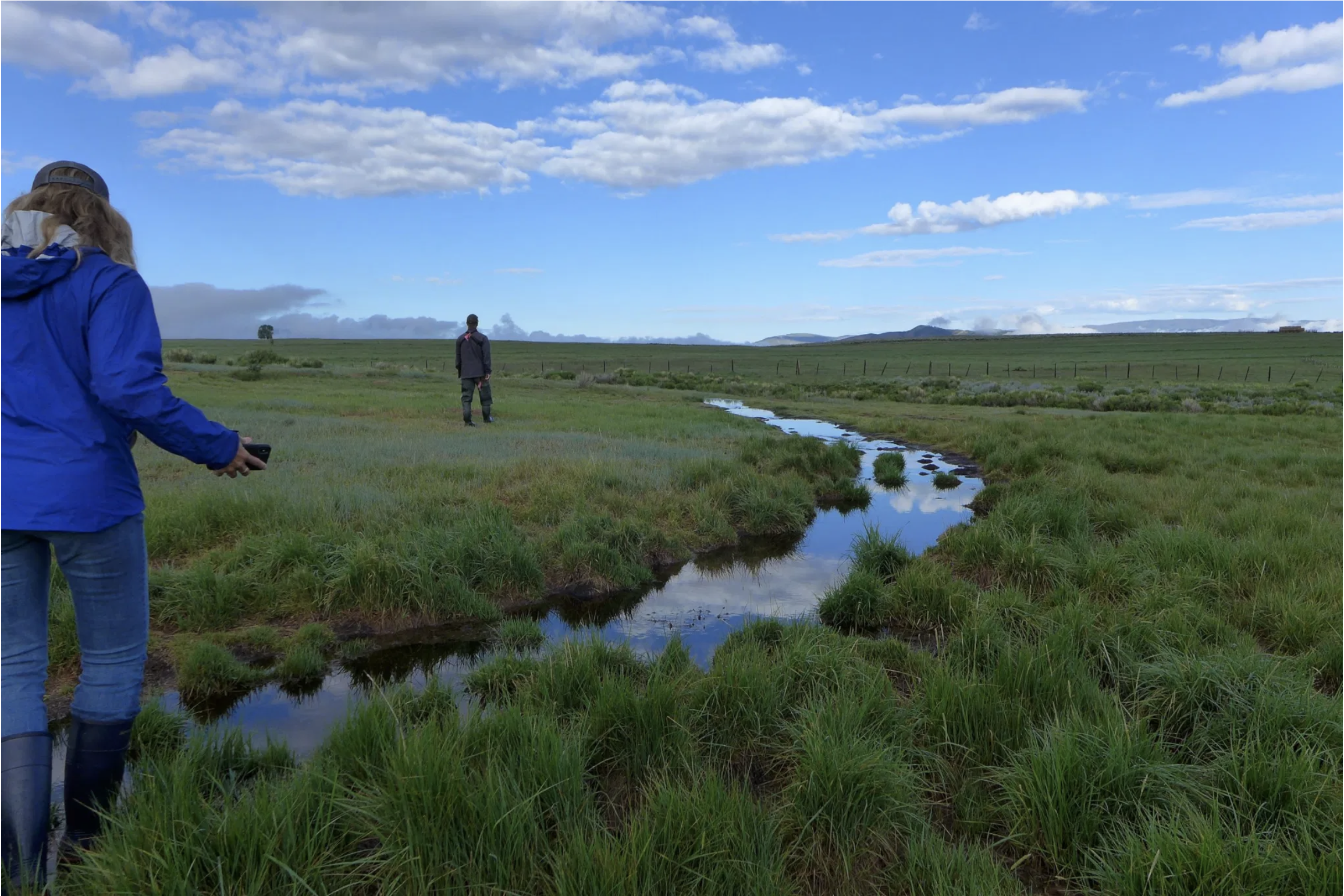


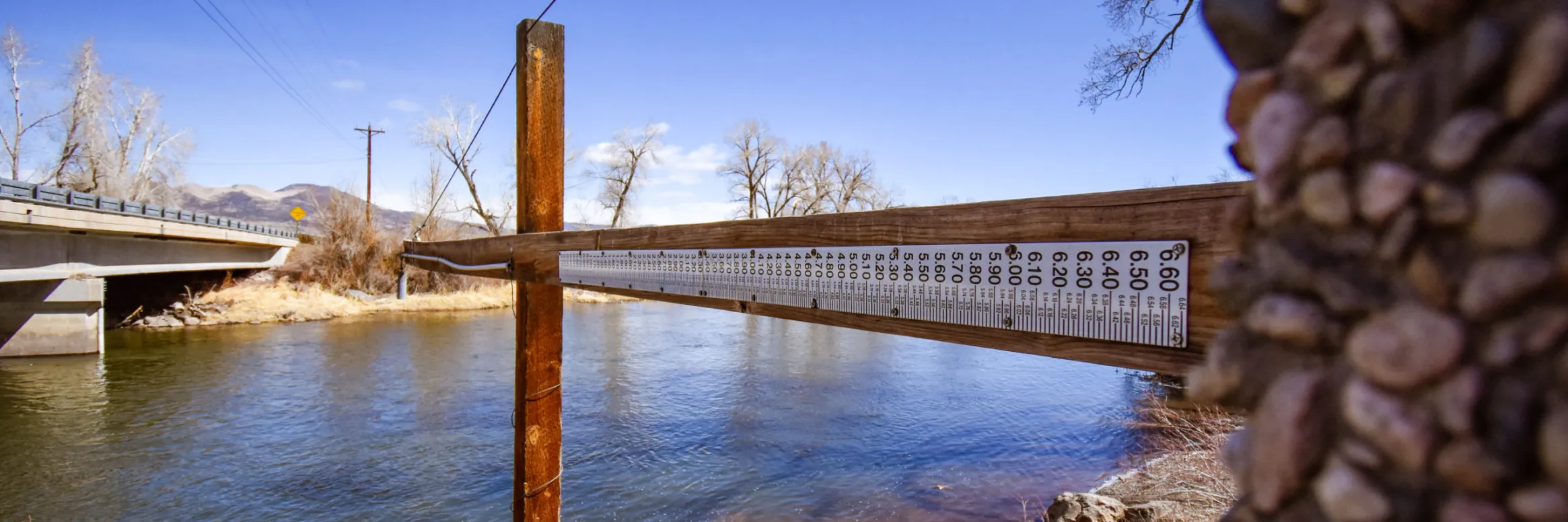

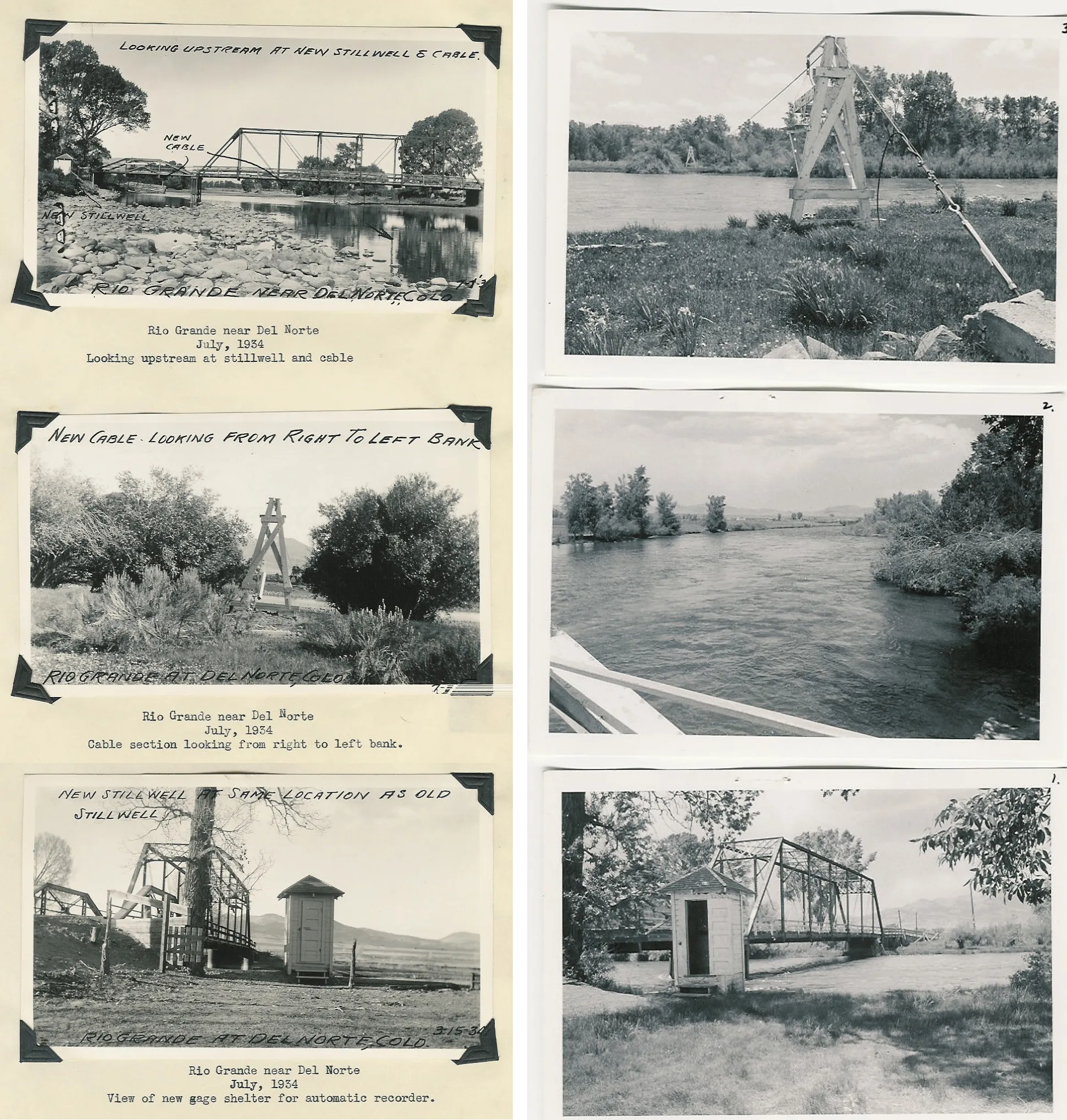

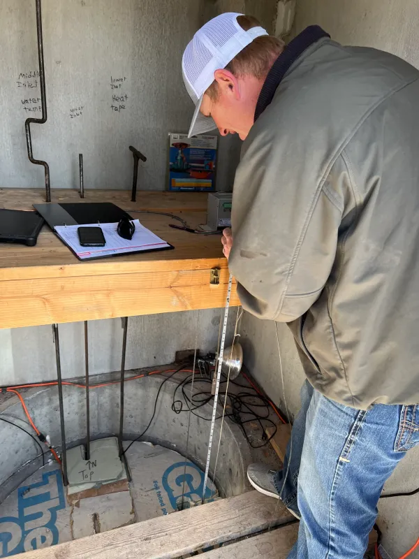
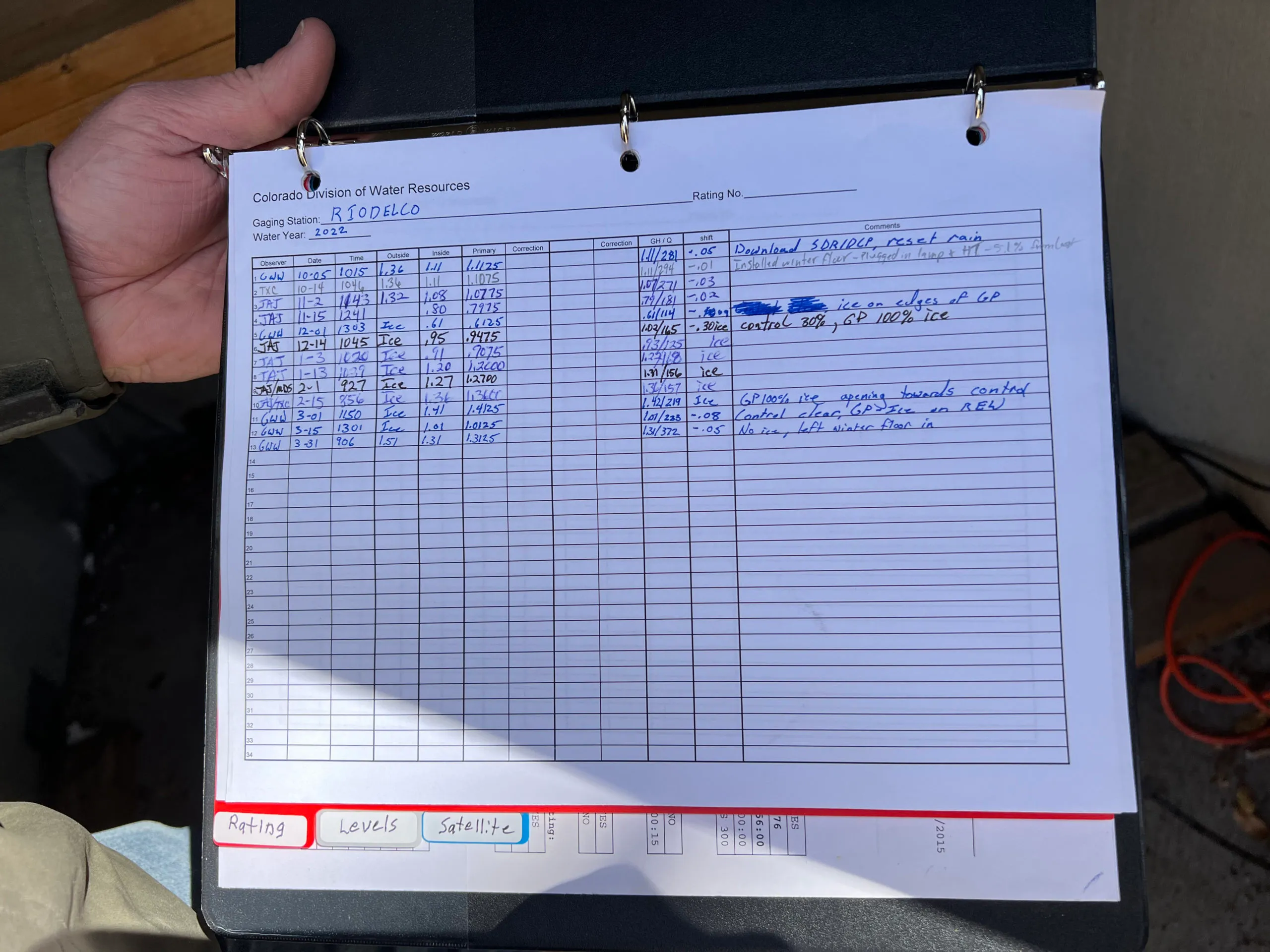
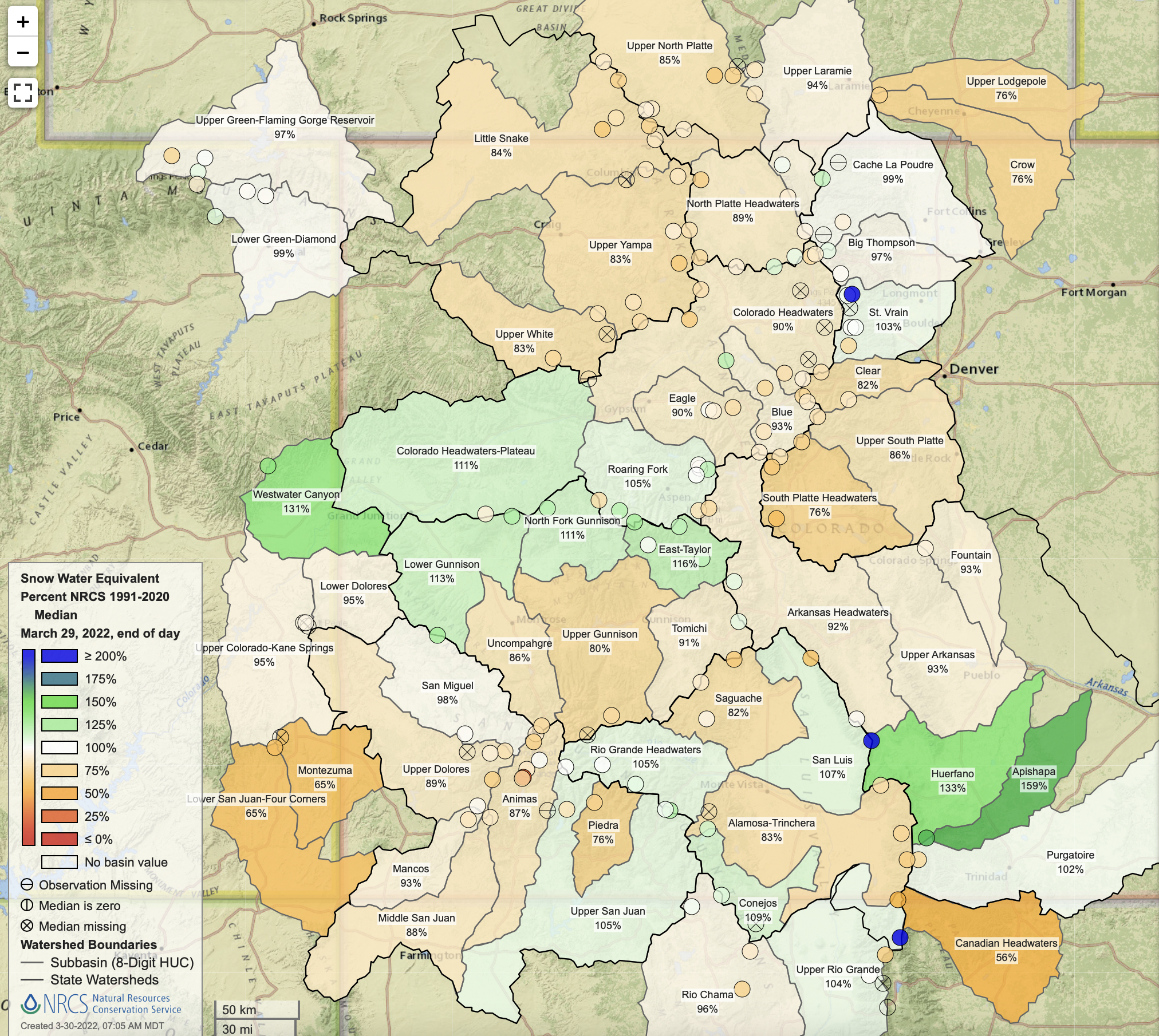
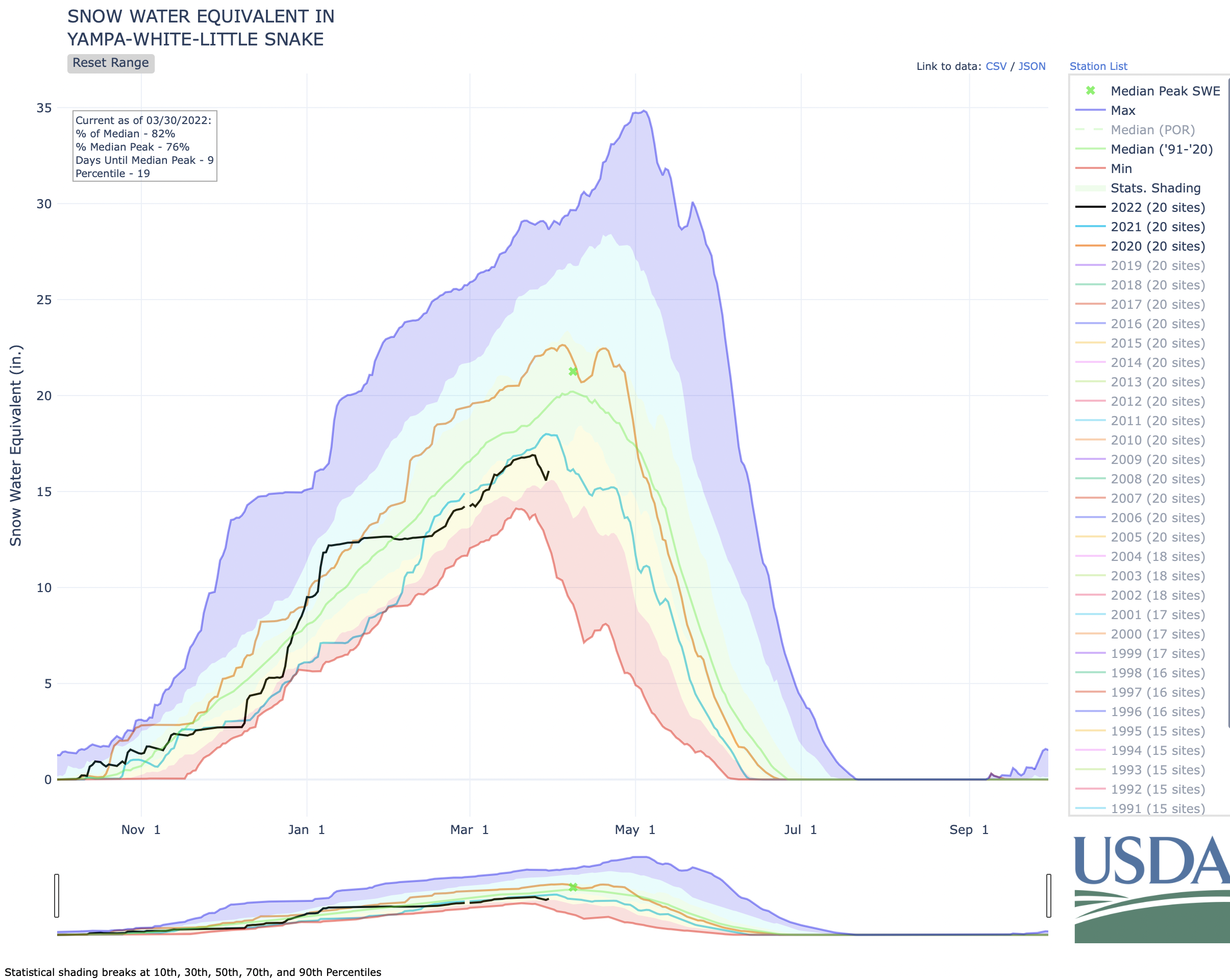
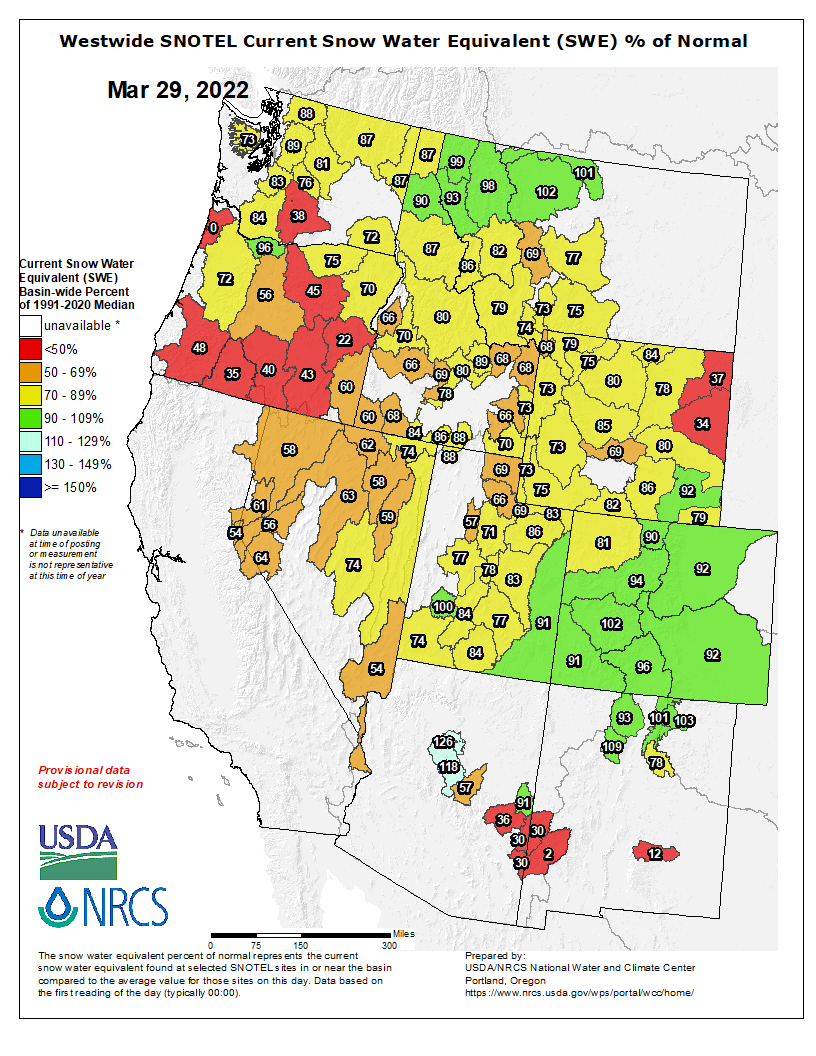


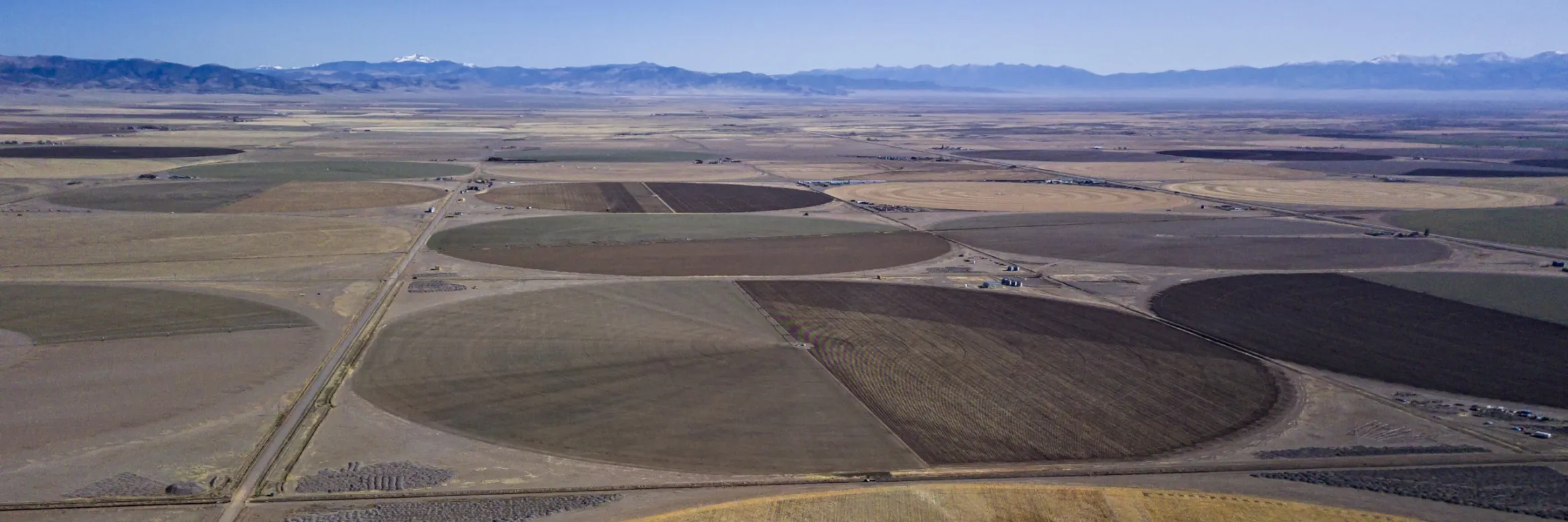

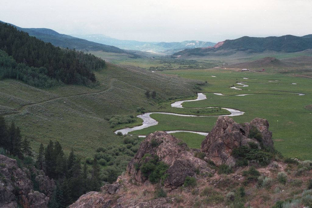
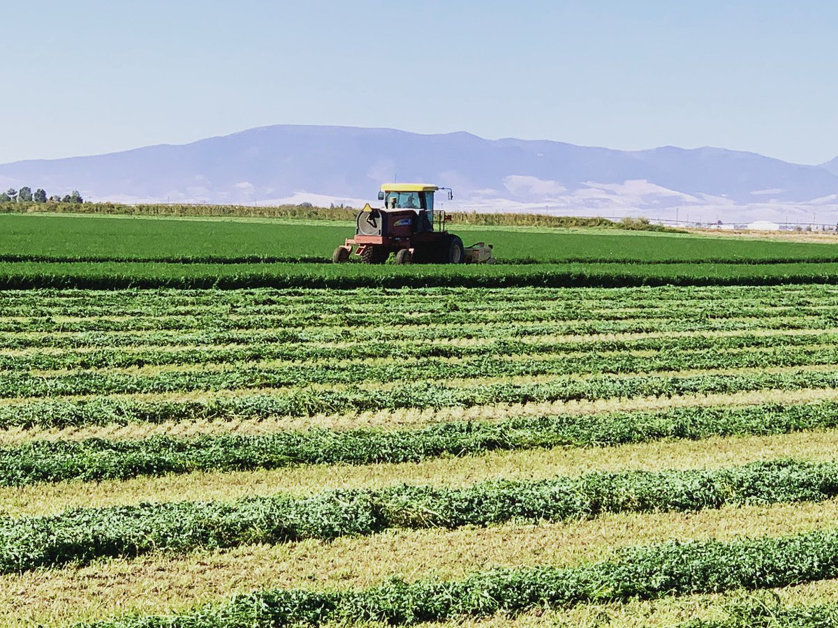
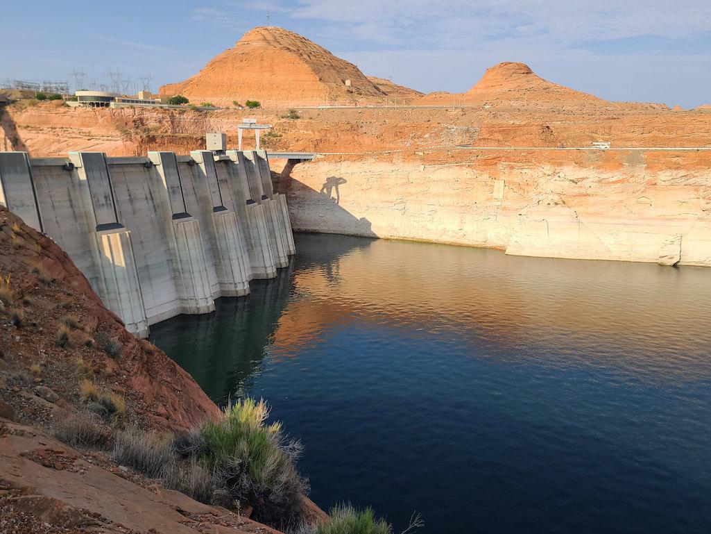

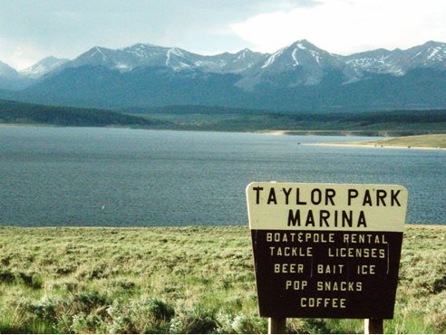


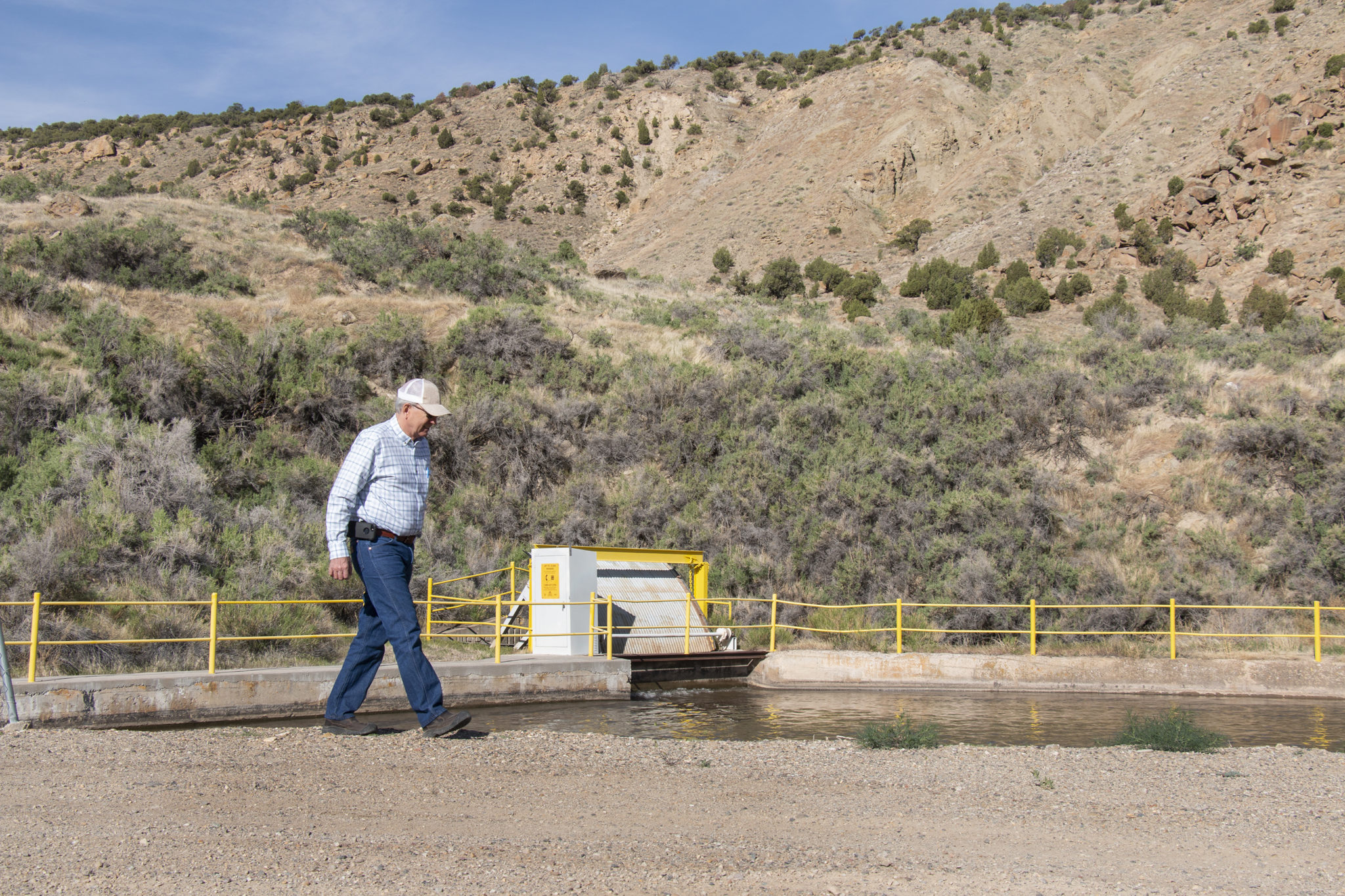


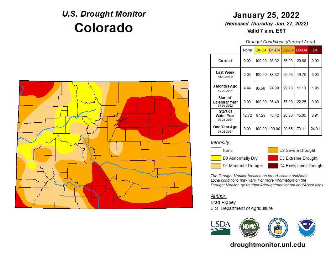
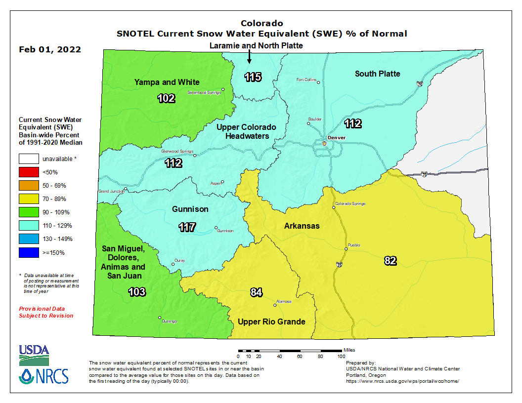

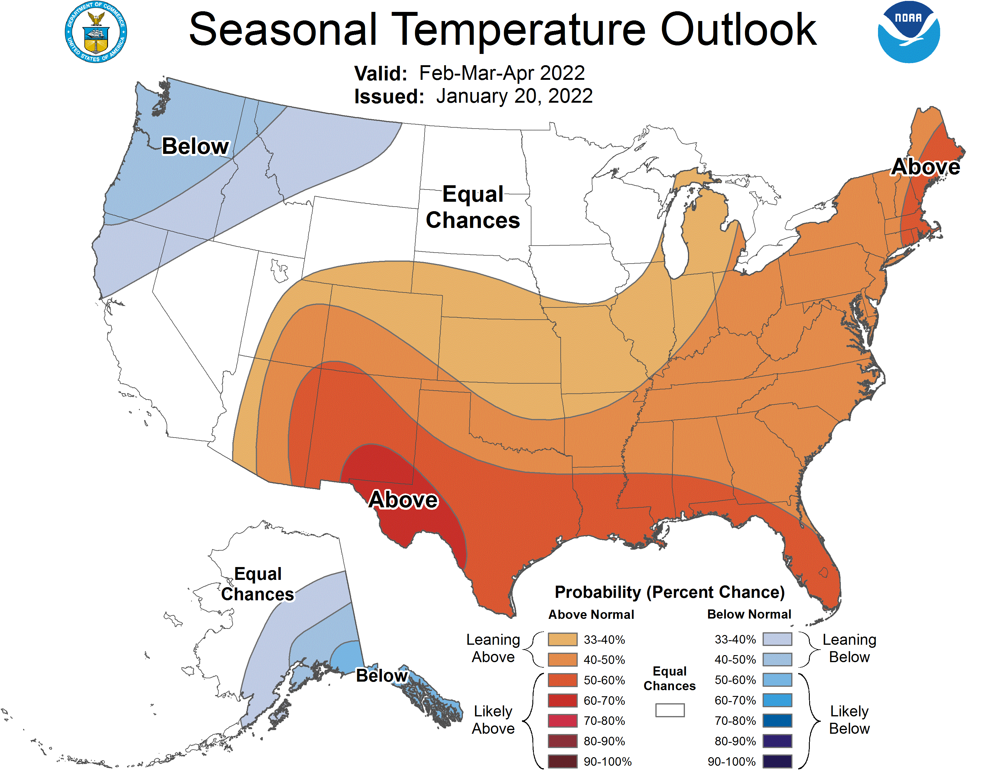
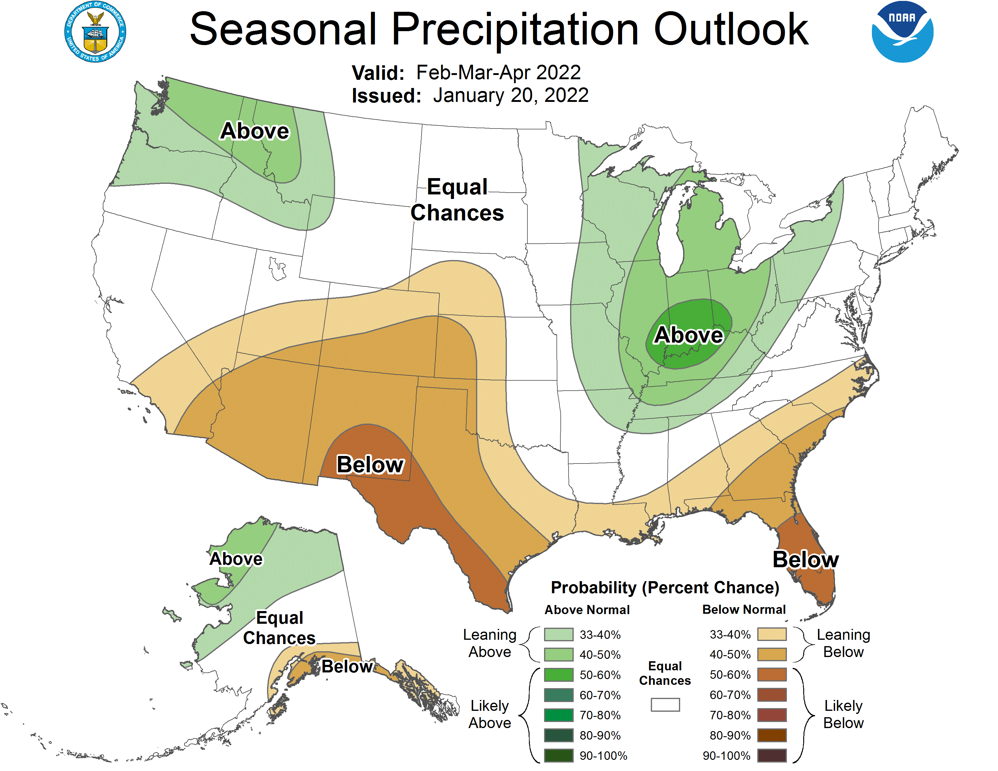
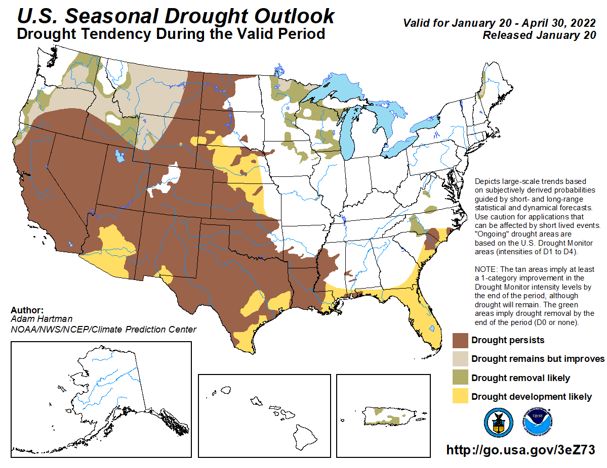


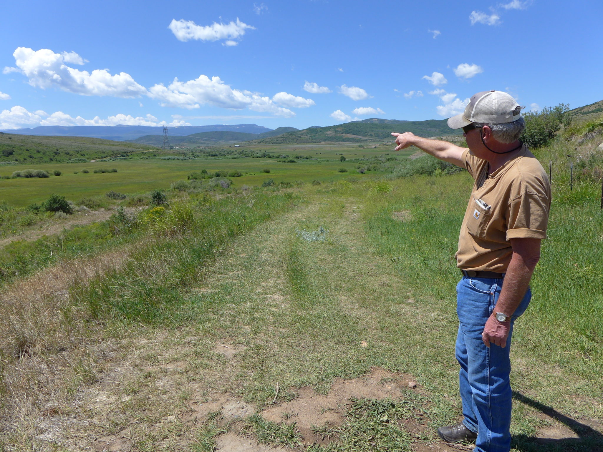
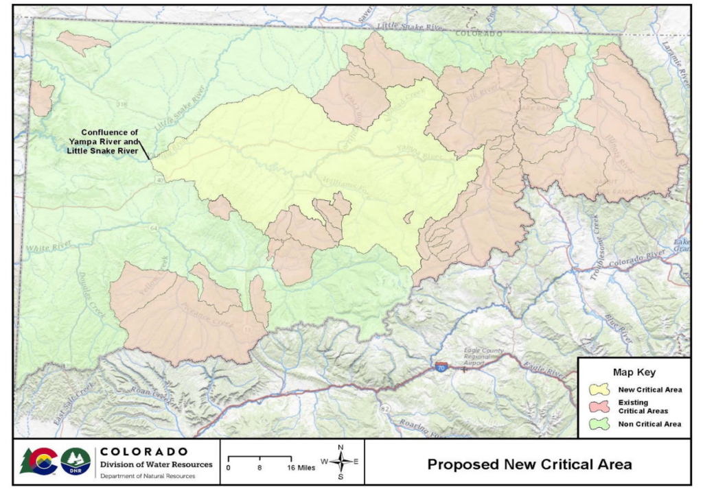


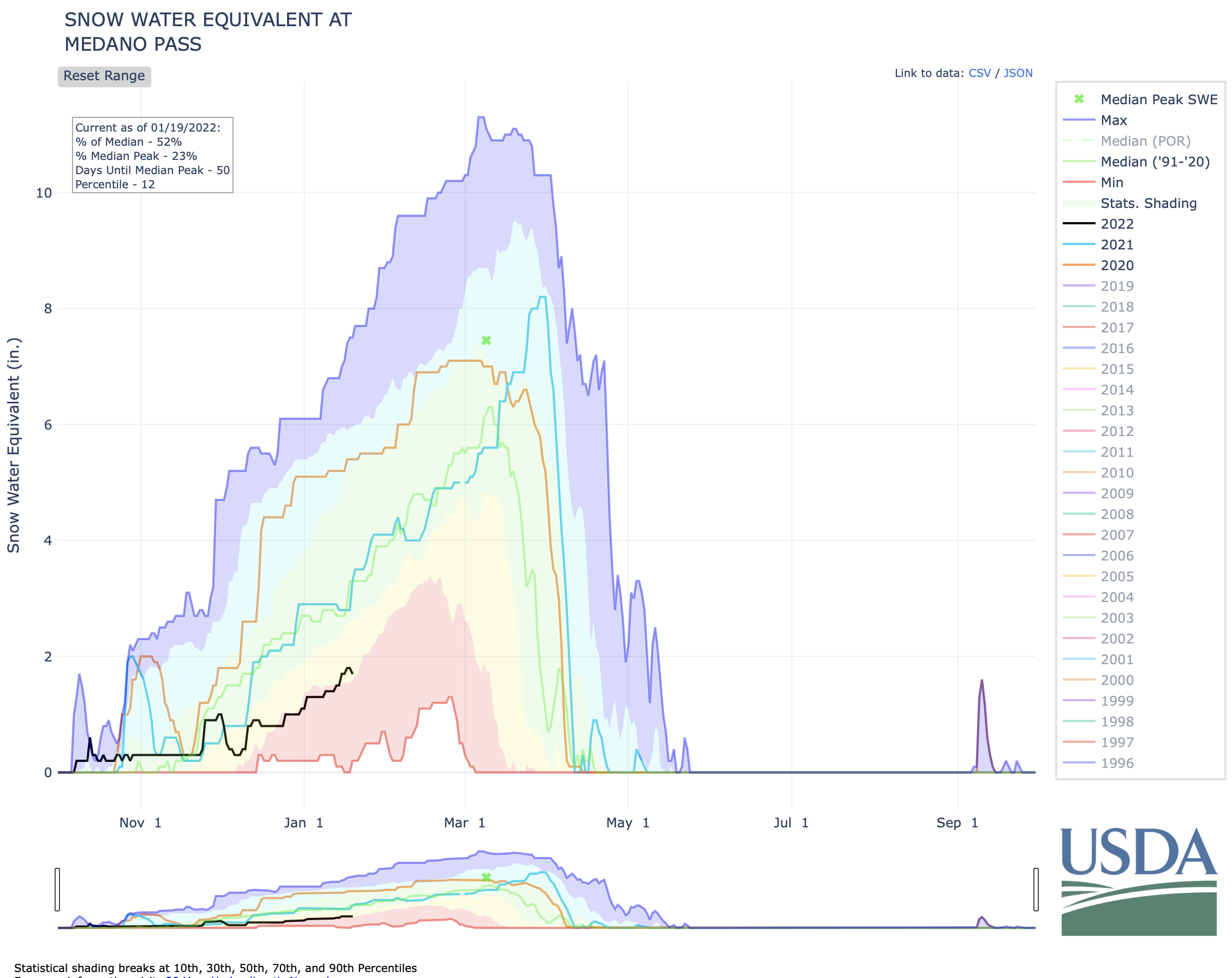

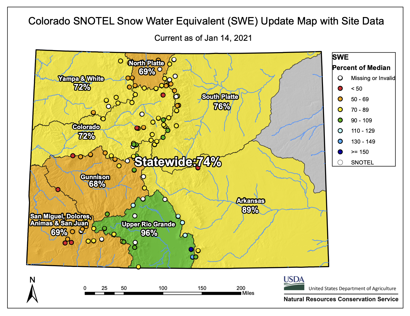
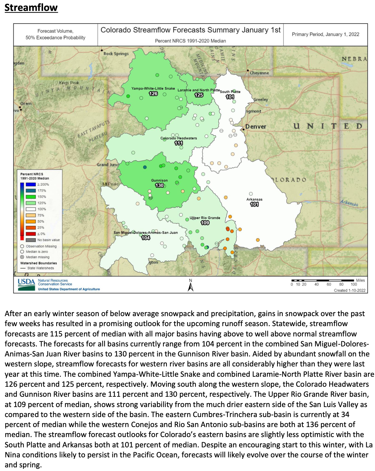
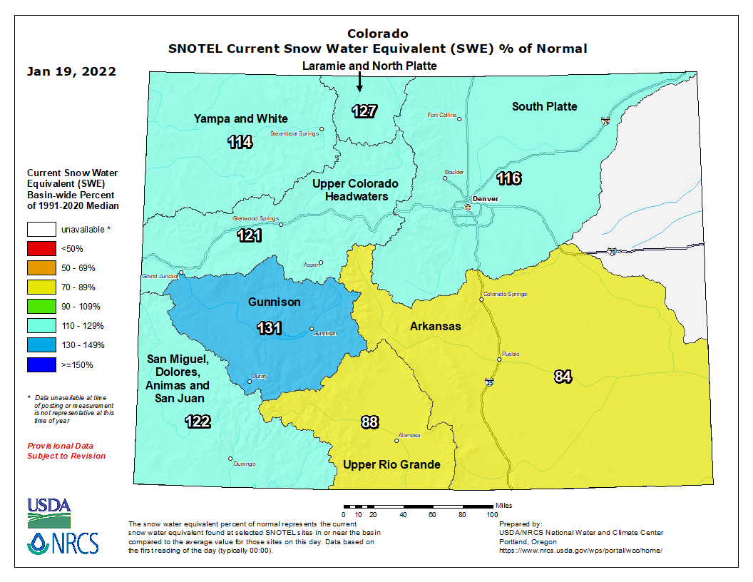


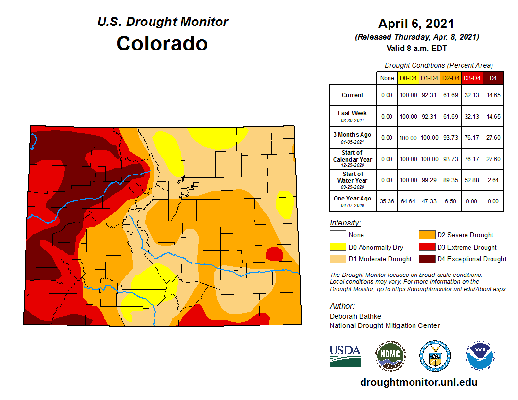
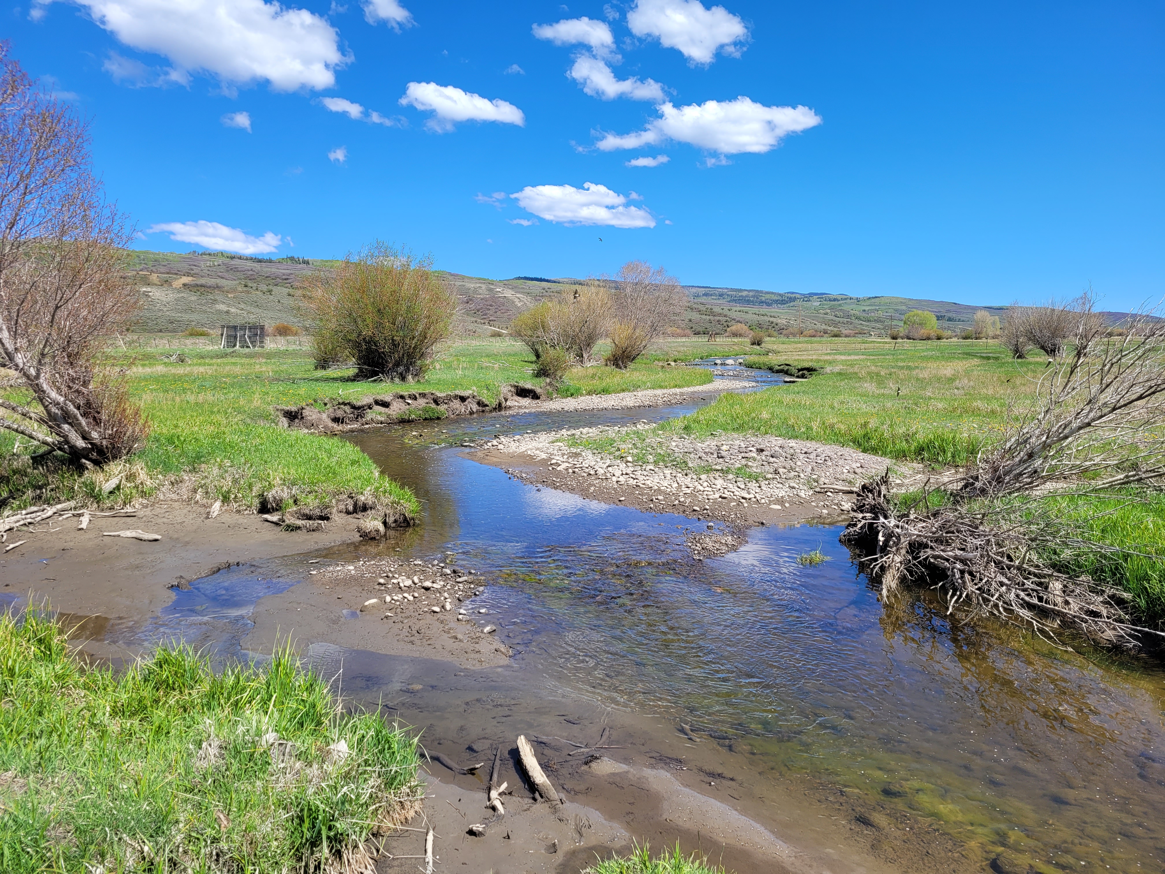
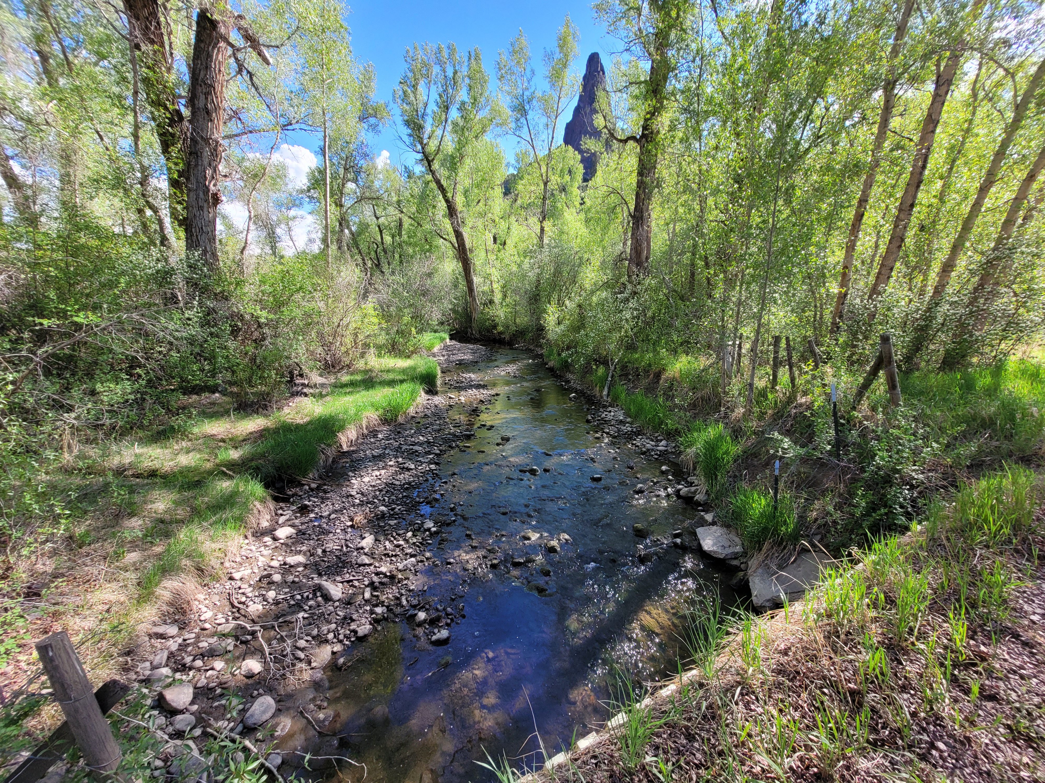


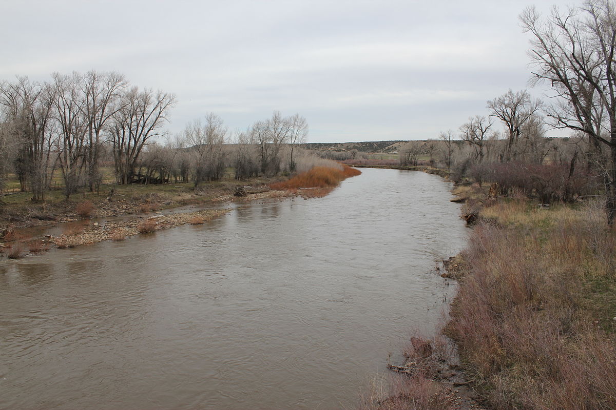


_basin_map")


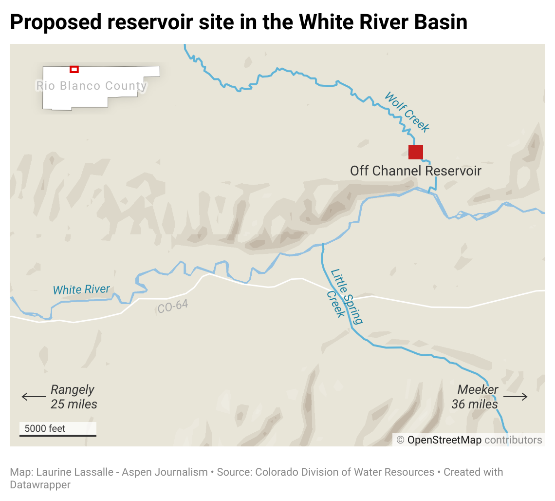


_basin_map")


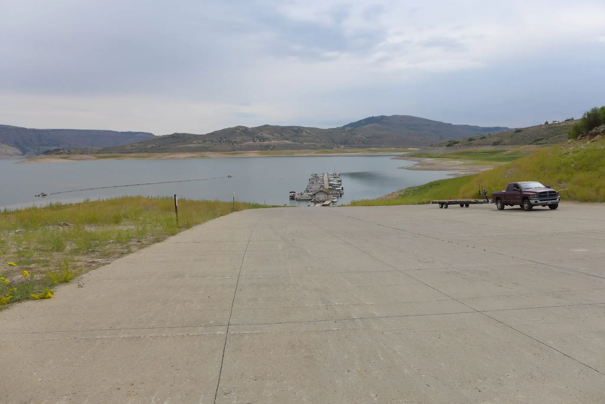

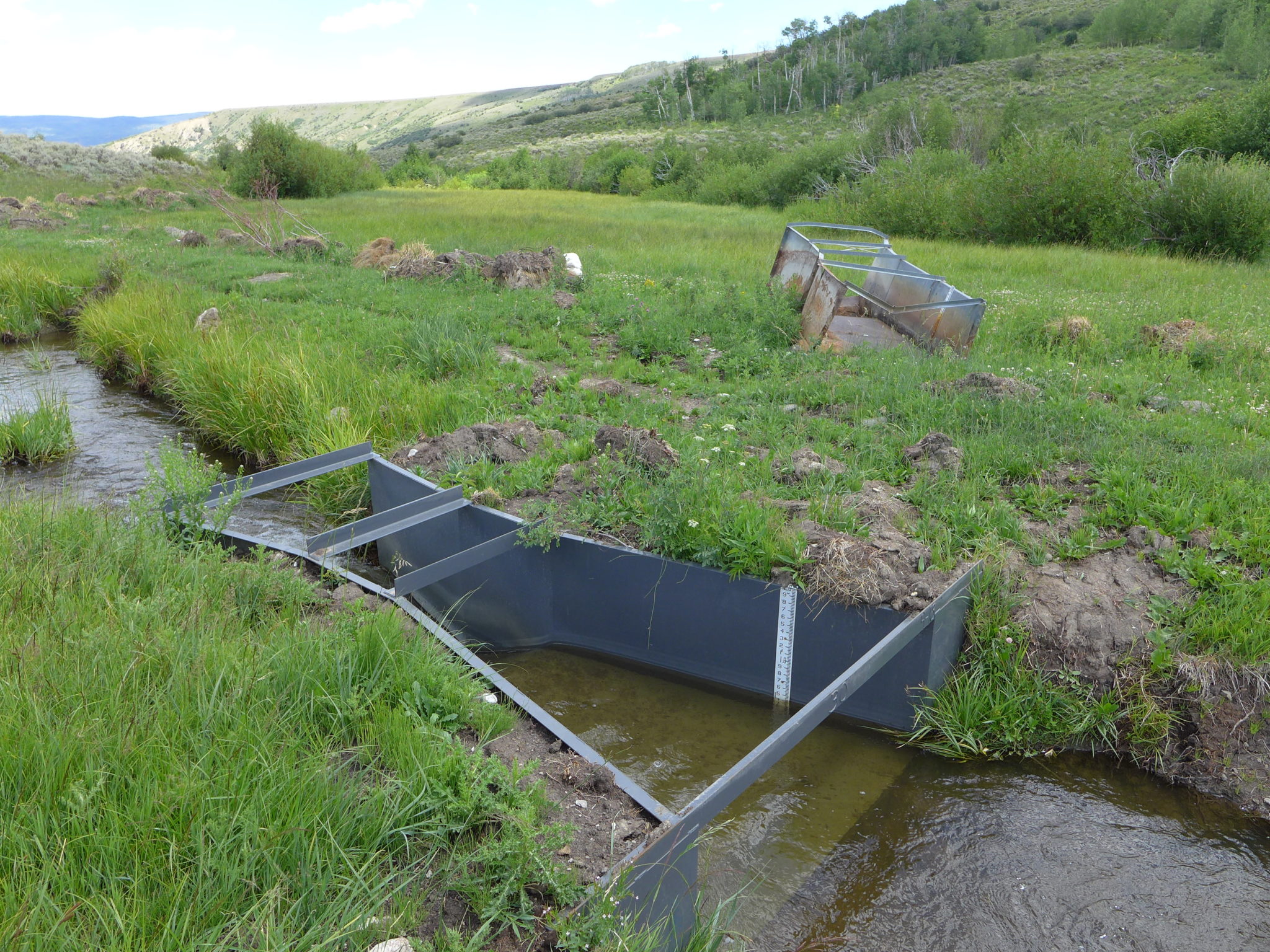

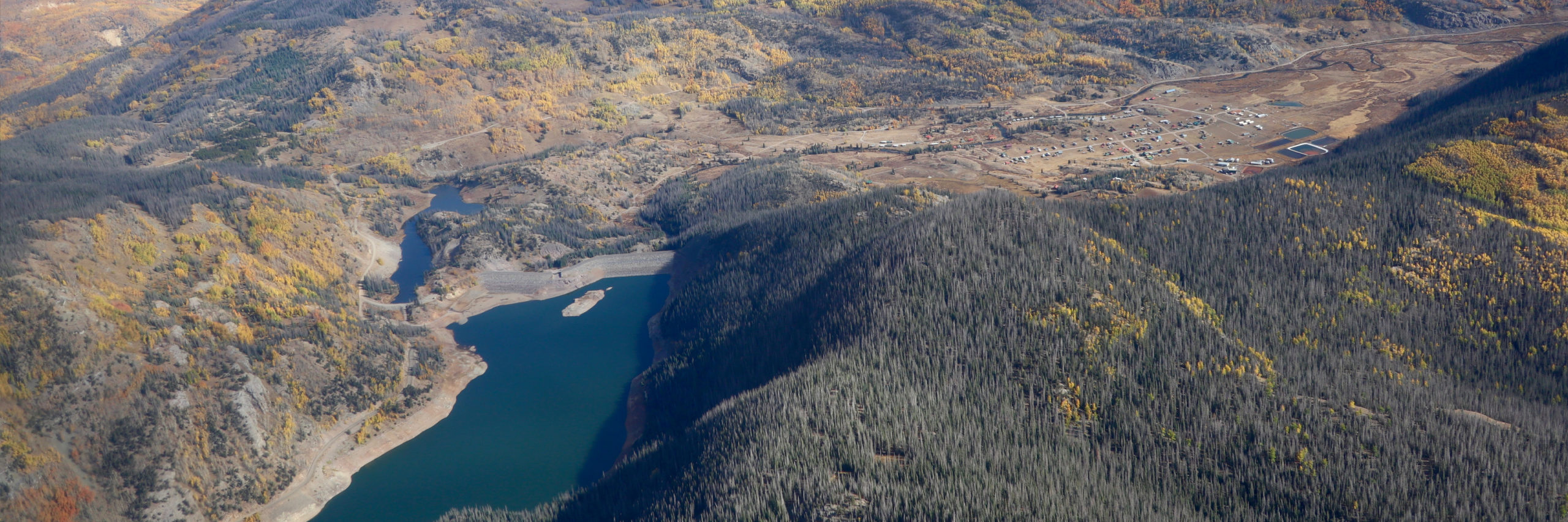
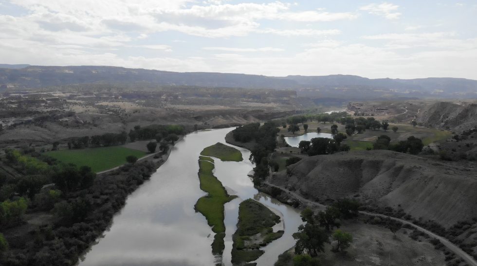


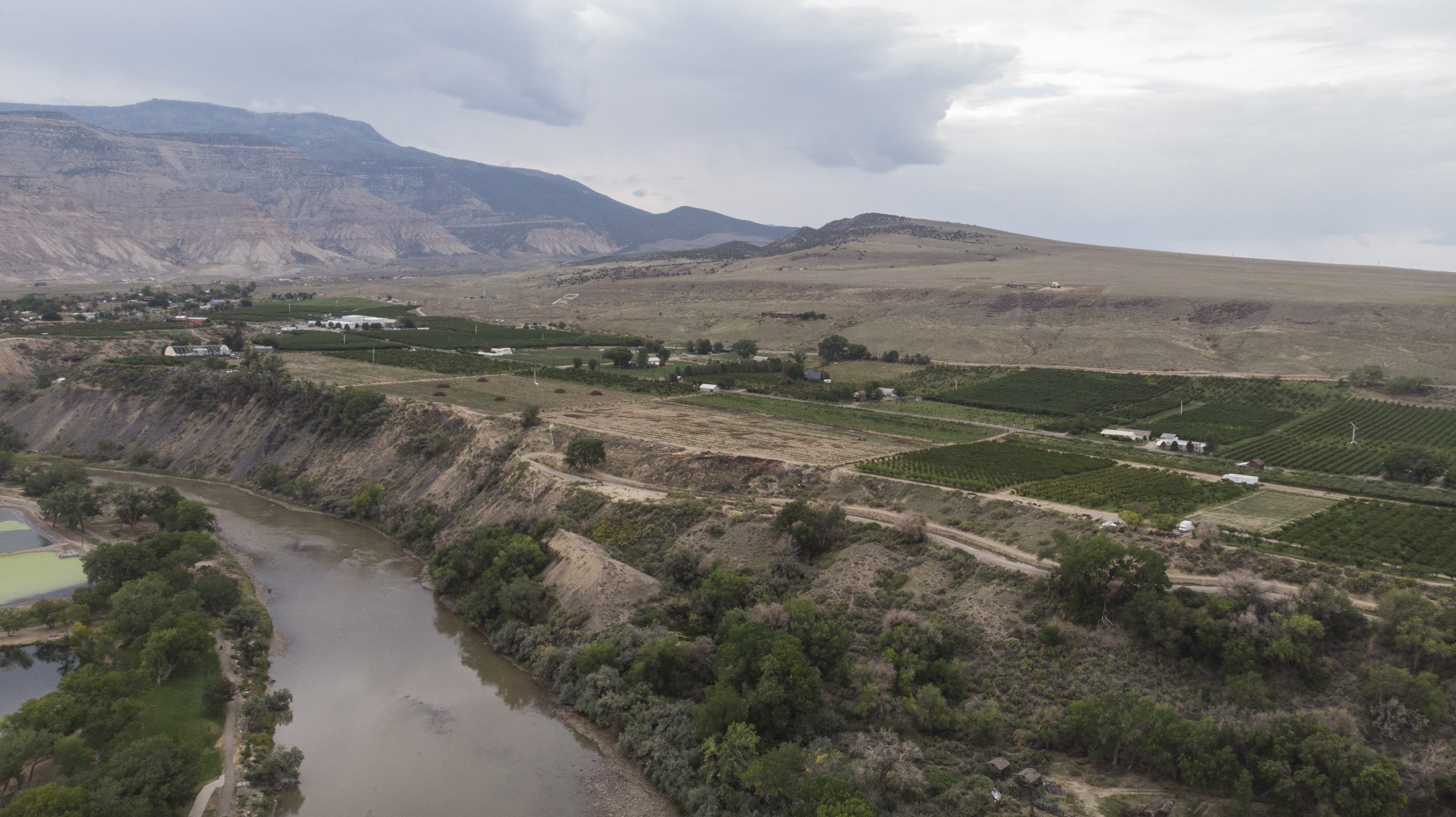
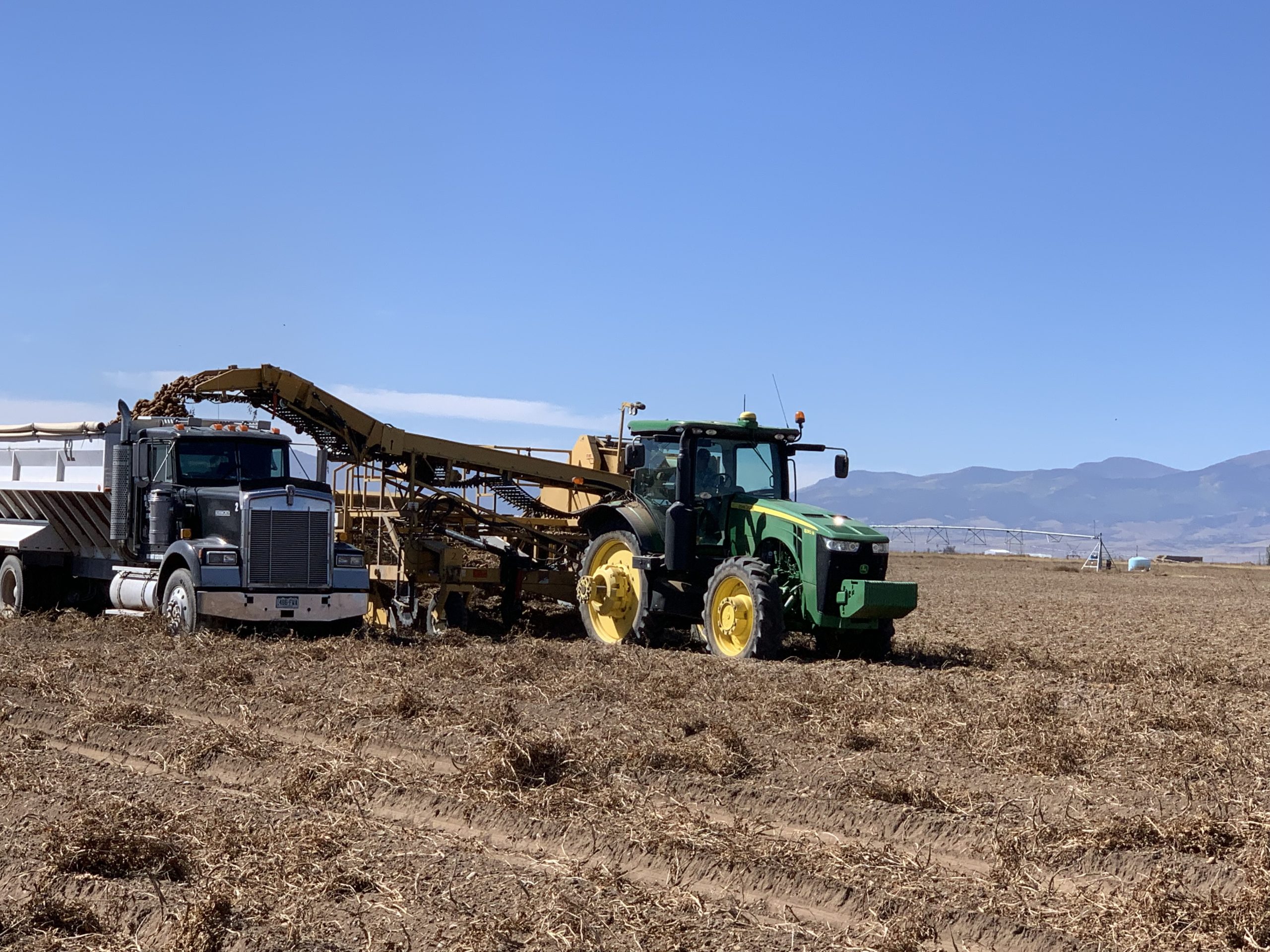

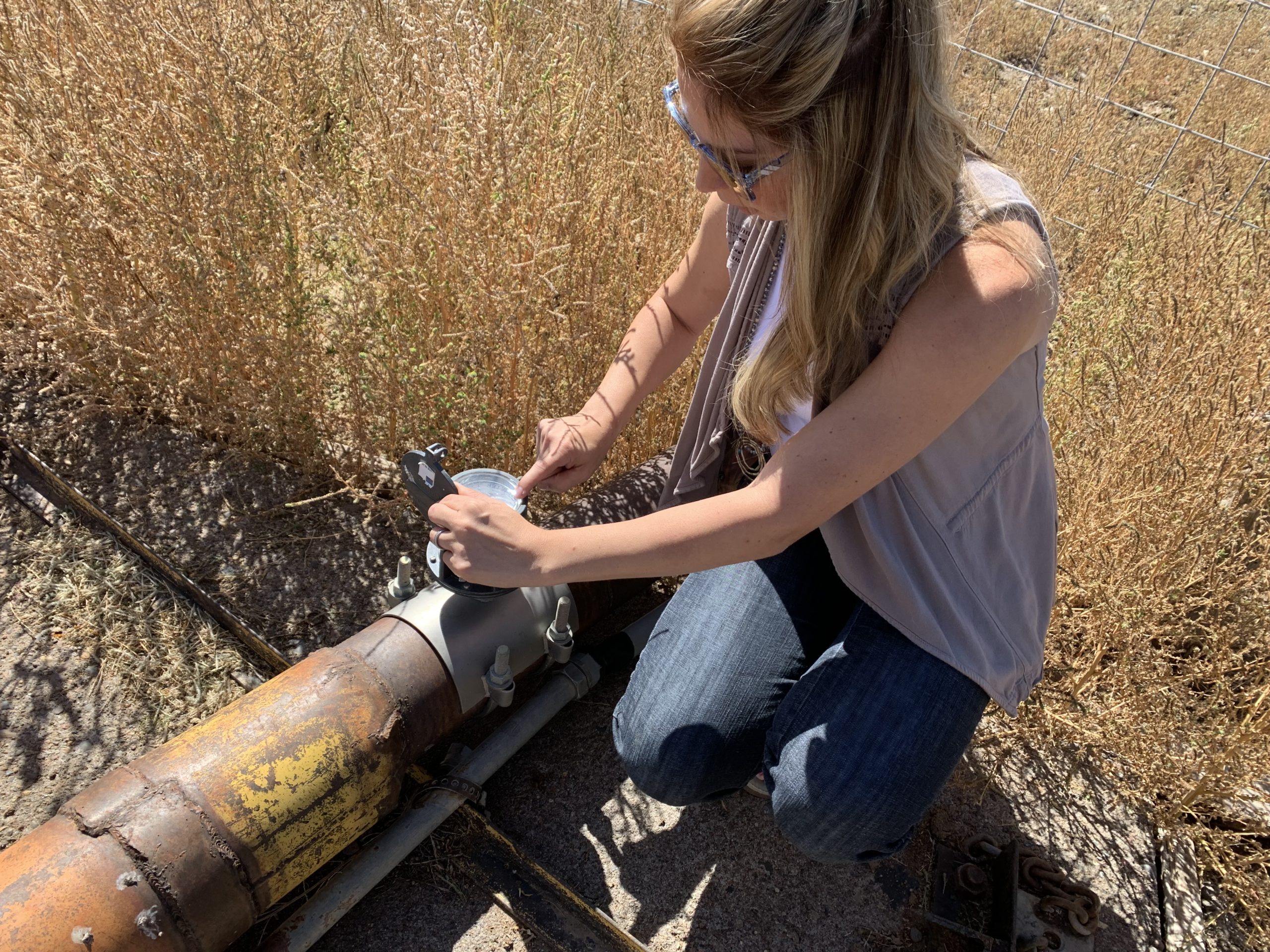
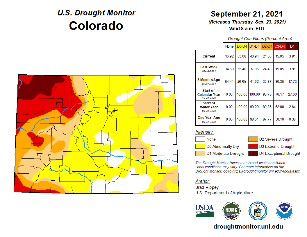


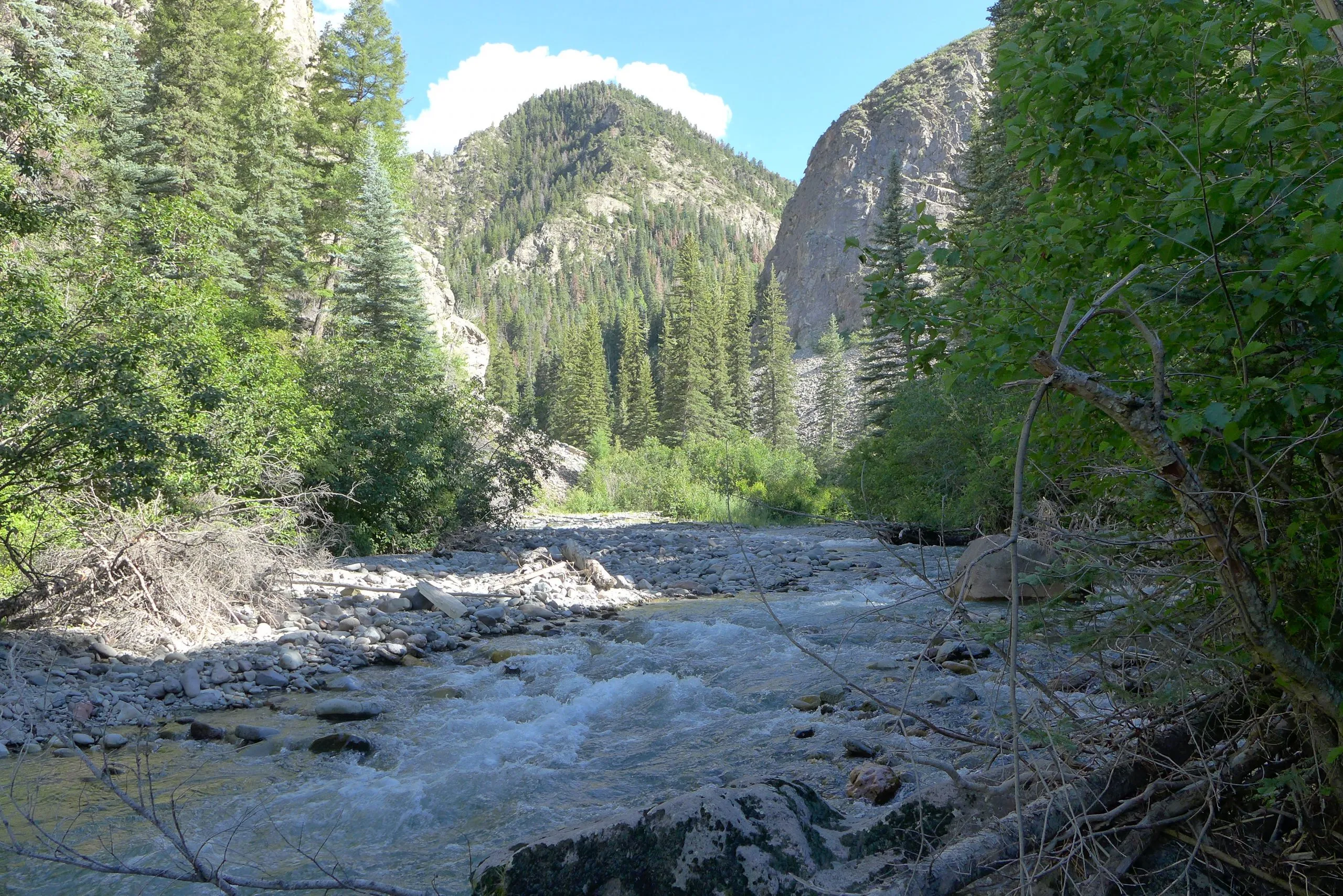

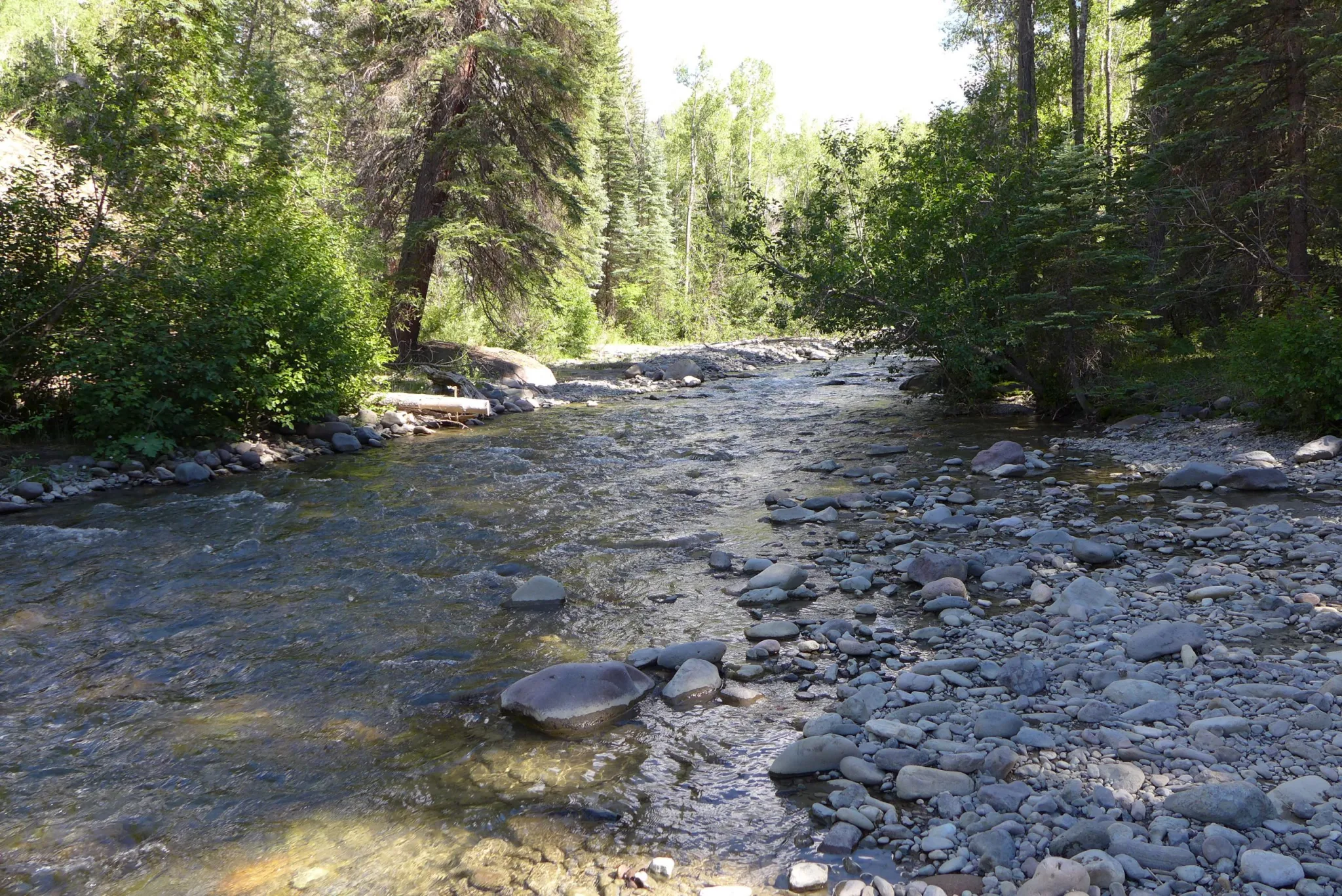
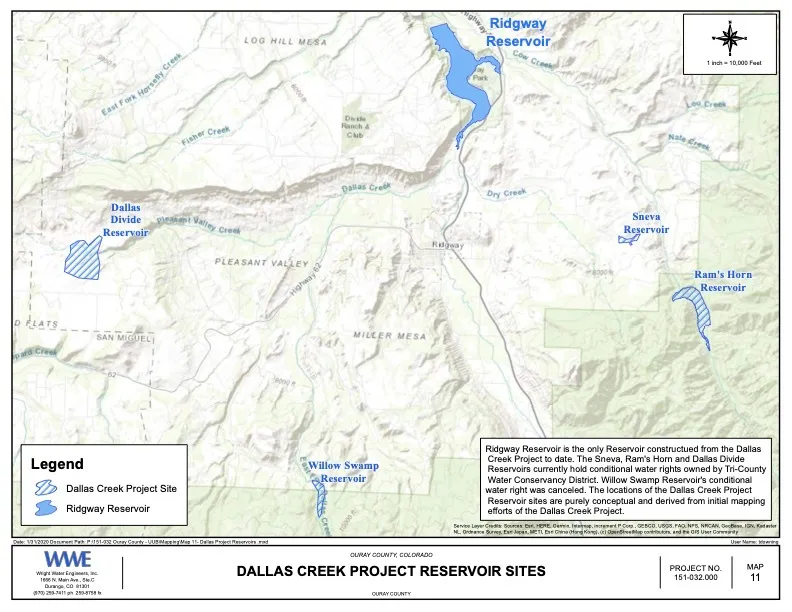

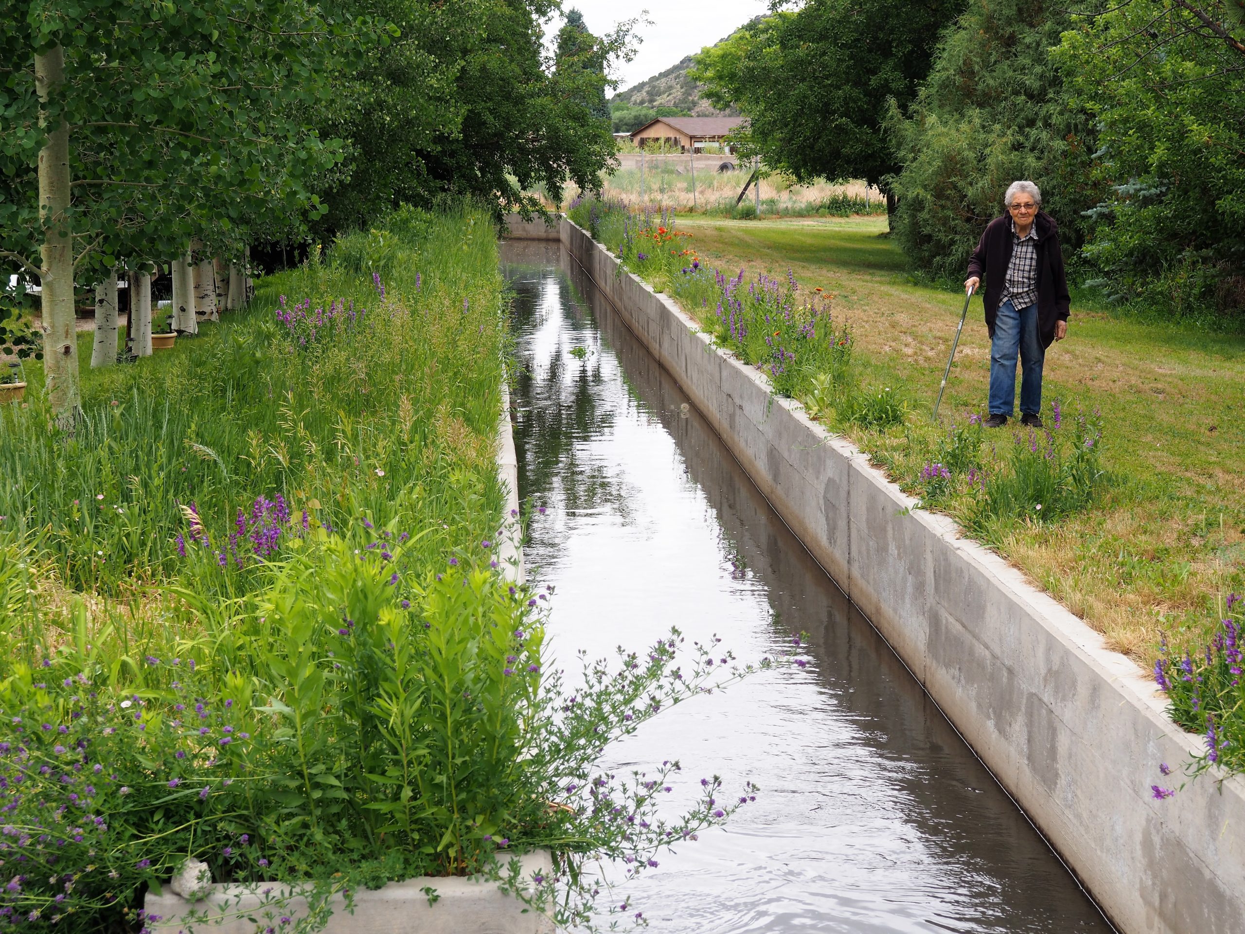
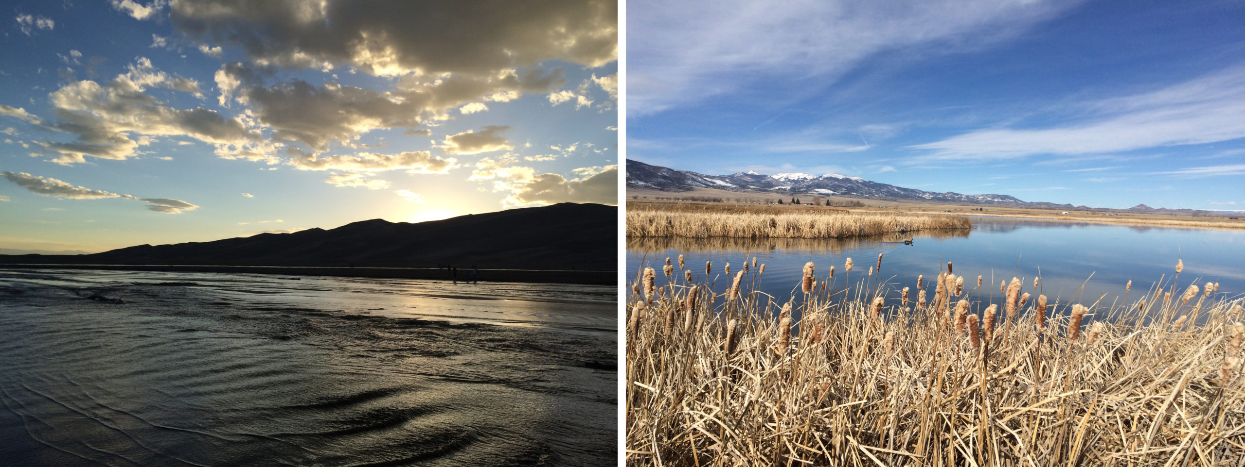
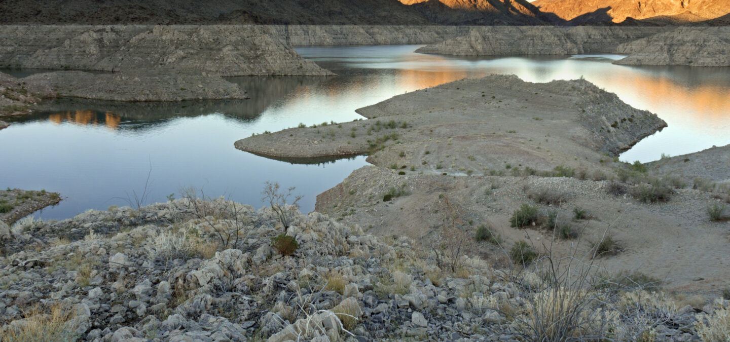


