The New River, a contaminated waterway that flows north from Mexico, spills into the Salton Sea in southwestern California’s Imperial Valley. Transborder pollution is among Jayne Harkins’ priorities as U.S. IBWC Commissioner. (Image: U.S. Bureau of Reclamation)
The Imperial Irrigation District board of directors voted Tuesday to allow access across its lands for critically needed state wetlands projects at the Salton Sea, designed to tamp down dangerous dust storms and give threatened wildlife a boost. In exchange, California will shoulder the maintenance and operations of the projects, and the state’s taxpayers will cover the costs of any lawsuits or regulatory penalties if the work goes awry.
Tuesday’s vote clears a key hurdle to constructing 3,700 acres around the heavily polluted New River at the south end of the lake, implementing what’s known as the Species Conservation Habitat plan. It’s one of the larger pieces of a stalled ten year pilot Salton Sea Management Plan to address increasing public health concerns and massive wildlife losses at California’s largest inland water body.
“I feel a lot more optimistic now that we finally got this step done, which has been bedeviling us for some time,” said Bruce Wilcox, Assistant Secretary of Natural Resources overseeing Salton Sea efforts. “It feels good. Now we just need to move on to the next step.”
[…]
Tuesday’s agreement clears a particularly thorny issue that stopped the larger wetlands projects in their tracks: Who’s responsible if something goes wrong? Neither IID nor previous state officials were willing to budge, but new California water board chairman E. Joaquin Esquivel in March gave state natural resources staff and IID until May 1 to strike an agreement, and told them to report back to him by June…
The threat of lawsuits is not an idle one. Farmers along the edge of the 350 square mile sea — twice as large as Lake Tahoe — have sued before and say they could sue again if state work harms their crops, or, conversely, if nothing is done to stop increasing air quality problems.
“If the government doesn’t do anything about it and all the dust comes into our crops and kills them, well then, we have a pretty good case,” said Juan DeLara, risk manager for Federated Mutual Insurance, which leases 1,000 acres of farmland on the north end of the sea to a grower. DeLara is also head of the Salton Sea Action Committee and would-be developer of a 4,900 acre housing, commercial and recreational project at the sea’s north end.
It’s unclear on what specific legal grounds farmers could sue. Past runoff from their fields included pesticides, herbicides and fertilizer discharge into the shimmering blue water body, which began life as an agricultural sump. But it’s also agricultural runoff, mixed with naturally salty Colorado River irrigation water, that is keeping the sea afloat, so to speak. Without the runoff, it would dry even faster…
Martinez, IID’s general manager, said he was not familiar with case law on the issue, but said, “any time someone’s business suffers as a result of some action, they’re going to look for the biggest pockets out there to help meet their costs.”
He said that concern is part of what motivated IID to dig in its heels and formally nail down that the state would bear responsibility for Salton Sea restoration before allowing access. Another big factor, he said, was that California officials agreed to be responsible for restoring the sea in a 2003 multi-party agreement between them, federal officials, IID and other water districts…
The next steps for the plan include finalizing the easement documents and seeking bids.
From the Associated Press (Felicia Fonseca) via The Salt Lake Tribune:
The bug flows are part of a larger plan approved in late 2016 to manage operations at Glen Canyon Dam, which holds back Lake Powell. The plan allows for high flows to push sand built up in Colorado River tributaries through the Grand Canyon as well as other experiments that could help native fish such as the endangered humpback chub and non-native trout.
Researchers are recommending three consecutive years of bug flows. Scott VanderKooi, who oversees the Geological Survey’s Grand Canyon Monitoring and Research Center in Flagstaff, said something about the weekend steady flows is encouraging bugs to emerge as adults from the water, which might lead to more eggs, more larvae and more adults. But, more study is needed.
Researchers also are hopeful rare insects such as stoneflies and mayflies will be more frequent around Lees Ferry, a prized rainbow trout fishery below Glen Canyon Dam.
The bug flows don’t change the amount of water the U.S. Bureau of Reclamation must deliver downstream through Lake Mead to Arizona, Nevada, California and Mexico. The lower levels on the weekend are offset by higher peak flows for hydropower during the week, the agency said.
Hydropower took a hit of about $165,000 — about half of what was expected — in the 2018 experiment, the Geological Survey said.
The agency recorded a sharp increase in the number of caddisflies through the Grand Canyon. Citizen scientists along the river set out plastic containers with a battery-powered black light for an hour each night and deliver the bugs they capture to Geological Survey scientists, about 1,000 samples per year.
In 2017, the light traps collected 91 caddisflies per hour on average, a figure that rose to 358 last year, outpacing the number of midges for the first time since the agency began tracking them in 2012, VanderKooi said.
The number of adult midges throughout the Grand Canyon rose by 34% on weekends versus weekdays during last year’s experiment. Intensive sampling one weekend in August showed an 865% increase in midges between Glen Canyon Dam and Lees Ferry, the agency said.
“For a scientist, this is really great,” VanderKooi said. “This is the culmination of a career’s worth of work to see this happen, to see from your hypothesis an indication that you’re correct.”
The Arizona Game and Fish Department also surveyed people who fished from a boat at Lees Ferry during the experiment to see if the bug flows made a difference. Fisheries biologist David Rogowski said anglers reported catching about 18% more fish.
He attributed that to the low, steady flows that allow lures to better reach gravel bars, rather than the increase in bugs.
A raft, poised for action, on the Colorado River. Photo: Brent Gardner-Smith/Aspen Journalism
From the Hutchins Water Center at Colorado Mesa University:
The Mesa County State of the Rivers meeting will provide you with an update on this year’s snowpack, expected river flows and reservoir operations, as well as drought planning and information on an innovative project to help endangered fish in the Grand Valley.
A free chili dinner will be served at 6:00; the program will begin at 6:30.
Date And Time
Tue, May 14, 2019
6:00 PM – 8:00 PM MDT
Add to Calendar
Location
CMU University Center Ballroom
1451 North 12th Street
Grand Junction, CO 81501
Click here to read the discussion. Here’s an excerpt:
Water Supply Forecast Summary:
The majority of the Upper Colorado River and Great Basin April-July water supply forecasts increased between April and May. The forecasts at locations that did not increase had minimal changes from early April.
Widespread significant precipitation occurred over the Green River Basin in Wyoming, the Great Basin and the Sevier and San Rafael River basins during the first half of April. The remainder of the Upper Colorado River Basin was mostly dry and received minimal precipitation the first half of the month. However, river basins in Colorado benefited from a significant precipitation event the last four days of the month. Specifically, the Gunnison River basin and Upper Colorado River basin headwaters received up to or more than the average monthly total precipitation during this time period.
The largest increases in water supply forecasts between April 1st and May 1st occurred in the Green River basin in Wyoming, and the San Juan, Gunnison, and Dolores River Basins. Significant increases also occurred throughout the Great Basin, Duchesne, San Rafael and Sevier River Basins in Utah. Forecasts in the Upper Colorado River headwaters and Yampa River basins had slight increases or remained similar to the April 1st forecasts. April-July runoff volume forecasts now range from near 115 to 200 percent of average. Currently only a few northern headwater basins of the Green River Basin in Wyoming and the Great Basin (Bear River Basin) have forecasts below average for the 2019 season.
Very dry soil moisture conditions were widespread entering the winter season. These may have some impact on the overall yield of runoff that ends up in the streams depending on how the snow melt plays out. In areas with significant snowpack or where snowmelt is delayed the impacts of dry soils may be lessened.
April-July unregulated inflow forecasts for some of the major reservoirs in the Upper Colorado River Basin include Fontenelle Reservoir 740 KAF (102% average), Flaming Gorge 1050 KAF (108% of average), Blue Mesa Reservoir 970 KAF (144% of average), McPhee Reservoir 420 KAF (142% of average), and Navajo Reservoir 930 KAF (127% of average). The Lake Powell inflow forecast is 9.20 MAF (128% of average).
April Weather Synopsis-Precipitation-Temperature:
Storm systems favored central/northern Utah and southwest Wyoming for the first half of April. Areas including the Great Basin, Sevier River Basin and the Green River Basin received above average precipitation for the first two weeks of April. River basins in Colorado did not benefit from the storm track early in the month. However, areas in Colorado benefited from a significant precipitation event the last four days of the month which continued into the first few days of May. Specifically, the Gunnison River basin and Upper Colorado River basin headwaters received up to or more than the average monthly total precipitation during this time period.
By the end of the month, the highest wet anomalies (in percent of normal terms) were across the Green River basin in Wyoming, the Duchesne River Basin, parts of central Utah and the Great Basin including the Bear, Weber, Six Creeks, Provo, and Sevier River basins where precipitation was 120-140% of average. Other basins including the Upper Colorado Headwaters, Gunnison River Basin and the Yampa River Basin ended the month with precipitation near 100-105% of average. These areas would have ended the month with below average precipitation and a resulting decrease in water supply forecasts had it not been for the storm at the end of the month. The San Juan River Basin, Dolores River Basin and the Lower Colorado River Basin in Arizona all received below average precipitation for April…
Soil Moisture:
Soil moisture conditions in the higher elevation headwater areas are important entering the winter, prior to snowfall, as it can influence the efficiency of the snowmelt runoff the following spring. The effects are most pronounced when soil moisture conditions and snowpack conditions are both much above or much below average. In areas where the soil moisture was below average entering the winter and the current snowpack is also much below median, spring runoff may be further reduced.
Modeled soil moisture conditions as of November 15th were below average over most of the Upper Colorado River Basin and Great Basin. In the Upper Colorado River Mainstem River Basin, soil moisture conditions were below average in headwater basins along the Continental Divide, and closer to average downstream. Soil moisture conditions in the Gunnison, Dolores, and San Juan basins were much below average.
Snow levels have presumably peaked in the San Juan Mountains and, as expected, they look pretty darned healthy. That said, it’s not quite the biggest snow year on the books. How 2019 ranks depends on which SNOTEL station you’re looking at.
…as of May 1, this year’s snow levels were the second highest at Red Mountain Pass and Columbus Basin, fourth highest at the lower elevation Cascade station, and fifth at Molas Lake (which seems off to me).
But whether it was a record year or not, it’s clear that it has been — and continues to be — a good year for water supplies and river flows in the whole region. At every station the snowpack remains far above average, and three to four times what it was at this time last year. Also, one only needs to look at all the snow slide debris in the high country to determine that it was a historic avalanche cycle…
But that was past. What about the near future? How high will the Animas River get this year?
It’s already hit 3,000 cubic feet per second in Durango, which is plenty of flow for some good kayaking and rafting (albeit a bit chilly). And it’s fair to bet that it will top 5,000 cfs before the runoff is over. But whether it will shoot up past 8,000 cfs as it did in 2005 (which saw a smaller snowpack at most stations in the watershed) or not is anyone’s guess.
Just because the snowpack is bigger than 2005 doesn’t mean the runoff will hit a bigger peak. A cool spring will result in a slower melt, and that will mean a higher average flow and a longer rafting season, but not necessarily a bigger peak.
Either way, the reservoirs are likely to get a bit of a boost, and the smaller ones will likely get topped off. As for Lake Powell rising back up to its former glory? Don’t get your hopes up.
Animas River at Durango March 1 through May 6. 2019 via USGS
A kayaker makes her way down the San Juan River, which delivers water from Colorado, New Mexico and Utah to Lake Powell. Photo credit: Brent Gardner-Smith/Aspen Journalism
Anybody who has gone camping in the desert for more than a day has asked the same questions that John Currier, the chief engineer at the Colorado River Water Conservation District, has been obsessing about the past 18 months.
How much water do we have left?
How much water have we been using?
How much water will we have if our friends join us and they don’t bring water?
And while many campers ask these questions standing over a 5-gallon plastic jug, for Currier, the water-storage vessel he’s concerned about, Lake Powell, holds 24 million acre-feet of water.
But the giant reservoir, formed by Glen Canyon Dam, was under 40 percent full the last week of April.
And a lot of water is still being released from the reservoir, more demands on the water are expected, and the water supply above the reservoir, in the sprawling Colorado River system, is expected to decrease.
So Currier, along with John Carron of Hydros Consulting in Boulder, has been asking questions familiar to all campers, but asking them on a much larger scale. And with a lot more at stake.
How much water in Western Slope rivers is currently being depleted, or consumed, mainly through irrigation and transmountain diversions?
How much more water is likely to be consumed on the Western Slope, and the upper basin states of Utah, Wyoming and New Mexico?
If more water is consumed on the Western Slope and the upper basin, what does that do to the risk of Lake Powell falling below 3,525 feet above sea level? That level is beneath the intakes to the dam’s hydropower plant, aka minimum power pool.
To try to get the answers, Hydros has developed a water model for the river district’s “risk study” that uses information from two other hydraulic models: one used by Colorado called StateMod, which includes detailed information about water rights and use in Colorado; and the other used by the Bureau of Reclamation called Colorado River Simulation System, which provides a regional look at the river system.
“To the best of my knowledge, I don’t think anybody has ever practically linked StateMod with CRSS, so I think the work that Hydros is doing here is out in front of anything anybody has gotten done,” Currier told the River District’s board of directors, who represent 15 Western Slope counties, on April 15. “And they are just now really getting into the guts, the interesting stuff, of the study.”
Detailed results from the risk study are slated to be shared June 20 in Grand Junction at a regional meeting of Western Slope water users and providers.
Lake Powell, and an increasingly familiar bathtub ring. Photo credit: Aspen Journalism/Brent Gardner-Smith
Studying the options
To handle the supply side of the scenarios, Hydros is using the recorded hydrology from 1988 to 2015, a period that was drier than even the most severe climate-change models show. As such, it’s called the “stress test” hydrology.
To model potential future depletions, Hydros has taken guidance from a series of programmatic biological opinions, or PBOs, done in various river basins as part of managing endangered fish populations.
The study is focused on the five major river basins on the Western Slope that contribute water to the Colorado River system above Glen Canyon Dam: Yampa, White, Colorado, Gunnison and San Juan.
With supply-and-demand assumptions in hand, Currier said the model can be asked a question on many people’s minds in Colorado: How might consumptive use of water be curtailed or reduced on either a mandatory or voluntary basis in order to maintain targeted elevations at Lake Powell, such as minimum power pool at 3,525 feet?
Minimum power pool makes a good target elevation for the model, because not only is the produced electricity valuable, but the elevation level also serves as a good proxy for staying in compliance with the 1922 Colorado River Compact.
If Lake Powell stays above minimum power pool, there is almost zero chance the compact will be violated, Currier told the river district board.
Colorado also is studying curtailment options using its own methodologies, but unlike the River District, it is not releasing its findings due to concerns of potential litigation.
The Front Range Water Council, an ad-hoc group of the largest water providers between Fort Collins and Pueblo, is also conducting studies that ask questions similar to those being asked by the state’s curtailment study and the river district’s risks study, according to Currier.
The river district’s model is exploring two ways a potential mandatory curtailment in Colorado could be implemented, or administered, by the Division of Water Resources.
The first way is based on the priority system in Colorado of first in time, first in right.
Say the state, in order to not violate the compact, set a goal of sending 100,000 acre-feet of water a year to Lake Powell from the Western Slope, water that otherwise would have been used or consumed.
And say the state began curtailing water rights, starting with the most junior rights, and proceeded down the list of rights, by date, until it reached rights that carry a date prior to Nov. 24, 1922, when the compact was signed.
Such pre-compact water rights are exempt from its terms.
How far down the list would the state have to curtail to put 100,000 acre-feet in Lake Powell?
And which junior rights, in each the five basins, would be curtailed first?
For example, almost all of the 600,000 acre-feet of water diverted through transmountain diversions was developed after 1922, and so the Front Range cities and farmers relying on that water are vulnerable to a compact call.
Knowing how a mandatory curtailment, administered in priority, rolls out “would really be useful for a lot of users,” Currier said.
Another way to potentially administer a curtailment is to do it on a pro-rata basis
For example, of all of the post-compact depletions occurring in Colorado, 70% are happening in the Colorado River basin proper, which includes flows above Grand Junction.
Currier said, for example, that a preliminary model run shows if the state wanted to curtail 300,000 acre-feet of post-compact water today, do so on a pro-rata basis among the Western Slope basins, the Colorado basin would have to come up with 69% of the water. And the White River basin would have to come up with just 1% of the water.
Currier said the results of the risk study will not only help how a mandatory curtailment would be implemented, it will also help inform how a voluntary program could be set up.
The CWCB is currently developing such a “demand management” program,” as are the other upper basin states. Colorado’s program is to be voluntary, temporary, compensated and equitable between basins and water users.
The framework for the nascent demand management programs was approved recently approved by an act of Congress, along with a series of other DCP agreements.
As part of DCP, the upper basin secured the option of storing 500,000 acre-feet of water in Lake Powell in a new regulatory pool that is exempt from the 2007 interim guidelines that now dictate how water is stored and released from Lake Powell.
The guidelines have a goal of equalizing the levels in both Powell and Mead, and upper basin water managers say the result is that more water is being released from Powell, to the benefit of Mead, and is reducing the upper basin’s operating cushion in Lake Powell.
This new pool of water in Powell must come from actual savings in water use, or water that otherwise would have been consumed by agriculture or cities, but instead was not used and was sent downriver to Lake Powell.
The Colorado River, in a reflective mood, in Westwater Canyon, en route to Lake Powell. Photo: Brent Gardner-Smith/Aspen Journalism
Key questions
Today across the Western Slope, an annual average of 2.6 million acre-feet is being depleted, or consumed, according to StateMod. And the risk study estimates an average annual increase in depletions of 287,000 acre-feet.
The Colorado River basin, above Grand Junction, accounts for 1.2 million acre-feet of those depletions, the Gunnison for 575,000, the San Juan for 500,000, the Yampa for 197,000 and the White for 62,000.
The estimated 287,000 of total future average depletions on the Western Slope represents an 11 percent increase in water use, Currier said.
If that 11% increase is applied to the current use in the other upper basin states, it means another 390,000 acre-feet of water could be depleted in the future above Lake Powell.
Which leads to the posing of a series of questions to the Hydros model, and reflected in a chart that shows how different measures lower the risk of reaching minimum power pool.
Let’s say an additional 390,000 acre-feet of water is developed in the upper basin, the dry stress-test hydrology is applied over 25 years, and the upper basin reservoir re-operations, recently approved by Congress as part of a drought contingency planning program, are not yet in effect. What, then, happens to Lake Powell?
Well, this scenario shows there is a 17% chance that Lake Powell will fall below 3,525 feet, or minimum power pool. The risk study calls this the “baseline, future” scenario.
Now, let’s say that the new 390,000 acre-feet of depletions are made, but the drought contingency planning measures are applied, including releasing water from three big upper basin reservoirs.
This scenario, called “DCP, future,” cuts the risk level at Lake Powell to 10 percent.
Now, say that no new water is developed, or consumed, but the DCP measures are not yet in place.
That scenario, “baseline, current,” cuts the risk to about 5%.
And finally, assume that no new water is developed, but the DCP water conservation and supply measures are in place.
The risk drops to about 3%, in the “DCP, current” scenario.
“You get down to maybe a 3% chance that you’re going to drop below 3,525,” Currier said.
Given the 3% risk factor, should the upper basin also shore that number up by adding 500,000 acre-feet of water into a new demand-management pool?
If demand management — difficult and expensive to implement — is going to provide only a small pillow against minimum power pool, is it worth doing?
If it helps answer the question, Currier said the 500,000 acre-foot demand-management pool at Powell amounts to 8 feet of additional elevation, once the reservoir has dropped to 3,525 feet.
“We’re not talking a huge pillow here to save us, with 500,000 acre-feet,” Currier said.
But he noted that trying to fill that pool could still yield benefits.
First, it could show the lower basin states that the upper basin states can actually use less water, and securely get it to Lake Powell — which might lead the lower basin states to agree to an even larger demand-management pool.
Also, it could help water users in Colorado figure out how to use less water on a voluntary basis.
If they do that, they might be able to camp out a little longer with the water they have.
Aspen Journalism covers rivers and water in collaboration with The Aspen Times and other Swift Communications newspapers. The Times published this story on Monday, April 29, 2019.
Releases from the Aspinall Unit will be increased by 130 cfs on Friday, May 3rd. This will bring flows in the Gunnison River through the Black Canyon up to shoulder flow levels, as described in the decree for the Black Canyon water right. The current forecast for the April-July runoff volume for Blue Mesa Reservoir is 970,000 AF of inflow, which is 144% of average. Flows in the lower Gunnison River are currently above the baseflow target of 1050 cfs. River flows are expected to stay above the baseflow target for the foreseeable future.
Pursuant to the Aspinall Unit Operations Record of Decision (ROD), the baseflow target in the lower Gunnison River, as measured at the Whitewater gage, is 1050 cfs for May.
Currently, diversions into the Gunnison Tunnel are 680 cfs and flows in the Gunnison River through the Black Canyon are around 830 cfs. After this release change Gunnison Tunnel diversions will still be 680 cfs and flows in the Gunnison River through the Black Canyon will be around 960 cfs. Current flow information is obtained from provisional data that may undergo revision subsequent to review.
The establishment and naturalization of non-native Russian olive (Elaeagnus angustifolia) in southwestern US riparian habitats is hypothesized to have negative implications for native flora and fauna. Despite the potential for Russian olive establishment in new riparian habitats, much of its ecology remains unclear. Arid river systems are important stopover sites and breeding grounds for birds, including some endangered species, and understanding how birds use Russian olive habitats has important implications for effective non-native species management. We compared native bird use of sites that varied in the amount of Russian olive and mixed native/non-native vegetation along the San Juan River, UT, USA. From presence/absence surveys conducted in 2016 during the breeding season, we found 1) fewer bird species and functional groups used Russian olive habitats and 2) the composition of species within Russian olive habitats was different from the composition of species in mixed native/non-native habitats. Our results suggest Russian olive may support different bird compositions during the breeding season and as Russian olive continues to naturalize, bird communities may change. Finally, we highlight the paucity of research surrounding Russian olive ecology and stress the need for rigorous studies to improve our understanding of Russian olive ecology.
Looking downstream from Chasm View, Painted Wall on right. Photo credit: NPS\Lisa Lynch
From email from Reclamation (Erik Knight):
Releases from the Aspinall Unit will be increased by 250 cfs on Wednesday, May 1st. This will bring flows in the Gunnison River through the Black Canyon up to shoulder flow levels, as described in the decree for the Black Canyon water right. The current forecast for the April-July runoff volume for Blue Mesa Reservoir is 860,000 AF of inflow, which is 127% of average. Flows in the lower Gunnison River are currently above the baseflow target of 1050 cfs. River flows are expected to stay above the baseflow target for the foreseeable future.
Pursuant to the Aspinall Unit Operations Record of Decision (ROD), the baseflow target in the lower Gunnison River, as measured at the Whitewater gage, is 1050 cfs for April and May.
Currently, diversions into the Gunnison Tunnel are 675 cfs and flows in the Gunnison River through the Black Canyon are around 575 cfs. After this release change Gunnison Tunnel diversions will still be 675 cfs and flows in the Gunnison River through the Black Canyon will be around 825 cfs. Current flow information is obtained from provisional data that may undergo revision subsequent to review.
Denver Water’s collection system via the USACE EIS
FromThe Boulder Daily Camera (Charlie Brennan) via The Denver Post:
Boulder County has notified Denver Water it will not process the utility’s land use review application for a Gross Reservoir expansion at the same time it is defending itself in a lawsuit by Denver Water challenging the need to even submit to that procedure.
Denver Water on April 18 filed a lawsuit in Boulder District Court claiming a zoned-land exemption should excuse Denver Water from having to submit to the land use review process for the expansion, which — should it go through — would be the largest construction project in county history.
However, at the same time, Denver Water CEO/manager Jim Lochhead had said the utility was taking the steps to satisfy that county requirement, even while the lawsuit was pending.
“We remain committed to finding a path forward with the county that respects the community’s needs and concerns while allowing the project to proceed, which is why we have initiated the 1041 application process,” Lochhead said at the time…
Denver Water’s bid to participate in that process and simultaneously challenge it legally, however, is not going to work, according to Boulder County.
In a letter to Denver Water dated April 18, Boulder County Land Use Director Dale Case said, “While the County believes it will prevail in litigation, it would not be appropriate for the Land Use Department to proceed with an application under these circumstances.”
It is Case who initially made the determination that Denver Water, although holding a permit for the expansion project from the U.S. Army Corps of Engineers, still needed to submit to the county’s permitting process — a judgment Denver Water already unsuccessfully appealed before the county commissioners on March 14.
“It would be an imprudent expenditure of taxpayer dollars for the County to process an application when the process itself is the subject of a lawsuit,” Case added in his letter. “Accordingly, the Land Use Department will not accept an application for processing until the lawsuit is resolved.”
[…]
Denver Water public documents once showed a 2019 start date on construction, but that is no longer the case, and the lawsuit against Boulder County is not the only legal hurdle to launching the project. In separate courtroom action, a coalition of six environmental groups has sued at U.S. District Court in Denver, challenging the Corps of Engineers’ July 2017 decision to issue its permit for the $464 million (in 2025 dollars) project…
The current Denver Water project timeline now shows 2020 to 2026 for the project’s start to completion.
Denver Water Program Manager Jeff Martin answered Case’s recent letter with an April 29 letter, stating that Denver Water nevertheless intends to submit an application to initiate a land review process, citing the “significant resources” it has already expended in preparing its application in “a good faith effort” to comply with county requirements.
Denver Water also argues that processing the utility’s application should not put a financial strain on the county, because “Denver Water will reimburse Boulder County for its time in considering the application.”
Arkansas River Basin High/Low graph April 30, 2019 via the NRCS.
FromThe La Junta Tribune-Democrat (Christian Burney) The Bent County Democrat:
Southeast Water Conservancy District board member Kevin Karney attended the April 22 Otero Board of County Commissioners meeting to discuss the summer’s projected water levels and the potential for flooding in North La Junta. Land Use Administrator Lex Nichols previously addressed the issue of flooding at a BOCC meeting on March 25.
The water collected in the Pueblo Reservoir and travels through the Lower Arkansas River is controlled by multiple entities, including the Colorado Division of Water Resources, the Bureau of Reclamation and the Army Corps of Engineers.
Whenever levels approach the reservoir’s capacity, the Army Corps of Engineers will release some water into the Arkansas River to prevent over-spill. However, as that water travels downstream, it can collect in North La Junta. If too much water is sent downstream at once, North La Junta cannot bear the load and tends to flood.
Karney attended the BOCC meeting to reiterate the threat posed to North La Junta and to share the Southeast Water Conservancy District’s projected water imports.
When water enters the Pueblo Reservoir flood pool, the Army Corps of Engineers takes over to empty it, said Karney.
The Corps doesn’t technically have any obligation to Otero County to watch how much water they release or how fast they release, Nichols said, but the county had a working relationship with the officials who formerly monitored the Pueblo Reservoir’s flood pool. The problem for Otero County is that those employees have since moved on, and the new crew isn’t savvy to North La Junta’s issue.
Karney encouraged the county to re-establish a working relationship with the new officials to ensure they are aware of North La Junta’s predicament. He indicated it is important to establish that relationship quickly because Southeast Water Conservancy District projections indicate that the county will be receiving higher than average water levels this summer.
In a series of Southeast Water Conservancy District graphics distributed at the BOCC meeting by Karney, the Fryingpan-Arkansas collection basin, as of March, the snowpack levels are at 162 percent above the median.
The historic median for the snow water equivalent of imported water in the Fryingpan-Arkansas collection basin is just over 10 inches for the month of March. In March of this year, however, the collection basin has experienced nearly 20 inches in imported water.
The Upper Arkansas Basin similarly experienced a 143 percent of median in imported water.
The historical median is just below 15 inches of water, while 2019 projections place water import into the Upper Arkansas Basin at 20 inches of water…
In another Southeast Water Conservancy District document provided by Karney, it’s shown that Pueblo Reservoir, as of April 18, contains 242,849 acre-feet of water out of a maximum available capacity of 245,373 acre-feet.
“There’s available 2,524 acre-feet of space before it gets into flood pool,” said Karney.
“We’re going to be running water soon. And a lot of it,” said Commissioner Jim Baldwin.
The total amount of water expected to be [released] down the Lower Arkansas River in the coming months is approximately 90,500 acre-feet of water, it was stated at the meeting. On average, Otero County sees about 50,000 acre-feet of water over the summer.
Westwide SNOTEL basin-filled map April 30, 2019 via the NRCS.
…many measuring sites in Colorado experienced their wettest spring on record, according to Paul Miller, a hydrologist for the Colroado River Basin Forecast Center. Temperatures also were relatively cool, limiting the kind of premature snowmelt that has been seen with increasing frequency in recent years…
And that’s especially good news for water supplies in the Colorado River Basin. For the past 20 years, drought, aridification from warming temperatures, and increasing consumption, have caused water levels in the region’s two largest and most critical reservoirs — lakes Mead and Powell — to drop to very concerning levels…
As of the end of March, Lake Powell was at 37 percent of capacity, and Lake Mead was at 42 percent. Even though flows into the latter reservoir are projected to be at 130 percent of average, it would take multiple years like this to bring the water back up to comfortable levels.
Don’t count on that happening. Tighi points out that after a very wet year in 2011, people began speculating that a long-term drought in the Colorado River Basin was over. But 2011 “was followed by two of the driest years on record,” she notes. “We consider ourselves lucky that we got this one year reprieve. But luck and hope is not a way to manage and plan for the future.”
The reprieve does appears to forestall a first-ever shortage declaration by the federal government that would occur when Lake Mead’s level drops to 1,075 feet above sea level. That declaration would trigger significant mandatory cutbacks in water use.
Macro Invertebrates via Little Pend Oreille Wildlife Refuge Water Quality Research
Here’s the release from the Bureau of Reclamation:
The Department of the Interior will conduct a second Macroinvertebrate Production Flow this summer at Glen Canyon Dam under its Long-Term Experimental and Management Plan. This experiment, also known as a Bug Flow, aims to improve egg-laying conditions for aquatic insects that are the primary food source for fish in the Colorado River. The experiment will begin on May 1 and continue through August 31, 2019.
“Last year’s experiment was a big success, so we’re excited that a second year of testing will occur,” said Scott VanderKooi, Chief of the U.S. Geological Survey’s Grand Canyon Monitoring and Research Center, which monitors Colorado River ecosystem response to all Glen Canyon Dam flow experiments. “By directly experimenting with flows, we were able to learn a lot about the aquatic ecosystem in Grand Canyon. More importantly, preliminary results show that many different resources may have benefitted from last year’s experimental flows.”
This year’s Bug Flows will slightly modify release schedules and flow rates from Lake Powell through Glen Canyon Dam, but will not affect total annual, monthly or weekly release volumes. Flows during the experiment will include relatively low, steady weekend water releases while maintaining routine hydropower production flows on weekdays. Weekday flows will be higher than normal, but hourly changes in release rates will remain unchanged. Steady weekend flows are expected to provide favorable conditions for aquatic insects to lay and cement their eggs to rocks, vegetation and other materials near the river’s edge at a low enough level that the eggs will not dry out as flows fluctuate during the week. Casual recreational river users are unlikely to notice the changes in water levels.
Preliminary findings show that caddisflies, an aquatic insect that has been extremely rare in the Grand Canyon over the past several decades, increased nearly four-fold during last year’s Bug Flow experiment. Non-biting midges, another type of aquatic insect that is a key food source for fish and other wildlife, were up to 800% more abundant on weekends when flows were steady compared to weekdays when flows fluctuated for hydropower production. Data collected by the Arizona Game and Fish Department showed that fishing also improved, with the average angler catching around 18% more rainbow trout at Lees Ferry during weekend steady flows compared to weekdays when flows fluctuated.
The decision to conduct this experiment was based on input from a collaborative team, including the Department of the Interior’s Bureau of Reclamation, National Park Service, U.S. Geological Survey, U.S. Fish and Wildlife Service, and Bureau of Indian Affairs; the Department of Energy’s Western Area Power Administration; the Arizona Game and Fish Department, Upper Colorado River Commission and all seven of the Colorado River Basin States. Experiments are designed to optimize benefits to the Colorado River ecosystem through the Grand Canyon while meeting water delivery requirements and minimizing negative impacts to hydropower production.
Insects expected to benefit from this experiment are an important food source for many species of fish, birds, and bats in the canyon. Beyond expected resource benefits, this experiment will also provide scientific information that will be used in future decision making.
The Middle Colorado Watershed Council is partnering with the Colorado Natural Heritage Program and NRCS to plant native vegetation along the banks of Rifle Creek. This is an effort that will improve water quality, benefit fish and wildlife, and restore ecosystem function. We have already planted over 800 willow and cottonwood cuttings! We will continue this effort by planting a wide variety of different native rooted plants that will hopefully get this stretch of Rifle Creek back towards what it should be.
This event includes lunch, snacks, and camaraderie! It will be 9am to 4pm, come for all or part of the day!
To sign up send an email to ReviveRifleCreek@gmail.com. Also, you can give an RSVP on Facebook.
The goal is for local community members, students, master gardeners’, natural resource buffs, local landowners, and anyone interested to involved and then be able follow the results of the these efforts for years to come. So come help us get 1,400 native plants in the ground on May 11th! Well… and there is always that free lunch!
The City of Aspen holds conditional water rights tied to a potential 155-foot-tall dam that would flood a scenic meadow with dramatic views of the Maroon Bells. The city is seeking a diligence ruling on those rights, which it then intends to transfer to other locations. Photo credit: Brent Gardner-Smith/Aspen Journalism
The question of whether the City of Aspen has valid conditional water-storage rights tied to the potential Castle and Maroon creek reservoirs — rights the city now wishes to move to other locations — remains unresolved before state water court.
The latest activity in the two water-court cases about the Castle and Maroon water rights took place April 19, when water attorneys for the city responded to a judge’s request to provide more information about two key legal questions: whether the city has been diligent in its efforts to develop the reservoirs and whether it has a legitimate need for the amount of water it is claiming.
It’s not yet clear whether the information the city submitted to the court April 19 will be enough to satisfy Judge James Boyd, who is overseeing both cases — one involving the Castle Creek Reservoir water right and the other involving the Maroon Creek Reservoir water right — in Division 5 water court in Glenwood Springs.
A case-management conference call in the case was slated for Thursday morning — and that may have provided some insight into how the judge viewed the city’s latest information — but another ongoing trial required the judge to reschedule the conference call about the Castle and Maroon water rights for May 8.
Boyd in November told the city’s water attorney, Cynthia Covell of Alperstein and Covell, that he needed more information on both diligence and need.
“I don’t know if I have any information, really, in the record for me to make the finding that as part of a diligence decree, or diligence burden of proof, of a substantial probability that the project will ultimately reach fruition, so it seems to me I may need some additional actual record to support that conclusion,” Boyd said in November.
Regarding the city’s stated need for up to 13,000 acre-feet of water between the two potential reservoirs, he also said, “There is nothing in the record to really explain why that’s an appropriate number for the court to approve, and I think I may need some record to support that.”
The city is seeking a ruling from the judge that it has been diligent in developing the two potential reservoirs.
The city has told the court that, after obtaining a positive diligence finding, it intends to try to transfer the location of the conditional water-storage rights, which carry a 1971 adjudication date and 1965 appropriation date, from the original locations in upper Castle and Maroon creeks to locations closer to the Roaring Fork River.
The locations include the city’s golf course, the Maroon Creek Club golf course, the Cozy Point open space, the Woody Creek gravel pit operated by Elam Construction and an empty parcel of land next to the gravel pit now owned by the city.
A look into the deep hole in Woody Creek at the gravel pit operated by Elam Construction. The City of Aspen has included this location on its list of potential locations it might move the water rights from the Castle and Maroon creek reservoirs to, along with an undisturbed parcel next door to the gravel pit. Photo credit: Brent Gardner-Smith/Aspen Journalism
Briefly
In the information submitted to the court April 19, in both cases, Covell made the city’s case in succinct fashion, submitting a six-page, revised proposed decree and a four-page supplement to an earlier motion to approve the proposed decree.
The city has previously told the court that it has been diligent in its efforts to develop the reservoirs and that it does, in fact, need the water to meet future demands, especially given climate change.
And it said so again April 19 — but without adding much, if any, new information to the existing court record.
“Aspen needs the Maroon Creek Reservoir water right,” the city said in the April 19 filing. The city also told the court that it “has exercised reasonable diligence in the development of the Maroon Creek Reservoir water right.”
It made similar statements regarding the water right tied to a potential Castle Creek Reservoir.
Under Colorado water law, decisions about whether an applicant has been reasonably diligent in pursuing the development of a given water project are made by a judge on a case-by-case basis.
The court cases began when the city filed a diligence application with the water court in October 2016 seeking to maintain its conditional water-storage rights for both reservoirs, which the city first filed for in 1965.
Ten parties — Pitkin County, the U.S. Forest Service, American Rivers, Wilderness Workshop, Colorado Trout Unlimited, Western Resource Advocates and four private property owners — filed statements of opposition in response to the city’s 2016 diligence applications.
Two years later, in October 2018, the city announced it had reached agreements with all of the opposing parties in the two cases and submitted those agreements to the court, along with a request that the court issue a new decree finding that the city has been diligent and that the conditional water-storage rights are valid for at least another six years.
The new decree also incorporates the terms of the agreements reached with the opposing parties.
The agreements say the city will not build the Maroon and Castle creek reservoirs in their decreed locations and, instead, will seek to move the location of the conditional water storage rights out of the two pristine valleys.
The city also is now limited to storing no more than 8,500 acre-feet of water in the new locations, instead of potentially storing more than 13,000 acre-feet under the original decrees. The water for the 8,500 acre-feet of storage could come from both Castle and Maroon creeks under the agreements.
Today, the city’s water supply comes primarily from Castle Creek, but the supply is supplemented with water from Maroon Creek. The city has senior water rights for those diversions that are not tied to the conditional water storage rights.
The opposing parties also agreed not to challenge the city’s anticipated request to change the location of the conditional storage rights, but other outside parties may still do so.
Notably, in the latest information submitted by the city, there is a sentence in each case that seems to contradict the city’s agreed-upon position that it no longer intends to build either the Castle or Maroon creek reservoirs.
A sentence in the supplement to an earlier motion in the Maroon Creek case says, “Aspen intends to construct the Maroon Creek Reservoir to provide a legal, reliable water supply to its customers.”
In the Castle Creek case, a similar sentence says, “Aspen intends to construct the Castle Creek Reservoir … .”
Asked about the sentence in the Maroon Creek Reservoir case, which seems at face value to indicate that Aspen still intends to build a big dam within view of the iconic Maroon Bells, Covell said, “They intend to construct the reservoir. They intend to construct it at a different location.”
Aspen Journalism covers rivers and water in collaboration with The Aspen Times and other Swift Communication newspapers. The Aspen Times published this story on Friday, April 26, 2019.
“The city is confident, based upon volumes of analysis, that it has adequate water supply to provide West Steamboat Neighborhoods, even in dry years,” city Water Resources Manager Kelly Romero-Heaney said…
According to a water demand study conducted by the developers, at full build-out, homes in the neighborhood will require a total of 203.9 acre-feet of additional water…
The addition of a school and commercial developments increase this demand to 255.3 acre-feet, Romero-Heaney said…
Between 2006 and 2017, the city of Steamboat Springs used an average of 1,344 acre-feet each year, according to Romero-Heaney.
In 2012, one of the driest years on record in the Yampa River Basin, according to the Natural Resource Conservation Service, about 7,800 acre-feet of water was available to the city from Fish Creek, Romero-Heaney said. The Yampa River added another 2,000 acre-feet.
She estimated that 93% of the water the city uses comes from Fish Creek, with the remaining 7% coming from the Yampa River. The city is working to expand its Yampa River water intake to provide an additional water source should Fish Creek become unusable.
Funding additional water infrastructure
Before the first home is built, West Steamboat Neighborhoods will be required to do the following under the annexation agreement:
Pay $292,000 to a newly established water-firming fund to pay for additional water infrastructure
Install a “water distribution system” either by extending a water main along U.S. Highway 40 that currently ends near Snow Bowl Plaza, by connecting to and extending from water lines in the neighboring Overlook Park development or by building a storage tank in the development
Install pressure-relief valves and boosters
Brynn Grey will be required to pay $15,000 to the water-firming fund upon the closing of each market-rate home. There will be an additional $11,200 payment to the fund on closing when selling homes with secondary units. This amount will be adjusted for inflation according to the Engineering News-Record Construction Cost Index.
This payment is in addition to standard tap fees Brynn Grey will pay when it receives a building permit for each home. Water tap fees equate to about $6,800 for a 1,500-square-foot, two-bath, single-family home.
The developer’s total contribution to the water-firming fund is expected to be more than $4.67 million at full build-out, according to the city.
The water-firming fund would be used to eventually build an additional water-treatment plant and purchase additional water rights, which would be necessary should the city annex land beyond West Steamboat Neighborhoods, Romero-Heaney said.
The city also will build a new water tank on the west side of town within two years of the proposed annexation agreement taking effect. In 2018, the city budgeted $3.82 million for the project.
Silverton, Colo., lies an at elevation of 9,300 feet in San Juan County, and the Gold King Mine is more than 1,000 feet higher in the valley at the left side of the photo. Photo/Allen Best
The Environmental Protection Agency has named four areas in the Animas River basin where it plans to focus on improving water quality for aquatic life.
The EPA recently released a study assessing risks in aquatic habitats, a result of years of sampling and testing water quality in the Animas River basin around Silverton.
Andrew Todd, an aquatic toxicologist for the EPA, said the study confirmed many suspicions throughout the watershed: In areas where water had low pH and elevated metals, fish and other aquatic life populations were highly impaired or non-existent.
But the study also helped inform the EPA about what areas the agency could focus on with cleanup projects, he said, where marked benefits, such as restoring aquatic populations, could be achievable.
The areas include:
The Animas River just below the confluence of Elk Creek, about 5 miles downstream of Silverton.
The upper Animas River from Howardsville to just above the confluence with Cement Creek.
The south fork of Mineral Creek.
Upper Mineral Creek from Mill Creek to just above the confluence with the middle fork of Mineral Creek.
[…]
Christina Progress, Bonita Peak Mining District Superfund site manager, said a final decision on the EPA’s quick-action plan that seeks to address 26 mining sites over the next five years or so should be announced in the next month or two.
Progress said the cleanup projects in the proposed plan are in line with the EPA’s four identified priority areas.
Weather permitting, Progress told The Durango Herald, the EPA plans to conduct four or five projects this summer. The low water year in 2017-18 and the high water year in 2018-19 are also allowing the EPA to get a better idea of the hydrology of the mountains.
Because Cement Creek has never been known to support aquatic life, it was not considered in this part of the EPA’s process, Progress said. The mines draining into upper Cement Creek are considered some of the worst loaders of heavy metals in the basin.
“We need a lot more understanding of the groundwater system to understand how best to address those (mine) sources,” she said. “We know it’s a significant area of contamination and prohibitive to our overall success.”
Progress said the EPA’s human health risk assessment should also be released in the next month or so. A terrestrial health risk assessment is expected this fall, she said.
The Blue River turned orange in Breckenridge on Saturday afternoon. The river’s water went from its natural blue-green hue to a bright, burnt orange within a few hours, with emergency officials believing the discoloration to be runoff from an area above Illinois Gulch known to cause similar discoloration in the past.
After investigating, fire officials determined that the runoff came from a mine located on private property at the corner of Boreas Pass Road and Bright Hope Circle. The water runoff at the source appeared as a thick, muddy orange stream with no obvious unique odor or taste. Fire officials said that the location has been the source of orange mine runoffs in the past…
Red, White and Blue Fire District issued a press release Saturday evening stating that first responders were alerted about discolored water in the Blue River at 3:15 p.m. Multiple fire companies and a specialty HAZMAT unit responded. The fire district determined that the source of the orange water was a known release point on Boreas Pass Road. Initial testing done by fire district personnel found the water to not be an immediate danger to human health. The fire district also said there is no immediate corrective action possible from first responders. Typically, this kind of orange mine runoff lasts about 24 hours.
“Given the rainfall that occurred last night, it is not surprising that we are seeing this type of activity today,” said RWB batallion chief and incident commander Drew Hoehn. “We realize the optics of the run-off are in stark contrast to what folks are normally used to seeing in the Blue River, but we are confident in the assessment and assurance of the public’s welfare in this particular situation.”
Summit County’s director of environmental health, Dan Hendershott, also sought to downplay concerns about the health impact of the orange water.
“Based on previous similar releases that have occurred, we don’t have reason to believe this event poses a risk to the public’s health,” Hendershott said. “However, out of an abundance of caution, we recommend that people and pets avoid contact with this water. Untreated surface water should never be consumed, and that would certainly be the case here, too.”
Authorities are still investigating the incident and all local water districts have been notified. The Blue River is one of the primary sources for the Dillon Reservoir, which provides drinking water for hundreds of thousands of people on the Front Range.
Prior to mining, snowmelt and rain seep into natural cracks and fractures, eventually emerging as a freshwater spring (usually). Graphic credit: Jonathan Thompson
Pushing the…administration to continue financial support for the Arkansas Valley Conduit pipeline is a priority, Colorado Sen. Cory Gardner told an audience of water district officials here Wednesday.
The 130-mile pipeline — which would run from Lake Pueblo to Lamar — was first authorized in 1962 but was unfunded until 2009, when Congress began authorizing planning funds for the long-awaited project.
Speaking to the Arkansas River Basin Water Forum in Pueblo, the Republican senator said he recently met with officials of the Bureau of Reclamation earlier this month to press the administration to support the pipeline project.
“I won’t let the federal government walk away from its obligation to the communities along the project,” he told the audience of several hundred water district officials at the Pueblo Convention Center.
Most recently, the federal bureau completed a feasibility study of the project.
Headwaters of the Arkansas River basin. Photo: Brent Gardner-Smith/Aspen Journlaism
[Colorado and Kansas] are working together now on how to share a river that is lifeblood to eastern Colorado and western Kansas farmers and ranchers, according to experts at the 25th Arkansas River Basin Water Forum here this week.
The states have been to the U.S. Supreme Court seven times since 1902, most often because Kansas officials charged that Colorado was overusing the river. That wasn’t an empty claim, lawyer Matt Montgomery told the audience Thursday.
“The river essentially runs dry every summer near Dodge City because of its heavy use by agriculture in Colorado and Kansas,” he said.
Of course, it resurfaces further east and continues its way to the Mississippi River.
The historic source of the water feud was the fundamental clash in water philosophy. Colorado’s landowners and Legislature believed in an appropriated system of awarding water rights. People with the most senior water rights on the river get water before any junior rights are recognized.
Kansas, which was settled earlier, had a more land-based view. Owning land next to a river granted the landowner automatic water rights. The problem was the Arkansas might be used up before it reached some Kansas landowners.
Also, Colorado farmers were quick to drill wells in the valley. More than 1,000 new ones were installed after World War II, Montgomery said.
When states fight, it’s the U.S. Supreme Court that has primary jurisdiction. The court ordered the two states to reach some accommodation — and they created the Arkansas River Compact in 1949.
John Martin Reservoir back in the day
To help regulate water flow in the river, John Martin Reservoir was built in the 1940s near Lamar.
“But then Lake Pueblo and Trinidad Reservoir were built (in the 1970s), and that triggered the last lawsuit from Kansas, that Colorado was storing too much water,” Montgomery said.
But the two new lakes weren’t the problem; it was the additional wells that were depleting the river, he noted.
Today, the two states monitor the river use — and in Colorado, water courts require augmentation to the river before new wells are added.
Bill Long with Gib Hazard. Photo credit: Southeastern Colorado Water Conservancy District
Here’s the release from the Southeastern Colorado Water Conservancy District (Chris Woodka):
The second-longest serving director of the Southeastern Colorado Water Conservancy District Board, Gibson Hazard Jr., retired [April 18, 2019] after 31 years of service.
Gibson Hazard Jr., of Colorado Springs, joined the board on April 21, 1988. At his last meeting, fellow board members gave him a rousing send off.
“To put that in perspective, Ronald Reagan was president when you joined the board and gas was 98 cents,” quipped Bill Long, district president. “Since the district was formed (in 1958), we’ve had 72 board members and Gib has served with 47, which is quite an accomplishment. This includes our longest serving board member, (the late) Frank Milenski.”
Hazard served as secretary of the board, and represented El Paso County.
“You worked for the good of the district, which was always important,” Long told Hazard.
Hazard was raised on a ranch in southern Arizona, and graduated from Colorado College in Colorado Springs. He was a founding member of the Colorado Water Protective and Development Association, which is now the largest water augmentation group in the Arkansas Valley.
Hazard also served as manager of the 5,000-acre King-Barrett Ranch and Farm operation in Crowley County before it was sold to the Foxley Cattle Co.
The District presented Hazard an Excellence of Service award.
El Paso County has five members on the 15-member board. Members are appointed by district judges.
Jim Broderick. Photo credit: Southeastern Colorado Water Conservancy District
Here’s the release from the Southeastern Colorado Water Conservancy District (Chris Woodka):
A hydroelectric generation plant at Pueblo Dam was named for longtime executive director Jim Broderick of the district which is building the facility.
The Southeastern Colorado Water Conservancy District Board Thursday unanimously passed a resolution naming the plant the James W. Broderick Hydroelectric Power Facility at Pueblo Dam when it is completed.
“Jim always takes a proactive approach through strategic planning and forward thinking in addressing the many and complex challenges that confront the Southeastern District, seeking solutions that are fair and equitable, and that protect and conserve the water resources of Colorado and the Southeastern District,” Board President Bill Long in proposing the resolution.
Broderick has led the team constructing the hydro plant through the initial steps for obtaining a Lease of Power Privilege from the Bureau of Reclamation to the eventual construction.
After obtaining final Reclamation approval to construct the hydro plant in 2017, the District signed a design-build contract with Mountain States Hydro of Sunnyside, Wash. Construction began in September of 2017, and is now substantially completed. Testing of the equipment at the plant is underway, and should be completed in May, when flows on the Arkansas River will increase to optimal levels for power production.
The $20.3 million hydro plant will use the natural flows released from the North Outlet at Pueblo Dam to the Arkansas River without consumption of any water. The plant uses three turbines and two generators individually or in combination to produce up to 7.5 megawatts of electricity at flows ranging from 35 to 810 cubic feet per second.
Based on historic averages, the hydro plant will be able to generate an average of 28 million kilowatt-hours annually, or enough electricity to power 2,500 homes.
The plant was funded by loans from the Colorado Water Conservation Board and the District’s Enterprise Activity.
“This is an important step for the District,” Broderick said. “We envision this as a long-term revenue source for Enterprise programs, such as the Arkansas Valley Conduit. Equally important will be the new source of clean power we have created.”
Power from Pueblo Dam Hydro will be sold to the city of Fountain, and to Fort Carson, through a separate agreement with Colorado Springs Utilities for the first 10 years of generation. For the next 20 years, Fountain will purchase all of the power generated by the plant.
“We’re very excited,” said Curtis Mitchell, utilities director for Fountain, and vice-president of the Southeastern Board. “This provides us with a source of clean electric power, and it has the added benefit of saving money for our ratepayers.”
Interior of the new Broderick Power Plant. Photo credit: The Southeastern Colorado Water Conservancy District
The Yampa River had almost no flows at Deerlodge Park, at the entrance to Dinosaur National Park, when this photo was taken in mid-August, 2018. Photo/Erin Light via The Mountain Town News
When the Yampa River went on call for the first time last year, 65% of water users on the river had to cut back or stop using their water because they didn’t have a measuring device or headgate on their diversion.
In light of that, Colorado Division of Water Resources Division 6 Engineer Erin Light sent water users on the Yampa a notice earlier this year, requiring that they install these devices.
Water users must install headgates
“We know we had a problem with measuring devices … but because of this call and this recognition of a problem of having so many structures without measuring devices, I made the decision to send out notices for the installation of headgates and measuring devices,” Light told the audience at the annual State of the River presentation in Steamboat Springs earlier this month.
Light is asking users to install devices by July 31 or ask for more time. If someone does not comply with the notice or receive an extension, they’ll receive an order to install these devices. Not complying with the order can result in a locked headgate, which means a user can’t use any of their water, or a $500 fine per day for every day a user continues to divert water without a headgate.
These structures are required by law, but the Yampa River is still the Wild West when it comes to water use. The Yampa was among the last, if not the last, large rivers in the state to go on call. The area also is among the last in the state to have so many diversions without headgates.
When the river went on call, even water users who had senior water rights and were using less water than they were legally entitled to were not allowed to use their water because their ditches didn’t have measuring devices that count how much water is used.
That’s means about 65% of the devices Light and her staff track in the Yampa River basin — about 850 — were shut off.
A similar notice and order was issued after the Elk River was placed on call in 2010.
Measuring for the future
These devices are important, Light said, because, in the state’s eyes, the value of a water right is based on the record of how much water that crops, livestock and people consume.
Without a way to measure the water, this record is an estimate, with water commissioners — the people charged with monitoring water rights on the ground — taking an educated guess at how much water is flowing based on how quickly a dandelion head floats downstream.
And how the state values a water right is becoming increasingly important as water managers start to plan for the possibility of an interstate call under the Colorado River Compact, which would require Colorado to cut back use as a state in order to send water downstream. Water managers are already working to balance increased demand for water with less available water…
The Upper Yampa Water Conservation District, which includes much of Routt County, offers mini-grants for up to half of the project cost or $500 to assist water users with the cost of installing water control and measuring devices. Each device can earn a grant, so if a producer is installing a headgate and measuring device, they can receive up to $1,000, Upper Yampa General Manager Kevin McBride said.
The petition, filed in Los Angeles Superior Court, alleges violations of the California Environmental Quality Act by the Metropolitan Water District of Southern California, and names the Coachella Valley, Palo Verde and Needles water districts as well. It asks the court to suspend the Lower Basin Drought Contingency Plan until a thorough environmental analysis has been completed.
“The logic in going forward without (us) was that the (drought plan) couldn’t wait for the Salton Sea,” Henry Martinez, IID general manager, said in a statement. “This legal challenge is going to put that logic to the test and the focus will now be where it should have been all along — at the Salton Sea.”
Martinez said in an interview that the district also had to act because of the continuing threat of possible mandatory water cuts, especially to farm districts like IID, if Metropolitan and others can’t meet their obligations. MWD committed to keep 2 million acre feet of water in the reservoirs under the plan, and its general manager, Jeffrey Kightlinger, has said his staff concluded this year’s healthy precipitation meant they could do it.
But Martinez said that was a short-term fix. “When you go through a drastic drought, you have to keep cutting back and cutting back. It is our opinion that Met cannot supply all of the water … that would be required,” he said. If mandatory cuts were ordered, “politically, urban water users are the heavyweights at the end of the day. … Humans will beat out plants.”
IID’s petition alleges that MWD wrongly committed to enter into agreements on behalf of itself and all other California contractors.
In a statement, Kightlinger said, “We are disappointed that the Imperial Irrigation District is using litigation as a tool to block implementation of the Drought Contingency Plan. Parties on the Colorado River need to collaborate during this time of crisis, not litigate.”
[…]
IID was cut out of the drought plan after MWD stepped in and said it would contribute its rural neighbor’s required share of water in drought years. The districts had previously signed contracts technically making the swap possible.
In his statement, MWD general manager Kightlinger said, “During our negotiations on the Drought Contingency Plan, it was our goal to find an approach that had no adverse impacts on the Salton Sea. That goal was achieved — the contributions to Lake Mead that will be made by Metropolitan and others will not decrease water going to the sea.”
Reclamation and state water officials, including California, signed a joint letter to Congress requesting the drought plans be approved on March 19, without IID. The legislation passed rapidly and overwhelmingly, and was signed into law by Trump on Tuesday. Mexico will also be a party per a previous agreement. State representatives now need to finalize their approvals.
The ripples of IID’s lawsuit were felt in the Arizona legislature on Wednesday, where top water officials gave an update on the drought plan to the Senate Committee on Water and Agriculture. Arizona Department of Water Resources Director Tom Buschatzke testified that although the potential impact of the lawsuit was unknown, he doesn’t see it affecting much. He is encouraging more dialogue to bring IID back into the deal.
“They’re choosing right now to go down this path, but from my perspective, this will not prohibit us in moving forward and signing the Drought Contingency plan,” he said.
Buschatzke said the focus is on implementing the Drought Contingency Plan as is. If MWD doesn’t sign as a result of the litigation, others will “assess where we’re at” then.
IID’s Martinez said that the timing of the lawsuit the same day as Trump signed the legislation was coincidental. The district was up against a deadline to act once Metropolitan’s board voted to approve taking on IID’s share of water, he said.
Here’s the release from the Metropolitan Water District of Southern California (ebecca Kimitch/Maritza Fairfield):
Jeffrey Kightlinger, general manager of the Metropolitan Water District of Southern California, issues the following statement on Imperial Irrigation District’s legal challenge alleging violations of the California Environmental Quality Act.
“During our negotiations on the Drought Contingency Plan, it was our goal to find an approach that had no adverse impacts on the Salton Sea. That goal was achieved – the contributions to Lake Mead that will be made by Metropolitan and others will not decrease water going to the sea. Moving forward, we remain committed to working with our partners on the Colorado River and with the federal government to secure funding and lasting solutions to the challenges of the Salton Sea.
“The Drought Contingency Plan will help stabilize Colorado River supplies for seven states and Mexico for the next eight years while we find lasting solutions in the basin that ensure the people, crops and ecosystems that rely on the river have a reliable water supply for generations.
“We are disappointed that the Imperial Irrigation District is using litigation as a tool to block implementation of the Drought Contingency Plan. Parties on the Colorado River need to collaborate during this time of crisis, not litigate.”
This month marks the 10th anniversary of the first rail shipment of radioactive tailings from the “Pile” near the banks of the Colorado River, with an estimated 9.5 million tons buried 30 miles away.
The U.S. Department of Energy announced that roughly 6.5 million tons of the uranium mill tailings remain.
In February, the government began a stepped-up schedule of removal, doubling weekly train shipments to Crescent Junction, where the disposal cell is located.
Each train can haul up to 144 containers and carry approximately 4,700 tons of mill tailings.
The accelerated schedule added 23 new employees to the project, which sits on 480 acres near the west bank of the river. The tailings cover 130 acres.
Once the site is fully remediated, community leaders say it could be home to numerous amenities such a trails, an outdoor event center, a community park or a welcome center.
The mill was built in 1956 outside Moab and closed in 1984. The site is monitored continuously for groundwater contamination and with air monitors. A portion of the site has been contoured to protect against flood events.
Moab tailings cleanup site
Colorado River at Moab aerial
Moab tailings site with Spanish Valley to the south
A view of the Colorado River flowing into the still waters backed up by Glen Canyon Dam at the top of Lake Powell. The reservoir is now 37 percent full, but is expected to rise this year as an above-average snowpack turns into an above-average runoff in the Colorado River basin. Photo credit: Brent Gardner-Smith/Aspen Journalism
[The President] tweeted this week that he “just signed a critical bill to formalize drought contingency plans for the Colorado River.”
It was the first time that Trump had ever mentioned the Colorado River in a tweet.
And the drought contingency planning, or DCP, bill the president signed Tuesday had been whisked through Congress in just six days.
For water managers used to working in slow-moving “water time,” it was a surprise to see the federal legislation necessary to implement the DCP agreements happen so fast, and compelling for the Colorado River to be in President Trump’s hands, however briefly.
“That did go through fairly quickly, and in a relatively non-confrontational manner,” Andy Mueller, the general manager of the Colorado River Water Conservation District, told the district’s board of directors Tuesday morning during a quarterly meeting.
And by the end of the meeting, Mueller was announcing that Trump had just tweeted about signing the bill.
The brief DCP bill authorizes the Interior secretary, now David Bernhardt of Rifle, to implement the DCP agreements negotiated by water managers in the upper basin states of Colorado, Utah, Wyoming and New Mexico and the lower basin states of California, Arizona and Nevada.
Perhaps less surprising to regional water managers was that the Imperial Irrigation District, which is the biggest user of water in the lower basin, wasted no time and filed a lawsuit Tuesday in an effort to halt, or at least influence, the DCP agreements. The district is seeking funding to help restore the shrinking Salton Sea and had been vocal in its dissent when the DCP bill was before Congress.
It is not clear yet how Imperial’s lawsuit will affect the still unfolding DCP process, but James Eklund, who represents Colorado on the Upper Colorado River Commission and would sign the DCP agreements for Colorado, said Tuesday he was still optimistic the agreements would be signed this month.
If the DCP agreements are finalized, it means Colorado and the upper basin states could store up to 500,000 acre-feet of conserved water in Lake Powell, and other upper basin reservoirs, and do so in a new regulatory framework that shields the water from the current operating guidelines dictating how Lake Mead and Lake Powell are operated.
Those guidelines, which sunset in 2026, seek to balance the levels of the two big reservoirs, which have been falling due to a 19-year drought, of which this past snowy winter was a welcomed exception. (The Bureau of Reclamation announced Monday that it was forecasting runoff into Lake Powell would be 112 percent of average, up from 43 percent of average in 2018.)
In balancing the levels of Lake Powell and Lake Mead, the upper basin states feel that the guidelines require the release of too much water from Lake Powell, and they want to create a savings account they control in the big reservoir to raise the surface level and protect against a violation of the Colorado River Compact, which requires the upper basin to deliver a set amount of water to the lower basin.
With the passage of the DCP legislation, that savings account in Lake Powell is almost a reality, as is authorization for the Bureau of Reclamation to release water from Flaming Gorge, Blue Mesa and Navajo reservoirs down the Green, Gunnison and San Juan rivers to help keep Lake Powell above minimum power pool.
And next comes the part where the upper basin states each have to figure out a demand management, or water-use reduction program, to fill their new water savings account.
The conserved water is supposed to come from the reduction of consumptive use, which in Colorado means it will mainly come from applying less water to fields, pastures and urban lawns.
In Colorado, it is the job of the Colorado Water Conservation Board to figure out how, and if, to start up a demand management program.
To investigate its options, the state agency plans to create eight small working groups to tackle various aspects of demand management, and officials have given people until the end of day Friday to express interest in serving on the various work groups, which are expected to meet throughout the year.
Mueller, the manager of the Colorado River District, has informed the CWCB that the district wants to place a staff member on every one of the eight work groups, given the importance of the potential demand management program to the 15 Western Slope counties the district covers.
The River District’s board wants to ensure that a demand management program is voluntary, temporary, compensated and equitable for water users across the state.
And while the CWCB has adopted a policy that includes those goals, it has confirmed that the state also is studying how an involuntary reduction in water use might happen if necessary to avoid violating the Colorado Compact.
“The state has been working on a study that evaluates the legal elements of compact compliance,” CWCB Director Rebecca Mitchell said Thursday. “This is being done through a variety of evaluations that focus on avoiding the need for compact compliance and for options that the state engineer may want to take into consideration in case administration of the compact is necessary to address a compact deficit on the Colorado River.”
Aspen Journalism covers rivers and water in collaboration with The Aspen Times and other Swift Communications newspapers. The Times published this story on Friday, April 19, 2019.
Detailed Colorado River Basin map via the U.S. Bureau of Reclamation.
FromThe Grand Junction Daily Sentinel (Hannah Holm):
Even as successive snowstorms obliterated drought conditions in the state of Colorado, the states that share the Colorado River put the final touches on a plan to use less water. On March 19, representatives from California, Arizona, Nevada, Utah, New Mexico, Wyoming, Utah and Colorado asked Congress to approve their “Drought Contingency Plan.” Congressed obliged, and [the President] added his signature on April 16.
The lightning speed with which the Drought Contingency Plan was approved in contentious Washington, D.C. reflects the plan’s importance. Over the past two decades, water use from the river has regularly exceed inputs from snow and rain, leading water levels in Lakes Mead and Powell to drop perilously low.
The risk is most acute for the downstream states, because if water levels get too low at Lake Mead, no one but Las Vegas will be able to get any of their Colorado River water out. Las Vegas has spent billions on an intake at the bottom of the lake, just in case. Because of that risk, the lower basin portion of the plan has a detailed schedule of delivery cuts triggered by different lake elevations. Until the snowstorms really picked up this year, the first trigger was expected to come in 2020.
Here in Colorado and the other upstream states, we catch whatever water falls from the sky on its way to Lake Powell. Water in Lake Powell is mainly useful to us for generating hydropower (and money from hydropower, which is spent on infrastructure and environmental projects) and for keeping us out of trouble with our obligations to the downstream states.
Releases to the lower basin have always met or exceeded the requirements in the 1922 compact between the states, and the obligation is calculated on a 10-year rolling average. The threat of having to cut upper basin water uses to comply with the compact is therefore somewhat distant and shrouded in both hydrologic and legal uncertainties.
Because the upper basin risk is less immediate, the upper basin portion of the Drought Contingency Plan is less tangible. It is a “plan to plan,” outlining processes for making extra releases from upstream reservoirs under certain conditions, and for developing a special account in Powell for conserved water. Water in this special account would be protected from releases to Mead under normal operations to balance water levels in the reservoirs.
The conserved water pool in Powell can’t be used unless a “Demand Management” plan is developed and unanimously agreed to by all four upper basin states. Colorado officials are currently gathering input on what such a plan should look like. Based on what they’ve already heard, fundamental criteria are that any Demand Management Plan would be based on voluntary, temporary and compensated water use reductions: no one would be forced, no uses would be permanently retired, and whoever participates will get paid for it.
It seems obvious that it’s a good idea to start building a savings account little by little through modest, deliberate, compensated water use cuts in order to avoid large, mandatory, uncompensated cuts in the future. But important concerns have been raised about how water use cuts would be balanced between the West Slope and East Slope, between urban and agricultural users, and between different West Slope basins. Since agriculture is the biggest user of Colorado River water, it is almost certain that under any Demand Management Plan, agricultural water use will decline, even if cities are roped into sharing some of the burden. That’s a tough pill for a lot of people to swallow.
It sometimes seems like proactively cutting water use is just too unpleasant and complicated, and maybe doing nothing would be better. But the Drought Contingency Plan was developed for a reason. There’s less water in the river than there used to be, and our long-term warming trend suggests that there will be even less in the future.
Last year’s miserable snowpack showed us our vulnerabilities. If the snow hadn’t come back this year, even Grand Valley farmers served by big ditches with senior rights and reservoir storage upstream would have been forced to cut their water use over the coming summer, despite a lack of compact compliance problems. And no one would have paid them for it.
At some point, we will get two really bad snow years in a row. Participation in a voluntary, temporary, compensated Demand Management program may, if done right, help fund investments in technology and crop alternatives that enhance local farmers’ ability to stay viable when less water is available. This will benefit our entire community, regardless of whether the shortage results from downstream obligations or nature’s failure to provide.
Courtesy Photo This trout is one of a new pure genetic strain of cutthroat trout (San Juan cutthroat) found recently by Colorado Parks and wildlife biologists. This photo was taken at CPW’s Durango fish hatchery via the South Fork Tines.
The San Juan cutthroat trout, a fish native to the San Juan Wa- tershed and once thought to be extinct, will be reintroduced to the area in a project administered by Colorado Parks and Wildlife (CPW ) and the San Juan National Forest…
In 1874, naturalist Charles E. Aiken collected and preserved samples of the San Juan cutthroat in Pagosa Springs, one of which has been stored in the Smithsonian Museum of Natural History in Washington, D.C., since the late 1800s.
The San Juan cutthroat was believed to have gone extinct about 100 years ago.
About 10 years ago, samples of a cutthroat were collected, but scien- tists didn’t, or couldn’t, prove that it was the same genetically pure San Juan cutthroat that originated in the San Juan Watershed and was collected in 1874.
“There were a couple populations identified around 10 years ago,” Hanks said. “People started looking at ‘em and saying, ‘Hey, what’s the deal with these, there might be something special about these. But, the consensus was that they were just some sort of hybrid.”
Last year, modern genetic test- ing was done on the fish samples collected 10 years ago that prove a genetic match between the recent samples and the Smithsonian samples from the late 1800s. “Now we know, without a shadow of a doubt, that those fish we’ve always wondered about are indeed the San Juan lineage cutthroat trout. They are not a hybrid, they are native to the San Juan Basin,” said Hanks.
Now, CPW, the San Juan National Forest and Trout Unlimited are partnering to breed and reintroduce the San Juan cutthroat, in abundance, to the area around Pagosa Springs…
The project, currently under- way, will breed the San Juan cut- throats in the Durango hatchery and ultimately release them into Wolf Creek, near Wolf Creek Pass…
Hanks explained that Wolf Creek was chosen as the site of the proj- ect because “it’s a very productive fishery.”
The San Juan cutthroat bred in Durango will be released into Wolf Creek around the summer of 2022.
American Avocets in the Salton Sea. Photo: David Tipling/NPL/Minden Pictures. Screen shot American Audobon Society western water website, October 4, 2017.
Here’s the release from the Imperial Irrigation District:
On the same day President Trump signed the Drought Contingency Plan into law, Imperial Irrigation District filed a petition in Los Angeles Superior Court alleging violations of the California Environmental Quality Act by the Metropolitan Water District of Southern California.
The petition calls on the court to suspend approvals and actions related to the Lower Basin Drought Contingency Plan until such time that an appropriate CEQA analysis and process has been completed.
“The logic in going forward without IID was that the DCP couldn’t wait for the Salton Sea,” said Henry Martinez, IID general manager. “This legal challenge is going to put that logic to the test and the focus will now be where it should have been all along – at the Salton Sea.”
IID’s petition alleges that MWD violated CEQA principles by committing to enter into agreements, on behalf of itself and all other California contractors, which will require MWD to forgo diverting up to hundreds of thousands of acre-feet of water annually from the Colorado River without considering how it will make up the shortfall.
“Metropolitan engaged in a prejudicial abuse of discretion and failed to proceed in the manner required by law,” wrongly determining that the DCP approvals were exempt from environmental laws, the suit continues.
CEQA is a statute that requires state and local agencies to identify the significant environmental impacts of their actions and to avoid or mitigate those impacts, if feasible.
Without IID’s participation, the Bureau of Reclamation and state water officials, including California, signed the DCP on March 19.
While IID worked to be a partner in the DCP process, the district objected, citing environmental issues posed at the Salton Sea and lack of federal funding commitments for the state’s 10-year Salton Sea Management Plan.
The district maintains that the Salton Sea is an integral part of the Colorado River system and its decline presents a severe public health and environmental crisis for the Imperial and Coachella valleys and the state.
IID has pointed out that MWD’s obligation to the river, under this DCP, could be over 2 million acre-feet.
“As long as IID was part of the DCP, the Salton Sea would have been insulated from impacts because IID could have protected it,” said IID board president Erik Ortega. “But under this DCP, particularly now that MWD is calling the shots for California and acting on behalf of the rest of the Colorado River, the Salton Sea is truly on its own. That’s why IID is acting to preserve its rights – and the Salton Sea’s future – by filing this CEQA challenge.”
The Shoshone hydropower plant on the Colorado River east of Glenwood Springs was not producing power for most of last week [April 7, 2019], but regional water managers went with the flow and — thanks to an “outage protocol” — honored the plant’s senior water rights anyway.
Plant operators with Xcel Energy notified state, federal and regional water managers April 5 that they needed to inspect a leak in a diversion tunnel adit, or access point. To do so, they would be slowly shutting the flow of water to the plant’s two 7.5 mega-watt (MW) turbines and taking the plant offline.
The facility’s two-mile-long tunnel runs through cliffs in Glenwood Canyon and moves water from behind a dam on the river to the penstocks above the plant, which is just upstream of the boat ramp for the Shoshone run. The plant, which Xcel began powering down April 5, was offline by April 8.
The plant stayed offline until Friday, when the leak in the tunnel was fixed and the plant began powering back up, according to Michelle Aguayo, a media-relations representative at Xcel.
The outage at what Xcel calls the Shoshone Generating Station did not affect local or regional power customers, because other electricity on the grid system made up for the loss of the plant’s capacity, Aguayo said.
Outage lifts call
The Shoshone plant and boat ramp on the Colorado River. Photo credit: Brent Gardner-Smith/Aspen Journalism
In response to the plant going offline, officials at the state division engineer’s office lifted the call on the river on April 8. If the hydro plant is not in operation, the water right tied to it is not being put to beneficial use and cannot be administered, or legally enforced.
The call for water that is tied to the Shoshone plant’s most senior water right from 1902 means junior upstream diverters have to forego storing or diverting enough water to keep 1,250 cubic feet per second of water available for the plant.
Without the call, and the outage protocol, more water could be diverted under the Continental Divide or kept in upstream reservoirs, and less would flow through Glenwood Springs.
Ruptured penstock
The blown-out penstock in 2007 at the Shoshone plant. Photo credit: Brent Gardner-Smith/Aspen Journalism
The outage protocol concept was prompted by the increase in outages at the Shoshone plant starting in 2004. It took on greater importance when a penstock at the plant ruptured in 2007.
The protocol was given a trial run in 2010, formalized in 2012 as part of the Colorado River Cooperative Agreement, and then signed as a stand-alone agreement in 2016.
Parties to the protocol include the Colorado River Water Conservation District, the Bureau of Reclamation, Denver Water, Northern Water, Aurora and other entities.
Protocol days
Number of days the Shoshone outage protocol, or ShOP, was in effect, and stages of the agreement.
According to Don Meyer — who is a senior water-resources engineer at the Colorado River District, which is based in Glenwood Springs — the protocol was in effect from April 8 until the call came back on the river on Sunday.
And he said it worked as intended, with the parties cooperating in an amiable manner.
“Without the outage protocol, the river probably would have been impacted,” Meyer said.
He also didn’t think most upstream operators changed how they were managing their water, because the protocol meant they were still working against a need to keep flows on the river at 1,250 cfs, even with the plant offline.
Fortuitous flows
The river rose, on its own, during the time the plant was out. But the outage protocol also helped boost flows.
The river’s level was also helped by a short warm spell that caused flows at the Dotsero gage, where the flow to Shoshone is measured, to rise above 1,250 cfs starting the day that the plant first started powering down on April 8.
By April 10, the river had risen to 1,750 cfs. But then cold weather dropped the river back under 1,250 cfs on Sunday, as forecast, just when the plant was powering back up and the call was coming back on.
If the plant had been down longer, and flows had stayed low due to cool mountain weather, the outage protocol could have mattered more to the flows in the river.
Meyer said that when the plant was offline for repairs in 2012, the outage protocol kept the river through Glenwood from falling below 1,000 cfs for about two weeks in late June of that notably dry year.
Editor’s note: Aspen Journalism covers rivers in collaboration with The Aspen Times, the Glenwood Springs Post Independent, the Vail Daily, the Summit Daily and the Steamboat Pilot. The Post Independent and The Times published this story on April 16, 2019.
Low flows on the Colorado River in Cataract Canyon. Flows on the Colorado have always risen and fallen seasonally, but water managers in the west now firmly see a future with less water overall to work with.
From Western Resource Advocates (Jamie Trafficanda):
Today, President Trump signed a law authorizing a Drought Contingency Plan (DCP) to protect the Colorado River, following the bill’s passage through Congress with bipartisan support. The law, which follows years of negotiations and effort among the seven Colorado River basin states, will allow for voluntary, proactive conservation measures to take effect and bolster water levels in Lake Mead.
In response to the news, leading national conservation and sportsmen organizations issued the following statements:
“This is a historic moment for the Colorado River, the West, and the entire country,” said Kevin Moran, Senior Director for the Colorado River Program at Environmental Defense Fund. “Passing the DCP sets in place a foundation for conservation that will ensure a more secure future for the American Southwest. Now comes the hard work of implementing the DCP in each state. We look forward to continuing to partner with the basin states, farmers, cities, water agencies, tribes and businesses to drive implementation forward.”
“Not only did DCP pass–it did so with strong bipartisan support,” said Scott Yates, Director of Western Water and Habitat Program at Trout Unlimited, “Building that consensus took years of effort from advocates, water agencies, tribes and other stakeholders. That process is a model for conservation across the country.”
“Today marks a huge step forward for the Colorado River and hunters and anglers, but our challenges are far from over,” said Melinda Kassen, Senior Counsel at the Theodore Roosevelt Conservation Partnership, “Faced with an increasingly arid climate in the West, it’s critical that we move forward to implement the Drought Contingency Plan without delay and build upon the foundation it provides.”
“I’m thankful to all parties involved who pushed for the successful passage of this bill. We will continue to work collaboratively with stakeholders during DCP implementation, as we also work to improve conditions at the Salton Sea,” said Jennifer Pitt, Colorado River Program Director at the National Audubon Society, “This is a historic day for the 40 million people who rely on the Colorado River, as well as the 400 bird species and other wildlife.”
“Moving the needle to conserve the Colorado River has required patient compromise and dedication,” said Matt Rice, Colorado Basin Director at American Rivers, “Leaders from each of the seven basin states set aside their differences and came together to do the hard work. These leaders and our representatives in Congress, deserve credit for working together to get DCP done.”
“Our economy, our ecosystems and our communities all rely on the Colorado River,” said Taylor Hawes, Colorado River Program Director at The Nature Conservancy, “Today marks a critical milestone in managing the River in a more sustainable way to benefit many diverse stakeholders and interests, who all set aside their differences and worked toward their shared interest in the health of the River.”
“As the West faces a growing gap between the water we need and declining supply, we have to be ready to work together to make every drop count,” said Jon Goldin-Dubois, President at Western Resource Advocates. “That’s exactly what happened with the Drought Contingency Plan, a state-driven solution that shows we can address big water challenges when the West speaks with a unified voice. There’s still much work left to be done, but this is a true accomplishment that will help improve how water is managed in the region.”
Changes in the northeastern reaches of Lake Powell are documented in this series of natural-color images taken by the Landsat series of satellites between 1999 and 2017. The Colorado River flows in from the east around Mile Crag Bend and is swallowed by the lake. At the west end of Narrow Canyon, the Dirty Devil River joins the lake from the north. (At normal water levels, both rivers are essentially part of the reservoir.) At the beginning of the series in 1999, water levels in Lake Powell were relatively high, and the water was a clear, dark blue. The sediment-filled Colorado River appeared green-brown. To see the complete series go to: earthobservatory.nasa.gov/WorldOfChange/LakePowell. Photos via NASA
Here’s the release from the Bureau of Reclamation (Michael England):
Today, [the President] took a historic step to reduce risk on the Colorado River by signing bipartisan legislation authorizing the Department of the Interior to implement Drought Contingency Plans in the Upper and Lower Basins of the Colorado River. This action supports agriculture and protects the water supplies for 40 million people.
The Colorado River is the single most important water resource in the southwestern United States and northwestern Mexico. All levels of government stepped up to address the Basin’s worst drought in recorded history. We’ve seen collaborative efforts among the seven Basin states, local water agencies, Tribes, Mexico and the Department of the Interior. Congress took prompt action on implementing legislation for the Drought Contingency Plans, and the President acted swiftly to sign that legislation into law. Adopting consensus-based DCPs is the best path toward safeguarding this critical water supply.
The president’s signing capped a years-long process of sometimes difficult negotiations among the seven states that rely on the river. Trump announced his approval of the bill in a tweet, calling it a “big deal” for Arizona…
…[the] signing comes just over a week after Congress fast-tracked bills through the U.S. House of Representatives and the Senate. Rep. Raul Grijalva, D-Ariz., and Sen. Martha McSally, R-Ariz., led those efforts and introduced identical bills endorsing the plan.
While Trump congratulated McSally, it was Grijalva’s version the president signed. That wasn’t a problem for McSally, who had said previously she supported the fastest path to approve the bill…
The one-page measure [the President] signed was not the drought plan itself, but legislation that allows the Bureau of Reclamation to carry out the plan. Next, representatives from Arizona and the other Colorado River basin states who had a hand in crafting the deal are expected to meet for a formal signing ceremony. The details haven’t been announced yet.
The plan they will sign aims to spread the effects of expected cutbacks to the river and protect the levels of the Colorado’s two largest reservoirs, Lake Mead and Lake Powell…
Brenda Burman, the reclamation commissioner, kept state water leaders and lawmakers in check with several strict deadlines, some of which were not met. Despite the pace, Burman said Tuesday in a statement that Trump’s action and the signing of such a landmark water deal was a historic step for the Southwest’s water future…
This aims to protect water users from losses and prevent Lake Mead and Lake Powell from falling to critical lows. Lake Powell is 37 percent full, while Lake Mead is 41 percent full, just above a threshold that would trigger a first-ever declaration of a shortage by the federal government.
The three-state lower basin agreement, negotiated among California, Arizona and Nevada, lays out a framework for taking less water from Lake Mead and sharing in cutbacks between 2020 and 2026.
A new study released by the U.S. Bureau of Reclamation predicts a release of up to 9 million acre-feet of water from Lake Powell to Lake Mead this year, which means a possible shortage declaration looming in 2020 might be averted.
The snowpack in the Colorado River Basin is about 130 percent of average, with flows into Lake Powell predicted to be 128 percent of average during the runoff season.
According to the bureau’s 24 month operational study, the projected release will be updated each month and reflect the fluctuating levels at Lake Mead. Lake Mead’s Jan. 1, 2020, elevation is forecast to be 1,084.27 feet, almost 10 feet above the shortage determination trigger of 1,075 feet…
The seven basin states recently approved drought contingency plans, endorsed by Congress and awaiting the signature of President Donald Trump.
Should Lake Mead drop below the 1,075 elevation, that would trigger shortages for Arizona and California.
The contingency plans are designed to provide a workaround among all the states to reduce consumption and still ensure adequate delivery of water to the lower basin…
In fact, a 2012 benchmark study by the bureau showed that in the previous 10 years, the upper basin delivered more than 92 million acre-feet of water to the lower basin states of Nevada, Arizona and California — or 17 million acre-feet more than what was required under the compact.
Here’s the Westwide SNOTEL basin-filled map for April 16, 2019 via the NRCS.
Westwide SNOTEL basin-filled map April 16, 2019 via the NRCS.
Click here to read the release from the USGS (Jennifer LaVista):
A new study shows that mysterious cycles in salinity in the lower Colorado River are a result of precipitation patterns in the headwaters of the upper basin more than a thousand river miles away. The salinity levels generally repeat about every 10 years.
Beginning in the late 1970s, these decadal-scale salinity cycles were observed at monitoring locations on the lower Colorado River in the U.S., hampering the Bureau of Reclamation’s efforts to manage salinity in the river for delivery of water to Mexico to meet obligations under an international treaty.
The Colorado River provides water for more than 35 million people in the U.S. and 3 million in Mexico. The river also sustains agricultural production of food for millions in both countries. Mexico uses nearly all of its Colorado River allotment for irrigation. High salinity in irrigation water can reduce agricultural productivity and may preclude growing crops such as tomatoes and lettuce.
“It’s important for Reclamation to be able to understand and forecast changes in salinity in the lower Colorado River as management actions may be required,” said Fred Tillman, lead author of the study. “Understanding the causes of the salinity cycles will provide Reclamation with about 4 years of advance notice on future changing salinity cycles in the lower river.”
USGS scientists tracked salinity cycles from the northern international boundary with Mexico, upstream through Lake Mead and the Grand Canyon, to Lees Ferry using extensive streamflow and water- chemistry datasets. Scientists first hypothesized that evaporation in Lake Powell may cause the cycles. However, evaluation of lake water levels, evaporation data and salinity results from Lake Powell eliminated the reservoir as the cause. Scientists continued their search even farther up the basin, finding that monitoring data from the Green, Colorado and San Juan Rivers in the upper basin all showed salinity cycles that were similar to those seen on the lower river. Cyclical patterns in precipitation in the upper basin were discovered to be causing the cyclical salinity patterns in the river that then travel downstream relatively unchanged.
The Colorado River at the Imperial National Wildlife Refuge near Cabin Lake, Arizona. Photo credit: USGS
Click here to go to the website. Here’s an excerpt:
#1: GILA RIVER, NEW MEXICO
Threat: Water Diversion, Climate Change
Flowing out of the nation’s first wilderness area, the Gila River supports outstanding examples of southwestern riparian forest, cold-water fisheries and a remarkable abundance of wildlife. The Gila River provides significant economic value to the region, with superb opportunities for outdoor recreation, nature-based specialty travel and wilderness experiences. It is also important to indigenous peoples who have lived in southwestern New Mexico for thousands of years. Many cultural sites are found along the Gila River and throughout its watershed. Furthermore, the Hispanic community has a culture, heritage and way of life tied to the river and forest, where generations continue to hunt, fish, hike and enjoy family time together.
After more than a decade of planning and more than $15 million spent, a substantial diversion project is in the last year of review under the National Environmental Policy Act. A draft environmental impact statement is expected in April 2019 with a record of decision by the end of 2019. Despite the projected high costs, severe delays in schedule and feasibility issues with multiple iterations of the diversion proposal, this project continues to move forward with likely support from the Trump administration.
In this critical year, New Mexico Governor Michelle Lujan Grisham can eliminate the threat to the Gila River by withdrawing the project from the Arizona Water Settlements Act process and instead spend available AWSA funding on non-diversion projects to meet the water needs of communities throughout southwest New Mexico. Governor Lujan Grisham has pledged to end work on the diversion by using these funds more efficiently on other projects and to ensure that the Gila River is protected by federal law. We urge her to fulfill this promise, saving taxpayers and water users money, providing direct benefits for area farmers and businesses and protecting the Gila River for future generations.
American Rivers appreciates the collaboration and efforts of our partners:
Gila Conservation Coalition
Center for Biological Diversity
Upper Gila Watershed Alliance
One threat down one to go
From the New Mexico Political Report (Laura Paskus):
Last week, when Gov. Michelle Lujan Grisham signed the last of the bills from the 2019 legislative session, she line-item vetoed $1.698 million in New Mexico Unit funding for the Gila River diversion.
Tripp Stelnicki, the governor’s director of communications, said Lujan Grisham has been clear about her views on the diversion project. He added that the administration’s opposition to it “does not come down to one veto or one source of funds but rather the policies that will be spearheaded by the OSE and ISC.” The Office of the State Engineer and the Interstate Stream Commission are the state’s two water agencies.
Since January 2012, the U.S. Bureau of Reclamation has deposited more than $60 million into New Mexico’s coffers for the project. Already, about $15 million of that money has already been spent (plus about another $2 million in state money), even though plans for the project have yet to be solidified and no one has yet identified buyers for the water, which would cost about $450 per acre foot. (And those contracts would need to be approved by both the New Mexico Office of the State Engineer and the U.S. Department of the Interior.)
After the New Mexico Interstate Stream Commission voted in 2014 to build the diversion, the state created the New Mexico Central Arizona Project. Made up of representatives of local irrigation districts, counties and towns, the entity oversees its construction, maintenance and operation. To receive the full federal subsidy for the project, the entity is supposed to have completed environmental studies and received approval from the secretary of the Interior Department by the end of 2019. But despite the millions of dollars spent, the project is about 18 months behind schedule.
Courtesy Photo This trout is one of a new pure genetic strain of cutthroat trout found recently by Colorado Parks and wildlife biologists. This photo was taken at CPW’s Durango fish hatchery via the South Fork Tines.
From Colorado Parks and Wildlife via The South Fork Tines:
Management plans for a new pure genetic strain of cutthroat trout will be discussed at a meeting, 6:30 p.m., April 16 at the Springs Resort, 165 Hot Springs Blvd. in Pagosa Springs.
The meeting will be led by representatives from Colorado Parks and Wildlife, Trout Unlimited-Five Rivers chapter and the U.S Forest Service.
The unique San Juan River cutthroat trout was found by Colorado Parks and Wildlife biologists several years ago; however, the find was only verified last year thanks to advanced genetic testing techniques. Specimens of the fish were found in eight remote and isolated streams in Southwest Colorado on public and private land. Last summer, some trout were spawned on site and the fertilized eggs were taken to CPW’s Durango hatchery to be raised. Some trout were also removed because the streams were in danger of being damaged by the 416 Fire.
“The goal of the meeting is to provide additional information on the San Juan Cutthroat trout lineage discovery, how we plan on conserving the fish, and what that might mean for fishing opportunities in the future,” said Jim White, CPW’s aquatic biologist in Durango.
The focus of the initial conservation efforts will be in the upper reaches of Wolf Creek in Mineral County. A portion of the creek was treated last summer to kill non-native trout in the stream. CPW hopes that some San Juan cutthroats can be stocked there this summer. CPW is also working with the U.S. Forest Service, Trout Unlimited, water agencies and private landowners to identify other waters where the fish can be stocked.
Discovery of the fish dates back to 1874 when naturalist Charles E. Aiken removed and preserved two of the fish and placed them in the Smithsonian Natural History Museum in Washington, D.C. The specimen was forgotten until 2012 when researchers from the University of Colorado and CPW were searching for old trout specimens in the nation’s museums. When the researchers tested tissue from those two specimens they found genetic markers unique to the San Juan River Basin. Armed with the knowledge of these genetic “fingerprints”, CPW researchers and biologists set out to test all the cutthroat trout they could find in the basin in search of any relic populations.
John Alves, senior aquatic biologist for CPW’s Southwest Region in Durango, said re-establishing the fish will be a long-term process.
“Finding and identifying the fish was a tremendous discovery,” Alves said. “But because the populations we’ve found are so small it will take years of work by CPW’s fish culturists and our biologists to establish self-sustaining populations.”
Cutthroat trout originated in the Pacific Ocean and are one of the most diverse fish species in North America with 14 different subspecies. Three related subspecies are found in Colorado: Colorado River cutthroat trout found west of the Continental Divide; greenback cutthroat trout in the South Platte River Basin; and the Rio Grande cutthroat trout in the San Luis Valley. Cutthroats from each of these areas have specific and distinctive genetic markers. CPW propagates the three remaining subspecies, and actively manages their conservation and recovery throughout the state.
On Monday, 30 officials and residents attended an informational meeting at the Dolores Fire Station hosted by Montezuma County emergency manager Mike Pasquin.
The town has not experienced a major flood from the river since 1911, which filled the town valley with up to 3 feet of water.
But there is potential this year because of the heavy snowpack, warming weather, and wet El Niño weather pattern.
The Dolores River peaks from snowmelt between May 15 and June 15, officials said. How much comes down and at what rate depends on snowpack levels, temperature, rain and soil moisture. Runoff forecasting is an educated guess, and possible flood levels require ground truthing as well.
There are some trigger points to watch for, officials said.
Flood stage for the Dolores River in town is 8 feet. A safe maximum flow of the Dolores River is about 6,000 cubic feet per second in town, said Ken Curtis of the Dolores Water Conservancy District.
Flows above that increases the risk of flooding, and flows of 7,000 or 8,000 cfs would start to overflow the banks. Flows can be viewed by visiting the Dolores River Boating Advocates web page…
Increased flows from a hot spell or rain event in the upper valley takes time to reach town and usually arrives at night, said town board member Val Truelsen, “so there should be some nighttime monitoring of the banks.”
Residents should stay tuned to the National Weather Service for regional and local flood watches and warnings.
Montezuma County Sheriff Steve Nowlin said the community will be given warnings about predicted flooding conditions through media outlets, town reports, reverse 911, Nixle and social media. The town has recently repaired emergency siren that would also be activated as a warning.
Bridges up the valley are being monitored for debris accumulation and to ensure boaters can safely get under them. Collapsed mines in Rico that collect runoff have automated sensors that warn emergency personnel if the pressure and levels are too high, triggering relief valves.
Community sandbagging projects are happening in some flood-prone towns in the state, said Karen Dixon, emergency manager for the county health department. Local agencies said they are ready to respond to a flood emergency with equipment and staff.
If needed, sand is available at the county shop on County Road 30, said county road manager Rob Englehart.
Officials said severe flooding could compromise utility systems such as water, sewer and natural gas lines, and cause them to be shut down until the water recedes and repairs are made.
Potential shelter areas for evacuees discussed were the Dolores Community Center, Dolores High School, county fairgrounds, House Creek and McPhee campgrounds, and Canyons of the Ancients Museum and Visitor’s Center.
Westwide SNOTEL basin-filled map April 16, 2019 via the NRCS.
A winter wonderland in Winter Park, Colorado, near the west portal of the Moffat Tunnel, which delivers water from the Fraser and Williams Fork River basins, under the Continental Divide and on to the Moffat Treatment Plant in Lakewood, Colorado. Photo credit: Denver Water. (Photo taken in winter of 2016-2017.)
Here’s the release from the Bureau of Reclamation (Pattie Aaron/Marlon Duke):
A monthly study released today by the Bureau of Reclamation indicates this winter’s plentiful snowpack will benefit the Colorado River Basin through increased runoff to crucial reservoirs. With the improved hydrology, Lake Powell’s operation for water year 2019 will shift to a balancing release of up to 9.0 million acre-feet. Snowpack in the upper Colorado River basin is about 130 percent of average, with a forecasted April through July inflow into Lake Powell of 9.20 maf, or 128 percent of average. That above-average inflow projection is due to extremely wet conditions in the basin during February and March. Releases from Lake Powell to Lake Mead are consistent with the 2007 Colorado River Interim Guidelines for Lower Basin Shortages and the Coordinated Operations for Lake Powell and Lake Mead.
“This year’s snowpack is welcome news for the Colorado River Basin,” said Reclamation Commissioner Brenda Burman. “But one good year cannot reverse the effects of nearly two decades of severe drought. Current total Colorado River System storage is approximately 45% of full capacity.”
Commissioner Burman continued, “Recent accomplishments like the drought contingency plans provide an important bridge to minimize risks from ongoing drought and gain valuable operating experience during the remaining period of the 2007 operating guidelines.”
The April 2019 24-Month Study projects Lake Mead’s January 1, 2020 elevation to be 1,084.27 feet, almost 10 feet above the shortage determination trigger of 1,075 feet. The August 2019 24-Month Study projections will be used to determine the operating tiers for Lake Powell and Lake Mead in 2020.
From the Engineering News Record (Thomas F. Armistead):
“In the water-scarce West, there is little to no new water,” says Laura Belanger, water resources and environmental engineer with Western Resource Advocates. “What we’re seeing is a shift to a suite of solutions that make the most of our region’s water resources. So the first line is and always should be conservation, because that’s the most cost-effective thing utilities can do, and it’s also fast.”
[…]
In Colorado’s Front Range, the Northern Colorado Water Conservancy District is accepting qualification statements for construction of Colorado’s tallest new dam in a half-century, with selection of a contractor and notice to proceed by December, says Joe Donnelly, spokesman. The main dam will be a rockfill structure with a hydraulic asphalt core, 360 ft tall and 3,500 ft long at the crest. The dam will impound the 90,000 acre-ft Chimney Hollow Reservoir for the Windy Gap Firming Project. A contract for design was awarded to Stantec in 2016.
The reservoir would store water for 12 municipalities and other water suppliers. The project has support from both public authorities and some environmental advocates. But six environmental groups are contesting the project in federal court because it will divert 30,000 acre-ft annually from the Colorado River, taxing the already challenged flow of that body.
Denver Water is proceeding with the expansion of Gross Reservoir, built in the 1950s with a 1,050-ft-long, 340-ft-tall concrete gravity arch dam impounding 42,000 acre-ft of water. Following 14 years of planning, the U.S. Army Corps of Engineers issued a 404 permit in July 2017, allowing Denver Water to raise the reservoir’s dam 131 ft and expand the reservoir’s capacity to 77,000 acre-ft.
The utility is expanding the reservoir to address a known imbalance in the city’s water system, said Jeff Martin, program manager for the project, in a video on the project’s website. The North System, where Gross Reservoir is located, stores about 30% of the water, and the South System the rest. The imbalance results from differential snowpack runoff on the system’s north and south sides. “This will provide extra insurance and extra reservoir capacity to make sure that we can weather those times when we do have issues in our system,” Martin said…
Some existing storage facilities are being expanded or are having their water reallocated, and regional water sharing also is beginning to grow, Belanger says. She cites the Chatfield Reservoir, built in 1965 on the South Platte River south of Denver for flood control, as an example. The U.S. Army Corps of Engineers determined that up to 20,600 acre-ft of the water can be reallocated to drinking water and industrial supply, agriculture, environmental restoration and other purposes without compromising its flood-control function. Environmental mitigation and modifications are expected to cost about $134 million.
Gross Reservoir, west of Boulder. Photo by Brent Gardner-Smith/Aspen Journalism
Map from Northern Water via the Fort Collins Coloradan.
FromThe New Mexico Political Report (Laura Paskus):
This week, Congress passed a bill directing the Secretary of the U.S. Department of the Interior to implement an agreement worked out by states that rely on water from the Colorado River. The Colorado River Drought Contingency Plan Authorization Act easily passed both chambers and now awaits a signature from the president.
The plan acknowledges that flows of the Colorado River—which supplies drinking water to 40 million people and irrigates 5.5 million acres—are declining. And it represents efforts by the states, cities, water districts, tribes and farmers to make changes that will keep two important reservoirs from dropping too low. Had they not come to an agreement, the U.S. Bureau of Reclamation would have imposed restrictions on water use.
Once the bill is signed, and the Drought Contingency Plan enacted, U.S. Sen. Tom Udall said it will have long-term benefits for water users in New Mexico, including tribes and farmers, cities like Santa Fe and Albuquerque and ecosystems and wildlife…
Over the past years, the [Upper and Lower] basins worked on developing their own drought plans and then came together in a final agreement aimed at ensuring people still receive water, even as flows decline, and making sure Glen Canyon Dam can still generate hydropower and deliver electricity. It’s also meant to make sure water levels don’t drop too low in Lake Mead and Lake Powell…
Combined storage in the two reservoirs last year reached its lowest level since Lake Powell began filling in the 1960s. As of April 10, Lake Powell’s level was at 3,569 feet, roughly 37 percent full.
In 2017, a study showed that between 2000 and 2014, annual Colorado River flows averaged 19 percent below the 1906-1999 average. Models showed that warming will continue to drive declines in river flows—by between 20 percent to 30 percent by mid-century and 35 percent to 55 percent by 2100. More recently, authors from the University of California-Los Angeles and Colorado State University found that 53 percent of the decrease in runoff is attributable to warming; the rest to reduced snowfall within regions that feed into the system.
This winter’s snowpack is anticipated to stave off an emergency.Current forecasts estimate Lake Powell will be at about 3,592 feet, with about 12.89 million acre feet of stored water (and 55 percent full), at the end of this water year.
NM has learned lessons from drought
Under the Colorado River Compact, New Mexico is allowed 11.25 percent of the Upper Basin’s annual allocation of 7.5 million acre feet.
New Mexico’s share of the Colorado River water is relatively small. On average, New Mexico uses about 410,000 acre feet of water from the basin. Arizona and California, meanwhile, each use millions of acre feet annually.
In New Mexico, cities like Aztec, Farmington and Bloomfield rely on water from the San Juan and its tributary, the Animas River, as do local ranchers and farmers. The San Juan supplies water to cities to Albuquerque and Santa Fe and the Middle Rio Grande Conservancy District via the San Juan-Chama Project. And during last year’s low flows on the Rio Grande, it was water from the San Juan-Chama Project that kept the Rio Grande flowing through Albuquerque. Both the Navajo Indian Irrigation Project and the Navajo-Gallup Water Supply Project, which is still being built, rely on water from the Colorado River Basin. The Jicarilla Apache Nation in northern New Mexico has rights to Colorado River water, as well.
Rolf Schmidt Peterson, Colorado River Basin Manager for the New Mexico Interstate Stream Commission, explained that as opposed to the Lower Basin states—which are already using all the water they have rights to, and more—New Mexico and other Upper Basin states were in a better position to come up with their drought contingency plan.
The Lower Basin will have to pull back on uses, whereas the Upper Basin can plan ahead on how to avoid water shortages.
Warming temperatures but especially so during spring months
In Pennsylvania, the groundhog known as Punxsutawney Phil saw no shadow this year. That is supposed to portend an early spring.
In the Rocky Mountains, early springs have been coming no matter what. This was a cold winter in many places, but on average the climate has been warming for several decades. It’s sure to get much warmer yet.
A case in point is Colorado’s North Park, headwaters of the North Platte River but a short distance from the headwaters of the Colorado River and also the Steamboat ski area.
There, according to Dr. J.J. Shinker, an associate professor from the University of Wyoming, the temperature overall has increased 1.44 degrees Celsius (2.6 degrees Fahrenheit) since 1909.
The Eagle River roils with spring runoff in June 2011 near Edwards, Colo. Photo/Allen Best
But warming during the spring months of March, April, and May has been disproportionate, rising almost 4 degrees Fahrenheit (2.21 degrees C) on average since 1909.
“That’s a lot of warming in a short period of time,” she told members of the Colorado Water Congress at a recent conference. She also pointed out that warming at high elevations has been disproportionately greater than the global average.
(But Jeff Lukas of Western Water Assessment, the lead author of “Climate Change in Colorado,” the 2014 synthesis report sponsored by the Colorado Water Conservation Board, points out that “there is no robust and consistent evidence that higher-elevation regions in Colorado are warming at a different rate than lower-elevation regions.”
But of disproportionate warming during spring, there is no dissent. And that produces earlier runoff in the North Platte and other rivers in Colorado. On average, runoff occurs five days earlier for every degree Celsius in warming.
This matters to water managers, who try to ensure the irrigation ditches still have enough water come August and September. It also matters to mountain resorts as warming springs shrink the backend of ski season.
But everybody should be concerned for two more reasons, says Shinker. First, the worst droughts we’ve seen, the worst on record since Eurosettlement about 150 years ago, don’t come close in depth and intensity to those of the past. Forest fires of the past were also giant affairs.
This was part of natural variability. But now there is the overlay of what might be called unnatural variability, this overlay caused by human forcing of the climate.
“The warming that we are seeing is occurring at a rate that is outside the range of natural variability,” Shinker said in an interview after her talk to Colorado water managers. “And it’s occurring as a result of the greenhouse gases that result from human activity.”
Paleoclimatologists can tell much about shifting climates of the past 12,000 years by studying high mountain lakes. Consider Emerald Lake, which is in Colorado’s Sawatch Range, near the trailheads to the state’s two highest mountains, Elbert and Massive. Scientists studying lake sediments and other clues have documented shorelines that a millennium ago were much lower. The droughts then lasted for decades, even hundreds of years, what are called megadroughts.
Lake of the Woods, which is located in Wyoming along the Continental Divide south of Jackson Hole, also offers evidence deciphered by scientists of a megadrought 5,200 years ago.
The point, said Shinker, is that natural variability has always occurred in the interior West. So, too have, extreme events, such as the wildfires that accompanied a megadrought in North Park about 2,000 years ago.
In the Colorado River Basin, scientists have reached much the same conclusion. Undeniably, there have been several hard drought years since 2000. But Brad Udall of Colorado State University and other scientists have concluded that it’s not a drought as conventionally understood. Rather, rising temperatures have begun causing more evaporation and transpiration, resulting in less water getting downstream.
That doesn’t mean conventional climatic forces don’t have swagger. From her post in Wyoming, Shinker studies what causes natural climatic variability in the interior West, such as movement of the polar jet stream north and south. But now there’s an overlay to those natural climatic variations, one created by human activities.
Despite its designation as a desert, the Coachella Valley is blessed with water. The very names associated with the most prominent places and businesses in the desert, such as the Oasis Hotel, Mineral Springs Hotel, Deep Well, Indian Wells, Palm Springs, Snow Creek, and Tahquitz River Estates, all conjure up pretty images of water.
But the early story of desert water is more utilitarian than picturesque: it quite literally can be seen as a history of ditches.
More than a century ago a prescient and patient few understood that water was the most precious of all resources in such an arid region. Hydrology was the purview of engineers, and the first way to move water was in ditches. The most famous Southern California water scheme, made to ensure a reliable water supply for burgeoning Los Angeles, came at the cost of turning a once fertile pasture surrounding a lake situated 200 miles away from LA into a dust-polluting salt flat the size of San Francisco. But here in the natural desert, there were visionaries thinking about using local water and building their own infrastructure to deliver it.
As early as 1830, the local Cahuilla people brought water from Tahquitz Creek to their village by simple ditches constructed for irrigation. The flow was seasonal and subject to diversion and clogging. Those at the end of the line seldom got water.
In 1887, early white settler John Guthrie McCallum formed the Palm Valley Water Company and began the construction of a stone-lined irrigation ditch to traverse what is variously reported as 16, 17, or 19 miles of desert between the San Gorgonio Pass and Palm Springs to carry the flow of the Whitewater River (whatever the actual distance, it was an astonishing accomplishment).
McCallum also developed the waters of Chino Canyon for irrigation, and hoped to prosper by raising figs, grapes, olives and apricots earlier than coastal farmers. There were unauthorized diversions of the sluice and many disputes — exacerbated by a flash flood that destroyed the canal — followed by more than a decade of drought during which most of any civilization in the Coachella Valley perished. By 1905, when the drought finally ended, actual lack of water and legal disputes over water rights left very few Cahuilla and even fewer white settlers in the region…
In 1927, Alvah Hicks acquired the Palm Valley Water Company with a loan from Mr. O’Donnell, reorganized it and changed its name to the Palm Springs Water Company. Hicks sourced water from Snow Creek and Falls Creek, each with their own conduits, while presumably improving water pressure up the hill. Alvah’s sons Harold and Milton Hicks took over the stewardship of the company from their father, expanding pipelines and supplies. Alvah prided himself on building for future capacity and his sons carried on that forward-thinking practice. Therefore, in addition to the flumes, wells were drilled to tap into the aquifer — the vast lake beneath the valley floor. Ironically, abundant water had been just below the ground for millennia — a legacy of the prehistoric Lake Cahuilla that had once inundated much of the valley…
[P.T] In 1927, Stevens formed the Whitewater Mutual Water Company and supplied irrigation water from the Whitewater River for residential and agricultural use. He had his own system of pipes and ditches that would divert the river, while allowing for intermittent flow from the river. Tom O’Donnell owned shares in Whitewater, which irrigated his golf course…
At the south end of the Coachella Valley, there was an even more ambitious ditch-digging project, rivaled only by Mulholland’s Los Angeles aqueduct. Starting in 1900, the California Development Company constructed hundreds of miles of irrigation ditches and canals to bring water from the Colorado River to the arid desert and create fertile farmland out of the Salton sink. At first the effort worked, but it lasted for only a few years until the silt-laden Colorado water clogged the canal.
After a prodigious rainfall in 1905, a breach in the walls of the canal caused the entirety of the river to flow into the sink for the next two years while workers frantically worked on repairs. This tinkering with nature resulted in the Salton Sea.
Agua Caliente Reservation in 1928. Photo credit Wikipedia.
Local water agencies have pumped so much water from aquifers to supply homes, farmland and resorts in the Coachella Valley that the land is sinking. The Agua Caliente Indian Reservation, created in 1876, runs in a checkerboard pattern in the area of Palm Springs. (Image credit: Tim Roberts Photography / Shutterstock)
Coachella Valley. Graphic credit USGS.
Coachella Valley photo credit the Water Education Foundation.
Blowing Alkali Dust at Owens Lake, California. Photo credit: Eeekster (Richard Ellis) via Wikimedia
Farm, farm workers, Mt. Williamson in background, Manzanar Relocation Center, California. Photo credit Ansel Adams circa 1943 via Wikimedia.
The first Metropolitan Water District Board of Directors’ meeting in Pasadena, December 1928. Photo via the Metropolitan Water District of Southern California.
Spray irrigation on a field in the Imperial Valley in southern California. This type of irrigation is a lot better than the extremely water inefficient type of flood irrigation that is popular in this region. Still, in the high temperatures of this desert region a lot of the water evaporates, leaving the salts, that are dissolved in the colorado River water that is used, on the soil.
A map of the Aqueduct route from the Colorado River to the Coastal Plain of Southern California and the thirteen cities via the Metropolitan Water District of Southern California.
Salton Sea shoreline screen shot of drone video June 11, 2016. Credit Palm Springs Desert Sun.
The April 1 forecast for the April – July unregulated inflow volume to Blue Mesa Reservoir is 925,000 acre-feet. This is 137% of the 30 year average. Snowpack in the upper Gunnison River basin is currently 132% of average. Blue Mesa Reservoir current content is 259,000 acre-feet which is 31% of full. Current elevation is 7440 feet. Maximum content at Blue Mesa Reservoir is 829,500 acre-feet at an elevation of 7519.4 feet.
Black Canyon Water Right
The peak flow and shoulder flow components of the Black Canyon Water Right will be determined by the May 1 forecast of the April – July unregulated inflow volume to Blue Mesa Reservoir. If the May 1 forecast is equal to the current forecast of 925,000 acre-feet of runoff volume, the peak flow target will be 6,513 cfs for a duration of 24 hours. The shoulder flow target will be 915 cfs, for the period between May 1 and July 25. The point of measurement of flows to satisfy the Black Canyon Water Right is at the Gunnison River below Gunnison Tunnel streamgage at the upstream boundary of Black Canyon of the Gunnison National Park.
Aspinall Unit Operations ROD
Pursuant to the Aspinall Unit Operations Record of Decision (ROD), the peak flow and duration flow targets in the lower Gunnison River, as measured at the Whitewater gage, will be determined by the forecast of the April – July unregulated inflow volume to Blue Mesa Reservoir and the hydrologic year type. At the time of the spring operation, if the forecast is equal to the current forecast of 925,000 acre-feet of runoff volume, the hydrologic year type will be set as Moderately Wet. Under a Moderately Wet year the peak flow target will be 14,350 cfs and the duration target at this flow will be 10 days. The duration target for the half-bankfull flow of 8,070 cfs will be 20 days. The criteria have been met for the drought rule that allows half-bankfull flows to be reduced from 40 days to 20 days.
Projected Spring Operations
During spring operations, releases from the Aspinall Unit will be made in an attempt to match the peak flow of the North Fork of the Gunnison River to maximize the potential of meeting the desired peak at the Whitewater gage, while simultaneously meeting the Black Canyon Water Right peak flow amount. The magnitude of release necessary to meet the desired peak at the Whitewater gage will be dependent on the flow contribution from the North Fork of the Gunnison River and other tributaries downstream from the Aspinall Unit. Current projections for spring peak operations show that flows in the Gunnison River through the Black Canyon could be over 7,500 cfs for 10 days in order to achieve the desired peak flow and duration at Whitewater. With this runoff forecast and corresponding downstream targets, Blue Mesa Reservoir is currently projected to fill to an elevation of around 7500 feet with an approximate peak content of 660,000 acre-feet.
Lake Granby spill June 2011 via USBR. Granby Dam was retrofitted with a hydroelectric component and began producing electricity earlier this year as water is released in the Colorado River.
Unit owners of the Colorado-Big Thompson project, which delivers Colorado River water from the wet Western Slope to the dryer Front Range, will get 70% of their quota this year, according to a Northern Water news release.
The 70% allocation means that a farmer who owns 10 acre-feet of Colorado-Big Thompson water will get seven in a year, with the remaining three kept in storage for use in dry years…
In wet years like this one, Northern sometimes downsizes the quota of Colorado-Big Thompson water distributed, since native streams can be full enough to provide farmers late-season growing supply, which provides Northern a storage opportunity for use in dry years.
But the move to boost the Colorado-Big Thompson quota from 50% — the level normally set at the start of Northern’s water year in November just to get users through the winter so snowfall can inform spring allocation rates — ensures farmers will have a more flexible late growing season.
The quota increases available Colorado-Big Thompson water supplies by 62,000 acre-feet from the initial 50% quota made available in November…
The snow-water equivalent mark for the Upper Colorado Basin is 120% of the normal median as of Thursday, according to the U.S. Bureau of Reclamation, with snowpack levels in other river basins across the southwest at even higher marks. But KUNC and The Aspen Times reported this year that despite the good snowfall this winter, officials predict spring runoff won’t be enough to replenish reservoirs across the southwest, because years of drought have left dry soil that sucks up extra drops.
“Modeled soil moisture conditions as of November 15th were below average over most of the Upper Colorado River Basin and Great Basin,” the Colorado Basin River Forecast Center stated in its April 1 report. “In the Upper Colorado River Mainstem River Basin, soil moisture conditions were below average in headwater basins along the Continental Divide, and closer to average downstream.”
Water from the Colorado-Big Thompson project supplements other sources for 33 cities and towns, 120 agricultural irrigation companies, various industries and other water users within Northern Water’s 1.6 million-acre service area, across parts of eight counties, the Northern release said.
Westwide SNOTEL basin-filled map April 11, 2019 via the NRCS.
Both science and science fiction say the future is going to be hotter, drier and dustier, and this silt-fall in upper Lake Powell in September 2018 captures the trend. Photo credit: Brent Gardner-Smith/Aspen Journalism
Once signed into law, the legislation will authorize the implementation of the Drought Contingency Plan agreements forged between the seven Colorado River Basin states and Native American tribes.
“Tens of millions of people in the western United States rely on the Colorado River to provide water for agricultural, municipal, and consumptive use, as well as support for our growing recreation economy,” Gardner said.
The Drought Contingency Plan enjoys widespread support in Colorado, including from the state and multiple Front Range and Western Slope water utilities.
“The Colorado River is the lifeblood of our economy, but in recent years we’ve experienced some of the worst drought conditions in centuries,” Bennet said. “Passing the Drought Contingency Plan is a win for the millions of people across the West who rely on the Colorado River.”
[…]
“Following the leadership of Coloradans and communities across the seven affected states, we are now one step closer to countering drought, addressing climate change, and strengthening Colorado’s agricultural and outdoor recreation-based economy,” Bennet said.
CIÉNEGA DE SANTA CLARA, MEXICO: Juan Butrón-Méndez navigates a small metal motorboat through a maze of tall reeds here in the Mexican state of Sonora. It’s nearing sunset, and the sky is turning shades of light blue and purple…
Butrón-Méndez lives nearby and works for the conservation group Pronatura Noroeste as a bird monitor…
He cuts the motor in an open stretch of water he calls the “scary lagoon,” ringed by tall grasses that rise from the thigh-high water. Without the boat’s droning hum, coastal birds appear over the reeds, and come in for a water landing.
American coots, with their white bills and dark grey feathers, cackle as they swim. They’re interspersed among broad-winged, yellow-beaked pelicans. Other birds, just silhouettes, dart along the surface, skimming for insects before dark. There’s no sign of them tonight, but several species of threatened or endangered marsh birds — like the Ridgway’s rail — call this place home too…
Butrón-Méndez has explored this wetland since its creation, watching over the course of decades as the shape-shifting oasis was born.
“Water started to flow to this place in the 1970s. I would walk around here without having to worry about getting wet,” Butrón-Méndez said though a translator. “If there wasn’t water, it’s a dry place.”
He’s been called the Ciénega’s patron saint, able to rattle off its history and the names of the birds, fish and mammals that live here.
The wetland is fed by a concrete canal that removes drainage water from American farms across the border in Arizona. The canal is called the MODE — Main Outlet Drain Extension. The salty runoff inadvertently created this oasis in the middle of the Sonoran desert, a perfect stopover for migratory birds on their journey along the Pacific coast…
But there’s a problem. As the Colorado River basin heats up and dries out like climate projections predict, Butrón-Méndez is concerned people will stop thinking of the water that flows to the wetland as waste, find a way to use it and, in turn, harm the Ciénega…
Wasted water
The Ciénega was born in 1977 when the U.S. began draining salty agricultural runoff to the Santa Clara slough, near the Gulf of California. Years prior, the U.S. agreed not to send degraded water to Mexico, a near-constant tension between the two countries since they signed their first Colorado River treaty in 1944.
In a 1973 agreement called the “Permanent and Definitive Solution to the International Problem of the Salinity of the Colorado River,” President Richard Nixon’s administration agreed to a limit on how salty water would be at when delivered at the U.S.-Mexico border.
To keep the river from becoming loaded with salt, someone had to devise a way to keep the farm runoff from ending up in it. That’s how the MODE canal came to be. After irrigating lettuce fields and date palms in salty soil near Yuma, Arizona, the concrete-lined MODE would take the leftover water across the border close to the Pacific Ocean to dispose of it.
No one meant to create a haven for birds and other wildlife in the dried-out Colorado River delta in the process. But by sending about 100,000 acre-feet of water annually out into the desert, that’s what happened…
The wetland does have some protections. The Mexican government has designated the Ciénega as a Biosphere Reserve in the Colorado River Delta. It’s also been recognized for having “great ecological significance” by the Ramsar convention, an intergovernmental treaty on the value of wetlands. If the U.S. were to run the Yuma Desalting Plant it would likely trigger a reconsultation of previous agreements between the two countries.
The Colorado River below Glen Canyon Dam. Photo credit: USBR
Here’s the release from the Bureau of Reclamation (Theresa Eisenman):
I’m pleased that collaborative efforts among the seven Colorado River Basin states, local water agencies, Tribes, non-governmental organizations, Mexico and the Department of the Interior to reduce risk on the Colorado River are succeeding. I applaud Congress for taking prompt action on implementing legislation for the Drought Contingency Plans. This brings us one step closer to supporting agriculture and protecting the water supplies for 40 million people in the United States and Mexico. Working together remains the best approach for all those who rely on the Colorado River.
Hoover Dam. Photo credit: Air Wolfhound Flickr Creative Commons
Legislation for the drought contingency plan aimed at propping up Lakes Mead and Powell unanimously cleared the House and Senate Monday and Tuesday, respectively. The bill now heads to President Trump for his signature.
The plan calls on the Lower Colorado River Basin states of Arizona, California and Nevada to conserve up to 1.2 million acre-feet of the 7.5 million acre-feet to which they have a right between now and 2026. The cuts will kick in at small amounts almost immediately and will escalate when Lake Mead drops low enough.
Arizona, whose $4 billion Central Arizona Project will take the first cuts during a Colorado River shortage, would lose 192,000 acre-feet of CAP water at first. (One acre-foot is enough water to serve four Tucson households for a year.)
When Lake Mead drops below 1,075 feet, which could happen by 2021, the CAP would lose nearly one-third of its supply, or 500,000 acre-feet. When Mead hits 1,025 feet, the CAP would lose more than 700,000 acre-feet.
The plan is aimed at delaying the time when the two reservoirs will drop so low that it will be difficult or impossible to get water and electric power from them.
Rep. Raúl Grijalva, a Tucson Democrat whose bill is the one headed to the White House, praised its passage but warned in an interview that it’s only an interim step.
The seven Colorado River basin states must soon start work on revising guidelines for managing the river that were approved in 2007 and expire in 2026…
This was “a remarkable chapter in the long story of securing Arizona’s water supplies,” said Arizona Department of Water Resources Director Tom Buschatzke.
In congressional testimony last month, Buschatzke acknowledged the plan isn’t a permanent solution: “We recognize that more must be done by the states to prepare for a drier future.”
Here’s the release from Representative Raúl M. Grijalva’s office (Adam Sarvana):
Chair Raúl M. Grijalva (D-Ariz.) today hailed House passage of the Colorado River Drought Contingency Plan Authorization Act, which he introduced April 2. Thanks to Grijalva’s leadership, the House approved the bill – formally designated H.R. 2030 – by a voice vote, expediting passage and avoiding procedural hurdles to get the bill closer to President Trump’s desk as fast as possible.
During a related debate in the Senate this afternoon, it was agreed that as soon as Grijalva’s bill is transmitted to the Senate, it will be considered approved and will be sent directly to the White House.
Grijalva’s widely endorsed bill, which received unanimous praise from Colorado River basin states, tribes and other stakeholders, implements the Drought Contingency Plan, a water-sharing agreement between Arizona, Colorado, Wyoming, Utah, California, New Mexico and Nevada that accounts for ongoing water shortages and regional climate change throughout the Southwest.
The Arizona Republic praised Grijalva’s leadership in advancing the bill last week, noting his intention to have the Natural Resources Committee serve as a public resource for data and research as the agreement is implemented and underscoring his commitment to widening the policy conversation beyond state-level representatives as the agreement is put in place.
The agreement establishes new water conservation measures to protect reservoir levels at Lake Mead and Lake Powell, using voluntary water reductions and innovative management strategies to avoid historic lows in Colorado River reservoirs, which would trigger dramatic water delivery cuts to the seven states.
In addition to each state, Grijalva’s bill enjoyed support from tribes throughout the region and from an alliance of conservation groups, who wrote a joint April 1 letter urging congressional approval. More information about the extraordinary network of support for Grijalva’s bill is available athttp://bit.ly/2G9bT2U.
A bill that would authorize the federal government to enact a drought plan for Colorado River basin states in times of shortage has passed Congress and is on its way to the White House for the president’s signature…
When enacted, the plan will spread the effects of expected cutbacks on the river and protect the levels of Lake Mead and Lake Powell, the river’s two largest reservoirs. Its aim is to protect water users from deep losses and keep the reservoirs and river healthy.
“The Colorado River is dissipating,” Grijalva told The Arizona Republic.
“There’s more demand from people and industries that depend on it. So how do we do that for the long-term? That’s the task ahead,” he said…
The drought plan is a short-term fix to stave off the most immediate effects of a 19-year drought that continues to threaten parts of the Southwest. Once the bill is signed by [the President], representatives of the seven river states are expected to meet again to finalize the deal.
Members of the Western Caucus released statements applauding the bipartisan passage of H.R. 2030, the Colorado River Drought Contingency Plan Authorization Act:
Chairman Paul Gosar (AZ-04): “I applaud Reclamation Commissioner Brenda Burman and Arizona Department of Water Resources Director Tom Buschatzke for all their hard work and leadership in bringing the Drought Contingency Plan together. The DCP reduces the threats associated with Lake Mead and Lake Powell falling to dangerously low levels. In my home state of Arizona, significant harm would ensue for farmers, tribes, cities and people if the water in Lake Mead dips below the 1020 feet threshold. In recent years, we have come dangerously close to that level as drought conditions and increased water use has threatened nearly 40 percent of the State’s annual water demand that comes from Colorado River water supplies. I am very grateful to the CRIT, the GRIC, the Central Arizona Project, the Salt River Project, irrigation districts, industrial water users, as well as other water users in Arizona and the West for uniting together and making significant voluntary contributions in order to allow these historic agreements to move forward. While the DCP may not be perfect in everyone’s eyes, it significantly reduces the threat of severe water shortages for Arizona and Western communities.”
House Natural Resources Committee Republican Leader Rob Bishop (UT-01): “With the states’ work and today’s vote, we have passed a solution that saves a river that serves forty million people, irrigates vast amounts of farmland, and encourages clean, emissions-free hydropower. I thank the Colorado Basin States for their leadership in negotiating and finalizing this plan, and Chairman Grijalva and colleagues in the House for moving quickly on this legislation. It is our hope the Senate will act quickly and send this bill to the president’s desk.”
Executive Vice-Chairman Scott Tipton (CO-03): “I am glad to see an effective strategy produced after years of collaboration between the seven states involved and the federal government. As the location of the headwaters for the river that supplies water to roughly 40 million people, Colorado plays an especially crucial role in the management of our most precious resource. This past winter brought much needed snowpack to the region, but there is no certainty this trend will continue in the coming years and it is important to have a contingency plan in place. Ensuring the Colorado River can meet the demands of all water users who rely on it is a shared responsibility among all Upper and Lower Basin states. The Drought Contingency Plan agreed to by the basin states will help ensure continued hydropower operations and compact compliance, and now each state must work to develop a plan for meeting the obligations of the DCP.”
Chief Budget Officer David Schweikert (AZ-06): “I am pleased to see this Colorado River Drought Contingency Plan Authorization Act passed through the House so we can better support our farmers, tribes, and all water users across Arizona. Even in a year of high rainfall, it is important that users of the Colorado River be responsible with water management, as Arizona has always been. The desert southwest, with our unique geography, is no stranger to drought and severe water conditions. The DCP is a great example of states working together to address extreme water challenges, without the federal government imposing a one size fits all solution.”
Chief Regulatory Reform Officer Andy Biggs (AZ-05): “Sustainability of the Colorado River is critical to maintain Arizona’s rapid growth and its strong agricultural economy. Arizona is in its 21st year of a long-term drought and has been able to sustain itself through this drought through implementation of successful conservation programs and robust collaboration between tribal, community, industry, and government leaders. The Colorado River Drought Contingency Plan will provide certainty to Arizonans – and to residents from the Colorado River Basin states – as to what their water security will look like for future generations. I thank all the stakeholders from Arizona for their leadership in this states-driven effort.”
Rep. Ken Calvert (CA-42): “The Colorado River is a critical source of water for approximately 19 million people in the southern California region. After 19 years of drought on the Colorado, Lake Mead is near critical levels. Thanks to the tremendous leadership of the seven Colorado River basin states and water users throughout the basin, the worst impacts of drought will be avoided. I applaud the work of Chairman Grijalva and Ranking Member Bishop to shepherd this legislation through the House, and I urge my Senate colleagues to take up this legislation swiftly to protect water supply reliability to southern California.”
Rep. Debbie Lesko (AZ-08): “The Drought Contingency Plan (DCP) is vital to the economic stability and overall future of Arizona. It took a lot of hard work to get this plan to Congress, and I am pleased to see it pass the House of Representatives with such broad bipartisan support. I am proud to support this bipartisan agreement and call on my Senate colleagues to quickly pass this bill so it can be signed into law. Arizonans are depending on it.”
Background:
The Colorado River Drought Contingency Plan (DCP) is a set of voluntary agreements among the 7 basin states (AZ, CA, NV, CO, NM, WY, UT), the U.S. and Mexico to use less Colorado River water. H.R. 2030 authorizes the Secretary of the Interior to execute and carryout multiple agreements in relation to the Colorado River Drought Contingency Plan.
H.R. 2030 Cosponsors include Representatives: Mark Amodei (NV-02), Andy Biggs (AZ-05), Rob Bishop (UT-01), Ken Buck (CO-04), Ken Calvert (CA-42), Liz Cheney (WY-At Large), John Curtis (UT-03), Diana DeGette (CO-01), Ruben Gallego (AZ-07), Paul Gosar (AZ-04), Debra Haaland (NM-01), Steve Horsford (NV-04), Jared Huffman (CA-02), Ann Kirkpatrick (AZ-02), Doug Lamborn (CO-05), Susie Lee (NV-03), Debbie Lesko (AZ-08), Mike Levin (CA-49), Alan Lowenthal (CA-47), Ben Ray Lujan (NM-03), Ben McAdams (UT-04), Grace Napolitano (CA-32), Tom O’Halleran (AZ-01), Ed Perlmutter (CO-07), Lucille Roybal-Allard (CA-40), Adam Schiff (CA-28), David Schweikert (AZ-06), Greg Stanton (AZ-09), Chris Stewart (UT-02), Scott Tipton (CO-03) Dina Titus (NV-01), Xochitl Torres Small (NM-02).
The DCP will reduce states’ water usage and target minimum water levels for reservoirs in the watershed including Lake Mead on the Arizona-Nevada border and Lake Powell on the Utah-Arizona border. Passage of H.R 2030 provides certainty and assists with ensuring a reliable supply of clean water for farmers, cities, tribes, other water users and future generations in the 7 basin states.
View the different plans codified by the DCP and a letter form the seven States of the Colorado River Basin requesting passage of federal legislation here.
Courtesy of House Committee on Natural Resources Republicans
Over the last century, water demand in the Colorado River Basin has increased while water supply has, on average, decreased. The average annual natural flows in the river are about 14.8 Million Acre-feet (maf). This is a decrease from the early 20th century flows of 18 maf, when many of these apportionments were enacted. The current natural flows no longer keeps up with the demands on the River.
The Colorado River Basin’s success is in large part due to the Basin’s water storage projects. These projects have capacity to store almost 60 maf or about four times the Colorado River’s annual flows. The Basin’s two largest dams are Glen Canyon Dam (Lake Powell) with a 26.2 maf storage capacity and Hoover Dam (Lake Mead) with 26.1 maf. These storage projects provide a reliable source of water for the Colorado River Basin.
Since 2000, the Colorado River Basin has experienced historic drought conditions. The Bureau of Reclamation has taken several actions, including the development of the 2007 Colorado River Interim Guidelines, to provide additional operational guiding principle and tools to meet the challenges of the drought.10 In December 2017, due to the continued drought, Reclamation Commissioner Brenda Burman called on the Basin States to put DCPs in place. Talks on the DCPs had been underway since 2015, but had not made significant progress until then.
The agreements include an Upper Colorado River Basin DCP and a Lower Colorado River Basin DCP. The Upper Basin DCP protects elevations at Glen Canyon Dam by keeping them above 3,525 feet, which is 35 ft above the minimum elevation needed to run the dam’s hydroelectric plan. In addition, it will help assure continued compliance with the 1922 Colorado River Compact and authorize storage of conserved water in the Upper Basin that could help establish the foundation for a Demand Management Program that may be developed in the future.
Courtesy of Bureau of Reclamation Commissioner Brenda Burman
The Colorado River irrigates nearly 5.5 million acres of farmland and serves approximately 40 million people in major metropolitan areas across nine states in the United States and Mexico including Denver, Salt Lake City, Las Vegas, Phoenix, Tucson, Los Angeles, San Diego, Mexicali and Tijuana, and a number of tribal reservations.
The Colorado River Basin (Basin) is currently experiencing its worst drought in recorded history. The period from 2000 through 2018 is the driest 19-year period in over 100 years and one of the driest periods in the 1,200-year paleo-record.
Over a decade ago, responding to five years of intense drought, the Department of the Interior (Interior) worked with the Basin States, tribes and other stakeholders in the Basin to adopt operating rules for Glen Canyon and Hoover Dams. These operating rules are known as the 2007 Interim Guidelines and were adopted to better coordinate the operations of Lakes Powell and Lake Mead, encourage water conservation, and to provide objective rules for shortages and reductions of water use in the Lower Basin by Arizona and Nevada.
Since 2007, the drought has persisted and more action, such as combining provisions requiring reduced use of water with new incentives to conserve water, is needed to protect these reservoirs that are essential to our environment and economy.
Following the extremely dry years of 2012 and 2013, when the Colorado River experienced the lowest 2-year runoff period in modern recordkeeping, the seven Colorado River Basin States began pursuing drought contingency plans. In 2014, Reclamation and the Basin States initiated a series of pilot projects to encourage additional, compensated, water conservation. Most recently, the adoption in September 2017 of a new, long-term cooperative agreement with Mexico known as Minute 323 included additional important water conservation and savings actions by Mexico. Some of these water savings actions would only be triggered if the DCPs are completed in the US, which intensified efforts to complete the DCPs in the Upper and Lower Basins.
In December 2017, [Commissioner Burman] called on all seven Basin States and key water districts in the Lower Basin to complete their work on finalizing the drought contingency plans by the end of 2018. During development of the DCPs, the states requested, and received, technical assistance from Interior on such matters as the projected risk facing the basin as a result of long-term drought. Interior is proud to have worked collaboratively with the States, tribes, non-governmental organizations and other Basin stakeholders on the DCPs.
Courtesy of the seven States of the Colorado River Basin3.19.19 letter
The Colorado River provides water to approximately 40 million people and 5.5 million acres of irrigated agriculture in the Upper Basin (Colorado, New Mexico, Utah and Wyoming) and Lower Basin (Arizona, California and Nevada). Since 2000, the Basin has experienced historically dry conditions and combined storage in Lakes Powell and Mead has reached its lowest level since Lake Powell initially began filling in the 1960s. Last year’s runoff into the Colorado River was the second lowest since 2000, and there is no sign that the trend of extended dry conditions will end any time soon even if 2019 provides above average runoff. Lakes Powell and Mead could reach critically low levels as early as 2021 if conditions do not significantly improve. Declining reservoirs threaten water supplies that are essential to the economy, environment, and health of the Southwestern United States.
Working together, the seven Basin States have developed drought contingency plans that are reflected in the agreements attached to this letter. We hereby request passage of federal legislation that would authorize and direct the Secretary of the Interior to sign and implement the agreements upon execution by the non-federal parties.
Federal legislation and subsequent implementation of the agreements will enable prompt action to enhance conservation of Colorado River water and provide us with water management tools necessary to address a looming crisis. These tools will assist us in reducing the probability that Lakes Powell and Mead will decline to critically low elevations.
Arizona, California, Colorado, Nevada, New Mexico, Utah and Wyoming spent years negotiating the drought plan. They aim to keep two key reservoirs from falling so low they cannot deliver water or produce hydropower.
Mexico has promised to store water in Lake Mead on the Arizona-Nevada border if the U.S. legislation is approved by April 22.
State water managers and federal officials have cited a prolonged drought, climate change and increasing demand for the river’s flows as reasons to cut back on water usage. The agreement runs through 2026.
In the lower basin, Arizona and Nevada would keep water in Lake Mead when it falls to certain levels. The cuts eventually would loop in California if Lake Mead’s level drops far enough.
The measure approved Monday reflects language proposed by the states but also includes a section that says the implementation of the drought plan won’t be exempt from federal environmental laws.
The Imperial Irrigation District in California, which holds the largest entitlement to Colorado River water, and environmental groups had raised concern about draft language they took to mean federal laws like the National Environmental Policy Act and the Endangered Species Act would be disregarded.
Multiple representatives from the seven Colorado River Basin states — Utah, Wyoming, Colorado, Arizona, Nevada, California and New Mexico — spoke on the urgent need for states to implement flexible water savings to ward off possible shortage declarations in the coming years.
In particular, congressional representatives stressed that while this past winter delivered outstanding hydrological conditions in many of the basin states, one good year is not a reason to relax.
“It is not an infinite resource, water, it is a finite resource and we need to treat it that way,” said Rep. Raul Grijalva, D-Ariz., and chairman of the U.S. House Committee on Natural Resources.
Both he and Bishop have been shepherding the bipartisan bill, which authorizes the U.S. Department of Interior’s Bureau of Reclamation to enact its provisions.
“The water from the Colorado River is not only the lifeblood for farmers and ranchers in eastern Utah, it also supplies drinking water to the rapidly growing Wasatch Front,” said Rep. Ben McAdams, D-Utah.
“Both Lake Powell and Lake Mead appear to be operating as designed but both are at uncomfortably low levels. Congress needed to act quickly so that the new agreement can be implemented, and water conservation efforts can begin.”
Added Rep. Greg Stanton, D-Ariz.: “The importance of the Colorado River to the West and to my home state cannot be overstated.”
The plans are designed to keep Lake Mead, in particular, from dropping below a level at which shortages would be declared and allow states to embark on water-saving strategies to keep more flows in the river, even as demands grow.
The bathtub ring in Lake Powell in October 2014. Today, the reservoir is under 40 percent full and water managers in Colorado, Utah, Wyoming and New Mexico are working on demand management programs that would reduce water use and send more water to the big reservoir that sits on the mainstem of the Colorado River. Photo credit: Brent Gardner-Smith/Aspen Journalism
A boater, Steve Skinner, makes his way toward Skull Rapid in Westwater Canyon. Future potential releases of water from Blue Mesa Reservoir down the Gunnison River and into the Colorado River could alter flows in Westwater, and boost water levels in Lake Powell. Photo credit: Aspen Journalism/Brent Gardner-Smith
Hoover Dam plugs the Colorado River on the Nevada-Arizona border. Photo December 2012/Allen Best
Photo credit: Bureaus of Reclamation
Colorado National Monument from the Riverfront Trail near Fruita September 2018.
The Colorado River below Glen Canyon Dam. Photo credit: USBR
Colorado River “Beginnings”. Photo: Brent Gardner-Smith/Aspen Journalism
Scouting Upset Rapid, on the Colorado River. Photo: Greg Schaffron
Big Drop 2, on the Colorado River. Photo: Brent Gardner-Smith/Aspen Journalism
The upper Colorado River, above State Bridge. Photo: Brent Gardner-Smith/Aspen Journalism
One efficient and effective form of collaboration on the Colorado River, in the Grand Canyon. Photo: Brent Gardner-Smith/Aspen Journalism.
The Colorado River, between Loma and Westwater. Photo: Brent Gardner-Smith/Aspen Journalism
Metropolitan Water District of Southern California scouting team looking for where to site our Colorado River Aqueduct intake on the Colorado River. Boats powered w Model T motor! — Jeffrey Kightlinger via Twitter. I will miss the photos that Mr. Kightlinger published from the Metropolitan archives.
Prior to 1921 this section of the Colorado River at Dead Horse Point near Moab, Utah was known as the Grand River. Mike Nielsen – Dead Horse Point State Park
The All American Canal carries water from the Colorado River to farms in California’s Imperial Valley. The Imperial Irrigation District holds more rights to Colorado River water than any other user in the basin. Photo credit: Adam Dubrowa, FEMA/Wikipedia.
The U.S. Whitewater Rafting Team trains on its custom-built raft in December on the Colorado River. The team was on pace for a record descent of the 277-mile canyon [January 14-15, 2017] when a wave broke the frame and punctured a tube. Photo Special to The Denver Post by Forest Woodward.
Lake Havasu is a large reservoir behind Parker Dam on the Colorado River, on the border between California and Arizona. Lake Havasu City sits on the lake’s eastern shore. Photo credit MyGola.com
In 1922, Federal and State representatives met for the Colorado River Compact Commission in Santa Fe, New Mexico. Among the attendees were Arthur P. Davis, Director of Reclamation Service, and Herbert Hoover, who at the time, was the Secretary of Commerce. Photo taken November 24, 1922. USBR photo.
At the Colorado River delta, cheniers of dead clam shells epitomize the carbon dioxide being added to the atmosphere upstream. Photo credit Jansen Smith via Cornell University.
Spray irrigation on a field in the Imperial Valley in southern California. This type of irrigation is a lot better than the extremely water inefficient type of flood irrigation that is popular in this region. Still, in the high temperatures of this desert region a lot of the water evaporates, leaving the salts, that are dissolved in the colorado River water that is used, on the soil.
Colorado River headwaters tributary in Rocky Mountain National Park photo via Greg Hobbs.
Delph Carpenter’s 1922 Colorado River Basin map with Lake Mead and Lake Powell shown. The two giant reservoirs have always been part of the governance of the river.
Pour offs along the Colorado River. Photo via Brent Gardner-Smith/Aspen journalism
Colorado River Basin, USBR May 2015
Colorado National Monument from the Colorado River Trail near Fruita September 2014
Colorado River pulse flow (Minute 319) reaches the Sea of Cortez for the first time since 1998 on May 15, 2014 via the Sonoran Institute
Hayfield message to President Obama 2011 via Protect the Flows
Upper Basin States vs. Lower Basin circa 1925 via CSU Water Resources Archives
Lake Granby spill June 2011 via USBR. Granby Dam was retrofitted with a hydroelectric component and began producing electricity earlier this year as water is released in the Colorado River.
The Dolores River, below Slickrock, and above Bedrock. Photo: Brent Gardner-Smith/Aspen Journalism.
Here’s the release from the USBR:
The Bureau of Reclamation will host the 2019 operations meeting for the Dolores Project on Thursday, April 18, at 7 p.m. The meeting will be held at the Dolores Community Center, 400 Riverside Avenue in Dolores, Colorado.
“This meeting is a great opportunity for our partners and the public to find out how the 2019 water year is shaping up and to have any related questions answered,” said Western Colorado Area Office Manager Ed Warner.
Meeting topics will include a review of 2018 operations, projected water supplies and runoff for 2019 and the forecasted possibility of a boatable release to the Dolores River below McPhee Dam in 2019.
The meeting will also include presentations and representation from several agencies, including: Reclamation, Bureau of Land Management, United States Forest Service, Dolores Water Conservancy District, Colorado Parks and Wildlife, Dolores River Boating Advocates, American Whitewater and Fort Lewis College. There will be opportunities for questions, comments, and discussion during the meeting.
For more information, please contact Robert Stump at 970-565-7232 or rstump@usbr.gov.
Last month, Bruce Whitehead announced he was retiring after more than a decade as executive director of the Southwestern Water Conservation District, which is charged with conserving and developing water in nine Southwest Colorado counties.
Now, the search is on to replace Whitehead, a task that has prompted SWCD board members to analyze the agency’s mission and the way it does business in the face of challenges brought on by drought and climate change.
This week, the SWCD board held work sessions in Durango aimed at this endeavor, having guest speakers Friday lay out the realities of climate change in Southwest Colorado.
Brad Udall, a senior water and climate research scientist at Colorado State University, said, first and foremost, climate change is happening and having impacts all over the world.
“Within the scientific community, there is no doubt about what’s going on here,” he said. “This is an issue humans have to face up to and realize we’re causing.”
“Within the scientific community, there is no doubt about what’s going on here,” he said. “This is an issue humans have to face up to and realize we’re causing.”
“I’ll continue to stay current on Colorado water issues and will likely see many of you in the not too distant future,” he wrote in his email reply. “I will always deeply value the friendships made during my 11½ years with the district, my time in the state Senate and my 25 years with the Colorado Division of Water Resources.”
Bob Wolff, president of the water district board and representing La Plata County, said Whitehead’s institutional knowledge and experience are going to be hard to replace.


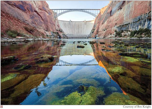

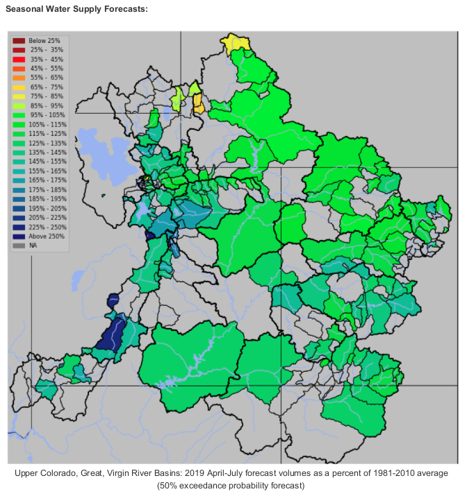
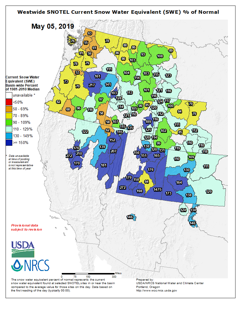
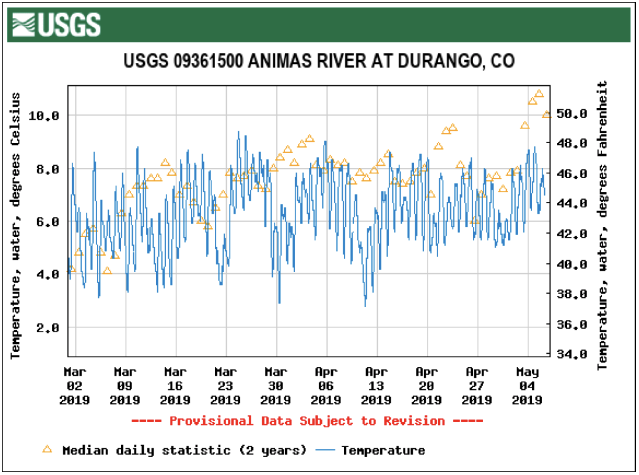

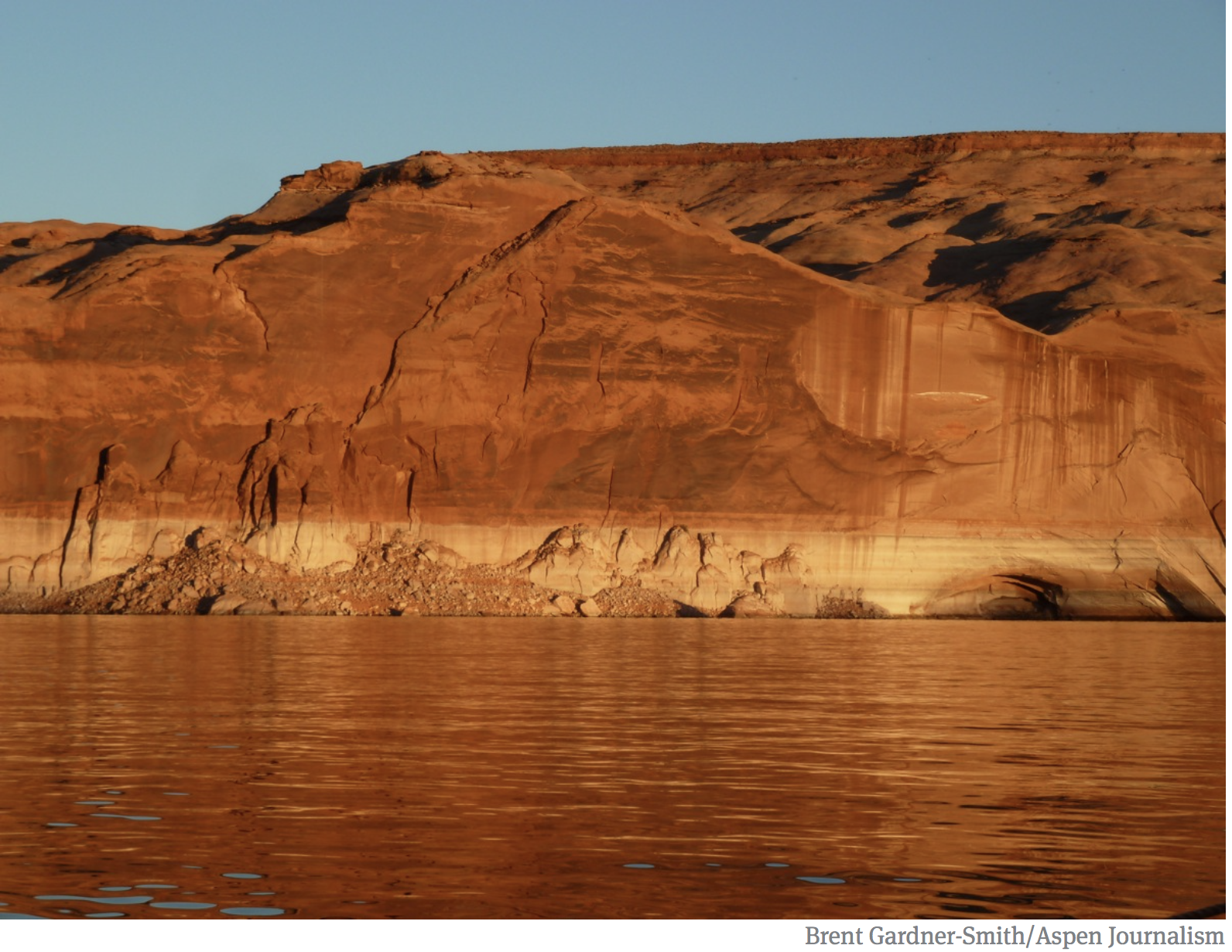
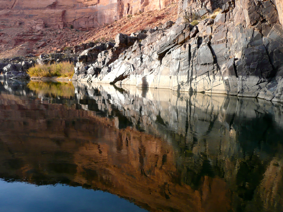


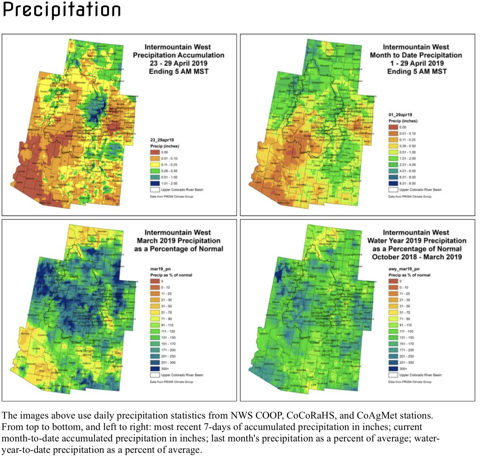
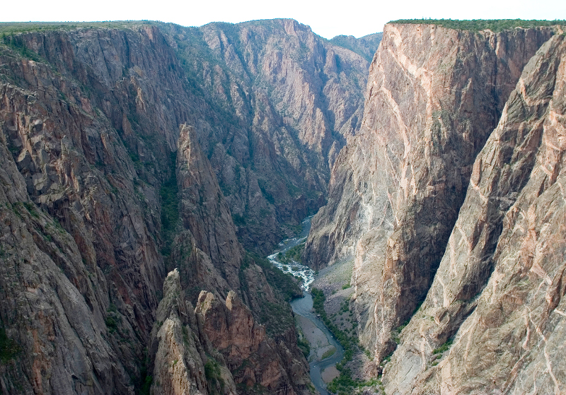

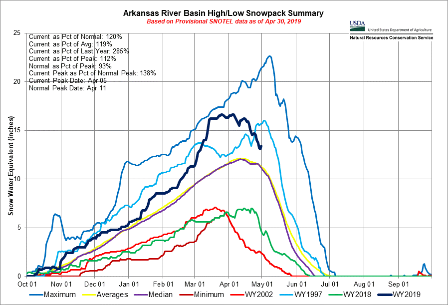


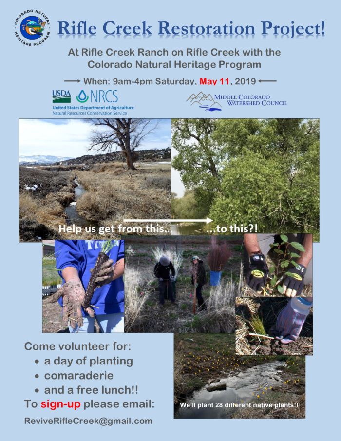
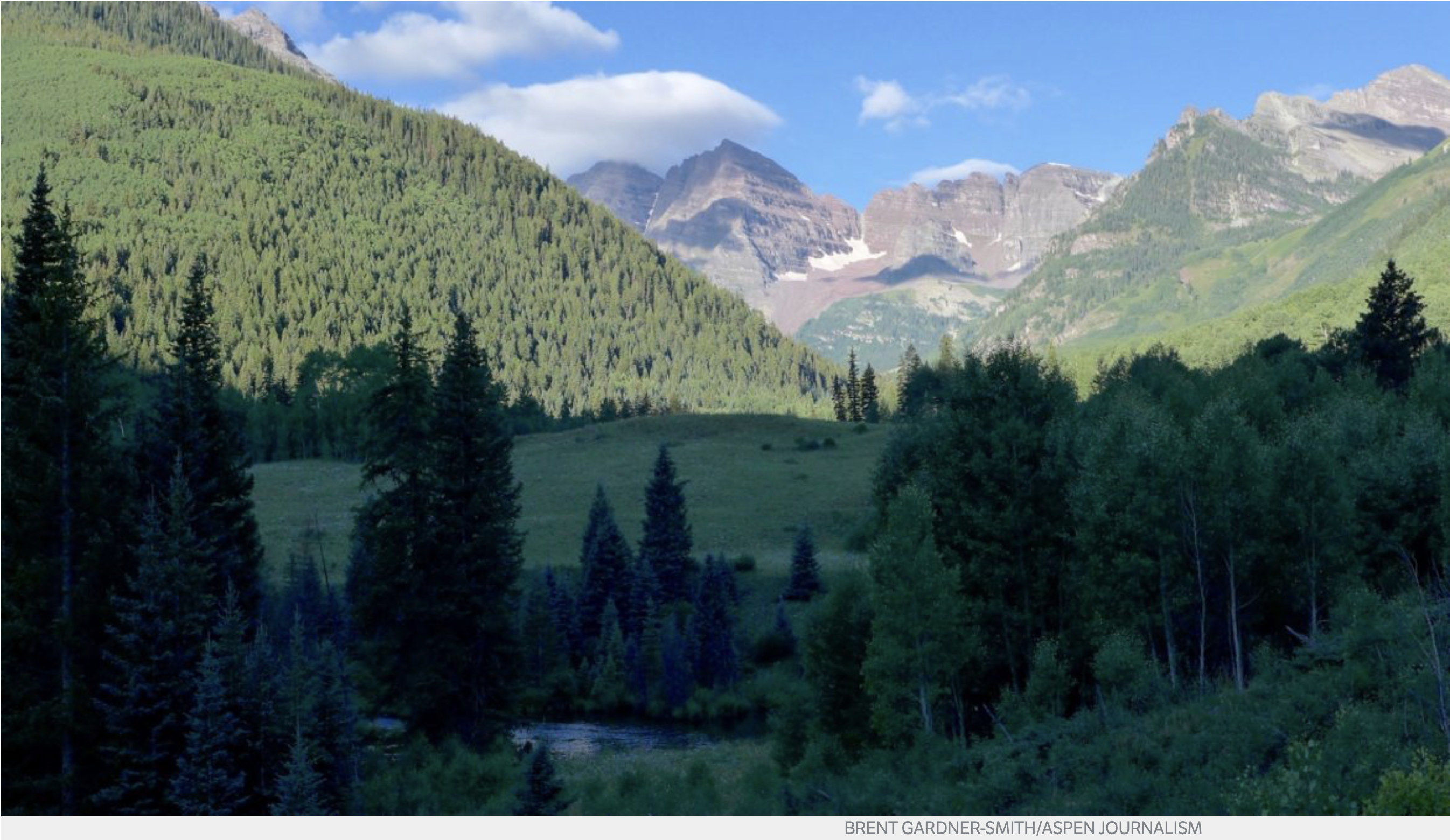
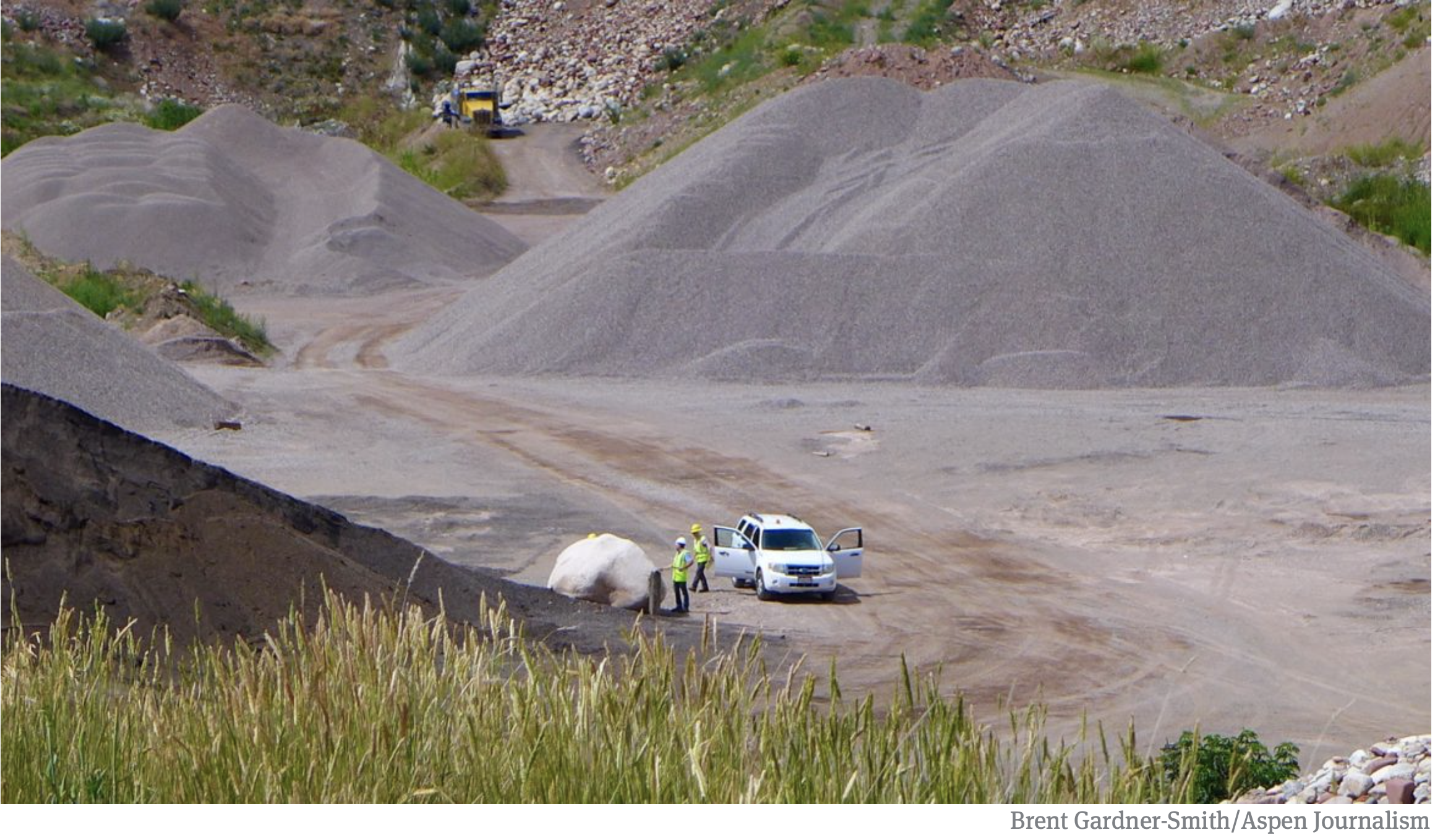

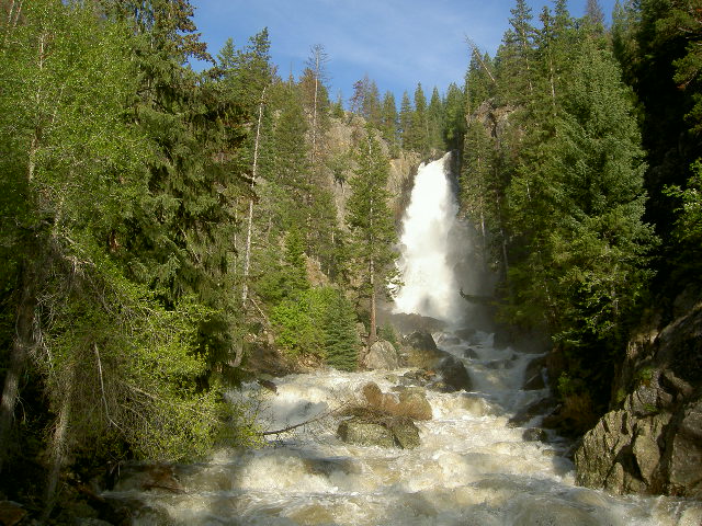


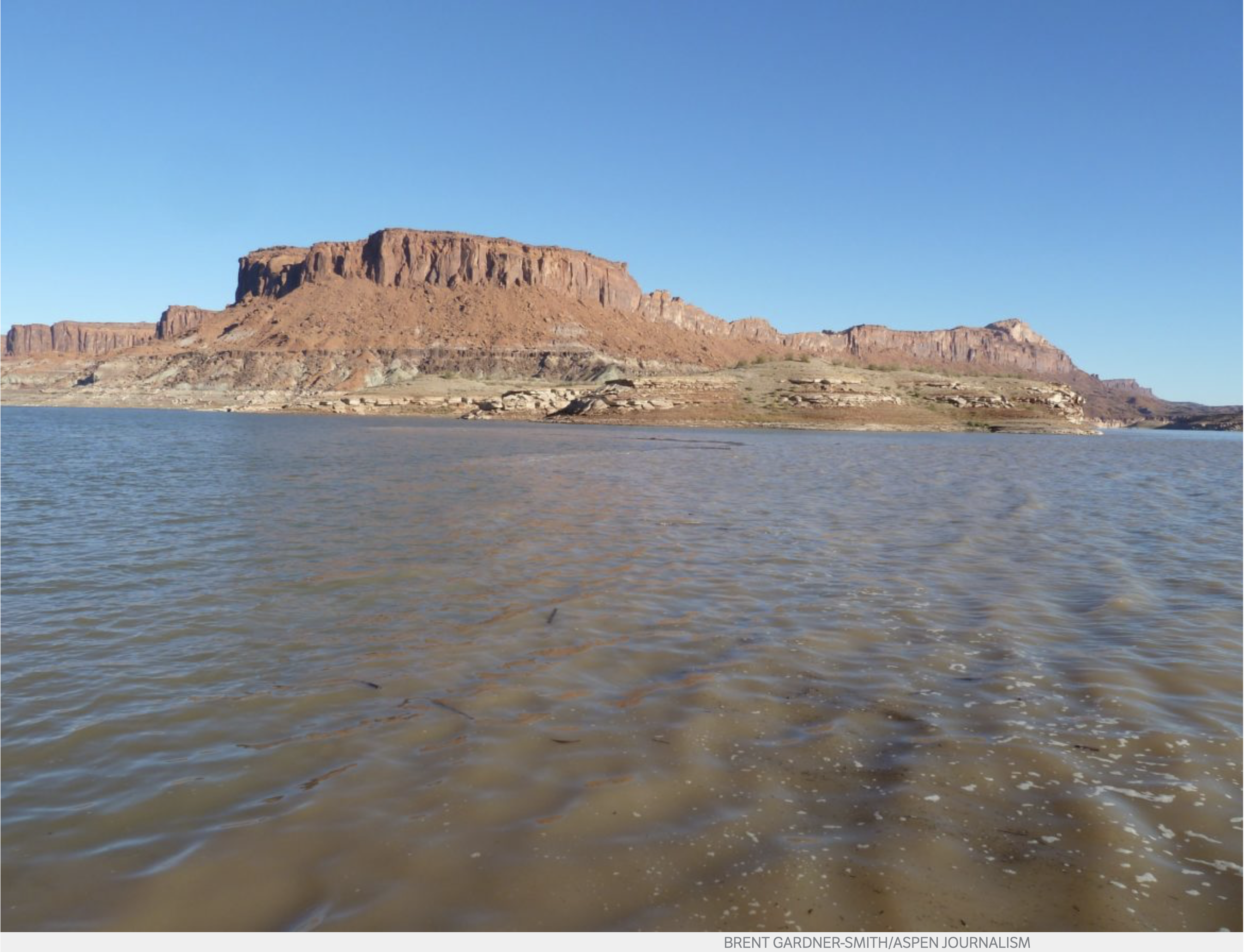

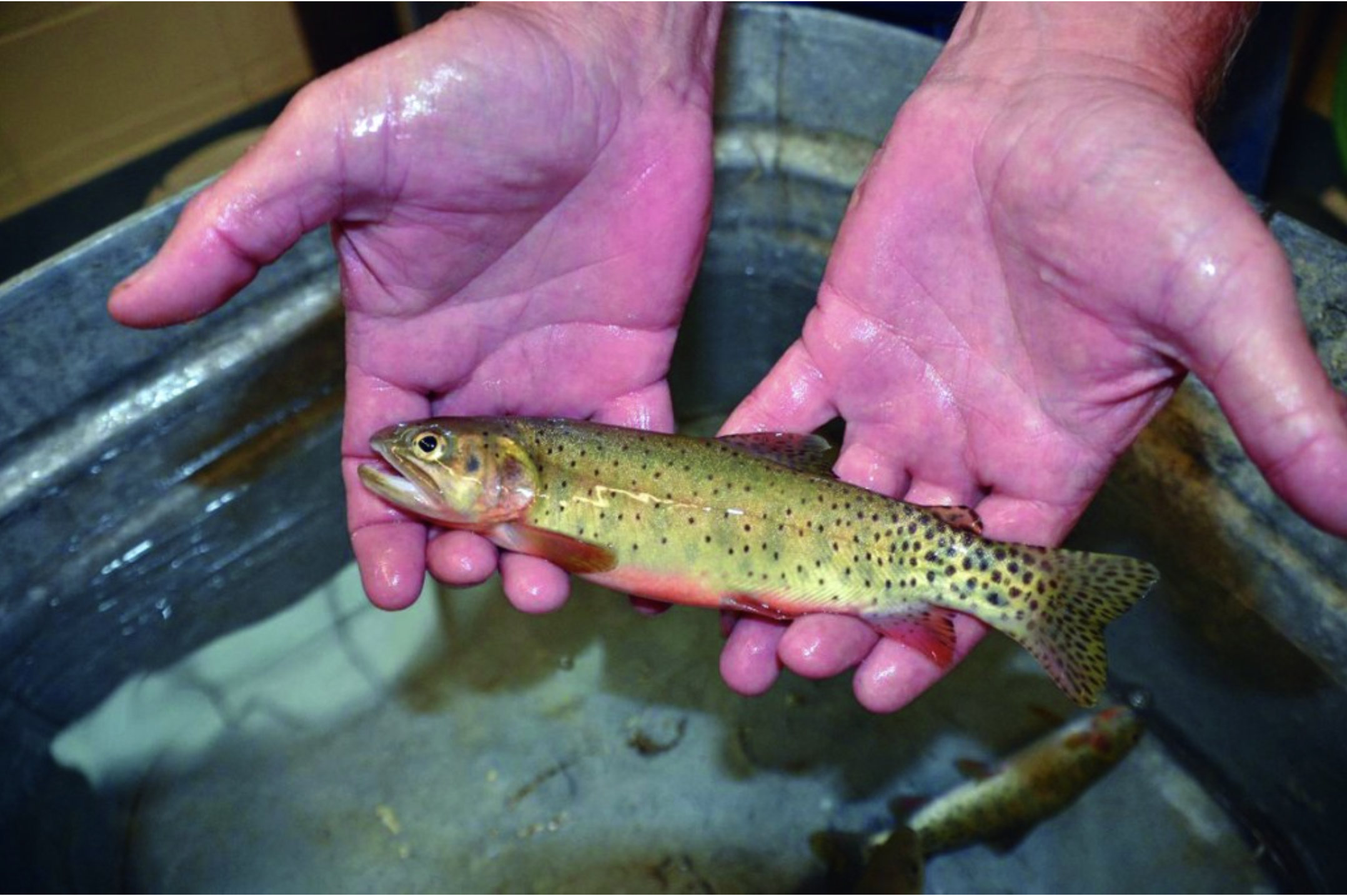

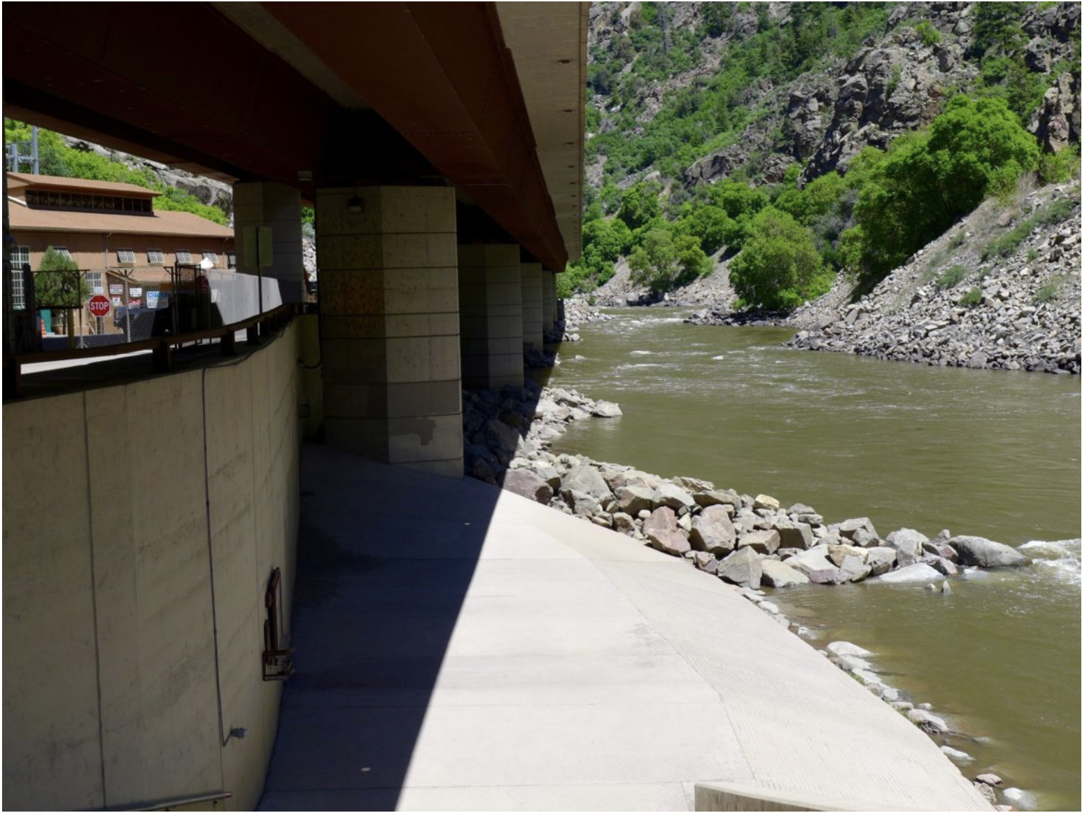


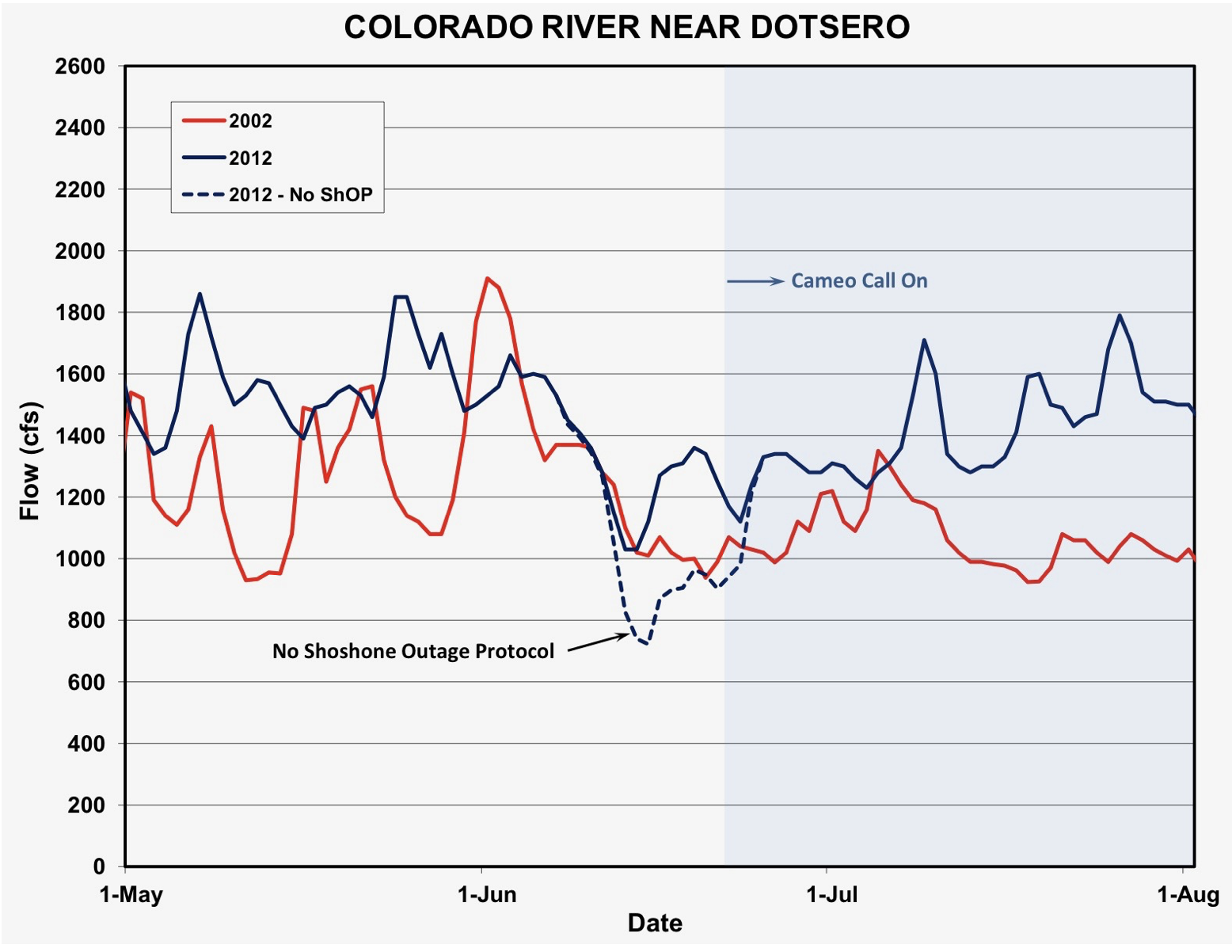
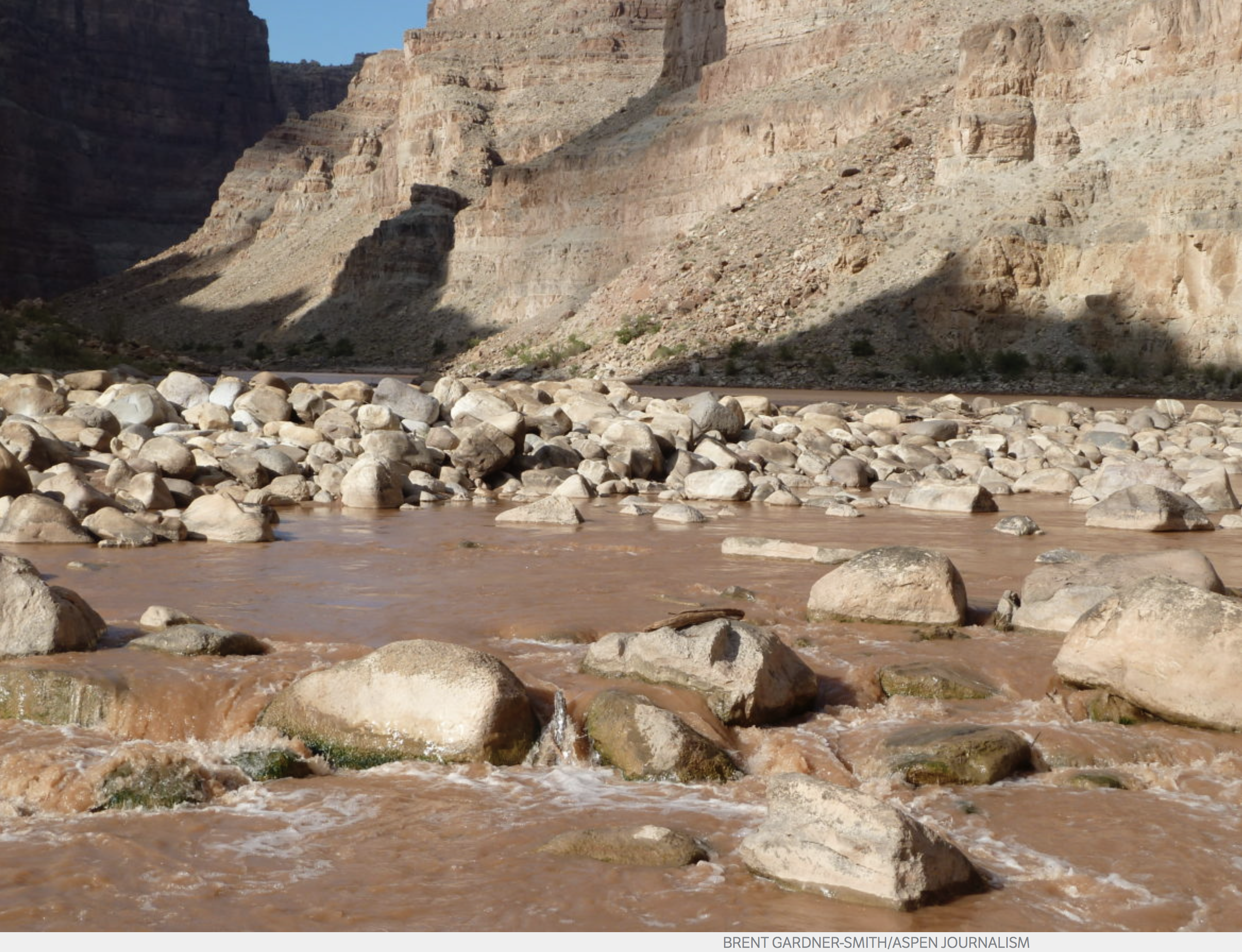


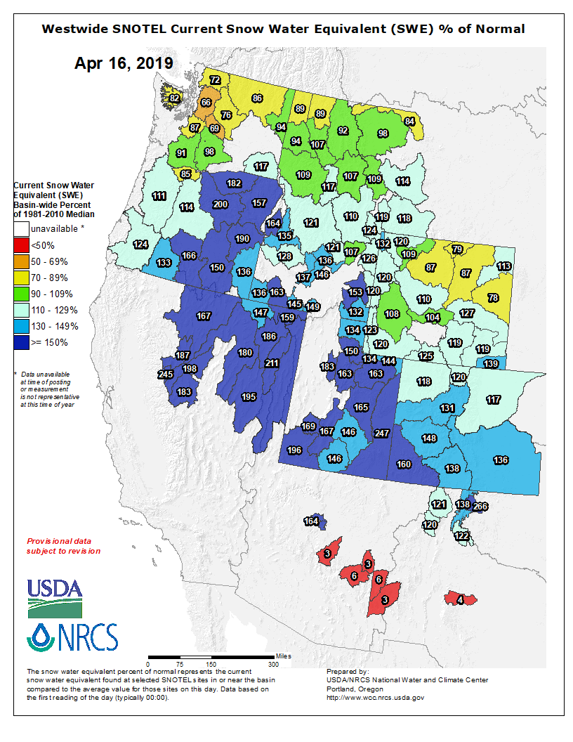
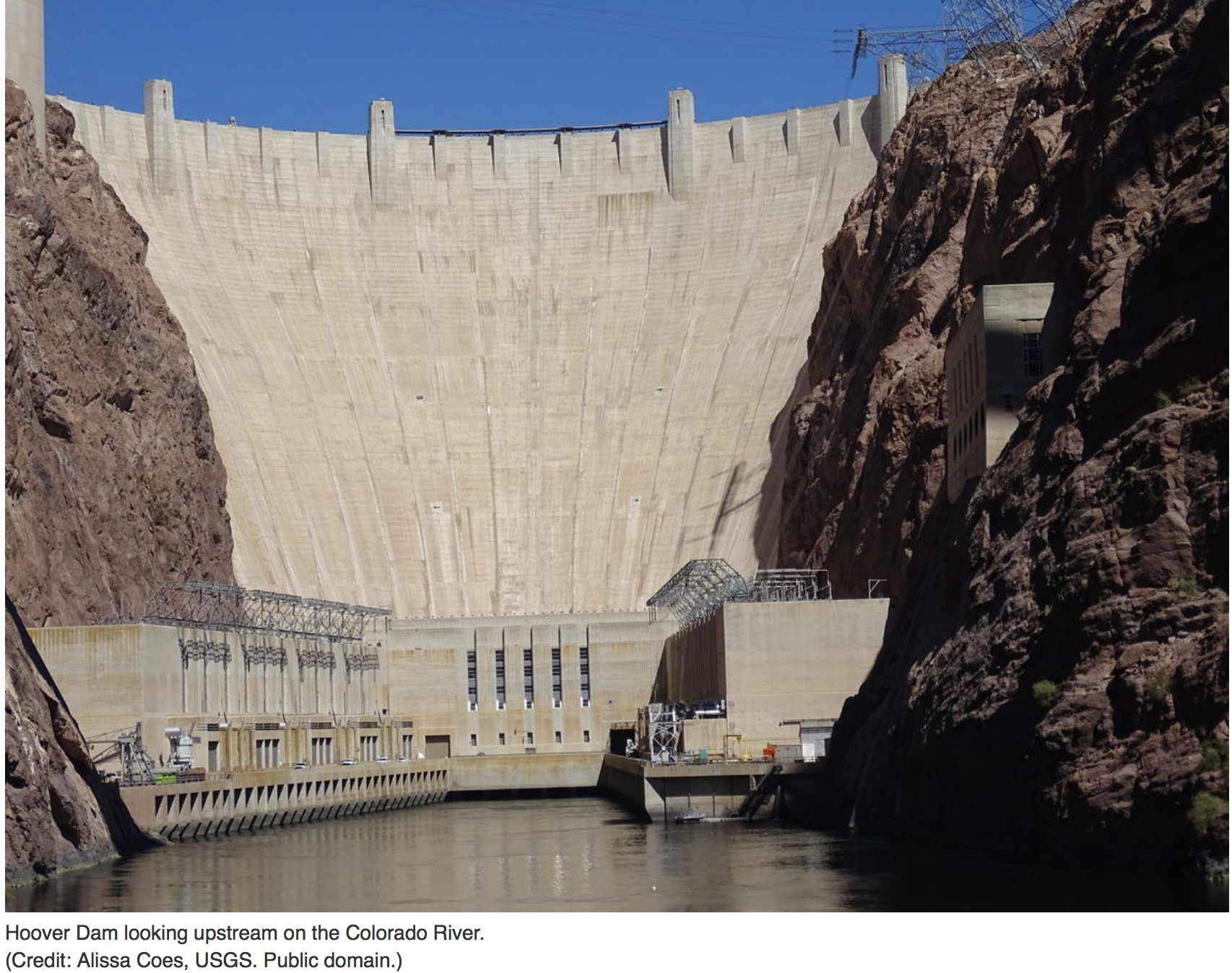

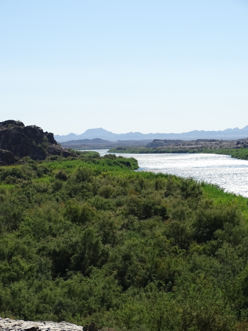


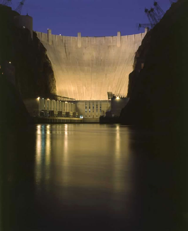
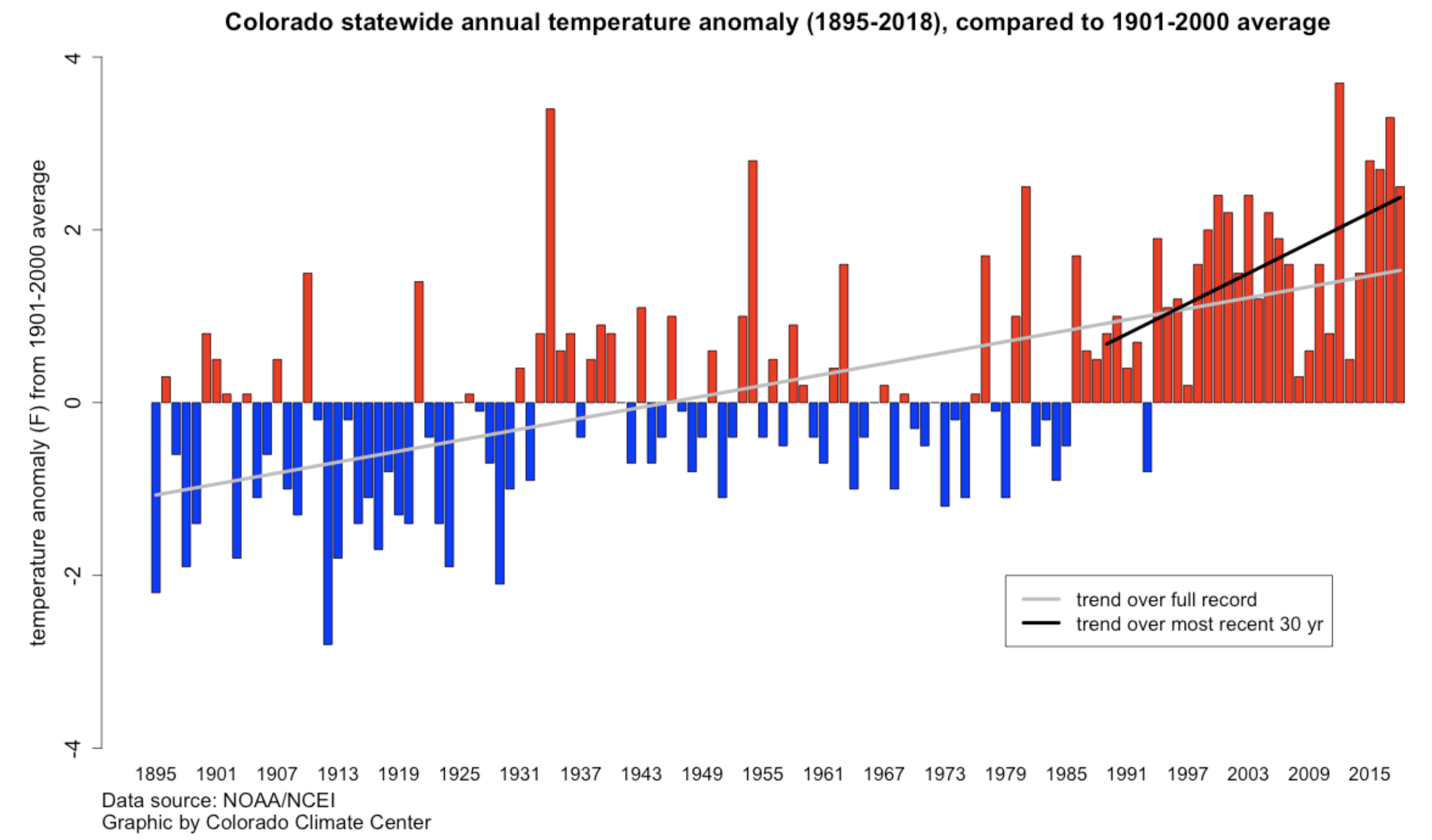
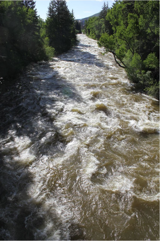


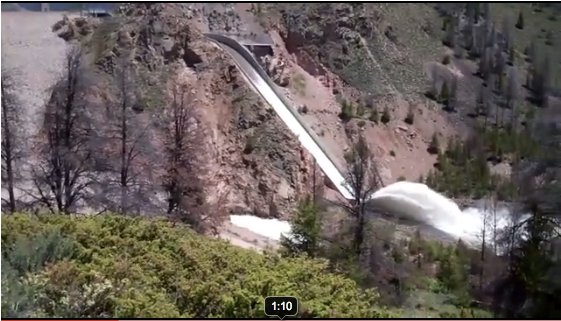
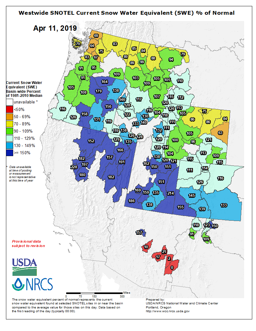
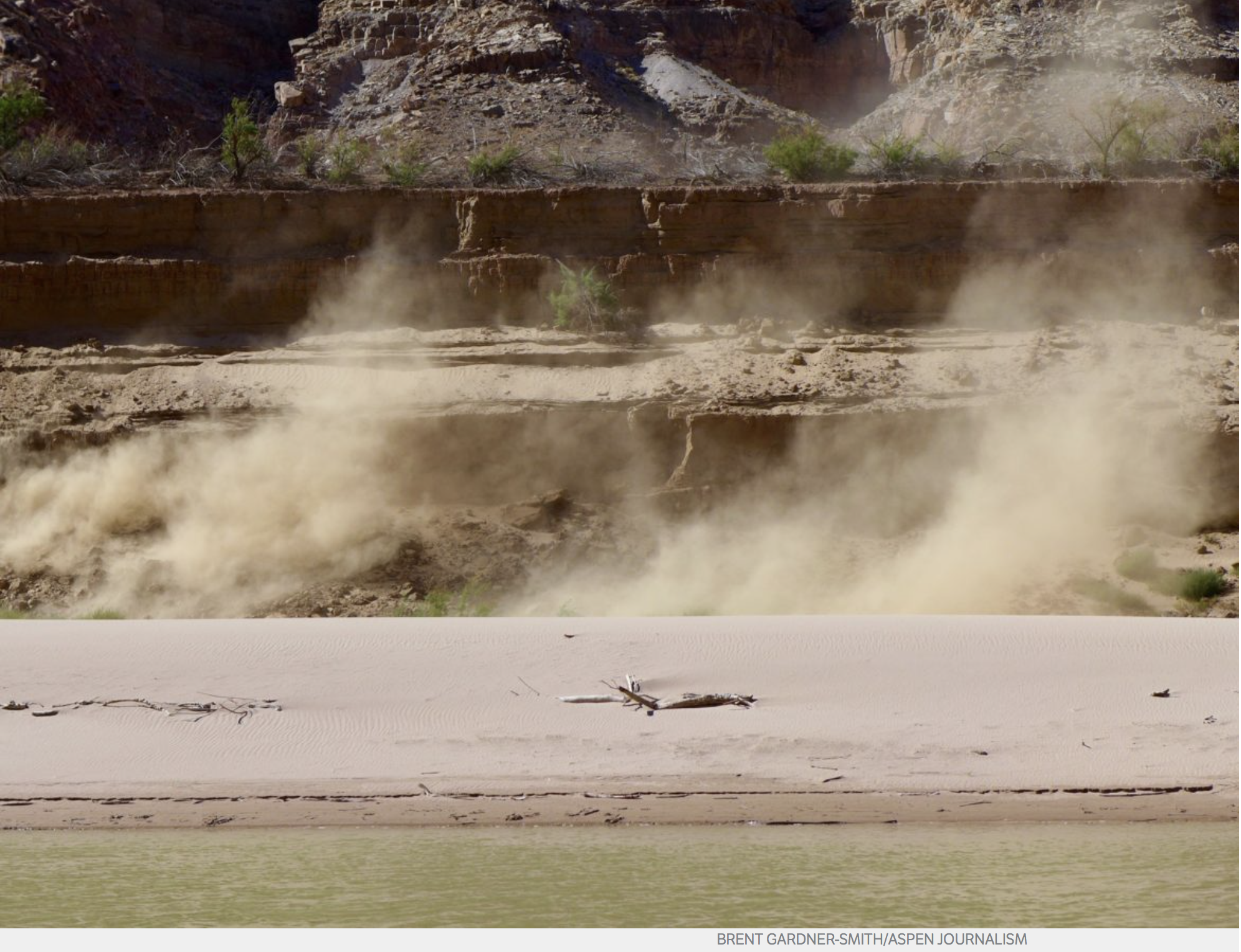
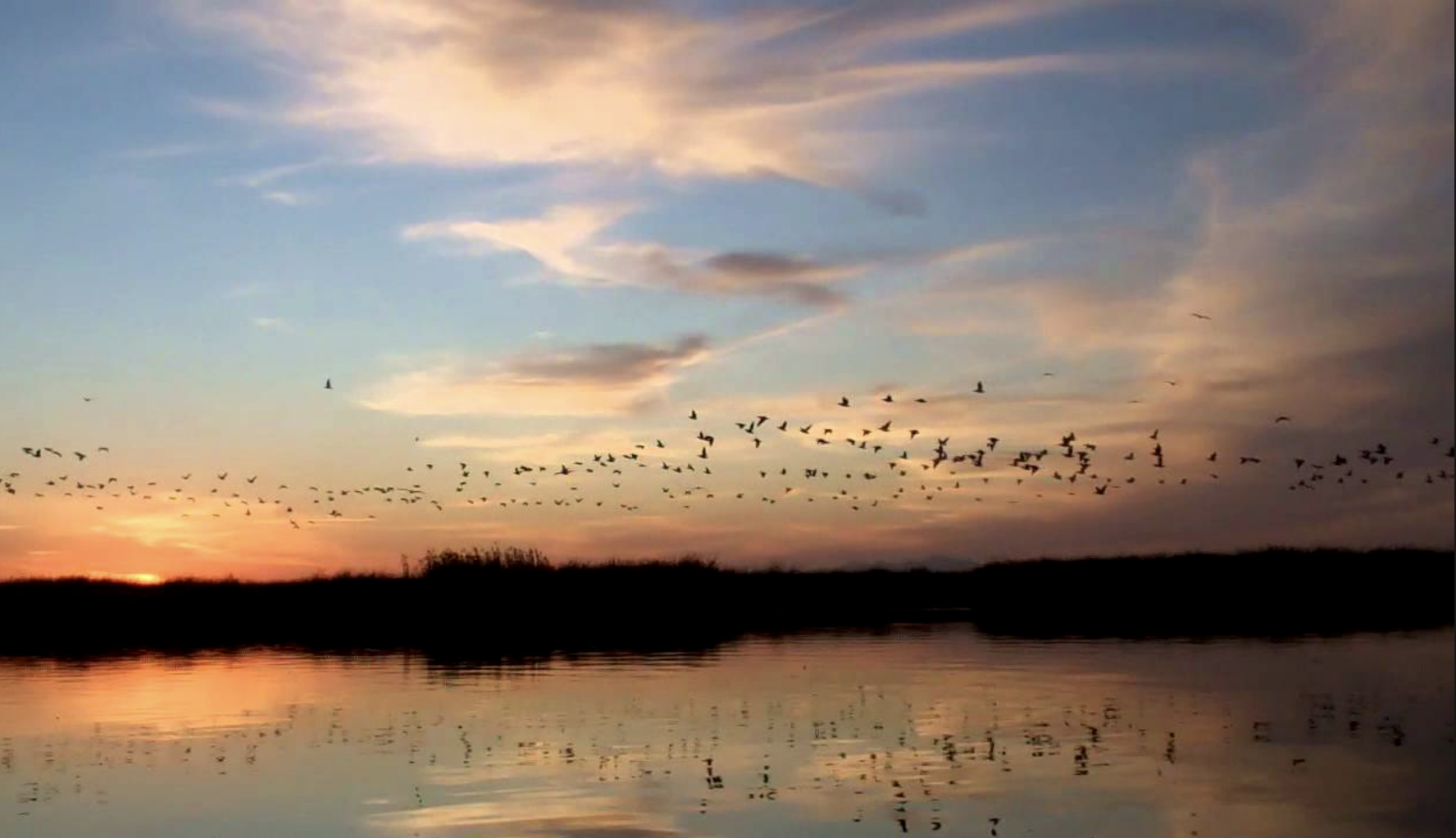

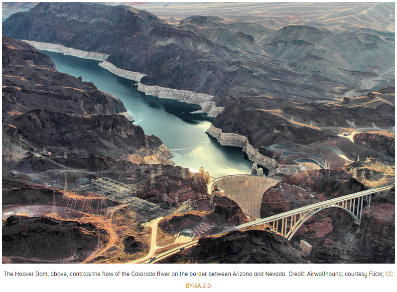


![The U.S. Whitewater Rafting Team trains on its custom-built raft in December on the Colorado River. The team was on pace for a record descent of the 277-mile canyon [January 14-15, 2017] when a wave broke the frame and punctured a tube. Photo Special to The Denver Post by Forest Woodward.](https://i0.wp.com/coyotegulch.blog/wp-content/uploads/2017/01/whitewaterraftgrandcanyonrecordattempt012017denverpost.jpg?w=453&h=302&ssl=1 "BZXXGRANDCANYON3.jpg")


