State and local water officials will host an informational meeting and discussion forum for water users and others interested in the water supply of the South Fork Republican River. The meeting will take place at 1:00 p.m. CST on Wednesday, Jan. 4, 2017, at the Cheyenne County 4-H building at the fairgrounds on N. College Street, St. Francis.
The Kansas Department of Agriculture and the Kansas Water Office will share information about the resolutions reached between Kansas, Colorado and Nebraska this year. Stakeholders are encouraged to attend and provide input to state water officials charged with administering the Republican River Compact. The Vision for the Future of Water Supply in Kansas includes a focus to represent Kansas in interstate water issues in order to best serve Kansas and its citizens.
“We want to hear from water users in the area as we continue to represent their needs in these interstate issues,” said Secretary of Agriculture Jackie McClaskey. “This long-term agreement reached by the three states will provide flexibility and greater certainty to all water users in this region.”
For more information on the meeting, please contact Chris Beightel at the KDA Division of Water Resources, at (785) 564-6659 or Chris.Beightel@ks.gov. To read more about the Republican River Compact, go to http://agriculture.ks.gov/RepublicanRiver.
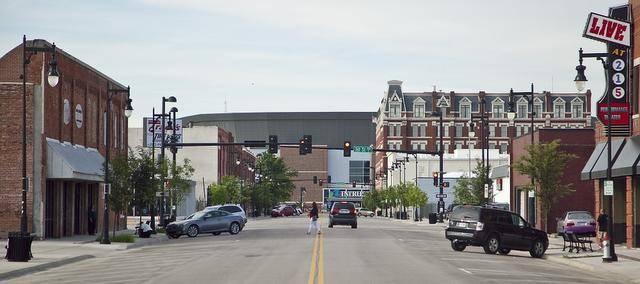
Saint Francis, Kansas credit Wichita Eagle.
Meanwhile, there is a meeting about the South Fork of the Republican River on January 4, 2017 in Saint Francis:
A meeting and discussion about the South Fork of the Republican River will begin at 1 p.m. Jan. 4 at the Cheyenne County 4-H Building in St. Francis.
Kansas Department of Agriculture and Kansas Water Office officials will share information on resolutions reached between Kansas, Colorado and Nebraska.
The Colorado agreement provides a path aimed at improving streamflow in the South Fork of the Republican, which flows through Cheyenne County in northwest Kansas. Included is a Colorado commitment to retire 25,000 more groundwater-irrigated acres to improve flows into Kansas, according to the Kansas Agriculture Department’s website.
The Nebraska agreement is billed to provide Kansas water users “much more certainty that there will be a viable irrigation supply during dry periods,” by delivering and storing “Compliance Water” to Harlan County Reservoir in southern Nebraska for Kansas irrigation use, the website reads.
Here’s the abstract (Scott J. Eilerman, Jeff Peischl, J. Andrew Neuman, Thomas B. Ryerso, Kenneth C. Aikin, Maxwell W. Holloway, Mark A. Zondlo, Levi M. Golston, Da Pan, Cody Floerchinger, and Scott Herndon):
Atmospheric emissions from animal husbandry are important to both air quality and climate, but are hard to characterize and quantify as they differ significantly due to management practices and livestock type, and they can vary substantially throughout diurnal and seasonal cycles. Using a new mobile laboratory, ammonia (NH3), methane (CH4), nitrous oxide (N2O), and other trace gas emissions were measured from four concentrated animal feeding operations (CAFOs) in northeastern Colorado. Two dairies, a beef cattle feedlot, and a sheep feedlot were chosen for repeated diurnal and seasonal measurements. A consistent diurnal pattern in the NH3 to CH4 enhancement ratio is clearly observed, with midday enhancement ratios approximately four times greater than nighttime values. This diurnal pattern is similar, with slight variations in magnitude, at the four CAFOs and across seasons. The average NH3 to CH4 enhancement ratio from all seasons and CAFOs studied is 0.17 (+0.13/–0.08) mol/mol, in agreement with statewide inventory averages and previous literature. Enhancement ratios for NH3 to N2O and N2O to CH4 are also reported. The enhancement ratios can be used as a source signature to distinguish feedlot emissions from other NH3 and CH4 sources, such as fertilizer application and fossil fuel development, and the large diurnal variability is important for refining inventories, models, and emission estimates.
The Republican River Compact Administration signed off on a resolution presented by Colorado last week during the three-state entities’ annual meeting.
The resolution lays out the final steps Colorado has to take for compliance with the Final Settlement Stipulation and Republican River Compact, between it, Nebraska and Kansas.
If Colorado meets the requirements laid out in the resolution, it will be protected from any further lawsuit filings in the matter by Kansas or Nebraska.
“It basically means Kansas can’t come after us again and again,” Colorado State Engineer Dick Wolfe said. “It doesn’t prevent them from raising some other issue we haven’t thought of yet.”
He added the states have agreed to try to work out future issues among themselves instead of immediately going to the costly and time-consuming non-binding arbitration process.
“This is not nearly as restrictive as some people fear,” Deb Daniel, general manager of the Republican River Water Conservation District, said of the resolution.
A final agreement on the use of Colorado’s compact compliance pipeline, as well as the voluntary retiring of more acreage along the South Fork of the Republican River, are the key components in the resolution. Colorado already has removed 23,838 acres from irrigation in the South Fork Republican River Basin, through voluntary retirement programs such as the federally-funded CREP.
The resolution, presented last week in Burlington by Wolfe, and signed by him and Kansas’ David Barfield and Nebraska’s Gordon W. Fassett, calls for Colorado to utilize voluntary programs to retire up to an additional 25,000 acres from irrigation in the South Fork Republican River basin.
The resolution states Colorado will retire at least 10,000 acres by 2022, and the remaining 15,000 acres by December 31, 2027. It also includes language allowing Colorado to submit to the other states for their approval a plan to reduce consumption within Colorado by other means if the state cannot or will not retire 25,000 acres by the 2027 deadline.
“It gave us and the users the most flexibility going into the future,” Wolfe said.
Daniel noted the agreement does not make any mention of stream flows or how much acre feet of water must be removed from consumptive use, only acreage.
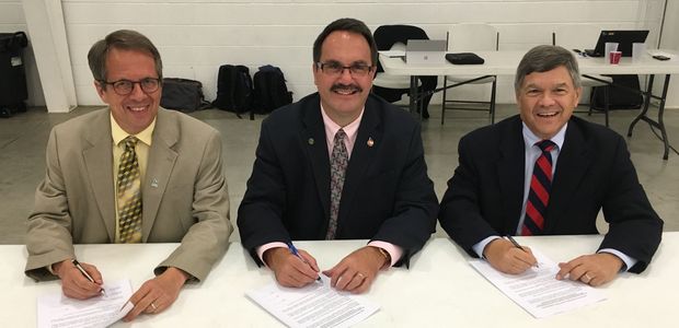
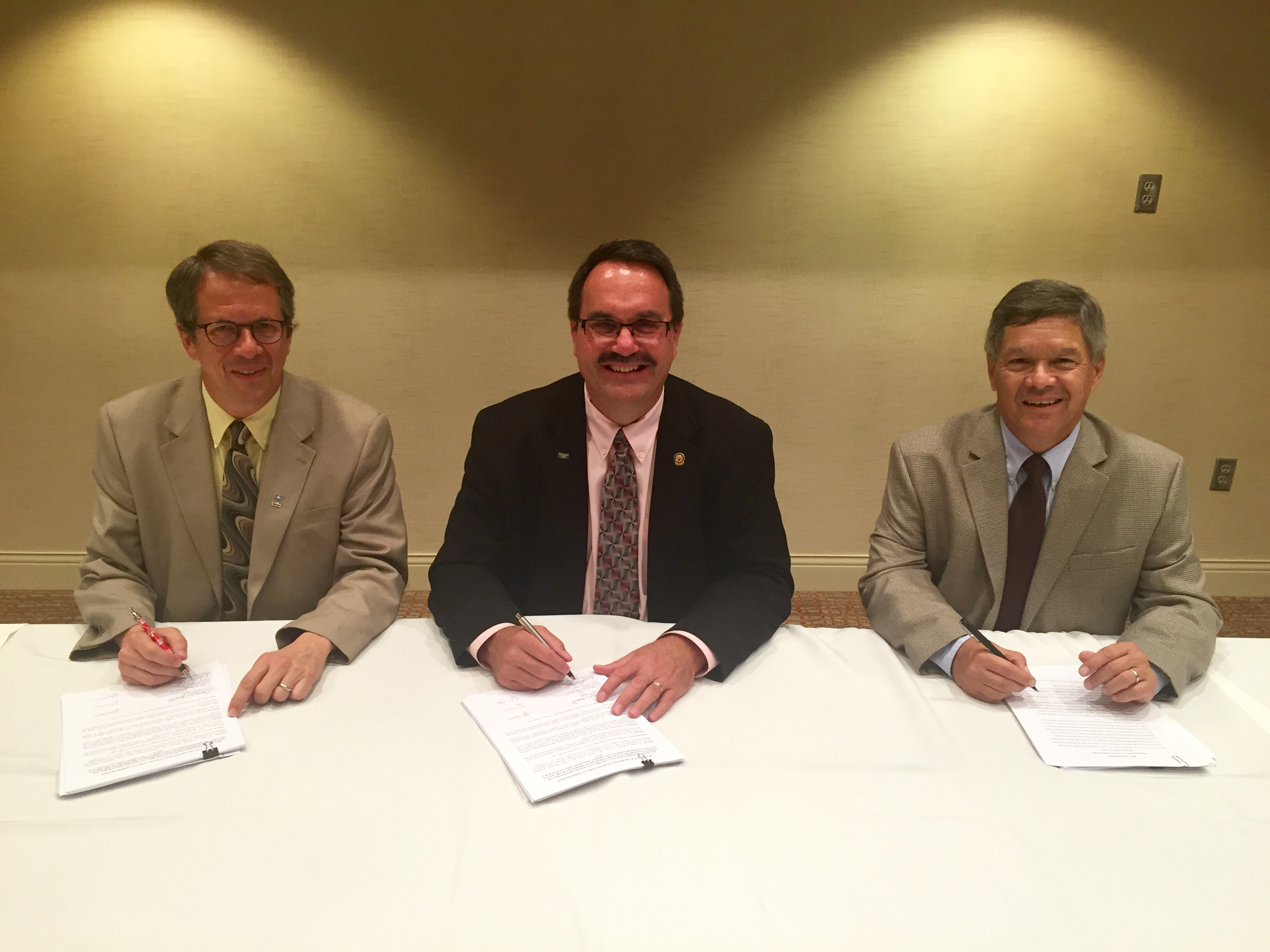
Photo: The commissioners of the Republican River Compact Administration sign the long-term resolutions on August 24: (from left) Commissioner David Barfield, Chief Engineer, Kansas Department of Agriculture; Commissioner Dick Wolfe, State Engineer, Colorado Division of Water Resources; Commissioner Jeff Fassett, Director of Nebraska’s Department of Natural Resources, via Governor Hickenlooper’s office.
Here’s the release from Governor Hickenlooper’s office:
Gov. John Hickenlooper today announced Colorado, Kansas and Nebraska established an agreement this week in the longstanding conflict over water from the Republican River basin, as the Republican River Compact Administration signed two resolutions.
Representatives from the three states have been meeting monthly for over two years, in an effort to change the approach and improve how they manage interstate water matters. This effort has created a new focus on transparency and certainty as all three states work to serve their water users. The intent of these resolutions is to replace the need for annual reviews and instead provide long-term surety to water users.
“We are proud to be part of this historic agreement,” said Hickenlooper. “For the first time since signing the Compact, the three states have worked together to resolve their issues without litigation and have brought certainty to the water users in the basin. This is how we do our best work in Colorado and defines our approach to addressing our water challenges — cooperation and collaboration.”
“Signing these resolutions shows the commitment from all three states to engage in open and transparent dialogue for the past two years,” said Kansas Governor Sam Brownback. “This long-term agreement will ultimately improve water management for water users in Kansas as well as Nebraska and Colorado.”
The resolutions signed this week will provide flexibility and greater certainty to all water users in the region, while remaining consistent with the terms of the Republican River Compact and the Final Settlement Stipulation of 2002. The three states have been involved in various litigation and arbitration for the past 15 years over administration of water in the Republican River basin, and this agreement is a significant and positive step forward, with the next steps focusing on working with the basin’s water users to implement these agreements.
“It has been a priority of the states to collaborate on interstate water matters to ensure each state’s water users are protected while also maintaining a positive working relationship between the compacting states. “These resolutions represent a long-term strategy for representing each state and ultimately improving water management for water users in all three states,” said Nebraska Governor Pete Ricketts.
The Republican River basin begins in the plains of eastern Colorado and flows through northwest Kansas and southern Nebraska, ultimately returning to Kansas. The Republican River Compact was negotiated during the early 1940s with participation by the states of Colorado, Kansas and Nebraska and a representative of the President of the United States. The Compact was formally signed in 1942. Its purposes are to provide for equitable division of such waters, remove all causes of controversy, promote interstate comity, promote joint action by the states and the United States in the efficient use of water and the control of destructive floods, and provide for the most efficient use of waters in the Republican River basin.
The state official in each of the three states who is charged with administering water law serves on the Republican River Compact Administration. For more information about the Compact, go to the following websites:
From the Republican River Water Conservation District (Deb Daniel):
The Republican River Water Conservation District (RRWCD) acting through its Water Activity Enterprise will again partner with NRCS to encourage water conservation through the Ogallala Aquifer Initiative (OAI). The RRWCD will provide incentives to producers that voluntarily implement certain water conservation measures. Last year the RRWCD teamed up with NRCS on this program and provided $510,000 to convert approximately five hundred ten acres (510 acres) from irrigated to dryland agriculture or grassland.
This year the District has expanded their participation in the program and will also provide funding along with the NRCS incentives on short-term irrigation rotations, and certain water management improvements such as soil moisture monitoring systems, weather stations, and conversion from sprinkler irrigation to an underground drip irrigation system.
In addition to the NRCS incentives, the RRWCD will provide between six hundred ($600.00) and one thousand two hundred dollars ($1,200.00) depending on the location of the well. In addition to the permanent well retirement practice, the District will be providing incentives to eligible producers that enter into short –term (1 -3 years) rotations from irrigated cropland to dryland cropping practices. Priorities have been established to focus RRWCD funding in areas that provides the highest level of credit for Colorado in the Republican River Compact.
Recent research has suggested that high capacity wells can reduce water consumption by as much as twenty percent (20%) in some cases, with little or no effect on the overall profitability of that particular well. To supplement NRCS incentives the RRWCD has earmarked fifty thousand dollars ($50,000.00) to producers who wish to continue to irrigate, but agree to reduce pumping by at least ten percent (10%) using water conservation measures such as weather stations, soil moisture monitoring and conversion from sprinkler irrigation to an underground drip system. More efficient irrigation systems can contribute substantially to prolonging the life of the aquifer, while maintaining a strong irrigated agricultural economy.
The RRWCD has consulted with groundwater management districts, the Water Preservation Partnership, and others to develop strategies to assist producers through financial incentives to voluntarily reduce water consumption. Several surveys distributed throughout the District to producers have indicated that voluntary, incentive based practices were preferred over regulatory water restrictions. The OAI provides yet another voluntary incentive based tool that all producers can use to help prolong the life of this aquifer. It is important that each and every irrigated agriculture producer evaluate their individual irrigation practices and determine if they can help reduce their impact on the aquifer by implementing one or more of these water conservation practices.
For more than 80 years, the Ogallala Aquifer, the largest freshwater aquifer in the world, has been the main source of agricultural and public water for eastern Colorado and parts of seven other states in the Great Plains. Now, Colorado State University will take a leading role as part of a USDA-NIFA funded university consortium to address agricultural sustainability on the Ogallala Aquifer.
$10 million over four years
The consortium, comprised of CSU and seven other universities as well as USDA-ARS, has been awarded a USDA Water for Agriculture Challenge Area CAP grant which will provide $10 million over four years for innovative research and extension activities to address water challenges in the Ogallala Aquifer region.
The Ogallala, along with many of the world’s aquifers, is declining on a path many consider to be unsustainable. The Ogallala Aquifer region currently accounts for 30 percent of total crop and animal production in the U.S and more than 90 percent of the water pumped from the Ogallala Aquifer is used for irrigated agriculture.
Cutting-edge science and technology
“This project will integrate cutting-edge science and technology with an evaluation of policy and economic strategies as well as outreach to foster adaptive management,” said Meagan Schipanski, assistant professor of Soil and Crop Sciences, and the project’s lead investigator. “Our interdisciplinary team has an exceptional track record of work in the region, and this project offers an opportunity for much-needed integration and collaboration to extend the life of our shared groundwater resources.”
Meagan Schipanski, assistant professor of Soil and Crop Sciences
Tremendous impact on rural economies
“Irrigated crop production has a tremendous impact on rural economies and Colorado’s overall agricultural output,” said Ajay Menon, dean of the CSU College of Agricultural Sciences. “Professor Schipanski brings her leadership along with the collective expertise of the CSU scientists to a team of Land Grant University researchers who are positioned to make a major impact on our understanding of the aquifer system by determining what approaches can improve the productivity and resiliency of this important region.”
The multi-disciplinary team includes scientists at the University of Nebraska-Lincoln, Kansas State University, Oklahoma State University, New Mexico State University, Texas Tech University, West Texas A &M University, Texas A & M AgriLife and the USDA-Agricultural Research Service.
To learn more about the project, visit the USDA news site.
Here’s the release from the US Bureau of Reclamation (Peter Soeth):
The Bureau of Reclamation has released the Republican River Basin Study, which identifies adaptation strategies that address water management challenges in the basin. This study, which includes a study area of 2.7 million acres of irrigated agriculture served primarily by groundwater supplies, represents an extensive collaborative effort among Colorado, Nebraska and Kansas.
“The Republican River Basin is a complex and important basin for these states,” Reclamation Commissioner Estevan López said. “Because of its importance, new ground and surface water modeling tools were developed to evaluate future hydrology and operations within the basin. These tools will assist water managers as they make decisions to build resiliency against future climate change, while also maintaining compliance with the Republican River Compact.”
The Republican River basin covers approximately 16 million acres and lies primarily within the Ogallala Aquifer. It originates in the high plains of eastern Colorado and flows east into Nebraska and Kansas.
The basin study found that climate change may impact future supplies and demands across the basin. Nebraska focused on augmenting the supply of Swanson Lake and creating new surface water storage on Thompson Creek, a tributary of the Republican River, while Kansas evaluated alternatives that increase the storage volume at Lovewell Reservoir. The modeling tools that were developed for the study evaluated alternatives to improve the supply reliability at the Frenchman-Cambridge Irrigation District in Nebraska, as well as the Bostwick-Irrigation District of Nebraska and Kansas.
Surface water supplies include a system of seven Reclamation reservoirs and one U.S. Army Corps of Engineers reservoir. These projects provide flood control benefits, as well as supplies to six irrigation districts that serve approximately 140,000 acres. The Republican River is subject to an interstate compact between Colorado, Nebraska and Kansas that was ratified in 1943.
The Republican River Basin Study is a part of Reclamation’s WaterSMART Program. The report is available online at http://www.usbr.gov/watersmart/bsp.
WaterSMART is the Department of the Interior’s sustainable water initiative that uses the best available science to improve water conservation and help water resource managers identify strategies to narrow the gap between supply and demand. For more information on the WaterSMART program, visit http://www.usbr.gov/WaterSMART.
Many Indian reservations are located in or near contentious river basins where demand for water outstrips supply. Map courtesy of the Bureau of Reclamation.
Here’s a report from Nnie Snider writing for E&E Publishing. Click through and read the whole article, here’s an excerpt:
It’s not just modern engineering that made Arizona’s desert bloom.
Thirty miles south of downtown Phoenix sits dusty land that was once farmed by one of the most advanced agricultural civilizations of prehistoric times. As far back as 300 B.C., the Hohokam people hand-dug a network of canals through the Gila River’s rich floodplains, diverting spring runoff to nourish their fields.
But by the end of the 19th century, their descendants’ fields were parched and dead, thanks to upstream diversions by white settlers.
“That era among our people is called the time of starvation,” said Gov. Stephen Roe Lewis, the top elected official at the Gila River Indian Community, home of the Hohokam’s descendants, the Pima, and the Maricopa tribe.
“Not only had our crops dried up because of lack of water, we were known as ranchers and a lot of our animals died because of lack of water,” he said. “We were really on the brink of extinction.”
Over the next century, the federal government put its financial and engineering might to work developing water projects around the reservation to benefit surrounding communities, but rarely the tribes.
Their fields dry, the Pima and Maricopa shifted from their traditional diet to a Western one, and the community’s diabetes rate skyrocketed to one of the highest in the country.
Traditional ways — weaving baskets of marsh grasses, using herbal medicines made from river sediment — were lost, too.
The painful irony: The tribes were technically the first in line for water.
Thanks to a 1908 Supreme Court ruling, tribes almost always have the most senior claim to water in the West, where water rights are prioritized based on when the resource was first put to beneficial use and reservations dot the landscape.
Rights mean little without a lawyer to defend them, though, and for generations, tribes were too poor to afford representation.
But in recent years, in part because of groundwork laid by the Native American civil rights movement, tribes are increasingly heading to court to assert their rights.
There’s a problem: While the high court was clear that tribes have rights to water, it did not say to how much.
In many cases, tribes claim a share large enough that it could crowd out neighboring cities’ and farmers’ water supplies and stanch future development.
Tribes along the main stem of the Colorado River in the Lower Basin have some of the few court-determined rights because of a 1963 Supreme Court decision covering larger battles over the river between California and Arizona. Today, just those few tribes have rights to roughly 20 percent of the Lower Basin’s flow — an amount that is more than five times the allocation for the entire state of Nevada…
Now, as booming populations and extended droughts have stoked competition for water supplies across the West, the uncertainty around tribes’ potentially massive claims to water in already overstretched river basins is posing real constraints on communities and businesses.
“It’s a very significant set of claims that tribes have on very limited and critical water supplies across the West,” said Deputy Interior Secretary Mike Connor, who has worked on tribal water issues throughout his career. “It’s uncertainty — that’s what water managers don’t want.”
But lawsuits have largely proved fruitless for all sides.
When tribes win, they receive only a legal right to the water — dubbed a “paper water right” — often without the infrastructure or funding needed to get the water to the reservation and put it to use.
Meanwhile, endless appeals offer certainty for no one.
Instead, many tribes and communities have opted to sit down at the negotiating table in an effort to hash out an agreement that can get the tribes what they most need — wet water and sometimes other support for economic development — while protecting nontribal users and absolving the federal government of liability for failing to protect tribes’ rights.
Moreover, with all parties at the table, settlements are increasingly providing an opportunity to take a holistic look at issues across the basin and address other sticky issues like endangered species management or land ownership.
“I think generally we kind of look at these things as an opportunity to figure out how water in a particular basin’s going to be used in the future because in these negotiations, everything’s on the table, everybody’s involved,” Echohawk said.
“The question is, how do we get that peace in the valley? How do we learn to live together in a sustainable basin?” he said. “It comes down to a master plan for water in a particular basin for time in eternity.”
But settlements tend to rely on an infusion of federal cash to help make the pie larger for everyone, and that funding is getting harder to fight for in Congress…
Complex legal landscape
Two legal concepts drive conversations about tribal water rights.
The first, known as the Winters doctrine, stems from a 1908 Supreme Court case, Winters v. United States, relating to water rights at the Fort Belknap American Indian Reservation in central Montana.
It holds that when Congress set aside land for an Indian reservation, it also intended to reserve the water necessary to make that land a permanent homeland. The same doctrine has also been applied to other federal reservations, like national parks.
But how much water does a homeland need?
Courts have generally looked to the purpose that Congress identified in establishing the reservation, which was often agricultural, even for tribes with no history of farming.
So to come up with a water right, experts would calculate how much reservation land could be farmed and how much water it would take to irrigate it — a complicated, time-consuming process that can result in a large amount of water for the tribe.
The second key legal concept relates to the federal government’s responsibility to tribes.
In a “trust responsibility,” the government, through the Interior Department, has a legal obligation to protect tribal treaty rights, land and other assets, and carry out federal laws relating to tribes.
Court rulings have made it clear that trust obligation includes protecting tribes’ water rights in the face of outside development — something the government frequently failed to do.
Meanwhile, some experts contend that the lack of infrastructure development for tribes is also a breach of that trust responsibility.
On the Navajo Nation, the country’s largest, poorest reservation, which spans a broad swath of Arizona, New Mexico and Utah, an estimated 40 percent of households lack access to running water.
There, families must travel dozens of miles to haul water from centralized wells or wait for the once-a-month delivery from a local church. Without water, economic development is nearly impossible.
But exactly what that federal liability means in dollars and cents is another major open question.
One of the highest-profile cases over breach of trust was a long-running class-action lawsuit relating to the Interior Department’s mismanagement of income from tribal trust lands. That case, Cobell v. Salazar, settled in 2009 for a whopping $3.4 billion.
But for water rights, there’s no solid precedent.
In part, that’s because neither side has wanted to take the risk to get a definitive answer.
For one thing, due to a 1952 appropriations rider, federal water rights like tribes’ can be adjudicated in state courts, which tribes tend to see as hostile to their interests.
Meanwhile, the country’s highest court is also seen as becoming less favorable to tribes.
The last major Indian water rights case to land before the Supreme Court was an appeal of a Wyoming state court’s decision that granted the Wind River Indian Reservation a large water right.
Then-Justice Sandra Day O’Connor recused herself from the case at the last moment, having discovered that her family’s ranch was part of a water adjudication that involved tribal water rights.
Without her, the high court reached a split, 4-4 decision that left the state court’s ruling in place.
But when Justice Thurgood Marshall’s papers were made public after his death, lawyers found a “ghost opinion” from O’Connor that would have overturned the Wyoming ruling and significantly revised the Winters doctrine.
All that leaves tribes gun-shy about a return trip to the high court.
“Tribes don’t want to be litigating these and going to the Supreme Court because they came within a whisper of losing it all in ’89, and in my view the Supreme Court has become a lot more hostile to tribal interests than the court we had at that time,” said Stanley Pollack, assistant attorney general for the Navajo Nation and a leading expert on tribal water rights.
The High Plains Aquifer provides 30 percent of the water used in the nation’s irrigated agriculture. The aquifer runs under South Dakota, Wyoming, Nebraska, Colorado, Kansas, Oklahoma, New Mexico and Texas.
Here’s the release from Kansas State University (Greg Tammen):
A new Kansas State University study finds that the over-tapping of the High Plains Aquifer’s groundwater beyond the aquifer’s recharge rate peaked in 2006. Its use is projected to decrease by roughly 50 percent in the next 100 years.
David Steward, professor of civil engineering, and Andrew Allen, civil engineering doctoral student, Manhattan, published those findings in the recent Agricultural Water Management study “Peak groundwater depletion in the High Plains Aquifer, projects from 1930 to 2110.” It is the first paper to look at and quantify peak aquifer depletion.
Researchers looked at the historic and projected future groundwater use rates of the eight states comprising the High Plains Aquifer. The aquifer runs under South Dakota, Wyoming, Nebraska, Colorado, Kansas, Oklahoma, New Mexico and Texas — eight agriculturally important states. It provides 30 percent of the irrigated water for the nation’s agriculture and is pivotal in food production.
This latest study builds on the 2013 Proceedings of the National Academy of Sciences study in which Steward and colleagues forecasted the future of the Ogallala Aquifer in Kansas. Researchers expanded their projections to include wells in Kansas that were both depleted and steady in their historic groundwater levels as well as the eight states that rely on the High Plains Aquifer. A total of 3,200 Kansas wells and 11,000 wells from the other seven states were studied to understand their water depletion processes.
Allen wrote the computer code necessary to analyze massive amounts of geographic information systems data about the more than 14,000 wells using the aquifer. A logistic equation was developed to apply more than 300,000 well measurements to create a historical record of its water level and also its projected water level through 2110.
“When we did the Kansas study, it really focused on those wells in Kansas that were depleting,” Steward said. “We came up with a set of projections that looked at how long the water would last and how the depletion process would play out over time. With this study, we wanted to learn how the depletion in various locations plays into a larger picture of the aquifer.”
Steward and Allen found that the High Plains Aquifer’s depletion followed a south to north progression, with its depletion peaking in 2006 for the entire High Plains Aquifer. Overall, researchers saw that some portions of the aquifer are depleting while others are not. Texas peaked in 1999, New Mexico in 2002, Kansas in 2010, Oklahoma in 2012 and Colorado is projected to peak in 2023. Nebraska, South Dakota and Wyoming are not projected to reach peaks before 2110.
“We are on a declining trend right now for water use in irrigated agriculture,” Steward said. “As we project what happens in the future following the existing water use patterns, the amount of depletion and the amount of water that comes out of the aquifer will decrease by about half over the next 100 years.”
Additionally, researchers saw that the water depletion rates for each state in the High Plains Aquifer follow a similar bell-shaped curve pattern as the one for oil depletion in the U.S. modeled by the Hubbert peak theory.
Pump photo via Kansas State University
While water is a finite resource, Steward said the intent behind the study is not raise alarm, but rather encourage proactivity to manage and preserve this resource.
“This study helps add to the dialogue of how is it that we manage water and the effects of the choices that we make today,” Steward said. “It has the same kind of message of our previous paper, which is that our future is not set; it’s not cast. The projections we show are projections based on the data we have available that show the trends based on how we used water. People have the opportunities to make choices about the way that things are done, and the findings from this study help add to the dialogue.”
The National Science Foundation and the U.S. Department of Agriculture funded the study. The U.S. Geological Survey and the Kansas Geological Survey contributed decades of information about the High Plains Aquifer and the Ogallala Aquifer for analysis.
From the Republican River Water Conservation District via The Julesburg Advocate:
In an effort to inform well owners of the legal actions taken by the Jim Hutton Educational Foundation, the Board of Directors of the Republican River Water Conservation District voted to provide the following basic information.
In February 2015, the Hutton Foundation sued State Engineer Dick Wolfe and others. The lawsuit makes no claim for relief against individual well owners but if successful the Hutton Foundation would demand the State Engineer force the shut-down of groundwater pumping to supply water for the senior water rights owned by the Hutton Foundation.
On September 30, 2015, the Colorado Water Court ordered the Hutton Foundation to notify well owners that everyone owning groundwater rights in the Northern High Plains Basin will be forced to abide with the final outcome of this lawsuit.
Recently well owners received a legal notice of this lawsuit from the Hutton Foundation. This puts the use of your wells and your legal rights at risk. You must respond if you intend to protect your rights.
The RRWCD received the same legal notice you received. This lawsuit threatens the use of the wells in the Compact Compliance Pipeline wellfield and the ability to stay in compliance with the Republican River Compact.
The RRWCD Board voted to take action to protect these wells. This is likely to be a very complex legal proceeding and will require significant time and effort. It is very important that well owners consider what you should do to protect your rights. There are several options available:
1.) An individual can hire an attorney to represent them.
2.) An individual can contact your local groundwater management district. It may be possible for
3.) Individuals can join into groups and together hire an attorney to represent their group.
4.) Individuals, but not corporations or other entities can proceed without an attorney. If you each groundwater district to ask their legal counsel to represent the well owners as a whole in their district.
proceed on your own, you will be responsible for filing all required paperwork and meet all required deadlines.
You can choose not to respond to this court case. If you choose to participate in this legal action or not your water right will be subject to the decision of the court regarding this lawsuit.
Once you involve yourself in the lawsuit you can’t simply stop participating. To be released from the lawsuit you will be required to receive an order from the Court. It is possible you will have to pay costs after the legal action is finalized if the Hutton Foundation is successful.
Everyone’s situation is different. Please consult with an attorney or other professional to help you decide how to protect your irrigation rights. As stated in the legal notice if you desire to participate, you must file your answer or other response with the Water Court in Greeley within 35 days after the last publication on November 6, 2015. In otherwords your response must be filed no later than December 10, 2015.
A copy of the Complaint filed by the Jim Hutton Educational Foundation in February is available on the RRWCD web site: http://www.republicanriver.com. You can contact the RRWCD office (970) 332-3552 if you have additional questions or concerns but the staff will not provide you with legal advice.
This lawsuit could have devastating effects on the economy of Northeastern Colorado. Irrigation contributes to the viability of every community in the Basin including our schools, hospitals, law enforcement, fire protection, etc. Whether you have irrigated crops or not you will be affected by the outcome of this lawsuit. It is your responsibility to be informed in making your best decision on how to protect your rights.
The Republican River Water Conservation District Board of Directors has a new president for the first time in its history.
Dennis Coryell of Burlington has held that position since the RRWCD was formed one decade ago. Fellow Burlington resident Tim Pautler also has been a board officer since the inception, the only holdovers from the original executive committee.
However, that changed a bit last week when the board held its annual officer elections, during its regular quarterly meeting held in Wray.
The board voted Rod Lenz as the president, but that was the only change to the Executive Committee. Greg Larson was the only candidate for vice president. Pautler remains as secretary, beating a challenge from Rod Mason. Incumbent Byron Weathers and Wil Bledsoe were the candidates for treasurer, with Weathers voted to remain in that role…
Six board seats also were up for appointment for new three-year terms. All the current board members were appointed to new terms — Stan Laybourn, representing Washington County; Wil Bledsoe, Lincoln County; Wayne Skold, Sedgwick County; Jack Dowell, W-Y Ground Water Management District; Brent Deterding, Central Yuma Ground Water Management District; and Coryell as the Plains District’s representative.
Pipeline
Dick Wolfe, Colorado’s State Engineer, reported to the board about negotiations with Kansas and Nebraska in regards to Colorado’s compact compliance pipeline, as well as credit to be received for draining Bonny Reservoir.
He said if the states can agree to an action plan by November 1, the agreement of operating the pipeline will automatically renew for 2016. He said the three states have met monthly all year, and came to a “conceptual agreement” on September 26, on the action plan. Wolfe said he expects it will be finalized when the three states meet October 28-29 in Manhattan, Kansas.
Approving the 2016 budget, and electing officers for the Executive Committee are among the agenda items for the Republican River Water Conservation District Board of Directors’ regular quarterly meeting, Thursday, October 8, in Wray.
The meeting will be held at Cobblestone Inn & Suites on Highway 385 north of Wray beginning at 10 a.m. Public comment will be heard at 1 p.m.
A hearing will be held on the proposed 2016 budget, followed by consideration and approval of the budget.
It also is time for new terms for some of the 15-member board, as well as elect officers for the Executive Committee. New terms will begin for directors representing Washington, Sedgwick and Lincoln counties, as well as the W-Y, Central Yuma, and Plains ground water management districts.
The compact compliance pipeline will remain in the forefront. The board is scheduled to approve the application to the Central Yuma Ground Water Management District for the export of water from wells within the Central Yuma district for the pipeline. The board also is set to receive a a report from the State Engineer’s and Attorney General’s offices on negotiations with Kansas regarding the pipeline and the Bonny arbitrations. Some of that report might be in executive session if negotiation and litigation strategy is going to be discussed.
A special meeting is held each fall in Greeley. The board will be asked to approve a resolution to hold the special meeting.
Discussion of the 2016 Ogallala Aquifer Initiative will be held, as well as other matters. The board will hear reports from General Manager Deb Daniel, as well as from the district’s engineer and legal counsel.
Cobblestone Inn & Suites is located at 35952 Highway 385.
RRCA resolution signing August 27, 2015. From left to right: David Barfield, Dick Wolfe and Jeff Fassett(Photo courtesy RRCA) From the Kansas Department of Agriculture:
Republican River Compact Adjustments to Benefit Basin Water Users
(Lincoln, Neb.) Today, the states of Colorado, Kansas and Nebraska have reached an agreement that will ensure more certainty to the basin’s water users in both Nebraska and Kansas. The agreement, in the form of a Resolution approved by the Republican River Compact Administration (RRCA), was achieved through collaborative negotiations that began in April 2015 and will provide timely notice and access to water for the 2016 irrigation season.
The agreement provides additional flexibility for Nebraska to achieve its Compact obligations while ensuring that the interests of Kansas are protected. The additional flexibility will allow the Nebraska Department of Natural Resources to provide a portion of the forecasted compliance water early in 2016 and provide any additional shortfall later in 2016 and through April 1, 2017. This also provides some improved operational predictability for Nebraska water users in that water users will not be subjected to closing notices related to the 2016 irrigation season.
The 2016 agreement builds upon the agreement reached for the 2015 irrigation season with further beneficial developments for water users. This agreement provides more advanced notice to irrigators in the basin of compliance activities that will likely occur in 2016, allowing for an advanced planning period producers desire for their efficiently run operations.
The States’ agreement is contingent upon the Nebraska and the Kansas Bostwick Irrigation Districts, working with the U.S. Bureau of Reclamation, – reaching agreement on modifications of certain contract provisions contained in their Memorandum of Agreement (MOA) also adopted last year. Thus, ensuring the availability of the water pumped from Nebraska augmentation projects for RRCA compliance.
Current RRCA Chairman, Gordon W. “Jeff” Fassett, Director of the Nebraska Department of Natural Resources, said, “Today’s agreement is good news for Nebraska water users and represents the continuation of the cooperative and positive collaboration we’ve fostered between our states as we work to find mutually agreeable solutions that best serve our citizens. Additionally, we are hopeful that this positive momentum will continue to move us closer to the goal of securing a long-term agreement. With significantly more planning time, Nebraska’s water users will have greater certainty in their water supply and make the best decisions for their operations.”
“We are pleased to collaborate with Nebraska and Colorado as we continue to develop balanced and fair water solutions benefiting all of the basin’s water users that reflects good water management,” said Kansas Commissioner David Barfield. “This fourth in our series of recent agreements with Nebraska allows Kansas to make effective use of its water supply in 2016 and allows the states additional time and experience with Nebraska’s compliance activities as we continue to move toward long-term agreement.”
Colorado Commissioner Dick Wolfe said, “This agreement exemplifies the success that can be achieved through collaboration and cooperation of the RRCA and the water users in the basin.”
The RRCA is comprised of one member each from the States of Colorado, Kansas and Nebraska. The purpose of the RRCA is to administer the Republican River Compact. This Compact allocates the waters of the Republican River among the three states. The next RRCA annual meeting is scheduled for August of 2016 and will be hosted by the State of Colorado in a location of their choice.
…But irrigation soon could end on [Brant] Peterson’s southwest Kansas farm. The wells under his land in Stanton County are fast running dry as farmers and ranchers across the Great Plains pump the Ogallala faster than it can be replenished naturally.
Three of his wells are already dry.
Within five years, Peterson estimates, he likely won’t be able to irrigate at all.
Wet and dry: A country divided
While the east half of the country generally receives at least 25 inches of rain a year, much of the west is dryer.
This means much of our country’s corn and hogs are farmed west of the 100th meridian. Meanwhile, in the Great Plains, milo, or grain sorghum, has become a popular crop due to its reduced need for water, and cattle farming has long been popular out west…
Western Kansas’ only significant water source is the Ogallala…
The vast freshwater reservoir beneath the prairie formed 5 million to 10 million years ago as streams draining from the Rocky Mountains deposited water in the clay, sand and gravel beneath the Great Plains.
The water lay there undisturbed for epochs until enterprising homesteaders who settled the West discovered the liquid bonanza that would make their arid land bloom.
Now, in a geological blink of an eye, the Ogallala, which made the Great Plains the nation’s breadbasket, is in peril…
The disappearing water supply poses a twofold danger. It could end a way of life in a region where the land and its bounty have been purchased by the toil and sweat of generations of farmers.
It also threatens a harvest worth $21 billion a year to Kansas alone and portends a fast-approaching, and largely unstoppable, water crisis across the parched American West.
With water levels already too low to pump in some places, western Kansas farmers have been forced to acknowledge that the end is near. That harsh reality is testing the patience and imagination of those who rely on the land for their livelihoods.
As they look for survival, farmers are using cutting-edge technologies to make the most efficient use of the water they have left. They’re contemplating something almost unimaginable just a generation ago: voluntary pacts with their neighbors to reduce irrigation.
And many are investing their long-term hopes in an astronomically expensive water transportation project that isn’t likely ever to be built.
The Arkansas River, which once flowed out of Colorado into western Kansas, is nothing but a dry ditch now, its riverbed reduced to a rugged obstacle course for all-terrain vehicles.
And average rainfall here is just 14 to 16 inches a year, nowhere near enough to replace the water that farmers draw from the Ogallala.
Kansas enjoyed a rainier-than-normal spring this year, easing several years of drought conditions throughout the state. But the relief is temporary.
The storms that soaked the state in recent months won’t alter the Ogallala’s fate, experts say…
Once emptied, it would take 6,000 years to refill the Ogallala naturally…
The Ogallala Aquifer supplies water for 20 percent of the corn, wheat, sorghum and cattle produced in the U.S.
It sprawls 174,000 square miles across eight states, from South Dakota to Texas, and can hold more than enough water to fill Lake Huron and part of Lake Ontario.
But for every square mile of aquifer, there’s a well. About 170,000 of them. Ninety percent of the water pumped out is used to irrigate crops…
Over the years, there have been multiple attempts to address the rapid decline of the aquifer. Water rights holders in much of western Kansas had to install flow meters in all their wells starting in the mid-1990s. Soon all wells in Kansas will have to be metered. And the state government has stopped issuing new permits to pump water from the Ogallala in areas of western Kansas where water levels have dropped the most.
Now, Kansas Gov. Sam Brownback has pledged to make water policy a central pillar of his administration. The final draft of his 50-year “water vision” for the state, released in January, outlines an incentive and education-based approach focused on encouraging voluntary, coordinated conservation efforts by the farmers who have the most to lose by the aquifer’s decline.
So far, however, farmers have agreed to limit water use in just part of two northwestern counties. A group of farmers in Sheridan and Thomas counties established a Local Enhanced Management Area, or LEMA, in 2012 to cut water use by 20 percent over five years.
It seems to be working: In the first year, participants in the LEMA used about 2.5 inches less water for irrigation than their neighbors and produced just two bushels less per acre, on average.
A proposal to create another LEMA in west-central Kansas was voted down last year by water rights holders.
“The problem is everybody wants to be democratic, and you have people for and you have some people against,” said Bill Golden, an agricultural economist at Kansas State.
It isn’t easy to convince individuals to put their profits at risk to preserve a common resource, especially when some farmers have more water left than others, Golden said.
“But I think that we will probably see more LEMAs in the coming years,” he said. “That is the most acceptable answer. I mean, we’re going to run out of water. Nobody’s talking about saving the aquifer and not using the water. The question is, can we extend the life of the aquifer and make it a soft landing?”
For now, that leaves individual farmers making their own decisions about how best to manage water on their land.
Ten miles east of Peterson’s farm, in Grant County, Kan., Clay Scott parked his Dodge pickup on a country road and reached for his iPad.
A few hundred feet away, a solar panel planted in a field of wheat powered a probe that measures soil moisture at different depths.
Right now the probe told Scott’s iPad that he could hold off on watering the field. His sprinklers lay idle.
“People think that we waste our water out here,” Scott said, “and we just kind of grin because we work so hard to use that water.”
In addition to the soil moisture probes linked to his iPad, Scott consults satellites and radar data to track every shift in the weather and drop of rain that falls in his fields so he can minimize irrigation. He uses low-till techniques to preserve the soil and experiments with genetically engineered drought-resistant corn. He installed more efficient nozzles on his center-pivot sprinklers.
And he’s trying out a new device called a “dragon line,” which drags perforated hoses behind a center pivot to deposit water directly on the ground, reducing pooling and evaporation.
Scott’s version of high-tech farming would be unrecognizable to his great-grandfather, who homesteaded in nearby Stanton County around the turn of the century.
Still, despite all his efforts, Scott knows there will come a day – sooner rather than later if nothing is done – when irrigation is no longer viable in this part of Kansas.
The effects of the depleted aquifer already can be felt on Scott’s farm, where he’s had to reduce irrigation by 25 percent.
Some of his two dozen wells are pumping just 150 gallons per minute now, down from thousands of gallons per minute when they were first drilled. And as the water table drops, the energy costs of pumping from deeper underground have become higher than the cash rents Scott pays on the fields he leases.
“We’ve gone through periods where we re-drilled and tapped all but the very lowest water,” Scott said. “There are places we don’t pump the wells anymore.”
As an elected board member for the local Groundwater Management District, Scott hopes that he’ll be able to shape conservation policies that will enable his children to continue farming after him. He sees the situation in California, where the state has forced farmers to cut water use, as a cautionary tale. If farmers in Kansas don’t find ways to conserve enough water on their own, the state could enforce water rationing.
“I’ve got three boys, and a couple of them have already talked very seriously about coming back to the farm, and I’d like them to have the opportunity and ability that I’ve had to grow crops and livestock, even in a drought,” he said.
Kansas Aqueduct route via Circle of Blue
Scott’s long-term hopes rest in the construction of an $18 billion aqueduct that would import high flows off the Missouri River to water crops grown in western Kansas.
As conceived by the U.S. Army Corps of Engineers, the concrete ditch would stretch 360 miles from east to west across Kansas with 16 lift stations and massive reservoirs on either end. The proposal was met with opposition – and not a little ridicule – by the legislature in Topeka, as state lawmakers struggled to close a $400 million budget hole.
“We’re not working on it at this point,” Earl Lewis, assistant director of the Kansas Water Office, said in an interview.
Missouri Gov. Jay Nixon dismissed the aqueduct as a “harebrained” scheme that would divert river water needed for barge traffic and municipal use.
But in western Kansas, it doesn’t seem like such a crazy idea.
“When they’re flooding in the Missouri River and cities are sandbagging, it sure seems to us like we have an answer to their problems,” Scott said. “Nobody wants to build a house and see it flooded; nobody wants to plant a field and watch it wither.”
Fervent support for the project speaks to the urgency felt by Scott, Peterson and other farmers and ranchers whose livelihoods and communities depend on irrigation. They’re hoping to convince the federal government to kick in funds for the aqueduct. And they’re looking into the possibility of building it through a public-private partnership, like a toll road. Farming cooperatives in California and Colorado have expressed interest in the project, they say, and want to explore extending it farther west.
A federal engineering bailout for western Kansas isn’t very likely, however.
Kansas Sen. Pat Roberts, the Republican chairman of the Senate Agriculture Committee, said in an interview that such a costly project would be a nonstarter under Congress’ current budget caps.
“In all honestly, it’s a front-burner issue for folks in southwest Kansas, but to build that kind of aqueduct would be billions of dollars, and I just don’t think that’s feasible at this point,” Roberts said.
Barring the construction of an aqueduct, rural communities that depend on the Ogallala face a bleak future.
The state would have to cut its irrigated acres in half today to get anywhere close to sustainability, said Golden, the agricultural economist from Kansas State.
But it isn’t as simple as turning off the sprinklers.
“People survived out here on dryland farming. I can do it,” Peterson said, using the term “dryland” to refer to growing crops without irrigation. “Here’s the cost: My community is going to wither away.”
An irrigated field in southwest Kansas produces more than eight times more corn per acre on average than a field that isn’t irrigated, according to the Kansas Department of Agriculture. Land values would drop. The loss of equity and tax base would mean fewer farmers and bigger farms, consolidated school districts, and impoverished towns with declining populations.
Like any economy dependent on mining a finite resource, this one is headed for a bust, and the farmers know it.
“We can’t wait another 30 years to get our policy right,” Scott said. “The drought in California is showing what living in denial can do.”
Keith Gido, professor in the Division of Biology; Josh Perkin, 2012 Kansas State University doctoral graduate; and several co-authors have published “Fragmentation and dewatering transform Great Plains stream fish communities” in the journal Ecological Monographs.
The article documents a reduction in water flow in Great Plains streams and rivers because of drought, damming and groundwater withdrawals. This is causing a decrease in aquatic diversity in Kansas from stream fragmentation — or stretches of disconnected streams.
“Fish are an indication of the health of the environment,” Gido said. “A while back there was a sewage leak in the Arkansas River and it was the dead fish that helped identify the problem. Children play and swim in that water, so it’s important that we have a good understanding of water quality.”
Several species of fish — including the peppered chub and the plains minnow — were found to be severely declining in the Great Plains during the ecologists’ field research, which compared historic records to 110 sampling sites in Kansas between 2011-2013. Both fish species swim downstream during droughts and return during normal water flow, but the construction of dams, or stream fragmentation, prevents fish from returning upstream.
“The Great Plains region is a harsh environment and drought has always been a problem. Historically, fish were able to recover from drought by moving,” Gido said. “They could swim downstream and when the drought was over, they could swim back. Now, there are dams on the rivers and the fish are not able to recover.”
Streams in the Great Plains region have more than 19,000 human-made barriers. Gido estimates that on average, stretches of streams in the Great Plains are about six miles long. In surveying Kansas’ streams and rivers, the researchers discovered numerous small dams that do not allow enough habitat for the fish to complete their reproductive cycles. Moreover, the fish are unable to migrate in search of suitable habitat.
“Groundwater extraction exasperates the drought, and the damming of the rivers inhibits the fish from being able to recover from those conditions,” Gido said. “This is unfortunate, but there are some things we can do to help.”
Gido suggested a renewed focus to conserve water, reduce dams and make fish passageways like the one on the Arkansas River under Lincoln Street in Wichita. During the planning for the reconstruction of the Lincoln Street Bridge and the dam over the river, the city worked with wildlife agencies to build a passage that would allow fish as well as canoes and kayaks to navigate through the structure.
Similar structures could be constructed on the Kansas River to help fish migrate.
“The plains minnow is still found in the Missouri River and could recolonize the Kansas River — where they used to be the most abundance species — if there was a fish passage through some of the dams.”
Shirley Hotel Haxtun, Colorado via History Colorado FromThe Yuma Pioneer (Tony Rayl):
The Republican River Water Conservation District Board of Directors will hold its regular quarterly meeting Thursday, July 9, at the Haxtun Community Center, 125 E. Wilson St.
Among the items on the agenda is approving the purchase of surface water rights with Bonny Company Trust. The board also is supposed to receive a report from Mike Sullivan and Scott Steinbrecher from the State of Colorado concerning negotiations with Kansas regarding the Compact Compliance Pipeline and Bonny arbitrations. Some portion of that report might take place in executive session due to possible negotiation and litigation strategy considerations.
District engineer Jim Slattery will make a presentation regarding the pipeline operations in 2015, and a pipeline update will be given.
The 2014 audit report is up for approval, and the board also is scheduled to approve an engagement letter for the 2015 audit.
The meeting is scheduled to run from 10 a.m. to 4 p.m. Public comment will be heard by the board beginning at 1 p.m.
If needing more information, please contact Deb Daniel, the RRWCD’s general manager, at 332-3552 or 630-3525, or email her at deb.daniel@rrwcd.com. The district’s website is http://www.republicanriver.com.
The RRWCD, which operates the pipeline for the state’s compliance efforts with the 1942 compact, sent approximately 7,000 acre feet into the North Fork of the Republican River in 2014.
That was part of an initial one-year agreement between Colorado and Kansas to operate the pipeline on a trial basis. The two states, along with Nebraska (the three comprise the Republican River Compact Administration), agreed to operate the pipeline again this year on another one-year agreement.
Nebraska also has two augmentation projects to meet its compact obligations. Read more about them in the accompanying article.
RRWCD completed the 2014 delivery through the pipeline over the last two months of 2014, and continued pumping another 4,000 acre feet by March 31 to begin meeting this year’s obligation.
However, the pipeline, located at the far east end of Yuma County, continues to pump water into the North Fork.
A total of 7,000 AF currently is being sent into the North Fork of the Republican River. RRWCD General Manager Deb Daniel told the Pioneer earlier this week the pipeline should meet the 7,000-AF benchmark by the end of this week. It then will be shut down until October 1, at which time pumping will resume with a target of an additional 6,000 AF delivered by the end of 2015.
Slattery has calculated Colorado is going to have to come close to pumping the full 13,000 acre feet allowed from the eight wells currently in use for the pipeline.
That is nearly double what Colorado sent into the North Fork in 2014.
Board members voiced concerns to Slattery that Colorado already is nearing its maximum pumping capacity in only the second year of the pipeline’s operation.
Ironically, it is because much of Colorado’s Republican River Basin received a welcome-amount of precipitation last summer.
Board member Brent Deterding said people are in awe so much more will be pumped this year after having more rain last year. Felloq board member Tim Pautler told Slattery last week the board needs to be equipped with an understanable explanation the members can share with the public.
Slattery explained a wet year hurts Colorado when the water does not reach the downstream gauges for the South Fork in Benkelman, Nebraska.
A wet year helps when there is so much rain that water reaches the gauges, which gives Colorado credit in compact compliance.
That was not the case in 2014. The region received healthy rain, but none of it reached the gauges, meaning Colorado did not share the extra water with its downstream partners, Slattery explained.
One of the key issues when Kansas first brought suit against Nebraska, and then Colorado, in the late 1990s and early 2000s for not meeting compact compliance, was the role played by high-capacity wells mining the underground Ogallala Aquifer.
A Supreme Court special master sided with Kansas in the early 2000s that the increased pumping since expansion of irrigation farming had impacted stream flows.
That ruling put all high-capacity wells in Colorado’s Republican River Basin in danger of being shutdown. The RRWCD was formed by state legislation in 2004, charged with finding ways to get Colorado into compliance without the forced shutdown of wells.
It eventually led to the construction of the compact compliance pipeline, which sat unused for a couple of years until Kansas finally agreed to the first one-year trail for 2014.
And so, back to the wet year resulting in Colorado having to pump more into the North Fork — the heavier rains meant more water in Colorado that was not shared downstream, the concept being it did not make it there because underground pumping has depleted the aquifer enough that the water soaks into the ground instead of making it downstream.
Therefore, Colorado has a bigger deficit to make up.
While 13,000 AF certainly is much more than Colorado expected it would have to be pumping so early in the pipeline’s use, wells within the Colorado Republican River Basin annually pump 700,000 AF out of the aquifer. Slattery noted it does not come free, as Colorado has to repay 13,000 AF — which equals 1.85 percent of the 700,000 AF pumped annually.
Slattery also warned the board that eventually Colorado is going to have to deliver up to 25,000 AF annually through the pipeline. There are eight wells being used now, and eventually seven more will have to come online. Slattery said the district will need to keep buying water rights for the pipeline.
Board members softened their remarks to Slattery by the end of the presentation.
“It just makes us nervous when we’re within 1,000 acre feet of the maximum in the second year,” Board President Dennis Coryell said.
“Basically, you’re just telling us what we don’t want to know,” Deterding added.
Kansas Gov. Sam Brownback and a few water-conscious underlings plan to discuss with locals Tuesday in St. Francis how water is being used in a three-state region.
Water from the Ogallala Aquifer, the huge underground driver of farm economies in portions of several states, is being mined to satisfy federal streamflow requirements on the Republican River.
Rep. Rick Billinger, R-Goodland, wonders about the wisdom of taking a resource that developed over centuries to enhance a river, losing some of the resource to seepage and evaporation.
“It makes no sense,” he said. “Here we are, trying to get a new vision out to preserve water for 50 years, and we have Colorado across the line, pumping from the Ogallala to replace surface water.”
The meeting will begin at 10:30 a.m. at the Cheyenne County 4-H Building in St. Francis.
Billinger aims to gather input on the pumping project and “possible ways to preserve the Ogallala for future users.”
Two similar augmentation projects just ceased in two areas of western Nebraska.
The Republican River Water Conservation District in northeast Colorado is pumping from eight irrigation wells into a pipeline that dumps into the north fork of the Republican. The district delivers 7,000 acre feet of water to the river from November through December, and from January through mid-April will pump another 7,000 acre-feet, said Deb Daniel, manager of the district based in Wray, Colo…
“The only way we can supply enough water to be in compact compliance is by delivering water to the stream,” she said.
Another effort to comply consisted of draining Bonny Reservoir northeast of Burlington during 2011 and 2012. It was the only lake in the region.
Evaporation and seepage from the lake were working against Colorado’s compliance, Daniel said…
Rep. Billinger argues that the pumping project benefits the north fork of the Republican, which doesn’t enter Kansas until it reaches Jewell County, in the north-central part of the state. The south fork dips into Kansas through Cheyenne County and flows back into Nebraska.
Among Billinger’s options is to influence Colorado to stop pumping water from the Ogallala to replace surface water.
Hoping for long-term solutions
The Kansas lawmaker also would advocate for Colorado putting water back in Bonny Reservoir, earmarking storage for Kansas, and enhancing the region’s fishing and other recreation opportunities.
Given the demands for compliance, Colorado’s Daniel said the district “didn’t have any choice.”[…]
Representatives from Daniel’s district are planning to attend the Tuesday meeting in St. Francis. NRD officials from Nebraska also are interested in what’s said at the meeting, Jenkins said, and some may attend.
Accompanying Brownback will be Kansas Agriculture Secretary Jackie McClaskey, Chief Water Engineer David Barfield and Kansas Water Office Director Tracy Streeter.
Meanwhile the Republican River Water Conservation District board meeting is next Thursday. From the Yuma Pioneer (Tony Rayl):
Yuma will be the site for the Republican River Water Conservation Board of Directors regular quarterly meeting, Thursday, April 9.
It will be held in the banquet room at Quintech, 529 N. Albany St. from 10 a.m. to 4 p.m. Public comment will be heard at 1 p.m.
A discussion regarding negotiations with the Jim Hutton Educational Foundation is on the agenda. The board will discuss possible financial support to the Water Preservation Partnership, as well as membership in the Colorado Foundation for Water Education, along with other matters.
Pipeline operator Tracy Travis will give a report, and the board will hear reports on other recent meetings and programs. The board holds out the right to have an executive session if necessary.
For further information, please contact RRWCD General Manager Deb Daniel at 332-3552, or on her cell phone at 630-3525, or email her at deb.daniel@rrwcd.com.
More Republican River Basin coverage here and here.
From the Republican River Compact Administration via the McCook Gazette:
Today, reflecting the continued spirit of cooperation, Colorado, Kansas and Nebraska, along with the U.S. Bureau of Reclamation, have reached an agreement that will ensure more certainty to the basin’s water users in both Nebraska and Kansas. The agreement, signed through the Republican River Compact Administration (RRCA), was achieved through collaborative negotiations that began in January 2015 and will provide timely access to water for the 2015 irrigation season.
The agreement provides additional flexibility for Nebraska to achieve its Compact obligations while ensuring Kansas water users’ interests are also protected. The additional flexibility allowed the Nebraska Department of Natural Resources to open Nebraska reservoirs and water user’s rights that were initially limited in 2015. Opening the Nebraska water rights allowed the Bureau of Reclamation to agree to modify certain contract provisions for its irrigation districts, ensuring the availability of the water that was pumped from Nebraska augmentation projects for Compact compliance.
Additionally, the agreement allows for the Nebraska Department of Natural Resources to ensure no additional regulatory water supply reductions for Nebraska surface water irrigation user’s water supplies for the 2015 irrigation season.
Current RRCA Chairman Jim Schneider, Acting Director of the Nebraska Department of Natural Resources, said, “This is a significant step forward for the states and our water users. Our collaborative work and this agreement further demonstrate the benefits of the recent cooperation that the states have been able to achieve. I am optimistic that the states and Bureau of Reclamation can work toward ensuring these types of arrangements can be in place each year so that both Nebraska and Kansas water users will secure the benefits of having more certainty in their water supplies.”
Kansas Commissioner David Barfield said, “Today’s agreement continues to move us forward toward a longer-term solution benefiting the basin’s water users. I appreciate not only Nebraska’s continued willingness to work through these issues, but also the Bureau of Reclamation and its irrigation districts for their part in reaching today’s agreement.”
Colorado Commissioner Dick Wolfe said, “These recent agreements are emblematic of the new cooperation among the states and the federal government. I hope it continues to be a model for cooperation and successful settlement of the remaining issues within the basin.”
At the Nov. 19, 2014, meeting in Manhattan, Kansas, the states reached an agreement that provided Nebraska with 100% credit for water delivered from augmentation projects to Harlan County Lake prior to June 1, 2015, and dedicated that water to be used exclusively by Kansas irrigators.
The RRCA is comprised of one member each from the States of Colorado, Kansas and Nebraska. The purpose of the RRCA is to administer the Republican River Compact. This Compact allocates the waters of the Republican River among the three states. The next RRCA meeting is scheduled for August to be hosted in Lincoln, Nebraska.
Republican River Basin by District From the Scottsbluff Star-Herald (Lori Potter):
Some surface water irrigators in Nebraska’s part of the Republican Basin will get more water for their 2015 crops than originally expected as a result of an agreement signed Friday through the Republican River Compact Administration…
A key part of the agreement allows water to be released from Nebraska reservoirs earlier than planned for irrigation, even if that means being out of compact compliance.
Acting Nebraska Department of Natural Resources Director Jim Schneider said Nebraska will be allowed to make up the difference in fall 2015 or spring 2016 with surface water administration and/or water from two natural resources district projects that pump groundwater into tributaries to enhance Republican River flows into Kansas.
Schneider said that before the agreement, Nebraska officials were being very conservative in water administration to ensure 2015 compact compliance, with water likely held in reservoirs until late summer.
Nebraska water rights for irrigation were opened in July 2014, which was too late for farmers to make crop plans based on having water. “It (2015) probably would have looked a lot like that,” Schneider said.
For the 22,455 acres of the Nebraska Bostwick Irrigation District downstream of Harlan County Lake, primarily in Franklin, Webster and Nuckolls counties, that meant a water supply equivalent to about 2.5 inches of water per acre.
District Manager Mike Delka of Red Cloud told the Hub that Friday’s agreement will increase that to 5 inches per acre.
Frenchman-Cambridge Irrigation District Manager Brad Edgerton said the main effect in his district will be downstream of Swanson Reservoir, where 20,000 acres from Trenton to the Indianola area along the Meeker-Driftwood Canal will get a boost from 1.5 inches per acre to 6 inches.
“This won’t be a full supply,” Schneider said, “but it will be the difference between being worth it to (irrigate) or not to take any water at all.”
For the irrigators, an earlier agreement would have been better. “The big advantage is knowing what you’re doing going into a crop year, so we would have liked to have known sooner,” Edgerton said.
Schneider said the incentive for Kansas officials to sign the agreement is that Kansas Bostwick Irrigation District irrigators have a certain 2015 water supply for 9 inches per acre.
Delka said Nebraska Bostwick and Frenchman-Cambridge officials started looking at options when it was clear 2015 would be another “compact call” year, with water to fill the irrigation districts’ needs being held in the reservoirs.
Delka said he, Edgerton and Kansas Bostwick Manager Kenny Nelson met with Bureau of Reclamation officials at a January meeting in Colorado.
“We said this is a third year of a compact call. This is just going to continue forever. We can’t afford that,” Delka said.
Work then began to identify how much water was needed to put Nebraska into compact compliance so the compact call could be lifted.
DNR officials had said an additional 19,000 a-f were needed for Kansas, Delka said, so irrigation district officials thought that had been achieved in a settlement giving Nebraska full credit for 20,000 a-f of Republican Basin water imported from the Platte Basin in 2014 and 2015.
He said DNR then kept increasing the amount required for state officials to agree to lift the compact call and release the water stored in the reservoirs. The other two key components for Friday’s agreement were approval by the Nebraska and Kansas Bostwick districts and by the Republican River Compact Commission.
Delka said the final agreement requires 31,700 a-f of water for Kansas before Nebraska Bostwick gets irrigation water. He said that’s the difference between 10 inches per acre and the 5 inches Nebraska Bostwick irrigators will get.
“We sacrificed, basically, half of our water supply for this,” Delka said. “The only way we could get water is to agree to this, which is wrong.”
Edgerton also said the agreement hinged on Nebraska Bostwick agreeing to those terms.
Delka said Nebraska Bostwick officials will issue a press release early next week explaining further why they don’t like the agreement, but approved it.
“This is one of the few times a public entity like us did something for the benefit of others,” he told the Hub.
In a 28-page majority opinion, the court unanimous agreed that Nebraska “knowingly” violated the Republican River Compact and took water that belonged to Kansas.
As a remedy, the Supreme Court ordered by a 6-3 vote that Nebraska not only must pay Kansas’ actual damages from loss of water during those two dry years but also must “disgorge” a portion of the economic gain Nebraska received from higher yields from irrigating crops with water that should have been sent downstream to Kansas.
“Nebraska recklessly gambled with Kansas’s rights, consciously disregarding a substantial probability that its actions would deprive Kansas of the water to which it was entitled,” Justice Elena Kagan wrote for the court’s majority. “That is nearly a recipe for breach [of the Compact that governs sharing of Republican River water]—for an upstream State to refuse to deliver to its downstream neighbor the water to which the latter is entitled. And through 2006, Nebraska took full advantage of its favorable position, eschewing steps that would effectively control groundwater pumping and thus exceeding its allotment. In such circumstances, a disgorgement award appropriately reminds Nebraska of its legal obligations, deters future violations, and promotes the Compact’s successful administration.
”Schmidt noted that the Supreme Court never before had ordered disgorgement of an upstream state’s unjust gains as a remedy in an interstate water dispute.
“Legally, this is a groundbreaking case that vindicates Kansas’s rights as a downstream state,” Schmidt said. “We brought this lawsuit to encourage our neighbors to live up to their obligations in future dry periods. I’m hopeful this strong and clear Supreme Court order will have that effect.”
The Supreme Court ordered Nebraska to repay Kansas $3.7 million to compensate for Kansas’s actual economic losses during 2005-06 and another $1.8 million as partial disgorgement of Nebraska’s unjust gains from illegally using Kansas water.
That $5.5 million recovery will be used to fully reimburse the attorney general’s office for its roughly $4.5 million in bringing the lawsuit and defending Kansas water rights, making the State of Kansas whole for its cost of litigation. The remainder will be available to the legislature to designate for other purposes as provided by law.
The Supreme Court also ordered technical changes to the calculation of future water flows from the Platte River basin into the Republican River basin as requested by Nebraska. The decision to order that reformation of the accounting procedure was 5-4.
Significant portions of the Ogallala Aquifer, one of the largest bodies of water in the United States, are at risk of drying up if it continues to be drained at its current rate. Courtesy of MSU
Kansas Aqueduct route via Circle of Blue
Ogallala aquifer via USGS
Republican River Basin by District
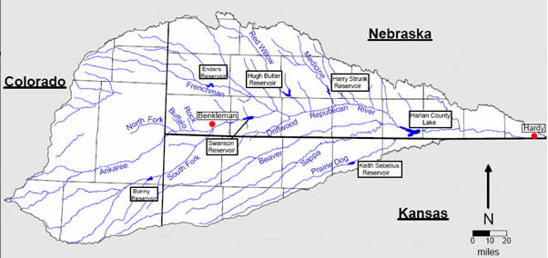
South Fork of the Republican River
From the Kansas State Research and Extension via KTIC:
The 2015 Central Plains Irrigation Conference and Exposition will take place Feb. 17-18 at the City Limits Convention Center, Colby, Kansas. The popular annual event focused solely on irrigation-related topics is hosted in Kansas every third year. Sponsors include Kansas State University, Colorado State University, the University of Nebraska and the Central Plains Irrigation Association.
The conference portion of the event will include many technical irrigation sessions presented by academic researchers from the areas of agronomy and irrigation engineering, for example, as well as representatives from governmental agencies such as the U.S. Department of Agriculture’s Agricultural Research Service.
Session topics include the crop water budget, optimizing crop water productivity in a variable climate, sensor technologies for irrigation management, advancements in subsurface drip irrigation and center pivot irrigation, updates on groundwater issues and crop options for deficit irrigation.
“The overall theme for this event from a crop water standpoint, particularly for western Kansas, is management with limited water supply,” said Danny Rogers, K-State Research and Extension professor and irrigation engineer. “But, the management issues we talk about with irrigation have application whether you have full water or limited water capabilities. There will be something for everyone.”
Bob Gillen, head of tri-center operations for K-State Research and Extension’s Western Kansas Agricultural Research Centers, will present the first day general session on lessons from 100 years of agricultural research in northwest Kansas. Ajay Sharda, assistant professor in K-State’s Department of Biological and Agricultural Engineering, will lead a general session discussion about the potential of technology and precision agriculture on the second day of the event.
The conference includes a menu-driven program, Rogers said, so participants can choose what to attend during the two days. The exposition side of the event will allow for industry representatives and irrigators to interact.
“Producers can come in and see, touch and talk about the new sprinkler options, soil sensors, plant health sensors, potentials for aerial sensors and other items out there,” Rogers said. “It’s a chance to have one-on-one conversations with industry folks, specialists and fellow irrigators.”
For a full list of sessions and presenters and the registration form, visit http://www.ksre.ksu.edu/sdi/REvents/CPIAprog.html. Register early by Jan. 30 at a discounted rate of $85 per person. After Jan. 30, registration is $100 per person. The fee covers access to technical and general sessions, the exposition and on-site meals. For more information, contact Donna Lamm at 785-462-7574 or donnalamm@yahoo.com.
More Ogallala Aquifer coverage here. More Republican River Basin coverage here. More Arkansas River Basin coverage here.
Significant portions of the Ogallala Aquifer, one of the largest bodies of water in the United States, are at risk of drying up if it continues to be drained at its current rate. Courtesy of MSU
Western Kansas is heavily dependent on the Ogallala Aquifer. But since 1950, that ancient supply of underground water has been rapidly depleted by irrigation. That irrigation produces corn, which is fed to livestock to support the beef and, more recently, dairy industries, which are the foundation of the western Kansas economy. But water levels have dropped so low in parts of more than 30 counties that irrigation pumps can no longer be used there. That’s why rivers in western Kansas are little more than dry stream beds.
Mark Rude is tracking the depletion of the aquifer for a groundwater management district in the heart of the affected area.
“We’re only 9 percent sustainable with that 2 million acre-feet that we use in southwest Kansas,” Rude says. “And 9 percent sustainable is a very formidable number, because you can’t conserve your way out of that.”
In other words, 91 percent of the water currently being pumped would have to be shut off just to keep the aquifer from declining any more. But if the water doesn’t come from the aquifer, where could it come from? The 2011 flooding on the Missouri River gave Rude and others an idea about how to answer that question. While devastating to those along the river, the flood looked like an opportunity.
“Folks who realize the deep value of water in western Kansas looked at that and go, ‘Wow, if we only had a couple days of that flow we could fill the aquifer, and we’d all be happy,’” Rude says.
Rude looked into that idea, and rediscovered the 1982 study proposing a system to capture excess water from the Missouri River and store it in a huge, new lake near White Cloud in the northeastern corner of the state. It would then be pumped uphill through an aqueduct to western Kansas. There it would be stored in another new lake — by far the largest in the state — for distribution.
The cost was estimated at $1,000 per acre-foot of water delivered. With that price tag, the concept was dead on arrival. But recently, the Kansas Water Office told the committee charged with updating the old study that the cost is now closer to $500 per acre-foot. The savings are due to lower interest rates. Cost is a concern for committee member Judy Wegener-Stevens, but it’s not the only reason she’s opposed to the project.
“I don’t feel an aqueduct should be built,” Wegener-Stevens says. “I feel that people in western Kansas have been pumping water unconditionally, without any rules, for 40 years, and they have not used their resource very well.”
Wegener-Stevens, who lives in White Cloud, said the nearby Iowa Tribe of Kansas and Nebraska would fight a proposed aqueduct. They have rights to water in the Missouri River and are working to quantify those rights. There might also be objections from other states, even though the idea is to take only “excess” water. Throw in anticipated battles over property rights and environmental concerns, and some committee members say the aqueduct still doesn’t appear realistic.
But committee member Clay Scott isn’t willing to give up on the idea. Three generations of his family raise cattle and grow irrigated corn and wheat near Ulysses, in southwest Kansas. Scott points to an Arizona aqueduct called the Central Arizona Project as proof that a Kansas aqueduct is feasible. He says a reliable source of water is vital to the future of his family’s farm.
“I’ve got three boys that are looking to maybe come back to the farm, but, you know, it takes a lot of acres in western Kansas to support a family — especially coming through these last three years of drought,” Scott says. “It’s a challenge to tell your boys that there’s an opportunity. There’s a future for you here.”
Scott and other members of the advisory committee say the first priority should be some sort of compact with other states and Indian tribes to secure rights to Missouri River water. Then they can worry about all the other obstacles to the project. Earl Lewis, the assistant director of the Kansas Water Office, agrees with that approach.
“Moving forward and investing considerable time and funds into pursuing a project that doesn’t have the legal security of a water right or some kind of compact doesn’t make a lot of sense,” Lewis says.
Even if the Missouri River doesn’t pan out as a water source, Lewis says there may be other options. State law could be changed to make it easier to transfer surplus water to western Kansas from other parts of the state. And Kansas may be able to get some financial help from Colorado, in exchange for providing water to ease shortages on the Front Range. But it will be up to others to explore those options and others. The advisory committee’s charge was solely to update the aqueduct study and make recommendations. Those recommendations are due by the end of January.
Wells are depleting the High Plains Aquifer at an alarming rate, according to a study released last week by the U.S. Geological Survey.
“The measurements made from 2011 to 2013 represent a large decline,” said Virginia McGuire, USGS scientist and lead author of the study. “This amount of aquifer depletion over a two-year period is substantial and likely related to groundwater pumping.”
The aquifer, also known as the Ogallala Aquifer underlies 175,000 square miles in Colorado, Kansas, Nebraska, New Mexico, Oklahoma, South Dakota, Texas and Wyoming.
Wells began tapping the aquifer heavily in the 1930s and 1940s, and the acreage irrigated expanded to 15.5 million acres in 2005 from 2.1 million acres in 1949.
The total water stored in the aquifer in 2011 was estimated at 2.92 billion acre-feet (951.5 trillion gallons). Pumping in two years depleted that by 36 million acre-feet (11.7 trillion gallons), causing an average drop in the aquifer of 2.1 feet. The overall rate of decline in the entire aquifer since pre-development is 267 million acre-feet, or 8 percent, resulting in a drop of 15,4 feet through 2013.
The change has been most significant in Texas, where levels dropped 44 feet in some places in the 2011-13 study period and 256 feet since pumping began. In some places, the well levels rose. With the highest rise since predevelopment recorded in Nebraska at 85 feet. Over time, Texas well levels have declined by 41 percent, and Kansas wells by 25 percent. Colorado dropped 14.3 percent over that same period, with more severe declines in the northern part of the state.
For the 2011-13 period, 7,460 wells were studied, 411 of those in Colorado. For the pre-development study, 3,349 wells were included, with 325 in Colorado.
“This multi-state, groundwater-level monitoring activity tracks water-level changes in all eight states through time and has provided data critical to evaluating different options for groundwater management,” said McGuire. “This level of coordinated groundwater-level monitoring is unique among major, multi-state regional aquifers in the country.”
Here’s the release from the United States Geological Survey (Virginia L. McGuire):
Abstract
The High Plains aquifer underlies 111.8 million acres (about 175,000 square miles) in parts of eight States—Colorado, Kansas, Nebraska, New Mexico, Oklahoma, South Dakota, Texas, and Wyoming. Water-level declines began in parts of the High Plains aquifer soon after the beginning of substantial irrigation with groundwater in the aquifer area (about 1950). This report presents water-level changes in the High Plains aquifer from predevelopment (generally before 1950) to 2013 and from 2011 to 2013. The report also presents change in water in storage in the High Plains aquifer from predevelopment to 2013 and from 2011 to 2013.
The methods to calculate area-weighted, average water-level changes; change in water in storage; and total water in storage for this report used geospatial data layers organized as rasters with a cell size of 500 meters by 500 meters, which is an area of about 62 acres. These methods were used to provide a raster dataset of water-level changes for other uses.
Water-level changes from predevelopment to 2013, by well, ranged from a rise of 85 feet to a decline of 256 feet. Water-level changes from 2011 to 2013, by well, ranged from a rise of 19 feet to a decline of 44 feet. The area-weighted, average water-level changes in the aquifer were an overall decline of 15.4 feet from predevelopment to 2013, and a decline of 2.1 feet from 2011 to 2013. Total water in storage in the aquifer in 2013 was about 2.92 billion acre-feet, which was a decline of about 266.7 million acre-feet since predevelopment and a decline of 36.0 million acre-feet from 2011 to 2013.
More coverage of the 2012 drought and its affect on the Ogallala Aquifer from Stephanie Paige Ogburn writing for KUNC. Here’s an excerpt:
In Northeastern Colorado, farmers growing food like corn and potatoes depend for water on a giant, underground reservoir. Called the Ogallala, or High Plains aquifer, this water source spreads across eight high plains states like a giant, underground lake.
In times of drought, farmers who use the aquifer for water take more of it. A report from the U.S. Geological Survey, published December 16, shows the 2012 drought significantly diminished the Ogallala’s water.
“The bottom line was, there was with the drought, increased pumping and you have decline of the water levels,” said Virginia McGuire, the U.S. Geological Survey scientist who authored the report.
Over the last six decades, Colorado has exceeded the aquifer’s resupply by 18.8 million acre-feet of water. An acre-foot is the amount of water needed to cover an acre of land one foot deep.
Between 2011 and 2013, the state used up 3 million acre-feet more than was recharged. Across most of the aquifer, other areas also used a whole lot of water during that period. Kansas and Texas, both hard hit by drought, caused the largest declines in Ogallala water levels.
McGuire, who has been tracking the aquifer’s water level for years, said she knew the drought would make an impact. She was a little surprised at how significant an effect it was, though.
“The story is drought was widespread and there were declines in most of the aquifer for the 2011 to 2013 time frame.”
Significant portions of the Ogallala Aquifer, one of the largest bodies of water in the United States, are at risk of drying up if it continues to be drained at its current rate. Courtesy of MSU
Significant portions of the Ogallala Aquifer, one of the largest bodies of water in the United States, are at risk of drying up if it continues to be drained at its current rate. Courtesy of MSU
The aquifer lost enough water over a recent two-year period to cover the entire state of Iowa in a foot of water, according to a new report by the U.S. Geological Survey that studies water level changes from 2011-13.
The vast underground lake that supplies water to wells in some of the country’s most productive agricultural land – including parts of Nebraska, Kansas, Colorado, Oklahoma and Texas – lost 36 million acre-feet of water from 2011-13. The aquifer has lost about 8 percent of its stored water since 1950.
Prolonged drought is mostly to blame for the recent depletion, said USGS’ Virginia McGuire.
“If you were a farmer in this area you would have known about the 2012 drought and you would have known about increased pumping in that time-frame,” McGuire said.
In parts of western Kansas and northern Texas, the aquifer is no longer a reliable or sustainable source for irrigation, which has forced some farmers to change how they use their land.
“They’ve had to make some adjustments in farmers going to dry land farming or maybe changing crop types,” McGuire said. “They’ve definitely had to adjust to the declining water levels.”
Irrigation is meant to supplement rainfall, but many arid parts of the Plains states haven’t received typical rainfall in recent years. Without irrigation, farmers may have to cut back on growing lucrative crops like corn and soybeans, in favor of crops like winter wheat and beans, which can require less water.
Significant portions of the Ogallala Aquifer, one of the largest bodies of water in the United States, are at risk of drying up if it continues to be drained at its current rate. Courtesy of MSU
Dick Wolfe, Colorado’s state water engineer, recently defined “sustainable groundwater supply” as one that is managed so that recharge matches withdrawals in a way to avoid long-term depletion of the aquifer.
By that definition, Colorado is not, for the most part, using its aquifers sustainably. Nor, for that matter, is most of the nation or world.
That much was made clear at a conference on Dec. 4 that was conducted by the American Ground Water Trust. Andrew Stone, the organization’s executive director, said 14 percent of all water used to irrigate crops in the United States comes from mining groundwater aquifers. This started slowly, but picked up as pumps and cheap energy became available around the end of World War II. The extraction by farmers and cities of water above the rate of recharge is now close to 400 cubic kilometers.
“We are robbing our savings account,” he said.
Driven by population growth and the uncertain effects of climate change, pressures on these subterranean savings accounts will only worsen, he said. This is not inevitable. He cited Los Angeles, which after World War II turned to groundwater exploitation to satisfy growth. “In the 1960s, it was pretty clear that the LA Basin was cruising for big trouble,” he said. But unsustainable exploitation has ended.
Problems of groundwater exploitation are common in many areas of the country, but solutions must be forged locally, “aquifer by aquifer, region by region,” said Stone.
Sobering statistics
The day was littered with fascinating statistics. Jeff Lukas, of the Western Water Assessment, explained that of the 95 million acre-feet that falls on Colorado, only 14 million acre-feet end up as runoff in our streams and rivers. The remainder, 80 million acre-feet, evaporates or gets drawn back into the atmospheric through transpiration. Together, the two are called evapotranspiration, or ET.
This rate of ET will almost certainly rise as the atmosphere warms. In the last 30 years, temperatures have ratcheted up 2 degrees Fahrenheit. Climate models forecast another increase of between 2.5 to 5 degrees by mid-century in Colorado. By mid-century, the hottest summers of the last 50 to 100 years will become the norm.
Too, everything from corn to urban lawns will need 5 to 30 percent more moisture during the longer, hotter summers—assuming precipitation does not increase.
How much precipitation will change as the result of elevated greenhouse gases in the atmosphere remains a mystery. Unlike temperatures, average precipitation in Colorado has not changed appreciably in the last three decades. Climate models have been clear about increasing temperatures, but precipitation remains a flip of the coin.
However, warming alone will drive changes, “pushing both the supply and demand in the wrong direction,” said Lukas. Increased evapotranspiration will reduce runoff and the amount of moisture available to percolate into soils and down into aquifers. Spring runoff has already accelerated and will come one to three weeks earlier.
Bottom line: Hotter temperatures will drive farmers to suck up more subterranean water. If anything, aquifers will recharge more slowly.
Wolfe, in his turn at the microphone, had even more statistics: Of Colorado’s 16 million acre-feet, 10 million acre-feet flow out of state, mostly as a result of compacts governing the Colorado and other rivers.
“That leaves us about 6 million acre-feet in Colorado to use,” he said. This surface water provides about 83 percent of water used in Colorado, and the other 17 percent comes from aquifers, which are tapped by 270,000 wells.
Of this groundwater, 85 percent goes to agriculture, for more than 2 million acres, but there’s also a strong urban component. One in five Coloradans get their water from wells. Most prominent are Denver’s southern suburbs in Douglas County.
Denver’s South Metro
South Metro has been a poster child for living in the moment. It’s affluent and rapidly growing. Served almost exclusively by wells, the residents of Castle Park, Parker and adjoining areas comprise about 6 percent of Colorado’s population but command 30 percent of income. Today’s population of 300,000 residents is projected to grow to 550,000 by mid-century.
Wells have been dropping rapidly, five feet in just one year in Dawson, one of the aquifers.
Eric Hecox, executive director of the South Metro Water Supply Authority, explained that it was always understood that wells would not last forever. The area had hoped to benefit from Denver’s Two Forks Dam, which was to have been filled primarily by expanded diversions from the Western Slope.
Two Forks was sunk by environmental concerns in the early 1990s. Inconveniently, Douglas County surged in population, routinely landing in the top 10 of the nation’s fastest-growing counties, a distinction that only lately has abated.
Other projects have also nudged the South Metro area off its exclusive dependence on groundwater, but even collectively they do not provide the answer. Hecox called for continued efforts to pinpoint needs while creating a new generation of partnerships and infrastructure.
Can South Metro’s needs for sustainable water supplies be answered by building a giant pipeline from Flaming Gorge Reservoir, on the Utah-Wyomng border? That idea was proposed in 2006 by entrepreneur Aaron Million, and then echoed by Frank Jaeger, the now-retired director of Parker Water and Sanitation District.
Hecox said the Bureau of Reclamation study about water availability from Flaming Gorge has not been completed. That study will provide the 14 members in Hecox’s South Metro coalition “base information on which to decide whether we want to pursue it any further,” he said.
Two key agriculture areas
Two agriculture areas in Colorado that rely upon aquifers are in arguably worse shape. The San Luis Valley has an area called the Closed Basin. With the arrival of electricity to farms in the 1950s, large-scale pumping began and, for a number of years, all went well, said Steve Vandiver, general manager of the Rio Grande Water Conservation District.
Despite earlier hints of problems, the magnitude of over-pumping started becoming apparent in 1998. One million acre-feet had been pumped from the aquifer above the amount of recharge. Figuring out what to do took time and negotiation. “There have been rocks thrown from every quarter,” he said.
The plan now in place has cut pumping by 30 percent during the last three years. The amount of irrigated acreage has declined from 175,00 to 150,000 acres. Water use on those remaining acres has been reduced in some cases by planting different, less water-intensive crops and also by using different irrigation methods.
Up to 300,000 cubic feet per second of water continues to be pumped on the fields in the Closed Basin on hot summer days.
And the Ogallala….
The Ogallala Aquifer is perhaps America’s best-known story of groundwater depletion. It extends over parts of eight states, from Texas to South Dakota, and the aquifer has declined at a shocking rate in several of those states, but more slowly or not at all in places, especially the Nebraska Sand Hills.
The Republican River Basin of northeastern Colorado is emblematic of many. Farmers working with local districts and the state government have been shifting the paradigm. Whether they’re shifting rapidly enough is an open question.
The river and its tributaries originate on the high plains, gaining no benefit from mountain snowpack. Yet this region had 480,000 irrigated acres in an area where annual precipitation is only 17 inches a year.
The key: mining the Ogallala. In the late 1970s, Colorado began taking action to slow the unsustainable over-pumping, but more radical measures were triggered by the need to comply with the interstate compact governing the river shared with Nebraska and Kansas. Colorado was forced to release more water downstream.
It did this partly by abandoning Bonny Reservoir, eliminating the evaporative losses. At greater expense, the district constructed an expensive pipeline and now pumps water—ironically from wells—to release into the Republican River at the state line. The total cost of the pipeline and the purchase of water rights was $48 million.
Much is being done to steer the Titanic away from the iceberg of exhausted aquifer water, but Deb Daniel, general manager of the Republican River Water Conservation District, suggested the magnitude of the challenge when she said: “Sustainable, that’s a scary word where I come from.”
Unlike everything else said in the day, several speakers argued that not enough pumping has been occurring along the South Platte River. Their solution: more reservoirs and also more acreage returned to production.
Robert A. Longenbaugh, a consulting water engineer, pointed to 400,000 acre-feet average annually flowing into Nebraska above the compact requirement. “I call that a waste of water,” he said. At the same time, he and others pointed to reports of basements in Weld County getting flooded because of rising groundwater levels.
Even in the 1960s, a Colorado law was adopted that formally recognized that aquifers and surface streamflows comingled waters . In other words, if you have a well a quarter-mile from the South Platte River at Greeley and pump it, that might mean less water in the river as it flows toward Fort Morgan.
The drought of 2002 forced the issue, and in 2006 the state put well irrigators into the priority system. In 2012, a hot and dry year, many wells had to be shut down and corn and other corps left to dry up. Longenbaugh called for changes.
“Strict priority administration of ground and surface rights does not maximize the beneficial use,” he declared. Instead, he wants to se a “real-time management of the South Platte, to monitor surface and ground water and “make short-term decisions” looking out six months ahead while still maintaining the priority-appropriation doctrine that is the bedrock of Colorado water law.
A panel of state legislators later in the day acknowledged varying degrees of agreement with Longenbaugh’s statement. Sen. Mary Hodge, a Democrat from Brighton, described a pendulum that went from “too lax” to now one of being “too stringent.”
Sen. Vicki Marble, a Republican from Fort Collins, described the situation as deserving of an “emergency measure.” She later added: “We should let people self-regulate,” while suggesting that the wells should be allowed to pump. “It’s their right,” she said.
Republican River Basin by District From the High Plains/Midwest Ag Journal:
Reflecting a new spirit of cooperation, Colorado, Kansas and Nebraska recently have reached an historic agreement during a special meeting of the Republican River Compact Administration. Representatives of the states have signed a resolution, approving operational adjustments in 2014 and 2015 under the Republican River Compact that will benefit water users throughout the Basin and set the administration on a course to find long-term solutions to persistent problems.
Chairman Brian Dunnigan, Nebraska Director of the Department of Natural Resources, cited recent comments by U.S. Supreme Court Special Master William J. Kayatta, who encouraged the states to work toward greater consensus for administering the waters of the Basin. “It is in that spirit that the states have negotiated the resolution that was approved today,” said Chairman Dunnigan.
The signed agreement addresses the operational adjustments address how water is administered for the benefit of irrigators in the Basin. It provides Nebraska with 100 percent credit for water delivered from augmentation projects to Harlan County Lake prior to June 1, 2015, and the delivered water is for exclusive use by Kansas irrigators.
The agreement is in addition to two cooperative agreements signed in October. Together, these three agreements change the traditional ways the compact has been previously interpreted and implemented for a more cooperative approach.
Kansas Commissioner David Barfield acknowledged the new resolution comes on the heels of another mutually acceptable pair of resolutions signed in October in Denver, Colorado. “Approving the resolutions will bring significant benefits to the states by preserving the remaining water supply in Harlan County Lake and providing additional certainty to water users throughout the Basin.”
“These resolutions reflect the states’ strong resolve on these matters,” said Dick Wolfe, commissioner from Colorado. “We know there is additional work to do, but we are moving in the right direction to reach long-term agreements that are fair to all parties and reflect good management of the Basin’s water supply.”
At an Oct. 22 Republican River Compact Administration meeting in Denver, Colorado, two of the agreements were signed. One of the agreements ensured the Kansas Bostwick Irrigation District in north central Kansas will have a viable irrigation water supply for the 2015 growing season while providing Nebraska certainty of the effectiveness of its compact compliance efforts. The other agreement ensured Colorado and Kansas will work towards improving Kansas’ water supply on the South Fork Republican River while authorizing Colorado to receive credit in the Compact accounting for operating its augmentation project on the North Fork Republican River.
Significant portions of the Ogallala Aquifer, one of the largest bodies of water in the United States, are at risk of drying up if it continues to be drained at its current rate. Courtesy of MSU
Ever since the Ice Ages, the Ogallala’s been slowly accumulating water. Modern farmers, though, pump so much water that this “timeless” aquifer is starting to run out. Someday up ahead, Northeast Colorado may have to curtail some crops, and some farm towns might become ghost towns.
Towns are few and far between vast expanses of short grass prairie in Northeastern Colorado. This semi-arid desert gets on average only 17 inches of precipitation every year.
But near the farming community of Wray, there’s a feedlot that depends on plenty of water. A few miles further away are mounds of freshly dug up potatoes and conveyor belts that hoist the spuds into trucks.
Around another bend, dinosaur-sized pivots watch over cornfields. Next spring, those giant sprinklers will spray enough water to grow row after row of leafy green stalks.
“Yuma County is one of the top two counties in the state, and sometimes ranked in the top 10 in the nation, for corn production,” says Deb Daniel, General Manager for the Republican River Conservation District.
This river basin springs from streams that bubble up from the Ogallala aquifer then flow east, starting in Northeastern Colorado around Sterling and Wray, and also around Burlington, near the Kansas border.
Daniel says the aquifer is how farmers in this area get their water.
“We don’t benefit from the snowmelt and the runoff that a lot of the South Platte and the Colorado River benefit from,” says Daniel. “All of our water here is stored underground and very very little of it is recharged.”
This region’s aqueous gold is the Ogallala Aquifer. Stretching from South Dakota down to Texas, the Ogallala is one of the world’s largest underground reservoirs. Think of it as an enormous bowl that’s hundreds of feet under ground, filled with sand, gravel and water that’s been drip-dropping in for thousands of years.
Daniel says she thinks of it as water within a sponge. “And we have all of these straws poked into this sponge from all of these irrigation wells, municipal wells, commercial wells for feedlots and hog confinement, so all of these straws are poked down into this sponge of water.”
Those “straws,” slurping the ancient Ogallala, add up to an enormous gulp. Colorado’s Deputy State Water Engineer Mike Sullivan says that if you think of how much snowmelt it takes to supply Denver, Boulder, Greeley, Fort Collins—the northern Front Range cities—that’s also how much farmers pump from the Ogallala in the Republican River Conservation District.
“They’re both withdrawing or diverting about 700,000 acre feet of water in an average year,” says Sullivan.
But there’s a big difference between snowmelt and the slow-to-recharge Ogallala. “One’s a renewable supply, and the other is a static supply that is being consumed,” adds Sullivan.
Legal battles over just who gets to “use up” the Ogallala have led the state to monitor pumping rates. A well house near a center pivot houses pipes, a pump, and a fist-sized dial, called a flow meter.
“Each year,” says Deb Daniel, “all the growers have to send in an annual water use report.”
According to water engineer Mike Sullivan, the goal is to get more stewardship tied to water use.
“You got a tremendous economy out there, and we don’t want to see that basically dry up and blow away.”
In shallower areas, the Ogallala already is drying up – in Southern Kansas, Texas, and in a small town near I-70, called Stratton, Colorado, where Tim Pautler lives and farms. Pautler is secretary of the board for the Republic River Conservation District.
“My domestic well, 50 years ago, probably had 50 to 60 to 70 feet of water,” says Pautler. “I’m down to 17. You go west of here, you can find farmsteads that are actually out of water.”
Pautler wants to save enough of his local part of the Ogallala so that maybe his grandkids can farm around Stratton someday. To keep this in mind, he shares what an old-timer told him about how to fill a glass of water:
“He says, before we had running water in the house, you had to go outside and hand pump your water, and the glass was right there,” Paulter says. “You didn’t rinse your glass. You just filled your glass. And you didn’t put anymore in the glass than what you could consume, because you didn’t want to throw it away. Things are going to go full circle. At some point we’re going to be going, gosh I wish I just had some of the water that I wasted in the last 50 years.”
Pautler has retired irrigation wells in exchange for government conservation money. His family is now growing drought tolerant wheat and dryland corn.
Mike Sullivan says that if flow meter monitoring leads to more water conservation, the Ogallala might change from an aquifer that’s drying up to one that can last.
Connecting the Drops is a collaboration between Rocky Mountain Community Radio Stations and the Colorado Foundation for Water Education. Find out more about water in the state at http://YourWaterColorado.org.
Republican River Basin by District From the Omaha World-Herald (Joe Duggan):
Nebraska, Kansas and Colorado have reached another key agreement on management of the Republican River for irrigation in 2015. Representatives from all three states, who serve on the Republican River Compact Administration, signed a resolution Wednesday that they said will benefit water users throughout the river basin, according to a press release.
The agreement credits Nebraska for augmentation water delivered to Harlan County Lake before June 1, 2015. Two projects, operated by several natural resources districts in Nebraska, pipe groundwater to the lake to be used for surface irrigation. Water delivered by the projects is for exclusive use by Kansas irrigators.
Wednesday’s agreement follows two related resolutions signed by compact members last month. Representatives from the states say the agreements demonstrate “a new spirit of cooperation” after years of legal battles between Nebraska and Kansas.
In October, the U.S. Supreme Court heard arguments on a special master’s recommendation on penalties for Nebraska’s overuse of compact water in 2005 and 2006. A final decision by the court is expected by the end of June.
Kansas has reached agreements with Colorado and Nebraska to allow for 100-percent credit for augmentation efforts to bring the latter two into compliance with the Republican River Compact.
The three states met as the Republican River Compact Administration in Denver on October 22, when the agreements were signed.
The agreement between Colorado and Kansas ensures that Colorado can operate its compact compliance pipeline again in 2015, and receive 100-percent credit for the water pumped into the North Fork of the Republican River near the Colorado-Nebraska border in extreme eastern Yuma County. The pipeline is operated by the Republican River Water Conservation District, and is being paid for by assessment fees on all groundwater users in Colorado’s Republican River Basin, with irrigation farmers carrying the bulk of the cost.
“The Republican River Water Conservation District appreciates the efforts of State Engineer Dick Wolfe and his staff in reaching this agreement with Kansas and Nebraska,” RRWCD General Manager Deb Daniel said. “We encourage the states to continue negotiations and permanently grant us 100 percent credit for the water delivered by the pipeline so that Colorado will continue to comply with the compact.”
The agreement signed last month is another one-year resolution, mirroring the one Colorado and Kansas are operating under this year. Colorado delivered 4,000 acre-feet to the North Fork from January to March 2014, and will finish delivering the water necessary to be in compliance for 2014, beginning Monday, November 10, and finishing by December 31.
Daniel said the plan is to pump an additional 2,500 to 3,000 acre-feet, although final calculations have not been compiled yet.
“We will deliver most of the water in November and early December,” Daniel said, “and slow the pipeline down as we get near the end of the year so that we only deliver as much water as is necessary to be in compliance with the pipeline.”
Under the next one-year agreement, Colorado will continue operating the pipeline in the first months of 2015, delivering 4,000 acre-feet by March 31 to begin meeting compliance for next year.
Calculations will be made throughout the growing season, and Colorado will deliver in November and December whatever amount is necessary to be in compliance for 2015.
Colorado has agreed to pump a minimum of 4,000 acre-feet each year to help alleviate some of the concerns Kansas has voiced during prolonged negotiations over the augmentation plan’s permanent approval.
The approximately 7,000 acre-feet to be pumped by the end of 2014 is just a little more than half of the approximately 13,000 acre-feet allowed, based on the historical consumptive use of the wells in operation. (Daniel said there are seven more wells that will be connected to the pipeline in the future, when it becomes necessary to deliver more water. The annual maximum capacity at that time will increase to 25,000 acre-feet, though the state still will deliver only what is necessary to meet compliance, besides the annual minimum 4,000 acre-feet.)
By comparison, Nebraska has pumped 63,500 acre-feet of water from two augmentation projects. Nebraska’s engineers have calculated the state needed somewhere around 40,000 acre feet this year to stay in compliance. It pumped more than needed because the projects at first were not receiving 100-percent credit. In fact, Nebraska would have received credit for only 37,000 acre-feet if the agreement had not been reached with Kansas.
Republican River Basin by District From the Associated Press via the Scott’s Bluff Star-Herald:
A new agreement about managing the Republican River’s water this winter suggests more cooperation is possible in the long-running dispute between Kansas, Nebraska and Colorado. The Lincoln Journal Star reports the states signed a one-year deal last month that allows Nebraska to keep some water in Harlan County Reservoir this fall, so it will be there next spring to help farmers downstream.
Without the new agreement, the 1943 compact between Kansas, Nebraska and Colorado would have required the water to be released this fall when farmers couldn’t use it…
But the new agreement could signal the states might be more willing to settle their water disputes cooperatively in the future but it’s still early, said Don Blankenau, who represents Nebraska in Republican River litigation.
“Until an arrangement like that becomes permanent, my enthusiasm is a bit contained, but I think it is a good start,” he said.
Kansas Secretary of Agriculture Jackie McClaskey agreed the pact appears promising.
To help make sure Kansas receives enough water, natural resource districts in Nebraska have bought thousands of acres of land along the Republican River and ended irrigation there. The water that had been used for irrigation is being pumped into the river to boost its flow.
Before last month’s agreement, Nebraska wasn’t getting credit for all the water being pumped into the river and the compact called for more water to be released this fall and winter, said Jim Schneider, deputy director of the Nebraska Department of Natural Resources.
“We basically went to them and said this water is going to have to get released if we’re going to follow the compact accounting as it is currently written. If you would like to avoid that, we’d like to talk about these augmentation plans as well,” Schneider said.
Now Kansas irrigators can receive between 20,000 and 25,000 acre feet of water next year when it will be more useful to farmers. And Nebraska farmers in the Bostwick Irrigation District will be able to use some of the water being kept in the reservoir.
The new agreement will also allow Colorado irrigators to use wells to pump water into the river to make up for that state’s overuse this year. [ed. emphasis mine]
Schneider said the states are close to finalizing a similar agreement for 2015. That should allow time for the states to work on a long-term compromise.
Republican River Basin by District FromThe Kearney Hub:
An agreement approved Wednesday by the Republican River Compact Administration gives Nebraska 100 percent credit for groundwater that natural resources districts are using to augment river flows for compact compliance. It also ensures that water stored in Harlan County Reservoir for compliance won’t go to waste, according to a press release from Upper Republican NRD officials in Imperial.
They said it is hoped the agreement will lead to a similar deal for 2015 and to a new, positive working relationship between Kansas and Nebraska that benefits water users in both states.
“The resolution approved by the RRCA allows water now being held in Harlan County Reservoir to be released to Kansas during the 2015 irrigation season when it can be beneficially used, without compromising Nebraska’s ability to maintain compact compliance,” Nebraska Department of Natural Resources Deputy Director Jim Schneider said. He chaired the meeting in Denver. “The ability of the states to work together in resolving these issues is a significant step forward.”
There are two augmentation projects: Rock Creek Augmentation Project in Dundy County operated by the URNRD and Nebraska Cooperative Republican Platte Enhancement project in Lincoln County operated by the Upper, Middle and Lower Republican NRDs, along with the Twin Platte NRD.
Combined, the projects will add about 63,500 acre-feet of water to the Republican River system for 2014. Without the agreement, Nebraska’s credit would have been 37,000 a-f.
Nebraska officials have said that without the augmentation projects to ensure adequate flows into Kansas for compact compliance an alternative could be shutting down irrigation on more than 300,000 crop acres in Nebraska.
URNRD General Manager Jasper Fanning said Wednesday’s agreement “should provide Nebraskans assurance that water being added to streams in 2014 effectively prevented a shutdown of more than 300,000 irrigated acres in the basin this year and that we aren’t being required to do more than what we should under the agreement.”
He said it benefits water users in both Kansas and Nebraska…
The agreement approved by representatives of the compact states, Colorado, Nebraska and Kansas, means Kansas water users could get 20,000-25,000 a-f next year and the balance could be used by Nebraska Bostwick Irrigation District irrigators downstream from Harlan County Dam.
The agreement follows last week’s oral arguments before the U.S. Supreme Court on a special master’s recommendation on penalties for Nebraska’s overuse of compact water in 2005 and 2006…
A final decision by the court is expected by the end of June.
On Tuesday, the Court heard arguments in an original jurisdiction dispute between Kansas, Colorado, and Nebraska over flows of a common river: the Republican River. After the states disputed the terms of their 1943 compact, they enacted a 2003 settlement stipulation. When the parties confronted a breach by Nebraska and a dispute over the water supply models they used to calculate Nebraska’s share, they reached an impasse. Kansas exercised its veto power, sending the dispute first to arbitration, then the Special Master and to the Supreme Court.
At oral argument, Kansas disputed the special master’s proposal to alter the settlement stipulation’s water accounting procedures based on a claim of mistake. Kansas spent most of its argument focused on the accounting procedures changes suggested by the special master. Kansas argued that the special master exceeded the charge and upset a carefully negotiated compromise by siding with one party. Nebraska similarly focused on the accounting issue, but characterized the carefully negotiated bargain as the principle that imported water should not be counted, with the formula representing a tool for implementation as opposed to a term. Justices pushed back on both sides.
Kansas argues Against the Five-Run Solution
Kansas Solicitor General Stephen McAllister came out forcefully arguing that the settlement stipulation itself was a carefully crafted compromise. McAllister stated that all parties were aware that the accounting procedure was subject to uncertainty. Kansas’s primary objection to the special master’s report involves the special master’s recommendation to amend the accounting procedure to implement Nebraska’s proposed “five-run solution.”
Justice Stephen Breyer pushed back on the argument against reformation, noting pointedly that, due to a mistake in the model, Nebraska’s use of “imported water” from sources outside the Republican River basin is counted against it under the settlement stipulation’s accounting procedures. Justice Breyer continued: “And nobody wanted that. That would be totally unfair. … So what do you suggest we do about the mistake? Nothing?”
McAllister responded that they should send the case back and do nothing about the mistake, since it is not a mutual mistake. He emphasized that the intersection between the “five-run solution” and other issues were highly complicated and that Nebraska had gotten concessions in other areas of the settlement which kept the accounting mistake from being unfair. McAllister pointed out the effect of groundwater recharge credits as an example: “We gave Nebraska a high credit for groundwater recharge at a percentage much higher than Colorado and Kansas get and Nebraska crowed about that as a concession they got from Kansas that was worth 15 to $20 million annually, that’s Exhibit K, 133, in the record.”
Justice Antonin Scalia asked McAllister about the role of deference in the case. McAllister said that there was no deference owed the special master and argued that the special master ignored trade-offs. McAllister asserted that the parties needed to renegotiate the entire set of trade-offs in order to be fair, rather than allowing the special master to set aside one set of trade-offs to the benefit of Nebraska and Colorado.
Chief Justice John Roberts asked what Kansas thought of its chances if the matter were sent back to the Republican River Compact Administration, for resolution. (All disputes under the compact are run first though this body, consisting of one representative of each of the three states.) McAllister responded, “Twenty-some years ago, Kansas introduced a resolution in the RRCA that said, how about we all resolve that we will comply with the compact. Kansas voted yes, Colorado voted yes, and Nebraska voted no. So this goes back a long ways.” McAllister went on to explain that its proposed disgorgement remedies against Nebraska were necessary.
The United States argues for the special master’s disgorgement remedy
Assistant to the Solicitor General Ann O’Connell argued on behalf of the United States in support of the special master’s Report. O’Connell defended disgorgement by pointing out that disgorgement must be sufficient to discourage opportunistic breach, citing to the Restatement of Restitution and Unjust Enrichment. Justice Scalia asked whether the United States was overstating case law by citing the Restatement, telling her that “I don’t think the Restatement can change our law by just saying something by consensus of law professors.” O’Connell cited back to the classic case of Texas v. New Mexico to support her position. In response to questioning about the amount of disgorgement, O’Connell avoided taking any position at odds with the special master. Justice Kagan asserted that the $1.8 million figure recommended was less than what Nebraska had gained by its breach, arguing against an equitable balancing approach.
Nebraska argues that Kansas’s veto requires the Court to break the impasse
David Cookson, Nebraska’s chief deputy attorney general, argued that the bargain Nebraska struck with Kansas was that water imported from the Platte River Basin would not be counted towards Nebraska’s allocation of the Republican River. Justice Scalia questioned whether the deal was actually that broad, suggesting instead that Nebraska had agreed to a formula, not a broader principle.
Scalia explained: “The parties knew that this formula would not be entirely accurate and they agreed to a fair price, that is, none of this water should be counted. But they said the way to figure out whether this water is coming in or not is this formula. Why shouldn’t they be held to that formula?”
Cookson responded that the settlement specifically provided the parties with the ability to modify the accounting formulas. Nebraska asked the Republican River Compact Administration to modify the accounting procedures, to which Kansas objected exercising its veto powers. The issue was then sent to arbitration and finally to the special master who recommended the change to the formula, the “five-run solution.”
Chief Justice Roberts asked Cookson if he agreed that the special master would have been powerless to change the formula if it had been part of the original compact as opposed to a later settlement. Cookson readily agreed that amending the compact would be beyond the power of the special master, citing Alabama v. North Carolina for support.
Justice Kagan picked back up the thread of Justice Scalia’s question and extended it further. She asked Cookson what would happen if the parties had negotiated over three distinct formulas and had chosen one. Under that situation, she wanted to know, would it be right to continue to use the formula chosen going forward? Cookson pushed back that changing the accounting procedures is basic process under the agreement, and that prior to the current dispute, fourteen such formula changes have been approved by the three states. Cookson continued that this time is different, because Kansas has objected. He reasoned that the exercise of a veto can kick the dispute to the Supreme Court to break the impasse created by the veto process in the compact itself, likening the problem to the one faced in the Pecos River Compact, brought before the Court in Texas v. New Mexico.
Chief Justice Roberts countered that the formula, as specific language in the contract, should control the general statement that imported water not be counted. Cookson argued that the imported water stipulation was the specific term and the formula was just the tool designed to deliver that deal.
Cookson defended Nebraska’s response as not showing an intentional violation of either the compact or the stipulation. He argued that Nebraska could not have foreseen dust-bowl-like conditions. He argued that there is no need for an injunction or for disgorgement, tangling with Justice Scalia again on how those remedies interact.
Kansas rebuts Nebraska’s argument that the formula was just a toolkit
In rebuttal, McAllister returned to Justice Kagan’s line of questioning the choice of formulas for accounting made by the parties in the settlement stipulation. McAllister pointed out that the formula that Nebraska is seeking to have reformed was actually selected by Nebraska as its first choice during settlement negotiations. Citing the result in the boundary dispute of New Hampshire v. Maine, McAllister told the Court that it had given “New Hampshire the answer we think you should give Nebraska today, which is: ‘Sorry; you made the deal, and just because you now think you have a better way of doing it doesn’t mean we should rewrite the contract.’”
In closing, Justice Sonia Sotomayor asked McAllister how much money is represented by the difference between the accounting preferred by Nebraska and that preferred by Kansas. McAllister answered with the amount of water in dispute – between 8,000 and 10,000 acre-feet. (An acre-foot is the amount of water needed to cover an acre of land to a depth of one foot, approximately 325,851 gallons.) When Sotomayor pressed for a dollar figure, McAllister told her that the special master had valued the water to Nebraska at $362 per acre-foot. On that note, the Court adjourned.
Ryke Longest is the Director of the Environmental Law and Policy Clinic and a Clinical Professor of Law at the Duke University School of Law.
The nine justices of the U.S. Supreme Court heard oral arguments from Kansas and Nebraska Tuesday on the 2013 findings of Special Master William Kayatta, Jr.
Kayatta issued the ruling last year in an ongoing dispute dating to 2010 between the two states over Nebraska’s overuse of water in 2006.
Kayatta recommended Nebraska pay Kansas $5.5 million—$3.7 million as the actual damages Kansas suffered by Nebraska’s overuse; and $1.8 million to Kansas for the gain Nebraska received by pumping extra water in 2006.
He also said the accounting methods used to calculate water supplies in the Republican River Basin should be revised.
Two primary issues
The oral arguments by the states and questioning by the justices Tuesday centered on two main subjects:
Whether Kansas was entitled to a significant disgorgement or damage payment for Nebraska’s compact violation; and
Whether new accounting procedures for measuring imported water supplies into the basin, sought by Nebraska and recommended by Kayatta, should be allowed.
Kansas Solicitor General Stephen McCallister was the first to present arguments before the high court and set out by addressing the changes in the compact accounting. He said Kansas does not agree with Nebraska and the special master that the method for calculating imported water supply should be rewritten.
“That agreement itself (2002 settlement) was a complex set of concessions and compromises,” he told the justices.
The water model is an estimation at best of what’s going in the basin, he said. Parties were aware of the imported water phenomenon when the agreement was reached, he added. He said it wasn’t fair the water master focused solely on what Nebraska wanted changed while Kansas had issues that weren’t addressed. Justice Sonia Sotomayor said Kansas was invited to provide a better solution to the accounting issues but did not. McAllister said they were working on one but didn’t have time to develop it.
If contract principles were applied to the disagreement, the remedy would be to rescind the compact settlement.
“And I don’t think you want that,” Sotomayor said. McAllister agreed that none of the states would want that.
So if rescinding the agreement isn’t possible, she said, then it falls back to reforming or revising the contract.
She asked McCallister, “If Kansas couldn’t come up with an alternative, why shouldn’t the court just accept the special master’s recommendation?”
McCallister said Nebraska’s change in accounting procedures came late in the process, as a counterclaim during arbitration.
Justice Ruth Bader Ginsburg asked about the process when the states can’t agree.
McAllister said there’s the option of non-binding arbitration, “which we all love and almost always works out our disputes.”
If that doesn’t work, and the states feel strongly about it, they can request a special master, he said. “But again, I don’t think we’ll get there because the parties can and have negotiated successfully.”
Sotomayor was skeptical of this. “But I thought you had gone through the alternatives,” with no resolution, she said.
He said they brought this case to the high court because Kansas believed there was a compact violation by Nebraska that needed a remedy.
Disgorgement remedy
That remedy would be for the justices to grant Kansas a significant disgorgement payment from Nebraska to get their attention, McAllister said.
Disgorgement is defined as the forced giving up of profits obtained by illegal or unethical acts.
Of the $80 million Kansas sought in damages, they designated $60 million as profits or unjust enrichment Nebraska received by their overuse of water.
Justice Antonin Scalia said disgorgement payments aren’t a normal contract remedy and require an intentional violation.
McAllister said if Nebraska only has to pay Kansas $3.7 million, there’s little incentive for compliance, especially if a dispute can drag out eight years before any possibility of recovery.
Justice Samuel Alito, Jr. said Kayatta found Nebraska didn’t intentionally violate the compact agreement.
McAllister said the master did find that Nebraska “knowingly exposed Kansas to a risk of violation.”
While they didn’t purposefully violate, they did violate it, McCallister said. “I think you have to say it’s more than negligent.”
McCallister continued, “Nothing less than a substantial disgorgement award seems to really get their attention. And here it has gotten their attention and it has also gotten Colorado’s attention.”
Justice Dept. sides with Kansas on disgorgement
Ann O’Connell, Assistant to the Solicitor General, U.S. Department of Justice, said disgorgement should be an available remedy when a state violates an interstate water compact.
She said the monetary remedy would “help to stabilize compacts and ensure the states are working vigorously to meet their compact obligations.”
Justice Scalia reiterated the need for intentional violation in contract law and asked O’Connell for cases where the high court imposed disgorgement, even in the case of intentional violation. She could not cite any.
She did cite a case between Texas and New Mexico where disgorgement could be a possible remedy. She continued, “It certainly left that door open.”
“For an intentional violation?” Scalia questioned. “Yes,” she replied.
“But we’ve never done it, have we?” Scalia asked. “No. And this is a novel . . .” she said before Scalia cut her off.
At the end of her argument, O’Connell did go on record that the Justice Department does support the special master’s recommendation to revisit the compact accounting methods.
Nebraska wants accounting change, not high damages
Nebraska’s Chief Deputy Attorney General, David Cookson, was the final lawyer to present arguments. He stated the compact settlement specifically says the accounting will not count imported Republican River water and requested the court approve Kayatta’s recommendation for the accounting change.
Scalia challenged him, saying the settlement included how such a water supply be determined—by a formula—and that was agreed to.
Cookson countered, saying the deal Nebraska agreed to was not the formula.
“The deal we made was not to count imported water,” he said.
He said the final settlement made it clear that accounting procedures could be modified at any time through the appropriate process.
Cookson said Nebraska followed that process, by going to the three-state compact administration. After Kansas objected, non-binding arbitration was sought.
“The master agreed the mistake occurred, sent it back to the RRCA (Republican River Compact Administration) to develop a solution. This was all presented to Kansas in 2007,” Cookson told the justices.
He said the accounting procedures are a technical appendix to the settlement and were not part of the settlement agreement.
Scalia asked if the final settlement could be amended by mutual agreement.
Cookson said no, because the three states, in the final settlement, put in a non-severability clause that they couldn’t change it. Cookson made the distinction that the accounting procedures could be changed and cited case law where the court allowed appendixes to state settlements to be changed. In addition, he said the accounting procedures appendix was not included as part of the compact settlement when it was approved by Congress.
Chief Justice John G. Roberts, Jr., said the settlement is an agreement between two sovereign states.
“The idea of a special master or this court changing the nature of that agreement is a pretty radical one,” he said.
Cookson responded, “But we’re not changing that agreement. The agreement in the final settlement stipulation is do not count imported Platte River water.”
When negotiating the settlement, Cookson asserted the parties knew the accounting procedures would change as things moved forward. He cited roughly 14 changes that have already been made and approved by the compact administrators. He said Kayatta’s recommendation doesn’t reform the compact settlement, just the technical appendix
on accounting procedures.
Disgorgement not justified
On the issue of disgorgement, Cookson said Nebraska took exception to the award because the state did not deliberately violate the compact.
Justice Elena Kagan said the special master and Justice Department Solicitor General characterized Nebraska as “a conscious wrong-doer, that you failed to act, refused to act in the face of known risk.”
Cookson took exception, noting that Nebraska took control of consumptive use in 2002, while the settlement was still being negotiated. In addition, through 2006, the state reduced its pumping by 500,000 acre-feet, a 35 percent reduction. He said it was not possible for Nebraska to foresee its allocations would fall even below the record lows that occurred during the Dust Bowl of the 1930s. He urged justices to understand that allocations in the settlement were based on a 10-year period of the Dust Bowl. He said it was reasonable for Nebraska to believe allocations would never go below those of the Dust Bowl.
“And yet in ‘05 and ‘06, our allocations significantly fell below the Dust Bowl,” he told the justices.
He said Nebraska conceded it fell short of compliance in 2006 and offered to pay Kansas its actual damages.
Since then, Cookson said Nebraska has remained in compliance “even in the driest condition now of record in the basin.”
For these reasons, he said Kansas’ claim of unjust enrichment “as a means of disgorging gain to Nebraska” is not appropriate.
In rebuttal to Cookson’s arguments, McAllister said the court should give Nebraska this answer on changing the accounting method: “Sorry; you made the deal, and just because you now think you have a better way of doing it, doesn’t mean we should rewrite the contract.”
Nebraska delegation attends
A Nebraska delegation including representatives from the Department of Natural Resources, the Attorney General’s office and attorneys and natural resource district officials closely associated with the case attended the oral arguments. Those attending from the Upper Republican NRD included Manager Jasper Fanning, Assistant Manager Nate Jenkins and Board Member Jason Kunkel.
The justices will now review the case and render a decision which could occur sometime before the end of the year but no later than the end of June 2015.
The court heard oral arguments Tuesday in the latest twist of the 1943 Republican River Compact signed by Kansas, Nebraska and Colorado. The case pits Nebraska against Kansas — not only over the amount of money Nebraska owes, but also to set the ground rules for what are sure to be future battles over the use of a critical but stressed resource.
Justices had sharp questions for both sides. They expressed skepticism about Kansas’ claim for higher damages as well as Nebraska’s desire to rewrite the formula used to calculate water usage.
As is typical in such interstate disputes, a special master earlier had reviewed the case for the court. He found that Nebraska owes $5.5 million — $3.7 million in basic damages with an additional $1.8 million attributed to the gains made by Nebraska farmers as a result of the violations. Nebraska is challenging the extra $1.8 million penalty.
Kansas Solicitor General Stephen McAllister, however, urged the justices to go significantly higher in penalizing Nebraska, contending that Nebraska’s actual gains were much larger than $3.7 million, or even $5.5 million. If Nebraska winds up with more in benefits than it is penalized for the excess water, he said, it will have no incentive to work hard at compliance in a future drought.
Justice Antonin Scalia focused on the extra penalty that Kansas is seeking.
“You want more than damages,” Scalia told McAllister. “You want to say, ‘I not only want to receive what it cost me, what your violation cost me, but I want in addition to receive any benefits that you got from the violation.’ … That’s not a normal contract remedy.”
Justice Samuel Alito pointed out that Nebraska’s violations of the compact had been ruled unintentional. But McAllister said Nebraska knew it was exposing Kansas to risk and described it as “more than negligent” on Nebraska’s part.
“These were massive violations on Nebraska’s part, knowing they were in trouble and just really not taking any kind of adequate steps,” McAllister said.
Nebraska Chief Deputy Attorney General David Cookson defended Nebraska’s efforts to stay in compliance
with the compact and to mitigate the situation once the problems were revealed. Still, he faced questions from Justices Elena Kagan and Ruth Bader Ginsburg, both of whom cited the special master’s findings that while Nebraska’s violations were not an intentional breach, the state should have seen what was coming.
“The special master also said essentially … that you were a conscious wrongdoer, that you failed to act, refused to act in the face of a known risk,” Kagan said to Cookson. She said the special master found that “unless there was some very lucky fortuitous thing that happened, the quite foreseeable effect of your actions was going to be that Kansas didn’t have enough water.”
Cookson said Nebraska does not agree with the findings about what Nebraska should have known or the idea that it took no action.
“Nebraska seized control of its consumptive use in 2002 while it was still negotiating the compact, and through 2006 reduced its pumping (by 35 percent),” Cookson said. “At the same time, however, Nebraska could not reasonably foresee that its allocations were going to fall even below the historical low period of record in this basin, which was the Dust Bowl.”
Nebraska also has asked the court to go along with the special master’s finding that the formula for calculating water usage should be reworked because it is unfair. Chief Justice John Roberts expressed skepticism about taking such a step, however.
“The idea of a special master or this court changing the nature of that agreement is a pretty radical one,” Roberts said.
The court is expected to rule before the end of the year.
After the arguments, Cookson told The World-Herald that it’s impossible to gather from the court’s questions which way the justices are leaning. They often play devil’s advocate and push harder on the side they ultimately agree with in order to sharpen the arguments in their favor.
“The court was very engaged,” Cookson said. “They asked questions that pushed the boundaries of both sides’ arguments.”
The Supreme Court tomorrow will wade into a decades-long water use dispute between Kansas and Nebraska.
At issue is a localized disagreement among the two states and Colorado over an interstate compact that allocates water from the 430-mile Republican River.
The river — which rises in Colorado, crosses the northwest tip of Kansas before crossing into Nebraska, and then re-enters north-central Kansas — travels a sparsely populated area. It drains a nearly 25,000-square-mile watershed, and more than 1.8 million acres of land is irrigated using its water to grow crops like corn, soybeans and milo.
Use of the river has been contentious since the three states sought to create a compact in the early 1940s. President Franklin Roosevelt vetoed the first version, and later signed the congressionally ratified compact in 1943.
The case is narrow in scope and is unlikely to yield a ruling from the justices with broad implications.
Kansas has long claimed that Nebraska is using more than its allotment. The state first took the case to the Supreme Court in 1999, claiming that Nebraska’s groundwater pumping was depleting the river.
That case led to a 2003 settlement that added groundwater to the terms of the compact.
However, by May 2010, Kansas claimed that Nebraska used about 79,000 acre-feet more than its allotment in 2005 and 2006. It again asked the high court to review the case, and the court, for the second time, appointed a federal judge — or “special master,” in court parlance — to resolve the dispute.
The judge’s report found that Nebraska did knowingly violate the compact in 2005 and 2006, but has since taken steps to come into compliance. It recommended requiring Nebraska to pay Kansas $5.5 million, roughly the equivalent of the water Kansas lost plus a $1.8 million penalty.
It also recommended amending how the states administer the compact by changing its accounting procedures to include water entering the basin that is not part of the Republican River’s “virgin water supply.” “Imported water” drains into the basin every year from the Platte River, which sits at a higher elevation to the north.
The original compact did not include water that migrated from the Platte River, and the judge reasoned that use of the imported water should not count against a state’s Republican River allotment.
The judge suggested that the Supreme Court adopt a “five-run solution” proposed by Nebraska and backed by Colorado that more accurately reflects groundwater consumption and imported water.
Tomorrow morning, the justices will consider each state’s exceptions to the report’s recommendations. Kansas, for example, does not want to rewrite the compact’s accounting procedures and is seeking more money from Nebraska for its violations. It is also seeking an injunction to bar Nebraska from taking too much water from the basin.
Nebraska, on the other hand, contests the $1.8 million penalty to be awarded to Kansas and takes exception to the judge’s conclusion that it “knowingly failed” to comply with the compact.
The Obama administration has also weighed in on the dispute and has urged the justices to uphold all of the judge’s recommendations.
“The United States supports the Master’s report,” Solicitor General Donald Verrilli wrote in court documents, adding that the government supports “overruling the parties’ exceptions.”
The court will rule on Kansas v. Nebraska and Colorado by the end of next June.
Nebraska’s regulatory landscape is significantly different now from when the state consumed more Republican River water than allocated in 2006.
So is some of the physical landscape in and around the basin in southwest and south-central Nebraska.
There are stricter regulations on how much underground water farmers may pump to irrigate cropland. Two pipeline projects pour water into the Republican River to supplement flows during dry periods. And there are fewer acres of irrigated cropland.
Nebraska’s biggest challenge under a 71-year-old interstate compact that shares the river water with Kansas and Colorado has been staying within its allotment in dry years. Now the state should never again find itself violating the compact in dry years, said Dean Edson, executive director of the Nebraska Association of Resources Districts.
“Everything’s in place,’’ he said. “Taxpayers are protected, the aquifer is protected and the irrigated-acre tax base of rural communities in the basin is protected.’’
New state laws, tighter regulations and innovative projects by the Upper, Middle and Lower Republican Natural Resources Districts and the Twin Platte NRD have made the difference since 2007, Edson said.
The estimated 1.1 million irrigated acres in Nebraska’s portion of the river basin represent what is believed to be the largest area of regulated groundwater use in the eight-state region that overlies the Ogallala Aquifer, a vast underground reservoir of fresh water.
No other state has more stringent water-pumping regulations than Nebraska, Edson said. Allocations in Nebraska’s Republican basin have declined to between 9 and 13 inches annually. That’s approximately 45 percent less than allowed in neighboring Kansas, Edson said.
Rules and regulations have helped produce rising aquifer levels in some regions, stabilized levels in others and significantly slowed rates of decline elsewhere, he said. Further reductions in water use are assured by requirements agreed to with the State of Nebraska that groundwater pumping volumes decrease by 20 percent, to 1998-2002 levels. An additional 5 percent reduction is required by 2015.
Nearly two years ago, four Natural Resources Districts bought 19,500 acres southwest of North Platte that lie squarely between the Platte and Republican Rivers. About 15,800 of those acres were irrigated and now are retired from irrigated production.
A six-mile pipeline is taking water from about 30 wells that would have been used to irrigate crops on that land and delivering it to the Republican via Medicine Creek. The 42-inch-diameter pipeline was used for the first time this year to meet Nebraska’s flow obligations to Kansas.
“Without this project, severe and sudden reductions in water allocations might have to have been imposed on irrigators in the basin,’’ Edson said.
Edson said the willingness of landowners to impose a $10 per irrigated acre tax on themselves made the project possible.
“I’ve not met anyone yet who wants their taxes raised, but if we don’t augment stream flows, we’d be looking at the forced shutdown of at least 300,000 irrigated acres, or nearly a third of the irrigated acres in the basin,’’ he said. “It’s pretty doggone cheap compared to what they could lose. It would be devastating.’’
A similar project in the southwest corner of the state retired 3,260 irrigated acres in Dundy County. Water that would have been consumed by crops is sent seven miles through a 24-inch pipeline to Rock Creek for delivery into the Republican River.
The Republican River begins in Colorado on the eastern side of the Rocky Mountains, then flows through part of Kansas. The river then crosses and into Nebraska before crossing back into Kansas, where it then turns southeasterly. In Junction City, Kansas, it joins with the Smoky Hill River to become the Kansas River, a tributary of the Missouri River.
More than 24,000 square miles of watershed on the Great Plains support the flow of the Republican River. This territory contains rich agricultural soils and relatively abundant average annual rainfall. During the Great Depression, the three states and the federal government planned to use the Republican River for water resource development. This area was at the western edge of the Great Plains Dust Bowl, which experienced horrific dust storms in 1934 through 1935 that carried tons of soil through the air as far as the Atlantic Ocean.
Federal relief programs were mobilized to help the residents respond to the terrible conditions. A devastating flood on the Republican River in 1935 hastened along state and federal planning to create both flood control and irrigation projects. Federal agencies endorsed the need for the projects as well as their feasibility, but the Bureau of Reclamation warned that they should not go forward until the three states entered into a compact.
The states had agreed to terms within a few years, but President Franklin Delano Roosevelt vetoed the first attempted compact in response to objections by federal agencies. On December 31, 1942, on their second attempt, the federal government and Colorado, Kansas, and Nebraska agreed to an interstate compact to allocate water flowing in the Republican River. This compact was then ratified by the state legislatures, approved by Congress and signed into law by the President on May 26, 1943. However, rather than resolving all controversy about water allocation between the parties, the compact merely moved the locus of the disputes. Since its signing, disputes between the states over water use focus on the compact’s terms.
Origin of disputes under the Compact
Flows in the Republican River have been declining for decades, with reduced flows in nearly all its tributaries. The reduced flows alarm farmers in all three states who rely on irrigation to keep crops at profitable yields. As the primary downstream users, Kansans look to the compact to protect them from overuse by upstream users. As the state with the largest allocation, Nebraskans look to the compact to protect their farmers from unreasonable demands from Kansans.
When use increases and flows decrease, disputes follow. As the aphorism often attributed to Mark Twain goes, “Whiskey is for drinking, but water is for fighting.” Disputes among users and their political leaders come quickly behind the spread of economic prosperity.
Under the compact, disputes first flow through the Republican River Compact Administration, which consists of one representative of each of the three states. Following ratification, all states needed to change water resource allocation laws within their respective states to ensure compliance with the new compact’s requirements. In 1945, Kansas enacted a statute that combined allocation of groundwater and surface water into a unified permitting system using prior appropriation principles. In Nebraska, allocation of groundwater remained subject to restriction by common law principles of reasonable use within the context of correlative rights as set forth in the 1933 case of Olson v. City of Wahoo. The state codified these principles in 1975 and later adjusted its groundwater law in 1996 with amendments under LB 108, promoted by Nebraska Governor Ben Nelson. Nebraska’s efforts under LB 108 were clearly designed to prevent allocation of groundwater in a way that causes violations of an interstate compact. Yet its critics maintain that these efforts hampered management by putting the fox in charge of the henhouse (local Natural Resource Districts).
Groundwater’s special place
When the compact was signed, one of its key purposes was to remove all causes that “might lead to controversies.” Yet, within its key terms lay the seed of controversy: the term “Virgin Water Supply.” It was defined as the “water supply within the Basin undepleted by the activities of man.” Nebraska interpreted the caveat “within the basin” to exclude groundwater pumping from the scope of activities that deplete the Virgin Water Supply. The compact defines “basin” as the “area naturally drained by the Republican River and its tributaries.” Nebraska’s argument unduly restricted the scope of the Virgin Water Supply by taking the groundwater that drains into the Republican River and its tributaries out of the compact.
In many places, the Republican River is a gaining stream, one where groundwater from alluvial and surficial aquifers seeps into the riverbed. Excluding groundwater from allocation formulas in a gaining stream will always lead to problems unless groundwater pumping from alluvial and surficial aquifers is completely prohibited. In a gaining stream system, these aquifers are just as important sources to stream flow as the surface tributaries. However, these flows are harder to measure, model, and quantify.
Litigation before the Supreme Court: Round I
In 1999, the Supreme Court granted Kansas’s motion for leave to file a bill of complaint. Kansas complained that Nebraska had violated the compact by allowing proliferation of thousands of groundwater wells that were connected to the Republican River. Kansas’s complaint asserted that Nebraska’s regulatory apparatus failed to prevent the violations into the future, and it asked for damages and a decree commanding Nebraska to meet its delivery obligations under the compact. Nebraska sought leave to file a motion to cismiss the complaint under Federal Rule of Civil Procedure 12(b)(6) and presented affirmative defenses to Kansas’s complaint. Nebraska’s Rule 12(b)(6) motion was limited to the question whether the compact applied to groundwater consumptive use within Nebraska. Colorado responded that groundwater from alluvial aquifers was included within the compact but groundwater from the deeper Ogallala aquifer was not. The Court appointed a special master to preside over the hearing, after which the special master’s report recommended that Nebraska’s motion be denied. In June 2000, the Supreme Court denied Nebraska and Colorado’s exceptions and sent the case back. Following a series of memoranda on various issues by the special master, the parties negotiated a settlement stipulation.
Republican River Compact settlement stipulation
The settlement stipulation imposed additional obligations on the parties beyond those required by the Compact itself. All parties waived any claims against each other arising prior to 2002, and the stipulation required a drilling moratorium on wells within the Republican River Basin. It also explicitly recognized that groundwater was a component of the Virgin Water Supply. Beyond that, the parties to the current dispute disagree about significant aspects of the settlement stipulation as well as the special master’s report. While the stipulation established that the scope of covered water was water originating in the basin, there arose a dispute over the method of accounting for “imported water” – water that was originally part of the neighboring Platte River Basin but now percolates into the Republican River. In places, this seeping imported water had raised the water table by ten feet. The special master has proposed changing the accounting procedure so that Nebraska may use water imported from the Platte. Kansas vehemently objects that this change violates the terms of the compact.
Each state will argue objections to the special master’s report. Expect to hear Kansas argue forcefully in favor of the Court strengthening its disgorgement remedies against Nebraska and requesting injunctive relief. Nebraska will argue that the special master’s disgorgement remedy was too harsh. Nebraska also admits that it overused its allocation for the year 1996, but that in so doing it did not violate the compact but took steps immediately thereafter to reduce consumptive use and to pay Kansas for its actual damages. Kansas also objects to the special master’s proposed amendment to the settlement stipulation, a remedy defended by Nebraska.
Colorado will argue that the disgorgement is not allowed for unintentional violations by Nebraska and that the proposed award represents a windfall for Kansas. The Solicitor General will argue that the special master’s report falls within the scope of the broad discretion afforded the Supreme Court in fashioning remedies for breaches of compacts. He will defend the partial disgorgement remedy as protective against efficient breach concerns, but he will also argue against Kansas’s request for injunctive relief. It will be interesting to see whether the Court inquires about injunctive relief as a further protection against efficient breach concerns.
Significant portions of the Ogallala Aquifer, one of the largest bodies of water in the United States, are at risk of drying up if it continues to be drained at its current rate. Courtesy of MSU
Ogallala aquifer via USGS
Ogallala aquifer boundaries
Here’s the blog post from the US Department of Agriculture:
James Pike has tackled an important and thorny issue in Laramie County, Wyoming – water conservation. More specifically, this district conservationist with USDA’s Natural Resources Conservation Service (NRCS) has diligently worked to encourage farmers and ranchers in the region that is fed by the Ogallala Aquifer to use water wisely.
Stretching from western Texas to South Dakota, the Ogallala Aquifer supports nearly one-fifth of the wheat, corn, cotton and cattle produced in the United States. Underlying about 225,000 square miles of the Great Plains, water from the aquifer is vital to agricultural, cities and industry, making up 30 percent of all groundwater used for irrigation in America.
NRCS’ Ogallala Aquifer Initiative aims to reduce aquifer water use, improve water quality and enhance the economic viability of croplands and rangelands in Colorado, Kansas, Oklahoma, Nebraska, New Mexico, Texas, South Dakota and Wyoming.
Too many wells combined with inefficient irrigation have made water conservation a volatile topic in Wyoming.
The result of Pike’s hard work for Wyoming so far: 1 trillion gallons of water saved annually or 3,000-acre feet. To put acre feet into perspective, in the United States, one acre foot of water is used by a suburban family of five each year.
The former Agricultural Water Enhancement Program, or AWEP, provides farmers like Mike Poelma, who grows wheat on 125 acres, with financial incentives to not use underground water source for crops – only rainwater.
Poelma hopes his one irrigation well and two smaller wells will eventually recharge with water. But he knows it’s not an easy fix and will take some time.
Additionally, AWEP also provides financial assistance for practices for better efficient water use. The program has helped save energy that would have gone to growing marginal crops. From 2010 to 2014, NRCS invested about $2 million through the program in Laramie County.
The 2014 Farm Bill has many other programs are available to landowners who want to help conserve water, including the Environmental Quality Incentives Program, which is the program that now funds NRCS’ Ogallala Aquifer Initiative.
This initiative in the eight states saved enough water during fiscal 2010 and 2011 to provide water for over 53,000 families or 265,000 people.
Significant portions of the Ogallala Aquifer, one of the largest bodies of water in the United States, are at risk of drying up if it continues to be drained at its current rate. Courtesy of MSU
Following a regional trend, Colorado’s water board is likely to approve a $US 160,000 grant on Friday that will help farmers in the state’s northeastern plains reckon with a water-scarce future.
Researchers at Colorado State University will use the state funds to answer a simple but profound question that is blowing across the American Great Plains like a stiff wind: What does water conservation mean for farming families, their towns, and their livelihoods?
Requested by the Water Preservation Partnership, a coalition of a farm group and all of the region’s water management districts, the two-year academic study reflects an important development in the nation’s grain belt…
“There is concern now over the rate of pumping,” Chris Goemans, an agricultural economist at Colorado State and one of the study leaders, told Circle of Blue. “The question is, what do we do and what happens if we do that?”
If current practices continue, wells in some counties will be dry within a decade, with disastrous economic and social consequences for rural communities. Faced with this prospect, the people of the plains, from Nebraska to Texas and now Colorado, are beginning to tighten the spigot and embrace, sometimes grudgingly, water conservation…
The Water Preservation Partnership, which recently marked its first anniversary, was created to find a local solution to the problem of groundwater depletion. It takes as a model a similar grassroots success story in northwest Kansas.
“The goal is to work together to find methods for conserving the precious lifeblood of our basin,” Deb Daniel told Circle of Blue. Daniel is general manager of the Republican River Water Conservation District, one of 10 members of the partnership.
Eight of the partners are groundwater management districts. Farmers in these districts account for 80 percent of the water used in northeastern Colorado and half of regional economic output. Altogether, the nine-county region withdraws nearly twice as much water each year as filters back into the aquifer, according to recent research. The annual deficit is 488 million cubic meters (396,000 acre-feet), roughly twice what Denver uses in a year.
The members see the writing on the wall for the aquifer if current behaviors continue, and they support a reduction in water use. Doing so will keep water in the ground longer, but not forever. The demands of irrigation are far too great. Still, the farmers want a clearer idea of the changes that conservation might bring.
“The WPP believes we must follow the lead of groups in Kansas, Texas and elsewhere who have developed grassroots, self-governing policies, by imposing pumping policies upon ourselves,” the members wrote in their application for state funding. “The challenge is determining what the policies should be, taking into consideration their economic feasibility for our agricultural producers and rural communities as well as their regional support.”[…]
Researchers at Colorado State University, which will contribute $US 48,000 to the project, will develop four products. First, they will use computer models to analyze the relationship between water use and agricultural production over the next 100 years. Several levels of conservation will be assessed, showing a range of possible outcomes.
Farmers in northwest Kansas, for example, are in the second year of a five-year plan to reduce water use by 20 percent. Their economic performance under the restrictions is being assessed by Kansas State University in a separate, ongoing study.
Next, the Colorado State University researchers will fan out into the community to educate farmers about the results of the modeling.
Then farmers will take a survey that asks what types of policies they prefer for achieving the reductions in water use. Goemans, the economist, said that policies will fall into one of two categories: those that put a price on water and those that put a cap on how much farmers use.
Lastly, the researchers will combine the modeling results and the survey preferences in a set of recommended policies…
The Colorado State University study has the conditional support of the state water board, said Rebecca Mitchell, head of the water supply planning section.
Mitchell told Circle of Blue that approval of the grant on Friday is “likely” though the state wants to see a few more letters of support to ensure the project has wide appeal. The board itself is interested, viewing the study as a template for analyzing water conservation policies in other areas of the state.
Significant portions of the Ogallala Aquifer, one of the largest bodies of water in the United States, are at risk of drying up if it continues to be drained at its current rate. Courtesy of MSU
The scope of this mounting crisis is difficult to overstate: The High Plains of Texas are swiftly running out of groundwater supplied by one of the world’s largest aquifers – the Ogallala. A study by Texas Tech University has predicted that if groundwater production goes unabated, vast portions of several counties in the southern High Plains will soon have little water left in the aquifer to be of any practical value.
The Ogallala Aquifer spreads across eight states, from Texas to South Dakota, covering 111.8 million acres and 175,000 square miles. It’s the fountain of life not only for much of the Texas Panhandle, but also for the entire American Breadbasket of the Great Plains, a highly-sophisticated, amazingly-productive agricultural region that literally helps feed the world.
This catastrophic depletion is primarily manmade. By the early eighties, automated center-pivot irrigation devices were in wide use – those familiar spidery-armed wings processing in a circle atop wheeled tripods. This super-sized sprinkler system allowed farmers to water crops more regularly and effectively, which both significantly increased crop yields and precipitously drained the Ogallala.
Compounding the drawdown has been the nature of the Ogallala itself. Created 10 million years ago, this buried fossil water is–in many places—not recharged by precipitation or surface water. When it’s gone, it’s gone for centuries…
“The depletion of the Ogallala is an internationally important crisis,” says Burke Griggs, Ph.D., consulting professor at the Bill Lane Center for the American West at Stanford University. “How individual states manage the depletion of that aquifer will obviously have international consequences.”[…]
“We’re headed for a brick wall at 100 miles per hour,” says James Mahan, Bruce Spinhirne’s father-in-law and a plant physiologist at the USDA’s Agricultural Research Service lab in Lubbock. “And, really, the effects of climate change are branches hitting the windshield along the way.”
Last August, in a still-echoing blockbuster study, Dave Steward, Ph.D., and his colleagues at Kansas State University, informed the $15 billion Kansas agricultural economy that it was on a fast track to oblivion. The reason: The precipitous, calamitous withdrawal rates of the Ogallala Aquifer.
The Ogallala is little known outside this part of the world, but it’s the primary source of irrigation not just for all of western Kansas, but the entire Great Plains. This gigantic, soaked subterranean sponge – fossil water created 10 million years ago – touches eight states, stretching from Texas all the way up to South Dakota, across 111.8 million acres and 175,000 square miles.
The Ogallala supports a highly-sophisticated and amazingly-productive agricultural region critical to the world’s food supply. With the global population increasing, and as other vital aquifers suffer equally dramatic declines, scientists acknowledge that if the farmers here cannot meet ever-growing food demands, billions could starve.
Steward’s study predicted that nearly 70 percent of the portion of the Ogallala beneath western Kansas will be gone in 50 years. He’s not the kind of person to shout these results; he speaks slowly and carefully. Yet, he has the evident intensity of one who’s serving a greater purpose. “We need to make sure our grandkids and our great grandkids have the capacity to feed themselves,” he says.
Now the chief executive of the state, himself from a farming family, is using Steward’s report as a call to action.
“One of the things we [have] to get over … is this tragedy of the commons problem with the Ogallala,” says Governor Sam Brownback, a Republican who at age 29 was the youngest agriculture secretary in state history. “It’s a big common body of water. It’s why the oceans get overfished … You have a common good and then nobody is responsible for it.”
“That’s one of the key policy issues that you have to get around,” Brownback says in his roomy, towering office at the capitol in Topeka. “Everyone has to take care of this water.”
In that spirit, a tiny legion of farmers and landowners in the northwest corner of Kansas, where the Rockies begin their rise, have just begun year two of what could be one of the most influential social experiments of this century.
The group is only 125 in number but controls 63,000 acres of prime farmland in Sheridan County. Collectively, voluntarily, they have enacted a new, stringent five-year water conservation target, backed by the force of law and significant punishments.
The Local Enhanced Management Act, or LEMA, is the first measure of its kind in the United States. Specifically, the farmers are limiting themselves to a total of 55 inches of irrigated water over five years – an average of 11 inches per year…
“So now we have the high morality of the need to protect the ecosphere. But it’s legal to rip the tops off mountains. It’s legal to drill in the Arctic. It’s legal to drill in the Gulf. It’s legal to build pipelines. It’s legal to send carbon into the dumping ground called an atmosphere. So we’ve not yet reconciled the high moral with the legal.” [Wes Jackson]
The Republican River Water Conservation District Board of Directors will be holding its regular quarterly meeting Thursday, July 10, in Holyoke. It will be from 10 a.m. to 4 p.m. in the Biesemeier Meeting Room in the Phillips County Events Center.
The agenda includes a report from Colorado State Engineer Dick Wolfe on negotiations with Kansas regarding the compact compliance pipeline resolution and the Bonny Reservoir resolution. The board will receive the 2013 audit report, and is expected to approve an engagement letter for the 2014 audit.
A team of paragliders won’t cut it out of a glacier with a chainsaw. A ski patrol can’t bring it down from the top of a snowy mountain. Deep-sea divers won’t blow up an iceberg to get at it. In other words, no Silver Bullet for the state water plan. But it will provide options, said James Eklund, executive director of the Colorado Water Conservation Board.
“If you want to do planning, you have to do it before the crisis hits,” Eklund told the Arkansas River Basin Water Forum at Otero Junior College on Wednesday. “We’re not going to luck into what we want for our kids. We have to be intentional.”
The state water plan occupied all of the attention at the first day of the forum, along with the Arkansas Basin Roundtable’s basin implementation plan. The forum continues today with the focus on preserving irrigation for farms. The basin plan will be part of a draft state water plan that will be submitted to the governor in December.
“I can’t tell you what will be in the plan,” Eklund said. “It has to come from the grassroots up.”
The basin roundtables, the Interbasin Compact Committee and the CWCB have been talking about the core issues of a water plan — alternatives to ag dry-up, urban conservation, new supply, storage and environmental needs — for 10 years. New meetings are pushing to include more people in the statewide conversation, with about a dozen more planned in the next three months.
Eklund stressed the need to preserve watershed health to prepare for drought, floods and fires that have plagued the state for the past two years. While there will be measurable outcomes, the state water plan likely will not contain blanket solutions for filling the needs of cities on the Front Range as more people move into the state, he added.
“There may be tough decisions in the future,” Eklund said, speaking about some climate models that show reduced snowpack in coming years. “If climate change occurs, at that point dramatic steps will be taken. We have to be comfortable as a state.”
The Arkansas River basin is no stranger to the troubles of overdevelopment of water resources. But its neighbors also have complaints as they develop their part of the state water plan. Experts from four other basins shared some of those Wednesday at the Arkansas River Basin Water Forum at Otero Junior College.
September’s record floods were a mixed blessing for the South Platte basin, said Sean Cronin, executive director of the St. Vrain and Left Hand Water Conservancy District.
“While some reservoirs filled, it wiped out the infrastructure to deliver water to ditches,” Cronin said.
The Rio Grande basin has been in drought since 2002, and will provide little help in meeting the state’s water gap because it’s struggling to fill its own needs, said Mike Gibson, general manager of the San Luis Valley Water Conservancy District.
“We’re an ag-based economy, and we have a gap already,” Gibson said.
He jokingly suggested moving Interstate 70 — the dividing line for the state’s wet and dry weather — 300 miles south to solve state water problems.
The Gunnison River basin is softening its hard line against taking water out of its basin, but would demand tough conservation measures and no Colorado River Compact complications before agreeing to any further diversions out of the basin, said John McClow, attorney for the Upper Gunnison River Water Conservancy District. It’s still not a popular idea.
“We’re an untapped basin and intend to keep it that way,” McClow said. “And, we’re paranoid.”
Colorado transmountain diversions via the State Engineer’s office
The Colorado River basin is also resistant to more transmountain diversions, said Jim Pokrandt, an education and communication specialist for the Colorado River District. The Front Range already takes 450,000-600,000 acre-feet from the Colorado River each year, so there is no excess water. Pokrandt applauded cooperative agreements with the Denver Water Board and proposals by the Northern Water Conservancy District as examples of moving ahead collaboratively. The Colorado River basin is cautious because of the types of problems the Arkansas River and Republican River basins already have faced.
“What happens when you overdevelop?” Pokrandt asked. “The Colorado River Basin Roundtable does not want that kind of future.”
An aquatic biologist who worked to establish a high-quality fishery on the Upper Arkansas River was honored Wednesday. Greg Policky, who works for Colorado Parks and Wildlife, received the Bob Appel Friend of the Arkansas River award at the 20th Arkansas River Basin Water Forum. The award is named for the late Bob Appel, who was a farmer and conservationist who helped found the forum 20 years ago. Policky has been the state’s primary biologist for the Upper Arkansas River for more than 20 years and has worked to improved the brown trout fishery.
“His attention to detail and collection of objective fishery data has provided numerous benefits to the river’s fishery,” said Jean Van Pelt, in introducing him at the forum.
In addition to programs and studies, his ability to provide public education about fisheries was cited.
“His goal is to increase the public understanding of aquatic ecology and fishery management,” she said. “He has actively targeted angling organizations and land resource agencies, but he finds his most rewarding beneficiaries in school-age children.”
Policky was humble in accepting the award, thanking members of the Arkansas River basin forum for working together on the voluntary flow program, which modulates reservoir releases for the benefit of fish.
Past winners of the Appel award are Mike Conlin, Denzel Goodwin, Paul Flack, Reed Dils, Carl Genova, Allen Ringle, Bud O’Hara, Alan Hamel and Steve Witte.
More Forum coverage from Bette McFarren writing for the La Junta Tribune-Democrat:
The 20th Arkansas River Basin Water Forum “Planning and Planting for the Future” got under way on Tuesday evening at Otero Junior College. Welcoming the group was La Junta Utility Board Chairman Lorenz Sutherland.
The first session was “Landscaping for Drought Tour of Otero Junior College Campus,” an informative session on selecting drought tolerant plants, xeriscape principles and growing drought tolerant trees, conducted by Genia Short of Otero Junior College, Liz Catt of Southeastern Colorado Water Conservancy District, and Shelly Simmons of the Colorado State Forest Service. The group urged use of drip irrigation and showed the simple and inexpensive tubing needed to accomplish the job. Also stressed were weed barrier material which is water permeable, gravel for mulch and edging to keep out encroaching grass. Also, look at your neighbors’ yards for good drought-tolerant plants. Anything with a bulb or tuber, such as irises and tulips, are drought-tolerant. Also, the old-fashioned bushes like spirea and rose of Sharon are good. Many other design suggestions and tree selection pointers made the session extremely worthwhile.
In the next session, Kevin Rein of the State Engineer’s Office explained the complications of the Colorado water rights system. It sounds simple, first in, first rights, but industrial, agricultural and municipal needs have complicated matters. Many states, in fact more than half of the United States, depend on water originating in Colorado, known as the Headwater State. “It falls as snow on our mountains,” said Rein, “melts, and runs off out of state. We try to catch a little of it as it goes by.”
La Junta’s Director of Water and Wastewater Joe Kelley led off the session on the Arkansas Valley Conduit, supported by Erin Mink, of Senator Mark Udall’s office. She recalled 20 years ago when she was warned about our drinking water while she was working at Bent’s Old Fort. Also making comments about the conduit were Doris Morgan of Congressman Cory Gardner’s office and Brian McCain, of Congressman Scott Tipton’s office. They emphasized that all of Colorado’s congressional representatives are supporting the Arkansas Valley Conduit.
On Wednesday morning, the really big crowd arrived, filling the adjacent parking lots around the Otero Junior College Student Center. Host Chairman Lorenz Sutherland, Otero County Commissioner Keith Goodwin, and La Junta City Manager Rick Klein welcomed the group. The local color guard presented the colors. The keynote speaker was James Eklund, director of the Colorado Water Conservation Board, who spoke on “Colorado’s Water Plan.”
It is time for the Republican River Water Conservation District Board of Directors to hold its regular quarterly meeting in Yuma. It will be held at Quintech on Thursday, April 10, beginning at 10 a.m. Public comment is scheduled for 1 p.m.
The board will receive a report from Assistant Attorney General Scott Steinbrecher on the negotiations with Kansas regarding compliance with the Republican River Compact, the Bonny Reservoir accounting issue, and the compact compliance pipeline. There also could be other matters addressed by Steinbrecher.
The pipeline has been put to use this past winter as Kansas agreed to a one-year test run in 2014. Tracy Travis, the pipeline manager, will provide a report on the pipeline.
Conservation has been a focus, particularly with a symposium sponsored by the RRWCD and local businesses held last month highlighting the need to conserve the Ogallala Aquifer, the region’s source of water. The board will discuss conservation survey results during the April 10 meeting.
Also on the agenda, HDR Engineering will give a report regarding the Colorado Water Plan. There also will be a presentation on the Great Divide.
The board will consider purchasing agency bonds, and receive reports on various recent meetings and programs.
Quintech is located at 529 N. Albany St. in Yuma. For further information, or having any questions, please call RRWCD General Manager Deb Daniel at 970-332-3552, or email her at deb.daniel@rrwcd.net. The RRWCD website is http://www.republicanriver.com.
“The aquifer is depleting rapidly…should we be concerned?” That was the label on several cases of half-filled bottles of drinking water served with lunch at the “State of the Basin Symposium” held this past Monday at the Wray High School Auditorium from 9 a.m. to 4 p.m.
The symposium was sponsored by the Conservation Committee of the Republican River Water Conservation District (RRWCD).
About 250 people packed the auditorium to hear prominent speakers from Colorado, Kansas, and Nebraska present a situation report on water issues affecting the Republican River Basin’s many thirsty users. When water is short, state lines become battlegrounds and the recent legal battle between Colorado, Kansas, and Nebraska points to a future that can’t be “business as usual” for Great Plains water users.
Principal speakers included; Congressman Cory Garner, who was rescheduled from 4 p.m. to 1p.m.; Colorado Supreme Court Justice and water law expert Gregory Hobbs; Dick Wolfe, Colorado State Engineer; Scott Steinbrecher, Colorado Assistant Attorney General; officials of water conservation districts in adjacent Kansas and Nebraska; and experts from academic and private water engineering firms.
With population growing, and water supplies fixed, aggressive water conservation practices surfaces as one humanly manageable variable in the complex climatic, hydraulic, legal, and distribution environment of the Republican River Basin.
The Republican River Water Conservation District along with numerous businesses throughout the Basin are working together to co-sponsor The State of the Basin symposium. During this one-day event speakers will give presentations that will address these concerns. The public will have the opportunity to ask questions and to offer input.
The State of the Basin symposium is free and open to the public. It will be held on Monday, March 17th at the Wray High School auditorium from 8:30 AM – 4:00 PM. RSVP is requested to assist in planning for the meal.
For more information contact the RRWCD office at (970) 332-3552.
With the go-ahead from Kansas, Colorado began pumping water from their northeast Colorado augmentation project. The Compact Compliance Pipeline (CCP) started delivering water to the North Fork of the Republican River on Friday, Jan. 17, according to Deb Daniel, manager of the Republican River Water Conservation District (RRWCD) in Wray, Colo.
Daniel said the CCP is scheduled to deliver approximately 4,000 acre feet of water prior to April 1. This should put Colorado in compliance with the 2003 Republican River Compact Settlement with Kansas.
In late summer 2014, Colorado will calculate if the state will be in compliance depending on weather conditions and the amount of water that is pumped in the basin during the summer months.
If additional water is required, the pipeline will deliver the necessary acre feet to be in compliance with the compact, prior to the end of 2014, Daniel said…
Daniel said the current well field, which consists of eight wells, has an annual capacity of around 15,000 acre feet. She said they plan to add seven more in the future.
RRWCD purchased the water rights to 58 irrigation wells in eastern Yuma County. The appropriations from these wells were transferred to the new well field, she said.
Water delivered by the pipeline is measured in the channel just prior to the water flowing into the river. The water passes through an open concrete flume equipped with a measuring device to calculate the amount of water delivered to the river.
Each of the wells are also equipped with flow meters to measure the amount pumped. RRWCD can pump no more from the well field than the historic consumptive use of the 58 wells.
More Republican River Basin coverage here and here.
Any overpumping of a large-capacity well from now on will remain on that well’s permanent record, no matter how many times ownership might change.
The Colorado Division of Water Resources held a meeting in Wray last week to discuss the overpumping issue. It was reported that about 60 people attended. State Engineer Dick Wolfe was among those representing the state government.
The state enforced overpumping orders beginning with the 2012 irrigation year. A total of 292 wells were overpumped, which actually accounts for only 8.8 percent of the 3,300 active high-capacity wells in Colorado’s Republican River Basin. Total overpumping by those 292 wells was 14,819 acre-feet, which is about the same amount as the maximum that could ever be sent downstream into Nebraska by the compact compliance pipeline. (Per the pipeline’s wells historical consumptive use.)
As reported in the past, the state issued orders dictating a one-for-one reduction in pumping in 2013 for those offending wells, i.e., a well that overpumped its allowed amount by 50 acre-feet in 2012 was to pump 50 acre-feet below its allowed amount in 2013.
All offending wells that complied with the overpumping orders in 2013 will be allowed to return to normally permitted acre-foot allocations in 2014.
It was reported last week at the Wray meeting that only 18 of the 3,300 high-capacity wells (0.5 percent) overpumped during the 2013 irrigation season. The total overpumped amount was 393.6 acre feet.
Of those 18, three were wells that also overpumped in 2012, meaning the owners did not follow the required overpumping orders from the state. Division of Water Resource staff is in the process of filing complaints with the court against those well owners. State officials said they will collect fines for pumping in violation of the orders. The Attorney General’s Office is in the process of preparing a settlement package for each owner, which the owners have the option to either agree to and sign or not.
The owners will be under orders again in 2014, only this time it will be a two acre-foot reduction for every one acre-foot overpumped.
Those wells will now be under order to never overpump again, and if do, the owners could be subjected to additional hefty fines, contempt and possibly more.
Pueblo and 14 other Colorado counties have received drought disaster designation from the U.S. Department of Agriculture. The designation makes farmers in the counties eligible for federal assistance, including Farm Service Agency emergency loans.
The Arkansas Valley has been in a widespread drought since August 2010, but some areas have experienced drought conditions since 2000. [ed. emphasis mine] Lower precipitation, decreased stream flows and declining soil moisture levels have degraded farm and rangeland. Farmers have thinned cattle herds and cut back on production.
Ten other counties contiguous to those also are in the drought disaster declaration.
“Farmers in Southeastern Colorado are facing extreme drought conditions that are devastating their crops and hurting local economies,” U.S. Sen. Michael Bennet said. “The availability of these needed resources will be welcome news for struggling family farms that have worked this land for generations.”
Bennet added the designation underscores the need for a comprehensive farm bill to give agricultural producers more certainty and stability.
The counties included in the drought designation are: Baca, Bent, Cheyenne, Crowley, El Paso, Kiowa, Kit Carson, Las Animas, Lincoln, Otero, Phillips, Prowers, Pueblo, Sedgwick and Yuma. Surrounding counties are: Arapahoe, Costilla, Custer, Douglas, Elbert, Fremont, Huerfano, Logan, Teller and Washington.
he Republican River Water Conservation Board of Directors will hold its quarterly meeting on Thursday, January 9, in Burlington. It will be from 10 a.m. to 4 p.m. at the Burlington Community and Education Center, 340 S. 14th. Public comment will be heard at 1 p.m.
The board will hear updated reports from State Engineer Dick Wolfe and Scott Steinbrecher on the arbitration between Colorado and Kansas regarding the pipelien and Bonny proposals, as well as the RRCA’s approval for operation of the pipeline in 2014.
Reports from the district’s engineers and attorneys also are on the agenda, as well as routine business such designating public posting places for RRWCD meetings, and hearing reports from board members.
Here’s an insider’s look at operating the compliance pipeline in 2014, from Deb Daniel, Republican River Water Conservancy District General Manager, running in The Yuma Pioneer:
Colorado, Kansas, Nebraska and Colorado have unanimously approved a resolution that allows Colorado to operate the Compact Compliance Pipeline and deliver water to the North Fork of the Republican River for one year – 2014.
It was hailed as being made possible thanks to the continuous efforts and cooperation of the Republican River Water Conservation District (RRWCD), the Sandhills Groundwater Management District and the State of Colorado.
On May 5, 2013, Colorado submitted to the Republican River Compact Administration (RRCA) the resolution approving and Augmentation Plan for the Colorado Compact Compliance Pipeline (CCP). Nebraska and Colorado voted in favor of the resolution. Kansas voted against it. Colorado then instituted mandatory non-binding arbitration disputing Kansas’ decision and requesting the arbitrator find Kansas had acted unreasonably. During a three-day hearing, October 1-3, 2013, arbitrator Martha Pagel, listened to testimony regarding the pipeline proposal. She published her decision on November 27 regarding the arbitration – finding that, although Colorado had met all the requirements for approval of the pipeline, Kansas nevertheless did not act unreasonably in not approving it.
However, one day before her decision was published, Kansas Chief Engineer David Barfield reached out to Dick Wolfe, state engineer for Colorado, with a proposal that would allow Colorado temporary use of the pipeline.
Colorado and the RRWCD carefully considered the proposal from Kansas, and with the cooperation of the Sandhills GWD, drafted and presented a new resolution during a special meeting of the RRCA held Thursday, December 19. During the special meeting, Kansas, Colorado and Nebraska discussed the resolution for the temporary use of the pipeline. Barfield stated that Kansas and Colorado have made great strides in closing the gap of disagreement concerning the use of the pipeline. Kansas continues to not agree to the resolution which Colorado presented to the RRCA in May 2013, but Barfield said he saw the temporary approval as a way of gaining experience and insight into pipeline operations.
Brian Dunnigan, RRCA Commissioner from Nebraska, stated Nebraska supported the resolution from Colorado. Dunnigan also pointed out that this resolution does not give long-term assurances to Colorado water users in their extensive efforts to try to reach compact compliance. He stated that he hoped the RRCA could reach permanent resolution of all outstanding issues.
Wolfe thanked his staff and the Colorado Attorney General’s staff in all their efforts to negotiate with Kansas. He thanked the Republican River Water Conservation District and the Sandhills GWMD for all that they have done to assist Colorado in trying to reach compact compliance. Wolfe also stated his appreciation to the legal counsel and engineering consultants for the RRWCD and their efforts in assisting Colorado with this monumental task.
Following Wolfe’s request for a vote approving the resolution, Kansas, Colorado and Nebraska voted unanimously in favor of approving the use of the compact compliance pipeline in 2014 as stated in the resolution.
Since the RRWCD will be operating the Compact Compliance Pipeline in 2014, the RRWCD Board of Directors has terminated the water lease to Cure Land, LLC and Cure Land II LLC.
Dennis Coryell, RRWCD board president, stated, “This is a great day for the people of the Republican River Basin; it is a monumental step forward towards permanent compact compliance. It supports the certainty of the future of agriculture and the economy it supports within the basin.”
“Although this approval is only temporary, it allows Colorado to show the other states the CCP can be operated and will provide a benefit to the water users in Nebraska and Kansas,” he continued. “Hopefully this is the beginning of a new era where the states can work together to solve the problems facing all three states and we can soon have permanent approval to operate the CCP.”
Coryell went on to thank Barfield for initiating this temporary approval. He thanked Wolfe and the personnel of the State of Colorado for all of their hard work. Coryell also expressed his appreciation to Barfield and Dunnigan for supporting Colorado’s resolution to operate the pipeline.
“Thanks to the Sandhills Groundwater Management District and District Manager Nate Midcap for their approval to export water from their district,” he added.
“I especially want to thank the water users within Colorado’s Republican River Basin for their long-standing and continued support of the efforts of the RRWCD,” Coryell concluded. “It’s amazing what we can accomplish when we work together and succeed in finding a way to move forward toward our goals.”
More Republican River Basin coverage here and here.