Inflation Reduction Act Funds Landmark Agreements to Accelerate #SaltonSea Restoration — The U.S. Department of Interior #ColoradoRiver #COriver #CRWUA2022

Birds gather at the Salton Sea and important stop on the Pacific Flyway. Photo credit: The Revelator

Click the link to read the release on the DOI website:

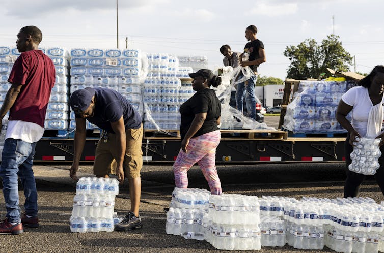
The Department of the Interior today announced a historic agreement funded by the Inflation Reduction Act that will mitigate impacts from the worsening drought crisis impacting the Salton Sea in Southern California.

Established by Deputy Secretary Tommy Beaudreau and leaders from the California Natural Resources Agency, Imperial Irrigation District (IID) and Coachella Valley Water District (CVWD), the agreement will accelerate implementation of dust suppression and aquatic restoration efforts at the Salton Sea in Southern California. The agreement, which is set for consideration by the IID board of directors at its meeting tomorrow, will expedite implementation of the state’s 10-year plan and enable urgent water conservation needed to protect Colorado River reservoir storage volumes amid persistent climate change-driven drought conditions.

“The Biden-Harris administration is committed to bringing every resource to bear to help manage the drought crisis and provide a sustainable water system for families, businesses and our vast and fragile ecosystems. This landmark agreement represents a key step in our collective efforts to address the challenges the Colorado River Basin is facing due to worsening drought and climate change impacts,” said Deputy Secretary Beaudreau. “Historic investments from the Inflation Reduction Act will help to support the Imperial and Coachella Valley and the environment around the Salton Sea, as well as support California’s efforts to voluntarily save 400,000 acre-feet a year to protect critical elevations at Lake Mead.”

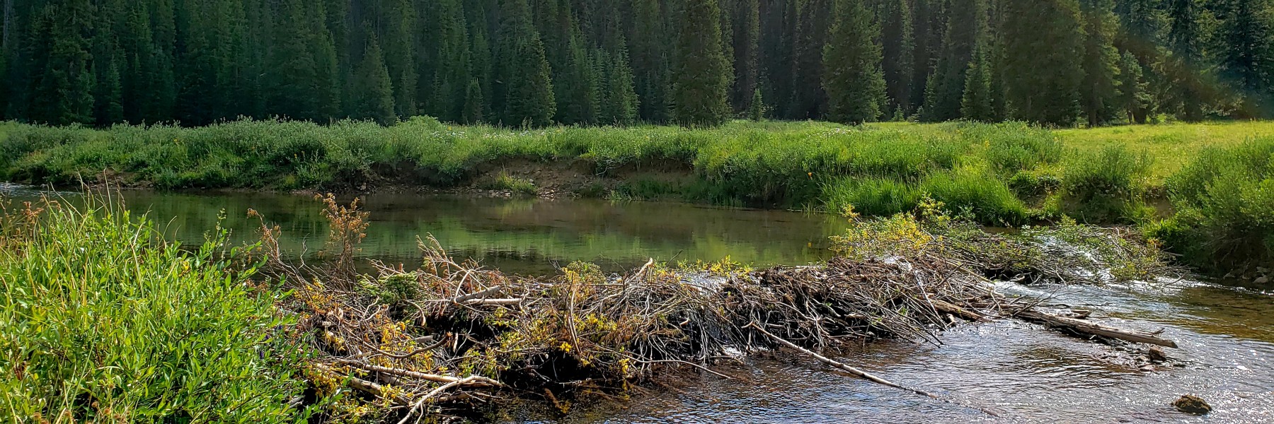
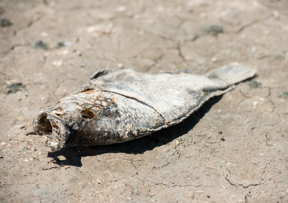
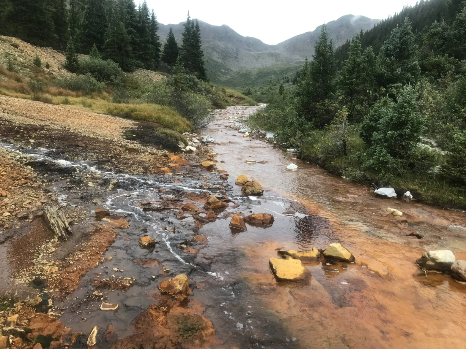
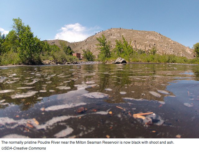
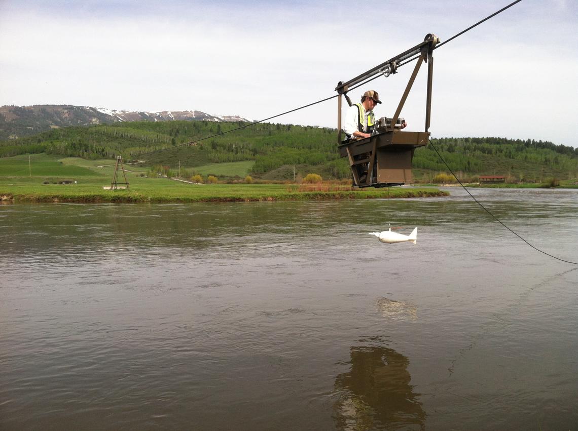
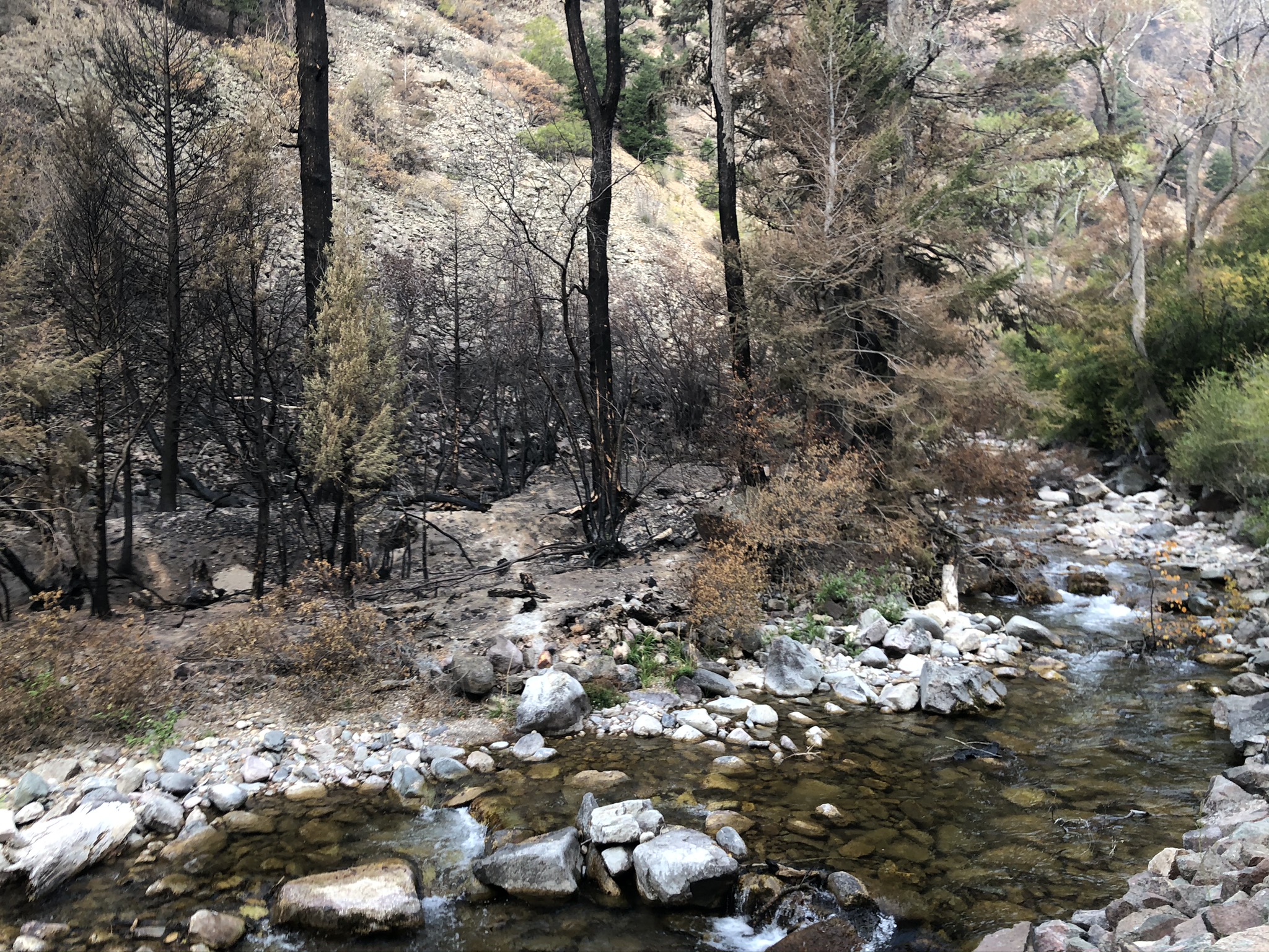
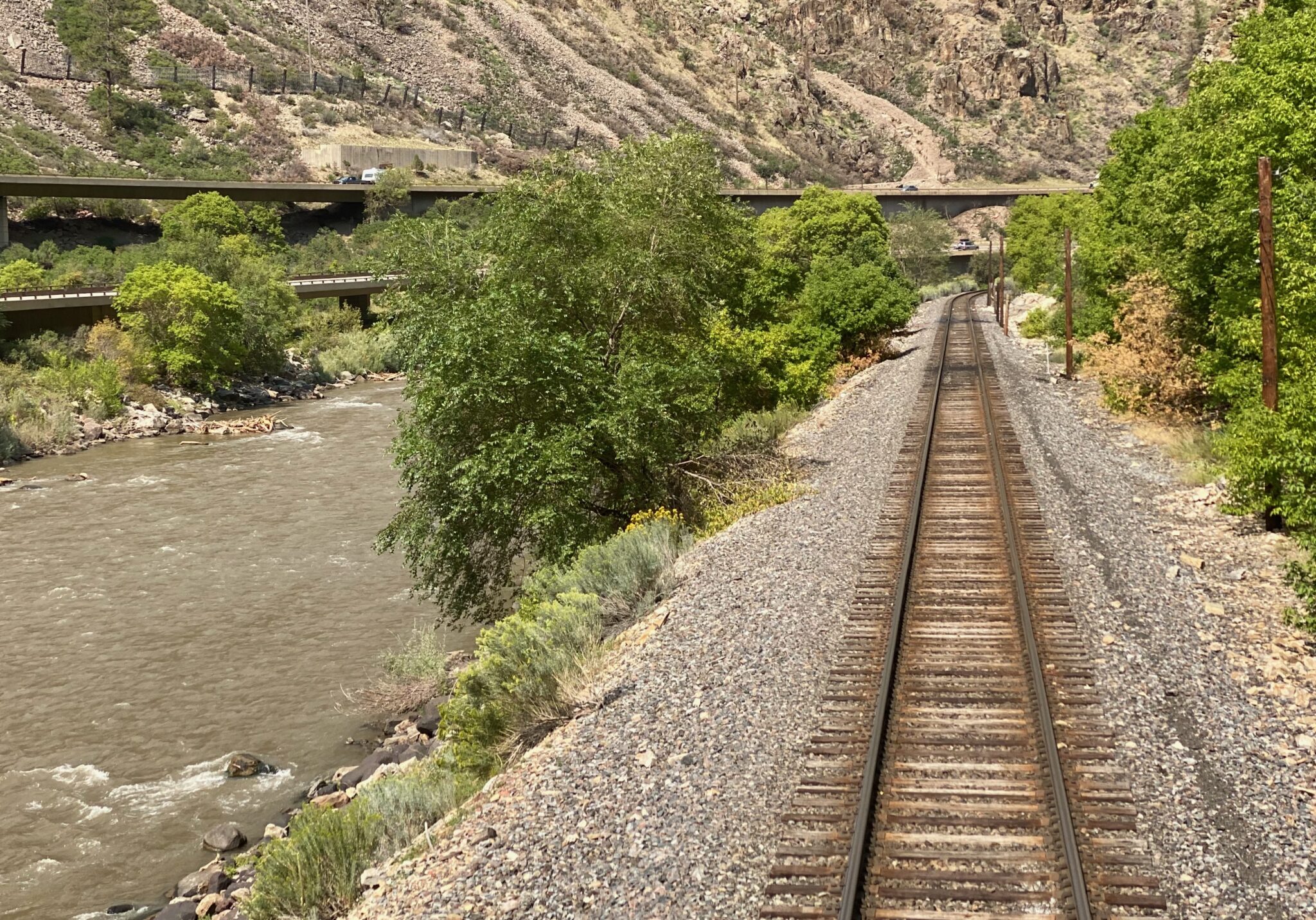
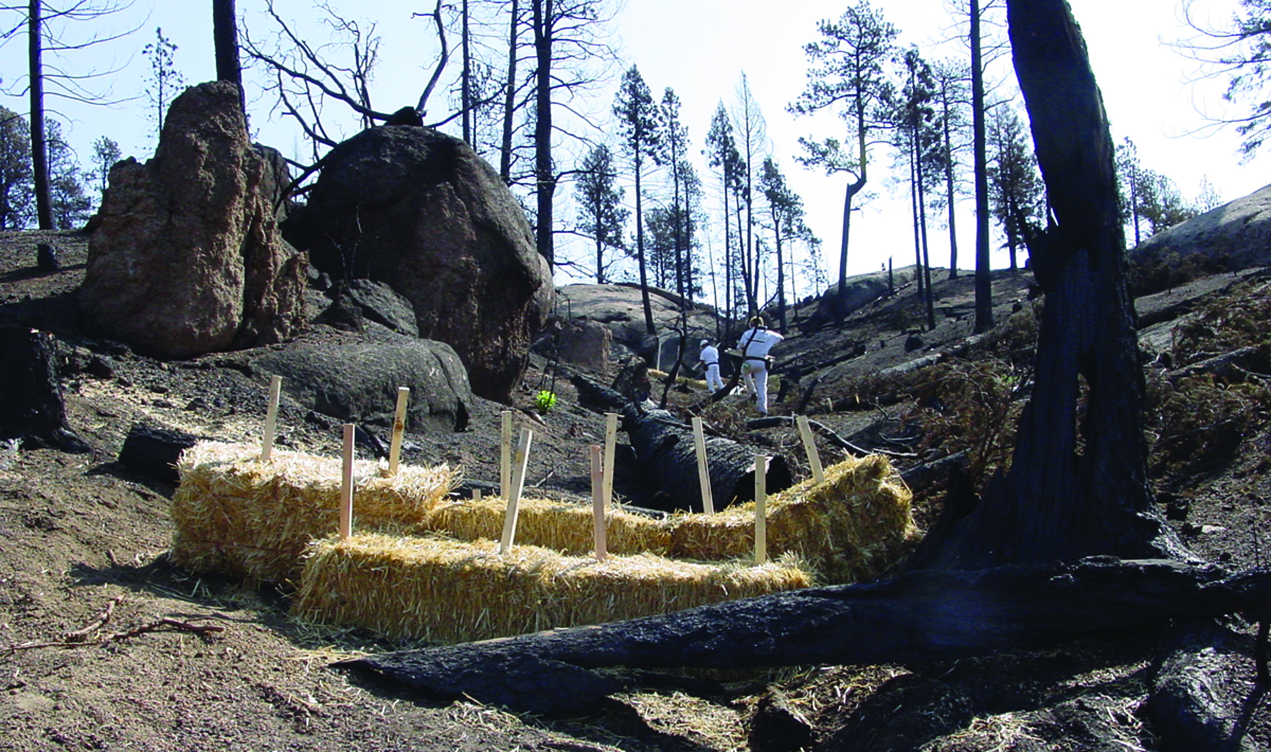
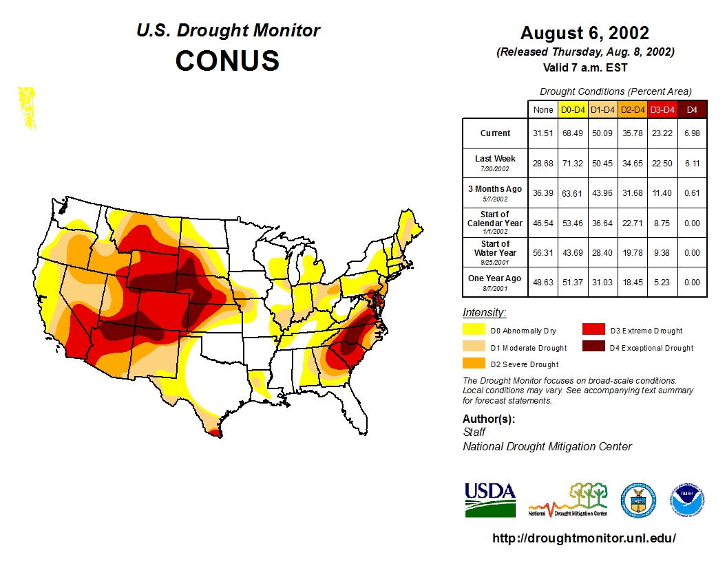
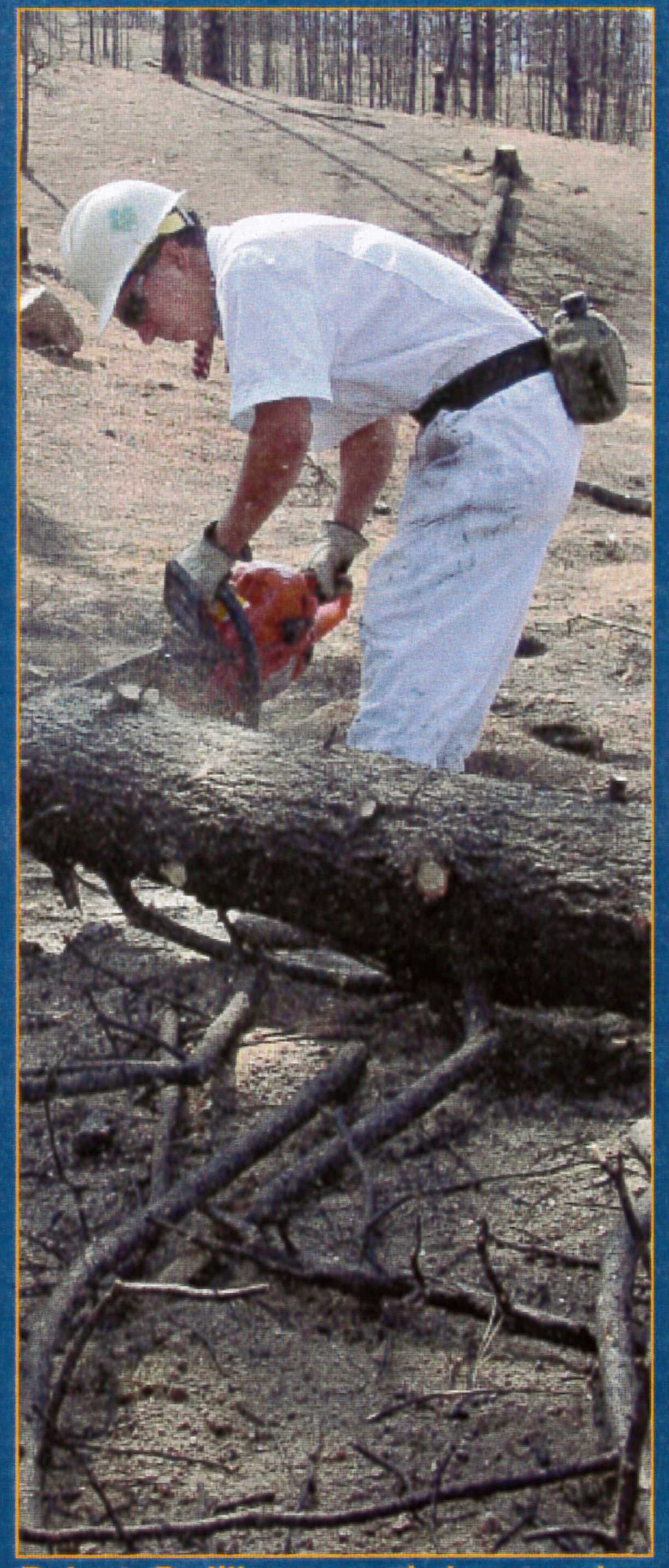
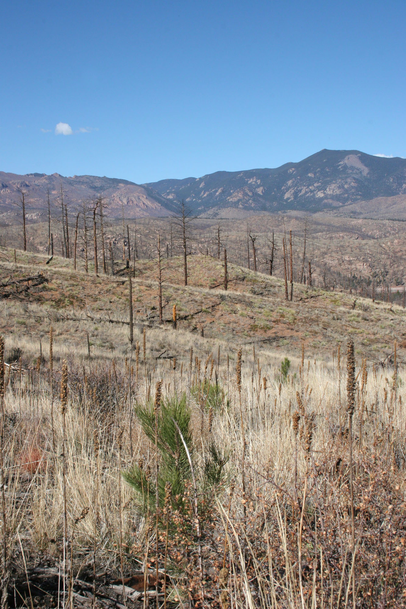
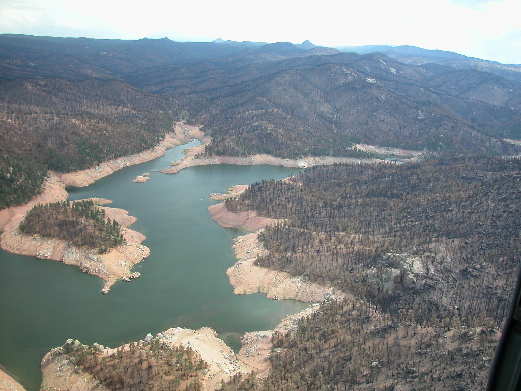
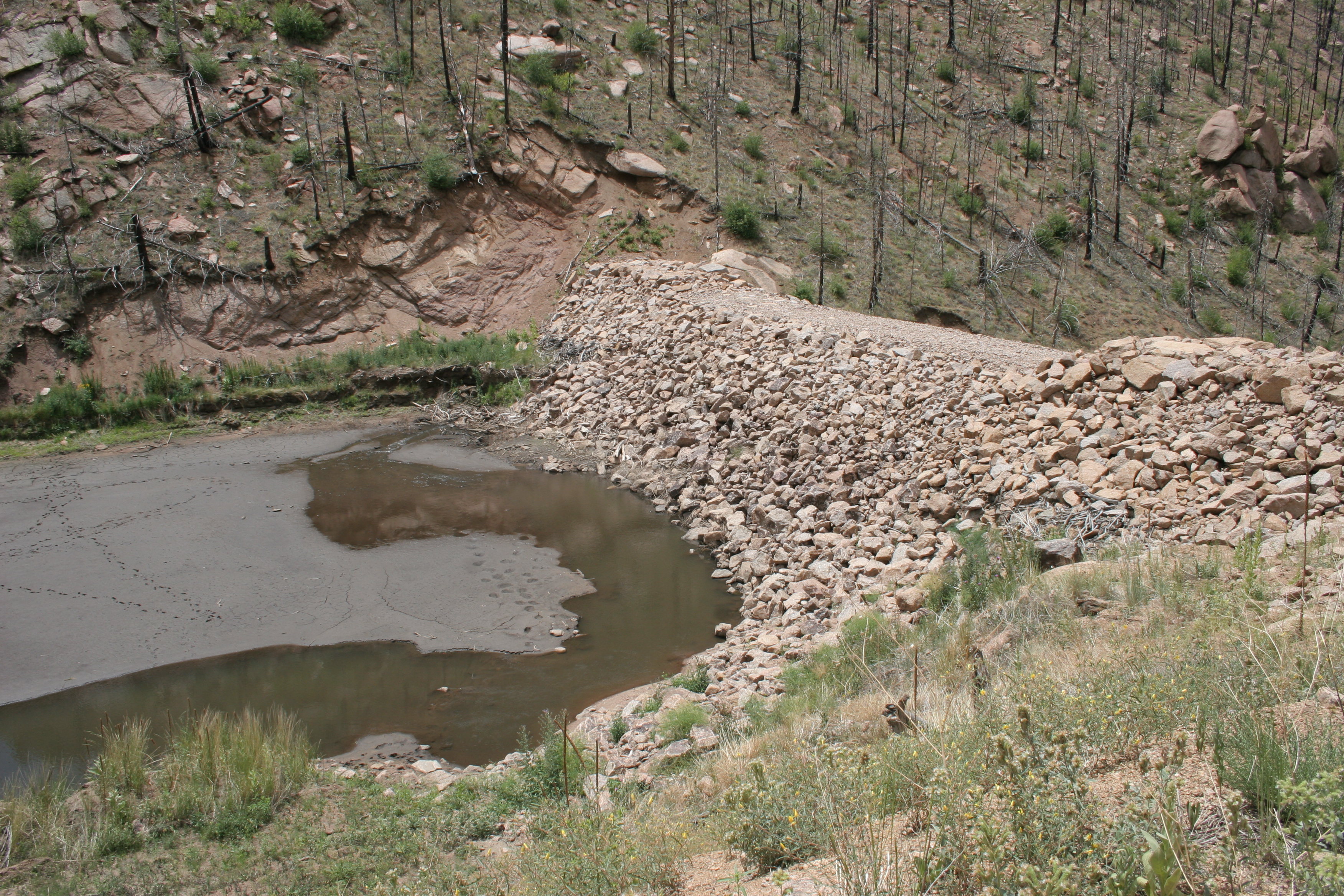
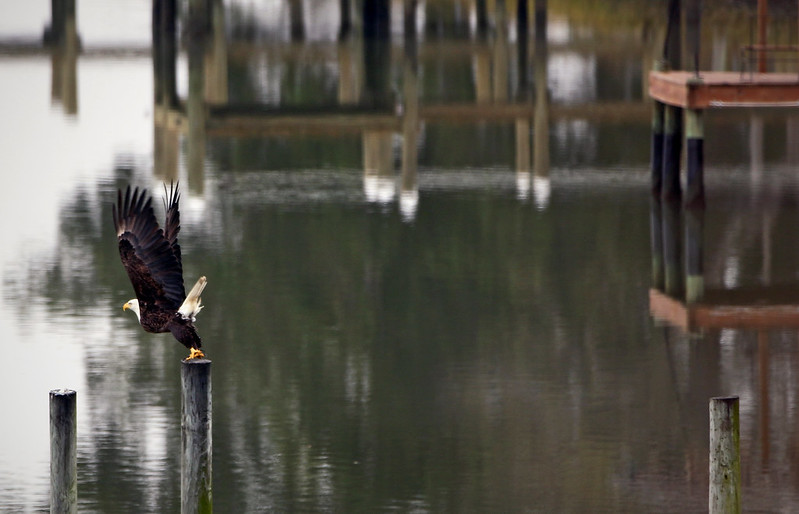
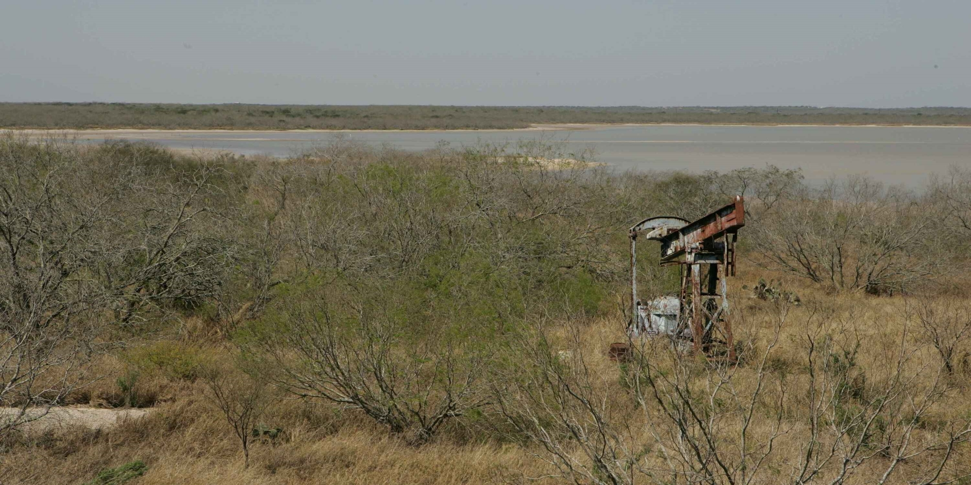
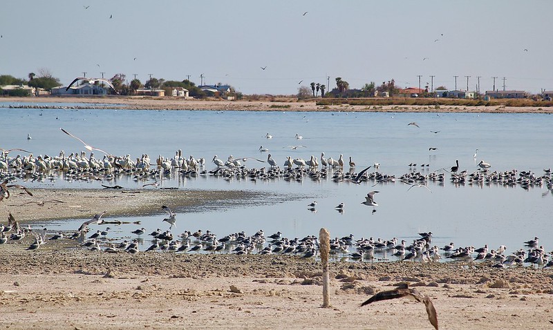
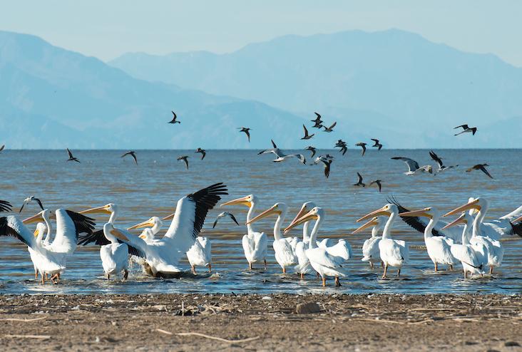
The Salton Sea, California’s largest lake, is receding due to the drought crisis gripping the West and resulting necessary conservation actions in the Imperial Valley that have reduced inflows to the Sea. Exposed lakebed is contributing to harmful dust emissions to the surrounding environment and reducing important environmental habitat for wildlife.

Under the agreement, the Interior Department’s Bureau of Reclamation will provide $22 million in new funding through the Inflation Reduction Act in fiscal year 2023 to implement projects at the Sea, support staffing at the Torres Martinez Desert Cahuilla Indian Tribe, and conduct scientific research and management that contributes to project implementation.

Subject to the implementation of voluntary conservation actions proposed by IID and CVWD, Reclamation will also provide an additional $228 million over the next four years to expedite existing projects and bolster staffing capacity at the water agencies to help deliver new projects. This is in support of California’s commitment to voluntarily conserve 400,000 acre-feet annually, starting in 2023. This $250 million investment from the Inflation Reduction Act will complement the $583 million in state funding committed to date.

“This agreement is a huge step forward,” said California Natural Resources Secretary Wade Crowfoot. “It builds our momentum delivering projects at the Sea to protect communities and the environment and ensures that California’s leadership conserving Colorado River water supplies doesn’t come at the expense of local residents.”

Under the agreement, the California Natural Resources Agency commits to accelerating project delivery through permit streamlining and use of its full contracting authority. It also commits to continue pursuing additional funding for projects to build on state funding already committed to Salton Sea Management Program implementation.

The Interior Department, IID and CVWD have agreed to establish programmatic land access agreements to enable state agencies to implement projects. In addition, the two water agencies will provide available future water supplies for new projects. This will enable California water agencies to commit to voluntarily reduce their water usage each year beginning in 2023 through 2026 to protect critical elevations in Lake Mead.

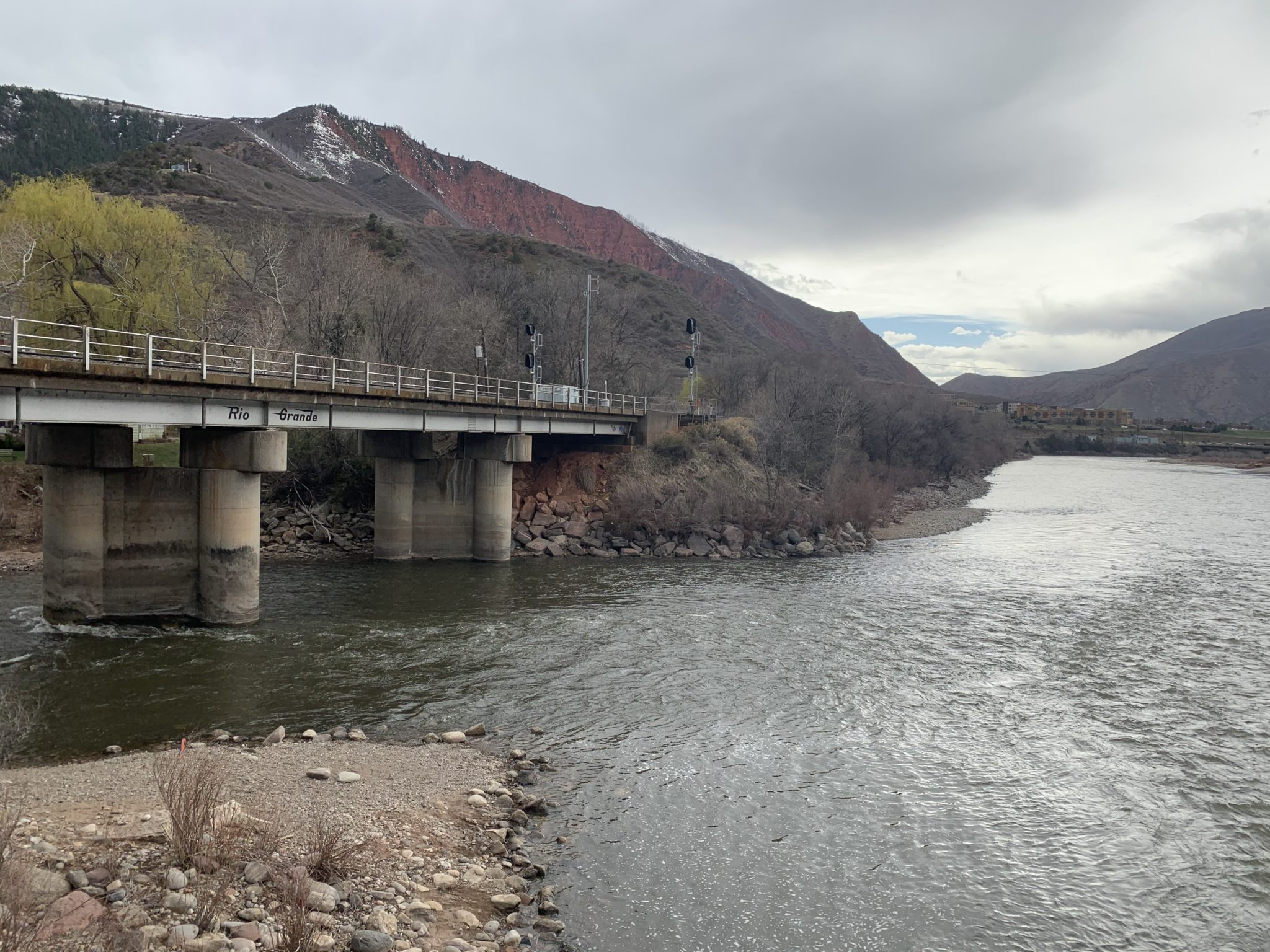
The Colorado River provides water to two countries, seven western states, 30 Tribal Nations and 40 million residents. It is currently experiencing the longest and worst drought on record, driven by hotter temperatures under climate change. Efforts continue in California and across the Colorado River Basin to find ways to stabilize water storage volumes in Lakes Powell and Mead. Reclamation and water agencies are working closely to take extraordinary actions to protect the Colorado River System.

Southern California water agencies have agreed on a deal to cut back on the amount of water they use for the Colorado River, some of which is used to grow crops in the Imperial Valley. Ted Wood/The Water Desk

Click the link to read “Drying California lake to get $250M in US drought funding” on the Associated Press website (Kathleen Ronayne). Here’s an excerpt:

The future of the Salton Sea, and who is financially responsible for it, has been a key issue in discussions over how to prevent a crisis in the Colorado River. The lake was formed in 1905 when the river overflowed, creating a resort destination that slowly morphed into an environmental disaster as water levels receded, exposing residents to harmful dust and reducing wildlife habitat. The lake is largely fed by runoff from farms in California’s Imperial Valley, who use Colorado River water to grow many of the nation’s winter vegetables as well as feed crops like alfalfa. As the farmers reduce their water use, less flows into the lake. California said it would only reduce its reliance on the over-tapped river if the federal government put up money to mitigate the effects of less water flowing into the sea. The deal announced Monday needs approval from the Imperial Irrigation District, the largest user of Colorado River water. The water entity’s board will take it up on Tuesday. Both the district’s general manager and board member JB Hamby applauded the deal Monday.

“The collaboration happening at the Salton Sea between water agencies and state, federal, and tribal governments is a blueprint for effective cooperation that the Colorado River Basin sorely needs,” Hamby said in a statement.

The $250 million will come out of the recently passed Inflation Reduction Act, which set aside $4 billion to stave off the worst effects of drought across the U.S. West. Most of the money is contingent on the Imperial Irrigation District and Coachella Valley Water District making good on their commitments to reduce their own use of river water. Both submitted proposals to cut back their usage for payment as part of a new federal program.

The Salton Sea is a major nesting, wintering and stopover site for about 400 bird species (Source: California Department of Water Resources)

Click the link to read “U.S. government pledges $250 million to help ailing Salton Sea” on The Los Angeles Times website (Ian James). Here’s an excerpt:

This year, federal officials demanded large-scale water cutbacks throughout the Southwest to try to prevent the Colorado River’s reservoirs from dropping to dangerously-low levels. Four major California water districts have proposed to reduce water use by up to 400,000 acre-feet per year for the next four years, about 9% of the state’s total water allotment.

The Imperial Irrigation District has pledged to take on the largest share of California’s reductions, up to 250,000 acre-feet of water per year.

“From the outset, IID made it clear that taking action to protect the Colorado River system would have significant impacts on the Salton Sea, and that IID’s participation was conditioned on real efforts and dollars to protect public health and wildlife around the sea,” Hamby said.

He said the federal government’s new commitment “makes it much easier and simpler for us to make large contributions toward the Colorado River system.”

The infusion of federal money is the central feature of an agreement among the federal government, the Imperial Irrigation District, the California Natural Resources Agency and the Coachella Valley Water District. The Interior Department announced the plan on Monday, and the Imperial Irrigation District’s board narrowly endorsed the agreement in a 3-2 vote at a meeting Tuesday. The debate was contentious, with some farmers, community advocates and local officials saying they didn’t think the agreement was a good deal for the Imperial Valley, or that the community should have more time to weigh in.

Luis Olmedo, executive director of the nonprofit group Comite Civico del Valle, said his organization opposed what he called a “hastily announced, half-baked deal.” He said in a statement, which a colleague read at the meeting in El Centro, that the board was deciding with little public scrutiny.

Where did the #PFAS in your blood come from? These computer models offer clues — Environmental Health News

PFAS contamination in the U.S. via ewg.org.

Click the link to read the article on the Environmental Health News website (Marlowe Starling):

New research could help pinpoint “forever chemicals” exposure — giving communities a roadmap for cleanup and individuals direction on what to avoid.

Downstream of a Chemours fluorochemical manufacturing plant on the Cape Fear River in North Carolina, people living in Brunswick and New Hanover counties suffer from higher-than-normal rates of brain tumors, breast cancers and other forms of rare — and accelerated — diseases.

Residents now know this isn’t a coincidence. It’s from years of PFAS contamination from Chemours.

It wasn’t easy to make the connection. More than a decade of water testing and lawsuits identified the link between aggressive cancers and per-and polyfluoroalkyl substances, or PFAS – a class of more than 9,000 toxic and persistent man-made compounds known informally as “forever chemicals.” They’re commonly found in nonstick cookware, water-resistant clothing, firefighting foam, cosmetics, food packaging and recently in school uniforms and insecticides.

The difficulty of tracing these chemicals to a specific source is that Americans — 97% of us, by one estimate — are exposed to potentially thousands of PFAS.

New research published in Science of the Total Environment now finds that tracing models can identify sources of PFAS contamination from people’s blood samples. Instead of using environmental measures of PFAS as a proxy for how people are exposed, the methods use blood samples as a more direct way to map people’s exposure.

“If this works, it would allow us to identify, without any prior knowledge, what people are being exposed to and how they’re being exposed to it,” Dylan Wallis, a lead author of the paper and toxicologist formerly at North Carolina State University, told EHN.

The research, while not yet perfect, marks the beginning of what could become a wide-scale method of determining where the PFAS in our blood came from—such as our food, drinking water or use of nonstick cookware—and how much of it came from each source. But its effectiveness hinges on the need to collect more comprehensive data on where PFAS occurs in people’s bodies, the environment and sources. If scientists can collect this data, then these methods would be able to draw a roadmap for people’s exposure, allowing us to pinpoint problem areas, avoid contamination and implement regulatory changes.

PFAS in blood samples

For this tracing method to work, scientists need an idea of which compounds exist in air, water, food and everyday products in a determined community. First, they have to know where to look for PFAS. This study used data from previous research to identify the types of PFAS in drinking water. Then, they test blood samples for which PFAS are in people’s bodies—although using blood alone gives us only part of the contamination picture, Carla Ng, a chemical and biological engineer at University of Pittsburgh, told EHN. Once they match PFAS proportions in blood to what’s in their drinking water, as in this study, they can gain clues to which sources contributed the chemicals showing up in people’s blood.

“You start to build this picture of what are the inputs, what’s the material they’re getting their exposure from, and then what’s in their blood,” Ng, who was not involved in the study, explained.

Widefield aquifer via the Colorado Water Institute.

The new study analyzed blood samples taken in 2018 and 2020 from residents in Wilmington, North Carolina, and three towns in El Paso County, Colorado. Both communities are near well-known PFAS polluters: the Chemours facility in North Carolina, which manufactures fluoropolymers for nonstick and waterproof products, and the Peterson Space Force Base in Colorado, which uses PFAS-containing firefighting foam, also called AFFFs.

Related: PFAS on our shelves and in our bodies

The team used computer models to identify 20 PFAS compounds from residents’ blood samples and then grouped them in categories representing different sources. Some are easy to identify because manufacturers often use a specific type of PFAS. For example, the compounds found in firefighting foam have a unique signature, like a fingerprint, making Peterson Space Force Base the obvious culprit. But more diffuse sources of PFAS, such as those in dust or food, are harder to pin down because scientists aren’t sure which PFAS are in them or where they come from.

In North Carolina and Colorado, the sources were more obvious, allowing the research team to test models’ ability to identify sources. However, to conduct similar research on a national scale is not so simple. The U.S. Centers for Disease Control and Prevention’s National Health and Nutrition Examination Survey has tested levels of PFAS in blood samples nationwide since 1999, but it only tests for a specific list of PFAS, which could overlook the full spectrum of compounds.

Drinking water in both locations in the study shows high levels of fluoroethers and fluoropolymers, many of which are “legacy” PFAS, meaning they have been phased out of production for at least a decade but are still found in drinking water. Because the chemical bonds are so strong, they persist in the environment for years, which is why they show up in blood samples long after companies have stopped using or manufacturing them. Long-chain PFAS like PFOA and PFOS, which are the most-studied compounds with a longer structure of carbon-fluorine bonds, are harder to break down, and they bond to proteins in the blood more easily than short-chain compounds.

“These last a really long time,” Wallis said of long-chain PFAS, which were recorded at levels several times higher than national averages. “If you were drinking a really high level of it 40 years ago, you would still have really high levels of it 40 years later.”

A pollution snapshot

Wallis said they were surprised the models worked because they have never been used for PFAS before. They were built to trace other contaminants in the environment, like particles in air pollution, rather than in people.

Tracing PFAS is more challenging than tracing air pollution for several reasons, Xindi Hu, a lead data scientist at the research organization Mathematica, told EHN. Hu conducted earlier research using a different type of computer analysis of blood samples to identify the main sources of PFAS contamination in the Faroe Islands.

Many PFAS lack distinct chemical fingerprints to tell researchers exactly where a particular compound came from, Hu said. But in the study led by Wallis, the chemical fingerprints from the Space Force base in Colorado and fluorochemical facility in North Carolina are well-known.

“When you take a blood sample, it’s really just a snapshot,” she said. “So how do you translate this snapshot of concentration back to the course of the entire exposure history?”

That’s partly why the new paper’s authors conducted this study: The more compounds that are correctly linked to a source, the better these models will work, Wallis said. In essence, they need a better database of PFAS compounds so the models know how to connect the dots.

PFAS also react differently in the human body than in the environment, and scientists still don’t fully understand how we metabolize different compounds. Shorter-chain PFAS, for example, are more likely to appear in urine samples than in blood because they are water-soluble, said Pittsburgh’s Ng, who studies how PFAS react in humans and wildlife.

“If you’re doing everything on the basis of blood levels, it may not tell you everything you need to know about exposure and potential toxicity,” she said, adding that PFAS could also accumulate in the liver, brain, lungs and other locations where it’s difficult to take samples.

Worse, more modern PFAS with carbon-hydrogen bonds can actually transform into other types of compounds as the body metabolizes them, which could give a false impression of what people are exposed to.

“The key to identifying a good tracer is a molecule that doesn’t transform,” Ng said. Some PFAS are great tracers, she added, but “the more transformable your PFAS is in general, the poorer the tracer is going to be.”

That’s why newer PFAS compounds like GenX were not detected in blood samples or used as tracers in the recent study.

“These models aren’t going to account for everything,” Wallis said. “No model is.”

Stopping the contamination 

Wallis and their co-authors said they hope the models can become more accurate for less exposed communities in the future. With more data, it would be easier to suggest what to avoid instead of guessing where PFAS exposures come from, Wallis said, adding that it could lead to more protective regulations.

Although these models can vaguely help identify where compounds might come from in a particular community, it’s not a definitive solution, Alissa Cordner, an environmental sociologist and co-director of the PFAS Project Lab who was not involved in the recent study, told EHN. Even if there’s no immediate application of these methods, identifying where PFAS are is the first step.

“Everybody can point their fingers at other possible sources of contamination,” Cordner said. “The best way to address this is not to try to, after the fact, link people’s exposure to a contamination source. It’s to stop the contamination.”

From Your Site Articles

San Juan Basin Public Health offering free well testing for #PFAS chemicals — The #PagosaSprings Sun

PFAS contamination in the U.S. via ewg.org.

Click the link to read the article on the Pagosa Springs Sun website (Megan Graham). Here’s an excerpt:

San Juan Basin Public Health (SJBPH) has received a grant from the Colorado Department of Public Health and Environment to address contaminants in drinking water. The funding will be used to provide free testing for perfluoroalkyl and polyfluoroalkyl substances (PFAS), which is a broad group of manmade chemicals in industry and consumer products sometimes known as “forever chemicals” because they do not easily break down in the environment or the human body…

La Plata County and Archuleta County residents can now have their private wells sampled and tested for PFAS chemicals at no cost. The program is targeting areas in the counties close to fa- cilities where PFAS chemicals are known to be used or stored, but all well owners in both counties are encouraged to have their wells tested. Facilities that may have stored or used PFAS chemicals in- clude airports, landfills and some fire stations. If you receive water from a municipality, water district or shared delivery system, contact your water provider for PFAS infor- mation. Several local public water providers have already tested their systems for PFAS contamination. SJBPH Environmental Health staff will be available to discuss test results, which will be processed by a certified independent labora- tory and can take up to 45 days to receive. Staff will assist well owners with determining next steps based on the test results. To have your well water tested, please contact us at eh@sjbpublichealth.org or (970) 335-2060…

There are several education events planned to help share in- formation on PFAS chemicals and testing options. Join us from 5:30 to 6:30 p.m., Thursday, Dec. 8, at the Durango Public Library, 1900 E. Third Ave., Durango. Additional education events in Archuleta and La Plata counties will be an- nounced in the weeks to come.

Hard #water: In these metro neighborhoods, few drink the tap water. Can trust in safe water make a comeback? — @WaterEdCO

Sunset in Commerce City, a fast-growing industrialized suburb just north of Denver. Credit: Jerd Smith, Fresh Water News

Click the link to read the article on the Fresh Water News website (Jerd Smith):

In the halls of the Colorado State Capitol drinking fountains are in easy reach, and grabbing a quick drink of cool, clear, odorless water is an automatic act.

But just minutes away, in dozens of industrialized neighborhoods in North Denver, Commerce City and unincorporated Adams County, many homeowners and apartment dwellers never drink their tap water.

Tens of thousands of people in this area have been exposed to contaminated water over the years. Convincing them finally that their water is now safe to drink is a tough sell.

In a Commerce City bungalow on Kearney Drive, Armando Guardiola and his family are sitting in a small kitchen, eating posole from brightly colored bowls. The water served for this meal did not come from their tap. Instead, it came from a large, pale blue five-gallon jug perched on the edge of the sink.

It has been this way since Guardiola, a retired railway worker, and his parents moved into this bungalow in 1982.

Maria Guardiola cleans up after dinner. In her and her husband’s bungalow in Commerce City, the pale blue water jugs supply the family with drinking water. They don’t drink tap water. Credit: Jerd Smith, Fresh Water News

Their tap water, he says, as his brother and sister interpret, is full of minerals that leave a residue everywhere. Sometimes it has an odor or a strange taste. The family’s water comes from the South Adams Water and Sanitation District and meets all the state standards for water quality and safety. But this is no comfort to the people who live here.

“They used to say, don’t drink the water,” Guardiola said. “Then, they came out about 15 years ago and said it was better. But we don’t trust this. A lot of people here have skin rashes. They have lost their hair. It has been a continuous problem.”

Two water bills

Parts of north Denver, south Adams County, and Commerce City have a legacy of water contamination that dates back more than half a century and is tied to aging lead service lines, in Denver, and various industrial activities farther north.

Wave after wave of pollutants have been discovered in this area, from contaminants that leaked from the Rocky Mountain Arsenal in the 1980s, to contamination from the local oil refinery whose lights dot the skyline at dawn and dusk.

Now, so-called forever chemicals, also known as PFAS, short for per- and polyfluoroalkyl substances, have been discovered in the groundwater in Commerce City and have been linked to firefighting foam used up until 2018 at the nearby Denver Fire Training Academy, according to the Colorado Department of Public Health and Environment.

The City of Denver disputes that finding. It declined an interview request, citing potential litigation.

The South Adams Water and Sanitation District (SAWSD) says it must spend $45 million to $70 million to build a new treatment plant to remove this PFAS from its raw water.

Will it ever end, residents ask. They can’t answer that question.

Instead, many opt to pay two water bills: one at the local water filling station, where they often spend $10 to $50 a week to buy water for drinking and cooking, for watering plants and caring for their pets. This is in addition to their monthly water and sewer bills from the local utility, in this case the South Adams Water and Sanitation District. Utility costs vary depending on location and water use.

One of several commercial water stations in Commerce City and unincorporated Adams County where residents fill jugs with water for drinking and cooking because they don’t trust the tap water. Credit: Jerd Smith, Fresh Water News

Sacrifice zones

Armando’s brother Beto says there is little hope in the community that their tap water will ever be drinkable.

“To go back to the tap water we think is risky,” Beto said. “We’ve been told it’s good. We’ve been told it’s bad. We hope what happened in Jackson, Mississippi, doesn’t happen here,” referring to the decades-long problems with Jackson’s water system that finally collapsed earlier this year after it was inundated by flood waters.

Patricia Ferrero heads Protégete, an environmental justice initiative housed within Conservation Colorado.

“Honestly it all comes down to trust” Ferrero said. “I don’t know if there is one thing that would re-establish trust with these communities. Industry is so close to home. There is too much evidence that it is a sacrifice zone.”

Cultivando, another environmental justice group which is focused on Commerce City, recently launched a tap water testing program funded by the University of Denver. It has signed up 30 homeowners in the area, who have agreed to allow specially trained community members to come into their homes and gather water samples to have them privately tested. These residents get their water from various sources, including some from privately owned wells.

Residents from Commerce City and Adams County gather at Our Lady Mother of the Church in October to learn about private water testing being offered for free by environmental justice group Cultivando and funded by the University of Denver. Credit: Jerd Smith, Fresh Water News

Once results are in, the activists will consider what next steps need to be taken. This could mean pushing for better water treatment or new indoor piping, or, if results confirm that the water is, in fact, safe to drink, looking at how they can work alongside the state health department and water providers to reassure residents on this point. In this way, the community organizers hope to begin rebuilding trust in the local water along with the government agencies and water utilities charged with protecting their water and their health.

Mike Wireman, a former national groundwater specialist at the U.S. Environmental Protection Agency, is running the Commerce City testing program for Cultivando.

“We have heard for some time, from residents who live in parts of Commerce City, that their water tastes bad, smells bad, feels bad. Bacteria can cause that. We know they have a problem, but I don’t believe that it is related to the water that leaves the Commerce City treatment plant. It gets back in somewhere between the water treatment plant and the homes,” Wireman said.

The problem may be inside these older homes. “The houses that were built were not constructed with the best materials. They were not $500,000 homes. They were built to accommodate industrial workers,” he said.

In addition to neighborhood activists, lawmakers have also taken note. In 2021, at lawmakers’ request, the Colorado Department of Public Health and Environment created an environmental justice action task force in an effort to forge better relationships with communities whose water quality has been harmed by industrial contamination.

“We take these issues very seriously,” said Nicole Rowan, head of CDPHE’s Water Quality Division.

The state has also begun working with the City of Denver to oversee the removal of PFAS from soils around the Denver Fire Training Academy in Adams County. How long the cleanup might take isn’t clear. But Rowan said some mitigation work at the site has begun.

Generations of distrust

For the South Adams Water and Sanitation District, the legacy of contamination is a powerful, cultural constant. The district has built two treatment plants and is planning a third to deal with the issues, which stem both from industrial activities and naturally occurring minerals present in groundwater.

The discovery of PFAS in its groundwater wells in 2018 added another major item to its long list of industrial woes. The district immediately shut down wells that were too contaminated to salvage at the time, and began aggressively treating its other wells, as well as blending with clean water purchased from Denver, to meet federal PFAS safety standards. According to its 2022 Consumer Confidence Report, the district has been successful in meeting all federal and state water quality standards.

The district has spent millions of dollars and has some of the most sophisticated on-site testing equipment in the state, if not the country, according to Kipp Scott, SAWSD’s manager. Its high-tech labs allow the utility to test its raw water and treated water almost continuously to ensure it is safe. But new PFAS standards that are close to being finalized by the federal government will mean more has to be done.

Alan Frey, a PFAS analyst at South Adams Water and Sanitation District, checks levels Nov. 4 in Commerce City. Credit: Jerd Smith, Fresh Water News

Scott remains deeply worried that the plume of contamination moving from the fire academy toward his district’s wells won’t be stopped before it gets any closer. In the interim, the district is spending some $8 million a year to buy clean surface water supplies from Denver Water to mix with its own, to ensure it can continue to deliver clean water until the contamination is removed.

Equally distressing is the community’s skepticism about the district’s efforts to deliver clean water to them, Scott said.

“It’s been a public relations nightmare,” he said.

The district is also plagued with naturally occurring hard water, which damages plumbing and can cause skin rashes and hair loss in some. Last year, the district built a $60 million water-softening plant that now delivers water that is much softer to residents.

Many of its customers still don’t know the water has been improved or do not believe it.

Theresa Friess, SAWSD’s public affairs coordinator, was hired to help educate and engage customers.

“It’s been a hard conversation, in part because it’s hard to hear that our customers feel this way,” said Friess. “But we have tried to increase our outreach and we are having more conservations with non-English speaking residents as well.”

The district has hosted tours and open houses, and has had various government officials meet with residents and publicly drink the water that flows from the taps in an effort to prove it is safe.

To date, there is little if any belief among nearly two dozen residents across north Denver, Commerce City and unincorporated Adams County interviewed by Fresh Water News that the water won’t make them sick.

“We have been drinking this water for years,” said one woman at a meeting convened by Cultivando in Commerce City last month on the private tap water testing program. Speaking through an interpreter, she said, “They think they can come in here and take one drink of water to convince us it is safe? What does that prove?”

Are your pipes okay?

In Denver’s Elyria, Swansea and Globeville neighborhoods, Denver Water has been working since 2019 to replace tens of thousands of lead service lines to protect its customers from lead contamination. Testing had shown that lead was leaching from the pipes into the water that reached the tap. The work is going on across the city, including such neighborhoods as Hilltop and Washington Park. Lead service lines are more likely to be an issue for homes built before 1951.

The agency replaced the old lead service lines in front of Tony Garcia’s Elyria house two years ago.

Garcia, a well-known historian and executive director of Su Teatro, and others in the neighborhood are happy about the remediation project. Some even drink the water now. But the utility is still almost 10 years away from having all the city’s lead service lines replaced, even with a new federal infrastructure grant to speed the process.

Raymond Gallegos water his lawn in Elyria in North Denver. Gallegos, whose water service lines have been replaced by Denver Water to help eliminate lead contamination, said he trusts the water now. Credit: Jerd Smith, Fresh Water News

Garcia still uses filters provided by Denver Water, and the utility still tests his water periodically. Denver Water spokesman Todd Hartman said the ongoing testing is part of its lead monitoring program. For many of these older homes, the water may still contain lead, leaching not from the main delivery lines, which are lead-free, or from the customer-owned service lines Denver Water is replacing, but from the aging plumbing systems within the homes themselves. No amount of lead is safe to drink.

Garcia doesn’t drink the tap water and has no plans to do so. If his home’s pipes need to be replaced, he said, it will have to be done by the next homeowner or someone else.

CDPHE’s Rowan said her agency is researching whether some of its grant money could be accessed by homeowners to be used for in-home pipe replacement, but isn’t clear yet whether that is possible.

What the neighborhood has endured, not just with lead contamination but also with air and groundwater pollution, “would not be tolerated in other communities,” Garcia said.

In addition to the ongoing risk to public health, cost is a major concern, for residents and the water districts and state agencies charged with keeping the water safe.

On a recent Friday morning, student chef Paul Tyrell is filling up several of the ever-present five-gallon pale blue jugs at a private water station in Commerce City. His pregnant partner sits in the front seat as he hauls the empty jugs out of the back seat, fills them at the water station, and lugs them to the car.

Commerce City resident Paul Tyrell fills his family’s water jugs here every week because he and his wife say the water in their apartment makes them feel sick. Credit: Jerd Smith, Fresh Water News

Here five gallons of water costs $1.50, or 30 cents a gallon. Tyrell will fill up all his containers once a week, at a cost of $7 to $10. If he could use his apartment’s tap water from SACWD, it would cost less than 5 cents a gallon. The district charges $5.24 for the first 12,000 gallons used.

“I wish we would have better water,” Tyrell said. “We don’t use the water in our apartment because it makes us feel sick.”

Who pays

Denver Water has raised residential water rates to help pay for its lead remediation work, in addition to issuing bonds and using cash on hand to cover for the $168 million overall project cost. It has also been approved for a $76 million federal infrastructure grant to help accelerate the work.

In South Adams County, the federal government paid for the district’s primary water treatment plant, completed in 1989, as part of the Superfund cleanup at the Rocky Mountain Arsenal.

But since 2018, the district has been forced to uses its own money, and some state grants, to fund the $3 million price tag on new water treatment processes along with testing equipment related to the PFAS contamination.

Residents are paying just over $4.50 a month additionally to cover the cost of the new water softening plant, but Scott says the district doesn’t believe they should have to pay to cover the cost of the new $45 million to $70 PFAS treatment plant. The district plans to apply for federal infrastructure improvement funds to get that done.

“Our residents should not have to bear this cost for the additional treatment we are going to have to put in place. But the new plant is going to be less expensive than purchasing Denver water over the long haul.”

It’s not just water bills that are expensive. Residents are often approached by sales people suggesting the water is so unsafe that they need to buy expensive in-home treatment systems and filters.

South Adams Water Quality Supervisor Kevin Pustulka said he recently went out to a home where a woman was preparing to buy a $20,000 in-home softening system that she didn’t need. “Please don’t,” he told her.

His message to everyone else: “The next time someone offers to sell you an in-home water device, call me.”

Olga Gonzalez hopes they do. She is executive director of Cultivando and has watched people in these North Metro communities struggle for years. That things may be changing is possible, she said, but her level of skepticism remains high.

“We are seeing them [the CDPHE and South Adams] ask what our communities need and be transparent and explain things in a way residents can understand. I feel hopeful that finally community members will be heard. We have been very clear that we don’t want these agencies to just check boxes and say they have been in touch with the community.”

For the environmental justice activists on the ground, after years of battling industrial pollution and institutional indifference, they are convinced the way to deliver safe tap water and to convince residents that it won’t make them ill, lies in rebuilding trust between residents and the government.

“In the end, we don’t want to be residents’ go-to,” Gonzalez said. “We want them to go to the people who are paid to protect them, and take care of their health.”

This project was made possible, in part, by funding from the Colorado Media Project.

Jerd Smith is editor of Fresh Water News. She can be reached at 720-398-6474, via email at jerd@wateredco.org or @jerd_smith.

New Report: State of the Science on Restoring Western Headwater Mountain Streams — American Rivers #CRWUA2022

Click the link to read the article on the American Rivers website (Hannah Holm):

As western mountain snowpacks diminish and wildfires race across parched landscapes, appreciation has grown for the moist mountain meadows and wetlands that hold water up high, feeding streams throughout the summer and providing fire-resistant refuges for wildlife. Before beavers and their dams were largely eliminated by the fur trade, these natural water storage features and refuges were common across western states’ mountain landscapes.

The removal of beavers and other land disturbances have led many creeks to cut deeper into their valleys and detach from their floodplains, dropping the water table and drying out the landscape. A growing field of stream restoration, known as low-tech process-based restoration (LTPBR), seeks to reverse these changes through methods that mimic beaver activity in hopes of enticing them to return.

Projects across the west have demonstrated the benefits of LTPBR on the landscape. Projects have improved water quality, provided important habitat, trapped sediment, increased riparian vegetation and forage, and bolstered resilience against drought, fire, and floods. These benefits are achieved by installing low-tech, hand-built structures, creating “speedbumbs” that enable water from snowmelt and storms to spread across the riparian area, slowing peak flows and recharging groundwater. The rewetted soil “sponge” supports healthy riparian vegetation and reduces wildfire risks.

As LTPBR projects have proliferated across western states, both excitement about their benefits and questions about potential impacts have grown. A new report from American Rivers reviews the published science and case study information on LTPBR to better understand the full range of benefits these projects can provide, and provides scientific evidence to address potential concerns. The report finds ample evidence for LTPBR benefiting habitat and buffering the impacts of droughts, floods, and wildfires, but concludes that more research is needed to better understand the full suite of ecosystem service benefits. It also provides insights on how to address human and social factors related to LTPBR projects, such as mitigating beaver dam impacts to infrastructure.

Click here for full report

#California Attorney General Rob Bonta sues makers of cancer-causing ‘forever chemicals’ — The Los Angeles Times #PFAS

Products that contain PFAS. Graphic credit: Riverside (CA) Public Utilities

Click the link to read the article on The Los Angeles Times website (Susanne Rust). Here’s an excerpt:

The state of California on Thursday sued the manufacturers of a class of chemicals known as “forever chemicals” that are found in a variety of consumer items including food packaging and cookware and are linked to cancer and other illnesses…

“PFAS are as ubiquitous in California as they are harmful,” Atty. Gen. Rob Bonta said during a news conference in San Francisco on Thursday morning. “The damage caused by 3M, DuPont and other manufacturers of PFAS is nothing short of staggering, and without drastic action, California will be dealing with the harms of these toxic chemicals for generations.”

The suit is targeted at 20 chemical manufacturers, including 3M and DuPont de Nemours Inc. California joins a growing list of states and municipalities that have sued over these chemicals, as well as crafted laws to ban or phase them out.

A whistleblower and watchdog advocacy group used an EPA database of locations that may have handled PFAS materials or products to map the potential impact of PFAS throughout Colorado. They found about 21,000 Colorado locations in the EPA listings, which were uncovered through a freedom of information lawsuit. Locations are listed by industry category. (Source: Public Employees for Environmental Responsibility analysis of EPA database)

The NGWA submits comments to EPA on proposed rule to designate PFOA and PFOS as hazardous substances #PFAS

Products that contain PFAS. Graphic credit: Riverside (CA) Public Utilities

Click the link to read the article on the NGWA website:

NGWA submitted comments on November 7, 2022 to the U.S. Environmental Protection Agency on its recently proposed rule to designate PFOA (perfluorooctanoic acid) and PFOS (perfluorooctanesulfonic acid) as hazardous substances under the Comprehensive Environmental Response, Compensation and Liability Act (CERCLA), which is commonly referred to as “Superfund.”

This rulemaking, if finalized, would increase transparency around the release of these chemicals and prompt regulatory actions regarding their cleanup and disposal. The proposed rule is the EPA’s latest action as part of its PFAS Strategic Roadmap, which outlines the agency’s strategy to address PFAS (per- and polyfluoroalkyl substances) nationwide.

In its submitted comments, NGWA states the proposed rule lacks information on the impact of the designations on the groundwater industry. The Association also states the rule is unclear on how it may impact other chemical control statutes such as the Clean Water Act.

“A key concern is that the proposed rule does not address important information regarding the effect of this designation on the regulatory processes of other existing chemical constituent control statutes such as the Resource Conservation and Recovery Act, Safe Drinking Water Act, and Clean Water Act that would also regulate PFOA and PFOS and affect the groundwater industry,” said Chuck Job, NGWA’s regulatory affairs manager. “NGWA comments are directed toward a more holistic regulatory approach to PFAS contaminants. Additionally, the proposed rule raises many questions about how the measurement of a reportable amount of hazardous substance would occur.”

Click here to read NGWA’s comments.

NGWA has long been an industry leader in providing PFAS research, education, and resources to the public and scientific communities. Learn more by visiting NGWA.org/PFAS, which is a complete resource center about the groundwater contaminants featuring a recently updated top-10 facts sheet, a position paper, and more.

Also found there is Groundwater and PFAS: State of Knowledge and Practice, which NGWA published in 2017 and is one of the first PFAS guidance documents to be released. The Association recently hosted its second conference in Westerville, Ohio, focused entirely on PFAS science and remediation.

Beaver dams overshadow #climate extremes in controlling riparian hydrology and #water quality — Nature Communications

Beaver dam. Photo credit the Walton Family Foundation

Click the link to access the article on the Nature Communications website (Christian Dewey, Patricia M. Fox, Nicholas J. Bouskill, Dipankar Dwivedi, Peter Nico & Scott Fendorf). Here’s the abstract:

Hydrologic extremes dominate chemical exports from riparian zones and dictate water quality in major river systems. Yet, changes in land use and ecosystem services alongside growing climate variability are altering hydrologic extremes and their coupled impacts on riverine water quality. In the western U.S., warming temperatures and intensified aridification are increasingly paired with the expanding range of the American beaver—and their dams, which transform hydrologic and biogeochemical cycles in riparian systems. Here, we show that beaver dams overshadow climatic hydrologic extremes in their effects on water residence time and oxygen and nitrogen fluxes in the riparian subsurface. In a mountainous watershed in Colorado, U.S.A., we find that the increase in riparian hydraulic gradients imposed by a beaver dam is 10.7–13.3 times greater than seasonal hydrologic extremes. The massive hydraulic gradient increases hyporheic nitrate removal by 44.2% relative to seasonal extremes alone. A drier, hotter climate in the western U.S. will further expand the range of beavers and magnify their impacts on watershed hydrology and biogeochemistry, illustrating that ecosystem feedbacks to climate change will alter water quality in river systems.

#Colorado #water users, environmentalists brace for changes as EPA, Supreme Court weigh wetland rules — @WaterEdCO

Sunrise Over Wetland by NPS/Patrick Myers

Click the link to read the article on the Water Education Colorado website (Caitlin Coleman):

A race is on to determine which wetlands and other waters will be protected under the Clean Water Act, the law that regulates the discharge of pollutants into the nation’s water. At issue is not only the protection of water bodies but also clarity for farmers, ranchers, developers, and others who question whether the actions they take on their lands require a federal permit.

Last month, on October 3, the U.S. Supreme Court heard Sackett v. EPA, a case that asks whether certain wetlands are protected under the Clean Water Act and how that should be determined. The Supreme Court offers no specific timeline as to when it will release an opinion, aside from by the end of this term in June 2023, or sooner, but likely not before January 2023.

“The magnitude of this Supreme Court case can’t be overstated,” said Ashley House, director of public policy national affairs for the Colorado Farm Bureau. “It’s a matter of food security.” But it’s also a matter of protecting the state and nation’s water resources.

In Colorado there is no state program to protect certain wetlands and waterways from dredging, filling and other damage if they’re not covered by the Clean Water Act. The state has always relied on the federal government’s program for dredge and fill permits, though it could develop its own protections if needed.

Over the past seven years, the test for which water bodies are protected under the Clean Water Act has changed three times – with each new presidential administration – as certain categories of wetlands and ephemeral streams have been revised in and out of the definition for “waters of the United States,” also known as WOTUS, a federal status that extends them protections under the Clean Water Act.

Now, the U.S. Environmental Protection Agency and the Army Corps of Engineers are developing another new rule that would also clarify which waters are protected from pollutants under the act. The agencies’ final rule was submitted in September 2022 and, according to EPA, the agencies plan to issue the rule by the end of the year.

Recent changes to the definition of WOTUS occurred in 2015, 2020 and 2021, with another likely coming in 2022. Those recent definitions for what qualifies have bounced between broader and narrower.

“A narrow definition of waters of the U.S. leaves an incredibly important water resource value unprotected by federal law — which is basically uniform across the nation — and then it’s up to the states to decide what to do, and some states won’t decide to protect those areas at all,” said Joro Walker, general counsel with Western Resource Advocates.

Ephemeral streams are streams that do not always flow. They are above the groundwater reservoir and appear after precipitation in the area. Via Socratic.org

The 2020 definition, for example, excluded all ephemeral waterways and some wetlands. Ephemeral streams represent more than 25% of Colorado’s stream miles, according to Colorado Trout Unlimited.

But farmers and ranchers, developers, and other business owners worry the broader definition would mean federal involvement in day-to-day decisions around their properties, or the need to consult a lawyer on something like driving across an ephemeral stream or running water through an irrigation ditch every few years. The 2015 rule included a broad definition and has been referred to as a federal “overreach.” Sen. John Barrasso (R-Wyo.) said in 2019 that the rule would have put “backyard ponds, puddles, and prairie potholes under Washington’s control.”

Now though, the Colorado Farm Bureau and others who are regulated are calling for clarity and security, something they hope the Supreme Court will provide.

“It’s hard to know what is covered,” said Travis Vincent, general counsel and director of public policy state affairs for the Colorado Farm Bureau. “We want a more bright-lined test so our members have a better understanding of when their property or something on their property would be regulated under WOTUS.”

The organization is also looking for more stability.

“On the existential level it creates a lot of anxiety when you have changes to the definition with every changing administration. There’s a sense of anxiety with all producers,” said House. “Producers need accountability and also regulatory consistency.”

Currently, EPA and the Army Corps of Engineers are relying on the definition that was in place through 2015, which they call a “familiar approach” that will “support a stable implementation of ‘waters of the United States’” while EPA and the Army Corps continue their rulemaking.

According to a statement issued by EPA, the new rule will include “amendments to reflect the agencies’ determination of the statutory limits on the scope of the ‘waters of the United States’ informed by Supreme Court precedent, the best available science, and the agencies’ experience and technical expertise.”

But the Supreme Court’s decision could change that. If the Supreme Court issues a decision before EPA finalizes its rule, the agency would likely need to adjust its rule before issuing it. If EPA’s call comes first, it could render the court’s decision moot, or mean that the agencies need to go back to the drawing board after the court’s decision is released. Both the court’s opinion and the rulemaking could affect EPA’s regulatory process and the level of protection that water bodies receive.

“We are in a very dynamic situation with the rule and have been for a number of years,” says Trisha Oeth, director of environmental health and protection at the Colorado Department of Public Health and Environment. “I think all interests would benefit from certainty and stability in this area, so we continue to watch it very closely and have been having conversations with stakeholders here in Colorado to figure out, long term, what is the right path for us.”

Colorado Rivers. Credit: Geology.com

In Colorado, not all changes to the rule have been implemented. A month after the 2020 revision took effect, which rolled back protections, Colorado filed a legal challenge. According to Colorado’s Water Quality Control Division, some 25% to 50% of Colorado streams, lakes and wetlands could have been impacted by the 2020 rule. Colorado’s attorneys initially secured a stay on enacting the new rule and absorbing more enforcement responsibilities, but that ruling was vacated by the Tenth Circuit Court in March 2021.

In 2021, the nation reverted back to the pre-2015 rule but just after that, in January 2022 the Supreme Court agreed to review Sackett v. EPA, which questions whether certain wetlands are waters of the United States. The Sacketts own land in Idaho which lies across from wetlands and drains into a tributary that feeds Priest Lake. They had long been trying to build there but EPA and the Army Corps of Engineers found that the dredging and filling of construction would affect the tributary and lake.

When the case went to the U.S. Court of Appeals, the court upheld EPA’s conclusion, based on a test established through a 2006 Supreme Court case, Rapanos v. United States, in which Justice Kennedy argued that the Army Corps of Engineers should determine whether the water at issue possesses a “significant nexus” to waters that are navigable when determining whether a water body meets the definition of WOTUS.

But in the Rapanos case, justices failed to achieve a majority opinion on the WOTUS test. This has left, as the Sacketts have said, a landscape of “fruitless confusion, conflict, and litigation.”

The Sacketts appealed the Court of Appeals’ decision to the Supreme Court. The Sacketts aren’t alone in standing up to EPA on its decision. In April 2022, the Colorado Farm Bureau joined 19 other state Farm Bureaus in filing a brief with the court in support of the Sacketts.

More than 40 additional briefs in support of either EPA or the Sacketts have been filed by many other parties, including the State of Colorado, which filed a brief in June arguing for broad protection of waters and for the use of the “significant nexus” test in determining which waters to protect.

Although the court has heard oral arguments, it remains unclear where the justices will side and whether they will come together to provide a new, definitive test for WOTUS jurisdiction.

“It’s hard to speculate on what the [U.S. Supreme Court decision] is going to look like,” said Oeth. “If the outcome were to change the definition of WOTUS or add a new test for what WOTUS includes, that could have an impact here in Colorado.” If a new definition were to apply to fewer water bodies than it does now, that would mean that Colorado waters would have less protection than they do today, she said.

Elizabeth Miller contributed to this report.

Caitlin Coleman is a contributor to Fresh Water News and is editor of Water Education Colorado’s Headwaters Magazine. She can be reached at caitlin@wateredco.org.

EPA Awards Nearly $750,000 in Funding to Research #PFAS Exposure Pathways

PFAS contamination in the U.S. via ewg.org.

Click the link to read the release on the EPA website:

Today [October 28, 2022], the U.S. Environmental Protection Agency (EPA) announced $748,180 in research grant funding to three institutions for research to improve our understanding of how people are exposed to per- and poly-fluoroalkyl substances (PFAS) in several communities throughout the country.

“Recognizing that exposure to PFAS is a public health and environmental issue facing communities across the United States, and consistent with EPA’s Strategic Roadmap for PFAS, the EPA is investing in scientific research to increase understanding of PFAS exposures,” said Chris Frey, Assistant Administrator of EPA’s Office of Research and Development. “The research announced today will answer critical questions regarding the contribution of PFAS exposures at home to PFAS found in the body and will produce science that can help inform and focus decisions to protect human health.”

PFAS are a large group of chemicals that are used in many consumer products and industrial and manufacturing applications and are commonly known as ‘forever chemicals’ since they take so long to break down. Due to their widespread use and environmental persistence, most people in the United States have been exposed to PFAS. There is evidence that continued exposure above specific levels to certain PFAS may lead to adverse health effects. More data is needed to measure the nature and levels of PFAS in homes and food to understand pathways for human exposure and risk mitigation.

The research grants announced today will help us better understand the sources and pathways related to people’s exposures to PFAS chemicals.

The following institutions are receiving awards:

  • Silent Spring Institute, Newton, Mass., to measure PFAS in air and dust in homes, and evaluate associations between potential residential sources and PFAS occurrence at home. This research will enhance understanding of the contribution of residential pathways to PFAS exposures and improve the interpretation of PFAS biomonitoring data.
  • Duke University, Durham, N.C., to determine how different sources of PFAS exposure, including PFAS in drinking water and in homes, contribute to levels measured in blood. This study will address key questions on the most relevant PFAS exposure pathways for the general U.S. population.
  • Emory University, Atlanta, Ga., to develop a standardized, validated, scientific protocol to measure levels of a targeted set of PFAS in the home. Data collected from home samples will be compared to data collected from PFAS in blood to help identify residential sources of PFAS measured in people’s blood. 

Learn more about the research grant recipients.

Learn more about EPA research grants.

Pitkin County petitions to join fight over oil trains — The #Aspen Daily News #ActOnClimate #KeepItInTheGround

Rockslides in Glenwood Canyon are one reason Eagle County is concerned about the potential for 10 additional train trips daily hauling crude oil. Pitkin County is trying to lend a voice to Eagle County’s objection to the additional rail traffic.. Glenwood Canyon and the Colorado River. Photo credit: CDOT via Roads & Bridges

Click the link to read the article on The Aspen Daily News website (Scott Condon). Here’s an excerpt:

Pitkin County government has joined a legal challenge to try to prevent crude oil from being shipped by rail from Utah to Denver in an effort to support neighboring Eagle County. Pitkin County doesn’t have a dog directly in the fight, but the county commissioners on Oct. 26 approved attempting to hop in because of concerns over what a train derailment could mean to Colorado’s environment.

“You can only imagine the catastrophe if we had an incident in Glenwood Canyon, for instance, or anywhere on the river corridor on the Upper Colorado,” said Commissioner Greg Poschman. “It would affect 40 million people downstream, so I think it’s a risky thing to do, and I think they can find another way to transport their oil.”

[…]

Pitkin County is one of several counties and municipalities that entered an amicus, or friend-of-the-court brief, asking for permission to join the legal fight headed by Eagle County and a coalition of conservation groups. Eagle County and conservation groups headed by the Center for Biological Diversity appealed a decision by the U.S. Surface Transportation Board that would allow construction of an 88-mile rail line from the Uinta Basin in Utah to carry crude oil from a production field and tie into the existing 457-mile Union Pacific rail line for delivery to a refinery in Denver. The crude oil would be hauled along the Interstate 70 corridor into Eagle County and then into Grand County, through the Moffat Tunnel and down the East Slope to Denver.

$500M in new federal funds to give thousands of Coloradans freedom from #lead, #PFAS tainted drinking #water — @WaterEdCO

Denver Water crews replacing a lead service line at 1657 Vine Street. Jan. 12, 2021. Credit: Jerd Smith

Click the link to read the article on the Water Education Colorado Website (Jerd Smith):

Hundreds of thousands of Coloradans exposed to drinking water tainted by lead from aging, corroded city pipes or so-called “forever chemicals,” will see clean water faster thanks to a historic infusion of $500 million from the federal government.

The money, largely from the new Bipartisan Infrastructure Law, is being funneled through the Colorado Department of Public Health and Environment over a five-year period and will allow miles of lead water delivery pipes to be replaced in towns across the state much faster than cities with little access to cash could achieve.

It will also be used to remove a set of chemicals known as PFAS, or poly and perfluoroalkyl substances, that are present in household and industrial products, such as Teflon and fire-fighting foam. The substances have been unregulated to date, although states and the federal government are writing new regulations to address the contaminants.

CDPHE officials said the money will double the agency’s capacity to fund its water quality safety work.

“The federal money is big,” said Nicole Rowan, director of the CDPHE’s Water Quality Control Division. “It’s a once in a generation opportunity to improve our infrastructure here in Colorado.”

To date, 67 Colorado water districts and communities, including the Academy Water and Sanitation District north of Colorado Springs, Limon, Louisville and Grand Junction, have expressed an interest in and are eligible for the funds, according to documents on file at the CDPHE.

Denver Water has been awarded $76 million to fast-track its lead pipe replacement program. The infusion will allow Denver to shave 1.5 years off the 15-year program, according to spokesman Jose Salas.

The City of Englewood also plans to apply, and will ask for $79 million to replace 8,000 lead service lines, according to Sarah Stone, deputy director of business solutions for Englewood Utilities.

Stone said the federal infrastructure funding will provide a critical boost to its efforts to remove lead from Englewood’s drinking water delivery system, if the city’s application is approved.

“We were extremely worried,” Stone said. “This means we can fund the program.”

Cities across the country, including Denver, Flint, Mich., Pittsburgh, Penn., Newark, N.J., and Washington, D.C., have been dogged by an increase in lead contamination as service lines age and corrode, allowing the lead to comingle with drinking water supplies, eventually reaching taps.

Denver Water, which is Colorado’s largest municipal water utility, has known lead was present at the tap in some of its customers’ homes since it appeared in routine sampling in 2013. The levels exceeded the benchmarks set under the Safe Drinking Water Act.

For several years, the utility ran pilot tests and negotiated with CDPHE and EPA over how best to eradicate the harmful metal. Though the amounts of lead found in Denver’s tap water samples varied, no amount of lead is considered safe to ingest, especially for young children.

The CDPHE issued an order in 2018 requiring Denver to begin adding phosphorous to its water, one of the most effective ways to reduce corrosion in pipes. But phosphorous is also a pollutant and causes problematic algae blooms in lakes and rivers. Adding it to the municipal drinking water supply would also make it harder for wastewater treatment operators to meet their own obligations to keep phosphorous out of rivers and streams.

Due to those concerns, Aurora, Metro Water Recovery, The Greenway Foundation, and eventually Denver, sued the CDPHE in 2018 to stop the order from taking effect.

The dispute was settled after Denver was able to obtain a rare variance under the Safe Drinking Water Act in exchange for agreeing to invest some $68 million over 15 years to replace lead service lines, offer free water filters to residents as they wait for the new lines to be installed, conduct community education programs, and increase the pH of the water supply to also help reduce corrosion in pipes.

Several cities and water districts are hoping the federal funding will allow them to mitigate their ongoing issues with PFAS contamination.

Roy Heald manages the Town of Security’s water utility. The town has been hard-hit by PFAS contamination attributed to Peterson Air Force Base. The PFAS chemicals from fire-fighting foam contaminated its groundwater.

Though the military facility has built a remediation plant for Security, it is considered a temporary facility, Heald said. With $450,000 in federal money from the American Rescue Plan Act approved earlier this year, Security is converting the plant to a permanent facility, one capable of operating for the decades it will likely take to clean up the groundwater.

“We’re happy to get it,” Heald said. “This work has to be done, and it’s $450,000 our ratepayers won’t have to pay.”

Jerd Smith is editor of Fresh Water News. She can be reached at 720-398-6474, via email at jerd@wateredco.org or @jerd_smith.

Clean Water Act at 50: environmental gains, challenges unmet — The Associated Press #cwa

Kayakers on the Cuyahoga River in downtown Cleveland, Ohio. Photo: Erik Drost (CC BY 2.0)

Click the link to read the article on the Associated Press website (John Flescher). Here’s an excerpt:

As officials and community leaders prepared to celebrate the law’s 50th anniversary Tuesday [October 18, 2022] near the river mouth at Lake Erie, the Cuyahoga again is emblematic. This time, it represents progress toward restoring abused waterways — and challenges that remain after the act’s crackdown on industrial and municipal sewage discharges and years of cleanup work. A 1967 survey found not a single fish in the river between Akron and Cleveland. Now, there are more than 70 species including smallmouth bass, northern pike and muskellunge. Limits on eating them have been lifted. The Cuyahoga is popular with boaters. Parks and restaurants line its banks…

The Clean Water Act established ambitious goals: making the nation’s waters “fishable and swimmable” and restoring their “chemical, physical and biological integrity.” It gave the newly established U.S. Environmental Protection Agency broad authority to set and enforce regulations. Experts and activists agree many waterways are healthier than they were, and cleanups continue. The Biden administration’s 2021 infrastructure package includes $50 billion to upgrade drinking water and wastewater treatment systems, replace lead pipes and cleanse drinking water of toxic PFAS, known as “forever chemicals.”

But the law’s aims have been only “halfway met,” said Oday Salim, director of the University of Michigan’s Environmental Law and Sustainability Clinic. ”If you spoke to most clean water policy advocates today, they’d be pretty disappointed in how long it has taken to get halfway.”

#Westminster, #Thornton, #Northglenn sites on ‘forever chemicals’ list — The Northglenn/Thornton Sentinel #PFAS

PFAS contamination in the U.S. via ewg.org.

Click the link to read the article on the Northglenn/Thornton Sentinel website (Luke Zarzecki). Here’s an excerpt:

Rocky Mountain Metropolitan Airport, Thornton’s Ascent Solar and Westminster’s Ambassador Printing are all sites called out in a new interactive map that identifies places across the country contaminated by “forever chemicals.” […] The map calls out places that have tested positive for having PFAS onsite as well as “presumption contamination” from things such as firefighting foam and industrial chemicals. The sites in Northglenn, Thornton and Westminster are all listed among the sites with presumed contamination…[Alissa Cordner] said the tool’s purpose is to provide regulators, decision-makers and public health officials more information regarding potential risks to their communities.  Places with contamination or presumptive contamination do not imply direct exposure or ingestion…

In 2020, the Colorado Department of Public Health and Environment tested 400 Colorado water systems, 15 firefighting districts and 43 streams and found 34% of drinking water systems tested had some level of PFAS in the water.  A 2020 survey from the Colorado Health Department found 71 surface water samples had concentrations as high as 257 parts per trillion for 18 different kinds of PFAS.  The state health department released a report in April indicating that bodies of water in El Paso, Adams and Jefferson counties were contaminated with PFAS. CDPHE collected 49 fish representing 10 different species from Willow Springs Pond in El Paso County, Tabor Lake in Jefferson County and Mann-Nyholt Lake at Adams County’s Riverdale Regional Park. They found PFAS in 100% of the fish they collected. 

Forest Service Employees for Environmental Ethics Sues Forest Service Over Fire Retardant

Dropping fire retardant on wildfire. Photo credit: Forest Service Employees for Environmental Ethics

Click the link to read the release on the Forest Service Employees for Environmental Ethics website:

Discharging chemicals into waterways violates the Clean Water Act.

Sixty days have passed since FSEEE delivered a notice of intent to file a lawsuit against the U.S. Forest Service for its use of fire retardant in violation of the Clean Water Act (CWA). The Forest Service has not responded, so we have filed a lawsuit in U.S. District Court in Missoula, Montana.

The CWA prohibits the discharge of pollutants into U.S. waters without a permit, yet the Forest Service has discharged hundreds of millions gallons of fire retardant without a permit since 2012. In a draft environmental impact statement (EIS), the Forest Service admits that it and its contractors discharged retardant from aircraft directly into U.S. waterways on at least 376 occasions between 2012 and 2019.

Fire retardant is a pollutant, and the agency’s use of retardant is ongoing and increasing, putting additional waters at risk from these illegal chemical dumps. The Forest Service draft EIS states that fire retardant “may affect” 57 threatened and endangered aquatic species and is “likely to adversely affect” an additional 32 aquatic species, further acknowledging that the Forest Service regularly discharges a chemical pollutant into waterways.

The Forest Service has taken the position that a June 23, 2011, letter from the U.S. Environmental Protection Agency (EPA) excuses its failure to obtain a permit. Nonetheless, an EPA opinion cannot amend an act of Congress, and the CWA requires a National Pollutant Discharge Elimination System (NPDES) permit for the discharge of fire retardant from aircraft into waterways.

In our notice of intent, FSEEE expressed a willingness to discuss effective remedies for these CWA violations, but since the 60-day notice period passed without any response from the Forest Service, FSEEE’s lawsuit seeks “injunctive relief to compel the Forest Service to comply with applicable environmental statutes.”

#Colorado Issues Suncor Permit But Also Demands Tougher Monitoring — The North #Denver News

Suncor Refinery with Sand Creek in the foreground July 9, 2022. Photo credit: Allen Best/Big Pivots

Click the link to read the article on The North Denver News website (James Python). Here’s an excerpt:

Colorado air pollution regulators have issued one of the Suncor refinery’s two long-delayed permit renewals, while also strengthening rules on how the company must carry out a new air monitoring law to protect neighbors. The EPA also signaled it no longer objects to the Plant 2 permit for Suncor after the state made some revisions. But clean air advocates who have long fought Suncor’s high-pollution presence in Commerce City just north of Denver said they will renew efforts to block the permit…

Suncor has two permits from the Air Pollution Control Division. Suncor submitted a renewal application for Plants 1 and 3 in 2008, and that is still under review by the division. Many Colorado polluters are allowed to continue operating under the conditions of expired permits while the state works through a backlog of dozens of applications and renewals. Suncor, which primarily refines gasoline and asphalt from petroleum at the Commerce City complex, is one of the largest emitters of greenhouse gases in Colorado. The state-issued permit also has specific limits on individual pollutants such as nitrogen oxide or sulfur dioxide. The state on Aug. 18 said after incorporating public comments and staff reviews, it was sending the required air monitoring plan back to Suncor with additional requirements. Colorado is demanding Suncor report data on 14 different compounds emitted beyond the borders of the plant, in addition to the three required in the 2021 law that targeted Suncor and a handful of other emitters of toxic substances. The three chemicals originally targeted by the law were benzene, hydrogen cyanide and hydrogen sulfide.

Other changes Colorado wants from Suncor to stiffen the air monitoring include:

– Additional monitoring resources to fully encompass the refinery complex, and to make air monitoring continuous. The new requirement includes an additional monitor along Brighton Boulevard, and more advanced equipment to detect hydrogen sulfide at lower levels.

– Updating online emissions data every five minutes.

– Using lower thresholds of emissions that would prompt public emergency notifications.

– Add more nonemergency notifications that are for “informational purposes.”

– There will be two tiers of notifications under the state’s demands for Suncor: An emergency level, which will go out to all citizens with cellphones, though the public can choose to turn off those notifications; and an optional level, with much lower thresholds well below those with health impacts, where residents can opt in for the alerts. Suncor has until Nov. 1 to address the state’s demands for the additional monitoring provisions.

U.S. 2022-2027 Global #Water Strategy — U.S. Department of State

(Click to enlarge)

Click the link to read the strategy on the Department of State website:

The global water crisis threatens U.S. national security and prosperity. Water insecurity endangers public health, undermines economic growth, deepens inequalities, and increases the likelihood of conflict and state failure. Strong water, sanitation, and hygiene services, finance, governance, and institutions are critical to increasing resilience in the face of global shocks and stressors, such as the COVID-19 pandemic and climate change.

The 2014 Water for the World Act requires that USAID and the Department of State deliver a whole-of-government Global Water Strategy to Congress, beginning in 2017 and refreshing it every five years until 2032 (see the 2017 Global Water Strategy). The 2022 strategy will operationalize the first-ever White House Action Plan on Global Water Security that Vice President Kamala Harris launched in June 2022.

Strategic Objectives

Under this strategy, the U.S. government will work through four interconnected and mutually reinforcing strategic objectives:

– Strengthen sector governance, financing, institutions, and markets;   

– Increase equitable access to safe, sustainable, and climate-resilient water and sanitation services, and the adoption of key hygiene behaviors; 

– Improve climate-resilient conservation and management of freshwater resources and associated ecosystems; and

– Anticipate and reduce conflict and fragility related to water.

New Priorities

This strategy advances new priorities, such as:

– Going beyond community-managed services for a comprehensive, professionalized, and scalable approach;

– Prioritizing local leadership of water and sanitation systems and services;

– Integrating climate resilience to respond to the growing threat that climate change poses to water security; and

– Increasing coherent implementation across humanitarian, development, and peacebuilding contexts.

Opinion: Let Good Samaritans help with abandoned mine cleanups: Acid mine drainage in the #Colorado mountains damages waterways throughout the state — Colorado Newsline

Prior to mining, snowmelt and rain seep into natural cracks and fractures, eventually emerging as a freshwater spring (usually). Graphic credit: Jonathan Thompson

Click the link to read the guest column on the Colorado Newsline website (Martin Saunders):

In the West and around the country, tens of thousands of abandoned mines — an estimated 23,000 in Colorado alone — dot the landscape, many of them fouling waterways and harming aquatic ecosystems.

Seven years ago in the mountains above Durango, workers for the Environmental Protection Agency dislodged rock while inspecting the Gold King Mine. Water that had built up in the mine suddenly gushed forth and 3 million gallons of liquid tainted with heavy metals, including lead and arsenic, flowed into Cement Creek, then the Animas, the San Juan and on to Lake Powell. As bad as it was, that spill represented just a trickle of the millions of gallons of tainted water that flow from abandoned mines — big and small — every year nationwide.

This image was taken during the peak outflow from the Gold King Mine spill at 10:57 a.m. Aug. 5, 2015. The waste-rock dump can be seen eroding on the right. Federal investigators placed blame for the blowout squarely on engineering errors made by the Environmental Protection Agency’s-contracted company in a 132-page report released Thursday [October 22, 2015]

The Gold King helped shine a brief spotlight on a major issue.

As imposing as they may seem, Colorado’s mountains are not rock solid. Beneath those peaks are thousands of miles of old mine tunnels, many of them discharging acidic, metal-laden water that kills insects and fish, taints drinking and agricultural water and damages waterways throughout the state. A 2017 study commissioned by then-Gov. John Hickenlooper estimated that more than 1,800 miles of streams in Colorado are polluted by that water — known as acid mine drainage.

But thanks to bipartisan legislation in the U.S. Senate, help could be on the way.

Colorado Sens. Michael Bennet and John Hickenlooper are two of the 14 bipartisan cosponsors of S. 3571, the Good Samaritan Remediation of Abandoned Hardrock Mines Act of 2022Introduced by Sens. Martin Heinrich (D-N.M.) and James Risch (R-Idaho), the bill would establish a new pilot program administered by the EPA that would help spur abandoned mine cleanups.

It is estimated that it could cost at least $54 billion to clean up abandoned mines in the West. Currently those costs fall on underfunded government agencies, so there’s never enough money. While the recently passed Infrastructure Investment and Jobs Act established a new abandoned hardrock mine remediation program, that “fund” has yet to be funded. State agencies and non-governmental parties want to help fill this resource gap and add horsepower to federal cleanup efforts, but substantial legal liability obstacles severely limit the work these entities — called Good Samaritans — can do.

The “Bonita Peak Mining District” superfund site. Map via the Environmental Protection Agency

At present, the only legal mechanism to address these leaking, abandoned mines is a federal Superfund cleanup, a program that is ironically also underfunded. Moreover, Superfund only addresses the worst cases and is not well-suited for the thousands of smaller discharges and waste rock piles impacting Western waterways.

Without a legal mechanism authorizing state agencies and private organizations to add to federal cleanup capacity and take on smaller remediation projects, these sites will bleed and bleed, decade after decade. Thus, incremental water quality improvements are hamstrung by provisions in the Clean Water Act and Superfund law that treat those who want to clean up abandoned mines as if they themselves are polluters.

That is why the Good Samaritan bill co-sponsored by Bennet and Hickenlooper is so important.

State agencies and non-governmental organizations, such as Trout Unlimited, that have no legal or financial responsibility or connection to a project — true Good Samaritans — want to help fill the gap between Superfund and the immense need to remediate abandoned mine sites. Complex projects like the Gold King would be off the table, but there are thousands of smaller, low-risk cleanups where Good Samaritans could substantially improve water quality.

By cleaning up sites that pose a low risk for accidents, cost-effective Good Samaritan cleanups would improve water quality. But, conservation organizations, state agencies, and watershed groups can’t help clean up draining abandoned mines unless Congress makes minor, targeted changes in law to provide Good Samaritans with conditional liability relief.

The Good Samaritan bill enables willing and well-qualified Good Samaritans to provide badly needed help.

It is time to empower volunteers who want to clean up abandoned mines — it’s time to solve a problem that has been more than a century in the making.

@DenverWater on schedule for lead pipe replacement, awaiting additional federal approval — The #Denver Post

Denver Water crews dug up old lead service lines from customers’ homes for years of study that led to the utility’s Lead Reduction Program. Photo credit: Denver Water.

Click the link to read the article on The Denver Post website (Conrad Swanson). Here’s an excerpt:

The Environmental Protection Agency said the utility has succeeded in its three-year trial program and should be allowed to finish its 15-year program

Denver Water’s plan to replace tens of thousands of lead pipes connecting homes to the city’s water supply is working well enough to move past the trial phase, federal officials said. Environmental Protection Agency officials gave the utility three years in late 2019 to try its unique approach of replacing lead service lines, home by home, while changing the chemistry of its water supply to keep lead levels low. In that time, Denver Water has replaced thousands of lead service lines and kept levels of the toxic, heavy metal in its water supply at a fraction of the allowable federal limits, Sarah Bahrman, chief of the EPA’s Safe Drinking Water Branch, said. Bahrman said EPA officials are recommending that Denver Water be allowed to finish the remaining 12 years of its replacement plan, a decision that EPA Region 8 Administrator KC Becker is expected to make in the coming weeks.

Denver Water officials originally estimated that between 64,000 and 84,000 homes received water through lead service lines and that replacing them would cost about $500 million and take 15 years. Considering inflation, supply chain shortages and more, Alexis Woodrow, the utility’s lead reduction program manager, said the new cost estimate for the life of the program is more likely to be $681 million…

Denver Water needed approval from the EPA because CEO and Manager Jim Lochhead pushed back on a mandate from the Colorado Department of Public Health and Environment, which originally ordered the utility to inject a nutrient – orthophosphate – into its water system. Lochhead argued that orthophosphate could pose a health risk for metro residents and downstream communities. Instead he proposed to send water filters to homes that might have lead service lines, replace the service lines themselves and to slightly boost the water’s alkalinity to stop the heavy metal from breaking off into the water supply.

How #California’s #SaltonSea went from vacation destination to toxic nightmare — Grist

Rising salinity levels have had a detrimental impact on wildlife at the Salton Sea. (Source: California Department of Water Resources)

Click the link to read the article on the Grist website (Zoya Teirstein):

This story is part of the Grist series Parched, an in-depth look at how climate change-fueled drought is reshaping communities, economies, and ecosystems.

Southern Pacific passenger train crosses to Salton Sea, August 1906. Photo via USBR.

In the spring of 1905, the Colorado River, bursting with seasonal rain, topped an irrigation canal and flooded the site of a dried lake bed in Southern California. The flooding, which continued for two years before engineers sealed up the busted channel, created an unexpected gem in the middle of the arid California landscape: the Salton Sea. In the decades that followed, vacationers, water skiers, and speed boat enthusiasts flocked to the body of water. The Beach Boys and the Marx Brothers docked their boats at the North Shore Beach and Yacht Club, which opened in 1959. At the time, it seemed like the Salton Sea, and the vibrant communities that had sprung up around it, would be there for centuries to come. 

But the sea’s heyday was short-lived. Cut off from the life source that created it — the Colorado River — and sustained mainly by limited agricultural runoff from nearby farms, the landlocked waterbody began to evaporate. The water that remained became increasingly salty and toxic. Tourism dried up. The scent of rotten eggs, from high levels of hydrogen sulfide in the sea, filled the air. Fish died in droves from lack of oxygen, their bones washing up on the beach like sand. 

By the 1980s, the rich, white vacationers had fled. Today, the community is made up of predominantly Latino agricultural workers who labor in nearby fields in Imperial County, among the poorest counties in California, and Indigenous tribes that have called the region home for millennia. They suffer from a unique cocktail of health threats that stem from the Salton Sea. 

The waterbody is fed by about 50 agricultural channels, carrying limited amounts of water infused with pesticides, nitrogen, fertilizers, and other agricultural byproducts. As a result, the briny lake’s sediment is laced with toxins like lead, chromium, and DDT. Climate change and the prolonged megadrought gripping the western United States are only compounding these problems. The Salton Sea is projected to lose three quarters of its volume by the end of this decade; declining water levels could expose an additional 100,000 acres of lake bottom. The sea’s surface has already shrunk roughly 38 square miles since 2003.

More from Parched:

How Colorado River Basin tribes are managing water amid historic drought

Federal government announces historic water cuts as Colorado River falls to new lows

How climate change spurs megadroughts

As the sea dries and more shoreline is exposed, the strong winds that plague this part of California kick up chemical-laced dust and blow it into nearby communities, where roughly 650,000 people live. Residents complain of headaches, nosebleeds, asthma, and other health problems. 

“It’s a huge environmental justice issue,” Jenny Binstock, a senior campaign representative at the Sierra Club, told Grist. “It leads to increased asthma attacks, bronchitis, lung disease.” Hospitalization rates for children with asthma in facilities near the sea are nearly double the state average.

Beyond dust, Ryan Sinclair, an environmental microbiologist at the Loma Linda University School of Public Health in California, is concerned about bioaerosols — tiny airborne particles that come from plants and animals — that can develop from algae or bacteria in the sea’s shallow, tepid waters. 

“Algae produce algal toxins and bacteria can produce endotoxins,” he said, “and both of those can aerosolize and blow into nearby communities.” When researchers exposed mice to aerosolized Salton Sea water, the mice developed a “unique type of asthma,” Sinclair noted. He’s currently working with communities around the Salton Sea to measure and document levels of nutrients and algae in the water, something that is not currently being done by state or federal agencies. “Something needs to be done about this,” he said. 

But solutions are limited. The dust that gets kicked up can be suppressed, to some extent, with habitat restoration projects. The first-ever large-scale restoration project for the Salton Sea, a network of ponds on 30,000 acres of lake bed, is proposed to start this year. But the project is no substitute for the obvious: The sea is rapidly shrinking and it needs a fresh infusion of water to survive. “A perfect solution for the Salton Sea — in a world where we have an abundance of water and more reliable hydrological cycles — is we would just fill that thing back up,” Binstock, from the Sierra Club, said. 

But there’s no water to be had. One proposal is to ship saltwater in from Mexico’s Sea of Cortez, 125 miles south, but Binstock isn’t so sure the positives of that plan outweigh the negatives. “The tremendous investments in hard infrastructure, the disturbance of playa, and the public health and environmental impacts, the costs are just … it’s pretty bananas to think about,” she said. 

Last week, an independent review panel appointed by the state to assess viable, long-term dust suppression options for the Salton Sea advised against importing water from the Sea of Cortez or any other nearby body of saltwater. Instead, the panel recommended the state build a desalination plant next to the sea to gradually filter out some of the lake’s salinity. It also suggested paying Imperial County farmers not to plant their fields, which would allow more water to reach the sea from the Colorado River instead of getting siphoned off by farmers. Both strategies would slowly replenish the sea with fresh water, revive its aquatic ecosystems, and allow the sea to “return to being a jewel in the Californian desert, and a place others will want to visit and live next to again,” the panel’s summary report said. 

Mariela Loera, a policy advocate at the California-based Leadership Counsel for Justice and Accountability, doesn’t see an adequate, long-term solution to the problem. She has been doing work with communities surrounding the Salton Sea for years. Dust suppression efforts and habitat restoration projects are a useful bandaid, she said, “but ideally, there’s a long-term, clean water solution.” 

Meanwhile, the Salton Sea’s copious brine presents an unexpected opportunity: a bonanza of lithium, the highly sought-after metal. 

Lithium is the key ingredient in electric vehicles batteries and clean energy storage, but it is also in short supply. Lithium prices shot up some 400 percent this year as the global appetite for EVs rose and companies became increasingly desperate to find new sources of the metal. The state of California estimates that the Salton Sea has enough lithium to supply America’s entire appetite, now and in the future, and 40 percent of the globe’s demand on top of that. 

Loera and other local groups recognize the importance of the sea’s lithium stores, but they say communities affected by the region’s toxic dust and algae blooms need justice before extraction can begin. “A lot of residents have questions about potential impacts,” Loera said. Lithium mining requires copious amounts of water. Would that water come from the sea’s own limited supply? And what impacts would mining have on the state’s ongoing habitat restoration and dust suppression efforts? Those questions and others raised by the community haven’t been adequately answered yet. “There’s a lack of community engagement in the decision making process to date,” she said. “We need to have that conversation:  How are we going to continue this green transition, but in an environmentally just way?”

Supreme Court hears lively debate on protecting wetlands, led in part by Justice Jackson — The Los Angeles Times #wotus

Ephemeral streams are streams that do not always flow. They are above the groundwater reservoir and appear after precipitation in the area. Via Socratic.org

Click the link to read the article on The Los Angeles Times website (David G. Savage). Here’s an excerpt:

The Supreme Court opened its new term on Monday by hearing a property rights appeal that calls for limiting the government’s power to protect millions of acres of wetlands from development. At issue is whether the Clean Water Act forbids polluting wetlands and marshes that are near — but not strictly part of — waterways.

Justice Ketanji Brown Jackson in her first day on the bench led the way in questioning why the court should move to limit the protection for wetlands. She said Congress in 1977 determined that wetlands “adjacent” to rivers and bays should be protected. Why should the law be narrowed, she asked, “when the objective of the statute is to ensure the chemical, physical, and biological integrity of the nation’s waters? Are you saying that neighboring wetlands can’t impact the quality of navigable waters?” Justices Elena Kagan and Brett M. Kavanaugh said they agreed with that view. Kavanaugh said that seven administrations — Republican and Democratic — had taken the view that wetlands were protected if they were near a waterway.

Damien Schiff, an attorney for Pacific Legal Foundation, agreed that some wetlands can be protected, but he argued property owners should not be blocked from developing their land simply because it has a marshy area. His argument won favor with several of the court’s conservatives who questioned how property owners of land near a waterway or a wetland would know if they were subject to federal regulation. Jackson noted that the prior owners of the Idaho land were told it included protected wetlands.

“You keep talking about fair notice and property owners, about not being able to tell or know about this issue,” she told Schiff. But with respect to the Idaho couple, “there seems to have been a prior determination that the land was a wetland before they bought it, and whether or not they know, they could have known, I presume.”

Idaho Rivers via Geology.com

Agencies looking into #water quality on Lincoln Creek: Mine drainage could be a cause of recent issues — @AspenJournalism #RoaringForkRiver

Lincoln Creek is one of several drainages that flow into Grizzly Reservoir, a collection pool for Twin Lakes Reservoir and Canal Company. Drainage from defunct upstream mines may be partly responsible for the water’s yellow color. Photo credit: Heather Sackett/Aspen Journalism

Click the link to read the article on the Aspen Journalism website (Heather Sackett):

State, local and federal agencies are working to figure out what is causing changes to the waters and streambed of Lincoln Creek.

In recent days, the water in Lincoln Creek below Grizzly Reservoir has turned a milky green color and a sediment — yellow in some places, white in others — has settled on the streambed. The water flowing into the reservoir from upper Lincoln Creek ran yellow on Saturday.

According to Andrew Wille, a concerned citizen and educator who has done a field study in the area, the discolored stream is not totally unusual.

“I would say (Lincoln Creek above the reservoir) is always like that, but it might be a little worse this year,” said Wille, who is also a member of Pitkin County’s Healthy Rivers board but clarified he was not speaking on the group’s behalf.

What is unusual, Wille said, is that the issue extends below the reservoir to the water flowing down Lincoln Creek to its confluence with the Roaring Fork River.

“I was just kind of concerned and upset it made its way into the Roaring Fork,” he said.

Prior to mining, snowmelt and rain seep into natural cracks and fractures, eventually emerging as a freshwater spring (usually). Graphic credit: Jonathan Thompson

A culprit could be defunct mines in the area, where prospectors mined gold, silver, lead and copper in the early 1900s. It includes the well-known Ruby Mine near the ghost town of the same name.

Bryan Daugherty, an environmental health specialist with Pitkin County, took samples of the water in the creek last week.

“It could be that we have had significant weather up there and it has opened up some of the channels or something that expose more of the mining waste,” Daugherty said. “We just don’t have a great answer as to why it looks different than it has in the past years.”

Officials may have more answers after Tuesday, when a team of water quality experts from different agencies, including the U.S. Environmental Protection Agency, the Roaring Fork Conservancy and others, are scheduled to test the waters of Lincoln Creek. It is part of an ongoing water quality monitoring program.

Water from the Ruby Mine adit — which is the mine’s opening — mixes with water from Lincoln Creek in late August. Defunct mines in the area could be affecting water quality downstream. CREDIT: ANDRE WILLE

Mines could be a cause

Jeff Graves, program director for the Colorado Inactive Mine Reclamation Program, said the Ruby Mine was brought to his attention last year when there was a fish die-off in Grizzly Reservoir. His agency, the Colorado Division of Reclamation, Mining and Safety, joined other agencies in water quality sampling in early summer. Those results are not back yet.

But Graves said the problem may not be caused solely by the Ruby Mine.

“There’s obviously some legacy mining up there; that includes the Ruby Mine,” he said. “But there’s also a significant geologic component unrelated to mining. So there are a couple different things going on that we need that sampling data back to clarify what the actual cause of any potential problems are downstream.”

Graves estimated there are about 400 mines across Colorado that are discharging into waterways and potentially creating a water quality issue downstream. He said there has not been any reclamation done on the Ruby Mine and that it would not have fallen under any regulatory authority at the time it was mined around the turn of the 20th century.

Grizzly Reservoir will be drained next summer for a rehabilitation project on the dam, tunnel gates and outlet works. The reservoir serves as the collection bucket for water from the surrounding drainages before it’s diverted through the Twin Lakes Tunnel to the Front Range. CREDIT: HEATHER SACKETT/ASPEN JOURNALISM

Much of the water collected in Grizzly Reservoir from the high mountain drainage of Lincoln Creek is sent through the Twin Lakes Tunnel under the Continental Divide to be used in Front Range cities. Colorado Springs Utilities owns the majority of the water from the Twin Lakes system, which represents the city’s largest source of West Slope water and about 21% of its total supply.

Twin Lakes Reservoir and Canal Company Manager Bruce Hughes said on Monday that the Twin Lakes system was operating normally, which at this time of year means not diverting to the Front Range and instead letting the water from Grizzly Reservoir flow down Lincoln Creek.

Graves said in general, the environmental concerns associated with mines involve aquatic life like fish and the bugs they eat. The orange color of the water and stained streambed is from iron; the white is from aluminum, he said.

“Generally speaking, there is very little human health concerns associated with the sites,” he said. “Most of the time, it is aquatic life concerns and the specific concern is zinc. Fish are very intolerant to high levels of dissolved zinc in the water.”

As of Saturday [September 24, 2022], there were still plenty of fish swimming in Grizzly Reservoir.

Aspen Journalism covers rivers and water in collaboration with The Aspen Times. This story ran in the Sept. 27 edition of The Aspen Times.

Map of the Roaring Fork River drainage basin in western Colorado, USA. Made using USGS data. By Shannon1 – Own work, CC BY-SA 4.0, https://commons.wikimedia.org/w/index.php?curid=69290878

#YampaRiver Rendezvous recap — Steamboat Pilot & Today #GreenRiver #ColoradoRiver #COriver #aridification

Coyote Gulch on the Yampa River Core Trail August 24, 2022.

Click the link to read the article on the Steamboat Pilot & Today website (Suzie Romig). Here’s an excerpt:

…after years of drought conditions in Colorado, any lingering optimism for a return to previous patterns of rain showers most afternoons in the High Country is not a realistic outlook. Water managers now need to use the most conservative, lower water flow predictions to manage shrinking water resources effectively, said Andy Rossi, general manager of the Upper Yampa Water Conservancy District…

The annual volume of water in the Yampa River Basin was 1.5 million-acre-feet in the early 1900s but now is 1.12 million-acre-feet, Rossi noted. Rossi compared the two consecutive years from 2011 and 2012 as one example of water projection difficulties. During the wetter 2011 at the Fifth Street river gauging station in downtown Steamboat, the flow on June 7 was 4,780 cubic feet per second compared to 305 CFS on the same date in 2012. Last week, at the same gauging station, the natural river flow contributed only half of the flow because approximately 50% of the flow was from storage releases from Stagecoach Reservoir, he said…

Although precipitation levels in the Yampa River Basin historically include highly variable ups and downs, data shows an “incredibly sharp recent decrease in precipitation” that led to five of the lowest water inflows into Stagecoach Reservoir during the past 10 years, Rossi said. From 2010 to 2021, the annual precipitation in Routt County dropped by 5.26 inches, he said…

Community members were urged to learn more about local water issues and to review the final version of the Yampa Integrated Water Management Plan that was released earlier this month available online at the Yampa-White-Green Basin Roundtable website at YampaWhiteGreen.com

Yampa River Basin via Wikimedia.

New Poll Shows Americans Strongly Support Clean Water Act on 50th Anniversary — Walton Family Foundation

Kayakers on the Cuyahoga River in downtown Cleveland, Ohio. Photo: Erik Drost (CC BY 2.0)

Click the link to read the release on the Walton Family Foundation website (Mark Shields):

The Walton Family Foundation, in collaboration with Morning Consult, released new polling today showing that at least seven-in-ten adults nationally have a favorable opinion of the Clean Water Act (CWA). This comes with the Supreme Court set to hear oral arguments in October about whether certain waters can be protected under the Clean Water Act in the case of Sackett v. Environmental Protection Agency (EPA). The poll, released as UN Climate Week gets underway, shows Americans strongly prefer that the federal government maintains water standards. The EPA is the top choice of Americans to set standards to protect the rivers, lakes and streams that provide drinking water from pollution — and 68% think it is very important the EPA has the authority to protect clean water through the Clean Water Act.

“Clean water and the Clean Water Act continue to unite Americans,” said Moira Mcdonald, Environment Program Director of the Walton Family Foundation. “We all believe that water is vital to every aspect of our lives — from our health to the economy to our ecosystems–and that we must continue to have strong laws that protect this vital resource. Americans do not want to roll back clean water standards, because they want to trust that drinking water is safe.”

Key findings from the poll include:

95% of Americans say that protecting the water in our nation’s lakes, streams and rivers is important. Further, 79% want to strengthen or maintain current standards, while just 8% want to relax them.

88% agree that it is important that the EPA has the authority laid out in the Clean Water Act – such as restricting pollution entering our waters and limiting the destruction or physical damage to lakes, rivers, wetlands, streams and other waterways.

– After a brief description of Sackett v. the Environmental Protection Agency, 75% of adults are supportive of protecting more waters and wetlands under the Clean Water Act.

89% of adults would be concerned if polluters no longer had to meet water requirements before adding waste into streams or wetlands and 88% would be concerned if the permit requirement to make a permanent physical change to a water body was removed in some cases. 

Adults want more safety standards for water releases from factories and industrial processes (69%), municipal drinking water (68%) and drinking water in their community (67%).

Polling Methodology:

This poll was conducted between August 26th – 27th, 2022 among a sample of 2,210 Adults. The interviews were conducted online and the data were weighted to approximate a target sample of Adults based on gender, age, race, educational attainment, and region. Results from the full survey have a margin of error of plus or minus 2 percentage points.

A day in Uranium Country — @Land_Desk #DoloresRiver

Hmmm…. Jonathan P. Thompson photo.

Click the link to read the article on The Land Desk website (Jonathan Thompson):

It’s one of those days when the clouds pile up in the azure blue, their shadows gliding across the sandstone and sage, offering a bit of relief from the late June heat. They also promise rain, but I have my doubts. This is the Paradox Valley, after all, which lives up to its name in more way than one, a place of beauty and brutality.

Manhattan Project 1944, Uravan. Photo credit: Uravan.com

The Uravan Mineral Belt, which roughly follows the lower Dolores River in western Colorado, slices perpendicularly across the Paradox Valley just like the river, giving it its name. The mineral belt, meanwhile, got its name from the elements that lie within: vanadium and uranium. The belt was the center of the radium boom from the early 1900s into the 1920s and was ravaged for uranium from the 1940s into the 1980s. Vanadium was mined here in between. 

Dolores River watershed

Jennifer Thurston, the executive director of the Colorado mining watchdog group INFORM, tells me there are 1,300 mining sites, abandoned and otherwise, in the Dolores and San Miguel River Basins, making it among the most heavily mined sites in the West. And it shows. 

I’m here with Thurston and Soren Jespersen to take a look at myriad wounds inflicted by the mining industry, most still gaping and oozing with uncovered waste rock, rusty equipment, and other detritus decades after they were last active. But this is more than a journey into the past, it’s also a look at what might happen again in the not-so-distant future. A renewed interest in nuclear energy as a low-carbon power source and a desire to source reactor fuel domestically could wake the U.S. uranium industry from its long dormancy and rouse some of the mineral belt mines back into action. 

“Here we go again,” Jespersen, of Colorado Wildlands Project, said earlier in the day, as we examined what looked a tombstone-looking monument marking the internment site of nearly 1 million tons of radioactive tailings from the Naturita Mill. “Are we going to stumble blindly down the same path?” Thurston and Jespersen are both working, in their own way, to prevent that from happening.

Abandoned car and uranium mine in the Uravan Mineral Belt. Jonathan P. Thompson photo.

The U.S. uranium industry has been on a downward slide since the eighties. First the 1979 Three Mile Island incident gave Americans the nuclear power jitters (Chernobyl, in ’86, didn’t help matters). Then the Cold War ended, allowing the fissionable material in dismantled nuclear warheads to be downgraded to a concentration that could be used as reactor fuel, and opening up Russian and former Soviet republic markets to the world. Uranium prices dropped significantly, gutting the domestic mining industry. Now at least 95% of all of the uranium used to fuel American reactors is imported from Kazakhstan, Canada, Australia, Russia, and other countries. 

After the Fukushima disaster it seemed as if nuclear power would gradually fade away, at least in the U.S. New conventional reactors are simply too expensive to build and low natural gas prices and a flood of new renewables on the power grid threatened to make the existing, aging nuclear fleet obsolete. But as the effects of climate change become more and more apparent, and the sense of urgency around the need to decarbonize the power sector intensifies, climate hawks are giving nuclear power a new look

The Diablo Canyon nuclear plant outside San Luis Obispo, California, for example, is scheduled to shut down in 2025, but now California Gov. Gavin Newsom is leading a push to keep it open longer. His reasoning: The state’s grid doesn’t have the renewable generation capacity yet to replace the big plant, meaning if it were to close now grid operators would have to rely on carbon-emitting natural gas-fired generation. 

Meanwhile, a Bill Gates-backed firm called TerraPower is working to build an advanced nuclear reactor in Kemmerer, Wyoming, and Oregon startup NuScale is looking to install a battery of small modular reactors at the Idaho National Laboratory and sell power to small, Western utilities.

Any of these initiatives, on their own, can’t revive the U.S. uranium industry. But this mild resurgence in nuclear power, paired with the fallout (only figurative, we hope) of Russia’s invasion of Ukraine, has caused the price of uranium to double over the last couple of years. If that trend continues—and if the federal government pitches in subsidies for the industry—it might be enough to make U.S. uranium mining economically feasible and spark renewed interest in the Uravan Mineral Belt.

The JD-7 open pit mine in the Paradox Valley. The landscape was torn apart to remove the overburden, but the mine never produced any ore. Jonathan P. Thompson photo.

“Mining has to be part of this energy solution,” Thurston says. “The problem is, mining is not just about siting, but also bringing regulations into modern times and the future. It’s about convincing the government it’s not 1872 anymore.” 

Thurston has tirelessly worked to bring regulations and regulators out of the 19th century, sometimes by dragging them into court. She was instrumental in the fight to block a proposal to build a uranium mill in the Paradox Valley several years ago and more recently has forced regulators to revoke long-idled mines’ “temporary cessation” status, clearing the way for them to be cleaned up. (For more on her efforts, check out this Land Desk dispatch from March.

Jespersen is taking a different tack, he explains as we stand next to the confluence of the San Miguel and Dolores Rivers, swatting away pesky horse flies. His organization was formed with the aim of achieving landscape level protection for Bureau of Land Management lands on the Colorado Plateau. In this case, they are looking at the Dolores River watershed, specifically the lower, northern end, which manages to be spectacular, remote, and industrialized by uranium mining, all at once.

A piece of that is moving forward. In July, Sen. Michael Bennett introduced a bill that would establish a National Conservation Area along the Dolores River from McPhee Dam to the San Miguel County line, just upstream from Bedrock and the Paradox Valley. That would add a layer of protections to a 76-mile stretch of the river corridor, including prohibiting new mining claims. However, it would not stop mining on existing claims or Department of Energy leases, both of which are abundant.

Looking down the Dolores River from its confluence with the San Miguel. Jonathan P. Thompson photo.

But, thanks to local political opposition, Bennett’s bill leaves out the lower 100 river miles—along with serpentine canyons, slickrock expanses, isolated mesas, and the western edge of the Uncompahgre Plateau. Jespersen and Colorado Wildlands Project are looking to up protections on that remaining section, specifically the area from the Dolores River’s confluence with the San Miguel River downstream. During uranium mining times, much of that section of river was dead, thanks to tailings and other waste dumped into the river from the mills and mines. But still other areas remain relatively unmarred and even qualify for wilderness designation.

We drive along the Dolores River, stop for lunch at the Bedrock recreation area, which was once a well-tended and crowded takeout zone for Dolores River rafters. But since McPhee Dam’s operators have released little more than a trickle into the river due to aridification, the picnic area no longer serves much of a purpose and is sad-feeling and overgrown. Thurston tells us mining speculation has picked up in the area, but not much else. And then she explains a sort of ore pre-processing technique called ablation that some mining companies are hoping to use to save costs and maybe get around regulations.

Jennifer Thurston walks near the head frame of the JD-5 mine above the Paradox Valley. Jonathan P. Thompson photo.

Then we drive into the heart of the wreckage on a nearby mesa. From there we see the JD-7, a big, open pit mine in the Paradox Valley that never even produced ore. Now it sits idle and unreclaimed. We peer down into the darkness of a mine shaft and poke around in a dilapidated building where packrats have taken up residence among old equipment. This is one of the mines that INFORM won a cleanup case against, but regulators haven’t approved a reclamation plan, so nothing’s happened. “This whole formation is basically Swiss cheese,” Thurston says as we ponder yet another abandoned site, replete with a couple of ancient cars with “straight eights” under the hoods. And we go out to a point where we can look out on the landscape and see the web of roads scraped through the piñon, juniper, and sagebrush decades ago to give prospectors access to every inch of this vast space.

It’s heartbreaking to see, but hopeful, too, as the land is slowly healing. Yet it’s infuriating to think that the wounds may one day be torn open again.

Sylvie’s Seat and the La Sal Mountains. Jonathan P. Thompson photo.

Well how about that. You may remember our story last month about the Horseshoe-Gallup oil field and about how a determined group of activists and land protectors were trying to bring regulators’ attention to the blight there. Not only did they get the Bureau of Land Management’s attention, but they got their boss—Interior Secretary Deb Haaland—to come out and see one of the worst sites. Haaland also announced $25 million in federal funding to plug and reclaim orphaned oil and gas wells in New Mexico during her visit.

Intense heat waves and flooding are battering electricity and water systems, as America’s aging infrastructure sags under the pressure of climate change

Volunteers distributed bottled water after Jackson, Mississippi’s water treatment plant failed during flooding in August 2022. Brad Vest/Getty Images

Paul Chinowsky, University of Colorado Boulder

The 1960s and 1970s were a golden age of infrastructure development in the U.S., with the expansion of the interstate system and widespread construction of new water treatment, wastewater and flood control systems reflecting national priorities in public health and national defense. But infrastructure requires maintenance, and, eventually, it has to be replaced.

That hasn’t been happening in many parts of the country. Increasingly, extreme heat and storms are putting roads, bridges, water systems and other infrastructure under stress.

Two recent examples – an intense heat wave that pushed California’s power grid to its limits in September 2022, and the failure of the water system in Jackson, Mississippi, amid flooding in August – show how a growing maintenance backlog and increasing climate change are turning the 2020s and 2030s into a golden age of infrastructure failure.

I am a civil engineer whose work focuses on the impacts of climate change on infrastructure. Often, low-income communities and communities of color like Jackson see the least investment in infrastructure replacements and repairs.

Crumbling bridge and water systems

The United States is consistently falling short on funding infrastructure maintenance. A report by former Federal Reserve Board Chairman Paul Volcker’s Volcker Alliance in 2019 estimated the U.S. has a US$1 trillion backlog of needed repairs.

Over 220,000 bridges across the country – about 33% of the total – require rehabilitation or replacement.

A water main break now occurs somewhere in the U.S. every two minutes, and an estimated 6 million gallons of treated water are lost each day. This is happening at the same time the western United States is implementing water restrictions amid the driest 20-year span in 1,200 years. Similarly, drinking water distribution in the United States relies on over 2 million miles of pipes that have limited life spans.

The underlying issue for infrastructure failure is age, resulting in the failure of critical parts such as pumps and motors.

Aging systems have been blamed for failures of the water system in Jackson, wastewater treatment plants in Baltimore that leaked dangerous amounts of sewage into the Chesapeake Bay and dam failures in Michigan that have resulted in widespread damage and evacuations.

Inequality in investment

Compounding the problem of age is the lack of funds to modernize critical systems and perform essential maintenance. Fixing that will require systemic change.

Infrastructure is primarily a city and county responsibility financed through local taxes. However, these entities are also dependent on state and federal funds. As populations increase and development expands, local governments have cumulatively had to double their infrastructure spending since the 1950s, while federal sources remained mostly flat.

Congressional Budget Office

Inequity often underlies the growing need for investment in low-income U.S. communities.

Over 2 million people in the United States lack access to safe drinking water and basic sanitation. The greatest predictor of those who lack this access is race: 5.8% of Native American households lack access, while only 0.3% of white households lack access. In terms of sanitation, studies in predominantly African American counties have found disproportionate impacts from nonworking sewage systems.

Jackson, a majority-Black state capital, has dealt with water system breakdowns for years and has repeatedly requested infrastructure funding from the state to upgrade its struggling water treatment plants.

Climate change exacerbates the risk

The consequences of inadequate maintenance are compounded by climate change, which is accelerating infrastructure failure with increased flooding, extreme heat and growing storm intensity.

Much of the world’s infrastructure was designed for an environment that no longer exists. The historic precipitation levels, temperature profiles, extreme weather events and storm surge levels those systems were designed and built to handle are now exceeded on a regular basis.

Unprecedented rainfall in the California desert in 2015 tore apart a bridge over Interstate 10, one of the state’s most important east-west routes. Temperatures near 120 degrees Fahrenheit (49 C) forced the Phoenix airport to cancel flights in 2017 out of concern the planes might not be able to safely take off.

A heat wave in the Pacific Northwest in 2020 buckled roads and melted streetcar cables in Portland. Amtrak slowed its train speeds in the Northeast in July 2022 out of concern that a heat wave would cause the overhead wires to expand and sag and rails to potentially buckle.

Washed out road in Yellowstone National Park
Fast-moving floodwater obliterated sections of major roads through Yellowstone National Park in June 2022. Jacob W. Frank/National Park Service

Power outages during California’s September 2022 heat wave are another potentially life-threatening infrastructure problem.

The rising costs of delayed repairs

My research with colleagues shows that the vulnerability of the national transportation system, energy distribution system, water treatment facilities and coastal infrastructure will significantly increase over the next decade due to climate change.

We estimate that rail infrastructure faces additional repair costs of $5 billion to $10 billion annually by 2050, while road repairs due to temperature increases could reach a cumulative $200 billion to $300 billion by the end of the century. Similarly, water utilities are facing the possibility of a trillion-dollar price tag by 2050.

A city bus was caught and several people were injured when a bridge collapsed in Pittsburgh in January 2022. Jeff Swensen/Getty Images

After studying the issue of climate change impacts on infrastructure for two decades, with climate projections getting worse, not better, I believe addressing the multiple challenges to the nation’s infrastructure requires systemic change.

Two items are at the top of the list: national prioritization and funding.

Prioritizing the infrastructure challenge is essential to bring government responsibilities into the national conversation. Most local jurisdictions simply can’t afford to absorb the cost of needed infrastructure. The recent infrastructure bill and the Inflation Reduction Act are starting points, but they still fall short of fixing the long-term issue.

Without systemic change, Jackson, Mississippi, will be just the start of an escalating trend.

Paul Chinowsky, Professor of Civil Engineering, University of Colorado Boulder

This article is republished from The Conversation under a Creative Commons license. Read the original article.

#Colorado landowner’s takings claim against EPA advances after judge denies motion to dismiss — The Ark Valley Voice #AnimasRiver #GoldKingMine

This image was taken during the peak outflow from the Gold King Mine spill at 10:57 a.m. Aug. 5, 2015. The waste-rock dump can be seen eroding on the right. Federal investigators placed blame for the blowout squarely on engineering errors made by the Environmental Protection Agency’s-contracted company in a 132-page report released Thursday [October 22, 2015]

Click the link to read the article on the Ark Valley Voice website (Jan Wondra). Here’s an excerpt:

On Tuesday, August 30, Judge Armando Bonilla of the U.S. Court of Federal Claims issued a decision from the bench in favor of New Civil Liberties Alliance’s (NCLA) client and denying a motion to dismiss in Todd Hennis v. The United States of America.

“Today, the Court of Federal Claims recognized what we have long known. EPA must answer for the bad decisions it has made and the unlawful actions it has taken since 2015, said New Civil Liberties Alliance (NCLA) Litigation Counsel Kara Rollins. “We are pleased that Mr. Hennis’s case is moving ahead, and we look forward to presenting the facts about what the EPA did to him—and took from him.”

Hennis filed a lawsuit against the United States for the physical taking of his property without just compensation in violation of the Fifth Amendment to the United States Constitution. He took this step after years of waiting for action. On August 5, 2015, EPA destroyed the portal to the Gold King Mine, located in Silverton, Colorado. Upon doing so, the agency released a toxic sludge of over 3,000,000 gallons of acid mine drainage and 880,000 pounds of heavy metals into the Animas River watershed. According to Hennis, the Environmental Protection Agency (EPA) caused an environmental catastrophe that preceded and culminated in the invasion, occupation, taking, and confiscation of Hennis’s downstream property. Ever since, he has been trying to recover damages.  This ruling means the U.S. Court of Federal Claims is allowing Mr. Hennis’s lawsuit to go forward to discovery, and ultimately to trial…

[The EPA] eventually mobilized supplies and equipment onto Hennis’s downstream property to address the immediate after-effects of its actions, but it apparently ignored Hennis’s explicit instructions on how to protect the land and the scope of the access that he granted. Instead, the EPA constructed a multimillion-dollar water treatment facility on his land, without permission, compensation, or even following a procedure to appropriate his property for public use. After seven years, Hennis says the U.S. Government has been “squatted on his lands”, and he wants financial compensation. Hennis says he didn’t voluntarily give EPA permission to construct and operate a water treatment facility on his property. It was built without his knowledge or consent, and it later coerced him into allowing access to his lands by threatening him with exorbitant fines (over $59,000 per day) should he exercise his property rights. When Hennis  refused to sign an access document, the EPA preceded to occupy his property by operation of the agency’s own administrative order—and threatening him with fines if he challenges it.

Cement Creek aerial photo — Jonathan Thompson via Twitter

Fire and rain: Buckhorn Canyon residents feel left out of flood recovery efforts — The #FortCollins Coloradoan #PoudreRiver #SouthPlatteRiver #wildfire

A burnt sign on Larimer County Road 103 near Chambers Lake. The fire started in the area near Cameron Peak, which it is named after. The fire burned over 200,000 acres during its three-month run. Photo courtesy of Kate Stahla via the University of Northern Colorado

Click the link to read the article on the Fort Collins Coloradoan website (Miles Blumhardt). Here’s an excerpt:

Two years after the Cameron Peak Fire started Aug. 13, 2020, its aftermath continues to plague residents in the burn scar and Larimer County, emotionally and financially. The 112-day fire had a perimeter encircling nearly 209,000 acres, making it the state’s largest recorded wildfire. It destroyed more than 460 structures…Since then, flash floods over scorched mountainsides laden with millions of dead trees and tons of sediment have killed six people, damaged more homes, washed away roads and culverts, and heavily impacted water supplies for the cities of Fort Collins, Loveland and Greeley. And that has left those living in the once-idyllic mountains west of Fort Collins frustrated and questioning the recovery response.

“Fire happens once and it’s done, but the floods keep going on,’’ said Tim Fecteau, whose property in the Upper Buckhorn Canyon and home he hand-built more than 40 years ago is sandwiched between scars left by the 2012 High Park and 2020 Cameron Peak fires…

From Tim and Betsy Fecteau’s mountain getaway perched above the single-lane dirt road Boogie Woogie Way, the view across Buckhorn Canyon to Crystal and Lookout mountains was for decades a mosaic of lush aspens and pines.

Ash and silt pollute the Cache la Poudre River after the High Park Fire September 2012. Photo credit: USDA

That ended in 2020, when the Cameron Peak Fire roared across the ridgeline, claiming all but a handful of homes and charring the mountainsides as far as the eye can see. Soon thereafter and continuing until recently, rains that would have been welcomed now cast a pall because of repeated flash floods. The National Weather Service has issued 31 flash flood warnings for the Cameron Peak burn scar so far this year. Last year, it issued 36 such warnings over the entire year. The 67 flash flood warnings issued since the fire far exceeds the 39 issued the two years after the High Park Fire, which burned more than 87,000 acres, and is more than were issued in the 15 years previous to the Cameron Peak Fire.

Using #water to fight lead in drinking water: How #Denver Water engineered a permanent solution to a legacy problem — News on Tap

Click the link to read the article on the Denver Water website (Cathy Proctor and Jay Adams):

Protecting people from hazards that can lurk in their drinking water is the day-in, day-out job for water industry engineers, utilities and regulators.

And at Denver Water, efforts to protect people from the health risks posed by lead from old, lead service lines getting into drinking water, has been part of the job for decades.

There is no lead in the water Denver Water delivers to customers, but the utility regularly tests for lead in the drinking water of homes that are known to have lead water service lines, the primary source of lead in drinking water.

Rachel Himyak, water treatment lead, collects a sample of water that’s been run through old lead service lines as part of ongoing studies at Denver Water of pH adjustment. Photo credit: Denver Water.

In the first half of the 20th century, lead was a common, cheap and easy-to-work-with material to use when forming small pipelines that carry drinking water from utility pipelines in the street into customers’ homes. But these old lead service lines, which in Denver Water’s experience are more often found in homes built before 1951, pose a threat in the community, particularly to children, infants and pregnant women.

Denver Water has tested for lead in customers’ drinking water for decades under the Environmental Protection Agency’s Lead and Copper Rule. In 2012, the routine monitoring indicated the utility needed to investigate whether it could adjust the chemistry of the water it delivered to customers to better protect them from the risk of lead getting into drinking water.

Read this 2019 story to learn about Denver Water’s efforts over the years to combat lead in drinking water, which culminated in the 2020 launch of its groundbreaking Lead Reduction Program.

In short, the results of tests on customers’ drinking water launched Denver Water into years of study centered on one question: What more could it do to better protect at-risk customers?

The first step was more testing.

“For a utility of our size and the number of lead service lines we have, you can’t just test something by putting it into the distribution system that’s delivering water to 1.5 million people every day. That’s not acceptable to us,” said Ryan Walsh, manager of the water treatment engineering section at Denver Water.

“We had to test things at a pilot scale, by doing the pipe loop study, before we could move forward.”

Walsh’s team was in charge of testing various treatment options via the pipe loop study and later planned, designed and executed the treatment plant systems involved in increasing the pH level.

Denver Water crews dug up old lead service lines from customers’ homes for years of study that led to the utility’s Lead Reduction Program. Photo credit: Denver Water.

To build the pipe loop study, Denver Water used old lead service lines its crews removed from customers’ homes (replacing them with lead-free lines) as the crews found the old lines during their regular work on water mains across the utility’s service area.

Denver Water plumbers connected the decades-old pipes together on racks and its treatment engineers ran water through them for hours, days and years. They tested different treatment methods to find out which worked best to reduce the risk of lead from the old pipes getting into the water passing through them.

Watch this video to see Denver Water’s pipe loop study, which is still underway today.

“That testing was so critical because we used the water that had been treated by our treatment plants, Moffat and Marston, the water that was going into our system to customers. The pipe loop study allowed us to test the adjustments we might do to the water to keep people safe,” said Patty Brubaker, a water treatment plant manager.

Aaron Benko, water treatment lead, pulls a sample of water from the rack of old customer-owned lead service lines that Denver Water crews dug up from customers’ homes and researchers continue to study. Photo credit: Denver Water.

“We tried different pH levels, we tried different phosphate levels, and we tried all of them on the actual lead pipes that had been taken from our system,” Brubaker said.

“There were so many people involved in putting this together. We had the crews who went out and pulled those lines, the plumbers that put them together on the racks, the people who made the adjustments and tested the water as it ran through the pipes.

All of us were studying the impacts to figure out which would be the best method to use to protect our customers from those old lead pipes.”

Decision time

In March 2018, based on Denver Water’s studies, state health officials told Denver Water it had two years — until March 2020 — to get ready to start using a food additive called orthophosphate to tamp down the potential for lead to get into customers’ drinking water.

The decision worried many people inside and outside of Denver Water.

The concern wasn’t whether orthophosphate would reduce the potential for lead to get into drinking water. They knew it would.

Denver Water treatment engineers and operators (from left) Ryan Walsh, Aaron Benko, and Rachel Himyak at the pipe loop rack, which continues to have water running through the old lead service lines for ongoing studies. Photo credit: Denver Water.

Denver Water’s years of tests on the old pipes had shown orthophosphate would work, and other water utilities use orthophosphate to reduce the risk of lead getting into their drinking water.

But Denver Water, environmental groups and other water and wastewater utilities downstream of Colorado’s capital city worried about the widespread, long term — and expensive — consequences of adding orthophosphate to such a large system, including the increased potential for environmental impacts in and downstream of the Denver metro area.

Nicole Poncelet-Johnson, director of Denver Water’s water quality and treatment section, had been hired at the utility few months before the state’s 2018 decision on orthophosphate. From previous jobs involving water and wastewater treatment plants, she’d seen what orthophosphate could do at the plants and in the environment.

Hector Castaneda, a water treatment technician, and Nicole Poncelet-Johnson, director of Denver Water’s water quality and treatment section, at the Marston Treatment Plant filter beds, where water is filtered through tiny pieces of sand and anthracite coal as part of the treatment process. Photo credit: Denver Water.

“I’d seen the algae, which can grow faster when there are higher levels of phosphate in the water. I’d seen it coating the valves coming into the treatment plant so we couldn’t bring water in. I’ve seen how the taste and odor problems with the water were so bad that people bought and used bottled water instead of tap water,” Poncelet-Johnson said.

“And in Colorado’s dry, arid environment, with our long, sunny days and the UV light, adding orthophosphate to our system would have created a primordial soup. Plus, after the expense of adding it to the water at the drinking water treatment plant, it’s hard, expensively hard, to get phosphorous out of the water when it arrives at the downstream wastewater plants,” she said.

About half of Denver Water’s residential water use is outdoor water use used on lawns and gardens. Photo credit: Denver Water.

On top of the expensive work that would be required at wastewater treatment plants, there simply was no way to recapture all the orthophosphate that would be added to Denver’s drinking water due to the way water is used in the metro area, she said.

About half of Denver Water’s residential water use is outdoor water use, tied to the irrigation of lawns and gardens. That means some of the orthophosphate-treated drinking water was bound to run off of lawns, down the gutter and end up in the metro area’s urban creeks, streams and rivers.

Water used for irrigation of lawns and gardens often ends up in urban creeks and streams that flow throughout the Denver metro area. Photo credit: Denver Water.

The groups worried that under the right conditions, that additional phosphate could accelerate the growth of algae not only downstream of the city, but also in the metro area’s urban creeks, streams and reservoirs.

There had to be another way, they said.

Alternative path

“We went back to the data from the years of tests we’d run. We saw that if we raised the pH level of the water, instead of adding orthophosphate, we could protect people from the lead service lines,” Poncelet-Johnson said.

“And if we combined a higher pH with replacing those lead service lines with new, lead-free copper lines, then the lead levels would drop to the point where the tests couldn’t detect anything.”

In 2019, Denver Water formally proposed an alternative approach to state and federal regulators.

Denver Water’s proposal, at its core, called for raising the pH of the water delivered to customers from 7.8 to 8.8 on the pH scale, and keeping it there with relatively little variance as it flowed from the treatment plant to the customers’ homes and businesses.

Raising the pH of the water delivered to customers strengthens an existing protective coating inside lead service lines, which reduces the risk of lead getting into drinking water. Image credit: Denver Water.

The higher pH level would strengthen an existing protective coating inside the lead service lines, reducing the risk of lead getting into the drinking water as it passed through the lead pipes.

And that — combined with significantly accelerating the replacement of the old lead services lines — would 1) lower the risk faster than relying on orthophosphate alone, and 2) do so without the cost and environmental concerns posed by adding the phosphate.

This graphic (not to scale) portrays how a higher pH level creates a stronger protective coating (shown in white and brown on the left) inside a lead service line (shown in grey), separating the water (blue) from the lead pipe and reducing the risk of lead getting into the drinking water. Image credit: Denver Water.

“It was a better solution, a permanent solution to the problem of old lead service lines, which are the primary source of lead in drinking water,” Poncelet-Johnson said.

“Because instead of a Band-Aid approach, instead of just adding chemicals to the system and then dealing with the widespread economic and environmental consequences of that decision for decades, we went the other way and proposed permanently removing the problem by raising the pH of the water and replacing the lead service lines,” she said.

Listen to Nicole Poncelet-Johnson, director of Denver Water’s water quality and treatment section, discuss Denver Water’s Lead Reduction Program:

Denver Water’s alternative proposal focused on five areas:

Raising the pH of the water it delivers to 1.5 million people to 8.8, and keep it fairly constant, with very little variance, as the water flowed from treatment plant, through the distribution system, to customers’ homes and businesses.

  • Mapping the location of the customer-owned lead service lines in its service area and sharing that map with customers.
  • Replacing the estimated 64,000 to 84,000 customer-owned lead service lines in its service area with new lead-free copper lines at no direct cost to the customer.
  • Providing customers enrolled in the program with water pitchers and filters certified to remove lead to use until six months after their lead line was replaced.
  • Launching the largest public health communication effort Denver Water had ever done to educate its customers about the risks of lead, the importance of using filtered water until the old lead service lines could be replaced, and the process for replacing those lead pipes.
  • Watch this video to learn more about lead service lines.

    Breaking new ground

    The proposal broke new ground in the water industry in two main ways.

    It attacked the legacy issue posed old lead service lines from all sides — by raising the pH level, replacing customers’ old lead service lines, providing water filters to customers enrolled in the program to use until six months after their line was replaced, and educating those customers about the program.

    And Denver Water said it would tackle all those steps on a scale and at a speed never before seen in the water industry.

    Communicating with customers enrolled in the Lead Reduction Program is one of five elements of the biggest public health initiative in Denver Water’s history. Image credit: Denver Water.

    Other cities had aimed to replace a few thousand lead service lines.

    But Denver Water proposed replacing up to 84,000 customer-owned lead service lines estimated to be in Denver Water’s service area, doing it at no direct cost to the customer, and doing it in 15 years.

    And, the utility proposed sending water pitchers and filters to more than 100,000 households enrolled in the program to use for cooking, drinking and preparing infant formula until six months after their lead line was replaced.

    More than 100,000 households enrolled in the Lead Reduction Program were supplied with water pitchers and filters certified to remove lead to use for cooking, drinking and preparing infant formula until six months after their lead line is replaced. Photo credit: Denver Water.

    In December 2019, health officials at the EPA and the Colorado Department of Public Health and Environment agreed to Denver Water’s alternative proposal.

    Weeks later, in January 2020, Denver Water launched its Lead Reduction Program — and immediately faced a crucial deadline.

    The utility’s engineers, treatment plant operators and monitoring teams now had to implement the systems and processes that would raise the pH level of the water and maintain that level as the water flowed across more than 3,000 miles of pipe to 1.5 million people. And they had less than 90 days to do it.

    Tourist haven #GrandLake asks state to intervene in federal #water quality stalemate — @WaterEdCO

    Shadow Mountain Dam, astride the main stem of the upper Colorado River. Photo: Brent Gardner-Smith/Aspen Journalism

    Click the link to read the article on the Water Education Colorado website (Jerd Smith):

    Fourteen years after Colorado adopted standards to restore Grand Lake, the state’s largest natural water body once known for its astonishing clarity and high water quality continues to deteriorate.

    Frustrated and worried about the future, Grand Lake locals are asking the state to intervene to break through a log jam of federal and environmental red tape that has prevented finding a way to restore the lake’s clarity and water quality, despite a 90-year-old federal rule known as Senate Bill 80 requiring that the work be done.

    At issue: Grand Lake serves as a key element of Northern Water’s delivery system, which provides water to more than 1 million people on the northern Front Range and thousands of acres of irrigated farmlands.

    Owned by the U.S. Bureau of Reclamation and operated by Northern Water, what’s known as the Colorado-Big Thompson Project gathers water from streams and rivers in Rocky Mountain National Park and Grand County, and stores it in man-made Lake Granby and Shadow Mountain Reservoir. From there it is eventually moved into Grand Lake and delivered via the Adams Tunnel under the Continental Divide to Carter Lake and Horsetooth Reservoir, just west of Berthoud and Fort Collins respectively.

    During that process, algae, certain toxins and sediment are carried into Grand Lake, clouding its formerly clear waters and causing algae blooms and weed growth, and harming recreation.

    Map of the Colorado-Big Thompson Project via Northern Water

    In a hearing before the Colorado Legislature’s Interim Water Resources and Agriculture Review Committee on Aug. 4, Mike Cassio, who represents the Three Lakes Watershed Association in Grand County, pleaded with state lawmakers to intervene and launch a study process that would help trigger federal action.

    by Jerd Smith | Aug 10, 2022 | Climate and Drought, Colorado River, Environment, Infrastructure, Recreation, Restoration, Water Legislation, Water Quality |

    Tourist haven Grand Lake asks state to intervene in federal water quality stalemate
    A woman paddles on Shadow Mountain Reservoir, which is caught in federal stalemate over how to improve water quality to help improve its neighboring Grand Lake. Credit: Daily Camera

    Fourteen years after Colorado adopted standards to restore Grand Lake, the state’s largest natural water body once known for its astonishing clarity and high water quality continues to deteriorate.

    Frustrated and worried about the future, Grand Lake locals are asking the state to intervene to break through a log jam of federal and environmental red tape that has prevented finding a way to restore the lake’s clarity and water quality, despite a 90-year-old federal rule known as Senate Bill 80 requiring that the work be done.

    At issue: Grand Lake serves as a key element of Northern Water’s delivery system, which provides water to more than 1 million people on the northern Front Range and thousands of acres of irrigated farmlands.

    Owned by the U.S. Bureau of Reclamation and operated by Northern Water, what’s known as the Colorado-Big Thompson Project gathers water from streams and rivers in Rocky Mountain National Park and Grand County, and stores it in man-made Lake Granby and Shadow Mountain Reservoir. From there it is eventually moved into Grand Lake and delivered via the Adams Tunnel under the Continental Divide to Carter Lake and Horsetooth Reservoir, just west of Berthoud and Fort Collins respectively.

    During that process, algae, certain toxins and sediment are carried into Grand Lake, clouding its formerly clear waters and causing algae blooms and weed growth, and harming recreation.

    In a hearing before the Colorado Legislature’s Interim Water Resources and Agriculture Review Committee on Aug. 4, Mike Cassio, who represents the Three Lakes Watershed Association in Grand County, pleaded with state lawmakers to intervene and launch a study process that would help trigger federal action.

    “We have the highest respect for all of our partners,” Cassio said, referring to ongoing remediation efforts involving Northern Water and the U.S. Bureau of Reclamation.

    “But due to the design of the system, you have this beautiful natural lake and then you fill it up with reservoir water. Usually, in July when spring runoff is going on, Grand Lake is flowing from east to west. It is extremely clear. But as soon as Shadow Mountain’s water sits and starts to cook and grow weeds and algae, and the pumps come on, this massive plume of nitrates, inorganics, just basic muddy water flows into Grand Lake,” Cassio said.

    In 2008, the Colorado Water Quality Control Commission moved to set a clarity standard, but it has since been replaced with a clarity goal and the aim of achieving “the highest level of clarity attainable.” Instead of working under a regulated water quality standard, Northern Water and others have implemented different management techniques, including changing pumping patterns, to find ways to improve water quality in all three water bodies.

    In 2016, the U.S. Bureau of Reclamation took the first steps required under the National Environmental Policy Act of 1969 (NEPA) to do the scientific and engineering studies and public hearings that would be required to fix the system. But Reclamation stopped the process in 2020, saying that it could not definitively establish any structural alternatives that would work, nor could it find a way forward on funding what could be a project that would cost hundreds of millions of dollars, according to Jeff Rieker, general manager of Reclamation’s Colorado Eastern Plains office.

    During last week’s hearing, lawmakers said they want more information and that Northern Water’s system is too critical to the northern Front Range to do anything without careful consideration.

    “We are in a moment of time like none other,” said State Rep. Hugh McKean, a Republican who represents Loveland and other northern Front Range communities. He cited the warming climate and the effects of the massive East Troublesome fire in 2020, which engulfed lands around the three lakes and created additional water quality problems, which still impact the watershed today.

    “Is this the moment to create a long-term plan, when right now our water situation is in flux? I’m resistant to say let’s stop everything and study this,” McKean said.

    But Grand Lake Mayor Steve Kudron disagreed.

    “This is exactly the right time,” Kudron said. “Tourism impacts my community more than almost any other community in the state. One million people visited [Fort Collins’] Horsetooth Reservoir last year. Are we getting to the time when recreation on the East Side of the [Continental Divide] is more important than the West Side?”

    Grand Lake via Cornell University

    Northern Water’s Esther Vincent told lawmakers at the hearing that management efforts have improved clarity somewhat. In 1941, before the Colorado Big Thompson Project began operating, clarity was measured at 9.2 meters, Vincent said.

    “The [state’s] clarity goal is 3.8 meters,” she said. “We don’t hit it every year, but we’re doing a lot better. Over the past 17 years we’ve met the 3.8-meter goal 35% of the time and in the past five years we’ve hit the goal 60% of the time,” she said. “But East Troublesome complicates everything. We are still trying to wrap our heads around what this means for the system.”

    Still, she said Northern was committed to finding a path forward and indeed is legally obligated to do so under the terms of its operating contract with Reclamation.

    What that path may look like isn’t clear yet. Lawmakers did not recommend any action in the form of bills to authorize a study after Thursday’s hearing, according to interim committee staff.

    But Grand Lake advocates say the state rightly should step in because it was the Colorado water users in Northern’s system that repaid the federal construction loans on the project.

    “We have a lake unlike any lake in the country,” Kudron said. “The moment we start talking about closing the lake, it has a long rippling effect. There isn’t a Target [store] that will make up the tax dollars that would be lost. There are just 16,000 people in Grand County. If the natural resources that attract people to our county are interrupted, the county becomes interrupted. If we can’t rely on the water resource, we are in big trouble.”

    Jerd Smith is editor of Fresh Water News. She can be reached at 720-398-6474, via email at jerd@wateredco.org or @jerd_smith.

    #Water Quality Sampling Techniques — USGS

    Water-quality sampling from Salt River cableway, Etna, Wyoming. Credit: Cheryl Eddy Miller, USGS

    Click the link to read the article on the USGS website (Water Science School):

    Checking the water quality of the Nation’s streams, rivers, and lakes is one of the main responsibilities of the U.S. Geological Survey (USGS). Physical water measurements and streamflow are almost always taken, but often water samples are needed for chemical analyses, and sampling must follow strict guidelines to collect scientifically-viable samples.

    Water Quality Sampling Techniques

    Checking the water quality of the Nation’s streams, rivers, and lakes is one of the main responsibilities of the U.S. Geological Survey (USGS). Physical water measurements and streamflow are almost always taken, but often water samples are needed for chemical analyses. Generally, it is imperative that water samples be representative of the whole stream, and so, sampling a stream means more than just dipping a coffee cup in at the stream bank and sending it to the laboratory. The USGS uses strict scientific methodology in taking samples of any water body.

    USGS scientists collect water samples for chemical analysis from an excavated pond in the New Jersey Pinelands. Credit: Kelly Smalling, USGS

    Sampling methodology depends on stream size

    The USGS has to utilize different methods and equipment when taking a sample of water from a stream—it all depends on the size of the stream, how deep the water is, and how fast the water is moving. Also, I should add, on the ability of the water scientist to be able to access the water. As the left-side pictures below show, often a hydrologist can simply step out into a small stream and dip a bottle in at the appropriate place, but on larger rivers, it might be necessary to build a cableway and take water samples from high above the water surface. Sampling methodology also depends on the type of water sample needed.

    Sampling a small stream

    For a small stream where the water is well mixed, it is sometimes possible to take a single “grab sample”, where the hydrologist just dips a bottle in the stream at one location, still trying to move the bottle up and down to sample the entire vertical column of water. Note how the sampler always stands downstream from the sampling point—don’t want to stir up any sediment that could alter the chemical analysis of the water sample.

    Quite often it is important to take a water sample that represents the stream as a whole. That entails taking small amounts of water from numerous horizontal sections across the stream, at regular intervals, as the middle picture shows. There is a bottle inside the white container at the end of the pole (bottom picture). The bottle has a small tube in it that allows only a small amount of flow into the bottle, and thus, the hydrologist can regulate how much water is sampled at various points in the stream. She can sample different horizontal sections separately by using a different bottle for each vertical section or use a single bottle for the whole stream.

    Sediment sampling and surrogates. Sediment work using samplers, laser diffraction, and acoustics on the Kickapoo Creek near Bloomington, Illinois, on April 22, 2011. Credit: Tim Straub, USGS

    Sampling a larger river

    It takes a lot more work to get a water sample from a larger river, as this picture shows. In larger rivers, there is more chance of variability in the water characteristics and quality across the river. There may be a tributary coming in from the left side above the sampling point or there may a wastewater treatment outflow pipe a mile upstream on the right bank.

    It takes longer for all the water in large rivers to mix together. So, to understand the water properties of the whole river it is necessary to obtain individual samples at set increments across the river. Bridges make this task very convenient, although samples can be taken using a boat, if no bridge is available.

    If the water is moving fast or if the depth is too deep, then a crane with an electric motor (or hand crank for especially hardy hydrologists) is used to obtain the water sample (above picture). The heavy metal “fish” which holds the sampling bottle is needed to keep the sampler from being pushed downstream, as it is important to representatively sample the vertical column of water at each sampling point across the river. The hydrologist has to move the sampler up and down at a steady rate until the bottle is filled, while at the same time being sure not to smash the nozzle into the mud on the stream bed!

    Sometimes only a cableway will do

    USGS hydrologists can’t always count on a nice, wide bridge being available for hydrologists to sample from, and sometimes it is too dangerous (due to high flows or floating debris) to use a boat for sampling. In these cases, a cable can be strung across the river, from which a hydrologist can move across and sample and measure the river as needed.

    Water quality monitoring sites help navigate the #ColoradoRiver’s many colors — Steambot Pilot & Today

    The Grizzly Creek Fire jumped Grizzly Creek north of Glenwood Canyon. (Provided by the City of Glenwood Springs)

    Click the link to read the article on the Steamboat Pilot & Today website (Ray Erku). Here’s an excerpt:

    Turbidity in the Colorado River is dropping to levels previous to major wildfires and mudslides that roiled Glenwood Canyon in 2020 and 2021, Silt Public Works Director Trey Fonner said…Whenever loose rock and dirt unearthed from heavy rainstorms barrel into the Colorado River — the main source of drinking and agricultural use for Silt, Rifle and Parachute — sediment increases. The measurement is called turbidity…Turbidity levels rose after the Grizzly Creek wildfire consumed more than 32,631 acres within Glenwood Canyon in 2020 and after a rare, 500-year rain event in summer 2021 caused massive debris flows in the same area…

    Middle Colorado Watershed Council Executive Director Paula Stepp said one of the ways to mitigate turbidity relies on new measurement devices installed up and down the Colorado River. With water quality monitoring stations established by the USGS in Garfield County, data collected from these sites are used to warn downstream users. Though Glenwood Springs’ primary water source isn’t the Colorado River, the city has water monitoring stations at Veltus Park on the Roaring Fork River and at the confluence of the Colorado and Roaring Fork Rivers near Two Rivers Park. Three other stations are located in South Canyon, Silt and Rulison…

    Recently, Silt used $200,000 in American Rescue Plan Act funds to pursue an engineering study on how it can better its methods of pulling water from the Colorado River. That study concluded the city needed at least $30 million to not only combat turbidity levels but better serve its growing population. One way to pay for water and wastewater treatment improvements falls on the $1 trillion bipartisan infrastructure bill passed by Congress in November 2021.

    A real gold mine: Multimillion-dollar settlements raise questions among #Colorado officials — The #Durango Telegraph #AnimasRiver #SanJuanRiver

    This image was taken during the peak outflow from the Gold King Mine spill at 10:57 a.m. Aug. 5, 2015. The waste-rock dump can be seen eroding on the right. Federal investigators placed blame for the blowout squarely on engineering errors made by the Environmental Protection Agency’s-contracted company in a 132-page report released Thursday [October 22, 2015]

    Click the link to read the article on the Durango Telegraph website (Jonathan Romeo). Here’s an excerpt:

    With the recent news that the Environmental Protection Agency agreed to pay New Mexico and the Navajo Nation more than $63 million for damages related to the Gold King Mine spill, some Coloradoans are asking: What about us?

    “I just always question, should we have been louder, because holy smokes, that’s a lot of money,” La Plata County Commissioner Matt Salka said. “And it is concerning when $60 million-plus goes to communities at the end of the river, yet (Durango and Silverton) were the most heavily impacted.”

    […]

    The “Bonita Peak Mining District” superfund site. Map via the Environmental Protection Agency

    After the plume passed by, the communities closest to the headwaters – Silverton and Durango – decided not to pursue litigation against the EPA. Instead, they chose to push for the cleanup of mines that pock the mountains around Silverton and have degraded water quality in the Animas River since the heydey of mining in the late 1800s, early 1900s. And indeed, in fall 2016, a collection of historic mines in the area, including the Gold King, received a Superfund designation with widespread local support…

    Downstream communities in New Mexico and on the Navajo Nation, however, went a different route. New Mexico sued the EPA in May 2016, with the Navajo Nation following suit a few months later. The $63 million settlement, announced in June, is now under question by upriver elected officials.

    “Those are funds I would have liked to see go to the actual source of the issue,” Salka said. “We should be addressing the Superfund site, making sure water quality is good and preventing another mine blowout.”

    […]

    While the sheer sight of the spill alarmed even the most involved members of groups such as the Animas River Stakeholders Group (a now-defunct organization of volunteers dedicated to protecting the health of the river), the fact that a mine blew out near Silverton wasn’t a shock. It has happened many times over the years. Looking at the long view: roughly 5.4 million gallons of acid mine drainage leaches into the Animas each day, compared to 3 million in the one-time Gold King blowout. The spill, however, was the catalyst that finally secured a Superfund designation for the mines draining around Silverton. In the past, some community members objected that a Superfund declaration carried a stigma that would imperil the town’s tourism economy and destroy any possibility of reviving the local mining industry. But after the Gold King blowout drew national attention, there was no stopping the momentum, and the Bonita Peak Superfund site was established. It’s composed of 48 historic mining sites around Silverton that are the biggest culprits of metal loading…

    Prior to mining, snowmelt and rain seep into natural cracks and fractures, eventually emerging as a freshwater spring (usually). Graphic credit: Jonathan Thompson

    It should be noted New Mexico also reached an $11 million settlement with Sunnyside Gold, the last operating mining company in Silverton, and is still pursuing a lawsuit against the EPA’s contractor…

    The orange plume flows through the Animas across the Colorado/New Mexico state line the afternoon of Aug. 7, 2015. (Photo by Melissa May, San Juan Soil and Conservation District)

    On the Navajo Nation, a different case was made about the Gold King Mine spill. From a Native American cultural perspective, waters are sacred, and the disturbing sight of a bright orange San Juan River had a traumatic impact on tribal members (not to mention the history of environmental injustice on tribes throughout North America). According to media reports, some farmers on the Navajo Nation refused to use San Juan River water for years after the spill…

    That’s not to say Silverton and Durango were shorted. Both governments received some reimbursement for dealing with the spill itself. The EPA built a $1 million water treatment plant that continues to operate at a cost to the EPA of $2.5 million a year. And, the agency has spent about $100 million to date on the Superfund site and expects to spend significantly more in the coming years…

    Since the Gold King Mine spill happened, a lot of money has been exchanged (and not exchanged: the EPA, for instance, denied liability for $1.2 billion in private damages, such as rafting companies that took a hit during the river closure, lost wages for the tourism sector and alleged damage to crops and livestock). EPA’s Basile added a separate lawsuit settlement will have Sunnyside Gold pay $41 million to the federal government and $4 million to Colorado, all to be used on top of the federal government’s $45 million for the Bonita Peak site…At the end of the day, however, local officials say the best payout of all would be improved water quality in the Animas River watershed. Yet, Brookie said it does sting to see the dollar amount going to a New Mexico community that may not necessarily have a case for claiming they were impacted by the Gold King Mine spill.

    San Juan River Basin. Graphic credit Wikipedia.

    Helicopters are back in the air to protect northern #Colorado’s #water — KUNC

    Aerial mulching. Photo credit: Colorado State Forest Service

    Click the link to read the article on the KUNC website (Alex Hager):

    Work to protect water quality on the northern Front Range resumes this week with a whir of helicopter blades in Poudre Canyon. For the second year in a row, those aircraft will drop mulch on areas burned by the Cameron Peak Fire in 2020 — an effort to stabilize burned soil and keep ashy debris out of rivers.

    Colorado’s largest-ever wildfire left a charred moonscape, with soil turned into gray dust and shards of blackened trees and plants littering the ground. When it rains, ash and sediment can be swept downhill into rivers that supply water to town pipes. In 2021, that forced the City of Fort Collins to stop treating water from the river and switch to an alternate supply from Horsetooth Reservoir…

    Last year, crews dropped wood shards on 5,050 acres in the Cache La Poudre and Big Thompson watersheds. This summer, they hope to cover nearly 5,000 more — with 3,500 acres identified near the Poudre and 1,200 acres near the Big Thomspon. Those efforts aren’t cheap. Last year’s aerial mulching work cost $11 million. Keeping a helicopter in the air costs $87 each minute, but local utilities justify the expense as a precaution against even more costly treatment that would be necessary without it.

    Contractors will begin 2022’s aerial mulching campaign on Thursday, July 14, 2022 starting in the Pingree Park area. It will continue through the summer and fall.

    The South Platte River Basin is shaded in yellow. Source: Tom Cech, One World One Water Center, Metropolitan State University of Denver.

    Plan for up to 10 oil trains a day through #Colorado on track for administration’s approval — Colorado Newsline #ColoradoRiver #COriver #KeepItInTheGround #ActOnClimate

    The Union Pacific railroad along the Colorado River through Glenwood Canyon is pictured on Sept. 2, 2021. (Chase Woodruff/Colorado Newsline)

    The Biden administration is set to approve another key permit for a new railroad in Utah that is expected to drastically increase the amount of crude oil hauled through Colorado by rail, dismissing objections from environmental groups and Colorado communities along the impacted route.

    Officials with the U.S. Forest Service on Tuesday rejected a challenge to its decision to allow part of the proposed 88-mile Uinta Basin Railway to cross a protected roadless area in the Ashley National Forest. Securing the right-of-way is a critical step for the project, which is backed by a public-private partnership between seven Utah county governments, Drexel Hamilton Infrastructure Partners and the Rio Grande Pacific railroad company.

    Utah’s oil and gas industry has eagerly supported the proposed rail line, which is projected to significantly increase oil production in the Uinta Basin by connecting the region to the national rail network, allowing crude oil to be transported over the Rocky Mountains to refineries along the Gulf Coast. An environmental impact statement prepared by federal regulators estimated that the increased production from the Uinta Basin alone could increase total annual U.S. greenhouse gas emissions by nearly 1%, at a time when scientists are urging drastic global emissions cuts to avoid the worst impacts of climate change.

    GET THE MORNING HEADLINES DELIVERED TO YOUR INBOX

    “President Biden should be doing everything in his power to respond to the climate emergency, but he’s about to light one of the nation’s biggest carbon bombs,” Deeda Seed, a senior campaigner with the Center for Biological Diversity, said in a statement. “This is pouring another 5 billion gallons of oil on the fire every year and bulldozing a national forest in the process. It’s a horrifying step in the wrong direction.”

    Much of the additional crude oil produced as a result of the Uinta Basin Railway would be hauled through Colorado on a route that passes through Glenwood Canyon along the Colorado River, then through the Moffat Tunnel and central Denver. Up to 10 two-mile-long trains would travel the route daily, and because the Uinta Basin produces a type of oil known as “waxy” crude, the tank cars used to transport it need to be heated, creating additional safety and environmental risks.

    Dozens of cities, counties and water districts along the route have voiced opposition to the project, including Glenwood Springs, where city officials worry about potential impacts to the Colorado River Basin, and Eagle County, which has joined environmental groups in suing the U.S. Surface Transportation Board in a federal appeals court over its 4-1 vote to approve the project as a whole in December.

    This is pouring another 5 billion gallons of oil on the fire every year and bulldozing a national forest in the process. It’s a horrifying step in the wrong direction.

    – Deeda Seed, a senior campaigner with the Center for Biological Diversity

    At least 21 oil train derailments have occurred in the U.S. and Canada since 2013, according to a 2021 report from the nonprofit Sightline Institute. Such incidents frequently result in fires and spills, including the 2016 derailment of an oil train in Oregon’s Columbia River Gorge, in which an estimated 42,000 gallons of crude oil were spilled.

    The partnership behind the railway project says it’s “committed to minimizing and mitigating environmental impacts where possible,” and will comply with “all federal, state, and local environmental regulations.”

    In a notice sent on Tuesday, Forest Service officials rejected the Center for Biological Diversity’s challenge to the Ashley National Forest right-of-way permit, writing that despite some “concerns” about the environmental impact statement prepared by the Surface Transportation Board, the agency believes the analysis “supports permit issuance.”

    “There is nothing in the proposal that would suggest that the Forest Service must reject the proposal or deny the application,” wrote Deb Oakeson, deputy regional forester for the USFS Intermountain Region. “Analysis in the (environmental impact statement) has led to certain protective measures and mitigations that would be stipulated conditions of any potential special use permit.”

    Backers say the $1.5 billion Uinta Basin Railway would be the largest new railroad project in the United States in nearly 50 years. Construction could begin as early as next year.

    Opponents, however, still hope to prevail in several legal challenges, including Eagle County’s suit against the Surface Transportation Board and a separate complaint alleging misuse of state funds in connection with the project’s financing. Eagle County and other petitioners in the federal lawsuit are scheduled to file opening briefs in the case by Aug. 4.

    In a letter sent earlier this year, more than 50 Colorado city and county governments urged Democratic Sens. Michael Bennet and John Hickenlooper to speak out in opposition to the project. Both senators have said that they share Colorado communities’ “concerns” about the proposal.

    Meanwhile, more than 100 environmental groups from Colorado, Utah and other Western states have voiced their opposition, objecting to the railway’s potential to do “tremendous harm to the environment.”

    “This area is already facing water and air quality issues,” Jonny Vasic, executive director of Utah Physicians for a Healthy Environment, said in a statement Wednesday. “The railway will quadruple production of oil in the Uinta Basin, resulting in dire consequences for air quality, public lands, water, public safety and the climate.”

    SUPPORT NEWS YOU TRUST.

    Colorado Newsline is part of States Newsroom, a network of news bureaus supported by grants and a coalition of donors as a 501c(3) public charity. Colorado Newsline maintains editorial independence. Contact Editor Quentin Young for questions: info@coloradonewsline.com. Follow Colorado Newsline on Facebook and Twitter.

    The legacy of #Colorado’s largest #wildfire [Until 2020]: Years after the devastation of the #HaymanFire, the work to plant trees and regenerate the soil goes on — News on Tap

    Click the link to read the article on the Denver Water website (Sabrina Hall):

    Editor’s note: This story was originally posted on TAP in 2017, 15 years after the Hayman Fire, then the largest in Colorado’s history, burned 137,760 acres in the summer of 2002. But following the summer and fall of 2020, the Hayman Fire fell to fourth on the list of Colorado’s biggest fires.

    Colorado’s biggest wildfires are: the Cameron Peak fire, which started Aug. 13, 2020, and burned 208,913 acres; the East Troublesome fire, which started Aug. 14, 2020, and burned 193,812 acres; and the Pine Gulch Fire, which started July 31, 2020, and burned 139,007 acres.

    The Hayman Fire is the state’s largest recorded wildfire. Smoke from the massive blaze could be seen and smelled across the state. Photo credit to Nathan Bobbin, Flickr Creative Commons.

    The ominous plume of smoke rising in the skies southwest of Denver. The ash falling on cars like large dried-up snowflakes. Many who lived in Colorado in the summer of 2002 will never forget the Hayman Fire, which burned 137,760 acres before it was over. Hayman still holds the dubious title as Colorado’s largest recorded wildfire.

    This June marks the 15th anniversary of the destructive blaze, and Denver Water continues to deal with the aftermath. The fire seared through sizable portions of Denver Water’s watershed, reaching Cheesman Reservoir on its second day, where it destroyed 7,500 of the 8,500 forested acres Denver Water owns at the reservoir.

    Front-row seat

    Bill Newberry, one of Denver Water’s caretakers at Cheesman, got a front-row seat to the fire’s destruction. Newberry, who retired in 2014, stood near the reservoir’s shoreline as the fire blew through the area. He said the firestorm roared like a hurricane as it approached, and there was considerable heat and smoke, though he didn’t have to go into the water to escape the blaze.

    Thankfully, the fire spared all of Denver Water’s caretakers, homes and buildings at Cheesman other than three small storage sheds. But what it left in its wake was a blackened landscape with only a few trees lining the reservoir, creating a danger of erosion and sedimentation problems from subsequent rains.

    Traps and racks

    Sediment traps made of straw bales and trash racks were fashioned from downed trees following the fire. The traps and racks were positioned across drainages to catch ash and debris after heavy rains to prevent it from entering the reservoir and causing operational challenges. Photo credit: Denver Water

    Immediately following the fire, Denver Water sent employees to help erect sediment traps made of straw bales and trash racks fashioned from downed trees. The traps and racks were positioned across drainages to catch ash and debris after heavy rains. Denver Water then built more permanent rock sediment traps to capture ash, sand and other debris from Turkey and Goose creeks, preventing that material from entering the reservoir and causing operational challenges.

    US Drought Monitor August 6, 2002

    The crews building the traps were used to spending their days laying new pipe in Denver’s streets, and many had never even used a chainsaw. But given the 2002 drought that had parched the city and led to severe watering restrictions, Denver Water had suspended new pipe installation. Each day, 40 to 45 workers were bused from Denver to Cheesman to help build the sediment traps.

    Bobby Padilla saws timber to build a sediment trap to slow runoff.

    “I was on a pipeline crew in Denver, and they moved us up there after the fire hit,” said Bobby Padilla, now a senior work planner at Denver Water. He worked at Cheesman for three years after the fire, helping with the restoration efforts. “I’ll always remember the devastation. The burnt trees looked like telephone poles with nothing on them, and everything was burnt and dark. When it rained, there were rivers everywhere — there was nothing to slow down the water.”

    Fifteen years after his unusual work assignment, Padilla is still in awe at the damage of the fire. “I can’t believe how fire damages and ruins land. You could tell it was intense,” he said.

    Financial flames

    When Hayman tore through the watershed, Denver Water was still dealing with fire fallout from the 1996 Buffalo Creek fire, which burned 11,900 acres near Cheesman. In the aftermath of both fires, Denver Water has spent more than $27 million on water quality treatment, sediment and debris removal, reclamation techniques and infrastructure projects.

    The combination of the two fires, followed by significant rainstorms, resulted in more than 1 million cubic yards of sediment accumulating in Strontia Springs Reservoir. Prior to the wildfires, the reservoir had approximately 250,000 cubic yards of sediment, which had been accumulating since 1983, when the dam was completed. Increased sediment creates operational challenges, causes water quality issues and clogs treatment plants.

    Sprouts of recovery

    A ponderosa pine seedling peeks out of the Hayman-Fire scarred landscape near Cheesman Reservoir. After the fire, Denver Water spent more than 10 years working with volunteers and Colorado State Forest Service crews to plant about 25,000 trees per year on the 7,500 acres of Denver Water property destroyed by Hayman. Photo credit: Denver Water

    After the fire, Denver Water spent more than 10 years working with volunteers and Colorado State Forest Service crews to plant about 25,000 trees per year on the 7,500 acres of Denver Water property destroyed by Hayman.

    Following the tree-planting effort, the From Forests to Faucets partnership began in 2010 between Denver Water and the U.S. Forest Service – Rocky Mountain Region. More than 48,000 acres of National Forest System lands have been treated so far, accomplishing important fuels reduction, restoration and prevention activities.

    But in many areas, the fire burned so hot it changed the chemistry of the soil in the months following the fire. Natural regeneration has been difficult, which is why Denver Water continues to work to reduce the risk of catastrophic wildfires.

    After signing the renewal for the From Forests to Faucets partnership in February 2017, Denver Water CEO/Manager Jim Lochhead reiterated the need to stay vigilant. “We have a responsibility to our customers to provide safe, reliable water,” he said. “We also have an obligation to be a good steward of our natural resources. By protecting our watersheds, we’re also preserving our water.”

    More photos of the Hayman Fire aftermath:

    The devastation following the Hayman Fire, coupled with the crippling effects of a severe drought, stretched as far as the eye could see in this photo of Cheesman Reservoir taken in August 2002. The fire destroyed 7,500 of the 8,500 forested acres Denver Water owns at Cheesman Reservoir. Photo credit: Denver Water

    Subsequent rains following the Hayman Fire in 2002 led to erosion problems and silt buildup in the creeks surrounding the reservoir. Photo credit: Denver Water

    Immediately following the Hayman Fire, Denver Water sent employees to help erect sediment traps made of straw bales and trash racks fashioned from downed trees. The crews building the traps were used to spending their days laying new pipe in Denver’s streets, but given the 2002 drought parched the city and led to severe watering restrictions, Denver Water suspended new pipe installation. Photo credit: Denver Water

    Following the Hayman Fire, Denver Water built large sediment traps to capture ash, sand and other debris from Turkey and Goose creeks, preventing that material from entering the reservoir. Photo credit: Denver Water

    Uinta Basin Railway faces obstacles: Litigation takes aim at public funding for project that would run heated oil trains through #Colorado — @AspenJournalism #ActOnClimate #KeepItInTheGround

    The Roaring Fork River (left) joins with the Colorado River in downtown Glenwood Springs. Photo credit: Heather Sackett/Aspen Journalism

    Click the link to read the article on the Aspen Journalism website (Amy Hadden Marsh):

    There comes a phase in almost any large-scale, controversial project on public or private land when the questions arise and the lawsuits begin. The proposed Uinta Basin Railway (UBR) is no different.

    Everything about the venture is large-scale, from its nationwide scope to potential global impacts. Although the UBR, at 88 miles, is considered a “short line,” it would create a new link in the oil supply chain connecting the vast, fracked-oil fields in northeast Utah’s Uinta Basin to the national rail network, passing through Glenwood Canyon on its way to the refineries on the Gulf Coast. The UBR, approved by the Federal Surface Transportation Board (FSTB) in late 2021, would provide enough transportation capacity to increase oil production in the Uinta Basin from between 80,000 and 90,000 barrels per day (B/D) currently to 350,000 B/D — essentially quadrupling output.

    The increase in CO2 from expanding Uinta Basin production would come at a time when scientists around the world are sounding an alarm. In 2022, the Intergovernmental Panel on Climate Change stated that global greenhouse gas emissions must peak by 2025, drop by half by 2030 with net-zero CO2 emissions by 2050 to avoid catastrophic and possibly irreversible climate changes.

    Combined CO2 emissions from the estimated fracked-oil operations in the Uinta Basin as result of the UBR and end-product combustion range from about 20 to 55 megatons per year, which, at the high end, is equal to about 1% of the U.S. or 17.5% of the United Kingdom CO2 output in 2020.

    The Uinta Basin is shown on this map, along with existing rail terminals in Carbon County, Utah, where limited amounts of the basin’s waxy crude is loaded into train cars. A proposal to create a direct rail link to the basin would provide shippers with enough transportation capacity to quadruple output.

    Salt Lake City refineries at capacity
    The type of oil found in the Uinta Basin is tricky to transport and difficult to refine. Called “waxy crude” because of its high paraffin content, it solidifies at about 100 degrees Fahrenheit. The Utah Department of Environmental Quality states that it must be “heated in the field and transported in insulated trucks.”

    As explained by Adam Sayres, president of Axia Energy II, which operates in the Uinta Basin, Uinta crude is like Chapstick. He gave a detailed presentation to the Board of Trustees of Utah’s School & Institutional Trust Lands Administration (SITLA) in May 2018, stating that the crude is liquid underground at about 225 degrees, but once it hits the surface, it has to be kept in heated tanks at 180 degrees. Then, it’s loaded onto insulated trucks that head for Salt Lake City refineries, about 150 miles away.

    According to Matt Sands, host of the Mineral Rights Podcast, in 2019, those refineries had a total production capacity for 189,000 B/D but only about 88,000 B/D for Uinta Basin waxy crude. Salt Lake City was declared a nonattainment area by the Environmental Protection Agency for air-quality standards twice in one decade — in 2009 for fine particulate matter and in 2015 for ozone — which proved problematic for those wanting to increase Uinta Basin waxy-crude production. “Production has had to mirror the refining capacity,” Sayres told the SITLA board.

    Bryce Bird, director of the Utah Division of Air Quality, told Aspen Journalism that ozone levels have not improved and emissions from all refining operations are capped due to air-quality concerns. “Without getting permit changes or offsetting emissions, the refineries cannot increase production,” he said.

    Wendy Park, an attorney for the Center for Biological Diversity, a conservation group opposed to the UBR, said Uinta Basin oil producers are locked into the Salt Lake City refinery market, which gives the refineries a distinct advantage. “The Salt Lake City refineries can ask for a discount because there isn’t much competition for this waxy crude oil, [since companies] can’t get it to other customers,” she said. “The increase in markets for Uinta Basin crude would allow oil producers to charge higher prices, which would spur increased drilling.”

    The only way to increase production in the Uinta Basin is to refine the waxy crude somewhere else. Proponents of the UBR say the best way to do that is to link the Uinta Basin by rail to the national rail network, near Price, Utah, and take that crude to Gulf Coast refineries that can handle it.

    Glenwood Springs Mayor Jonathan Godes near the Union Pacific rail yard just west of downtown. Godes is opposed to oil trains from the Uinta Basin coming through Glenwood Springs.

    Oil trains would go through Colorado
    The UBR promises to add from three to 10 oil trains daily to the national railway running through Colorado. The trains would share the tracks with Amtrak and freight haulers, winding through Glenwood Canyon and up through the Moffat Tunnel before descending to Denver and then east and south. The waxy crude would be shipped in heated unit cars — approximately 110 cars per train with the capacity to carry about 642 barrels in each car.

    Communities along the Colorado route, including the city of Glenwood Springs, have written to U.S. Sens. Michael Bennet and John HIckenlooper against the UBR, citing concerns about air quality, wildlife, water and public safety. Glenwood Springs Mayor Jonathan Godes told Aspen Journalism that an accident or spill in Glenwood Canyon would be disastrous all the way to the Sea of Cortez. “To say it’s a far-fetched possibility, I think, is to ignore reality,” he said. “If that waxy crude that’s heated in order to stay viscous spills into our watershed and into the Colorado River, it would be a massive cleanup where they would have to remove tons of soil and debris.”

    Eagle County officials, who are party to a lawsuit challenging the FSTB’s December approval of the UBR, have also voiced concerns that the long-dormant Tennessee Pass rail line would be revived as an alternate route for the oil trains should the national rail network through Colorado — particularly the Moffat Tunnel — become crowded.

    Texas-based Rio Grande Pacific Corp (RGPC), which plans to build and operate the UBR, also owns Colorado, Midland & Pacific Railway (CMP), which, in late 2020, attempted to lease a portion of the Tennessee Pass line from UP for possible commuter/passenger service and freight options, and applied for fast-track approval from the FSTB. RGPC made a point of stating that it “has no plan to operate oil trains over Tennessee Pass.” RGPC even went so far as to amend its plan a week before the FSTB made its decision, requesting restriction from hauling crude oil, coal and hazardous materials in the proposed lease.

    But Eagle County Commissioner Matt Scherr is not convinced. “There is no way they can commit to that,” he told Aspen Journalism. “They are not allowed to officially make a promise that [they] will not do some sort of activity on a line that has a general practice of moving freight.”

    The FSTB denied the application — and, by extension, RGPC’s proposed amendment — on March 25, 2021, for a variety of reasons, including public opposition and RGPC’s apparent rush to get it done. But the decision left the door open for CMP to reapply with a more comprehensive impact review and a full application process. “So, the proposal could come back,” said Park.

    EPA Warns of Health Problems: When #PFAS Levels in Drinking #Water Are Inconceivably Tiny — Circle of Blue

    The South Adams County Water and Sanitation district is one of several water providers around the state now treating to remove PFAS from its drinking water supplies. Nov. 23, 2021. Credit: Jerd Smith

    Click the link to read the article on the Circle of Blue website (Brett Walton):

    The EPA issued new or updated health advisories for four PFAS chemicals: PFOA, PFOS, GenX, and PFBS.
    Health advisories are not enforceable.
    The science behind the health advisories will inform federal drinking water standards that will be published later this year.
    The U.S. Environmental Protection Agency’s new warnings about the danger of certain PFAS chemicals to human health are a stepping stone toward the agency’s development of national drinking water standards later this year. The warnings also test the limits of laboratory observation.

    On June 15, the agency substantially lowered existing health advisories for two of the so-called “forever” chemicals, PFOA and PFOS. The agency also posted first-ever advisories for two additional chemicals, GenX and PFBS.

    The new interim advisory levels for PFOA and PFOS are almost inconceivably small. So small, in fact, that laboratory methods cannot detect the chemicals in drinking water at these levels: 0.004 parts per trillion for PFOA and 0.02 parts per trillion for PFOS. The previous advisory level, set in 2016, was 70 parts per trillion combined — more than 10,000 times higher than the new level for PFOA.

    “It’s unclear what to do,” said Alan Roberson, executive director of the Association of State Drinking Water Administrators, a group that represents state regulators. Roberson said a health advisory set below the detection level has never happened before.

    For members of the general public who are attuned to drinking water contaminants, the EPA announcement is raising concerns, according to John Lovie, president of the Whidbey Island Water Systems Association. Located in Washington state, the association counts about 100 water systems as members, which range in size from several thousand customers to just three or four. The town of Coupeville, one of the largest in the association, is dealing with PFAS chemicals in its water.

    Lovie said that people on the island have already started to ask water systems what they are planning to do about the health advisories.

    “The short answer is: not very much at the moment,” Lovie said.

    Not very much because of the nature of the tool that the EPA is using. Unlike federal drinking water standards, health advisories are not enforceable. Water utilities are not punished if they exceed the limits. The advisories instead are meant as guidance for utilities, notifying them of chemical concentrations at which health damage can occur.

    The EPA’s 2016 revision of the PFOA and PFOS health advisories helped to lift the class of nonstick, water-repelling chemicals into the national spotlight. Found in cookware, clothes, carpets, firefighting foams, and burger wrappers, PFAS chemicals number in the thousands. They have been linked to a cluster of undesirable health problems: high cholesterol, kidney cancer, low birth weight, and hampered immune systems.

    In developing the new advisory levels, the EPA considered recent scientific findings that suggest health damage occurs at minuscule concentrations. The revised health advisories for PFOA and PFOS are due in large part because the chemicals inhibit vaccine response in children. The advisories are based on a lifetime of tap water consumption.

    Two other PFAS chemicals received their first health advisories. The advisory level for GenX (10 parts per trillion) was based on liver damage. The advisory level for PFBS (2,000 parts per trillion), on thyroid effects.

    Lovie is concerned that drinking water is being “singled out” in the regulatory world because measuring PFAS in water is easier compared to measuring exposure from other sources of PFAS, like clothing, food packaging, or dental floss.

    “It’s thrown a lot of pressure on water systems to do something,” Lovie said. “It seems a bit of a mess.”

    Health advisories are the EPA’s first step. The official name for an enforceable federal drinking water standard is a maximum contaminant level, or MCL. The EPA intends to publish draft MCLs for PFOA and PFOS by the end of 2022 and finalize the rules next year.

    The lack of federal rules has not stopped states from acting. According to the Association of State Drinking Water Administrators, 11 states have instituted their own health advisories, MCLs, or notification levels. These rules are a mixed bag of mandates and guidance, covering nine PFAS chemicals.

    Roberson said that many states are waiting for the federal MCL before taking any additional action.

    New Hampshire set its own standards in 2019. Jim Martin, a spokesperson for the New Hampshire Department of Environmental Services, said the state will be engaging with the EPA as the MCL process unfolds.

    That process has a second layer. At the same time as the MCL, the EPA will publish a maximum contaminant level goal, or MCLG. This is the level below which no health problems are expected for people who drink tap water over a lifetime.

    Because the MCL incorporates economic factors like the cost of compliance, it will undoubtedly be higher than the MCLG. According to an EPA spokesperson, the MCLG will be based on the same science that the agency consulted when developing the health advisories.

    For Lovie, the likely divergence between a regulatory standard in parts per trillion and a health advisory in parts per quadrillion means that the EPA and utilities will confront a public communications challenge. They will need to explain why the federal standard is higher than the level which provides the most health protection.

    “Hopefully they’re going to come up with some further information on how to rationalize an MCL that’s going to be probably 1,000 times higher at least than the lifetime health advisories that they put out there,” Lovie said. “That’s a hard circle to square.”

    PFAS contamination in the U.S. via ewg.org. [Click the map to go to the website.]

    Upper Taylor and Soap Creek designated as ‘Outstanding Waters’ — The #Gunnison Country Times #GunnisonRiver #ColoradoRiver #COriver

    The Taylor River, jewel of the Gunnison River basin. Photo: Brent Gardner-Smith/Aspen Journalism

    Click the link to read the article on the Gunnison Country Times website (Bella Biondini). Here’s an excerpt:

    On [June 14, 2022] the Colorado Water Quality Control Commission designated the headwaters of the Taylor River and lower Soap Creek as “Outstanding Waters,” a label that will protect the water quality of the stream reaches for future generations. During its June rulemaking hearing, the state commission voted to protect 25 of the 26 stream segments proposed — encompassing 520 river miles throughout the Animas, Gunnison, San Juan, San Miguel and the Upper Dolores basins. The proposal, three years in the making, was created by the Southwest Colorado Outstanding Waters Coalition, a group of stakeholders and organizations from across the state, to conserve the segments’ exceptionally high water quality and the benefits they provide for wildlife and communities throughout southwestern Colorado.

    Through the Clean Water Act, the state can designate a waterway as “outstanding” to protect it from actions that would permanently degrade the water quality such as mining, road development and oil and gas extractions.

    The commission reviews each river basin across the state for new designations every three years. The process to nominate a stream is rigorous, and includes year-round water sampling, data analysis and evaluation and widespread public outreach. A stream must meet three main criteria to qualify as outstanding. First it must have either exceptional recreational or ecological significance. Examples include Gold Medal fisheries as well as waters within national parks and monuments. Nominees must also need additional protections from the state to maintain existing quality, and meet water quality standards that support aquatic life, recreation and domestic water supply use — requiring measurements of pH levels, dissolved oxygen, E. coli, metals and other trace elements.

    Microplastics found in freshly fallen Antarctic snow for first time: New Zealand researchers identified tiny plastics, which can be toxic to plants and animals, in 19 snow samples — The Guardian

    Ross Ice Shelf, 1997 The Ross Ice Shelf from the NATHANIEL B. PALMER Ross Sea, Antarctica. Photo credit: Public Domain

    Click the link to read the article on The Guardian website (Eva Corlett). Here’s an excerpt:

    Microplastics have been found in freshly fallen snow in Antarctica for the first time, which could accelerate snow and ice melting and pose a threat to the health of the continent’s unique ecosystems. The tiny plastics – smaller than a grain of rice – have previously been found in Antarctic sea ice and surface water but this is the first time it has been reported in fresh snowfall, the researchers say. The research, conducted by University of Canterbury PhD student, Alex Aves, and supervised by Dr Laura Revell has been published in the scientific journal The Cryosphere.

    Aves collected snow samples from the Ross Ice Shelf in late 2019 to determine whether microplastics had been transferred from the atmosphere into the snow. Up until then, there had been few studies on this in Antarctica…“We were optimistic that she wouldn’t find any microplastics in such a pristine and remote location,” Revell said. She instructed Aves to also collect samples from Scott Base and the McMurdo Station roadways – where microplastics had previously been detected – so “she’d have at least some microplastics to study,” Revell said. But that was an unnecessary precaution – plastic particles were found in every one of the 19 samples from the Ross Ice Shelf.

    “It’s incredibly sad but finding microplastics in fresh Antarctic snow highlights the extent of plastic pollution into even the most remote regions of the world,” Aves said.

    EPA Announces New Drinking Water Health Advisories for PFAS Chemicals, $1 Billion in Bipartisan Infrastructure Law Funding to Strengthen Health Protections #PFAS

    PFAS contamination in the U.S. via ewg.org. [Click the map to go to the website.]

    Click the link to read the release on the EPA website:

    Agency establishes new health advisories for GenX and PFBS and lowers health advisories for PFOA and PFOS

    Today, the U.S. Environmental Protection Agency (EPA) released four drinking water health advisories for per- and polyfluoroalkyl substances (PFAS) in the latest action under President Biden’s action plan to deliver clean water and Administrator Regan’s PFAS Strategic Roadmap. EPA also announced that it is inviting states and territories to apply for $1 billion – the first of $5 billion in Bipartisan Infrastructure Law grant funding – to address PFAS and other emerging contaminants in drinking water, specifically in small or disadvantaged communities. These actions build on EPA’s progress to safeguard communities from PFAS pollution and scientifically inform upcoming efforts, including EPA’s forthcoming proposed National Primary Drinking Water Regulation for PFOA and PFOS, which EPA will release in the fall of 2022.

    “People on the front-lines of PFAS contamination have suffered for far too long. That’s why EPA is taking aggressive action as part of a whole-of-government approach to prevent these chemicals from entering the environment and to help protect concerned families from this pervasive challenge,” said EPA Administrator Michael S. Regan. “Thanks to President Biden’s Bipartisan Infrastructure Law, we are also investing $1 billion to reduce PFAS and other emerging contaminants in drinking water.”

    “Today’s actions highlight EPA’s commitment to use the best available science to tackle PFAS pollution, protect public health, and provide critical information quickly and transparently,” said EPA Assistant Administrator for Water Radhika Fox. “EPA is also demonstrating its commitment to harmonize policies that strengthen public health protections with infrastructure funding to help communities—especially disadvantaged communities—deliver safe water.”

    Assistant Administrator Fox announced these actions at the 3rd National PFAS Conference in Wilmington, North Carolina.

    $1 Billion in Bipartisan Infrastructure Law Funding

    As part of a government-wide effort to confront PFAS pollution, EPA is making available $1 billion in grant funding through President Biden’s Bipartisan Infrastructure Law to help communities that are on the frontlines of PFAS contamination, the first of $5 billion through the Law that can be used to reduce PFAS in drinking water in communities facing disproportionate impacts. These funds can be used in small or disadvantaged communities to address emerging contaminants like PFAS in drinking water through actions such as technical assistance, water quality testing, contractor training, and installation of centralized treatment technologies and systems.

    EPA will be reaching out to states and territories with information on how to submit their letter of intent to participate in this new grant program. EPA will also consult with Tribes and Alaskan Native Villages regarding the Tribal set-aside for this grant program. This funding complements $3.4 billion in funding that is going through the Drinking Water State Revolving Funds (SRFs) and $3.2 billion through the Clean Water SRFs that can also be used to address PFAS in water this year.

    Lifetime Drinking Water Health Advisories for Four PFAS

    The agency is releasing PFAS health advisories in light of newly available science and in accordance with EPA’s responsibility to protect public health. These advisories indicate the level of drinking water contamination below which adverse health effects are not expected to occur. Health advisories provide technical information that federal, state, and local officials can use to inform the development of monitoring plans, investments in treatment solutions, and future policies to protect the public from PFAS exposure.

    EPA’s lifetime health advisories identify levels to protect all people, including sensitive populations and life stages, from adverse health effects resulting from a lifetime of exposure to these PFAS in drinking water. EPA’s lifetime health advisories also take into account other potential sources of exposure to these PFAS beyond drinking water (for example, food, air, consumer products, etc.), which provides an additional layer of protection.

    EPA is issuing interim, updated drinking water health advisories for perfluorooctanoic acid (PFOA) and perfluorooctane sulfonic acid (PFOS) that replace those EPA issued in 2016. The updated advisory levels, which are based on new science and consider lifetime exposure, indicate that some negative health effects may occur with concentrations of PFOA or PFOS in water that are near zero and below EPA’s ability to detect at this time. The lower the level of PFOA and PFOS, the lower the risk to public health. EPA recommends states, Tribes, territories, and drinking water utilities that detect PFOA and PFOS take steps to reduce exposure. Most uses of PFOA and PFOS were voluntarily phased out by U.S. manufacturers, although there are a limited number of ongoing uses, and these chemicals remain in the environment due to their lack of degradation.

    For the first time, EPA is issuing final health advisories for perfluorobutane sulfonic acid and its potassium salt (PFBS) and for hexafluoropropylene oxide (HFPO) dimer acid and its ammonium salt (“GenX” chemicals). In chemical and product manufacturing, GenX chemicals are considered a replacement for PFOA, and PFBS is considered a replacement for PFOS. The GenX chemicals and PFBS health advisory levels are well above the level of detection, based on risk analyses in recent scientific studies.

    The agency’s new health advisories provide technical information that federal, state, and local agencies can use to inform actions to address PFAS in drinking water, including water quality monitoring, optimization of existing technologies that reduce PFAS, and strategies to reduce exposure to these substances. EPA encourages states, Tribes, territories, drinking water utilities, and community leaders that find PFAS in their drinking water to take steps to inform residents, undertake additional monitoring to assess the level, scope, and source of contamination, and examine steps to reduce exposure. Individuals concerned about levels of PFAS found in their drinking water should consider actions that may reduce exposure, including installing a home or point of use filter.

    Next Steps

    EPA is moving forward with proposing a PFAS National Drinking Water Regulation in fall 2022. As EPA develops this proposed rule, the agency is also evaluating additional PFAS beyond PFOA and PFOS and considering actions to address groups of PFAS. The interim health advisories will provide guidance to states, Tribes, and water systems for the period prior to the regulation going into effect.

    The EPA’s work to identify and confront the risks that PFAS pose to human health and the environment is a key component in the Biden-Harris Administration whole-of-government approach to confronting these emerging contaminants. This strategy includes steps by the Food and Drug Administration to increase testing for PFAS in food and packaging, by the U.S. Department of Agriculture to help dairy farmers address contamination of livestock, and by the Department of Defense to clean-up contaminated military installations and the elimination of unnecessary PFAS uses.

    To receive grant funding announced today through the Bipartisan Infrastructure Law, states and territories should submit a letter of intent by August 15, 2022.

    To provide the public with more information about these actions, EPA will be hosting a webinar on June 23, 2022 at 12:00 pm Eastern. Learn more or register for the event.

    A whistleblower and watchdog advocacy group used an EPA database of locations that may have handled PFAS materials or products to map the potential impact of PFAS throughout Colorado. They found about 21,000 Colorado locations in the EPA listings, which were uncovered through a freedom of information lawsuit. Locations are listed by industry category. (Source: Public Employees for Environmental Responsibility analysis of EPA database)

    Click the link to read “EPA warns toxic ‘forever chemicals’ more dangerous than once thought” on The Washington Post website (Dino Grandoni). Here’s an excerpt:

    The guidance may spur water utilities to tackle PFAS, but health advocates are still waiting for mandatory standards

    The new health advisories for a ubiquitous class of compounds known as polyfluoroalkyl and perfluoroalkyl substances, or PFAS, underscore the risk facing dozens of communities across the country. Linked to infertility, thyroid problems and several types of cancer, these “forever chemicals” can persist in the environment for years without breaking down…

    The guidance aims to prompt local officials to install water filters or at least notify residents of contamination. But for now, the federal government does not regulate the chemicals. Health advocates have called on the Biden administration to act more quickly to address what officials from both parties describe as a contamination crisis that has touched every state…

    Agency officials assessed two of the most common ones, known as PFOA and PFOS, in recent human health studies and announced Wednesday that lifetime exposure at staggeringly low levels of 0.004 and 0.02 parts per trillion, respectively, can compromise the immune and cardiovascular systems and are linked to decreased birth weights.

    Those drinking-water concentrations represent “really sharp reductions” from previous health advisories set at 70 parts per trillion in 2016, said Erik Olson, a senior strategic director for the Natural Resources Defense Council, an advocacy group. The announcement, he added, sends “an important signal to get this stuff out of our drinking water.”

    More significantly, the EPA is preparing to propose mandatory standards for the two chemicals this fall. Once finalized, water utilities will face penalties if they neglect to meet them. The advisories will remain in place until the rule comes out. The EPA also said Wednesday that it is offering $1 billion in grants to states and tribes through the bipartisan infrastructure law to address drinking-water contamination.

    Heading to the lake? #Colorado trying new tools, including Phosphorus-Free lawns, to combat toxic algae — @WaterEdCO

    Beach at Barr Lake, where agencies are working to remove toxic algae. May 31, 2022. Credit: Jerd Smith, Fresh Water News

    Click the link to read the article on the Fresh Water News website (Jerd Smith):

    Read the label on your lawn fertilizer bag and help save your favorite lake or reservoir from those smelly, pea-green algae blooms that shut down summer watering spots for weeks at a time.

    That’s the message from water quality officials and city water utilities this year as the summer lawn and recreation season gears up.

    Algae blooms, long common in the Eastern United States, are becoming more frequent in Colorado lakes and reservoirs as a 20-year mega-drought reduces water levels, 90-plus degree days occur more often, raising water temperatures, and growing numbers of homeowners add phosphorous-laced lawn fertilizers to their grass.

    Blue-green algae produces toxins that can harm people and pets, and can also create odors and tastes that degrade water quality.

    The problem surfaced at Aurora’s Quincy Reservoir in 2020. Since then the city has taken the lead on trying new treatment methods, such as installing aeration devices that inject oxygen into the water. It has also spent millions on other treatments such as hydrogen peroxide and alum, which kill certain types of toxin-producing algae and, with alum, weigh the phosphorous down so that it falls to the bottom of the lake and becomes encased in silt and mud.

    But the biggest issue, by far, says Sherry Scaggiari, an environmental services manager at Aurora Water, is the increasing amount of phosphorous that finds its way from lawns into stormwater, and then into streams and lakes.

    “We are trying to get people to use less phosphorous on the grass. You need nitrates, but you don’t need phosphorous,” Scaggiari said.

    At Barr Lake State Park near Brighton the problem has triggered several efforts to clean up Barr and Milton Reservoir, which are owned by a private irrigation company. Steve Lundt, a scientist who sits on the board of the Barr-Milton Watershed Association, has been monitoring the watershed for some 20 years.

    Beach at Barr Lake, where agencies are working to remove toxic algae. May 31, 2022. Credit: Jerd Smith, Fresh Water News

    “People always ask, ‘Why is there so much phosphorous in these reservoirs?’ Well, there are 2.5 million people living in the watershed. That is half the population of the state.”

    Fixing Barr and Milton is a major undertaking. Treatments such as alum work best in water bodies, such as natural lakes, where water supplies aren’t released annually for irrigation. Much of the Barr-Milton system is used to irrigate farm lands on the Eastern Plains as well as to supply municipal drinking water. It drains and fills every eight months, roughly.

    “We would be adding alum almost continuously,” Lundt said, an expensive process that also expands the park’s carbon footprint because the alum has to be mined.

    Aurora, however, hopes it only needs to treat Quincy once every 10 years or so, according to Greg Baker, spokesperson for Aurora Water. But if phosphorous levels continue to rise, it may have to be done more frequently.

    Lundt is also using a method known as bio-remediation to remove some 8,700 carp, or roughly half of the local carp population, from Barr Lake since 2014. The invasive species is known for stirring up the sediment, releasing phosphorous into the water and creating a situation ripe for algae growth.

    This month the association plans to hold a fishing competition with a $2,000 prize for the angler who removes the most carp.

    And Aurora and Barr-Milton are looking at extensive planting programs along waterways leading to their reservoirs that will use plants, such as cattails, that are effective at removing phosphorous from water.

    Still, water officials say, the best tool, and perhaps most cost-effective, is to begin slashing the use of phosphorous-based lawn fertilizers.

    The Barr-Milton Watershed Association has been leading a campaign, called the P-Free Lawn Fertilizer campaign, to encourage consumers to omit phosphorous from lawn care for several years. And Water ’22, a year-long campaign to educate Coloradans on water issues, is also highlighting the issue. [Water ’22 is being led by Water Education Colorado, which sponsors Fresh Water News].

    Lundt said some 12 states have already outlawed phosphorous-enriched fertilizers’ use by homeowners unless they can prove their soils are short of phosphorous.

    Major fertilizer makers, such as Scott, have removed phosphorous altogether.

    “Fertilizer companies are on board, it’s a matter of just changing the culture of how we fertilize our lawns,” Lundt said.

    Jerd Smith is editor of Fresh Water News. She can be reached at 720-398-6474, via email at jerd@wateredco.org or @jerd_smith.

    On the Clean Water Act’s 50th Birthday, What Should We Celebrate? — The Revelator

    Ohio’s Cuyahoga River Water Trail passes through the national park.
    NPS / D.J. Reiser

    Click the link to read the article on the Revelator website (Rona Kobell):

    Some rivers and lakes wouldn’t be swimmable today without this critical law. But it could use a refresh to help meet our current challenges.

    The Clean Water Act came to life the same year I did, kicking and screaming and full of promise. Now we’re both turning 50 — me and the law formally known as the Federal Water Pollution Control Act Amendments of 1972.

    The half-century mark is a good time to take stock of one’s performance, and it’s fair to say that, like me, the Clean Water Act has some wrinkles and blemishes. As a longtime environmental journalist covering the Chesapeake Bay, I’ve seen the Act struggle as it reached middle age. At times, it hasn’t been all it could be, or all it should be.

    It tackled the easy problems first, like factory pollution and sewage discharges, while putting off the harder lifts like agriculture and stormwater. And it’s become weak in the face of problems it doesn’t regulate, like manure runoff from small operations. It can seem, well, tired. As if it’s lost its fight, its verve, and it’s still following routines that don’t quite get the job done. We’re still wrangling over what waters fall under its jurisdiction, and what we define as a waterway. At 50, we should know what we are, right?

    But I’ve seen major improvements that wouldn’t have happened without the law. So even if a blowout party is unwarranted (it’s still Covid times, after all), I think the Act is entitled to at least a nice glass of clean H20.

    Fifty years after its passage, the Clean Water Act has restored fisheries in many rivers, lakes and estuaries. In Chicago, Pittsburgh, Chattanooga and Washington, D.C., residents can kayak on rivers that were once so fetid no one would dare go near them. Bostonians have taken clean water a step further; they can swim in the Charles. Musicians Randy Newman and Michael Stipe immortalized the burning smell of Cleveland’s Cuyahoga River in their songs; today, largely thanks to the Act, the river has a state scenic river designation and has become a centerpiece of Cleveland’s downtown.

    Kayakers on the Cuyahoga River in downtown Cleveland, Ohio. Photo: Erik Drost (CC BY 2.0)

    With its cousin, the Clean Air Act, regulators forced polluters to stop emitting nitrogen, phosphorus, mercury and other pollutants into the air. Steel production, coal mining, oil and gas drilling, nuclear power generation — all these industries were put on notice. If they polluted the water, they wouldn’t be in business long. The government and citizens could file suit under the Clean Water Act. Not wanting to face the negative publicity or the fines, many industries worked with regulators to clean themselves up.

    The Clean Water Act doesn’t celebrate its 50-year-milestone alone. It had help. On June 14, 1972 — the day I was born — the administrator of the U.S. Environmental Protection Agency banned the use of the pesticide DDT, which was killing eagles and ospreys in massive numbers. That October, Congress passed the Marine Mammal Protection Act to safeguard ocean mammals from poaching and other threats.

    Thanks to these efforts, Chesapeake Bay now has more nesting pairs of bald eagles than any other place on the U.S. East Coast. The nation’s bird soars at Conowingo Dam, a power-generating station on the Susquehanna River, and at Aberdeen Proving Ground, which was once on the nation’s list of most hazardous sites for its legacy of pollution from munitions testing. Crabbers ply the waters from Baltimore to Norfolk; oyster dredgers work steadily in the Tangier Sound.

    No species could thrive without clean water — nor could the fishers whose livelihoods depend on it. Aquaculture, too, has taken a hold in the Chesapeake. The most important consideration for where to locate an oyster farm or hatchery? The water’s salinity, and its cleanliness.

    A bald eagle works on a mid-day fish along a dock pile at Mill Creek in Hampton, Virginia. Photo: Aileen Devlin/Virginia Sea Grant (CC BY-ND 2.0)

    I’ve long admired the fortitude of the bipartisan Congress that overrode President Richard Nixon’s veto and passed the law to forever protect the waters of the United States. It wasn’t the first law to do it — the Rivers and Harbors Act of 1899 made it illegal to discharge refuse of any kind into navigable waters, and it later required federal permits to put structures in the water. But the Clean Water Act expanded protections to all waterways.

    Monumental as it was, though, now the Clean Water Act at 50 needs a bit of a refresh, since the pollution it’s meant to stop has changed. In the Chesapeake Bay, our problem today is largely not industrial smokestacks but rather the detritus of how we live our lives. The Act doesn’t regulate these “nonpoint sources,” as we call them: the pesticides coming off our lawns, the motor oil and mercury in our stormwater, the nitrogen and phosphorus from the manure that farmers apply to their fields. We’ve made huge strides in sewage treatment, in standards for nitrogen emissions that end up in our waterways from cars, and in regulations for large animal facilities. But we have yet to figure out how to regulate the pollution that doesn’t come out of a tailpipe or a smokestack.

    Another area that needs improvement: EPA officials regularly pass most of the Act’s enforcement to states, and states chronically understaff inspection units. Earlier this year Maryland Environment Secretary Ben Grumbles promised the legislature he would ramp up efforts, but only after lawmakers reviewed reports of how much the situation had deteriorated. If enforcement is lousy in a blue state bordering Washington, D.C., imagine how it looks in other states. All of them need to look at the teeth in their laws.

    Laws like the Clean Water Act are good at stopping bad things, but they’re not always up to date for allowing good things. And that’s what we need now, whether it’s large-scale wind turbines in our oceans or manmade islands to protect crucial habitat for shorebirds. We need to eliminate barriers to beneficial uses of natural material, such as living shorelines, and not make the process of farming oysters so onerous. We need developers to understand that filling a wetland and creating another is nothing like no-net-loss; it’s a capitulation of everything we hold dear. Water ecosystems take decades to evolve and grow; laws that protect them must take into account the importance of legacy plants that hold roots together and protect land and water.

    Despite the wear and tear, the Clean Water Act is holding up. The women’s magazines keep telling us 50 is still young and vibrant. And I hope that’s true for this law. There’s a lot more to do.

    #AnimasRiver #water quality is improving in #Durango, study shows — The Durango Herald #SanJuanRiver #ColoradoRiver #COriver

    Upgrades made to the Santa Rita Water Reclamation Facility have improved water quality in the Animas River. Reduced nutrients and E. coli make the river safer for recreationists and limit impacts on aquatic life. (Courtesy of Mountain Studies Institute)

    Click the link to read the article on The Durango Herald website (Aedan Hannon). Here’s an excerpt:

    A study by Mountain Studies Institute, the city of Durango and the Colorado Department of Public Health and Environment released late last year has revealed that upgrades made to the Santa Rita Water Reclamation Facility from 2017 to 2020 have improved water quality in the Animas River. The improvements have decreased the nutrients and bacteria the reclamation facility discharges into the Animas River, creating a healthier ecosystem for aquatic life and making the river safer for recreation…

    The improvements were extensive and included new headworks, which is where the wastewater enters the plant, secondary processing infrastructure and an ultraviolet disinfection system. They completely changed parts of the water treatment process at Santa Rita. From 2017 to 2020, the city, CDPHE and MSI conducted a study to quantify the water quality improvements in the Animas River from the facility’s upgrades as a part of CDPHE’s Measurable Results Program. They took water samples above and below Santa Rita, as well as at the point where the facility discharged treated water back into the river, and measured the concentrations of nutrients and E. coli.

    The changes were significant.

    The study found the upgrades reduced phosphorous by 93%, nitrogen by 59% and E. coli by 90% in the water the treatment plant releases into the Animas. Santa Rita’s May 2020 permit allowed for 100 mg/L of nitrogen in the water it released. After the improvements, it was releasing 7.16 mg/L. For E. coli, the facility’s permit allows 1,756 mpn/ml. With the new UV system, it now releases less than 10 mpn/ml, Elkins said. Mpn/ml stands for most probable number per milliliter and is a measurement of the concentration of bacteria in water.

    “That should give you an idea of how well we’re doing,” Elkins said.

    What the Supreme Court’s ruling on clean water means for rivers: Breaking down the recent clean water ruling — American Rivers

    San Luis Valley. Photo credit: The Alamosa Citizen

    Click the link to read the release on the American Rivers website (Amy Souers Kober):

    Clean water is essential to all life. As we mark the 50th anniversary of the Clean Water Act this year, we should be moving forward – not backward – when it comes to safeguarding clean, accessible, safe, affordable water for all.

    But the U.S. Supreme Court recently issued an unfortunate ruling on Section 401 of the Clean Water Act. Kelly Catlett, director of hydropower reform at American Rivers, breaks down what the ruling means, and what’s next:

    Why is Section 401 of the Clean Water Act important – what does it do?

    The Clean Water Act helps prevent water pollution. Section 401 of the Clean Water Act gives states and certain tribes authority to place conditions for the protection of water on permits and licenses for the construction and operation of projects that could harm rivers, streams, and other water bodies. These protections ensure that infrastructure projects, such as dams or pipelines, won’t pollute our water or otherwise negatively affect water quality. Section 401 also allows states and tribes to work with the federal government to ensure that rivers are protected and that projects meet the needs of local communities.

    What did the Supreme Court rule, and what’s the impact for rivers?

    In 2020, the Trump Administration’s EPA made drastic changes that limit the way states and tribes can apply Section 401. The changes unraveled 50 years of practice and cooperation between the federal government and states and tribes in the administration of these protections. American Rivers, along with our allies, sued to overturn the rules and successfully convinced a District Court to nullify the 2020 rule while the current EPA works to revise them. A few states, the fossil fuel industry and the hydropower industry appealed to the Supreme Court and asked that the Supreme Court reinstate the 2020 rule until the current EPA successfully completes its process to change the rules in 2023. The result of this decision is that it will be more difficult for states and tribes to protect water. For example, the 2020 rules prohibit states and tribes from weighing climate change and its impacts in making conditioning decisions and it restricts conditions to addressing only point source pollution.

    What happens now — what are the next steps?

    American Rivers is not giving up because these clean water protections are too important. The Supreme Court did not provide a rationale for why they reinstated the 2020 rule, but the message appears to be that they found it inappropriate for the lower courts to nullify the rule without making a determination on the merits of the arguments each side had raised. American Rivers and our partners at American Whitewater, Idaho Rivers United, and California Trout will continue to make our case in the federal courts for why this rule should be overturned. We will also work with the EPA to make sure that the new rule due in 2023 will fix the flaws in the 2020 rule.

    Latest settlement involving 2015 #GoldKingMine spill to send $90 million for cleanup: Federal officials say they’ll drop their cases against mining companies with the settlement — The #Denver Post

    Bonita Mine acid mine drainage. Photo via the Animas River Stakeholders Group.

    Click the link to read the article on The Denver Post website (Conrad Swanson). Here’s an excerpt:

    The Sunnyside Gold Corporation and its corporate owner will pay about $45 million under yet another settlement connected to the 2015 Gold King Mine spill, which dumped a yellow plume of heavy metals into the Animas River, federal officials announced Friday [April 29, 2022]. The federal government will kick in another $45 million as well. Under the finalized settlement, the company and its Canadian owner, Kinross Gold Corporation, will pay the United States $40.1 million and another $4 million to the Colorado Department of Public Health and Environment for cleanup efforts, Environmental Protection Agency spokesman Rich Mylott said in a release.

    Cleanup is needed in the broader Bonita Peak Mining District Superfund site, in southwest Colorado’s San Juan County. That site includes dozens of abandoned mines, which are polluting the area’s waterways but it’s also the location of the 3-million-gallon spill at the Gold King Mine, which EPA officials triggered…

    Already, cleanup efforts have cost more than $70 million, The Denver Post previously reported. Sunnyside also agreed to a $1.6 million settlement in December and agreed last year to pay $10 million to the Navajo Nation and $11 million to New Mexico, downstream of the mines and spill site.

    The family-owned Pankey Ranch in Moffat and Routt counties has been honored with the 2022 Leopold Conservation Award

    Front row (left to right): Ryan, Adyson, Shelley, and Jack Pankey. Back row: Justin, Shea, Keith, Kevin, and Sarah Pankey. Photo credit: Sand Country Foundation

    Click the link to read the release on the Sand County Foundation website:

    The Pankey family’s resilience was put to a test when a wildfire burned nearly half of their ranch in 2018. Among the devastating impacts of the fire was livestock and wildlife could no longer drink from ponds because they were covered in ashes.

    Keith and Shelley Pankey raise beef cattle with their sons, Kevin and Justin and their families, in Moffat and Routt counties. They have a history of doing right by their land. Following the fire, they cleaned the ponds and aerially reseeded native grasses on 900 acres in the fire’s path. It’s not the first time investing in conservation practices has paid off for this family and the landscape they share with livestock and wildlife.

    Keith’s great grandfather homesteaded an area of high desert known as Great Divide. The Pankeys are still able to graze cattle in the drought-prone region from spring through fall thanks to improved water distribution and rotational grazing systems.

    They replaced windmill-powered wells with solar pumps. New water storage tanks and nearly three miles of natural flow pipelines were also added. By expanding the number of watering stations (from six to 12) the Pankeys increased their ability to properly graze cattle while creating wildlife habitat across the ranch.

    Precipitation, range conditions, and animal performance all impact how the Pankeys plan pasture rotations and stocking rates. They analyze pasture rotations to determine which areas benefit from early, middle or late season grazing. They’ve also found that some areas benefit from longer or shorter periods of grazing, while others benefit from being grazed twice in the same season.

    When cattle widely disburse themselves, the Pankeys find that grass recovers at a faster rate, and taller grass is left behind when the cattle are rotated to another pasture. The ranch’s wildlife populations have greatly increased thanks to rotational grazing and the improved water system. By working with neighbors to control noxious weeds, desirable grasses have become dominant across the ranch.

    Pankey Ranch borders Colorado’s largest Greater sage-grouse lek, a breeding ground for this declining species. The Pankeys hosted Colorado State University students to study grasses, insects, and Greater sage-grouse habitat in the Great Divide range. Their study was helpful in determining which conservation practices to adopt. The Pankeys fenced off a large area around a natural spring to provide cover. They also equipped water storage tanks with overflows that provide water and prolonged green vegetation to encourage production of insects that grouse chicks consume.

    The Pankeys are involved with a large-scale conservation effort led by Trout Unlimited to stabilize Elk Head Creek’s riparian corridor. They have installed rock toe and erosion control mats, and reseeded stream banks to prevent erosion. Hundreds of willow trees have been planted in corridors to preserve wetlands and fish habitat. Less erosion in the creek means cleaner water downstream in the Elk Head Reservoir and Yampa River. This family’s leadership in raising awareness of the creek’s impaired health, and commitment to on-the-ground conservation practices, is inspiring other landowners to follow suit.

    The Pankeys also provide public hunting opportunities on their land. In 2011, they obtained a conservation easement on their Routt County property through the Colorado Cattlemen’s Agricultural Land Trust to ensure future agricultural uses on the land. As a longtime volunteer with the Moffat County Fair, Keith shares his land ethic and conservation practices with youth, neighbors and the general public.

    Click the link to read “Pankey Ranch’s conservation efforts earn attention from Colorado Cattlemen’s Association” on the Craig Press website (Amber Delay). Here’s an excerpt:

    According to the Colorado Cattlemen’s Association, the Leopold Award was created in honor of renowned conservationist Aldo Leopold to recognize farmers, ranchers and forestland owners who inspire others with their voluntary conservation efforts on private, working lands…

    The Pankeys will be presented with the award June 13 at the Colorado Cattlemen’s Association Convention in Colorado Springs…

    To mention a few who have contributed in addition to Trout Unlimited were: The National Resources Conservation Services, Colorado Parks and Wildlife, U.S. Fish and Wildlife Service, the City of Craig, The Yampa-White-Green-Basin Roundtable and The Lower Colorado River Habitat Partnership Program.

    Suncor discharging “forever chemicals” into #SandCreek and the #SouthPlatteRiver, enviro report says: Sand Creek and the South Platte provide drinking water and are used to irrigate crops — The #Denver Post #PFAS

    PFAS contamination in the U.S. via ewg.org. [Click the map to go to the website.]

    Click the link to read the article on The Denver Post website (Conrad Swanson). Here’s an excerpt:

    Discharges from one of Suncor’s drainage ports accounts for between 16% and 47% of the total PFAS pumped into Sand Creek in 2021, according to a report from Wheat Ridge’s Westwater Hydrology LLC. The creek dumps into the South Platte River and the refinery can be linked to 3% to 18% of the total PFAS found in that waterway. Analysts with Westwater Hydrology prepared their report for Earthjustice, a national environmental nonprofit…Chemicals found in Sand Creek and the South Platte River can be especially troubling because cities like Commerce City, Brighton, Thornton and Aurora take in water from the river downstream of Suncor, the report indicates…

    Pollution measured in the study only accounts for a portion of the discharges from Suncor, Wheeler said. The refinery installed a temporary treatment system in October to reduce PFAS discharges “but even with these measures in place, the pollution remains at toxic levels” under limits set by the Environmental Protection Agency and the Agency for Toxic Substances and Disease Registry.

    Zephyr Minerals’ Dawson Gold Mine permitting process extended a year — The #CañonCity Daily Record #ArkansasRiver

    Arkansas River Basin — Graphic via the Colorado Geological Survey

    Click the link to read the article on The Cañon City Daily Record website (Carie Canterbury). Here’s an excerpt:

    Zephyr Minerals’ Dawson Gold Mine permitting process has been extended by at least a year after they’ve been told by the Colorado Division of Reclamation Mining and Safety that they need to drill five groundwater monitoring wells and monitor them for five quarters, as well as one compliance well. This pushes out the potential approval of the mining permit to late 2023. Under current regulations, DRMS must respond, by approving or denying the mining permit application, within one year from the date on which DRMS considered the application to be complete, July 15, 2021.

    “Clearly, it is impossible timewise to do five quarters of monitoring between now and the 15th of July 2022,” said Will Felderhof, who is the executive chairman for Zephyr Minerals. “That’s why we withdraw the application, do our monitoring and then resubmit the application to address these questions regarding the information they are requesting with the water wells.”

    […]

    Additionally, the decision to ask for a two-month extension will allow for more time to get more exact locations for the additional water monitoring wells. Once those are approved, he said, Zephyr will withdraw the application in order to move forward with the five quarters of water monitoring.

    Opinion: Abandoned mines, wells present vexing problems — The #Durango Herald

    Bonita Mine acid mine drainage. Photo via the Animas River Stakeholders Group.

    Click the link to read the opinion piece from the San Juan Citizens Alliance (Mark Pearson) on The Durango Herald website:

    Our region hosts an abundance of abandoned mine sites and orphaned oil and gas wells.

    They contaminate our water and air with acid mine drainage and leaking methane. They are the legacy of decades of resource extraction, and unfortunately, taxpayers often end up with the liability to reclaim the damage.

    The Bipartisan Infrastructure Act passed in November includes billions of dollars for abandoned mine reclamation and plugging orphaned oil and gas wells. But more importantly, rules are needed to head off the creation of future problems.

    Most of us are likely familiar with abandoned mines that dot the hillsides above Silverton and elsewhere, but the ones of most concern are those draining water laden with heavy metals. Our region also contains more 30,000 oil and gas well sites, and a surprising number are inactive with rusted equipment bleeding methane, a potent greenhouse gas.

    Abandoned mines and orphaned wells are derelicts without any responsible owner willing or financially capable of reclamation. These sites are not intentionally created, but creep up on us as owners change over the decades and lose interest or capacity to keep them operating. An owner might hope that metal or oil prices will spike and lead to a resurgence of extraction, but these sites have marginal reserves to begin with, and eventually owners may just walk away, leaving someone else on the hook for cleanup.

    One important means to prevent these liabilities from burdening taxpayers is to require reclamation while a financially viable owner still exists. That’s the basis of Colorado’s Mined Land Reclamation Act, which allows mines to “temporarily” cease production for a limited period. If production does not resume, then it is in the interest of the state and taxpayers to make sure reclamation starts while someone responsible is still around.

    Screenshot of Old uranium sites in Colorado via The Denver Post

    The uranium mines scattered across the Dolores River basin are a case in point. Most haven’t operated for decades, but over the past 40 years owners kept hoping that uranium prices might reach a level that again spurred production. But at some point, reality needs to set in and owners should start undertaking efforts to reclaim mines. That’s the point of Colorado’s reclamation law.

    Orphaned oil well. Photo credit: DroneDJ.com

    Orphaned oil and gas wells are similarly vexing. A nearby example is dozens of rusting, derelict, leaking wells west of Farmington in an area called the Hogback. State and federal records list these as active, but the rust and the fact one needs a high-clearance four-wheel-drive vehicle to even reach them is ample evidence the wells haven’t produced in many years. The companies associated with them have long since vanished, with phone numbers disconnected. If today’s price of oil hasn’t spurred any renewed activity, it seems unlikely anything would.

    Colorado hopes to prevent additional orphaned wells by increasing bonds posted by oil companies. The bonds ideally should be ample enough to cover the costs of plugging and reclaiming wells in the event the companies disappear, so as to keep taxpayers off the hook.

    It seems common sense to head off future problems, and forestall asking for billions in tax dollars like the Infrastructure Act provides, but not all agree. Right now, the mining industry is aggressively opposing rules about temporary cessation at hardrock mines, arguing for loopholes that allow mines to be idled and largely abandoned for decades, just in case someday they might again become profitable.

    The plague of abandoned mines and orphaned wells proves the worth of Benjamin Franklin’s adage that an ounce of prevention is worth a pound of cure. We can hope state officials to appropriately translate that advice into rules.

    Mark Pearson is executive director at San Juan Citizens Alliance. Reach him at mark@sanjuancitizens.org.