
Click here to go to the AMS website for the publication. Click here to read the early online release.
Here’s the abstract:
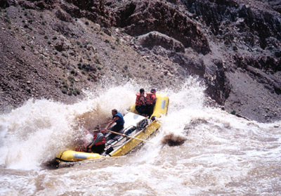
The Colorado River is the primary water source for more than 30 million people in the U.S. and Mexico. Recent studies that project streamflow changes in the Colorado River all project annual declines, but the magnitude of the projected decreases range from less than 10% to 45% by the mid-21st century. To understand these differences, we address the question the management community has raised: “why is there such a wide range of projections of impacts of future climate change on Colorado River streamflow, and how should this uncertainty be interpreted?” We identify four major sources of disparities among studies that arise from both methodological and model differences. In order of importance, these are differences in: Global Climate Models (GCMs) and emission scenarios used; ability of land surface and atmospheric models to simulate properly the high elevation runoff source areas; sensitivities of land surface hydrology models to precipitation and temperature changes; and methods used to statistically downscale GCM scenarios. In accounting for these differences, there is substantial evidence across studies that future Colorado River streamflow will be reduced under the current trajectories of anthropogenic greenhouse gas emissions, due to a combination of strong temperature-induced runoff curtailment and reduced annual precipitation. Reconstructions of pre-instrumental streamflows provide additional insights; the greatest risk to Colorado River streamflows is a multi-decadal drought, like those observed in paleo reconstructions, exacerbated by a steady reduction in flows due to climate change. This could result in decades of sustained streamflows much lower than have been observed in the ~100 years of instrumental record.
Here’s a release from one of the sponsoring organizations, the Cooperative Institute for Research in Environmental Sciences:
The Colorado River provides water for more than 30 million people in the U.S. West, so water managers have been eager to understand how climate change will affect the river’s flow. But scientific studies have produced an unsettling range of estimates, from a modest decrease of 6 percent by 2050 to a steep drop of 45 percent by then.
A new paper by researchers at the University of Washington (UW), CIRES, NOAA and other institutions across the West investigates and explains why those estimates differ and summarizes what is known about the future of this iconic Western river—key information for decision makers.
“We know, for example, that warmer temperatures will lead to more evaporation and less flow,” said co-author Bradley Udall, who contributed to the study as director of the CIRES Western Water Assessment, a NOAA-funded program at the University of Colorado Boulder. Udall is now director of CU-Boulder’s Getches-Wilkinson Center for Natural Resources, Energy and Environment at Colorado Law. “Although projections of future precipitation aren’t as clear, it’s likely that we’re going to see a reduction in overall flow in the Colorado,” Udall said.
The study is published this week in theBulletin of the American Meteorological Society.
While the paper does not narrow the existing range of estimates, it provides context for evaluating the current numbers. The 6 percent reduction estimate, for example, did not include some newer climate model runs, which tend to predict a drier West. And the 45 percent decrease estimate relied on models with a coarse spatial resolution that could not capture the effects of topography in the headwater regions. The new analysis, thus, supports more moderate estimates of changes in future flows.
“The different estimates have led to a lot of frustration,” said lead author Julie Vano, who recently earned a UW doctorate in civil and environmental engineering. “This paper puts all the studies in a single framework and identifies how they are connected.”
In evaluating recent scientific papers that estimate future flow of the Colorado River, she and her co-authors identified several reasons for different flow estimates. Among them are differences in:
Climate models and future-emissions scenarios used. Models run with higher future greenhouse gas emissions, for example, typically produce warmer and often drier climates, and smaller Colorado River flows. The models’ spatial resolution, which is important for capturing topography and its effects on snow distribution in the Colorado River’s mountainous headwaters. Models with coarser resolution tend to overestimate the sensitivity of runoff to climate change. Representation of land surface hydrology, which determines how precipitation and temperature changes will affect the land’s ability to absorb, evaporate or transport water. Methods used to downscale from the roughly 200-kilometer resolution used by global climate models to the 10- to 20-kilometer resolution used by regional hydrology models. The new paper also highlights several important realities faced by Western water managers reliant on Colorado River flows. The early 20th century, for example, is the basis for water allocation in the basin, but was a period of unusually high flow, so Colorado River water is already overallocated. Moreover, tree ring records suggest that the Colorado has experienced severe droughts in the past and will do so again, even without any human-caused climate change. If exacerbated by steadily decreasing flows due to climate change, such a “megadrought” could result in decades of extremely low streamflow, much lower than observed in the last century.
– See more at: http://cires.colorado.edu/news/press/2013/coloradoriver.html#sthash.EGBPC9pg.dpuf
From the Fort Collins Coloradoan (Bobby Magill):
…the river’s flows are likely to greatly decline, according to an American Meteorological Society paper co-authored by Bradley Udall, director of the Western Water Assessment at the University of Colorado Boulder…
Studies have long shown that flows in the river will decline, but projected decreases have ranged from 10 percent to 45 percent.
The wide range in projected flow decreases occurred because of differing climate models scientists used and how they accounted for the vulnerability of mountain snowpack to climate change, according to the paper.
Regardless of previous streamflow projections, it’s clear that the Colorado River’s flow will likely decline significantly in the coming years, according to the paper…
Tree ring records show severe droughts have been common in the past and will come again, according to the paper. If climate change makes those droughts worse, already-low flows in the river will decline even further. “Such a ‘megadrought’ could result in decades of extremely low streamflow, much lower than observed in the last century,” the paper says.
From the Summit County Citizens Voice (Bob Berwyn):
A new study by an interdisciplinary team of scientists from around the West doesn’t provide a definitive answer [ed. to the question of how far streamflow may drop] — but it does help explain why the estimates are so different and may help narrow the range in the next generation of climate models.
“We tried to tease apart all the reasons for this broad range,” said Brad Udall, who contributed to the paper as director of the CIRES Western Water Assessment, a NOAA-funded program at the University of Colorado Boulder. When you include all the elements, including natural climate variability and the challenges of downscaling models, the biggest message is continuing uncertainty, Udall said.
“We really don’t know, but we have pretty good handle that it’s negative. It ranges from, we can handle this, to, Oh my God, it’s really off the charts and we need to rethink water management in the basin,” he said. “This paper puts people on notice that you’re going to live with this uncertainty.”
The paper also assesses what scientists do know, including that future emissions of greenhouse gases really matter. Regardless of the other variables, climate models agree that, the warmer it gets, the drier it gets, Udall said, outlining some of the key points of the study.
As they surveyed various Colorado River studies, the team found that the models are all over the map, so it matters which one is used for projections — but 70 percent of the models indicate that flows will decrease.
One of the challenges is related to the scale of the models. Udall said it’s important to remember that 85 percent of the water in the Colorado River Basin comes from 15 percent of the basin’s geographic span, a relatively small mountain region (the Colorado River headwaters) where climate models have a hard time projecting global warming impacts based in part on the complex topography.
On the other hand, the study was able to make some conclusions about the relationships between temperatures, precipitation and flows, showing, for example, that if precipitation holds steady, runoff decreases by about 2 to 5 percent for every 1.8 degrees Celsius of warming.