
From The Pueblo Chieftain (Chris Woodka):
If this were a postcard winter, it would be the kind in which a polar bear in sunglasses was enjoying a tropical drink and a lot of the words in the message were crossed out and scribbled over.
On paper, everything looks pretty average. But there have been twists of extreme cold and higher-than-normal temps, snowpack that built up early and began to dwindle and the typical uncertainty of how things will play come springtime.
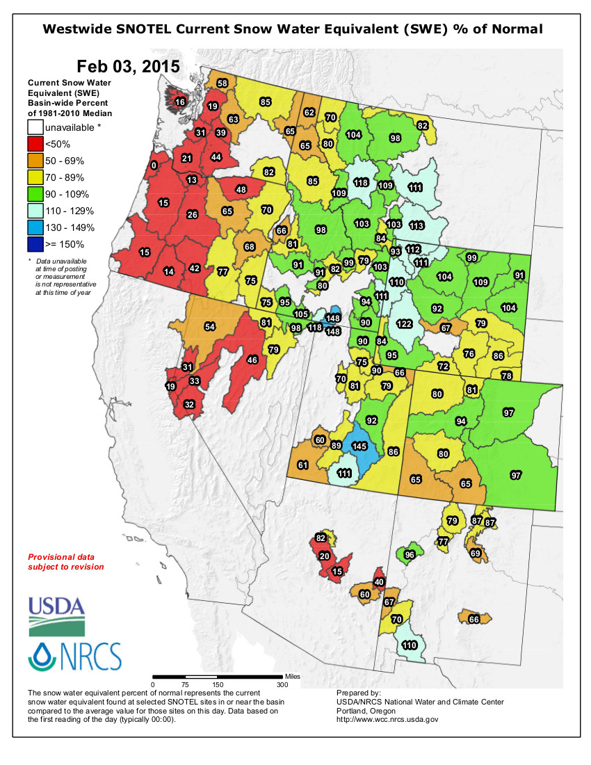
Snowpack for Colorado as a whole was just 81 percent of median as of Tuesday, but that’s no indication of how it will turn out or even of how it is in any given part of the state.
Most of the snowpack is clustered over the central mountains at the top of watersheds that feed into the Arkansas, Colorado and South Platte basins — all of which are almost at normal levels.
The outlying parts of the state are drier than normal.
“What’s unusual is that we normally see very cold weather in the December-February time period,” said Charles Kuster, who watches the weather closely in the Leadville area. “This year, I’ve only recorded 26 days with lows of 0 degrees (Fahrenheit), and the average is usually about 60 days of those type of temperatures.”
The high temperature in Leadville was 50 degrees on Jan. 26, and the lows were 7 degrees above average overall.
That has played havoc with a snowpack that built up generously in November and December, but suffered in January. Kuster recorded just a foot of snow last month, about 17 inches below normal.
“We’ve had very warm nights for this time of year,” he said. “Normally that’s not a factor. But even with the low sun angle, we’re seeing some melting. It’s unusual to have significant melting this time of year.”
Still, some sites in the Leadville area remain well above normal, such as Fremont Pass, which is sitting at 123 percent of median in snowpack and 124 percent of average precipitation since October.
The Rio Grande basin is just at 65 percent of median snowpack, the driest area of the state.
Colorado’s Southeastern corner still is in severe drought, according to the U.S. Drought Monitor.
The National Oceanic and Atmospheric Agency’s three-month outlook is calling for aboveaverage precipitation and below-average temperatures for Southeastern Colorado.<,/blockquote>
 West Drought Monitor January 27, 2015
 Statewide snowpack January 30, 2015
 Arkansas Basin High/Low graph January 30, 2015
 Upper Colorado River Basin High/Low graph January 30, 2015
 Gunnison Basin High/Low graph January 30, 2015
 Laramie and North Platte Basin High/Low graph January 30, 2015
 Upper Rio Grande River Basin High/Low graph January 30, 2015
 San Miguel, Dolores, Animas, and San Juan Basin High/Low graph January 30, 2015
 South Platte River Basin High/Low graph January 30, 2015
 Yampa and White Basin High/Low graph January 30, 2015