
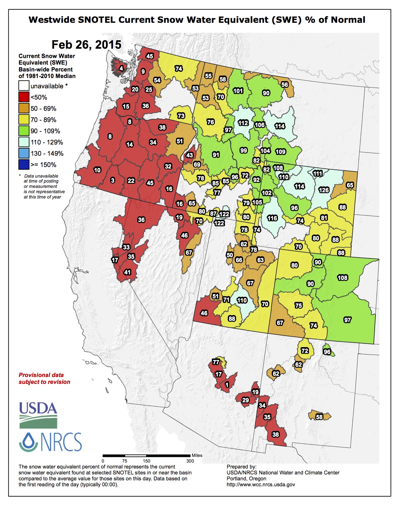
Click on a thumbnail below to view a gallery of snowpack data for February 25, 2015 from the NRCS.

Statewide snowpack February 25, 2015 via the NRCS

Arkansas River Basin High/Low Graph February 25, 2015 via the NRCS

Upper Colorado River Basin High/Low Graph February 25, 2015 via the NRCS

Gunnison River Basin High/Low Graph February 25, 2015 via the NRCS

Laramie and North Platte Basin High/Low Graph February 25, 2015 via the NRCS

Upper Rio Grande River Basin High/Low Graph February 25, 2015 via the NRCS

San Miguel, Dolores, Animas, and San Juan Basin High/Low Graph February 25, 2015 via the NRCS

South Platte River Basin High/Low Graph February 25, 2015 via the NRCS

Yampa and White Basin High/Low Graph February 25, 2015 via the NRCS
The current snowpack for the Roaring Fork Watershed is down to 78% of normal. Even with the recent new snow, the snowpack continues to be…
— RoaringFkConservancy (@rfconservancy) February 26, 2015