Town of Winter Park officials meet with EPA, CDPHE, UPRR to discuss wastewater treatment project — Sky-Hi Daily News

westportalmoffattunnel

From The Sky-Hi Daily News (Travis Poulin):

MEETING WITH WINTER PARK, EPA, UPRR

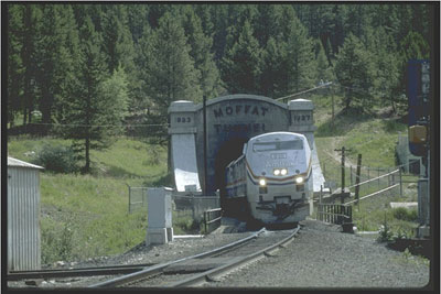
The Town of Winter Park scheduled a meeting in Denver with the EPA (Environmental Protection Agency), participants from Grand County, CDPHE (Colorado Department of Public Health and Environment), UPRR (Union Pacific Railroad), CDM Smith (UPRR’s consultant), Winter Park Ranch and HRS Water Consultants, Inc. on November 21. The meeting was to address the Class V injection well permitting process regarding the permit that will be submitted by the UPRR for a well near the Moffat Tunnel.

According to Lisa McClain-Vanderpool, Public Affairs Officer for the EPA the purpose of the meeting was to educate the parties on the Class V well permitting process and discuss issues associated with the wastewater treatment plant project for discharges from the Moffat Tunnel to the Fraser River. EPA’s UIC (Underground Injection Control) Class V program has authorized the construction of an onsite waste water system for domestic waste. UPRR will submit a Class V permit application for its wastewater treatment facility. Additional sanitary waste would be dumped into the system as well.

WINTER PARK’S CONCERNS

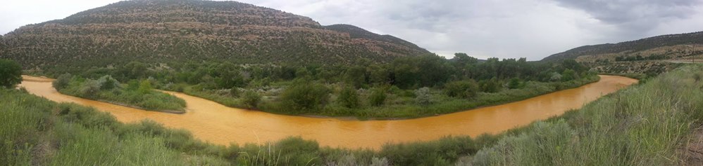
Winter Park Town Manager Drew Nelson said, prior to the meeting, that with the nature of the soils in the area, the Town is concerned that contaminants could easily move between the septic and leach field into the Fraser River. The meeting was not held to address the contaminants seen discharging into the Fraser River in September, but only concerned waste materials generated by the new water treatment facility. The facility has been under construction for the last few years.

GRAND COUNTY’S CONCERNS

Grand County Water Specialist Katherine Morris expressed the Water Resource Management department’s concerns about the project to the Grand County BOCC (Board of County Commissioners) on November 1.

Morris submitted an update memo stating that the treatment plant has a bathroom and faucet needing treatment, and will produce a certain amount of centrate waste from the plant waste treatment process that needs to be dealt with appropriately. UPRR applied to Winter Park Water and Sanitation District (WPWSD) to accept the waste stream and was granted a variance from the compulsion to connect because the waste will be classified “industrial” and would require reopening WPWSD’s permit and likely redesign of the plant. UPRR then applied to the county for Class V injection permit, which is essentially an OWTS (On-site Water Treatment System). The OWTS was declined because it would include industrial rather than solely domestic waste. Morris said Grand County Water had several concerns about the new application. She said it is unclear if the plant has a source of potable water for the restroom. Because there is no acknowledgment yet in the discharge permit of the organic contamination within the discharge, to the county’s knowledge, the plant was not designed to treat organics, and it is unclear how much of a threat the organics pose. The update states it is not clear what will be the fate and transport of organics through the treatment process, and they don’t know how much of the organic pollutants will end up in the centrate that is destined for the OWTS. Morris referenced the discharge from the Moffat Tunnel in September, stating that events like that are likely to overwhelm the plant. The update asked: if an OWTS is approved, what oversight will there be to ensure that highly concentrated discharges are actually processed through the plant? And is an OWTS adequate to the task of safely breaking down any organics that survive treatment, or will they just concentrate in the vault or travel by groundwater through the relatively close connection to the Fraser River?

WHAT IS A CLASS V INJECTION WELL?

According to the EPA website, a Class V well uses injection techniques different from those used by wells in other classes. Some Class V wells are technologically advanced disposal systems, but most are low-tech holes in the ground. A typical Class V well is shallow and relies on gravity to drain or inject waste into the ground, which is often directly into, or above, an underground source of drinking water. Class V wells are used to inject non-hazardous fluids underground. Most are used to dispose of waste into or above underground sources of drinking water. This disposal can pose a threat to ground water quality if not managed properly.

Examples of simple class V wells are dry wells, cesspools, and septic system leach fields.

REQUIREMENTS

The EPA has established minimum requirements to prevent injection wells from contaminating underground sources of drinking water. According to the EPA website, in most cases Class V wells are authorized by rule—meaning they may be operated without a permit as long as the owners or operators abide by a set of regulations:

Submittal of inventory information to their permitting authority and verify that they are authorized to inject—the permitting authority will review the information to be sure that the well will not endanger drinking water

Operate the wells in a way that does not endanger drinking water.

APPLICATION PROCESS

The process for a Class V application relies on public input, according to McClain-Vanderpool.

First, an applicant submits an application to the UIC unit. The UIC unit will make sure the application is complete. If complete the review process starts.

After the technical and administrative review process is done and the application meets EPA requirements, they continue on to the next step. If it does not meet EPA requirements, a letter is sent to the applicant explaining the reason it was not approved.

The UIC program will draft a permit and submit it for a 30-day public notice on their website and in the local newspaper.

If no comments are received, the UIC unit will finalize the permit and issue it. If they get public comment, they will consider the comments for their decision.

The timeline depends on the complete application and the public notice response.

The UIC unit cannot estimate a timeline for this process, according to McClain-Vanderpool.

@USGS: Characterization and relation of precipitation, streamflow, and water-quality data at the U.S. Army Garrison Fort Carson and Piñon Canyon Maneuver Site, Colorado, water years 2013–14

fortcarsonpinoncanyonusgs

Click here to read the report. Here’s the abstract:

To evaluate the influence of military training activities on streamflow and water quality, the U.S. Geological Survey, in cooperation with the U.S. Department of the Army, began a hydrologic data collection network on the U.S. Army Garrison Fort Carson in 1978 and on the Piñon Canyon Maneuver Site in 1983. This report is a summary and characterization of the precipitation, streamflow, and water-quality data collected at 43 sites between October 1, 2012, and September 30, 2014 (water years 2013 and 2014).

Variations in the frequency of daily precipitation, seasonal distribution, and seasonal and annual precipitation at 5 stations at the U.S. Army Garrison Fort Carson and 18 stations at or near the Piñon Canyon Maneuver Site were evaluated. Isohyetal diagrams indicated a general pattern of increase in total annual precipitation from east to west at the U.S. Army Garrison Fort Carson and the Piñon Canyon Maneuver Site. Between about 54 and 79 percent of daily precipitation was 0.1 inch or less in magnitude. Precipitation events were larger and more frequent between July and September.

Daily streamflow data from 16 sites were used to evaluate temporal and spatial variations in streamflow for the water years 2013 and 2014. At all sites, median daily mean streamflow for the 2-year period ranged from 0.0 to 9.60 cubic feet per second. Daily mean streamflow hydrographs are included in this report. Five sites on the Piñon Canyon Maneuver Site were monitored for peak stage using crest-stage gages.

At the Piñon Canyon Maneuver Site, five sites had a stage recorder and precipitation gage, providing a paired streamflow-precipitation dataset. There was a statistically significant correlation between precipitation and streamflow based on Spearman’s rho correlation (rho values ranged from 0.17 to 0.35).

Suspended-sediment samples were collected in April through October for water years 2013–14 at one site at the U.S. Army Garrison Fort Carson and five sites at the Piñon Canyon Maneuver Site. Suspended-sediment-transport curves were used to illustrate the relation between streamflow and suspended-sediment concentration. All these sediment-transport curves showed a streamflow dependent suspended-sediment concentration relation except for the U.S. Geological Survey station Bent Canyon Creek at mouth near Timpas, CO.

Water-quality data were collected and reported from seven sites on the U.S. Army Garrison Fort Carson and the Piñon Canyon Maneuver Site during water years 2013–14. Sample results exceeding an established water-quality standard were identified. Selected water-quality properties and constituents were stratified to compare spatial variation among selected characteristics using boxplots.

Trilinear diagrams were used to classify water type based on ionic concentrations of water-quality samples collected during the study period.

At the U.S. Army Garrison Fort Carson and the Piñon Canyon Maneuver Site, 27 samples were classified as very hard or brackish. Seven samples had a lower hardness character relative to the other samples. Four of those nine samples were collected at two U.S. Geological Survey stations (Turkey Creek near Fountain, CO, and Little Fountain Creek above Highway 115 at Fort Carson, CO), which have different geologic makeup. Three samples collected at the Piñon Canyon Maneuver Site had a markedly lower hardness likely because of dilution from an increase in streamflow.

@NOAA: GOES-R is now GOES-16!

From NOAA:

[On] November 29, 2016, NOAA’s GOES-R satellite executed its final liquid apogee engine burn without anomaly. This has placed the satellite approximately 22,000 miles away with an inclination of 0.0 degrees, meaning it has reached geostationary orbit. GOES-R is now GOES-16!

Later today, GOES-16 will perform its second stage solar array deployment, releasing the solar array yoke and solar pointing platform. In the days that follow, the software will be transitioned from the ‘orbit raising’ mission phase to ‘operational,’ several maneuvers will be conducted to adjust the satellites precise orbit, and the magnetometer boom will be deployed. Testing and calibration of GOES-16 will then begin.

GOES-R Prepares For Launch. Photo credit NASA.

McElmo Flume Overlook dedication Dec. 5 — Cortez Journal

Triad Western Constructors restored the foundation McElmo Flume historical site. The structure was stabilized with new concrete footers and the metal was restored. A pullout off U.S. Highway 160 east of Cortez allows travelers to view a piece of pioneer history. Photo credit the Cortez Journal.

From Montezuma County via The Cortez Journal:

Trail of the Ancients National Scenic Byway, Montezuma County and the Colorado Department of Transportation will host a dedication of the McElmo Flume Overlook at 11 a.m. on Monday, Dec. 5.

Transportation to the site is by shuttle bus from the Montezuma County Fairgrounds.

Visitors are asked to park north of the indoor arena no later than 10:45 a.m. on Dec. 5, to meet the bus. RSVP’s to James Dietrich (970)565-7402, jdietrich@co.montezuma.co.us, for planning purposes, please.

A local landmark from the last century, the flume can now be seen from viewing platform at a new highway rest stop off U.S. Highway 160 east of Cortez. The turnout includes informational panels about water and irrigation in our county.

There will be numerous speakers at the dedication. Susan Thomas, of the Trail of the Ancients Byway, will give welcoming remarks; Terry Knight of the Ute Mountain Historic Preservation Office, will conduct a blessing of the site; Les Nunn, of the Montezuma Valley Irrigation Co. (retired), and Linda Towle, of the Cortez Historic Preservation board, will tell the history of local irrigation; Mike Preston, of the Dolores Water Conservancy District, will tell the modern irrigation story; and James Dietrich, federal lands coordinator for Montezuma County, will discuss the next preservation steps for the 125-year irrigation structure.

The many sponsors of the McElmo Flume Project include: Ballantine Family Fund, Colorado State Historical Fund, Colorado Department of Transportation, Federal Highway Administration, Mesa Verde Country, Montezuma County, Montezuma County Historical Society, Southwestern Water Conservation District, Southwest Basin Roundtable, Trail of the Ancients Scenic Byway, and the Ute Mountain Ute Indian Tribe.

Weekly Climate, Water and #Drought Assessment of the Upper #ColoradoRiver Basin #COriver

Upper Colorado River Basin month to date precipitation through November 27, 2016 via the Colorado Climate Center.

Click here to read the current assessment. Click here to go to the NIDIS website hosted by the Colorado Climate Center.

#Snowpack #Drought news: “…we’ll take moisture at this point, any way we can get it” — Tom Laca

Westwide SNOTEL map November 29, 2016 via the NRCS.

From KRDO.com:

Some farmers unable to plant fall, winter crops

The longer the area’s unusually dry fall weather continues, the more people worry it may continue through winter and into spring.

Tom Laca, a Colorado State University Extension agent for Pueblo County, said few farmers are planting winter wheat this season — a process that normally begins in September.

Laca said except for larger farms with irrigation, it’s too late to plant winter wheat and other late-season crops…

“To get back to where we need to be, we can (do it) several ways,” he said. “One big snowstorm would put us back there, if we got enough in that snowstorm. Can’t say it wouldn’t happen. Several smaller events would also be beneficial, as well. We just need moisture, and we’ll take moisture at this point, any way we can get it.”

[…]

Most farmers can handle the situation, Laca said, because they’re resilient and don’t rely solely on one crop.

“But if it’s still this dry in the spring, farmers will face tough decisions about what to plant,” he said.

Meanwhile, Colorado Springs is dealing with several issues related to the fall dry spell.

The Parks and Recreation Department exceeded its watering budget by $220,000 and needed approval from the City Council to find money from other sources.

“We’ll probably need to ask for $75,000 more,” said Kurt Schroeder, parks operations manager.

Schroeder said the warmer, drier fall means increased use of parks, and greater wear and tear on grass.

“We still need to water but we can’t water everything because we’ve already blown out our sprinkler systems,” he said. “If it continues to be dry, we’ll do what we’ve done before — turn the systems back on in the larger parks and athletic fields, and water them as much as we can until we get some moisture.”

Under that strategy, Schroeder said neighborhood parks won’t be watered, which could leave grass in worse condition when spring arrives.

From 9News.com (Maya Rodriguez):

“Colorado, we’re going through a bit of a shift right now,” said Becky Bolinger, a climatologist with the Colorado Climate Center in Fort Collins.

Every Tuesday, climatologists at the center analyze the state’s soil moisture and snowpack data, which is then used by the U.S. Drought Monitor to put together a map of conditions.

“We were looking at snowpack of about 20 to 25 percent of average,” Bolinger said. “In the past couple weeks, things have started to shift. We started to see a little bit more an accumulation of snow in the high country and that’s really helped to boost those numbers.”

They now range closer to between 40- and 60-percent of what the state would normally see in snowpack at this time, not great numbers, but snow of late is helping.

“The areas that have seen the most improvement are the Southwest Corner and Northwest Corners of the state,” said Colorado Climate Center Climatologist Peter Goble.

So where are things not great? Look east.

“The areas that are struggling the most are east of the Divide,” Goble said.

In the meantime, climatologists say Colorado looks like it’s starting to get back into the swing of snow in the winter. Yet, there is reason for caution.

From The Pueblo Chieftain (Peter Roper):

“This is the slowest start on snowpack that we’ve seen in decades,” said Alan Ward, division manager at the Pueblo Board of Water Works. “The snow monitors we have in the mountains show that there is only 8 percent of the normal amount of snow we typically see in November.”

That said, Ward emphasized the Pueblo utility has enough stored water that, even if the winter stays bone dry, Pueblo residents would probably not face any water restrictions next summer.

“But we’d like to see that snowpack improving,” he said. “A couple of good storms could catch us up to normal.”

There was as little as 2 inches of snow recorded in some mountain areas [November 17, 2016]. And water content was less than that.

“If the winter stays dry, city residents won’t face restrictions but it would affect how much water we lease to farmers,” Ward said.

The dry weather already has had obvious consequences, with two fast-burning wildfires in the mountains west of Pueblo this fall.

And the lack of snow has kept the Monarch Mountain ski resort and other ski areas from their usual November openings.

Monarch staff is advising callers to check on the resort’s website each day for news about when it will open.

The Western U.S. is experiencing weather from a La Nina cooling effect over the Pacific Ocean.

That usually produces warm, dry weather in the Southwest, while Washington, Oregon and the Northwest region may get rain and snow.

Ward said the short-term forecast from the National Weather Service calls for more warm, dry weather; and the three-month forecast also is very uncertain about rain or snow this winter.

“We’ve had that La Nina effect in place for a few years, and we’ve actually done all right in the Pueblo area during winter,” he said.

Colorado Drought Monitor November 22, 2016.

#ClimateChange: What Happens When the Ice Disappears? — Pacific Standard #keepitintheground

Here’s a report from Bob Berwyn writing for Pacific Standard Magazine. Click through for the photos. Here’s an excerpt:

The world depends on snow and ice for everything from water to sun-reflection. But thanks to global warming, big parts of the Earth’s cryosphere have already disappeared.

The Rutgers Global Snow Lab tracks hemispheric snow cover extent.

In the age of global warming, one thing is certain: There will be less ice and snow. Glaciers, ice shelves, and sea ice are melting away, and there has been a dramatic drop-off in the number of snow-covered days around the world, as documented by the Rutgers University Global Snow Lab. Since 1967, spring snow cover in the Northern Hemisphere has dwindled by about three million square kilometers.

The loss of Earth’s reflective white surfaces will intensify the spiral of global warming. Darker surfaces absorb more incoming solar radiation. That warmth delays the onset of winter and hastens the arrival of spring. In the Arctic, the decline of the cryosphere is affecting fundamental biological cycles like the reproduction of carbon-storing plankton. And it may also be affecting the jet stream, making weather more extreme across the Northern Hemisphere.

But the realms of ice and snow aren’t confined to the North and South Poles —they also include the world of frozen tundra and boreal forests, as well as snow-covered mountains and highlands, especially the glacial regions of the Andes, Himalaya, Alps, and Rockies. The meltdown in these areas is affecting every ecosystem imaginable.

Water stored in snow and ice represents a crucial global supply for human communities, irrigating rice paddies in Pakistan, cattle pastures in Canada, and verdant fields of mountain hay in the European Alps. Global warming is disrupting the seasonal cycle of those flows nearly everywhere. The changes will require fundamental and costly infrastructure adjustments.

Earth’s icy realms have started melting so fast that even the mainstream media, which hasn’t paid nearly enough attention to global warming, started to heed the issue this past month. In November, even CNN reported on the record-low ice extent at both poles.

But for big parts of the Earth’s cryosphere, it is too late. Even if greenhouse gas emissions were completely stopped today, most of the world’s glaciers would still disappear or dwindle to remnants by the end of this century, just from the CO2 that’s already in the atmosphere, while the polar ice caps will likely keep shrinking for centuries to come.

The cryosphere isn’t just some distant abstract place. If you live outside the planet’s tropics or hot desert belts, it extends, at least seasonally, into your backyard. Snow and ice have cultural, economic, aesthetic, and even spiritual values that will be lost as the world warms. Many communities, regions, and even entire countries identify themselves with snow and ice, from reindeer herders in Lapland to Native American seal hunters and winter sports enthusiasts in the Rocky Mountains. There’s really no way to pin a precise dollar amount to some of those values, but that doesn’t diminish the cost of their loss.

Lamar: 2016 Annual Meeting Arkansas River Compact Administration, Friday, December 9, 2016

Arkansas River Basin via The Encyclopedia of Earth

From email from the Arkansas River Compact Administration:

The 2016 Annual Meeting of the Arkansas River Compact Administration (ARCA) will be held on Friday, December 9, 2016, commencing at 8:00 A.M. MST (9:00 A.M. CST) at the location noted above. The meeting will be recessed for lunch at about 12:00 P.M. and reconvened for the completion of business in the afternoon as necessary.

The Engineering, Operations, and Administrative/Legal Committees of ARCA will meet on Thursday, December 8, 2016, also at the location noted above, starting at 1:00 PM. MST (2:00 P.M. CST) and continuing to completion. The public is invited to attend the Committee meetings, however please be aware time for comments may be limited.

Meetings of ARCA are operated in compliance with the federal Americans with Disabilities Act. If you need a special accommodation as a result of a disability please contact Stephanie Gonzales at (719) 688-0799 at least three days before the meeting.

This information is also available on ARCA’s website: http://www.co-ks-arkansasrivercompactadmin.org/

@USBR Releases Progress Report on Meeting #ClimateChange Adaptation Strategy

Hydroelectric Dam
Hydroelectric Dam

From the US Bureau of Reclamation (Peter Soeth):

tevan López released a report today that provides a status update on the actions Reclamation is undertaking to meet the challenges of climate change on Western water supplies. This includes meeting the four goals established in the strategy, increasing water management flexibility, enhancing climate adaptation planning, improving infrastructure resiliency, and expanding information sharing.

“Climate change poses clear risks to our ability to deliver water and power,” Commissioner López said. “In light of those risks, Reclamation and our partners will take key steps that line up with the goals of this strategy, helping to ensure a sustainable water supply across the West.”

The strategy identifies four primary goals to improve Reclamation’s ability to consider climate change information in its decision making:

  • Goal 1 – Increase Water Management Flexibility
  • Goal 2 – Enhance Climate Adaptation Planning
  • Goal 3 – Improve Infrastructure Resiliency
  • Goal 4 – Expand Information Sharing
  • Reclamation is making progress on the activities identified in the four goals of the strategy. These activities include:

  • five reservoir operation pilot studies that are evaluating how weather, hydrology and climate change information can better inform reservoir operations;
  • implementing hydropower optimizations that could increase generation by 410,000 to 1.2 million megawatt hours per year, enough electricity for between 37,000 to 109,000 households;
  • Reclamation is supporting integration of climate change information across planning activities through approaches developed through the basin studies and the drought response program;
  • the Western Watershed Enhancement Program that has provided nearly $1.2 million to cost-share seven wildfire resiliency projects in Arizona, California, Colorado, Idaho and Washington; and
  • Reclamation working with its partners to offer climate change training courses for technical water resource professionals and for general audience on integrating climate change considerations into water resources planning.
  • The actions identified in the Climate Change Adaptation Strategy are part of the Department of the Interior’s implementation of President Obama’s Climate Action Plan, the strategy provides a framework in which Reclamation managers can develop and adopt innovative solutions that provide a more reliable water supply in a changing climate. It also supports the Nov. 1, 2013, Executive Order, Preparing the United States for the Impacts of Climate Change.

    To view the progress report and learn more about how Reclamation is incorporating climate change into its efforts, please visit https://www.usbr.gov/climate.

    #AnimasRiver: Justice Dept. to look at #GoldKingMine spill lawsuit — Albuquerque Journal

    This image was taken during the peak outflow from the Gold King Mine spill at 10:57 a.m. Aug. 5. The waste-rock dump can be seen eroding on the right. Federal investigators placed blame for the blowout squarely on engineering errors made by the Environmental Protection Agency’s-contracted company in a 132-page report released Thursday [October 22, 2015]
    This image was taken during the peak outflow from the Gold King Mine spill at 10:57 a.m. Aug. 5. The waste-rock dump can be seen eroding on the right. Federal investigators placed blame for the blowout squarely on engineering errors made by the Environmental Protection Agency’s-contracted company in a 132-page report released Thursday [October 22, 2015]

    From the Associated Press (Dan Boyd) via The Albuquerque Journal:

    New Mexico’s lawsuit against neighboring Colorado over the fallout of a massive mine spill could be affected by the pending presidential transition, after the U.S. Supreme Court on Monday asked the federal Department of Justice to weigh in on the case…

    Top-ranking state officials indicated Monday that they are taking a wait-and-see approach to the request for the federal government’s legal opinion – even if that means a drawn-out court saga.

    “We will be interested to read the U.S. Office of the Solicitor General’s opinion of our lawsuit filed in the U.S. Supreme Court against the state of Colorado,” state Environment Secretary-designate Butch Tongate said in a statement.

    New Mexico’s lawsuit, filed in June, contends Colorado was too lax in its oversight of water contaminated by decades of mining and should be held responsible for the fallout of the 2015 Gold King mine spill. It was filed by Attorney General Hector Balderas’ office and outside attorneys hired by the Environment Department…

    In addition to the lawsuit against Colorado, New Mexico has also filed a lawsuit in federal court against the EPA and the owners of a mine adjacent to the Gold King Mine. That lawsuit seeks more than $136 million in damages, which would be used to pay for economic losses the state attributes to the mine spill, specifically in the tourism, recreation and agriculture sectors.

    The U.S. Supreme Court…handles cases that involve one state suing another. And it’s common for the nation’s highest court to ask the solicitor general, a top attorney within the Justice Department, to weigh in on such cases by filing official court briefs. The briefs lay out the federal government’s views on the case, including its merits.

    #ColoradoRiver: “It was a how-should-we-be-prepared-for-another-drought study” — Eric Kuhn #COriver

    Glen Canyon Dam June 2013 -- Photo / Brad Udall
    Glen Canyon Dam June 2013 — Photo / Brad Udall

    From The Grand Junction Daily Sentinel (Dennis Webb):

    The head of the Colorado River District is defending an ongoing water study from Front Range concerns about its intent and possible regional bias.

    Eric Kuhn, the district’s general manager, says while Front Range water interests view the project as a water supply study, that’s not the case.

    “It was a how-should-we-be-prepared-for-another-drought study,” he said Monday in providing an update to the Colorado Basin Roundtable water group.

    The first phase of a study undertaken by the four Western Slope river basin roundtables, with the leadership of the river district and Southwestern Water Conservation District, found that another severe drought such as the one in the early 2000s could cause enough of a drop in Lake Powell to jeopardize Glen Canyon Dam’s ability to generate electricity. It also could create a risk of Colorado and other Upper Colorado River Basin states being unable to meet their downstream water delivery obligations under a 1922 interstate compact and under guidelines established in 2007. That could result in a cutback in Upper Basin water uses.

    The Western Slope is now planning a second phase of the study that would cost about $90,000. The goal is to further quantify the drought risks to water users in the state by looking at use-reduction scenarios for making up for a deficit of water in Powell.

    Four Western Slope roundtables are asking the Colorado Water Conservation Board for $10,000 apiece, or $40,000 total, for the study’s second phase, with the river district and Southwest district splitting the difference. But Jim Lochhead, chief executive officer and manager of Denver Water and president of the Front Range Water Council utilities group, has written a letter arguing that such a study would be best conducted at a statewide or Upper Colorado River Basin level, “with all interested water users represented, rather than by particular sub regions or individual roundtables.”

    Some of the proposed involuntary water-use curtailment alternatives in the study’s second phase “potentially favor limited special interests,” Lochhead wrote, stressing the need instead for a state-led discussion that considers all interests.

    He also voiced the council’s concern that assumptions used in phase one “may be creating biased impressions regarding the amount of the remaining developable water” in the Colorado River Basin, and that phase one may be viewed by some outside the state “as representative of the State of Colorado’s position on remaining developable water.”

    How much of that water remains to be developed is a sensitive issue for the Western Slope, where most of Colorado’s water originates, and for the Front Range, which diverts a substantial amount of Colorado River water and wants to divert more.

    Kuhn says the study is simply intended to contribute toward developing a collaborative program for avoiding Colorado River compact problems for existing uses and some reasonable amount of new uses on the Western Slope. Collaboration aimed at heading off such curtailments on use due to interstate obligations was identified in the new state water plan as one of seven principles for guiding any discussions of new transmountain diversions out of the river basin.

    The CWCB’s director, James Eklund, has agreed to head up meetings aimed at resolving Front Range concerns about the study and its funding. Kuhn said he sees the result being that the state has a bigger say in the study’s scope of work, not that it takes over the study altogether.

    Colorado transmountain diversions via the State Engineer's office
    Colorado transmountain diversions via the State Engineer’s office

    #Snowpack news: Thanks Ullr, keep it coming

    Ullr: Guardian Patron Saint of Skiers
    Ullr: Guardian Patron Saint of Skiers

    Click on a thumbnail graphic below to view a gallery of snowpack data from the NRCS:

    And below is the Westwide SNOTEL map from the NRCS:

    Westwide SNOTEL map November 28, 2016 via the NRCS.
    Westwide SNOTEL map November 28, 2016 via the NRCS.

    County approves flood-recovery projects in Longmont, Boulder — Longmont Times-Call

    St. Vrain River floodplain November 2013 via the Longmont Times-Call
    St. Vrain River floodplain November 2013 via the Longmont Times-Call

    From The Longmont Times-Call (John Fryar):

    The Boulder County commissioners this morning approved flood-recovery projects that the cities of Longmont and Boulder have planned for stream properties they own in unincorporated areas of the county.

    Commissioners Elise Jones and Deb Gardner approved Longmont’s application for restoration work inside the city’s Button Rock Preserve, along a 1.3-mile stretch of North St. Vrain Creek between the Button Rock Dam spillway and Longmont reservoir.

    The commissioners also approved the Boulder Open Space and Mountain Parks’ application for reconstructing the bank and channel of Boulder Creek and an in-stream and riparian habitat restoration project near the junction of Boulder Creek and South Boulder Creek — an area lying north of Valmont Road and west of North 61st St.

    No members of the general public spoke at today’s commissioners’ hearings before Jones and Gardner voted their approvals of the two projects, each of which is to repair damages from the September 2013 floods. Commissioner Cindy Domenico did not attend the meeting.

    In each case, the cities will have to meet a number of conditions in order to proceed with the projects, including getting county grading permits and floodplain development permits.

    Preserving the prairie — The Greeley Tribune

    Lower South Platte River
    Lower South Platte River

    From The Greeley Tribune (Dan England):

    Bruce Sikich didn’t like it when his boss put the land they cared for in the hands of Colorado Open Lands.

    Sikich went to school with Clyde Abbett’s son. Sikich wasn’t very nice to Abbett’s son — Sikich was a macho punk before the U.S. Navy straightened him out — but they got along. One day, while Clyde Abbett watched Sikich work next door on his stepfather’s property, Abbett asked Sikich if he wanted to farm, too. That was 30 years ago.

    Abbett became Sikich’s best friend. Sikich visited him many days in the home, trimmed his trees at his Greeley house and misses him dearly now that he’s gone.

    Sikich was upset at Abbett’s decision to put the land in a conservation trust. It seemed to go against everything they’d worked for as farmers. Farmers, he said, don’t like to be told what to do, and the organization put restrictions on the land, even beyond the obvious ones that promise to leave the land untouched by development. He can’t ride his race bike out on the farm. Workers came around and sniffed out noxious weeds on the land.

    And yet, because Sikich loved Abbett, he understood. His land abutted the South Platte River, and that drew bald eagles and a heron rookery and places full of pasture where Abbett could rest his arms on his tractor wheel and look out into the flowing water. He buried his dogs on a nearby hill.

    At times people would offer Abbett money. They said they just wanted to build a farmhouse on his land. Sikich himself advised Abbett to take the money. It was good money. Yet Abbett never trusted them. More often than not, the person secretly wanted to mine the land for gravel, and Abbett didn’t want anyone to gouge a hole in his land.

    “This farm isn’t great,” Sikich said. “The soil isn’t that good, and it lays poorly. But it’s a beautiful place.”

    It’s the kind of place Colorado Open Lands hopes to keep protected. The organization, which recently merged with the Colorado Conservation Trust, considers Weld County land — like the tract owned by Abbett’s estate and farmed by Sikich — to be some of the most important land in the state. It also appears to be coveted by developers. And now there’s a race to control it.

    “While we work statewide, I believe that Weld County is under the greatest resource pressure,” said Sarah Parmar, director of conservation of Colorado Open Lands. “We have a unique moment in time to conserve those lands in the country that are most critical to habitat, food production and community character.”

    Weld County faces three distinct development pressures that could further change the way it looks, even breathes, Parmar said, in the next decade. Many counties face one of those pressures. Weld faces all three: Mining, both gravel and oil and gas; an exploding population; and nearby municipalities thirsty for water.

    The new organization hopes to show its renewed commitment to Weld by opening an office in northern Colorado. The organization is even considering Greeley for its location, although Fort Collins also is in the mix.

    WHERE RESOURCES ARE VALUABLE

    Although it will talk to any landowner about conservation, Colorado Open Lands does not hope to conserve every piece of farmland from development. The organization maps out areas where it believes resources are the most valuable. Those resources include wildlife habitat, prime soil on agricultural land and water rights. Many areas of Weld have all those, and those pressures that Parmar mentioned above all threaten them in some way.

    Two of those pressures won’t surprise anyone who’s lived in Weld the last few years. Oil and gas development and population growth both demand a lot from our county.

    The oil and gas boom is no longer, although there are indications that it could pick back up again. But Weld still has double the next highest county’s number of active wells. And though population projections do depend a bit on oil and gas, many still have Weld doubling its residents in the next 25 years.

    The last is a bit more complicated, but it’s still important, and it shows how hot spots such as the South Platte River can be impacted even when developers don’t necessarily want to build subdivisions on its banks.

    The organization’s worked with 15 landowners in Weld County to conserve more than 18,000 acres of land and the associated water rights. Those water rights are just as important as habitat, Parmar said, because municipalities in the Denver area appear to be targeting Weld for its water. Those cities, to feed their growth, will purchase the water rights and leave the land in what many call “buy and dry” deals. Though that can still create habitat for some wildlife, the deals also leave thousands of useless acres surrounding small or mid-sized municipalities.

    Water rights often support both agricultural production and wildlife habitat. Weld has some of the best soils in Colorado, but those soils are considered prime only if they are irrigated, Parmar said. And the habitat in Weld is more valuable than many of its residents may realize.

    “The juxtaposition of native prairie and the riparian and wetland habitats, which are often created by irrigation, harbors an amazing array of species,” Parmar said. “In other words, it is the land and water together that create these stacked economic benefits and habitat values.”

    It’s already happened in Weld, and it happened long ago, in 1986, when the city of Thornton purchased nearly 20,000 acres of irrigated farmland in Weld and Larimer counties. Pierce and Ault still feel the effects of its stagnated growth from that purchase.

    The South Platte Basin is expected to take the biggest hit to irrigated agriculture in order to meet that projected water gap, Parmar said. That’s why Colorado Open Lands hopes to target more land along the South Platte such as the tract Sikich farms as well as other key areas of Weld, such as the protection of private lands surrounding the Pawnee National Grassland.

    “The South Platte is incredibly important, as all waterways are in Colorado, because they create a convergence of resources valued by people and wildlife,” Parmar said. “The development along these waterways can have a disproportionate impact on species and can create greater problems for communities when major flood events happen, as we saw in 2013.”

    Those who hope to protect those water rights — Parmar refers to her organization and others like it as the “conservation community” — do need to show the same kind of flexibility they want from municipalities and landowners, Parmar said. One way to compromise may be to tie water rights to farms but allow some leasing for municipal needs.

    REAL AND LASTING ECONOMIC BENEFITS

    Even as Parmar insists there are real and lasting economic benefits from wildlife habitat and agriculture, there’s no doubt Weld’s also benefited from the recent growth boom and the one that occurred in the early 2000s. Oil and gas filled our coffers: At one point, the county had a $100 million reserve fund. Gravel mining’s also an important part of that.

    There is some concern that conservation easements will attempt to stop oil and gas development and gravel mining. There’s already a lot of mining along the South Platte corridor, said Tom Parko, director of planning services for Weld County.

    Conservation easements naturally place restrictions on use once they’re in place, as the idea is to preserve the land in its most pristine state. Those restrictions usually include subdivisions and residential structures, and they almost always prohibit the sale of water rights.

    If an owner has the mineral rights, the organization may ask the landowner give up the right to sell them or mine them on the surface. Lateral drilling is permitted, Parmar said.

    However, most of the time, a third party owns the mineral rights in Weld County, and in that case, a conservation easement can’t prohibit oil and gas development, and the land trust works with the owner to limit the impact if any mining takes place.

    “We are not against oil and gas development, or residential development,” Parmar said. “Our goal is to work to see it done well and in the most appropriate places.”

    A GOOD FIT

    The organization does make some inquiries, but it doesn’t try to convince landowners to move into conservation easements. Not all of the land is a good fit, and it’s a commitment and a financial sacrifice, even with the tax benefits an easement provides. Landowners need to be sure it’s a good fit for them.

    But just as the old adage that once one house pops up, others follow, that can also be true of conservation easements, Parmar said. Once you get that first conservation easement, it’s easier to get others. That’s true in part because the organization does do some limited outreach to landowners, just like developers might.

    “But it’s the neighbors and others who do most of the marketing for us,” Parmar said. “Word of mouth is our best resource.”

    Still, she looks at those three pressures that Weld faces, the growth and oil and gas and the prospect of our water going to other cities, a situation unique to our county, and sees it as an opportunity for residents.

    “I’m not saying that any of these things are inherently bad, but they are all pressures on resource conversion,” Parmar said, “and for a county whose identity and economic drivers have been largely agricultural, these combined pressures provide an opportunity for the residents of Weld County to think about their vision for its land and water.”

    Sikich’s knees and hips hurt, and he recently watched his grandkids play hockey in Minnesota and enjoyed that. He misses that now. He’s 62. He probably could do another five years, maybe even seven, but he’s not sure he wants to do that. He misses his family, and he misses Abbett as well.

    “He was my purpose,” Sikich said of his close friend and boss, “and now he’s gone. Honestly without him, it’s just no fun anymore.”

    Maybe he’s now reflecting on his career, but he’s happy with Colorado Land Trust and the work it does.

    He doesn’t know how long he’ll be around to work the land. But he’s satisfied knowing Abbett would have liked knowing it will be around after he’s gone.

    History made right, as [San Miguel] river is restored — Telluride Daily Planet

    Photo via TellurideValleyFloor.org
    Photo via TellurideValleyFloor.org

    From The Telluride Daily Planet (Jessica Kutz):

    Thanks to the Valley Floor River Restoration Project, the San Miguel River on the west side of Telluride finally was reunited on Sunday with its natural meandering ways.

    The plan for the “new” river route was based on aerial photography taken before the channelization had taken place. This helped project officials in finding the general area where the river had once been. They then were able to accurately locate the original alignment by studying the prominence of gravel layers in the area.

    In the words of Gary Hickcox, former chair of the Open Space Commission and former director of the San Miguel Conservation Fund, “The river will be able to do what rivers do.” It will be able to flood when necessary, foster riparian habitat and overall “be a much healthier river system,” he said.

    Once confined to the southern side of the Valley Floor, the river will now run lazily through the space and work its magic on land that had been devoid of the water source for more than 100 years. To recreate the meandering nature of the river, an additional 1,300 feet of length was introduced.

    It is hoped that ecologically, the area eventually will return to something close to its original state. As David Blauch, project designer with Ecological Resource Consultants, put it, “ Five years from now, we are hoping that nobody knows this is a new channel.”

    According to Hilary Cooper, program manager for Valley Floor Preservation Partners, “They set up the project to have minimal human engineering and to have the river do the engineering.”

    Although there will be some human-led interventions, including planting a seed mix based on studies of plants native to the area as well as continuous monitoring, it is believed that the river — and as some said, the beavers — will take care of the rest.

    If the river is able to flood naturally again, it will be able to “deposit sediment in a way that naturally encourages vegetation,” Cooper said.
    Hickcox added that for nature enthusiasts, the river restoration was a good move “not only from an environmental standpoint, but also visually it will be much more attractive.”

    For Cooper, and for many others invested in the project, Sunday was momentous. “It is important in so many ways ecologically, but emotionally right now it feels really good to resolve something that was a mistake. Trying to control a river and channelize it for the human population is never a good idea,” Cooper said.

    So what happens next? According to town Program Manager Lance McDonald, the commission now will start planning new trails. But he added, “We will wait to see how the landscape functions prior to making any decisions.”

    McDonald said remaining work should be completed before the end of this month, and the area will be open to the public sometime in November for all to enjoy.

    Dolores River watershed
    Dolores River watershed

    UAWCD files objection in Coaldale water case — The Mountain Mail

    Graphic via the Upper Arkansas Water Conservancy District
    Graphic via the Upper Arkansas Water Conservancy District

    From The Mountain Mail (Joe Stone):

    The Upper Arkansas Water Conservancy District board of directors voted at its recent meeting to file an objection to the Security Water District’s court application for a change of water rights on Hayden Creek in Coaldale (Division 2, case 2016CW3055).

    In discussing whether or not to get involved in the case, Upper Ark directors mentioned unresolved issues with Hill Ranch near Nathrop after the Pueblo West Metropolitan District purchased the ranch, changed the water right and dried up the land.

    The directors’ discussion highlighted three main concerns:

  • Ensuring that the amount of water claimed by Security is not excessive.
  • Ensuring that Security administers the amount and timing of return flows so that other water rights are not injured by the change of use.
  • Ensuring that the dried-up ranch land is properly revegetated.
  • Security acquired the 1894 agricultural water rights when it purchased a Coaldale ranch that, according to the filing, historically used the water to irrigate 195 acres.

    The filing cites Security’s own study of consumptive water use on the ranch from 1912 through 2006 in asserting that historical water use “resulted in net stream depletions (consumptive use credits) of approximately 236 annual acre-feet.”

    Security seeks to change the Hayden Creek water rights from an agricultural use in Coaldale to a municipal use in Security, allowing the water to flow into Pueblo Reservoir before diverting the proposed 236 acre-feet per year through the Fountain Valley Conduit.

    The Security filing indicates that the water right may be used for continued irrigation on the ranch “to the extent not limited by municipal use of the depletion credits and dry-up requirements.”

    In the filing Security commits to constructing a Coaldale augmentation station to measure and administer the Hayden Creek water rights. The filing also indicates Security “may construct a groundwater recharge facility” that “may be used for recharge to the aquifer and later delivery of accretion credits back to the Arkansas River” (i.e., return flows).

    This would help prevent injury to other water rights holders because the return flows would be delivered to the river in the same location as the historical return flows created by irrigating the ranch.

    But the filing also indicates that Security may “replace return flow obligations to the Arkansas River” by means of “releases from Pueblo Reservoir,” which could injure other water rights between Coaldale and Pueblo Reservoir.

    Since Security owns the Hayden Creek water rights, the Upper Ark district’s filing won’t prevent the change of use, but as an objector, the conservancy district will receive future filings in the case and will have the opportunity to negotiate stipulations to address concerns.

    San Luis Valley: New groundwater sub-district forms

    Artesian well Dutton Ranch, Alamosa 1909 via the Crestone Eagle
    Artesian well Dutton Ranch, Alamosa 1909 via the Crestone Eagle

    From The Valley Courier (Ruth Heide):

    Southern San Luis Valley water users took charge of their future on Tuesday as they became the third group to form a water management sub-district of the Rio Grande Water Conservation District.

    The sponsoring district board unanimously accepted petitions for its latest subdistrict , which encompasses 141 wells covering 170 parcels of land in Conejos County.

    The sub-districts are designed to provide an alternative to individual well regulation by grouping wells in geographic or hydrological areas of the San Luis Valley (Rio Grande Basin), which as a group replaces its injurious depletions to surface water rights. Sub-districts are also beginning to repair long-term depletions to the Valley’s aquifer system caused by well pumping.

    Sub-district participants pay fees, which are used to buy water and/or provide incentives to reduce pumping. In the sub-district presented on Tuesday, participants will be assessed fees per well and per acre foot of water.

    Rio Grande Water Conservation District (RGWCD) Program Manager Amber Pacheco presented to the sponsoring district board on Tuesday petitions representing 141 of a potential 198 wells in Sub-district #3. Nathan Coombs and LeRoy Salazar, who were part of the group that formed the subdistrict , were also present for the petition presentation to the RGWCD board.

    Pacheco told the board staff and working group members had been working on this third sub-district for many months. Once they had information from the groundwater model, which determines depletions, the group was able to move forward.

    Pacheco said the group was very successful in persuading well owners to join the sub-district , which is an “opt-in” sub-district . People had to choose to join. The first sub-district , on the other hand, was drawn up to cover a specific geographical area in the Valley’s closed basin region, and the work group then had to gather petitions from at least 51 percent of the landowners and 51 percent of the land.

    Pacheco said efforts were made to contact every well owner in the Conejos subdistrict to give them the opportunity to join the subdistrict . Only one well owner, whose address was in Florida, did not respond at all, and another did not want to be involved. Both of those wells had not been used in a while.

    Four other well owners opted out, not because they were against the sub-district but because they had other plans for their properties, and 21 wells belonging to governments such as towns or school districts indicated they would like to contract with the sub-district but could not participate directly, Pacheco explained.

    She added a number of well owners decided to move their wells to exempt status so they would not fall under the groundwater rule process, for example downgrading them to stock or domestic wells, and a couple of well owners planned to seek abandonment of their wells.

    All of the irrigation wells in the third sub-district are included, however, Pacheco said.

    After receiving the petitions , RGWCD staff verified ownership and legal descriptions before presenting them to the board.

    “It’s a massive undertaking ,” said RGWCD General Manager Cleave Simpson who commended the staff who completed that process. He also commended the residents who have been working on this for some time.

    “The people have been great to work with,” Pacheco added.

    RGWCD Attorney David Robbins said the process now is to file the petitions with the district court in Conejos County (because that is where the land lies in this subdistrict ) and seek the court’s approval for the sub-district’s formation. The court must hold a hearing no less than 60 days and no more than 90 days after receiving the petitions , he added. Individuals with questions or challenges against the sub-district formation may express those to the court.

    “With our participation basically 100 percent, we would hope we wouldn’t see much of a protest to the formation of the sub-district ,” Pacheco said.

    If there are no challenges, the court will enter an order forming the sub-district , and a board of managers can then be appointed and a plan of management prepared, Robbins explained.

    That plan will be submitted to the state engineer’s officer for approval.

    The first sub-district , which is one of the largest and most complicated, has been in operation for a few years now, and the second sub-district in the alluvium of the Rio Grande was officially formed in March of this year and is currently working on its plan of water management.

    Pacheco said progress is also being made in sub-districts in the San Luis Creek, Saguache and Alamosa/La Jara areas. She said the goal is to have the remainder of the sub-districts in front of the court by early next year.

    RGWCD staff has been meeting with entities such as the towns of La Jara and Saguache and the East Alamosa Water & Sanitation District to discuss their options for contracting with sub-districts . Discussions are also occurring with federal agencies.

    San Luis Valley aquifer marks another year of gains — Pueblo Chieftain

    Pond on the Garcia Ranch via Rio Grande Headwaters Land Trust
    Pond on the Garcia Ranch via Rio Grande Headwaters Land Trust

    From The Pueblo Chieftain (Matt Hildner):

    The shallow aquifer leaned on heavily by farmers in the San Luis Valley is up 58,000 acre-feet over last year at this time.

    The news delivered by Rio Grande Water Conservation District Engineer Allen Davey marks the third straight year the aquifer has gained.

    “The last three years have seen a significant change in direction,” he told the district’s board Tuesday.

    Davey, as he has in previous years, credited gains to the reduction in groundwater pumping by well owners in Subdistrict No. 1, which takes in 163,000 irrigated acres in the north-central part of the San Luis Valley.

    The subdistrict, which was implemented four years ago, assesses a combination of fees on its members that aim to reduce pumping and also pay to fallow farm ground.

    Groundwater pumping was expected to be 238,000 acre-feet, according to the subdistrict documents, although a final tally won’t come until later in the year.

    Landowners in the subdistrict have also fallowed 14,245 acres of ground since 2013 through the U.S. Department of Agriculture’s Conservation Reserve Enhancement Program.

    The program pays farmers to either permanently retire ground or fallow for 15 years.

    Davey also said Mother Nature has cooperated by providing decent snowpack.

    “If we can just get in that cycle where we’re average, we have a good future ahead of us,” he said.

    The shallow aquifer, also known as the unconfined aquifer, recharges from stream flow and from the return flows that follow surface-water irrigation by farmers.

    Once stream flows dwindle in late summer, farmers typically rely on groundwater to finish their crops.

    The shallow aquifer has recovered by nearly 250,000 acre-feet since 2013.

    The aquifer would have to recover by another 350,000 acre-feet to meet the goals laid out in the subdistrict’s management plan.

    San Luis Valley Groundwater
    San Luis Valley Groundwater

    Will-O-Wisp’s water project 1041 permit for Tanglewood Reserve Planned Unit Development revoked — Fairplay Flume

    drinking_water

    From The Fairplay Flume (Lynda James):

    Will-O-Wisp Metropolitan District’s water project 1041 special development permit for the now nullified Tanglewood Reserve Planned Unit Development was revoked on Nov. 3.

    The county 1041 permit, approved in 2008, was to minimize impacts from the metro district developing infrastructure to pump water from Elk Creek and pipe it up Mount Evans Boulevard to the Tanglewood PUD.

    The final plat for the 400-plus lot high density Tanglewood, located adjacent to Pine Junction on both sides of U.S. Highway 285, was conditionally approved in 2006 and nullified in 2015 for not fulfilling the conditions of approval.

    The land was slated to be the second phase of the WOW subdivision development in the 1980s, is in WOW service area and WOW was going to use its Elk Creek water rights to provide water.

    Phase 2 was never developed and the land has been through several owners since then.

    At the Nov. 3 meeting, Park County Attorney Lee Phillips said the 1041 permit stated that if substantial material changes occurred after approval, the commissioners shall suspend the permit and set a hearing to determine whether new requirements are needed or if revocation was appropriate.

    Phillips said the commissioners suspended the permit in June and decided to schedule a hearing to determine if it should be revoked since the PUD plat had been nullified.

    Phillips said the county received a letter from WOW in August asking that the permit be kept active.

    WOW’s attorney Richard Toussaint attended the Aug. 25 commissioners meeting and asked the commissioners not to revoke the district’s water project 1041 permit.
    Toussaint said the permit was needed so WOW could continue to show the state that it was completing due diligence on the conditional water right WOW owned on Elk Creek.

    He said a possibility exists that WOW could lose their water rights if the 1041 permit was revoked and WOW could not continue its due diligence.

    By state water law, due diligence means actively doing something to reach the point where the water rights are put to beneficial use. Once beneficial use is established, the water right becomes absolute, instead of a conditional water right.

    Toussaint said WOW wants to start building the infrastructure in Elk Creek as part of its due diligence. (See “Residents pack room for … ” in the Sept. 2 issue of The Flume).

    A hearing was set for Sept. 22, but continued to Nov. 3 because Doug Windemuller, whose property would have been impacted the most, was gone in September.

    Neither Toussaint nor anyone from WOW attended the Nov. 3 hearing.
    Windemuller owns one of the three lots in Woodside Park subdivision where infrastructure was proposed both on land and in the creek.

    At the hearing, he recommended revocation and that if a different land development on that property was permitted, then WOW could reapply for a 1041 to meet that development’s water needs.

    Restoring the Eagle River in Camp Hale — The Mountain Town News

    In 1942, a new channel for the Eagle River was built at Camp Hale to replacing the naturally meandering route. Photo/Denver Public Library Western History Department via The Mountain Town News.
    In 1942, a new channel for the Eagle River was built at Camp Hale to replacing the naturally meandering route. Photo/Denver Public Library Western History Department via The Mountain Town News.

    From The Mountain Town News (Allen Best):

    A vision gains support for freeing Eagle River from WWII straitjacket

    Work could begin in 2018 in restoring the Eagle River at Camp Hale, the training site for the 10th Mountain Division, to something more closely resembling its pre-World War II look and functions.

    Photos of the valley by William Henry Jackson, the famous landscape photographer of the 19th century, show a meandering river through the valley, called Eagle Park, clogged with willows and wetlands. A steam train chugged through the valley and later, at a railroad siding called Pando, ice was harvested.

    All this changed in 1942. The U.S. Army first considered a site near Yellowstone National Park and other options before settling on the valley, elevation 9,200 feet, for training of elite troops capable of engaging enemy soldiers in mountainous terrain. Access to a transcontinental railroad was key. Within a few months, streets had been created, barracks erected, and the river confined to a straight-as-an-arrow ditch.

    Photo via The Mountain Town News.
    Photo via The Mountain Town News.

    Now, 74 years later, it’s still in that same ditch.

    After the 10th Mountain soldiers were dispatched in 1944 to Texas for toughening up, the Army began dismantling Camp Hale. Barracks and other buildings were leveled, including the auditorium where visiting dignitaries such as prize- winning fighter Joe Louis and actress Jane Wyman, the first Mrs. Ronald Reagan, appeared. The camp was used once more from 1959 to 1965, this time by the Central Intelligence Agency for training of Tibetan guerrillas, before the military reservation was returned to the U.S. Forest Service.

    But even now, cleanup from the war efforts continues. In 1997, an unexploded mortar shell was discovered on Mt. Whitney, in the nearby Homestake Valley. The U.S. Army Corps of Engineers later tried to recover all old weapons of war from the landscape,
    returning again this summer for a final sweep using metal detectors. There’s some lingering asbestos. And there’s the ditch called the Eagle River.

    Many stakeholders in Camp Hale

    Talk about restoring the river has occurred several times since the 1970s, says Marcus F. Selig, of the National Forest Foundation, a non-profit partner of the U.S. Forest Service, but never made significant progress. The new effort began in 2013, when 40 groups with a direct interest in the valley were gathered to work toward a coherent vision for a restored landscape.

    While adjoining streets and buildings were quickly removed, the Eagle River today flows in a ditch created at Camp Hale in 1942. Photo credit Allen Best The Mountain Town News.
    While adjoining streets and buildings were quickly removed, the Eagle River today flows in a ditch created at Camp Hale in 1942. Photo credit Allen Best The Mountain Town News.

    The Aspen-based 10th Mountain Division Hut Association has several huts in the area. Meeker residents Sam and Cheri Robinson have grazed thousands of sheep every summer in the mountains above Camp Hale. The dwindling number of 10th Mountain vets and now their descendants want the legacy of their war training remembered.

    Stakeholders agreed that what exists now is “not a healthy aquatic ecosystem,” says Selig, the vice president of programs for the National Forest Foundation.

    What has emerged is a plan that would create five to seven miles of a meandering, ox-bowed Eagle River in the valley bottom as it winds around to the east, from the Climax Mine. The work would also create 200 acres of wetlands. The dirt moving would create a 300-foot-wide flood plain or riparian area.

    A related but somewhat separate effort involves creating an even stronger historical presence. A pullout along Highway 24 has exhibits, but the 10th Mountain has enough of a compelling story to justify a book. In fact, about 10 of them have been written, along with films and other remembrances.

    In Italy, the 10th Mountain engaged in fierce fighting in the Apennine Mountains of Italy. Among the veterans were Fritz Benedict, the architect who was an integral part of the post-World War II revitalization of Aspen, and Pete Seibert, who also spent several years in Aspen during its early incarnation as a ski town before eventually creating Vail. The two are just the tip of the ski history iceberg involving Camp Hale.

    Then there are side-stories. Camp Hale was also used to hold prisoners of war, in particular those of Field Marshal Erwin Rommel’s Afrika Corps. For mystifying reasons, the Army also stationed German sympathizers deemed too risky to become front-line soldiers next to the POW camp.

    One of them included a brilliant Harvard- trained philologist, Dale Maple, who engineered an escape with two POWs. As told in a New Yorker story, they made it as a far as Mexico before being apprehended.

    What it will take

    What will it take to get the Eagle River out of its straitjacket? Money, obviously. The cost has been estimated at $10 to $20 million. The plan also needs Forest Service approval. The proposal is currently being reviewed under the National Environmental Policy Act process.

    “It’s not happening anytime soon,” says Selig, of dirt-moving. “It’s a multi-year project. In the best-case scenario we would start work in 2018.”

    One possibility is that wetlands created at Eagle Park could be used to offset wetlands destroyed elsewhere, such as by creation of a reservoir. One such reservoir is among the options on nearby Homestake Creek being studied by two Front Range cities and their Western Slope partners. Such in- lieu payments would provide money.

    Another possibility is if Camp Hale gets federal designation as a national historic landscape. The idea was proffered by U.S. Sen. Michael Bennet on Memorial Day. No such designation classification now exists. It would literally take an act of Congress. But there is some speculation that a designation could also produce money for river restoration along with historical preservation.

    Plans for Camp Hale call for a loosening of the Eagle River into a setting resembling what existed prior to 1942. Graphic via The Mountain Town News.
    Plans for Camp Hale call for a loosening of the Eagle River into a setting resembling what existed prior to 1942. Graphic via The Mountain Town News.

    “That would be wonderful,” says Aaron Mayville, district ranger for the Eagle-Holy Cross District of the Forest Service, of the idea of federal funding. However, he also reports he has seen nothing in writing.

    Mayville reports that the Army Corps of Engineers this year, in addition to trying to find old bullets and perhaps mortars with a metal detector, has been working to clean up asbestos. “They used asbestos building materials at just about every building out there,” he says. He says the final work on asbestos removal will occur this fall.

    Whatever happens in the future, says Mayville, the plans must honor the reality that there have been both multiple historic and current users. “It’s a very complex piece of ground,” he says.

    Selig says the National Forest Foundation’s plan recognizes these different histories and the multiplicity of current stakeholders. “We are not doing full ecological restoration. We not putting it back to exactly what it was. We are not leaving all history untouched,” he says. It is a “vision built on compromise.”

    This story was originally published in the Aspen (Colo.) Daily News on Sept. 25.

    Colorado WaterWise 8th Annual Water Conservation Summit, December 2

    Olivia Alirez, a fifth-grade student from Ignacio Elementary School, empties buckets of water in a race known as the bucket brigade during the Children’s Water Festival on the campus of Fort Lewis College Wednesday. The 21st annual event attracted more than 750 fifth-grade students from 15 schools across Southwestern Colorado. The event is sponsored by the Southwestern Water Conservation District and is an effort to educate students about water issues, the importance of the natural resource and how they can help to protect it. Photo by Shaun Stanley/Durango Herald.
    Olivia Alirez, a fifth-grade student from Ignacio Elementary School, empties buckets of water in a race known as the bucket brigade during the Children’s Water Festival on the campus of Fort Lewis College Wednesday. The 21st annual event attracted more than 750 fifth-grade students from 15 schools across Southwestern Colorado. The event is sponsored by the Southwestern Water Conservation District and is an effort to educate students about water issues, the importance of the natural resource and how they can help to protect it. Photo by Shaun Stanley/Durango Herald.

    Click here for all the inside skinny. From the website:

    Come on out and hear the latest on water education on topics such as Children’s Water Festivals; Project Wet; Edible Aquifers; Colorado Water: Live Like You Love It Testimonials; Colorado Collaboratory: A Living Laboratory Campus Experience; Brewery’s Matter and much more at Colorado WaterWise’s 8th Annual Water Conservation Summit! Download the program here.

    Space is limited so register now!

    Sponsorship opportunities are available at the best rates in town.

    Hope you’ll come out and support, participate and network with Colorado WaterWise; the voice of Colorado’s water conservation community!

    Durango will get its water this winter solely from the #AnimasRiver — The Durango Herald

    Lemon Dam, Florida River
    Lemon Dam, Florida River

    From The Durango Herald (Jonathan Romeo):

    Work at Lemon Dam will cut city’s access to Florida River

    For the first time in well over a century, the city of Durango will rely exclusively on the Animas River for its water supply throughout the winter.

    “There’s always a first time for everything,” said Steve Salka, the city’s utilities director.

    Normally, the city supplies its reservoir in the winter solely from the Florida River, a waterway further east of town, which Salka said is the preferred option.

    Water from the Florida River is diverted through a gravity driven nine-mile pipeline into the city’s reservoir near Fort Lewis College, whereas water taken from the Animas River must be pumped uphill from the intake at Santa Rita Park, a more costly endeavor.

    However, while the Bureau of Reclamation performs overdue maintenance on Lemon Dam, which bottlenecks the Florida River about 14 miles northeast of town, the river will be reduced to a trickle of about 3 cubic feet per second.

    That’s not enough to pump into the city’s reservoir, Salka said.

    Instead, the city will use the Animas River to maintain the reservoir’s capacity of 90 million gallons to meet the population’s demand of about 3 million gallons of water a day.

    That’s all made possible, he said, by the timely and recently finished $1 million project that altered the flow of the Animas River near the Whitewater Park, diverting a significant portion of the river directly into the city’s intake.

    “That’s why we did all that work on the Animas River before they started their project: so we can pump during the winter if we need to,” he said.

    Salka said the city is able to draw 3.3 million gallons a day from the Animas River through three pumps, “more than enough to keep the reservoir full in winter time.”

    Water history
    The city of Durango started using the Florida River as its primary source of water in 1902, after miners further upstream in Silverton refused to stop dumping mine waste into the Animas River, which flows directly through town.

    “They dumped mine tailings, smelter waste, garbage – they dumped everything,” said local historian Duane Smith, adding that ranchers in the Animas Valley also threw dead animals into the river. “It must have tasted terrible.”

    But the city was forced to draw from the Animas River as the town’s population sharply increased after World War II. According to the U.S. Census, Durango’s population went from about 4,000 in 1920 to more than 10,500 in 1960.

    “That’s when the real pressure mounted on water,” Smith said.

    In recent years, with Durango’s population nearing 19,000 residents, the city uses more than 8 million gallons a day at the height of summer, Salka said.

    Despite the Animas River’s higher concentrations of heavy metals, it’s not more expensive to treat the water, and consuming it does not pose any health risks, he said.

    “In winter, that water is pretty clear and pristine,” he said. “And we’re monitoring for turbidity, pH. We know everything about that river 24 hours a day. If anything changes, we stop pumping.”

    Liane Jollon, executive director for the San Juan Basin Health Department, said, “Water that is supplied by the city is safe for consumption at all times based on standards enforced by Colorado Department of Public Health and Environment.”

    Worst-case scenario, Salka said, the city would contact the Bureau of Reclamation and ask to release more water out of Lemon Reservoir.

    Lemon Dam repairs
    Tyler Artichoker, facilities manager with the Bureau of Reclamation, said work at Lemon Dam should be completed by March, at which time, flows will return to 10 to 11 cfs, the usual release rate during the winter.

    The $1.3 million project will replace four high-pressure gates inside the dam that are the original pieces installed when Lemon Dam was built in 1963. The work has nothing to do with dam safety, Artichoker said, but it will allow crews to inspect other parts of the system that are inaccessible when in operation.

    Joe Lewandowski, spokesman for Colorado Parks and Wildlife, said although “no doubt there will be fish mortality,” this is the best time of year for the water level to be brought down.

    “Even with the flow down, there will still be pools in which some fish can survive,” Lewandowski said. “A lot depends on how long the water level stays at 3 cfs – the shorter the better for aquatic species.”

    Lemon Dam is part of the Colorado Water Storage Project, capable of supplying water for 19,450 acres of irrigated land. The earth-fill structure has a height of 284 feet and a crest length of 1,360 feet. And the reservoir itself has a capacity is 40,146 acre-feet.

    Tom Fiddler, a commissioner with the Colorado Division of Water Resources, said the senior waters rights on the Florida belong to the city of Durango and then the various irrigators along the waterway.

    He said before the Lemon Dam was built, the river dried every year because of increasing demands. When the dam regulates on a normal operating schedule, at least there’s some water left in the river for a fish habitat, he said.

    “There’ll be some die off, yeah, but they’re going to come back,” he said. “This has been happening on the Florida way before the dam was built.”

    Winter flow program floats fish, tourism — The Valley Courier

    Conejos River
    Conejos River

    From The Valley Courier (Ruth Heide):

    Putting more water in the Rio Grande and Conejos Rivers in the wintertime benefits more than the fish, Trout Unlimited’s Kevin Terry told water leaders during the Rio Grande Roundtable’s meeting this week in Alamosa.

    Terry works for the national Trout Unlimited Western Water and Habitat Program.

    “We look for opportunities to find environmental flow solutions that coincide with agricultural purposes,” he explained. “We are looking for partnerships with agricultural water users.”

    When Trout Unlimited (TU) hired Terry in 2013, one of his directives was to increase winter flows on the Conejos River.

    Having grown up close to the Conejos River, Terry was familiar with the river but not with all of the water sources that fed into it and the regulations that governed them.

    “I wanted to understand the history and constraints of the watershed,” he said. He said he gained a wealth of information from Conejos Water Conservancy District Manager Nathan Coombs.

    In 2014 Terry began the Conejos Winter Flow Program to provide more water for the fish in the river, which in turn would provide better fishing for anglers and more tourism for the area.

    “There’s a lot of people interested in coming here to fish, bring some money, drop it off and go home,” he said.

    “Twenty-two inch rainbow trout need water,” Terry said.

    He explained he was particularly interested in increasing winter flows below Platoro Reservoir in the 15-mile stretch between Platoro and the south fork of the Conejos where the high altitude and long winter create icy conditions forcing fish populations to congregate where they can find winter habitat. When the population is too dense, it stresses the fish and increases mortality rates, Terry explained.

    Finding more water in the wintertime would bolster the fish population, “because we have close to gold medal quality fisheries in the upper Conejos,” Terry said.

    The Conejos Winter Flow Program’s target was 3 cubic feet per second (cfs) during the five non-irrigation months, which would be a 42-percent increase in water through the system.

    “You don’t always have to hit the target,” he said. “There’s times you go beyond that 3 cfs and times we don’t have enough.”

    This is a totally voluntary program, he added. There are no long legal documents to sign, he said. Willing partners participate as they are able and water is available.

    Terry commended entities such as Colorado Parks & Wildlife who have worked with TU to contribute water to the river during the winter and the Colorado Division of Water Resources for making sure everything is accomplished within the rules. Other great partners have been the Conejos Water Conservancy District, SLV Water Conservancy District, Rio Grande Water Conservation District, SLV Irrigation District and Rio Grande Water Users, he said.

    “We are increasing the flows for consumptive and nonconsumptive purposes,” Terry said.

    He said the water is not just for environmental purposes, but a lot of it is used again for other purposes in the basin.

    In addition, efforts on the Rio Grande help the Conejos and vice versa, he said. A project on the Rio Grande ties into the Conejos Winter Flow Program.

    “We are looking at water transfers with double duty flow benefits,” he said.

    For example, ramping down storage water deliveries more gradually resulted in the Rio Grande still being “floatable” over the Fourth of July holiday when visitors were in Creede and other areas along the Rio Grande wanting to spend time and money.

    “We have set a target to keep boats floatable especially during that weekend,” Terry said.

    Entities worked together to make that happen, which resulted in the same water producing multiple benefits, Terry added.

    “We just want to make the water work harder for us,” he said.

    Ranch on Conejos River conserved — The Valley Courier

    Rainbow Trout Ranch photo credit DudeRanchcom.
    Rainbow Trout Ranch photo credit DudeRanchcom.

    From the Rio Grande Headwaters Land Trust via The Valley Courier:

    Over a mile of the upper Conejos River is now protected forever, thanks to the commitment of the VanBerkum family. As of last week the beautiful Rainbow Trout Ranch was preserved in perpetuity through a conservation easement with the community’s Rio Grande Headwaters Land Trust (RiGHT).

    “On behalf of Linda, David, Jane and myself, we would like to express our appreciation to RiGHT and to the many individuals who have helped us in our journey to preserve this beautiful stretch of the Conejos River,” said Doug Van Berkum. “We are blessed to live in the spectacular Conejos Canyon and are honored to share the traditional western lifestyle with our guests, and to know that the natural and unspoiled beauty will be preserved for generations to come.”

    The 591-acre Rainbow Trout Ranch is a historic guest ranch that has been in operation for over 85 years. Largely surrounded by public lands, the entire ranch, including the impressive rock outcrops above the main lodge, can be seen from the scenic overlook on Highway 17 as it climbs the Cumbres/La Manga Pass. Highway 17 is designated as a Los Caminos Antigos Scenic and Historic Byway and the views of the Conejos Canyon and the ranch from the overlook are spectacular. With few privately owned parcels protected along the Conejos, the preservation of this historic and picturesque ranch is an important conservation accomplishment. “We are immensely grateful to the Van Berkum family for their dedication to this beautiful property and to the Conejos Canyon,” said Nancy Butler, RiGHT’s executive director. “As the owners of Rainbow Trout Ranch since the early ’90s, they share the ranch with over 700 guests every summer who come from across the United States and overseas to enjoy the beauty and serenity of the Conejos River valley. Protection of the ranch will help ensure that legacy continues far into the future and that the land and wildlife habitat will remain intact for all to enjoy.”

    The conservation of Rainbow Trout Ranch was made possible through the generous support of Great Outdoors Colorado (GOCO), the Gates Family Foundation, the North American Wetlands Conservation Act and the Sangre de Cristo National Heritage Area. Rainbow Trout Ranch was featured by RiGHT in their 2014 “Save the Ranch” campaign, and a total of 57 individual donors also contributed to make this project a success. RiGHT would especially like to thank: Forrest Ketchin, Duane and Susan Larson, Chris and Christy Hayes, Michael and Andrea Banks’ Nature Fund, Jim Gilmore, Tom and Pat Gilmore, Barbara Relyea, Nancy Starling Ross and Wayne Ross, and Bonnie Orkow and many others for their generous contributions to this exceptional conservation effort.

    “This project exemplifies the power of partner- ships,” said Katherine Brown, RiGHT’s development coordinator. “The support of these funders, from state and federal programs and private foundations, along with contributions from so many individuals and the Van Berkum family all came together to make this possible. We hope that everyone who drives up Forest Service Road 250 to the Platoro Reservoir or who stops at the Highway 17 overlook to take in the majestic view of the Conejos Canyon will appreciate the spectacular landscape that will remain open and connected through this conservation project.”

    As part of RiGHT’s Rio Grande Initiative to protect the land and water along the Rio Grande and Conejos Rivers, Rainbow Trout Ranch is the first conservation easement on the upper reaches of the Conejos. Bordered by the Rio Grande National Forest on three sides and La Jara Reservoir State Land Trust land to the north, the permanent conservation of the property will enhance and maintain the overall landscape. This is vital for wildlife movement as well as the preservation of the scenic beauty of the area. The property features large intact areas of Douglas fir forest and extensive riparian habitats, both important wildlife resource areas for large mammals including the federally-threatened Canada Lynx, elk, and black bear as well as migratory birds that rely on high altitude river corridors and the important fisheries of the Conejos River.

    Nearby landowner, former RiGHT board member, and renowned artist who draws great inspiration from the scenic beauty of the upper Conejos area, Jim Gilmore said of the completed easement, “I feel the Conejos Canyon is one of the most beautiful spots in Colorado. And the Rainbow Trout Ranch is one of the largest and most desirable properties along the river. It is great news that RIGHT and the Van Berkum family worked together to conserve this beautiful piece of land.”

    Conservation of this historic guest ranch also protects the history of western recreation and the cultural importance of a natural playground that generations of guests have enjoyed. First known as the Rainbow Trout Lodge, the ranch opened to guests in 1927, mainly as a fishing retreat, with horseback riding, backcountry pack trips and hiking also offered. In 1993 the Van Berkum family converted it to a full-fledged guest ranch complete with youth programs, evening activities and recreational and fishing access to the beautiful Conejos Canyon. With an emphasis on the western traditions and lifestyle, the Rainbow Trout Ranch will continue to be a place for families to experience the beauty of nature far into the future.

    For more information about the conservation work of RiGHT please visit www. riograndelandtrust.org or contact the land trust office in Del Norte at 719-657-0800 or info@riograndelandtrust.org.

    The November 2016 eWaterNews is hot off the presses from @Northern_Water

    First water through the Adams Tunnel. Photo credit  Northern Water.
    First water through the Adams Tunnel. Photo credit Northern Water.

    Click here to read the newsletter. Here’s an excerpt:

    The C-BT Project water year ended on Oct. 31. C-BT Project storage levels on Nov. 1 were above average for a third consecutive year, with 548,274 acre-feet in active storage. The Nov. 1 average is 444,177 AF. Deliveries increased in 2016 over 2015 levels, with 204,078 AF delivered (including quota, Carryover Program and Regional Pool Program water). Forty-six percent of the deliveries were from Horsetooth Reservoir, 40 percent from Carter Lake and the remaining 14 percent went to the Big Thompson River, Hansen Feeder Canal and the South Platte River. Estimated deliveries to municipal and industrial users totaled 102,157 AF, while agricultural deliveries were approximately 101,921 AF.

    Work beginning for Toots Hole on Yampa River — Steamboat Today

    The Yampa River Core Trail runs right through downtown Steamboat. Photo credit City of Steamboat Springs.
    The Yampa River Core Trail runs right through downtown Steamboat. Photo credit City of Steamboat Springs.

    From Steamboat Today (Teresa Ristow):

    Work begins [November 21, 2016] on a new whitewater feature on the Yampa River adjacent to Little Toots Park.

    The new Toots Hole will be similar to the A-Wave upstream, which was reconstructed in December 2015.

    “There is going to be a drop feature on the right-hand side and then a passage on the left for fish,” said Kent Vertrees, board member for Friends of the Yampa, which is carrying out the project in collaboration with the city of Steamboat Springs Parks and Community Services Department. “It will create a good, fun wave for tubers and also create some fish habitat.”

    The project will include river bank stabilization, riparian habitat restoration and other improvements.

    In December 2015, the river’s A-Wave was reconstructed, as the drop-off had become troublesome for tubers who could hurt themselves or become stuck in the wave.

    “At low water, it was keeping tubers in the hole, or tubers were flipping in and getting stuck,” Vertrees said. “Now, it flushes.”

    Both the A-Wave and Toots Hole projects are being funded by Friends of the Yampa, thanks to grants the organization received from the Colorado Water Conservancy board’s Yampa White Green Basin Roundtable and the Yampa Valley Community Foundation.

    Friends of the Yampa also organizes additional fundraisers, including its annual Big Snow Dance, which took place Saturday. The event raised more than $12,000 through an auction, money that will also support the Toots Hole project.

    “That money goes directly into the river for this project,” Vertrees said. “The community of river people and Friends of the Yampa folks have really supported this project.”

    The improvements to the river were identified in the 2008 Yampa River Structural Plan, and the two projects together are expected to cost about $130,000.

    Vertrees said Toots Hole is the last component of what he calls the Yampa River Boating Park, a series of river features through downtown.

    “We’ve created this interesting little urban river canyon, and we’re just adding to it,” he said. “We’re really excited about the conclusion of this project.”

    Vertrees thanked Rick Mewborn, of Nordic Excavating, for his work on the projects, including donations of time and rock.

    “Without him as a partner, this wouldn’t have been as successful,” he said.

    Work on the project is expected to last about two weeks, and periodic closures of the Yampa River Core Trail might occur while work is taking place.

    NOAA: GOES-R heads to orbit, will improve weather forecasting

    From NOAA (Connie Barclay/John Leslie):

    GOES-R, the first of NOAA’s highly advanced geostationary weather satellites, lifted off from Cape Canaveral, Florida, at 6:42 p.m. EST [November 19, 2016]. The satellite will boost the nation’s weather observation network and NOAA’s prediction capabilities, leading to more accurate and timely forecasts, watches and warnings.

    goesrlaunch11192016

    In about two weeks, once GOES-R is situated in orbit 22,300 miles above Earth, it will be known as GOES-16. Within a year, after undergoing a checkout and validation of its six instruments, the new satellite will become operational.

    “The next generation of weather satellites is finally here. GOES-R is one of the most sophisticated Earth-observing platforms ever devised,” said NOAA Administrator Kathryn Sullivan, Ph.D. “GOES-R’s instruments will be capable of scanning the planet five times faster and with four times more resolution than any other satellite in our fleet. With these new instruments and powerful new capabilities, GOES-R will strengthen NOAA’s ability to issue life-saving forecasts and warnings and make the United States an even stronger, more resilient Weather-Ready Nation.”

    GOES-R will scan the skies five times faster than today’s GOES spacecraft, with four times greater image resolution and three times the spectral channels. It will provide high-resolution, rapid-refresh satellite imagery as often as every 30 seconds, allowing for a more detailed look at a storm to determine whether it is growing or decaying.

    GOES-R data will help improve hurricane tracking and intensity forecasts, the prediction and warnings of severe weather, including tornadoes and thunderstorms. Additionally, GOES-R’s improved rainfall estimates will lead to more timely and accurate flood warnings.

    “We are ready to receive and process GOES-R data into our forecasts as soon as it is available,” said NOAA National Weather Service Director Louis W. Uccellini, Ph.D. “Forecasters will not only have sharper, more detailed views of evolving weather systems, they will have more data – better data – ingested into our weather models to help us predict the weather tomorrow, this weekend and next week. This is a major advancement for weather forecasting.”

    For the aviation sector, GOES-R will deliver clearer views of clouds at different atmospheric levels, generating better estimates of wind speed and direction and improved detection of fog, ice and lightning. This will improve aviation forecasts and flight route planning to avoid hazardous conditions such as turbulence.

    “GOES-R will significantly improve the ability of emergency managers across America to prepare for, and respond to, weather-related disasters. Better situational awareness will result in better outcomes — from where to best position resources ahead of a storm to delivering more targeted information to local officials to decide if an evacuation is necessary,” said Craig Fugate, FEMA administrator.

    GOES-R is flying six new instruments, including the first operational lightning mapper in geostationary orbit. This new technology will enable scientists to observe lightning, an important indicator of where and when a storm is likely to intensify. Forecasters will use the mapper to hone in on storms that represent the biggest threat. Improved space weather sensors on GOES-R will monitor the sun and relay crucial information to forecasters so they can issue space weather alerts and warnings. Data from GOES-R will result in 34 new, or improved, meteorological, solar and space weather products.

    “We’ve crossed an historic performance threshold with GOES-R,” said Stephen Volz, Ph.D., director, NOAA’s Satellite and Information Service. “NOAA is now operating the most sophisticated technology ever flown in space to help forecast weather on Earth.”

    There are four satellites in the GOES-R series: –R, –S, –T and –U, which will extend NOAA’s geostationary coverage through 2036.

    “NOAA and NASA have partnered for decades on successful environmental satellite missions,” said Sandra Smalley, director of NASA’s Joint Agency Satellite Division, which worked with NOAA to manage the development and launch of GOES-R. “Today’s launch continues that partnership and provides the basis for future collaboration in developing advanced weather satellites.”

    Beyond weather forecasting, GOES-R will be part of SARSAT, an international satellite-based search and rescue network. The satellite is carrying a special transponder that can detect distress signals from emergency beacons.

    NOAA manages the GOES-R Series Program through an integrated NOAA-NASA office. NASA’s Goddard Space Flight Center oversees the acquisition of the GOES-R series spacecraft and instruments. Lockheed Martin is responsible for the design, creation and testing of the satellites and for spacecraft processing along with developing the Geostationary Lightning Mapper and Solar Ultraviolet Imager instruments. Harris Corp. provided GOES-R’s main instrument payload, the Advanced Baseline Imager, the antenna system for data receipt and the ground segment. The Laboratory for Atmospheric and Space Physics provided the Extreme Ultraviolet and X-Ray Irradiance Sensor, and Assurance Technology Corporation provided the Space Environment In-Situ Suite.

    Additional GOES-R satellite information is available online.

    From NOAA:

    Since launch on Saturday, November 19, GOES-R has transitioned to the ‘orbit raising’ phase of the mission and is making its way to geostationary orbit. The spacecraft is currently positioned in a sun-point attitude, which allows its solar array to harness the sun’s power. The GOES-R team has performed the first liquid apogee engine (LAE) burn without anomaly. This engine burn is part of a series of LAEs that will help position GOES-R in geostationary orbit. The next major milestone will be the second stage deployment of GOES-R’s solar array, which is currently scheduled to occur on November 30, 2016.
    Since launch on Saturday, November 19, GOES-R has transitioned to the ‘orbit raising’ phase of the mission and is making its way to geostationary orbit. The spacecraft is currently positioned in a sun-point attitude, which allows its solar array to harness the sun’s power.
    The GOES-R team has performed the first liquid apogee engine (LAE) burn without anomaly. This engine burn is part of a series of LAEs that will help position GOES-R in geostationary orbit. The next major milestone will be the second stage deployment of GOES-R’s solar array, which is currently scheduled to occur on November 30, 2016.

    What’s next for GOES-R?
    November 21, 2016

    NOAA’s GOES-R satellite launched from Kennedy Space Center in Florida this weekend at 6;42pm on November 19, 2016. But what’s next for the nation’s most advanced weather satellite to-date?

    The GOES-R team has confirmed satellite communication and power. Over the next several days, team members will perform a series of maneuvers to bring the satellite into geostationary orbit. This is expected to occur approximately 16 days after launch.

    Once GOES-R — now GOES-16 — is placed in geostationary orbit, it will undergo an extended checkout and validation phase lasting approximately one year. The satellite will transition to operations immediately afterward. Whether it will serve as GOES East or GOES West has yet to be determined. The final decision will be based on the health and performance of the NOAA GOES constellation.

    Click here to read more about the launch of GOES-R.

    For the latest news about GOES-R, now GOES-16, stay tuned to the GOES-R launch page.

    Water resources management under ‘Deep uncertainty’ #ClimateChange #keepitintheground

    Slopes above Cheesman Reservoir after the Hayman fire photo credit Denver Water.
    Slopes above Cheesman Reservoir after the Hayman fire photo credit Denver Water.

    From @circleofblue (Brett Walton):

    The old ecological and political order is crumbling. When calculations are complete, 2016 will be the hottest year on record, surpassing a mark set one year ago. The oceans are rising at an increasing rate. In the American West, it is too warm and dry this month for snow, delaying the accumulation of a natural water reserve that cities, farms, and fisheries rely on during the summer. Politics are no less turbulent. After the U.S. election, domestic regulations affecting energy development, infrastructure spending, and water supplies are in flux. Allies in the struggle to slow global carbon pollution ponder America’s commitment to the Paris Agreement, which went into effect earlier this month.

    To navigate the peril, managers need to understand the concept of “deep uncertainty,” argues Robert Lempert, the president of the Society for Decision Making Under Deep Uncertainty, whose mission is to help leaders make better decisions for water, energy, and food systems in a time of rapid environmental and social change.

    Uncertainty implies that managers know the potential outcomes of their actions and the probability that they occur. Think of flipping a coin. The result of any particular toss is unknown — but the potential outcomes and the probabilities are not. Fifty percent chance of heads, fifty percent chance of tails.

    Formed last December after three years of workshops, the society holds its first official conference on November 16 and 17 in Washington, D.C.

    Deep uncertainty acknowledges a dynamic system where inputs — such as rainfall or economic growth or regulations — are changing or unknown. Water utility plans, for instance. These documents often look decades ahead. Actions today — building a desalination plant or increasing the size of a reservoir — will resonate for a generation or more. The deep uncertainty method is about planning for multiple possible futures and finding comfort in complex decisions that may need to be revised.

    “Even today, particularly consequential things can surprise you,” Lempert told Circle of Blue the day after Donald Trump was elected U.S. president.

    Laurna Kaatz photo credit Aspen Global Change Institute.
    Laurna Kaatz photo credit Aspen Global Change Institute.

    Whatever the Future May Hold

    Denver Water is one of the utilities that uses deep uncertainty tools in its planning. Laurna Kaatz, a climate scientist and Denver Water’s adaptation program manager, helped form the society and is one of its “practitioners” — those who make decisions at public agencies.

    About one-third of society members are utility planners or managers, like Kaatz. The others are academics or they have a foot in both worlds. Their professional backgrounds are diverse: energy utilities, insurance groups, economists, computer modeling whizzes. The founding organizations include the World Bank, RAND Corporation, and TU Delft, a university in the Netherlands. Both Kaatz and Lempert, who is a scientist at the RAND Corporation, a research group that often advises the U.S. government, said the rainbow of expertise is fertile ground for new ideas. The group’s name springs from a talk by the Nobel Prize-winning economist Kenneth Arrow, Lempert said.

    The society’s main objective is to develop tools for better decisions, especially for water. The old water planning model, Kaatz explained, was retrospective. It looked backward at demand and extended that line forward. Many utilities soon found that they had wildly overestimated. On a graph, these projections look like a porcupine: forecasted demand lines pointing sharply upward, like the quills, while actual demand is flat or slopes downward along the spine.

    In the past utilities simply built bigger canals and larger reservoirs to buffer against drought. Now those options are rarely the first choice. They are costly and there is not enough water. “We need to be more clever,” Lempert says.

    The deep uncertainty analysis unfurls in stages. First, a utility outlines a water supply plan. That plan is put to a stress test by running it through computer model simulations with various assumptions for rainfall, temperature, population growth, regulatory changes, and more. The simulations help identify the conditions under which the plan does not meet water supply targets. What if a there is a drought more severe than the worst on record? What if the economy tanks? How do urban development patterns influence demand? These simulations lead to scenarios, which describe potential future conditions. The UN climate panel does this for carbon emissions. Military leaders do this to test their response to conflict.

    “We want to be prepared for the future as best as possible, whatever that future is,” Kaatz said. Scenario planning allows utilities to ask questions that, in the past, would have been viewed as unusual for a utility to consider. For Denver Water this is a series of social values questions. How will the relationship to water change? Will residents not want lawns? Will they demand more density and thus required less outdoor water?

    Based on its deep uncertainty analysis, Denver Water is investigating storing water in aquifers for later recovery, Kaatz said. The utility had not considered this option before the analysis.

    Lempert says that the deep uncertainty methods are not yet widespread among water utilities, but the ideas are gaining ground. He has worked with a diverse group: on Louisiana’s coastal restoration plan; on sea-level rise and saltwater intrusion with South Florida utilities; and on water supply plans for Southern California utilities.

    Denver Water had its wakeup call in 2002 when a severe wildfire charred nearly 80,000 acres of forest above Cheesman reservoir, owned by the utility. The severity of the burn was the worst in seven centuries, according to a U.S. Forest Service assessment. When the rains returned, ash and debris were flushed into the city’s raw water supply. Denver Water spent $US 27 million to dredge two reservoirs and restore the watershed.

    “We didn’t anticipate a drought and forest fire that bad,” Kaatz recalled. “It caused us to step back and say, ‘Let’s look into different approaches.’”

    Given Denver’s experience, Kaatz wonders what leads utilities down a new path, whether calamity and crisis are necessary for managers to take action. A topic of conversation this week at the conference, no doubt.

    @DenverWater rate hike?

    Water infrastructure as sidewalk art
    Water infrastructure as sidewalk art

    From The Denver Post (Bruce Finley):

    Denver Water utility officials will ask city water commissioners on [November 16, 2016] to increase rates enough to raise an additional $7 million for a proposed 2017 annual budget of $431.6 million — up 12 percent from the current budget.

    The $7 million from higher bills for Denver Water’s 1.4 million customers would fund projects such as modernizing water-cleaning plants, replacing aging pipes and making sure underground water storage tanks don’t leak.

    “Denver Water needs to be able to continue to collect, treat and deliver safe, reliable water to our customers,” utility spokeswoman Stacy Chesney said. Higher rates “will allow us to continue improving our water system while ensuring essential water use remains affordable for our customers.”

    The water commissioners are scheduled to vote on the rate hikes Dec. 14. The higher rates would kick in around April 2017.

    Total water use by Denver Water customers, including factories and businesses, has decreased by 20 percent since 2001 despite a 15 percent increase in the number of customers, according to utility data.

    This week, Denver Water officials said they have re-calculated residential water use and determined that their customers use about 90 gallons a day per person. Denver residents used about 120 gallons per person in 2001. Denver has emerged as a leader among western cities pushing conservation to avoid running dry amid a regional boom in population growth and development.

    “Water conservation has been a cost-effective way to extend our supplies,” Chesney said. “Customers are using less water, but our population is growing. Our rate structure is aimed at balancing conservation, affordability and revenue stability.”

    How much Denver residents pay still will depend on the amount of water they use and whether they receive water directly from Denver Water pipelines or from contracted suburban water distributors.

    ‘We’d better have a good door:’ Colorado farmers depend on immigrants to feed the country — The Greeley Tribune

    Farm, farm workers, Mt. Williamson in background, Manzanar Relocation Center, California. Photo credit Ansel Adams circa 1943 via Wikimedia.
    Farm, farm workers, Mt. Williamson in background, Manzanar Relocation Center, California. Photo credit Ansel Adams circa 1943 via Wikimedia.

    From The Greeley Tribune (Catharine Sweeney):

    “The idea that many other Americans will do the kind of work that a (local farmer) will need to have done — it’s a dream,” said Dave Eckhart, Colorado Corn President. “It’s a myth. They won’t do it.”

    Because many fruits and vegetables are too tender for mechanical harvest, operations often depend on manual labor. In the past, families and young people worked in the fields, but that’s becoming increasingly less common, farmers say.

    The debate over immigration and its effect on the economy features a widely prominent argument: They’re taking our jobs. But when it comes to farming, Eckhart said, that isn’t true.

    “We have had absolutely a decline in available workers over the last several years, and it’s to the point now that it’s difficult to raise a crop,” Eckhart said.

    The laborers who used to tend the fields have gone into other industries. Eckhart thinks many of Weld County’s potential help went into the energy industry.

    “With the oil and gas boom, there was a lot of employment that became available to folks other than having to work in the fields,” he said. “When oil and gas declined, those workers either chose not to or didn’t need to come back and work in the field.”

    The work can be grueling. Workers spend all day in blistering summer heat with the Colorado sun beating down on them.

    When Americans can find pay doing something else, they will, Eckhart said.

    His farm and many others depend on seasonal migrant workers. His employees do what they can to ensure that his workers are documented, he said. Even then, it can be hard on the workers.

    “I know there’s a fear out there,” he said. “This fear has been out there for quite some time. ‘When is immigration services going to come to the field?’ I’m sure there’s some apprehension, whether they’re legal or not.”

    Nationwide, immigrants with green cards and other temporary arrangements are calling various legal assistance organizations, wondering whether they will continue to be allowed in the country, the Associated Press writes. During the campaign, Trump pledged to deport the estimated 11 million immigrants living in the country illegally and to build a border wall. Trump’s campaign website says these policies are meant to prioritize jobs, wages and security of the American people.

    “It’s fine to build a wall, but we’d better have a good door,” said Robert Sakata, an onion and sweet corn farmer who serves as president of the Colorado Fruit and Vegetable Growers Association.

    Sakata and other farmers have pushed for programs that allow migrant field hands to get temporary visas.

    “For fruit and vegetables, we’re so seasonal,” he said. “We depend on a seasonal work force.”

    The country already has a similar program, but it’s difficult for local farmers to use.

    “Right now, that current program is really bureaucratic,” he said. “That system has created a problem for some of the applicants.”

    For example, if a farmer hires someone from another country, that worker can’t go off and work on another farm during the stint. That inflexibility can’t work, Sakata said. If a farmer’s cabbage gets hailed on, there’s not going to be any more work. Then the visitor is stranded with no income.

    It’s difficult for farmers to get through the paperwork, documentation and red tape in time for seasons to start and wrap up.

    “With farming, timing is everything,” he said.

    The administration needs to work to improve programs like these, farmers say. The country and its food source depends on it.

    “I think that if we’re talking about national security, how we’re feeding the people of the U.S. should be an important part of that discussion,” Sakata said. “That’s critical.”

    #Snowpack news: Some improvement, snowing today in the mountains

    Westwide SNOTEL November 27, 2016 via the NRCS.
    Westwide SNOTEL November 27, 2016 via the NRCS.

    From The Mountain Mail (Joe Stone):

    Colorado snowpack stood at 6 percent of average Nov. 14, “the worst start to the mountain snowpack season since at least 1986,” the first year for which daily snowpack measurements were recorded.

    Brian Domonkos, snow survey supervisor with the Natural Resources Conservation Service Snow Survey and Water Supply Forecasting Program, delivered the bad news at the Nov. 15 meeting of the Governor’s Water Availability Task Force.

    Even with a recent storm, snowpack remains at 14 percent of median in the Arkansas River Basin as of Monday, according to the NRCS snowpack report.

    Becky Bolinger, a drought specialist with the Colorado Climate Center, reported weak La Niña conditions contributed to the “well-below-normal precipitation” and above-average temperatures in October and the first half of November.

    “October was the third warmest on record, and temperatures across the state through Nov. 14 ranged from 4 to 10 degrees above normal,” she said.

    Domonkos reported that water-year mountain precipitation stands at 34 percent of average, and the lack of precipitation is negatively affecting the winter wheat crop. However, statewide reservoir levels are at 104 percent of average. (The water year, based in part on irrigation season, begins in October and ends in September.)

    For the Arkansas River Basin, the surface water supply currently rates “above normal,” as reported by the Office of the State Engineer.

    Water providers attending the meeting reported water storage levels ranging from 70 to 123 percent of average with above-average attributable to warm temperatures.

    The U.S. Drought Monitor shows severe drought in Larimer and Lincoln counties with moderate drought for most of the state. Less than 2 percent of Colorado, the northwest corner of the state, is currently drought-free.

    Bolinger said La Niña conditions may be gone by 2017, and forecasts give Colorado equal chances for moisture through late winter with a chance for extra moisture in December and “near-normal moisture” for the next 2 weeks.

    Alamosa outlines rate increases — The Valley Courier

    Alamosa railroad depot circa 1912
    Alamosa railroad depot circa 1912

    From The Valley Courier (Ruth Heide):

    Utility rates will increase in Alamosa next year, and now residents have a better idea by how much.

    The Alamosa city council Wednesday night approved on first reading and scheduled for a December 7 public hearing an ordinance increasing rates for water, sewer and solid waste (trash) disposal in 2017.

    City water customers using about 8,000 gallons a month will see a 48-cent increase in their water bills, or just under 3 percent. Based on a conservation-oriented rate structure, customers using 50,000 gallons of water a month will see a larger increase, about $23 more a month, or about 25 percent. Customers using 100,000 gallons a month will see an even bigger increase, of more than $110 a month, based on the city’s conservationoriented rate structure.

    Sewer rates will be increased by 8 percent across the board. The average customer using about 5,000 gallons a month will see an increase of $1.42 a month…

    “We would never increase rates just to increase rates,” she said.

    She said the staff has tried to manage the city systems as efficiently as possible to keep costs down, and staff wants the public to know the reasons for the increases. She explained that while the general fund covers many areas of city service, the enterprise fund covers the utilities, which should pay for themselves through rates and other charges. The enterprise fund revenues must not only cover operating and maintenance costs but also upgrades and improvements to the system, many of which are required by regulations and standards. The city cannot risk becoming noncompliant or its systems failing, Brooks explained. If the city is out of compliance with standards and regulations it could be fined or in an extreme case its systems be taken over by the state.

    Sanitation and sewer rates have not increased since 2012 and water rates minimally since 2013, Brooks said.

    The past increases have barely kept up with the normal cost of business but not covered capital improvement needs, she said.

    “We have significant capital needs, especially with wastewater .”

    She said funding sources like the Department of Local Affairs do not want to provide funds to communities where ratepayers are not paying their fair share.

    The city contracted with Willdan Financial Services to perform a rate study, and the rate increases are based on what the consultant found and recommended.

    Water conservation is key

    Water revenues needed to increase by 6 percent, but the city is not proposing to increase rates 6 percent across the board, Brooks explained.

    Part of what is driving these costs is the new groundwater rules taking effect in the San Luis Valley. To comply with the rules, the city is working on an augmentation plan, an effort costing upwards of $3 million.

    If the city wants to continue providing municipal water, it must comply with these rules, Brooks explained.

    The water rate structure takes conservation into account , Brooks added.

    “We heard very clearly from council we needed to do more in conservation,” she said.

    The city created a water smart team that has been looking at several measures including reducing irrigation needs on city-owned properties while still maintaining those properties for uses such as soccer fields.

    “This team looked at every park and right of way the city owns and ways to reduce water usage,” Brooks said.

    The team is also: looking at ways to educate the public on how to reduce water usage; creating programs to help residents on fixed incomes; and looking at ways to encourage landscaping changes to use less water and be more deer resistant.

    In 2007 the city created a conservation-oriented staggered rate system that charges a higher rate to those who use larger amounts of water. The proposed 2017 rate structure adds another category for industrial users such as the school district and Adams State, which irrigate large areas and might be able to reduce that usage.

    Brooks said another reason for larger water users, whether residential or commercial, to pay more is because it costs the city in infrastructure to accommodate that large of a volume.

    “We have to build a system for the peak instead of normal residential usage,” she said. “There is additional cost to the city to have a system to meet that peak demand.”

    Alamosa Public Works Director Pat Steenburg said Alamosa averages 1.2 million gallons a day during the winter but 5.1-5 .2 million gallons a day during the peak summer demand season.

    “That’s all irrigation,” he said.

    Another reason to be conservation oriented, Brooks explained, is because Valley water users can no longer continue pumping down the system.

    “We don’t live in an environment that is water rich,” she said, “and we have been living like that. If you want to live that way, make a choice in landscaping that does not match the environment we have, there’s a cost for that.”

    Councilor Liz Thomas Hensley said compared to San Francisco, where she was from, “we haven’t even touched what is conservation where I grew up.”

    People were fined if they used too much water, could only water on certain days and used gray water for their yards.

    She said with the water issues here, conservation should be taken seriously and those who choose to water more should have to pay more.

    Councilman Jan Vigil said he grew up in El Paso, Texas, which is a desert, like the San Luis Valley, and he believes strongly in conservation.

    Sewer system has significant needs

    Sewer rates will be increased 8 percent across the board. Brooks said the capital needs in wastewater are significant . Some parts of the treatment system have become obsolete, and the city cannot even find parts and can only find one person anywhere who is qualified to work on the system.

    One example is the UV (ultraviolet) system, which the city is cannibalizing parts from one unit to try to keep another working, and there is no backup if the one UV unit fails.

    One motherboard is being jumped with a nail.

    “When that board fails and it’s going to we can’t even replace it,” Brooks said. “This is an emergency.”

    Another costly item, required by the new discharge permit, entails moving the discharge point, which will cost about $500,000. Fixing the HVAC system will cost another $100,000, repairing the aeration system will take another $500,00, and the list goes on, Brooks explained.

    The city has deferred many of these repairs and replacements but cannot continue to do so, Brooks explained.

    “This is something where we have significant capital needs that is driving the need for a rate increase,” she said.

    Rates still comparatively low

    Brooks said the city has performed an exceptional job to try to keep costs low. She shared comparisons with other municipalities, not in an effort to “keep up with the Joneses” but to show that even with the extensive system Alamosa has to operate, it has kept rates low, especially compared to other cities.

    For example, with the increases the average Alamosa municipal customer will be paying about $42 a month for water and sewer while the average customer in Gunnison pays about $47 a month, East Alamosa $62 a month, Salida about $65 a month, Monte Vista about $73 a month, La Junta about $81 a month, Montrose about $87 a month, Pagosa about $98 a month and Durango about $131 a month.

    Councilor Charles Griego said he did not care what other communities were doing but wanted to make sure Alamosa was taking care of its people, and he appreciated the fact the staff only recommended increases to cover the services and capital improvements needed.

    Alamosa Mayor Josef Lucero also commended the staff and consultant for dealing with this complex and difficult issue.

    “There are so many of us that go to the tap, turn that water on and don’t realize what really goes into every drop that comes out of that tap,” Lucero said. “It’s important for us to realize what we are paying for is basically life, because water is life. That’s our lifeblood here. We need to take care of it.”

    NASA: Developing satellite for snow observation

    Senator Beck Basin weather stations photo credit Center for Snow & Avalanche Studies.
    Senator Beck Basin weather stations photo credit Center for Snow & Avalanche Studies.

    From The Durango Herald (Jessica Pace):

    Launching a five-year project called SnowEx, NASA will collect data in Grand Mesa, east of Grand Junction, as well as at the Center of Snow and Avalanche Studies’ Senator Beck Basin, just north of Red Mountain Pass. NASA will use the research to develop a multisensor satellite to study snow across the globe.

    Snow has societal impacts throughout the world relating to weather and climate, natural hazards, and in areas like Colorado’s Western Slope, snow translates to water for drinking, agriculture and industry.

    “It’s a critical aspect of the water cycle, and there’s no comprehensive way to observe that globally at the moment,” said Ed Kim, a physical scientist for NASA. “How much snow is there, where is it, how quickly will it melt? Those are what we’re developing techniques for.”

    NASA sought study areas with particular conditions and snow types, as well as examples of what makes snow observations challenging.

    “Grand Mesa is flat and has varying degrees of forest cover,” said Jeff Derry, director of CSAS. “Then they fly to our complex terrain, the basin, where there are rocks, trees and steep slopes.”

    CSAS has hosted snow research for 10 years for the Colorado Dust-on Snow program, which is primarily conducted out of the 12,000-foot Senator Beck Basin study area in the Uncompahgre National Forest.

    About 30 scientists visited the study sites in early fall to do prep work before snow was on the ground. NASA installed four scientific weather stations at different points on the mesa.

    Instruments too difficult to move around will take measurements from an observation site near the Forest Service’s Jumbo Campground.

    A team of about 40 or 50 will return in February to study Grand Mesa by snowmobile, while a smaller group of about 15 will take measurements in the basin, traveling primarily by skis to reduce avalanche hazards.

    Four aircraft are confirmed for the mission, and there may be more. Locals can expect to see low-flying aircraft – about 1,000 feet off the ground – in Grand Mesa, and aircraft at slightly higher altitudes in the basin.

    Whether NASA will continue studying in Southwest Colorado or elsewhere for the remainder of the project is undecided.

    “It’s been 14 years since the snow research community has conducted a campaign like this. We’ll have people from Canada, Europe, the whole international snow research community,” Kim said. “Colorado is a fantastic outdoor laboratory for doing this kind of work in the hope of figuring out how much snow is out there. It’s amazing in this day and age that we don’t already have that technology.”

    #ClimateChange #keepitintheground Scientists Warn That Melting Arctic Could Be Climate Change Catastrophe — Complex.com

    Daily mean temperatures for the Arctic area north of the 80th northern parallel. (Danish Meteorological Institute)
    Daily mean temperatures for the Arctic area north of the 80th northern parallel. (Danish Meteorological Institute)

    From Complex.com (Candace Bryan):

    The Arctic is currently experiencing unprecedented high temperatures, and a new report warns that the implications of that unusual phenomenon could be catastrophic.

    Right now, the Arctic region is 36 degrees warmer than usual and sea ice is at a record low. Winter has arrived at the Arctic, and that typically means the sun disappears from the region, temperatures drop, and sea ice grows thick over the North Pole. But due to a strange pattern in the jet stream, the air current that affects the climate of the northern hemisphere, a patch of polar air is currently stuck over Russia’s Siberian region and the Arctic is abnormally warm.

    Scientists are worried that this warmth may have a devastating global impact, according to the new Arctic Resilience Report, the culmination of years of research done by 11 scientific organizations. The melting polar ice cap could trigger what they call “tipping points” that could have irreversible effects on the climate around the globe.

    The tipping points, the report says, include phenomena like vegetation growth on tundra, which could make the region warmer for longer periods of time; higher levels of the greenhouse gas methane; destroyed marine ecosystems; and global climate pattern changes that could affect monsoons in Asia. These tipping points would make it impossible for the Arctic to recover and would affect not only the vulnerable residents of the region, but communities around the globe.

    Future of Denver’s South Park watershed up in air, BLM planners need another 5 years — The Denver Post

    Upper South Platte Basin
    Upper South Platte Basin

    From The Denver Post (Bruce Finley):

    For more than two years, BLM officials who manage much of South Park have been developing a plan to balance conservation with economic activities including oil and gas drilling that can degrade the environment. The work begun in 2014 was aimed at setting out where companies could drill, where wildlife would prevail, and where houses could be built to maximize protection of delicate ecosystems across South Park, an inter-mountain valley southwest of Denver…

    At a public meeting this month, no draft was available.

    “Planning and public involvement does take a considerable amount of time,” Hall said. “It’s not going to be completed in the next two months, certainly.”

    […]

    Current target date: 2021.

    BLM officials at first refused but eventually agreed to hash out a master plan after controversial leases were issued to oil and gas companies to drill for oil and gas adjacent to reservoirs that hold drinking water for residents of metro Denver. The South Platte River — northeastern Colorado’s main waterway, essential for cities and agriculture — forms in South Park.

    A broader BLM plan guiding land use across eastern Colorado, which will incorporate South Park oil and gas leasing, also is in the works. A current regional plan is more than 20 years old.

    BLM Colorado director Ruth Welch said grassroots sentiments of South Park residents drove the planning in progress. “I know they are anxious,” Welch said…

    Among those keen to implement protection are the three Park County commissioners, all Republicans, who have pressed for federal foresight to ensure appropriate development.

    Interior Secretary Sally Jewell, who oversees the BLM, has pushed better landscape-scale planning to guide smarter land use and balance competing interests.

    “There are benefits to this type of planning and, as we saw from the major opposition to the thoughtless attempts to lease lands in this area, which set off a lot of the community concerns, those benefits include directing leasing and development to the right places,” Wilderness Society spokeswoman Anastasia Greene said.

    Setting out rules in advance for where oil and gas wells could be drilled “just makes more sense,” Greene said.

    #AnimasRiver monitoring results available at meeting — Farmington Daily Times #GoldKingMine

    The Animas River at the Colorado- New Mexico state line, August 7, 2015. Photo courtesy Melissa May.

    From The Farmington Daily Times:

    New Mexico Environment Department Chief Scientist Dennis McQuillan will present an update Monday on the department’s monitoring efforts on the Animas River following last year’s Gold King Mine spill, according to an NMED press release.

    In August 2015, crews working for U.S. Environmental Protection Agency triggered a blowout at the Gold King Mine near Silverton, Colo. The blowout caused millions of gallons of water laden with toxic mine waste to flow down Cement Creek into the Animas River and eventually the San Juan River.

    Following the spill, NMED formed a Gold King Mine Spill Citizens’ Advisory Committee. The committee will meet at 5:30 p.m. Monday in the San Juan College Student Center, 4601 College Blvd. Meetings are open to the public.

    For more information, go to http://nmedRiverWaterSafety.org.

    #ColoradoRiver: Sharing Water: A Special Presentation from Author John Fleck Wednesday, November 30 #COriver

    Young girl enjoying the river restored temporarily by the pulse flow March 2014 via National Geographic
    Young girl enjoying the river restored temporarily by the pulse flow March 2014 via National Geographic

    Register here. From the website:

    When the governments of the United States and Mexico released water from Morelos Dam on the Colorado River in the spring of 2014, it marked the culmination of one of the most important environmental restoration experiments in arid western North America. In the midst of deep drought, water returned to the river’s desiccated delta, and with it birds, riparian plant communities, and even beavers. But while all nature is ultimately local, bringing water and wildlife back to that landscape required linking those local environmental concerns to water management in the entire Colorado River Basin, spread across seven U.S. states and two in Mexico. John Fleck will talk about his new book “Water is for Fighting Over: and Other Myths about Water in the West,” which chronicles the environmental success in the delta and the broader problem solving that made it possible.

    waterisforfightingoverandothermythsaboutwaterinthewestjohnfleckcover

    How Fort Collins’ biggest brewery reduced its thirst — Fort Collins Coloradan

    Photo credit Colorado Brewed.
    Photo credit Colorado Brewed.

    From The Fort Collins Coloradoan (Jacy Marmaduke):

    Anheuser-Busch’s Fort Collins facility reached a water-to-beer ratio of about 2.9 gallons this year, the lowest of the city’s 21 breweries.

    Brewery leaders say there’s still plenty of wiggle room for water conservation, especially for a facility that churns out about 10 million barrels of beer each year using only Fort Collins Utilities water from Horsetooth Reservoir and the Cache la Poudre River. That’s a lot of water to make the brewery’s popular beverages, and with the city entering its first weeks of severe drought, the spotlight on conservation is as bright as ever.

    “Every year, we’re watching that snowpack,” A-B senior brewmaster Katie Rippel said. “It can turn on a dime. We’ve had a couple good winters in a row — I call it fat, dumb and happy — but it was only a few years ago when that wasn’t the case.”

    A-B’s water use decreased 11 percent between 2011 and 2015, thanks in part to a tweak that allows re-use of the water used to rinse the brewery’s towering fermentation tanks.

    The brewery didn’t provide its total water usage, but Coloradoan calculations indicate it now uses upwards of 900 million gallons of water each year, equal to the annual water use of about one-sixth of Fort Collins households. The estimate comes from the brewery’s water-to-beer ratio and its 2014 production volume.

    Brewer Bill Workman, who designed and implemented the rinsing water change with maintenance technician Tim Burge, came up with the idea after noticing how much water and yeast drained out of the brewery’s massive, multi-story fermentation tanks during rinsing.

    Workman, a Berthoud native who’s worked at A-B since the year after it opened in 1988, wondered if all that water could be re-used in earlier steps of the brewing process.

    “We were told it couldn’t be done,” he recalled during an interview in the brewery’s upper-level tasting room. “We were like, ‘Wanna bet?’ Katie said, ‘Go find a way.’

    Workman and Burge spent close to a year engineering a programming pathway for their idea that wouldn’t sacrifice the quality of the brewery’s two-dozen-odd beers or interfere with other parts of the brewing process.

    The change was fully implemented in summer of 2015 and saves about 800,000 gallons of water each year. Other North American A-B breweries are now starting to implement the change and finding comparable water savings.

    Other conservation methods have helped the brewery reduce its water use, including installation of low-flow nozzles on every tank, re-use of water throughout the cleaning and bottling process and technology that helps brewers determine when equipment is truly clean, reducing rinse water.

    The floor for water use is about 1 gallon of water for every gallon of beer, plus a smaller amount used for cleaning, Rippel estimated.

    “Everything else is on the table,” she said, adding the brewery will next look for even more ways to re-use water and cut down on water used during cleaning.

    Water conservation means cost savings for the brewery, which pays for its Fort Collins Utilities water like any other customer. It also means something more personal to employees, many of whom have worked in the brewery and lived in the Fort Collins area for decades.

    “That’s why we’re trying to minimize our impact: All of us love the area we live in,” Rippel said. “I mean, we want to be good corporate citizens, but it’s more about, ‘I live here, and I’m using the same water to brew that I’m using at home.’ So I’m protecting mine.”

    Water usage at other Fort Collins breweries

  • The Nos. 2 and 3 breweries for production, New Belgium Brewing Co. and Odell Brewing Co., respectively use about 4 gallons and 3.6 gallons of water per gallons of beer produced. Economy of scale makes it difficult for smaller breweries to achieve the same water savings as larger producers.
  • The industry average water-to-beer ratio is about 7:1, according to the Brewers Association
  • .

    Wildfire is top threat to Gypsum’s drinking water — Glenwood Springs Post Independent

    Town of Gypsum via Vail.net
    Town of Gypsum via Vail.net

    From The Glenwood Springs Post Independent (Pam Boyd):

    …a new report prepared by the Colorado Rural Water Association for the town of Gypsum has reminded the community that wildfire impact is the top risk identified for its drinking water system.

    Source water specialist Paul Hempel prepared the report for the town.

    “People don’t ever think about water safety, really. Water just comes out of the tap,” said Hempel.

    But water does come from somewhere, and ensuring the safety of their water sources is a prime concern for municipal providers. Source water assessment and protection came into existence in 1996 as a result of Congressional amendments to the Safe Drinking Water Act. The amendments required each state to develop a source water assessment and protection program. In Colorado, the Water Quality Control Division, an agency of the state Department of Public Health and Environment, assumed the responsibility for conducting the program.

    The effort includes four parts:

    • Delineating the source water assessment area for each of the drinking water sources.

    • Conducting a contaminant source inventory to identify potential sources of contamination within each of the source water assessment areas.

    • Conducting a susceptibility analysis to determine the potential susceptibility of each public drinking water source to the different sources of contamination.

    • Reporting the results of the source water assessment to the public water systems and the general public.

    GYPSUM’S THREATS

    Gypsum obtains its drinking water from one intake on Mosher Spring and two intakes on Gypsum Creek. The town supplies drinking water to approximately 7,000 residents with 2,791 connections. The average daily demand on the system is 1.23 million gallons, and the average peak demand is 1.43 million gallons.

    The Gypsum stakeholder group included representatives from the town, Eagle County, the U.S. Forest Service, the U.S. Bureau of Land Management, the Gypsum Fire Protection District, the Eagle River Watershed Council and several local landowners.

    Through the process, Hempel assisted a steering committee as they categorized the potential course of contamination and issues of concern for the town’s water. The identification noted both the probability of impact from various sources as well as the level of risk they presented.

    VERY HIGH AND CATASTROPHIC

    The study revealed wildfire impact to the upper watershed, located on Forest Service property, was the greatest danger to Gypsum’s water supply. The risk level was categorized as “very high” and the impact to the system was classified as “catastrophic.”

    “It is certainly Gypsum’s No. 1 concern” said Hempel.

    But the community isn’t unique in this regard. Hempel noted many mountain communities that get water from surface sources identified similar risks and impacts. While it may be a cliche, it is still true that identifying the problem is the first step toward addressing it.

    In Gypsum’s case, Hempel said the town needs to complete more soils and slope study for the area around its intakes to determine a defensible space. Defensible space is a familiar term for anyone who lives in wooded mountain areas, and it refers to a series of actions that can lessen the chances of wholesale property loss due to wildfire. These actions include everything from cutting back thick brush to laying down gravel or other material to limit fuels around a structure.

    West Fork Fire June 20, 2013 photo the Pike Hot Shots Wildfire Today
    West Fork Fire June 20, 2013 photo the Pike Hot Shots Wildfire Today

    Platte River: Protected species make water projects especially important — The Kearney Hub

    The Platte River is formed in western Nebraska east of the city of North Platte, Nebraska by the confluence of the North Platte and the South Platte Rivers, which both arise from snowmelt in the eastern Rockies east of the Continental Divide. Map via Wikimedia.
    The Platte River is formed in western Nebraska east of the city of North Platte, Nebraska by the confluence of the North Platte and the South Platte Rivers, which both arise from snowmelt in the eastern Rockies east of the Continental Divide. Map via Wikimedia.

    From The Kearney Hub (Lori Potter):

    Nebraska has a unique role among the four partners in the Platte River Recovery Implementation Program, according to Nebraska Department of Natural Resources Director Jeff Fassett.

    “All the (protected) species and all the habitat are in Nebraska,” he said.

    The Central Platte Valley is the target area for least terns, piping plovers and whooping cranes, while pallid sturgeon are in the Lower Platte River.

    All the water options for a proposed program extension, which will focus on reducing river depletions by another 40,000 [acre-feet] or more, are in Nebraska to be as close as possible to the target habitat.

    Fassett said that with a major reservoir project now off the table, new projects will include groundwater recharge, facilities to hold water for retimed releases and water leasing.

    He noted Tuesday at the annual convention of the Nebraska State Irrigation and Nebraska Water Resources associations that initial water projects were completed by all three states toward meeting the program’s first-increment goal to reduce river depletions by 130,000-150,000 [acre-feet].

    However, more recent projects and those being considered for the future are only in Nebraska. “There is hydrologic logic about that,” Fassett said, because projects hundreds of miles from the target habitat are not as effective.

    Nebraska’s benefits include regulatory stability the program provides for the Platte Basin. Projects in Nebraska, Colorado and Wyoming that must comply with the federal Endangered Species Act can do so through the program instead of individually, he said.

    Another issue for Nebraska is its own demands to enhance water in the river. Fassett said state laws for the overappropriated area of the Platte Basin west of Elm Creek require “moving the train backward” to mitigate new water uses since 2007.

    #ColoradoRiver: Inside the Glen Canyon Dam during a high-flow experiment #COriver — #Arizona Daily Sun

    The generator building of Glen Canyon hydro power plant in Arizona via Wikimedia.
    The generator building of Glen Canyon hydro power plant in Arizona via Wikimedia.

    From The Arizona Daily Sun (Taylor Hartman):

    In an attempt to restore some natural flow to the Colorado River, high flow experiments are conducted from Glen Canyon Dam. Taking tips from Mother Nature, these experiments mimic natural floods that occurred before the construction of the dam. On Monday, November 7, one such experiment began, freeing a large quantity of water from Lake Powell reservoir over the span of five days.

    During the controlled flood, the view from the steel bridge changes: the awakened Colorado River thrashes in the canyon below. Water flows through the hydroelectric generators and erupts from four river outlet tubes, with its roar reverberating off the canyon walls and mist sparkling under the warm November sun. Dazzling white due to immense pressure, 36,000 cubic feet of water bursts from the dam every second. This peak flow is four to six times greater than usual discharge, and lasted for 92 hours.

    While the bridge offers an incredible view of the dam, canyon, river and reservoir, tours bring visitors inside the dam daily. From within the cold walls of the dam, the sound of rushing water is accompanied by the rhythm of generators turning at 150 rounds per minute. During the experiment, these generators still produce hydroelectric power, but less than usual. The Bureau of Reclamation says that all power demands will still be met.

    The ground floor of the dam tour is at river level, and the 710-foot dam is even more impressive when viewed from the bottom. At this level, the sound of water overpowers all other noise, and wild emerald waves crash against concrete and sandstone. As floodwaters leave the dam and travel through Grand Canyon, sediment is picked up from tributary rivers and suspended in the tumultuous flow. The experiment is timed to follow an influx of sand from the Paria River, enabling the flood to redistribute it throughout the river corridor.

    Downstream, the river corridor is cleansed: low vegetation is ripped from riverbanks, beaches are submerged, and sand is suspended and deposited. The flood affects campers and rafters through Grand Canyon. People recreating near or on the Colorado River were encouraged to be on alert, camp on high, stable beaches, and practice leave-no-trace ethics. On the other side of the dam, water level at Lake Powell has dropped more than three feet.

    This flood is the latest release in a series of high flow experiments since 1996. Controlled floods have the potential to enlarge sandbars and beaches downstream of Glen Canyon Dam, which could provide ecological and recreational benefits. These benefits include: improving the habitat of native fish such as the endangered humpback chub, reducing erosion of archaeological sites, restoring vegetation, and increasing the size of beaches.

    As the flood ramps down, the river returns to its usual controlled flow condition. The promising white blast from the outlet tubes subsides, and the buzzing of the generators recaptures the soundscape at Glen Canyon Dam. Scientists will continue to monitor Colorado River conditions in order to understand how this flow affects downstream ecosystem and resources, and to plan future floods. The Bureau of Reclamation says that the occurrence and intensity of future high flow experiments will depend on weather, sediment influx from tributaries, and other resource conditions.

    November 2012 High Flow Experiment via Protect the Flows
    November 2012 High Flow Experiment via Protect the Flows

    2017 #coleg: #Storage has to be on the table — Jerry Sonnenberg #COWaterPlan

    Clear Creek Reservoir
    Clear Creek Reservoir

    From The Sterling Journal-Advocate (Jeff Rice):

    Contacted at his home over the holiday weekend…[Jerry Sonnenberg] said the issues the legislature will be grappling with are becoming more acute as time goes on. And none are more contentious than those facing the committee the popular Sterling farmer will again be chairing. Commonly called the Ag Committee, the panel is actually the Senate Agriculture, Natural Resources, and Energy committee — three areas that can come into conflict when it comes to lawmaking.

    The biggest challenge Sonnenberg sees for that committee in the coming session is getting meaningful legislation out of the Colorado Water Plan. Only one bill, the South Platte storage survey, which Sonnenberg sponsored in the Senate, came out of this year’s session. He believes there will be much more legislation on that issue next year but it will be more contentious.

    “It appears that people only want to implement the conservation part of the (CWP) and not the storage,” Sonnenberg said. “I see the Colorado Water Conservation Board as largely ignoring the whole storage issue.”

    But storage has to be on the table in any bill that reaches the Sonnenberg-led ag committee.

    “You can’t get stuff through my committee until we have a conversation about (water storage,)” he said…

    Sonnenberg is again on the Senate Appropriations Committee, and it’s the one that may actually be dearest to his heart because it’s where he can apply his conservative philosophy of government thrift. That’s not necessarily less spending, but spending where it does the most good, he explained.

    “I’m going to question, where is this money coming from?” he said. “Is this money coming out of education or is it coming out of transportation? Are we robbing Peter to pay Paul? I think those are very important things to watch out for.”

    […]

    The first regular session of the 71st Colorado General Assembly will convene on Jan. 11, 2017.

    #COWaterPlan: Coalition embarks on Blue River efficiency project — Sky-Hi Daily News #ColoradoRiver #COriver

    Blue River
    Blue River

    From The Sky-Hi Daily News (Kevin Fixler):

    Efforts continue throughout Colorado with implementation of the one-year-old state water plan, and Summit County is trying to do its part.

    A countywide push led by the town of Frisco and the High County Conservation Center (HC3) recently garnered a $94,000 grant from the Colorado Water Conservation Board (CWCB) to move forward with a comprehensive Blue River watershed efficiency-planning project. The regional venture, scheduled to start in January 2017, has a total budget of $162,500, and matching cash and in-kind labor contributions from each of the county’s major municipal water providers make up the difference…

    The Blue River itself acts as a source for drinking water and agricultural irrigation to Summit’s 29,000 year-round population, not to mention the countless visitors who spend time on the water body each year for recreation. Projections suggest the local population will increase by at least 5 percent over the next decade, meaning the need to conserve and discover additional efficiencies is one of the more painless ways to get ready for the additional ask.

    “Water doesn’t recognize geopolitical boundaries, so it’s important we work as a watershed to accomplish some really good water conservation goals,” said Frisco Councilwoman Jessica Burley, who is also HC3’s community programs manager. “The state has set some interesting water goals, and it’s our job to go forth and conquer from a regional perspective. With these initiatives and this plan, hopefully we will make an impact on the Colorado River basin.”

    […]

    The statewide plan calls for 400,000 acre-feet of new storage and that same total in conservation from urban areas. An acre-foot is the U.S. standard measurement for water bodies and equates to about 326,000 gallons. Sharing 50,000 acre-feet of water possessed by agriculture based on senior rights through alternative methods is another facet of the state plan.

    Thus far, the execution of much of the lofty benchmarks has been sluggish, in part due to a lack of funding. It’s why obtaining dollars from the state for such municipal projects is so important. Not only does it provide capital at present while the research is done, but the initial approval also offers eligibility for future grants and loans. Without an CWCB-endorsed efficiency plan in place, funds are otherwise not available.

    Mimicking a model previously created by the Roaring Fork Valley, Summit’s Blue River planning enterprise is backed by Breckenridge, Frisco, Copper Mountain Metro, Dillon, Silverthorne, as well as Summit County government — “So we all have a little skin in the game, so to speak,” said Burley — with the primary objective of reducing water consumption by a measurable amount in the next few years. The consortium anticipates a 14-month investigation and review process, followed by some potential actionable items, such as leak detection and repairs, education and outdoor watering mandates, as soon as a year after that.

    “This is the first step into bringing the Colorado Water Plan to fruition,” explained Jim Pokrandt of the Colorado River District, a public policy agency in charge of protecting the named basin. “Part of being more water efficient is finding those leaks and stopping them. That’s efficiency at a systematic level, then it drills down to the retail level with things like lawn irrigation, efficient appliances and efficient spigots and showerheads.”

    If it’s to be successful, putting the ambitious state plan into practice will ultimately fall more on the shoulders of each local community and watershed, he added, rather than through commands dictated at the state level. And that’s a summons Summit County leadership recognizes and is attempting to embrace one year later.

    Lawsuit over [Platte to Park Hill stormwater] project moves forward — @dnvrite

    Photo credit The Cultural Landscape Foundation.
    Photo credit The Cultural Landscape Foundation.

    From DenverRite.com (Erica Meltzer):

    Earlier this year, a longtime northeast Denver resident and former state attorney general, John D. MacFarlane, sued the city of Denver over its plans to use City Park Golf Course as part of the Platte to Park Hill flood control project.

    On Wednesday, that lawsuit survived its first hurdle — a request from the city that it be summarily dismissed. Denver District Court Judge Michael Vallejos ruled that the court had jurisdiction and the plaintiff had standing. The lawsuit will proceed.

    In his lawsuit, MacFarlane makes a number of claims: that the flood control project violates the city charter by using park land for something other than a park purpose, that the city has “obfuscated” the true purpose of the project and that it is primarily to benefit the proposed I-70 expansion and the redevelopment of the National Western Center rather than the residents of northeast Denver.

    The city argued that the court didn’t have subject matter jurisdiction because the claims were not “ripe.” The city said MacFarlane had not suffered any specific injury, and the city’s plans are too tentative for the court to determine the impact of the project on the golf course and its users.

    Vallejos didn’t buy that.

    “A site selection has been made for the Project and Defendants’ own materials include a tentative redesign timeline indicating closure from late 2018 into 2019,” he wrote in a ruling issued Monday. “Here, it does not appear to the Court that this is a mere possibility of a future controversy, but rather Defendants have selected (City Park Golf Course) for the site location, developed and distributed fact sheets concerning the Project, and advanced several plans for the Project which allegedly all require closure of the (golf course).”

    The city also argued that there was no basis for MacFarlane to claim that the city was “disposing” of park property for non-park purposes, as the city isn’t leasing or selling the golf course. The golf course will remain in city hands and reopen as a golf course when the project is done.

    However, Vallejos found that the links between the flood control project and I-70 might be relevant.

    “Plaintiff alleges that the Colorado Department of Transportation (“CDOT”) needs a location to put storm water in order to protect its I-70 project,” the ruling says. “Plaintiff asserts that I-70 is in need of a drainage system to accommodate the 100 year flood protection plan. Plaintiff in turn argues that “[r]ather than CDOT constructing its own drainage system . . . CDOT proposes to construction [sic] through impoverished north Denver neighborhoods,” in violation of the Denver Charter because such actions are akin to a sale or lease of a portion of CPGC.

    Storm drain and open channel improvements between the East Rail Line (38th & Blake Station) and the South Platte River (Globeville Landing Outfall), Stormwater detention/conveyance between the East Rail Line (38th & Blake Station) and Colorado Blvd, (Montclair Basin) Stormwater detention/ conveyance immediately east of Colorado Blvd. (Park Hill Basin).
    Storm drain and open channel improvements between the East Rail Line (38th & Blake Station) and the South Platte River (Globeville Landing Outfall), Stormwater detention/conveyance between the East Rail Line (38th & Blake Station) and Colorado Blvd, (Montclair Basin)
    Stormwater detention/ conveyance immediately east of Colorado Blvd. (Park Hill Basin).

    Movement seeks to bring back flood irrigation in some areas — Capital Press

    Flood irrigation in the Arkansas Valley via Greg Hobbs
    Flood irrigation in the Arkansas Valley via Greg Hobbs

    From Capital Press (John O’Connell):

    Chris Colson champions an admittedly antiquated and inefficient method of watering crops — flood irrigation.

    The Boise-based regional biologist for Ducks Unlimited is part of a movement that recognizes the wildlife and water-supply benefits of flood irrigation, and the need to make certain it continues to be used in floodplains and other strategic locations across the West.

    Ironically, his efforts to preserve flood irrigation often tap the same federal dollars that help farmers install high-efficiency pivots, which threaten to render flood irrigation obsolete.

    The attraction for Colson and others is that flood irrigation, with its leaky canals and standing water, helps recharge shrinking aquifers and provides migratory birds with a stopover on their annual pilgrimages between the Arctic and points south.

    Unlikely partnerships of agricultural landowners, conservationists, government officials and water managers are behind efforts to keep farmers flooding fields in Idaho, Oregon, Washington and California. During the past year, Colson estimates the movement has maintained flood irrigation on roughly 4,000 acres across the West.

    “For 15 or 20 years or more, the conservation community has been telling people how wasteful flood irrigation is and convert to sprinkler,” Colson said.

    Farmers have relied on flood irrigation — using gravity to spread surface water across fields — for thousands of years.

    Since the late 1960s, however, growers have been moving away from flooding in favor of more efficient sprinklers. On average, 120,000 acres in 11 Western states were converted from flood irrigation to sprinklers annually between 1995 to 2010, according to a study of U.S. Geological Survey water-use data.

    Unintended consequences

    Conservation funding sources, such as the Environmental Quality Incentives Program under the USDA Natural Resources Conservation Service, have long supported sprinkler conversions with water-efficiency grants.

    But the pursuit of efficiency has had unintended consequences. Migratory wading birds feed in flood-irrigated fields, which have provided an artificial alternative to the natural marshes lost to river damming. And Western aquifer levels have dropped in correlation with the disappearance of flood irrigation — historically a major source of incidental aquifer recharge.

    In Idaho’s Eastern Snake Plain, for example, officials say the aquifer has been dropping by 200,000 acre-feet per year on average, due to increased groundwater use and reduced flood irrigation.

    Zola Ryan, NRCS district conservationist in Harney County, Ore., says her agency’s goals of improving irrigation efficiency and preserving flood irrigation needn’t be at odds.

    Ryan explained efficient sprinklers are ideal for irrigators using groundwater, and watering where benefits of flooding aren’t as pronounced.

    “There is a place and time for flood irrigation and a place and time for sprinkler irrigation,” Ryan said.

    The High Plains Aquifer provides 30 percent of the water used in the nation's irrigated agriculture. The aquifer runs under South Dakota, Wyoming, Nebraska, Colorado, Kansas, Oklahoma, New Mexico and Texas.
    The High Plains Aquifer provides 30 percent of the water used in the nation’s irrigated agriculture. The aquifer runs under South Dakota, Wyoming, Nebraska, Colorado, Kansas, Oklahoma, New Mexico and Texas.