NGWA Seeks Volunteers To Review Water Well Construction Standard

Typical water well

From PublicWorks.com:

The National Ground Water Association is seeking volunteers to assist in reviewing and updating the ANSI/NGWA-01-14 Water Well Construction Standard, which was last approved in 2014. This process is being initiated according to the American National Standards Institute’s requirement that all standards be routinely revised, reaffirmed, or withdrawn to ensure content remains relevant.

The Water Well Construction Standard is a performance standard encompassing municipal, residential, agricultural, monitoring, and industrial water production wells. Sections include well site selection; casing and casing installation; screens, filter pack, and formation stabilizer; grouting; plumbness and alignment; well development; testing for performance; data recording; disinfection with chlorine; water sampling and analysis; and permanent well and test-hole decommissioning.

Volunteers will assist NGWA’s Standard Development Oversight Task Group by reviewing the entire standard using NGWA’s standard development process briefly outlined below:

  • Review each section of the standard to determine if revisions are necessary
  • Revise sections requiring further consideration
  • Publish the revised standard for public review and comment
  • Respond to and resolve all public comments
  • Vote to approve the revised standard
  • Submit the standard to ANSI for review and action once consensus has been achieved (i.e., affirmative votes from the Standard Development Oversight Task Group, all comments responded to and resolved, no outstanding negative votes with comment).
  • Throughout the process, NGWA’s Standard Development Oversight Task Group will include representation from three interest categories: contractors—those who complete the physical groundwater work, manufacturers/suppliers—those who make the equipment to install the materials to retrieve the groundwater or provide the contractors with this equipment or these materials, and other—those who have a demonstrable material interest in the standard that do not identify with the other interest categories listed. The group will be composed to achieve a balance of interests, without dominance from any specific interest category, individual, or organization.

    The group is specifically seeking those identifying with the manufacturer/supplier and other interest categories to help with this process. Membership with NGWA or any other organization is not required to participate.

    The Standard Development Oversight Task Group will meet via conference calls and an in-person meeting scheduled during NGWA’s 2017 Groundwater Week in Nashville, Tennessee.

    Adiós Nolan Doesken, good luck in retirement

    From The Fort Collins Coloradoan (Kevin Duggan):

    Nolan Doesken, the state climatologist since 2006 and the assistant state climatologist for many years before that, is retiring. He plans to scale back his workload to about quarter time starting with Colorado State University’s fall semester.

    That means he might not be traveling as much to the Eastern Plains to talk to farmers about what they can expect from their crops this year or to the Western Slope to talk about the implications of the snowpack.

    He may be less available to news organizations across the state that need historical context for stories about floods, droughts tornadoes, blizzards, heat waves, cold snaps, and so on.

    During his 40 years at the Colorado Climate Center in CSU’s Department of Atmospheric Science, Nolan established himself as a researcher and record keeper but also as something of a celebrity, in a low-key and good humored way.

    He could connect with anyone. He was adept at community engagement and outreach before they became buzz words.

    My first contact with Nolan was in 1990, when I was an intern at the Denver Post. The editors had me doing some weather story.

    I don’t remember the story but I remember calling Nolan and chatting him up. He was gracious and patient in explaining weather in terms I — and therefore the general public — could understand.

    Six years later, I moved to Fort Collins to work for the Coloradoan. I spoke to Nolan regularly for weather stories, although his interest wasn’t so much in forecasting what the high temperature would be the next day but rather long-range trends and outlooks.

    Fort Collins, Spring Creek flood July 28, 1997

    The aftermath of the 1997 flood in Fort Collins brought us together a lot. We both wanted to understand and explain what happened that night.

    For Nolan, that led to the start of the Community Collaborative Rain, Hail and Snow network, or CoCoRaHS, which has volunteers record and report daily precipitation amounts and significant weather events.

    The program has grown from its roots in Fort Collins to every state in the country and into Canada and the Bahamas. It has more than 20,000 volunteers.

    I’m pretty sure I wrote the first story about CoCoRaHS. Nolan had organized a volunteer recruiting event and I agreed to cover it.

    A retirement party at CSU’s Foothills Campus on Wednesday was well attended by colleagues from the university and the National Weather Service. But there were also representatives from the city of Fort Collins, water districts and regional ditch companies who knew and appreciated Nolan for his work and personality.

    Stories were shared, including a misadventure to Maybell, Colorado, in February 1985 to verify a measurement of minus-61 degrees F, the all-time minimum temperature recorded in the state. The story involved someone (not Nolan) sitting on and breaking a thermometer.

    Nolan, a native of rural central Illinois, recalled how he felt unqualified to take the assistant state climatologist job in 1977. He knew little about Colorado agriculture and he lacked the five years of experience in mountain weather required in the job description. He had about 19 days.

    But it worked out. And Colorado and the Climate Center have been better for it.

    Nolan received cards and gifts from friends, including an automated weather station and a sword-like instrument for measuring snow depths.

    From the Coloradoan, he received an umbrella decorated with images from the Sunday comics page.

    I knew he didn’t have an umbrella. Why would he? We don’t use umbrellas much in Colorado because it hardly ever rains, right?

    But if you ever want to know exactly how much it rains here and why, you need only ask Nolan Doesken. He’ll be pleased to tell you.

    What’s really in your water? – News on TAP

    Startling social media stories often mislead and take data out of context. Here’s what you can do to stay informed.

    Source: What’s really in your water? – News on TAP

    #Drought news: D0 (Abnormally Dry) reduced in N. #Colorado

    Click here to go to the US Drought Monitor website. Here’s an excerpt:

    Summary

    This week was marked by torrential rains and flooding in cities such as New Orleans, Houston, Kansas City, and Las Vegas. Heavy rainfall over the Gulf Coast and into the Mid-South kept drought conditions at bay while scattered showers and thunderstorms over the southern Rockies erased pockets of abnormally dry conditions. In the drought-afflicted Plains, rains brought relief to a few areas, slowed deterioration in others, and had minimal impact on areas suffering from long-term impacts. Once again, rain bypassed the Pacific Northwest, where record-breaking high temperatures and the prolonged dry spell deteriorated drought conditions…

    High Plains

    Hit-and-miss rainfall throughout the High Plains brought changes in this week’s Drought Monitor to every state. In east central North Dakota, abnormally dry conditions (D0) were expanded because of continued rainfall deficits and reports of crops showing signs of drought stress. The entire state now has some level of dry/drought depiction. While other parts of the state received beneficial rainfall, it was typically just enough to “string crops along” and keep drought conditions from further deterioration in these areas. The only exception was a small area of improvement to the extreme drought (D3) conditions in the south central part of the state along the South Dakota border. This area has consistently received above-average rainfall and has 30-day totals in excess of 200 percent of normal.

    South Dakota also saw a mix of improvements and degradations due to the spotty nature of last week’s rains. Locally heavy rainfall brought a full category improvement to an approximate one-to-two county wide band extending from northeast to central South Dakota. Counties along the southwestern edge of South Dakota’s drought-afflicted region missed out on the rains and saw an expansion of moderate and severe drought. The tri-state area of South Dakota, Nebraska, and Iowa also saw an expansion of severe drought (D2) conditions as rainfall deficits grew and crops began to see stress. However, Nebraska saw improvements on this week’s map. Locally heavy rainfall of 3-plus inches brought improvements to the abnormally dry (D0) areas in the northwest and southeast part of the state and the moderate (D1) and/or severe drought (D2) in the southwest and north central regions. Counties in eastern Kansas received a month’s worth of precipitation in one week, erasing abnormally dry conditions. Central Kansas saw an expansion of moderate drought (D1) as continued rainfall deficits dried out soils, lowered streamflow, and stressed vegetation…

    West

    Scattered showers and thunderstorms over the southern Rockies and Southwest brought improvements to abnormally dry (D0) regions of Colorado, New Mexico, and Arizona and the removal of moderate drought (D1) in southeastern Wyoming.

    Much of the Northwest saw a degradation in conditions as the region’s hot, dry weather continued to dry out soils, stress vegetation, and cause fire restrictions to be put in place. In Washington and Oregon, abnormally dry conditions (D0) were expanded to cover the majority of both states. Montana saw an introduction of moderate drought (D1) in the northwest part of the state, which has seen increased temperatures and precipitation deficits, high wildfire activity, low surface water supplies, and fishing restrictions. The central part of Montana also saw an expansion of moderate (D1) and severe (D2) drought. Rains in the eastern part of the state primarily kept conditions from additional deterioration…

    Looking Ahead

    Since the Tuesday morning cutoff for this week’s map, rain has continued to fall on the central and southern High Plains and over a swath from south central Texas to the mid-Atlantic. For August 9-15, the National Weather Service’s Weather Prediction Center forecasts more rain across the drought-stricken regions of the upper Midwest and Great Plains. The upper Midwest and northern Plains can expect to see about an inch of rain while locations in the southern Plains and Mid-Atlantic may see amounts approaching 3 inches. Rainfall should keep temperatures in these regions near or below normal. Conditions in the Pacific Northwest are not expected to show considerable improvement over the coming week with the forecast of minimal rainfall amounts and continued warm temperatures.

    @NOAAClimate” The 2016 “State of the Climate” report is hot off the presses

    Here’s the release from NOAA:

    A new State of the Climate report confirmed that 2016 surpassed 2015 as the warmest year in 137 years of recordkeeping. Last year’s record heat resulted from the combined influence of long-term global warming and a strong El Niño early in the year.

    History of global surface temperatures since 1900

    Yearly surface temperature since 1900 compared to the 1981-2010 average, based on four independent data sets. NOAA Climate.gov graphic, adapted from Figure 2.1a in State of the Climate in 2016.

    These key findings and others are available from the State of the Climate in 2016 report released online today by the American Meteorological Society (AMS).

    The 27th annual issuance of the report, led by NOAA National Centers for Environmental Information, is based on contributions from nearly 500 scientists from more than 60 countries around the world and reflects tens of thousands of measurements from multiple independent datasets (full report). It provides a detailed update on global climate indicators, notable weather events and other data collected by environmental monitoring stations and instruments located on land, water, ice and in space.

    The report’s climate indicators show patterns, changes and trends of the global climate system. Examples of the indicators include various types of greenhouse gases; temperatures throughout the atmosphere, ocean, and land; cloud cover; sea level; ocean salinity; sea ice extent; and snow cover.

    Report highlights include these indications of a warming planet:

    Greenhouse gases were the highest on record. Major greenhouse gas concentrations, including carbon dioxide (CO2), methane and nitrous oxide, rose to new record high values during 2016. The global annual average atmospheric CO2 concentration was 402.9 parts per million (ppm), which surpassed 400 ppm for the first time in the modern atmospheric measurement record and in ice core records dating back as far as 800,000 years. This was 3.5 ppm more than 2015, and it was the largest annual increase observed in the 58-year record.

    Global average carbon dioxide each month since 1980. NOAA Climate.gov graphic, based on data provided by NOAA ESRL. Photo of Cholla power plant in Arizona by John Fowler available through a Creative Commons license.

    Global surface temperature highest on record. Aided by the strong El Niño early in the year, the 2016 annual global surface temperature observed record warmth for a third consecutive year, with the 2016 annual global surface temperature surpassing the previous record of 2015. Many places experienced record numbers of extremely hot days.

    The number of extremely warm days (temperature above the 90th percentile in 2016 compared to the 1961-1990 average. NOAA Climate.gov graph adapted from Figure 2.1c in State of the Climate in 2016. Based on data provided by Robert Dunn.

    Increasing frequency of very hot days

    As the global average temperature has risen, so has the number of extremely hot days that occur each year. This graph tracks the changing frequency of days on which the temperature was in the 90th percentile of the historical record since 1950. Graph by NOAA Climate.gov, adapted from Plate 1.1g in State of the Climate in 2016. Background photo by Bob James via a Creative Commons license.

    Global lower tropospheric temperature highest on record. In the region of the atmosphere just above the Earth’s surface, the globally averaged lower troposphere temperature was highest on record. Meanwhile, sea surface temperatures were also highest on record. The more recent global sea surface temperature trend for the 21st century-to-date (2000-2016) of +2.92°F (1.62°C) per century is much higher than the longer term (1950-2016) warming trend of +1.8°F (1.0°C) per century.

    2016 ocean temperatures set new record high

    Ocean surface temperature in 2016 compared to the 1981-2010 average. NOAA Climate.gov map, adapted from Figure 3.1a in State of the Climate in 2016.

    History of sea surface temperatures since 1900

    Sea surface temperature each year since 1900 compared to the 1981-2010 average. NOAA Climate.gov graphic, adapted from Figure 2.1e in State of the Climate in 2016.

    Global upper ocean heat content near-record high. Globally, upper ocean heat content saw a slight drop compared to the record high set in 2015, but reflected the continuing accumulation of thermal energy in the top 2,300 feet (700 meters) of the ocean. Oceans absorb more than 90 percent of Earth’s excess heat from global warming.

    Near record high ocean heat storage in 2016

    Heat energy in the global ocean in 2016 compared to the 1981-2010 average. Map by NOAA Climate.gov, adapted from Figure 3.4a in State of the Climate in 2016.

    Upper ocean heating faster than deep ocean

    Yearly ocean heat storage compared to the 1993 average from a variety of data sets. The upper ocean (surface–2,300 feet; red lines) is picking up heat from the atmosphere more quickly than the deeper ocean (2,300–6,600 feet; orange lines)—consistent with heating from the atmosphere above. NOAA Climate.gov graph adapted from Figure 3.16a-b from State of the Climate in 2016.

    Global sea level highest on record. Global average sea level rose to a new record high in 2016 and was about 3.25 inches (82 mm) higher than the 1993 average, the year that marks the beginning of the satellite altimeter record. This also marks the sixth consecutive year, global sea level has increased compared to the previous year. Over the past two decades, sea level has increased at an average rate of about 0.13 inch (3.4 mm) per year, with the highest rates of increase in the western Pacific and Indian Oceans.

    Sea level patterns in 2016

    Global sea level in 2016 compared to the 1993-2016 average. NOAA Climate.gov graphic, adapted from Figure 3.16a in State of the Climate in 2016.

    Meltwater and thermal expansion driving sea level rise

    Global sea level since the start of the satellite record in 1993 (black line). Independent estimates of the amount of the trend due to thermal expansion (water volume increasing due to warming) are shown in red. The blue line shows an independent estimate of the amount of water being added to the ocean by melting of ice sheets and glaciers. The purple line shows the sum of the two contributions and how well the estimate matches the satellite observation. NOAA Climate.gov graphic, adapted from Figure 3.15a in State of the Climate in 2016.

    Extremes were observed in the water cycle and precipitation. A general increase in the water cycle (the process of evaporating water into air and condensing it as rain or snow), combined with the strong El Niño, enhanced the variability of precipitation around the world. In addition to many parts of the globe experiencing major floods in 2016, for any given month at least 12 percent of global land was experiencing at least “severe” drought conditions, the longest such stretch in the record. Drought conditions were observed in northeastern Brazil for the fifth consecutive year, making this the longest drought on record in this region. The increased hydrologic cycle was also reflected, as it has been for more than a decade, by patterns of salinity (saltiness) across the globe’s ocean surface.

    Extensive drought in 2016

    Areas experiencing drought in 2016 compared to average conditions for that region from 1901-2016. NOAA Climate.gov map, adapted from Figure 2.1q in State of the Climate in 2016.
    Percent of the global land area experiencing moderate, severe, or extreme drought each month from 1950–2016. NOAA Climate.gov graph adapted from FIgure 2.29 in State of the Climate in 2016.

    The Arctic continued to warm; sea ice extent remained low. The average Arctic land surface temperature was 3.6°F (2.0°C) above the 1981-2010 average, breaking the previous record of 2007, 2011 and 2015 by 1.4°F (0.8°C), representing a 6.3°F (3.5°C) increase since records began in 1900. Average sea surface temperatures across the Arctic Ocean during August in ice-free regions ranged from near normal in some regions to around 13° to 14°F (7° to 8°C) above average in the Chukchi Sea and eastern Baffin Bay off the west coast of Greenland, and up to 20°F (11°C) above average in the Barents Sea.

    Increasing temperatures have led to decreasing Arctic sea ice extent and thickness. On March 24, the smallest annual maximum sea ice extent in the 37-year satellite record was observed, tying with 2015 at 5.61 million square miles, 7.2% below the 1981-2010 average. On September 10, Arctic sea ice annual minimum extent tied with 2007 for the second lowest value on record, at 1.60 million square miles, 33 percent smaller than average. Arctic sea ice cover remains relatively young and thin, making it vulnerable to continued extensive melt.

    Arctic sea ice concentration on the date of the 2016 minimum extent, September 10, 2016. NOAA Climate.gov image based on NOAA and NASA satellite data from NSIDC.

    Antarctic sees record low sea ice extent. During August and November, record low daily and monthly sea ice extents were observed, with the November average sea ice extent significantly smaller (more than 5 standard deviations) than the 1981-2010 average. These record low sea ice values in austral spring 2016 contrast sharply with the record high values observed during 2012-2014.

    Ice and snow declining. Preliminary data indicate that 2016 was the 37th consecutive year of overall alpine glacier retreat across the globe, with an average loss of 2.8 feet (852 mm) for the reporting glaciers. Across the Northern Hemisphere, late-spring snow cover extent continued its trend of decline, with new record low April and May snow cover extents for the North American Arctic. Below the surface, record high temperatures at the 20-meter (65-feet) depth were measured at all permafrost observatories on the North Slope of Alaska and at the Canadian observatory on northernmost Ellesmere Island.

    Ice loss from mountain glaciers

    Glacier mass balance—the difference between ice lost through melting and ice gained through new snowfall—each year since 1980 (blue bars) for the 44 glaciers in the World Glacier Monitoring Service’s reference network. Data from 2016 are preliminary. The orange lines shows the running total ice mass loss between 1980–2015. These glaciers have lost 18.8 m water equivalent (w.e.), the equivalent of cutting a 21-m (nearly 70-foot) thick slice off the top of the average glacier. NOAA Climate.gov graph adapted from Figure 2.13 in State of the Climate in 2016.

    Northern Hemisphere snow cover below average

    Monthly snow cover extent over the Northern Hemisphere relative to their 1981-2010 averages. NOAA Climate.gov graphic, adapted from Figure 2.12 in State of the Climate in 2016.

    Tropical cyclones were well above average overall. There were 93 named tropical cyclones across all ocean basins in 2016, well above the 1981-2010 average of 82 storms. Three basins—the North Atlantic and eastern and western North Pacific—experienced above-normal activity in 2016. The Australian basin recorded its least active season since the beginning of the satellite era in 1970.

    The State of the Climate in 2016 is the 27th edition in a peer-reviewed series published annually as a special supplement to the Bulletin of the American Meteorological Society. The journal makes the full report openly available online.

    Opinion: What [#Utah] State Water Strategy got right … and wrong — @AmeliaNuding

    Lake Powell pipeline map via the City of St. George.

    Here’s a guest column from Amelia Nuding that’s running in The Spectrum:

    The new State Water Strategy has important implications for St. George as well as all of Utah’s public health, economy and environment. Utah’s population is expected to nearly double over the next 50 years, and the way water is managed will impact the future we create.

    The State Water Strategy, released July 19 by the Water Strategy Advisory Team, is a significant step in addressing this critical issue, and offers many sound and actionable strategies that are important for St. George, as well as the rest of the state.

    The strategy’s focus on water conservation and better data management are spot-on, laying the foundation for affordable, responsible stewardship of Utah’s most precious natural resource. Being increasingly efficient with every drop of water in homes and businesses is absolutely necessary.

    Agriculture also has a role to play in our water future, as over 80 percent of Utah’s water is used for agriculture. The State Water Strategy gets it right again by committing to maintain a robust agricultural economy while also exploring ways to facilitate the voluntary transfer of water from agriculture to other users.

    However, there is a major cart-before-the-horse problem with the plan. Two proposed water projects that would tap into the Colorado and Bear rivers — the Lake Powell Pipeline and the Bear River Development Project, respectively — received plan support, in spite of the fact that the state acknowledged it does not have the data to justify the projects are needed. Good data should be a prerequisite for any proposed water project, a point which is articulated in the strategy but has yet to be rigorously applied to the Lake Powell Pipeline.

    These unnecessary water diversion projects will cost billions of ratepayer and taxpayer dollars, take years to build, and threaten Utah’s recreation-based economy. While planning for the Lake Powell Pipeline is already well underway, it hasn’t been built yet, and it should be held to the same rigorous standards articulated in the strategy, ensuring that:

    • It’s actually needed by St. George and other communities.
    • Adheres to the highest fiscal responsibility standards.
    • Would be a viable, long-term source of water.

    There is still progress yet to be made in achieving full and efficient use of existing water supplies, through conservation and reuse and purchasing water from irrigators. Cheaper and safer water management alternatives should be utilized first, so that St. George residents and other Utah citizens who would be footing the bill know their water is being managed well.

    It is up to state policymakers, water utilities, and every individual to make sure we are good stewards of our water. The good news is there are literally dozens of cost-effective water-saving measures that can be implemented to reduce water waste without sacrificing our quality of life.

    As a first step, all water providers should install water meters to measure water used on landscapes — because you can’t manage what you don’t measure.

    Second, homes and businesses can install smart irrigation controllers to ensure that sprinklers are not watering when it’s raining or snowing, which will greatly reduce water waste while keeping landscapes beautiful.

    We’d like to thank Gov. Gary Herbert for convening this advisory team and for the hard work the team put into this very important process. Now is the time to take action on the strategy’s best elements to ensure that the cheapest, fastest, and best water management options for meeting our water future are fully realized before making St. George residents and all Utah taxpayers build unnecessary, expensive projects such as the Lake Powell Pipeline.

    #Utah #GoldKingMine lawsuit lacks details

    This image was taken during the peak outflow from the Gold King Mine spill at 10:57 a.m. Aug. 5. The waste-rock dump can be seen eroding on the right. Federal investigators placed blame for the blowout squarely on engineering errors made by the Environmental Protection Agency’s-contracted company in a 132-page report released Thursday [October 22, 2015]

    From the Associated Press (Dan Elliot):

    Utah’s $1.9 billion claim against the Environmental Protection Agency for a multi-state mine waste spill says Utah’s water, soil and wildlife were damaged, but it offers no specifics.

    The Utah Attorney General’s Office provided a copy of the claim to The Associated Press Wednesday…

    Utah’s claim from the spill is believed to be the largest of 144 filed under the Federal Tort Claims Act, which allows people to seek government compensation without a lawsuit. The claims seek payment for lost crops, livestock, wages and income and other damages.

    The Navajo Nation filed a claim for $162 million and the state of New Mexico for $130 million. Both have also filed lawsuits against the federal government.

    Utah also filed suit, but it named mine owners and EPA contractors as defendants, not the government.

    The EPA said January it was prevented by law from paying any of the damages under the Tort Claims Act, angering many. EPA Administrator Scott Pruitt, who took over after President Donald Trump assumed office, has said the agency will reconsider at least some of the claims.

    Utah’s claim cites damage to the San Juan River and Lake Powell, a vast reservoir on the Colorado River which the San Juan feeds into. It also cites damage to other waterways, underground water, soil, sediment, wildlife and other, unspecified natural resources.

    It does not say how state officials arrived at the $1.9 billion figure.

    Dan Burton, a spokesman for Attorney General Sean Reyes, said the state’s lawyers came up with the number after consulting with Utah Department of Environmental Quality scientists and others.

    10 states file lawsuit to overturn 9th district appeals court decision for Agua Caliente Band of Cahuilla Indians groundwater rights under Winters Doctrine

    From The Palm Springs Desert Sun (Ian James) via USA Today:

    Ten states from Nevada to Texas have weighed in to support two water agencies in their fight with an Indian tribe over control of groundwater in the California desert.

    The states filed a brief Monday before the U.S. Supreme Court, which will soon decide whether to take up an appeal by the Desert Water Agency and the Coachella Valley Water District.

    The water agencies are challenging a decision by the Ninth Circuit Court of Appeals, which ruled the Agua Caliente Band of Cahuilla Indians has a federally established right to groundwater dating to the creation of its reservation in the 1870s.

    If the Supreme Court agrees to hear the case, it would have a rare opportunity to settle the question of whether tribes hold special federal “reserved rights” to groundwater as well as surface water, and to define more clearly the boundaries between state-administered water rights and federal water rights.

    The 10 states joined the case in a “friend-of-the-court” brief, saying every state “has an obvious stake in the preservation, maintenance and allocation of their most precious natural resource.”

    The states argued the appeals court’s ruling that the tribe has a priority right to groundwater “is literally a watershed opinion washing away the authority and control that states have traditionally exercised over groundwater resources.”

    Nevada Attorney General Adam Laxalt led the coalition of 10 states, saying the case is about defending state governments’ authority over the regulation of groundwater…

    Other states that signed on in support of the water agencies included Arizona, Arkansas, Idaho, Nebraska, North Dakota, South Dakota, Texas, Wisconsin and Wyoming. California was not among them and has not formally taken a position on the case.

    The Agua Caliente tribe sued the water agencies in 2013, seeking to assert rights to groundwater beneath its reservation in Palm Springs and surrounding areas.

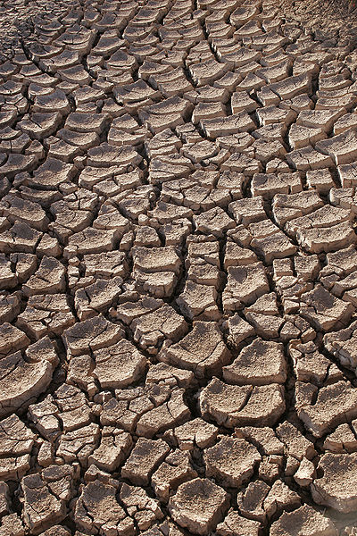
    The tribe accuses the agencies of imperiling the aquifer by allowing its levels to decline over the years and by using saltier, less pure Colorado River water to replenish the aquifer. The agencies defend their efforts to combat groundwater overdraft and insist that Colorado River water meets all drinking water standards.

    Managers of the water agencies argue groundwater is a public resource and the tribe has the same rights under California law as all other landowners to use water pumped from the aquifer.

    The Supreme Court hears a small percentage of the cases that are petitioned for review, and the court is expected to announce in the fall whether it will take up the case.

    The states’ involvement in the case, and their stance that it presents an important unresolved legal issue, could increase the odds of the court hearing the case.

    If the Agua Caliente tribe prevails, the lawsuit would set a powerful precedent for other tribes across the country, strengthening their claims to groundwater.

    The U.S. Department of Justice joined the suit in support of the tribe in 2014, saying the federal government has an interest in ensuring water rights for the tribe.

    The Supreme Court has never ruled on the question of whether tribes have a federally established right to groundwater.

    Groundwater and surface water have long fallen under separate, different water-rights systems.

    The case is pushing the courts to sort out how groundwater fits into laws drawn up more than a century ago, before the widespread use of mechanical pumps that enabled people to easily tap underground water supplies.

    One of the central legal questions in the case centers on state and federal courts’ varying interpretations of a 1908 Supreme Court decision, Winters v. United States, which affirmed that Indian tribes are entitled to sufficient water supplies for their reservations.

    The Ninth Circuit Court of Appeals said the so-called Winters doctrine applies to both surface water and groundwater on federally reserved land – including Indian reservations as well as other lands set aside by the government, such as national forests, national parks and military bases.

    The states’ attorneys general pointed out in their legal brief that “as a general matter, water rights must be acquired under state law, even for federal lands.”

    They argued that if a reservation created by the federal government “can assert absolute preemption over state groundwater allocation laws and regulations, a state’s effort to effectively manage those limited water resources will be thrown out of balance.”

    In a state like Nevada – which has more of its land under federal ownership or control than any other state – the states’ attorneys said the appeals court’s ruling would have “potentially devastating consequences” if it stands. They said claims of priority federal rights would lead to over-allocation of the limited water supplies in western states.

    The attorneys said the Ninth Circuit’s decision leaves states “facing a possible tide of federal reserved water right claims,” which they argued creates great uncertainty.

    In explaining Nevada’s stance, Laxalt said he has shown throughout his tenure as attorney general that “my office stands ready to defend our state from unlawful federal overreach regardless of the source.”

    That position resonates with conservatives in other states. All of the 10 states that sided with the water agencies are led by Republican governors.

    Four organizations also submitted briefs supporting the water districts. One of them, the Pacific Legal Foundation, advocates “limited government and the strong protection of private property rights.” It said the Ninth Circuit’s decision could have harmful effects for landowners’ water rights.

    The other organizations include the National Water Resources Association, which represents water agencies; the Western Coalition of Arid States, which is comprised of municipal entities; and the Irrigation and Electrical Districts’ Association of Arizona, whose members supply water and power to much of Arizona, including cities as well as most of the state’s farmland.

    Those organizations echoed the California water agencies’ concerns, saying if it the appeals court’s decision isn’t overturned, it will threaten established water rights throughout the West, create widespread uncertainty in a region where water is scarce and “force water users to engage in unnecessary litigation.”

    The Agua Caliente tribe has until Sept. 6 to submit its argument to the court.

    If the tribe wins, the case would continue with other phases to determine whether the Agua Caliente own storage space in the aquifer, whether their rights include a water-quality component and how much groundwater they would be entitled to.

    The tribe has about 485 members. Its reservation spreads across more than 31,000 acres in a checkerboard pattern that includes parts of Palm Springs, Cathedral City, Rancho Mirage and surrounding areas.

    The tribe owns two golf courses, the Spa Resort Casino in Palm Springs and the Agua Caliente Casino Resort Spa in Rancho Mirage, and has plans to build new subdivisions and another casino. Thousands of homes stand on leased tribal land.

    The tribe buys its water from the local water agencies, which operate wells across the Coachella Valley.

    Tribal Chairman Jeff Grubbe has said the case is about securing a “seat at the table” for the tribe to have a formal say in decisions about how the aquifer is managed.

    “Having a right to govern that water and decide what to do with that water is a right that every tribe should have,” Grubbe told The Desert Sun in an interview last week. He said if the tribe wins, one of the first priorities would be to start treating the Colorado River water that flows to the Coachella Valley and is used to replenish the aquifer.

    He said the tribe’s leaders are concerned about the quality of the water and the aquifer’s long-term sustainability, and would be willing to help pay for building treatment facilities to remove dissolved solids and contaminants from the imported water.

    The agencies’ managers say the water they get from the Colorado River meets all state and federal drinking water standards. They say treating the water would be expensive and unnecessary. They worry that if the tribe prevails, its privileged rights could drive up water costs for customers and complicate efforts to manage groundwater.

    “Our groundwater has been a shared local resource that the public and the tribe can access equally,” said James Cioffi, president of the Desert Water Agency board. He said in a statement that with the tribe now trying to secure special rights, “frankly, we don’t know what exactly they want or how much that could impact our community.”

    Leaders of other Native American tribes across the West are closely watching the case.

    A list of 35 tribes and five tribal organizations filed a brief in support of the Agua Caliente tribe last year. They included the Spokane Tribe of Indians in Washington and the Pyramid Lake Paiute Tribe in Nevada, as well as other tribes in California.

    @ColoradoClimate: Weekly Climate, Water and #Drought Assessment of the Intermountain West

    Upper Colorado River Basin month to date precipitation through August 7, 2017.

    Click here to read the current assessment. Click here to go to the NIDIS website hosted by the Colorado Climate Center.

    Interview: How Water Became the New Focus of Corporate Sustainability — Water Deeply

    Graphic credit: International Facility Management Association.

    Here’s an interview with Kellen Klein from Matt Weiser that’s running in Water Deeply. Click through and read the whole thing. Here’s an excerpt:

    Water crises in the West have pushed some companies to apply sustainability labels to their beverages, clothes and other water-dependent products. Kellen Klein, a senior manager at Future 500, helps sort through the claims.

    CAN A WATER-DEPENDENT PRODUCT – beer, for example – achieve sustainability in its water use? And how should we evaluate such a claim?

    Chronic water scarcity in the West has prompted a surge in examples of this kind of marketing. Companies that rely heavily on water have begun to test various “green” marketing strategies, just as companies have long attached sustainability goals to the air pollution they cause or the habitat they impact.

    Beverage companies are claiming they’ve reduced their water consumption, neutralized it somehow, or even achieved some kind of net benefit in water supply through various kinds of watershed enhancement projects. Some are experimenting with using recycled wastewater in their products.

    What is the right path for companies interested in these efforts? How should consumers react to these claims? Is it even possible to achieve sustainability in a water-dependent product?

    To explore these questions, Water Deeply recently spoke with Kellen Klein, a senior manager at Future 500, a nonprofit consultancy that works to find common ground between corporations and environmental groups to solve global problems. Klein, based in Portland, Oregon, focuses on water sustainability issues, among other specialties…

    Water Deeply: Can you share some early examples of this in the corporate world?

    Klein: One that initially comes to mind is Coca-Cola [disclosure: Klein has worked on projects with Coca-Cola]. They made this pretty dramatic goal to replenish the water that goes into their bottles. They reached that goal three or four years ahead of time. And that has become a prominent communications point for them when marketing their products at a broader level.

    Another going on for a while now is Levi’s, the maker of jeans and other clothing.Levi’s looked at the life cycle of their jeans; the most prominent use of water comes from producing cotton, but also a ton of water is used in the washing of their clothes. So they said, hey, this is a great opportunity for consumer engagement, and we need to take some action and do some education here. So they started an education program (Water-Less) to encourage consumers to wash their jeans on a cold setting, and to not wash them as often as a way of conserving water and energy.

    One example of a company struggling with these types of positive commitments is Fiji Water. They claimed they were carbon negative, because their investment in carbon reductions were so significant. It turns out a lot of those projects were actually carbon futures that would not pull carbon out of the atmosphere for years down the road, and they ended up being sued over that.

    @LREwater: Advancements in ASR well construction and operations

    From Leonard Rice Engineering:

    A Three-Part Blog Series

    To paraphrase Brad Pitt, the first rule of Water Club is that “there is never enough water”. OK, maybe not everywhere, but in the Western United States, there isn’t a truer statement to be had. The states in this region constantly struggle to find balance between an ever-growing population and an ever-dwindling water supply for that population. Municipalities are continually seeking ways to maximize the usage of accessible supplies, which has spawned alternative water resource management solutions like Aquifer Storage and Recovery (ASR). ASR can be achieved through recharge basins, vadose zone wells, or dual purpose wells (Figures 1-3). One of the benefits in storing directly into aquifers is the ability to preserve supplies from evaporating, which typically occurs behind surface reservoirs. ASR is still an evolving science, and there are currently several ASR methods being utilized within the industry, each with benefits and drawbacks.

    In this three-part series, we will review ASR as a viable water resources management strategy and how new technologies are improving well efficiencies in recharge and pumping performance. These newer recharge well systems have also become manager/operator friendly, which results in efficient reporting to State Agencies, reducing the labor force, reducing operational and maintenance costs, and provide quick performance data.

    Part One: Reverse Siphon Method

    Before we dive into the different kinds of recharge methods, let’s take a look at some pitfalls that are common to all ASR wells. We start with the number one issue – clogging. Reading the term clogging and the first word you think of might be an artery, like your heart. Actually, well clogging is a lot like artery clogging and the end result is the same – the equipment stops working, which is not good in either case!

    Figure 1: Vadose zone well with down-gradient recovery well, Credit Leonard Rice Engineering.

    Well clogging typically occurs in three locations: proximal to the well, intermediate (interface between filter pack and aquifer) and distal (exceeding 100 feet beyond the well). Depending on where the well clogs, it can take different forms. Abrasion between grains, air binding, biofilm, cementation and dissolution are all types of clogs found in ASR wells, and all require slightly different solutions to resolve the issue.

    The conventional method in reducing air binding/air entrainment clogging in ASR wells is by the installation of a down-hole flow control valve. This valve is attached to the pump assembly and prevents air from the column pipe from binding onto the filter pack and unconsolidated sediments in the aquifer.

    An alternative recharge method was developed at the City of Phoenix to reduce air entrainment into the aquifer, ensure easy maintenance, lower operations and maintenance costs, provide an easy operator interface, have the ability to unclog the well with the permanent pump, and increase recharge utilization. This alternative method is called “reverse siphon”. Instead of a valve connected at the bottom of the pump assembly, the controlling valves are positioned at the wellhead infrastructure for system hydraulic balancing, removing air from the column pipe, and for easy maintenance for the operator. This method requires an understanding system hydraulics, programming, and reverse flow testing through line-shaft turbine impellors.

    Figure 2: Recharge basin with down-gradient recovery well.

    The reverse siphon method entails the following steps:

  • Pump the well to waste (e.g., sanitary sewer) to expel out particulates accumulated in the well and to remove air from the column pipe.
  • Slowly transition and open the recharge globe valve to deliver the source water to the well and pump to waste system. All purged particulates in the recharge source will go to the pump to waste line.
  • Once the programmed flow rate is achieved on the recharge line, the pump to waste valve will slowly close and the line-shaft turbine pump will shut off and lock into place with the use of a non-reverse ratchet.
  • The recharge source line will flow resources down the well (via system pressure and gravity) and to the pump to waste line.
  • Once the pump to waste line is fully closed, the well is transitioned into recharge mode. This reverse siphon method typically takes 5 to 7 minutes to transition from pump to waste to recharge mode and all valves are automated to open and close with programming developed at the Operator Interface Terminal.
  • Figure 3: Dual purpose well that can recharge and recovery supplies within the same well.

    In Part Two: we will continue examining new technologies linked to the “reverse siphon” method. These technologies/advancements build upon better and sustainable well injection performance.

    Fort Collins councillors approve sending staff NISP wildlife mitigation comments to state

    Poudre River Bike Path bridge over the river at Legacy Park photo via Fort Collins Photo Works.

    From The Fort Collins Coloradoan (Kevin Duggan):

    The City Council on Tuesday approved sending staff-generated comments on a Wildlife and Fish Mitigation Enhancement Plan proposed by Northern Water for NISP to the Colorado Parks and Wildlife Commission.

    The council voted 4-3 in favor of sending on the comments, with members Bob Overbeck, Ross Cunniff and Ken Summers opposed, although for different reasons.

    For Overbeck and Cunniff, the comments by staff do not go far enough in criticizing the project and insisting on more mitigation. Cunniff said he did not like the process used by the state for addressing mitigation and the controversial water-storage project…

    Summers, who supports NISP, said the comments should not be sent.

    Staff’s comments touched on numerous areas of concern, including water quality and the amount of funding designated for wildlife mitigation. It includes recommendations for improving the plan, such as guaranteeing three days of peak flows on the river for critical “flushing” to support the river’s health.

    John Stokes, director of the city’s Natural Areas Program, said the comments do not imply support for NISP. But they were generated with the thinking that if the project is built, then steps should be taken to mitigate its impacts…

    The commission will weigh the plan in upcoming meetings and potentially forward it to the Colorado Water Conservation Board and the governor for approval. If approved, the plan would likely be included in the federal permitting process for NISP.

    Update: Big Thompson restoration project

    This slideshow requires JavaScript.

    From The Loveland Reporter-Herald (Pamela Johnson):

    This stretch of the Big Thompson River, from the Jasper Lake bridge to just before the Cherry Cider Store, was scoured and severely changed during the 2013 floods. It was left too wide and entrenched, with vegetation ripped away from the banks.

    The new face of the river has a narrower channel with more areas along the banks for waters to disperse in the event of another flood.

    It has large boulders specifically placed to control the flow of the water and to create pools for fish habitat.

    There are large trees that extend from under the banks into the river, stabilizing the bank, preventing erosion and creating habitat.

    And trees, forbes and shrubs were strategically planted, again to stabilize the banks, prevent erosion and create shade and habitat.

    “We’ve really made it look like a river again,” said Shayna Jones, watershed coordinator with the Big Thompson Watershed Coalition.

    The goal was to mix several different restoration techniques — the planting, the rocks, the tree trunks — to improve the river while keeping it natural, which from the look of the river is mission accomplished.

    “It’s a really good mix of types of restoration,” added Jones.

    Even the planting is mixed for diversity and meticulously planned out. The project team chose all native vegetation and placed different shrubs, trees, forbes and grasses in different zones along the banks. The willows, live stands transplanted from the river corridor nearby, are close to and in some spots in the water, while pine trees are further away up the shore.

    The trees and shrubs are planted in clumps to mirror nature, not in neat rows as a gardener would do.

    Much of the vegetation was transplanted from the natural surroundings, while other plants were specifically grown by the Colorado State Forest Service for river restoration.

    This project is among five already completed by the Big Thompson Watershed Coalition and its partners, which have more planned this year in the Big Thompson as do other entities like the city of Loveland and Colorado Department of Transportation.

    The recently completed work, called the Jasper Lake project, spans a half mile of the river on both the north and south sides of the highway and crosses private, Larimer County and U.S. Forest Service land.

    It cost $800,000 with the money coming from a mixture of federal, state and private sources, including the Natural Resources Conservation Service, the Department of Local Affairs, the Colorado Water Conservation Board, Rocky Mountain Flycasters and the Trout and Salmon Foundation.

    Though the river project abuts Narrows Park, that piece of public land has not yet been restored. Owned by Larimer County, that park will serve as the site of a temporary bridge crossing the river while the county replaces the Jasper Lake Bridge this fall, so restoration is planned by the county after that bridge project, according to officials involved with the restoration project.

    The Big Thompson Watershed Coalition worked with contractors and several partners, including private landowners, on this project. Walsh said one of the greatest parts was to meet the people, to listen about the river’s past and to explain the new, healthier river that was being created.

    @NOAA: Globe had 2nd warmest year to date and 3rd warmest June on record

    From NOAA:

    Arctic and Antarctic sea-ice coverage remains small

    In terms of Earth’s seasonal change, June is a significant month: It marks the summer solstice for the Northern Hemisphere and the winter solstice for the Southern Hemisphere. It also means the calendar year is half-over, and it’s time for a climate check-up.

    Let’s dive deeper into our monthly analysis to see how the planet fared for the month and the year to date*:

    Climate by the numbers — June
    The average global temperature set in June 2017 was 1.48 degrees F above the 20th-century average of 59.9 degrees, according to scientists from NOAA’s National Centers for Environmental Information. This average temperature was the third highest for June in the 1880-2017 record, behind June 2015 (second) and a record-breaking June 2016. June 2017 marks the 41st consecutive June and the 390th consecutive month with temperatures at least nominally above the 20th-century average.

    *Year to date | January through June 2017
    The year-to-date average temperature was 1.64 degrees F above the 20th-century average of 56.3 degrees. This was the second-warmest for this period, 0.29 of a degree behind the record set in 2016.

    A map of significant climate events that occurred around the world in June 2017. (NOAA NCEI)

    Other notable climate events and facts around the world last month included:

    Below-average sea ice at the poles continues

    The average Arctic sea ice extent (coverage) for June was 7.5 percent below the 1981-2010 average, the sixth smallest for the month since satellite records began in 1979. The average Antarctic sea ice extent was 6.3 percent below average, the second smallest on record for June behind 2002.

    Warmer-than-average lands and oceans

    The globally averaged land-surface temperature (fourth warmest for the month of June) and the sea-surface temperature (third warmest) ranked second highest on record for the year to date.

    Africa and Europe lead the continents in warmth rankings

    Africa had its warmest June on record; Europe, its second (tied with 2007); South America, its third (tied with 2005); Asia, it’s eighth; North America, its 10th; and Oceania, its 50th (tied with 1927).

    Navajo and #NM lawsuits preclude @EPA review says agency #GoldKingMine

    The orange plume flows through the Animas across the Colorado/New Mexico state line the afternoon of Aug. 7, 2015. (Photo by Melissa May, San Juan Soil and Conservation District)

    From the Associated Press (Dan Elliott) via The Durango Herald:

    In a written statement, the EPA said the law prevents it from reconsidering claims from anyone who has filed suit.

    That could rule out a review of the two largest claims from the 2015 spill in southwestern Colorado, which the EPA inadvertently triggered…

    More than 70 governments, businesses and individuals sought about $420 million in damages under the Federal Tort Claims Act, which is a way to settle without a lawsuit. The Navajos filed claims for $162 million and New Mexico for $130 million.

    New Mexico and the Navajos sued the EPA for damages in federal court…

    President Donald Trump’s appointee to head the agency, Scott Pruitt, pledged during his confirmation hearing he would review that decision. On Friday, the second anniversary of the spill, he announced a new course.

    “A new review is paramount to ensure that those who have, in fact, suffered losses have a fair opportunity to have their claims heard,” he said.

    Monday’s EPA statement appeared to narrow the scope of the review considerably.

    “EPA won’t be able to reconsider a claim once the claimant has sued the U.S. in court, which the state of New Mexico and the Navajo Nation have done,” it said.

    The EPA designated the Gold King and 47 other mining sites in the area a Superfund district and is reviewing options for a cleanup.

    On April 7, 2016, the Environmental Protection Agency proposed adding the “Bonita Peak Mining District” to the National Priorities List, making it eligible for Superfund. Forty-eight mine portals and tailings piles are “under consideration” to be included. The Gold King Mine will almost certainly be on the final list, as will the nearby American Tunnel. The Mayflower Mill #4 tailings repository, just outside Silverton, is another likely candidate, given that it appears to be leaching large quantities of metals into the Animas River. What Superfund will entail for the area beyond that, and when the actual cleanup will begin, remains unclear.
    Eric Baker

    Now that’s what we call quality – News on TAP

    National Water Quality Month reminds us all just how important it is to protect our drinking water.

    Source: Now that’s what we call quality – News on TAP

    @USBR: Paonia Dam intake structure repair open house, August 15, 2017

    Intake structure during construction in 1961. Photo Credit Reclamation.

    Here’s the release from the US Bureau of Reclamation (Tom Fowlds, Justyn Liff):

    The public is invited to a public meeting on Tuesday, August 15, at 7 p.m. to meet with project representatives from the Bureau of Reclamation, Fire Mountain Canal Company and North Fork Water Conservancy District to learn about Paonia Dam intake structure repairs. The meeting will be held at Memorial Hall, 175 North 1st Street, in Hotchkiss, Colo.

    Repairs will begin in mid-September 2017 to the Paonia Dam intake structure and bulkhead, part of the Paonia Project located near Paonia, Colo.

    Crews will dismantle the damaged concrete bulkhead located within the intake structure and then install an aluminum trash rack and bracing to the top of the intake structure. Prior to and during intake structure repair, increased turbidity downstream of the dam will be noticeable due to reservoir operations and drawdown. These repairs are necessary to help ensure continuation of normal dam operations and water delivery to downstream users.

    During repair and construction, work crews and heavy construction equipment will be operating at the dam. Turbidity will increase in Muddy Creek and the North Fork of the Gunnison River downstream of Paonia Dam, and sediment deposition will occur primarily in Muddy Creek from the dam to the confluence of Anthracite Creek until flushing flows are released in spring 2018. Repairs are expected to be completed in November 2017.

    To learn more about the Paonia Project, upcoming repair work or sedimentation issues in the reservoir, visit our website at: http://www.usbr.gov/uc/wca/progact/paonia/index.html. You can also join our email list for project updates by clicking the “Contact Us” link.

    @USBR: Future scientists study with current scientists at Nature High Summer Camp

    Students looking at and learning about an animal pelt.

    Here’s the release from the US Bureau of Reclamation (Chris Watt):

    Bureau of Reclamation employees Shane Mower and Dave Snyder taught students hands-on lessons in fish data acquisition using seining, animal skull anatomy and physiology, wildlife adaptions, wildlife tracks and possible impacts to fish and wildlife from natural and human-influenced changes in the environment, at Nature High Summer Camp held July 31 to Aug. 5.

    Reclamation’s Upper Colorado Region, along with other Department of the Interior, Department of Agriculture, Utah State University, and local agencies, sponsor and participate in the Nature High Summer Camp. Started in 1991, the goal of the camp is to introduce high school students to science and natural resource fields of study and careers they might not have otherwise considered.

    Federal professionals share their expertise by providing students with actual field activities and experiences in hydrology, rangeland conservation, wildlife biology, soils, and forestry. Students learn how to use information from these disciplines in creating team-based camp projects that address natural resource issues from the differing perspectives of environmentalist, farmers, ranchers, recreationists, and government agencies.

    “#Wyoming will continue to rely on science and scientists to manage,” the Greater Sage-Grouse — Gov. Matt Mead

    Greater sage grouse via Idaho Fish and Game

    Here’s the release from Governor Mead’s office:

    Wyoming Governor Matt Mead released the following statement on today’s announcement from the US Department of the Interior (DOI) regarding Greater Sage-Grouse management:

    “Secretary Zinke and the Department of the Interior made an earnest effort to collaborate with the states during the sage-grouse management review,” said Governor Mead. “The states have primacy over sage-grouse management and Wyoming’s plan is solid and should be allowed to work. The Wyoming approach balances energy, agriculture, conservation and recreation. The federal plans do not fully implement the Wyoming approach. While DOI identifies numerous ways to improve federal plans, I am concerned that the recommendations place more focus on population targets and captive breeding. Industry needs predictability, but the report does not explain fully how population targets provide that certainty. Wyoming will continue to rely on science and scientists to manage the species. I will continue to work with Secretary Zinke, state and local stakeholders on this issue.”

    Farmers are starting to change practice to hedge against #ClimateChange #ActOnCimate

    http://www.tatteredcover.com/book/9780865717749

    Here’s an interview with Laura Lengnick from KUNC (Luke Runyon). Click through and read the whole article. Here’s an excerpt:

    Our changing climate presents a unique challenge to our food system. Soil scientist Laura Lengnick says she has some tools that could help farmers and ranchers deal with the risks. She’s a small farmer herself and a longtime sustainable agriculture researcher.

    Lengnick’s most recent book, “Resilient Agriculture,” lays out case studies of farmers across the country who are adopting practices meant to hedge against the hotter temperatures and more erratic precipitation climate change will bring. She profiles a handful of Colorado farmers and ranchers making changes already.

    The idea is meant to challenge the concept of “sustainability,” which Lengnick says is a “20th century idea.” Sustainability, she says, takes too many things for granted, while resilient practices help farmers adjust to a changing climate and economy.

    The solar industry is creating jobs nearly 17 times faster than the rest of the US economy #ActOnClimate

    Solar panels, such these at the Garfield County Airport near Rifle, Colo., need virtually no water, once they are manufactured. Photo/Allen Best

    From the Climate Reality Project:

    In 2016, jobs in the United States solar industry increased nearly 17 times faster than the rate of the overall economy. This was part of a global trend of jobs growing in renewable energy.

    Republished from Futurism. Licensed under CC by NC 4.0/Desaturated from original.

    The data shows it: We don’t have to choose between good jobs and the future of our planet. A new report released by the International Renewable Energy Agency (IRENA) reveals that solar jobs in the US (and around the world) are expanding rapidly.

    As of November 2016, the American solar industry employed 260,077 workers – an increase of 24.5 percent from 2015. When you crunch the numbers, that means the solar industry is growing just shy of 17 times faster than the American economy as a whole. That’s incredible progress.

    So in what areas of the industry are these jobs? The lion’s share (241,900) were in solar photovoltaic (PV). According to IRENA, the worldwide growth in solar PV jobs had to do with “declining costs and supportive policy frameworks in several countries around the world [that] led to a record year for solar in 2016.”

    In addition to photovoltaic, an additional 13,000 American solar jobs were in solar heating and cooling, and the remaining 5,200 were in concentrated solar power (CSP).

    In terms of job function, more than half of all solar jobs in the US were in installation. Another 15 percent were in manufacturing, with 13 percent in project development, 12 percent in sales and distribution, and a final 6 percent in other areas, including research and development.

    It’s important to remember: Not only is the solar industry booming – but the jobs pay well, too. As costs for materials continue to drop, solar jobs remain a well-compensated area for blue-collar workers. Bryan Birsic, CEO of Wunder Capital, said, “It seems to be one of the few areas of high-paying, blue-collar jobs – and you don’t have to learn to code.”

    Another sign of improvement? The solar labor force is becoming more diverse, with the number of women workers at 28 percent in 2016, up from 19 percent from 2013. This means more women have jobs in solar than in the conventional energy industry, although women in solar still lag behind their representative 47 percent of the US economy.

    A RENEWABLE FUTURE

    Solar isn’t the only thriving industry in the US economy right now – the wind industry put about 102,500 people to work in 2016. In fact, wind turbine technician is the single fastest growing occupation in the United States. IRENA projects the industry will grow to 147,000 jobs by 2020.

    Here’s the reality: jobs in dirty energy are on the decline as fuel sources become more scarce and less expensive options become available. But people laid off from the fossil fuel industry can find safer, well-playing jobs in clean energy. And as prices continue to drop, all of us can expect to see more and more jobs in clean energy. That’s good for our economy and for our planet.

    Take a 1,450 mile journey along the #ColoradoRiver — TheDenverChannel.com #COriver

    Pour offs along the Colorado River. Photo via Brent Gardner-Smith/Aspen journalism

    Here’s a series about the Colorado River from TheDenverChannel.com:

    TThe Colorado River is so much more than something we raft and fish in. Millions of people in the western U.S. drink water that comes from the river. Millions more use electricity generated by hydroelectric power plants along the river’s 1,450-mile course. Most of the produce on our table is grown using water from the river and its tributaries.

    When you think about it, the Colorado River is so much more than just a river, it’s a lifeline for the southwestern U.S.

    In the Denver7 special presentation Colorado River: Lifeline of the West, hosts Lisa Hidalgo and Eric Lupher share the story of a river that has shaped the landscape for millions of years but is now having itself reshaped by people trying to harness its power.

    Over 30 minutes, Lisa and Eric take viewers on a journey down the Colorado River from its headwaters in Colorado’s Rocky Mountain National Park to the farm country around Yuma, Ariz., where the remaining water leaves the U.S. for Mexico. Along the way, Lisa and Eric show viewers how the river is not just used for recreation, but how it is controlled and contained at places like Glen Canyon and the Hoover Dam to provide water, electricity and irrigation to millions of people. They also find out how all this control may be impacting the health of the river itself and share stories of about the river’s name, the location of key dams and how farmers in some of the driest places along the river’s course have found innovative new ways to conserve water while growing produce in the middle of a drought.

    Colorado River: Lifeline of the West is a remarkable journey that few people will ever take on their own but will never forget after they see it.

    #StandUp / Stand N Rock #NoDAPL (Official Video) #ActOnClimate

    Click here to cast your vote for the MTV vma 2017 awards.

    Death Valley had hottest month ever in Western Hemisphere in July #ActOnClimate

    Death Valley photo credit NPS.

    From The Las Vegas Review-Journal (Henry Brean):

    The famously fiery national park 100 miles to the west set an unpleasant record in July with an average temperature of 107.4 degrees. That ranks as the hottest month ever measured in the Western Hemisphere, according to the National Weather Service.

    Christopher Burt thinks it might be a world record as well.

    The weather historian for Weather Underground said he only knows of one monthly average that’s higher — 107.44 degrees recorded in July 2014 at a military base in northern Saudi Arabia — but that measurement has been discredited because it apparently didn’t include overnight temperature readings.

    “So far nobody’s come up with another figure that’s higher than Death Valley’s,” Burt said.

    Andy Gorelow, a meteorologist with the National Weather Service in Las Vegas, said unusually hot conditions at night were largely responsible for the new monthly record in Death Valley.

    The average low at the park’s official weather station in Furnace Creek, California, was 95.1 in July, the warmest of any month on record by more than a full degree.

    By comparison, Gorelow said, “the highs really weren’t that high.”

    That’s relatively speaking, of course.

    The average high in Death Valley last month was 119.6 degrees. July 7 was the single hottest day, with a high of 127. The temperature never dropped below 89 all month.

    @ConservationCO rates Arkansas River = “C”

    Here’s a guest column from Beau Kiklis writing in The Pueblo Chieftain:

    My organization, Conservation Colorado, just released a report card that looks at the state of our rivers and how we can work to protect them. In it, we evaluate and grade the health of eight major rivers in Colorado, based on factors including water quality, the presence of dams and how much water is diverted out of the river and sent to be used elsewhere.

    Here in the Arkansas River Basin, the Arkansas River received a “C” grade, meaning it is in mediocre condition and needs our attention.

    The Arkansas River Basin is the largest basin in Colorado, making up nearly a third of the state’s total land area. Cities including Pueblo and Colorado Springs are located in the basin and get their water from this critically important river.

    A tributary to the Mississippi River, the Arkansas is born from snowmelt high in the rugged Sawatch Mountains above Leadville. It serves several states as it cascades east and eventually spills into the Gulf of Mexico. The wild upper section of the Arkansas River is famous for containing Colorado’s longest stretch of gold medal trout fishing waters, spectacular scenery and thrilling whitewater boating opportunities through the Numbers and Browns Canyon National Monument.

    However, up in the mountain headwaters, human impacts have marred this river, mainly due to pollution from the area’s more than 150-year legacy of hardrock mining. Mining pollution taints the water quality in the Arkansas and while various remediation and clean-up efforts have improved the river from its previous state of poor water quality, the work is not done — many abandoned mine sites continue to pollute the river today.

    While much of the upper stretch of river has improved over time, the lower Arkansas faces its own unique challenges, mainly the need to provide water for the bustling cities of Pueblo and Colorado Springs, as well as an established agricultural economy. Today, the Arkansas River Basin has the second-highest percentage of urban and commercial water use in the state, leaving farmers downstream struggling to irrigate their crops with limited water.

    As the trend of urban growth prevails, it is critical that we manage our water with the future of our agricultural and recreational economies in mind. Consider this: average flows on the Arkansas River have decreased by 17 percent over the last 10 years. While this cannot be attributed to any one thing, it would be hard not to point to the cities outside of the Arkansas River Basin that buy up agricultural water rights to meet their own demands. When water is moved outside of the basin, it contributes heavily to decreasing river flows.

    Luckily, the Arkansas River is an excellent example of how collaboration and innovation can provide solutions to the issues facing our rivers.

    For example, some Arkansas River irrigators are choosing to take part in water conservation programs and are advocating for even more tools to improve flexibility for sharing and leasing their water without compromising their water rights. These new ideas avoid drying up farmland and help our water supply go further. And it can stretch even further if cities and towns also work to improve the efficiency of their own water use.

    It’s important to note that recreation and tourism contribute $1 billion to the economy of the Arkansas River Basin every year and therefore we should put time and effort into fostering them.

    Out of the eight rivers we assessed in our report card, only one received an “A” grade, while four received a grade of “C” or less. In short, our Colorado rivers face significant challenges, but there are many ways that we can make a difference for them. If we work together to save water, prioritize safe drinking water, and implement innovative policy solutions, we can ensure a future where our rivers are clean and flowing.

    #Monsoon2017 brings cooler temperatures to Front Range

    7 Day Quantitative Precipitation Forecast issues August 7, 2017 via the Weather Prediction Center.

    From Denverite (Andrew Kenney):

    “It looks like we’re tapping a rich vein. We’ve got the right flow patterns, unless we continue to be unlucky,” said Jeff Lukas, research integration specialist for the Western Water Assessment at CU Boulder.

    Here’s a quick review of our summer weather and what may happen for the rest of the month. As a bonus, I made Lukas explain thunderstorms.

    Why it was so hot:

    “In July, the northern Front Range and most of the rest of Northeastern Colorado just got unlucky,” Lukas said.

    In the summertime, a lot of Colorado’s moisture blows in from the Gulf of Mexico, which is to our southeast.

    That monsoon wasn’t reaching Colorado for much of June, leaving the state dried out. It blew better in July, delivering storms to Castle Rock and points south, but few reached Denver.

    And without cloud cover to absorb sunlight, temperatures were running up to 4 degrees above normal in June and 2 degrees above normal in July, recently maxing out at 102 degrees, Lukas said.

    “You’re not getting the moisture in the soil and the vegetation that acts as kind of a swamp cooler for summer days in Denver,” Lukas said.

    But while it was hotter than normal, he said, it was “nothing like the record hot summers we’ve had,” referring to 2000 and 2012 in particular.

    Denver as of this week was still “abnormally dry,” according to the U.S. Drought Monitor.

    What’s happens next:

    The monsoon has put much more moisture over the Front Range in the last 10 days, returning the southern part of the metro to average or above-average precipitation, Lukas said.

    “Sterling has been getting hammered in the last week,” he explained. Still, “the flow is just not quite fully getting to all parts of the front range.”

    Boulder, Denver and Arapahoe counties have remained relatively dry over the last week, though they’ve certainly had more clouds and rain.

    “Even when the flow pattern’s really good, the storm may not quite hit,” Markus said. But if the current trend holds, we’ll at least have more chances for rain.

    The national Climate Prediction Center forecasts that August will see below-normal temperatures and above-normal rain in August.

    How storms move:

    I was a bit confused when Markus mentioned that the monsoon wind blows from the southeast to the northwest. Don’t thunderstorms and snowstorms both roll in from the western mountains out onto the plains?

    They do! But it’s more complicated than that. The moisture flow tends to come in at a really low level, Markus said. If you’re standing on a reservoir, the wind at the surface might indeed be blowing in from the east.

    That moisture starts to accumulate into storm clouds as it reaches the higher terrain. “The thunderstorms will build — and once they get 10,000, 15,000 feet up, they’ll hit the westerly flow at upper levels and start drifting to the east,” Markus said.

    “By the time they get out to I-25, you can start getting some more mature thunderstorms.”

    In other words, the wind higher up is still blowing from west to east, and it carries the rising thunderstorms back from the mountains out onto the plains.

    What about winter?

    The CPC’s three-month projections, running through October, show somewhat hotter temperatures and more rain than normal for most of Colorado.

    However, climate models get pretty bad once you try to go more than a couple weeks out. The first decent estimates should arrive around September or October, Markus said — but even then, they’re unlikely to accurately predict the kind of topsy-turvy shifts we saw last year.

    North American Monsoon graphic via Hunter College.

    The effects of #ClimateChange during summer 2017 #ActOnClimate #KeepItInTheGround

    Here’s a guest column from Malin Moench that’s running in The Salt Lake City Tribune:

    This summer, Salt Lake City has already suffered a dozen days over 100 degrees with August still to come. This spate of hot, stagnant air has left us breathing ozone and fine soot that are twice the health limits set by the EPA.

    If you think this weather is nothing to worry about because it is atypical, think again. This summer is a preview of the new normal for Utah and the American Southwest. Currently, Salt Lake City averages six 100-degree days per year. Climate scientists estimate that Salt Lake will average 58 100-degree days per year by the end of this century if CO2 continues to build up in the atmosphere at current rates. The resulting heat and drought predicted by the year 2100 will turn the Salt Lake and Utah valleys to blowing dust.

    The media used to be filled with claims that our climate is not actually warming. Because the last 19 years include 17 of the hottest years on record, few now deny the warming trend. However, many still deny that the trend has a human cause.

    Climate scientists have a different view as 99.5 percent of them now say that the predominant cause of climate change is the massive amount of fossil fuel that been burned since the world began to industrialize in the mid-19th century.

    The basics physics that explains why rising CO2 warms the climate is simple. Sunlight is mostly short-wave radiation (visible light). When it reaches the earth’s atmosphere, CO2 molecules scatter it, rather than absorb it. When this short-wave radiation strikes the surface of the earth, however, it converts to long-wave radiation (infrared, or “heat”). When heat is reflected back into space, CO2 absorbs it like a sponge.

    This is the physics in a nutshell: The CO2 molecule holds two oxygen atoms loosely on either side of the carbon atom. The two oxygen atoms are able to flex around the carbon atom like the wings of a bird. This flexing allows the CO2 molecule to absorb infrared radiation. This greenhouse effect is powerful. Without it, climate scientists agree that the earth’s entire surface would be freeze solid.

    As carbon dioxide accumulates, it puts those who live in the American West in great peril. In 2015, scientists from NASA, Cornell and Columbia University applied a 1,000 years of climate-history data to 17 independent climate models. Those models consistently predicted that at current rates of CO2 build up, increased heat and reduced precipitation in America’s Central Plains and Southwest will drive much of the remaining moisture out of these regions’ soil.

    The study calculates that there is an 80 percent chance that, before the end of this century, Utah and the American Southwest will experience a drought deeper than the 10-year Dust Bowl of the 1930s, but lasting three times as long.

    Such a drought will cripple agriculture in the nation’s breadbasket, cut the flow of the Colorado River in half, transform the forests of the Rocky Mountains into dead kindling, and increase their burn area by 500 percent. In other words, it will bring both environmental and economic ruin to America’s Central Plains and Southwest.

    President Trump only appoints people to federal policy positions who ignore or deny the basic physics of climate change described above. He is hastening the day that Utah becomes uninhabitable because he plans to extract and burn every last ton of America’s dirty energy reserves, saying that this will make America great again.

    One has to wonder how great America will be when its western half becomes an uninhabitable dust bowl and most of its residents have become climate refugees.

    Malin Moench, Holladay, has degrees in law and economics from the University of Utah. After 37 years of legal analysis and econometric modeling work for the federal government, he now volunteers for the Citizens Climate Lobby.

    #Snowpack = #Colorado water supply

    The snow-capped mountains of Colorado and Utah contain trillions of gallons of water stored in the form of snow. Meltwater from this snow will eventually flow into the Colorado River, delivering much needed water to seven Western states and 33 million people. Accurately predicting water from snowmelt is critical to the region, and Earth-observing satellites can help.
    Credits: iStock

    From TheDenverChannel.com (Eric Lupher, Kevin Krug):

    “If you go to your tap, four out of every five glasses of water you will fill up will have originated as snow,” said hydrologist Keith Musselman of the National Center for Atmospheric Research (NCAR).

    Musselman says the most sobering thought is that we are so reliant upon the resource.

    “It’s that reliance and the increase in population here on the Front Range and in many cities across the west where we need to know exactly how much water there is in any given year,” he said.

    Snow survey supervisor Brian Domonkos of the U.S. Department of Agriculture uses data collected at Snotel sites around the state to keep an eye on how much water is in Colorado’s snowpack.

    “During the winter we want snow. During the summer, we want an appropriate amount of rain,” he said.

    Domonkos agrees that water is increasingly important here in Colorado, but points out that what happens in Colorado impacts everyone downstream as well.

    “There’s a lot that goes into it on top of making sure that all of your water users down below are getting the water they need,” Domonkos said. “Providing that water to them as well as making sure you’re retaining in stream flows and meeting all your compacts for downstream water users, downstate… it’s extremely complex.”

    Aspen puts forward settlement proposals for Maroon and Castle creek dams

    This meadow, about two miles below Maroon Lake, would be covered by the potential Maroon Creek Reservoir. The 85-acre reservoir would also flood portions of the Maroon Bells -Snowmass Wilderness.

    The city of Aspen has told opposing parties in two water court cases it is willing to remove the prospect of a potential Maroon Creek Reservoir from the Maroon Creek valley, if the way is made clear for it to apply to transfer the conditional water rights for the reservoir to other sites in the Roaring Fork River valley.

    The city’s proposal requires the parties to let the city’s periodic diligence applications proceed unopposed, and to also agree not to challenge the city’s efforts to transfer the water rights in new cases, according to several attorneys for opposing parties who attended a city-hosted settlement meeting Wednesday.

    And, the city said, even if it’s not successful in those cases, it won’t return and try to store water in the current location of the potential Maroon Creek Reservoir.

    “We had a great meeting with the city yesterday and we’re very encouraged that we’ll be able to settle the Larsen family’s opposition on the Maroon Creek Reservoir by the end of the year,” said Craig Corona, a water attorney in Aspen representing Larsen Family LP, which is only in the Maroon Creek case in water court.

    Aspen City Attorney Jim True said Thursday that “potential resolutions of the cases were discussed” at the meeting. He was there along with other Aspen officials, including City Manager Steve Barwick, Mayor Steve Skadron and Aspen City Councilwoman Ann Mullins.

    Representatives or attorneys from nine of the 10 opposing parties were at the closed-door meeting.

    The city of Aspen told the opposing parties it wants to transfer the full 4,567 acre-foot conditional storage right in the Maroon Creek Reservoir to other potential sites, including the Aspen golf course, Cozy Point Ranch at Brush Creek Road, an approximately 60-acre site next to the gravel pit in Woody Creek operated by Elam Construction Inc., or the already-excavated gravel pit. (Barwick, during a July 19 press conference, described the city’s general intent to try and transfer the water rights).

    Paul Noto is a water attorney representing American Rivers, Colorado Trout Unlimited and the Roaring Fork Land and Cattle Co. in the Maroon Creek case, and the two environmental groups in the Castle Creek case. He said they were “getting closer” to a settlement.

    “The proposal on Maroon Creek, we are a lot closer on, because as I understand it, the city is committing to move their water storage right, and therefore the potential to dam the creek, out of Maroon Creek valley forever and always,” he said. “And that’s a good thing.”

    A map showing the potential Castle Creek Reservoir. The City of Aspen has agreed not to flood property owned by Simon Pinniger and Mark and Karen Hedstrom, and so the reservoir is expected to be smaller than shown.

    Castle Creek proposal

    The city’s proposal regarding the 9,062-acre-foot Castle Creek Reservoir is more complex than its proposal for the Maroon Creek Reservoir.

    The city said it would be willing to reduce the size of the Castle Creek Reservoir so it does not flood very small portions of the wilderness, as it does under its current decree. It would then move those portions of the water rights out of the Castle Creek valley.

    (Since 2010 the city has signed agreements with two other private property owners whose lands would be flooded by the Castle Creek Reservoir. The city agreed not to flood portions of land owned by Simon Pinniger and by Mark and Karen Hedstrom, on the upstream edge of the potential reservoir. “It is expected that this commitment by Aspen will result in a reduction in the volume and surface area of the Castle Creek Reservoir, and Aspen has contracted for a preliminary investigation of the anticipated revised size and volume of the Castle Creek Reservoir,” the city’s due diligence application from Oct. 31 states. As such, it already be the case that the potential reservoir would not encroach on the wilderness).

    The city also said it might further reduce the size of the reservoir if that’s consistent with the size of the city’s future water needs, which are not yet determined. It also might move the resulting reservoir off the private land where it is now sited to another unspecified location or locations.

    “The city is just not willing yet to make the commitment to move the water right out of the Castle Creek valley forever and always,” Noto said. “They have more work to do and studies to do to be able to be comfortable in making that commitment.”

    But the negotiations over Castle Creek could slow down an agreement on Maroon Creek.

    “At this point they aren’t willing to commit to settling the Maroon Creek case separately from the Castle Creek case, so there is a bit of a timing issue because we have more work to do on Castle Creek,” Noto said.

    A view, looking toward Aspen, of the gravel pit in Woody Creek operated by Elam Construction Inc. The city has put the sage-covered property next to the gravel pit, to the right in the photo, under contract as a potential reservoir site.

    Since 1965

    As currently decreed, the Maroon Creek Reservoir would be formed by a 155-foot-tall dam that would back up water over 85 acres of USFS land about 2 miles below Maroon Lake and would flood a portion of the Maroon Bells-Snowmass Wilderness.

    The Castle Creek Reservoir would require a 170-foot-tall dam across Castle Creek two miles below Ashcroft, mainly on private land, but with some USFS and wilderness land flooded. The surface area of the reservoir would cover 120 acres of land.

    The conditional storage rights for the two reservoirs carry a 1971 decree date and were filed by the city in 1965. Since then the city has periodically told the state it still intends to build the two reservoirs someday, if necessary.

    In October, the city submitted two due diligence applications for the potential reservoirs in water court. The applications drew opposition from 10 parties, including four landowners, four environmental groups, Pitkin County and the U.S. Forest Service.

    “I think the city has done a lot of work in a short time frame since the last meeting, but there is still a lot more work for all the parties to do,” said Rob Harris, an attorney with Western Resource Advocates who is representing WRA and Wilderness Workshop in the two cases. “Frankly, for both of these water rights, neither one is moved out until they are moved out. We can talk about potential alternative solutions, but we’re not through the woods until both water rights are out of these valleys.”

    When asked about the city’s proposal on Castle Creek, Harris said WRA was “committed to protecting” both valleys.

    “We do genuinely believe that the city’s goal is to protect these valleys and to avoid building dams in them,” Harris also said. “But their goal is also to hang on to as much of their water right as they can feel comfortable hanging on to. And we have to work really hard to make those goals compatible.”

    Aspen Journalism is collaborating with The Aspen Times on coverage of water. The Times published this story on Friday, August 4, 2017.

    @EPAScottPruitt tours the #GoldKingMine

    On April 7, 2016, the Environmental Protection Agency proposed adding the “Bonita Peak Mining District” to the National Priorities List, making it eligible for Superfund. Forty-eight mine portals and tailings piles are “under consideration” to be included. The Gold King Mine will almost certainly be on the final list, as will the nearby American Tunnel. The Mayflower Mill #4 tailings repository, just outside Silverton, is another likely candidate, given that it appears to be leaching large quantities of metals into the Animas River. What Superfund will entail for the area beyond that, and when the actual cleanup will begin, remains unclear.
    Eric Baker

    From The Denver Post (Jesse Paul):

    Environmental Protection Agency chief Scott Pruitt says his agency “walked away” from Colorado after the Gold King Mine spill under the Obama administration, vowing Friday to make a federal cleanup of the Gold King and other abandoned mines around Silverton a priority…

    Pruitt visited the site Friday with a delegation of Colorado’s top politicians on the eve of the two-year anniversary of the EPA-triggered disaster. He said that he planned to meet with private citizens impacted by the spill, as well as local leaders, to get first-hand information on his agency’s response.

    “I’ve already sent out a letter to all the claimants who have filed claims asking them to resubmit,” Pruitt told The Denver Post in a phone interview ahead of his visit to the Gold King. “Some of those folks I’m sure I’ll meet today, and I’m looking forward to speaking with them directly. Farmers and ranchers, business owners, the recreational activities that occur on the Animas River — all were impacted, and from my perspective it was a wrong that we need to make right.”

    Remediation will take place at the scores of sites that have leeched millions of gallons of heavy metal-laden water from the Gold King and surrounding mines, Pruitt said, despite President Donald Trump’s proposed funding cuts to the EPA’s Superfund cleanup program. Silverton’s leaders have expressed concern about the EPA’s efforts taking too long or being delayed indefinitely.

    “I can absolutely commit that this will be a priority,” Pruitt said. “I’ve shared with Congress that if money is a concern about fulfilling our responsibilities under Superfund, I will advise them.”

    Pruitt said he is working to create a list of 10 Superfund sites — of the more than 1,300 nationwide — for the EPA to focus on.

    “I don’t know yet (if the Gold King and surrounding mines will be on that list),” he said. “We are evaluating all of the sites right now. Either way, it is going to be a priority.”

    From the Associated Press via The Fort Collins Coloradoan:

    The Environmental Protection Agency will reconsider whether to pay farmers, business owners and others in three states for economic losses caused by a mine waste spill that government crews accidentally triggered in 2015, the agency’s leader said Friday during a visit to the site.

    EPA Administrator Scott Pruitt, who toured Gold King Mine with Colorado lawmakers on the eve of the disaster’s second anniversary, said he told people to resubmit claims rejected under the Obama administration. It’s not clear if the agency could pay on its own or how much of the potential payouts would need to be approved by Congress…

    The EPA has designated the area a Superfund site to pay for a broad cleanup…

    Pruitt, who had promised to visit the mine during his confirmation hearing earlier this year, said he has sent letters to people whose claims were rejected by former President Barack Obama’s EPA.

    In January, the agency said federal law prevented it from paying claims because of sovereign immunity, which prohibits most lawsuits against the government…

    It’s uncertain whether the White House and Congress, both controlled by Republicans, are willing to pay for any of the economic losses, although the GOP has been most vocal in demanding the EPA make good.

    It’s not clear how much money would be at stake in a new round of claims.

    Claims for $1.2 billion in lost income, property damage and personal injuries were initially filed with the EPA, but attorneys for some of the larger claimants later reduced the amounts they were seeking. A review by The Associated Press estimated the damages sought at $420 million.

    The EPA has spent more than $31.3 million on the spill, including remediation work, water testing and payments to state, local and tribal agencies.

    The agency said last year it would pay $4.5 million to state, local and tribal governments to cover the cost of their emergency response to the spill, but it rejected $20.4 million in other requests for past and future expenses, again citing federal law.

    From CBS Denver (Rick Sallinger):

    In an interview with CBS4’s Matt Kroeshel, [U.S. Senator Michael] Bennet said, “Having designation as Superfund site is only one step in the process. We need to make sure the resources are put into there to do the remediation that’s required at the site.”

    The environmental mess that flowed from the Gold King Mine could happen again. Its owner Hennis says an adjacent mine is filled with even more toxic liquids.

    When asked, “Could we have another disaster?” Hennis replied, “Absolutely and it would be a thousand times worse than Gold King.”

    […]

    Sen. Gardner echoed that this is not a one time only problem, “Not just Gold King, we are talking about a handful of mines around the West that pose a threat to our environment and our community.”

    I went to see “An Inconvenient Sequel” #ActOnClimate #keepitintheground

    It’s time to accelerate the move to renewables.

    Al Gore’s new documentary explains the need to solve the Climate Crisis because it is the existential necessity and the social justice movement of our time. In the film Mr. Gore passionately makes the point that we must succeed. He also talks about his role in building a large group of engaged activists through the Climate Reality Project. (I attended the March 2017 training in Denver.)

    In the film you get to view Gore’s approach to gathering information. You get the opportunity to view the effects of global warming through the work of gifted film makers. The segment about the Paris agreement inspires emotion and resolve.

    I would have liked more current data about the renewable energy sector but I realize that presenting the data seldom wins anyone to your side. Those forces aligned against solving the climate crisis attack the credibility of the science, the motivations of the women and men of the scientific community, and the consensus of Americans. Doubt has worked in their favor. They know that trillions of dollars of sales will end up as stranded assets and each company wants to make sure that their assets don’t end up staying in the ground. The economics are against fossil fuels.

    Left: Fossil fuel emissions 1850 to 2010 and since 2000. Right: Amount of fossil fuel emissions to keep warming under 2C vs. potential emissions from proven reserves. Fossil fuel companies know that they cannot compete with renewable energy v. cost. The competitive cost advantage will be advanced if the fossil fuel companies are compelled to pay a cost for their pollution. Credit: The Climate Reality Project.

    Remember, this is a fight for our common property — the atmosphere. And that is where the film takes you. Mr. Gore makes the point that folks speaking truth to power about what is currently happening to the water cycle from climate change will win the day because they will win the moral and social victory as did the great movements of human history.

    Al Gore is a great man for taking up this cause.

    Go see the film. Take everyone you can, especially the kids. They will bear the brunt of future warming that is already baked into the atmosphere.

    CPW: Alberta Park Reservoir dam to undergo maintenance

    Alberta Park Reservoir photo credit GeoView.com.

    From Colorado Parks and Wildlife via The Pagosa Sun:

    Colorado Parks and Wildlife (CPW) is lowering the water level at its Alberta Park Reservoir to accom- modate repairs that must be made to the dam as soon as possible. The reservoir, about 40 acres in size, is located at an altitude above 10,000 feet just east of Wolf Creek Pass in Mineral County in southwest Colorado.

    The earthen embankment structure is stable; however, CPW is moving quickly to make the repairs, according to John Clark, dam operations engineer for CPW. Work will start July 31 after the water level has been lowered 10 feet. Repairs should be complete by late September.

    During a planned field evaluation of the dam that took place the week of July 17, a CPW contractor drilled into the dam. The contractor ob- served that the seepage, as a result of the drilling, was more than expected downstream of the embankment. Field activities were immediately stopped and the drill hole was filled with a mixture of cement and bentonite, which is standard procedure. “The overall integrity of the struc- ture is not in danger and we are monitoring the dam on a daily basis,” Clark said.

    For the repair, a small area on the right side of the toe of the dam will be excavated. Sand, gravel and other material will be placed there to slow the flow of the water and provide a filter to mitigate further seepage.

    “While this will stabilize that part of the structure, this is an interim measure. This dam is over 60 years old and we plan to initiate major rehabilitation activities as funds become available,” Clark said.

    The evaluation of the dam by the contractor was initiated to support the planned rehabilitation of the dam. Constructed in the 1950s, the dam is at the top of CPW’s priority list for reconstruction. Clark said rehabilitation work could cost more than $6 million and is planned within the next two to three years.

    CPW owns and operates more than 110 dams throughout Colorado and the average age of these dams is more than 70 years. Accord- ing to a 2014 study, CPW’s dams are in need of substantial repair and rehabilitation at a cost of at least $60 million within the next five years. In 2016, CPW completed a three-year, $15.5 million project to rehabilitate the dam at Beaver Creek Reservoir,
    located in Rio Grande County. “Maintaining and repairing dams is an essential activity, not just to prevent loss of life and property damage, but to enhance outdoor recreation. Unfortunately, it is very costly,” Clark said.

    The reservoir is located in an area managed by the U.S. Forest Service’s Rio Grande National Forest. Forest Service officials have put a closure order in effect for the area around the dam to protect human health and safety during repair work. The closure prohibits people from passing through or being in the restricted area from the boat ramp to 100 yards below the dam, including the dispersed camping site.

    Alberta Park Reservoir impounds about 600 acre feet of water, which is used for fisheries management, fishing, wildlife conservation and recreational purposes.

    Increased hay exports will drive opportunity for some farmers

    Hay meadows near Gunnison

    From The Western Farm Press (Todd Fichette):

    A report by Rabobank suggests Saudi Arabia will need 1.3 million tons of high-quality hay annually by 2019 as the kingdom faces water conservation measures that will force tighter restrictions on the production of domestic forages for animal consumption.

    In 2016 the U.S. exported 288,000 tons of hay to the kingdom, or an estimated 65 percent of total Saudi hay imports.

    The Rabobank report does not break down hay by variety. Even so, alfalfa remains the top hay type produced in California and Arizona. Of the 315,000 acres of hay produced in Arizona in 2016, 280,000 acres of that was alfalfa. California growers that year produced 720,000 acres of their total 1.2 million acres of hay.

    For the U.S. to hold to this figure and the kingdom’s projected needs, American hay production will need to increase by 45 percent, year-over-year through 2019, according to James Williamson, dairy analyst with Rabobank in Fresno, Calif.

    This need is contributing to Saudi Arabia’s penchant for real estate as the country seeks irrigated land elsewhere around the world to secure the forages it needs. Since 2014 one Saudi company has purchased more than 14,000 acres in Arizona and California to grow alfalfa and export it to its dairies in the Middle East.

    Rabobank also projects that Saudi Arabia could bolster its forage supplies in general through long-term contracts or joint ventures in the West, and could help meet its demand for dry-cow hay by working with East Coast producers to grow lower-quality, dehydrated forages…

    Rabobank projects demand from the top-six international importers – China/Hong Kong, Taiwan, South Korea, the United Arab Emirates, and Saudi Arabia – will continue to increase over the next five years. Saudi Arabia will likely lead the increased buying as water availability there forces continued water conservation efforts.

    Under the tightening regulations, Saudi dairies that export milk will be forced to stop producing hay by 2018 and those that sell milk only for local markets will be required to reduce hay production by 2019, the Rabobank report states.

    While Williamson focused on Saudi Arabia in his report, in a phone interview he mentioned China as another large buyer of American hay. In 2016 the U.S. shipped 1.275 million tons of hay to China and Hong Kong.

    An Inconvenient Sequel: Truth to Power

    Update: The film starts today in Denver.

    Here’s a review from the New York Times:

    In a summer movie landscape with Spider-Man, a simian army waging further battle for the planet and Charlize Theron as a sexy Cold War-era superspy, it says something that one of the most compelling characters is Al Gore.

    “An Inconvenient Sequel: Truth to Power,” a follow-up to “An Inconvenient Truth,” Davis Guggenheim’s Oscar-winning documentary from 2006, is a reboot that justifies its existence — and not just because Mr. Gore has fresh news to report on climate change since his previous multimedia presentation played in multiplexes.

    Now gray-haired and at times sounding angrier in his speeches, Mr. Gore, in “Sequel,” takes on the air of a Shakespearean figure, a man long cast out of power by what he casually refers to as “the Supreme Court decision” (meaning Bush v. Gore) but still making the same arguments that have been hallmarks of his career.

    If there is a thesis in this new documentary, directed by Bonni Cohen and Jon Shenk (“Audrie & Daisy”), it’s that a rise in extreme weather is making the impact of climate change harder to deny. The movie touches on Hurricane Sandy, Typhoon Haiyan in the Philippines, the wildfire in Fort McMurray, Canada, and the Zika virus. Mr. Gore visits Greenland and the flooded streets of the Miami area. (He acknowledges a complicated relationship with Florida.)

    “The dots are seldom connected in the media,” he says at one point, but events like these are symptoms of global warming.

    As positive developments, he notes the 2015 launch of the Deep Space Climate Observatory satellite, and visits a small city in Texas whose Republican mayor has decided that renewable energy makes market sense.

    “An Inconvenient Sequel” delves deeper into the arcane details of compromise than its predecessor, with scenes of Mr. Gore working to find a middle ground between the needs of developed and developing nations. In a group meeting, Piyush Goyal, India’s power minister, pushes back against Mr. Gore’s desire to replicate in India the expanded use of solar energy in the United States. “I’ll do the same thing after 150 years,” Mr. Goyal replies.

    During the 2015 Paris Climate Change Conference, Mr. Gore, who wasn’t an official negotiator, tries to persuade Lyndon Rive, then chief executive of the American company SolarCity, to grant India the rights to a patent on a type of solar technology. (The results aren’t clear from the film; India signed on to the Paris agreement without making a deal with SolarCity and still hasn’t made one.)

    Mr. Gore likens President Trump’s election to a quip often attributed to Mike Tyson: You always have a plan until you get punched in the face. The movie has been updated since its premiere at the Sundance Film Festival in January to include Mr. Trump’s announcement of the United States’ withdrawal from the Paris climate accord, a decision that probably forecasts another sequel.

    Google says that the party starts next Thursday around the Denver area.

    @CWCB_DNR: July 2017 #Drought Update

    From the Colorado Water Conservation Board (Taryn Finnesey) and Colorado Division of Water Resources (Tracy Kosloff):

    June was characterized by warm and dry conditions; statewide it was the 12th driest June on record and the driest we have seen since 2013. Above average temperatures have continued into July, particularly on the west slope where it has been as much as four degrees above average. Consequently, abnormally dry conditions have expanded west of the divide, should we have a strong monsoon season these conditions may be abated. Reservoir storage remains high, and municipal water providers have no immediate concerns with levels of supply and demand in their systems.

  • Reservoir storage statewide remains high at 113% of normal.
  • After receiving only 23% percent of statewide average precipitation in June at SNOTEL stations, July precipitation
    to date statewide is 125% of average as of July 24.
  • Long-term forecasts for the monsoon season indicate a continuation of above average temperatures and above average chances of precipitation, mostly in August.
  • ENSO-neutral conditions are forecast to persist throughout the fall.
  • 36 percent of Colorado is classified as abnormally dry (D0), with no other drought classifications in the state.
  • Warmer than normal temperatures have affected Colorado throughout the summer and are forecast to continue into the fall.
    Models indicate above normal chances of precipitation for parts of Colorado through the monsoon season (Aug-Oct). Should this forecast verify this would bring much needed moisture to parts of the state that are currently abnormally dry.
    Three month precipitation outlook through October 31, 2017 via the Climate Prediction Center.

    San Juan River: Scientists find yearling #Colorado Pikeminnow

    From The Farmington Daily Times (Hannah Grover):

    A fish that federal officials say was once widely known as the “salmon of the southwest” shows signs of recovering its diminished population in the San Juan River basin, according to data collected last year.

    Scientists say they have found evidence that the Colorado pikeminnow is reproducing in the San Juan River, and the offspring are surviving.

    This conclusion is based on data gathered last year following the spring peak release from Navajo Dam. Scientists found more Colorado pikeminnow in the San Juan River than in previous years, according to a press release from the U.S. Department of Fish and Wildlife Services. They also found 23 yearling fish. Prior to last year, only one juvenile fish had been caught by scientists since work began in the 1990s to restore habitat.

    In a press release, Tom Wesche, a University of Wyoming professor emeritus and a member of the San Juan River Recovery Implementation Program’s biology committee, said finding the young fish that had been born in the river and survived the winter is great news. He said it “hopefully represents important progress along the road to species recovery.”

    More than 540 Colorado pikeminnow were counted in the San Juan River last year, according to a press release from the U.S. Fish and Wildlife Service…

    The San Juan River Recovery Implementation Program — which includes participation by several entities, including the state of New Mexico, that are working to improve habitat in the San Juan River — is credited with helping the endangered Colorado pikeminnow recover. The program’s goal is to eventually get the Colorado pikeminnow removed from the endangered species list.

    One of 23 yearling endangered Colorado pikeminnow captured in 2016 in the San Juan River by the New Mexico Department of Game and Fish biologists is measured. This is only the second time that yearling fish have been captured in the San Juan River. (Photo: Courtesy of New Mexico Department Game and Fish) via The Farmington Daily Times.

    Whitmore said finding the juvenile fish was a step toward reaching that goal. There are still other milestones that need to be met before the fish can be removed from the list.

    There must be more than 800 adult Colorado pikeminnow and more than 1,000 juveniles in the San Juan River basin before the species can be delisted. Other criteria that must be met are listed on the program’s website.

    Whitmore said the Colorado pikeminnow’s decline was likely caused by human development along the river, including dams, diversions and depletion of water for agricultural uses…

    Snow melt, which increases the flow of the river, triggers the fish to spawn, but the dam at Navajo Lake has prevented large spring runoffs. When there is enough moisture, the U.S. Bureau of Reclamation increases the flow in the San Juan River to 5,000 cubic feet per second. The bureau has able to conduct the spring peak release for the past two years.

    Danielle Tremblay of Colorado Parks and Wildlife holding a Colorado pikeminnow collected on the Colorado River in Grand Junction. An apex predator in the Colorado, pikeminnows used to be found up to six feet long and weighing 100 pounds.

    S.W. #Colorado “River Protection Workgroup” disbands

    Proposed Hermosa Creek watershed protection area via The Durango Herald

    From The Durango Herald (Jonathan Romeo):

    After more than a decade, the River Protection Workgroup, tasked with drafting a region-wide approach to land and river management in Southwest Colorado, has decided to disband after divided interests could not reach a compromise.

    “Water in the West is complicated and there are many, many interests,” said Marsha Porter-Norton, a facilitator for the group. “I think people left in a civil way … and agreed to disagree.”

    […]

    Wanting to start a community-wide conversation, the San Juan Citizens Alliance, a Durango-based environmental group, proposed forming a workgroup to look at what sort of management plan may work for the region.

    As a result, representatives from various interest groups partnered to form the River Protection Workgroup, including SJCA, the Wilderness Society, Trout Unlimited, and the Southwestern Water Conservation District – the entity tasked with developing water resources in the Southwest basin.

    Over the past decade, the group embarked on an extensive public outreach effort, holding up to 24 meetings in each river basin to get a sense of how nearby residents and water users would like to see the land and water managed.

    The group’s most notable success was in 2014, when after six years of negotiations, the Hermosa Creek Watershed Protection Act was signed into law, designating 37,400 acres as wilderness area and 70,600 acres as a Special Management Area in the San Juan Mountains, north of Durango…

    But as negotiations came down to the wire, the group was unable to reach agreement on a region-wide package.

    The Southwestern Water Conservation District offered to place Hermosa Creek on the Wild and Scenic list, which would have been the second river in Colorado to carry such a designation, but only if the other rivers were dropped from consideration.

    However, SJCA argued that Hermosa Creek is already highly protected through the 2014 act, and conservation efforts would be giving up a lot to have all those other segments taken out of the Wild and Scenic designation.

    The final blow was the language in the draft legislation concerning new water projects. SWCD agreed to no new “major impoundments” on the Animas and Piedra within a quarter mile of the river corridor.

    But conservation groups wanted more of a concrete definition of “major impoundment,” fearing there could be loopholes for large-scale construction projects, which could possibly impact the wild quality of the rivers.

    Trout Unlimited was on board with the deal, but SJCA and the Wilderness Society were ultimately unsatisfied.

    “One of the reasons to do this (workgroup) was to avoid litigation,” said Jimbo Buickerood, with SJCA. “Because there was no concrete definition (of major impoundments), we didn’t see it as progress, and that there could be litigation in the future.”

    Bruce Whitehead, executive director of SWCD, said it’s the water district’s responsibility to ensure existing and future water needs, and that some of the environmental group’s demands would have conflicted with that mission.

    “It’s critical for us to maintain those balances,” Whitehead said. “(The group) just kept coming back around and talking about the same issues and eventually it ran its course.”

    On May 19, members of the River Protection Group decided to part ways.

    The latest “The CWCB Confluence” newsletter is hot off the presses from @CWCB_DNR

    Click here to read the newsletter. Here’s an excerpt:

    The CWCB is pleased to announce that Becky Mitchell is our new Director! Prior to becoming Director, Becky served as the Section Chief for the Water Supply Planning section, which focuses on ensuring sufficient water supplies for Colorado’s citizens and the environment. She’s played a significant role in working with the state’s Basin Roundtables, the Interbasin Compact Committee, the public at large, and CWCB staff in producing Colorado’s Water Plan.

    “I’m excited and fortunate to have an opportunity to serve a state agency filled with committed and thoughtful stewards of Colorado’s precious water resources. Coloradans and our water communities are working like never before to solve our state’s challenges collaboratively. The same kind of cooperation that led to Colorado’s Water Plan will fuel the long-running effort necessary to continue putting the plan into action. What a privilege to be part of this process.” — Becky Mitchell, Coyote Gulch.

    The CWCB is thrilled to welcome Becky into this new role! Read more about her.

    Rebecca Mitchell was named to the Colorado Water Conservation Board on July 5, 2017. Photo credit the Colorado Independent.

    Stabilizing water levels in [High Plains Aquifer] possible, survey shows — @KUnews

    Graphic via the Kansas Geological Survey.

    Here’s the release from the University of Kansas:

    For at least the next one to two decades, irrigators in western Kansas may not have to cut groundwater use nearly as drastically as once thought to stem declines in the High Plains aquifer, according to water experts at the Kansas Geological Survey based at the University of Kansas.

    Most water in western Kansas is drawn from the expansive High Plains aquifer, an underground network of water-bearing sediments whose main component is the Ogallala aquifer. Underlying portions of eight states, the High Plains aquifer is the primary source of irrigation, municipal, industrial and domestic water for western and central Kansas.

    As groundwater pumping from the aquifer increased significantly over the last 70 years, groundwater levels have fallen precipitously in some parts of the aquifer compared with pre-pumping levels. Such declines will continue unless pumping is reduced.

    The critical question is how much should pumping be reduced to make a significant impact on the decline rate. To help irrigators with that question, KGS scientists developed a method to determine how much of a reduction in water use would be needed to achieve a specific decline rate or even stabilize water levels in the aquifer.

    “We came up with a new approach for estimating the impact pumping reductions have on the rate of water-level declines,” said Jim Butler, KGS senior scientist and geohydrology section chief. “It’s tailor-made for the High Plains aquifer in Kansas, where groundwater is pumped mainly during the growing season, and exploits the great groundwater data we have in the state.”

    Scientists originally predicted groundwater use might have to be reduced 75 percent or more to maintain the aquifer in western Kansas at or near current water levels. Based on their new analyses, Butler and his colleagues assert that can be achieved with just 25 percent to 45 percent reductions in most areas. Promising results for irrigators who reduced pumping at those lower levels have already been seen in one area of northwestern Kansas.

    In mid-July, Kansas Gov. Sam Brownback asked Butler to accompany him to present the KGS findings to a group in Hoxie in Sheridan County, where local irrigators had initiated a Local Enhanced Management Area, or LEMA, to reduce usage on a voluntary basis. Water users within the LEMA’s boundaries created a plan to reduce pumping in a way that would not hinder crop production.

    Actions that can be taken to achieve reductions include shutting off irrigation pivots when it rains, growing more drought-resistant crops and growing a greater variety of crops. Technologies such as soil-moisture probes that indicate when irrigation is or isn’t needed and high-efficiency irrigation systems that lose less water to evaporation have made reduction efforts easier.

    Although members of the Sheridan County, or SD-6, LEMA were aiming to reduce pumping by 20 percent, in actuality they achieved a 35 percent reduction over four years.

    “The result is that the decline rate there has gone from about 2 feet per year to about 5 inches per year without affecting the bottom line of producers in the area,” Butler said. “That’s a big deal.”

    However, water levels, which have dropped as much as 80 feet in southwest Kansas since just 1996, will never be restored to pre-pumping levels.

    “Realistically, we are talking about reducing the rate of decline or stabilizing water levels,” Butler said. “Replenishment of the aquifer is really not in the cards.”

    Even if pumping were stopped completely, it would take hundreds of years to recharge the aquifer.

    “The hope is that the success of the SD-6 LEMA will inspire others to follow suit,” Butler said.

    The SD-6 LEMA is the only one implemented in the state so far, although LEMAs are under consideration elsewhere. On the trip to western Kansas with the governor, Butler also presented the KGS findings to an interested group of irrigators north of Garden City. KGS analysis shows that a 28 percent reduction in pumping in their area would stabilize water levels.

    Besides encompassing the Ogallala aquifer, the High Plains aquifer includes the smaller Equus Beds aquifer around Wichita and Hutchinson and Great Bend Prairie aquifer in the vicinity of Great Bend, Kinsley, Greensburg and Pratt. Because the central part of the state generally receives more annual precipitation than far-western Kansas, stable water levels appear to be attainable in the Equus Beds and Great Bend Prairie with pumping reductions of less than 10 percent.

    The KGS researchers’ new approach to estimating pumping reductions was inspired by groundwater flow patterns observed in the real-time data from several wells they monitor continuously. Results found with the approach are based on pumping data recorded by flow meters that the state of Kansas requires on all nondomestic wells as well as water-level data collected annually by the KGS and the Kansas Department of Agriculture’s Division of Water Resources (DWR) from more than 1,400 wells in western and central Kansas.

    Aspen puts forward proposals to avoid dams on Maroon, Castle creeks — @AspenJournalism

    A map provided by the city of Aspen showing the two parcels in Woody Creek it has under contract. The city is investigating the possibility of building a reservoir on the site, as well as looking at the possibility of a reservoir in the neighboring Elam gravel pit.

    From Aspen Journalism (Brent Gardner-Smith) via The Aspen Times:

    The city of Aspen has told opposing parties in two water court cases it is willing to remove the prospect of a potential Maroon Creek Reservoir from the Maroon Creek valley, if the way is made clear for it to apply to transfer the conditional water rights for the reservoir to other sites in the Roaring Fork River valley.

    The city’s proposal requires the parties to let the city’s periodic diligence applications proceed unopposed, and to also agree not to challenge the city’s efforts to transfer the water rights in new cases, according to several attorneys for opposing parties who attended a city-hosted settlement meeting Wednesday.

    And, the city said, even if it’s not successful in those cases, it won’t return and try to store water in the current location of the potential Maroon Creek Reservoir.

    “We had a great meeting with the city yesterday and we’re very encouraged that we’ll be able to settle the Larsen family’s opposition on the Maroon Creek Reservoir by the end of the year,” said Craig Corona, a water attorney in Aspen representing Larsen Family LP, which is only in the Maroon Creek case in water court.

    Aspen City Attorney Jim True said Thursday that “potential resolutions of the cases were discussed” at the meeting. He was there along with other Aspen officials, including City Manager Steve Barwick, Mayor Steve Skadron and Aspen City Councilwoman Ann Mullins.

    Representatives or attorneys from nine of the 10 opposing parties were at the closed-door meeting.

    Now that’s what we call quality – News on TAP

    National Water Quality Month reminds us all just how important it is to protect our drinking water.

    Source: Now that’s what we call quality – News on TAP

    The Water Values Podcast: Water Leadership with Pat Mulroy #ColoradoRiver #COriver

    The one and only Pat Mulroy joins The Water Values Podcast for a discussion about water leadership and training the next generation of water leaders. Pat also discusses utilities facing problems, solving those problems, and preparing and planning for the future. This is a can’t miss episode of The Water Values Podcast.

    In this session, you’ll learn about:

  • Pat’s background and how she rose to be the General Manager of the Southern Nevada Water
  • Authority and Las Vegas Valley Water District without being a “water” person
  • What Pat thinks the tools the next generation of water leaders must possess
  • How to encourage collaboration on tough issues
  • Some history of how Colorado Basin states started collaborating
  • Pat’s views on infrastructure financing and rates
  • Where Pat sees water utilities headed in the future
  • Wellington water system taste and odor impacted by algae

    Graphic credit Encyclopedia Britannica.

    From The Fort Collins Coloradoan (Jacy Marmaduke):

    From the gravel road that borders the fenced North Poudre Reservoir No. 3, you can’t see the blue-green algae that is to blame for Wellington’s water woes.

    But if you poured yourself a glass from any faucet this summer, you probably tasted and smelled it. Your senses would’ve detected geosmin, the same compound that gives mud and rain-soaked streets that familiar earthy smell.

    In a perfect world, geosmin levels in the town water supply would hover no higher than about 20 parts per trillion parts of water, town administrator Ed Cannon said.

    As of early July, geosmin levels in North Poudre Reservoir No. 3 were about 15 times that. Summer heat invigorates the algae…

    The good news: As of Wednesday, geosmin levels were down to less than 2.5 parts per trillion in the town’s raw water thanks to a copper sulfate treatment on the reservoir, Cannon said.

    While the water tastes better than it did earlier this summer, history shows that the town has a long, expensive fight ahead of it.

    The algae problem isn’t unique to Wellington. Loveland’s Green Ridge Glade Reservoir became a veritable algae garden during last year’s steaming summer, making for earthy, pondlike water similar to what Wellington’s residents are experiencing this year.

    Loveland’s algae hasn’t gone away, but the city invested thousands of dollars in tools to beat it back, including hydrogen peroxide, four reservoir mixers and activated carbon compounds. If those tools aren’t enough, Loveland has a backup plan in the form of plentiful Big Thompson River water rights.

    Wellington’s backup plan is less airtight.

    Three algae-free wells supplement the reservoir water, but their output is limited. The town must draw even more water from the reservoir as its ranks swell and residents use more water on their lawns. That throws off the ratio of algae-free well water to algae-filled reservoir water and makes the stuff coming out of the tap smell and taste worse.

    The algae visits Reservoir No. 3 every summer, like an unwelcome house guest. Town officials say the guest was even more obnoxious this year because it started earlier and bloomed more fiercely.

    “To attack (the algae), we’re going to get extremely aggressive,” Cannon said during an interview at his office in Wellington’s town hall.

    In July, a gang of boats blasted the reservoir with copper sulfate to kill off the algae. They’ll probably have to make the rounds again this summer, Cannon said.

    The town hired additional workers for its water treatment plant and is adding another filtration process to increase the output of its Wilson Well facility, Wellington’s secondary water source. The $400,000 upgrade will supply the town with another 100,000 gallons of algae-free water each day once it comes online by this fall.

    Ashley MacDonald, one of Wellington’s six trustees, said Wellington needs to — and plans to — do two things to truly solve its water problem: Revamp the town water treatment plant and find new water sources…

    “I feel for them,” he said. “I’m dealing with the same issues. I don’t have an answer that’s going to please everybody, other than to make some assurances that we feel the investment we’re making in our water treatment plant will address that.”

    Cannon is referencing a plan to overhaul Wellington’s water treatment facility, which was built when the town was about two-thirds its current size. The upgrade will increase the plant’s capacity so it can treat water for as many as 16,000 residents. It will also make its filtration process more sophisticated so the water tastes better.

    That project is still in its design phase and will take at least 12 to 18 months to finish once Wellington’s trustees approve a game plan, Cannon said. Costs have not yet been projected.

    The other big goal to solve the problem is locking down higher-quality water sources for Wellington. The Board of Trustees hired Denver consulting firm Wright Water Engineers to help them evaluate options, including water from the City of Fort Collins, the East Larimer County Water District, the Poudre River and the Colorado-Big Thompson Project.

    The board will narrow down those options based on cost and efficiency in coming weeks, MacDonald said.

    Water treatment is important, but cities like Fort Collins have better-tasting water primarily because they store it in colder, deeper and higher-altitude reservoirs that are less vulnerable to algae attacks, according to Lisa Rosintoski, customer connections manager at Fort Collins Utilities…

    Wellington’s water doesn’t violate any water quality regulations, according to its most recent round of state tests in 2016. Those tests included tests for copper, lead, chlorine and uranium, among other compounds.

    A state test of raw water in North Poudre Reservoir No. 3 this summer came back absent of microcystin and cylindrospermospin, two compounds sometimes present in algae that are of public health concern.

    #Drought news: #Monsoon2017 showers lead to reduction in D0 (Abnormally Dry) in SW #Colorado

    Click here to go to the US Drought Monitor website. Here’s an excerpt:

    Summary

    Rain fell in much of the country last week with the greatest amounts occurring in a band that extended from the Southwest to the Great Plains and across much of the eastern half of the country. Rainfall bypassed the Northwest, south-central U.S., and parts of the north-central U.S. Continued precipitation deficits combined with above normal temperatures resulted in an expansion of abnormal dryness and drought. Seasonal monsoon showers in the Southwest alleviated lingering short-term dryness and began to chip away at the long-term deficits. Rainfall in the Plains and Midwest brought relief to a few locations and staved off degradation in others….

    High Plains

    Scattered showers in the Plains brought drought relief to a few isolated locations and merely stalled the deterioration in others. In North Dakota, temperatures in excess of 5 degrees above normal, combined with a continued lack of rainfall led to an expansion of abnormally dry, moderate drought, and severe drought in the east. A one category improvement, from severe to moderate drought, was made over the south-central part of the state near the South Dakota border in response to locally heavy rainfall that improved many of the drought indicators including stream flow, soil moisture, and evaporative demand. However, impacts to vegetation are generally set with the rainfall having come too late in the season to improve things. Conditions in the remainder of the state remain unchanged. USDA reports nearly three-quarters of the state’s topsoil is short to very short and reports of agricultural impacts are widespread. North Dakota Governor Doug Burgum has declared a drought disaster for most of the state.

    In South Dakota, two weeks of localized rainfall brought a mixture of improvements and degradations to the eastern half of the state. Moderate drought was reduced slightly in central South Dakota and a one-category improvement was made near the east-central border where reports of 12 inches of rainfall fell. The southeastern part of the state missed out on the heavy rains. Leading to the expansion of moderate drought into the area. The western part of the state remained status quo.

    As with the Dakotas, patchy rainfall also occurred in Nebraska and Kansas. Nebraska saw a small reduction in abnormal dryness in the east-central part of the state where locally 3-5 inches were reported last week. Kansas saw a reduction in abnormally dry conditions in the southwest part of the state and an increase in the southeast…

    West

    Last week, the west was marked by hot, dry conditions in Montana, the Northwest, and California. Meanwhile, cooler than normal temperatures and monsoonal rainfall in the southwest. Oregon, Washington, and Idaho all saw an expansion of abnormally dry conditions as temperatures of 4 to 8 degrees above average combined with persistent precipitation deficits dried out vegetation and stressed water supplies.

    Another week with little to no rainfall in Montana left western portions of the state with precipitation deficits of 2 to 4 inches and eastern portions with 4 to 8 inches. Severe drought was expanded slightly in the northeast part of the state and moderate drought was expanded in the northwest in response to the continued lack of rainfall, high evaporative demand, and widespread reports of impacts. USDA reports 96 percent of the state’s topsoil is short to very short and Governor Steve Bullock has signed an executive order declaring a statewide fire emergency.

    Abundant rainfall in the southwest due to increased monsoonal moisture, led to the removal of many of the abnormally dry conditions in southern Nevada, central and southeastern Utah, western Colorado, eastern Arizona, and over much of New Mexico…

    Looking Ahead

    In the two days since the Tuesday morning cutoff time for this week’s map, monsoon showers and thunderstorms have continued to bring precipitation to the southwestern U.S. For August 2nd to the 7th, the National Weather Service’s Weather Prediction Center forecasts rainfall across many of the drought afflicted regions of the country. The highest totals, up to 3 inches, of rain is forecast for Oklahoma and the upper Midwest. One to 1.5 inches is forecast for the eastern Great Plains and much of Texas, while the western half of the Great Plains, west and south Texas, and the long-term drought areas in southern California and Arizona could see about a half inch. The Pacific Northwest and western Montana are expected to see little or no precipitation and continued high temperatures ranging from 5 to 15 degrees above normal. Much of the rest of the country is expected to experience cooler than normal conditions.

    The latest briefing is hot off the presses from the Western Water Assessment

    A high desert thunderstorm lights up the sky behind Glen Canyon Dam — Photo USBR

    Click here to read the briefing the Western Water Assessment. Here’s an excerpt:

    Highlights:

  • After an extremely dry June for the region, July brought relief in the form of above-normal precipitation for much of Colorado, southern and eastern Utah, and south-central Wyoming. Dry conditions continued in July for most of Wyoming, northern and central Utah, and northeastern Colorado. Some locations in southeastern Colorado received over 7″ of rain in July, while parts of Utah, Wyoming, and Colorado received less than 0.1.”
  • July temperatures were warmer than normal over nearly all of the region, with most locations running 2-4 degrees F above normal. Salt Lake City had its warmest-ever July, with an average temperature of 85.3 degrees F, 6.6 degrees F above normal. June was also much warmer than normal across the region.
  • With dry and warm conditions in many parts of the region this summer, since early June there has been expansion of drought conditions in western Colorado, central and eastern Utah, and southern and eastern Wyoming. D1 conditions have emerged in limited areas of central and eastern Utah and eastern Wyoming, with a small sliver of D2 in northeastern Wyoming.
  • The above-normal snowpacks last winter continue to pay dividends for the region’s streams and rivers, with nearly all gages showing normal or above-normal flows for early August despite the overall dry June-July period in most mountain areas.
  • The observed April-July inflows to Lake Powell came in at 8180 KAF, 114% of the official 1981-2010 average, and 146% of the 2000-2016 average. At the end of July, Lake Powell storage was at 15.38 MAF (64% of capacity), compared to 13.58 MAF last year.
  • The experimental PSD precipitation forecast guidance for the July-September period shows enhanced chances for above-normal precipitation for far eastern Colorado, and below-normal precipitation for western Utah.
  • Cheesman Dam: Happy trout, reliable water supply – News on TAP

    Century-old workhorse dam keeps the water flowing and the temperatures just right for great fishing.

    Source: Cheesman Dam: Happy trout, reliable water supply – News on TAP