7 things to know about NCEI’s U.S. billion-dollar disasters data
Drought, floods, freezing temperatures, severe storms, tropical cyclones, wildfires, winter storms—every year since 1980, these weather and climate disasters have claimed countless lives and caused billions of dollars in damages in the United States. And, it is NCEI’s job to chronicle these disasters and document their impacts to the Nation.
1. Why study the cost of weather and climate disasters?
NCEI is the Nation’s scorekeeper in terms of addressing severe weather and climate events in their historical perspective. As part of our responsibilities of monitoring and assessing the climate, we track and evaluate climate events in the United States that have great economic and societal impacts.
NCEI’s U.S. billion-dollar disaster analysis seeks to bring the best public and private disaster loss data together in a systematic approach. To that end, we maintain a consistent record of weather and climate disasters with costs equaling or exceeding $1 billion in damages (adjusting for inflation) using high-quality data sources and peer-reviewed methods. This enables us to provide historical context to these events when they occur while quantifying their total, direct costs.
Our data and information are used to examine past events and gauge future risk. The National Hurricane Center, the reinsurance industry, and catastrophe modelers incorporate such information into their assessments, to contextualize risk and loss potential for communities across the Nation.
NCEI currently monitors and assesses the costs and impacts of:
-Hurricanes
-Drought
-Inland floods
-Severe local storms
-Wildfires
-Crop freeze events
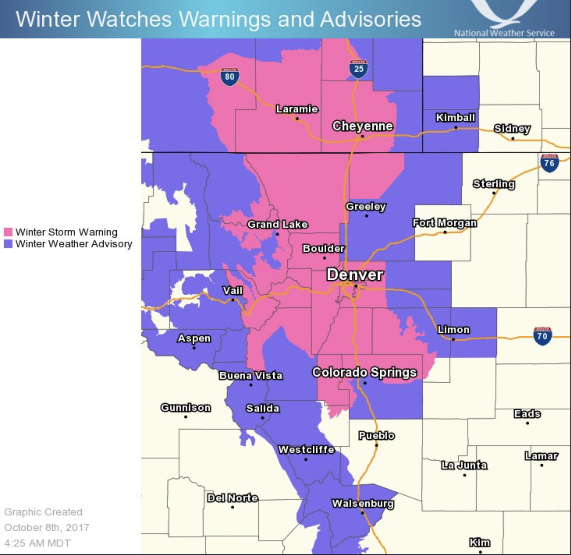
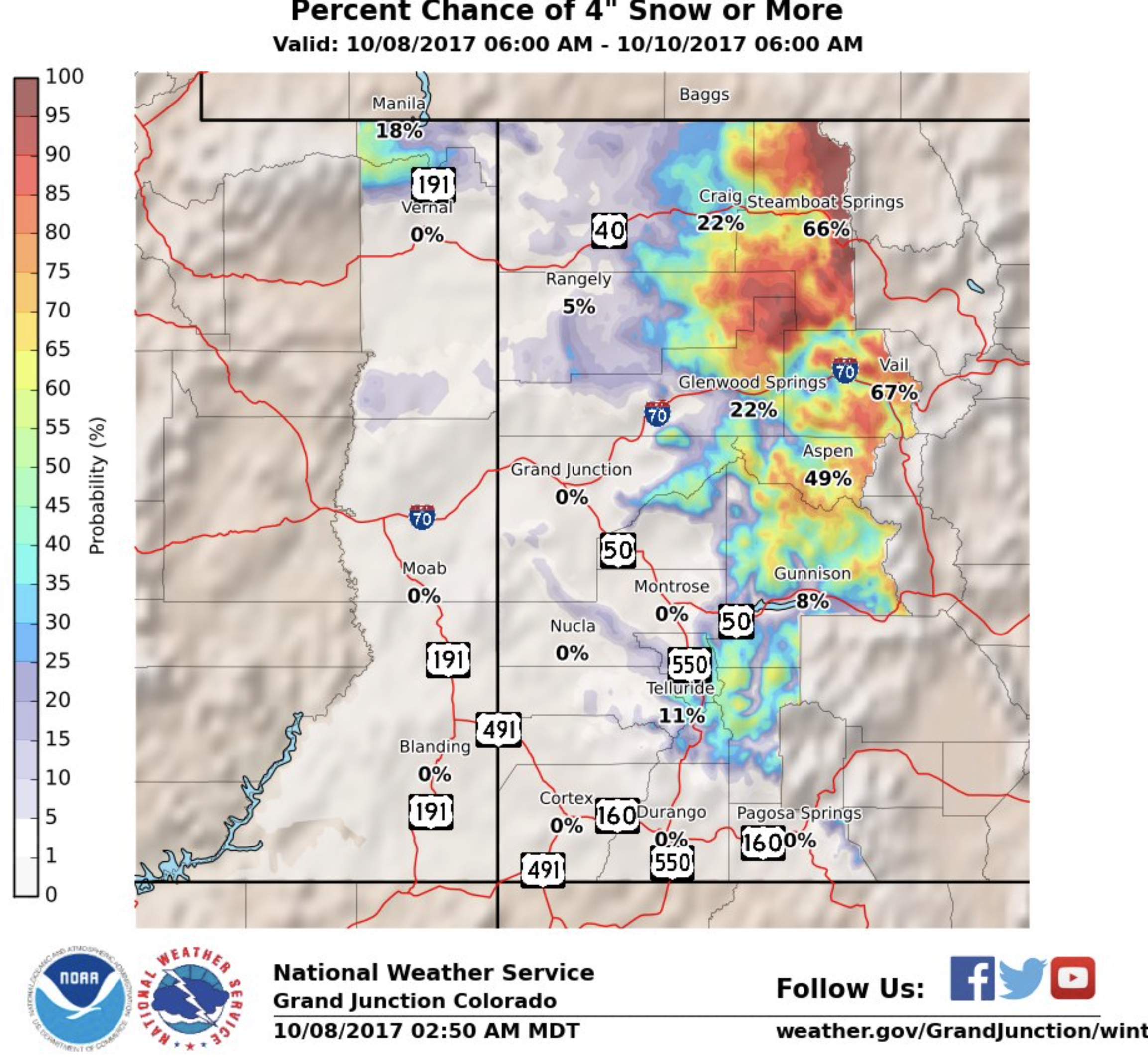
-Winter storms
2. What are the most costly weather and climate disasters?
In short, tropical cyclones are the most costly of the weather and climate disasters. Since 1980, the U.S. has sustained at least 218 weather and climate disasters where overall damages/costs reached or exceeded $1 billion (including Consumer Price Index adjustment to 2017). The total cost of these 218 events exceeds $1.2 trillion. However, this total does not include the costs for Hurricanes Harvey, Irma, and Maria, which are substantial and are still being assessed.
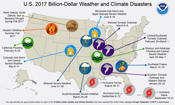
Not including hurricanes Harvey, Irma, and Maria, 35 tropical cyclones have caused at least $583.5 billion in total damages—with an average of $16.7 billion per event. Accounting for just under a fifth (17 percent) of the total number of events, tropical cyclones have caused almost half (47 percent) of the total damages attributed to billion-dollar weather and climate disasters since 1980. These numbers will dramatically rise once the 2017 hurricanes costs are included.
Following tropical cyclones, the most costly event types are:
1. Drought, with an average cost of $9.4 billion per event
2. Flooding, with an average cost of $4.3 billion per event
3. Freezes, with an average cost of $3.4 billion per event
4. Winter storms, with an average cost of $3.1 billion per event
5. Wildfires, with an average cost of $2.5 billion per event
6. Severe storms, with an average cost of $2.2 billion per event
For more information on the distribution of damage from these billion-dollar disaster events, see our summary statistics.
3. Has every state experienced a billion-dollar disaster?
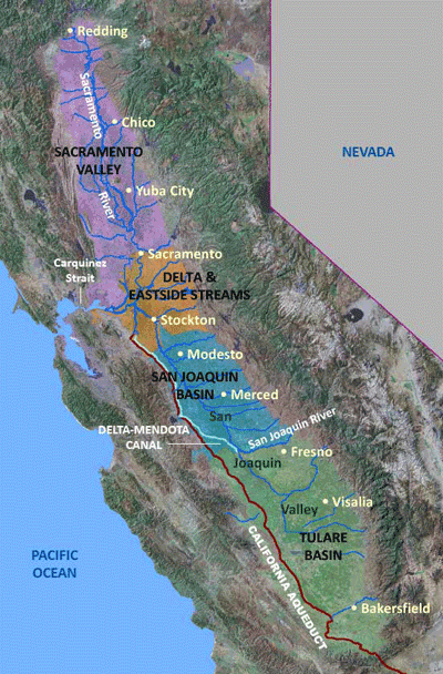
While each region of the United States faces a unique combination of weather and climate events, every state in the country has been impacted by at least one billion-dollar disaster since 1980. Over 94 of these disasters have affected at least some parts of Texas, while only one event has impacted Hawaii (Hurricane Iniki in 1992).
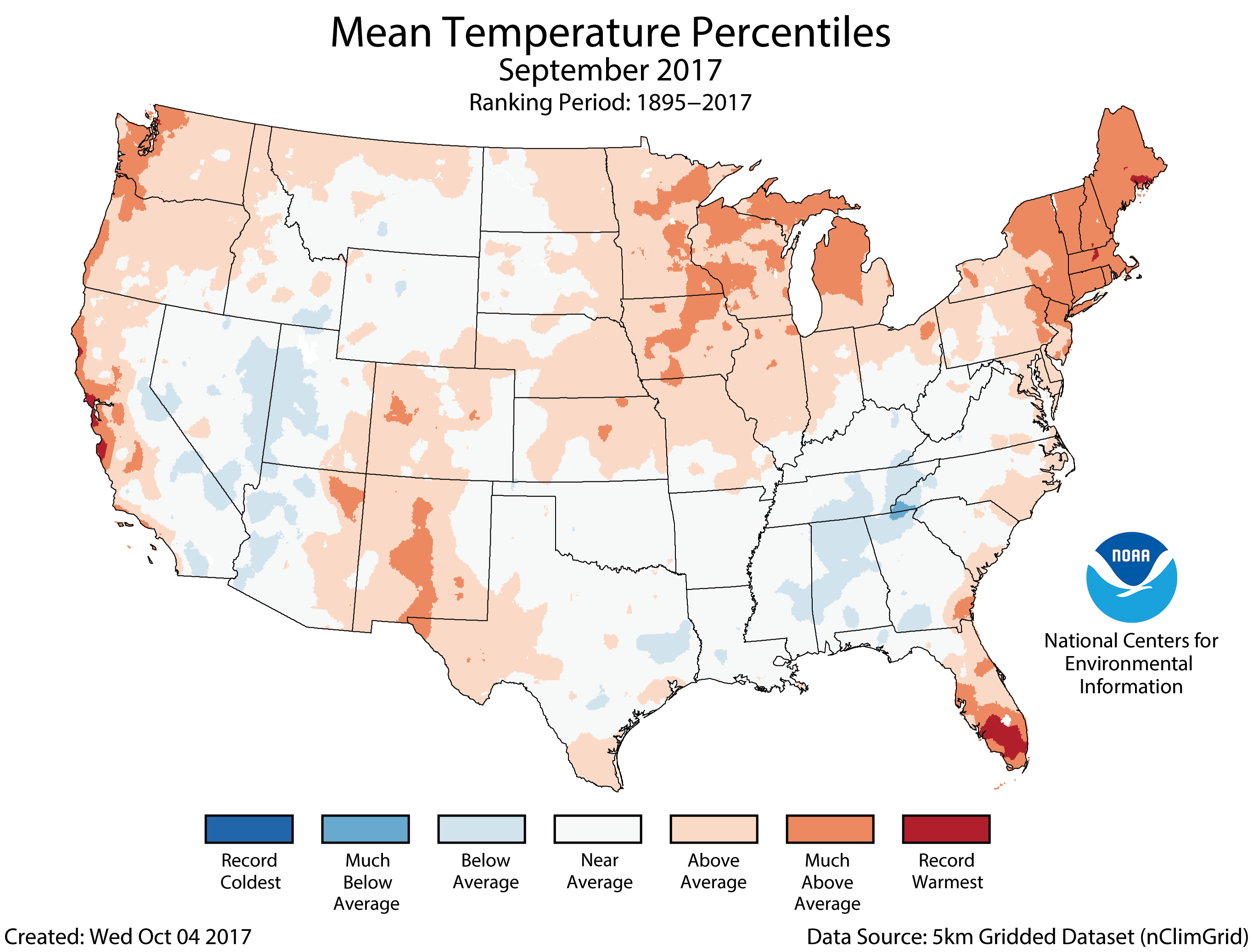
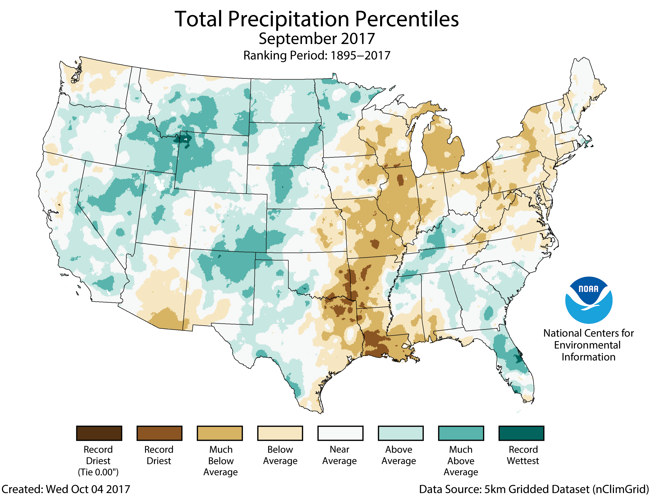
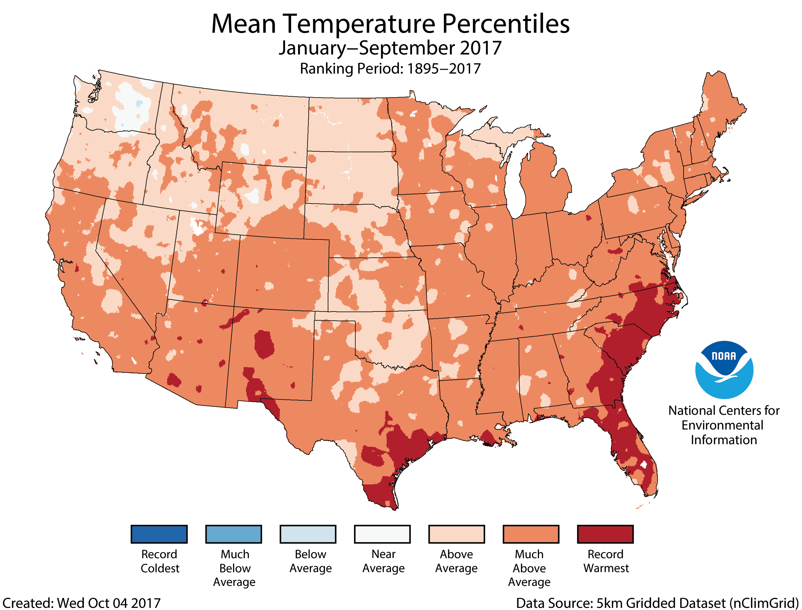
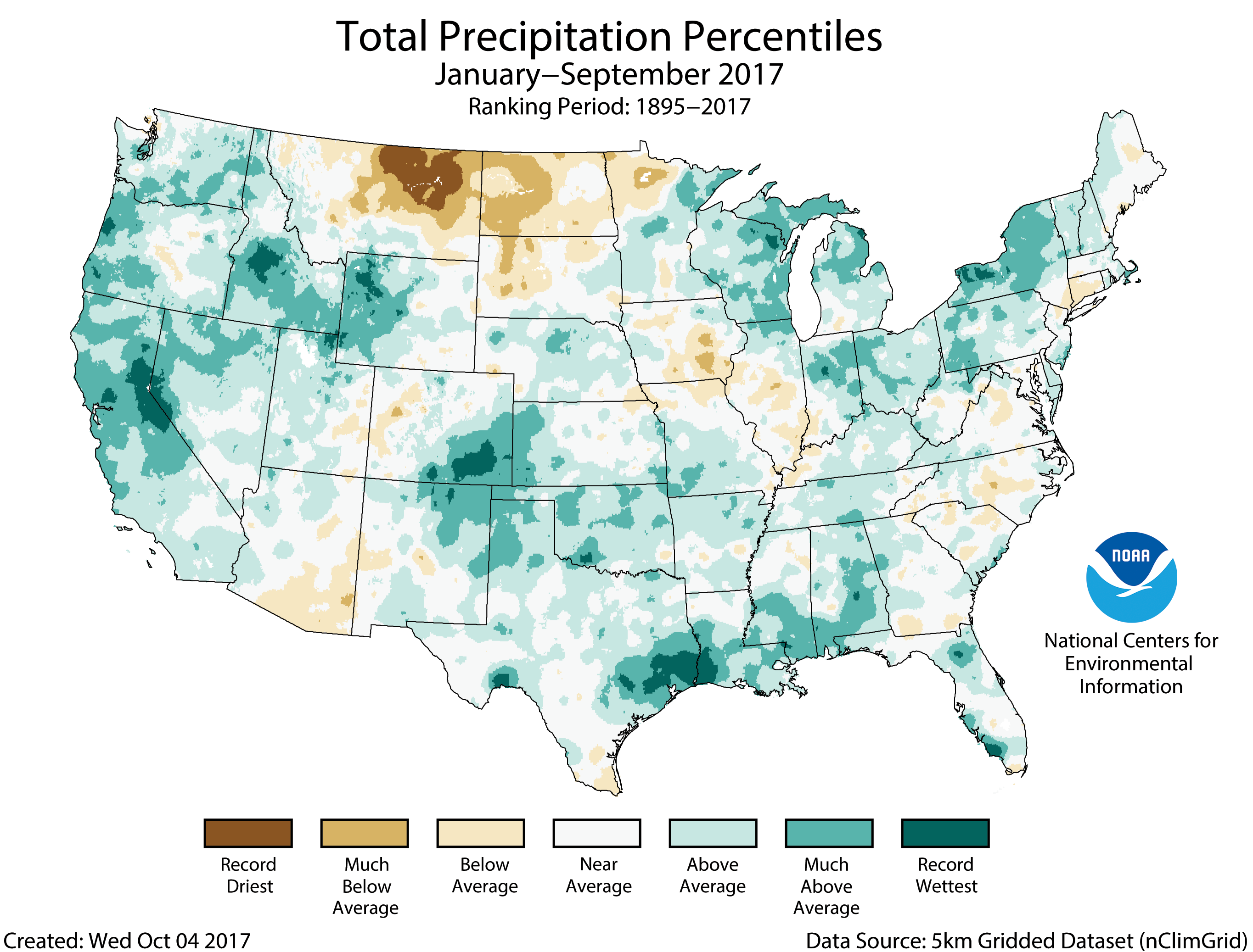
Wildfires are most common west of the Plains states and in several Southeastern states. Inland flood events—not caused by tropical cyclones—often occur in states near large rivers or the Gulf of Mexico, which is a warm source of moisture to fuel rainstorms. Drought impacts are mostly focused in the Southern and Plains states where crop and livestock assets are densely populated. Severe local storm events are common across the Plains, Southeast, and Ohio River Valley states. And, winter storm impacts are concentrated in the Northeastern states while tropical cyclone impacts range from Texas to New England but also impact many inland states.
In total, the Central, South, and Southeast regions typically experience a higher frequency of billion-dollar disasters than other regions.
To visualize the the frequency and cost of billion-dollar disasters, check out our mapping tool.
4. How do you calculate a disaster’s price tag?
In calculating the cost assessments, we receive input from a variety of public and private data sources including:
– Insurance Services Office
– Federal Emergency Management Agency
– U.S. Department of Agriculture
– National Interagency Fire Center
– Energy Information Administration
– U.S. Army Corps
– State agencies
Each of these data sources provides key pieces of information that capture the total, direct costs—both insured and uninsured—of weather and climate events. These costs include:
– Physical damage to residential, commercial, and government or municipal buildings
– Material assets within a building
– Time element losses like business interruption
– Vehicles and boats
– Offshore energy platforms
– Public infrastructure like roads, bridges, and buildings
– Agricultural assets like crops, livestock, and timber
– Disaster restoration and wildfire suppression costs
One of the key transformations is scaling up insured loss data to account for uninsured and underinsured losses, which differs by peril, geography, and asset class.
However, these loss assessments do not take into account losses to natural capital or assets, health care related losses, or values associated with loss of life. Therefore, our estimates should be considered conservative with respect to what is truly lost, but cannot be completely measured.
5. How long does it take to calculate the price tag?
The scale and complexity of a disaster greatly influence the length of time to assess the losses. We’re seeing this with Hurricanes Harvey, Irma, and Maria right now. Hurricanes are particularly challenging, because it takes time to better understand the wind versus water damage losses across a variety of assets (like homes, businesses, boats and vehicles, infrastructure, and agriculture) and how much of this damage is insured versus uninsured. In contrast, with more localized events—like a Colorado hail storm—where property is highly insured, we can more quickly capture the losses.
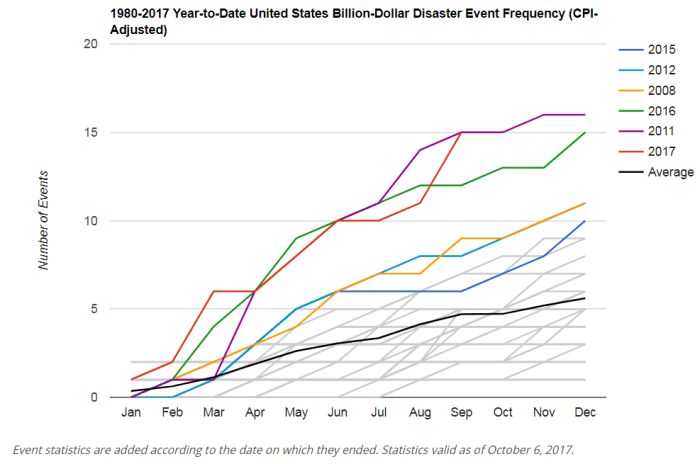
6. Are billion-dollar disasters becoming more frequent?
The increases in population and material wealth over the last several decades are an important factor for higher damage potential. These trends are further complicated by the fact that many population centers and infrastructure exist in vulnerable areas like coasts and river floodplains, while building codes are often insufficient in reducing damage from extreme events. Climate change is also playing a role in the increasing frequency of some types of extreme weather that lead to billion-dollar disasters.
7. Has the U.S. experienced more flooding events in recent years?
Billion-dollar inland—non-tropical—flood events have increased in the United States. Most notably, four separate billion-dollar inland flood events occurred in 2016. This doubled the previous record since no more than two of these events had occurred in a year since 1980 until last year.
So far in 2017, two non-tropical inland flood events have affected the country (in California and Missouri/Arkansas). Also, we experienced historic rainfall from Hurricane Harvey, which is tropical-cyclone related flooding. This perhaps should be expected, as heavy rainfall events and their ensuing flood risks are increasing because warmer temperatures are “loading” the atmosphere with more water vapor. Over time, this increases the potential for extreme rainfall events. And, where we build and how we build determines our resilience to the increasing risk of flood events.
For more information on how the different types of billion-dollar disaster events have changed over time, see our time series.