Walleye from #LakePowell new threat to endangered #Colorado pikeminnow

Danielle Tremblay of Colorado Parks and Wildlife holding a Colorado pikeminnow collected on the Colorado River in Grand Junction. An apex predator in the Colorado, pikeminnows used to be found up to six feet long and weighing 100 pounds.

From The Grand Junction Daily Sentinel (Gary Harmon) via The Aspen Times:

the endangered Colorado pikeminnow faces a new threat, a predator that eagerly scarfs down young pikeminnow, taking a jagged bite out of the species’ overall numbers.

Unfamiliar predation on the pikeminnow comes from a species of fish that’s native to the flatwaters of Canada and the northern tier of the United States. Walleye is a prized food fish, but its voracious appetite for pikeminnow is proving to be a setback to expectations that the pikeminnow could be removed from the endangered species list.

“Walleye have gone gangbusters in Lake Powell,” said Tom Chart, a fisheries biologist who heads the Upper Colorado River Endangered Species Recovery Program for the U.S. Fish and Wildlife Service.

It’s likely that walleye found their way up the Colorado from Lake Powell, Chart said. It’s also possible that the hungry newcomers could have swum down from Rifle Gap and Elkhead reservoirs in Colorado and from two reservoirs in Utah, Red Fleet and Starvation, both near Vernal, said Henry Maddux, director of Utah’s species recovery programs.

On a barely encouraging note, “We haven’t seen walleye reproduce in the rivers,” Chart said. “Yet.”

Walleye nonetheless have taken up residence in waters where they don’t belong, feasting on the young pikeminnow that hatched in the critical 15-mile reach of the Colorado River through the Grand Valley and washed downriver into the slower waters where for eons they have grown to become the apex predators on the river.

The latest #ColoradoRiver streamflow forecast is hot off the presses #COriver

Nearly the full length of Lake Powell on the Colorado River in southern Utah and northern Arizona is visible in this photograph shot by an astronaut aboard the International Space Station, on Sept. 6, 2016. The view is toward the southwest. Water flow is from the lower right toward the top. (Source: NASA Earth Observatory)

From the US Bureau of Reclamation:

Current runoff projections into Lake Powell are provided by the National Weather Service’s Colorado Basin River Forecast Center and are as follows: Observed unregulated inflow into Lake Powell for the month of December was 0.299 maf or 82 percent of the 30-year average from 1981 to 2010. The forecast for January unregulated inflow into Lake Powell is 0.310 maf or 86 percent of the 30-year average. The forecasted 2018 April through July unregulated inflow is 3.900 maf or 54 percent of average.
In this study, the calendar year 2018 diversion for Metropolitan Water District of Southern California (MWD) is forecasted to be 0.732 maf. The calendar year 2018 diversion for the Central Arizona Project (CAP) is forecasted to be 1.574 maf. Consumptive use for Nevada above Hoover (SNWP Use) is forecasted to be 0.290 maf for calendar year 2018.

Due to changing Lake Mead elevations, Hoover’s generator capacity is adjusted based on estimated effective capacity and plant availability. The estimated effective capacity is based on projected Lake Mead elevations. Unit capacity tests will be performed as the lake elevation changes. This study reflects these changes in the projections.

Hoover, Davis, and Parker historical gross energy figures come from PO&M reports provided by the Lower Colorado Region’s Power Management Office, Bureau of Reclamation, Boulder City, Nevada. Questions regarding these historical energy numbers can be directed to Eric Carty at (702) 293-8129.

Note: John Fleck warns about the “error bars” around a forecast this early in the season.

Improving forecasts goal of research effort by Fort Lewis College biologist and others across the west

Graphic credit: American Rivers

From The Durango Herald (Mary Shinn):

Researchers are working to predict water flow in the Western United States – in the same way meteorologists predict weather – to help cities, ranchers and emergency managers make crucial decisions about water management in a changing climate.

The work is focused on forecasting the quality and quantity of water flowing into rivers from mountainous areas, said Heidi Steltzer, an associate professor of biology at Fort Lewis College and an executive committee member working on the project.

Forecasts will make short-term and long-term predictions – from what will happen in one day, in a month or annually – for watersheds across the Western U.S. and beyond, she said.

“You could bring (the model) to the Animas River Valley, you could run the model and we could do a better job managing for water,” she said.

The forecasts could provide better answers to questions such as: “How much water is going to be available for agriculture? Do cities have the water they need? … Do species that live in and around the water corridors have the water they need?” Steltzer said.

Researchers aren’t looking to make predictions hundreds of years into the future, but they want to make accurate predictions as the environment and the system change over time, she said.

For example, they are working to understand the effect snow melting earlier in the year has on the watershed system.

The predictions will also assess what water is bringing down from the mountains, such as nutrients, dissolved salt, dissolved organic carbon and metals. Better water-quality data will help water-treatment managers make long-term decisions about what equipment is needed to treat water to preserve the taste or perhaps strip out certain metals, such as cadmium, said Kenneth Williams, deputy lead and chief field scientist for the project.

The multimillion-dollar project received its funding from the U.S. Department of Energy in October 2016. Researchers are working in the Elk Mountains near Crested Butte, where they plan to collect data in four watersheds. The project’s federal funding will be reviewed every three years, and there is no predetermined end date, Williams said.

Interview with Andy Wood — S2S Climate Outlooks for Watersheds

From Water Deeply (Matt Weiser):

Understanding watersheds is vital to tracking environmental conditions and water availability. Now there’s a web-based tool that offers temperature and precipitation forecasts at the watershed level, says scientist Andy Wood.

ANYONE WHO TRACKS the weather closely soon becomes aware of a surprising fact: it’s not easy to get a forecast tailored to your local watershed – perhaps the most important natural terrain feature that determines water supply, water quality and flood risk.

In the United States, most weather forecasts pay no attention to watersheds. Instead, predictions are made within broad “climate divisions” that do not necessarily recognize the finer scale of watersheds. The National Weather Service (NWS) does have a network of river forecast centers, mainly to provide vital streamflow predictions. These are mostly aimed at a technical audience and do not break out information by watershed.

Now there is a new tool to fill this forecast gap. A partnership between the National Center for Atmospheric Research (NCAR) and the University of Colorado Boulder has produced a forecasting website that offers real-time weather prediction maps based on watershed boundaries across the nation.

Not only is the new system watershed-based but it also offers temperature and precipitation forecasts up to a month ahead. That is well beyond conventional forecasts offered by the NWS.

Known as S2S Climate Outlooks for Watersheds, the system is still considered a prototype. But it has already begun to fill an important need by applying weather and climate data to watersheds. Water Deeply recently spoke to Andy Wood, a project scientist at the NCAR and co-leader of the project, who explained how the system was developed and how it can be used.

Wood emphasized he is eager to hear feedback from users (via this form) about how to improve this new tool.

Photo credit UCAR/NCAR

Water Deeply: Why did you want to bring forecasting to the watershed level?

Andy Wood: This is something I’ve been interested in doing for a while. I used to work for NOAA [the National Oceanic and Atmospheric Administration] in two different river forecast centers: in Salt Lake City for the Colorado Basin, the other in Portland for the Northwest region. As somebody who looked at climate forecasts in that context, it always struck me that it would be nice to have it communicated on a spatial basis, but connected a little more strongly with the kind of modeling and analysis that we would do for river forecasting. And one major basis for that is watersheds and watershed scale.

For instance, if you manage water in the Yakima Basin [in Washington state], you would be able to find information that’s kind of tailored to that watershed. So it’s a pretty simple concept, in a way.

#Snowpack Near Record Lows Spells Trouble for Western Water Supplies — Inside Climate News #ColoradoRiver #COriver

Westwide SNOTEL basin-filled map January 15, 2018 via the NRCS.

From Inside Climate News (Bob Berwyn):

Scientists say snow seasons like the U.S. West is experiencing now will become more common as global temperatures rise, and economic costs will go up, as well.

Months of exceptionally warm weather and an early winter snow drought across big swaths of the West have left the snowpack at record-low levels in parts of the Central and Southern Rockies, raising concerns about water shortages and economic damage.

Drought spread across large parts of the Western United States this month, and storms that moved across the region in early January made up only a small part of the deficit. Runoff from melting snow is now projected to be less than 50 percent of average in key river basins in the central and southern Rockies.

Most of the region’s annual water cycle starts as thick layers of mountain snow that accumulate during winter and melt slowly in spring. If the snows don’t come, there’s no water to fill the reservoirs.

A series of recent studies examines how vulnerable that snowpack is to rising temperatures, and how the economic costs from the declining snowpack could soar into the hundreds of billions of dollars.

From the Associated Press via Steamboat Today:

Aspen Skiing Co. said snowfall has improved recently, with up to 17 inches falling in the past week. Storms last week allowed Aspen to open more terrain.

Colorado Ski Country USA noted the state’s historically snowiest months are still ahead.

Snowpack in the Colorado mountains ranged from 34 percent to 84 percent of the long-term average on Sunday, with the southwestern corner of the state hardest hit.

Drought conditions have spread across virtually all of Colorado, according to the U.S. Drought Monitor, a federal agency that tracks conditions nationwide.

West Drought Monitor January 9, 2018.

From The Rio Blanco Herald-Times (Jennifer Hill):

The first two weeks of 2018 have seen a continuation of dry weather as the local region plunges further into drought-like conditions.

According to the National Integrated Drought Information System, the western half of Rio Blanco County is currently experiencing Moderate Drought conditions with less than 30 percent of normal precipitation. The Eastern side of the county is considered Abnormally Dry.

The Colorado Snow Survey lists Rio Blanco County at 66 percent of normal snow pack.

The dry weather has put pressure on area ranchers as they are forced to continue hauling water to livestock that would normally lick snow. Jon Hill, owner of the Cripple Cowboy Cow Outfit, expressed concerns about the health impact of the extra dust in the air on the livestock. He’s also worried about the long term ability of area wells and springs and what the spring and summer grasses will be like without enough running water. But it’s not just his ranch that Hill is concerned about. “The bigger issue isn’t just one ranch,” he said. “This could impact the Colorado River Compact.”

[…]

Gary Moyer, vice president of the White River Conservation District, is hopeful that some much needed moisture will soon arrive and alleviate concerns about a lack of moisture in the soil. “We are all holding our breath,” he said. “It could change rapidly in the coming months.”

According to the Climate Prediction Center organized by the National Oceanic and Atmospheric Administration, or NOAA, the next three months are likely to bring the possibility of near normal precipitation to the county coupled with above normal temperatures. Jim Pringle with Grand Junction NOAA Office said the weather is currently tracking normal for a La Nina pattern which typically brings the storm track to the northern states and drier weather to the south. An El Nino year tracks the opposite with precipitation to the south and dry weather in the north.

The dry start to winter is not unheard of. One hundred years ago the Meeker Herald reported very similar conditions of little to no snow and concerns that there wouldn’t be any ice to cut. However, the mostly anecdotal historical record may provide some hope. If the weather cycle continues to follow the pattern of 1918, we’ll have snow by the end of the month.

From The Denver Business Journal (Ben Miller):

The 2017-2018 ski season isn’t starting very well for Vail Resorts Inc.

The Broomfield ski resort operator (NYSE: MTN) said total skier visits to its North American ski resorts were down nearly 11 percent compared with a year earlier.

That’s not all that’s down this season: Vail said ski school revenue was down 4.5 percent, dining revenue was down 8.7 percent, and retail/rental revenue was down 11.5 percent compared with last season.

Surface water is becoming more acidic #ActOnClimate #KeepItInTheGround

The Cladocera are an order of small crustaceans commonly called water fleas. Around 620 species have been recognised so far, with many more undescribed. They are ubiquitous in inland aquatic habitats, but rare in the oceans. Daphnia pulex image credit: Wikimedia

From PBS News Hour (Teresa Carey):

What the scientists did: With the ongoing combustion of fossil fuels adding carbon into the atmosphere, aquatic biologist Linda Weiss wanted to learn if freshwater ecosystems fall victim to the same acidification as the oceans. Ocean acidification happens when excess carbon dioxide mixes with seawater, increasing the water’s acidity through a chemical reaction.

So Weiss looked to an organization in Germany that monitors drinking water quality of four reservoirs.

Using their data, which spanned from 1981-2015, Weiss calculated pCO2, a measure that reflects the carbon dioxide exchange between the lake and its environment, and from that, she derived acidity. Reminder: Acidity is measured in pH levels, with lower numbers signifying an increase in acid.

What they found: Over a 35-year span, their data showed a continuous increase in pCO2 in the lakes that was associated with rising acidification — pH levels decreased by 0.3. This rate is three times what has been measured in oceans since the industrial revolution. Weiss’ team found lakes are absorbing some CO2 out of the atmosphere, like oceans, but even more of this carbon pollution comes from emissions settling in soil and washing into freshwater.

Why it matters: Weiss wasn’t surprised. Scientists have speculated if the oceans are becoming more acidic as they absorb excess carbon dioxide, then freshwater may do the same. But Weiss’ findings exceeded previous predictions for freshwater acidification. For example, the dramatic increase in acidity she found over 35 years is equal to the levels expected in the Great Lakes in 2100 — 82 years from now.

Will wildlife suffer? Daphnia, water fleas, are tiny abundant crustaceans in freshwater rivers and lakes. Because many larger animals, like tadpoles, newts and fish, regularly snack on the water flea, they are an important link in the food chain.

“If they are harmed by any stressor, then this may have cascading effects for the rest of the community,” Weiss said.

Larimer County: Thornton submits 1041 application for pipeline project

Map via ThorntonWaterProject.com.

From The Fort Collins Coloradoan (Jacy Marmaduke):

Thornton recently submitted its 1041 application to Larimer County, a key point in the review process for the contested portion of the pipeline route.

The Larimer County Planning Commission will hold a hearing for the project Feb. 21 at 6:30 p.m., and Larimer County commissioners are set to review the issue March 26.

‘Atmospheric rivers’ aid the West — and imperil it — @HighCountryNews

From The High Country News (Emily Benson):

When a rainstorm slammed California’s Russian River watershed in December 2012, water rushed into Lake Mendocino, a reservoir north of San Francisco. The cause? An atmospheric river, a ribbon of moisture-laden air that can ferry water thousands of miles across the sky. When the tempest hit, the state was on the brink of an exceptional drought. But instead of storing the surge the storm brought for the dry days to come, the reservoir’s owner, the U.S. Army Corps of Engineers, let it run downstream.

They had to. Army Corps rules say Lake Mendocino must be partly drained during the winter, leaving room for the next deluge to prevent downstream flooding. But in 2013, that space ended up being superfluous, mostly because drought conditions kicked into high gear and the rainy season essentially ended after the December downpour. “We lost that water,” says Shirlee Zane, who serves on the board of the Sonoma County Water Agency, which delivers water from Lake Mendocino to nearby homes. The agency estimates that more than $2 million slipped down the river. It was a loss that might have been prevented if the Army Corps had known they could safely store the water — and one managers would hate to repeat. “We lose millions of dollars of water if we don’t have better forecasting,” Zane says.

Atmospheric river storms swelled the American River in January 2017, inundating a footbridge near Sacramento, California.
Dale Kolke / California Department of Water Resources

Now, scientists are getting closer to solving that problem. Atmospheric rivers can cause dangerous deluges — an atmospheric river contributed to the mudslides that recently killed more than a dozen people in southern California — but they also provide up to half the annual precipitation on the West Coast. To make the most of those benefits while reducing risks, researchers are improving forecasts using computer models, weather balloons and instruments dropped from airplanes. The knowledge they’re gaining could help reservoir managers stockpile more water for dry periods without sacrificing the safety of downstream communities. And as climate change intensifies both floods and shortages in the coming decades, meeting that balance will become even more critical.

“It’s possible to predict these storms, to a degree,” says Marty Ralph, the director of the Center for Western Weather and Water Extremes, part of U.C. San Diego’s Scripps Institution of Oceanography. Meteorologists can see an atmospheric river coming a few days in advance; and, just as important, they can also see when the coast is clear after a big storm swells reservoir storage. “With good enough forecasts of no big atmospheric river coming in the next few days,” Ralph says, “then it’s plausible that one could safely keep that extra water.”

To explore that possibility, Ralph and a group of scientists, water managers and agency officials are studying what would happen to water supply and flood risk at Lake Mendocino if reservoir operators didn’t always have to leave room for a winter storm that isn’t coming. Could they avoid a repeat of the December 2012 water dump, without imperiling people downstream? “It looks viable,” Ralph says.

Further improving forecasts could help. “We’re good at seeing (atmospheric rivers),” says Anna Wilson, also a researcher at the Center for Western Weather and Water Extremes. “But we are not yet good at telling exactly where they’re going to land, exactly how strong they’ll be, and, in certain instances, whether precipitation is going to fall as rain versus snow.” Wilson, Ralph and other partners, including a U.S. Air Force squadron nicknamed the “hurricane hunters,” plan to drop dozens of parachute-carried sensors measuring moisture, temperature and wind data through several atmospheric rivers early this year. Working with the National Weather Service, they hope to advance forecasts of storm location and other details.

Better forecasts could also help water managers deal with the increasingly intense atmospheric rivers climate change will likely cause. Because warmer air can hold more moisture, by the end of this century individual atmospheric rivers could drop substantially more precipitation on the West Coast than they already do, according to research done by Michael Warner, a Seattle-based meteorologist with the U.S. Army Corps of Engineers.

Those lessons won’t just apply to California reservoirs. For a place like Washington’s Howard Hanson Dam, more intense storms might demand faster reservoir releases, which could put downstream areas in peril. In addition to supplying Tacoma with water during the summer, the dam protects more than $6 billion in businesses, infrastructure and homes from flooding. “Every major flood in the coastal Pacific Northwest has been associated with an atmospheric river event,” Warner says.

Though it will take years of further research before official policies can be changed, managers at Lake Mendocino may try taking atmospheric river forecasts into account this year. This winter, for the first time, the steering committee of the Lake Mendocino project has requested that the Army Corps deviate from the rules that forced the agency to dump water in the past — if forecasts suggest it’s safe to do so. “We are in a feast or famine type of climate here on the West Coast,” says Zane, of the Sonoma County Water Agency. “If we have better data and we can do the forecasting … it’s going to improve our water management.”

This story was originally published at High Country News (http://hcn.org) on Jan. 11, 2018.


Rain totals from atmospheric river event in S. California January 8-9, 2018 via NWS Los Angeles.

@GovofCO presents his final state of the state address

Colorado Water Plan website screen shot November 1, 2013

Here’s the complete text of the speech from The Denver Post. Here’s an excerpt:

We created the country’s first and best methane regulations; a water plan that secures food production; protected the sage grouse from being listed as an endangered species; and developed an electric vehicle infrastructure spanning 7,000 miles.

We cut or modified almost half of our rules and regulations. And in doing so, saved businesses nearly eight million dollars and over two million hours last year alone.

Two million hours!

And we measured our progress on everything that matters.

We trained thousands of employees who completed 600 LEAN process improvements…created more value for Coloradans and won several awards…

So we will not let up. We won’t stop to enjoy the view. We have a lot to accomplish in the next 119 days:

● We need to find the right solution to PERA’s unfunded liability.
● We need to pass legislation to safely cap orphan wells.
● We need to halt the opioid epidemic that continues to destroy lives and families, and disproportionately affects our rural communities.
● We need to enact a K-12 and Infrastructure Funding Plan that will help make the Water Plan a reality.
● We need legislation and funds to ensure full broadband buildout in rural areas.
● And we need to protect our rural communities by addressing the intense, negative impact the Gallagher amendment has had, and will have, in the future.

It’s a commonsense agenda…

We need your support to get to the finish line. One of the most essential pieces of infrastructure in our economy is our natural landscape, our clean air and water — the things everyone thinks about when they hear the word “Colorado.”

It’s one reason why companies of all sorts have been drawn to this place we love. And the reason why the outdoor recreation show is coming to Denver in a couple weeks along with its $110 million in economic impact.

It’s why many of our farmers and ranchers, who live on the land, came here, and stay here.

But the responsibility to be good stewards doesn’t only fall on rural parts of the state. It rests with all of us.

Xcel has submitted a plan to close two coals plants in Pueblo. This will clean our air and lower costs for consumers – and lead to greater investments that support 21st-century careers.

What is it the critics don’t like? Is it the cleaner air or the lower utility bills?

Clean air matters.

Xcel is also working with Evraz Rocky Mountain Steel — one of the cleanest steel plants in the world — to move toward renewable energy while protecting Pueblo’s future as a center for steel manufacturing. We need everyone’s support to make this a reality.

Pueblo is known as steel city, but soon it could also be “solar and wind city.”

Most of us agree that science shows climate change is happening at a significant rate in large part because of humans. But even those of us who disagree on climate change can agree that we need to protect the Colorado environment our grandchildren will grow to love with a strong economy where they can find jobs.

This includes protecting our water for agriculture. If we don’t implement our water plan, rural agricultural communities will be hit first and hardest. We live in a state of open markets. They can never afford to match what Front Range homeowners pay for domestic water.

Having a sustainable source of food — no matter what happens around the world — is an essential foundation for the future of our state.

We’re one of the great food exporting states and that’s a resource we should continue to invest in…rather than put at risk.

The Colorado Water Plan provides a framework but doesn’t include all the funding for the last $1 billion over the next 30 years. We need the support of the General Assembly.

But the cost of water has been a small part of rising new housing prices along much of the Front Range and elsewhere. It strains one’s ability to love where they live when they can’t afford the price of a home or even rent near the jobs and communities they care about.

#Snowpack news: Statewide = 2nd lowest on record

Westwide SNOTEL January 13, 2018 via the NRCS.

From The Pueblo Chieftain (Jon Pompia):

Information provided by the Department of Agriculture indicates that as of Jan. 5, the statewide snow water equivalent was 54 percent of normal — “the second lowest on record.”

Across Colorado, the snowpack levels range from a low of 23 percent of normal in the combined San Miguel, Dolores, Animas and San Juan basins, to a high of 87 percent of normal in the North and South Platte basins.

Snowpack in the Arkansas Basin, which encompasses Pueblo and Southern Colorado, was only 48 percent of normal, with big differences between the northern (81 percent of normal) and southern portions (an average of 17 percent) of the basin.

In the nearby Rio Grande Basin, January snowpack was only 29 percent of normal.

While 2017 was classified a “big year in terms of precipitation around here, well above normal across most of the area” by local National Weather Service meteorologist Tony Anderson, the last three months of the year were extremely dry…

Chris Woodka, issues management program coordinator with the Southeastern Colorado Water Conservancy District, agreed that it’s too early to start worrying.

“So far, this year is shaping up like some of the drier years we’ve seen, but it’s still pretty early in the snow season,” Woodka said. “The heaviest snows typically come in March and April.

“We have not made any estimates of how much water will be imported through the Fryingpan-Arkansas Project this year. Like everyone else, we’ll be watching the snowpack carefully as we head into 2018.”

On a positive note, all major river basins in the state are currently holding above average reservoir storage.

Less encouraging is the fact that all streamflow forecasts in the state are far below average spring and summer volumes.

Drought news: D2 (Severe drought) expanded in the Grand Valley #ColoradoRiver #COriver

West Drought Monitor January 9, 2018.

From West Slope Now (Marcus Beasley):

We’re currently under a severe drought here in Grand Junction, but how’s that affecting the snow pack up in the mountains, and what will the results be come spring time here in the grand valley?

The “Ute Water Conservancy District” are keeping their eyes on the snow pack up in the mountains, and that way, they will know if we are going to have a shortage of water here in the spring.

“Ute Water Conservancy District uses the north side of the mesa for our source water. We’re looking at two snotel sites on the north side of the Grand Mesa. We look at Mesa Lakes which is currently at 26%, and Park Reservoir, which is at 25%.”

Those numbers are a little low because we’d like to see numbers around 100%, but it’s a little too early to start worrying about the water for the spring.

“mid to late March is when we’ll have a better indicator of where we’re going to be for the rest of the year, and that’s when we’ll start to formulate a plan if we need to move into any of our phases in our drought plan, it’ll happen around that time.”

Keeping an eye on the #LakePowell water level #ColoradoRiver #COriver

Lake Powell April 12, 2017. Photo credit Patti Weeks via Earth Science Picture of the day.

From the Colorado Cattlemen’s Ag Water NetWORK via The Fence Post:

The collective water use of the upper basin states is still well below the 7.5 M acre-feet annual average depletion maximum. U.S. Bureau of Reclamation reports indicate that the upper basin water use averaged 4.4 M acre-feet between 2000 and 2015. The highest use among these years was 4.9 M acre-feet.

The lower basin states, with greater population and higher evapotranspiration, have a more difficult time managing water demands within the limitations of the compact. For the last several years, annual releases from Lake Mead have averaged about 9 M acre-feet to meet lower basin water demands. Lake Mead also loses about 1.2 M acre-feet in evaporative and system losses, so the total annual outflow from Lake Mead has been about 10.2 M acre-feet.

The imbalance between Lake Mead’s recent inflows and outflows is called the “structural deficit.” This is the amount by which the lower basin states and Mexico must reduce their demands in order to reach a more sustainable withdrawal rate from Lake Mead.

Lake Powell stores water that flows from the upper Colorado River basin and is used to buffer declines in Lake Mead. Glen Canyon Dam, which creates Lake Powell, also generates 5 billion kilowatt-hours of hydroelectric power annually. The Western Area Power Administration distributes this electricity to Colorado and six other states at cost-effective rates. The total value of the electricity produced is about $120 million annually. A small, but important, portion of the annual power revenue is used to fund salinity control programs that help pay for irrigation infrastructure upgrades on the western slope, and provide funding for the Colorado River and San Juan River endangered species recovery programs.

In 1970, formal “Operating Criteria” were agreed upon by the seven states and the Bureau of Reclamation to provide for the coordinated operation of reservoirs in the upper and lower basins and set conditions for water releases from Lake Powell and Lake Mead. The Operating Criteria allow the secretary of the interior to make releases from Lake Powell to raise the water level in Lake Mead so that the stored volume of the two reservoirs is roughly equal. The upshot is that Lake Powell will decline when Lake Mead declines, even if ample flow is entering Lake Powell from the upper basin states.

Since 2000, the two reservoirs have been drawn down to approximately half of their capacity to meet lower basin demands. The current water level of Lake Mead (1,083 feet above sea level) is the lowest since the reservoir started filling in 1935 (ref http://lakemead.water-data.com). It is currently just above the “Tier 1 Shortage level” of 1,075 feet, which is the point where water allocations to Arizona and Nevada are automatically reduced. These reductions become increasingly severe at Tier 2 and Tier 3 levels.

The current level of Lake Powell is about 3,625 feet above sea level. The concern for the upper basin states is that if the structural deficit continues and/or a drought returns, Lake Powell could be lowered to a level below 3,490 feet, which is the minimum level needed to generate electricity.

The lower basin states and Mexico have implemented conservation measures that have saved about 1.2 M acre-feet in Lake Mead since 2014. This has resulted in the lake level being 14 feet higher than it would have been otherwise.

For Colorado and the other upper basin states, the challenge isn’t complying with the usage limit spelled out in the 1922 compact. Instead, it is simply how to deal with snowpack and runoff shortages over a multi-year period. Since many Front Range cities and irrigation districts rely on Colorado River basin water via trans-mountain diversions, runoff shortages on the western slope also directly affect eastern slope residents and farmers. And of course, multiple years of drought in the upper basin could result in lowering of Lake Powell to the power pool level simply because of inadequate runoff. When the 2002-2003 drought began, Lake Powell was full. Today it is about 58 percent of its capacity.

In 2015, a program was created to determine whether voluntary, compensated reductions in consumptive use in the upper basin states could be a useful tool to put water into Lake Powell and minimize lake-level declines during drought periods. The System Conservation Pilot Program is funded by southern California’s Metropolitan Water District, Central Arizona Project, Southern Nevada Water Authority, Denver Water, U.S. Bureau of Reclamation, and NGOs. About $4.5 M has been spent on the program through 2017 and approximately 22,000 acre-feet of consumptive use water has been conserved through such fallow and deficit irrigation, alternative cropping and a municipal water savings program. The program is being continued in 2018.

Nederland budget approved

Mailboxes are laden with snow on April 17, 2016 in Nederland, Colorado. (Helen H. Richardson, The Denver Post)

From The Mountain Ear (John Scarffe):

A new Waste Water Treatment facility and sewer maintenance dominated the 2018, $4.9 million budget approved by the Nederland Board of Trustees during a regular meeting at 7 p.m., December 5, 2017, at the Nederland Community Center…

Estimated expenditures for each fund: General Fund: $2,793,371; Conservation Trust Fund: $16,000; Community Center Fund: $391,068; Water Fund: $708,808; Sewer Fund: $812,422; Downtown Development Authority Fund: $30,700; Downtown Development Authority TIF Fund: $2,900. Total: $4,755,269…

The Sewer fund capital improvements have multiple items such as manhole repairs, mains and a new vehicle. The design and engineering of the Waste Water Treatment Plant Biosolids project will get up to 100 percent in 2018 but will be reimbursed by a loan, Hogan said, and will hopefully be awarded a $950,000 grant for improvements. It is a $2 million project.

Capital improvements from the water fund include the other half of the new vehicle, a Micro Hydro Feasibility Study with a matching $8,000 grant, and other projects, Hogan said.

Grant activity includes a Colorado Department of Local Affairs grant for the Biosolids project, a Great Outdoors Colorado grant for Fishing is Fun; a Colorado Department of Public Health and Environment grant for Pursuing Excellence Raw Water Filtration, a Colorado Water Resources and Power Development Authority grant for the Micro Hydro Feasibility Study with an $8,000 match and a GOCO Parks grant with a $6,000 town match…

For the Water Fund, the changes in rates are explained in the fee schedule. Total revenue is $707,000, operating expenses are $475,000, capital improvements $91,000 and debt payments of $143,000, resulting in a net change in cash of negative $1,200.

The Sewer Fund will also contain a fee schedule increase. Total revenue is budgeted to be $814,000, operating expenditures $527,000, capital improvements $42,000 and debt payments of $244,000, resulting in a positive net change in cash of $2,000.

Hogan presented the 2018 Fee Schedule. Noteworthy increases include the water fee with a three percent increase, and the sewer fund with a four percent increase.

#Drought news: Hope for Spring moisture

US Drought Monitor January 9, 2018.

From CBS Denver (Jeff Todd):

Nearly all of Colorado is now abnormally dry or worse on the U.S. Drought Monitor.

“This isn’t unprecedented but it’s certainly on the low end of the distribution. It looks somewhat similar to what we saw in the 2002 and 2012 type drought years,” said Peter Goble with the Colorado Climate Center at Colorado State University.

A majority of southwestern Colorado is now in the classified as severe drought.

“This is largely based off of a concerningly low snow year in the western portion of Colorado,” Goble said. Adding that there is only a five percent chance the mountains in the San Juan Mountains reaches average or normal amounts.

Water managers say despite the lacking snowpack Colorado’s reservoirs are at or above average.

But many are looking toward the end of the winter and hoping for precipitation packed storms.

“If you look especially at the eight to 14 day timeframe, the things aren’t necessarily lining up to get worse. They’re also not lining up to fix all the problems. Our primary focus will be snow just because as that snow melts out in the spring it recharges our springs and reservoirs and our soils,” Goble said.

From CBS Denver (Ashton Altieri):

The weekly drought data was released Thursday morning and it’s not good. 99 percent of Colorado is now experiencing abnormal dryness or drought.

The percentage of the state with at least moderate drought has increased 42 percent from a week ago and now includes the entire Denver metro area.

Even worse, severe drought jumped 15 percent and now has a grip on nearly the entire Western Slope.

The data was calculated on Tuesday and therefore doesn’t include most of the moisture from our recent storm. So it’s possible we could see limited improvement particularly in southwest Colorado next week.

But in terms of the metro area, the rain and snow we saw Wednesday is unlikely to make much of a difference.

As of this morning we’ve seen 6.8 inches of snow this season in Denver. And that’s nearly 17 inches below normal through Jan. 11.

#Snowpack news: Not much of a bump from the recent snowfall

From The Alamosa News (Ruth Heide):

With a basin-wide snowpack sitting at 31 percent of normal and the National Weather Service calling for dry conditions in coming months, “It’s not looking real great for us right now,” Colorado Division of Water Resources Division 3 Engineer Craig Cotten said during a water meeting in Alamosa on Tuesday.

“We are a little bit lower than 2002 at this point,” he said. That was one of the San Luis Valley’s worst drought years.

However, Cotten said that last year looked about the same until storms came in December to boost levels. “We could get something like that happening again,” he said, adding that a storm was supposed to be coming in on Wednesday…

Although the Rio Grande Basin (San Luis Valley) is not the worst in terms of snowpack right now — the San Juan Basin is lower at 27 percent of normal — the snowpack as of Tuesday morning was only 31 percent of normal in the Rio Grande Basin. The basin with the highest snowpack on Tuesday was South Platte with only 82 percent of normal…

The current annual flow forecasts from the Natural Resources Conservation Service (NRCS) for the Rio Grande and Conejos Rivers are 54 percent of the long-term average, Cotten told members of the Rio Grande Roundtable on Tuesday. The preliminary annual flow for the Rio Grande at Del Norte is 345,000 acre feet, or 54 percent of the long-term average and about half of what the river produced in 2017 (690,500 acre feet), while the NRCS is currently predicting an annual flow on the Conejos River system of 165,000 acre feet, also 54 percent of the long-term average and significantly below the 2017 total of 439,6000 acre feet.

The only upside of those lower numbers, Cotten added, is that less would be required to be sent downriver to comply with the Rio Grande Compact. Of the currently predicted 345,000 acre feet on the Rio Grande, the state would only owe 85,000 acre feet to downstream states, and curtailment during the irrigation season would likely be nil.

The same would be true on the Conejos River system, with no curtailment necessary during the irrigation season if the current prediction of 165,000 acre feet holds. The state would have to send 27,500 acre feet downstream to meet compact obligations, “which can be met without curtailment on the Conejos,” Cotten said…

Cotten said Colorado ended 2017 in the black as far as Rio Grande Compact accounting on the Rio Grande, with about 1,850 acre feet credit, while the Conejos River couldn’t keep up with its increased obligation due to higher flows and ended the year with about 3,050 acre feet in debt.

“The Compact allows that,” Cotten explained. “It’s not a problem. You can go into debt and make it up the next year.”

The Conejos experienced an above-average year for the first year in a long time last year, Cotten said, at 143 percent of normal. It has a higher obligation to the compact than the Rio Grande and had to send 51 percent of its annual flow downstream, or 222,800 acre feet of the total 439,600 acre feet.

The Rio Grande also experienced an above-average year in 2017 at 108 percent of normal, which was the third year in a row for an above-average year on the river, Cotten said. Its obligation to the compact was 29 percent, or 199,800 acre feet of the total 690,500 acre feet.

On a legal note, Cotten said the trial over the groundwater rules/regulations will begin with opening arguments on January 29 and is currently scheduled for four weeks. He said five or six objectors are still in the case. The case will revolve around groundwater rules promulgated by the state engineer for water users in this basin. The case will present its arguments first, Cotten explained.

Chief District/Water Judge Pattie Swift will preside over the case, which will be heard in the Rio Grande Water Conservation District’s building at 8805 Independence Way in south Alamosa.

From The Vail Daily (Randy Wyrick):

With Wednesday’s storm possibly followed by a quick hitter on Friday, and possibly followed by another the middle of next week, this Colorado winter might begin at least looking like a Colorado winter.

“An active pattern might be setting up by the end of next week,” said Mike Meyers, a meteorologist with the National Weather Service in Grand Junction.

From the Associated Press (Susan Montoya Bryan) via the The Santa Fe New Mexican:

A small amount of rain fell over the state’s largest metropolitan area Wednesday, ending one of the longest dry spells in recorded history. Albuquerque had logged more than three straight months without any measureable precipitation — a stretch that threatened to break records that had been set decades ago…

So just how much rain was measured Wednesday morning? Only three-hundredths of an inch, or less than one millimeter.

The recent dry spell marked the fifth longest on record, according to the weather service. The record of 109 days was set in 1902.

While the moisture is welcomed, water managers and environmentalists are most concerned about snowpack levels in the mountains along the New Mexico-Colorado border that feed the Rio Grande basin.

A recent forecast issued by the Natural Resources Conservation Service shows Rio Grande flows at various spots in Northern New Mexico could range from 15 percent to 24 percent of average this year. It’s early in the winter season, but it still marks a dry start to things.

The most recent federal map that tracks drought shows much of the American Southwest is dealing with conditions that include moderate to severe drought. Every square mile of neighboring Arizona is affected, while it’s dry across New Mexico but for a sliver of its southeastern border with Texas.

Jen Pelz with the group WildEarth Guardians said it appears from January’s stream-flow forecast that 2018 could be similar to the lean years earlier in the decade where the Rio Grande’s flows were less than half of average.

From The Albuquerque Journal (Ollie Reed Jr.):

“The outlook from late winter through spring is below-average precipitation,” said Kerry Jones, a meteorologist with the Albuquerque office of the National Weather Service. “The odds are tilted that way. It’s not good.” Wednesday’s rain, 0.03 inch recorded at the Albuquerque airport by midafternoon, broke a city dry spell that had stretched to 96 days without measurable precipitation, the fifth-longest such period since 1891. The longest such period is 109 days in 1902.

Although there wasn’t much measurable precipitation at the airport, the storm left wet streets and plenty of puddles around the city.

“If we had not had (Wednesday’s) precipitation, we could have given that longest stretch a run for its money, maybe even broken it,” Jones said. While Wednesday’s moisture is welcome, Jones said, it’s not much help.

“We would need unprecedented wetness, almost equivalent to the dryness we have experienced, to make up the ground we have lost,” he said.

At the start of 2017, slightly more than 4 percent of New Mexico was experiencing some degree of drought. At the start of this year, 46 percent of the state, mostly in the extreme north and in the west, had some level of drought. And Jones said the condition of mountain snowpacks, the source of spring runoffs that feed the state’s streams and rivers, is dismal.

“Up north, most basins have snowpacks that are at from zero to 6 percent of median,” he said. “Up on the state border, some basins are at 15 percent of median.”

He said a gauge at Bobcat Pass, an area just below 10,000 feet between Red River and Eagle Nest, is indicating that location’s lowest measurement since 1980.

The latest Intermountain West Climate Briefing is hot off the presses

Westwide SNOTEL basin-filled January 11, 2018 via the NRCS.

Click here to read the briefing:

The latest monthly briefing was posted [January 10, 2018] on the Intermountain West Climate Dashboard. The highlights, also provided below, cover current snowpack and drought conditions, seasonal runoff forecasts, December and annual precipitation and temperature, and ENSO conditions and outlooks.

  • A winter drought is developing across Utah and Colorado, with very low precipitation and poor snowpack conditions accompanied by very warm temperatures and unusually high evaporative demand. It is unlikely that the snowpack will recover to average conditions by spring, and very low spring-summer runoff is increasingly likely, especially in southern Utah and southwestern Colorado.
  • The snowpack in both Utah and Colorado is at a near-record-low for early January, with statewide SWE at around 50% of normal, and many individual basins in southwestern Colorado and southern Utah well below 50%. Wyoming is faring much better, with above-normal SWE in the northwest basins grading to below-normal SWE in the southern basins.
  • The first official seasonal runoff forecasts, issued in early January by NRCS and NOAA, call for below-average (70-89%) or much-below-average (<70%) April-July runoff for nearly all forecast points in Colorado and Utah, with many points expected to see less than 50% of average runoff. Forecasted runoff for Wyoming is generally above average or near average.
  • La Niña conditions are more firmly entrenched and expected to persist through the winter, with a transition back to ENSO-neutral conditions likely by late spring. Historically, weak to moderate La Niña events are associated with below-normal March-May precipitation for Utah and Colorado.
  • December saw much-below-normal precipitation and very warm conditions for Colorado and Utah, and near-average precipitation but very warm conditions for Wyoming. Calendar year 2017 was the 3rd-warmest on record for both Colorado and Utah, with near-normal annual precipitation in both states, while Wyoming had its 7th-warmest year on record despite much-above-normal precipitation.
  • Since early December, drought conditions have emerged or worsened for nearly all of Colorado, southern and western Utah, and parts of southern Wyoming . As of January 2nd, 61% of Utah is in D1 or D2, and another 29% in D0; in Colorado, 33% is in D1 or D2, and 60% in D0; and in Wyoming, only 2% is in D1, and 23% in D0.
  • #Drought news: D1 (Moderate Drought) expanded over most of E. #Colorado

    Click here to go to the US Drought Monitor Website. Here’s an excerpt:

    Summary

    Dryness continues over most of the country with only isolated areas of above-normal precipitation for this week. The “snow drought” over much of the mountainous western United States is catching more attention, but there is time to make up the poor start to the current water year. Portions of California and coastal Washington did have good precipitation for the week, along with areas of southern Louisiana, east Texas, and southern Mississippi. A significant winter storm brought precipitation to many areas along the east coast from Florida to Maine, but this did not reach too far inland. Over the last 60 days, extensive areas of the country have recorded below 25 percent of normal precipitation, from the Southwest into the central Plains and Midwest as well as in the Southeast and into the Mid-Atlantic. Cold air has also dominated much of the Midwest and eastern United States, with departures from normal temperatures in the Mid-Atlantic 15-20 degrees below normal…

    High Plains

    A dry week for the region, but also a very cold week, with most of the eastern portions of the region recording temperatures 5-10 degrees below normal. Dryness over the last 3 months has been a concern, even during the fall and winter months. Moderate drought conditions were expanded over all of eastern Colorado, western Kansas and more of central Kansas. Severe drought was also expanded over southwest Kansas while a new area of extreme drought was introduced along the Oklahoma border where less than 10 percent of normal precipitation has been recorded over the last 90 days…

    West

    The story over the region has been the slow start to the current water year with the lack of both rain (in the lower elevations) and snow (in the upper elevations). The anomaly has been the northern Rocky Mountains in that the wet pattern over the last several weeks has allowed for a full category improvement to the drought status over Montana with all areas of extreme drought being removed this week. In the central Rocky Mountains and Four Corners regions, drought conditions continued to intensify, with moderate and severe drought expanding over Colorado, New Mexico, Utah, and southern Wyoming. Abnormally dry conditions were introduced into Oregon, northern California, and western Idaho this week in response the dryness. Heavy rain at the end of the period brought the first significant rainfall to southern California and portions of the desert Southwest this winter, bringing with it mudslides and flooding as the rain saturated areas burned earlier…

    Looking Ahead

    Over the next 5-7 days, precipitation is widespread over much of the contiguous United States, with all but areas of the Southwest expecting to record some precipitation. The Pacific Northwest and northern Rocky Mountains are anticipated to have significant precipitation with liquid amounts of 3-4 inches along the coasts of northern California, Oregon, and Washington as well as over much of northern Idaho and western Montana. Significant precipitation is also anticipated over the Ohio River Valley and into the Mid-Atlantic, where 1.50-2.50 inches of liquid precipitation is forecast over widespread areas. Cooler than normal temperatures are anticipated over most areas east of the continental divide with departures of up to 15 degrees below normal while the western areas are anticipated to be warmer than normal with departures of 5-10 degrees above normal.

    The 6-10 day outlooks show that the trend of warmer over the West and cooler over the East will likely continue. Temperatures have the greatest chance of being below normal over the Mid-Atlantic into the Southeast and above normal over the Southwest. Precipitation chances are projected to be greatest over the Great Basin and Pacific Northwest as well along the Mississippi River Valley. Drier than normal conditions are anticipated to mainly be over the areas of west Texas and southern New Mexico as well as along the coastal regions of the Southeast, with higher than normal chances of dry conditions along much of the east coast.

    Dillon’s Frosty: The fairest of them all – News on TAP

    Colorado’s snowpack numbers are the worst they’ve been in 33 years, but Denver’s water supply is still in good shape.

    Source: Dillon’s Frosty: The fairest of them all – News on TAP

    Efficiency is the new conservation – News on TAP

    After a successful 10-year conservation plan, our focus turns to water efficiency. Here’s a look at what that means.

    Source: Efficiency is the new conservation – News on TAP

    Fort Collins Utilities’ water treatment plant is changing treatment process

    The water treatment process

    From The Fort Collins Coloradoan (Jacy Marmaduke):

    Fort Collins Utilities is changing some of its procedures after breaking two state water quality rules last month.

    The associated incident happened Dec. 14 and lasted 18 minutes, from 8:41 to 8:59 a.m. Water users were never at risk as a result of the incident, which involved a malfunction in the water treatment system, water resources and treatment operations manager Carol Webb said.

    The malfunction involved a portion of the system that adds lime to water to prevent pipe corrosion. Though lime is a safe and state-approved drinking water additive, the system added too much lime to water on Dec. 14, causing a spike in turbidity, or cloudiness.

    The overfeeding of lime caused water midway through the treatment process to spike to 2.5 times the mandated maximum cloudiness. The state enforces turbidity requirements because high turbidity can interfere with disinfection and offer a medium for microbial growth. Turbidity can also indicate the presence of disease-causing organisms in water, according to the Colorado Department of Public Health and Environment.

    By the time the water reached users, its cloudiness was below state-mandated levels, but the turbidity spike in the combined filter effluent is still considered a violation because the state requires monitoring of water quality at several stages throughout the treatment process.

    Fort Collins Utilities also failed to notify the state of the turbidity spike within 24 hours, which elevated the issue to require public notice. The city didn’t immediately notify the state in part because the department has never before experienced a situation like this one, water production manager Mark Kempton said.

    The department is reviewing its training procedures and considering changes to automated alarms to prevent future violations, utilities staff said. They also said they plan to get to the bottom of the treatment malfunction to avoid a recurrence.

    2017 = 3rd hottest year on record for #Colorado #ActOnClimate #KeepItInTheGround

    From TheDenverChannel.com (Robert Garrison):

    The state experienced the third hottest year on record, according to the National Oceanic and Atmospheric Administration.

    The annual temperature in Colorado for 2017 was 2.2 degrees above the 1981-2010 average.

    Some regions of the state saw even warmer temperatures.

    Last year was the hottest year for western Colorado, where record books documented the warmest average and minimum temperatures in 125 years.

    NOAA also said that 2017 was the 82nd wettest for Colorado. The state’s annual perception was .20 inches above average.

    But the annual perception numbers Colorado experienced last year is a trend that appears to have slowed in the new year.

    Some parts of Colorado are currently seeing record-low snowpack levels, creating concerns about water supply. This season’s lack of snow is also having a significant impact at ski resorts.

    Colorado was not alone in experiencing warmer than average temperatures.

    The weather agency said that 2017 was the third hottest year for the Lower 48 states with an annual temperature of 54.6 degrees — 2.6 degrees warmer than the 20th century average.

    CCA’s Ag Water NetWORK hosts webinar on new ag water leasing tool

    Photo by Havey Productions via TheDenverChannel.com

    From the Colorado Cattlemen’s Association via The Fence Post:

    Colorado Cattlemen’s Association’s Ag Water NetWORK has created an online tool that helps agricultural water right holders assess the potential of leasing their water rights for other uses. The supporting webinar describes the features of the lease screening tool, which generates a description of a water right’s lease potential based on user-inputted information about the water right, including location, seniority, acres irrigated and other criteria. Both the webinar and the lease Decision Support Tool are available at https://www.agwaternetwork.org/.

    The state water plan, released in 2015, calls for more water storage, conservation and alternative transfer mechanisms (ie. ag water leasing) to help minimize ‘buying and drying’ of irrigated farm land in Colorado. Under a lease program, farmers are compensated for sharing a portion of their irrigation water with municipal, industrial or other water interests to help them meet their respective water needs. Ag water right holders retain full ownership of their water rights and land. Irrigated fields may be fallowed or deficit-irrigated to ‘free up’ consumptive use water for temporary leasing.

    An ag water right holder can use the Decision Support Tool to find out the key considerations of an ag water lease and how suitable his or her water right(s) might be for leasing.The Ag Water NetWORK website includes a map which also shows locations around the Colorado where leases are occurring.

    Colorado’s population of 5.4 million could nearly double to 10 million by 2050 according to the state water plan. The plan estimates that as much as one-fourth of Colorado’s irrigated agricultural land could be lost through the purchase and transfer of water rights from agriculture to urban areas. Such large-scale dry-up of irrigated agriculture would have permanent adverse economic, environmental and food security impacts.

    @COWaterCongress Annual Convention, January 24 – 26, 2018 #cwcac2018

    Travis Smith and past Aspinall Award Recipients at the 2017 Aspinall Award Luncheon. L to R: David Robbins; Harold Miskel, Eric wilkinson; Ray Kogovsek; Gale Norton; Lewis Entz; Don Ament, Travis Smith; Hank Brown. Photo credit Greg Hobbs.

    Click here for all the inside skinny and to register:

    The Colorado Water Congress Annual Convention takes place annually, in January, for three days in Denver, Colorado. The 2018 convention will take place at the Hyatt Regency Denver Tech Center, January 24-26.

    The Colorado Water Congress Annual Convention is the premier water industry event in the state, attracting 500+ attendees that convene for networking and collaboration on the important water issues of the day.

    2018 @CWCB_DNR Instream Flow Workship, January 24, 2018

    Rodeo Rapid, on the upper Colorado River. Photo credit: Brent Gardner-Smith Aspen Journalism

    From email from the CWCB (Rob Viehl):

    Each year, the CWCB’s Stream and Lake Protection Section hosts an annual workshop that provides state and federal agencies and other interested persons an opportunity to recommend certain stream reaches or natural lakes for inclusion in the State’s Instream Flow (ISF) Program. The entities that make ISF recommendations will present information regarding the location of new recommendations as well as preliminary data in support of the recommendation. There will be an opportunity for interested stakeholders to provide input and ask questions. CWCB staff will provide an overview of the ISF Program and the new appropriation process, along with an update of pending ISF recommendations from previous years.

    The second half of this workshop will focus on a partnership between the Colorado Water Trust (Water Trust), and the Colorado Water Conservation Board (CWCB) on a pilot strategic approach to ISF water acquisitions to preserve or improve the natural environment. This new Request for Water Acquisitions Pilot Process (Process) is intended to accomplish several goals: to proactively invite voluntary water right offers for ISF use from willing water rights owners; to provide a user-friendly mechanism for water rights owners to investigate working with CWCB and the Water Trust on ISF acquisitions; to streamline transaction processes and utilization of resources; to facilitate implementation of Colorado’s Water Plan objectives; and to add flows to river segments in need while coordinating with agricultural and other uses. Topics covered will include the Process timeline, available stream restoration and transaction tools, and information a water right owner needs to provide to initiate participation in the Process.

    Open to Public

    Date: January 24, 2018

    Time: 2:00-5:00 PM

    Location: Hyatt Regency Denver Tech Center, 7800 E. Tufts Avenue, Denver, CO 80237

    For more information about this workshop, please contact Rob Viehl at rob.viehl@state.co.us

    2018 #COleg: LSPWCD supports Reservoir Release Bill

    North Sterling Reservoir

    From The Sterling Journal-Advocate (Jeff Rice):

    The Lower South Platte Water Conservancy District’s Executive Committee voted Tuesday to support the Reservoir Release Bill that should be taken up by the General Assembly later this month.

    The committee reviewed a draft of the bill at its Tuesday meeting and made clear that it supports the draft as it now exists.

    The bill covers only the Northern Integrated Supply Project now, but might affect any future water project and possibly projects that include expansion of existing reservoirs. It requires Northern Colorado Water Conservancy District to maintain a prescribed stream flow in the Cache la Poudre River as it passes through Fort Collins, or about 12 miles of river channel. That water flow would be regulated by releases of water from Glade Reservoir.

    The proposed legislation converts into law a plan Northern Water presented last year, and that the Colorado Parks and Wildlife Commission signed off on last September, that mitigates NISP’s impact on recreational use of the river through Fort Collins

    The key to getting groups like Lower South Platte to support it is a section called “Costs of Bypass Structures.” In order for river flow to be maintained from the water release point at Glade Reservoir to the end of the project, it will have to flow past several irrigation diversion structures. Because a constant stream flow must be maintained, some or all of those structures will have to be modified because they now completely block the river and dry up the river at several places. Ordinarily, that’s allowable as long as sufficient water is returned to the river somewhere downstream.

    But under the terms of the Reservoir Release Bill, the prescribed stream flow has to stay in the river, which means diversion structures will have to be rebuilt or modified to allow water to go around them.

    The Costs of Bypass Structures clause puts the cost burden of those modifications on the reservoir owner, who is the party responsible for maintaining prescribed stream flow; in this case, that’s Northern Water.

    Lower South Platte’s manager, Joe Frank, told the executive committee Tuesday he thought the district should publicly support the draft legislation, partly to avoid any misunderstanding.

    “Last year we took a neutral stance on (a previous version) and someone took that to mean we didn’t care about it,” Frank said. “We do care, we care deeply, and we support it. What we meant was that we didn’t oppose the plan, but someone took it to mean we didn’t support it, either.”

    During discussion of the legislation Bruce Phillips, the state’s water commissioner for District 64 which includes the lower South Platte, said he thought stream maintenance provisions would be required in all storage projects…

    Ken Fritzler, the district’s board chairman, asked whether other committee members thought the draft legislation is something the board could publicly support. Gene Manuello answered that he thought it was.

    “I think we should support the draft as it is now,” he said. “We have supported NISP all along, and I think a majority of WRASP supports it.”

    WRASP stands for Water Rights Appropriators of the South Platte; it is a consortium that represents more than 240,000 irrigated acres from Barr Lake to Julesburg, and more than 1,150 high capacity irrigation wells that draw from the South Platte alluvial aquifer.

    #Drought news: Dryness hurting farm plans

    West Drought Monitor January 2, 2018.

    From KOAA (Shayla Girardin):

    Local farmers need that rain and snow to mellow out the ground and get the soil ready for planting. This could also have a big impact for you at home!

    December 2017 was the 6th driest on record in Colorado Springs and the 9th driest in Pueblo and these dry, dusty conditions could have a big impact on farmers.

    We spoke to one local farmer who tells us they’re not worried yet, but we need to see some rain or snow and fast! They’re hoping for a big snowfall in February and March to get them back on track.

    We’ll start worrying about it in February and March,” said Shane Milberger of Milberger Farms. “If we’re not getting any snow yet, at that point we’ll decide what we’re planting, what we’re not planting, how much.”

    If they don’t see that snow, they’ll have to be selective about what they can plant and your wallet could feel that! A lower supply would increase prices.

    If there’s one crop you can bet on it’s the Pueblo Chile! Regardless of the amount of snow farmers say they’ll make sure that plenty of chiles get planted.

    #Snowpack news: #Colorado needs 139% of normal precipitation to hit the normal peak, thanks La Niña

    Statewide snowpack January 9, 2018 via the NRCS.

    Here’s a snowpack measurement primer from Cory Reppenhagen writing for 9News.com:

    Light snow fell Tuesday morning as a crew from the Natural Resources Conservation Service trekked into the Colorado backcountry to conduct a snowpack survey, or what they call a snow course.

    “We are strictly the data providers. We collect, provide and analyze the best data we possible can,” said Karl Wetlaufer, an NRCS hydrologist.

    That data is very important for state water managers trying to plan for how much water will be available in the coming years. Eighty percent of Colorado’s water comes from snowpack.

    That is how much water you would end up with if all the snow was melted.

    “Generally, 7 inches of SWE is what I was expecting, and under the tree canopy it will be a little less,” Wetlaufer said.

    That’s not too bad for that location on Berthoud Pass, which is at 78 percent of average, but it really shows you how bad things really are down to our south.

    “Southwest Colorado is extremely dry. Where a lot of these sites would normally have say, in the range of 7 inches of snow water equivalent, they have like 1.2 (inches),” Wetlaufer said.

    NRCS can’t do manned surveys too often, so that is where automated snow telemetry, or Snowtel sites come in.

    One hundred and fifteen of these sites across Colorado measure and report snow depth and snow-water equivalent every day. That is how we get those snowpack graphics that you often see published on 9NEWS…

    We’ve heard no panic from state water managers yet because we have plenty of water stored in our reservoirs across the entire state.

    The peak of snowpack in Colorado is usually about the middle of April, so there is still time to make up some ground, but the La Niña weather pattern, which is getting most of the blame for our dry season, is forecast to remain in place into the spring time.

    Karl Wetlaufer (NRCS), explaining the use of a Federal Snow Sampler, SnowEx, February 17, 2017.

    From CBS Denver (Matt Kroschel):

    The northern mountains are holding more snow than those of the southern half of the state with the South Platte basin. That’s where CBS4 toured Tuesday, which has the most at 83 percent of median.

    Alternatively, the combined San Miguel, Dolores, Animas, and San Juan basins are the lowest with a meager 21 percent of normal.

    “While there is still a lot of Winter left we would need to receive well above average precipitation for the rest of the season to achieve a normal peak snow accumulation, especially in southern Colorado,” Wetlaufer said.

    Westwide SNOTEL basin-filled map January 8, 2018 via the NRCS.

    From Outside Magazine (Grayson Schaffer):

    As the East gets pummeled by winter storm (cough!) Grayson, a so-called bomb cyclone, and the President issues dumb tweets about global warming, it’s worth noting that ski areas in the central and southern Rockies are having the driest year in recent memory.

    “The official numbers show ten to 20 percent of average snowpack,” says Joel Gratz, founding meteorologist at Boulder, Colorado-based OpenSnow, which offers forecasts for skiers. “There’s no way to sugar coat it. There’s just not a lot of snow on the ground.”

    Just how dry has this winter been? According to Gratz, automated Snotel measurements done by the USDA have only been in place since the nineteen-seventies. But current conditions from roughly the I-70 corridor—which runs east to west from the main Colorado ski resorts through the Front Range—and south match or exceed the lowest snowpack Snotel levels ever recorded. “It could be the low end since the fifties or sixties,” Gratz speculates.

    Brian Lazar, the deputy director of the Colorado Avalanche Information Center, based in Carbondale, notes that the snowpack in southwestern Colorado is especially grim. “Statewide snowpack in Colorado is just over 50 percent of where we should be at this time of year,” says Lazar. “December was one of the driest snowfall months on record. But the southern mountains are doing even worse than that. It gets progressively worse as you move south.”

    There are some bright spots, though. Arapahoe Basin and Breckenridge, closer to the Continental Divide along I-70, have nearly 90 percent of their usual snowpack. Farther north, from northern Washington across northern Idaho and into western Montana, snowfall is above average. And British Columbia is its usual snowy self.

    #SCOTUS #TX v. #NM and #Colorado: “New Mexicans, though, lift their faces to the rain” — Laura Paskus

    Map of the Rio Grande watershed, showing the Rio Chama joining the Rio Grande near Santa Fe. Graphic credit WikiMedia.

    Here’s a report from Laura Paskus writing for The New Mexico Political Report. Click through and read the whole article. Here’s an excerpt:

    In its U.S. Supreme Court case against New Mexico and Colorado, the State of Texas says that by letting farmers in southern New Mexico pump from wells near the Rio Grande, our state has failed to send its legal share of water downstream. The water fight has some New Mexicans gnawing their nails—and not just southern farmers whose water rights could be cut if Texas prevails.

    Monday’s oral arguments before the court, over whether the feds can intervene under the Rio Grande Compact, drew a large crowd from the Land of Enchantment. Watching the proceedings from the audience were some of the state’s most prominent water attorneys, as well as Attorney General Hector Balderas, State Engineer Tom Blaine, an entire crew of employees from the Office of the State Engineer, officials from the City of Las Cruces and the Albuquerque Bernalillo County Water Utility Authority, and U.S. Sen. Tom Udall.

    Like everyone else, New Mexico’s senior senator, a Democrat, had to check his coat and belongings before entering the court, and after arguments, Udall said he wanted to be there because the case will affect the management and division of water use by farmers and communities for decades.

    “Regardless of the ultimate decision, it’s critical that we understand that one of the root causes of the dispute is the increasing scarcity of water in the Southwest, and climate change is making that worse,” he said. “We must seek cooperative solutions or there will be more disputes over water—not fewer.”

    There’s a lot at stake: The state has already spent $15 million on staff and legal fees. And if the Supreme Court decides in favor of Texas, New Mexico could owe a billion dollars or more in damages and be forced to curtail groundwater pumping around places like Hatch, Las Cruces and Mesilla.

    Intervening interests

    Now entering its sixth year, No. 141, Original: Texas v. New Mexico and Colorado stems from a deal two irrigation districts signed with the federal government during the drought of the 2000s.

    After the relatively wet decades of the ’80s and ’90s ended, the Elephant Butte Irrigation District and El Paso County Water Improvement District No. 1 watched reservoir levels drop. In 2008, they decided to share water through dry times. The two signed a new agreement with the U.S. Bureau of Reclamation, operator of the Rio Grande Project, which is anchored by Elephant Butte Reservoir.

    But the two states weren’t parties to that agreement—and then-New Mexico Attorney General Gary King sued the federal government, alleging too much water was being given to Texas.

    In 2013, Texas fired back against New Mexico and Colorado, pointing out that by allowing farmers to pump groundwater connected to the Rio Grande, New Mexico had for decades taken more than its legal share of water under the Rio Grande Compact of 1938.

    That’s the case moving through the US Supreme Court. But things are even more complicated than they seem.

    That’s in part because under the compact, New Mexico doesn’t deliver Texas’ water at the state line. Rather, water goes to Elephant Butte Reservoir, about 100 miles north of Texas. From there, the Bureau of Reclamation delivers it to farmers in both southern New Mexico and Texas.

    Now, the United States says that by allowing farmers to pump groundwater, New Mexico has harmed its ability to deliver water under the compact, as well as under the international treaty with Mexico.

    And that brings us to Monday’s oral arguments before the Supreme Court…

    During the fast-paced arguments, seven of the nine justices questioned each of the attorneys, parsing their way through Western water rights and the role Reclamation plays in both Texas and New Mexico. (Clarence Thomas stayed characteristically quiet and Samuel Alito asked no questions.) Many asked questions about the compact, the Reclamation Act of 1902 and treaty rights.

    For Associate Justice Stephen Breyer, however, the case was clear.

    In response to Colorado’s opposition of federal intervention, Breyer cited the U.S. Constitution, which allows the federal government to intervene in cases in its own interest.

    “Obviously, the founders who wrote this wouldn’t want three or four or five or six states to enter into some compact that might wreck the Union,” Breyer said. “So doesn’t that suggest that they do have a right, the United States, to intervene, at least where there is a federal interest?”

    It seems “quite simple,” he said: “The Constitution foresees that they can intervene where there’s an interest. They have several interests. End of case, unless there is something that I don’t see.”

    Colorado and New Mexico don’t see it that way, of course.

    New Mexico doesn’t object to the US joining the case; in fact, the state argues it is a necessary party to the suit. But New Mexico doesn’t want the federal government to raise a claim under the Rio Grande Compact.

    After questions from multiple justices, including Ruth Bader Ginsburg, Sonia Sotomayor and Elena Kagan, New Mexico’s Rael tried to clarify that distinction, noting that the U.S. doesn’t own water rights itself under the compact or through the Rio Grande Project.

    “Those water rights are owned by the landowners themselves who are represented by their individual states as parens patriae,” he said to Kagan. “And so the United States has an interest in the project, and they can certainly sue to enforce to make sure that we’re meeting our—that we’re not interfering with its project obligations, but it can’t sue us under the compact.”

    […]

    She also worries that if the justices decide that the U.S. can assert a federal interest in a case between states, that could affect other interstate river compacts.

    What [Samantha Barncastle] seems to want more than anything, though, is an end to fighting. It would be better for people to control their own destiny, she says, and work together instead of litigating.

    “When you’re talking about a multi-billion dollar agricultural economy and municipalities and colonias, and all these different water users, you have got to look at other solutions beyond pure litigation,” she says. As interesting as it was for everyone to come to the Supreme Court this week, she says, how things might shake out is scary.

    Leaving the court later that day, past the contemplative figure of Justice and her scales, the gray sky starts to spit freezing rain. Women flip open umbrellas, men hunker down into their scarves. New Mexicans, though, lift their faces to the rain.

    Here’s the timeline for the case from The New Mexico Political Report:

    Things are complicated. Here’s a timeline to help you keep track of the Supreme Court lawsuit New Mexico is facing on the Lower Rio Grande.

    1902 – The United States Reclamation Service (now the US Bureau of Reclamation) is established to study and develop water resources in Western states.

    1906 – The United States and Mexico sign a convention to ensure the Rio Grande’s waters are shared equitably between the two countries.

    1906 – Construction begins on dams and canals on the Rio Grande. Leasburg Diversion Dam and Canal is completed in 1908, Elephant Butte Dam in 1916 and Caballo Dam in 1938. The Rio Grande Project, operated by the Bureau of Reclamation, provides irrigation water to farmers in southern New Mexico and Texas.

    1938 – Colorado, New Mexico and Texas work out the Rio Grande Compact in a desire to “remove all causes of present and future controversy” among states and their citizens. The treaty was ratified by the three states and passed by Congress in 1939, and amended in 1948.

    1950s – Drought strains water supplies along the Rio Grande. Farmers along the Rio Grande in Southern New Mexico and Texas drill about 1,000 new irrigation wells to supplement surface water supplies with groundwater.

    2003 – After decades of relatively wet conditions, drought hits New Mexico, putting a strain on Rio Grande water supplies and reservoir levels.

    2006-2007 – US Bureau of Reclamation creates a new operating procedure, which water users in southern New Mexico (Elephant Butte Irrigation District) and Texas (El Paso County Water Improvement District No. 1) sue over.

    2008 – US Bureau of Reclamation, the Elephant Butte Irrigation District, and the El Paso County Water Improvement District No. 1 come to an agreement over water deliveries and sharing. The states of Texas and New Mexico are not a part of this new operating agreement for the Rio Grande Project.

    2011 – Then-New Mexico Attorney General Gary King sues the US Bureau of Reclamation in New Mexico federal district court over the 2008 Operating Agreement, alleging that too much water was being given to Texas—water that should have stayed in New Mexico.

    2013 – Texas sues New Mexico and Colorado in the US Supreme Court over violations of the compact. Texas alleges that by allowing farmers to pump groundwater connected to the Rio Grande, New Mexico has been taking more than its share of compact water. Texas wants the court to make New Mexico pay for the water it has been taking, over the course of many decades.

    2014 – Special Master A Gregory Grimsal is appointed in the case and directed to submit reports to the court.

    2014 – US Bureau of Reclamation intervenes in the case, alleging that by allowing farmers to draw water from the river and below ground, New Mexico is allowing people to use more water than they legally should. And it says New Mexico’s diversions interfere with water deliveries to Mexico.

    2014 – New Mexico makes a motion to dismiss Texas’ complaint. (The court denies this in 2017.)

    2015 – In a report to the New Mexico Legislature, scientists note that the Mesilla Valley aquifer “may no longer have the capacity to provide a reliable, supplemental supply during extended drought conditions and with the current levels of intensive use of groundwater.”

    2016 – The special master releases his draft report, which indicates Texas has the upper hand in the lawsuit and recommends the high court reject New Mexico’s motion to dismiss.

    September 2016 – US Bureau of Reclamation releases its final decision and environmental studies related to the 2008 Operating Agreement, which outlines operations through 2050.

    January 2017 – New Mexico Office of the Attorney General, Office of the State Engineer and the Interstate Stream Commission announce they are working together on the case and also enter into joint defense agreements with New Mexico State University, PNM, the New Mexico Pecan Growers Association, Southern Rio Grande Diversified Crop Farmers Association, the City of Las Cruces and Camino Real Regional Utility Authority.

    February 2017 – Special Master finalizes his first interim report. Parties have the chance to reply and/or file exceptions to his report.

    January 2018 – Oral arguments occur in US Supreme Court. Justices hear from attorneys for Colorado, New Mexico, Texas and the federal government.

    Elephant Butte Reservoir back in the day nearly full

    Southwest ‘on front lines … of climate change’ — The Taos News

    President Obama at Hoover Dam

    From The Santa Fe New Mexican (Rebecca Moss) via The Taos News:

    Extreme hurricanes, fires and earthquakes dominated headlines in 2017. And almost daily, the validity of policy enacted by the Obama administration to prevent global warming through international commitments and domestic policy are disputed and unwound by the Trump administration. It’s a debate that resonates deeply in New Mexico, where environmental concern and an oil-driven economy are often at odds.

    “If people demand iron-clad proof that humans are changing the climate, then we can’t react,”Gutzler said. “But from my perspective, there has been such a mountain of evidence – to toss all that out because there are uncertainties would be choosing stupidity.”

    Gutzler’s profession is based on an ever-evolving science of prediction and how finite environmental conditions – the precise interaction between the amount of atmospheric moisture and the velocity of the wind – correlate to the weather tomorrow, next winter and, ultimately, decades from today.

    Uncertainty is what first drew Gutzler to the field. As an undergraduate student at the University of California, Berkeley, he intended to study physics but, on a whim, signed up for a meteorology lecture. The professor introduced him to the principles of chaos theory, based on meteorologist Edward Lorenz’s research on what is now known as the butterfly effect.

    Southwest #Colorado Ag Water Workshops, January 30 & 31, 2018 — Colorado Ag Water Alliance

    Mancos and the Mesa Verde area

    Click here for the inside skinny and register:

    The Colorado Ag Water Alliance is an association of 20 agricultural organizations. These workshops are meant to provide information and gain feedback from farmers and ranchers around the state on important Ag water issues. We’ll be discussing water leasing across the state, “use it or lose it,” Ag water conservation, and piping and lining ditches.

    Mancos Workshop – January 30th – 12PM – 4PM
    Mancos Community Center – 130 W. Grand Ave, 81328 Mancos, CO

    Arriola Workshop – January 31st – 9AM – 1PM
    Lewis Arriola Community Center – 21203 Road S, Cortez, CO 81321

    Food is provided.

    Read more about CAWA and the agenda here.

    Breckenridge: Ullr Fest #hope #snowpack

    Illustration from an 18th-century Icelandic manuscript shows Ullr on his skis and with his bow. Credit: Wikimedia

    From The Summit Daily (Eli Pace):

    Don’t be surprised when horned Viking helmets inundate Breckenridge this week, as more than 12,000 snow-worshipers are expected to line Main Street for the 55th annual Ullr Fest parade.

    The parade on Thursday serves as the centerpiece for one of Breckenridge’s most well known, signature wintertime festivals, a four-day celebration paying homage to Ullr, the Norse god of snow.

    The name is pronounced “ULL-er” — it rhymes with “cooler” — and few, if any, Colorado towns can put on a winter festival that’s even near as cool as the one Breckenridge has been perfecting for over a half-century now.

    ULLR FEST SCHEDULE

    Below is a lineup of events for Ullr Fest in Breckenridge, a four-day festival honoring Ullr, the Norse god of snow, Wednesday through Saturday.

    Wednesday

    6:30 p.m. — Crowning of the Ullr Fest King and Queen at the Riverwalk Center, 150 W. Adams Ave., immediately before the Breck’s Got Talent contest. Doors open at 6 p.m.

    6:30 p.m. — Breck’s Got Talent at Riverwalk Center. The first 200 attendees over 21 get a free beer. For more info, email miranda@alwaysmountaintime.com.

    7 p.m. — Rocky Mountain Junior Hockey League All-Star Game at the Stephen C. West Ice Arena, 189 Boreas Pass Road, with intermissions featuring Ullr prizes and family fun.

    Thursday

    4 p.m. — Ullr Shot Ski on Main Street. Registration is $10. People must be at least 21 years old with valid ID to participate. Proceeds benefit the Breckenridge Mountain Rotary. Register online at GoBreck.com.

    4:30 p.m. — Fat Tire Ullr Bike Race on Main Street. Register online at GoBreck.com.

    4:30 p.m. — Ullr Parade on Main Street with cash prizes.

    5-7 p.m. — Ullr Bonfire at the South Gondola Parking Lot with free entertainment by Red Bull.

    Friday

    2-4 p.m. — iFurnish Ullr Ice Plunge in Maggie Pond at Main Street Station Plaza, 501 S. Main St.

    8 p.m. — Comedy Night with stand-up comedian Jimmy Dunn at Riverwalk Center. Doors open at 7 p.m. Tickets are $25 and available online at BreckCreate.org.

    Saturday

    11:30 a.m.-1 p.m. — Family Snow Day at Carter Park, 300 S. High St. where children are welcome to play in the snow, sled, build a snowman or participate in other fun family activities. Everything is free.

    1:15-3 p.m. – Ice Skating Party and free kids Ullr helmet decorating at Steven C. West Ice Arena.

    6 p.m. — Wild and Scenic Film Festival at Riverwalk Center. Tickets are $20 in advance or $25 at the door. For more, HighCountryConservation.org or GoBreck.com.

    #Snowpack news: The #Colorado Water Supply Outlook Report January 1, 2018 is hot off the presses from @USDA_NRCS

    Click here to read the report. Here’s an excerpt:

    Summary

    The 2018 water year has been off to very dry start across Colorado, with the southern half of the state receiving notably less precipitation than the northern half. As of January 5th, the statewide snow water equivalent (SWE) was the second lowest on record. There is a wide range of snowpack levels across the state, from a low of 23 percent of normal in the combined San Miguel, Dolores, Animas, and San Juan basins to a high of 87 percent in the North and South Platte basins, with the statewide SWE being 54 percent of normal. These same spatial trends exist in water year-to-date precipitation values with an even broader spread. The aforementioned basins of southwest Colorado have received 19 percent of average precipitation since October 1st and the South Platte has received 102 percent, with the entire state averaging out at 59 percent of average. Given the dry conditions to date, it is generally viewed as good news that all major river basins in the state are currently holding above average reservoir storage. Of particular note is the Rio Grande basin which has only 29 percent of normal snowpack but despite having been below the long-term average for the vast majority of time since 2001, has now had above average reservoir storage since last June. Streamflow forecasts largely reflect the spatial patterns observed on precipitation and accumulated snowpack, with forecasts being much lower in the southern half of Colorado and higher in the north. That said, currently all streamflow forecasts in the state of Colorado are for below average spring and summer volumes.

    Snowpack

    The snowpack across most of Colorado’s mountains is at dismal levels after a dry start to the accumulation season. On January 1st, 34 of the 104 SNOTEL sites with at least 10 years of data collection had record low snow water equivalent (SWE) amounts, another 13 had the second lowest SWE accumulations, and about 90 percent of sites were reporting a snowpack below median levels. Almost half of river sub-basins in Colorado are below 50 percent of normal snowpack, with most of these drainages concentrated in the southern portion of the state. Additionally, four of the seven major river basins are below 50 percent of normal, and all are below 90 percent of the median for January 1st. The combined San Miguel Dolores, Animas, and San Juan River basins have the lowest snowpack, with respect to normal, and collectively have only accumulated 23 percent of median snowpack for January 1st. The other southern basins are also experiencing low-snow conditions, with the Upper Rio Grande and Gunnison River basins at 29 and 37 percent of the median respectively, and the Arkansas at 48 percent of median, bolstered mainly by higher accumulations in the northern reaches of the basin. Snowpack conditions improve slightly moving northward, where the combined Yampa and White River basins are at 65 percent of the median and the Colorado River basin is at 68 percent. The South Platte and North Platte, the northernmost basins east of the Continental Divide, contain the best snowpack, with respect to normal, and are both at 87 percent of the median. With about half of the snow accumulation season still ahead of us, there is still time for conditions to improve across the state. However, only about three months remain until Colorado’s mountains typically reach their peak snowpack for the year, so the foundation that has been set does not provide a promising outlook for universally abundant snowmelt runoff this spring.

    Precipitation

    Dry conditions have dominated the 2018 water year for most of Colorado’s major river basins. The majority of storm events reaching the state have skirted the southwest basins almost entirely. The combined San Miguel, Dolores, Animas, and San Juan River basins have not exceeded 25 percent of average for a single month since the water year began on October 1st. Currently SNOTEL stations in those basins have received on average only a meager 2.1 inches of precipitation since October, bringing the basins to only 19 percent of average water year precipitation. The Upper Rio Grande and Gunnison River basins have not fared much better, and have remained below 50 percent of average monthly precipitation for each month this water year. These basins are currently at 34 and 37 percent of average, respectively, for year-to-date precipitation. The Arkansas River basin has received only slightly better precipitation accumulations since this fall, and water year-to-date precipitation is currently at 56 percent of average. The Upper Colorado and combined Yampa, White, and North Platte River basins are also well-below average at 74 and 76 percent of average, respectively, for the water year. The South Platte River basin is the anomaly in Colorado so far this year, and is currently at 102 percent of average for the water year. Ample precipitation in October, at 117 percent of average, provided the South Platte River basin a good start to water year, and subsequent months have remained only slightly below normal. Regardless, statewide precipitation is only at 59 percent of average for water year-to-date and Colorado’s mountains have a lot of catching up to do to bring the statewide precipitation to near normal levels.

    While the 2018 water year has been off to a very dry start, Colorado reservoir storage has remained above average in every major river basin for the last three months. These values range from a low of 104 percent of average in the Gunnison basin to a high of 143 percent average storage in the Arkansas basin. Statewide reservoir storage was 115 percent of average as of January 1st. These above average storage volumes may be particularly important in the Rio Grande, San Miguel, Dolores, Animas, and San Juan basins of southwest Colorado where snowpack and water year precipitation have been by far the lowest in the state. These storage levels come at a critical time to the Rio Grande, in particular, because with the exception of one spike in 2009 this basin has had below average storage levels since 2001, until last June when they finally reached above average levels and have remained so ever since. The basin is holding 123 percent of average storage as of January 1st. While still holding 105 percent of average reservoir storage the combined basins of southwest Colorado appear to be in a slightly more precarious situation at this point in the season because this region only has 23 percent of normal snowpack compared to the slightly higher 29 percent of the Rio Grande. Current streamflow forecasts for both areas are well below normal, so without a substantial increase in precipitation that reservoir storage will become critical this summer. The South Platte, Colorado, and combined Yampa, White, and North Platte basins are all holding between 113 and 117 percent of average reservoir storage.

    Streamflow

    The current range of streamflow forecasts do not provide an optimistic outlook for superfluous runoff in Colorado this spring. Drastically below normal snowpack and precipitation, particularly in the southern half of the state, have caused forecasted streamflow volumes for most forecast points to fall below normal for all but the lowest exceedance probabilities. This indicates that although there is still much uncertainty in forecasts this early in the water year, conditions are such that changes are not likely to be drastic enough to elicit near normal streamflow volumes. However, there is a wide range of forecasted streamflow volumes for gages across Colorado, and there are several forecast points in the northern river basins that have a higher probability of reaching normal streamflow volumes. Following the trends in snowpack and precipitation, the bleakest April through July streamflow volumes are anticipated for the Upper Rio Grande and combined San Miguel, Dolores, Animas, and San Juan River basins. Here, the entire suite of forecasts fall below normal. Therefore, if current conditions prevail, there is less than a 10 percent probability of reaching normal flows at all but two forecast points and the 50 percent exceedance forecasts are calling for flows ranging from 28 to 63 percent of average. Forecasts in the Gunnison River basin are for similarly low volumes, ranging from 33 to 78 percent of normal. Many forecasts in the Colorado and combined Yampa and White River basins are also well below normal. Forecast points on some tributaries do have a better outlook, leading to a wide range of anticipated streamflows, from 45 to 92 percent of average. Forecast points in the North and South Platte River basins are the most likely to achieve normal flows given current snowpack and precipitation conditions and range from 73 percent to 94 percent of average. There is still time for a positive change to water supply conditions, but it would be wise to start planning for below normal runoff across much of Colorado.

    #Colorado #Snowpack Enters 2018 at Near Record Lows — @USDA_NRCS

    Here’s the release from the NRCS (Brian Domonkos):

    The start to the 2018 water year has been one of the driest on record for Colorado, as recorded by the NRCS SNOTEL network which has been monitoring mountain snowpack and precipitation since the late 1970s. As of January 5th, statewide snow water equivalent (SWE) is at 52 percent of median and there are some very stark differences across the various basins of Colorado. The northern mountains are holding substantially more snow than those of the southern half of the state with the South Platte basin having the most, at 83 percent of median. Alternatively, the combined San Miguel, Dolores, Animas, and San Juan basins are the lowest with a meager 21 percent of normal SWE. Karl Wetlaufer, a Hydrologist with the NRCS Snow Survey Program, notes that “While there is still a lot of winter left we would need to receive well above average precipitation for the rest of the season to achieve a normal peak snow accumulation, especially in southern Colorado”

    La Niña conditions are currently present and so far this water year, temperature and precipitation have seemed to display the pattern that is commonly observed across the Rocky Mountains under this climate phenomenon. Wetlaufer explains “This is being observed with the Northern Rockies generally receiving colder temperatures and more precipitation and the Southern Rockies being notably warmer and drier” adding “Montana and Northern Wyoming have had well above normal snowfall for the last several months while much of Arizona and New Mexico have received little to no precipitation at all, with Colorado and Southern Wyoming filling in the north to south gradient”.

    From a water supply standpoint the good news for Colorado is that this is the first January in many years where every major river basin in the state is holding above average reservoir storage volumes. These values range from a low of 104 percent of average in the Gunnison to a high of 143 percent in the Arkansas River basin. Statewide reservoir storage currently resides at 115 percent of average.

    While it is good to keep in mind that a lot can still change to influence spring and summer streamflow volumes, forecasts generally reflect the trends in snowpack across Colorado, with higher volumes forecasted for the northern basins and lower volumes in the southern parts of the state. That said, at the 50 percent chance of exceedance level there are no streams in the state forecasted to have above average streamflow volumes at this time. For more specific forecast values and water supply prospects view the Colorado Water Supply Outlook Report.

    For more detailed and the most up to date information about Colorado snowpack and supporting water supply related information, refer to the Colorado Snow Survey website at:

    http://www.nrcs.usda.gov/wps/portal/nrcs/main/co/snow/

    Or contact Brian Domonkos – Brian.Domonkos@co.usda.gov – 720-544-2852

    The tiny power plant that shapes the Colorado River — merely by existing — @HighCountyNews

    From The High Country News (Emily Benson):

    Head east from Glenwood Springs in western Colorado today, and you’ll encounter an isolated stretch of I-70 hugging the curves of the Colorado River. But 110 years ago, you would’ve hit “a thriving little city” of hundreds of people living in tents, nestled there between the high walls of the river canyon so its residents could build a hydroelectric plant.

    That facility, the Shoshone power plant, still adds energy to the grid, but its true importance lies elsewhere: Shoshone is a cornerstone of the elaborate complex of water rights, laws, agreements and relationships that shape the management of the upper Colorado River. Because of the water rights it holds — and because it returns the water it uses to the river channel — the diminutive plant dictates how the river is managed in Colorado. “It’s an interesting historic relic with huge implications for the ecological health of the river,” says Brent Uilenberg, a manager in the U.S. Bureau of Reclamation’s Upper Colorado Region, “and (for) providing a reliable water supply for East and West Slope human uses.”

    Shoshone Hydroelectric Plant back in the days before I-70 via Aspen Journalism

    The water system Shoshone has shaped irrigates crops, supports endangered fish and keeps a nearly $8 million rafting industry afloat. Merely by existing, the plant helps keep the demands of Denver and other thirsty cities in check.

    In what has long been a source of conflict and compromise among Colorado’s water managers, most of the state’s precipitation falls west of the continental divide, on the Western Slope, separated from the majority of the population by the Rocky Mountains. Since the early 1900s, a series of tunnels and ditches have addressed that mismatch by ferrying water out of the Colorado River basin, supplying cities and irrigating fields east of the Rockies. “The Shoshone power plant has played a dominant role on the river since it first came online,” says John Currier, chief engineer at the Colorado River Water Conservation District.

    But Shoshone, because it predates those diversions, keeps some water that might otherwise cross the backbone of the continent in western Colorado. In the world of Western water, older rights get first dibs: So Shoshone gets priority, even if that means managers must let water flow past their tunnel intakes. Less water for eastern Colorado means the river keeps rushing downstream toward Shoshone, and people and ecosystems that depend on it.

    Downstream communities draw drinking water from the Colorado, and growers near Palisade and Grand Junction use it to irrigate peaches and other crops. Keeping water in the river has also been fundamental to a collaborative program to recover four species of endangered fish in the Colorado River. “It comes back to, fish need water,” says Tom Chart, the director of the Upper Colorado River Endangered Fish Recovery Program.

    Downstream of Shoshone, just above where the Gunnison River empties into the Colorado, there’s a stretch of river where endangered Colorado pikeminnow lay their eggs after spring floods have cleared the cobbles of silt. But human demands on the river tax it so much that during drought, it can get close to drying up. To prevent that, water users and managers work within a tangled web of agreements and rules, looking for ways to keep the river wet. The flows that come down from Shoshone anchor that effort. “I always view Shoshone as our first line of protection,” Reclamation’s Uilenberg says.

    But that protection hasn’t always been assured: If the power plant needs maintenance or shuts down, it wouldn’t be allowed to exercise its water rights, because water must be put to “beneficial use” under Western water law. To preserve Shoshone’s influence on the Colorado River — to protect the wildlife, farms and economies that depend on it — water districts from both sides of the continental divide formalized a plan in 2012. They agreed upon a protocol for releasing water from upstream reservoirs that would mimic the Shoshone flows should the power plant go offline, effectively preserving the plant’s influence for the long term. Short shutdowns at the aging facility aren’t uncommon, and “hav(ing) that protocol in place to bridge those gaps is key,” Chart says.

    A separate deal, however, allows reductions in the Shoshone flows. Xcel Energy, the owner of the plant, has agreed to allow more water to go to Denver during dry periods by running just one turbine — cutting the plant’s water needs in half — when certain conditions are met. But crucially, that “relaxation” of Shoshone’s water rights is typically limited to the season when it would be least impactful to others: mid-March through mid-May, when the Colorado is beginning to run high with snowmelt but irrigation and rafting seasons have yet to begin.

    For its part, Xcel says their interests lie simply in running the plant, not in negotiating battles over water, according to Richard Belt, a water resources senior analyst for Xcel based in Denver. “Shoshone has sort of been a neutral third party there, kind of minding its own business,” he says, a role it has played for decades, through deluges and droughts, major repairs and evolutions in water management — and one which the tiny, century-old plant will likely hold for years to come.

    @NOAA_Climate: 2017 was 3rd warmest year on record for U.S.

    From NOAA (Brady Phillips):

    2017 will be remembered as a year of extremes for the U.S. as floods, tornadoes, hurricanes, drought, fires and freezes claimed hundreds of lives and visited economic hardship upon the nation. Recovery from the ravages of three major Atlantic hurricanes making landfall in the U.S. and an extreme and ongoing wildfire season in the West is expected to continue well into the new year.

    For a fuller picture of just how extreme last year was, let’s dive into our U.S. year-end recap:

    Climate by the numbers

    Full year 2017 | January-December
    The average U.S. temperature in 2017 was 54.6 degrees F (2.6 degrees F above average), making 2017 third warmest year in 123 years of record-keeping, according to scientists from NOAA’s National Centers for Environmental Information. In fact, the five warmest years on record for the U.S. all have occurred since 2006.

    2017 was also was the 21st consecutive year that the annual average temperature exceeded the average. For the third consecutive year, every state across the contiguous U.S. and Alaska experienced above-average annual temperatures.

    Precipitation for the year totaled 32.21 inches (2.27 inches above the long-term average) ranking 2017 as the 20th wettest year and the fifth consecutive year with above-average precipitation. The national drought footprint (total area) began and ended with about one quarter of the Lower 48 states in drought. The drought footprint reached a low of 4.5 percent in May, the smallest drought footprint in the 18-year period of the U.S. Drought Monitor.

    December 2017
    The month of December ranked near the warmest third of the record, with an average temperature across the contiguous U.S. of 34.8 degrees F, 2.1 degrees above average. Much-above-average temperatures were observed across the Southwest with record warmth in parts of California and Arizona, while near- to below-average temperatures were observed across parts of the Great Plains, Midwest and Northeast. The month ended with record and near-record cold temperatures for many locations in the East. The precipitation total for the month was 1.55 inches (0.80 of an inch below normal), making it the ninth driest December on record and the driest in nearly three decades.

    Here’s a U.S. map plotted with 16 billion-dollar weather and climate disasters that occurred in 2017. (NOAA NCEI)

    Billion-dollar disasters in 2017
    Last year, the U.S. experienced 16 weather and climate disasters each with losses exceeding $1 billion, totaling approximately $306 billion — a new U.S. record.

    Far more tragic was the human toll. At least 362 people died and many more were injured during the course of the disasters that included:

  • 1 freeze;
  • 1 drought (affected multiple areas);
  • 1 wildfire (affected multiple areas);
  • 2 floods;
  • 3 major hurricanes (Harvey, Irma and Maria); and
  • 8 severe storms.
  • The biggest newsmakers include the western U.S. wildfires that caused damages tallying $18 billion — triple the previous U.S. record. Losses from Hurricane Harvey exceeded $125 billion, which ranked second only to Hurricane Katrina, the costliest storm in the 38-year period of record. Hurricanes Maria and Irma had total damages of $90 billion and $50 billion, respectively. Hurricane Maria now ranks as third costliest weather and climate disaster on record for the nation, with Irma coming in close behind as fifth costliest.

    Since 1980, the U.S. has sustained 219 weather and climate disasters that have exceeded $1.5 trillion in overall damages to date.

    R.I.P. Ray Thomas

    Ray Thomas via the Daily Star.

    From Billboard:

    Ray Thomas, flautist and vocalist for British rock group The Moody Blues, has died at 76.

    His music label, Esoteric Recordings/Cherry Red Records, says Thomas died suddenly Thursday at his home in Surrey, near London.

    No cause of death was given Sunday (Jan. 7), but Thomas disclosed in 2014 that he had been diagnosed with prostate cancer.

    Born in 1941, Thomas founded The Moody Blues in 1964 with fellow musicians including Mike Pinder and Denny Laine.

    The band soon swapped blues roots for a more orchestral sound that came to be called progressive rock. Thomas’s flute solo was a key ingredient on one of its biggest hits, “Nights in White Satin.”

    The band is due to be inducted into the Rock and Roll Hall of Fame in Cleveland, Ohio in April.

    Ray Thomas sings “For My Lady” at Red Rocks in 1992.

    #Snowpack news: Early season SWE way below average

    Click on a thumbnail graphic to view a gallery of snowpack data from the NRCS.

    And here’s the Westwide SNOTEL basin-filled map for January 8, 2018 via the NRCS.

    Westwide SNOTEL basin-filled map January 8, 2018 via the NRCS.

    Dillon’s Frosty: The fairest of them all – News on TAP

    Colorado’s snowpack numbers are the worst they’ve been in 33 years, but Denver’s water supply is still in good shape.

    Source: Dillon’s Frosty: The fairest of them all – News on TAP

    Tons of steel on the move in Grand County – News on TAP

    What it takes to remove and restore a 5-ton steel gate buried deep inside Williams Fork Dam.

    Source: Tons of steel on the move in Grand County – News on TAP

    Gilcrest: High groundwater levels update

    South Platte River Basin via the Colorado Geological Survey

    From The Greeley Tribune (Tyler Silvy):

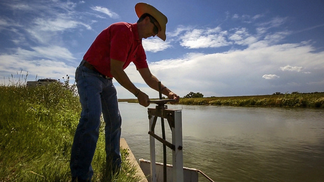
    Underneath Gilcrest lies an aquifer, and the water in that aquifer should slowly make its way north, underground, to the South Platte River.

    When it didn’t, at least not at the rate some say it should have, downstream surface water rights holders weren’t too happy and blamed the newer wells in this area as the culprit.

    Irrigation wells were first put into Colorado’s prior appropriation system following legislation in 1969. Prior appropriation is a fancy way of saying water rights, and water rights are organized by the date a farmer or ditch owner or reservoir owner or well owner first used the water. People who first diverted water have senior water rights as early as the 1850s.

    So, when farmers across Gilcrest began digging wells in the early 1900s, they were infringing upon longstanding senior surface water rights downstream, because that well pumping affected downstream flows in the river.

    Numerous studies have shown the negative effects of well pumping, and how it depletes river flows even years later. But for farmers around Gilcrest, the court solutions and augmentation decrees are out of balance with well owners’ perceived wrongdoings and even with Mother Nature…

    The impacts of less well pumping are many:

    » Less well pumping means less water for crops during crucial times, such as when Strohauer had to deal with weeds in a potato crop because he couldn’t pump enough water to treat the fields with weed killer early in the season.

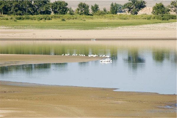
    » High groundwater leaves mineral deposits, including salt, near the surface, rendering portions of fields useless and stunting crop growth…

    Glenn Fritzler, owner of the famed Fritzler Corn Maze, used to plant one-third of his land in onions, another third in carrots and the final third in corn. Apparently, carrot and onion mazes haven’t yet taken off.

    But there’s a problem. Carrots and onions need a lot of water – about as much as corn. They’re also quite sensitive to salty soils, something exacerbated by high groundwater, which deposits salts near the surface once they recede, and by less well pumping, because over-watering is one way of dealing with salty soils.

    So Fritzler has changed crops. He’s now planting a quarter of his land in onions, a sixth in carrots and the rest in corn and winter wheat, which uses less water.

    Winter wheat isn’t a money maker, certainly not when compared to produce, which, when healthy during a strong market is a farmer’s lottery, capable of paying off farm equipment and setting aside a nice chunk of dough.

    “You’re probably breaking even at best; probably minimizing your losses,” Fritzler said of winter wheat. “It’s better than not growing anything.”

    Jan. 1, 2006.

    At least half of the wells along the South Platte River Basin were either reduced or shut down. Thousands of wells, built to get farmers through dry years, couldn’t be operated without an augmentation decree from water court.

    Such a decree requires farmers to replace portions of what they pump.

    Even farmers who obtained such decrees saw the face of farming change overnight thanks not only to requirements that well pumpers replace portions of what they pump, but that they replace what they had pumped since 1976.

    It’s called augmentation, and there are a variety of ways to do it.

    One such way is called artificial recharge, and typically it involves digging a shallow pond, filling the bottom with rock or sand to make it more porous, and then filling that pond with water as often as possible.

    Artificial recharge, essentially putting water back into the underground aquifer well pumping has drained, pays dividends for farmers.

    Almost every acre-foot of water poured into an artificial recharge pond can be claimed to allow well pumping in the future.

    It’s why Randy Ray, executive director for Colorado Central Water Conservancy District, says farmers in the LaSalle-Gilcrest area are better off today than they were in 2006.

    But it has come at a cost. Some farmers weren’t able to pump their wells for seven years, including the drought year of 2012, when farmers dried up hundreds of acres of corn.

    Strohauer doesn’t like to look upon his eastern neighbors with envy. But he does notice things. He has his pilot’s license, and when he was taking potato samples to Imperial, Neb., to get tested for pests in 2012, he noticed something…

    For farmers, the formulas used to determine how long recharge water takes to get to the river and how many days they’re able to pump are a headache-inducing mess.

    In 2010, when Strohauer’s field was full of rotting potatoes, Stulp recommended Strohauer put in a de-watering well. Essentially, he wanted Strohauer to dig a well, pump water out of that, put it in a pipeline or ditch and send it back to the river.

    Strohauer threw up his hands, pointing to his existing irrigation well on the property, the one the courts shut down…

    “I looked at John, and I said, ‘John, right there’s your de-watering well. It’s right there. Let us pump the stupid well, and we’ll let the surface water go down the river, and it doesn’t cost the state a single dime. It will cost us some power, and somebody receives some extra water down the river. How hard is that?'”

    It’s quite hard, actually, because things are never simple when it comes to water.

    If a farmer here sends that water downstream, that will affect the flow of the river, and believe it or not, even the senior water rights holders may not want that extra water all the time. For instance, those rights holders out east may not want extra water coming downstream in March because they don’t have the reservoir capacity to store it.

    The formula, called the Glover formula, was first used in the 1950s, and it tells everyone how much that well pumping will affect the river and when. Nearly 70 years later, we’re still using the formula, and Ray, Strohauer, Fritzler and countless others don’t know why.

    Bob Longenbaugh, who once worked in the state engineer’s office, and has spent decades studying groundwater, is one of those others.

    Longenbaugh said the Glover formula overestimates the impacts of pumping on the aquifer, meaning farmers around Gilcrest are forced to push more water downstream than Mother Nature says.

    Further, the formula makes too many assumptions, Longenbaugh said. Among the assumptions are no precipitation, the idea none of the water used to irrigate crops soaks into the soil to recharge the aquifer and an assumption the geology underground between any farm and the river is completely uniform.

    #LakePowell and #LakeMead end 2017 with higher pools that 2016 #ColoradoRiver #COriver

    From Marianne Goodland writing for ColoradoPolitics.com via The Colorado Springs Gazette:

    Lake Powell, at 490 feet, is at the highest it’s been since 2012, and about 22 feet higher than a year ago, according to a Jan. 1 report by Water.data.com. Located on the Utah-Arizona border, Powell is the “bank” for the four upper basin states of the Colorado River Compact, which includes Colorado, Wyoming, Utah and New Mexico.

    Lake Mead, just east of Las Vegas, rose from 1,075 at the end of 2016 to 1,082 feet at the end of 2017. The measurements refer to lake surface elevation above sea level. At capacity, Mead would be at 1,220 feet, and its often-photographed “bathtub ring” of recent years shows just how far it has fallen…

    The good news about lake levels must be tempered, however, by low snowpack levels and unusually dry conditions throughout much of the Southwest. The Natural Resources Conservation Service with its SNOTEL data shows the snowpack in the Upper Colorado River Basin at 62 percent of average for this time of year, and at only 53 percent compared to this time last year.

    The U.S. Drought Monitor, meanwhile, has much of Colorado’s Western Slope designated as D-1, or moderate drought, while parts or all of eight counties in the state’s southwest corner are listed as D-2, extreme drought. Drought is intensifying generally throughout the Four Corners region.

    The improvements on Powell and Mead might not seem like much, but, according to John Fleck, director of the water resources program at the University of New Mexico, the added volume in Powell and Mead represents about 2 million more acre-feet of water…

    Fleck attributed the higher water levels to an above-average year with snowmelt in the Sierra Nevada mountains of California. But the biggest reason, he said, is that water users in the three lower Colorado River basin states have consumed far less water than they’re allotted.

    Fleck, in his blog Inkstain, states that the use of Colorado River water by residents of California and southern Nevada is down 25 percent since its peak in the early 2000s. Arizona is also taking less water than it has in previous years.

    At the same time, population in the three states has grown 55 percent. “This is not the result of a shift to groundwater, this is straight up conservation success,” Fleck wrote…

    While the improved water levels are definitely good news, it’s not even close to time to pop open the champagne or the bottled water, said James Eklund, former director of the Colorado Water Conservation Board and now an attorney in private practice. Eklund represents Colorado on the Upper Colorado River Commission.

    Eklund told Colorado Politics that he’s been monitoring the water levels at Mead and Powell closely, and is pleased that the lower basin states have taken less water than they’re entitled to. The river, as a result, “is better off than it otherwise would be. It’s a great indicator of what good solid management decisions can do.”

    But that great snowpack year in the Sierra isn’t likely to repeat this winter, he said, which raises concerns that the water levels could again drop to critical levels. And, at the same time, the upper basin and lower basin states need to solidify their drought contingency plans, Eklund said.

    In the lower basin, a drought contingency plan would help prevent Mead from dropping too low, and thus avoid mandatory water reductions. For the upper basin states, a drought plan would keep Powell from dropping below its critical levels and still maintain its ability to produce hydroelectric power.

    That’s important for Colorado, where almost everyone outside of most urban areas benefits from Lake Powell electricity.

    Chris Treese, government affairs director for the Colorado River District, noted last week that Lake Powell hydroelectricity supplies power all over the Western United States. In Colorado, that power goes to rural electric associations.

    “Another couple of dry years” and Powell could fall below the level it needs to produce power, Treese said.

    The contingency plan for the upper basin states is looking at how to put additional water into the river, and finding alternative ways for keeping water in the river that was previously consumed. The upper basin Colorado is already in a deficit in the amount of water the river is supposed to supply, Treese said, although not to a level requiring water reductions.

    Another part of the drought contingency plan intends to bring in farmers and ranchers to help figure out how quickly farmland can return to full productivity after the land has been fallowed for a year or more, the costs of fallowing as well as impacts.

    But it’s snowpack that everyone is watching to see if 2018 keeps both lakes supplied. The Upper Colorado Basin snowpack has been above average since 2013, but predictions for 2018 indicate precipitation in the Southwest could be 33 percent to 40 percent below average.

    #AnimasRiver: #UT expands lawsuit over the #GoldKingMine spill

    Cement Creek photo via the @USGS Twitter feed

    From the Associated Press via The Salt Lake Tribune:

    Utah has added the U.S. Environmental Protection Agency and a contractor as defendants in the state’s lawsuit over a mine waste spill in Colorado that polluted rivers in three states.

    The Utah Attorney General’s Office said Friday it’s still negotiating with the EPA over damages from the spill but filed suit to preserve the state’s legal rights.

    The state didn’t explain why it added the contractor, Weston Solutions Inc. Neither the EPA nor Weston Solutions immediately responded to after-hours emails seeking comment.

    Utah sued mine owners and other contractors in August seeking unspecified compensation for the 2015 spill at the Gold King Mine.

    #Snowpack news: @NASA is heading back out into the field this winter and needs back-country oriented folks

    SnowEx aircraft, February 17, 2016.

    From the Associated Press (Dan Joling) via The Kingman Daily Miner:

    America’s space agency wants you to head for the mountains with a smartphone and a measuring stick…

    NASA’s earth science arm is funding research that recruits citizen scientists on skis, snowshoes and snowmobiles to measure snow depth in backcountry locations of the Pacific Northwest and Alaska.

    Their measurements will be incorporated into computer models that calculate how much water will end up in the region’s rivers and reservoirs.

    Early results have been promising.

    “Our initial model runs show that citizen science measurements are doing an amazing job of improving our simulations,” said David Hill, an Oregon State University professor of civil engineering, who is collaborating with Alaska and University of Washington researchers. They received one of 16 NASA citizen science grants for the project.

    From The Deseret News (McKenzie Romero):

    The National Weather service reported 0.3 inches of snow and 0.18 inches of rain at the Salt Lake City International Airport on Saturday, but the storm was expected to dry up overnight. The agency called the sleety conditions “a very rare phenomena for Utah” on Twitter and its website.

    “Sleet occurs when snowflakes only partially melt when they fall through a shallow layer of warm air. These slushy drops refreeze as they next fall through a deep layer of freezing air above the surface, and eventually reach the ground as frozen rain drops that bounce on impact. Depending on the intensity and duration, sleet can accumulate on the ground much like snow,” the National Weather Service explained.

    The rest of the Salt Lake Valley recorded less than an inch of precipitation, as did cities to the north and south along the Wasatch Front.

    The storm was just the outer edge of a weather system expected to sock western Colorado with up to 10 inches of snow in high country areas, according to the Associated Press. The Colorado Department of Transportation warned skiers and others recreating in the mountains in that state to consider heading home early to avoid dangerous driving conditions.

    Saturday’s storm came just two days after the Natural Resources Conservation Service called Utah’s snowpack, especially in southwestern Utah, “beyond abysmal.”

    “This is one of the worst water years I’ve seen in my lifetime,” Ron Thompson, general manager of the Washington County Water Conservancy District, said in a press release Thursday. “We can drive our entire watershed right now and kick up dust – that’s unprecedented for this time of year.”

    Randy Julander, snow survey supervisor for the Natural Resources Conservation Service, said there is less than a 20 percent chance that southern Utah will hit its normal snowpack levels this winter.

    As of 3 p.m. Saturday, the National Weather Service reported that southern Utah’s mountains had seen between 0.2 and 0.1 inches of precipitation during the storm.

    From The Grand Junction Daily Sentinel (Katie Langford):

    [Powderhorn Mountain Resort on Grand Mesa] will temporarily reduce its schedule starting Monday in an effort to preserve the 7 inches of snow currently on the mountain, said General Manager Sam Williams. Until further notice, the resort will be open Thursday through Sunday…

    Crested Butte Mountain Resort is faring better than other resorts in western Colorado. The resort has 2 feet of snow and 77 of 121 trails open. Spokesman Zach Pickett said while there’s far less natural snow this year compared to previous years, the resort has managed to “maximize our snow-making efforts” in order to open new terrain.

    From The Denver Post (Bruce Finley):

    Survey crews have measured snow depths in southwestern Colorado at 22 percent of normal, the upper Colorado River Basin at 65 percent of normal and the Arkansas River Basin at 49 percent of normal. National Weather Service meteorologists forecast limited snow through mid-January, though they also see a possibility that ocean-driven atmospheric patterns will shift by March and bring snow…

    Colorado natural resources officials plan to review “emerging drought conditions” next week. While most of Colorado currently is classified as abnormally dry, areas of the Western Slope are officially in drought.

    Statewide snowpack January 7, 2018 via the NRCS.

    …the Colorado mountain snowpack that feeds the nation’s main rivers hasn’t been this paltry statewide in the more than three decades since systematic measuring began, U.S. Natural Resources Conservation Service snow survey supervisor Brian Domonkos said…

    For the Gunnison River Basin, snowpack at 35 percent of normal ranked the lowest on record for this time of year, as did the 64 percent snowpack along the Yampa and White rivers, according to federal data. The Upper Rio Grande River Basin snowpack, at 29 percent of normal, ranked third lowest in 32 years. Metro Denver residents rely heavily on the South Platte River Basin, where snowpack measured 83 percent of normal for early January…

    “It is still hard to tell what the water supply implications are going to be. We are still somewhat early in the season,” Colorado Water Conservation Board climate change specialist and drought program manager Taryn Finnessey said.

    “It is not good. But, right now, our reservoir storage is above average in all basins,” Finnessey said. “The further along we get in the snow season, the harder it is to make up the deficit. Should we be in this same position in late March, obviously, we would be reacting differently than we are in January.”

    Denver Water officials on Thursday said their reservoirs measured 88 percent full, higher than the average at this time of year of 83 percent. And snowpack in the areas where snow feeds Denver Water reservoirs generally is thicker than in other parts of the state.

    From The Crested Butte News (Aimee Eaton):

    Nordic skiing is taking a hit around Crested Butte this winter as warm temperatures and little snowfall are limiting trail openings and forcing local non-profit organization Crested Butte Nordic to make tough decisions regarding grooming and trail maintenance…

    With current conditions, Crested Butte Nordic will need about six inches of snow to be able to groom again on the Westside trails that have already opened, and a foot or more to get any new trails open.

    “We have five kilometers of good, groomable trails open right now, and another five kilometers to ten kilometers of packed trails open on the Westside that we can’t continue to groom but will leave open for scenic enjoyment. Those looking to skate or enjoy good classic tracks should head to the Bench/Ruthie’s Run. Those looking for a nice walk or tour in the sunshine can still head out Mike’s Mile,” said Hicks. “Trail passes are still required on all open trails, and we kindly ask that folks respect all closures until we get more snow.”

    From The Summit Daily:

    Breckenridge, Copper Mountain and Loveland — were all reporting 5 inches of fresh snow each as of 7 a.m. today.

    At the same time, Keystone and Arapahoe Basin had each gotten 4 inches, according to the resorts, and Vail Ski Resort in Eagle County had received 9 inches.

    CDPHE: State provides $575,000 in grants to improve water quality

    The Yampa River Core Trail runs right through downtown Steamboat. Photo credit City of Steamboat Springs.

    Here’s the release from the Colorado Department of Public Health and Environment (Meghan Trubee):

    This year, seven entities across the state will receive more than $575,000 in grant funds for projects aimed to improve water quality. Projects must be focused in one of three areas: stormwater management training, projects that improve water quality where there’s been a violation, and the planning and/or construction of stormwater or wastewater improvement projects. Government agencies, publicly owned and nonprofit water systems, watershed groups, stormwater program administrators, training providers, and private landowners were eligible to apply.

    The grants are an important assistance tool for communities working to improve water quality in their area. Small and economically challenged communities are given priority for the funds.

    Funds for these projects come from penalties collected for water quality violations (Section 25-8-608, C.R.S., of the Colorado Water Quality Control Act and HB 11-1026). This list is subject to change based on contract negotiations.

    2018 #COleg: Water Resources Review Committee wants to charge $25 per boat to fight quaggas

    Colorado Capitol building

    From The Grand Junction Daily Sentinel (Charles Ashby):

    ■ Farmers and ranchers could see some incentives to hire interns to work in the agricultural industry. The idea, from the Young and Beginning Farmers Interim Study Committee, would reimburse qualifying farms and ranches up to 50 percent of the cost of hiring such interns. Donovan and Rep. Marc Catlin, R-Montrose, are to introduce that bill.

    ■ A few measures designed to limit oil and gas development, and the use of hydraulic fracturing, are expected to return again this session. Those include measures to give local governments more say about where drilling can occur and increasing the state’s standard for how much power must be generated from renewable energy.

    ■ To help crack down on people who fail to extinguish their campfires adequately, Coram and Hamner, members of the Legislature’s Wildfire Matters Review Committee, are to introduce a measure to increase the penalty for leaving a campfire unattended, moving it from a petty offense to a class 3 misdemeanor punishable by up to a $750 fine and six months in jail.

    ■ The Legislature’s Water Resources Review Committee, meanwhile, is proposing creating a $25 special stamp that all boaters would have to purchase for a new Aquatic Nuisance Species Program. That program is designed to raise funds to battle foreign species like the zebra mussel.

    #Snowpack news: Many eyes are watching the SWE in #Colorado, #WY, and #UT #ColoradoRiver #COriver

    Westwide SNOTEL basin-filled map January 6, 2018 via the NRCS.

    Luke Runyon (KUNC) brings us up to date on the current state of winter snowpack storage in the Colorado River Basin. Here’s an excerpt:

    The first official forecast for the amount of water expected in the Colorado River and its Rocky Mountain tributaries this spring is in, and the outlook is grim.

    “Well, it’s not looking really great at this point,” says Greg Smith, a senior hydrologist at the National Oceanic and Atmospheric Administration’s Colorado Basin River Forecast Center in Salt Lake City, Utah.

    Layers of snow in the Colorado, Wyoming and Utah mountains feed the Colorado River basin. Some regions are reporting the driest start to a winter ever recorded. All of the river’s upper basin streams empty into Lake Powell, a reservoir on the Utah-Arizona border. The lake’s inflow — all water entering the reservoir — is anticipated to be 55 percent of average during spring runoff.

    Snowpack in Colorado is currently less than half of what it is in an average year.

    “The forecasts have dropped off quite dramatically,” Smith says. “We have several areas where we’re forecasting less than 50 percent of average.”

    That means some major streams could have less than half their normal flow from April to July. Low snowpack and low soil moisture in Colorado’s Gunnison, Dolores and San Juan river basins are causing forecasts to dip into the 30 to 60 percent of average range.

    Portions of Colorado, Utah, Arizona and New Mexico are experiencing moderate to severe drought, according to the most recent U.S. Drought Monitor. Almost the entirety of the watershed is in some form of short-term and long-term drought.

    Coming off a couple years of average to above average snowpack in the Rocky Mountains, many of the region’s reservoirs have the capacity to withstand a dry year. But Smith says some of the smaller reservoirs’ managers are beginning to sweat the low snowpack.

    Here’s a deep dive into snowpack history in Aspen from Scott Condon writing for The Aspen Times. Here’s an excerpt:

    The city of Aspen water plant recorded 9 inches of snow in November and 6 inches in December 1976. That’s just 15 inches to start the season.

    This year, 6.8 inches was recorded in November and 13 inches in December, according to water plant data released Wednesday. That’s 19.8 inches to start the winter.

    That’s not unheard of in Aspen. In 1943 only 22.3 inches fell in November and December. In 1954 the figure was 20.5 inches.

    More recently, another drought hit in 1980 when 22 inches fell in November and December.

    From the Associated Press via The Denver Post:

    Rocky Mountains snowpack that feeds Colorado River water supplies was 20 percent below average in December in some areas, prompting a prediction that the key water source for seven U.S. states could flow at 54 percent of its average volume during the April-July snowpack runoff period.

    On Thursday, snowpack in the Upper Colorado Basin was reported at 65 percent of normal…

    Lake Mead’s surface has dropped more than 130 feet since drought descended on the Colorado in 2000. But the lake that sits upstream from Hoover Dam east of Las Vegas ended 2017 almost 2 feet higher than a year ago, as use of Colorado River water by Nevada, Arizona and California hit its lowest level since 1992.

    According to preliminary accounting figures from the U.S. Bureau of Reclamation, those three states consumed a combined 6.7 million acre-feet from the river last year, driven by wet conditions in California and widening efforts to curb use in Arizona.

    That left enough water in Lake Mead to keep it more than 7 feet above the trigger point for a federal shortage declaration, which would mean mandatory cuts for river users in Nevada and Arizona.

    The federal projections released last month called for Lake Mead to finish 2018 roughly 4 feet lower than it is now but still safely out of shortage territory. In light of Wednesday’s river forecast, the projections for the lake are almost certain to get worse.