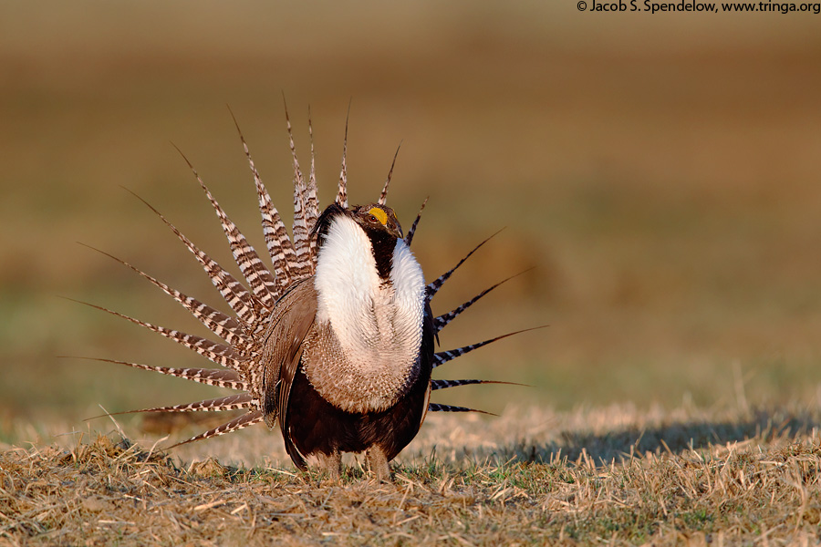
Biologists say federal target numbers are too low to ensure recovery of the Gunnison sage-grouse, which is listed as threatened under the Endangered Species Act. The bird’s largest population is in the Gunnison basin. Photo credit: Colorado Parks and Wildlife.
In the late 1980s, conservation biologist Jessica Young was an undergraduate researching the sage grouse in the Sierra Nevada when one of her professors handed her a cassette tape. He said there was a guy out in Gunnison, Colo., who claimed that the grouse there sounded different. Young listened to the recording of grouse calls and decided she had to see the birds for herself.
Young began working with Clait Braun, a researcher at Colorado Parks and Wildlife (then called the Department of Wildlife) who had discovered as early as 1977 that the Gunnison sage-grouse was different from its cousin, the wider-ranging greater sage-grouse.
The work of Young, Braun and other scientists eventually helped prove that the Gunnison sage-grouse was a separate species of ground-nesting bird, one that was officially declared a new species in 2000.
But there was a problem.
Researchers quickly realized that not only was this grouse a new species, it was also in serious trouble. By the time they discovered that this bird — which is perfectly adapted to western Colorado’s high-desert sagebrush ecosystem and famous for its elaborate spring mating dance — was a distinctive, smaller species, the bird was already on the verge of vanishing.
“It was clear to me by the mid-1990s that this was about much more than the Gunnison sage-grouse,” Young said. “I remember thinking that it was probably going to be the 21st-century test of how my nation valued both biodiversity and the economic well-being of communities across the West. I believe that is what the Gunnison sage-grouse really represents.”
Target numbers too low?
After years of conservation efforts in the Gunnison basin and elsewhere, the bird’s numbers are still declining. In 2014, in a controversial move that sparked lawsuits from the state of Colorado, Gunnison County and the Gunnison County Stockgrowers Association, the U.S. Fish and Wildlife Service listed the bird as “threatened” under the Endangered Species Act. Five years later, it remains unclear what effect the listing has had on the bird.
This past fall, the FWS released its draft recovery plan for the species, which is open for public comment through Tuesday. The plan lays out target-population numbers that must be met for seven out of nine years before the species could be considered on the road to recovery and potentially delisted. The plan also charts conservation projects and actions for the next 50 years, at an estimated cost of more than $560 million. The final recovery plan is scheduled to be completed by Nov. 1.
But environmental groups — along with Braun and Young, two scientists who have dedicated much of their careers to studying the bird — say these population targets are too low to ensure recovery of the species. The target number for the Gunnison basin is 748; in 2019, researchers counted nearly 400 fewer than this.
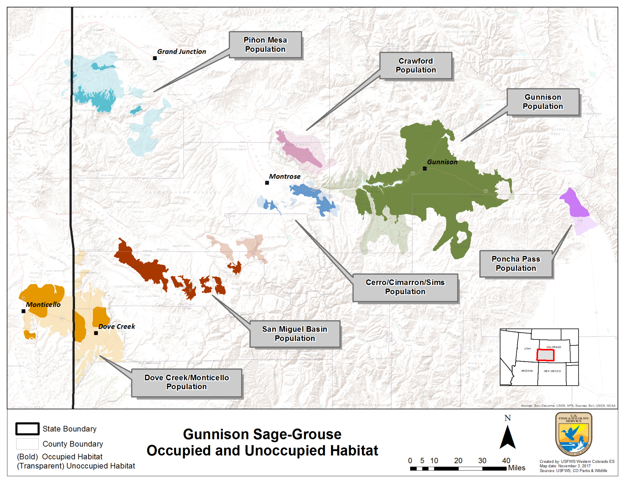
The largest population of the Gunnison sage-grouse — about 85 percent of the species — lives in the Gunnison basin, with smaller satellite populations scattered throughout western Colorado. Biologists estimate the bird is now found on less than 10 percent of its historic range. Credit: USFWS
Declining populations
Gunnison sage-grouse numbers have indeed declined — some say alarmingly so — in recent years.
Over the past several years, the three-year average high male count — the highest number of male birds that the researchers spot — has dropped across all populations. In the Gunnison basin, the 2019 number was 583, down from 772 in 2018, 886 in 2017 and 905 in 2016.
2019 posted the lowest bird numbers since the count methodology was standardized in 1996. The high male count for the Dove Creek population in western Dolores County dipped to zero, while high male counts at Cerro Summit and Poncha Pass in Colorado and the area near Monticello, hovered from just three to seven birds.
“You don’t want to see declines like this when you have seven birds,” said Kathy Griffin, grouse conservation coordinator for CPW. “To say we are not concerned would not be true. … We have seen these kinds of declines before, but we are getting to the lowest we’ve ever been.”
According to a paper by Braun, Young and others, the Gunnison sage-grouse once roamed throughout most of southwestern Colorado. It disappeared from Pitkin County in the 1960s. In the 1990s, it was extirpated in Eagle and Garfield counties.
The largest populations of the Gunnison sage-grouse — and around 85 percent of the bird’s remaining total population — live in the Gunnison basin. Smaller populations of the species, referred to as satellite populations, are scattered throughout western Colorado (Cerro Summit, Crawford, Dove Creek, Pinon Mesa, Poncha Pass and western San Miguel County) and eastern Utah (Monticello).
The 2014 “threatened” listing was based mostly on these shrinking satellite populations, which scientists think need to remain robust as an insurance policy should some kind of environmental-related disaster or disease befall the main population of birds in the Gunnison basin.
Those who opposed federal involvement, including Gunnison County, still feel the sting of the 2014 listing as an affront to the collaborative conservation work of local groups, including the county-led Gunnison Sage-Grouse Strategic Committee. Committee Chair and Gunnison County Commissioner Jonathan Houck said the recovery plan, much like the listing itself, still focuses too much on the satellite populations. The Gunnison basin, Houck said, is doing its part to help the bird.
“The draft recovery plan correctly recognizes the high resiliency of the Gunnison sage-grouse population in the Gunnison basin and also recognizes correctly the strength of the habitat protection in the Gunnison basin,” Houck said. “The irony to me is this is the entire argument we made before the listing.”
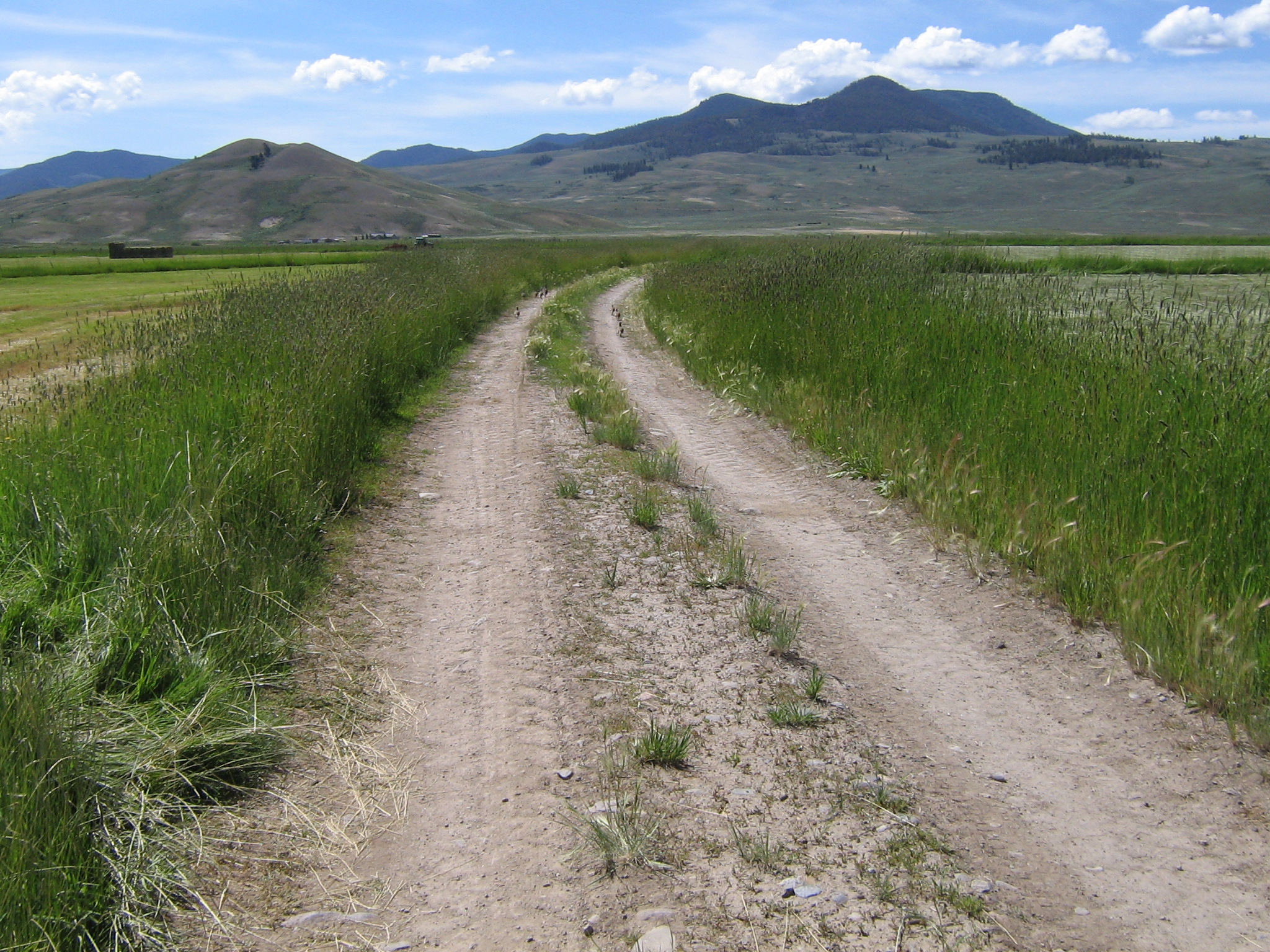
A Gunnison sage-grouse hen leads her chicks in the Gunnison basin during the summer of 2019. Some private landowners have undertaken habitat restoration projects on placed conservation easements on their property in an effort to protect the bird. Photo credit: Greg Petersen via Aspen Journalism
Bird counts
CPW uses something called “High Male Count” to track bird numbers year over year. Each spring, biologists watch from the sidelines as regal-looking male Gunnison sage-grouse perform their courtship ritual — strutting and bobbing, fanning their banded tail feathers and popping their air sacs in an effort to attract a female — on leks, which are open areas ringed by sagebrush that the birds return to year after year.
Researchers count each male they see on several trips to the leks they make each season, meaning the same bird can be counted more than once. These numbers are then averaged over three years to smooth out the seven-to-12-year fluctuations associated with grouse population and used to estimate the total population size.
The one-two punch of 2018’s extreme drought, which may have resulted in bird deaths, and 2019’s deep snow may have contributed to this year’s low counts. Counting is a logistical challenge because of the precise method used. CPW biologists were not able to access all of the leks last spring because of lingering deep snow, and in other areas, counters heard the birds’ signature popping noise but didn’t catch sight of them.
“We had a horrible year of counting,” Griffin said. “Because we could never see them, we had to put down a zero even though we knew there were birds there.”
Whatever the reason for the low counts, bird populations will need to increase in order for the FWS to consider the species recovered and to potentially delist it. The recovery plan sets a target three-year average high male count in the Gunnison basin of 748 for seven out of nine years for the population to be considered stable.
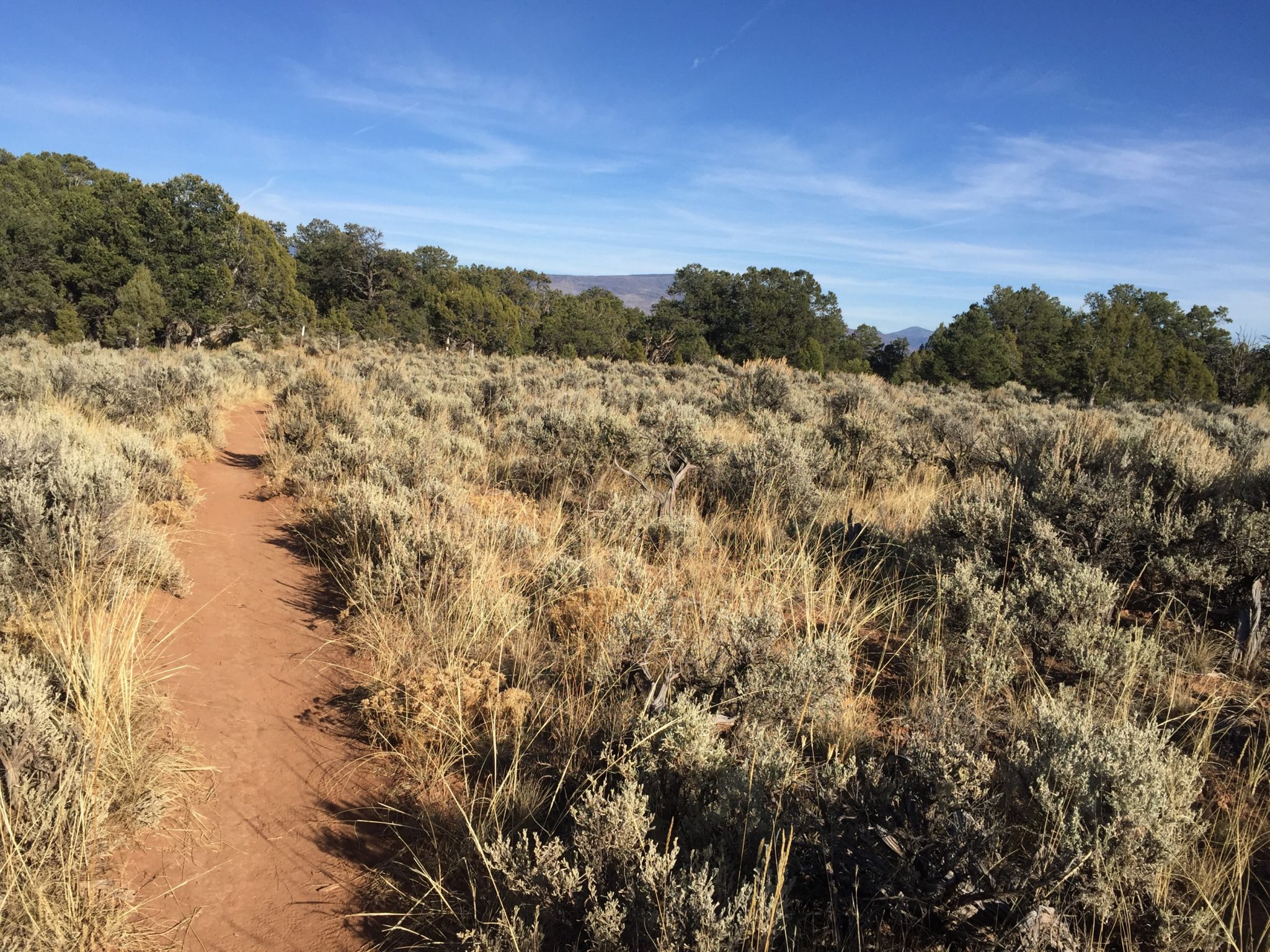
Western Colorado’s sagebrush sea is the favorite habitat of the Gunnison Sage-grouse. But much of it, like this area near Carbondale, is bisected by trails and encroached upon by piñon and juniper trees. Photo credit: Aspen Journalism
The sagebrush sea
Braun and others, including environmental group Rocky Mountain Wild, also say the draft recovery plan lacks specificity when it comes to how to conserve the bird’s habitat — the silvery-green expanse known as the sagebrush sea.
Western Colorado’s sagebrush sea is naturally fragmented by canyons and mountains. But in recent decades, prime habitat has also been bisected by roads and trails, interrupted by residential developments, affected by cattle grazing, and encroached upon by pinon and juniper trees. The Bureau of Land Management manages about 42 percent of Gunnison sage-grouse habitat.
“I think the really key thing is that there needs to be habitat that is set aside from development and other threats on public land, and that isn’t really the case right now,” said Megan Mueller, a senior conservation biologist at Rocky Mountain Wild.
Although some private landowners in the Gunnison basin have participated in habitat restoration projects such as restoring wet meadows and putting conservation easements on their property to protect it from future development, Braun says those measures are not enough. He thinks a more drastic action is needed: stopping livestock from grazing on public land in Gunnison sage-grouse habitat until populations of the bird increase.
“Grazing is a key factor in why sage-grouse populations are down in the Gunnison basin,” Braun said. “Until we get a handle on the livestock grazing, nothing is going to really improve.”
Braun recognizes that his idea to temporarily outlaw grazing on public land in Gunnison sage-grouse habitat is an idea many will find unpalatable, even radical. Ranching is an important part of the culture of rural western Colorado.
“We want to keep ranching active in the Gunnison Valley,” Houck said. “It’s the thing that’s defined this place.”
One challenge to habitat conservation, Young said, is that the sagebrush sea has long been an undervalued ecosystem. It has traditionally been a place with few regulations, where mountain biking and hiking trails snake through the landscape; where people put dumps and mine tailings; where driving off-road was — and sometimes still is — common; and where overgrazing damaged the landscape.
Saving the Gunnison sage-grouse, Young said, will require reexamining the economic, social and ecological values that people hold about this landscape. Although the federal involvement may have polarized some groups, the little ground-nesting bird also has the potential to bring together disparate factions to work toward the same goal: species conservation.
“I think, in the 2000s, the Gunnison sage-grouse are asking us again to consider what our values are for both biodiversity and community success during a time of climate change,” Young said. “They are going to be an indication of how we come together and demonstrate our values and resilience.”
Aspen Journalism collaborates with The Aspen Times and Aspen Public Radio on coverage of water and environmental issues. This story was published online by The Aspen Times on Dec. 31 and a conversation about this reporting aired on APR on Dec. 31.
The Colorado River Compact and water infrastructure projects will be among the items discussed at the annual Four States Irrigation Council meeting held Wednesday through Friday in Fort Collins.
the Four States Irrigation Council is a group of irrigators, irrigation and water districts, ditch companies and others looking to discuss water-delivery and irrigation-related issues affecting the Four States region, which encompasses Colorado, Kansas, Nebraska and Wyoming.
Exhibitors at the event will showcase some of the latest innovations and provide attendees with up-to-date information on new products and services. Awards will also be presented.
Membership in the Four States Irrigation Council is open to anyone and free of dues or fees. Someone can become a member by attending the annual meeting or visiting 4-states-irrigation.org and requesting to be added to mailing list.
More information about the meeting is also available on the website.
Denver’s water supply today
The city of Denver has gotten its water from the utility Denver Water since 1918. Today, the utility’s coverage area is larger than the city limits of Denver, covering surrounding suburbs like Lakewood and Littleton. This includes about 1.4 million people who use an average of 65 billion gallons of treated water per year…
Most of this water goes to Denver homes and apartment buildings, and a whopping 40 percent of it winds up being used outdoors on lawns and other landscaping.
Denver Water’s collection system via the USACE EIS
Denver water map
The map shows the system Denver Water uses today to collect water and transfer it to homes in the metro area. In any given year, about 52 percent of the water that finds its way into Denver’s taps comes from the South Platte River. The Fraser River and Williams Fork River together make up 20 percent of the water supply and the final 28 percent comes from the Blue River.
These last three rivers are all part of the Colorado River system, and that water needs to be transferred to Denver under the Continental Divide. Water geeks call this type of water conveyance trans-mountain diversions. There are 24 main tunnels that bring about 400,000 acre-feet of water from the West Slope to the Front Range and provide water for both the growing cities and the robust agricultural industry on the Front Range.
Colorado transmountain diversions via the State Engineer’s office
While these diversions have been common over the last century, they’ve become controversial in the last few decades of drought on the Colorado River. There is debate as to whether the Colorado River system can sustain many more large diversions.
On the map, you can see Denver has two major trans-mountain conveyance systems.
Workers pose for a photo in the Moffat Water Tunnel in this 1930 photo.
Moffat Tunnel: This old railroad tunnel was the first trans-mountain diversion to feed the city of Denver. The tunnel transfers water directly from the Fraser River under the divide and into South Boulder Creek where it eventually ends up in Gross Reservoir in Boulder County. From there, the water is diverted through a canal to Ralston Reservoir, which provides water to the Moffat Water Treatment Plant.
The Williams Fork River also puts water into the Moffat Tunnel, but its journey is even more complicated. Before any Williams Fork water even reaches the Moffat Tunnel, it is first diverted into the Gumlick Tunnel, under Jones Pass then back over the divide again through the Vasquez Tunnel. The Vasquez Tunnel empties near Winter Park where the Moffat Tunnel is. By the time this water reaches Denver, it has passed under the Continental Divide three times.
Harold D. Roberts Tunnel: The Roberts Tunnel was built in 1952 to bring water to Denver from Dillon Reservoir, which sits at the confluence of the Blue River, Snake River and Ten Mile Creek. This large reservoir is Denver Water’s largest, representing 37.1 of the utility’s total storage capacity.
The tunnel diverts water directly from the reservoir and pipes it under the divide. The 23-mile-long tunnel sits 4,000 feet underground at some points. The pipe itself is ten feet in diameter. This water empties into the North Fork of the South Platte River and runs down the main stem of the river.
Cheesman Dam spilling June 2014 via Tim O’Hara
South Platte River Water: Most of Denver’s water supply is drawn straight out of the South Platte River. There are three stems to the river (South, Middle and North), which all converge just south of Denver. Along the river are a number of reservoirs. When the river is running high, the reservoir’s dams hold back some of the water so it can be used later on by the city. These storage reservoirs, which can be found all over the state, let water managers capture the high levels of spring runoff and distribute it well into the summer.
Water from the South Platte is eventually diverted through a series of pipelines to the Marston Reservoir, which is treated at the Marston Water Treatment Plant and sent to city customers.
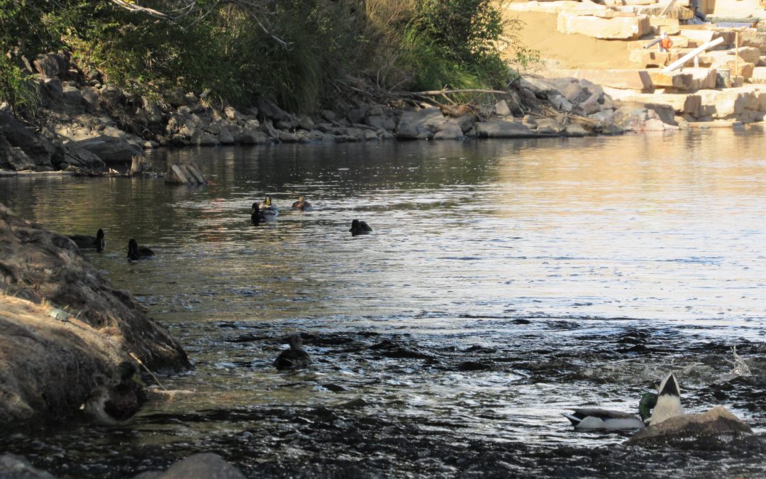
Ducks patrol the South Platte River as construction workers shore up bank. Oct. 8, 2019. Credit: Jerd Smith