
Click here to read the current assessment. Click here to go to the NIDIS website hosted by the Colorado Climate Center. Here’s the summary:
Summary: January 21, 2020
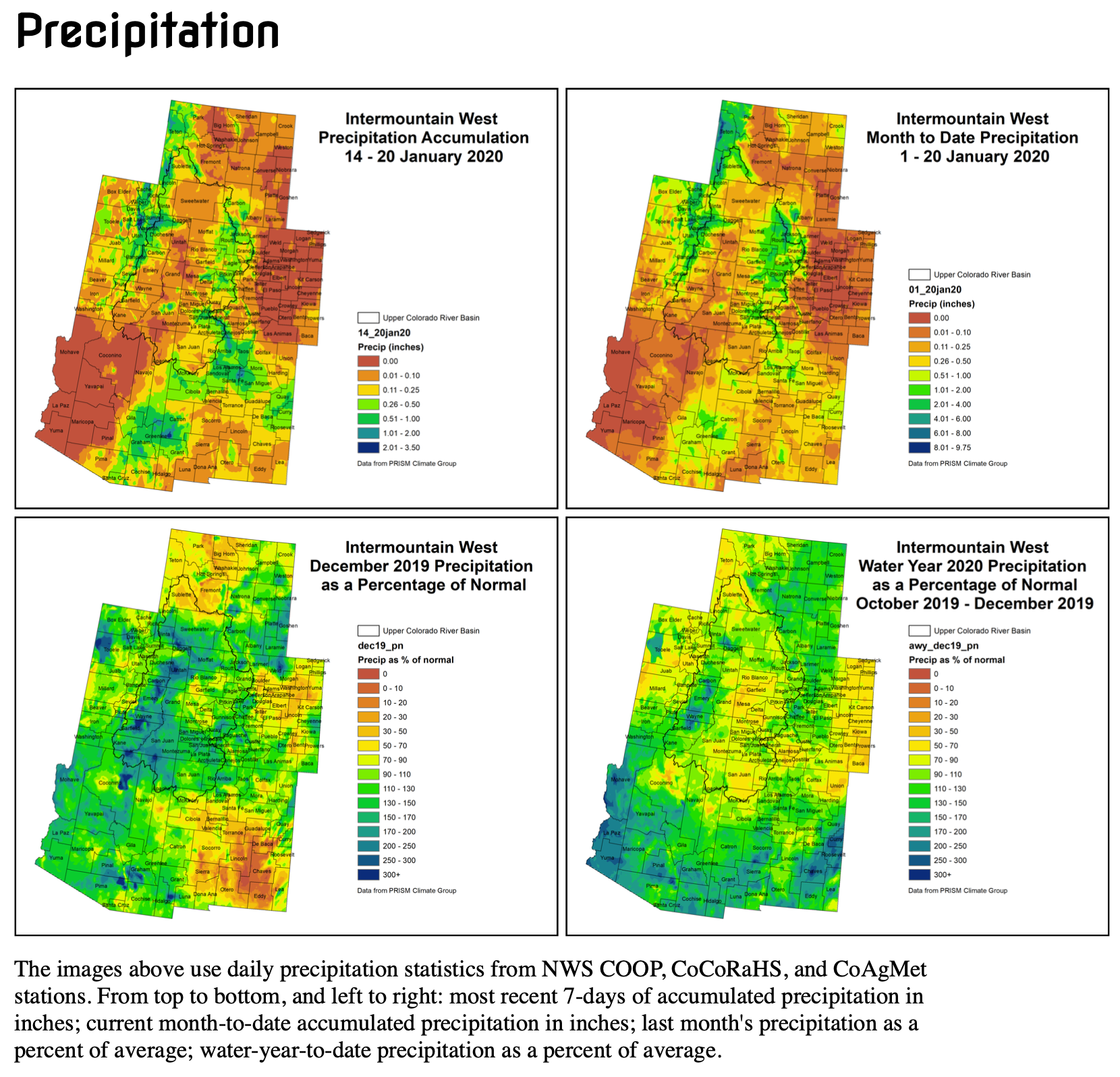
Last week has continued the very typical winter pattern of drier conditions in the lower elevations of the Intermountain West, with around a quarter to half inch of moisture in the mountains. Temperatures for the week were very close to average for this time of year.
Snowpack is keeping in good condition, with most basins in the IMW near to above average. Individual SNOTEL site percentiles range from the 40s to the 70s, with a bit drier showing in precipitation percentiles around the Upper Green in western Wyoming.
Short-term Standardized Precipitation Index (SPI) are showing some drying around the Colorado Front Range and in Big Horn basin in northern Wyoming, with mostly near normal conditions around the rest of the IMW. As we extend to the longer-term, 120-day and 6-month SPIs show the extreme dryness in the areas where current drought is most severe in the Upper Colorado River Basin.
The outlook shows more typical precipitation for the next week, with lower accumulations around the lower elevations and higher accumulations in the mountains. Temperatures for the next week are expected to be near to above normal for most of the IMW.