Denver Water raises about $300 million to help pay for capital improvements and minimize future rate increases. The post Bond sale and refi to save water users at least $17.5 million over time appeared first on News on TAP.
Water efficiency coming to 40 new homes in Stapleton area by using greywater. The post Big water savings come home in groundbreaking pilot project appeared first on News on TAP.
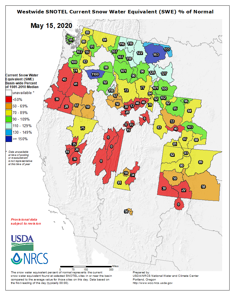
The findings pinpointed basins around the world most at risk of not having enough water available at the right times for irrigation because of changes in snowmelt patterns. Two of those high-risk areas are the San Joaquin and Colorado river basins in the western United States. Photo: Kevin Bidwell/ Pexels
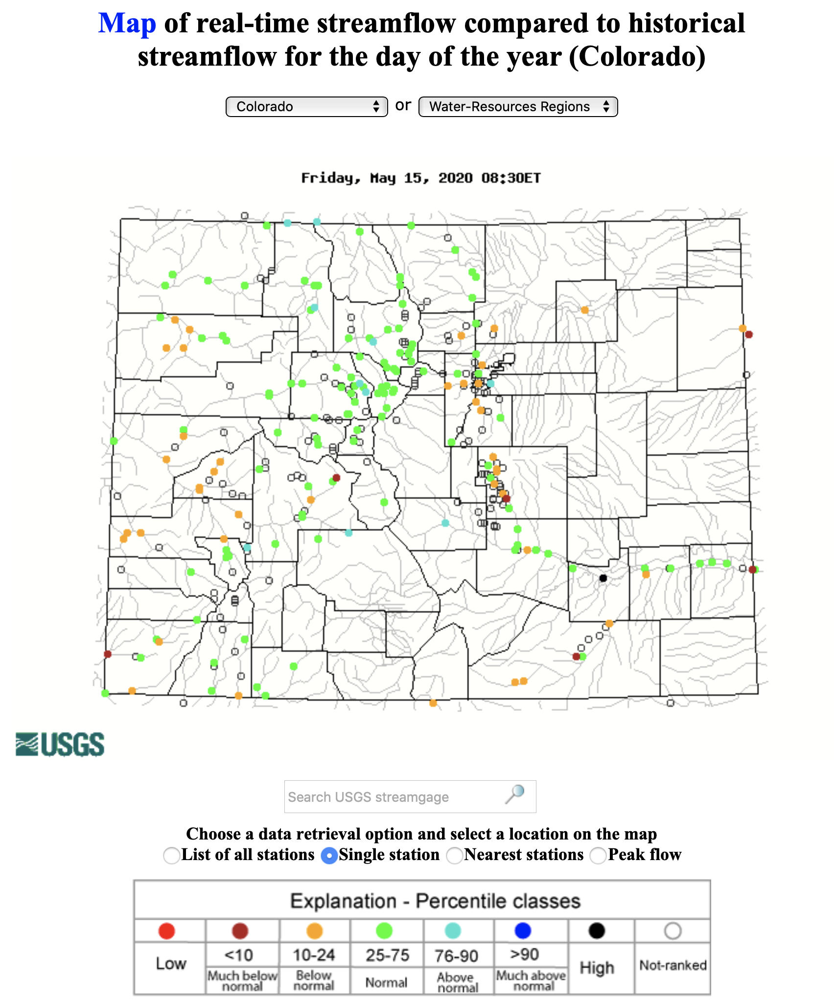
[John] Fleck has spent years studying the Colorado River, a crucial source of water for much of the region around it. He said that Lake Mead and Lake Powell’s reservoirs have what he described as “big bathtub rings” around them, left behind as the water declines.
“There is less water in the system now than there was 20 and 30 years ago,” he said.
Fleck explained that a “wet year” every few years may seem like the drought is ending, but those years are still comparatively lower than decades before.
“When we do get a snowpack in the mountains over winter, we are seeing less water make it into the rivers, and downstream to the farms and cities and the fish and the ecosystems that depend on the water,” he said.
A team of scientists is researching megadroughts that have lasted as long as 40 years, using tree ring evidence going back 1,200 years…
[Park] Williams said the drought of the last two decades “developed the same way that the megadroughts did.”
However, the key difference now is climate change’s effect on weather conditions in the area, which largely depends on melting snowpacks to fill reservoirs.
“Without human-caused climate change, we would still have a drought,” Williams said. “But it wouldn’t be a serious as the one we’ve actually seen.”
Workstation, SnowEx, February 27, 2017.
NASA-run project SnowEx has researchers in the mountains of Idaho developing remote sensing equipment to get accurate snowpack measurements from space in order to determine how much water they will produce.
“It’s becoming more challenging for us to not only predict how much water is going to enter our reservoirs, but also the ability to store that water all the way through the end of the summer for agriculture and water resource purposes,” said Hans Peter Marshall, a scientist working on the project.
This map shows the snowpack depth of the Maroon Bells in spring 2019. The map was created with information from NASA’s Airborne Snow Observatory, which will help water managers make more accurate streamflow predictions. Jeffrey Deems/ASO, National Snow and Ice Data Center