From The Fort Collins Coloradoan (Miles Blumhardt):
NWS issued a winter weather advisory for 5 p.m. Tuesday to late Wednesday night for a large swath of the northern mountains, foothills, I-25 corridor and stretching onto the Eastern Plains…
The slow-moving storm will mostly center on the foothills, Interstate 25 corridor and Eastern Plains, according to the National Weather Service.
Snow will first develop over the mountains and foothills Tuesday afternoon and spread east across the I-25 corridor in the late afternoon and early evening. It’ll be onto the Eastern Plains by Tuesday night.
Snow will continue throughout Wednesday, leaving behind bitter cold…
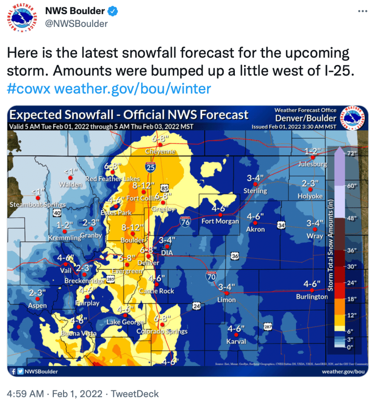
The higher snow totals are expected in the foothills and just west of I-25.
The forecast calls for an 80% chance of snow Tuesday night and 90% during the day on Wednesday in Fort Collins, resulting in 6 to 8 inches of snow…
Cheyenne, Boulder, Estes Park and Red Feather Lakes could see similar snowfall as Fort Collins, while Greeley, Denver and most of the Eastern Plains are forecast to see 4 to 6 inches…
[Fort Collins] has had 19.1 inches of snow this season, compared with the average of 26.6 inches, according to the Colorado Climate Center.
At the end of January last year, the city had 33.4 inches of snow, on its way to 80 inches for the season, which is nearly 30 inches above average.
The city has had 11.9 inches of snow this January, compared with the average of 6.5 inches. The city would have had more, but most of the New Year’s Eve snowfall total went into December because the Colorado State University campus weather station records that day’s totals only through 7 p.m.
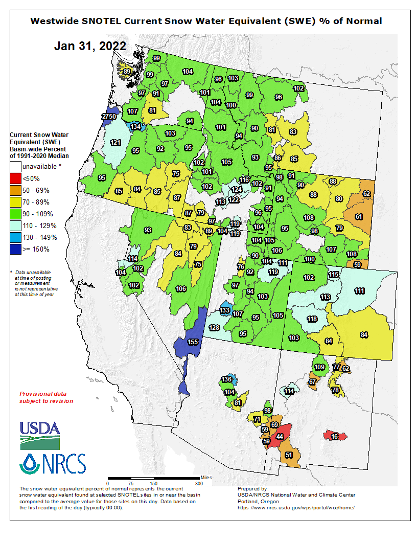
The statewide snowpack is at 104% of median, including 114% in the South Platte Basin in which Fort Collins is located, according to the National Resources Conservation Service.