Click the link to read the article on TheDenverChannel.com (Bayan Wang). Here’s an excerpt:
Authorities confirmed that the now dormant Marshall Coal Mine near the area believed to be the starting point of the Dec. 30 Marshall Fire is among many other potential sources of the inferno that are being looked into.
The Marshall Coal Mine is located just south of the Marshall Mesa trailhead off Highway 93 and is one of 38 abandoned coal mines in the state that are listed to have some level of fire activity, according to a 2018 inventory report of Colorado underground coal mine fires…
In 2005, a brush fire was ignited by a hot vent from the Marshall Coal Mine, which was quickly contained, according to the 2018 report. As a result, officials filled the vent with 275 tons of small rocks.
In 2016, authorities went back for touch-ups and to cover up small vents.
Maintaining mines with any level of fire activity is important. Former US Forest Service Branch Chief of the Rocky Mountains Region Jim Krugman points out that fires that spark from coal mines can be very complex…
Among the coal mines investigation, authorities are also looking into whether a burning shed, downed power lines or human activity near the starting point of the fire were the possible cause.
Here’s a story map about the Marshall Fire from NOAA:
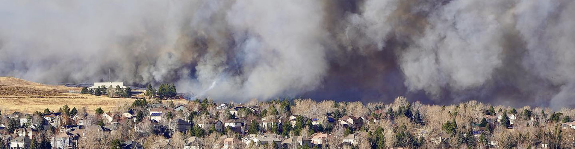
On December 30, 2021, a combination of long-term drought and hurricane-force winds set the stage for what would become the most destructive fire in Colorado history in terms of property loss. Driven by ferocious winds, a grass fire quickly advanced from the outskirts of Boulder on the neighboring cities of Louisville and Superior. Horrified residents had little time to evacuate as the wildland fire transformed into an urban firestorm. This story recounts the events of that day from the perspective of NOAA’s National Weather Service meteorologists who sent the first high-wind warnings in the hours before dawn, and continued to alert residents throughout the day as the worst-case scenario unfolded.