

Click the link to read the article on the Science Magazine website (Eli Kintisch). Here’s an excerpt:
Utah’s Great Salt Lake is smaller and saltier than at any time in recorded history. In July, the U.S. Geological Survey (USGS) reported that the world’s third-largest saline lake had dropped to the lowest level ever documented. And last week researchers measured the highest salt concentrations ever seen in the lake’s southern arm, a key bird habitat. Salinity has climbed to 18%, exceeding a threshold at which essential microorganisms begin to die. The trends, driven by drought and water diversion [ed. and aridification influenced by Climate Change], have scientists warning that a critical feeding ground for millions of migrating birds is at risk of collapse.
“We’re into uncharted waters,” says biochemist Bonnie Baxter of Westminster College, who has been documenting the lake’s alarming changes. “One week the birds are gone from a spot we usually see them. The next week we see dead flies along the shore. And each week we have to walk further to reach the water.”
After years of inaction, the prospect of a dying lake, plus the risk of harmful dust blowing from the dry lakebed, is galvanizing policymakers to find ways of restoring water to the shrinking lake.
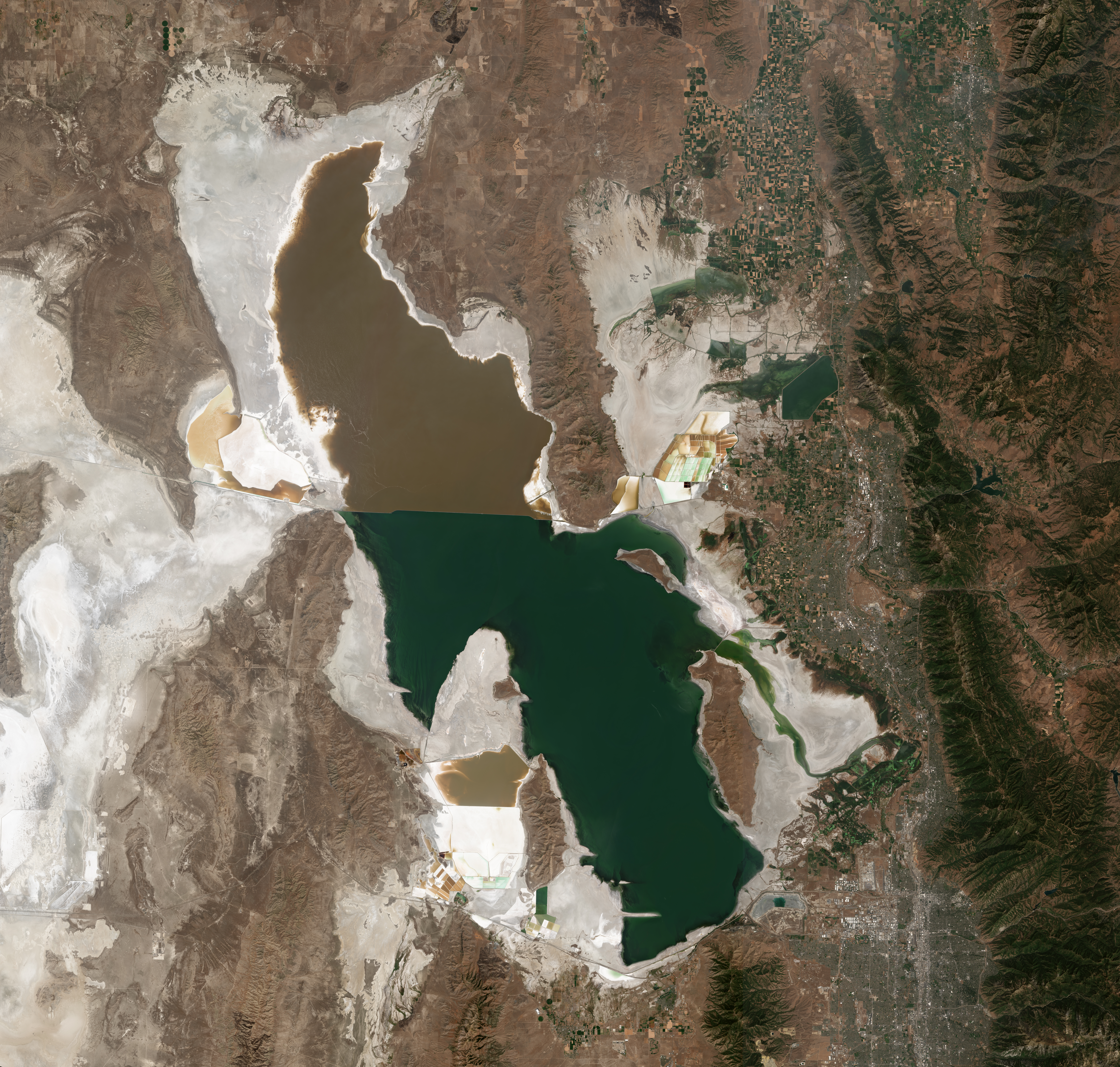
The Great Salt Lake is really two lakes, divided in 1959 by a railroad causeway. Over time, the northern arm, which has few sources of fresh water, became saltier than the southern arm, which is fed by three rivers. Historically, salinity in the northern arm has hovered around 32%—too salty to support more than microorganisms—and about 14% in the southern arm. Although the southern part is about four times saltier than seawater, it supports a vibrant ecosystem characterized by billions of brine shrimp and brine flies, which feed on photosynthetic cyanobacteria and other microorganisms. Birds, in turn, devour prodigious numbers of flies and shrimp when they arrive at the lake to nest, molt, or rest during migrations. A diving waterbird called the eared grebe, for example, needs 28,000 adult brine shrimp each day to survive.