
Click the link to read the release on the NRCS website:
Warm and dry conditions during January drove Colorado snowpack to record low levels statewide. Late month snowfall was insufficient to change overall conditions, increasing the likelihood of below normal peak SWE and reduced spring runoff across most river basins.
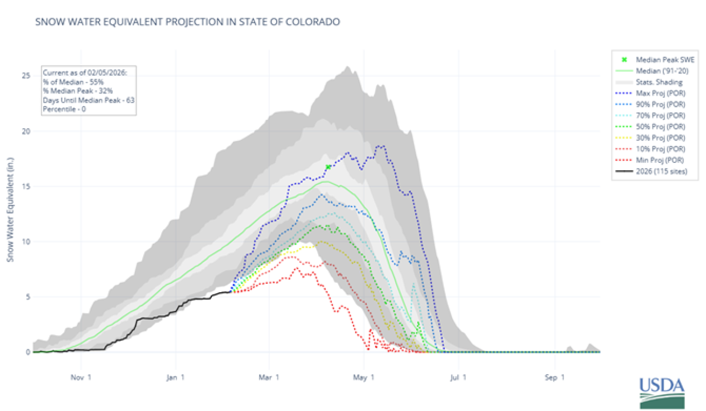
February 10th, 2026 – Warm and dry conditions persisted across Colorado during most of January, which has led to record low snowpack for much of the state. Every major river basin across Colorado received below normal precipitation in January, ranging from 58 percent of median in the Upper Rio Grande river basin to 76 percent of median in the Arkansas river basin. Although there were a series of storm systems during the first and last week of January which delivered snowfall across the state, this was not enough to improve overall conditions. Based on the 1991-2020 median, current statewide snow water equivalent (SWE) is 55 percent of normal, and ranges from 48 percent of normal in the Arkansas river basin to 64 percent of normal in the Laramie-and-North Platte river basin. Since January 13th, snowpack across Colorado has been at record low levels when compared to the 30-year normals, and with only a couple more months left in the typical snow accumulation season, it looks less likely that we will receive enough snowfall by April 1st to achieve normal peak SWE. It would take consistent, record-breaking snowfall for the rest of the season to reach normal peak SWE, and with the long-term outlooks, that is looking highly unlikely. Based on projection plots, even if the state receives average snowfall (50% projection) for the rest of the season, we would end up around 70 percent of median peak SWE (figure 1).
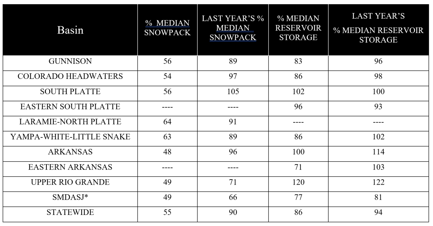
Current statewide reservoir storage is 86 percent of median, slightly lower than this same time last year which was 94 percent of median. It’s certainly not ideal to have low reservoir storage during these dry years. With basins below normal reservoir levels will likely face more severe water shortages this upcoming runoff season. All major river basins currently have below normal reservoir storage, except the Upper Rio Grande, South Platte, and Arkansas river basins which are at 120 percent, 102 percent and 100 percent of normal. February 1, 2026 streamflow forecasts at the 50 percent exceedance probability show similar spatial trends as snowpack and precipitation. Current streamflow forecasts are predicting below normal streamflow across the entire state. They range from 28 percent of normal for Sangre de Cristo Creek to 91 percent of normal for the Big Thompson River at Canyon Mouth. Notably, the combined Laramie-North Platte and Colorado Headwaters river basins have the lowest streamflow forecasts in the state at 50 percent and 58 percent of normal. Overall, the record warm and dry conditions that have persisted for much of the 2026 water year have been detrimental for Colorado’s water supply outlook. All current indications are pointing to well-below normal streamflow across the state.
* San Miguel-Dolores-Animas-San Juan River basin
* *For more detailed information about February mountain snowpack refer to the February 1st Colorado Water Supply Outlook Report. For the most up to date information about Colorado snowpack and water supply related information, refer to the Colorado Snow Survey website.