Click the link to read the article on the NOAA website:
March 20, 2026
Drought conditions are forecast to worsen or develop for many areas in the West and south-central Plains, according to NOAA’s Spring Outlook released today for April through June. Forecasters from NOAA’s National Weather Service also predict above-normal temperatures for the majority of the U.S.
“Factors influencing NOAA’s Spring Outlook include the El Niño-Southern Oscillation (ENSO), low snowpack in the West and soil moisture content throughout the lower 48 states,” said Ken Graham, director of NOAA’s National Weather Service. “This spring will also feature a transition from La Niña to ENSO-neutral conditions, meaning neither El Niño nor La Niña.”
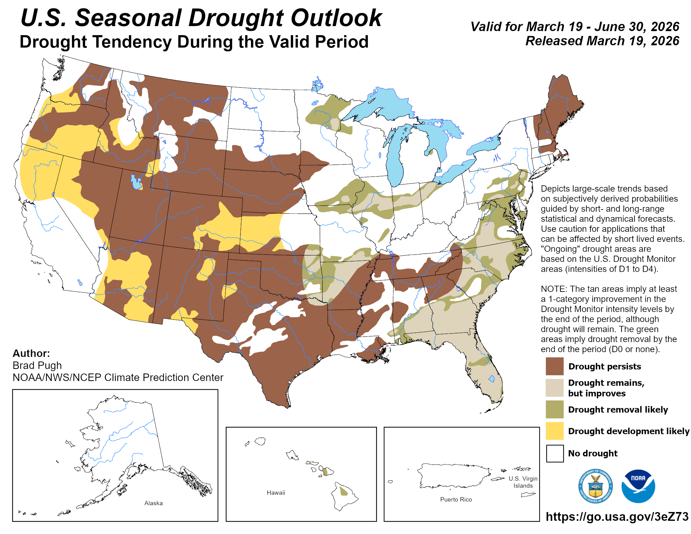
As of mid-March, moderate to exceptional drought conditions exist across 55% of the continental United States.
“Drought conditions worsened or developed for much of the Great Plains, Lower Mississippi Valley, and Southeast U.S. due to warmer and drier than normal conditions this winter,” said Jon Gottschalck, chief of the Operational Prediction Branch, NOAA’s Climate Prediction Center. “Drought is likely to persist across much of the West while developing in parts of the Pacific Northwest, Great Basin, central Rockies and Southwest. Dry conditions are expected to improve for some areas in the Midwest and Atlantic seaboard.”
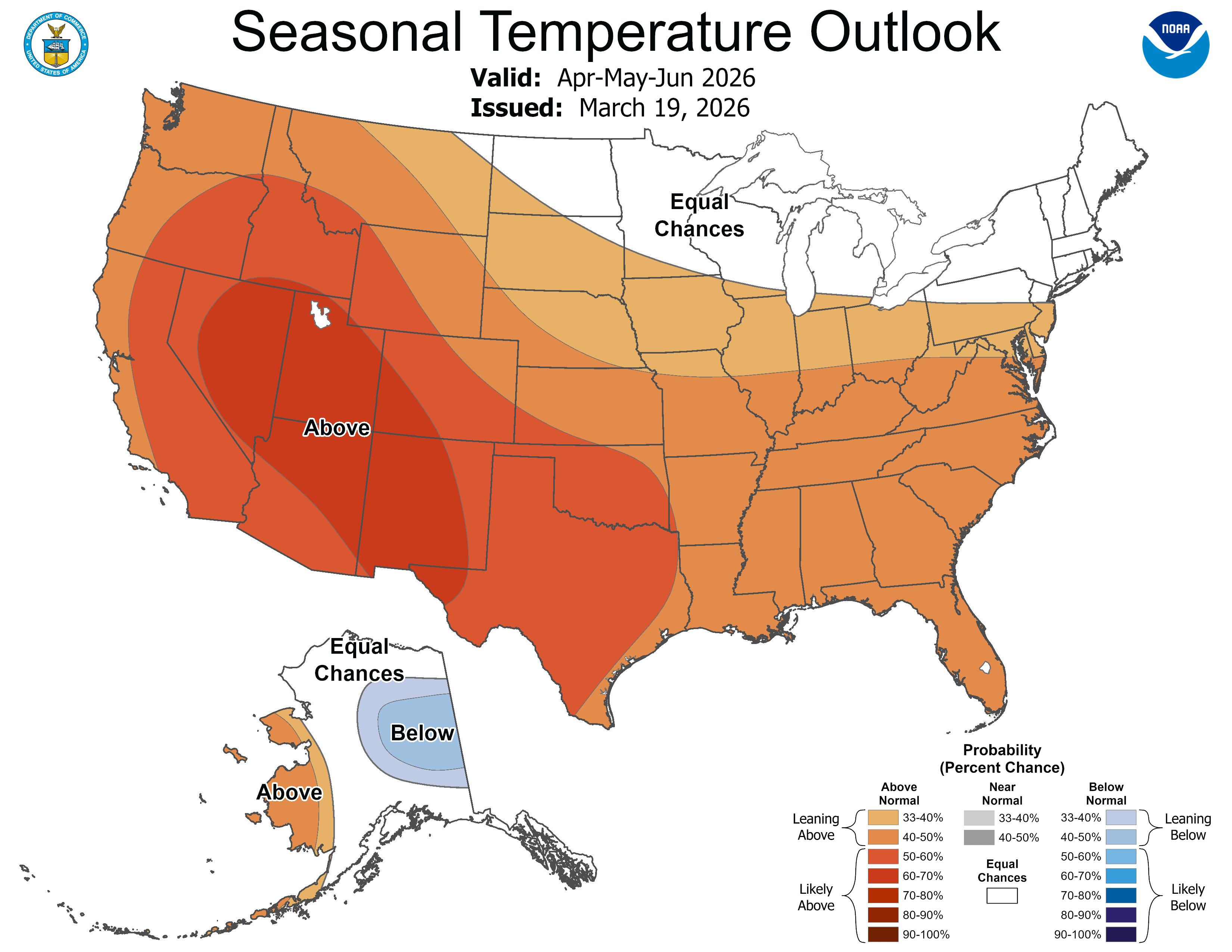
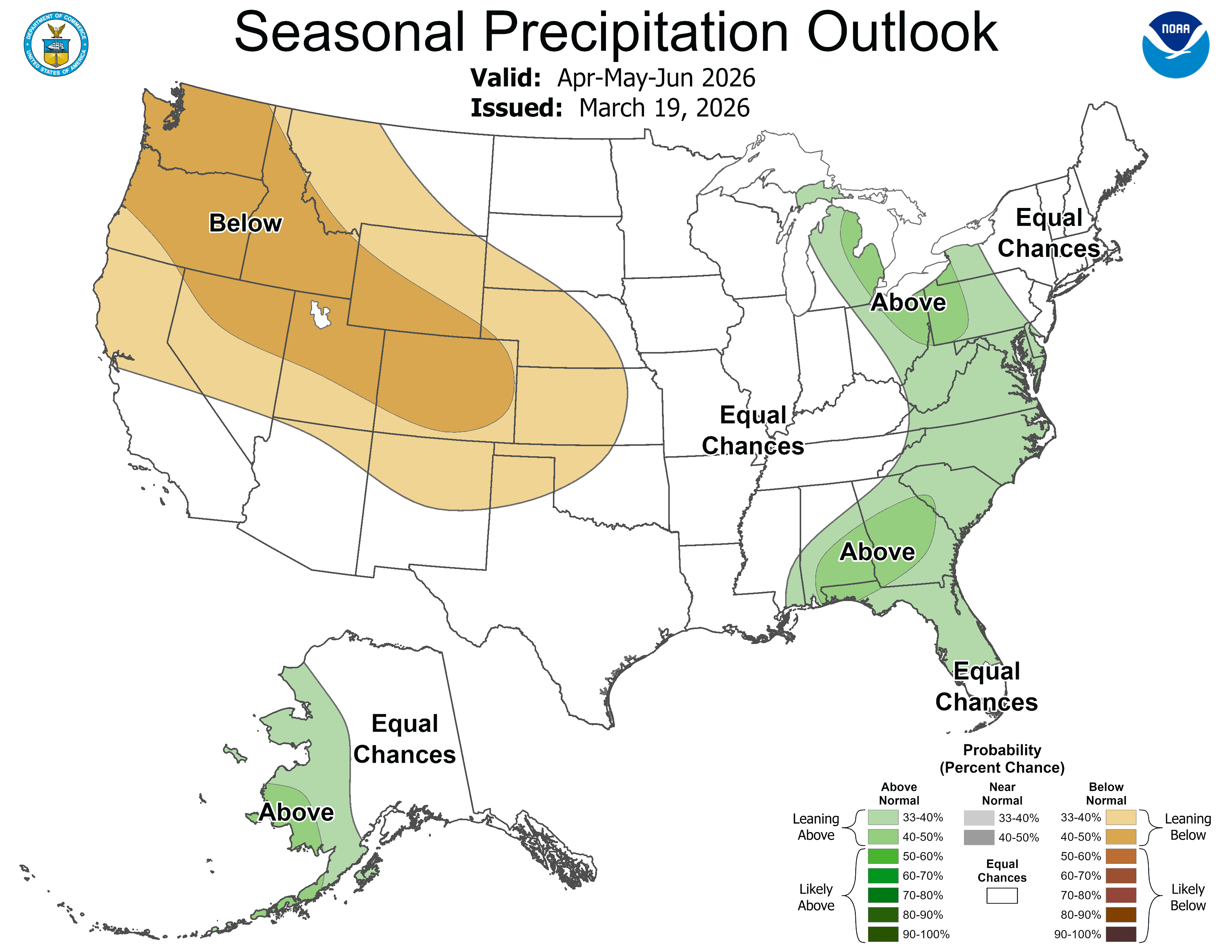
Temperature and precipitation outlooks
The temperature outlook for April through June shows above-normal temperatures are favored across the majority of the western U.S. eastward to include much of the Plains, the lower and middle Mississippi Valley, the Ohio Valley, the Tennessee Valley, the Southeast and the southern Mid-Atlantic. The highest likelihood of enhanced warmth ranges from the Southwest to the Inter-Mountain West. Below-normal temperatures are forecast for east central Alaska.The precipitation outlook favors below-average precipitation for the Pacific Northwest, parts of the Great Basin, Southwest, central High Plains and most of the Rockies. The greatest likelihood of below-average precipitation is forecast from the Pacific Northwest to the central Rockies. While above-normal precipitation is forecast for western Alaska, the eastern Great Lakes, mid-Atlantic and parts of the Southeast.
Spring flood risk
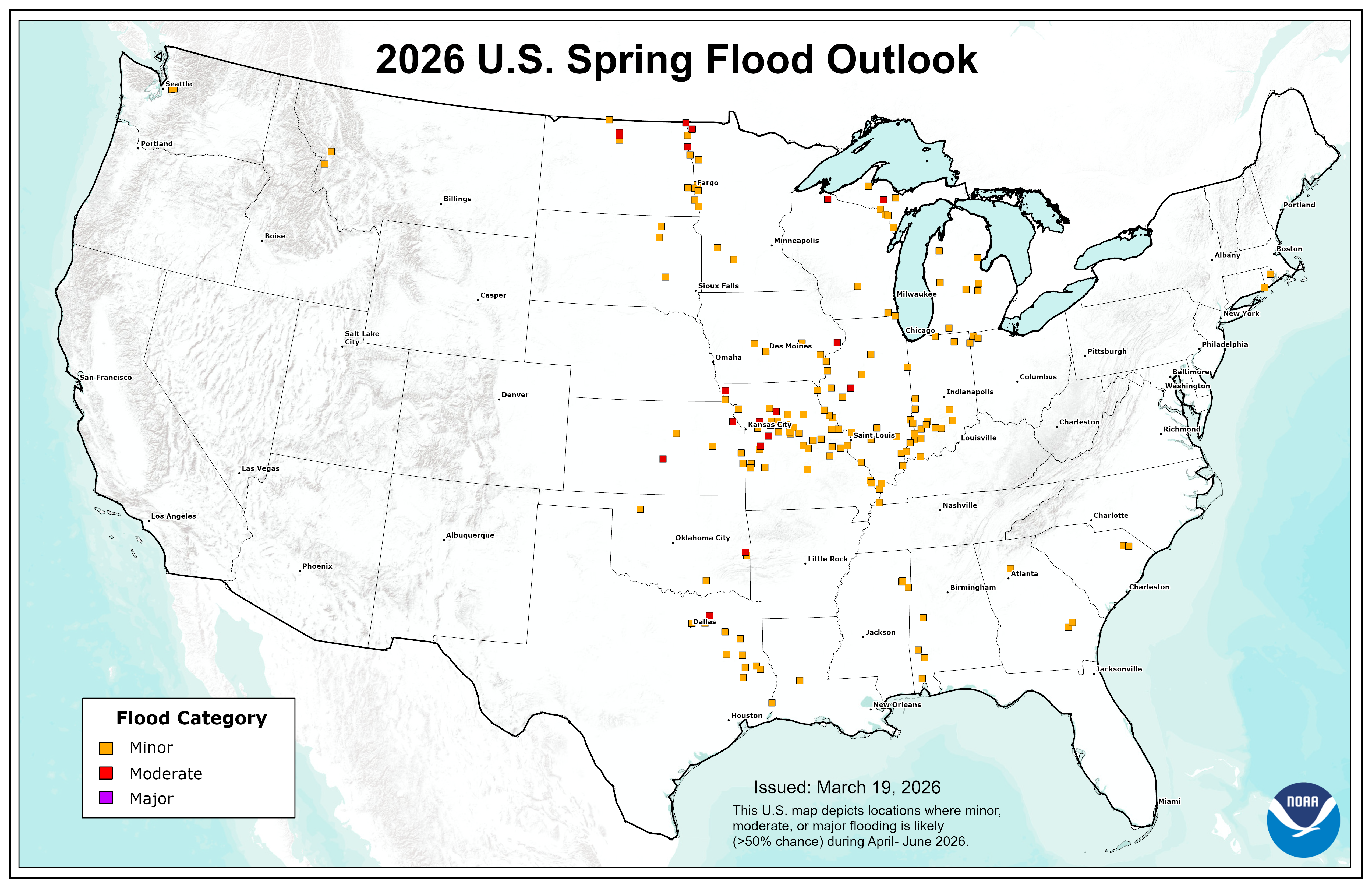
NOAA’s National Hydrologic Assessment, issued by NOAA’s National Water Center, evaluates a number of factors, including current conditions of snowpack, drought, soil saturation levels, frost depth, streamflow and precipitation.
The overall flood risk across most of the continental U.S. for Spring 2026 is currently assessed as normal to below normal. This risk determination was made primarily because of a dry and warm winter that resulted in dry soils over much of the eastern U.S., mitigating the threat of rainfall-driven flooding. Additionally, a well-below-normal snowpack across most of the country will reduce the risk of snowmelt-driven flooding.
However, the Red River of the North and the lower Ohio Valley typically experience flooding annually; therefore, flooding is anticipated in these basins this year as well.
“We anticipate typical spring flooding this year over portions of the Greater Mississippi River Basin, but the risk for widespread significant flooding is low,” said Ed Clark, director of NOAA’s National Water Center. “However, it is crucial to remember that heavy rainfall has the potential to lead to a major flooding event.”
Flooding can occur rapidly from intense rainfall, even in regions with a generally low risk. Rainfall intensity and location can only be accurately forecast days in the future, and flood risk can change rapidly. Stay current on flood risks in your area with the latest official watches and warnings at weather.gov. For detailed hydrologic conditions and forecasts, please visit water.noaa.gov.