
Click the link to access the research paper on the Wiley Online Library website (Ellen Soles, Martha Cooper, Laurel Saito). Here’s the abstract:
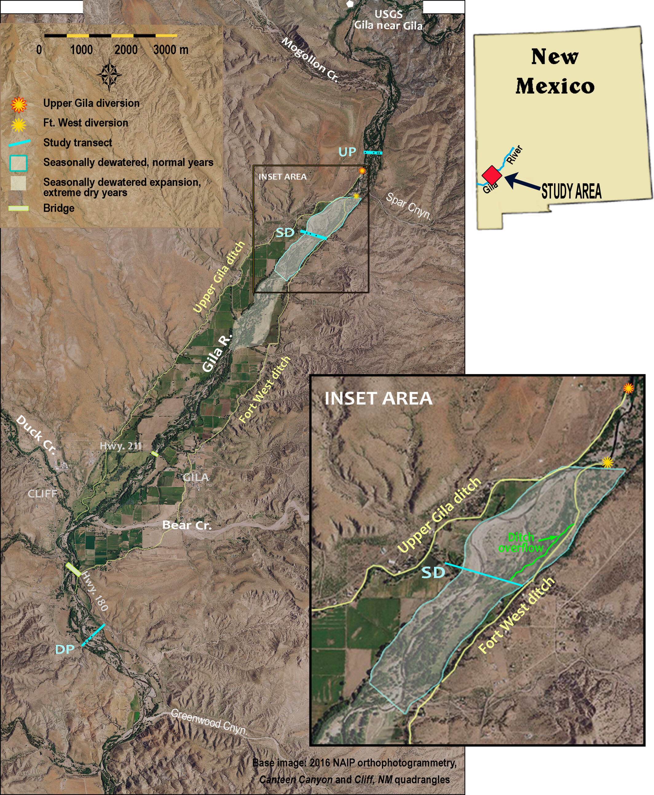
In arid regions with limited water supplies like the Colorado River basin of the southwestern United States, flow regimes and water availability are major controls on native riparian ecosystems resilience, persistence and function. In this paper, we share a case study that uses a long-term dataset of topographic, vegetation and groundwater data collected over water years 2011–2021 to demonstrate how secondary channels formed during high flow events enhance groundwater-dependent riparian ecosystem resilience, favouring native over non-native vegetation. In the Cliff-Gila Valley of southwestern New Mexico, channelization and levee construction between 1940 and 1980 profoundly altered the floodplain and channel of the Gila River, a Colorado River tributary. During subsequent large floods, river anastomosis (branching) left a network of secondary channels across the floodplain. Long-term data show that these channels improve vegetation access to groundwater, facilitating regeneration and expansion of diverse native groundwater-dependent vegetation. Data also show that even the lowest perennial flows (0.4–0.6 m3 s−1) sustain rates of groundwater recession favourable to successful native riparian seedling recruitment in the topographic lows created by secondary channels. Alluvial groundwater recedes more sharply in a reach seasonally dewatered by irrigation diversions, but seepage through diversion structures and unlined ditches maintains shallow groundwater levels. This case study demonstrates that even in arid regions, robust native groundwater-dependent riparian areas can co-exist with human water demands when large floods can move across broad floodplains and create topographic complexity. [ed. emphasis mine] The study also highlights the importance of long-term datasets for documenting ecosystem resilience to floods, drought and ongoing climate change.
