Click the link to read the article on The Pagosa Springs Sun website (Clayton Chaney, Randi Pierce and Josh Pike). Here’s an excerpt:
November 12, 2026
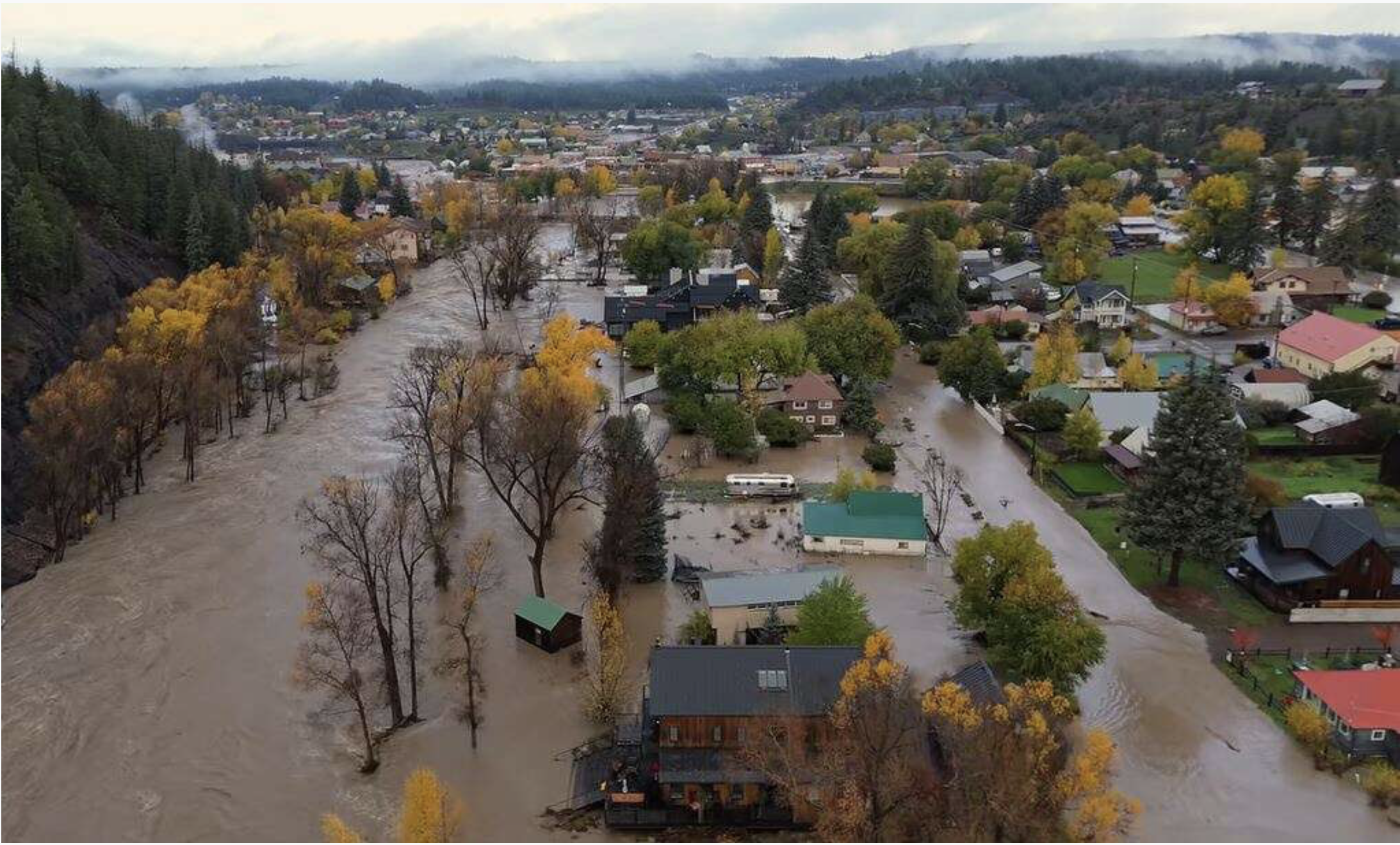
Pagosa Country continues to contend with challenges and damage caused by a pair of major floods that moved through the area in recent weeks, with local, regional, state and federal resources continuing work in the area…oint preliminary damage assessments were slated to be conducted Tuesday, Nov. 10, through Thursday, Nov. 12, across southwest Colorado in Archuleta, Conejos, La Plata, Mineral, Montezuma and Rio Grande counties, according to a press release from the Colorado State Emergency Operations Center. According to the center, assessment teams include representatives from each county, the Colorado Division of Homeland Security and Emergency Management, the U.S. Small Business Administration (SBA) and the Federal Emergency Management Agency (FEMA). A member of United Way’s 211 team was also join the individual assistance teams…
On Thursday, Nov. 5, the Town of Pagosa Springs announced that crews from Durango and Boulder had arrived to assist local teams with ongoing sewer system repairs. Most of Archuleta School District’s schools remained closed due to the needed sewer system work in the downtown area, with the district announcing on Monday, Nov. 9, “At this point, Town Public Works officials have completed needed repairs to the sewer system, downtown conditions have been deemed safe, all school buildings are safe for students and staff, we have sufficient staffing to support students’ return, and transportation services are ready to resume (with some route adjustments …).” Pagosa Area Water and Sanitation District (PAWSD) District Engineer Justin Ramsey provided an update to the PAWSD board on flooding impacts to the district at its Nov. 5 meeting. Ramsey explained that PAWSD lost a water line under the bridge on U.S. 160 near 1st Street, depriving the businesses on the north side of the highway east of the bridge of water.
“The only way to get them water is to tie into the 6-inch line on the south side and bore underneath,” Ramsey said, adding that PAWSD received permission to do this from the Colorado Department of Transportation (CDOT) on Nov. 4 and that PAWSD was working with the company CDOT had hired to do boring in the area since they have recent experience in the area and there is “a lot of risk” with a variety of buried infrastructure that could be damaged in the area.
He indicated that water for these businesses would be restored once the boring is complete. Ramsey stated that a large amount of sediment accumulated in the pond used to divert water for the district’s San Juan water treatment plant and that it would have to be removed before resuming operations of this plant. He added that the Colorado Department of Public Health and Environment was also concerned about the potential for raw sewage contamination due to sewage spills into the river upstream and that the diversion and pond would have to be fully drained and cleaned before use resumes. Ramsey indicated that the diversion and pipeline from the West Fork of the San Juan River that feeds the Snowball water treatment plant was damaged, but that PAWSD staff were still working to assess what this damage might be. The water line that feeds the Log Park subdivision also broke, he stated, and PAWSD staff were working on repairing it. The water line at the Apache Street bridge over the San Juan was also lost, but it did not result in customers losing water due to pipe infrastructure in the area and would be repaired at a later time, Ramsey indicated. Stevens Reservoir also overflowed through its spillway and washed out part of Honeybee Place, although it did not damage the culverts on the road and the road is currently “passable.” He added that exposed pipes caused by washouts on North Pagosa Boulevard and Mockingbird Lane would also have to be replaced in the future, although they are currently functioning.
