FromThe Albuquerque Journal (Therasa Davis) via The Farmington Daily Times:
[After the August 5, 2015 spill]…The EPA paid state and tribal governments for emergency water tests, but initially denied 79 economic damage claims.
In August 2017, EPA administrator Scott Pruitt – who resigned in July 2018 – visited the spill site and said the agency would reconsider the claims. The New Mexico Environment Department said Friday that it was unaware whether any of those payments have been made.
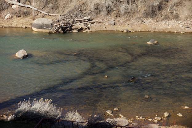
Animas River at the New Mexico/Colorado State line August, 2015.
NMED chief scientist Dennis McQuillan said there is ongoing monitoring to determine long-term effects of the spill.
“Dozens of mines are leaking acid mine water into the watershed,” McQuillan said. “Gold King was just one of those.”
Under new administrator Andrew Wheeler, the federal agency, its contractors and mining companies asked for dismissal of the lawsuits, arguing the EPA had immunity and was already working on cleanup.
Environment Department general counsel Jennifer Howard said a federal judge in Albuquerque rejected that argument in March, so the lawsuits “should definitely start proceeding at a faster pace.”
A November 2018 EPA report showed fish had elevated metal levels in the weeks after the spill, but returned to pre-spill levels by spring 2016.
Gold King Mine Entrance after blow out on August 5, 2015. Photo via EPA.
Research by the New Mexico Bureau of Geology and Mineral Resources, New Mexico Game and Fish, Mountain Studies Institute, San Juan Basin Public Health and Colorado Parks and Wildlife echo that claim.
“The farming industry is still hurting,” McQuillan said. “I’ve talked to farmers who said their sales are down 25% from before the spill because people say they won’t buy food grown on the San Juan. But our agriculture products are safe. The fish are safe to eat. The river is safe for irrigation.”
McQuillan said the federal WIIN Act (Water Infrastructure Improvements for the Nation) will provide money for the Navajo Nation to test fish in the spill area and start outreach to address the misconception that the river water is unsafe.
In 2016, the EPA designated the area around the spill site as the Bonita Peak Mining District Superfund site, which opens up money for cleanup and places the site on a priority action list. Howard and McQuillan agreed that was a positive development, but Superfund cleanup is a slow process.
“It was a significant issue four years ago and remains a significant issue,” Howard said. “The motivation for our lawsuit is to have EPA step up to the plate and address the economic impact this (spill) had on agriculture and tourism for our state.”
The “Bonita Peak Mining District” superfund site. Map via the Environmental Protection Agency
The Colorado Court of Appeals ruled companies must reclaim uranium mines that sit idle for more than 10 years
Recent images of the Van 4 uranium mine show a dark rig towering above a sagebrush and juniper mesa. Beside the scaffolding sit piles of loose white rocks and two metal buildings, one of which drips insulation from its ruptured ceiling. The site is one of western Colorado’s active uranium mines. But it looks deserted.
The operator, Piñon Ridge Mining, LLC, a subsidiary of Western Uranium & Vanadium Corp., is waiting for the price of uranium to rebound before firing up the mine again. The last time that happened was 30 years ago.
Just how long mines like the Van 4 should be allowed to remain open — but idle — has long been a point of contention in Colorado between environmentalists and mine owners.
Environmentalists argue the site should have been cleaned up and restored to sagebrush scrub decades ago.
But the Colorado Mined Land Reclamation Board, an eight-member panel appointed by the governor that enforces the state’s mining laws, has allowed mining companies to delay tearing down their operations by granting mine owners reclamation exemptions, known as “temporary cessation” permits.
This delay has frustrated environmental advocates. They see the unremediated sites as threatening wildlife habitat, water quality and a new West End economy based on recreational opportunities. They believe companies have relied on temporary cessation permits to sidestep environmental regulations requiring them to close and clean their all-but-shuttered mining operations.
And last week, the Colorado Court of Appeals agreed with them.
The court ruled state regulatory board “abused its discretion” by granting two five-year temporary cessation permits to Piñon Ridge Mining, which owns the Van 4 site. After 10 years of sitting idle, the court said, the Van 4 operation must be terminated and the owner must fully comply with reclamation requirements, restoring the site closer to its natural condition.
Phone messages left for the operator of the Van 4 mine seeking a response to the ruling were not returned Wednesday. But the president of the Colorado Mining Association argued it’s important to consider national security risks when deciding whether to close mines.
The court’s opinion could have far-reaching consequences. Owners of the state’s 29 active uranium mines — 16 of which have been granted temporary cessation permits, according to state data — may have to begin tearing down rigs and buildings and testing for radiation. The state does not yet know how many mines are past due for reclamation, according to the court’s interpretation. But it knows there are several.
“Those sites will very likely need to be reclaimed in accordance with this order,” said Ginny Brannon, director of the Division of Reclamation, Mining and Safety.
The state estimates the federal Department of Energy holds about $14.5 million in bonds that companies front to ensure resources are available to restore closed mining operations.
View of Durango, CO, Remediated Processing Site (1991) via US Department of Energy.
Radioactive material used for roads, foundations, landscaping in mid-1900s
It turns out more than 100 properties in Durango were missed during a massive, multi-million dollar cleanup in the 1980s of radioactive waste that was once used for the construction of homes, buildings and roads.
Now, more than three decades later, the state of Colorado’s health department says these hot spots that slipped through the cracks need to be cleaned up.
“We’re now looking to raise the awareness of this potential issue in Durango,” said Tracie White, a remediation program manager for the Colorado Department of Public Health and Environment. “It’s been on our radar for a while, and we’ve been laying the groundwork. Now, it’s coming into place.”
A cheap and easy material
Durango is no stranger to the issues left behind from the town’s legacy with uranium mining.
In the 1940s, the U.S. government built a mill on the northeast side of Smelter Mountain, now the Durango Dog Park, to reprocess uranium tailings for sale to the Manhattan Project, which produced the world’s first atomic bomb.
After extracting uranium, though, what’s left behind is a gray, sand-like waste product that can be filled with radioactive components, like radium and radon. In Durango, this pile grew to 1.2 million cubic yards, enough to fill nearly 400 Olympic-size swimming pools.
Over the years, people freely used the uranium mill tailings in construction around town, said Duane Smith, a local historian and former Fort Lewis College professor. It was as easy as driving your truck up to the waste pile and taking a load…
The uranium tailings were a cheap, easy material to work with and were used for the foundation of buildings and homes, driveways and roads, including sections of Camino del Rio. The radioactive waste was even used as a substitute for sand in gardens and sandboxes.
The practice went unchecked until the tailings became a major public health concern in the 1970s, which prompted Congress to pass the “Uranium Mill Tailings Radiation Control Act” in 1978 to tackle the 24 worst uranium sites around the country.
Durango ranked in the top four.
In the 1980s, the U.S. Department of Energy estimated 122,000 cubic yards of radioactive waste had been used in and around Durango homes, businesses, public buildings, roads and parks, and that it would take years and millions of dollars to remove it all.
Greg Hoch, the city of Durango’s longtime planning director, now retired, said federal government officials went up and down Durango streets surveying for hot spots. In the end, most of the high-risk sites were removed and cleaned up, he said…
But properties were missed, not just evidenced by this recent announcement from the state health department. In 1997, it was discovered that even more hot spots beneath Durango homes and streets remained contaminated by tailings, a discovery that “unsettled” the city at the time, according to The Durango Herald archives.
Records identify 115 properties at risk
This time around, the Colorado Department of Public Health and Environment is trying to spread the word that uranium mill tailings contamination potentially still exists on about 115 properties in and around Durango, but at this point, it’s still a bit of a guessing game.
White, with the state health department, said surveys in the 1980s estimated approximately 915 properties in Durango were believed to have the uranium waste byproduct. While most were cleaned up, there has always been an understanding that some likely escaped the effort, she said.
Recently, however, CDPHE was able to home in on which properties may still pose a risk after records from the 1990s were digitized.
“Now that the records are more easily accessible and searchable, we are able to identify properties that may still have tailings remaining,” White said.
Health officials suspect properties have been passed over for a number of reasons: tailings could have been relocated, properties could have been partially but not fully cleaned or, in some cases, the homeowner at the time refused to take part in the project.
Home buyers and sellers are not required to test for radon or uranium issues. However, if a seller is aware of an issue, he or she would legally have to share that information, said John Wells with the Wells Group.
But ultimately, state health officials can’t say for sure whether there’s a contamination problem until crews can conduct gamma radiation surveys. And in yet another wrinkle, that cannot happen until a disposal site is secured to take the waste – and there’s no telling when that will happen.
Here’s the release from the Bureau of Reclamation (Justyn Liff, Marc Miller):
The Bureau of Reclamation invites members of the press and public to a meeting where it will begin negotiations for an operations, maintenance and replacement contract with the Navajo Tribal Utility Authority for operation of federally-owned Cutter Lateral features of the Navajo-Gallup Water Supply Project, located near Bloomfield, New Mexico.
This operations, maintenance and replacement contract for Cutter Lateral will facilitate water delivery to the Navajo and Jicarilla Apache Nations. The negotiations and subsequent contract provide the legal mechanism for delivery of the Navajo Nation’s Settlement Water in the state of New Mexico. WHAT: Public meeting to negotiate the Cutter Lateral operations, maintenance and replacement contract.
WHEN: Wednesday, July 31, 2019, at 1:00 p.m.
WHERE: Navajo Engineering and Construction Authority, 1 Uranium Blvd, Shiprock, New Mexico
WHY: The contract to be negotiated will provide terms and conditions for the operation, maintenance and replacement of specific project features. All negotiations are open to the public as observers and the public will have the opportunity to ask questions and offer comments pertaining to the contract during a thirty-minute comment period following the negotiation session.
The proposed contract and other pertinent documents will be available at the negotiation meeting. They can also be obtained on our website at: http://www.usbr.gov/uc/wcao/index.html, under Current Focus or by contacting Marc Miller at 185 Suttle Street, Suite 2, Durango, Colorado, 81301, 970 385-6541, mbmiller@usbr.gov.Installing pipe along the Navajo-Gallup Water Supply Project. Photo credit: USBR
USGS scientist measuring pH, Specific Conductance and dissolved oxygen in a remediation ditch constructed with local volcanic rock possessing some acid neutralizing capacity. Brown’s Gulch is below the Brooklyn Mine, a few miles north of Siverton, Colorado, in the Mineral Creek basin. (Credit: Douglas Yager , USGS. Public domain.)
The U.S. Forest Service has embarked on a bit of a science experiment this summer, to see if trees, willows and other vegetation are able to take root on a waste pile near the Brooklyn Mine, located on a mountainside northwest of Silverton, said Gretchen Fitzgerald, a forester with the agency.
“Not much has been done with this waste rock,” Fitzgerald said. “But I wanted to try this.”
If successful, the project could have beneficial effects on water quality and set a precedent for the future restoration of toxic areas.
“It’s an experiment,” Fitzgerald said…
Because the Brooklyn Mine is located on the San Juan National Forest, the Forest Service is taking the lead on the cleanup there, said Ben Martinez with the San Juan National Forest. But it’s possible previous mining companies could be on the financial hook.
“The EPA along with its federal and state partners are coordinating on site-wide efforts to identify potentially responsible parties at the (Bonita Peak) site,” Martinez said.
In the meantime, federal agencies are going ahead with the cleanup. Martinez said the site is being investigated to find out just how much contamination the Brooklyn Mine is contributing to the headwaters of the Animas, and what the possible right steps are for long-term remediation.
South Fork Mineral Creek, Silverton photo via hhengineering.com
Peter Butler with the Animas River Stakeholders Group said the Brooklyn Mine was included in a list of the top 33 polluting mine sites created by the stakeholders group years ago. He said the wastewater coming out of the mine, especially, poses a problem, leeching heavy metals into Mineral Creek, a tributary of the Animas River…
While the big picture cleanup is being figured out, projects like Fitzgerald’s tree planting could help with issues associated with the waste rock pile.
For the project, seeds were collected from Engelmann spruce trees right next to the pile, and native flowers were taken from Ophir, a small mountain town 13 miles west of Silverton.
The seeds were sent to a nursery and matured for two years. This summer, interns with Mountain Studies Institute, Southwest Conservation Corps and Outward Bound took on the task of planting 900 spruce trees, 300 flowers and 30 willows.
There’s a bit of technique and skill involved if you want reforested plants at an elevation of 11,000 feet to survive, Fitzgerald said…
Fitzgerald said she’s never undertaken a project quite like this, but if the plants take hold, it could stabilize the hillside and keep the waste rock out of the watershed, acting as a sort of filter.
There is some precedent for trying to grow on mine waste in Southwest Colorado.
According to a Mountain Studies Institute report, some of the most significant and enduring problems of the legacy mining in the San Juan Mountains are soil and water quality degradation associated with abandoned mine tailings and waste rock piles.
And a major impediment to reducing the amount of pollution from these sites, according to the report, is the difficulty of reestablishing vegetation.
How biochar works. Graphic credit: The High Country News
Mountain Studies Institute tried a few years ago to test the effectiveness of biochar (a charcoal used as a soil alternative, rich in carbon) and straw compost at abandoned mine sites around Silverton…
The results were encouraging: The addition of biochar resulted in a nearly 200% increase in biomass on sites with levels of high acidity. On areas where soil acidity was low, however, biochar increased vegetation by only 6% to 11%.
That’s why the Forest Service’s experiment at the Brooklyn Mine is a little more of a test trial: Fitzgerald said the mine waste rock at the site has low acidity. But, the fact some plants are naturally starting to creep out of the ground nearby is encouraging.
One the region’s foremost water experts is being offered another job in the industry that would take him back to Durango. Frank Kugel, general manager of the Upper Gunnison River Conservancy District, is in negotiations with the Southwestern Water Conservation District for the top job.
According to the SWCD website, “on July 15, pursuant to C.R.S. § 24-6-402(3.5), the Board of Directors of the Southwestern Water Conservation District selected Frank J. Kugel as the finalist under consideration for the position of Executive Director.” The SWCD board plans to approve a conditional offer employment at its August 6 meeting and formally make the offer on August 7.
Kugel confirmed the situation and said if all goes well and the SWCD board accepts the terms of employment, he would begin the new position on September 3.
Kugel has led the UGRWCD for almost 13 years. “The Southwestern Water Conservation District serves all of nine counties, as opposed to three with the UGRWCD, so it is a higher profile position for me,” Kugel explained in an email this week. “I have worked with the SWCD for 18 years, 11 of which were while inspecting dams while living in Durango. The other seven years were while I was Division 4 Engineer in Montrose and dealing with water administration in the San Miguel and lower Dolores River basins.
“The Southwestern District shares a number of common challenges with UGRWCD, namely Colorado River issues and drought contingency planning and demand management,” Kugel continued. “They also face a challenge of having nine separate river basins, most of which individually flow out of the state.”
[…]
The SWCD board unanimously chose Kugel as the top finalist for the executive director job as the previous executive director had retired in April. Board president Robert Wolff explained there is a two-week public notice period before a formal job offer is made, so that will happen after the August meeting.
“For me personally, several things about Frank stood out,” Wolff said. “He is fluent with all the Western Slope water issues we are dealing with, and he lived in Durango back in the 1990s. He is well thought of in the water community as a whole and he seems to know how to manage a district.”
Kugel said he is fortunate to have this new opportunity and also lucky to have been in the Gunnison Valley for a dozen years. “I have been blessed with a supportive board and top-notch staff over these past 13 years,” he said. “We have done great things to develop and protect the quality and quantity of our precious water resources. The Upper Gunnison basin is a very special place and I will always hold it, and its people, near and dear to my heart.”
Driven by desire to know what lies beneath, crews bore deeper every day
EPA crews last week started to bore into the ground in what is expected to be a more than 500-foot journey to reach the American Tunnel in hopes of better understanding a complex network of mines in the upper Cement Creek basin, a tributary of the Animas.
It’s these mines that are considered the worst polluters of heavy metals seeping into the Animas River…
In 1959, however, when Standard Metals announced it was going to reopen the Sunnyside Mine, the now-defunct company also said it was going to extend the American Tunnel from the vast mine network to Gladstone, an old mining community about 10 miles north of Silverton.
Extending the tunnel solved two costly problems for previous mining companies: It allowed for ore to be easily taken out for further processing, and it created a better system for groundwater to exit the mine.
The move led to a three-decade period of prosperity, said Bev Rich, Silverton native and director of the San Juan County Historical Society.
“They discovered some really good gold, and a good reserve of it,” she said.
In 1991, however, the Sunnyside Mine, which had been taken over by Sunnyside Gold Corp., closed as a result of depressed gold prices. What was left behind, in terms of the American Tunnel, was a never-ending pathway for acidic discharges.
Sunnyside Gold initially pulled water coming out of the American Tunnel into a treatment plant, a costly yet effective method that took metals out of Cement Creek and greatly improved the quality of the Animas River.
But, in a move hoping to end its financial involvement in the Animas River basin, Sunnyside Gold entered an agreement in 1996 with the state of Colorado to shut down the treatment plant and instead install three bulkheads that essentially function as plugs to stem the acidic flow.
By 2001, though, it was thought the water had backed up and reached capacity within the Sunnyside Mine network, which has led some researchers and experts familiar with the basin to believe that water is spilling out into adjacent mines, like the Gold King.
Sunnyside Gold, which was purchased by international mining conglomerate Kinross Gold Corp. in 2003, has adamantly denied that its mine pool is the cause of discharge from other mines, saying there is no factual evidence for the assertion…
One thing is clear: After the Bonita Peak Mining District Superfund site was officially listed in fall 2016, EPA made it a priority to figure out what was happening with water movement underground. This past winter, a helicopter carrying an electromagnetic mapping device made the rounds around Silverton to try to understand the geological makeup of the San Juan Mountains, and hopefully, its groundwater workings.
This desire to know what lies beneath is what ultimately led to EPA drilling into the American Tunnel…
Guy, with the EPA, said it could take almost a month to reach the American Tunnel, boring through 20 to 30 feet of hard rock per day. The intent is to reach a portion of the tunnel between bulkheads 2 and 3, but it’s going to take more wells and more research to form a better grasp on how water moves underground in this geological puzzle…
Butler said the project plays into the larger question surrounding the Bonita Peak Superfund site: What is the ultimate strategy to fix issues in the upper Cement Creek area? EPA, for its part, has said that question warrants further investigation and time before being answered.
The EPA recently ordered the Sunnyside Gold Corp. to do some drilling work to investigate where the water originates to help with cleanup. But just a few days ago, Sunnyside Gold sent a letter to the EPA essentially saying, “No, we’re not going to do it.”
What’s their rationale for refusing?
Back in 1992 when Sunnyside Gold Corp. closed the mine and started cleaning up, the company came to an agreement with Colorado that they would plug the mine and do a certain amount of cleanup.
Sunnyside Gold also agreed to clean up unrelated, neighboring mines to offset the pollution in the river. In a way, they were like pollution credits.
The company spent well over $20 million on clean-up. Now they’re basically saying, “Look, we came to this agreement with the state — the EPA signed off on the agreement — and we did everything that we were supposed to do.”
So what’s the next step?
We’ll it’s going to be another court battle, likely. So far, it has been the subject of a number of ongoing lawsuits. This is just going to add to that legal quagmire. In the meantime, it’s just going to delay progress on the superfund cleanup.
Do you foresee the cleanup will eventually finish?
It will take place, it’s going to take a long time. And that’s not totally surprising. Superfund designations tend to be very long, drawn out processes. Don’t expect them to wrap up the cleanup any time in the next 10 years, maybe not the next 20.
What are the detrimental effects to the environment?
Mostly it’s to aquatic life: bugs and fish. It’s bad for them. We’ve seen that dramatically on the Animas River, where the mine spilled into. The number of species of fish downstream for maybe 40 miles downstream has declined.
Are people threatened by these kinds of spills?
Not necessarily. People were certainly affected because they had to close the river and they had to shut off irrigation ditches. And it was also emotionally and psychologically traumatic for people, to see the river turn that color. As far as health effects go, there wasn’t enough lead or mercury in the spilled water to really affect human health, and many wastewater treatment facilities downstream are able to clean these things out.
Prior to mining, snowmelt and rain seep into natural cracks and fractures, eventually emerging as a freshwater spring (usually). Graphic credit: Jonathan Thompson
Prior to mining, snowmelt and rain seep into natural cracks and fractures, eventually emerging as a freshwater spring (usually). Graphic credit: Jonathan Thompson
Sunnyside Gold Corp. is refusing to carry out work ordered by the Environmental Protection Agency as part of the Superfund cleanup of mines around Silverton.
“Enough is enough,” Kevin Roach, with Sunnyside Gold, wrote in an email to The Durango Herald. “EPA has a clear conflict of interest and has wrongfully targeted SGC (Sunnyside Gold Corp.) … (and) SGC will no longer be a pawn in this never-ending science project.”
In June, the EPA ordered Sunnyside Gold to install five groundwater wells and two meteorological stations at mining sites around the headwaters of the Animas River as part of the investigation into the Bonita Peak Mining District Superfund site…
Sunnyside Gold has denied any responsibility but has been willing to work with the EPA in limited ways during the past three years. On Tuesday, however, Roach sent a letter to EPA staff saying Sunnyside Gold “declines to undertake the work,” arguing the company no longer has any liability for mining pollution issues in the Animas River watershed.
Peterson said Wednesday morning that EPA has not yet received the complete letter from Sunnyside Gold…
In 1996, Sunnyside Gold entered an agreement with the state of Colorado to install three plugs to stem the flow of acid drainage out of the American Tunnel, which served as the transportation route for ore, as well as mine runoff, from the Sunnyside Mine to facilities at Gladstone, north of Silverton.
By 2001, however, it was thought the water had backed up and reached capacity within the Sunnyside Mine network. Now, several researchers and experts familiar with the basin believe water from the Sunnyside Mine pool is spilling into adjacent mines, like the Gold King.
Sunnyside Gold, which was purchased by international mining conglomerate Kinross Gold Corp. in 2003, has adamantly denied that its mine pool is the cause of discharge from other mines, saying there is no factual evidence for the assertion.
Much of the work EPA ordered Sunnyside to do, however, seeks to gain more insight into the issue. EPA, too, intends to drill into the American Tunnel this month to better understand groundwater conditions in the area.
Earlier this year, Sunnyside Gold called for the EPA to be recused from leading the Superfund cleanup, arguing it is a conflict of interest for the agency to do so after it caused the blowout at the Gold King Mine in August 2015.
EPA’s Peterson said at the time the agency “will continue to require the company to take actions to ensure that financial responsibility for cleanup is not shifted to taxpayers.”
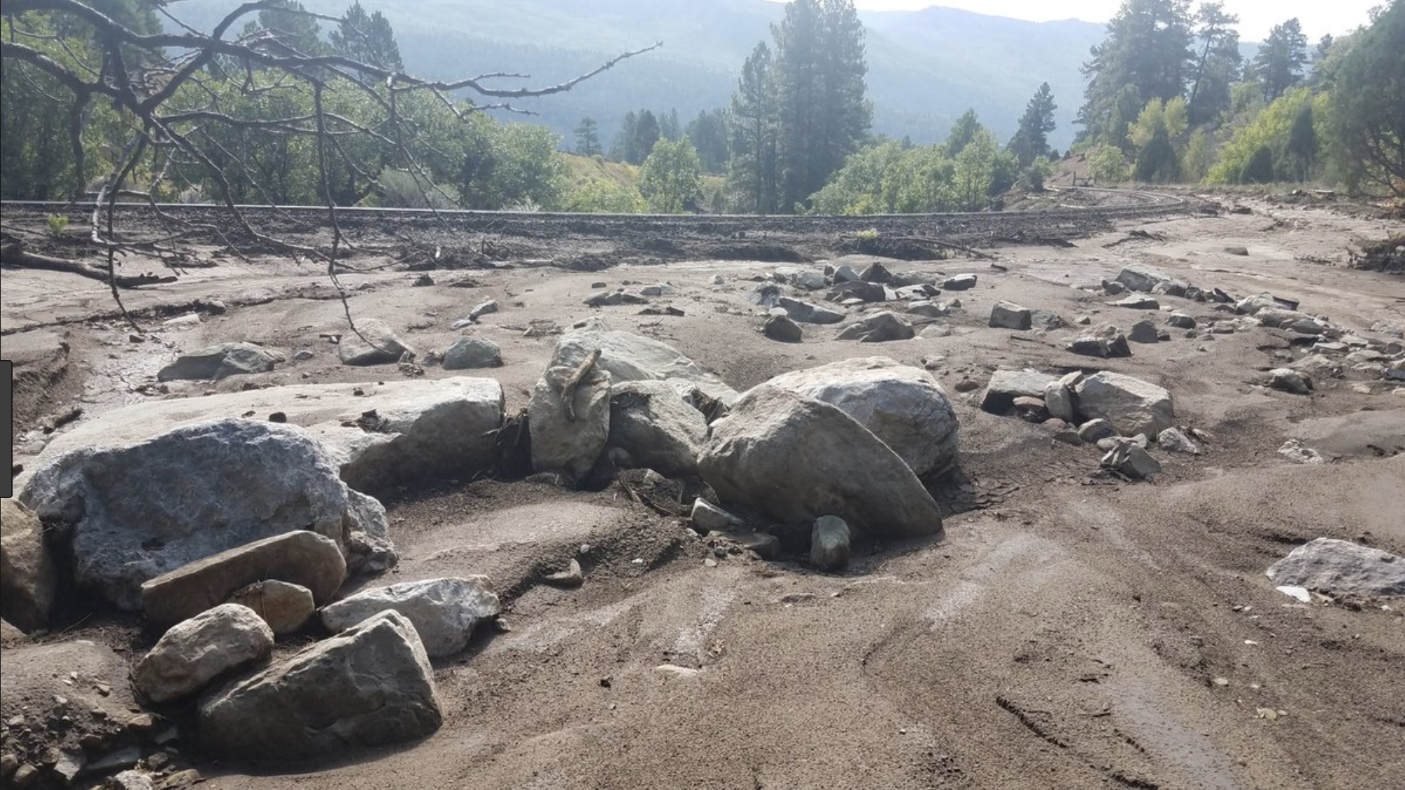
Screen shot of Animas River debris flow July 2018 aftermath of 416 Fire (CBS Denver).
FromThe Durango Herald (Jonathan Romeo) via The Cortez Journal:
Colorado has more than 300 miles of streams with Gold Medal status, which is intended to highlight the state’s rivers and creeks that provide outstanding fishing opportunities.
To qualify, a waterway must meet two criteria: have a minimum of 60 pounds of trout per acre and at least 12 trout measuring 14 inches or longer.
In 1996, a 4-mile stretch of the Animas River from the confluence of Lightner Creek down to the Purple Cliffs by Home Depot gained the Gold Medal tag and, ever since, has been marketed as a premier destination for fishing…
The water quality issues in the Animas are complex, said Jim White, an aquatic biologist for Colorado Parks and Wildlife based in Durango.
A combination of factors – heavy metals leeching from abandoned mines in the Animas headwaters around Silverton, above-average water temperatures, sediment loading and urban runoff – have had a detrimental impact on aquatic life.
As a result, fish in the Animas River are unable to naturally reproduce, and the waterway must rely on annual stocking of rainbow and brown trout by Colorado Parks and Wildlife.
In 2014, the Animas River started showing signs it was not meeting Gold Medal criteria, when a fish survey found a disappearance of large, quality-size trout in the stretch.
It was thought aquatic life would take a devastating hit from the Gold King Mine spill in 2015, which sent an estimated 3 million gallons of mine wastewater down the Animas River. Ultimately, however, subsequent studies showed the tainted waters had no effect on fish.
But in 2018, “everything went to hell,” White said.
Fish and other aquatic life were already stressed from low flows and high water temperatures when torrential rains in July 2018 hit the burn scar of the 416 Fire, sending a torrent of black mud and ash down the Animas River, which killed most of the fish in the waterway downstream of Hermosa Creek.
White said it may take up to four years to again meet Gold Medal standards in the Animas as the river recovers. Still, there’s been no discussion about delisting the impaired waterway, he said…
…Scott Roberts, an aquatic biologist with Mountain Studies Institute, has said it generally takes one to 10 years for a watershed to recover after a wildfire, but because only a small percentage of the 416 Fire burned at high intensity, he expects the timeline for recovery to be on the short end.
And, many wildlife officials, like Japhet and White, are hopeful the Environmental Protection Agency’s Superfund cleanup of mines around Silverton will help with metal contamination issues. EPA spokeswoman Cynthia Peterson said the work in the Bonita Peak Mining District will reduce the frequency of elevated metals in the Animas River, as well as the pulses of metals the agency suspects are being released from the mines.
White said this year’s high runoff will do wonders for aquatic life in the long run. He said wildlife officials plan to stock the Animas this summer and early fall.
From the Associated Press via The Greeley Tribune:
A company that operates a historic railroad that carries tourists through southwestern Colorado’s mountains and forests was accused Tuesday in a lawsuit of causing one of the largest wildfires in state history.
Federal investigators found that a coal-burning engine operated by the Durango & Silverton Narrow Gauge Railroad and American Heritage Railways threw cinders or other hot material onto brush near its track and started a fire on June 1, 2018, according to the office of U.S. Attorney Jason Dunn.
Flames eventually consumed about 85 square miles (220 square kilometers) of land near Durango, prompting evacuation orders affecting hundreds of people. Much of the damage occurred in the San Juan National Forest and on other federal land…
Officials had not disclosed a cause of the fire before Dunn’s office filed the lawsuit, which says multiple eyewitnesses told federal investigators that one of the trains passed through the area immediately before the fire began…
Residents and businesses have filed their own lawsuit against the railroad company, arguing that it knew or should have known about drought conditions that summer.
A statement released by Dunn’s office said federal authorities estimated damage and fire suppression involving the blaze could hit $25 million.
“This fire caused significant damage, cost taxpayers millions of dollars, and put lives at risk,” Dunn said in a statement. “We owe it to taxpayers to bring this action on their behalf.”
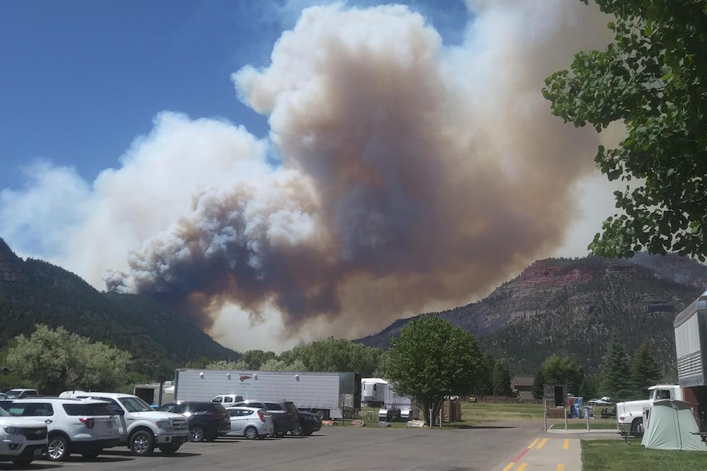
The 416 Fire near Durango, Colorado, ignited on June 1, 2018. By June 21, the wildfire covered more than 34,000 acres and was 37 percent contained. Photo credit USFS via The High Country News
416 Fire July 2, 2018. Graphic credit Incweb
The 416 Fire started at about 10 a.m. on June 1, 2018, approximately 10 miles north of Durango, CO. Rocky Mountain Type 1 Incident Management Team is managing the fire. The fire is burning on the west side of State Highway 550 on some private land and on the San Juan National Forest. The fire is burning in grass, brush, and timber. The Weather conditions remain critical and fuels are ideal for significant fire growth. The fire has been very active and continues to burn in rough and inaccessible terrain. Many homes have been evacuated and structure protection is in place. Map via Inciweb
Screen shot of Animas River debris flow July 2018 aftermath of 416 Fire (CBS Denver).
Debris flow from 416 Fire. Photo credit: Twitter #416Fire hash tag
On April 7, 2016, the Environmental Protection Agency proposed adding the “Bonita Peak Mining District” to the National Priorities List, making it eligible for Superfund. Forty-eight mine portals and tailings piles are “under consideration” to be included. The Gold King Mine will almost certainly be on the final list, as will the nearby American Tunnel. The Mayflower Mill #4 tailings repository, just outside Silverton, is another likely candidate, given that it appears to be leaching large quantities of metals into the Animas River. What Superfund will entail for the area beyond that, and when the actual cleanup will begin, remains unclear. Eric Baker
Click here to read the report. Here’s the introduction:
The Bonita Peak Mining District Superfund Site (Site) is located in southwestern Colorado. The Site consists of 48 historic mines or mining-related sources where ongoing releases of metal- laden water and sediments are occurring within the Mineral Creek, Cement Creek, and Upper Animas River drainages in San Juan County. Drainages within the Site contain over 400 abandoned or inactive mines, where large- to small-scale mining operations occurred. San Juan County is comprised of 10 historic mining districts (Colorado Geological Survey 2017). Historic mining districts within the Mineral Creek, Cement Creek, and Upper Animas River drainages include Animas, Animas Forks, Cement Creek, Eureka, Ice Lake Basin, and Mineral Point. Hereafter, the term “mining districts” or “Site” is used to refer to the mining districts within these three drainages. This document is a baseline human health risk assessment (HHRA) for the mining districts. The purpose of this document is to characterize the potential risks to humans, both now and in the future, from exposures to contaminants that may be present in the mining districts, assuming that no steps are taken to remediate the environment or to reduce human contact with contaminated environmental media. The mining districts are primarily used by humans for recreational, occupational, and tribal purposes. The receptor populations of interest for the risk assessment included campers, hikers, hunters, recreational fishermen, all-terrain vehicle (ATV) guides, ATV recreational riders, and county road workers. An addendum to this risk assessment will be developed to evaluate tribal exposures once the necessary exposure data are available.
The results of this assessment are intended to help inform risk managers and the public about current and potential future health risks to humans that may occur as a result of exposure to mining-related contaminants due to recreational and occupational activities, and to help determine if there is a need for action to protect public health at the Site. Site managers will also consider the results of the ecological risk assessment and any regulatory requirements in determining appropriate remedial actions for the Site. As appropriate, discussions and recommendations on how to manage potential risks will be provided in the Feasibility Study. The identification of remedial action levels, which will guide future remediation efforts, will be provided in the Record of Decision.
The methods used to evaluate risks in this HHRA are consistent with current guidelines for human health risk assessment provided by the U.S. Environmental Protection Agency (EPA) for use at Superfund sites (EPA 1989, 1991a, 1991b, 1992, 1997, 2002a, 2002b, 2002c, 2004, 2009a).
Despite findings, agency says cleanup remains a priority
A new study has found no serious risk to human health stemming from mines included in a Superfund site around Silverton, according to the Environmental Protection Agency.
“This is a good news story,” said Christina Progess, Superfund remedial project manager. “And it’s a really important milestone for the project that paints a more full picture in terms of what cleanup work needs to be done.”
[…]
As part of the Superfund process, the EPA must evaluate the risks contamination slated for cleanup has on human health. In the case of Bonita Peak, exposure to mine waste through incidental ingestion and inhalation stood as the highest possibilities for people who visit the area.
But, for the most part, the study showed there doesn’t seem to be much risk to human health…
“Overall, there’s a lot of good news in here,” Progess said. “It doesn’t impact the local tourism industry, and folks working out in the district aren’t at risk from a human health standpoint. But (the study) also helps us highlight there are some areas that people come in contact with it.”
While Superfund sites with clear and significant human health risks receive priority within the EPA for funding, Progess said she doesn’t expect the study’s findings to affect Bonita Peak.
“Bonita Peak has always been and continues to be one of the administration’s top priority Superfund sites in the nation,” she said. “I don’t anticipate (funding) being a concern.”
In April, the EPA released a study assessing risks to aquatic habitats, which showed that in areas where water had low pH and elevated metals, fish and other aquatic life populations were highly impaired or nonexistent.
The study helped EPA identify four areas where the agency would like to improve water quality in the Animas River watershed to the point where restoration of aquatic life could be achievable.
As the Animas River approaches peak flow, concerns are being raised that the city of Durango created a hazard when it added two new rapids to the Whitewater Park, resulting in many rafting companies choosing to bypass the park for safety reasons.
“It’s an unnatural hazard at the entry of the park, and it creates a rafting experience we’re not selling to our guests,” said Alex Mickel, owner of Mild to Wild Rafting & Jeep Tours. “It’s just been unfortunate.”
[…]
Since the 1980s, the city has made tweaks to the Whitewater Park, which flows alongside Santa Rita Park.
But in summer 2016, the city spent $1 million to create two new features just above the park with the sole purpose of diverting more water into the city’s water intake for municipal use.
It’s these new features that are drawing criticism and concern as the Animas River rises to higher-than-normal flows for the first time since the ledges were built. As of Friday, the river had usurped 6,000 cubic feet per second (the Animas usually peaks at around 4,700 cfs).
“They’re manmade nightmares,” said James Wilkes, co-owner of Mountain Waters Rafting. “They’re just not natural, and it’s very difficult for a raft to pass through it.”
The National Weather Service on Saturday issued flood advisories for the Mancos, Animas and La Plata rivers, and residents reported flooding along the Dolores River about 10 miles north of town.
“We have major flooding on Road 37, Dolores, 10 miles north of Dolores,” Jeffrey L. Jahraus told The Journal. Eight to 10 properties were getting water, he said.
The flooding began Tuesday and has continued intermittently, Jahraus said. About a half-acre of his neighbor’s property was under water.
Flooding has happened at their property once or twice before, he said, but never like this. The Jahrauses live along Road 37, right by where the now-famous rock slide happened on Memorial Day Weekend…
At the gauge in Dolores, the river was flowing Saturday morning at 4,200 cubic feet per second, about 256% the average June 8 rate of 1,604 cfs. Saturday afternoon, it reached 6.7 feet at the gauge, more that a foot shy of the 8-foot flood stage…
Meanwhile, flood advisories continued Saturday until further notice for the Mancos, Animas and La Plata rivers.
Mancos River
The river flow along the Mancos River was expected to remain near to slightly above bankfull, and minor lowland flooding was possible. Saturday morning, the river was at 5.3 feet – several inches above bankfull – and flood stage was at 6 feet. The river was expected to rise to about 5.4 feet around midnight Sunday.
La Plata River
A flood advisory also continued Saturday for the La Plata River at Hesperus. The flows along the La Plata River were expected to remain slightly above bankfull, and flooding is possible, the National Weather Service said. Bankfull stage is 5 feet, and flood stage is 5.5 feet. Saturday morning, the river was at 5.1 feet and expected to rise to nearly 5.3 feet by Monday morning.
Animas River
The Animas River was flowing Saturday at 6.6 feet. The National Weather Service said the river was expectd to reach 6.93 feet by Sunday morning, a foot shy of the flood stage of 8 feet. Moderate flooding would occur at 9 feet, and major flooding at 10.5 feet. The record height of the Animas is 11 feet, the weather service says.
San Juan River Basin. Graphic credit Wikipedia.
From the Brigham Young University The Daily Universe (Josh Carter):
Lake Powell is benefitting considerably from this year’s runoff following a strong snow year in the Rocky Mountains. The lake has risen 16 feet in the last month and is experiencing an inflow of 128% the average. While water levels are expected to continue to rise until the peak month of July, there is still a long way to go before the lake reaches full capacity.
“This year definitely helps,” said Bureau of Reclamation Public Affairs Officer Marlon Duke.
“But people need to keep in mind that when we came into this season Lake Powell was about 140 feet low. Even after this year, we’re going to be about 100 feet below full pool. So what we really need is three or four years just like this in a row.”
Lake Powell is currently stuck in the worst drought of its 56-year history. Its water levels and inflow have dropped significantly since the summer of 1999 — the last time Lake Powell was essentially full at 97% of capacity. The lake hit an all-time low in 2005 when its elevation sank to 3,555 feet, 145 feet below full pool.
The lake did experience a spike during the summer of 2010, when its levels got within 40 feet of full capacity. The drought has since continued, however, affecting not only Lake Powell but its sister reservoir Lake Mead as well.
“In 2000, when the drought started, Lake Powell and Lake Mead were both full,” Duke said. “Today Lake Powell is about 42% full and Lake Mead is even lower than that. Before we can start talking about whether or not the drought is over we need those reservoirs to be full again.”
Lake Mead was formed in 1935 and Lake Powell in 1963 after the completion of the Hoover and Glen Canyon dams, respectively, along the Colorado River. They were created in hopes to store and provide water for the Colorado River Basin states during times of drought. Lake Powell predominately serves the Upper Basin states of Utah, Colorado, Wyoming and New Mexico, while Lake Mead provides for the Lower Basin states of Arizona, Nevada and Southern California.
The Glen Canyon Dam was completed in 1963 and subsequently caused the formation of Lake Powell. Photo credit: Esri Photo Library/Flickr via Brigham Young University
While both man-made reservoirs have served their purpose throughout the current drought, experts are thankful for this year’s runoff after a particularly low year in 2018.
“We’re coming off of 2018 which was the second-driest year ever since we’ve been keeping records in the Basin,” Duke said. “We were worried because if we had another year like 2018 then that would have really put us in some trouble.”
The drought hasn’t been the only threat to the lake’s water levels in recent years. A couple different proposals and campaigns are calling for Lake Powell to be drained and to distribute its water to Lake Mead and elsewhere.
“Fill Mead First” is a campaign first started in 1996 to encourage conversation about restoring the dammed Glen Canyon to its natural state. As the drought continued, the campaign has gained traction, arguing that Lake Mead needs more water from Lake Powell to ensure big cities such as Las Vegas, Phoenix, Los Angeles and San Diego have enough. The campaign also argues that Lake Powell loses water through both rapid evaporation and water seeping into the porous sandstone walls.
BYU geology professor Gregory Carling talked about the potential benefits that could come from restoring Glen Canyon to what it once was.
“When the Glen Canyon Dam was built, it not only flooded one of the most beautiful canyons in the world but also thousands of archeological sites and side canyons,” Carling said. “Also, the way it is now with Lake Powell and Lake Mead half-full, both are losing lots of water through evaporation. So there probably is some sense in looking into what the benefits would be of draining Lake Powell and filling Lake Mead.”
Carling added, however, the proposal would have to go through a lengthy legislative process in order for anything to change.
“There are a lot of legal requirements and bureaucracy behind that, so it’s not just as easy as saying, ‘let’s drain one and fill up the other,’” Carling said. “You’d have to go back through a hundred years of the law of the river.”
Those opposing the “Fill Mead First” campaign argue that Lake Powell, one of the most popular boating and camping spots in Utah, supports the local economy through both recreation and tourism. The lake saw over 4 million visitors during each of the past two years for the first time in its history. Lake Powell supporters also argue the lake ensures a steady water supply to Lake Mead and the Lower Basin states.
Lake Powell attracts millions of boaters and tourists every year. Photo credit:Bernard Spragg/Flickr via Brigham Young University
The Lake Powell Pipeline is another proposal aimed at transferring water from Lake Powell to nearby Kane and Washington Counties in southern Utah. The proposed pipeline would run approximately 140 miles underground and deliver over 82,000 acre-feet of water per year to Washington County and 4,000 acre-feet of water per year to Kane County.
The proposal did take a hit last year when the Federal Energy Regulatory Commission ruled it would need greater oversight from other federal land agencies such as the Bureau of Land Management, the Bureau of Reclamation and the National Park Service. Officials expect a final decision to be made on the project by 2020.
Even amid the recent controversies experts hope the Colorado River Basin can take full advantage of its water resources, especially in times of drought. Representatives from all seven Colorado River Basin states recently met to sign drought contingency plans for the Upper and Lower Basins.
“This brings us one step closer to supporting agriculture and protecting the water supplies for 40 million people in the United States and Mexico,” said Bureau of Reclamation Commissioner Brenda Burman. “Working together remains the best approach for all those who rely on the Colorado River.”
“The City of Farmington has temporarily closed sections of trails in Berg Park due to rising water levels.” City spokesperson Georgette Allen said in a press release June 7. “Trails on the north side of the Animas River near the All Veterans Memorial Plaza will be closed throughout the weekend.”
From the Associated Press via Colorado Public Radio:
The EPA said it will drill into the American Tunnel next month to measure water levels and investigate how the passage is connected to other shafts.
The agency is looking for ways to stop or treat contaminated water pouring into rivers from old mine sites in the Bonita Peak Superfund area north of Silverton…
The EPA said it would follow strict safety guidelines when drilling the test well into the American Tunnel.
On April 7, 2016, the Environmental Protection Agency proposed adding the “Bonita Peak Mining District” to the National Priorities List, making it eligible for Superfund. Forty-eight mine portals and tailings piles are “under consideration” to be included. The Gold King Mine will almost certainly be on the final list, as will the nearby American Tunnel. The Mayflower Mill #4 tailings repository, just outside Silverton, is another likely candidate, given that it appears to be leaching large quantities of metals into the Animas River. What Superfund will entail for the area beyond that, and when the actual cleanup will begin, remains unclear. Eric Baker
A flood advisory has been issued for the La Plata River near Hesperus as rising temperatures and increasing snowmelt have pushed the river toward flood stage.
The National Weather Service in Grand Junction said flows along the La Plata River will remain near to slightly above the bank throughout the rest of the week, with the possibility for minor lowland flooding.
As of 7 a.m. Tuesday, a river gauge measured the flow of the La Plata River at 5 feet. A flood stage for the waterway is considered 5½ feet…
The Animas River in Durango was flowing at about 1,500 cubic feet per second Saturday. As of Tuesday morning, the river had reached more than 5,000 cfs and is expected to peak around 7,000 cfs later in the week.
Butch Knowlton, director of La Plata County’s Office of Emergency Management, said Monday that the Animas River begins to spill out onto some areas of the Animas Valley around 7,000 cfs.
The Animas River…was at about 1,500 cubic feet per second Saturday. On Tuesday, the river was running at more than 5,000 cfs and is expected to keep rising.
By the end of the week, the Colorado River Basin Forecast Prediction Center is calling for the Animas to hit nearly 7,000 cfs. (The Animas River usually hits a peak flow of about 4,700 cfs in early June at the height of spring runoff.)
[…]
If the Animas does reach 7,000 cfs, it would mark the largest peak since 2005 in the April-to-July snowmelt window, when the river hit 8,070 cfs on May 26. The last big water year was in 2015 when the Animas peaked at 6,210 cfs on June 12.
The Animas River at 7,000 cfs starts to spill out on the low-lying areas and fields in the lower Animas Valley north of Durango, Knowlton said. At 8,000 cfs, areas around Trimble Lane start to flood.
The water flow for the Animas River to be considered in a flood stage is about 10,500 cfs, Knowlton said. While the river may not hit that mark this year, there is a wild-card type scenario that has emergency managers concerned.
The National Weather Service has issued a river flood advisory for the Gunnison River in Mesa County. Water flows are expected to increase throughout the week.
“Some may start to get above bank full by this weekend. But it’s just something we’re monitoring. It’s not a sharp increase where we expect to see flooding in a couple of days. We are starting to see runoff and an increase in higher flows and higher levels,” said Matthew Aleksa, National Weather Service Grand Junction.
Prior to mining, snowmelt and rain seep into natural cracks and fractures, eventually emerging as a freshwater spring (usually). Graphic credit: Jonathan Thompson
FromThe Associated Press (Dan Elliott) via The Denver Post:
The work includes dredging contaminated sediment from streams and ponds, diverting water away from tainted mine waste piles and covering contaminated soil at campgrounds.
The agency first outlined the plan last June and finalized it Thursday.
This summer’s work is aimed at reducing the volume of toxic heavy metals that escape from mining sites and into rivers while the EPA searches for a more comprehensive solution under the Superfund program…
The Gold King is not on the list of 23 sites chosen for this summer’s work. The EPA installed a temporary treatment plant below the Gold King two months after the spill, and it’s still cleaning up wastewater flowing from the mine.
Two of the 23 sites are campgrounds, and three are parking areas or places where people meet for tours. The EPA plans to cover contaminated rocks and soil at those sites with gravel or plant vegetation to reduce the chance of human exposure and keep contaminants from being kicked into the air.
Besides the dredging work, the EPA will dig ditches and berms to keep rain, melting snow and mine wastewater from reaching piles of contaminated waste rock and carrying pollutants into streams.
The initial project will cost about $10 million and take up to five years, the agency said.
The EPA said last year the initial cleanup would include 26 sites. But three mines were removed from the list because work will be done there later.
Let’s take a minute to daydream. Close your eyes and envision beautiful mountain scenery and cold, clean water drifting through the valley floor, bugs flitting through the clear, blue sky, and the possibility of sighting wildlife around every bend. Listen to the birds chirping and the sound of water running over the backs of logs and rocks. Now picture over 100 miles of this river stacked with browns and rainbows. This is not a dream. This is the Arkansas River in central Colorado.
At one point in history, not too long ago, this was not the Arkansas we now know. It was severely contaminated from hardrock mining to the degree of needing a Superfund designation to clean it up. But clean it up they did. After years of remediation work, the Arkansas has rebounded better than imagined, becoming the Gold Medal river we know today.
Chaffee County Commissioner Greg Felt said, “When I first began fishing the Arkansas in 1985, one could catch a lot of fish, but they were small and in poor condition due to water quality issues. With the successful effort to improve that, we began to see fish live much longer and healthier lives, and the diversity of our aquatic entomology really flourished. While a Superfund project is not a quick nor easy process, the payoff for the fishery, and for anglers, local businesses, residents, and visitors has been phenomenal.”
This is also the hope for the Animas River just a few hundred miles to the southwest. Named a Superfund cleanup site in 2016, the Animas headwaters have a similar storied past of hardrock mining. Since the mining boom of the 1880s, the Upper Animas has seen massive heavy metal loads flowing through a wilderness section and into the town of Durango. Luckily, the metals dissolve significantly to leave the lower reaches valuable for anglers with its four miles of Gold Medal designation through Durango. But just imagine what could happen with the remainder of the river after the Superfund cleanup is complete.
We’ve already seen glimpses of rehabilitation on the Animas River. During a brief period when a wastewater treatment plant was in place at the headwaters, trout numbers in the upper reaches were about 400 fish per mile. Once that treatment plant was removed in 2004, numbers dropped to 100 fish per mile in 2010 and a dismal 73 fish per mile last year. The same is true for macroinvertebrates. The celebrated pale morning dun was once a character of the river landscape, but since the closure of the plant, they have been nonexistent. Clearly, remediation of any level is beneficial to trout and trout food.
If the Animas River Valley, its citizens and businesses, anglers and recreationists can learn anything from the Arkansas River success story, it’s this: hope is not lost. It will take time, but the Animas River will return to a healthy habitat for our beloved trout.
On April 7, 2016, the Environmental Protection Agency proposed adding the “Bonita Peak Mining District” to the National Priorities List, making it eligible for Superfund. Forty-eight mine portals and tailings piles are “under consideration” to be included. The Gold King Mine will almost certainly be on the final list, as will the nearby American Tunnel. The Mayflower Mill #4 tailings repository, just outside Silverton, is another likely candidate, given that it appears to be leaching large quantities of metals into the Animas River. What Superfund will entail for the area beyond that, and when the actual cleanup will begin, remains unclear. Eric Baker
Snow levels have presumably peaked in the San Juan Mountains and, as expected, they look pretty darned healthy. That said, it’s not quite the biggest snow year on the books. How 2019 ranks depends on which SNOTEL station you’re looking at.
…as of May 1, this year’s snow levels were the second highest at Red Mountain Pass and Columbus Basin, fourth highest at the lower elevation Cascade station, and fifth at Molas Lake (which seems off to me).
But whether it was a record year or not, it’s clear that it has been — and continues to be — a good year for water supplies and river flows in the whole region. At every station the snowpack remains far above average, and three to four times what it was at this time last year. Also, one only needs to look at all the snow slide debris in the high country to determine that it was a historic avalanche cycle…
But that was past. What about the near future? How high will the Animas River get this year?
It’s already hit 3,000 cubic feet per second in Durango, which is plenty of flow for some good kayaking and rafting (albeit a bit chilly). And it’s fair to bet that it will top 5,000 cfs before the runoff is over. But whether it will shoot up past 8,000 cfs as it did in 2005 (which saw a smaller snowpack at most stations in the watershed) or not is anyone’s guess.
Just because the snowpack is bigger than 2005 doesn’t mean the runoff will hit a bigger peak. A cool spring will result in a slower melt, and that will mean a higher average flow and a longer rafting season, but not necessarily a bigger peak.
Either way, the reservoirs are likely to get a bit of a boost, and the smaller ones will likely get topped off. As for Lake Powell rising back up to its former glory? Don’t get your hopes up.
Animas River at Durango March 1 through May 6. 2019 via USGS
Silverton, Colo., lies an at elevation of 9,300 feet in San Juan County, and the Gold King Mine is more than 1,000 feet higher in the valley at the left side of the photo. Photo/Allen Best
The Environmental Protection Agency has named four areas in the Animas River basin where it plans to focus on improving water quality for aquatic life.
The EPA recently released a study assessing risks in aquatic habitats, a result of years of sampling and testing water quality in the Animas River basin around Silverton.
Andrew Todd, an aquatic toxicologist for the EPA, said the study confirmed many suspicions throughout the watershed: In areas where water had low pH and elevated metals, fish and other aquatic life populations were highly impaired or non-existent.
But the study also helped inform the EPA about what areas the agency could focus on with cleanup projects, he said, where marked benefits, such as restoring aquatic populations, could be achievable.
The areas include:
The Animas River just below the confluence of Elk Creek, about 5 miles downstream of Silverton.
The upper Animas River from Howardsville to just above the confluence with Cement Creek.
The south fork of Mineral Creek.
Upper Mineral Creek from Mill Creek to just above the confluence with the middle fork of Mineral Creek.
[…]
Christina Progress, Bonita Peak Mining District Superfund site manager, said a final decision on the EPA’s quick-action plan that seeks to address 26 mining sites over the next five years or so should be announced in the next month or two.
Progress said the cleanup projects in the proposed plan are in line with the EPA’s four identified priority areas.
Weather permitting, Progress told The Durango Herald, the EPA plans to conduct four or five projects this summer. The low water year in 2017-18 and the high water year in 2018-19 are also allowing the EPA to get a better idea of the hydrology of the mountains.
Because Cement Creek has never been known to support aquatic life, it was not considered in this part of the EPA’s process, Progress said. The mines draining into upper Cement Creek are considered some of the worst loaders of heavy metals in the basin.
“We need a lot more understanding of the groundwater system to understand how best to address those (mine) sources,” she said. “We know it’s a significant area of contamination and prohibitive to our overall success.”
Progress said the EPA’s human health risk assessment should also be released in the next month or so. A terrestrial health risk assessment is expected this fall, she said.
Ride along with Jonathan Romeo from The Durango Herald to see what the operators of the Durango narrow gauge railroad are working against to clear the route to Silverton. Here’s an excerpt:
The Durango & Silverton Narrow Gauge Railroad, with the help of Durango-based Bonds Construction, has cleared the 45-mile track from Durango to Silverton.
Bonds Construction posted to its Facebook page this week that crews plowed through 42 avalanche/slide areas over the course of 14 miles in the past few weeks. As a result, the tracks were cleared two weeks ahead of schedule…
The D&SNG’s route from Durango to Silverton doesn’t encounter true avalanche danger until it reaches Cascade Canyon, about 26 miles north of the train station in Durango. From there, north to Silverton, eight to 10 avalanche paths can reach the railroad tracks.
But this year, crews saw avalanche paths slide that had never been witnessed running before. One particular avalanche was near Needleton, which put 60 feet of debris on the tracks.
By all accounts, the D&SNG will be ready to make its first round-trip from Durango to Silverton on May 4.
Officials will hear confirmation from the county’s emergency management manager on Wednesday that contaminated water recently released from the Gold King Mine did not adversely impact water quality downstream in the Animas River.
San Juan County Emergency Manager Mike Mestas will speak about the mine’s status in his presentation to the San Juan Water Commission during its monthly meeting at 9 a.m. Wednesday at the San Juan Water Commission Office Building, 7450 E. Main St. in Farmington.
The presentation will serve as an update for county water commissioners on the Gold King Mine spill of 2015, and what has happened since then.
The mine, near Silverton, Colorado, created concerns for water quality this winter when storms and avalanche danger cut off access to the facility that treats water draining from the mine.
The facility also lost power at that time, causing untreated water to bypass the plant and drain into Cement Creek for 48 hours.
A water gauge on the Animas River near the Powerhouse Science Center saw levels rise from 300 cubic feet per second Monday to more than 700 cfs as of Friday afternoon.
Water levels came close, but not close enough, to a previous high for March 29 set in 1916 of 1,100 cfs. The water gauge near the Powerhouse has 108 years of records.
Throughout the past week, daytime highs have lingered in the mid-60s, prompting the first round of snowmelt and runoff…
But early next week, Kormos said temperatures will rise once again, and the river along with it. By late next week, the center calls for the Animas River to exceed 1,000 cfs, though Kormos noted forecasts that far out are difficult to predict.
According to the Natural Resources Conservation Service, the Animas, Dolores, San Juan and San Miguel river basins are at 161 percent of historic, normal averages as of Wednesday, the latest available data. Those snow totals, however, are taken from weather stations placed in high elevations…
The rise in water and promise of a sustained spring runoff is a welcome sight to members of the boating community, especially after one of the lowest water years on record in 2018.
Yesterday, EPA released preliminary water quality sampling data related to the temporary shutdown of the interim water treatment plant at the Bonita Peak Mining District Superfund site at Gladstone (Colorado). EPA’s analysis confirms that there were no adverse impacts to downstream drinking water or agricultural users associated with the short-term shutdown of the plant based on data that indicate minimal to no changes in water quality at sampling points downstream of Silverton in Durango. There were no observed impacts to aquatic life. Any impacts to aquatic life would be limited to the Animas River near Silverton.
The water treatment plant went offline on the evening of 14 March due to extreme weather conditions resulting in a power surge that tripped critical circuit breakers at the facility. The same weather event triggered an avalanche and several snow slides across the county road and prevented access to the plant. After a period of less than 48 hours, EPA brought plant back online and resumed normal operations on the afternoon of 16 March.
“EPA appreciates the efforts of our partners in San Juan County Colorado and the water plant operators for working quickly to minimise the length of time the facility was out of operation and limit any localised impacts to water quality,” said EPA Regional Administrator Doug Benevento.
“During and after the treatment plant shutdown, real time measurements of turbidity, pH and electrical conductivity from sondes in the Animas River provided no indication that downstream water users would be adversely impacted,” said New Mexico Environment Department Chief Scientist Dennis McQuillan.
“EPA’s laboratory test results confirm the interpretation of real time sonde data.”
EPA collected water samples at four locations along the Animas River from Cement Creek to Durango from 15 – 21 March. A preliminary analysis of the sampling data from 15 – 20 March shows a measurable elevation of metals concentrations, particularly copper, at the confluence of Cement Creek and the Animas River, about six miles below Gladstone. Levels of metals were slightly elevated at a location on the Animas River approximately one mile south of Silverton.
Heavy metal concentrations in the Animas River at two sampling locations in Durango were well within the range of concentrations previously observed when the treatment plant is operating. The detections of low concentrations of metals in the Animas River may be associated with the temporary closure of the plant, but they may also be related to several other factors that should be considered when evaluating these data.
These include snow and avalanche debris being deposited in Cement Creek, the Animas River and local waterways which potentially introduced metals containing soils and sediments. There is also the potential for the ongoing rain and runoff at lower elevations to mobilise metals containing sediments from the 416 fire at locations below the confluence of Hermosa Creek and the Animas River.
Preliminary data can be viewed at https://response.epa.gov/GladstoneWTP. Data from samples collected on 21 March will available on this website later this week.
This story by Jonathan P. Thompson ran in the Silverton Mountain Journal in winter of 2002. Given the historic avalanche cycle, and the lengthy closure of Red Mountain Pass, it seemed like an opportune time to re-up it. Spoiler: Silverton has been shut off from the world by avalanches many times in the past. In 1932, the roads and railroad were shut down from February until the end of April. Yikes!
Eddie Imel died 10 years ago this March (editor’s note: in March 1992). Imel was a plow driver for the Colorado Department of Transportation on the Ouray side of Red Mountain Pass. Like all the plow drivers between Ouray and Cascade, Imel was part of the infantry; he was a foot soldier in the war to keep Highway 550 into Silverton open and keep the town it feeds alive. Imel was the third soldier to die in that war in 22 years and, like the other two, he was slain by the deadliest enemy of this unending conflict: the East Riverside Slide.
The winter of 1991-1992 was not an especially heavy one in these parts. In fact, after a good start–43″ of snow fell in Silverton in November–the snowfall petered out. December (15″), January (10″), and February (15″) were all unusually dry months for snow in the San Juans. Long periods of sunny days and cold, clear nights between storms served to rot out the early, scant snowpack. In other words, conditions were ripe for a serious avalanche season upon the arrival of the big, spring storms.
And arrive they did: Over 30 inches of snow fell in the San Juan Mountains and the slides were running all over the place. Highway 550 was finally closed, but by the time the gates were shut, it was too late. The CDOT truck that swept the road to make sure all motorists were out of danger dodged big slides before being blocked by a portion of the East Riverside Slide that had hit the road just north of the snowshed. Edie Imel and Danny Jaramillo were piloting a CDOT plow, attempting to clear the road so that the sweep truck and other motorists inside the snowshed could get to safety. The plow came to a stop, the two soldiers got out to adjust the chains, and, as the East Riverside is apt to do, it ran again, burying the plow and the drivers.
Everyone in the snowshed, CDOT officials, and local law enforcement reasonably assumed both victims of the slide were dead. A body recovery effort would have been too risky, so it was delayed. The motorists in the shed were escorted back to safety, the mourning began, and, 18 hours after the slide ran, a call came in from the emergency telephone in the snowshed. Danny Jaramillo had tunneled his way out of the cement-like snow. Imel’s body was recovered not long after.
The system, or rather the lack of a real system, for determining avalanche hazard and deciding when to close the road had failed one too many times. Things had to change.
Silverton’s connection with the outside world has always been vulnerable to snowslides. Before there were plow drivers risking their lives to keep the arteries and veins of San Juan civilization from being blocked, there were mail carriers. Before the railroad arrived in 1882, Silverton’s winter link to the lowlands usually consisted of no more than one man on a set of “snowshoes,” or long, wide, heavy wooden skis. Men with names like Greenhalgh, Aspaas, Bales, Mears, and Nelson skied regularly over Cunningham Pass (south of Stony Pass) with huge, 50- to 60-pound sacks on their backs or dragging sleds full of mail and supplies. It was not a job for the faint at heart — avalanche danger was ignored, at least one froze to death, and others, somehow, survived both snow and cold — but it was a necessary one. Without their efforts, Silverton would have had to shut down come winter.
Newspaper clipping from March 1906, after a huge storm resulted in a deadly St. Patrick’s Day avalanche cycle.
In 1882, the railroad finally reached the heart of the San Juans, but by no means did this signal an end to avalanche troubles. The snowshoe-riding mail carriers of old, as long as they avoided being hit by slides, could simply ski over the top of the slide debris, but the train could not. From Needleton to Silverton, the tracks pass through the depository for dozens of slides, some of significant size. Dramatic photos of the Saguache slide (probably also known as the Snowshed slide north of Elk Park) show a trench dug for the train through a 60 foot pile of snow and debris. Nearly every winter saw at least one avalanche-caused blockade during which the train could not reach Silverton. Sometimes they only lasted a few hours while tens or even hundreds of men cleared the tracks. But there were times when Silverton was cut off from the world for days, weeks, and, in one case, three months. In 1884, Silverton was without a train for 73 days. Food ran short and milk cows were killed for beef.
The winter of 1906 will long be remembered as the most tragic, avalanche-wise, in the San Juans. Big January storms pounded the region following a relatively dry November and December, and the slides came down. Five men were killed at the mouth of the tunnel of the Sunnyside Mine near Eureka when they were engulfed by a slide. Eleven avalanches were reported between Silverton and Elk Park that ranged from seven to 30 feet deep and 50 to 450 feet long; the train was kept at bay for 18 days.
All of that was minor compared to what followed in March when an enormous storm sat over the region for about a week, relentlessly pounding the San Juans. Slides swept away the Shenandoah boarding house, killing twelve men, and ravaged a number of other structures in the area, often killing their inhabitants and making that the most deadly avalanche season ever in the San Juans. Twenty-four people lost their lives to snowslides in San Juan County that winter.
Transportation in and out of Silverton came to a standstill. Two-hundred men of Japanese descent worked to clear 50-foot deep piles of debris that at least 15 slides had deposited on the tracks between Needleton and Elk Park. It took 33 days for them to break through. Local newspaper editors blamed the Railroad, not the snowslides, for the delay in opening the tracks, a sentiment that would echo throughout the years, even after the highway became the main link between Silverton and everywhere else.
Perhaps the worst winter, in terms of Silverton being cut off from the outside, was 1931-1932. By then the highways to Ouray and Durango were gaining importance as supply routes through the San Juans. That gave the newspapers someone else, the highway department, to blame for closures. After a December storm, the editor of the Silverton Standard wrote: “Now during the recent storm it was not deemed expedient for men to attempt to keep the highway open, but after the storm settled it was clearly the duty of the maintenance department of Colorado to open the roads, or at least determine that they should not be opened. What was done? Nothing. How long in our case did the situation continue? For at least one week.”
Silverton continued that year to be pummeled by storm after storm. In February, following a devastating “San Juaner,” all highways were closed, including those to Howardsville and Gladstone; a slide wrecked the Iowa-Tiger boarding house at Silver Lake; all telephone lines in and out of Silverton were down; and the train crashed near Rockwood while attempting to reach Silverton. One couple hiked out to Ouray in order to escape the confines of Baker’s Park, some snowshoed to Rockwood in order to catch the train, and a 350-pound load of butter, eggs, and meat was brought by toboggan from Ouray. In April, it was reported that the Riverside Slide had deposited a pile of snow 300 feet long and 60 feet deep. The road to Durango (which at that time traveled down avalanche-riddled Lime Creek, not over Coal Bank Pass) was opened on April 30, and the Ouray side was cleared shortly thereafter.
Only four years later Silverton was shut off again by slides for weeks, prompting a team made up of Louis Dalla, E.F. Sutherland, James Baudino, John Turner, and Carl Larson to snowshoe down the canyon to Needleton to fetch the mail.
By the time one of the biggest winters in San Juan history hit in 1951, the railroad’s importance had been diminished somewhat by the improved highways, especially to the south. But in the San Juans even good highways, which traveled through slightly less avalanche-prone areas, are liable to be shut down, and that’s exactly what happened that year. There was so much snow that people had trouble getting around town, not to mention over the passes. The Highland Mary Mill in Cunningham Gulch was wrecked by a slide, killing one. The highway to the north opened after six days, and it took several more days of around-the-clock effort, to break through the dozens of slides that covered the road to the south.
In spite of the huge winters, the series of avalanches that hit the roads with regularity, and the lack of any avalanche policy governing Highway 550 at the time, not one motorist had been killed by an avalanche on the highway by the middle of the 20th century. Nevertheless, following the huge winter of 1952, the Colorado Highway Department implemented an official policy dealing with road closures and avalanche hazard. The policy said that if avalanche danger was determined to be high, the road would be closed, control work would be done, the debris would be cleared, and the road re-opened.
At first glance, the system seems identical to the current one. In practice, however, the road was usually kept open until the slides were coming down so big, and with such frequency, that the plows were simply unable to punch through them anymore. It was a policy that, at best, was unscientific. Louie Dalla, road supervisor for the Silverton district, who was known as a man who almost always kept the roads open, described the non-policy policy in a 1963 interview with Allen Nossaman: “About the only good rule is not to go in a storm. They ask us how an accident could have been prevented in many slides. The best answer to that is — They should have stayed in bed. The study of slides is a science, and the study comes pretty close to getting the answers but not close enough.”
In other words, it was up to the motorist, not the highway department, to ultimately assess the danger and make the decision about whether to travel the road or not. It is a noble sentiment, and one from another time before liability and lawsuits were the norm. Up until 1991, the only avalanche forecasters were the plow drivers themselves, their command centers the cabs of their plows. The policy was imperfect, at best and, in 1963, its fatal flaws were first revealed.
On March 3, 1963, Reverend Marvin Hudson made his usual trip over Red Mountain Pass to preside over services at the Silverton Congregational Church. He had his daughters Amelia and Pauline in the car with him. A large storm had hit and the East Riverside Slide had already run once. His car was slip-sliding across the road as he passed under the ominous East Riverside slide, so the Reverend stopped to install his chains. That is when the Riverside ran again. It took rescuers a week to find the Reverend’s body and another to find Amelia’s. Pauline was not recovered until May 30.
The tragedy inspired a Colorado Highway Department Engineer to recommend the construction of a snowshed under the Riverside, a suggestion made by a Swiss avalanche expert two years earlier. The shed was not built, the road closure policy remained the same, and, in 1970, plow driver Robert Miller was killed by the Riverside’s infamous second release.
Angered citizens demanded the construction of a snowshed but Highway 550, which is still one of the last places to get funding from the state transportation coffers, would get no protection. Nothing was done.
It took yet another fatality, under similar circumstances, to motivate the state to finally build the snowshed. This time it was plow driver Terry Kishbaugh who was taken by the East Riverside on February 10, 1978. Seven years later, the snowshed was built. At least one expert recommended the snowshed be 1,200 feet long; others said that the absolute minimum length for it to be effective was 400 feet. When all was said and done, the snowshed only covered 180 feet of highway (as it does today), leaving cars, and plow drivers, and Eddie Imel and Danny Jaramillo exposed to the deadly torrent known as the East Riverside slide.
Those were the fatalities. Then there were the close calls. According to CDOT statistics, 68 cars were hit by slides between 1951 and 1991 between Coal Bank and Ouray. These included a Trailways bus that was knocked off Molas Pass by the Champion slide and a bus bashed by the Brooklyns filled with miners coming home to Silverton from their shift at the Idarado Mine. Injuries were relatively minor. Finally, when the San Juans had to say goodbye to a third plow driver in 22 years, things changed.
In July 1992, CDOT announced its new Highway 550 Avalanche Hazard Reduction Plan. Weather and snowpack evaluation stations would be installed under the plan; avalanche control equipment such as Howitzers would be implemented; CDOT workers would all be trained in avalanche awareness; and fixed control-gun towers would be installed. Most significantly, however, the avalanche forecasting job would go to two Colorado Avalanche Information Center professionals based in Silverton (plow drivers, however, continue to serve an important role, communicating their on the road observations to forecasters).
Silverton’s forecasters are devoted, full-time, to assessing the avalanche hazard on the passes. Even during long periods between storms, they patrol the passes and analyze the snowpack, its structure, and its stability, allowing them to know approximately how much snow, and at what density, the current snowpack can hold in the event of a storm. When a storm does hit, the forecasters are out on the highway alongside the plow drivers, constantly monitoring conditions and passing recommendations on to the local road supervisor in Durango or Ridgway. Ultimately, it is the road supervisor, not the forecaster, that makes the decision to close the road.
The days of waiting for several big slides to come down before deeming the hazard high are over, according to Silverton Avalanche Forecaster Andy Gleason. This has sometimes caused impatience in Silverton, where people still remember the old days and where mail, supplies, and commuter routes are shut down along with the roads. And, of course, when the road is closed it means the precious few winter tourists and their money are kept out, an issue that may even get more urgent when the new ski area opens. Many citizens, especially those that have been around for a while, feel that it is premature to close the roads before any slides have come down.
Gleason disagrees. “When I recommend closure I’m always asked: ‘What slides hit the road,” said Gleason. “If we were doing our job really well we would answer that nothing hit the road, but this is what is about to hit the road.” Gleason concedes that, partly because of the importance of the roads to Silverton, the road is usually not closed until smaller “indicator” slides such as the Blue Point have run. Or, he says, if two inches of snow fall in one hour or less in the Uncompahgre Gorge, then it is time to lock the gates with or without indicator slides. “It will avalanche,” said Gleason.
The ultimate goal of the avalanche reduction program, according to Gleason, is to create more avalanches of smaller size. “Our perfect avalanche control day would be if every slide ran small to the edge of the road so that there is no clean-up necessary,” said Gleason.
Although this policy may mean more frequent and earlier closures, ultimately it could result in cumulative closures of fewer hours during a winter than under the old policy. Most importantly, of course, it means that everyone — the plow drivers, the motorists, the law enforcement people patrolling the roads — are safer.
Its first decade of existence has been a successful one for the Avalanche Hazard Reduction Plan. Imel’s was the last avalanche-related fatality on Highway 550, close calls are rare, and during the past five years, long, sustained closures have been kept to a minimum. In 1998-1999 Red Mountain Pass was closed for a total of 110 hours and Molas/Coal Bank for 17 hours; in 1999-2000, the road to the north was only out of service for a total of 33 hours and Molas was closed for a paltry 6.5 hours; and last year, an average snow year, Red Mountain was down for 83 hours and Molas/Coal Bank for 30 hours. These numbers are not small, but in earlier years it was not unheard of for the road to be closed in both directions for 83 hours at one time.
Improvements during the last five years have helped the forecasters and controllers immensely. Snow measurement stakes have been placed in the starting zones of the West Lime Creek and Mother Cline slides; Howitzers have returned to their traditional place in avalanche control work, making helicopters less necessary and allowing for more efficiency and quicker control work; and the forecasters learn more about the snowpack each year.
Still, the new plan is not perfect. Gleason would like to see more forecasters here (two, Silverton-based forecasters cover Coal Bank, Molas, and Red Mountain Passes in addition to Lizard Head Pass, which is two hours away by CDOT truck); more passive control measures such as snowsheds, snow fences, and snow defense structures; better automated weather stations; and a remote avalanche detection system (one is being researched here but Gleason signed a waiver promising not to talk about it).
John Greenell (a.k.a. Greenhalgh) and his trusty pair of snowshoes was one of the mail carriers that provided Silverton a link with the outside world in its earliest winters of existence. He was known as a man that could make the trip up Cunningham Gulch, over Cunningham Pass, into the Rio Grande Country and to Del Norte and back in any type of weather.
On Monday, November 27, 1876, Greenell set out from Carr’s Cabin on the other side of the divide on the return trip (over Stony Pass this time) to Silverton. He never arrived. A group of searchers found his body a few days later, frozen to death near the top of Stony Pass, his hand rigidly clutching his mailbag.
We have changed a great deal since Greenell’s days, but the mountains are just about the same. Winters are still hard, avalanches still rush down mountainsides, and Silverton is still, occasionally, isolated from the outside world.
A heavy duty snow blower punches a hole through the snow that came down the West Riverside slide triggered yesterday, Monday, March 4, on north Red Mountain Pass, US 550. The snow shed which protects the traveling public from natural slide activity is seen in the background.
Let there be no doubt: It has been a snowy winter in the San Juan Mountains in southwestern Colorado, along with the rest of the state and much of the nation. Six people have been killed in Colorado avalanches, three of them in the San Juans. The highways leading into Silverton have been closed multiple times this winter due to avalanches, and Red Mountain Pass remains shut and buried with miles of slide debris as I write this early on March 7. Skiing, by all accounts, has been fantastic. If someone were to have gone into hibernation a year ago in the San Juans, and had just woken up today, they’d probably think they had been transported into a completely different world.
A CDOT driver clears debris from the East Riverside slide south of Red Mountain Pass in early March. This slide is the deadliest on Hwy 550 between Durango and Ouray. In the ’60s a reverend and his two daughters were killed here, and plow drivers were killed by the Riverside in ’78 and ’92, not long after the (too-short) snowshed was built. Courtesy Colorado Department of Transportation.
And yet, according to data from a sampling of SNOTEL stations across the San Juans, the March 1 snowpack still did not crack the top three highest levels on record, even though the SNOTEL records only go back less than four decades. Yeah, I know, those of you who have spent much of the winter shoveling out or catching sweet face shots are probably wondering what kind of Bulgarian weed this guy’s smoking. But I’m just the messenger, here, delivering data gathered by remote, automated, and perfectly sober stations, specifically those located near Molas Lake, on Red Mountain Pass, and in Columbus Basin in the La Plata Mountains.
The graphs below show this water year’s snow water equivalent for the first of each month so far, average level for the period of record, 2018 levels, and the two highest snowpacks on March 1 during the period of record.
Red Mountain Pass is so far seeing its 8th heaviest snowpack for 3/1 since 1981.We’re not sure what’s going on at Molas, where the SNOTEL station showed the March 1 snowpack sitting at average levels. This year is at 14th biggest snows since 1987.While the snowpack is sitting well above average at Columbus Basin, it remains far below previous years, sitting in sixth place since 1995.
The main takeaways: • The snowpack, i.e. the snow water equivalent, is sitting well above average for the period of record for each station. • The snow water equivalent for each station is currently about two times what it was a year ago. • A lot more snow will have to fall in order to make this the biggest winter on record.
And now for some caveats: • These graphs show snowpack levels at the first of the month, and all three of the sample stations have received two to three more inches of SWE since then in massive early March storms, which could have boosted this year’s ranking a bit. • I chose these three stations because they sit at a high altitude (and had values > 0 last year), and because they are geographically diverse. It’s possible that lower elevation stations have more snow this year than they ever have. I’ll look into that for a future post. • These data are merely for the amount of water in the snow at a specific point of time. They do not necessarily reflect total snow accumulation for the water year. It’s possible that more snow has fallen than in “bigger” years, but that warmer temperatures have melted it. I’ll also look into how this winter’s temperatures compare to previous years in a future post.
A federal judge has denied a motion to dismiss claims brought by state, federal and local governments and private entities related to damages caused by the Gold King Mine spill.
U.S. District Court Judge William P. Johnson denied the motion on Feb. 28 by the U.S. Environmental Protection Agency, its contractors and mining companies…
New Mexico, Navajo Nation and Utah, along with residents in Aztec and on the Navajo Nation, have filed lawsuits for environmental damages and tort claims against the federal agency and its contractors and mining companies since May 2016.
The defendants requested that the court dismiss claims, arguing sovereign immunity barred the litigation.
The two states and the tribe are seeking to recover the costs of their responses to the spill under the Comprehensive Environmental Response, Compensation and Liability Act.
New Mexico officials commended the latest court decision.
James Kenney, secretary for the environment department, said the state will continue to hold the defendants responsible for the environmental and economic harms caused by the spill.
Among damages the state is seeking on its behalf and for agricultural and recreational operations is more than $130 million in lost income, taxes, fees and revenues…
Navajo Nation President Jonathan Nez said the tribe is pleased with the judge’s decision.
This image was taken during the peak outflow from the Gold King Mine spill at 10:57 a.m. Aug. 5. The waste-rock dump can be seen eroding on the right. Federal investigators placed blame for the blowout squarely on engineering errors made by the Environmental Protection Agency’s-contracted company in a 132-page report released Thursday [October 22, 2015]
Is it a conflict of interest for the Environmental Protection Agency, responsible for the Gold King Mine spill, to lead the Superfund cleanup of mine pollution around Silverton? The last company to operate a mine in Silverton, which is also possibly on the hook for cleanup costs, seems to think so.
Sunnyside Gold Corp. on Monday sent a letter to the acting inspector general for the EPA, Charles Sheehan, asking the EPA be investigated for its part in the Superfund site and ultimately be recused as the lead agency in the cleanup.
“The conflict of interest is clear,” Kevin Roach, director of reclamation for Sunnyside Gold, wrote in an email to The Durango Herald. “EPA caused the Gold King spill, which led to the Superfund listing, and resulted in the EPA being a defendant in multiple lawsuits.”
[…]
Roach said the “conflict” has made the EPA incapable of cleaning up the site in an “even-handed” manner.
Since 1981, the Southwestern Water Conservation District has coordinated the Annual Water Seminar to bring together individuals who are passionate about water resources to hear expert speakers from around the state and region. Mark your calendars for this year’s event: Friday, April 5 in Durango…
Excited? You can reserve your seat early. Registration includes catered breakfast and lunch. Click the button below or call 970-247-1302.
On April 7, 2016, the Environmental Protection Agency proposed adding the “Bonita Peak Mining District” to the National Priorities List, making it eligible for Superfund. Forty-eight mine portals and tailings piles are “under consideration” to be included. The Gold King Mine will almost certainly be on the final list, as will the nearby American Tunnel. The Mayflower Mill #4 tailings repository, just outside Silverton, is another likely candidate, given that it appears to be leaching large quantities of metals into the Animas River. What Superfund will entail for the area beyond that, and when the actual cleanup will begin, remains unclear. Eric Baker
The Bonita Peak Mining District Superfund site, which includes 48 mining-related sites around Silverton, is one of six Superfunds nationwide to be part of the study, referred to as an “adaptive management” strategy.
“We are really excited about this for Bonita Peak,” said Christina Progess, Superfund remedial project manager.
In May 2017, then-EPA administrator Scott Pruitt formed a task force to think about ways to speed up Superfund cleanups, which in some cases can take decades to complete.
A month later, the task force recommended an “adaptive management” strategy that would improve and accelerate the process. Government agencies have used adaptive management since at least the 1970s, but the task force’s move made it formal for EPA.
Kate Garufi, an environmental engineer for EPA who is also chairwoman of the adaptive management task work force, said that some Superfund sites are large and complex, and it can take years to formulate a long-term cleanup plan.
“When you look at Superfund, it’s historically been very linear with a site investigation, evaluating alternatives, selecting a decision and implementing it, which can take a very long time,” she said.
Adaptive management, however, allows the EPA to target quicker projects year to year while a comprehensive solution is investigated, Garufi said.
“We’ll be able to take early actions and see those benefits while we continue to evaluate the entire basin,” she said.
The strategy made perfect sense for Bonita Peak, Progess said, which at 48 individual mining sites across the entire headwaters of the Animas River Basin is one of the larger and more complicated Superfund sites in the country.
As part of the adaptive management, Bonita Peak will be part of the 12-month study, which will set various goals and engage the local community.
“Because we are so early in the investigative process at Bonita Peak, adaptive management will help us set those goals and how to achieve them,” Progess said…
In June 2018, the EPA released a “quick action” plan for cleanup work at 26 mining sites over the next five years to be conducted while the agency comes up with a more long-term, comprehensive strategy to address mine pollution around Silverton.
The plan met resistance from local groups and individuals who say the plan fails to first quantify the benefits and goals that would result from the action plan, which would cost millions of dollars to clean up sites considered smaller contributors of pollution.
Thomas said the adaptive management will help refine that plan. She said a final decision, called an interim Record of Decision, could be issued within the next month or so.
On Wednesday, Thomas also addressed the concern that the partial government shutdown, which lasted 35 days, would cause the EPA to lose a summer season’s worth of work at Bonita Peak.
“Of course everyone here at EPA was dismayed about government shutdown, and it’s good to get back to work,” Thomas said. “Clearly there have been some impacts to the work we were all doing, but we’re doing our best to make sure we can take advantage of a full summer season.”
Click here to read the report. Here’s the executive summary:
Executive Summary
In response to the Gold King Mine (GKM) release on August 5, 2015, EPA mobilized field crews to sample water, sediment, and biological data from river segments impacted by the plume. Rivers downstream of the GKM release included the Animas River near Silverton, CO to its confluence with the San Juan River in Farmington NM, and the San Juan River from the Animas confluence to Lake Powell in Utah. A detailed examination of the water chemistry and sediment data collected from the Animas and San Juan rivers is presented in the EPA ORD report Analysis of the Transport and Fate of Metals Released from the Gold King Mine in the Animas and San Juan Rivers (EPA/600/R-16/296).
In this report, EPA presents its analysis of available biological data collected from the Animas and San Juan rivers to assess how the aquatic life responded to the GKM release. Biological communities provide a measure of water quality and aquatic habitat quality by responding to extreme events, such as the GKM release, and integrating stressors over time. Data gathered for this analysis include the EPA near-term (post-GKM release fall 2015) and long-term (fall 2016) biological monitoring of 30 locations, as well as biological data collected by federal, state, and tribal partners. The sampling and analysis approach was designed to evaluate potential changes in the species compositions, population abundance, and the concentration of metals in the tissue by comparing the post-GKM release data to the pre- release conditions.
Cement Creek aerial photo — Jonathan Thompson via Twitter
The upper Animas River immediately below the confluence with Cement Creek experienced the highest metal concentrations, the greatest number of water quality standards excursions, and the greatest deposition of GKM sediment, during and immediately following the GKM release. A significant increase in copper and decreases in manganese concentration were observed in benthic macroinvertebrate tissue in the near-term 2015 samples. Although these conditions existed, the pre- and post-GKM release analyses did not reveal any clear changes in the aquatic community. The lack of a biological response is largely because the aquatic life in this section of the river has been impacted for decades by legacy contamination from historic mine ore processing and ongoing acid mine drainage contamination. The sensitive macroinvertebrate and fish species that would be expected to respond to the GKM release were already extirpated from the upper reaches of the Animas River.
In the middle Animas River, we also did not observe a clear loss of, or change in the more sensitive macroinvertebrate and fish taxa that start to appear as one moves away from the concentrated historic mining operations in the headwaters. Our review of the Animas River adult fish population data collected by Colorado Parks and Wildlife near Durango agrees with existing state analyses, reports, and press releases that concluded fish were not exposed to acutely toxic concentrations in 2015. Naturally reproducing fish species (suckers and sculpin) and trout fry continue to be found in the Animas River at pre-release abundance levels weeks after and a year following the GKM release, however small bluehead suckers less than <200 mm were not observed in the 2016 data. The lack of a substantial biological response in this section of the river can be attributed to dilution of the plume, the dominant form of the metals was particulate rather than dissolved, and exposure duration was short, which resulted in fewer excursions of water quality standards.
Our analysis of fish tissue data collected by New Mexico Department of Game and Fish showed that many metals were significantly elevated in bluehead sucker and flannelmouth sucker liver and speckled dace muscle tissue samples collected in weeks after the GKM release in the lower Animas River. The degree of metal accumulation in liver differed by species, sampling location, and among the metals, with aluminum, cadmium, lead and manganese exhibiting the greatest concentrations. Cadmium and mercury in liver tissue and selenium in muscle were greater in the San Juan than in the Animas. When fish were sampled the following spring and fall in 2016, the concentration of metals in muscle/filet samples were similar to pre- release concentrations and were low throughout both rivers. For the most part, the elevated liver concentrations in 2015 did not translate to elevated muscle concentrations. Metal concentrations in muscle tissue never triggered human health consumption advisories. There were no fish population data available from this section of the Animas River to help us understand if the metal concentrations in fish tissue were sufficiently high to adversely affect the fish populations.
By the time the GKM plume reached its confluence with the San Juan River, total metal concentrations had declined by three orders of magnitude from what they were when the plume entered the Animas because of the combined effects of the dilution, chemical reactions, and deposition. The excursions of aquatic life water quality criteria in the San Juan were limited to metals that are also naturally high in the sediment and water.
The U.S. Fish and Wildlife Service fish population data for the San Juan River show that fish abundance in 2015 and 2016 was generally within pre-release levels. The exception to this was the abundance of bluehead sucker, flannelmouth sucker, and speckled dace in the middle reaches of the San Juan River. These species had historically low abundance in this area in both 2015 and 2016. The razorback sucker, Colorado pikeminnow and channel catfish, however, had high abundance in 2015 and 2016, which are potential predator/competitor species. We cannot conclude that changes in the physical (i.e., release from the Navajo dam resulting in a short duration of increased flow) and chemical conditions in the San Juan River during and after the plume contributed to changes in species abundance as, the aquatic life water quality criteria excursions were limited and the flow increase was similar to a moderate-sized storm event. It is as plausible that a combination of ecological (increase of predator/competitor species) and physical interactions, and/or fisheries management actions (stocking of razorback and pikeminnow), contributed to the observed changes.
With respect to metals accumulated in biota one-year post-GKM release, metal concentrations measured in benthic macroinvertebrate tissue and fish tissue generally track the gradient of concentrations measured in sediment and water through the watershed. The highest metal concentrations in tissue were typically observed in the upper Animas and the lowest concentrations were observed in the San Juan. Localized high metal concentrations were observed in the post-release tissue data; however, the location at which the high concentrations were observed was not consistent among years highlighting the high intra- and inter- site variability in tissue concentrations. In fall 2016, many metals were elevated in benthic macroinvertebrate tissue when compared to the pre-release concentration; however, the high concentrations were also observed in the upstream and tributary samples suggesting that something other than the GKM release contributed to the concentration change. Likely explanations include differences in sample collection methodologies between years and taxonomic differences between sampling locations. A comparison of pre- and post-GKM fish muscle data among data provider showed similar concentrations that did not exceed human health consumption screening advisory levels.
The EPA 2016 sampling was the first effort to obtain biological data that covered the entire Animas and San Juan rivers in a single sampling event with consistent sampling methods. Our ability to conduct a watershed-scale analysis of data collected by all partners was limited by the different sampling and analytical methods and revealed the need for a consistent sampling approach. This was especially true for studies focusing on bioaccumulation of metals. Future watershed-scale monitoring efforts should include the development of consistent sampling methods when an objective is to compare results to data collected from other areas of the watershed.
The EPA last week released a “Biological Response Report” that shows the agency’s analysis of the Gold King Mine spill…
Based on data from before and after the spill, the EPA “concluded there was no measurable changes to fish populations and bottom-dwelling organisms” after the Gold King Mine blowout.
The EPA said aquatic life in the river near Silverton had already been killed off from decades of legacy contamination from historic mine ore processing and ongoing acid mine drainage contamination.
In Durango, where aquatic life does exist, populations were not affected because the spill had been diluted, the metals were not toxic and the time of exposure was relatively short, the EPA said.
The EPA said that while some fish accumulated metals after the mine release, water quality returned to normal when samples were taken the next spring.
The study highlights what many researchers in the watershed have known for some time: The Gold King Mine spill’s tangible effect on the environment has been relatively small.
Just days after the Aug. 5, 2015, spill, Colorado Parks and Wildlife placed more than 100 hatchery fish along the Animas River. None of the fish died.
In August, San Juan Basin Public Health released the results of a three-year water-quality study, also finding the Gold King Mine spill had no lasting impacts.
Mountain Studies Institute, which has extensively monitored the river since the spill, has long maintained aquatic life had not been seriously affected. Recently, the group released a study that showed the 416 Fire runoff was by far more impactful.
This image was taken during the peak outflow from the Gold King Mine spill at 10:57 a.m. Aug. 5. The waste-rock dump can be seen eroding on the right. Federal investigators placed blame for the blowout squarely on engineering errors made by the Environmental Protection Agency’s-contracted company in a 132-page report released Thursday [October 22, 2015]
The sediment study will begin this month to collect historical and recent data on metal concentrations.
The Utah Department of Environmental Quality, the U.S. Geological Society, the National Park Service and the U.S. Bureau of Reclamation are all part of the collaborative effort.
According to the agencies, the monthlong project will extract cylindrical, long-core samples at multiple locations along the river deltas entering Lake Powell.
Scientists say the cores should reveal how flash floods, historic mining in the Upper Animas River, mine remediation activities, and spring runoff affects the timing, mass and concentration of metals deposited into the lake.
“This study will help us understand whether human activities such as mining in the San Juan River watershed have impacted or pose a risk to the important recreational, aquatic life, and cultural resources of the San Juan River and Lake Powell,” said Erica Gaddis, director of the Utah Division of Water Quality. “This project is a great example of applying science to inform water resources management.”
The survey will assess the concentration and distribution of metals at Lake Powell, including arsenic, cadmium, copper, mercury and lead.
Concentrations could affect water quality, human health and aquatic life, especially as drought continues to drag down the level of the lake. The lake is a critical component of a system that provides drinking water to 40 million people in the Southwest.
“This is the first study to collect and characterize sediment through the full thickness of the San Juan and Colorado river deltas,” said Scott Hynek, a scientists with the U.S. Geological Survey. “Drilling long cores of sediment will allow USGS scientists to analyze metal concentrations from before the Glen Canyon Dam was constructed through the present day.”
While the EPA initially encouraged people and businesses to file claims for financial losses, the agency backtracked in January 2017, saying it was legally protected from any damages associated from the spill.
The states of New Mexico and Utah, as well as the Navajo Nation, filed lawsuits seeking compensation. New Mexico is seeking $130 million, Utah is seeking $1.9 billion, and the Navajo Nation is seeking $130 million.
Over the summer, the EPA, through the Department of Justice, filed similar requests to dismiss the claims, arguing the agency is protected from litigation under federal law.
The motion filed Thursday argues the same point in seeking to dismiss a lawsuit that represents about 300 individual members of the Navajo Nation who claim a cumulative of $75 million in damages…
The Department of Justice’s motion argues the EPA is protected under the Federal Tort Claims Act, which gives federal agencies a “discretionary function exemption.”
The EPA was acting according to the Comprehensive Environmental Response Compensation and Liability Act by evaluating the mine for remediation and preventing environmental pollution of the Animas River watershed when the inadvertent release occurred, the motion states.
The motion states that so far, the EPA has spent $29 million on past and continuing efforts to address mine pollution in the Animas River watershed, including building a temporary water treatment plant and designating the area as a Superfund site.
The stage was set for a blowout at the Gold King Mine years before the EPA became involved in the situation.
With the plugging of the American Tunnel, many researchers and experts of the mine district around Silverton believe the waters of the Sunnyside Mine pool backed up, causing the Gold King Mine to discharge mine wastewater…
The lawsuit on behalf of Navajo members says the spill, which carried arsenic and lead, prevented them from using water for their crops and care for their animals, as well as personal use…
Ferlic said a hearing Monday will brings together her clients, the states of Utah and New Mexico, as well as the Navajo Nation, to set a date to discuss the motions to dismiss.
Study compared metal loading in both events; results surprised researchers
A new report shows that runoff from the 416 Fire burn scar this summer dumped higher concentrations of potentially toxic metals into the Animas River than the Gold King Mine spill three years ago…
It has been a rough couple of years for the Animas River.
In August 2015, the Environmental Protection Agency accidentally caused the Gold King Mine, near Silverton, to blow out, sending 3 million gallons of toxic waste down the Animas River, turning it orange.
Then, this July, heavy rain fell over the 416 Fire burn scar in the Hermosa Creek drainage, just north of Durango, and sent a torrent of black mud, rocks and other debris down the Animas River.
After both events, Mountain Studies Institute, an environmental research and education nonprofit, extensively monitored and researched the impacts on aquatic life and water quality in the Animas River.
Though only a few months removed from the July floods, the preliminary data show the impacts of the Gold King Mine spill pale in comparison to the mudslides and debris flows from the 416 Fire burn scar.
Peter Butler with the Animas River Stakeholders Group said that point was made clear when the 416 Fire runoff caused nearly all the fish in the Animas River to die.
By comparison, there has never been any evidence that the tainted Gold King Mine water caused any die-off of aquatic life.
Roberts’ study backs this with data.
The study took samples at the height of the 416 Fire debris flows on July 17 and July 24 on the Animas River, near Rotary Park, and compared it to samples taken during the mine spill as it passed through the same spot Aug. 6 to Aug. 9, 2015.
Debris flow from 416 Fire. Photo credit: Twitter #416Fire hash tag
Screen shot of Animas River debris flow July 2018 aftermath of 416 Fire (CBS Denver).
416 Fire July 2, 2018. Graphic credit Incweb
The 416 Fire near Durango, Colorado, ignited on June 1, 2018. By June 21, the wildfire covered more than 34,000 acres and was 37 percent contained. Photo credit USFS via The High Country News
Gold King Mine Entrance after blow out on August 5, 2015. Photo via EPA.
This image was taken during the peak outflow from the Gold King Mine spill at 10:57 a.m. Aug. 5, 2015. The waste-rock dump can be seen eroding on the right. Federal investigators placed blame for the blowout squarely on engineering errors made by the Environmental Protection Agency’s-contracted company in a 132-page report released Thursday [October 22, 2015]
Cement Creek remains lined with orange sediment after the Gold King Mine spill. The Environmental Protection Agency accidentally triggered the release of orange wastewater laced with heavy metals into Cement Creek on Aug. 5. The creek flows into the Animas River at Silverton, and eventually crosses into New Mexico and Utah
Gold King mine treatment pond via Eric Vance/EPA and the Colorado Independent
Acid mind drainage Cement Creek watershed
Cement Creek aerial photo — Jonathan Thompson via Twitter
Here’s the release from the Bureau of Reclamation (Justyn Liff, Ernie Rheaume):
The Bureau of Reclamation has released a draft Finding of No Significant Impact and Environmental Assessment for the Animas Water Quality and Resilience Improvement Project. The proposed project would implement riparian and streambank restoration activities at three sites identified in the Lower Animas River Watershed Based Plan, including the Flora Vista River and Riparian Restoration; Ruins Road Riparian Pasture Improvement; and Road 3133 Riparian Revegetation.
The project would improve water quality and resilience of the river. The project includes: river bank restoration, removal of Russian olive, reestablishment of native riparian species, river bank re-sloping to decrease sedimentation and fencing to exclude livestock access.
The draft FONSI and EA is available by contacting Reclamation at jliff@usbr.gov or erheaume@usbr.gov.
Reclamation will consider all comments received by Monday, October 22, 2018. Submit comments by email to erheaume@usbr.gov or to: Ed Warner, Area Manager, Bureau of Reclamation, 185 Suttle Street, Suite 2, Durango, CO 81303.
The 416 Fire near Durango, Colorado, ignited on June 1, 2018. By June 21, the wildfire covered more than 34,000 acres and was 37 percent contained. Photo credit USFS via The High Country News
The U.S. Forest Service declared the 416 Fire “controlled” at 3 p.m. Friday.
Remnants of Hurricane Rosa helped douse lingering flames burning within the 416 Fire containment lines, according to a news release issued Friday afternoon by the U.S. Forest Service.
The 54,000-acre fire started June 1 about 10 miles north of Durango and was declared fully contained 61 days later on July 31, meaning fire crews had the blaze contained within a certain boundary. Controlled means there is no active fire within containment lines and no hot spots near the containment lines.
But the Forest Service said the fire continues to smolder in spots, and smoke could occasionally rise from the burn area, according to the release.
It may be months before the fire is completely extinguished.
Snow, freezing temperatures or consecutive days of heavy rain may be needed to completely extinguish the fire.
Much of the 416 Fire burn area is closed and will remain closed for months to come, according to the news release.
The Forest Service, which is responsible for investigating the cause of the 416 Fire, has not determined what started the blaze. The agency intends to issue a ruling in late fall or early winter.
For the past week or so, the river in Durango has registered the lowest flows ever recorded at a water-level gauge, which has been in operation for 107 years, located behind the Powerhouse Science Center, according to data maintained by the U.S. Geological Survey.
Around Sept. 26, the Animas River dipped below 100 cubic feet per second – the measurement used for waterways.
According to a review of the water-level gauge’s data, the Animas River has never dropped below 100 cfs.
Robert Kimbrough with the USGS in Denver said although the gauge shows the Animas below 100 cfs, the information needs to be confirmed before it can be considered an official record. He did not have a timeline for when that would be finished.
Debris flow from 416 Fire. Photo credit: Twitter #416Fire hash tag
FromThe Durango Herald (Jonathan Romeo) via The Cortez Journal:
A fish count in the Animas River on Tuesday found populations have been drastically affected by deadly runoff from the 416 Fire burn scar.
Fish kills because of ash and dirt washing into the river started in mid-July, but a massive rain event around July 17 likely killed most of the fish in the waterway, wildlife officials said at the time.
The dirty runoff lowers the oxygen content in water, suffocating fish, which have been further stressed by abnormally low flows and high water temperatures.
For the first time since the 416 Fire runoff events, wildlife managers with Colorado Parks and Wildlife conducted a fish survey to better understand the extent of the fish kill.
Usually, CPW will use an electrofishing device from a raft to stun fish to survey two 1,000-foot sections of the Animas River: from Durango High School to the Ninth Street Bridge and from Cundiff Park to the High Bridge.
This year, low flows forced wildlife managers to use an electrofishing device from the banks and from in the river.
Jim White, an aquatic biologist for CPW, said in a normal year, a survey will find somewhere around 40 brown trout and 40 rainbow trout in the stretch from Cundiff Park to the High Bridge.
This year, CPW found one brown trout and one rainbow trout in that stretch and no molted sculpin, a small native species of fish that’s a key food source for trout.
In the stretch of river between Durango High School and the Ninth Street Bridge, CPW found four brown trout and two rainbow trout, as well as some molted sculpin, bluehead suckers and speckled dace.
“Normally, we’d catch 10 times that,” White said.
Colorado Parks and Wildlife fish count Animas River August 2018: Photo credit: Joe Lewandnowski
The mine spill temporarily closed down recreation in the river and forced farmers to shut off irrigation to their crops. But life in the river? It didn’t change much. The bugs and fish survived and showed no signs of short-term harm. The fish had been living with heavy mineralization of the water for decades.
Crisis averted — until this year…
The Animas began the summer with record low water because of drought and a warm winter. That primed the nearby mountains for a big wildfire. The 416 Fire ended up burning about 55,000 acres around the drainage basin for Hermosa Creek, a tributary of the Animas. Now when it rains over the burn area, a thick sludge washes into the river.
Horn says official surveys haven’t been conducted, but it’s likely the first few ash-laden runoff events killed 100 percent of the fish in a 30 mile stretch of the river.
“You could literally see the fish coming to the banks gasping for air. It physically smothered their gills and their ability to breathe,” Horn says. “So there it was, it didn’t look as bad. It came from a, you could argue, natural source and did way more damage.”
Many western rivers are stressed. They’re pressured by drought, pollution, overuse by cities and farmers and runoff from wildfires. The Animas acts as the perfect poster child.
“It certainly is unlucky,” says Scott Roberts, a researcher with the Mountain Studies Institute, a non profit research group based in nearby Silverton. “It’s unlucky now. And it’s been unlucky for throughout time really.”
The river’s facing problems that show themselves, Roberts says, like a vibrant orange smear or a chocolate brown sludge. Or like earlier this summer when the river’s water all but disappeared within Durango’s city limits, recording its record lowest flow in 107 years of data.
But there are many others that don’t draw intense public attention. Before the Gold King Mine spill, and even now, the river receives acidic water laden with heavy metals from the region’s numerous abandoned mines. Adding insult to injury, in July 2018 a truck carrying waste material from the mine site crashed into Cement Creek, another Animas tributary.
“It’s being stressed by drought, being stressed by warmer temperatures. It’s being stressed by runoff from wildfires, being stressed by elevated metal concentrations, being stressed by bacteria, by nutrients,” he says.
Roberts points to studies that showed samples of the river’s water with high levels of bacteria commonly found in humans, likely leached from underground septic tanks.
“I don’t think that the problems that are plaguing the Animas today are unique to the Animas,” says Trout Unlimited’s Ty Churchwell, based in Durango…
In fact, Churchwell says, all these issues are increasingly common throughout the West. Drought, ash-laden runoff and mine pollution are often the norm in western watersheds. The Animas has just experienced the extremes of all three in a short period of time…
But it could be another five to ten years before the Animas is back to its former self, according to water quality specialist Barb Horn.
Lake Nighthorse and Durango March 2016 photo via Greg Hobbs.
Click here to read the newsletter. Here’s an excerpt:
First Lake Nighthorse Water Use Celebrated with Pipeline Completion
La Plata West Water Authority held the Ribbon Cutting Ceremony to commemorate completion of the Phase 0 Raw Water Project. The ceremony was held at the Booster Pump Station located on County Road 210, at the entrance to the access road for the raw water intake structure at Lake Nighthorse. The event was attended by 32 guests all celebrating their efforts in making the project possible and come to fruition.
The new rural domestic water pipeline is a four-way partnership between La Plata West, Southern Ute and Ute Mountain Tribes, and Lake Durango. The process of this massive and costly construction design had to be laid out in multiple phases.
Phase 0 of the pipelines’ goal is to provide a supply of raw water from the La Plata reservoir up to Lake Durango.
A “get well soon” balloon floats in the contaminated waters of the Animas River flowing through Durango on Monday afternoon August 10, 2015 — photo The Durango Herald, Shane Benjamin
The study looked at 200 river-water samples and almost 200 sediment samples, as well as more than 100 private wells from Durango to Silverton, testing for 13 different heavy metals and other possible contaminants, the health department said.
Some findings, according to San Juan Basin Public Health:
Water quality, except in Cement Creek, is better than the minimum standards set to protect aquatic life and human uses.
Additional sampling performed as part of this study revealed that natural variability in river flows produces occasional “spikes” in certain metals that may have been missed in less-frequent sampling.
Sediment in the Animas River, including beach sediment at six popular Durango recreation sites, poses no risk to human health if common-sense precautions are followed.
About one-quarter of Animas Valley drinking water wells had naturally-occurring bacteria present, and all wells should receive filtration or treatment.
About 5 percent of Animas Valley wells had more serious contamination from heavy metals, nitrates or other forms of bacteria. Heavy metal contamination in these wells arises from the natural geology of the Animas Valley aquifer.
On April 7, 2016, the Environmental Protection Agency proposed adding the “Bonita Peak Mining District” to the National Priorities List, making it eligible for Superfund. Forty-eight mine portals and tailings piles are “under consideration” to be included. The Gold King Mine will almost certainly be on the final list, as will the nearby American Tunnel. The Mayflower Mill #4 tailings repository, just outside Silverton, is another likely candidate, given that it appears to be leaching large quantities of metals into the Animas River. What Superfund will entail for the area beyond that, and when the actual cleanup will begin, remains unclear. Eric Baker
Project to clean nearly 30 mines in 5 years has drawn criticism
The Environmental Protection Agency will not release public comments before it makes a final decision on a proposed plan to clean up 26 mine sites over the next five years in the Superfund area near Silverton.
In June, the EPA released the proposed plan, which identified quick action projects the agency wants to take while it comes up with a long-term plan for improving water quality in the upper Animas River. The proposed plan is expected to cost about $10 million.
“We’ve got years’ worth of investigations to do,” Rebecca Thomas, the EPA’s project manager, said in a previous interview. “These early actions are not intended to be a final remedy. They’re no-brainer activities to help get the water clean and reduce the amount of loading.”
The release of the plan kicked off a 30-day public comment period, which was extended another month in response to requests by the public. The comment period ended Wednesday.
When The Durango Herald asked EPA officials to review public comments, spokeswoman Cynthia Peterson said the public comments and the EPA’s response won’t be made available for review until the EPA makes a final decision.
“All significant comments, and EPA’s responses to those comments, will be compiled in a responsiveness summary. The responsiveness summary will be included in the final decision document – the Interim Record of Decision. The Interim Record of Decision will be published once the agency has had a chance to review and consider all comments received.”
Withholding of public feedback and the agency’s replies until after a final decision is made is in contrast with other comment periods the EPA has held. In 2015, for example, comments were posted in real time for the listing of the Superfund site.
“In some instances, such as federal rule-makings, comments can be made available in real time,” Peterson wrote. “However, significant comments on a site-specific Record of Decision are released in a responsiveness summary with the decision document.”
This image was taken during the peak outflow from the Gold King Mine spill at 10:57 a.m. Aug. 5. The waste-rock dump can be seen eroding on the right. Federal investigators placed blame for the blowout squarely on engineering errors made by the Environmental Protection Agency’s-contracted company in a 132-page report released Thursday [October 22, 2015]
Despite ash flows and mine waste, the river is resilient
It’s been a rough couple of years for the Animas River.
This weekend marks three years since the river, which runs through the heart of Durango, endured a massive mine waste spill from a blowout at the Gold King Mine. The waterway turned an electric orange and gained international attention.
The Aug. 5, 2015, spill brought to the forefront the longstanding issue of toxic metals leeching into the Animas River from legacy mining in its headwaters around Silverton.
This year has been an especially vicious dagger into the Animas.
A winter that never showed up in the San Juan Mountains resulted in one of the lowest snowpack years in recorded history. Then, through spring and early summer, extreme drought tightened its stranglehold on Southwest Colorado.
The Animas River saw its third lowest peak flow in more than 100 years of recorded history, and one of its earliest, hitting a high of about 1,000 cubic feet per second in May. Typically, the river peaks at about 4,700 cfs in early June.
Fish and other aquatic life were already stressed from low flows and high water temperatures when ash runoff from the 416 Fire burn scar came tumbling down north of Durango.
The dark-chocolate colored waters suffocated fish, which desperately washed ashore seeking oxygen. Though an official population survey won’t be conducted until this fall, it’s estimated thousands of fish died.
A raw sewage spill last week at Santa Rita Park was an extra twist of the dagger.
A river without fish
For some perspective, it’s likely aquatic life is either all but gone or dramatically depleted through the entire 126-mile stretch of the river from the headwaters in Silverton, down through Durango to the Animas’ confluence with the San Juan River in Farmington.
In recent years, the river from Silverton to Bakers Bridge (about 15 miles north of Durango) has been basically considered a dead zone because of toxic metal-loading from leeching mines.
The ash flows during the month of July killed most of the fish in the river through Durango. Even the most tolerant species – carp – was found dead along the river’s banks.
Fish in this stretch of the Animas River have been unable to reproduce because of a combination of factors, such as high water temperature and mining pollution. The fish that do live in the river are stocked by Colorado Fish and Wildlife.
The Southern Ute Indian Tribe declined to comment about how fish are doing in the Animas through tribal lands. Attempts to reach a biologist with New Mexico Fish and Game were unsuccessful. The Animas, however, has all but dried up before it reaches the San Juan River.
“It’d be unusual if everything was dead, but it’s probably to the point where it’s virtually that way,” said Jim White, an aquatic biologist for Colorado Parks and Wildlife.
But despite the onslaught of doom and gloom, there is reason to be optimistic: Rivers are resilient, and steps are finally being taken to make significant strides in the cleanup of the Animas River.
Improving water, habitat
After the Gold King Mine spill, for instance, the Environmental Protection Agency (which triggered the blowout while working at the inactive mine) declared a long-awaited Superfund listing, which will clean up nearly 50 mining sites around the Animas River headwaters.
Already, a temporary water-treatment plant built in 2015 has shown improvement in water quality downstream, said EPA spokeswoman Cynthia Peterson, though it’s too soon to know its effect on aquatic life…
While ash flows have decimated fish populations, research has shown aquatic species rebound quickly after wildfires, said Scott Roberts, an aquatic biologist for Mountain Studies Institute.
The orange plume flows through the Animas across the Colorado/New Mexico state line the afternoon of Aug. 7, 2015. (Photo by Melissa May, San Juan Soil and Conservation District)
The civil complaint states that plaintiffs in New Mexico, Utah, Arizona and Colorado were forced to stop using water from the San Juan River for crop irrigation, livestock watering and household purposes due to contamination from mine waste released on Aug. 5, 2015.
Group members claim crop harvests were lost due to the lack of irrigation and that livestock were unable to graze or drink water from the river. In addition, several ranchers sold livestock at a reduced price due to a decline in the animals’ quality.
The 114-page complaint was filed Aug. 3 in U.S. District Court of New Mexico. It seeks approximately $75 million in damages.
Along with the federal agency, the complaint lists as defendants Environmental Restoration LLC, Kinross Gold Corp., Kinross Gold USA Inc., Sunnyside Gold Corp., Gold King Mines Corp., Weston Solutions Inc., Salem Minerals Inc. and San Juan Corp., which the document describes as either EPA contractors or mine owners…
Kate Ferlic, lead attorney for the plaintiffs, said in a press release today that farmers and ranchers used various resources to try to save their crops and livestock, but to no avail.
“They trucked in water, they hand-carried gallons of water down long dirt roads, some even tried to use their tap water. The spill was a very real crisis for the Navajo people,” Ferlic said.
She added that while each of the 295 plaintiffs filed administrative claims with the EPA, the agency still has not acted on those requests…
Navajo Nation President Russell Begaye and tribal council Speaker LoRenzo Bates weighed in on the litigation in the press release.
Begaye said the spill was a disaster for the tribe and tribal members.
“The San Juan River has enormous cultural and spiritual significance for our nation in addition to its practical and economic importance. It is our lifeblood. Most of the farmers and ranchers have lived and farmed on these lands for generations,” the president said.
Bates said the spill resulted in farmers being unable to irrigate crops, causing a loss of the harvest, which is the sole source of income for many people.
While some farmers could save their crops by using other sources of water, a stigma developed about water contamination and crops grown in the area, resulting in people not purchasing produce from farmers, he added.
“Our people endured clear and significant losses, and I look forward to the court doing them justice by ordering the EPA and the other responsible parties to pay up for those losses,” Bates said.
Residents who live in Fountain Valley southeast of Colorado Springs are asking the Environmental Protection Agency to regulate the perflourinated compounds which have contaminated their drinking water supplies.
The requests came during a two day “community engagement” event sponsored by the EPA.
“I think this is a big deal,” said Fran Silva-Blayney of the Sierra Club’s Fountain Creek Water Sentinels. “It’s a big deal in terms of bringing public awareness to the issue and in terms of the EPA recognizing that we need to take regulatory action.”
Silva-Blayney said the community wants the EPA to set “maximum contaminant levels.”
[…]
The contamination in the public water supplies of Fountain, Security and Widefield came from firefighting foam, which was used for decades at Peterson Air Force Base.
Health Impact
Several residents and former residents raised questions about the health impact of long-term exposure.
“My father died of kidney cancer last year,” said Mark Favors, a member of the Fountain Valley Clean Water Coalition.
Favors told Denver7 that he was born and raised in the valley, and then moved to New York eight years ago.
“My cousin was here yesterday,” he said. “His grandson, at 14 years of age, had to have a kidney replaced, a transplant last year.”
“We would really like to know, do we have hereditary cancers, or do we have environmental cancers?” said Liz Rosenbaum, who founded the Fountain Valley Clean Water Coalition.
“Summit was amazing”
Rosenbaum said she is encouraged by what’s going on.
“The community wants to be more actively involved,” she said, adding that it’s a way to stay informed.
“When you’re scared, you get angry,” she said, “and if you know what’s going on, you can develop solutions and ideas.”
State health officials say they don’t know yet how widespread the contamination problem is in Colorado.
So far, contamination has been found during tests of public wells in the Fountain Valley, Commerce City and at a fire station on Sugar Loaf Mountain in Boulder County.
“We’re in the initial stages of identifying potential sources in the state,” said Kristy Richardson, an environmental toxicologist with the Colorado Department of Public Health and Environment. “We’re looking at all those sources that have been used in industry and manufacturing.”
Advisory limit
The EPA’s advisory limit for Perfluorooctanesulfonic acids (PFOs) and PFAS is 70 parts per trillion.
Residents who attended the EPA’s meetings would like to make it a regulatory standard and much tougher than 70 ppt.
“We have a health advisory for two substances, in a family of 3,000… so we don’t know if we’re removing all of them,” Richardson said. “Residents are very concerned about getting them out (of the water) and making sure they’re not exposed to them anymore.”
The Colorado Springs meeting was the third of four community forums scheduled across the country this summer, each hosted by the EPA, to collect feedback from people on the ground dealing with PFAS contamination.
“Understanding and addressing emerging contaminants such as PFAS is difficult, but critically important,” explained Doug Benevento, administrator of EPA Region 8, which includes Colorado and other western states. “The experiences and perspectives shared by state and local officials as well as community groups today, in addition to the numerous members of the public, will be invaluable as EPA develops a plan to manage PFAS.”
PFAS contamination is a growing concern among public health and water management professionals nationwide, with at least 40 states experiencing some form of contamination, according to the Environmental Working Group. The EPA says it has identified the issue as a high priority, and is in the process of developing new rules to regulate contamination levels in drinking water…
“We need regulatory infrastructure in order to, number one, compel investigation and clean up, but also to promote a more consistent approach to addressing PFAS nationwide,” Tracie White of the Colorado Department of Public Health and Environment told EPA officials Wednesday.
Her concern was echoed by members of the public and by those responsible for managing affected drinking water systems, who urged the EPA to establish a legally-binding Maximum Contaminant Level, or MCL, for the chemicals.
“Health advisories have the same connotations and effect as maximum contaminant levels, but none of the support that an MCL provides,” said Brandon Bernard, water manager for Widefield Water and Sanitation.
For their part, EPA officials didn’t say whether an MCL would be forthcoming, but said the agency is looking at a range of options to regulate the chemicals, including listing them as “Hazardous Substances” under the Comprehensive Environmental Response, Compensation, and Liability Act, otherwise known as Superfund. Jennifer McLain, deputy director of the agency’s Office of Groundwater and Drinking Water, said she couldn’t give a timeline for any future regulatory decisions, but stressed that the agency is “moving as quickly as possible.”
Over the course of the two day forum, residents of Security, Widefield, and Fountain also shared their experiences with contamination in the area. Liz Rosenbaum, who has lived in Security and Widefield for 15 years, spoke on behalf of the grassroots group, Fountain Valley Clean Water Coalition…
Many community members also said that they feel they’ve been left out of important discussions about the future of their drinking water, and haven’t been treated as stakeholders in the process.
Still, Rosenbaum said the community forum was a good first step, and that she was encouraged by the dialogue that took place. Going forward, she said she hopes the conversation can continue, so that the “community feels more connected in decision making processes” as the EPA and other agencies work to address the issue of PFAS contamination here in El Paso County and nationwide.
Over and over, residents and clean water advocates implored the Environmental Protection Agency on Tuesday evening to set enforceable drinking water standards for the toxic chemicals contaminating their water — and at tighter levels than the agency currently deems acceptable.
Their pleas came during the EPA’s third stop in a nationwide tour meant to help its leaders create a management plan for the toxic chemicals, called perfluorinated compounds. It marked the first opportunity in more than two years for people affected by the toxic chemicals to sound off to the EPA on the contamination of their drinking water.
Many argued that the EPA’s response was past due.
His voice cracking, Mark Favors, 49, listed several family members who drank the water most of their lives and have since died, many from kidney cancer. He read the obituary of one, Shelton Lee King, a retired master sergeant who served in Vietnam and died in 2012 of kidney cancer…
The EPA’s current process for regulating chemicals does not call for instituting any new drinking water standards for perfluorinated compounds until 2021.
Jennifer McLain, the agency’s deputy director in charge of groundwater and drinking water, said the agency is trying to accelerate that process, though she gave no timeline for when that might happen.
“We are working as quickly as we can,” McLain said.
So far, the EPA has only committed to evaluate the need for an enforceable drinking water standard for the two best-known types of perfluorinated compounds: perfluorooctane sulfonate, or PFOS, and perfluorooctanoic acid, or PFOA.
The EPA also is seeking to propose that those two chemicals be classified as “hazardous substances,” easing the process for seeking Superfund cleanup funding. And it is seeking to develop groundwater cleanup recommendations for both chemicals.
In addition, the agency is working to set toxicity levels for two other types of perfluorinated compounds. Neither was included in a different agency’s recent list of possibly dangerous chemicals.
The EPA’s management plan is due out by the end of the year.
Water managers for the El Paso County communities of Security, Widefield, Stratmore Hills, and Fountain have been working to rid their drinking water systems of Perfluorinated Chemicals since 2016. The contamination, discovered that year, traces back to firefighting foam used at nearby Peterson Air Force Base.
“Fifty years from now, 100 years from now, the Widefield Aquifer will still be contaminated if we don’t figure out a way to clean it,” said Fran Silva-Blayney, chair of the Sierra Club Fountain Creek Water Sentinels. “Is remediation even possible?”
Silva-Blayney was one of a handful of community stakeholders invited to speak at a listening session organized by the Environmental Protection Agency. Her comments and others carried the same message: the EPA isn’t doing enough.
“We are past the point of evaluating, proposing and recommending,” Silva-Balyney said. “People’s lives have been compromised. It’s time to regulate, enforce and remediate.”
In a statement, EPA Regional Administrator Doug Benevento said the community listening session would “inform our path forward in addressing PFAS in communities here in Colorado Springs and across the country.” Regulations are under consideration that would create an enforceable drinking water standard for two of the most common PFCs — mainly PFOS and PFOA.
Right now, EPA has an advisory in place, which isn’t enforceable. Water districts in the area have chosen, voluntarily, to make sure drinking water has no more than 70 parts per trillion of the chemicals. The agency could also classify certain PFCs as hazardous, and they’re developing groundwater cleanup recommendations if contamination is found.
On Aug. 5, 2015, Environmental Protection Agency workers at the long-abandoned Gold King Mine near Silverton, Colorado, accidentally released 3 million gallons of acidic water. The orange plume, laden with iron, zinc, cadmium and arsenic, flowed into the Animas River, then on into New Mexico and Utah (“Silverton’s Gold King Reckoning,” HCN, 5/2/16). Those two states and the Navajo Nation filed lawsuits seeking to recoup millions of dollars in cleanup costs from the EPA.
Cement Creek aerial photo — Jonathan Thompson via Twitter
FOLLOWUP
In late July, the EPA filed a motion to dismiss the combined lawsuits. The agency says that court intervention is unnecessary because it’s already working on cleaning up the mess — the Gold King and 47 other mine sites got Superfund status in 2016. The EPA ran out of room for storing the sludge waste from water treatment, and in mid-June, workers began moving it to a controversial new site northeast of Silverton. Critics say that location endangers fish, and in early July, a sludge truck crashed, spilling 9 cubic yards into a creek. The EPA is still working on a long-term cleanup plan for the Superfund sites in the Upper Animas watershed.
Building a pipeline from Lake Nighthorse to Farmington could cost between $83 million and $173 million without calculating the cost of acquiring right of way access, a consultant to the San Juan Water Commission told the group today.
Rick Cox, a senior engineer for the engineering firm AECOM who also serves as a consultant for the San Juan Water Commission, targeted that figure while delivering a presentation for the water commission during its monthly meeting here.
The commission spent about $20,000 on a study to look at three alternatives that could help local water users if another mine spill occurred in Colorado and dumped toxic material in the Animas River. Those alternatives included building a small-diameter pipeline from Lake Nighthorse, building a large-diameter pipeline from Lake Nighthorse and building additional storage reservoirs.
The lake is a storage facility located in a recently annexed portion of the city of Durango, Colorado. It stores water from the Animas River for several member entities including the Navajo Nation, the Ute Mountain Ute Tribe, the Southern Ute Tribe, the city of Durango and the San Juan Water Commission.
Building shallow ponds to increase the storage capacity by 50 million gallons at the lake was the least expensive of the three options cited during today’s meeting. Cox said it would cost about $18 million. The additional 50 million gallons of storage would last about 14 days.
The San Juan Water Commission represents Aztec, Bloomfield, Farmington and rural water users in San Juan County. Cox said not all of those water utilities would require additional storage capacity if another mine spill takes place.
He explained that some water utilities, such as the Lower Valley Water Users, already have enough storage capacity. Other water users, such as the city of Bloomfield, could benefit from additional storage capacity, Cox said.
Pipeline could provide water during drought
While the additional water storage capacity would help local water users if another mishap like the Gold King Mine spill of August 2015 occurs, it would not provide much help during drought conditions, Cox said.
A large-diameter pipeline could provide the water users with water for up to 114 days during drought, Cox said.
The commission is considering having a more extensive feasibility study conducted on the three alternatives presented by Cox. San Juan Water Commission executive director Aaron Chavez said that would cost about $250,000…
The San Juan Water Commission has rights to 20,800 acre-feet of water stored in Lake Nighthorse. During a drought, the water commission can call upon the Animas-La Plata Operations, Maintenance and Replacement Association, which oversees Lake Nighthorse operations, to release water for San Juan County water users. Currently, the only way to get that water from Lake Nighthorse to the water users in New Mexico is to release it back into the Animas River. A pipeline would ensure all the water released from Lake Nighthorse reaches water users in San Juan County.
Animas-La Plata Operations, Maintenance and Replacement Association general manager Russ Howard warned commissioners not to rely on Lake Nighthorse. Howard said it could take years to refill the reservoir after water is withdrawn. He warned if there was a multiple-year drought, Lake Nighthorse could only be an option for one year.
This image was taken during the peak outflow from the Gold King Mine spill at 10:57 a.m. Aug. 5. The waste-rock dump can be seen eroding on the right. Federal investigators placed blame for the blowout squarely on engineering errors made by the Environmental Protection Agency’s-contracted company in a 132-page report released Thursday [October 22, 2015]
The U.S. Environmental Protection Agency wants a federal court to toss a lawsuit filed by Utah, New Mexico and the Navajo Nation seeking the repayment of cleanup costs for a mine spill in Colorado that polluted rivers in three states.
The EPA said in a motion Wednesday that the court doesn’t need to intervene because crews are already working on the cleanup of water contaminated with heavy metals that was accidentally released from an EPA-monitored mine.
“Granting any relief in New Mexico, within the Navajo Nation, or in Utah would conflict and interfere with EPA’s exclusive jurisdiction over its on-going response action activities and cleanup remedies,” the federal government said in court documents filed in U.S. District Court in Albuquerque.
Utah is seeking for $1.9 billion in damages from the EPA. The Navajo Nation filed a claim for $162 million, and the state of New Mexico is seeking $130 million.
Cement Creek aerial photo — Jonathan Thompson via Twitter
Cement Creek photo via the @USGS Twitter feed
Confluence of Cement Creek and the Animas River from the Coyote Gulch archives (11/21/2010)
Screen shot of Animas River debris flow July 2018 aftermath of 416 Fire (CBS Denver).
Here’s the release from Colorado Parks and Wildlife via The Pagosa Daily Post:
Drought, hot weather… and ash and debris flows from the 416 Fire… are meeting in an unfortunate sequence of events to hit the Animas River this summer, according to Colorado Parks and Wildlife officials.
Because of the river’s low flow, the water temperature has been higher than normal and on some afternoons has risen above 70 degrees. Water temperature that high can cause fish to die. Consequently, CPW is requesting that anglers cooperate with a voluntary closure on fishing from noon to 7pm when the water temperature reaches 70 degrees.
Historical records for the river show that in mid-summer the Animas River averages 58 degrees.
“The temperature of the water does drop at night, so when the water clears we suggest fishing in the morning hours until noon,” said John Alves, senior aquatic biologist for CPW’s Southwest Region. “The fish are already stressed because of the warm water and their stress level only goes up when they start fighting a hook and line. Anglers can also go to high-elevation creeks where the water stays cool.”
Besides the water temperature, ash and debris flow increased this week; the river is running brown and fish are dying.
On July 10, after a local family reported dead fish in the river north of Durango, CPW determined that forest-fire ash flushed by heavy rain off the charred slopes killed the fish. Since then people are reporting seeing dead fish in the river from north of Durango all the way through town. The ash and debris flow came from the Hermosa Creek drainage which meets the Animas River about 10 miles north of Durango.
“We inspected the fish and found their gills were coated in ash, which caused them to suffocate,” Alves said. “In burned areas, the absence of vegetation and the presence of hydrophobic soils can lead to flash flooding and debris or ash flows even after small thunderstorms.”
The family that made the initial report collected 21 dead fish, 15 of them were brown trout. Those fish ranged in size from 16 inches to an inch or less.
Alves said that ash flows and sediment run-off are likely to continue throughout the summer as monsoon rains settle in; but some ash and sediment could continue to run off steep slopes for more than a year. The river, as of July 17, was running at about 300 cubic feet per second, compared to an average for this time of year of about 1,000 cfs.
“The water in the Animas River is so low that it can’t dilute the ash and sediment flow,” Alves said.
Trout are also stressed by all the float-craft on the river. When trout see something above they will seek cover in deep pools, behind rocks and under banks. When they’re forced to move they must use extra energy to stay safe; and because there is so little water in the river there are fewer places for fish to hide.
For anglers, CPW offers these suggestions to reduce stress on fish:
Buy a small thermometer and take the temperature of the water. If the temperature is 70 degrees or above, stop fishing.
Fish in the morning when the water temperature is cool.
Fish high-elevation streams which usually stay cool.
Use heavier tippet and land the fish quickly. Don’t “play” or tire fish.
Use barbless hooks which allow a quick release. Those using spinning gear – who don’t intend to keep fish – should press down the barbs of metal lures.
Release fish as fast as possible; minimize handling of fish and the amount of time they’re out of the water. Skip the photos for now.
Be sure to know the regulations for the river you’re fishing.
“Monsoon rains and, hopefully, snow next winter will help the river and fish recover,” Alves said. “But we can all do a little now to reduce stress on fish and on the river.”
CPW is an enterprise agency, relying primarily on license sales, state parks fees and registration fees to support its operations, including: 41 state parks and more than 350 wildlife areas covering approximately 900,000 acres, management of fishing and hunting, wildlife watching, camping, motorized and non-motorized trails, boating and outdoor education. CPW’s work contributes approximately $6 billion in total economic impact annually throughout Colorado.
Ash and debris carried by heavy rains from the 416 fire burn scar into the Animas River north of Durango suffocated thousands of fish, Colorado Parks and Wildlife officials said.
“We’re seeing thousands of fish struggle for their last gasp of air on the river 10 to 15 miles north of Durango, likely down into New Mexico,” said the spokesman for the Southwest Region of Colorado Parks and Wildlife Southwest, Joe Lewandowski. “We can’t even get an exact number because the river is so dark and brown, and we can’t do much about it until the runoff flushes out.”
Lewandowski added that the Animas River has not seen such a massive die-off from wildfire debris runoff in recent memory, though the Missionary Ridge fire wiped out the fish population in the Florida River northeast of Durango in 2002.
The hardest rains hit areas of the 54,129-acre burn scar about 5 p.m. Tuesday, the Durango Herald reported. The flooding and debris flows forced the closure of U.S. 550 and halted the Durango and Silverton Narrow Gauge Railroad train. About 400 passengers were shuttled off the train, and about 200 campers at the KOA near East Animas Road were bused to the La Plata County Fairgrounds.
Wildlife officials and members of the public are primarily finding dead rainbow and brown trout as well as flannel mouth and bluehead suckers. The flannelmouth and bluehead suckers are of particular concern, since the two species are native and endemic to the Colorado River basin.
“They’re very hearty fish that have endured huge runoffs, low water levels, high temperatures and a variety of other pressures,” Lewandowski said. “But we’re not sure how they’re going to do with this type of ash and debris runoff because we’ve never seen anything like this.”
Parks and Wildlife’s first gauge on the severity of the fish kill will likely come in September.
Biologists plan to conduct a fish survey in 6 miles of the Animas River that run through downtown Durango in which they electroshock the fish and record their numbers, weight, size, species and other observations.
Cement Creek aerial photo — Jonathan Thompson via Twitter
The “Bonita Peak Mining District” superfund site. Map via the Environmental Protection Agency
Geologic map of the Silverton Caldera showing the Animas River, Cement Creek and Mineral Creek, which outline the ring-shaped caldera. Much of the mineralization occurs in radial and graben faults. Credit: USGS/Church, von Guerard and Finger, 2007 (modified from Casadevall and Ohmoto, 1977).
Cement Creek photo via the @USGS Twitter feed
Cement Creek remains lined with orange sediment after the Gold King Mine spill. The Environmental Protection Agency accidentally triggered the release of orange wastewater laced with heavy metals into Cement Creek on Aug. 5. The creek flows into the Animas River at Silverton, and eventually crosses into New Mexico and Utah
The EPA’s wastewater treatment plant near Silverton, Colorado, on Thursday, Oct. 16, 2015 — photo via Grace Hood Colorado Public Radio
The Environmental Protection Agency’s temporary water-treatment facility at Gold King Mine, October 2015, via Steve Lewis/The Durango Herald.
The confluence of Cement Creek, at right, and the Animas River, left, as seen September 2015 in Silverton, Colo. This is where the plume of contaminated water from the Gold King Mine entered the Animas River. (Jon Austria — The Daily Times)
Acid mind drainage Cement Creek watershed
Cement Creek August 8, 2015 — Bruce Finley via Twitter
Confluence of Cement Creek and the Animas River from the Coyote Gulch archives (11/21/2010)
Settling ponds used to precipitate iron oxide and other suspended materials at the Red and Bonita mine drainage near Gold King mine, shown Aug. 14, 2015. (Photo by Eric Vance/EPA)
Bulkheads, like this one at the Red and Bonita Mine, help stop mine water discharges and allow engineers to monitor the mine pool. Credit: EPA.
FromThe Associated Press via The Colorado Springs Gazette:
The driver wasn’t severely injured, but about 9 cubic yards of waste sludge spilled into the creek.
The sludge is a byproduct of a U.S. Environmental Protection Agency treatment plant that is cleaning up water draining from the inactive Gold King mine. The EPA has said the sludge is not hazardous.
Authorities say it doesn’t appear the truck spilled any fuel.
FromThe Durango Herald (Jonathan Romeo) via The Cortez Journal:
A U.S. Geological Survey river gauge in Farmington that recorded the Animas River flowing at nearly non-existent levels was the result of human error, the scientific agency said Friday.
Fletcher Brinkerhoff, a supervisory hydrologic technician for the USGS in Albuquerque, said the reading of 0 cubic feet per second at the gauge was the result of incorrect information entered into the USGS’s database.
The Durango Herald reported about record-low reading in a Page 1A story Friday.
Still, water levels the past few weeks have been incredibly low, Brinkerhoff said, hovering around 5 cfs.

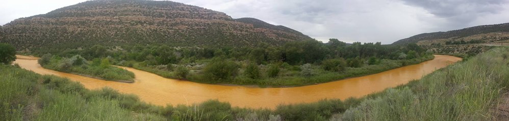
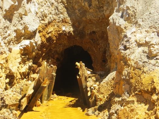

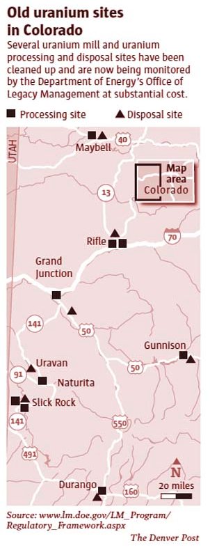
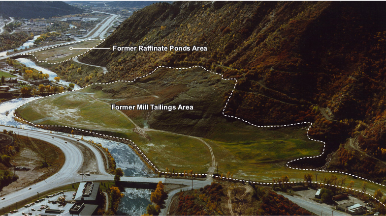


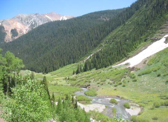
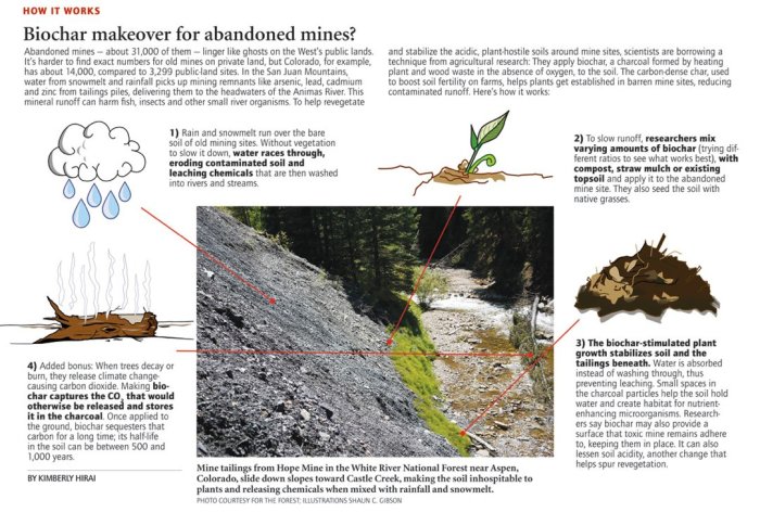

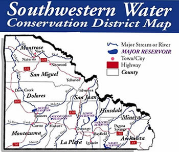


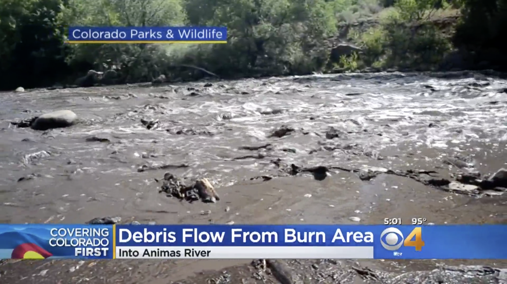


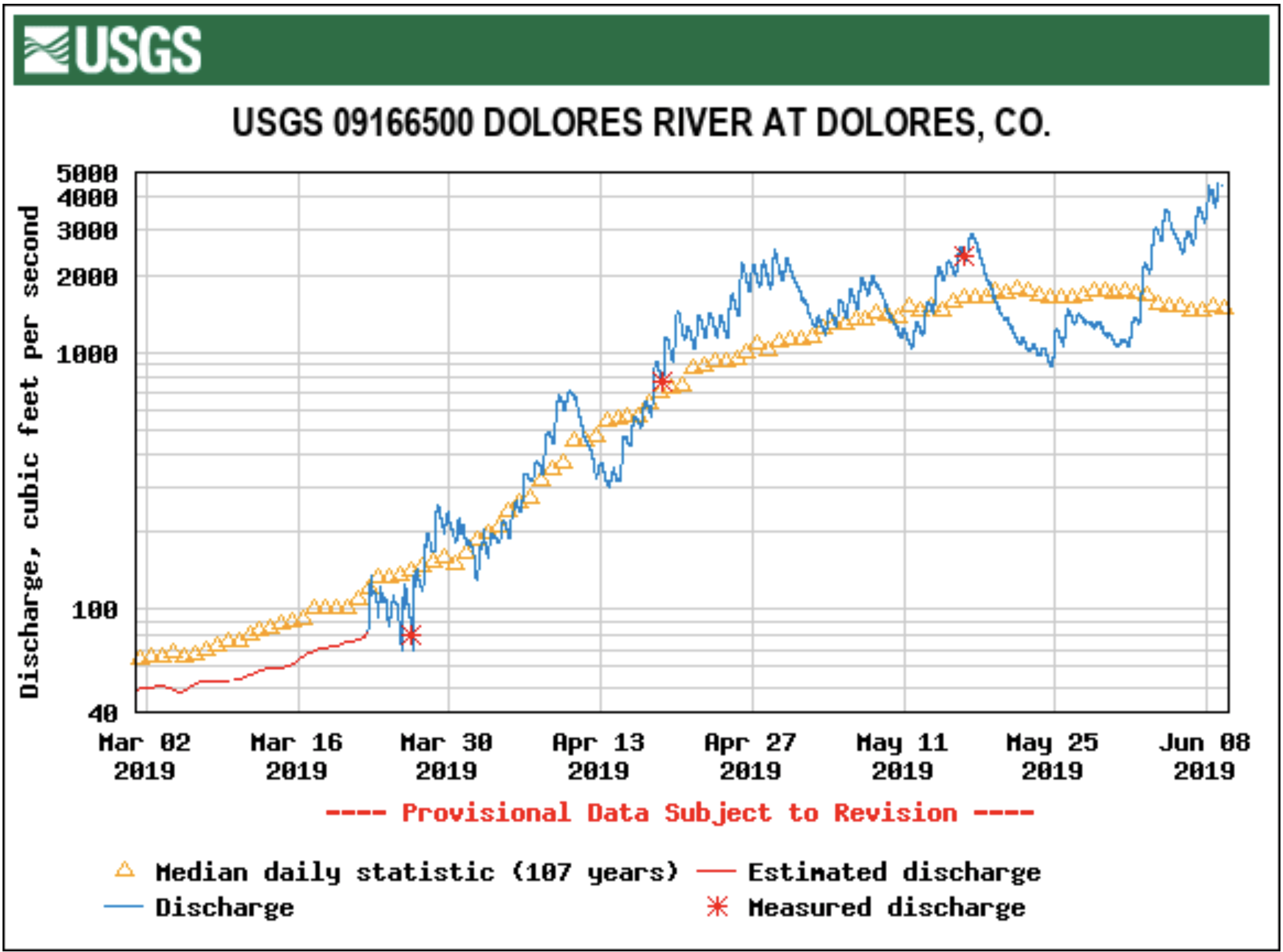
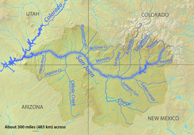
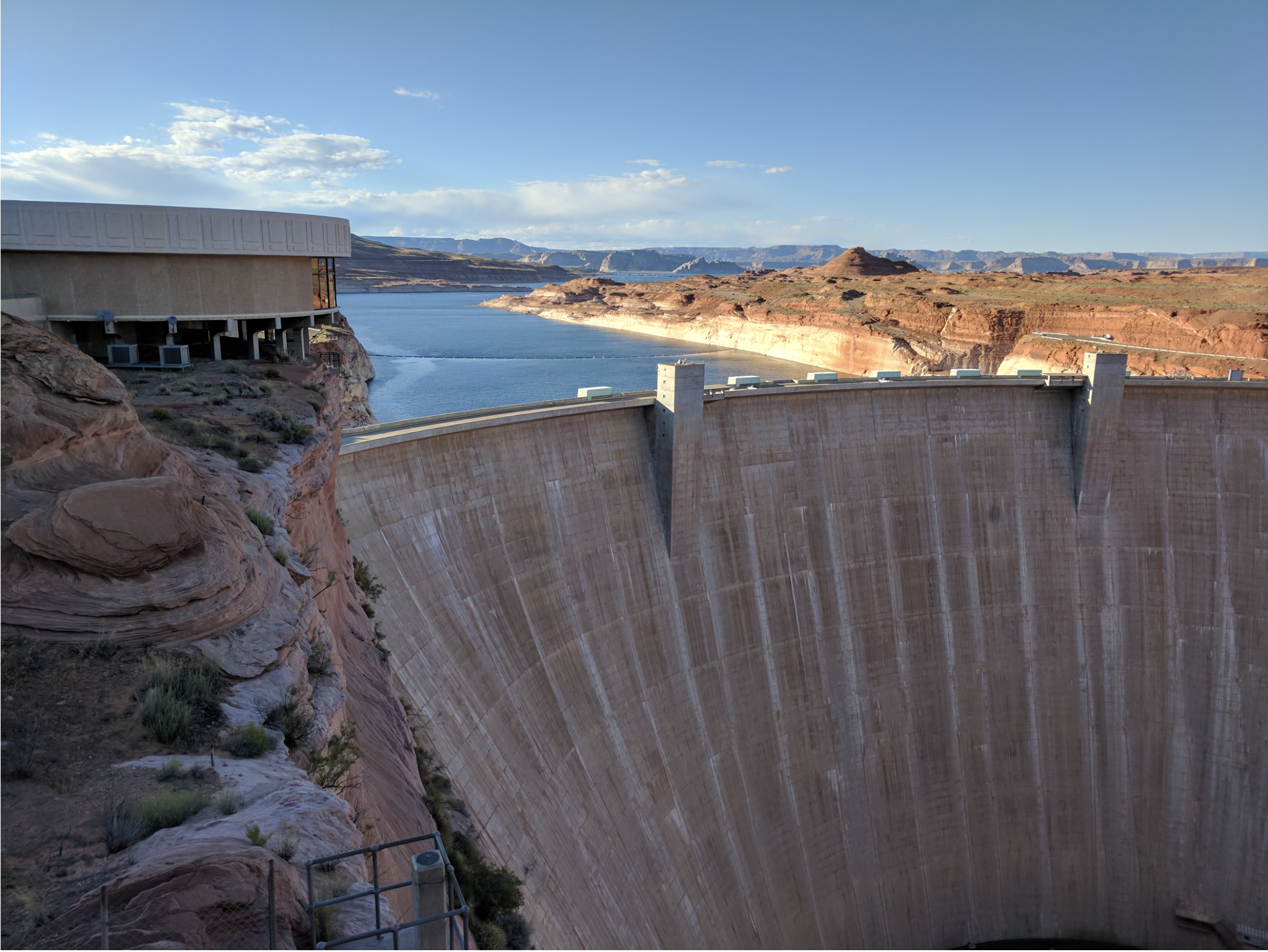
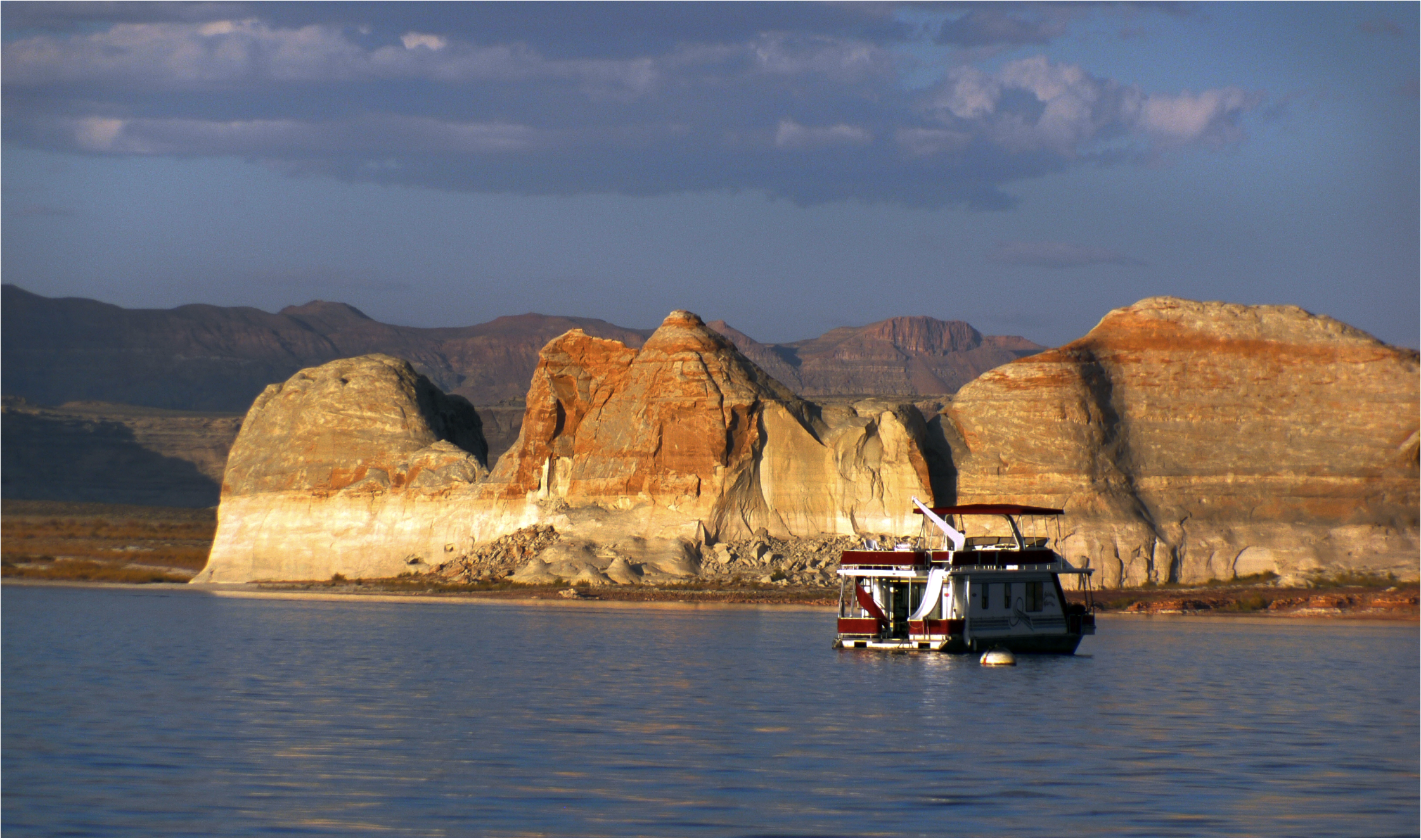
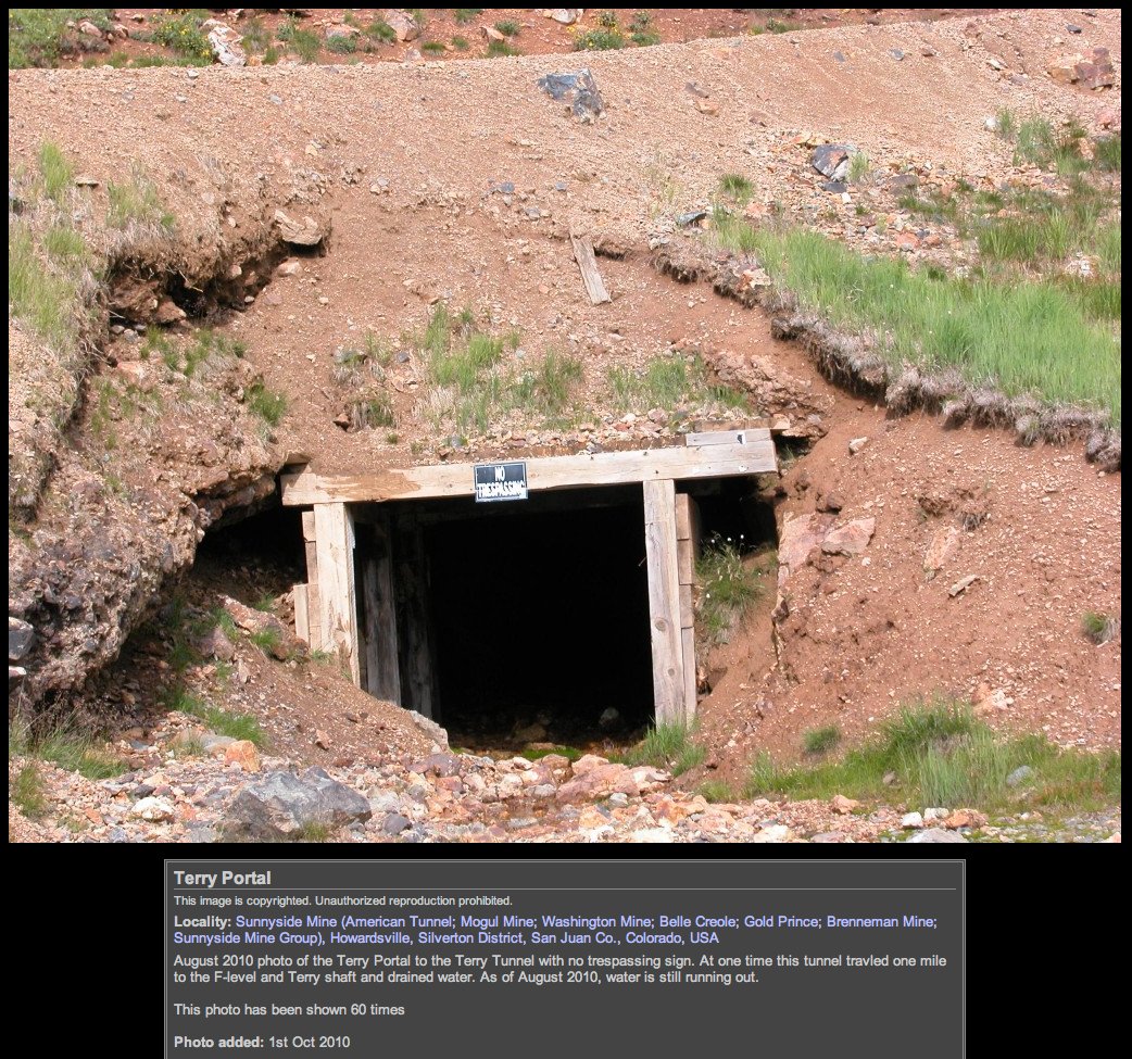
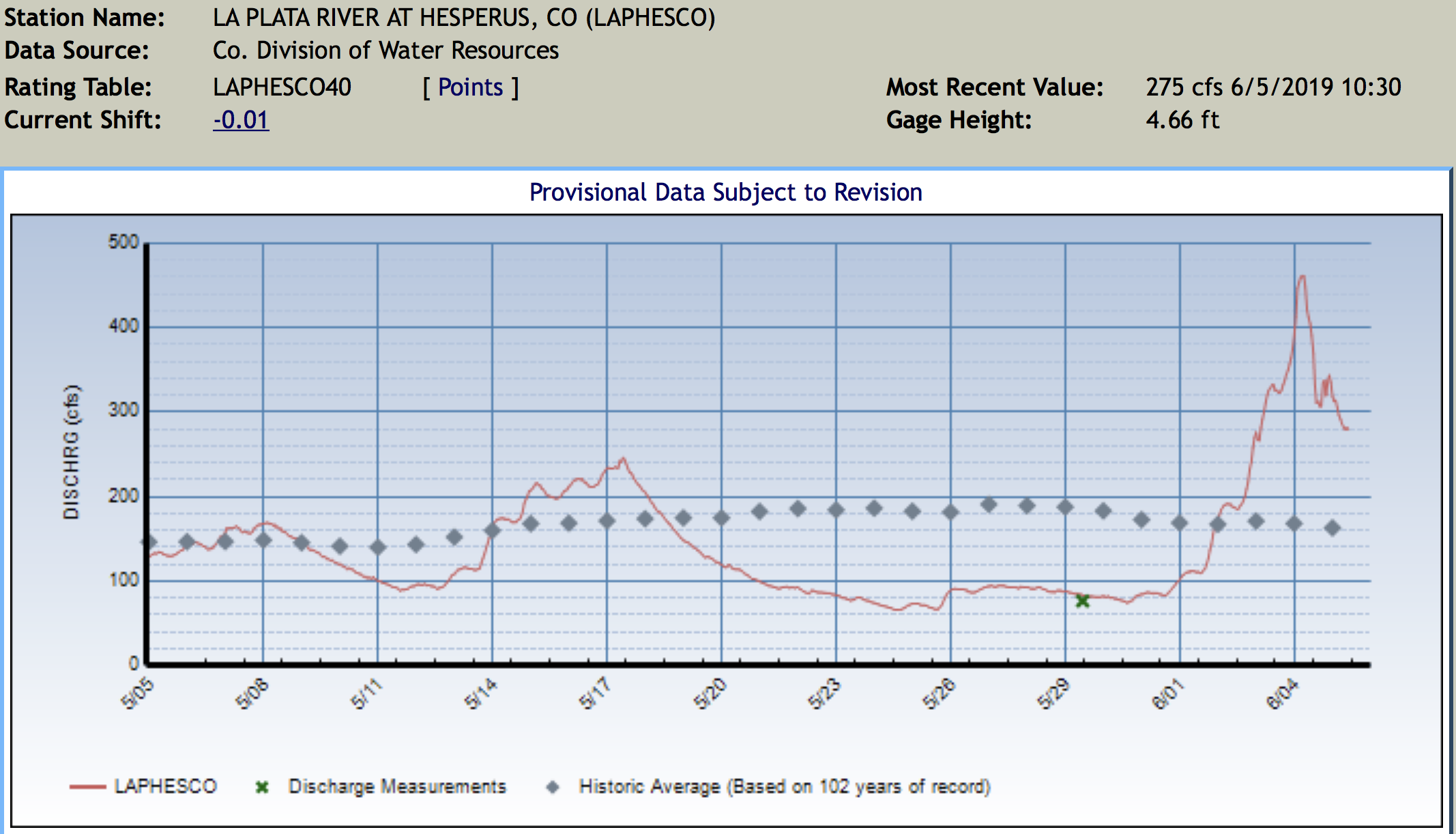

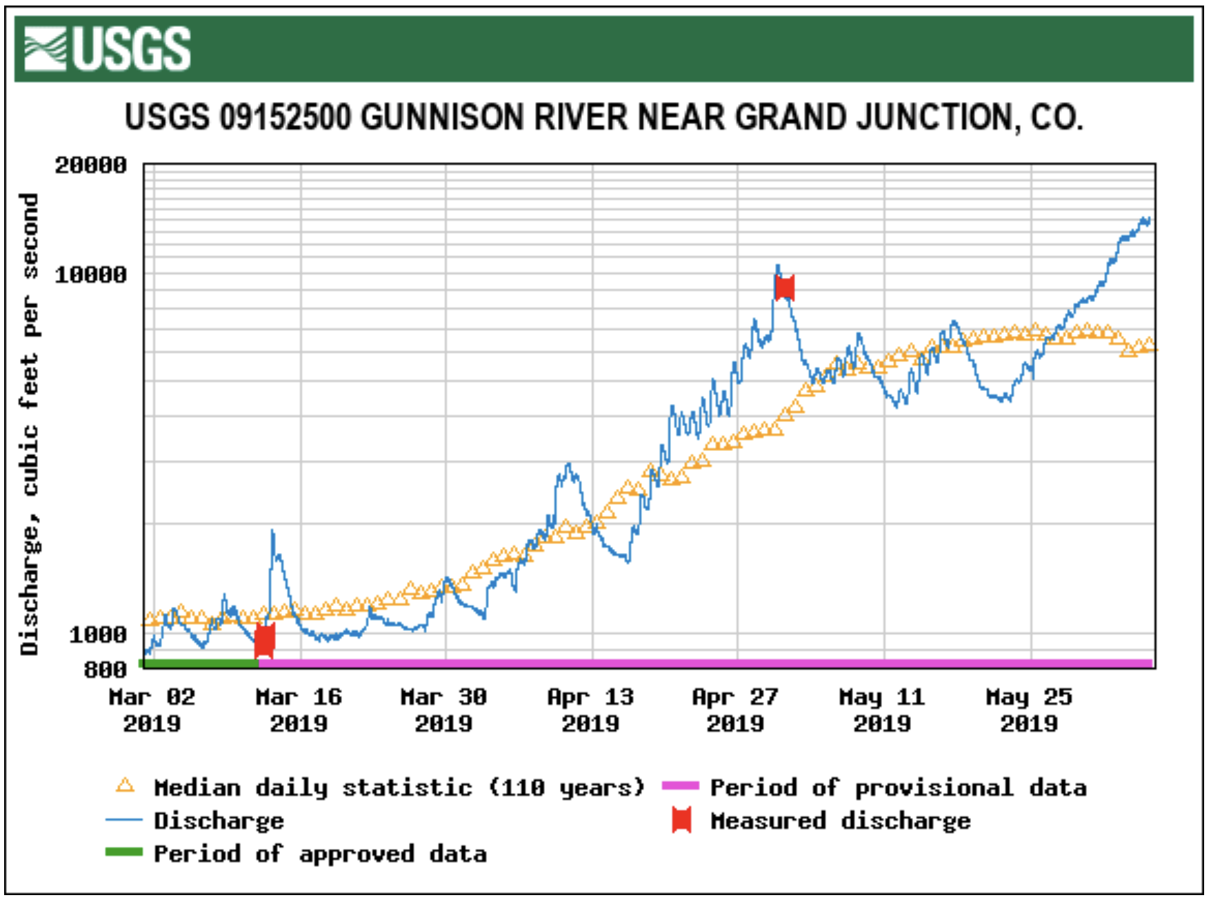

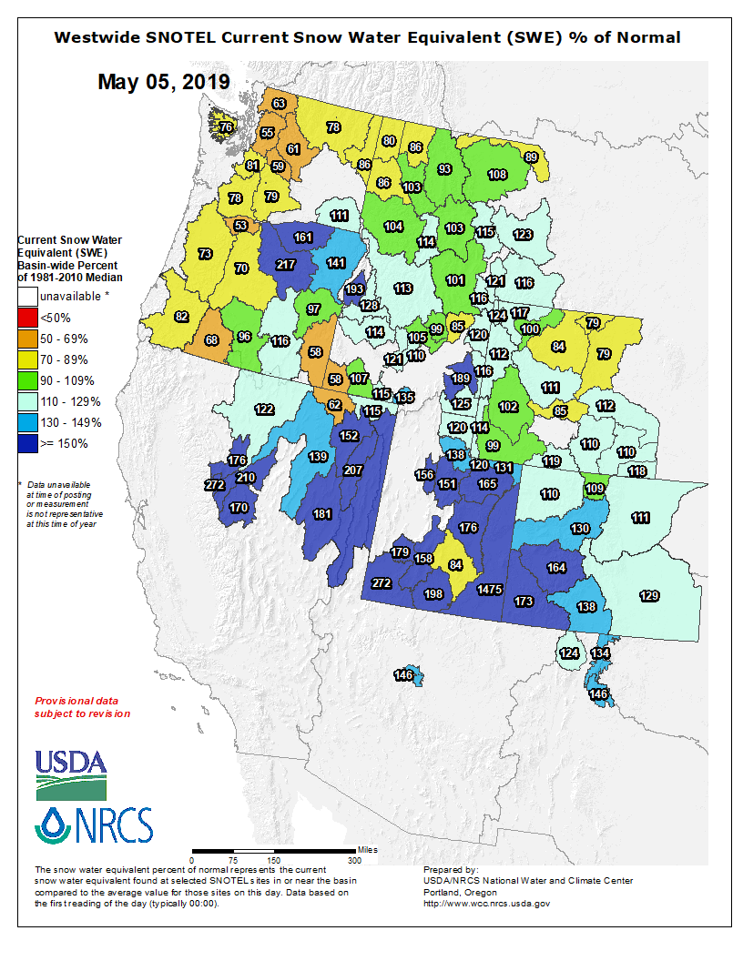
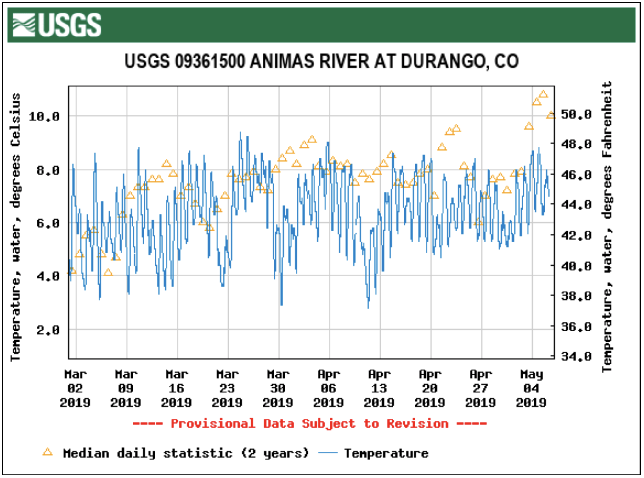

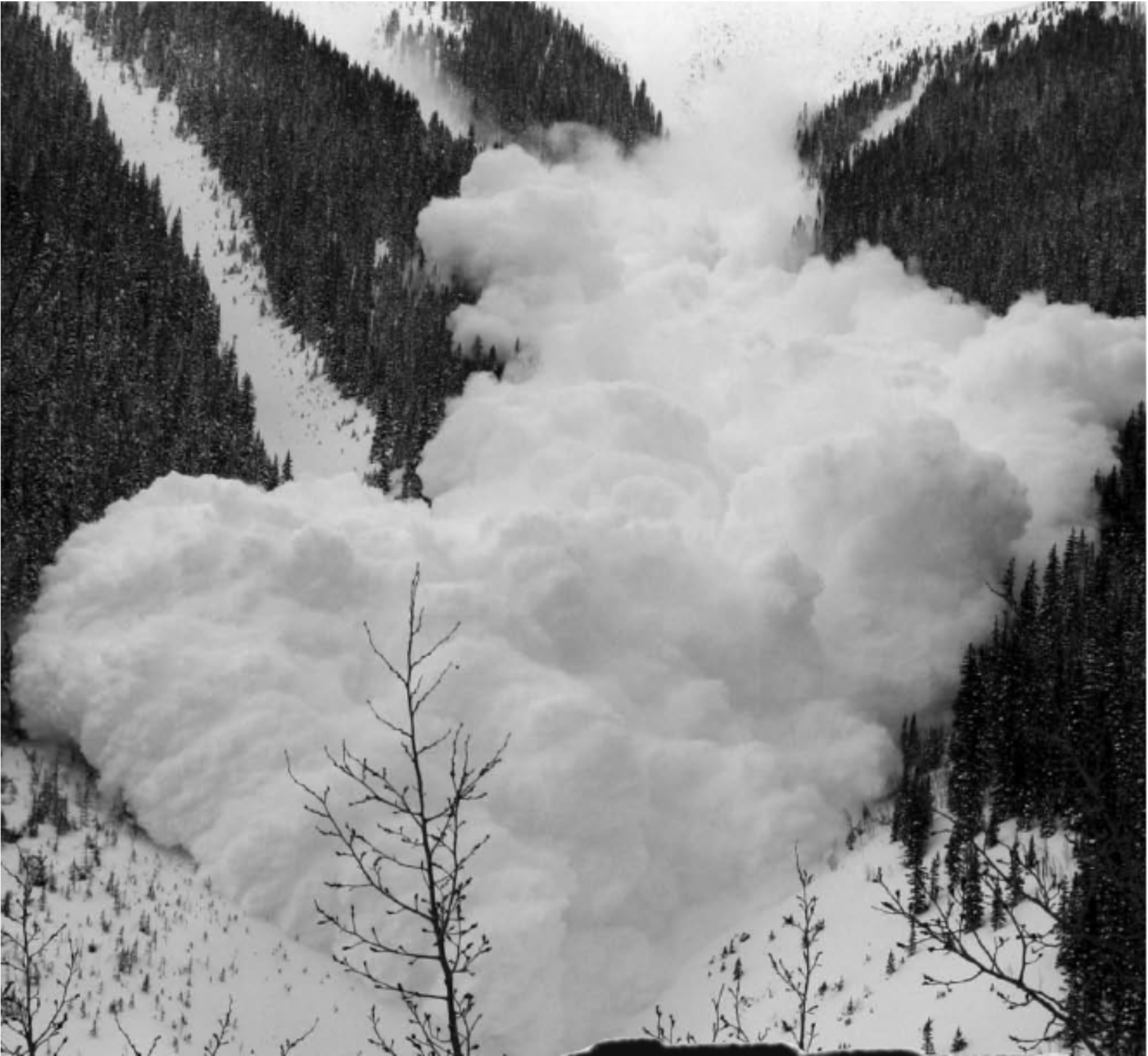
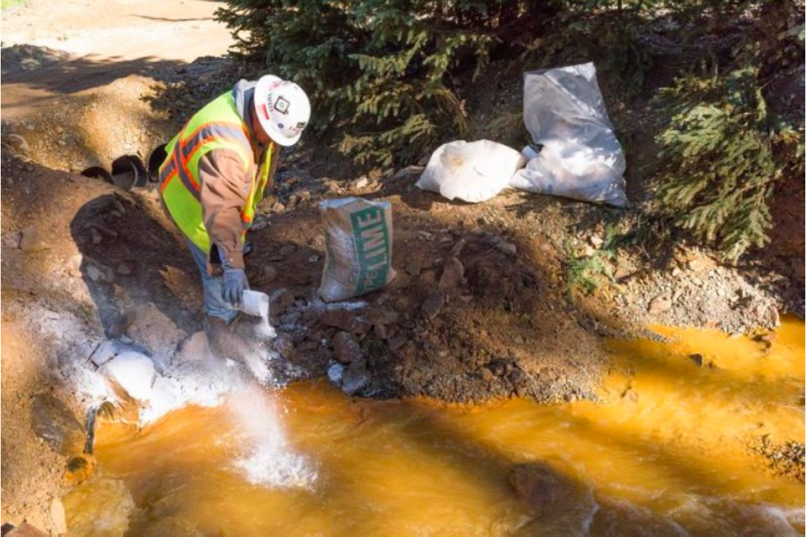
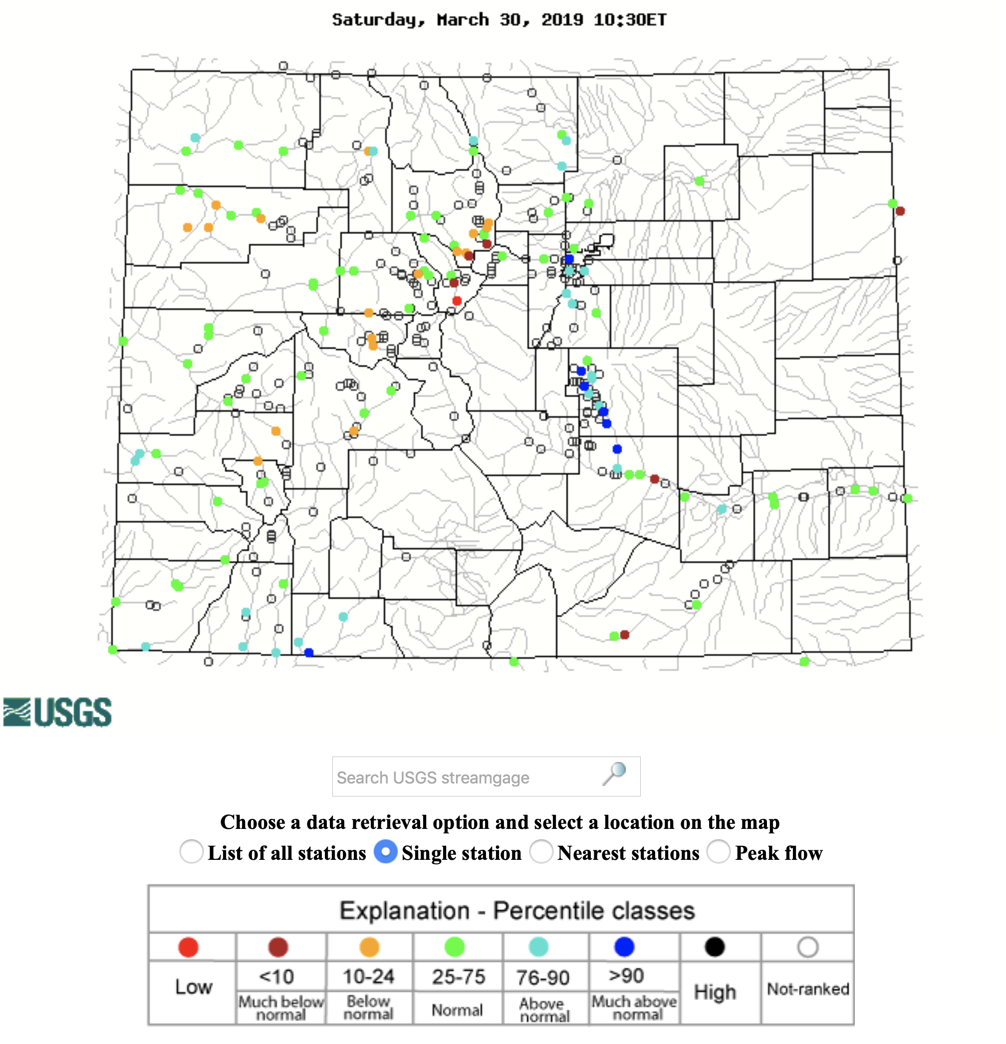


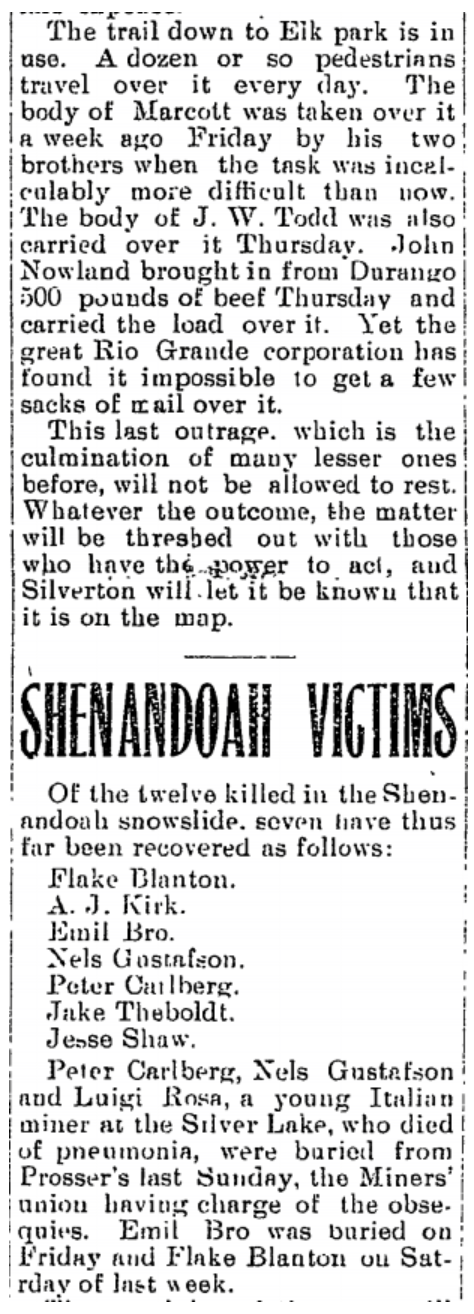



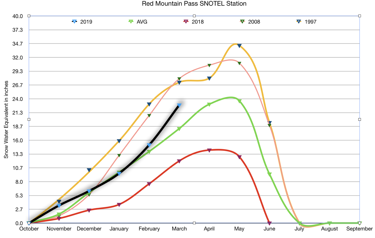
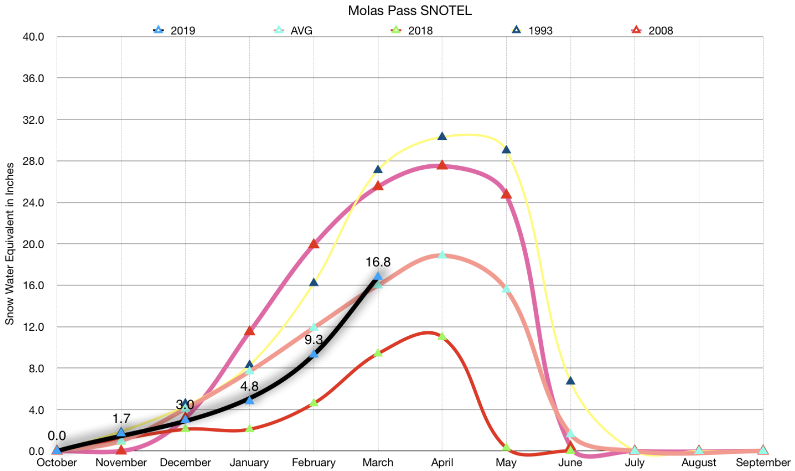
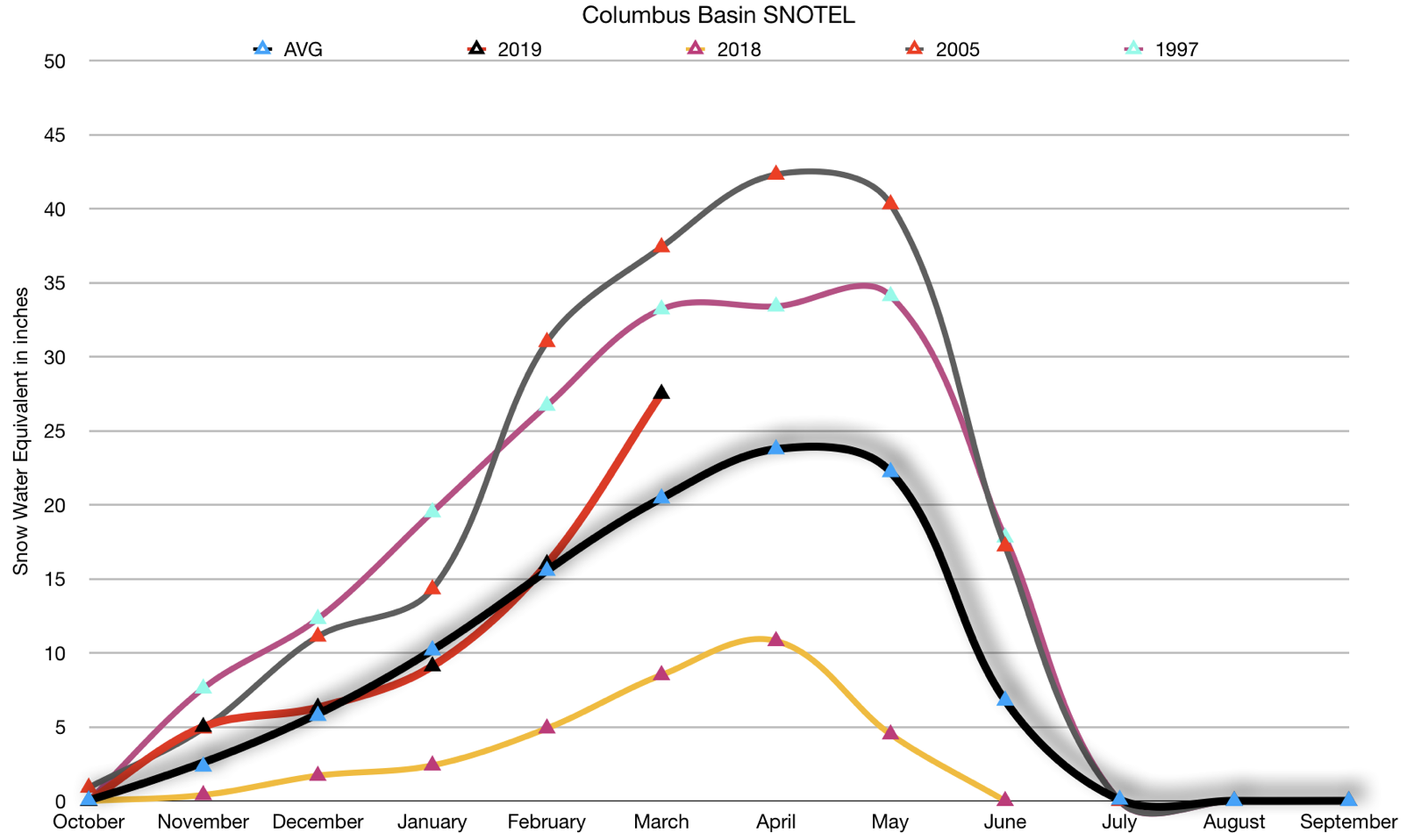


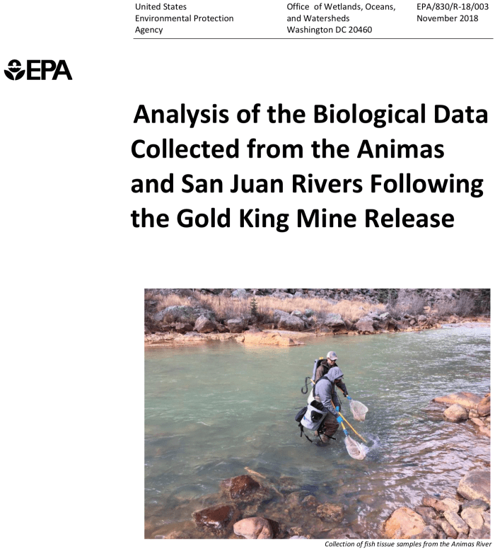




![This image was taken during the peak outflow from the Gold King Mine spill at 10:57 a.m. Aug. 5, 2015. The waste-rock dump can be seen eroding on the right. Federal investigators placed blame for the blowout squarely on engineering errors made by the Environmental Protection Agency’s-contracted company in a 132-page report released Thursday [October 22, 2015]](https://i0.wp.com/coyotegulch.blog/wp-content/uploads/2015/10/goldkingminespill1057am08052015viaepa.png?w=286&h=161&ssl=1 "goldkingminespill1057am08052015viaepa")