Click on a thumbnail graphic to view a gallery of drought data from the US Drought Monitor:


Click here to go to the US Drought Monitor website. Here’s an excerpt:
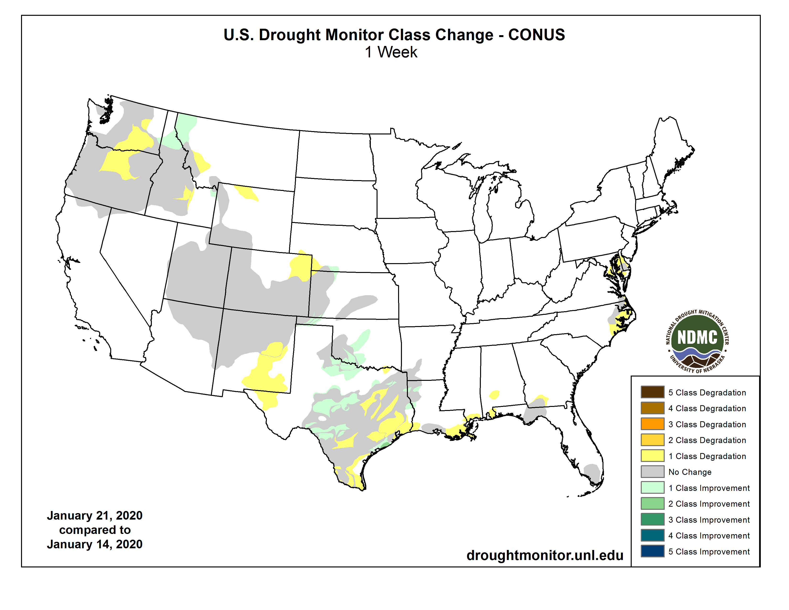
This Week’s Drought Summary
Pacific weather systems migrated across the contiguous U.S. (CONUS) in a fairly westerly jet stream flow during this U.S. Drought Monitor (USDM) week. East of the Rockies, they tapped Gulf of Mexico moisture and dropped above-normal precipitation in a storm track that stretched from Texas to the Great Lakes. The jet stream flow amplified as the week progressed, producing a strong trough over the eastern CONUS with a ridge migrating across the West into the central CONUS. Cold arctic air was directed by the trough into the East behind surface frontal low pressure systems. The Pacific fronts dropped precipitation along the coastal ranges, but the air masses quickly dried out as they crossed the interior West, resulting in below-normal precipitation from the High Plains west to the coastal ranges. The Gulf of Mexico and Atlantic coasts were mostly drier than normal. Weekly temperatures were warmer than normal from Texas to the Mid-Atlantic, and colder than normal along the West Coast and northern to central Plains. Drought and abnormal dryness expanded across parts of the West, southern Plains and Gulf Coast, and Mid-Atlantic coast, but contracted in parts of the northern Rockies and southern to central Plains, as well as Hawaii and the Alaska panhandle…
Half an inch or more of precipitation fell across parts of the eastern Dakotas and eastern Kansas, with less than half an inch westward. Very little to no precipitation occurred across large parts of the western High Plains from Colorado to the Dakotas. D0 was trimmed in parts of southern Nebraska and adjacent Kansas. But D0 expanded in northeast Colorado into adjacent Nebraska, and a spot of D0 was added in north central Wyoming. Dry conditions were evident in northeast Colorado in many indices, especially SPI, SPEI, soil moisture, and groundwater indicators, and most notably at the 4-month time scale. Temperatures have been warmer than normal in this area, December was drier than normal, and very little precipitation has fallen in January. An area to watch is southeast Colorado, where reports note that winter wheat is suffering and soils are very dry, and evaporative demand (as measured by the EDDI [Evaporative Drought Demand Index]) is high, indicating the occurrence of warm temperatures, low humidity, and higher winds…
The Pacific weather systems have brought precipitation to coastal Oregon, Washington, and northern California this week, with 2 to locally over 5 inches measured in favored upslope areas. But this is the wet season and precipitation normals are high, so only a few parts of southwest Oregon, northwest California, and northwest Washington were wetter than normal for the week. The rain soaks the coastal soils and makes it wet in the short term, but the bigger hydrological picture is dry. Precipitation in the Pacific Northwest is below to much below normal for the water year to date (beginning October 1, 2019), and mountain snowpack is below normal in many areas. The Pacific fronts move quickly across the region, drying out as they cross the coastal ranges and leaving below-normal precipitation in interior Washington and Oregon. Streams are near to above normal along the coast, but below normal east of the coastal ranges. Other indicators reveal dryness east of the coastal ranges, including soil moisture, SPI, and SPEI, especially for the 1 to 9 month time scales. As a result, the 3 D1 areas in interior Washington and Oregon were joined, and D0 expanded in northeast Washington. D0-D1 expanded in southeast Idaho and D0 expanded in southwest Montana, where 3-month precipitation deficits were notable. But above-normal precipitation over the last 30 days prompted contraction of D0 in the Idaho panhandle and adjacent Montana, and in parts of eastern Idaho. The impacts indicator in the Pacific Northwest was changed from S to SL to indicate both short-term and long-term precipitation deficits…
Bands of 2+ inch precipitation occurred across parts of Texas into central Oklahoma, and from eastern Texas into Mississippi, with some reports exceeding 5 inches. Half an inch or more of precipitation surrounded these areas across the region. But some areas had less than half an inch, including parts of western, southern, and east-central Texas, western Oklahoma, southeast Louisiana, and parts of Arkansas. For the dry areas, this week’s subnormal precipitation added to deficits stretching back 6 months or more. For the areas that were wet this week, the precipitation helped with short-term deficits, but longer-term deficits remained and were especially still severe at the 6-month time frame. The D2 in southwest Oklahoma was eliminated and its surrounding D0-D1 contracted. D0-D3 was contracted in the wet areas of Texas, but D0-D2 expanded in the dry areas. D0-D1 contracted in northwest Louisiana into adjacent Texas. Three-month precipitation deficits prompted expansion of D0 along the Louisiana coast into southern Mississippi…
Looking Ahead
Pacific weather systems will continue to cross the CONUS in a westerly jet stream flow. For January 23-28, 3 or more inches of precipitation is forecast for the northern California to Washington coast and coastal ranges, with an inch or more across parts of the Rockies, especially the northern Rockies. An inch or more of precipitation will be widespread from central Texas to the Tennessee Valley, across parts of the central Plains to Midwest, and from northeast Georgia to New England. Half an inch or less of precipitation is predicted for the rest of the West to central and northern Plains, and parts of Florida and the Great Lakes. Temperatures are forecast to be warmer than normal for much of the CONUS. For January 29-February 1, odds favor above-normal precipitation across eastern Alaska and the panhandle as well as most of the CONUS. Below-normal precipitation is expected for western Alaska, parts of the southwestern CONUS, and northern portions of the Great Lakes and New England. Odds favor a continuation of warmer-than-normal temperatures across most of the CONUS and the Alaska panhandle, with below-normal temperatures in the Four Corners area and across most of Alaska.