
Click here to read the current assessment. Click here to go to the NIDIS website hosted by the Colorado Climate Center. Here’s the summary:
Summary: May 19, 2020
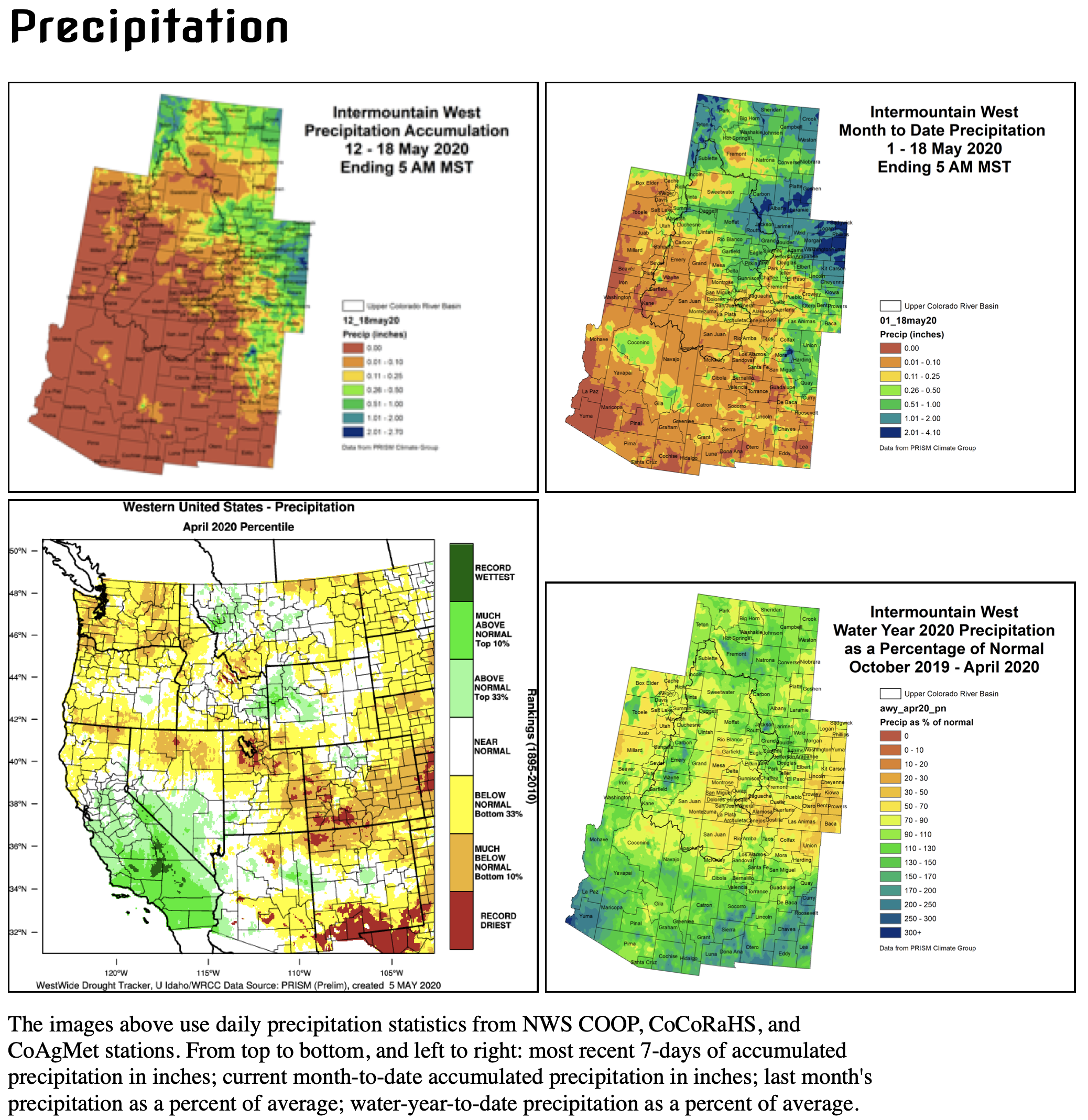
The majority of the Intermountain West (IMW) was dry for the week, with warmer than average conditions across much of the region. A couple of widespread thunderstorms did occur across the esatern plains of Colorado. For some areas, the benefit was limited and the moisture quickly dried out.
In the Upper Colorado River Basin, snowpack is melting quickly. In the southern portions, most of the snowpack is gone, and it’s possible that streams and rivers have already seen their seasonal peak flow. Northern high elevations are still holding onto some snow. For lower elevations, hot, dry, and windy conditions are dominant and fire danger has been high this week.
Extremely dry conditions are evident in precipitation deficits, high temperatures, high evaporative demand, vegetation stress, and dry soil moisture. The outlook shows that more relief may come for the eastern plains, but more warm and dry conditions are expected over the UCRB. Reservoirs are showing modest increases in levels right now, but for the southern reservoirs, it’s expected they will receive much less than average.