Click on a thumbnail graphic below to view a gallery of drought data from the US Drought Monitor.
This Week’s Drought Summary
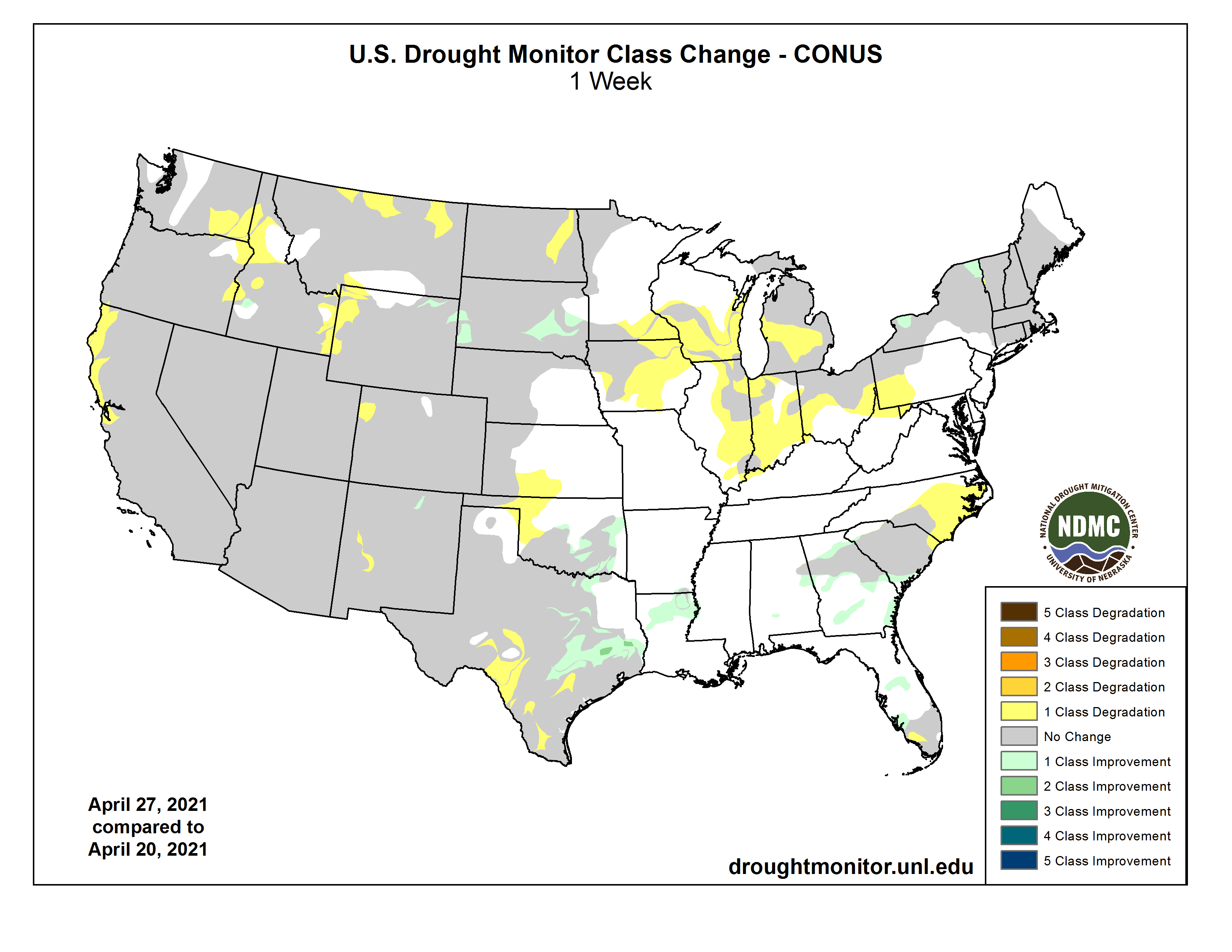
Several upper-level troughs and closed lows moved in the westerly jet stream flow across the contiguous U.S. (CONUS) during this U.S. Drought Monitor (USDM) week. They dragged surface fronts and low pressure systems along with them. The weather systems moved across the West then generally followed two storm tracks after crossing the Rockies – one track was along the Canadian border, while the other track was along the Gulf Coast states. As a result, above-normal precipitation fell across parts of the West, much of the Gulf Coast from eastern Texas and Oklahoma to Georgia, parts of the Mid-Mississippi Valley, and parts of the northern Great Lakes and Maine. Precipitation amounts were generally 0.5-2.0 inches in the West where precipitation fell, but exceeded 2 inches across a large part of the Gulf Coast states. The rest of the CONUS had below-normal precipitation for the week. A swath from New Mexico to Lower Michigan, and parts of the northern Plains and Far West, had little to no precipitation. With upper-level troughs and surface cold fronts dominating the circulation pattern, weekly temperatures averaged below normal across most of the CONUS. Drought or abnormal dryness contracted in parts of the southern Plains to Southeast, where heavy rains fell, and in parts of the northern Plains and Northeast, where overall conditions warranted improvement. But drought or abnormal dryness expanded or intensified across parts of the West, Midwest, other parts of the Plains, and the Carolinas, as well as much of Hawaii and Puerto Rico. In these areas, precipitation deficits grew and soils continued to dry. These changing conditions were reflected in several drought indices and indicators, including the Standardized Precipitation Index (SPI), streamflow and groundwater levels, soil moisture measurements on the ground and from satellite as well as soil moisture models, vegetation-based indices such as VegDRI, and mountain snow water content (SWE) in the West…
High Plains
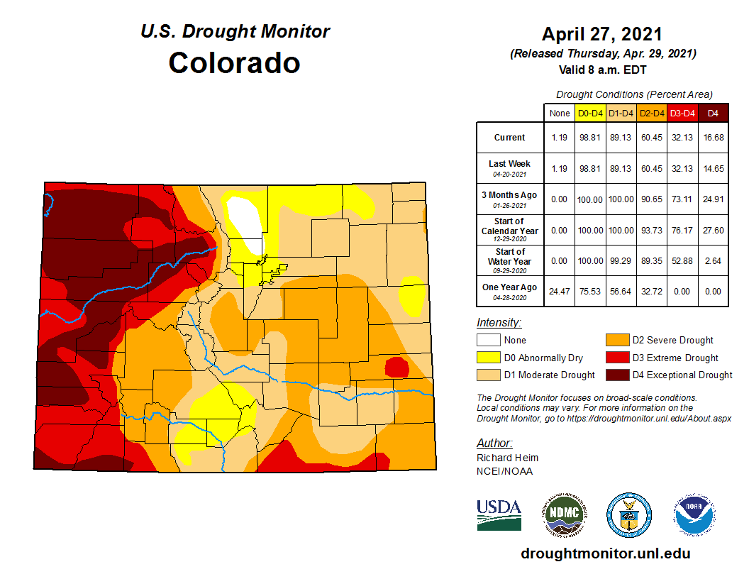
There were patches of 0.5-1.0 inch of precipitation in southeast Kansas, the Dakotas, Wyoming, Colorado, and the western half of Montana this week. But most of the region was dry, with less than 0.25 inch of precipitation falling. With improving conditions in the short-term (last 1-6 months), D0-D2 were pulled back in parts of South Dakota and northeastern Wyoming. But D4 expanded in northwest Colorado, and D3 expanded in eastern North Dakota where this week was dry and 6-9-month SPI are D3-D4, deeper soils are bone dry, streams are low, and stock ponds are dry or almost empty. D1-D3 expanded in northern Montana, D0-D2 expanded in western Wyoming, and D0 expanded in southwest Kansas. In the Montana Highline, reports were received from Blaine and Hill Counties of low soil moisture and stockwater ponds failing to fill. Three dozen reports were received from North Dakota, through the Condition Monitoring Observer system, of drying ponds and creeks, hay and feed shortages, and fire risk. USDA statistics rate more than half of the topsoil short or very short of moisture in Colorado (57%), Montana (57%), and Wyoming (55%), and nearly two-thirds or more so rated in South Dakota (62%) and North Dakota (80%); 32% of the winter wheat crop in Colorado was rated in poor to very poor condition. Several Colorado communities were asked to voluntarily conserve water…
West
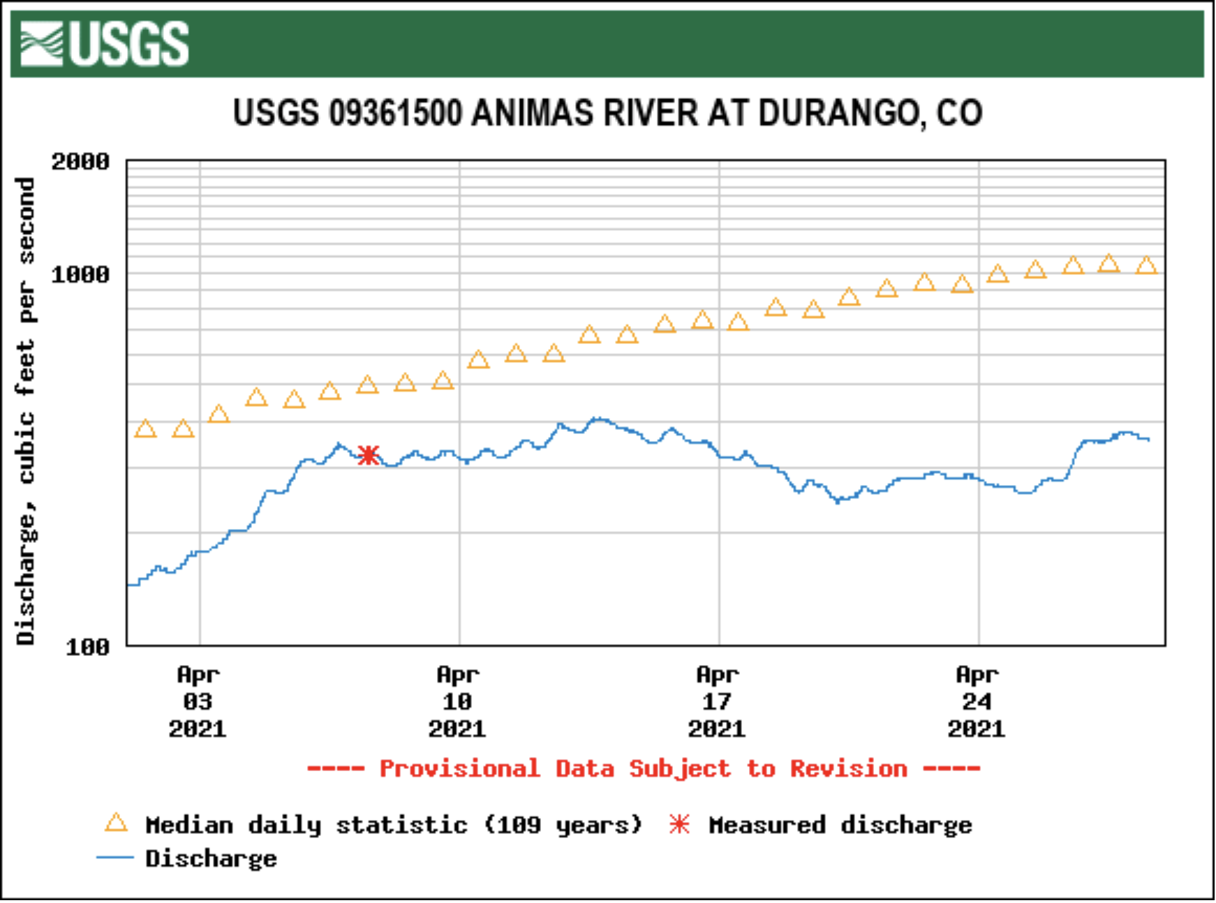
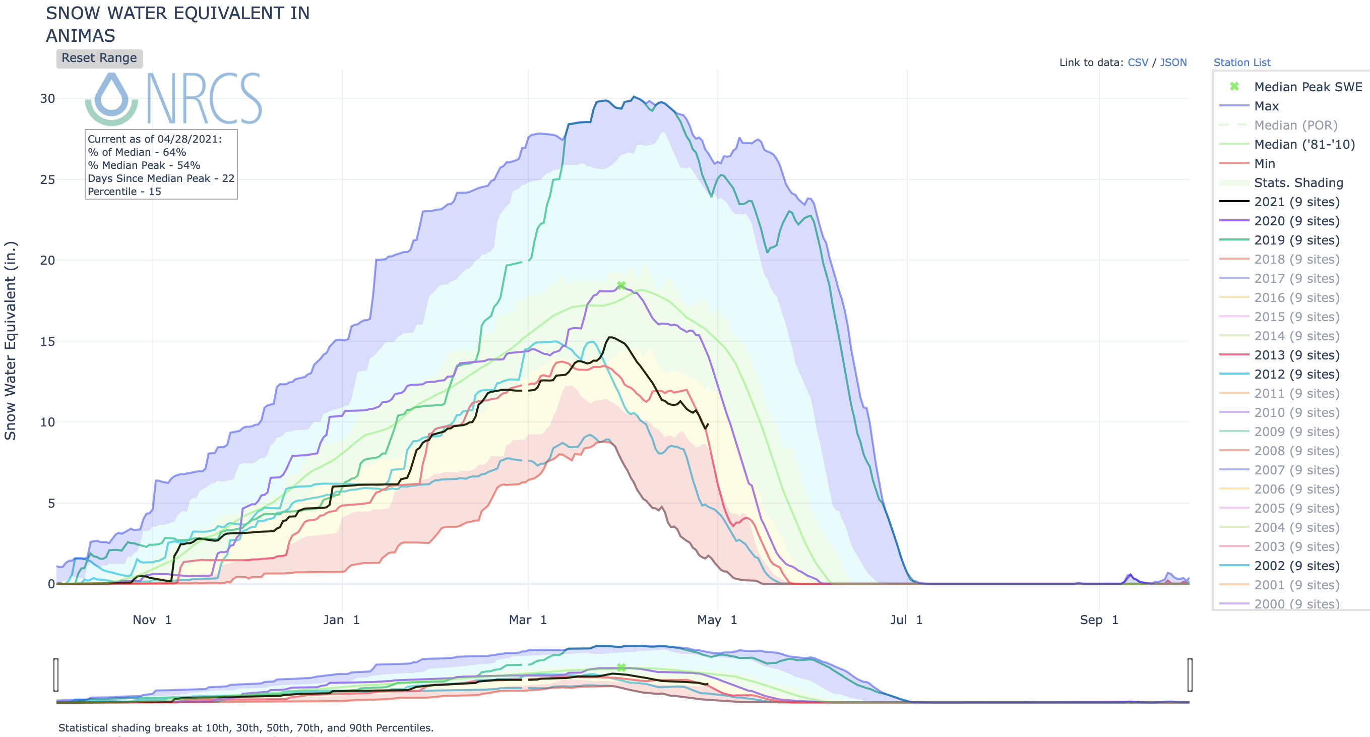
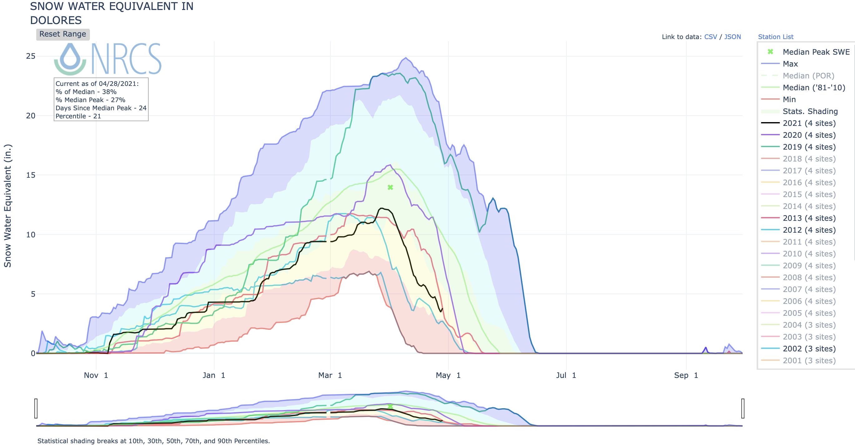
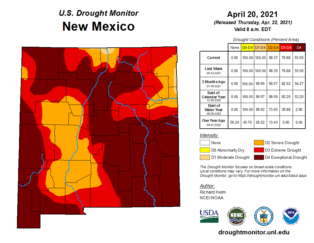
Precipitation amounts from the Pacific weather systems that moved across the West this week were patchy and not enough to erase months of deficits. Half an inch to locally 2 inches fell across coastal areas and coastal ranges of Oregon, Washington, and northern California; in the Sierra Nevada; northern and central Rockies; and Great Basin ranges. Rainshadow areas and valleys, and much of the Southwest, received little to no precipitation. There were minor contractions of D4 in New Mexico and D0 in Idaho, but worsening dry conditions prompted expansion of drought and abnormal dryness in several western states. D1-D3 expanded along the northern California coast, D0-D2 expanded in the Pacific Northwest, and D3 expanded in western New Mexico. In California, the Marin Municipal Water District board unanimously approved mandatory restrictions for its 195,000 customers in south and central Marin County which would take effect on May 1. The goal was to curb overall district-wide water use by 40%. The potential for water shortages in Marin County was so high that the Marin Municipal Water District was talking with East Bay officials about building a pipeline across the Richmond-San Rafael Bridge to bring water into the county if the upcoming winter is similarly dry as the past two. Such a measure was used during the 1976-77 drought. Record low reservoir levels contributed to California Governor Gavin Newsom proclaiming a regional drought emergency for the Russian River watershed in Sonoma and Mendocino counties. A super bloom of lupine covered parts of the Folsom Lake lakebed in the Beeks Bight nature area in Granite Bay as historically low rainfall left the lake unusually low. Folsom Lake is at 37% of capacity and 50% of the historical average for April 27, according to the California Department of Water Resources Data Exchange Center. Shallow wells were going dry in the San Joaquin Valley, while Tulare County ranchers were culling cattle for sale months earlier than usual and were considering idling row crops to leave water for higher-value permanent crops like nut trees. The prolonged drought is causing significant die-offs of juniper trees in large areas of central and northern Arizona, according to Forest Service officials. Between 50,000 acres and 100,000 acres of junipers were affected in areas of the Prescott and Kaibab national forests between Paulden and Ash Fork and north of Williams. The cause of death appeared to be water stress, although some insects were observed. Die-offs ranged from 5% to 30% of the tree population, with some pockets of dead junipers up to 15 acres. USDA statistics showed increases in the percentage topsoil moisture short or very short – up to 89% in New Mexico, 70% in California, 69% in Oregon, 61% in Washington, 50% in Utah, and 32% in Idaho. According to media reports, the Biden-Harris administration announced the formation of an Interagency Working Group to address worsening drought conditions in the West and support farmers, Tribes, and communities impacted by ongoing water shortages. The Working Group will be co-chaired by the Departments of the Interior and Agriculture to build upon existing resources to help coordinate across the federal government, working in partnership with state, local, and Tribal governments to address the needs of communities suffering from drought-related impacts. The Working Group will work to identify immediate financial and technical assistance for impacted irrigators and Tribes…
South
In the southern Plains, the western half of Texas and Oklahoma were dry this week, with little to no rain falling. But a half inch or more of rain was widespread across the rest of the South, with 2+ inches in streaks across eastern Oklahoma and Texas, Arkansas and Louisiana, and southern Mississippi. D0-D3 contracted in eastern Texas, D0-D2 contracted in parts of Oklahoma, D1 disappeared and D0 contracted in Louisiana. But further west, D0-D4 expanded in southern and southwest Texas and D0 expanded in western Oklahoma. Dry or very dry soils grew in area to 67% of Texas and 29% of Oklahoma, according to USDA statistics, and 43% of the winter wheat crop in Texas was in poor to very poor condition. In the Midland-Odessa, Texas, area, 2020-2021 had the driest 13-month April-April period on record, and the fourth driest any 13-month period ever (behind 2011 which had the top 3 driest 13-month periods). Falling levels of the Edwards Aquifer triggered water restrictions in several Texas communities, including San Antonio, New Braunfels, and San Marcos…
Looking Ahead
A large low pressure trough moving out of the Southwest triggered areas of rain across parts of the southern and central Plains into the Midwest, and another system spread precipitation across the Northeast, as the new USDM week began. During April 29-May 3, another Pacific system will move into the country. These weather systems are forecast to spread an inch or more of precipitation across the southern Plains, Lower to Mid-Mississippi Valley, Tennessee and Ohio Valleys, southern Great Lakes, and Northeast. Bands of heavy precipitation – 3 inches or more – are expected across Texas to Arkansas and along the Ohio River. An inch or more of precipitation is projected to fall across parts of northeast Colorado, Wyoming, and northwest Washington. Half an inch or less of precipitation should fall across the Southeast from Florida to Virginia, New Mexico to the central Plains, the rest of the Great Lakes, and central to northern Rockies. No precipitation is forecast to fall over much of the northern Plains and most of the rest of the West. Temperatures are predicted to be near to above normal for the week across the CONUS. The outlook for May 4-8 shows drier-than-normal weather is favored for much of the West to Great Plains with wetter-than-normal conditions for most of the Mississippi River to East Coast region. Warmer-than-normal weather is likely across most of the western, southern, and East Coast states, except for the Mid- to Upper-Mississippi Valley, Great Lakes, and New England. Odds favor wetter-than-normal weather for southern Alaska and cooler-than normal weather for most of the state.