Experts from different organizations presented updates specific to their work, all focusing on water rights, drought outlooks and river basin updates.
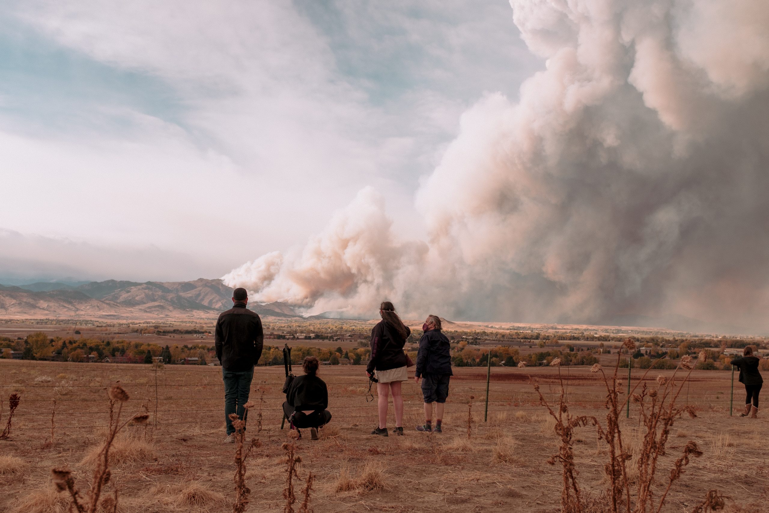
Russ Schumacher, director of the Colorado Climate Center at Colorado State University, went through the recent history of the ongoing drought in the state. He said throughout the past few months, eastern Colorado has seen decent drought improvement, but western Colorado has remained about the same.
Schumacher presented a chart showing average temperatures and precipitation from April through September, which showed that 2020 was somewhat of an outlier.
“It was the driest April through September on record and one of the few hottest on record, and that is a recipe for a drought that develops quickly,” Schumacher said…
Richard Van Gytenbeek, Colorado River Basin outreach coordinator for Trout Unlimited, provided an overview of the goals and accomplishments from phase one of the Blue River Integrated Water Management Plan. The first objective of the plan, which Van Gytenbeek said the group has spent most of its time on, is to understand potential causes for declining fish populations between the Dillon and Green Mountain reservoirs and how the decline can be mitigated…
The second objective is what Van Gytenbeek called a “literature search,” which aims to compile information regarding physical and biological aspects of the Blue River Basin’s water resources. This would then formulate objectives and goals for future phases of the plan.
Van Gytenbeek said the phase one report is currently being finalized, and they intend to submit it to an advisory committee in the middle of June. He said he expects the report to be made public in July or early August.
Once the report is completed the second phase of the project will continue, with hopes of having the final phase two report ready for the public by March 2022. Van Gytenbeek said he thinks integrated water management plan organizations like the Blue River Watershed Group should get some support to keep the dialogue going past the life of phase two of the project.
Dave Kanzer, deputy chief engineer at the Colorado River District, talked about supply issues within the Colorado River Compact…
Nathan Elder and Jason Finehout of Denver Water said there is a low likelihood of filling the Dillon Reservoir this year, predicting an inflow of about 50-60% of normal. Finehout went on to explain that many of Denver Water’s annual summer watering rules are the same as many jurisdictions’ stage one drought restrictions…
Swan River restoration Reach A gravel removal. Photo credit: Summit County
Brian Lorch, trails director of Summit County Open Space and Trails, provided an update on the Swan River Restoration Project, which aims to naturalize more than two miles of the Swan River Valley impacted by historical dredge mining.
Lorch said this summer, Reach B of the project will start to take shape, as contractors will create about another mile of stream channel.
New research shows forests not bouncing back from fires as quickly, which could lead to erosion and strains on drinking water
The U.S. Forest Service and Boulder County have begun a $6.5 million emergency push to try to stabilize slopes here before hard summer rain. It’s an immediate fix for what research indicates could be a long-term problem…
In Washington, D.C., Democratic Sen. Michael Bennet and Rep. Joe Neguse are pushing legislation to deploy tens of thousands of workers to thin western forests before fires break out — a technique Boulder County land managers have used repeatedly over the last decade. Federal land managers, meanwhile, said they’re evaluating whether to replant and how much in an effort to promote at least partial recovery from a wildfire…
Focus on forest health
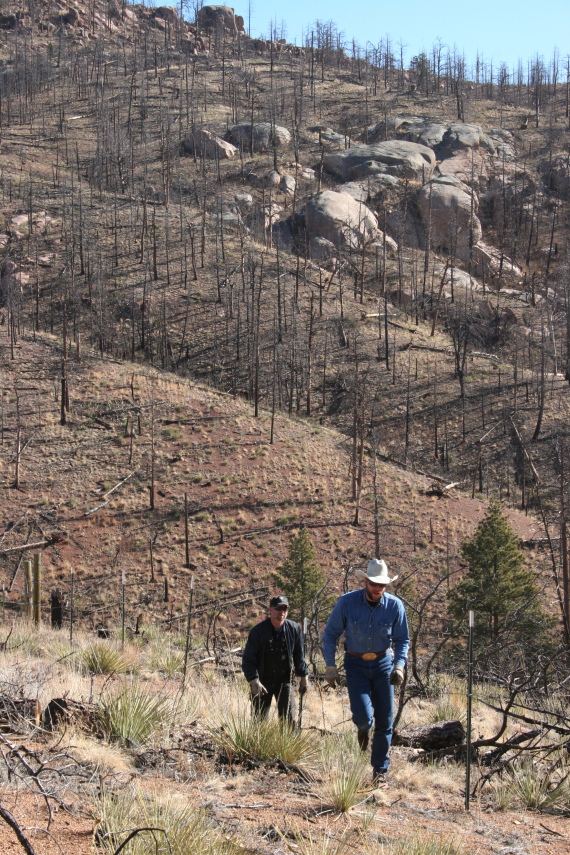
Wildfires played key roles in forming forests over thousands of years, bringing balance and diversity. But natural cycles were distorted by decades of humans aggressively suppressing fire, which is still a priority in Colorado and other western states. The resulting tree density, along with high temperatures and aridity, led to last year’s record-breaking megafires in California and Colorado.
“In many recently burned areas, trees aren’t reestablishing. We’re seeing this especially in wildfires that burned in Ponderosa pine forests,” said Tony Cheng, director of the Colorado Forest Restoration Institute and professor of forest and rangeland stewardship at Colorado State University.
Cheng recently testified in Congress, warning that forest fires are releasing more carbon into the atmosphere, that forest recovery may take centuries — if it happens at all — and that the United States’ capacity to sequester carbon is diminishing.
“If recent research is providing insight into the future, the prospects are low for forests to return to what people were used to seeing,” Cheng told The Denver Post. “Forest cover could be sparser, trees would be replaced with shrubs and other plants, the wildlife might be different, and the water-holding and filtering capacity of forests would be altered for a long time.”
A University of Colorado study published in February tracks with his assessment and blames climate warming. A 2017 study using data from 1,485 burn sites found increasingly unfavorable conditions for forests to regenerate throughout the Rocky Mountain West.
Slopes above Cheesman Reservoir after the Hayman fire photo credit Denver Water.
And northwest of Colorado Springs, the 70-square-mile core of the 214-square-mile scar from the 2002 Hayman fire shows how severe burning can reduce a towering 200-year-old Ponderosa and Douglas fir forest to grasses and shrubs two decades later.
Fighting to ‘keep the soil on the slopes’
Up on the blackened mountainsides between standing dead pines, orange-vested contractors recently were scoping sites to install 30 small dams and a pond to try to keep soil, crucial for new growth, from eroding.
Ground crews sawed into the pines, leaving roots in place. Amid a staccato thudding, red helicopters crisscrossed overhead, hoisting cut trunks using dangling hooks and hauling them into massive piles. A tractor-sized grinder turned the trunks to tons of mulch, which helicopters hauled in nets and dropped over severely scorched slopes six inches thick.
This emergency effort must stabilize the burned terrain as quickly as possible, Glowacki said, adding, “Our role in this is to keep the soil on the slopes.”
But by May 21, only 200 acres out of 1,800 acres prioritized in the project had been covered. The grinder had broken.
If scorched slopes remain barren, hard rain likely will cause flooding, possible slides and wash sediment into Geer and Plumley creeks, which flow into Lefthand Creek, the drinking water source for communities north of Boulder.