Click here to read the report (Natalie K. Day). Here’s the abstract:
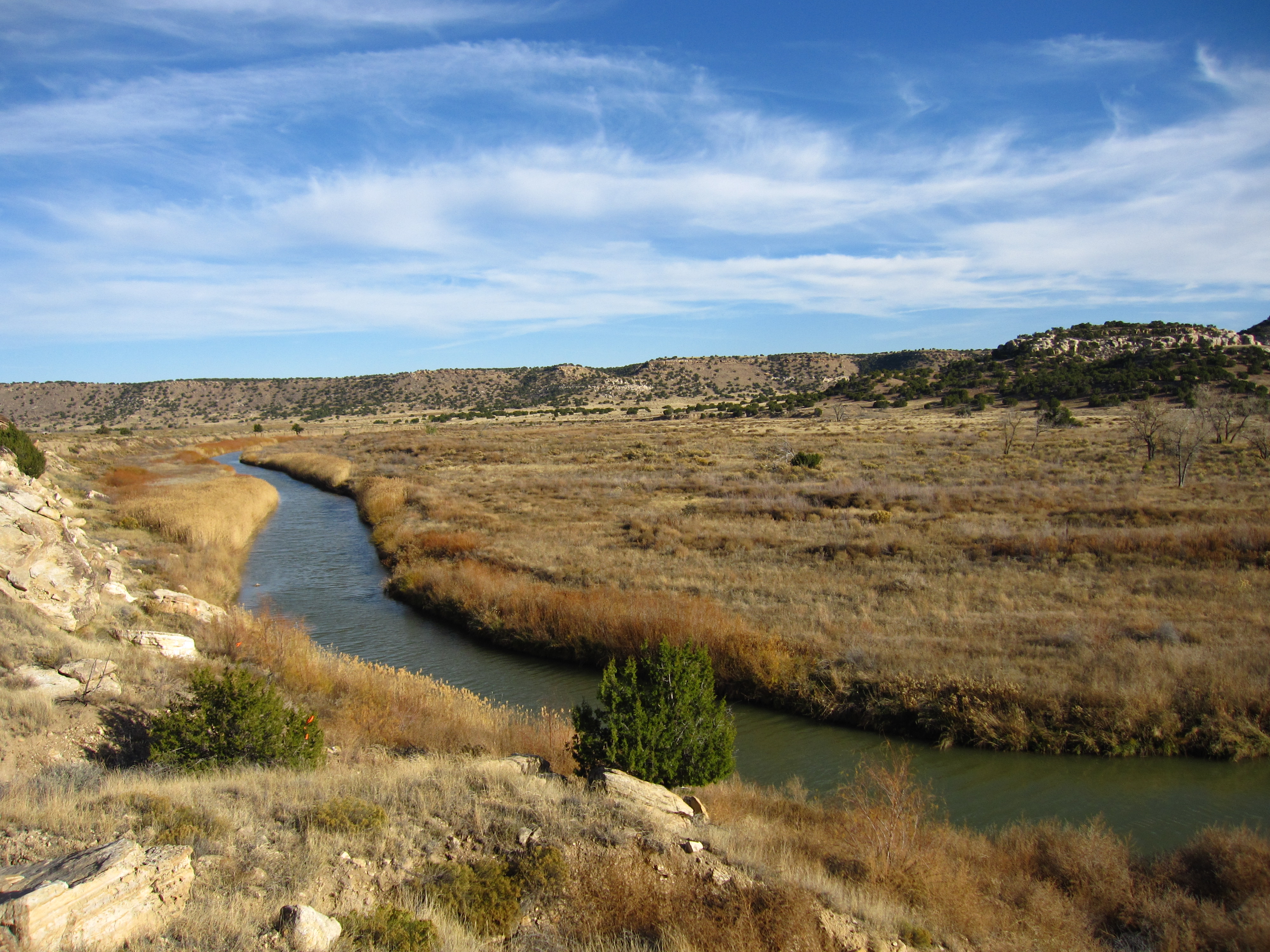
The Upper Yampa River Basin drains approximately 2,100 square miles west of the Continental Divide in north-western Colorado. There is a growing need to understand potential changes in the quantity and quality of water resources as the basin is undergoing increasing land and water development to support growing municipal, industrial, and recreational needs. The U.S. Geological Survey, in cooperation with stakeholders in the Upper Yampa River Basin water community, began a study to characterize and identify changes in streamflow and selected water-quality constituents, including suspended sediment, Kjeldahl nitrogen, total nitrogen, total phosphorus, and orthophosphate, in the basin. This study used streamflow and water-quality data from selected U.S. Geological Survey sites to provide a better understanding of how major factors, including land use, climate change, and geological features, may influence streamflow and water quality.
Analysis of long-term (1910–2018) and short-term (1992–2018) records of streamflow at main-stem Yampa River and tributary sites indicate downward trends in one or more streamflow statistics, including 1-day maximum, mean, and 7-day minimum. Long-term downward trends in daily mean streamflow in April (22 percent overall) at Yampa River at Steamboat Springs, Colorado, correspond to observed changes in streamflow documented across western North America and the Colorado River Basin that are predominately associated with changes in snowmelt runoff and temperatures. During the short-term period of analysis, decreases in streamflow at main-stem Yampa River and some tributary sites are likely related to changes in consumptive use and reservoir management or, at sites with no upstream flow impoundments, changes in irrigation diversions and climate.
Concentrations of water-quality constituents were typically highest in spring (March, April, and May) during the early snowmelt runoff period as material that is washed off the land surface drains into streams. Highest concentrations occurred slightly later, in May, June, and July, at Yampa River above Stagecoach Reservoir, Colo., and slightly earlier, in February and March at Yampa River at Milner, Colo., indicating that these sites may have different or additional sources of phosphorus from upstream inputs. Yampa River at Milner, Colo., and Yampa River above Elkhead Creek, Colo., had the highest net yields of suspended sediment, Kjeldahl nitrogen, and total phosphorus, and are likely influenced by land use and erosion as the basins of both of these sites are underlain by highly erodible Cretaceous shales.
Upward trends in estimated Kjeldahl nitrogen and total phosphorus concentrations and loads were found at Yampa River at Steamboat Springs, Colo. From 1999 to 2018, the Kjeldahl nitrogen concentration increased by 10 percent or 0.035 milligram per liter, and load increased by 22 percent or 26 tons. Total phosphorus concentration increased by 20 percent or 0.0081 milligram per liter, and loads increased by 41 percent or 6.2 tons. Decreases in streamflow and changes in land use may contribute to these trends.
During multiple summer sampling events at Stagecoach Reservoir, the physical and chemical factors indicated conditions conducive to cyanobacterial blooms, including surface-water temperatures greater than 20 degrees Celsius and total phosphorus and total nitrogen concentrations in exceedance of Colorado Department of Public Health and Environment interim concentrations for water-quality standards. Local geological features (predominately sandstones and shales) and additional inputs from upstream land use likely contribute to the elevated nutrient conditions in Stagecoach Reservoir.
Water volumes along the Colorado River are 55% of average for the amount of volume that would normally be seen from April to July, according to Aldis Strautins, hydrologist for the National Weather Service in Grand Junction.
That’s due to drought conditions that have persisted over the last year.
The Eagle River’s water volume is also at 55% of the average, and the Roaring Fork River is at 51% of the normal average volume, Strautins said…
Paula Stepp, executive director for the Middle Colorado Watershed Council, said the drought will likely impact the Glenwood Springs area in many ways.
Stepp said there are concerns about how the drought and lower water volumes along the Colorado River will impact agriculture, recreation and aquatic habitat.
Water use by agricultural producers is already stressed by the drought, Stepp said…
Stepp said she’s already heard that there’s not a lot of water available and there’s a need to be conservative with water usage.
On the recreational side of things, Stepp said there could be a much shorter rafting season.
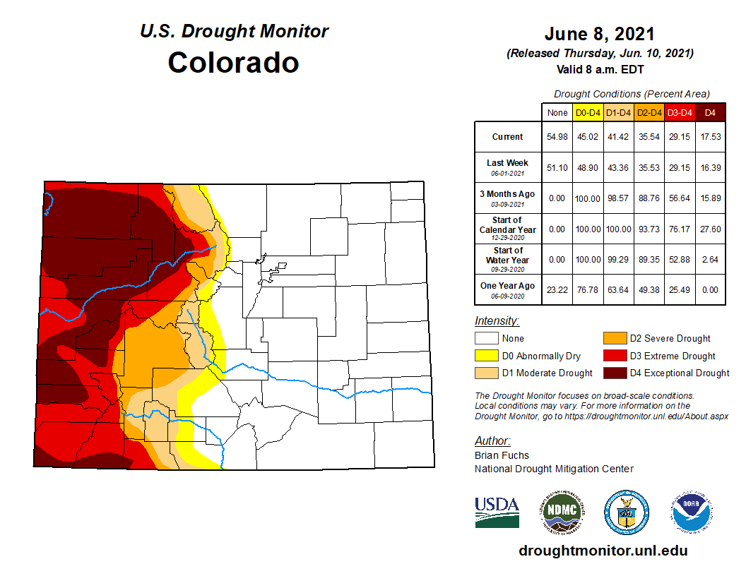
While Colorado east of the continental divide has shifted out of drought over the past three months, the western third of the state continues to suffer under extreme and exceptional conditions according to the latest report from the National Drought Mitigation Center.
Northwest Colorado has been particularly hard hit, with exceptional drought increasing in portions of Moffat, Routt, Rio Blanco and Grand counties this week. Earlier in the year, a similar expansion impacted Moffat, Rio Blanco and Garfield counties…
Colorado Drought Monitor map June 8, 2021.
Thirteen of Colorado’s 64 counties have a least some area in exceptional drought, with most or all of their remaining area in severe conditions.
The coming week’s forecast offers no hope for relief. The National Weather Service has issued an excessive heat warning for portions of west central Colorado for Monday through Friday. Such alerts are unusual for the state. Temperatures in the area – which includes Grand Junction in Mesa County – could reach 110 degrees, creating risks for heat-related illnesses, which can be deadly.
Excessive heat warning for portions of western Colorado June 14-18, 2021. – NWS via The Kiowa County Press
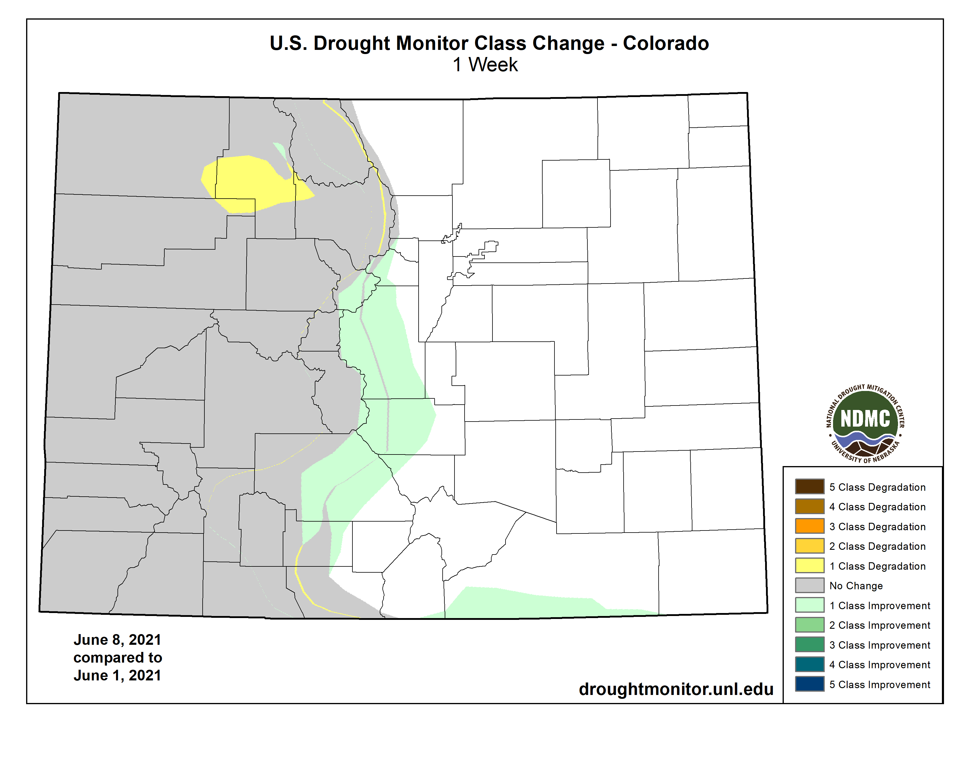
Along the continental divide, several central mountain counties, including Rio Grande, Saguache, Chaffee, Fremont, Park, Summit and Clear Creek, saw moderate drought improved to abnormally dry conditions.
Abnormally dry areas also declined near the improvements in moderate drought and disappeared from Las Animas County in the southeast.
Colorado Drought Monitor one week change map ending June 8, 2021.
Improvements in the eastern Colorado began in mid-March as significant snow provided relief. During May, thunderstorms continued to bring rain to the state’s eastern plains, resulting in drought-free conditions for most northeast counties by the end of the month.
The first drought-free area in Colorado since mid-2020 appeared in late April.
Overall, 55 percent of the state is drought-free, up from 51 percent last week, with an additional four percent in abnormally dry conditions, down from six percent in the previous week. Moderate drought covers six percent of Colorado, down from eight percent, while severe drought remains unchanged at six percent. Extreme drought dropped from 13 to 12 percent. Exceptional conditions expanded from 16 to 18 percent. Total does not equal 100 due to rounding.
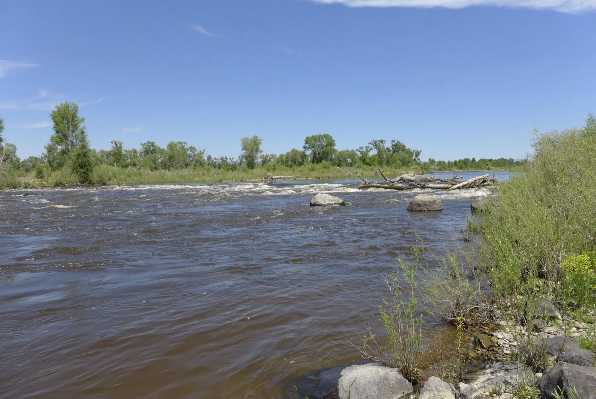
The Lefevre family prepares to put their rafts in at Pebble Beach for a float down the Yampa River to Loudy Simpson Park on Wednesday. From left, Marcie Lefevre, Nathan Lefevre, Travis Lefevre and Sue Eschen. CREDIT: HEATHER SACKETT/ASPEN JOURNALISM
With the impending closure of coal mines and power plants in northwest Colorado, Craig officials and river enthusiasts are hoping a long-overlooked natural resource just south of town can help create economic resilience.
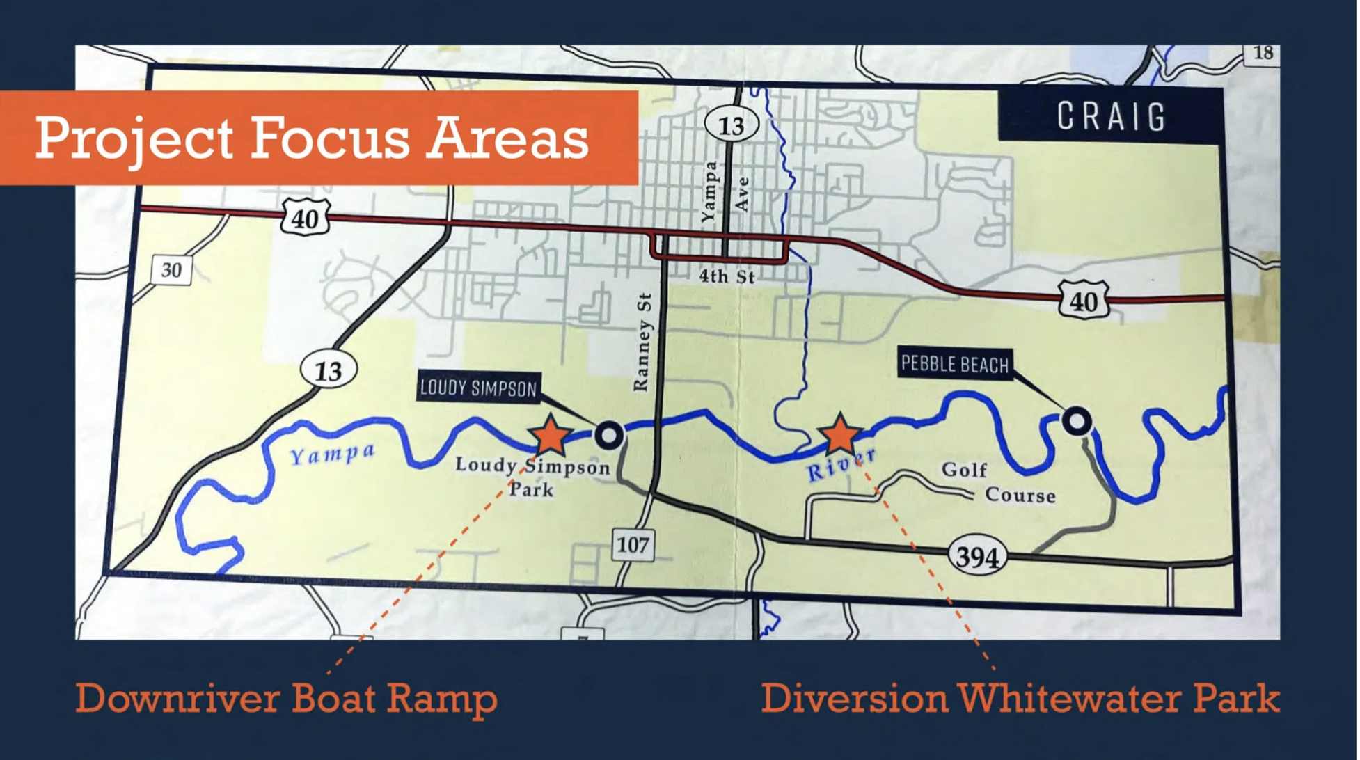
The city has applied for a $1.8 million grant from the federal Economic Development Agency for the Yampa River Corridor Project, which will refurbish boat ramps, add parking areas and a whitewater park, in an effort to develop the Yampa River as a source of outdoor recreation and local pride. The project is part of a multi-pronged approach to help rural Moffat County transition from an extraction-based economy to one that includes outdoor and river recreation as one of its main pillars.
“(River use) has definitely grown in the last couple of years,” said Jennifer Holloway, executive director of the Craig Chamber of Commerce. “Awareness that the river could be part of our future has grown. It had just not been on our radar as a town. We had the coal mines, we had the power plants. People tubed the river and fished in it sometimes, but it was not looked at as an economic asset until the last few years.”
An August 2020 preliminary engineering report by Glenwood Springs-based consultant SGM laid out the project components. The first phase of the proposed project would include improvements to Loudy Simpson Park on the west end of town, including a boat ramp, parking, a picnic area and vault toilet. The park is often a take-out point for tubers and boaters who float from Pebble Beach, just a few miles upstream. The project would also create better waves, pool drops with a fish passage, two access points and a portage trail at what’s known as the Diversion Park, as well as improve the city’s diversion structure.
The total project cost is roughly $2.7 million. A second project phase, which is still conceptual, would include bank stabilization and a trail connecting the river to downtown Craig.
Project proponents see the river as one of the town’s most under-utilized amenities and say it can add to the quality of life in the town of about 9,000.
Josh Veenstra is the owner of Good Vibes River Gear in Craig. The company rents paddle boards, rafts and tubes, runs shuttles on the Little Yampa Canyon and sells hand-sewn, mesh bags and drying racks, which are popular among the boating community. This is the fourth season for his company and Veenstra said the momentum is unbelievable.
“What it’s going to do is give Craig a sense of identity,” he said.
This boat ramp at Loudy Simpson Park will be replaced by a new one about a quarter-mile downstream as part of the Yampa River Corridor Project. The park is a popular place to take out after a day float from Pebble Beach. CREDIT: HEATHER SACKETT/ASPEN JOURNALISM
Transitioning from coal
Two of the region’s biggest employers and energy providers, Tri State Generation and Transmission and Xcel Energy, announced in 2020 that they would be closing their coal-fired plants and mines. Tri-State, whose plant is supplied by two local mines, Trapper and Colowyo, plans to close all three of Craig’s units by 2030. Xcel, whose plant is located in nearby Hayden, plans to close both its units by the end of 2028.
According to Holloway, the closures represent about 800 lost jobs.
“All of our restaurants survive off the power plant workers, all of our retail, all the rest of our businesses,” she said. “Most of our small businesses downtown are run by women whose husbands work in the mine. So I think we are going to see a mass changeover of people leaving.”
Holloway is focusing on ag-tourism, the arts and outdoor recreation as industries that can help replace lost jobs. Although she recognizes that tourism jobs generally don’t pay the high wages of extraction industries, outdoor recreation has been identified as an industry with a large potential for growth and is identified as a priority in Moffat County’s Vision 2025 Transition Plan.
In addition, the pandemic has shown that many white-collar workers can work remotely from anywhere that has internet. It has also increased interest in outdoor recreation. Project supporters say improving the river corridor could help attract a new demographic interested in the outdoors but who don’t want to pay the premiums of a resort community, like nearby Steamboat Springs.
“Entrepreneurs in the rec industry would be a great fit,” Holloway said. “A warehouse here would be so much cheaper than Steamboat. If we could get some of those entrepreneurs, that would attract those that have a remote job or business elsewhere but that want the rural outdoor lifestyle.”
This small section of rapids known as the diversion wave will get upgraded into a whitewater park as part of the Yampa River Corridor Project. The city of Craig is betting on river recreation to help fill the economic void as local coal-fired power plants shut down in the coming years. CREDIT: HEATHER SACKETT/ASPEN JOURNALISM
Recreation water right
Although city officials are moving forward with plans to build the whitewater park, they are — for now at least — forgoing a step that could help protect their newly built asset and keep water in the river.
Many communities in Colorado with whitewater parks, including Glenwood Springs, Basalt, Durango, Silverthorne and Vail, have a water right associated with the man-made waves, known as a recreational in-channel diversion or RICD. This type of water right ties an amount of water necessary for a reasonable recreational experience to the river features.
A RICD can help make sure there is enough water in the river for boating, but it also has the potential to limit future upstream water development. Under Colorado water law, known as the prior appropriation system, older water rights have first use of the river and therefore, a RICD does not affect existing senior water rights.
“It’s something that we have had some discussion about and we are looking closely at; it can be kind of political,” said Craig City Manager Peter Brixius. “I have not personally heard from folks, but I know people are opposed to it.”
Brixius said the conversation about a RICD is on hiatus at least until the fall.
Without a water right, which would secure the whitewater park’s place in line, future upstream water development could jeopardize having enough water for the park.
Peter Fleming, general counsel for the Colorado River Water Conservation District, said that while he can’t speak specifically for Craig, it makes sense for a municipality to protect its place in the prior appropriation system with a water right.
“If there may be some risk in the future that somebody is going to develop some water upstream that would either reduce or eliminate entirely the benefit of this expenditure, then yeah, you go to water court and try to protect this investment you have made,” he said. “Even if you don’t see anything on the horizon that is going to impact you, who knows what’s going to happen in 20 years.”
Craig has applied for a $1.8 million grant from the federal Economic Development Agency for the Yampa River Corridor Project, which will refurbish boat ramps, add parking areas and a whitewater park, in an effort to develop the Yampa River as a source of outdoor recreation and local pride.
Looking to the future
The city expects to find out if it got the EDA grant in early fall. The project has also received funding from Moffat County, Friends of the Yampa, Trapper Mine, Northwest Colorado Parrotheads, the Yampa/White/Green Basin Roundtable, Resources Legacy Fund and the Yampa River Fund.
City officials are hoping the Yampa River Corridor Project will attract visitors, contribute to marketing efforts to rebrand northwest Colorado and build morale around the area’s economic future. For river gear shop owner Veenstra, that future can’t come fast enough. He hopes to hold swift water rescue courses and do environmental education using the new river corridor area.
“Craig is one of the coolest little towns,” he said. “The closure of the power plant, everybody says it’s going to be the downfall of Craig. It’s the best thing that could ever happen to us because it made people snap out of it and go, ‘oh, we need to do something different.’ That’s why the whitewater park is getting built. It was a blessing in disguise.”
Timely information is now available detailing drought conditions, current emergency declarations and useful resources for affected areas
Governor Mark Gordon has announced the launch of a new website that will provide detailed, updated information on drought conditions in Wyoming. Developed through a collaboration of multiple state and federal agencies, drought.wyo.gov will be a resource for multiple sectors that monitor drought conditions.
The site provides resources and information for specific sectors impacted by drought, including agriculture, tourism, recreation, municipalities and water utilities. It also offers information on federal and state resources and assistance available to those impacted by drought. Information on wildfire conditions and restrictions plus links to United States Department of Agriculture (USDA) drought disaster designations for Wyoming are also available on the website.
“Our goal in developing this resource is to make relevant and timely information available in a single location,” Governor Gordon said. “This effort capitalizes on the collaborative partnerships already in place between state and federal agencies and allows us to better communicate program resources.”
The site is a cooperative effort between a state and federal drought conditions monitoring team comprised of State of Wyoming agencies, the University of Wyoming Extension, USDA, United States Geological Survey and the National Weather Service. Wyoming has been experiencing drought conditions since 2020 and this past winter’s average snowpack did not alleviate dry soil conditions that existed entering the winter.
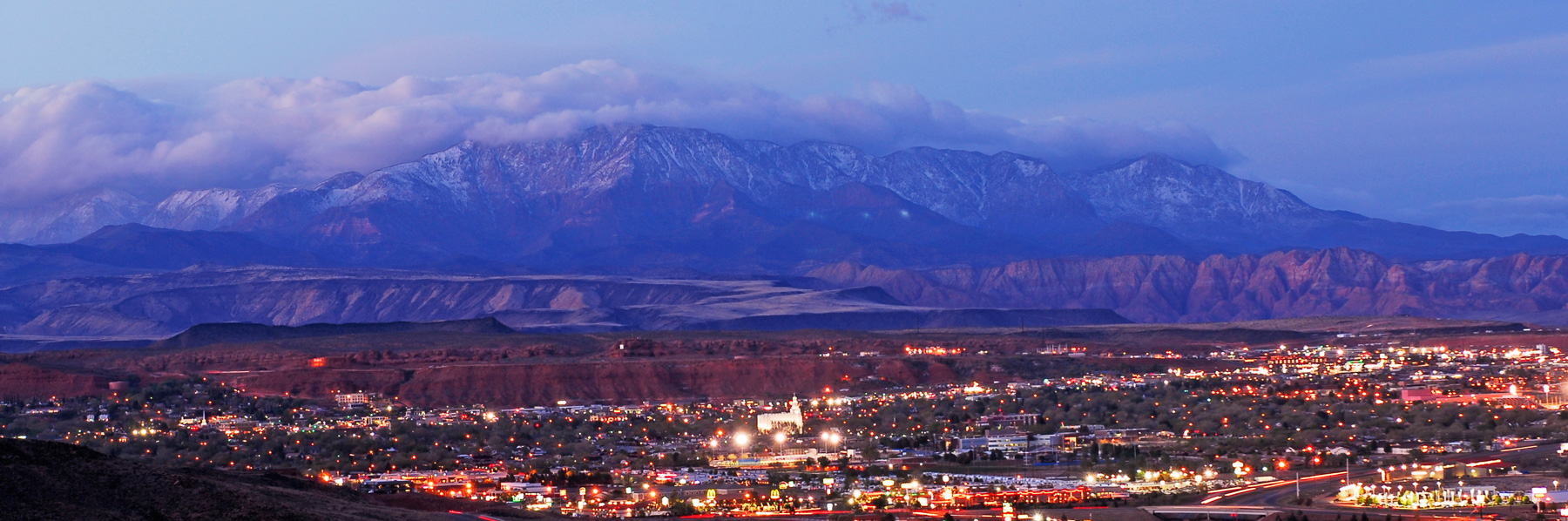
According to the recent U.S. census, Utah was the fastest-growing state in the nation between 2010 and 2020, increasing its population at a blisteringly fast rate of 18.4%. And in its southwest corner, Washington County, with its stunning vistas, National Park access, recreation opportunities and warm, sunny climate led the state in that trend, attracting nearly 50,000 new residents over the last decade, a 36% increase over its 2010 population.
Those 50,000 new people are just the beginning of a growth pattern projected by the Gardner Institute to flood Washington County with 321,000 additional residents over the next 45 years, to reach a local population of 509,000 by 2065. That number of people — 80% of the current population of Las Vegas — will require a lot of water in this desert landscape, more than is locally available at our current rate of use.
A Solution?
The WCWCD, along with the Utah Division of Water Resources, saw this problem coming as early as the 1990s, and started making plans to import Colorado River water from Lake Powell via a buried pipeline that would stretch 140 miles through rocky desert terrain, crossing some tribal lands and sensitive habitats. The project has inched its way forward over the decades since, finally advancing its federally-required Environmental Impact Statement through the public review process during the Trump administration, which identified the pipeline as one of its infrastructure priorities…
What is most important to today’s Utahns?
Despite these sentiments about Utah’s cultural values driving water infrastructure decisions, there has never been a widespread, unbiased attempt to poll existing Washington County locals on their thoughts about the pros and cons of the Lake Powell Pipeline project and whether they are willing to bear its approximately $2 billion cost. So The Spectrum & Daily News, with funding from The Water Desk, designed and commissioned a survey to do just that.
Survey data were collected by the Utah-based market research firm Dynata, hired based on their reputation and reasonable cost quote. Employees of this company randomly selected residents of Washington County to contact for a phone survey and received responses from 400 of them. Respondents represented a balanced range of ages, gender, household income levels and length of time they had lived in Washington County. The results presented below have been weighted slightly by Dynata to best reflect the actual demographic makeup of the county.
Knowledge is lacking
Of the 400 people surveyed, nearly a quarter (22%) said they had never heard of the Lake Powell Pipeline, despite the fact that this is a decades-old project that will have major financial and lifestyle implications for all Washington County residents. 35% felt they “knew a little about it” and 12% felt they “knew a lot about it.” Only 52% of those surveyed said they felt they knew enough about the project to have an opinion on it.
Support is high
Support for the project outweighed opposition to it, with 59% expressing some level of support for it and 35% expressing some level of opposition to it. A majority held relatively mild views on the project, but 35% of all respondents were “very supportive” and 19% were “very opposed.”
But few want to pay
This high level of support, though, did not carry through to a willingness to help fund the project, which has been estimated to cost anywhere between $1.1 and $2.4 billion, to be initially bankrolled by the state and then repaid over 50 years by Washington County residents. In fact, some already-implemented increases in impact fees, property taxes and water rates are currently being put towards project expenses. The WCWCD estimates that the state has already spent around $40 million on planning costs and feasibility studies.
Only 40% of survey respondents answered yes to the question of whether, “knowing what you do about the project, and that the pipeline is proposed as a way to address potential water shortages in the future, are you willing to help fund it, either through increased water rates, higher taxes, or higher fees charged for new water hookups.” 44% answered no to that question and 15% declined to answer.
Among that 40% of people willing to help fund the project, just 8% said they would pay anything more than $50 per month in fees for it, though some estimates suggest the actual cost may be much higher than this. 22% of those who initially answered both that they supported the project and would be willing to help fund it then said that they would not be willing to contribute anything or refused to answer a question about specific amounts.
Overall, then, 50% of all surveyed residents indicated at some point — either in response to the initial funding question or when asked about specific amounts — that they would not be willing to contribute financially to the project at all, despite the fact that some fees are already being collected county-wide to support it. An additional 18% of all those surveyed said that they were unsure about contributing or refused to answer the question. Less than 1% were willing to pay amounts in the highest tier.
Instead, they show a willingness to conserve
In 2011, the Utah Division of Water Resources submitted a 256-page study to the Federal Energy Regulatory Commission detailing how their water needs assessment justified pursuing the Lake Powell Pipeline project. In it, they outline how much water conservation they determined was “feasible for this area based on local conditions, development types, cost and public acceptance.” Conservation options that were considered but not deemed feasible to adopt included turf removal and some appliance rebates.
Survey results, however, indicate perhaps an increased willingness over the past decade to voluntarily adopt stricter water conservation measures.
When asked if they would be “willing to adopt any conservation practices in your own home or accept fewer amenities in your community if it would help avoid construction of the project,” 63% of survey respondents said they would, including 48% of those who had expressed support for the project. Only 26% said they would not be willing to conserve more water and 11% said they didn’t know.
Specific measures respondents said they would be willing to adopt included high levels of support for conservation measures previously ruled out by state and local officials as conflicting with Utah’s traditional cultural values:
75% of people who were amenable to conserving more water said they would reduce the size of their lawn.
88% were willing to take shorter showers.
75% were in favor of requiring desert-friendly landscaping in new housing developments.
67% thought we should stop building water features in parks and public places.
83% would support scaling back lawns in public places or on golf courses.
78% would be willing to update their home appliances.
76% supported increasing water rates/accelerating a tiered pricing structure.
Summary
Overall, results of our independent survey indicate that Washington County residents generally support the idea of the Lake Powell Pipeline project despite feeling that they don’t know much about it. But few want to contribute to it financially and instead they expressed a greater willingness to adopt new water conservation practices than has previously been recognized.
The people of Washington County have spoken.
Brad Udall: Here’s the latest version of my 4-Panel plot thru Water Year (Oct-Sep) of 2019 of the #coriver big reservoirs, natural flows, precipitation, and temperature. Data goes back or 1906 (or 1935 for reservoirs.) This updates previous work with @GreatLakesPeck
ENSO Alert System Status: Not Active
Synopsis: ENSO-neutral is favored through the Northern Hemisphere summer (78% chance for the June-August season) and fall (50% chance for the September-November season).
ENSO-neutral conditions continued during May, with near-average sea surface temperatures observed across most of the equatorial Pacific Ocean. In the last week, the Niño indices were all at -0.2oC, except for the Niño-1+2 index, which was -0.4oC. Subsurface temperature anomalies remained positive but decreased slightly due to the weakening of above-average subsurface temperatures around the thermocline in the central Pacific Ocean. Low-level easterly and upper- level westerly wind anomalies extended across most of the equatorial Pacific Ocean. At the Date Line, tropical convection was mostly near average, and enhanced rainfall was evident over the western Pacific Ocean. Overall, the ocean and atmosphere system reflected ENSO-neutralconditions.
A majority of the models in the IRI/CPC plume predict ENSO-neutral to continue through the fall 2021. The forecaster consensus generally agrees with this model outlook, although lower probabilities are assigned to El Niño during this period (remaining less than 10%). By the late fall and winter, La Niña chances increase to near 50%, reflecting the historical tendency for a second winter of La Niña following the first, and also the predictions from the North American Multi-Model Ensemble. However, these cooler conditions are predicted to exist for a short duration (3 overlapping seasons) and these predictions are still over 6 months into the future. In summary,ENSO-neutral is favored through the Northern Hemisphere summer (78% chance for the June-August season) and fall (50% chance for the September-November season; click CPC/IRI consensus forecast for the chances in each 3-month period).
To prevent waste and avoid sparking an interstate legal battle, Colorado has started cracking down on what may seem like a drop in the proverbial bucket — illegal ponds.
Martin Mendine recently found himself in the state’s crosshairs. His family ranch is a wide, grassy expanse near southern Colorado’s Spanish Peaks. A fork of the Purgatory River meanders through the land which supports about a hundred cattle, and herds of elk. Migratory sandhill cranes pass through each year…
It’s wet enough to support all this life in part because of a cascade of five small ponds, held in place by dams made of dirt. The ponds are more than 80 years old, Mendine said. They were built when his grandfather tended the ranch.
“So we’ve been running this water now for, you know, damn near (a) century and they’re telling me I can’t use it,” Mendine said…
He got a notice in the mail recently telling him the ponds have been identified as potentially illegal. It said the storage rights needed to create and sustain the ponds don’t exist. To be compliant, he either needs to drain them or come up with a state-approved plan to fill them from a different water source or replace any losses from evaporation…
“Our basin has been over-appropriated for a long period of time,” said Bill Tyner, Colorado’s division engineer for the Arkansas River basin, where Mendine’s ranch is located. The Purgatory River is a tributary to the Arkansas, and runs across an arid stretch of southeastern Colorado…
Using satellite imagery to build an inventory of human-made ponds in the basin, and then cross-referencing with water rights on the books, the state has identified about 10,000 illegal ponds just in the Arkansas basin, Tyner said. He likens it to a string of pearls. Each individual pearl isn’t that costly or consequential on its own. But when pulled together in a line, it’s highly valuable…
His office is now in the midst of a systematic review of all ponds in the Arkansas basin. Using the satellite data, water commissioners, the people who enforce water law on the ground, have been following up with pond owners, letting them know they’ve ended up on a list of potentially illegal ponds, and laying out their options to make them legal…
The ponds in question encompass everything from pools for livestock watering to decorative fountains in business parks to duck ponds scattered across the grounds of a mountainous mansion.
It’s not just the Arkansas basin that’s seeing increased enforcement. State officials have pursued illegal ponds in the upper reaches of the Colorado River basin as well.
The problem with ponds, Tyner said, is evaporation. Water in a shallow pond evaporates more than when it’s flowing through a narrow stream. The state views evaporated water as wasted water…
Without money or access to new water supplies, a landowner’s options to make their ponds legal are limited. There are some exceptions for ponds used for erosion control or livestock watering, but they’re limited in scope. And because the Arkansas basin is one of the most over-appropriated in the state, there’s very little excess water to tap into…
A recent dispute over ponds went to the Colorado Supreme Court last year, where the state prevailed. The ponds in question aren’t allowed to be filled, and the owner was ordered to pay $92,000 in civil penalties, plus attorney’s fees. Machado’s takeaway from that ruling?
“Once the state finds an illegal pond and says you need to drain it, you better do it,” he said.
Arkansas River headwaters. Photo: Brent Gardner-Smith/Aspen Journalism