
Click the link to read the newsletter on The Land Desk website (Jonathan P. Thompson). Here’s an excerpt:
Aridification Watch
Okay, “aridification” may be the wrong header this time, since the West is getting battered by atmospheric rivers and bomb cyclones and power grid-wrecking snows and winds and rains. It’s record-breaking craziness — at least it seems that way, since we haven’t had much like it in a bit. But is it really all that unusual? Here’s a mini-Data Dump on early winter snowpack levels to help us figure it out:
19: Number of monthly precipitation records broken during the first 28 days of December 2022 in the Western climate region (the final three days aren’t yet recorded in the system).
8.2: Inches of precipitation recorded during a 24-hour period at Sierraville Ranger Station in California on Dec. 2, 2022, shattering the previous all-time record set in 1913.
27: Inches of new snow that fell in the Tahoe City, California, area on Jan. 1, 2023. It contained about 3.33 inches of water. On Dec. 11 the area received 31 inches of snow in one day.
210,000: Approximate number of utility customers who lost power along the West Coast as a result of the late December storms.
30,000: Number of utility customers who lost power in the Northwest after vandals attacked four electrical substations in Washington state on Christmas day.
3: Number of people killed by avalanches so far this season, including two skiers/snowboarders in Colorado and a snowmobiler in Montana.
Further inland, the moisture is giving a needed boost to the giant snowpack “reservoir” that feeds the beleaguered Colorado River system. After tracking close to median levels for the first three months of the 2023 water year, this year’s Upper Colorado Basin snowpack shot up to 142% of the Jan. 3 “normal.” It may be a little too early to get excited, though — last year’s snows followed the same early season abundant pattern before dropping off in January.
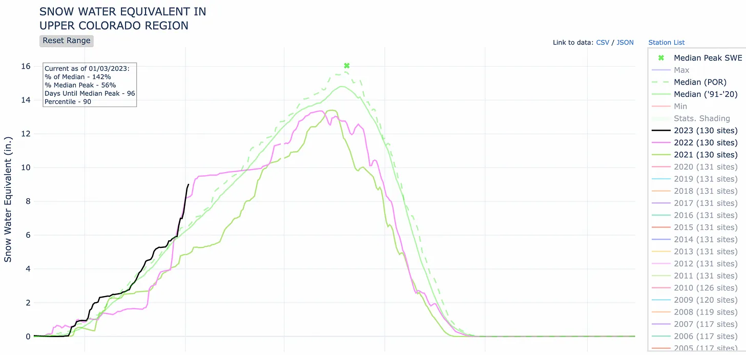
Zooming in on the San Juan Mountains and Southwest Colorado we see a similar but slightly less wet pattern. Levels are above the median, but still below last year and 2020.

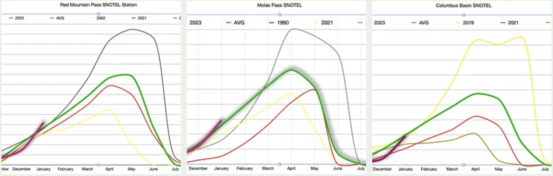
And zooming in even further to our three go-to SNOTEL stations, all located in Southwest Colorado, we find that snowpack levels are about at the average for each station’s period of record (which varies from station to station), but are still tracking ahead of 2019, which turned out to be a BIG snow year.
All of which is to say, it’s too early to really know what winter will bring us. So be sure to enjoy the snow while it’s here!