White Paper 1: Fill Mead First: A Technical Assessement — #Utah State University #LakeMead #LakePowell #ColoradoRiver #COriver #aridification

A bend in Glen Canyon of the Colorado River, Grand Canyon, c. 1898. By George Wharton James, 1858—1923 – http://digitallibrary.usc.edu/cdm/ref/collection/p15799coll65/id/17037, Public Domain, https://commons.wikimedia.org/w/index.php?curid=30894893

Click the link to access the paper from the Utah State University website (John C. Schmidt, Maggi Kraft, Daphnee Tuzlak, and Alex Walker | November 10, 2016):

The Fill Mead First (FMF) plan would establish Lake Mead reservoir as the primary water storage facility of the main-stem Colorado River and would relegate Lake Powell reservoir to a secondary water storage facility to be used only when Lake Mead is full. The objectives of the FMF plan are to re-expose some of Glen Canyon’s sandstone walls that are now inundated, begin the process of re-creating a riverine ecosystem in Glen Canyon, restore a more natural stream-flow, temperature, and sediment-supply regime of the Colorado River in the Grand Canyon ecosystem, and reduce system-wide water losses caused by evaporation and movement of reservoir water into ground-water storage. The FMF plan would be implemented in three phases. Phase I would involve lowering Lake Powell to the minimum elevation at which hydroelectricity can still be produced (called minimum power pool elevation): 3490 ft asl (feet above sea level). At this elevation, the water surface area of Lake Powell is approximately 77 mi2, which is 31% of the surface area when the reservoir is full. Phase II of the FMF plan would involve lowering Lake Powell to dead pool elevation (3370 ft asl), abandoning hydroelectricity generation, and releasing water only through the river outlets. The water surface area of Lake Powell at dead pool is approximately 32 mi2 and is 13% of the reservoir surface area when it is full. Implementation of Phase III would necessitate drilling new diversion tunnels around Glen Canyon Dam in order to eliminate all water storage at Lake Powell. In this paper, we summarize the FMF plan and identify critical details about the plan’s implementation that are presently unknown. We estimate changes in evaporation losses and ground-water storage that would occur if the FMF plan was implemented, based on review of existing data and published reports. We also discuss significant river-ecosystem issues that would arise if the plan was implemented.

Executive Summary 

15 Northern Colorado communities win key federal #water project OK as legal battle looms — @WaterEdCO #PoudreRiver #SouthPlatteRiver

Erie is among 15 Northern Colorado entities participating in the Northern Integrated Supply Project. Water to supply new growth is a key driver of the project. Construction underway in Erie. Dec. 4, 2022. Credit: Jerd Smith, Fresh Water News

Click the link to read the article on the Water Education Colorado website (Allen Best):

Fifteen towns, cities and water districts in northern Colorado hope to begin building two dams and other infrastructure in 2025 to deliver enough water to meet needs for a quarter-million people, many of them along the fast-growing Interstate 25 corridor.

Northern Water, the agency overseeing what’s known as the Northern Integrated Supply Project (NISP), hailed federal approval of a critical permit last month as a milestone. “This action is the culmination of nearly 20 years of study, project design and refinement to develop water resources well into the 21st century,” said Brad Wind, general manager of Northern Water. Wind said that NISP will enable the 15 project members, including Windsor, Erie and Fort Morgan, to grow without buying farmland, then drying it up and using its water for growth.

The environmental group, Save the Poudre, hopes to dash those plans. The nonprofit says it will file a lawsuit in an attempt to block the $2 billion NISP. To succeed, the group will have to overcome precedent. It failed to block Chimney Hollow, the dam that Northern Water is constructing as part of a separate project, in the foothills west of Berthoud whose construction began in 2022 after a three-year court case.

“We have a much stronger case against NISP because the project would drain a dramatic amount of water out of the Poudre River, which would negatively impact the river’s ecology, its habitat, and its jurisdictional wetlands — protected by the Clean Water Act — all the way through Fort Collins and downstream,” said Gary Wockner, director of Save The Poudre.

This new court challenge was set up by a U.S. Army Corps of Engineers announcement Dec. 9 that it was issuing a crucial permit under the Clean Water Act. Directors of Northern Water, the overarching agency for the participating jurisdictions, are scheduled on Thursday, Jan. 5, to take up whether to accept the terms of the permit. Staff members have advised them to do so.

Northern Integrated Supply Project (NISP) map July 27, 2016 via Northern Water.

The impetus for NISP can be traced to the early 1980s when Northern Water began drawing up plans to dam the Poudre River in the foothills near Fort Collins. Federal agencies balked at Denver’s plans for a similar project on the South Platte River at Two Forks, in the foothills southwest of Denver. Northern shelved its initial plan. But after the scorching drought that began in 2002, Northern developed plans for NISP, which it submitted to federal agencies in 2004.

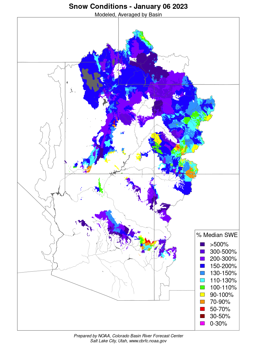
Two reservoirs are central to NISP. Glade Park, an off-channel reservoir, would be built north of La Porte, bounded by the Dakota hogbacks and a dam that would cross today’s Highway 287. It would have a capacity of 170,000 acre-feet, slightly larger than the 157,000 acre-feet of Horsetooth Reservoir. Northern’s water rights are relatively junior, dating from the 1980s and would only generate water in spring months during high runoff years.

The project promises delivery via pipeline of 40,000 acre-feet of high-quality water annually to the 11 mostly smaller towns and cities and the 4 water districts. Erie is buying the largest amount of water from the new project, claiming 6,500 acre-feet. An acre-foot equals 326,000 gallons.

The second storage pool, Galeton Reservoir, at 45,000 acre-feet, would impound water northeast of Greeley. Unlike the water from Glade, which is to be strictly dedicated to domestic use, Galeton would hold water that will be delivered to farms in Weld County that otherwise would have received water from the Poudre River. This will be done via a water-rights swap with two ditches north of Greeley. Those agreements have not been finalized.

Preservation of agricultural land, costs of water, and water quality figure prominently in the talking points both for — and, in some cases, against — the project.

Northern and its project participants argue that NISP will allow them to grow without drying up farms. It can do so, they say, by delivering the water at a lower cost.

The federal environmental impact statement’s no-action alternative found that population growth would occur regardless of whether a federal permit was issued, said Jeff Stahla, the public information officer for Northern Water. That analysis found that in the absence of NISP, the 15 cities and water districts would look to buy water rights currently devoted to agriculture, ultimately taking 64,000 acres — or 100 square miles — out of production.

The 15 utilities will be able to get NISP’s new water at $40,000 per acre-foot, substantially below current market rates for other regional water sources such as the Colorado-Big Thompson Project shares. Those shares, which constitute seven-tenths of an acre-foot, have been selling for about $75,000.

In some cases, expanding cities will take farmland out of production — and presumably gain access to the water, but not always.

“We do not want to dry up northern Colorado,” says John Thornhill, Windsor’s director of community development.

Thornhill said that Windsor, a town of 42,000 with its 20th Century sugar beet factory still standing, is participating in NISP to improve the resiliency of its water portfolio as it prepares for another 10,000 to 15,000 residents in the next 10 to 15 years.

“The town of Windsor has just as much interest in having a clean, healthy river as anybody else does,” he says. “[The Poudre River] goes right through our town.”

Fort Collins is not participating in the project. In a 2020 resolution, it said it would oppose the proposal or any variant that failed to “address the City’s fundamental concerns about the quality of its water supply and the effects on the Cache la Poudre River through the city.”

Water quality will be at the heart of Save the Poudre’s lawsuit against the Army Corps of Engineers’ 404 permit. The group’s Wockner says the diversion to Glade Reservoir will reduce peak flows in the Poudre, a river already suffering from E. coli and other pollutants, by up to 40%. “The water quality in the river will worsen because as you take out the peak flows what is left is dirty water,” he says.

Also at issue, says Wockner, will be the impacts to Fort Collins’ wastewater treatment. With reduced flows downstream from its two treatment plants, those plants would have to be upgraded.

On the flip side, Fort Morgan got involved partly because of Glade Reservoir’s higher water quality, according to City Manager Brent Nation.

The city of 12,000 historically relied upon aquifer water heavily laden with minerals for its domestic supply. As the aquifer became increasingly tainted by chemicals used in agricultural production, the city, in the late 1990s, began importing water through an 80-mile pipeline from Carter Lake, a reservoir that stores imported Colorado River water southwest of Loveland.

To use aquifer water for its new population growth Fort Morgan would need to upgrade its water treatment system to use reverse osmosis. That’s a more expensive treatment that also produces a problem of brine disposal.

Both Fort Morgan and Windsor have started working on land-use regulations that will restrict high-quality water for domestic use, at least in some subdivisions, leaving lower-quality water for landscaping.

If NISP as proposed survives Save the Poudre’s legal challenge, it may still need a 1041 permit from Fort Collins. Those regulations have not yet been adopted, however.

Allen Best grew up in eastern Colorado, where both sets of grandparents were farmers. Best writes about the energy transition in Colorado and beyond at BigPivots.com.

Political Landscape – #Colorado #Water Congress Panel — The Buzz #CWCAC2023

Click the link to read the post on The Buzz website (Floyd Ciruli):

Politics in 2023 will be the topic in a January 25 panel of Colorado political pundits at the annual Colorado Water Congress conference. Republican Dick Wadhams, Democrat Mike Dino, and pollster Floyd Ciruli will visit the hot Colorado topics in 2023 and heading into the 2024 presidential election.

Among the topics are:

  • Congressmen Boebert and Caraveo were in the five closest elections in the country in 2022. Will they have difficult 2024 reelections?
  • Will the large Democratic legislative majority affect the ideological/partisan shape of legislation in 2023? Are there any restraints on Democratic legislative priorities, especially of the far left? Can Republicans have influence?
  • Colorado’s Independent voters (46% of electorate, 40% of 2022 voters) are center stage. How are they changing the state’s politics? Can Democrats lose them, can Republicans reach them?
  • Can the current Colorado political distribution of power address the urban-rural divide (agriculture, endangered species, water, oil & gas)?
  • Does the changing political leadership (mostly Democrats) among Colorado River states affect the possibility for new agreements on saving or sharing water?
  • Will Joe Biden and Donald Trump be the two presidential nominees in 2024? If not, who? Will Governor Polis be a factor in the 2024 national race? Hickenlooper, Bennet?

See the land that tribes in the U.S. are protecting — ShareAmerica

Bison on the Fort Peck Reservation. Photo credit: Native: https://native.eco/about-us/

Click the link to read the article on the Department of Interior website (Noelani Kirschner):

The United States has more than 9.8 million square kilometers of land and water, both publicly and privately owned. Now, through a Department of the Interior (DOI) program, local governments and tribes in the United States will be working to conserve, protect and restore sections of both throughout the country.

With so much land at risk because of climate change and nature loss, the Biden administration aims to conserve at least 30% of American land and waters by 2030.

The America the Beautiful Challenge brings together many U.S. government agencies, led by the Department of the Interior, to advance an inclusive and collaborative land conservation mission.

The National Fish and Wildlife Foundation working with DOI will award $91 million in new grants — with $50.7 million matched by grantees, for a total amount of $141.7 million — to 55 nongovernmental organizations, tribes, U.S. territories and state governments across the United States. Applicants were encouraged to apply if their grant proposals included utilizing Indigenous Traditional Ecological Knowledge — a body of observations, oral and written knowledge, innovations, practices and beliefs developed by tribes and Indigenous peoples through interaction and experience with the environment, according to the White House.

“Nature is essential to the health, well-being and prosperity of every family and every community in America,” said Secretary of the Interior Deb Haaland. “This work will create jobs, strengthen our economy, address equitable access to the outdoors, and help tackle the climate crisis.”

The Fort Belknap Indian Community received nearly $5 million in funding to increase bison populations in collaboration with the Blackfeet, Chippewa-Cree of Rocky Boy and Fort Peck tribal communities across Montana (above). The project will restore 23,000 hectares of bison habitat. The tribes will continue to work together to share information about bison and land management.

Spirit Falls is generally shaded by the surrounding woods. However, in late spring and summer, sunlight reaches the base of the falls in the early afternoon hours and makes for a lovely photograph. Photo credit: Umpqua National Forest

NFWF awarded one of the largest grants — just over $6 million — to the Confederated Tribes and Bands of the Yakama Nation in Washington state. The Yakama Nation will use the funds for seven habitat restoration projects on 623 hectares to reconnect passageways between land and water on more than 2,400 hectares, and to strengthen the climate resilience of people, wildlife and habitats across the land.

In North Carolina, the Eastern Band of Cherokee Indians will use $309,000 to work with multiple government agencies to conserve or protect rare, culturally significant species within the greater Eastern Band of Cherokee Indians’ ancestral landscape. This includes improved data management and modeling tools to maximize conservation efforts on the ground.

With a $723,200 grant, the Stockbridge-Munsee Community plans to help bring Lenape tribal youth back to ancestral lands (Lënapehòkink) along the Delaware River watershed and in portions of New York state to cultivate tribal identity and provide career pathways for the youth. The collaboration between three Lenape tribes will help cultivate tribal identity and cultural resilience through a youth immersion program and 18 youth fellowship positions.

Native land loss 1776 to 1930. Credit: Alvin Chang/Ranjani Chakraborty

#California #snowpack is far above average amid January storms, but a lot more is needed — The Los Angeles Times

Click the link to read the article on The Los Angeles Times website (Ian James). Here’a an excerpt:

A series of atmospheric river storms has brought California heavy rains and above-average snowpack across the Sierra Nevada, but experts say the state still needs many more storms to begin to emerge from drought. The Sierra Nevada snowpack measures 174% of average for this time of year, but there are still three months left in the snow season, and the snow that has fallen to date remains just 64% of the April 1 average.

“It’s definitely a very exciting start to the year and a very promising start to the year. But we just need the storm train to keep coming through,” said Andrew Schwartz, lead scientist at UC Berkeley’s Central Sierra Snow Laboratory.

Storms swept in from the Pacific last week, bringing torrential rains and triggering major flooding in the Central Valley and other areas…

State water officials held their first manual snow survey of the year Tuesday at the Phillips Station snow course, one of more than 260 sites across the Sierra Nevada where the state tracks the snowpack…California’s largest reservoirs remain very low after the state’s driest three years on record. Shasta Lake is at 34% of capacity, while Lake Oroville is 38% full. Yet the start of this wet season has brought California some much-needed relief. State officials said the snowpack for this time of year is the third largest in the last 40 years, ranking behind 1983 and 2011.

Rivers in the Sky: 6 Facts you Should Know About #AtmosphericRivers — USGS

Click the link to read the article on the USGS website (Alexandra (Allie) Weill):

Atmospheric rivers have been in the news a lot over the past couple of months, from a late October atmospheric river that brought record-breaking rainfall across Northern California to a mid-November storm that led to catastrophic flooding in Washington. A new atmospheric river storm is hitting the Western U.S. now and more are likely on their way. But what exactly is an atmospheric river?

Atmospheric rivers aren’t a new phenomenon on the West Coast, but this type of storm has drawn greater attention in recent years as scientists have learned more about how they work.

Here are 6 things to know about atmospheric rivers as the West’s wet season continues:

1. Atmospheric rivers transport water vapor from the tropics towards the poles.

Sources/Usage: Public Domain. Visit Media to see details. Animation showing AR plumes over the Pacific during January 2012.

The formation of an atmospheric river starts near the equator. The sun heats the earth most directly at the equator, and these warm temperatures cause water to evaporate and rise into the atmosphere.

Some of that water vapor is pulled away from the equator by atmospheric circulation, forming a narrow band that transports the water vapor to other regions like a conveyer belt. Atmospheric rivers flow in the lowest part of the atmosphere, only about half a mile to a mile above the ground. When they reach the coasts and flow inland over mountains, the atmospheric river is pushed upwards, causing much of that water vapor to condense and fall to the ground as rain or snow, creating an atmospheric river-driven storm.

2. Atmospheric rivers are the largest “rivers” of fresh water on Earth.

While atmospheric rivers are pretty different from rivers of liquid water down on the ground, they transport enough water to deserve their moniker as rivers. Studies of atmospheric rivers over the Pacific have found that they transport water vapor at a rate equal to 7–15 times the average daily discharge of the Mississippi River. They can be hundreds to thousands of miles long, and though they are narrow in the context of weather systems, “narrow” can mean up to 300 miles across! 

Atmospheric rivers are always flowing somewhere on Earth, even though they don’t consistently stay in one place like rivers on the ground. At any given time, 90% of the water vapor moving toward the poles is concentrated in about 4-5 atmospheric rivers across the globe. Together, these narrow bands of flowing water vapor cover less than 10% of the circumference of the planet. 

Atmospheric river storms can affect people around the country and the world. Scientists estimate that atmospheric rivers provide over half of the mean annual runoff on the east and west coasts of North America, France, northern Spain and Portugal, the United Kingdom, southeastern South America, southern Chile, Southeast Asia, and New Zealand.

Sources/Usage: Public Domain. Visit Media to see details. Atmospheric rivers occur all over the world in this global view from February, 2017.

3. There’s a rating system for atmospheric rivers like there is for hurricanes.

Like the scales for hurricanes and other hazards, the rating scale for atmospheric rivers is based both its physical characteristics (wind speed for hurricanes, quantity of water vapor for atmospheric rivers) and on the level of destruction it causes.  

While other rating systems are focused solely on the hazards of the event, the atmospheric river system incorporates the idea that these events can be beneficial, hazardous, or both. On the low end of the scale, AR Cat 1 events rated as primarily beneficial and at the high end, AR Cat 5 events primarily hazardous.

Atmospheric River rating system. Sources/Usage: Public Domain. Visit Media to see details.

A scale that categorizes atmospheric river events based on the maximum instantaneous integrated water vapor transport (IVT) associated with a period of atmospheric river conditions (i.e., IVT ≥ 250 kg m–1 s–1) and the duration of those conditions at a point. 

Atmospheric river storms can be beneficial in places like drought-stricken California—up to 50% of California’s annual precipitation can come from atmospheric rivers, and atmospheric rivers can bring enough water to end a drought. USGS research has found that 33%–74% of droughts on the West Coast between 1950 and 2010 were broken by the arrival atmospheric river storms (the October atmospheric river eased but did not end California’s current drought, however). On the other hand, high-intensity atmospheric rivers can be as destructive as hurricanes and lead to widespread flooding, landslides, and debris flows.  

The atmospheric rivers that hit Northern California on October 24, 2021 and the Northwest on November 15, 2021 have both been rated 5, AR Cat 5 (Exceptional): Primarily hazardous.

Sources/Usage: Public Domain. Before a fire, forests act like a sponge and a water filter, meaning that rainwater can recharge drinking water supplies and only needs minimal treatment before use. After a fire, forests respond to rainfall as if the ground is covered in a layer of plastic wrap. Water cannot penetrate into the soil and huge amounts of surface runoff from rainstorms carry ash, sediment and other pollutants downstream into streams and reservoirs.

USGS scientists regularly conduct post-fire debris-flow hazard assessments for select fires in the Western U.S. not long after the fire burns. The hazard maps produced during these assessments help officials identify potentially dangerous conditions so they can take action to protect lives and property before and during extreme weather events. For example, USGS hazard maps of the 2020 Bond Fire informed response during subsequent atmospheric river storms in early 2021. 

Atmospheric rivers can influence the impacts of future fires, too. In 2017, USGS scientists studying this topic found that atmospheric rivers could actually increase the area burned by fires in the year following an event, especially in the most arid parts of the interior Southwest. Though wet winters can lead to higher soil moisture in the short term and increase snowpack in the mountains, wet winters also mean a lot of vegetation growth at lower elevations. Much of that growth is invasive grasses that dry out quickly come summertime and become highly flammable fuels for fast-moving wildfires.

Sources/Usage: Public Domain. Post-wildfire flooding and debris flow in a small canyon above the Las Lomas debris basin in Duarte, the winter after the the June 2016 Fish Fire in Los Angeles County, California.

5. An atmospheric river mega-storm could be California’s other “Big One.”

Visualization of the ARkStorm Scenario. Credit: USGS

If you live on the West coast, you’ve likely heard about “the big one” or even “the really big one,” phrases that refer to potential major earthquake events along the faults of California and the Pacific Northwest. But there’s another “big one” you may not have heard of: according to USGS natural hazards scientists, an atmospheric river-driven mega-storm that could cause catastrophic damage is plausible, if not inevitable, for California. Such a storm could cause extensive flooding across the state, raising environmental health concerns, causing thousands of landslides, disrupting critical infrastructure for days or weeks and causing 350 billion dollars in damages and 290 billion dollars in business interruption losses.

USGS scientists have developed ARkStorm, a hypothetical, scientifically realistic future winter storm scenario, to figure out all the details of what such an event would look like. ARkStorm (for Atmospheric River 1,000) was designed to be similar in intensity to the California winter storms of 1861 and 1862, the largest and longest California storms in the historic record and the cause of the Great Flood of 1862. This type of storm would produce precipitation at levels only experienced on average once every 500 to 1,000 years.

Artist’s drawing of flooded streets in Sacramento, California (view up K Street from the levee) during the flood of 1862.

6. Atmospheric rivers are expected to increase in intensity in California due to climate change.

Human-caused climate change is increasing the intensity of many extreme weather events, and atmospheric rivers are no exception, at least in California. Research by USGS scientists and partners has found that over the past 70 years, there is a pattern of increasing water vapor transport onto the West Coast associated with ocean surface warming. Atmospheric rivers aren’t predicted to become more frequent, but California’s precipitation will become more volatile, with more water concentrated into a smaller number of higher-intensity atmospheric river events. 

High-intensity atmospheric river storms can cause a lot of damage, and there are likely to be more such storms in our future. But with the help of USGS science, we have the information and tools to prepare for even a “big one.” Unlike earthquakes or fires, scientists can predict the timing and strength of atmospheric rivers several days in advance, allowing people to stock up on emergency food and water, make preparations for shelter, and avoid high-risk areas.  

Over the long term, the studies like the ARkStorm Scenario can help raise awareness of a future big storm and inform major logistical planning and infrastructure development, helping people prepare for major atmospheric river storms and limit their destruction. 

Sources/Usage: Public Domain. An atmospheric river hit the central California coast and stalled there between January 26 and 28, 2021 — with catastrophic consequences. Rainwater washed dead trees, ash, mud, and rock downslope from the nearby watershed, scorched by the Dolan Fire in Los Padres National Forest in the fall of 2020. Drain pipes that run below Highway 1 were rapidly clogged with the debris and were eventually overwhelmed. The roadway was no match for the overflowing culverts, resulting in a massive collapse of the rocky cliff.

Well, the West is Getting a Lot of Snow and Rain: But conservation mindset still needed — Audubon #snowpack

The Colorado River flows through Gore Canyon in Colorado. Photo: Mitch Tobin/The Water Desk

It’s early January, and while snow season in the Southern Rockies continues for another three months, we already see snowpack at 59% of the seasonal average. That is something to celebrate, as the Colorado River Basin has been in an extended drought going on 24 years, with consequences for people, birds and every other living thing that depend on rivers in this region. But the abundant start to the snow season does not mean Colorado River managers get a reprieve from their aggressive efforts to reduce water use and reform Colorado River operations.

In recent years we have seen “above average” early season snowpack turn into below average snowpack and far-below-average runoff. In 2021 for instance, 85% of average snowpack turned into runoff of 36%. A variety of factors created these dynamics, including fewer storms later in the snow season, warmer temperatures both increasing evaporation and evapotranspiration (evaporation from plants) and drying out soils which then soak up melting snow. Of course, we don’t yet know this how this year will turn out for Colorado River water supply. But we know it is too early to draw conclusions, other than – gee, sure would be nice if it keeps snowing.

With Colorado River reservoirs two-thirds empty, federal and state water managers have sounded alarms, pointing to the risk of infrastructure failure and even the ability to deliver water and hydroelectric power to tens of millions of people. The available storage space in the reservoirs can hold more than three years of the Colorado River’s average undepleted flow. So even a bomber snow season is not going to end the drought. Tom Buschatzke, who leads the Arizona Department of Water Resources acknowledged this in a recent interview with CNN:  “One good year doesn’t fix us—even a couple of good years doesn’t fix us…We’ve got to rebuild that bank account.”

With climate warming projected to increase, there’s an urgent need to balance Colorado River water uses with supply, even to reduce uses below supply so that there’s less risk to the dams, to people and to nature. Best to keep the pedal to the floor on reforming Colorado River management—because while winter storms are inherently good for water supplies, there is no guarantee winters will be long, sustained, or consistent.

Biden signs #water bills benefiting 3 tribes in #Arizona — The Associated Press #ColoradoRiver #COriver #aridification

Agriculture is the main economic venture on CRIT’s reservation, where a range of crops like alfalfa, cotton and sorghum thrive in the rich soil along the banks of the Colorado River. (Source: CRIT)

Click the link to read the article on the Associated Press website (Felicia Fonseca). Here’s an excerpt:

Amelia Flores, chairwoman of the Colorado River Indian Tribes. (Source: CRIT)

A Native American tribe that has one of the largest and most secure rights to Colorado River water now has approval to lease some of it in Arizona, a state that’s been hardest hit by cuts to its water supply and is on a perpetual search for more. President Joe Biden signed legislation Thursday giving leasing authority to the Colorado River Indian Tribes, whose reservation tracks its namesake on the Arizona-California border. Biden also approved a water rights settlement for the Hualapai Tribe and authorized additional funding to complete water projects for the White Mountain Apache Tribe.

The Colorado River Indian Tribes passed a resolution in 2020 to seek the federal legislation to help bolster the tribe’s economy and improve housing, health care and education on the reservation. Revenue from water leases also will help fund a nursing home, substance abuse….The tribe has the right to divert more than 662,000 acre-feet of Colorado River water in Arizona but hasn’t taken full advantage because it lacks the infrastructure. It also has rights to nearly 57,000 acre-feet of water in California…

[Amelia] Flores said the tribe is committed to helping its neighbors and maintaining the habitat along the river as water becomes more scarce and others face deeper cuts.

The #ColoradoRiver Compact at 100: Can it survive another century? — Audubon #COriver #aridification #CRWUA2022

A March 31, 1922 photo of the Colorado River Commission. Standing left to right: Delph E. Carpenter (Colorado), James G. Scrugham (Nevada), R. E. Caldwell (Utah), Frank C. Emerson (Wyoming), Stephen B. Davis, Jr. (New Mexico), W. F. McClure (California) and W. S. Norviel (Arizona). Seated: Gov. Emmet D. Boyle (Nevada), Gov. Oliver H. Shoup (Colorado), Herbert Hoover (federal representative and chair) and Gov. Merritt C. Mecham (New Mexico). The governors were not members of the Commission. Photo: Colorado State University Library

Click the link to read the article on the Audubon website (Jennifer Pitt):

On November 24, 1922, representatives of the seven Colorado River basin states—Arizona, California, Colorado, New Mexico, Nevada, Utah, and Wyoming—gathered in Santa Fe, N.M., to sign the Colorado River Compact, cementing into law a regime for dividing the river’s water. Without exception, these men were newcomers to a region inhabited since time immemorial by Native American Tribes. Two of them represented states just a decade old, none represented states more than 75-years-old, and their purpose was to enable colonial settlers to establish a foothold through irrigation-driven economic development.

Updated Colorado River 4-Panel plot thru Water Year 2022 showing reservoirs, flows, temperatures and precipitation. All trends are in the wrong direction. Since original 2017 plot, conditions have deteriorated significantly. Brad Udall via Twitter: https://twitter.com/bradudall/status/1593316262041436160

On the centennial anniversary of the creation of that consequential document, as Colorado River reservoir levels have plummeted to historic lows, Native American Tribes remain deprived of access to water rightfully theirs, and we see degradation of freshwater-dependent ecosystems throughout the basin, it seems worth asking whether the Compact serves us well.

Today, elected leaders of these seven states still regard the Compact as an essential, foundational document, and despite its flaws, it is still considered the bedrock of “the Law of the River” which also includes International Treaties with Mexico, federal and state laws, and regulations.

They point to the primary intent of the Compact: “to provide for the equitable division and apportionment of the use of the waters of the Colorado River System.” By 1922, “prior appropriation” was established as the law of the land within each of the Colorado River Basin States, meaning those who first took water from the river would have senior water rights and water developments that followed would be subordinated. If there wasn’t enough water to fulfill all the rights, the senior right would get water and the junior would get none. The negotiators from the “Upper Basin” states of Colorado, New Mexico, Utah, and Wyoming shared a concern that water users in “Lower Basin” states California and Arizona would put Colorado River water to use before they could (Nevada is also in the Lower Basin, but so few people lived there in 1922 they were not seen as a threat). The evidence: in 1901, irrigators began diverting vast quantities of Colorado River water onto farms in the Imperial Valley in California and the Yuma Valley in Arizona. The Upper Basin states were not putting anywhere near those volumes of water to use and sought the right to develop at their own pace in the future, without having to worry that the Lower Basin states would claim the entire Colorado River supply in senior rights. The solution in the Compact was to divide the Colorado’s water equally between the Upper and Lower Basins, regardless of the rate at which water was developed.

It is this “equitable division” of the Colorado’s water that many continue to view as essential. A century later, “equitable apportionment” between the basins still sounds reasonable, but if the seven Colorado River Basin States want to keep the Colorado River Compact in place, they have a lot of work to do, because it is indisputable that in 2022 Colorado River management is broken. The most visible problem is evident in reservoirs at historic lows and extraordinarily high risk of crisis-level water shortages for the 40 million people, and 5.5 million acres of farmland that rely on the river—but that’s hardly the extent of it. The Compact overlooked—or deliberately avoided—values we should uphold today as important, including equity for tribal communities and sustainable ecosystem management. Today’s states may view the Compact as essential to keeping the peace, but if they want the Compact to survive, they will need quickly to adapt the Compact to today’s standards by adopting rules and agreements that solve a host of problems:

The Compact cannot not achieve what the states defined as equitable apportionment with today’s river flows. Extended drought exacerbated by climate change has led to an average Colorado River yield of 12.4 million acre-feet of water in recent decades, while the Compact is premised on a flow of at least 16 million acre-feet. The Compact defines how to accomplish equitable distribution of water between the Upper and Lower Basins by prohibiting the Upper Basin from depleting flows to the Lower Basin below an average of 75 million acre-feet in any 10-year period, but there is not enough water for the Upper Basin to meet that obligation and develop another 7.5 million acre-feet of water for annual use. Moreover, as climate change increases aridification in the basin and the average water yield decreases further, the Upper Basin’s access to Colorado River will continue to shrink. In other words, drought and climate change have thrown a wrench into the Compact’s framework for managing the basin. Going forward, the states need either to find a way to fold the realities of climate change into a workable management framework or risk the ramifications of an uncertain future for communities, economies, and ecosystems throughout.

The states negotiated the Compact domestically, and without Mexico at the table they acknowledged both the Upper and Lower Basins would have responsibilities to provide water in event of a subsequent treaty; years later the 1944 Treaty was adopted, but there’s no clarity on which basin is responsible for providing the water. The fact that the states in 1922 saw fit to allocate the Colorado’s water without including Mexico speaks volumes about how their negotiators saw their neighbors to the south. Regardless, the 1944 Treaty guaranteed to Mexico 1.5 million acre-feet of water annually except in the event of extraordinary drought. While the Compact holds that the two basins should share the obligation to deliver that water when there is not enough over and above the U.S. allocations, there is no agreement on what that means legally. For example, does the Upper Basin need to ensure flows reaching the Lower Basin include an extra 0.75 million-acre-feet every year? What would that do to the Upper Basin’s chances of being able to develop its half of the Colorado’s water?

Click the image to read the 2018 Tribal Water Study, this graphic shows the location of the 29 federally-recognized tribes in the Colorado River Basin. Map credit: USBR

The Compact deliberately avoided incorporating allocations for Native American Tribes, who remain largely cut out of decisions about Colorado River management and in too many cases have not yet gained access to their water. This seems particularly egregious given that the Supreme Court ruled on the basis for determining Tribal water rights in 1908. Winters v. United States holds that Tribes could have an implied right to water based on the terms of their reservation, with seniority based on the Treaty date establishing the reservation. Today, the 30 federally recognized Tribes in the Colorado River Basin have secured rights to as much as 20% of all Colorado River water in the Basin. However, more than a third of the Basin’s Tribes have yet to settle their Colorado River water rights.  Moreover, even those with settled rights still lack sufficient infrastructure to access their water rights in a meaningful way, and all the Tribes still lack a formal seat at the table where Colorado River management decisions are made.

Red-winged Blackbird. Photo: Jake Mosher/Audubon Photography Awards

The Compact did not recognize and does not acknowledge nature’s water needs. Nowhere in the Compact is there language recognizing the value of water to natural systems as well as the legions of birds, fish, and other wildlife that depend on freshwater-dependent ecosystems. That failure underpins a century of devastating losses. Several programs have been established under the 1973 Endangered Species Act, but too many of the Colorado Basin’s rivers remain unhealthy and at risk. Dozens of species of Colorado River fish and wildlife are listed as threatened or endangered, and the Colorado River Delta, a lush ecosystem of 1.5 million acres, was allowed to dry up and disappear in the middle of the 20th century. The U.S. Bureau of Reclamation has raised the prospect that within the next year or two, it may become impossible to pass water through the Glen Canyon Dam, effectively eliminating the Colorado River surface flows from the Grand Canyon. The Compact’s promise of water for development depends on healthy rivers, and the region’s economies are dependent on the sustainability of natural systems. Yet, in its application, the Compact has allowed harm to the Colorado River and its tributaries, every living thing that depends on them, and all of us who value it for recreational, cultural, and spiritual reasons.

The looming water crisis in the Colorado River Basin calls for urgent management adjustments and adaptations to meet the challenges of today. As the Colorado River Basin States consider how they will share the diminishing water supply, they should at the same time be rectifying the Compact’s mistakes, oversights, and omissions. Audubon will continue to advocate for management that provides improved reliability of water for the 40 million people who depend on it, increased benefits for Native American Tribes from their water rights, and sustainable habitat for the hundreds of species of birds and wildlife that call it home. The Colorado River Basin States need to prove this can be done through adaptation within the framework of the Colorado River Compact and the Law of the River. If they instead use the Compact and other venerable laws to argue these outcomes are not possible, they will be proving the legal framework will need more than adjustment—it will need complete reform.

Map credit: AGU