Jeff Beck, one of the most skilled, admired and influential guitarists in rock history, died on Tuesday in a hospital near his home at Riverhall, a rural estate in southern England. He was 78…
In 1965, when he joined the Yardbirds to replace another guitar hero, Eric Clapton, the group was already one of the defining acts in Britain’s growing electric blues movement. But his stinging licks and darting leads on songs like “Shapes of Things” and “Over Under Sideways Down” added an expansive element to the music that helped signal the emerging psychedelic rock revolution…Three years later, when Mr. Beck formed his own band, later known as the Jeff Beck Group — along with Rod Stewart, a little-known singer at the time, and the equally obscure Ron Wood on bass — the weight of the music created an early template for heavy metal…he earned eight gold albums over more than six decades. He also amassed seven Grammys, six in the category of best rock instrumental performance and one for best pop collaboration with vocals. He was inducted into the Rock ’n’ Roll Hall of Fame twice, as part of the Yardbirds in 1992 and as a solo star in 2009…
He became attracted to electric guitar after hearing Les Paul’s work and was later drawn to the work of Cliff Gallup, lead guitarist for Gene Vincent’s band, and the British player Lonnie Mack. He became entranced not only by the sound of the guitar but also by its mechanics.
“At the age of 13, I built two or three of my own guitars,” Mr. Beck wrote in an essay for a book about his career published in 2016 titled “Beck 01: Hot Rods and Rock & Roll.” “It was fun just to look at it and hold it. I knew where I was headed.”
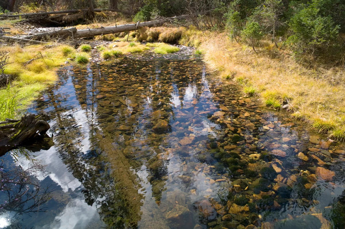
The upper reaches of Haggarty Creek on the Medicine Bow National Forest. (Angus M. Thuermer, Jr./WyoFile)
Click the link to read the article on the WyoFile website (Angus M. Thuermer):
Above the Colorado-Wyoming border, the Sierra Madre Mountain snowpack holds water that ranchers say flows downstream too fast. Some question whether a proposed 10,000-acre-foot reservoir is pork or progress.
As officials this week outline plans for a 264-foot-high concrete dam proposed for a wooded canyon in the Medicine Bow National Forest, irrigators and critics remain divided over the project’s benefits and impacts. The two sides disagree whether the estimated $80-million structure and accompanying 130-acre reservoir are pork or progress, boon or bane.
Federal officials begin receiving public comments on the proposed dam on the West Fork of Battle Creek in Carbon County as ranchers and environmentalists disagree over whether 450,000 cubic yards of concrete should plug a forested gorge and whether federal and state agencies are conducting environmental examinations appropriately. In what one official admitted is a complex process with parallel reviews, two federal agencies will make key findings to resolve the project’s fate.
The federal Natural Resource Conservation Service will examine dam construction and alternatives in an environmental impact statement. Meantime, the U.S. Forest Service will launch a separate “feasibility study” todecide whether it should take part in an estimated 6,282-acre land exchange facilitating construction of the dam. The study will determine whether trading the federal dam site to Wyomining “is in the best interest of the American public,” Medicine Bow spokesman Aaron Voos said.
Proponents want the dam and reservoir to yield 6,500 acre-feet of late-season irrigation for between 67-100 irrigators in Wyoming and Colorado. The 10,000 acre-foot impoundment would hold 1,500 acre-feet as a minimum bypass flow for fish and wildlife. The state would pay for most of the estimated $80 million cost, a figure calculated in 2017.
“We would like to have a project here because it’s good for our valley,” said Pat O’Toole, a former state representative who ranches along the Little Snake River. “The public interest is clearly that the storage project [aids] biodiversity” and boosts food production while creating “a really healthy landscape.”
[…]
The land exchange is an end-run around environmental reviews, he said, an assertion dam supporters and review agencies reject. [Gary] Wockner is worried that Medicine Bow officials won’t apply the same scrutiny to the land exchange that they would to the construction of a dam on National Forest property, he said. Building on federal land would require a more extensive review, he said, echoing dam backers’ own public statements.
Medicine Bow spokesman Voos rejected the assertion his agency is shirking its responsibilities. It is speculation to assert what level of review a proposal to build the dam on federal property would require, he said.
Wyoming agrees the process is sound. “It wouldn’t limit the environmental review at all,” Jason Crowder, deputy director of the Office of State Lands and Investments, told WyoFile.
In addition to its public-interest swap determination, the Medicine Bow is participating in a separate environmental impact review and statement — conducted by the Natural Resources Conservation Service — that will consider environmental and social impacts of dam and reservoir construction and operation. All that “satisfies the environmental review requirements for the land exchange,” Voos said.
Dwindling basin flows
At the upper reaches of the Colorado River Basin, where dwindling flows put seven Western states and Mexico at odds over historic and future use, the project comes at an uneasy time. It will test Wyoming’s willingness to impound and use what it believes river laws allow, despite an arid landscape of dwindling Colorado River flows, oversubscribed demands, climate change and growth.
Federal regulations state that a land exchange can take place only if the public interest “will be well served.”
One benefit to the Medicine Bow could be acquiring 640 acres of state-owned school-trust sections inside the national forest. “Quite a few of them are either in or adjacent to [a] wilderness area or roadless areas,” said Jonathan Bowler, watermaster for the Savery-Little Snake River Water Conservancy District.
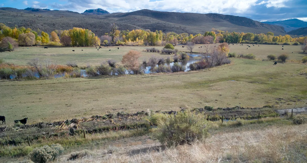
Little Snake River agricultural lands along the Colorado-Wyoming border. Angus M. Thuermer, Jr./WyoFile)
“The public could potentially see an expansion of roadless and wilderness in those areas,” he said.
The reservoir itself would flood land within about a half mile of the boundary of the Medicine Bow’s 31,057-acre Huston Park Wilderness Area, according to maps.
Bowler outlined other ways existing irrigation aids the environment; the dam would expand those benefits.
“You’ve got hundreds of ranchers pretty much doing the work of beavers to build riparian areas and habitat,” he said. Such irrigation-induced wetlands today cover more than 7,000 acres in the area, he said.
Birds and water at Bosque de Apache New Mexico November 9, 2022. Photo credit: Abby Burk
Irrigation aids amphibians and species like sandhill cranes that migrate to the Bosque del Apache National Wildlife Refuge in New Mexico, he said. “Our irrigation actually directly benefits that mating grounds down there that’s quite a tourist attraction.” Elk and other wildlife benefit from the open private land, he said.
Irrigation “basically fills up the soil … the largest reservoir that we have,” he said. When that moisture starts coming back out to the river, “that means that our rivers are higher [in] flow [in] late summer, early fall than historically they were.”
Wyoming calculates those returning flows — about 45% of what’s diverted onto fields — as water that can be used for irrigation again and counted as a benefit, according to a Water Development Office study.
“That late-season irrigation especially can help cool down river temperatures, which helps to provide for those big game populations as well as fish and other wildlife,” Bowler said.
Cutthroat trout historic range via Western Trout
The dam also could benefit Colorado River cutthroat trout because it would be an upstream barrier to competitors, helping fisheries managers enlarge a sanctuary for the species in and above the reservoir.
Said O’Toole, “this is may be as conservation-minded a place I know of in the western United States.”
Environmental review
…Wyoming wants 1,700 acres of Forest Service land for the dam and would analyze the value of between 2,024 and 4,400 acres of Wyoming school-trust land inside the Medicine Bow for the trade. Public announcements differ over the state acreage to be considered for trade.
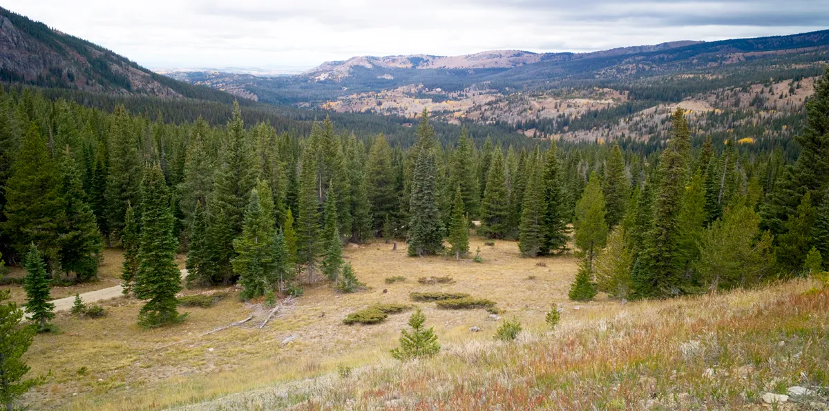
The valley in which the West Fork dam and reservoir would be constructed. (Angus M. Thuermer, Jr./WyoFile)
State and federal officials agree a land swap would make approval of the 130-acre reservoir easier. Wyoming’s exchange request states that a land swap “would eliminate the need for a USFS special use permit.”
Federal land ownership of the dam site “adds millions of dollars to that [permitting] process,” Harry LaBonde, former director of the WWDO told lawmakers in 2018. “Dealing with the Forest Service … very much complicates the NEPA process,” he said, and an exchange “very much streamlines” potential development.
Dam proponents “were running into a bit of a roadblock with Forest Service on Forest-Service-managed land,” OSLI Deputy Director Crowder told the Wyoming Board of Land Commissioners in 2021.
The Medicine Bow told Wyoming officials that building on federal, not state, land “would not be the best approach just due to all the regulations that would come along with a [required] special use permit,” Voos said in an interview. “And so I think that [land swap] has been our suggestion.”
The value of exchanged parcels can be balanced by adjusting the acreage or paying for a difference, according to Wyoming’s proposal.
Any increase in federal acreage — the state offered 4,400 acres for analysis and potential trade for 1,700 acres of Medicine Bow land — could run afoul of Carbon County’s Natural Resource Management Plan. That plan supports valuable exchanges but also calls for “no net loss of private or state lands in exchange for federal lands.”
Gov. Mark Gordon, too, “is not supportive of the federal government expanding their [sic] estate in Wyoming,” Gordon’s spokesman Michael Pearlman told WyoFile when the governor protested the 35,670-acre conservation purchase of the private Marton Ranch along the North Platte River last year.
Of the 1,700 acres of Medicine Bow property Wyoming would acquire, the state wants 1,336 acres for the dam and reservoir itself and another 426 acres covering parts of Haggarty Creek and the Belvidere Ditch, site of a water spatamong area irrigators.
Owning all the property would “provide for the efficient operation of the reservoir and surrounding lands,” the state said in its land-swap proposal.
The state would lease the newly acquired land to the Water Development Commission, which would eventually transfer ownership to Carbon County or some other entity, according to plans. That final owner would be responsible for compensating the school trust — whose land the state would trade away.
A mining company that owns land at the reservoir site also would be involved with the project. American Milling LP of Cahokia, Illinois owns about 124 acres inside the national forest at the proposed site of the reservoir. The Carbon County assessor lists the market value of the property, site of mineral claims, at $40,675. Wyoming would presumably have to acquire that property too, or somehow arrange for it to be flooded.
WyoFile did not receive a response to a certified letter sent to the company seeking comment on Wyoming’s plans to inundate the private land.
Equal values
The Forest Service must show that values and public objectives of the state parcels “equal or exceed” those that would be swapped, regulations state. Medicine Bow land that would become the dam site must “not substantially conflict with established management objectives on adjacent Federal lands,” the Forest Service said.
Medicine Bow officials last week couldn’t immediately outline those objectives.
A WWDO study, however, listed the benefits of a new dam, saying it would generate $73.7 million in public benefits. Reservoir releases would be coordinated with those from the High Savery Dam.
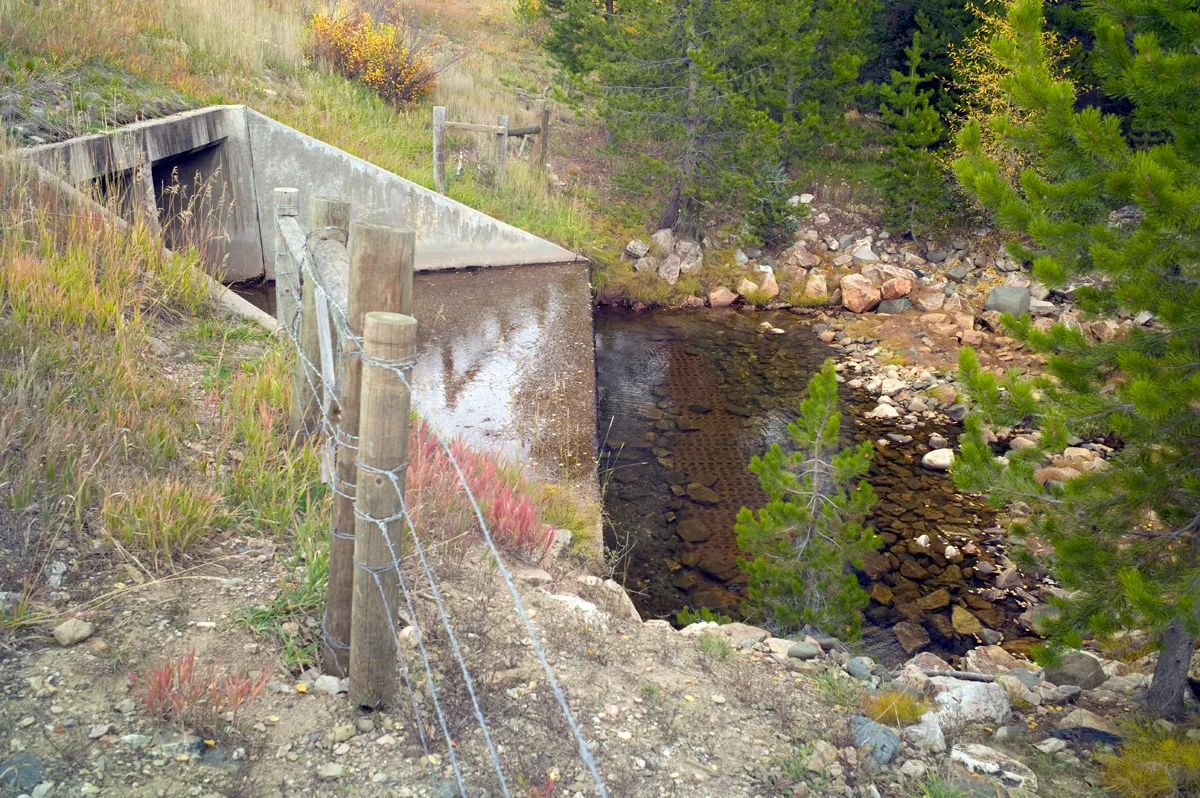
A fish barrier on Haggarty Creek provides an upstream sanctuary for Colorado River cutthroat trout. (Angus M. Thuermer, Jr./WyoFile)
Critics have questioned the accounting of benefits, including rosy projections for recreational revenue and the acreage that would benefit from irrigation.
The cost/benefit ratio allows the state to reduce the required contributions from irrigation districts from the typical 33% to 8% of construction costs.
Wyoming, however, has seen costs for dam construction increase dramatically in recent years, potentially upsetting the cost/benefit ratio. The environmental review will update those figures, Jason Mead, interim director of the WWDO, wrote in an email.
Construction would require an estimated 450,000 cubic yards of concrete, according to an application to appropriate water filed with the state engineer in 2014. The Forest Service public-interest determination and separate NRCS environmental impact statement seek to examine the construction plan through two separate reviews.
A 70-step process
The parallel review process is complex, Voos said. The Medicine Bow is engaged with the federal Natural Resources Conservation Service and the U.S. Army Corps of Engineers in a larger analysis of the dam’s environmental and social impact. Other state and federal agencies also are involved.
The separate Forest Service public-interest decision is entwined in that process, both to be explained at public meetings in the region on Tuesday, Wednesday and Thursday.
The public-interest determination, “that’s kind of a parallel process to the land exchange,” Voos said. “We are piggybacking in essence, on those public meetings,” to get comments on the swap.
“We have a full, almost … 70-step process that we have to go through for the land exchange,” Voos said. Reservoir construction on National Forest System lands “is not commonplace,” the Medicine Bow said in a statement.
After determining the public-interest benefit, “we proceed or don’t proceed with the rest of the land exchange process,” Voos said. The Forest Service is “not for or against the project.”
[…]
Interested parties can read a legal notice published by the NRCS or weigh in online, by post or hand-delivery. The comments go to the NRCS, which will forward relevant land-swap ones to the Forest Service, Voos said. Meetingsoutlining the scope of the analysis and potential alternatives will be held Tuesday, Wednesday and Thursday in Craig, Colorado, and Baggs and Saratoga respectively.
Back in 2017, at the Biennial of the Americas, Colorado State University and Denver Water announced plans to work together to support a new future for water research, policy, education and innovation. This week, that vision comes fully to life with the opening of the Hydro building on the CSU Spur campus at the National Western Center.
Jim Lochhead. Photo credit: Denver Water
Historically, water has been viewed through the lens of starkly different choices. Do we use it for agricultural lands and food production, urban life and expansion, recreation and the environment — or something else?
When CSU and Denver Water announced our partnership, we chose not to view water that way. We didn’t want to focus solely on the water needs of agriculture (a primary concern for CSU), nor just on issues connected to municipal water supplies (where Denver Water is focused). Instead, we approached it as all just water – a life-giving, flexible, finite resource that has to work for all of us, an approach much more closely tied to that of the Indigenous people who relied on the life-giving flows of the South Platte long before there were cities here. And we wanted to bring great minds, experimentation and learning about water together in one place where we could collectively focus on addressing the complex water challenges facing all sectors of our state and the American West.
Hydro is that place, and we’re honored to open its doors to the people of Colorado.
CSU Spur, with funding from the State of Colorado, is a three-building complex at the National Western Center nestled up against the Platte River. It’s a place where people of all ages and education levels can explore learning, research and demonstrations connected to food, water, and human and animal health. The Vida building, focused on human and animal health, opened a year ago. The Terra building, which opened this past summer, spotlights food and agricultural systems.
The partnership between CSU and Denver Water is centered in the third building at Spur, Hydro (named for the Greek word for water), which opens this week in conjunction with the National Western Stock Show.
Tony Frank March 22, 2018. Photo by Ellen Jaskol via CSU.
With its physical connectivity to the Platte, and a backyard space demonstrating the concepts of headwaters and watersheds, Hydro is uniquely positioned as a resource for teaching about the importance of water and how it flows to different users and communities. But for the people of Denver, its importance is even greater. Hydro will be the home to Denver Water’s new water quality lab, dramatically expanding our ability to ensure a safe and reliable water supply for the people we serve.
The lab is responsible for ensuring 1.5 million people across the Denver metropolitan area have safe, clean drinking water that meets all state and federal standards. Denver Water currently performs nearly 200,000 tests every year to monitor water quality and the effectiveness of our treatment and distribution systems. Thanks to the expanded capacity and state-of-the-art equipment at CSU Spur, the new laboratory will provide capacity for nearly three times as many tests.
The location at Spur also positions Denver Water to interact more closely with the University’s scientists and students. Planning for the water demands of tomorrow requires innovation and understanding as customer needs and policies surrounding water in our state are changing. It requires that all voices be brought into the mix of how water is discussed and treated. The partnership at Spur will help Denver Water provide leading solutions to water challenges for its customers, the state,and West in a more public-facing and engaging way than ever before.
The quality of the water around us — knowing what it is, how it changes, and how it affects our food, our health and our lives — will be crucial as we address new and emerging issues and uses, from the “forever chemicals” moving from consumer products into our environment to the cutting-edge use of wastewater to heat new buildings at the old Stock Show complex. Water quality also underpins the rehabilitation work underway at the edge of the Spur campus, where the South Platte River is becoming a place for recreation and wildlife habitat.
This is a neutral, science-based campus focused on finding solutions to real-world problems. We are interested in helping bring together people representing agencies and interests across many disciplines to work on challenges common to all of us. And the location at the National Western Center allows us to leverage the entire site to educate the water industry and the many types of visitors to the main NWC campus – starting with the North Denver community. Free educational programming will be a cornerstone of this campus for everyone.
When we announced this partnership back in 2017, we were inspired by the Biennial of the Americas and its mission to create connections, build community and inspire change. With Hydro, that mission is coming into focus in ways that will serve Colorado and its water future for generations to come.
Click the link to read the release on the USDA website:
Colorado Natural Resources Conservation Service (NRCS) State Conservationist, Clint Evans, announced the 2023 application cut-off dates for eligible entities to participate in the Agricultural Conservation Easement Program – Agricultural Land Easement (ACEP-ALE) in Colorado. There is one signup offered for complete and eligible applications to compete for available funding. Application packages are due on Friday, February 17, 2023, by 4:00 PM Mountain Standard Time (MST) for funding. Ranking pools offered for parcel applications are General, Grasslands of Special Significance (GSS), GSS Gunnison Sage Grouse, GSS Greater Sage Grouse, and General Urban Agriculture
The purpose of the ACEP-ALE program is to (1) protect the agricultural viability and related conservation values of eligible land by limiting nonagricultural uses of that land that negatively affect the agricultural uses and conservation values and (2) protect grazing uses and related conservation values by restoring or conserving eligible land.
Applicants (eligible entities) must be a federally recognized Indian Tribe, state or local units of government, or a non-governmental organization. Applicants must have an established farmland protection program that purchases agricultural conservation easements for the purpose of protecting agriculture use and related conservation values by limiting conversion to nonagricultural uses of the land.
USDA provides up to 50 percent of the appraised fair market value of the conservation easement in this voluntary program and up to 75 percent for qualifying Grasslands of Special Significance (GSS), including projects in Sage Grouse territory. The qualified landowner retains ownership and continues to use the land for agricultural purposes.
To be eligible to receive ALE funding, eligible entity applicants must demonstrate a commitment to long-term conservation of agricultural lands; a capability to acquire, manage, and enforce easements; adequate staff capacity for monitoring and easement stewardship; and the availability of funds. All landowners of record and the land being offered for enrollment must also meet specific eligibility criteria as outlined in the application materials posted to the State ACEP website.
Fully completed application packets must be received by no later than 4:00 PM MST on an advertised signup date to be considered. Application packets may be sent to the attention of Easements Program Manager, by email (preferred) to laura.trimboli@usda.gov; by FedEx or UPS to USDA-NRCS, Denver Federal Center, Building 56, Room 2604, Denver, CO 80225; or by USPS to USDA-NRCS, Denver Federal Center, PO Box 25426, Denver, CO 80225.
Applications postmarked or time stamped after the deadline WILL NOT be accepted. Only fully completed and properly executed applications that are submitted by the signup date on the appropriate forms and accompanied by all required supporting documentation will be considered for funding in FY 2023. All qualified applications will be reviewed, ranked, and considered for funding according to the Final ACEP rule, policy, and guidance. Complete applications received after the cutoff date may be considered if another sign-up date is announced
Incomplete applications WILL NOT be considered.
For more information about ACEP-ALE, please contact Laura Trimboli at 970-403-6379 or laura.trimboli@usda.gov. You can also visit your local NRCS at your nearest USDA Service Center or visit the Colorado NRCS ACEP website.
Click the link to read the article on The Deseret News website (Amy Joi O’Donoghue). Here’s an excerpt:
For the third time in six years, a convoluted case pitting public access to rivers and streams against private property rights is back in court, raising the question of whether this increasingly important issue in the West will ever be settled. The protracted legal fight hinges on the argument of whether the recreating public has a right of access to streams or rivers, even if they cross the private property of landowners to get there. A hearing is set [January 9, 2023] before the Utah Supreme Court where justices will be asked to determine if the 4th District Court erred when it dismissed a case involving the assertion that because navigating public waterways was a widespread practice by early Utah settlers, a public easement had been established. Herbert “Bert” Ley, vice president and director of the Utah Stream Access Coalition, said that argument failed because although there were newspaper articles and a digital record regarding the practice, the documentation happened before Utah gained statehood and there, of course, was no law on the books…
Utah, a state with a deep and long legal practice of honoring private property rights, has fought what it contends is unfettered access that torments landowners because of the trash, property damage and feces left behind by anglers and others. The Utah Farm Bureau has echoed that argument and contends such access imperils the rights of ranchers and farmers as well. One former executive with the bureau argued that the ruling affects what a landowner is allowed to restrict on private property, ultimately devaluing not only the land itself but the rights of an owner to have privacy and be secure in their investment…
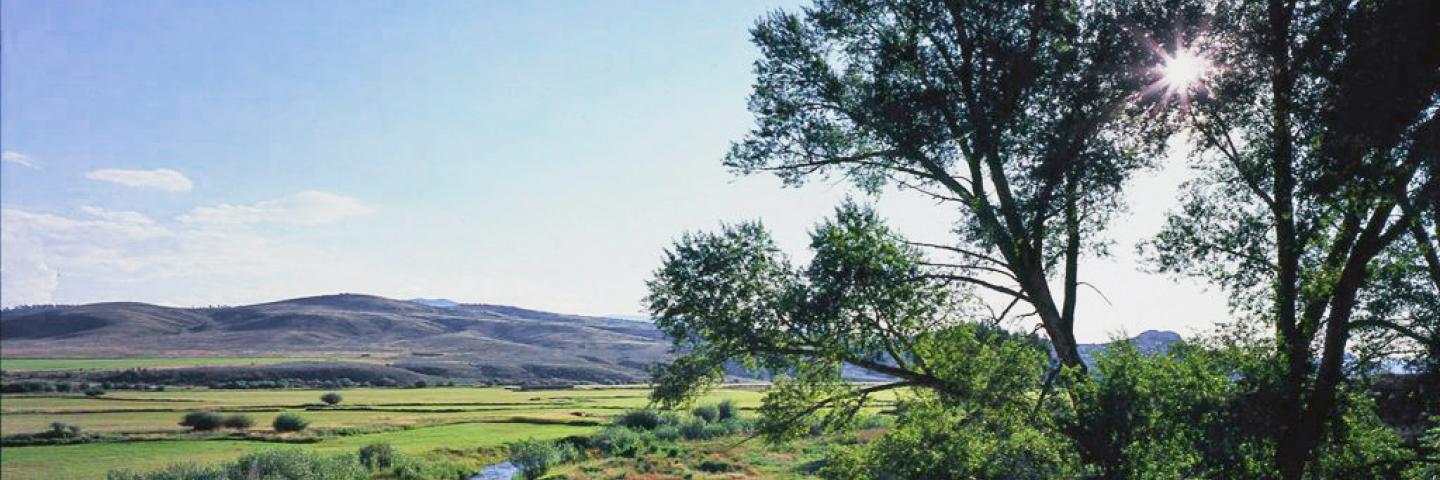
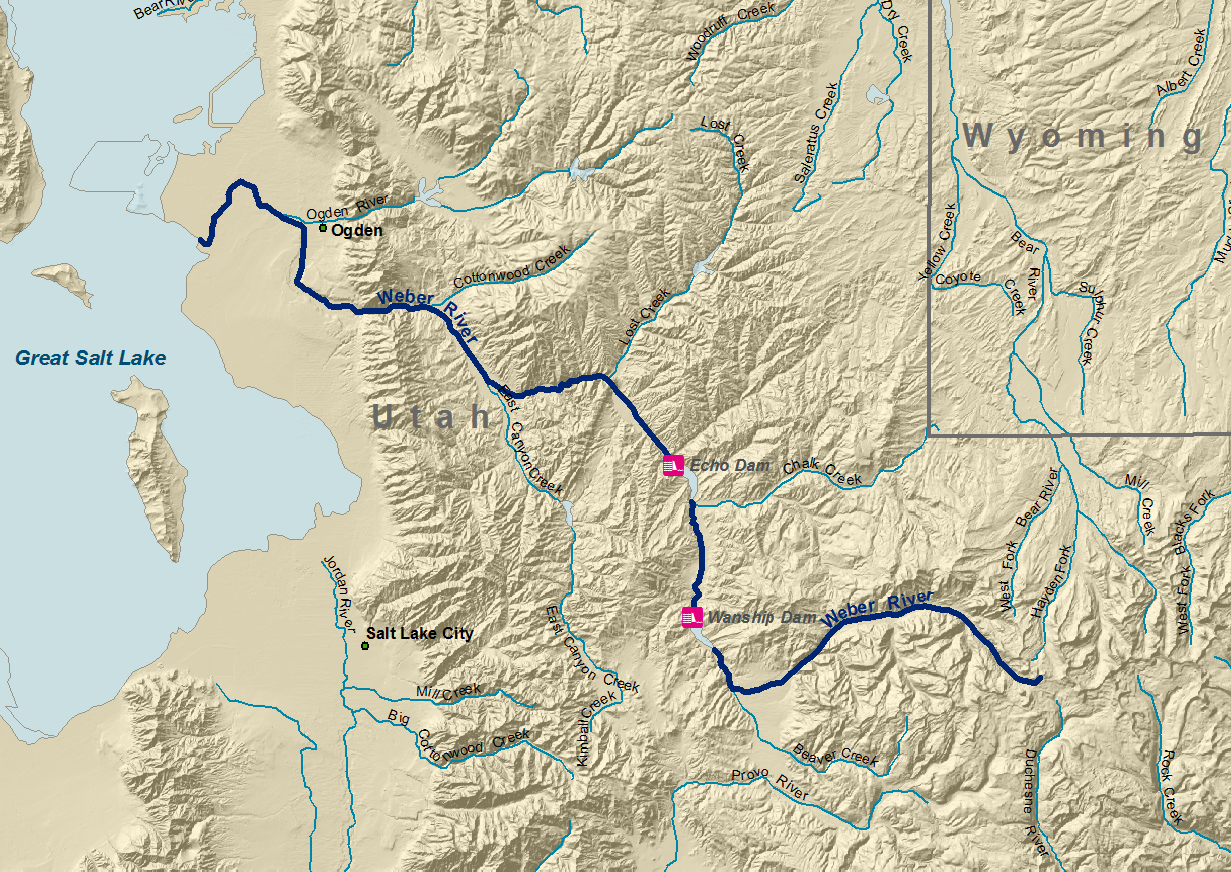
One of the stream access fights involved a portion of the Weber River, while Victory Ranch wants to restrict public recreation in a section of the Provo River that abuts its property. The coalition said it is committed to the principle that the waters flowing in all of Utah’s rivers and streams are owned by the public, and therefore the public should have the right to make use of those waters for lawful recreational purposes, regardless of who holds title to the lands beneath them.
Updated Colorado River 4-Panel plot thru Water Year 2022 showing reservoirs, flows, temperatures and precipitation. All trends are in the wrong direction. Since original 2017 plot, conditions have deteriorated significantly. Brad Udall via Twitter: https://twitter.com/bradudall/status/1593316262041436160
Click the link to read the article on the KUNR website (Kaleb Roedel). Here’s an excerpt:
In Nevada, more than $1.7 million will pay for Las Vegas Valley homeowners using septic tanks to convert to the municipal sewer system. This recycles water back into Lake Mead, which is fed by the drought-stricken Colorado River, said Doa Ross, deputy general manager of engineering for the Southern Nevada Water Authority…
In Colorado, $5 million will be used to build a collector well in Aurora. On the state’s Western Slope, Deutsch Domestic Water Company is getting $585,000 for storage and efficiency improvements…
In New Mexico, $5 million will go toward a groundwater well in Gallup. Another $1.5 million will help pay for new tools and strategies in regions with acequia water distribution systems, which are gravity-fed earthen canals that divert stream flow for distribution to fields…
Utah is getting the largest chunk of funds among states in the Mountain West. The state has seven different projects receiving a total of about $22.5 million
Supermoon over the San Luis Valley August 11, 2022. Photo credit: Chris Lopez/Alamosa Citizen
From the “Monday Briefing” newsletter from the Alamosa Citizen:
The new year likely will bring a new amended Plan of Water Management for irrigators in Subdistrict 1 of the Rio Grande Water Conservation District. The subdistrict’s board of managers in December approved a new amended plan that ties the allowable groundwater pumped to the natural surface of water of the property. This is a huge change that values snowpack, and if there isn’t any, irrigators can expect to pay a handsome fee to get surface water from a neighbor. The plan will get a hearing and vote before the Rio Grande Water Conservation District on Jan. 17. If approved there, as is likely, the amended Plan of Water Management then gets filed with Colorado Division of Water Resources for its blessing, or not.
We frequently note the activity of farmers in Subdistrict 1 because it is the subdistrict that pulls from the unconfined aquifer of the Upper Rio Grande Basin and is under state watch to reduce its groundwater pumping to recover water flows in the unconfined aquifer. It’s also the Valley’s most lucrative corridor for irrigated agriculture, and as such, the bellwether for farming in the Valley. The amended Plan of Water Management is a way for farmers in the subdistrict to try to stay in business while making gains in recovering the unconfined aquifer. More to come in 2023.
Wheat fields along the Colorado River at the Colorado River Indian Tribes Reservation. Wheat, alfalfa and melons are among the most important crops here. By Maunus at English Wikipedia, CC BY-SA 3.0, https://commons.wikimedia.org/w/index.php?curid=47854613
Click the link to read the article on the AZCentral.com website (Debra Utacia Krol). Here’s an excerpt:
Five Arizona tribes celebrated after President Joe Biden signed legislation that secured water rights, funding to develop water infrastructure and historically important tribal lands. Some tribes have been pushing for these bills for years, including the Colorado River Indian Tribes, which worked for more than two decades to secure the right to lease a portion of its Colorado River allotment. The bills were passed in the waning days of the 117th Congress. The Colorado River Indian Tribes Water Resiliency Act, the Hualapai Tribe Water Rights Settlement Act, and the White Mountain Apache Tribe Water Rights Quantification Act were signed by Biden Jan. 5.
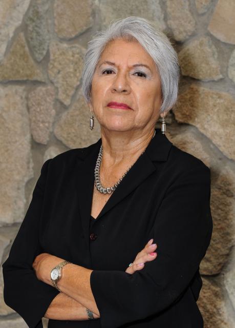
Amelia Flores, chairwoman of the Colorado River Indian Tribes. (Source: CRIT)
The Colorado River Indian Tribes, known as CRIT, had sought to lease part of its 719,248 acre-feet Colorado River allotment for more than 20 years, said CRIT Chairwoman Amelia Flores. The tribe has saved a portion of its allotment using conservation measures and will use the revenues from leasing it to help stabilize its economy and enable water service extensions to tribal members, she said. CRIT, which operates a large farm and casino, also plans to improve its canal system and conserve even more water. More importantly, Flores said, these measures will enable the tribe to help save the life of the river.
“The river’s the person. The river can’t speak for itself. And we as stewards need to step up and protect the river,” she said.
The Mojave and Chemehuevi have lived in the Colorado River Valley and the surrounding lands for millennia, and in recent years, Navajo and Hopi people relocated to the area. All four tribal cultures hold water as the source of life…Further up the river, the Hualapai Tribe finally secured a small water settlement that will provide a huge boost to its economy and community. The settlement provides 4,000 acre-feet from the river and authorizes the construction of a pipeline and other infrastructure to deliver the water to the tribe’s biggest enterprise, Grand Canyon West. Water will also be delivered to homes…The 2,300-member tribe had pushed for more than a decade to secure the allotment from the Colorado River. The tribe’s lands lie on the south side of the Grand Canyon along 108 miles of the river…
In eastern Arizona, the White Mountain Apache Tribe Water Rights Quantification Act amends a 2010 water rights settlement for the 15,000-member tribe. It authorizes federal funding and extends the time the tribe needed to complete its rural water system and Miner Flat Fam project.