One change could save Oak Creek ‘millions’ at Sheriff Reservoir; Earthquake potential reveals new risk — Steamboat Pilot & Today

Photo credit: Medicine Bow National Forest

Click the link to read the article on the Steamboat Pilot & Today website (Dylan Anderson):

Oak Creek could save “millions” off the projected $14 million price tag for fixes at Sheriff Reservoir after updated engineering on the project showed the town’s water source needs a much smaller spillway than originally thought. While the town previously believed the new spillway needed to be 300 feet wide, the updated work shows it only needs to be about 60 feet wide, according Steve Jamieson, an engineer with W. W. Wheeler that has been consulting for the town on the project. That is still twice the size of the existing spillway…

The recent work resulted from a Comprehensive Dam Safety Evaluation, which looked at ways the dam could fail during normal loading, flood loading and earthquake loading. The highest risk found was due to a gate failure, something that Jamieson said isn’t surprising as the town works to replace the original head gate on the nearly 70-year-old dam. Oak Creek has gone through a bid process for this work twice, but each effort failed to find a contractor the town could afford. A gate failure wouldn’t lead to loss of life, the analysis showed, but it would compromise the town’s water source, making the impact significant. The new risk identified is called a “liquefaction failure,” and it is related of the area’s seismic activity. While noticeable earthquakes are not common in Routt County, they are not unheard of. Since 2000, Routt County has seen approximately two-dozen earthquakes, with the largest being a 3.5 magnitude event about 10 miles northwest of Oak Creek in 2011, according to the U.S. Geological Survey.

The latest #Drought Monitor update shows improvement across most of the area compared to a year ago. However, more precipitation is needed to erase multiple years of drought conditions across the #ColoradoRiver basin. #utwx #cowx #azwx — Colorado Basin RFC

State legislators look to create a commission for #Wyoming’s stake in the #ColoradoRiver — Wyoming Public Radio #COriver #aridification

Green River Basin

Click the link to read the news brief on the Wyoming Public Radio website (Will Walkey). Here’s an excerpt:

The Wyoming State Legislature begins its lawmaking session this week. One bill, called the “Colorado River Authority of Wyoming Act,” would create a board and commissioner to manage Wyoming’s water in the Colorado River Basin. The system drains about 17 percent of the Cowboy State’s land area and is critical for agriculture, energy development and residential use in cities. The entire Colorado River Basin is currently under stress due to drought conditions and human development in the Southwest. The bill, sponsored by Rep. Albert Sommers (R-Pinedale) and Sen. Larry Hicks (R-Baggs) is similar to those previously passed in several other states that depend on the Colorado River.

“We feel it’s very important to have those people that are actually going to be affected that live in the Colorado River Basin [to] have an opportunity to participate in these policy-level decisions that’s going to affect your everyday life,” Hicks said.

The commission would include nine members, including five representatives from the Green River Basin appointed by commissioners in Sublette, Sweetwater, Lincoln and Uinta counties. Plus, one appointee from the Little Snake River Basin recommended by commissioners in Carbon County, as well as the state engineer, the governor or a designee and an at-large member. The authority would meet once a year and would include an official commissioner appointed by the governor who could represent Wyoming in negotiations with other states in the Colorado River Compact, a seven-state agreement that allocates river resources. However, any changes to water rights would still need to be approved by the state legislature, governor and relevant federal authorities.

#Water leaders to lawmakers: No ‘silver bullet’ in #Arizona’s water crisis — The Arizona Mirror

The 1980 Arizona Groundwater Code recognized the need to aggressively manage the state’s finite groundwater resources to support the growing economy. Areas with heavy reliance on mined groundwater were identified and designated as Active Management Areas (AMAs). The five AMAs (Prescott, Phoenix, Pinal, Tucson, and Santa Cruz) are subject to regulation pursuant to the Groundwater Code. Each AMA carries out its programs in a manner consistent with these goals while considering and incorporating the unique character of each AMA and its water users. Credit: ADWR

Click the link to read the article on The Arizona Mirror website (Jerod MacDonald-Evoy):

The day after Gov. Katie Hobbs delivered her first State of the State, outlining plans to address the state’s growing water crisis, the heads of the state’s water agencies stood before lawmakers to deliver an at times grim reality of the state’s water future. 

“I do not believe that any of the (Active Management Areas) are at a safe-yield,” Tom Buschatzke, director of the Arizona Department of Water Resources, told the House Natural Resources, Energy and Water Committee on Jan. 10. 

Active Management Areas, generally referred to as AMAs, were created in 1980 in an effort to help the state manage its groundwater resources as the state continued to grow. Only the AMA in Tucson is near a safe-yield, meaning the amount of water withdrawn is balanced with the amount recharging it, but Buschatzke said that Tucson has reached that by storing large amounts of Colorado River water delivered by Central Arizona Project. 

Approximately 82% of Arizona’s population resides within the state’s five AMAs. 

But Buschatzke did not see it as a failure, and instead focused on telling the committee that solutions will need to be explored and that, in the future, more and more groundwater will begin to be pumped by municipalities across the state. 

“It is not a failure in my mind in any way shape or form,” Buschatzke said, adding that the state needs to find more renewable water supplies, look to find ways to move water from one state to another or even from other sources outside the state

“There is no silver bullet,” Buschatzke said. “But I think we have to embrace the success we have.” 

The hearing also comes after Hobbs released an ADWR report showing areas in the West Valley cannot support planned development. Hobbs has accused former Gov. Doug Ducey of directing the agency to keep the report secret. 

Lawmakers didn’t directly reference or ask about the report, but questions about development and its impact on water became a hot-button issue during the hearing. 

Rep. Barbara Parker, R-Mesa, asked Buschatzke if he would be willing to help the legislature “educate” the public that agriculture uses more water than development. ADWR estimates from 2019 provided to the committee showed that agriculture made up for approximately 72% of water use, municipal 22% and industrial around 6%. 

“They always want to be down on a builder,” Parker said, additionally asking Buschatzke if he thought Hobbs’ speech unfairly targeted homebuilders. 

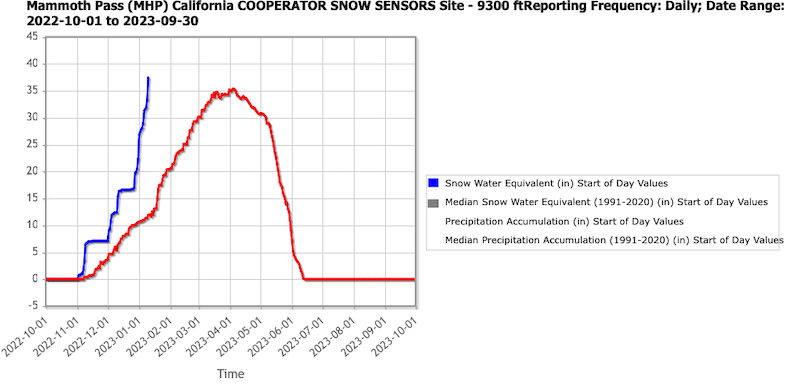
Buschatzke said that mandatory conservation requirements on farmers in AMAs have been efficient and have given them an advantage over California farmers. Both state’s farmers have been hit dramatically by the drought and recent cuts in Colorado River water. Arizona is facing a 21% cut in Colorado River allocation this year because of the drought and an alarming decrease of water in Lake Powell.

“We have done great things in this state — and there is more we can do and there is more we will have to do,” he said, adding that Hobbs’ new Water Policy Council will hopefully address some of these issues. 

Rep. Stacey Travers, D-Phoenix, asked Buschatzke if the state should close a loophole that allows developers to get around a state law that says that every new home must have a 100-year supply of water by declaring the homes are being built as rental properties. Buschatzke deflected, and said such a policy change would be up to the governor. 

“Perhaps that is an issue to be further discussed by Governor Hobbs’ water council,” he said. 

Lawmakers also heard from Central Arizona Project’s newly appointed general manager, Brenda Burman, who spoke to lawmakers on her third full day on the job. 

CAP oversees the 336-mile aqueduct that runs from Lake Havasu to Tucson, delivering Colorado River water to Maricopa and Pima counties. 

Burman reiterated what Buschatzke said, telling lawmakers that new solutions are needed to get water to more people and in a renewable way. She also mentioned the impacts of climate change on the state’s water supply, pointing out that water that in the past would have made its way into the Colorado River is now being absorbed into drier soil due to the prolonged drought. 

Both Buschatzke and Burman were asked by Rep. Oscar De Los Santos, D-Laveen, if they believed that climate change had impacted Arizona’s water supply and if they believed human activity had created climate change. Both agreed that climate change was impacting our water, but neither answered if they believed that human beings were the cause. 

Studies have definitively shown that climate change is occurring and human beings are contributing to it. 

“I’m no climatologist and I’m no expert in this,” Parker said shortly after De Los Santos had asked Burman about climate change. “I want to channel my inner Hohokam Indian. I’m an Arizona native, and I wish we could have that crystal ball and predict that everything was, you know, climate change. I don’t know if the Hohokam didn’t have fossil fuel problems in the past, but they went through a serious drought in the past, as we know, and they disappeared as an agricultural community.”

Parker then asked what CAP was doing to prepare for another “curveball” from “Mother Nature.” 

Burman explained that CAP has been storing water from times when the state experiences excessive rains, and noted that the Hohokam lived during a time of very dry years followed by very wet years. The state is currently in its 27th consecutive year of drought.

The hearing marked the beginning of what will likely be a long session for one of the two committees that will hear a slew of bills related to a key part of Hobbs’ agenda in the coming months. Lawmakers were amicable to the Hobbs appointees, stating they looked forward to working with them in the future. 

“We need to work together, and I think we have come a long way,” Republican Chairwoman Gail Griffin said at the end of the hearing.

Snow #Drought Current Conditions and Impacts in the West — NIDIS #snowpack (January 16, 2023)

Click the link to read the update on the NIDIS website:

Key Points:

  • A continuous barrage of atmospheric rivers have made landfall in central and northern California, spreading copious amounts of mountain snowfall in the Sierra Nevada, Great Basin, and parts of the Upper Colorado River Basin.
  • Snow water equivalent (SWE) is currently at 200% to over 300% of normal for much of this region, with record high SWE for this time of year at a number of SNOTEL sites in the Sierra Nevada.
  • There are still small areas of snow drought in isolated regions, including the Sangre De Cristo Mountains, straddling the New Mexico-Colorado border. 
  • The northern Rockies is another region to keep an eye on, with many locations at near-to-slightly below normal SWE in northern Idaho, western Montana, and northern Wyoming. 

The big story at the moment is the abundance of snow, not the lack of snow, across a large swath of the West. An almost continuous barrage of atmospheric rivers, beginning in the last few days of December, have made landfall in central and northern California, spreading copious amounts of precipitation (including mountain snowfall) in the Sierra Nevada, Great Basin, and parts of the Upper Colorado River Basin. These storms have been largely beneficial for drought improvements, but excessive rainfall has caused major flooding in parts of California. Snow water equivalent (SWE) is currently at 200% to over 300% of normal for much of this region, with record high SWE for this time of year at a number of SNOTEL sites in the Sierra Nevada. Even more encouraging is that many locations, especially at higher elevations, have already exceeded water year peak SWE values that typically occur from mid-March to mid-April. One example is Mammoth Pass, California, in the eastern Sierra Nevada, which currently has 37.4 inches of SWE, 314% of median for the date, and 104% of median water year peak. 

All that said, there is still a small spatial extent of snow drought in isolated regions. The Sangre De Cristo Mountains, straddling the New Mexico–Colorado border, is one of those regions. SWE at most SNOTEL sites in the Sangre De Cristo Mountains is in the range of about 40%–70% of normal. This area has been in the southeast of the storm track with minor impacts but not nearly the amounts of snow that have fallen further north and west. The snowpack in southeastern Arizona and southwestern New Mexico in the Gila Mountains has improved substantially since mid-December. The northern Rockies is another region to keep an eye on, with many locations at slightly below normal SWE (75%–90%) and a number of locations in northern Idaho, western Montana, and northern Wyoming in the 15th–30th percentile.

In Alaska, where observations are limited, most SNOTEL sites indicate that SWE is near normal to above normal, with very limited snow drought. An interesting pattern that set up in early December brought heavy snowfall to the Anchorage area but much less snow a short distance to the southeast around Turnagain Pass. SWE at the Anchorage Hillside SNOTEL site is currently 157% of normal SWE, whereas SWE at Mt. Aleyska, less than 50 miles away, is at just 71% of normal SWE. Snowpack is also below normal along the south side of the Alaska Range with very little snowfall since mid-December.

Stations with SWE Below the 30th Percentile

Snow water equivalent (SWE) percentiles for locations in the western U.S. at or below the 30th percentile as of January 9, 2023. Stations above the 30th percentile* are shown with a black “x”. Only SNOTEL and other Cooperative Snow Sensor stations with at least 20 years of data were used. Stations where the median SWE value for the date is zero are not shown. Data Source: USDA Natural Resources Conservation Service.

Snow Water Equivalent Percent of Water Year Peak

Snow Telemetry (SNOTEL) snow water equivalent (SWE) values as a percentage of the USDA Natural Resources Conservation Service (NRCS) 1991–2020 median water year peak. Only stations with at least 20 years of data are included in the station averages. This map is valid as of January 9, 2023. For an interactive version of this map, please visit NRCS.

Daily SWE at Mammoth Pass, California

Daily snow water equivalent (SWE values) at the Mammoth Pass, California Cooperative site. Values for the 2023 water year through January 9, 2023 are shown in blue, and the NRCS 1991–2020 median is shown in red. The January 9 value has already exceeded the water year peak median that occurs around April 1. Data are from the NRCS.

* Quantifying snow drought values is an ongoing research effort. Here we have used the 30th percentile as a starting point based on partner expertise and research. Get more information on the current definition of snow drought here

For More Information, Please Contact:

Daniel McEvoy
Western Regional Climate Center
Daniel.McEvoy@dri.edu

Amanda Sheffield
NOAA/NIDIS California-Nevada Regional Drought Information Coordinator
Amanda.Sheffield@noaa.gov

Britt Parker
NOAA/NIDIS Pacific Northwest Regional Drought Information Coordinator
Britt.Parker@noaa.gov

Just one meal of caught fish per year is a significant dose of #PFAS: “These fish are incredibly contaminated.”

Click the link to read the article on the Environmental Health News website (Grace van Deelen):

People who eat just one U.S. freshwater fish a year are likely to show a significant increase of a cancer-causing chemical in their bloodstream, new research warns.

An analysis of U.S. government data derived from more than 500 fish samples revealed that the majority of fish living in streams, rivers and lakes across the country are contaminated with per- and poly-fluoroalkyl substances (PFAS) at levels almost 300 times higher than found in fish from other sources, including ocean and farmed fish, according to the paper published recently in the journal Environmental Research. 

Importantly, perfluorooctanesulfonic acid (PFOS), a type of PFAS known to be particularly harmful, was the largest contributor to total PFAS levels found in freshwater fish samples, averaging 74% of the total, according to the study.

The U.S. Environmental Protection Agency (EPA) considers PFOS specifically to be a hazardous substance that “may present a substantial danger to human health” due to its links to cancer and effects on reproductive, developmental, and cardiovascular health, and warns that the chemical “may present a substantial danger to human health.” Other PFAS have also been linked to cancer, immune deficiencies, thyroid disease, and other health problems.

Great Lakes Watershed.

Freshwater fish represent an important U.S. food source, especially for people living on a low income. About 660,000 people in the U.S. eat fish they catch themselves three or more times per week.

“Consuming a single freshwater fish could measurably increase PFAS levels in your body,” said David Andrews, a senior scientist at the Environmental Working Group (EWG) and one of the authors of the paper. “These fish are incredibly contaminated.”

Many studies have shown that PFAS chemicals are pervasive in the environment and the new analysis underscores the growing understanding that humans and animals have little avenue for escaping contamination. The research paper found that fish from all 48 continental U.S. states showed PFAS contamination, and only one of the samples did not contain any detectable PFAS.

The study also found higher levels of PFAS among fish from the Great Lakes as compared to water bodies elsewhere, indicating that the Great Lakes are particularly vulnerable to contamination. According to Andrews, this could be because the water in the Great Lakes empties into the ocean much more slowly than other water bodies, aiding the accumulation of PFAS.

Heidi Pickard, a PhD candidate at Harvard University who studies PFAS in aquatic ecosystems and was not involved in the new study, said the results are likely an underestimate of the actual contamination present in fish, given the lack of ability to test for all of the thousands of PFAS chemicals and PFAS precursors — chemicals that break down to form PFAS once they enter the environment.

“We’re only starting to be able to measure and quantify [other PFAS compounds],” she said.

A ubiquitous pollutant

PFAS are also often referred to as “forever chemicals” because they do not break down in the environment and bioaccumulate, persisting in the bodies of humans and animals. There are more than 4,000 man-made PFAS compounds used by a variety of industries for such things as electronics manufacturing, oil recovery, paints, fire-fighting foams, cleaning products and non-stick cookware.

According to one nationwide study, 97% of Americans have detectable levels of PFAS in their blood, and the chemical is a ubiquitous pollutant in water and soil across the country.

The Biden Administration is implementing a series of steps to try to restrict PFAS from contaminating water, air, land, and food as well as to clean up PFAS pollution and speed up research on other PFAS issues.

Related: PFAS on our shelves and in our bodies

The findings are “very concerning” to communities that frequently consume fish from local waterways, said Andrews. The general U.S. population varies greatly in their frequency of fish consumption; anglers, individuals living near water bodies, and immigrant communities coming from cultures with high fish consumption are usually considered the highest consumers.

These people are at higher risk of PFAS contamination; for example, a 2017 study found that higher consumption of fish and shellfish was associated with elevated levels of some PFAS. A 2022 study of Burmese immigrant anglers in New York State found elevated levels of PFOS in the anglers compared to the general population. Some people, said Pickard, rely on freshwater fish for subsistence and may not be able to afford substituting store-bought fish for locally caught fish.

Catching and eating fish is also a sovereign right for Indigenous tribal nations.

Regulation lacking

While the EPA recognizes that eating U.S. freshwater fish exposes fishers to PFOS, there are currently no federal fish consumption regulations to protect fishers from these or other PFAS chemicals. Only 14 of 50 states have implemented PFAS-specific fish consumption advisories, which does not reflect the full extent of the contamination problem, according to the research paper.

For example, many states in the Great Lakes region use guidelines set by the Great Lakes Consortium for Fish Consumption Advisories to determine regulations. Those guidelines are based on the Environmental Protection Agency’s 2016 drinking water standards.

Related: What are PFAS? 

In 2022, the EPA substantially lowered the drinking water standards — by about three orders of magnitude — with new interim guidelines. If fish advisories across the country were updated to reflect the EPA’s interim guidelines, nearly all fish from rivers, lakes and streams could be considered unsafe, according to the research paper.

Sean Strom, an environmental toxicologist at the Wisconsin Department of Natural Resources, said a lack of funding and scientific capacity among state agencies is likely hindering the creation of new consumption advisories. States that have been monitoring PFAS for longer are more able to enact public health measures in response to changing science, according to Strom.

There is growing evidence that PFAS are affecting other wildlife across the country. The results for freshwater fish, said Andrews, is “just scratching the surface” of the likely contamination by industrial chemicals happening in ecosystems worldwide.

Pickard agreed and said more research is needed to show how PFAS are impacting the lives and health of wildlife.

“We have a significant challenge in being able to assess ecological risk for all these PFAS and what that’s going to mean for species,” she said. “What are the biological effects going to be for them?”

Cleaning up the country’s water bodies is unlikely, according to Ranier Lohmann, a professor of marine chemistry who studies PFAS at the University of Rhode Island.

“There’s not an easy solution to widespread, low-level contamination,” he said.

Editor’s note: This story was produced in collaboration with The New Lede. 

From Your Site Articles

Related Articles Around The Web

PFAS contamination in the U.S. via ewg.org.

Report: The Path to Universally Affordable #Water Access: Guiding Principles for the Water Sector — US Water Alliance

Click the link to access the report on the US Water Alliance website (Mami Hara and Oluwole A. (OJ) McFoy). Here’s the preface:

Water is essential to public health, but the standard, locally-reliant utility revenue model is a precarious way to fund such a fundamental public good. With rising infrastructure and pollution costs, exclusive reliance on local ratepayers places significant pressure on them—especially those who can’t afford their water and sewer bills. Unaffordable water can have very real and harmful consequences, and those consequences become even more severe when water access is lost.

To date, most innovations in affordability, cost control, and customer protection have come from local leaders— and even more are needed. Eight cities in the US Water Alliance network heard that call to action in spring 2020 as the COVID-19 pandemic wreaked havoc on the economy, disrupting livelihoods, businesses, and all levels of government. With the support of the US Water Alliance, utilities and community partners in each city began a deep exploration of policies and programs that could move them away from the practice of shutting off service or imposing liens for low-income customers behind on their bills.

Each city is making real progress to safeguard water access. Collectively, their work also reveals a key insight: the biggest wins are much larger than any single utility policy or program. They lie in creating an environment and context in which water shutoffs for low-income people are not necessary in the first place.

Creating that context and cultivating our collective under- standing of water and wastewater services as essential public goods will take collective effort. We hope that the insights and principles in this report support local leaders in their affordability and access efforts, while also inspiring the state and federal policymakers who have a significant role in ensuring everyone, regardless of income, has access to life’s most essential resource.

#RioGrande compact case: #Texas vs. #NewMexico — @AlamosaCitizen

Map showing new point to deliver Rio Grande water between Texas and New Mexico, at an existing stream gage in East El Paso. (Courtesy of Margaret “Peggy” Barroll in the joint motion)

From the Alamosa Citizen “Monday Briefing” newsletter:

Speaking of the Rio Grande, Texas and New Mexico, and to a degree Colorado, have been arguing since 2013 about water from the Rio Grande that Texas says New Mexico shorts it. Now the case has a proposed settlement. The biggest change the two sides have agreed on is that the gage station in El Paso, not Elephant Butte Reservoir in New Mexico, would be where Texas’ share of the Rio Grande would be measured. The agreement still needs a sign off from the U.S. Supreme Court.