
Click the link to read the article on the Summit Daily website (Shelby Reardon). Here’s an excerpt:
March 1, 2024
This is where Colorado’s resorts’ snow totals stand so far, according to resorts’ websites and unofficial tallies from OpenSnow.com:
- Steamboat Springs, 294 inches
- Winter Park, 257 inches
- Wolf Creek, 238 inches
- Powderhorn Mountain Resort, 220 inches
- Vail Mountain, 215 inches
- Copper Mountain, 215 inches
- Aspen Highlands, 214 inches*
- Crested Butte, 213 inches
- Snowmass, 211 inches*
- Breckenridge, 208 inches
- Beaver Creek, 203 inches
- Monarch Mountain, 202 inches
- Silverton Mountain, 190 inches
- Telluride, 185 inches
- Aspen Mountain, 179 inches*
- Arapahoe Basin, 177 inches*
- Loveland Ski Area, 177 inches
- Keystone Resort, 169 inches
- Purgatory, 167 inches
- Ski Cooper, 165 inches
- Eldora, 150 inches
- Buttermilk, 118 inches*
- Sunlight Mountain Resort, 98.5 inches
Unofficial number from OpenSnow.com are marked with an asterisk.

Click the link to read the article on The Denver Post website (Elise Schmelzer). Here’s an excerpt:
March 3, 2024
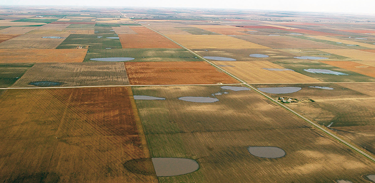
For decades, farmers in the Republican River basin have pumped water from the underground Ogallala Aquifer to grow wheat, beans, corn, potatoes, and feed for cattle and hogs. But the water is running out. Flows in the Republican River system are shrinking as the aquifer depletes, making it harder for Colorado to send enough water downstream to the east to fulfill its agreements with Kansas and Nebraska. To meet its obligations, Colorado is legally required to stop irrigating 25,000 acres in the southern part of the basin by the end of 2029 — more than a quarter of all irrigated acreage in that area. If the mandate is not met, state water officials say they will turn off wells for all 540,000 irrigated acres in the broader swath of the state that’s in the river basin, a move that would devastate the region’s economy and way of life…
With wells cut off, farms wouldn’t be able to grow crucial crops that feed Colorado and the wider region. The companies that sell farming supplies, such as seed, tractors and sprinklers, would lose massive amounts of business…Less local income would mean fewer meals at local restaurants in the plains towns and trips to the movie theater or bowling alley. Tax revenue would fall, potentially impacting schools and emergency and social services. Without irrigation, land values would drop — giving farmers less collateral for the loans they depend on to begin each season.
“What’s frightening about it is that it’s really an existential issue for those living in that region,” said Jordan Suter, a Colorado State University professor tasked with examining the economic fallout from that scenario. “With good reason. If irrigated production goes away, the area can’t really support a large population.”
Groundwater from the aquifer makes irrigated farming possible across a large part of Colorado’s Eastern Plains that spans about 7,000 square miles across eight counties — an area the size of New Jersey. In 2022, the counties produced more than $2.6 billion worth of agricultural products, according to the U.S. Department of Agriculture’s farm census. The state has made some progress, but even if it meets the 25,000-acre goal, the aquifer’s water level is still declining.