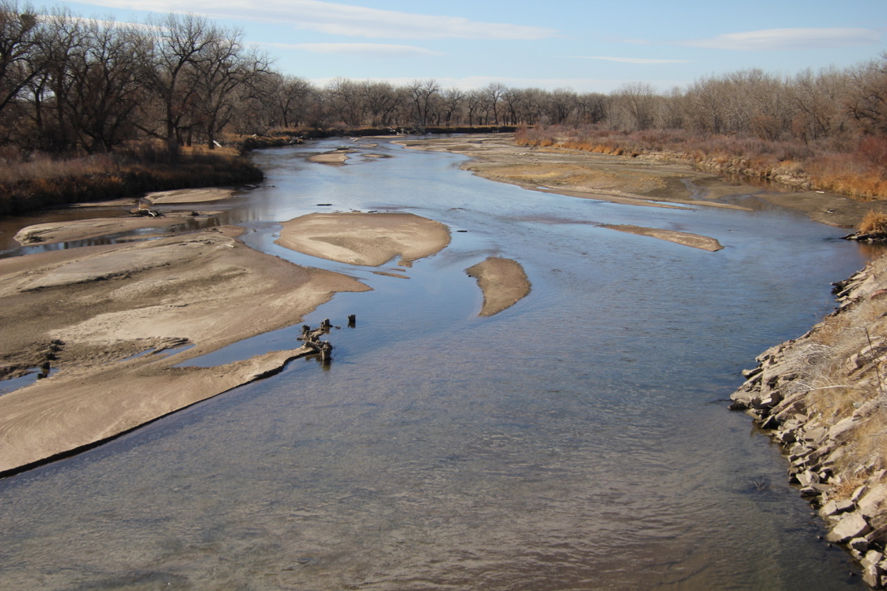
South Platte River at Goodrich, Colorado, Sunday, November 15, 2020. Photo credit: Allen Best
From email from the Colorado Water Conservation Board (Katie Weeman):
March 13, 2024 (Denver, CO) – The Colorado Water Conservation Board (CWCB) approved 52 Water Plan Grant applications today, which will distribute $17.4 million to fund critical projects to manage and conserve water, improve agriculture, spark collaborative partnerships, and much more. This funding cycle, CWCB received a record 70 applications requesting $25.6 million—$8.2 million more than is currently available.
“Water is on the top of many Coloradans’ minds. And the projects this program funds are critical to meet and mitigate our state’s most critical water challenges,” said Lauren Ris, CWCB Director. “We received significantly more applications than we had funding for this cycle of Water Plan Grants, showing just how much demand there is for this important funding, and how critical it is that we continue to fuel this effort.”
Every year, the Water Plan Grant Program provides millions of dollars of funding for projects in five key categories: Water Storage & Supply, Conservation & Land Use, Engagement & Innovation, Agricultural Projects, and Watershed Health & Recreation. Water Plan Grants support the Colorado Water Plan, and funded projects are wide-ranging and impactful to the state, focusing on enhancing water infrastructure, restoring ecosystems, supporting education and community collaboration, boosting water conservation and efficiency, guiding resilient land use planning, and more.
During this fiscal year, the CWCB awarded 83 grants totaling $25.2 million. CWCB’s Water Plan Grants run on two application cycles: the December application deadline receives final Board approval during the March Board Meeting, and the July deadline receives votes in September. On March 13, 2024, the Board voted to approve December’s 34-project cohort.
This cycle’s project applications are diverse in scope and location. A few examples include:
South Platte River Basin Salinity Study (Agricultural, $464,361): Colorado State University will conduct a comprehensive study on salinization across seven regions in the South Platte River Basin, to understand the severity and variability of salinity in water and land resources.
Denver One Water Plan Implementation Phase 2 (Conservation & Land Use, $200,000): Mile High Flood District will continue Phase 2 of Denver’s One Water Plan, which promotes coordination and collaboration among various city departments, organizations, and agencies in charge of managing all aspects of the urban water cycle.
Watershed PenPal Program (Engagement & Innovation, $136,947): Roaring Fork Conservancy will connect communities across the Roaring Fork Valley and Front Range, fostering understanding of water challenges through discussion, letter writing, and shared experiences.
Park Creek Reservoir Expansion (Water Storage & Supply, $1,750,000): The North Poudre Irrigation Company will expand the Park Creek Reservoir, increasing water storage capacity by 3,010 acre-feet to benefit agricultural use and water management.
South Boulder Creek Watershed Restoration Phase 3 (Watershed Health & Recreation, $1,000,000): Colorado Trout Unlimited will build upon previous phases of this project to support final design and permitting for multiple in-stream diversion structures in South Boulder Creek in Boulder, Colorado.
Looking forward, the CWCB hopes to continue and advance the Water Plan Grant program for decades to come. Projects funded and supported through this program address water-related challenges by harnessing the latest research, tapping into community engagement, and developing innovative solutions that allow water partners, agencies, and Coloradans to work together.
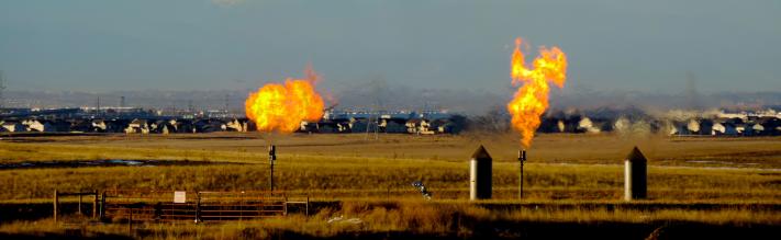
Natural gas flares near a community in Colorado. Colorado health officials and some legislators agree that better monitoring is necessary. Photo credit the Environmental Defense Fund.
Click the link to access the article on the Nature website (Evan D. Sherwin, Jeffrey S. Rutherford, Zhan Zhang, Yuanlei Chen, Erin B. Wetherley, Petr V. Yakovlev, Elena S. F. Berman, Brian B. Jones, Daniel H. Cusworth, Andrew K. Thorpe, Alana K. Ayasse, Riley M. Duren, & Adam R. Brandt). Here’s an excerpt:
As airborne methane surveys of oil and gas systems continue to discover large emissions that are missing from official estimates, the true scope of methane emissions from energy production has yet to be quantified. We integrate approximately one million aerial site measurements into regional emissions inventories for six regions in the USA, comprising 52% of onshore oil and 29% of gas production over 15 aerial campaigns. We construct complete emissions distributions for each, employing empirically grounded simulations to estimate small emissions. Total estimated emissions range from 0.75% (95% confidence interval (CI) 0.65%, 0.84%) of covered natural gas production in a high-productivity, gas-rich region to 9.63% (95% CI 9.04%, 10.39%) in a rapidly expanding, oil-focused region. The six-region weighted average is 2.95% (95 % CI 2.79%, 3.14%), or roughly three times the national government inventory estimate. Only 0.05–1.66% of well sites contribute the majority (50–79%) of well site emissions in 11 out of 15 surveys. Ancillary midstream facilities, including pipelines, contribute 18–57% of estimated regional emissions, similarly concentrated in a small number of point sources. Together, the emissions quantified here represent an annual loss of roughly US$1 billion in commercial gas value and a US$9.3 billion annual social cost. Repeated, comprehensive, regional remote-sensing surveys offer a path to detect these low-frequency, high-consequence emissions for rapid mitigation, incorporation into official emissions inventories and a clear-eyed assessment of the most effective emission-finding technologies for a given region.
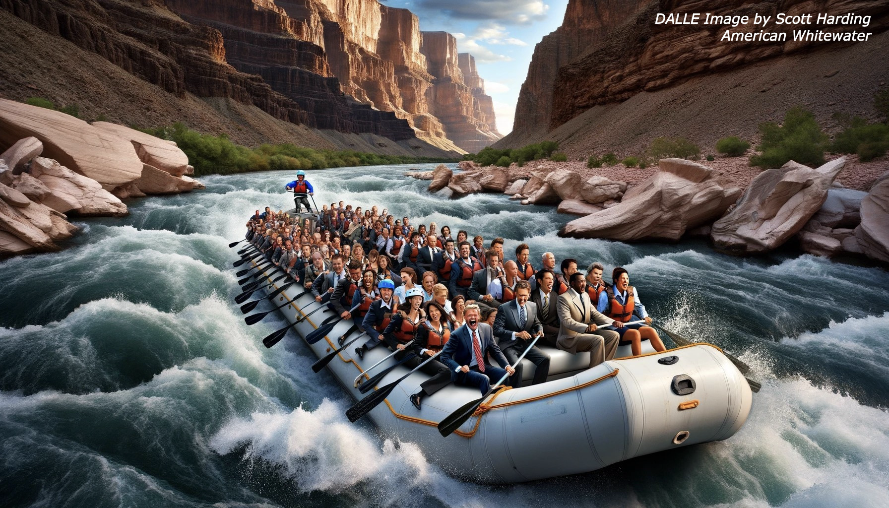
I really like the AI image above, created by a couple creatives at American Whitewater, Scott Harding and Kestrel Kunz. for a presentation at the Colorado River Water Users Association convention in January. It shows ‘the people who run the river’ running the river. But if you have ever been in that whitewater situation, you know that the river is really in charge; you run the river on the river’s terms. The guy standing up in the back of the boat is in charge of the boat, giving the others in the boat commands like ‘Five forward (strokes of the oars) on the right!’ ‘Two back on the left!’ ‘Everybody three forward!’ – trying to keep the boat on a ‘line’ he or she perceives through the rocks of the rapids. Thinking like the river to run the river.
We can draw some obvious analogies to Colorado River management – as Scott and Kestrel do in the picture above of the people in suits who ‘run the river.’ But the analogy breaks down quickly around the fact that they are all – we are all – in a boat without a boatman. Instead of all those who are running the river following directions from one person who is using his past experience to pick a line through the rocky places – ‘A 100,000 acre-feet to the Navajo!’ ‘Everybody cut 10 percent!’ – we are doing it through committees, groups, divisions, maybe some factions by James Madison’s classic definition (groups whose acts are ‘adverse to the rights of other citizens, or to the permanent and aggregate interests of the community’).
In this case we have the Lower Colorado River Basin on one side of the raft, the Upper Basin on the other side; they are each forming a perspective on the rocky places ahead and describing a line through them that requires issuing some advice or orders to those with oars on both sides of the boat about forward or backward actions, resulting mostly in quite a lot of noise, in which the intelligence from both sides gets rendered unintelligible….
There are various possible resolutions to such a situation. Some will say we have to have a boatman, one person to whom we will all listen and for whom we will all act obediently. On the real river, boatmen have to earn their right to be that person through experience. But on the metaphorical boat on the allegorical river, it is not always easy to select a boatman to get through the hard places because – what experience counts? What background is necessary and sufficient? What demonstrable skills? And there is always a loud narcissist in the boat who trumps the discourse by trumpeting that he or she is ‘the one, the only one that can get you through this’; those ‘strongmen’ appeal to many in the boat, when the better idea might be to just pull off the river before the hard place, unpack the lunch along with the situation, and work out a plan democratically before plunging in….
That is, in a sense, what is going on today in the Colorado River Region (natural basin plus out-of-basin extensions). Everyone knows that there are hard places as we all try to face up to some hard realities the river is imposing on us (at least partly because of hard things we have imposed on the river).
After a feel-good conference this January of the Colorado River Water Users Association, the seven basin states and representatives from the basin’s 30 First People nations sat down to work out a new set of ‘Interim Guidelines’ for an ‘interim’ beginning in 2027, to replace the tattered, battered and bandaged Interim Guidelines that the Colorado River waterworks have been working off of since 2007 with a ‘use by’ date of 2026.
The structural deficit refers to the consumption by Lower Basin states of more water than enters Lake Mead each year. The deficit, which includes losses from evaporation, is estimated at 1.2 million acre-feet a year. (Image: Central Arizona Project circa 2019)
That larger gathering hung together for several sessions; then, as I understand it, the three Lower Basin states withdrew to figure out how to handle a ‘structural deficit’ that is about one-fourth of their 8.5 million acre-feet (maf) allotment from the 1922 Colorado River Compact, which deficit they finally conceded was their responsibility – just their concession being a major step forward. The ‘other side of the boat,’ the Upper Basin states, began meeting on their own.
Now, just this week, the Basins have each submitted draft plans for post-2026 river management to the Bureau of Reclamation – the Upper Basin Tuesday March 4, and the Lower Basin Wednesday March 5.
I wanted to get something online this same week about this so my faithful readers would not think that I am asleep at the wheel or lost in river history, but there is no way to even obtain and read these plans, let alone try to make sense of them together, before my webmeister’s Friday deadline. So I’ll be back with you either next week or the week following with my two-bits on what’s going on.
Total losses (evaporation and riparian ET) from Reach 1 through Reach 5. Credit: USBR
But we can do a little backgrounding now. The ‘structural deficit’ the Lower Basin has finally conceded it must deal with is a substantial omission not covered in either the 1922 Compact nor in the subsequent elements of the Law of the River. It is, first, a compilation of all the ‘system losses’ from evaporation, bank storage, riparian vegetation, et cetera, from Mead Reservoir to the Mexico border – estimated by the Bureau of Reclamation to be around 1.3 million acre-feet (maf).
It also includes, second, up to 750,000 acre-feet that is the Lower Basin’s share of the Mexican obligation. Responsibility for these has been dismissed by the Lower Basin as being covered by ‘surplus flows’ – anything over the 7.5 maf the Upper Basin is committed to send through the canyons. For most of the 20th century this surplus was legitimate: water not yet being used by the Upper Basin and the Central Arizona Project, plus the occasional blessings of big water years. But for roughly the last quarter century that surplus has largely been a paper accounting; the ‘structural deficit’ that emerged was basically the Bureau drawing down storage in a time of drought to keep nurturing the ‘surplus’ fiction while praying for snow.
The 2007 Interim Guidelines were created to try to address this problem – but without really addressing it. The Guidelines were kind of a shell game, ‘balancing’ the contents of Mead and Powell reservoirs, with tipping points in the storage of both that would precipitate shortages being imposed on the Lower Basin states – but doing obeisance to California’s senior water rights by shorting the other two states first and most. And they continued releasing the substantial ‘structural deficit’ water to not force the Lower Basin states cut back on their own.
These ineffective guidelines led to the Bureau’s realization in 2022 – the centennial year of the Compact – that they might be two or three years from losing the storage in the big reservoirs entirely for much of the year, resulting in the quasi-panicky call to the seven states to cut consumption within a year by 2-4 maf.
I will not go through again all the plans and counter-plans that were proposed and analyzed to answer the Bureau’s call, but do want to call attention to the fact that the situation did revive a spate of ‘Caliphobia,’ when six of the Basin states prepared a plan for a proportionate sharing among the Lower Basin states of cuts that amounted to the structural deficit, but California would only participate if its substantial senior water rights were honored, with the other two states bearing the brunt of the cuts.
The Compact’s Signers. Photo via InkStain
This was – for me, at any rate – just more evidence of the extent to which the Colorado River Compact is a failed document. It was Caliphobia that had brought the seven states together in 1922 – California unenthusiastically – to create the Compact. All seven states had variations on the doctrine of prior appropriation as their foundational water law, and knew that the logic of the law meant they had to honor each other’s senior appropriations. But California was growing so fast, with claims on so much Colorado River water, that the other six states were concerned that there might not be enough water left for their own slower development.
Upper Basin States vs. Lower Basin circa 1925 via CSU Water Resources Archives
Their goal in coming together was to create a division of the river among the seven states that would override appropriation law at the interstate level, eliminating a seven-state appropriation horserace in which California was already lapping the field. California participated in the compact negotiations because Congress said there would be no money to build the big flood control and storage structures California desperately wanted until the seven states were in agreement on how the river’s water would be apportioned.
They were, however, unable to do the seven-state division they needed. They each came from their own state with estimates of their future needs that, in total, added up to half-again more water than even the 18 maf pluvial river carried in that first quarter of the 20th century. They were operating on dreams, not data, and after a couple days of critiquing each other’s numbers and defending their own, that gave up on the seven-state division.
The best they were able to do, in their November ten-day eleventh-hour do-or-die charrette was the two-basin division that gave the four states above the canyons some protection against California growth, but left the other two states below the canyons in the cage, as it were, with the thousand-pound gorilla, California. The Compact goal of ‘promoting interstate comity’ failed when Arizona refused to even ratify the Compact. And as average flows declined from the 1930s on, the Upper Basin’s Compact charge to ‘not cause the flow of the river at Lee Ferry to be depleted below’ the Lower Basin’s apportionment began to make the Upper Basin states feel more like juniors shorted to fulfill a senior water right than participants in an ‘equitable apportionment.’
“New plot using the nClimGrid data, which is a better source than PRISM for long-term trends. Of course, the combined reservoir contents increase from last year, but the increase is less than 2011 and looks puny compared to the ‘hole’ in the reservoirs. The blue Loess lines subtly change. Last year those lines ended pointing downwards. This year they end flat-ish. 2023 temps were still above the 20th century average, although close. Another interesting aspect is that the 20C Mean and 21C Mean lines on the individual plots really don’t change much. Finally, the 2023 Natural Flows are almost exactly equal to 2019. (17.678 maf vs 17.672 maf). For all the hoopla about how this was record-setting year, the fact is that this year was significantly less than 2011 (20.159 maf) and no different than 2019” — Brad Udall
Add in the failure to even mention the basin’s substantial system losses, and the Compact and subsequent Law of the River have not done much to ‘remove causes of present and future controversies,’ culminating in the situation we are in now, with California playing the seniority card on the other states, the Upper Basin and Lower Basin having different ideas about what it actually means to ‘not cause the flow of the river at Lee Ferry to be depleted below’ an average of 7.5 maf/year, and no one really wanting to face the fact that the Compact was written for a river half-again larger than the river we have now – with a modest but steady decline in this river as we continue to warm the world around it. We are going to have to impose, and accept, significant shortages that will have impacts on all of us, on the way we eat nationwide and how much we pay, as well as how we use water everywhere in the region.
What is truly ‘equitable’ when it comes to administering shortages? Or cutting right to the chase – to what extent should the appropriation doctrine dominate the discourse? Is ‘first-come-first-served’ to be the only measure for ‘equitable allocation’?
To put the question another way: could we acknowledge a distinction between water-use issues and all-river issues? Water-use issues can occur between agricultural users, and between agricultural and urban areas, and between urban areas. We have decided culturally to resolve those kinds of issues through the first-come-first-served laws, and whether that is the best way to resolve issues over water use or not, it is the way we do it. (Although it should be noted that, among multi-generation neighbors, with century-old water rights differing by a year or two, seniors seldom place ‘calls’ on their junior neighbors; they work out ‘gentlemen’s agreements’ to share the available water. Appropriation law can be brutal when strictly enforced.)
But all-river issues are matters above and beyond questions of prioritizing water use. Discovering that we are dealing with a river that is only two-thirds the size of the river the Compact was created for is an all-river issue. Trying to figure out how to do long-delayed water justice for 30 First People nations of varying sizes (with two-thirds of them in one state) on a fully appropriated river is an all-river issue. Managing for the unknown but unfolding consequences of a changing, warming climate is an all-river issue.
All-river issues are everyone’s problems, created and perpetrated by everyone, whether consciously or unconsciously; and in a just world everyone would share the pain of resolution in some equitable and proportionate way. With an all-river issue, ‘seniority’ just means the water user has been part of the problem, consciously or unconsciously, for a longer time.
I have some thoughts about how we could deal with some of our all-river issues, which I will no doubt unload on you over the next several posts, but I hope that if you have thoughts on it, you will unload them on me in comments below.
And I also hope some of the people actually at the table(s) are also trying to think beyond the limitations of the Compact and of the foundational law of the river, the prior appropriation doctrine that the Compact wanted to address but couldn’t. Like Becky Mitchell, Colorado’s main negotiator, said, ‘We must plan for the river we have, not the river we dream of.’
Colorado River “Beginnings”. Photo: Brent Gardner-Smith/Aspen Journalism
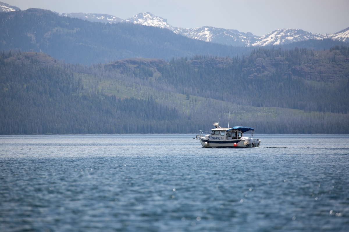
A motorboat on Yellowstone Lake. (NPS/Diane Renkin)
Click the link to read the article on the WyoFile website (Angus M. Thuermer Jr.):
March 12, 2024
To protect the headwaters of three major Western rivers from invasive, troublesome mussels, Yellowstone National Park wants to require larger boats to undergo a 30-day “dry time” before launching.
New rules up for comment also would ban any boat that’s once been contaminated by invasive Dreissena zebra or quagga mussels, regardless of decontamination cleaning.
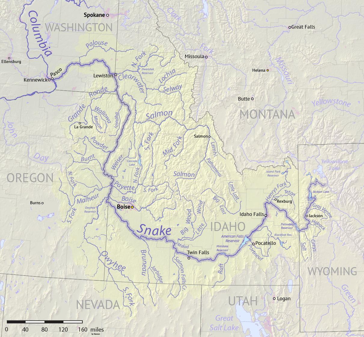
The proposal builds on existing rules, including inspection of all watercraft, designed to protect Yellowstone and downstream waters from the fingernail-sized freshwater bivalves that cling to hard structures like boat hulls, docks and irrigation headgates. The proposal would help protect the ecological integrity of Yellowstone Park and the Yellowstone, Missouri and Snake rivers downstream in Idaho, Montana and Wyoming.
Map of the Snake River watershed, USA. Intended to replace older File:SnakeRiverNicerMap.jpg. Created using public domain USGS National Map data. By Shannon1 – Own work, CC BY-SA 4.0, https://commons.wikimedia.org/w/index.php?curid=62294242
Under the proposed rules, boats with inboard, inboard/outboard and inboard jet motors — as well as sailboats — would have to be dried under a certified program for 30 days before launch. “Large, complex, trailered watercraft pose the highest risk of transporting and introducing invasive mussels … because they are difficult to inspect and less likely to … be fully decontaminated,” the park said in a release.
Manual cleaning is not 100% effective, the park said.
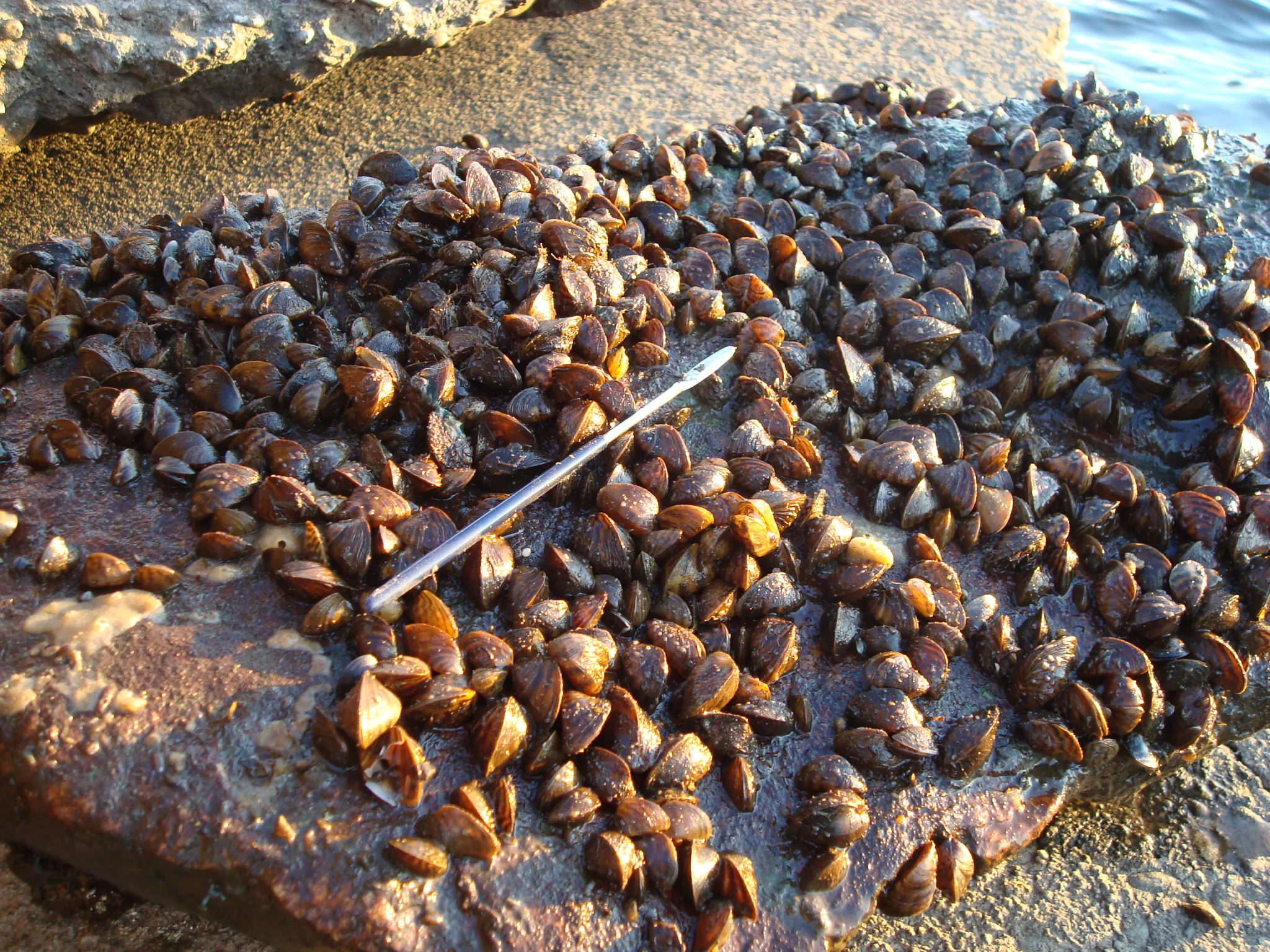
Mussels were recently discovered in waters within a day’s drive of Yellowstone, including the first found in the Columbia/Snake drainage last year near Twin Falls, Idaho. The year before, mussels showed up in Pactola Reservoir, South Dakota, not far from Wyoming’s eastern state line.
People can comment online through April 5 or to Yellowstone Center for Resources, Attn: AIS Proposed Changes, PO Box 168, Yellowstone National Park, WY 82190.
Spreading threat
The zebra mussel is native to the Black, Caspian, and Azov Seas and the quagga also comes from that area of Europe. They have infected the Midwest and lower Colorado River drainage.
Zebra Mussels in Lake Ontario. (John Manier/USGS)
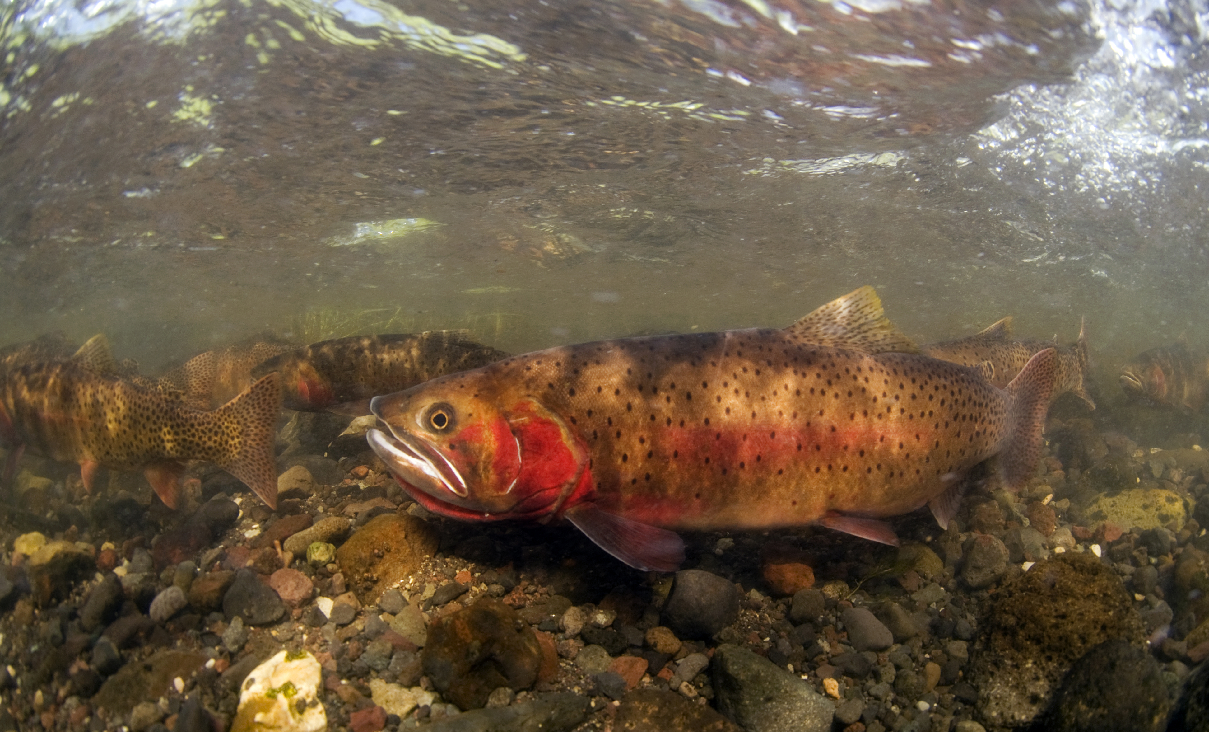
They could threaten Yellowstone cutthroat trout, a species the park has spent more than two decades restoring. The mussels can also be destructive to water and power infrastructure, according to the U.S. Department of Interior. There are no known ways to eradicate the mussels. Any invasion would be expensive to mitigate.
Motor- and sailboats falling under the new rule would be inspected and sealed to a trailer for the 30-day dry period. Seals from Yellowstone National Park, Idaho State Department of Agriculture, Montana Fish, Wildlife, and Parks and Wyoming Game & Fish Department would be honored.
Once-infected boats would be banned because of the possibility they could, even if cleaned, cause a false detection during routine DNA monitoring and consequently waste resources.