#Drought blankets most of Intermountain West, including #Colorado — and will likely get worse — Colorado Public Radio

West Drought Monitor map August 5, 2025.

Click the link to read the article on the Colorado Public Radio website (Ishan Thakore). Here’s an excerpt:

August 6, 2025

Most of the Intermountain West is in a drought, with nearly 20 percent of the region stuck in the most severe, driest conditions, according to a Tuesday presentation from Colorado state climatologist Russ Schumacher and the National Oceanic and Atmospheric Administration…The most drought-stricken areas are west of the continental divide – a scraggly arc of mountain ranges where precipitation eventually drains westward, towards the Pacific Ocean.  The driest conditions in Colorado are largely concentrated on the Western Slope, while much of the Eastern Plains faces little to no drought, and has seen average or above-average precipitation levels since October…in April, abnormally hot and dry conditions rapidly melted snowpack and began dumping  less precipitation than average across the West. Southern Arizona is even seeing some of its driest conditions over the last 130 years, according to data prepared by the Colorado Climate Center.  Climate change is also accelerating extreme heat conditions for the region, which could prolong future droughts. Denver, for instance, is projected to experience 32 days of extreme heat by 2050, compared to just four days on average between 1976-2005, according to NOAA data. 

#Drought worsens in #Colorado as hot, dry, windy weather fuels wildfire behavior — and risk — on Western Slope — The Summit Daily

Colorado Drought Monitor map August 5, 2025.

Click the link to read the article on the Summit Daily website (Ryan Spencer). Here’s an excerpt:

August 9, 2025

Colorado state climatologist says the weather has been hot and the monsoon season weak, with little signs of relief anytime soon

Drought conditions are getting worse on Colorado’s Western Slope, increasing the risk of wildfires, even as several large fires are already burning, scorching thousands of acres and forcing evacuations. Colorado State Climatologist Russ Schumacher said the extended dry period on the Western Slope contains “echoes” of the climate patterns in 2020, the worst wildfire season in Colorado history, when the three largest wildfires recorded in the state occurred…Like 2020, this summer has been hot, with above-average temperatures across much of the Western Slope, Schumacher said. The monsoon season has also been lackluster, with little precipitation and hot, dry weather coming on the heels of a winter with a poor snowpack. This June and July were among the 10 hottest on record in the northwestern corner of the state, where some of the largest wildfires are now raging, according to the Colorado Climate Center at Colorado State University. While the southern mountains got above-average precipitation in June, things remained dry in the northwest, where precipitation was less than 50% of average. In July, precipitation was below-average across the entire Western Slope…Extreme drought is now impacting all of Moffat, Rio Blanco, Garfield, Pitkin, Teller and Delta counties and part of Eagle County, according to the U.S. Drought Monitor. Severe drought has spread east into Summit, Routt and Lake counties and across the southwestern part of the state…

Lightning has sparked several wildfires in Colorado, including wildfires burning in the northwest near Meeker, in the southwest near Gatewayand in the Black Canyon of the Gunnison National Park, according to InciWeb.Wildfire.gov.  Over the past week, high winds and low relative humidity that dries out vegetation have been stacked on top of the heat, leading to red flag warnings across the Western Slope and fueling extreme fire behavior. After lightning sparked the Lee Fire in Rio Blanco County on Aug. 2, it exploded to more than 58,700 acres — making it the eighth largest wildfire in the state’s history — in just six days as high winds allowed the fire to surge through dry vegetation.

Middle #Colorado Watershed council: #RoanCreek fish barrier project groundbreaking: A milestone for native fish #conservation and water infrastructure #ColoradoRiver #COriver

Folks attending the groundbreaking ceremony for the Roan Creek fish barrier project. Photo credit: Middle Colorado Watershed Council

Click the link to read the release on the Middle Colorado River Watershed Council website:

August 6, 2025

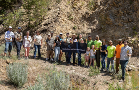
The Middle Colorado Watershed Council (MCWC), in partnership with Garfield County and state and federal funders, broke ground on the Roan Creek Fish Barrier Project on Tuesday, August 5. This long-anticipated conservation infrastructure project has been five years in the making and aligns directly with MCWC’s Integrated Water Management Plan (IWMP), a framework that dovetails with the larger Colorado Water Plan.

Located in a remote stretch of Roan Creek in western Garfield County, the project will construct a permanent fish barrier to protect one of Colorado’s most unique native fish assemblages—including a rare genetic strain of Colorado River cutthroat trout, as well as bluehead sucker, Paiute sculpin and speckled dace. These species are increasingly rare across the Colorado River Basin, with cutthroat trout occupying just one percent of their historic range.

The project is primarily funded through the Bureau of Reclamation’s WaterSMART Program, under the Infrastructure Investment and Jobs Act (IIJA). Additional support comes from the Colorado Water Conservation Board (CWCB), Colorado Parks and Wildlife (CPW) , the Colorado River District’s Community Funding Partnership and the Trout and Salmon Foundation. In total, the project represents a $1,034,995 investment in watershed health and habitat.

“This is a win-win for both water users and native fish,” said Garfield County Commissioner Perry Will, who served more than 40 years with CPW, including as a state wildlife officer and supervisor. “Garfield County is proud to support this project as a Category A partner, helping leverage the funding and collaboration it took to get here. The cutthroat trout in Roan Creek represent an incredibly unique genetic lineage—adapted to survive even in 80-degree waters. Keeping nonnative species like brook and rainbow trout out of this system is essential to preserving that rare genetic makeup and ensuring these fish continue to thrive.”

The project will also replace outdated irrigation infrastructure, eliminate push-up dams and install a modern concrete diversion with a headgate, fish screen and flow-measuring device —improving efficiency for water users while benefiting stream function and aquatic habitat.

Early funding from the Bureau of Land Management (BLM) supported the 90-percent design phase, completed in 2021 by Wright Water Engineers with guidance from BLM liaison and fisheries biologist Thomas Fresques.

“The construction of the fish passage barrier on Roan Creek marks a major step toward protecting and sustaining its unique native fishery,” said Assistant Area Wildlife Manager Albert Romero. “For more than 15 years, CPW and partners—including the BLM, local landowners and many others—have worked extensively throughout the drainage to conserve this vital resource.”

The Roan Creek Fish Barrier is the result of strong collaboration across local, state and federal partners. Garfield County played a key role as the Category A partner for Bureau of Reclamation funding, helping to secure vital federal support. The Middle Colorado Watershed Council continues to lead grant administration and stakeholder coordination. Wright Water Engineers serves in the project management role, and Kissner General Contractors, Inc. is constructing the structure.

“The Roan Creek Fish Barrier project is a great example of how targeted, local investments and partnerships can complete projects that support multiple benefits,” said Melissa Wills, Community Funding Partnership Program Manager at the Colorado River District. “Upgrading this infrastructure brings lasting benefits to both native ecosystems and the agricultural community. Through our Accelerator Grant Program, the River District is proud to have helped secure significant state and federal funding and to be part of the collaborative effort that made this project possible.”

Cutthroat trout historic range via Western Trout

Navajo Unit operations update August 12, 2025

The outflow at the bottom of Navajo Dam in New Mexico. Photo: Brent Gardner-Smith/Aspen Journalism

From email from the Bureau of Reclamation (Conor Felletter):

The Bureau of Reclamation has scheduled an increase in the release from Navajo Dam to 850 cubic feet per second (cfs) from the current release of 800 cfs for Tuesday, August 12, at 4:00 AM. 

Releases are made for the authorized purposes of the Navajo Unit, and to attempt to maintain a target base flow through the endangered fish critical habitat reach of the San Juan River (Farmington to Lake Powell).  The San Juan River Basin Recovery Implementation Program recommends a target base flow of between 500 cfs and 1,000 cfs through the critical habitat area.  The target base flow is calculated as the weekly average of gaged flows throughout the critical habitat area from Farmington to Lake Powell.  

This scheduled release change is subject to changes in river flows and weather conditions. If you have any questions, please contact Conor Felletter (cfelletter@usbr.gov or 970-637-1985), or visit Reclamation’s Navajo Dam website athttps://www.usbr.gov/uc/water/crsp/cs/nvd.html

Reclamation conducts Public Operations Meetings three times per year to gather input for determining upcoming operations for Navajo Reservoir. Input from individuals, organizations, and agencies along with other factors such as weather, water rights, endangered species requirements, flood control, hydro power, recreation, fish and wildlife management, and reservoir levels, will be considered in the development of these reservoir operation plans. In addition, the meetings are used to coordinate activities and exchange information among agencies, water users, and other interested parties concerning the San Juan River and Navajo Reservoir. The next meeting will be held Tuesday, August 19th at 1:00 PM. This meeting is open to the public with hybrid options, in person at the Civic Center in Farmington, NM (200 W Arrington St, Farmington, NM 87401, Rooms 4&5) and virtual using Microsoft Teams. Register for the webinar at this link