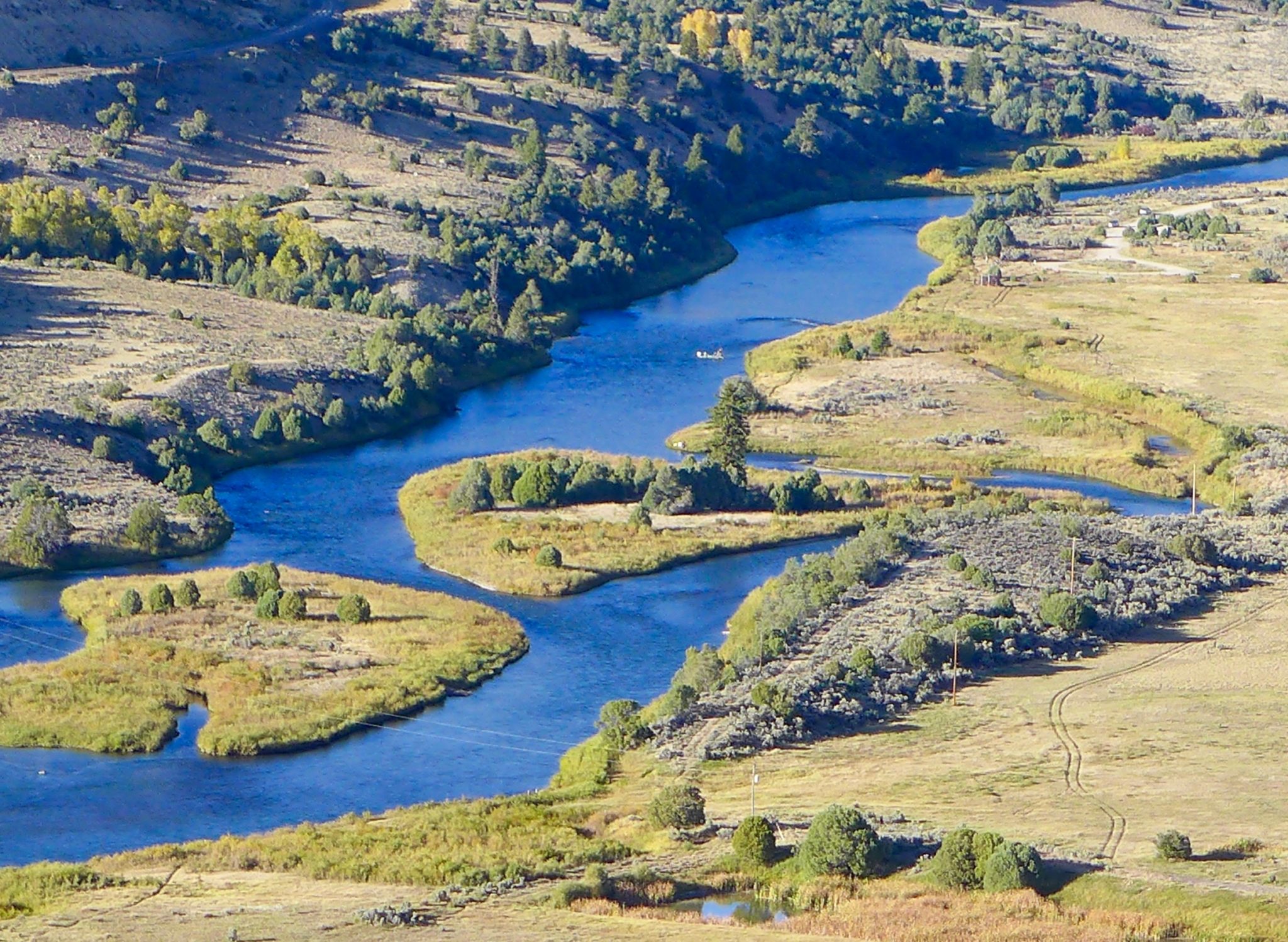
A view of the popular Pumphouse campground, boat put-in and the upper Colorado River. Photo credit: Brent Gardner-Smith/Aspen Journalism
Click the link to read the article on The Denver Post website (Elise Schmelzer). Here’s an excerpt:
September 28, 2025
The U.S. Department of the Interior plans to rescind the Biden-era Public Lands Rule, which directs the Bureau of Land Management to consider the conservation of public lands to be equally important as commercial uses like oil and gas extraction, mining, grazing and timber harvesting. When they announced the rollback, administration officials said the rule placed outsized priority on conservation and threatened to curtail grazing, energy development and other traditional land uses.
“The most effective caretakers of our federal lands are those whose livelihoods rely on its well-being,” Interior Secretary Doug Burgum said the proposal was unveiled. “Overturning this rule protects our American way of life and gives our communities a voice in the land that they depend on.”
Colorado conservation advocates said the rollback of the rule is shortsighted. The 2024 rule gives the BLM the tools to make sure the 8.3 million acres of Colorado land it manages — or nearly 13,000 square miles — remain healthy and productive for future generations, they said.
The rule provided balance so that the agency could “really embrace the most significant growing part of Western economies — the recreation economy,” said Michael Carroll, BLM campaign director for The Wilderness Society. “By not having balanced management on those landscapes, the pressure climate change is going to put on those landscapes is going to ultimately restrict the use of those lands, no matter what that use is.”
The proposed rollback is the latest in a series of moves by the Trump administration to open more public land to development and relax regulations around commercial uses on them. Months after a proposal to sell some of the West’s public lands failed due to an incredible onslaught of public opposition, federal lawmakers and the Trump administration are trying other methods to weaken protections for public lands, say conservation and recreation advocates…
Public comment on the administration’s proposed rule rescission is open until Nov. 10.
The 9-mile pipeline that delivers the city of Durango’s drinking water is in “critical need of replacement,” according to Public Works. The project has become more expensive than first thought because of easements and rights-of-way complications requiring the replacement pipeline to be built significantly farther from the original pipeline that was first laid in the early 1900s. Shelly Bellm, interim Public Works administrative manager, the original pipeline was originally intended to be repaired by slip lining, but engineers determined it needed to be replaced. Design for the replacement is slated to cost nearly $3.4 million. City Council approved a budget amendment of $2.8 million last week to pay for the design…It’s more feasible to build the new pipe along the same route as the original pipe while keeping the original pipe active, [Shelly Bellm] said. Otherwise, the water supply to the city’s reservoir would be cut while sections of the pipeline are shut down for weeks at a time.
Scientists secure jute netting over mulch on a newly planted section of the Ophir Pass fen in Colorado’s San Juan Mountains. Anna Marija Helt/High Country News
The resinous scentof Engelmann spruce wafted over a shallow, mossy pool surrounded by lush sedges near the 11,800-foot summit of Ophir Pass, in southwestern Colorado’s rugged San Juan Mountains. This type of wetland, known as a fen, forms when perennial water saturates the ground, limiting plant decomposition and allowing organic matter to accumulate as peat.
Just downhill, however, on that hot, sunny July day, another part of the fen was visible: a degraded area, bare soil exposed on a steep slope.
Peatlands — fens and bogs — are key climate regulators. (Bogs are maintained by precipitation, but fens, which, in North America, occur in the Northeast, Midwest and Mountain West, depend on groundwater.) Their peat retains plant carbon that would otherwise decompose and be released as carbon dioxide. Despite covering only about 4% of Earth’s land area, peatlands store a third of the world’s soil carbon — twice the amount trapped in forest biomass. “Fens are old-growth wetlands,” said Delia Malone, a recently retired field ecologist with the Colorado Natural Heritage Program. Some of Colorado’s fens are over 10,000 years old.
In relatively dry southern Colorado, they also provide a secondary round of water storage. The first round is Colorado’s snowpack, which, as it melts, feeds groundwater that fens’ spongy peat captures and later releases to dwindling waterways and drying landscapes after the snow is gone.
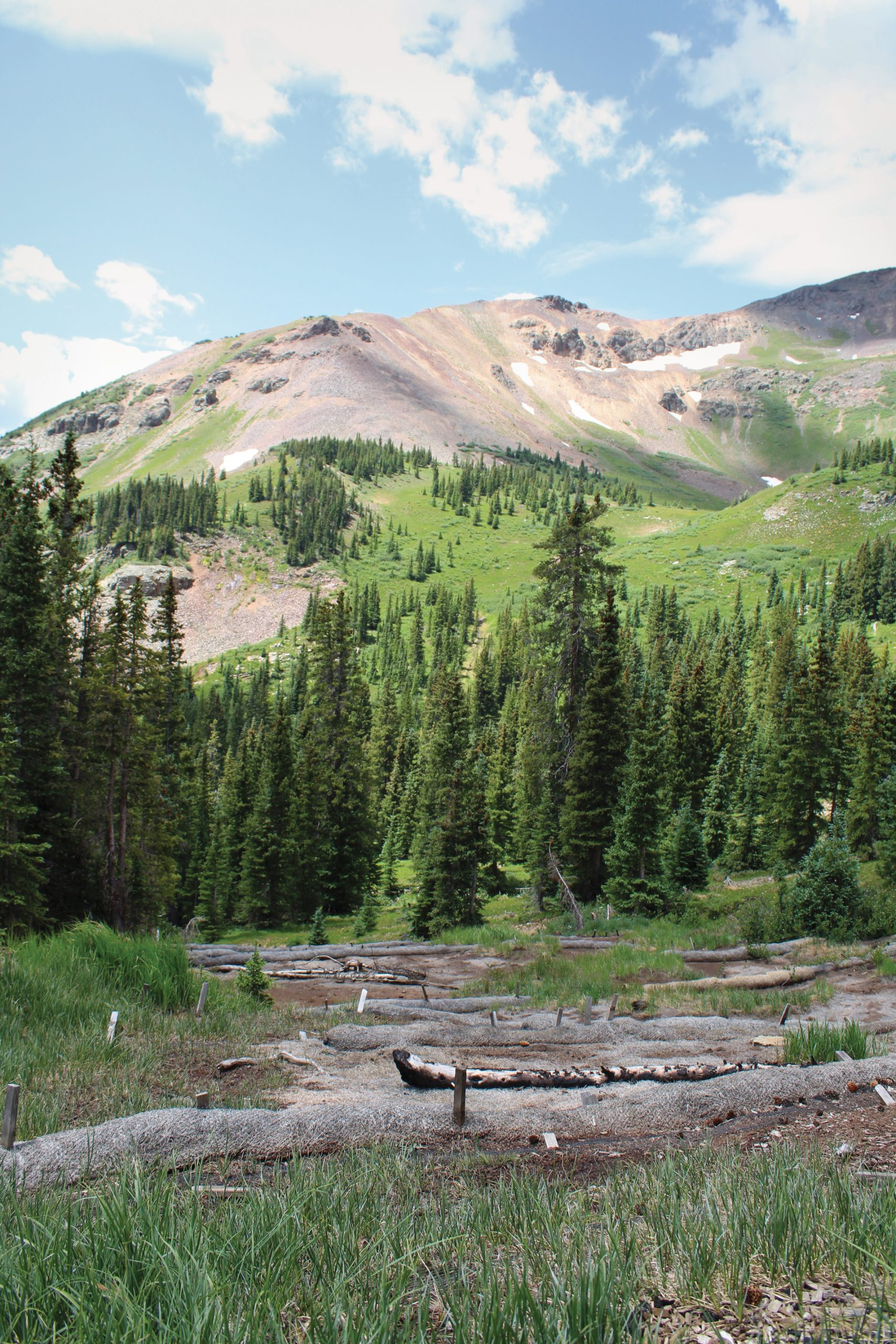
But the steep and degraded bare patch at Ophir Pass no longer functions. Where sedges, mosses, bog birch and other wetland species should be thriving, white PVC groundwater testing wells dot the ground, and heavy straw tubes called wattles reduce water and sediment runoff into the creek below.
“This is the steepest peatland we’ve ever tried to restore, as far as I know,” said wetland ecologist Rod Chimner, a professor at Michigan Tech. In the Rockies, fens lie at high elevations, which complicates restoration. Approximately 2,000 fens have been mapped so far in the San Juans, and about 200 need work. Chimner’s Ph.D. advisor, David Cooper, began restoring the area’s fens decades ago, and together they’ve literally written the book on mountain peatland restoration. Now, Chimner and staff from Mountain Studies Institute (MSI) — a local nonprofit research and education center — are restoring an ecosystem born from the last ice age but damaged by bulldozing in the 1970s.
Dams, road-building and other human activities harm Colorado’s fens, which can take 1,000 years to build just 8 inches of peat soil. The Ophir Pass fen is a rare iron fen, fed by groundwater rendered acidic by iron pyrite. The resulting chemistry supports unique plant communities — and leaves iron and other minerals incorporated in the peat or deposited in hardened layers. This fen was likely damaged by bog iron mining, which has degraded several iron fens in the San Juans.
Wattles on a steep degraded section of the fen. Anna Maria Helt/High Country News
Lenka Doskocil examines roots in peat that could be centuries old. Anna Maria Helt/High Country News
A restored pool flanked by sedges. Anna Maria Helt/High Country News
CLOUDS STARTED TO BUILD as workers used hand saws to extract plugs of sedge and soil from a healthy, already restored part of the fen. Like Goldilocks’ bed, the plugs have to be just right: Too large or too many, and digging them up disturbs the soil surface; too small, and they won’t survive transplantation. “As long as it has at least one rhizome, it will plant and spread,” said Lenka Doskocil, a research associate with MSI’s Water Program and Chimner’s graduate student. She split a plug, revealing rhizomes embedded in the rusty-brown peat, then nestled it into a bucket of plugs. Sometimes, workers plant nursery plugs or greenhouse starts from seeds collected in the area.
Chimner and Doskocil hauled the first bucket of plugs up to the bare patch, began digging small, regularly spaced holes, then gently inserted one sedge plug per opening. A stiff breeze provided relief as several other people joined in. “Take your time and do it right,” Chimner said encouragingly as he stepped back to observe. Otherwise, the plugs wouldn’t take.
Doskocil spotted an older plug protruding from the soil. But it wasn’t from rushed planting: Frost heave, a freeze-thaw cycle that thrusts soil upwards, had kicked it out of the ground, she said, tucking it back in. Frost heave complicates planting and breaks rhizomes, preventing nearby plants from colonizing bare soil. But Chimner’s past research has yielded a solution: Team members insulated the surface around each newly transplanted sedge with Excelsior, a shredded aspen mulch tough enough to withstand several winters. “We’re giving them little down jackets,” Chimner said.
A rhythm of extract-portage-dig-plant-mulch ensued as the iron-painted ridge of Lookout Peak towered to the north. A passenger yelled “thank you” from a truck descending the pass. Doskocil broke open a handful of peat, revealing roots that were hundreds of years old, if not older.
Planting the steepest quarter acre here has been difficult, and a 2021 fire didn’t help. “We’re kind of starting all over again” in that section, Chimner explained. They’re experimenting with direct seeding, which is common in wetland restoration, but challenging at the high-elevation site. “I’ve seeded here three times,” said Haley Perez, a community science program assistant with MSI.
Conservation biologist Anthony Culpepper, associate director of MSI’s Forest Program, gestured uphill toward what used to be a bare “Mars slope.” He listed the challenges: timing, winds that blow seeds away, variable winter and monsoonal precipitation, a short growing season, a sunbaked slope and animals that eat the seeds. Still, over many seasons and with multiple collaborators — several federal agencies, San Juan National Forest, Purgatory Village Land, the National Forest Foundation, San Juan Citizens Alliance and others — they’ve made great progress. That former Mars slope is now covered with mat-forming, soil-stabilizing wetland plants, including rare species.
The fen is wetter from strategic placement of wattles and check dams, wooden slats that slow surface water flow so that it soaks into the ground instead of running straight downhill. In turn, more groundwater has enabled transplantation and spread of thousands of plants. Much of the fen is now green, with mosses and other vegetation colonizing on their own. “This is the first time I’ve seen arnica at the site,” said Culpepper, who also noted the lack of invasives, a promising sign.
MSI takes an adaptive approach to restoration: Research guides planning and execution, and outcomes are carefully monitored to guide future work. That’s important in a region and state where rising temperatures and declining snowpack are predicted to lower water tables, which could disrupt new peat formation and even promote peat decomposition, potentially shifting some fens from carbon storage to carbon release. “How do we get our systems to a spot where they’re resilient enough to withstand the challenges that are going to continue to come?” asked Doskocil. MSI and its collaborators are working on it — at Ophir Pass; at Burrows Fen, a new project north of Silverton; and elsewhere throughout the San Juans.
Fat raindrops landed as the group debated whether to secure the mulch with a layer of jute netting. A wind gust decided it; they added the netting and then, just as the sun returned, trooped uphill to their vehicles to head home. Someone asked Chimner if he was satisfied with the day. “When I can look down and see all green, I’ll be satisfied,” he replied.
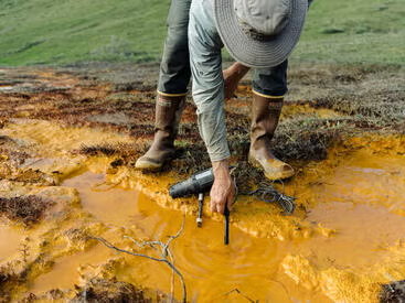
In Alaska’s Brooks Range, rivers once clear enough to drink from now run orange and hazy with toxic metals. As warming thaws formerly frozen ground, it sets off a chemical chain reaction that is poisoning fish and wreaking havoc on ecosystems.
Researcher testing murky waters in Alaska’s Brooks Range. (Photo: Taylor Rhoades)
As the planet warms, a layer of permafrost — permanently frozen Arctic soil that locked away minerals for millennia — is beginning to thaw. Water and oxygen creep into the newly exposed soil, triggering the breakdown of sulfide-rich rocks, and creating sulfuric acid that leaches naturally occurring metals like iron, cadmium, and aluminum from rocks into the river.
Often times, geochemical reactions like these are triggered by mining operations. But that is not the case this time.
“This is what acid mine drainage looks like,” said Tim Lyons, a biogeochemist at the University of California, Riverside. “But here, there’s no mine. The permafrost is thawing and changing the chemistry of the landscape.”
How the Salmon River looked prior to the permafrost thawing. (Patrick Sullivan/University of Alaska)
A new paper detailing the severity of the contamination has been published in the Proceedings of the National Academy of Sciences. Though the study focuses on the Salmon River, researchers warn that similar transformations are already underway across dozens of other Arctic watersheds.
“I have worked and traveled in the Brooks Range since 1976, and the recent changes in landforms and water chemistry are truly astounding,” said David Cooper, Colorado State University research scientist and study co-author.
Ecologist Paddy Sullivan of the University of Alaska first noticed the dramatic changes in 2019 while conducting fieldwork on Arctic forests shifting northward — another consequence of climate change. A pilot flying Sullivan into the field warned him the Salmon River hadn’t cleared up after the snowmelt and looked “like sewage.” Alarmed by what he saw, Sullivan joined forces with Lyons, Roman Dial from Alaska Pacific University, and others to investigate the causes and ecological consequences.
The research team on site in the Alaska wilderness. (Photo: Taylor Rhoades)
Their analysis confirmed that thawing permafrost was unleashing geochemical reactions that oxidize sulfide-rich rocks like pyrite, generating acidity and mobilizing a wide suite of metals, including cadmium, which accumulates in fish organs and could affect animals like bears and birds that eat fish.
In small amounts, metals aren’t necessarily toxic. However, the study shows that levels of metals in the river’s waters exceed U.S. Environmental Protection Agency toxicity thresholds for aquatic life. In addition, the iron-clouded waters reduce the amount of light reaching the bottom of the river and smother insect larvae eaten by the salmon and other fish.
While current metal concentrations in edible fish tissue are not considered hazardous to humans, the changes to the rivers pose indirect but serious threats. Chum salmon, a key subsistence species for many Indigenous communities, might struggle to spawn in gravel beds choked with fine sediment. Other species, such as grayling and Dolly Varden, may also be affected.
Hoof prints serve as reminders that river contamination affects more than fish. There are implications for whole ecosystems. (Photo: Taylor Rhoades)
“It’s not just a Salmon River story,” Lyons said. “This is happening across the Arctic. Wherever you have the right kind of rock and thawing permafrost, this process can start.”
Unlike mine sites, where acid drainage can be mitigated with buffers or containment systems, these remote watersheds might have hundreds of contamination sources and no such infrastructure. Once the chemical process begins, the only thing that can stop it is recovery of the permafrost.
“There’s no fixing this once it starts,” Lyons said. “It’s another irreversible shift driven by a warming planet.” [ed. emphasis mine]
The study, funded by the National Science Foundation’s Rapid Response program, highlights the potential danger for other Arctic regions. The researchers would like to help communities and land managers anticipate future impacts and, when possible, prepare for them.
“There are few places left on Earth as untouched as these rivers,” Lyons said. “But even here, far from cities and highways, the fingerprint of global warming is unmistakable. No place is spared.”
Pesticides sprayed on agricultural fields and on urban landscaping can run off into nearby streams and rivers. Here, pesticides are being sprayed on a soybean field in Iowa. (Credit: Eric Hawbaker, Blue Collar Ag, Riceville, IA)
EPA finalizes new water quality standards for a 38-mile urbanized section of the Delaware River.
EPA internal watchdog will begin assessments of wildfire and inland flood risk to Superfund sites.
USGS studies long-term trends for pesticide concentrations in groundwater, finding them declining.
GAO recommends that the Department of Energy hasten its reviews of historical PFAS use at its sites.
Defense Department delays PFAS cleanup at some of its contaminated sites.
And lastly, a federal judge allows a lawsuit against the EPA over the Flint water crisis to continue.
“The EPA failed to keep children and families safe during the water crisis. It is outrageous that a decade has passed without the EPA admitting its mistake and paying the citizens of Flint what they are owed. The EPA administrator should settle this lawsuit right now.” – Rep. Kristen McDonald Rivet (D-MI), in a statement about a lawsuit against the EPA for its role in the Flint water crisis. A federal district judge denied the EPA’s petition to dismiss the lawsuit, which was brought by city residents and alleges that the agency was negligent in its duties under the Safe Drinking Water Act.
By the Numbers
57: Department of Energy sites that are slated for an assessment of historical PFAS use. According to the Government Accountability Office, only 20 of the sites have completed an initial review. Twenty-one sites have a review in progress, and 16 have not started. More than 100 other DOE sites are not being reviewed.
News Briefs
PFAS Cleanup Delay The Defense Department is delaying PFAS cleanup at some of its contaminated sites, the New York Times reports. New timelines are in place for about 140 sites, the Times found when comparing a Trump administration update to a Biden-era plan.
Delaware River To protect two endangered fish species, the EPA strengthened water quality standards for a 38-mile urbanized section of the Delaware River.
The standards, which originated during the Biden administration and seek to increase dissolved oxygen levels, apply to parts of the river between Philadelphia and Wilmington, Delaware. Two species of endangered sturgeon live in these waters.
The standards will result in lower polluted discharges from industrial and municipal sewage and stormwater systems.
Studies and Reports
Pesticides in Groundwater A U.S. Geological Survey analysis found long-term declines in pesticide concentrations in groundwater in the nation’s major aquifer systems.
Across three decades of groundwater testing, the researchers found decreasing levels of most pesticides. That includes atrazine, one of the most broadly used chemicals. Twenty-one pesticides were analyzed.
Why the declines? Several factors are at play: less pesticide use, chemical degradation of pesticides in soils, and variable rainfall patterns and soil management, which can influence movement of pesticides after they are sprayed.
Some pesticides leave enduring legacies. DBCP, which was banned for agricultural use in the U.S. in 1979, was still the only pesticide in the study that exceeded human health standards in groundwater. (Though sampling for it took place only in California.)
The declines “can be viewed as encouraging results,” the authors write.
But they also urge caution: “many negative human-health effects have been linked to pesticide exposure, and these negative effects can occur when pesticide concentrations are below the human health benchmarks used in this study.”
The study results come from sampling 59 regional well networks and comparing pesticide concentrations to health standards. These networks represent agricultural and urban land uses, as well as areas in which groundwater is a drinking water source.
On the Radar
Superfund Environmental Risks The EPA’s internal watchdog will begin two investigations into environmental risks for Superfund sites.
One assessment will look at risks from inland flooding and whether remediation plans take into account potential flood disruptions. The other will do the same analysis but for wildfire risk.
Texas Desalination The Army Corps of Engineers issued permits for a proposed 100-million gallon per day desalination facility near Corpus Christi, Texas.
Federal Water Tap is a weekly digest spotting trends in U.S. government water policy. To get more water news, follow Circle of Blue on Twitter and sign up for our newsletter.
Colorado River headwaters-marker. Photo credit: Allen Best/Big Pivots
Click the link to read the article on the Big Pivots website (Allen Best):
September 28, 2025
Everyone knows about the Colorado River troubles. Even in the 1990s, the last time the river had enough water to reach the sea, problems were looming. Then came the 21st century with its mixture of severe drought, rising temperatures, and plunging reservoir levels.
You’ve likely read a few of the hundreds (and perhaps thousands) of stories that have been written about these diminishing flows and difficulty of the seven states and 30 tribes who share the river (along with Mexico) in reaching agreement about reduced uses. With a deadline of Nov. 11 looming to reach some basic agreement, the parties have not publicly retreated from their rigid talking points.
An ad hoc group of six Colorado River experts began assembling reports in 2025. They have been dubbed the Traveling Wilburys of the Colorado River Basin. Although several have previously served in various government roles, they report to no specific constituencies now. All save one are affiliated with academic institutions. They have freedom to speak the truth as they see it. They have no direct authority but they do have credibility.
In these white papers, they have consistently argued for the need to recalibrate expectations, to align demands with the water delivered by the shrinking Colorado River. They have not necessarily defined exactly how that is to be done. They argue for a shared burden.
Their position conflicts, to an extent, with the position of the four upper-basin states, who have never fully developed the 7.5 million acre-feet allocated to them in the Colorado River Compact of 1922 and insist that this allocation must be honored. Similarly, lower-basin interests have also continued to assert their rights to river entitlements.
Is this group of six having impact? That is hard to gauge, but observers and participants in Colorado River matters point to at least some small evidence that their thoughts and observations are showing up in take-away messages from meetings.
Big Pivots convened a conversation with several of the report authors on Sept. 18, a week after their latest report had been issued. In that report, (“Analysis of Colorado River Basin Suggests Need for Immediate Action,” Sept. 11, 2025) they took stock of the 24-month report from the Bureau of Reclamation that was issued in late August. That report delivered the numbers that collectively showed dramatically increased risk during the upcoming two years of the dams on the Colorado River becoming dysfunctional.
For reasons of expedience, the conversation was limited to three of the six individuals:
Eric Kuhn, who in 2018 retired from the Glenwood Springs-based Colorado River Water Conservation District after 22 years as general manager.
Eric Kuhn, who in 2018 retired from the Glenwood Springs-based Colorado River Water Conservation District after 22 years as general manager.
Anne Castle, a senior fellow at the Getches-Wilkinson Center for Natural Resources, Energy and the Environment at the University of Colorado Law School, who was the assistant secretary for water and science at the U.S. Department of Interior from 2009 to 2014 and the U.S. commissioner and chair of the Upper Colorado River Commission from 2022 to 2025. She had practiced water law for many years with Denver-based Holland & Hart.
John Fleck, the writer in residence at the Utton Transboundary Resources Center in Albuquerque since 2002 and before that directed the University of New Mexico’s Water Resource Program for five years. He was a journalist in his younger life.
Also contributing to the reports have been:
Jack Schmidt, director of the Center for Colorado River Studies at Utah State University, and former chief of the Grand Canyon Monitoring and Research Center of the U.S. Geological Survey;
Katherine Sorensen, of the Kyl Center for Water Policy at Arizona State University and former director of Phoenix Water Services; and
Katherine Tara, staff attorney for Utton Transboundary Resources Center at the University of New Mexico.
The conversation reported below has been tightened considerably and modified slightly to enhance clarity.
The three of you were among six authors of a report issued on September 11 that asked, “How close to the cliff’s edge we are in the Colorado River Basin?” How do you get six people in agreement to an answer for that question? What process do you use to produce these reports?
Eric Kuhn: When you focus on the data, coming to a similar conclusion about the future is actually quite easy. The (Bureau of Reclamation’s) 24-month study from August was out. It suggests that we’re closing in on the cliff. Jack Schmidt was very much involved in the numbers, the technical aspects. The message was easy. Getting agreement on the exact wording requires a little more patience.
John Fleck: Something that makes a process like this work with this group of people is that we all begin with a deeply shared understanding of how the system works and what those numbers mean. We don’t need to spend time learning about reservoir levels and the relationship between Powell and Mead. This is a group of people who already have a shared knowledge. [ed. emphasis mine]
In late May 2022, Lake Powell was declining after another year of low snow and high temperatures. By August, it was 26% full, the lowest it had been since waters had begun backing up behind Glen Canyon Dam in 1967. Photo/Allen Best
Anne Castle: I think we also share an overall goal of seeing a sustainable river system. We think that changes need to be made in an equitable way to match supply and demand, and that’s not happening. We all bring slightly different skills to the table and different experiences, which has improved the end product (the reports).
Fleck: One of the challenges in Colorado River governance is that you have many people who have a great deal of expertise who operate as employees of and advocates for a particular geography, for a particular community, especially those representing community or state water supplies.
Our group acts as citizens of the basin as a whole. Other people also see their role that way, especially folks in the federal government. But we have some freedoms that other people might not have in terms of being able to speak out publicly.
This is a third report since April by the same set of six authors. How did you come together?
Kuhn: Jack (Schmidt) is with the Center for Colorado River Studies. Jack and I co-authored white papers four and six among Jack’s series. That was now five years ago. Those papers are still very, very good. Because the supply-and-demand issue hasn’t been addressed, they’re still relevant. Jack and Anne go back a long way to when Jack was the head of the Grand Canyon research effort out of Flagstaff and Anne was assistant secretary of Interior. We’ve known each other for a long time. The new one is Katherine Tara, who just graduated a couple years ago from New Mexico law school and is now helping out John. So it was actually a pretty easy get together.
Fleck: We’ve all worked together in sort of twos and threes on books and papers.
Castle: John, Eric, Jack and I were having periodic meetings just to sort of talk through what was going on with the river and what the issues were. We were each doing our independent writing things. Jack and Eric and John had all worked with Katherine (Sorensen, of the Kyl Center for Water Policy at Arizona State University), and we wanted that lower basin expertise that Katherine has in spades.
We started to talk as a six-person group. In the spring, we decided the time was right for us to write something about the next set of guidelines. And that was the instigation for the report that we put out in April. See “Essential Pillars for the Post-2026 Colorado River Guidelines,” April 25, 2025.
All but one of the six of authors of these recent reports live in the upper basin states. I know you say that you do not have affiliations that tie you to a particular point of view. Still, does this tilt toward the upper basin dull some of your effectiveness?
Castle: I think, on the contrary, that the upper basin state principals would say that we tilt toward the lower basin because we haven’t adopted the positions that the upper basin principals have been taking.
Fleck: I have long been criticized here in New Mexico and by folks in the upper basin in general for always taking the side of the lower basin. I was born in California. One of my books was really lower basin focused. So I have a lot of connections and interest in the lower basin. It’s certainly the critique that we’ve received.
Kuhn: I agree. I think John and I wanted to take a basin perspective when we started writing our book (“Science Be Dammed: How Ignoring Inconvenient Science Drained the Colorado River”), but I acknowledge that after working for the Colorado River District for almost 38 years, that I do have an upper basin perspective on many things. In the recent papers, not much. My focus has been the entire basin.
Your reports have been very action oriented, and that is particularly true of this last one, where you call for drastic and immediate action. Are you seeing evidence that your work is having impact?
Castle: It’s getting attention. I don’t know if it’s resulting in action.
Fleck: One of our goals is to move conversations into the public arena that should be held in the public arena rather than in the sort of cloistered spaces in which a lot of Colorado River decision making is conducted. Katherine Tara, the newest member or youngest member of our group, talks about the need for a Colorado River C-SPAN, the need for broader public forums. And I think our work has contributed to forcing some issues and discussions into public.
I want to go back to something that Eric said at the outset. You said that you are of like mind, because you’ve all studied the data, and the data take you to the same conclusions. If that is the case with you having studied the data, what does that say about the broader basin discussion? If everybody has studied the data, should that not take everybody to the same conclusion?
Kuhn: The problem is that all the principals work for a governor or a board or constituents. The six of us all have focused on the data, and I think many, many of the journalists and many of the experts in the basin acknowledge the data. There’s still a culture among the major agencies and the states that supports a system that is unsustainable. We must reduce our uses to match the supply. But they all have constituencies and probably lawyers that tell them this is why it’s everybody else’s responsibility, not mine or not ours. We have yet to crack that culture that the basin must reduce water use — but not me.
Fleck: One of the things important about the book Eric and I wrote is in the title, ignoring inconvenient science, because we have a history in this basin of doing things for political expediency. Looking away from the most unpleasant scientific conclusions about the available water supply makes it easier for political actors to deal with their local and state constituencies. Because it’s hard to go to a community and say, “I’m sorry, there really is less water.” So, the political incentives are not aligned with responding to the science the way we think they should be, which is why we have to say these things that are really hard for a governor or governor’s representative to say.
Castle: Because we’re independent and do not answer to political constituencies, we have the ability and, frankly, the luxury of pointing to wherever the data takes us. The political incentives are almost diametrically opposed to doing the hard things that need to be done to balance what nature is supplying with what we’re using. One of the goals we’re pursuing is to educate a broader community about what the data shows and what conclusions that leads us to. That enables people to advocate to their own representatives for sensible solutions.
Do you have a bigger game plan in mind? Are you being reactive to events or do you have a strategy that goes beyond into like what we do in 2026, for example.
Fleck: Speaking for myself, I believe it is possible for us to continue to have communities that not only survive but thrive with less water if we find reasonable and equitable ways of sharing the burden of the impact of climate change across the entire West. My personal concern is that sort of parochial advocacy creates a winner- loser situation. Some community might win and not have to cut at all; another community could have disastrous cuts. That violates my basic notions of the moral framework that I have for thinking about what I want the future to look like.
Kuhn: My goal in this goes back to what John said about our book, which is paying more attention to the data and the science. We no longer have the luxury of ignoring the data and the science. Doing so will lead to an outcome that our constituents won’t like. We have to get over that hurdle. That has been my goal all along. More reliance on good data-based decision making.
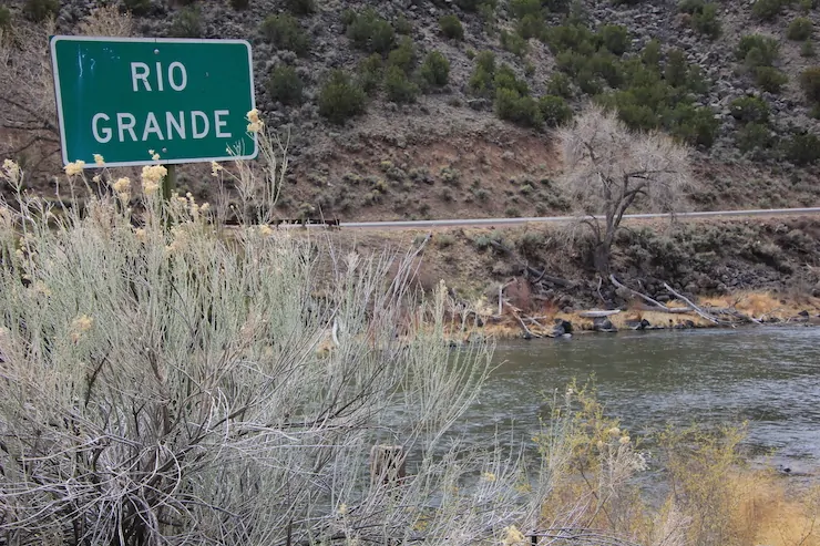
The Rio Grande in New Mexico between Taos and Espanola. Photo/Allen Best
Are there lessons for the seven states in the Colorado River Basin from the recent Rio Grande settlement?
Kuhn: I think so. Going out on a limb, I think the lesson here is that even if there’s litigation in the Colorado River Basin, the negotiations are going to continue. The mediation is going to continue.
My view of this Rio Grande agreement from 30,000 feet and from a long way away was that the court-appointed special master pretty much forced them to reach an agreement. He kept pushing them to reach an agreement. They failed initially (and) at last succeeded.
So I think the lesson is, even if there’s litigation, there’s going to be continued discussions and negotiations. I question whether, without the litigation, New Mexico would have been willing to enter into the agreement that they have entered into. I think that the additional risk of the court case brought New Mexico to the table on several issues, but that’s just my view of it from a long way away.
Castle: A legal lesson learned from the Rio Grande experience is don’t ignore the objections of the feds.
Fleck: A related lesson I have taken is that we have a history of litigation in the Colorado River Basin that was very, very much conflict-based for more than a decade. But the Rio Grande experience shows that, while extremely unpleasant and extremely expensive, it was possible to manage this river. It’s my river, right? I’m in Albuquerque. On the Rio Grande, we’re able to manage this river during the time of litigation. It did force the parties into collaboration and compromise, however ugly and unpleasant the process may have been.
It makes me think litigation on the Colorado River would be a terrible idea. A collaborative solution is much preferred. But I also think that litigation might very well push us toward the collaborative solution anyway. My argument is let’s just do it now (without the expense and the heartache) because ultimately we will end up with the same thing. That is the lesson we might draw from the litigation on the Rio Grande.
A hay meadow along the Colorado River in Middle Park, near Kremmling. Photo/Allen Best
What is the most hopeful thing that you’ve heard or seen in the last year or two in the Colorado River Basin?
Fleck: I have been really impressed with the continued push toward permanent, relatively deep reductions in the Lower Colorado River Basin. They’re consistently coming in well below their 7.5 million acre-feet. They’ve been learning important lessons about how to approach that since the early 2000s when California was using more than 5 (million acre-feet) and had to cut back to 4.4. There’s a lot of built-up experience about how to go about reducing your water use.
And the communities are still thriving. Las Vegas’s water use reductions are stunning. You’re seeing significant reductions in the water flowing down the Central Arizona Project canal and really successful adaptations in the Imperial Valley. Over and over again we are seeing that when people have less water, they use less water, and communities can still thrive.
One thing that bothers me — which I wrote about in my book (“Water is for Fighting Over: And Other Myths about Water in the West”) over a decade ago — is this sort of limbic fear that we get, that a reduction in our water supply means the death of our community. We can, in fact, get by with less water
The significant reductions you’ve seen in the lower basin are clearly not enough. The reservoirs are still dropping. But it shows what is possible.
Castle: The action that I found most surprising and hopeful or constructive was the lower basin’s willingness to own the structural deficit. The lower basin stepped up and said, “we’re not negotiating this. This is what we’re going to do.” I think that was huge and I think it shows that there can be movement that kind of goes against the political expediency.
Kuhn: Another example is that California basically accepted a portion of the shortages. This happened a while ago. This happened back in 2018 or 2019. Under the 1968 law (that authorized the Central Arizona Project), Arizona was to absorb the shortages and not California. They basically realized that that agreement that was made in the ’60s was tying up the lower basin from being able to move forward. California compromised on that, at least for the moment. And I think that this willingness of California to go along with what else has happened in the lower basin shows progress. Where we haven’t made any progress is what I would call the crossing of the Lee Ferry divide. That’s going to take more effort.
Editor’s note: The Colorado River Compact distinguished between the upper basin and the lower basin, creating an artificial dividing line at “Lee Ferry,” a point just below Glen Canyon Dam. George Sibley, a water writer from Gunnison, along with others. have maintained that this artifice creates unnecessary problems. See: “Why not create the Colorado River Compact they wanted in 1922?”Sept. 1, 2025.
Fleck: We’ve just contradicted ourselves here, or at least I’ve contradicted myself. We talked about the political incentives that make it difficult to accept the reality of what the numbers are showing us, but we have just described a situation where, in fact, the political leadership, especially in Arizona, but also in California, and for a long time in Nevada, has been willing to accept this reality.
Partly, it’s just through a lot of long, hard learning, the realization by these communities that we took these steps to use less water. And we’re still okay, you know, we still have water in the fountain at the Bellagio (hotel in Las Vegas). We still have hundreds of thousands of acre-feet of irrigated ag land in the Imperial Valley. There’s less than there used to be, but there’s still a lot. There’s still a robust agricultural economy there. So, in fact, this runs counter to the notion that political incentives always lead you to ignoring convenient science, because there’s clearly evidence to the contrary.
Denver Water gains supplies from tributaries to the Colorado River in Grand County for diversion to metropolitan Denver. Photo/Allen Best
In your papers, you have consistently said that the water rights of the tribal nations must be honored. Can their claims on the river actually be resolved at this juncture? Or is there an irreconcilable conflict?
Castle: There are several reasons we’ve called attention to the Tribal rights. One is historically, Tribal rights and interests haven’t been front and center. The tribes have historically been left out of these kinds of high-level negotiations. But the fundamental reason, in my mind is the tribal water rights are part of the bargain that our federal government made with individual tribes in exchange for the relinquishment of some of their ancestral lands. They were promised a livable homeland. Part of a livable homeland is the amount of water necessary to fulfill the purposes of that land, and that’s a promise of the federal government.
Many tribes have quantified their water rights, so we know exactly how much that promise meant in terms of the amount of water that goes along with their reservation land. And it’s a different animal than all the other kinds of Western water rights. It’s important that we keep that in mind, that it is a different kind of promise. It’s a different kind of property right. And we can’t solve this supply and demand imbalance on the backs of the tribes.
Fleck: Anne talked about a promise made by the federal government. But that’s us. This is our promise. We are the people of this country, the people of the federal government, right? The federal government is a creature of us. This is our promise to those people. It’s not something that we as individuals in this particular state should get in a fight with the federal government over. We made this promise to those people and that’s important. I describe it as a legal and a moral obligation. Respecting the legal obligation is critical to making the books balance. It’s also this moral obligation.
Eric, I have a question for you. I know you have followed climate science very closely over the years. We’ve talked about it from time to time, the current state of the science. How would you describe that? I mean, there’s a lot of uncertainty. What we really don’t know, we can’t know until it happens. Nonetheless, if you were to summarize, what should that tell us about the Colorado River going forward?
Udall/Overpeck 4-panel Figure Colorado River temperature/precipitation/natural flows with trend. Lake Mead and Lake Powell storage. Updated through Water Year 2024. Credit: Brad Udall
Kuhn: There is a lot of uncertainty, but with time, we’re seeing a narrowing of that uncertainty. We’re in some would say the 25 years of a drought, others would say it started in the late 80s. We’re seeing a very distinct stepwise reduction in flows, natural flows at Lee Ferry, and we’re seeing temperatures increase. We have documented both.
I still think there’s going to be a lot of uncertainty when it comes to what happens in those rare, odd years where we have a real wet winter and you have atmospheric rivers that run into the San Juans or the central Rockies. We could end up with a big year, and that’s all a part of climate science.
But I think the message is pretty clear that it’s unlikely that river flows will return to what we thought there was historically, which was around 14 to 14.5 million acre-feet per year. That’s unlikely. And I know no one in the basin, including the current administration, based on comments from Mr. Cameron (Scott Cameron, acting assistant secretary for water and science, Department of the Interior), who thinks that it’s likely. We’re dealing with the river that we have today, and that means that the uncertainty around the climate science has narrowed, and we sort of understand the future of this river. As long as temperatures keep going up, we’re going to see aridification of the basin.
A final question, if you will abide it, and it’s kind of a big, sweeping question. It strikes me that it’s a really interesting journey that all three of you have been on during this shift in attitudes in the Colorado River Basin. I remember going to the Colorado River Water Users Association conference in Las Vegas maybe 15 years ago, and there were people from Los Angeles or wherever who were kind of dubious. This was drought. This wasn’t climate change. We don’t have to have fundamental change. That (attitude) has clearly dissipated. My question has to do with what has not changed. How have attitudes NOT changed?
Kuhn: People are still going to be very reluctant to give up what they believe was their entitlement. They’ll compromise; they’ll reach agreements. But Colorado, which is among the leaders when it comes to the public’s acknowledgement of the issues related with climate change, has yet to say we’re going to sacrifice any portion of our theoretical entitlement. But we all have to give up some of those theoretical claims. So the culture is still “protect our entitlement,” even though that entitlement was based on data and science that are no longer valid. Just the word entitlement is indicative of the problem.
Castle: A component of that problem is the failure to recognize that while I have a perfectly good legal argument about why I have this entitlement, there are other perfectly good legal arguments about why I don’t, and we haven’t made huge steps toward acknowledging that. There are lots of legal arguments and lots of good ones, but they can’t all carry the day. Like John says, there’s not enough water for all the lawyers to be right.
What remains of the Colorado River as it enters Mexico is diverted to the farm fields near Mexicali. Farther south, near San Luis Rio Colorado, this is what the riverbed looked like in February 2017. Photo/Allen Best
Music video by The Traveling Wilburys performing Handle With Care. (C) 2007 T. Wilbury Limited. Exclusively Licensed to Concord Music Group, Inc. http://vevo.ly/LGLafI


