Telluride: The town council approves $10 million in bonds for new water treatment plant

A picture named bridalveilfallstelluride.jpg

From the Telluride Daily Planet (Katie Klingsporn):

The project aims to provide Telluride with a pure and secure source of water by tapping Blue Lake — located high in upper Bridal Veil Basin. The plan is to pipe water from Blue Lake to a facility built on a shelf of land in the east end of the box canyon, and from there disperse it to town users. Planning of the project has been in the works for more than a decade, and voters approved the bonds in 2006. However, it has been stalled by litigation, as the town wrangled in court with Idarado Mining Company over water rights and easements, and negotiations were still ongoing this summer.

But it lurched back to life early this fall when the town approved a construction contract, and the momentum was carried into a plan to issue the bonds to pay for it. The town’s bond counsel, Steve Jeffers, said the current climate is very favorable for bonding, and urged the town to pull the trigger this fall. By issuing bonds right now, he said, the town could find interest rates at around 3.4 percent. In previous discussions on the matter, Jeffers also indicated that contractor rates are low right now. And he urged the town to issue the bonds just in case a trio of controversial ballot measures, 60, 61 and 101 — which could adversely affect the ability of governments to bond — pass on Tuesday.

More San Miguel River watershed coverage here.

2010 Colorado elections: The Denver Post endorses John Salazar over Scott Tipton

A picture named coloradocongressionaldistrictboundaries2010

From the editorial staff at The Denver Post:

Salazar has shown an ability to work with people from differing political views to seek solutions that work for the district. In significantly advancing the prospects for a veterans’ cemetery in the Pikes Peak region, Salazar, an Army veteran, has worked with Republican Rep. Doug Lamborn and former Sen. Wayne Allard, and more recently with Democratic Sen. Michael Bennet. He also managed to get a $6 million appropriation for the Arkansas Valley Conduit, which will bring clean drinking water to 40 cities and towns along the 140-mile pipeline. The promise of clean drinking water to these poorer communities was made in the 1960s. It’s about time that promise is kept.

Salazar’s challenger in the race, Scott Tipton, is a conservative Republican and Cortez businessman who lost to Salazar by a wide margin in 2006. Tipton, a state lawmaker who also has deep roots in the district, is knowledgeable about the issues, and touts his private sector experience. He’s clearly qualified for the job.

We just think voters in the 3rd district will be better off with Salazar, a known quantity and reliable voice for the district.

More 2010 Colorado elections coverage here.

Telluride Institute’s Watershed Education Program overview

A picture named sanmiguelriver.jpg

From The Telluride Daily Planet (Matthew Beaudin):

The program offers classes throughout the San Miguel’s watershed, from Telluride’s landmarks (Bridal Veil, etc.) to an ecosystem camping trip on the San Miguel. “That is totally the mission of the watershed program: to being our communities together. We like to call it our ribbon of green. We all share that,” said Laura Kudo, the WEP’s director. “We really try and have it be as local and as central to our watershed as we can. I think that’s the biggest thing that sets us apart.”

The WEP is a non-profit, place-based program that utilizes local resources, experts, talents and surroundings to enable teachers throughout the San Miguel River Watershed (Telluride, Norwood, Nucla/Naturita and Paradox) to get students outside on full-day or overnight field trips. The program provides a very real environmental science curriculum supplement that’s based on Colorado education standards and offers the chance for students to move from desk to a classroom of the living watershed.

The watershed makes up about a 1 million acre basin in which the water starts at more than 14,000 feet and cascades all the way to Dolores’ red rock canyons at 5,000 feet in elevation. Of that 1 million acres, more than 60 percent is public land. The watershed isn’t without its perils, however: The dry, lofty, fragile ecosystem is home to one of the fastest growing areas on the Colorado Plateau…

One trip this fall toured nearly the entire river’s strech of the watershed and included a history and water usage talk by Bridal Veil Plant operator Eric Jacobson, a Nature Conservancy talk by Peter Mueller at Keystone Gorge, a Keystone Gorge hike with San Miguel Parks Director Rich Hamilton, a Deep Creek history talk with Dan Collins, a Down Valley Park ecological talk with Hamilton and a program put on by the Rimrock Historical Mining Museum in Naturita. It ended with a splash at the confluence of the Dolores and San Miguel rivers. Other trips on the agenda include a field trip with the Paradox Valley Charter School 5th and 6th grades supplementing a Patterns in Nature unit, another watershed tour with the Telluride Mountain School’s 3rd and 4th grades and a full watershed tour with the Norwood 6th grade.

More education coverage here.

Restoration: Agriculture Secretary Vilsack announces programs in nine states for reforestation and watershed improvment

A picture named uncompahgreplateau.jpg

From the Telluride Watch:

“This is welcomed money and will be put to very good use,” says Ron Henderson, chairman of the Montrose County Board of County Commissioners, of the [$446,000] grant. “The goal is to keep our forests healthy by reducing the risk of large wildfires, maintaining and improving water quality, preventing the spread of invasive noxious weeds and enhancing fish and wildlife habitats…

The restoration project is expected to create close to 750 part-time or seasonal jobs, supporting the enlargement of biomass markets for renewable energy and maintaining the viability of regional timber mills, the last remaining large sawmills in Colorado, for which a local and sustainable supply of wood is critical. Work, job-skill training and educational opportunities will be available for local youth and adults…

The restoration projects will focus on 555,300 acres of Forest Service land within a one-million acre landscape. Active restoration projects on 160,000 acres will include controlled burns; timber harvests; native plant establishment; trail and road relocations (to reduce sediment); riparian restoration and improvements for Colorado River cutthroat trout. Multi-party monitoring efforts are proposed for 68,000 acres. The grant provides money for the implementation of restorative work, and for monitoring, as well.

More restoration coverage here.

Energy policy — hydroelectric: Micro-hydro plant for Mountain Village?

A picture named microhydroelectricplant

From the Telluride Daily Planet (Celine Wright):

Though still in very early planning stages, the hope is that the town will apply and receive a grant in order to be able to conduct a feasibility study for micro-hydro power in Mountain Village. The Colorado Water Resources and Power Development Authority offers grants and loans to help local governments develop their hydropower resources; they still have $100,000 left in their 2010 grant funds. Applications are due by Aug. 1. Kurt Johnson of Telluride Energy will write and submit the feasibility assessment grant application. Johnson has written four other CWRPDA grant applications, and all have received funding. Last week Johnson met with Scotty McIntyre, director of public works in the Village. According to a town release on the subject: “Based on Scotty’s preliminary data, we have reason to believe our water system has potential for significant on-site energy production.”[…]

And if Mountain Village ends up receiving the grant: “The study will take a look at a map of our water system, the pressures the pipes contain, and the distances and elevations the pipes travel, crunch the numbers, and see if a significant amount of energy can be feasibly be generated,” says Deanna Drew, the town’s environmental services coordinator. Mountain Village has an extensive water system: more than 50 miles of pipeline and 27 pressure release valves (PRVs). With this, the potential for micro-hydro system could be there. “The city of Ouray is trying to replace a PRV with a turbine that generates electricity, it will be a great model, and something that might also be feasible here,” says Drew.

More hydroelectric coverage here and here.

Norwood: Total trihalomethanes and haloacetic acids well below requirements

A picture named watertreatment.jpg

From The Norwood Post (Ellen Metrick):

When measured at the end of last month, the TTHMs were at 44.7 ppb, and the HAA5s were at 27.7, both far below the set standard for the first time.

More water treatment coverage here.

Southwestern Colorado Water Conservation District Annual Seminar ‘Common Causes’ April 2

A picture named rioblanco.jpg

From the Pagosa Sun:

This year’s theme is “Common Causes,” and there will be a lineup of notable speakers who will address how water districts and various organizations work together to address common concerns.

In addition to [photographer John Fielder], one of the ranchers interviewed in Fielder’s recent book, “Colorado Ranges,” T. Wright Dickinson, will speak. Other speakers include Dave Grey; David Brown and Josh Linard from the United States Geological Survey; Doug Kemper, executive director of Colorado Water Congress, and Kent Singer, executive director of Colorado Rural Electric Association; and a panel that will talk about water quality work being done.

The registration is $30 for advance registration and $32 at the door, per person. This fee includes morning and afternoon snacks and a buffet lunch. Registration on April 2 begins at 8 a.m., the seminar begins at 8:30 a.m., and the seminar will wrap up at approximately 4 p.m.

It is recommended that advance reservations be made by contacting Jane Maxson at 247-1302.

More San Juan Basin coverage here.

Montezuma County: Southwest Colorado Watershed Workshop recap

A picture named farviewreservoir.jpg

From the Cortez Journal (Kimberly Benedict):

The workshop, sponsored by Colorado State University Extension and BUGS Consulting, was a gathering of all the major players in watershed activities in Southwest Colorado…

Representatives were on hand from a number of local, regional and state entities, including the Colorado Water Quality Control Commission, Mancos Water Conservancy District, Dolores River Restoration Partnership, Dolores River Dialogue, Colorado Watershed Assembly, Colorado Water Conservation Board, San Juan Citizens Alliance, Dolores Water Conservancy District, Montezuma Valley Irrigation Co., U.S. Bureau of Land Management, New Mexico Environment Department, Rocky Mountain Watershed Network, Pagosa Area Water and Sanitation District, Natural Resources Conservation Service and the U.S. Bureau of Reclamation…

Peter Butler, vice chair of the Colorado Water Quality Control Commission, discussed the history of the Animas River Stakeholders Group. The San Miguel Watershed Coalition was introduced by Peter Mueller, a volunteer with the organization and The Nature Conservancy’s North San Juans project director. Chester Anderson, owner of BUGS consulting, addressed work being done by the Dolores River Dialogue, which includes the Lower Dolores Management Plan Working Group. Felicity Broennan detailed efforts of the Mancos River Watershed Project, an undertaking of the Mancos Conservation District…

Jeff Crane, executive director of the Colorado Watershed Assembly, explained to participants that there is no such thing as an ideal model for a watershed organization. The assembly is a coalition of more than 70 watershed groups in Colorado. “You have been hearing about the groups in the Southwest, and they are really diverse,” Crane said. “And really, they are diverse throughout the state. It is all over the place how they are structured, and how they are organized is also all over the place. It is a lot of thinking outside the box.”

Afternoon sessions at the workshop dealt with the benefits of local watershed groups, group dynamics and best management practices…

On the Net: Animas River Stakeholders Group, http://sanjuanrcd.org/watermanagement.php#ARSG; Mancos River Watershed Project, http://www.sustainablemancos.com/watershed_project; San Miguel Watershed Coalition, http://www.sanmiguelwatershed.org; Dolores River Dialogue, http://ocs.fortlewis.edu/drd/default.asp.

More Dolores River watershed coverage here, San Juan Basin coverage here, Mancos River watershed coverage here, Animas River watershed coverage here and San Miguel watershed coverage here.

Norwood Water Commission switching to chloramines instead of free chlorine for disinfection

A picture named norwood.png

From The Norwood Post (Ellen Metrick):

In order to increase the quality of drinking water in the Norwood water district, the commission will stop using chlorine to disinfect water. On March 3, chloramines will be introduced into the system, which will reduce the amount of trihalomethanes, a carcinogenic by-product that occurs when chlorine is mixed with the organic matter in water…

The public is invited to an information session on Feb. 23, at 7 p.m., at the Norwood Community Center.

More San Miguel River watershed coverage here and here.

Telluride Town Council approves statement of opposition to San Miguel Valley Corp’s water court application for raw water facilities

A picture named telluridevalleyfloororg.jpg

From the Telluride Watch:

The filing concerns conditional water rights SMVC alleges it retained when the town acquired the 572-acre parcel in June 2008 after a lengthy condemnation battle. “It is SMVC’s understanding, based upon relevant case law concerning the use and enjoyment of water rights, that it therefore has retained all land use interests necessary for the full use and enjoyment of SMVC’s retained water rights, including the SMVC Conditional Water Rights,” attorneys for the company notified the town last February in a letter obtained by The Watch through a public records request. In essence, the company is putting forth a legal argument that maintains it has the right to access the Valley Floor and to construct whatever facilities there it deems necessary in order to exercise its water rights – including buildings or reservoirs.

More coverage from The Telluride Daily Planet (Katie Klingsporn):

In January, SMVC filed an application with the District Water Court seeking to make changes regarding points of diversion, conditional water rights, ground water rights and others on the Valley Floor. And on Tuesday afternoon, the Telluride Town Council voted unanimously to file a statement of opposition in the case. The town has until the end of February to file its statement.

The statement of opposition is a legal maneuver that makes the town a party to the proceedings. In water court proceedings, it doesn’t necessarily indicate a dispute. However in this instance, the town is opposed to some of SMVC’s assertions in the application about its water rights on the Valley Floor, according to Town Attorney Kevin Geiger. SMVC may have had water rights on paper that were proposed for the land at one time, Geiger said. But “now that they don’t own that property anymore, it seems highly doubtful that they can move forward on that.”[…]

[Chris Cummins, an attorney who represents SMVC] said the purpose of the application is to make changes to SMVC’s conditional water rights in light of the town’s condemnation. He did not comment on the disagreements the town and SMVC have over those rights.

More San Miguel watershed coverage here and here.

CWCB delays until January 2011 the instream appropriation on San Miguel River to allow time to study more storage off the mainstem

A picture named sanmiguelriver1109

From The Telluride Watch (Karen James):

The decision represents and effort to find a middle ground between groups seeking an immediate appropriation of the water right and others who are opposed to it. “The board agreed to table it for a year, but expressed concern about progress being made” on plans for storage, said Linda Bassi, Chief of the CWCB’s Stream and Lake Protection Section. As a result, the CWCB will expect a progress report on the storage plan effort when it meets in Durango in May, she said. “They sent a strong message that they are very supportive of this instream flow, but they are willing to hold off to allow these different communities to determine their needs and come together, “ said April Montgomery, who represents the San Miguel, Dolores, Animas and San Juan Rivers on the CWCB…

The instream flow being considered for the lower San Miguel River would designate minimum flows in a 16.5-mile stretch of the river in Montrose County that reaches from Calamity Draw west of Naturita to the Dolores River confluence. It has been recommended by both the Colorado Division of Wildlife and the U.S. Bureau of Land Management, primarily to prevent three dwindling species of native fish: flannelmouth sucker, bluehead sucker and roundtail chub, from being listed for federal protection under the federal Endangered Species Act. “The board members did acknowledge the need to protect an instream flow to prevent a federal listing of any of the sensitive species,” said Bassi…

The CWCB vote honored recommendations made to it by the San Miguel and Montrose County Commissioners and the Southwest Water Conservation District Board. “The two counties and the Southwest Water Conservation District Board asked the [CWCB] to do that so they could work together on assessing water user needs,” Bassi explained.

More San Miguel watershed coverage here and here.

Telluride: $15 million for the new Pandora water treatment plant

A picture named bridalveilfallstelluride.jpg

From the Telluride Daily Planet (Katie Klingsporn):

…with Mill Creek running at the upper reaches of capacity and the town’s growing population, town officials have been working to change that for years, setting their sights instead on the pure, high mountain lakes above Bridal Veil as a source of municipal water. The town has been working to make the Pandora water treatment plant — which would pipe the pure water up there to a plant at the end of the box canyon before dispersing it to town — a reality for most of the decade. Now, it appears that the plan, which was thrown off track by litigation in the past couple years, is on the horizon. The town expects open it up for bids in February and begin construction of Pandora by early this summer. That was the news delivered this week during a presentation to the town by URS Engineer Bill Wemmert, who has been working with the town on the plans for several years. “Slowly but surely we’re getting closer to where we can pull the trigger on construction,” said Town Manager Frank Bell.

Right now, the town relies on Mill Creek and a water treatment plant on Mill Creek Road for its primary source of water, with the Stillwell tunnel as a backup. However, in the early part of the decade a study concluded that during extended lapses of drought, there isn’t adequate raw water to meet Telluride’s demand — and that set the town on a path to create the Pandora system.

As planned, the system will tap water from Blue Lake, Lewis Lake and Mud Lake — pure, deep-blue alpine lakes above Bridal Veil — and carry it down an 11,000-foot pipe that follows the switchbacks of Black Bear Road to the plant, which will be located on a small shelf of land above the Pandora Mill. The plant is designed with the capacity to handle 2 million cubic gallons of water a day, and will be the primary source of drinking water for Telluride. In addition, it will be outfitted with provisions for the installation of a micro-hydro unit capable of creating 250 kilowatts of renewable energy, but Idarado would have to approve installation of the unit. The plant itself will be partially buried in the hillside and obscured by the surrounding vegetation. The water will be filtered through a membrane system and will receive chlorine treatment, but Wemmert said very little chemicals will be used for treating the water.

Though it diverts water from the San Miguel, Bell said it will not affect the watershed. “There aren’t any effects of this plant on downstream users,” he said.

The project also includes the creation of a chemical storage and transfer facility

More water treatment coverage here.

BLM seeking public input for draft Wild and Scenic River Eligibility report

A picture named sanmiguelriver1109

Here’s a release from the U.S. Bureau of Land Management (Erin Curtis):

The Bureau of Land Management (BLM) is seeking public comments on a draft Wild and Scenic River Eligibility Report conducted by the Uncompahgre Field Office.

The report is the first step in a Wild and Scenic River evaluation for the 900,000-acre field office, which is being conducted as the field office revises the Uncompahgre Resource Management Plan. The Draft Eligibility Report provides an inventory of river and stream segments on BLM-administered lands, and identifies those segments that meet the eligibility criteria necessary for federal Wild and Scenic River consideration.

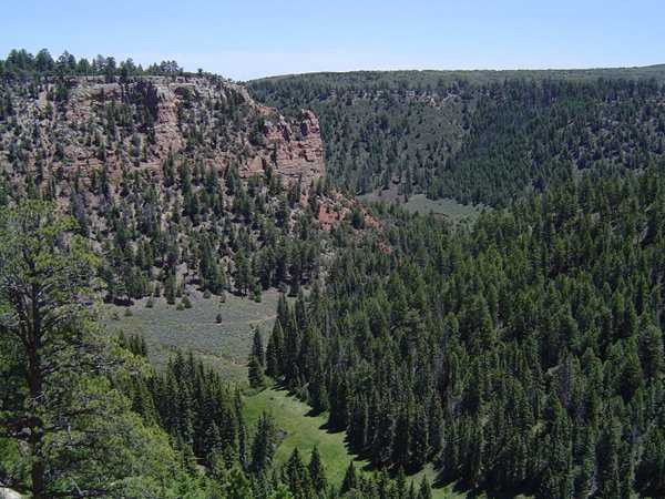
The Wild and Scenic Rivers Act was passed in 1968 to preserve selected rivers or sections in their free-flowing condition in order to protect “the water quality of such rivers and to fulfill other vital national conservation purposes.” To be eligible under the Wild and Scenic Rivers Act, a river or stream segment must possess one or more “outstandingly remarkable values,” have sufficient water quality to support those values, and be “free-flowing.” The BLM evaluated 174 river and stream segments and found 35 to be eligible.

The draft report identifies five segments of the San Miguel River (approximately 55 miles), two segments of the Dolores River (approximately 20 miles), and two segments of the Gunnison River (approximately 18 miles) as eligible. Eligibility review does not take into account potentially conflicting uses or the manageability of a river segment, which will be addressed in the upcoming suitability phase.

At this stage, the BLM is specifically looking for information regarding free-flowing condition and outstandingly remarkable values, including vegetation, wildlife, cultural, recreation, hydrologic, geologic, and scenic. Public comments on the draft report will be accepted through Feb. 26. The report is available at http://www.blm.gov/co/st/en/fo/ufo/uncompahgre_rmp.html.

Comments can be emailed to uformp@blm.gov or mailed to the Uncompahgre Field Office, Attn: RMP Revision, 2645 S. Townsend Ave., Montrose, CO 81401.

“Once the eligibility study has been finalized, we’ll be working with stakeholders to look at each eligible segment to determine whether or not it is suitable for Wild and Scenic River consideration,” said Uncompahgre Field Manager Barb Sharrow. “Public involvement in this process is essential.”

The suitability study will be included in the Resource Management Plan revision, which will analyze a range of possible recommendations. The BLM may or may not actively recommend suitable segments for Wild and Scenic River designation, based on input from stakeholders and the public.

River segments determined to be eligible are afforded interim protective management by the BLM until a suitability study is completed. The Resource Management Plan revision and suitability analysis is scheduled to be completed in 2013.

The Cache La Poudre River is currently the only river in Colorado with segments included in the Wild and Scenic River system. For more information on Wild and Scenic Rivers, visit http://www.nps.gov/rivers/.

More Wild and Scenic coverage here.

Wild and Scenic designation for parts of the San Miguel, Dolores and Gunnison rivers?

A picture named doloresrivercanyon.jpg

From the Telluride Daily Planet (Katie Klingsporn):

The Bureau of Land Management (BLM) just released a draft Wild and Scenic Eligibility Report — one of the first steps in achieving the designation — that identifies segments of the San Miguel and its tributaries, the Dolores and the Gunnison rivers for Wild and Scenic status. “The idea is to safeguard the value of the rivers,” said Erin Curtis, public information officer for the BLM. The BLM’s Uncompahgre Field Office is currently seeking public comment on the draft report, which can be found at http://www.blm.gov/co/st/en/fo/ufo/uncompahgre_rmp.html.

The document is basically a 155-page inventory that describes some 35 segments that may be eligible in terms of value of geography, ownership, wildlife, recreation and more. It identifies roughly 55 miles of the main stem of the San Miguel River — stretches that runs roughly from Deep Creek to the confluence with the Dolores River. It also identifies pieces of several of the San Miguel’s tributaries: Beaver Creek, Fall Creek, Dry Creek, Naturita Creek, Saltado Creek and Tabeguache Creek. In addition, it identifies approximately 20 miles of the Dolores River, including segments where “the scenic value created by the river flowing within the canyon is rare in the region of comparison.” These rivers were plucked from some 174 segments that the BLM inventoried — and were chosen for their beauty or history, their geology, paleontology or hydrology.

But in the end, in order to achieve this designation, a river or stream segment much be determined as both “eligible” and “suitable” — qualifications that each come with their own review process. Right now, these segments are in the eligible stage, during which land managers work to determine if the river or stream segments possess one or more “outstanding remarkable value.” These could range anywhere from having fantastic wildlife activity to great recreation, holding significant historic value to just being really darn scenic…

The BLM will be accepting comments on the Draft Eligibility Study until Feb. 26. Comments can be emailed to uformp@blm.gov or mailed to the Uncompahgre Field Office, Attn: RMP Revision, 2645 S. Townsend Ave., Montrose, CO 81401.

More Wild and Scenic coverage here and here.

San Miguel County commissioners meet to discuss San Miguel River instream flows

A picture named sanmiguelriver1109

From The Norwood News (Ellen Metrick):

San Miguel County Commissioners met in Norwood last week to decide what kind of letter to send to the Colorado Water Conservation Board, asking for a delay in filing for instream flow appropriations on the San Miguel River. The water would be set aside to meet habitat requirements for threatened native fish species — flannelmouth sucker, bluehead sucker, and roundtail chub — and to preserve a section of the San Miguel River ecosystem…

Originally, San Miguel County commissioners had been looking at two potential actions: To support CWCB’s declaration go to water court in January 2010, but have December as the actual appropriation date; or, to ask CWCB to wait until March to declare, which would mean the hearing process would begin in July, giving public the first half of 2010 to assess needs and file for appropriations. The January 2011 appropriation filing date was added to the options after the meeting began. Mark Uppendahl, DOW In-Stream Flow Program coordinator, stated that the “DOW is in a conservation management plan to prevent these species from federal listing … 11cfs provides minimal depths and the fish may not migrate or survive.”[…]

Uppendahl said that if the threatened species are not protected, there could be federal intervention. He said, “It would be hard to say what would happen then.” Uppendahl listed possibilities that ranged from water curtailment to preservation of the entire hydrology system, and possible curtailment of future diversion projects.

Approximately 70 people attended the meeting, including Montrose County Commissioners David White and Ron Henderson, State Senator Bruce Whitehead (D-Hesperus), Southwest Water Conservation Board members, Sheep Mountain Alliance representatives, and TelSki CEO Dave Riley. In the end, SMC commissioners voted two to one to ask CWCB to hold off until December 2011. Commissioner Joan May wanted to ask them to file mid-year 2010. After voting, Commissioner Fischer said, “But, we have to see progress, not just lip service to a process that never really happens.”

More San Miguel Watershed coverage here and here.

Norwood: CWCB instream flow meeting recap

A picture named sanmiguelriver1109

From The Norwood Post (Ellen Metrick):

Currently, the stream segments being considered for instream flow protection are Red Canyon Creek, North Fork Tabeguache Creek, San Miguel River, and Tabeguache Creek, as well as Alpine Gulch, Big Dominguez Creek, Blue Creek, Cebolla Creek, Cochetopa Creek, East Beaver Creek, Little Dominguez Creek, Spring Creek, and Willow Creek. “This segment of the San Miguel River has been identified as being an outstanding population of three fish that are species of concern,” said Mark Uppendahl of the State DOW office. According to the draft stakeholder recommendations (available online at http://www.cwcb.state.co.us, 2010 instream flow appropriations (proposed)), “The lower San Miguel River is known to provide habitat for globally imperiled riparian communities and other important riparian communities, because of the free-flowing hydrology of the river.” These communities include New Mexico Privet riparian shrubland and Skunkbrush riparian shrubland, Narrowleaf Cottonwood Communities and Fremont Cottonwood communities.

One thing that is certain, “A lot of water is lost in spring run-off,” said Goodtimes. “We need storage.” It is also true that in a dry year, there’s no water for anyone. Biologists say the fish can survive a year or two before they need water in order to repopulate and get strong again. Most of the flow in the San Miguel River (240,000 acre-feet per year, according to CWCB Web site) does come from snowmelt. Because of its relatively low, human population density and lack of large, water storage impoundments, the San Miguel Basin is considered to be one of the few ecologically and hydrologically intact river basins in Colorado. Goodtimes proposed to the Lone Cone and Gurley ditch users that they and the County band together. “Maybe we can get a grant from Southwest Water Commission to quantify and identify selected off-stem small sites for storage,” he said. “I wanna see if we can get our groups together and try and figure out a way to ask jointly.”[…]

CWCB had planned to file an application for these instream flows in January 2010, but Goodtimes said, “There was discussion about delaying that date of filing / appropriation to December 2010 to let people have a year to really look into it.” The streams mentioned in the proposed appropriations were presented by the recommending entities at the annual Instream Flow Workshop on Feb. 24, 2009.

More instream flow coverage here.

Telluride: USFS extends Bear Creek avalanche mapping permit

A picture named bearcreektelluride.jpg

From The Telluride Daily Planet (Matthew Beaudin):

Starting Nov. 16 and running through ski season, the Upper Bear Creek area will be closed to all travelers from 6 to 10 a.m. Ski Patrollers will not control the drainage but study it, sometimes using explosives. “It’s just a matter of mapping everything,” Telski COE Dave Riley said. Crews will also dig pits in hopes of better understanding a snowpack that’s as fussy as a 2-year-old…

Telski’s current permit was set to expire on Dec. 31. The new permit allows the ski area to continue mapping Upper Bear Creek’s dangers through the ski season. “Reissuing the permit for the upcoming winter will allow Telski to collect a full season’s worth of information and complete the snow study in Bear Creek,” Shutza said.

More San Miguel watershed coverage here.

Telluride and Idarado settle lawsuit

A picture named bridalveilfallstelluride.jpg

From the Telluride Daily Planet (Katie Klingsporn):

The litigation revolved around a plan the town has been pursuing for years — securing an ample source of water for its residents by tapping Blue Lake, a body of very pure water that sits in the rocky alpine basin above Bridal Veil Falls. The town’s plan entails piping the water down to a treatment plant above the Pandora Mill, and then dispersing it. The town set out to complete the project years ago — doing engineering, winning voter approval for a $10 million bond, and securing a piece of land (gifted by Idarado) for the treatment plant. But as the town was obtaining an array of deeds and easements necessary for construction, access and water rights, it stumbled over language in a 1992 settlement agreement with Idarado that would give the mining company the right to recall not only water rights, but also proportionate ownership in water storage and conveyance structures. When Idarado refused to omit the language, the town sued, claiming the mining company breached the contract and cost the town money by delaying its project. And Idarado replied with a countersuit, answering that it only wanted its rights protected.

A trial took place in January in Montrose. The mixed ruling that followed the trial awarded both sides some of what they fought for. For Telluride, there was good news: The town retained enough rights to move forward with the long-awaited implementation of its new water system and treatment plant. And for the mining company, the ruling meant it was able to hold onto some of the property and water rights it sought. Also: The judge ruled that when the town went on to Idarado property to do construction on a road, its actions constituted a taking (hence, last week’s settlement). But for the town, the bottom line is that: now it can continue pursuing its plans for a water system on the east end of the valley.

More San Miguel watershed coverage here.

Precipitation news: Telluride area is missing the monsoon season

A picture named lightning.jpg

From the Telluride Daily Planet (Katie Klingsporn):

This summer, though, there has been a noticeable absence of the afternoon storms. Monday — when people pulled out rain jackets and umbrellas to hide from the cold sheet of rain — was only the sixth day of rain in the month, according to a local weather reporter. And according to his tallies, the precipitation for the month is running nearly 2 inches behind average. “We’re way below average for the month,” said Thom Carnevale, who measures Telluride’s precipitation near San Juan Village. “This has been one of the driest Augusts we’ve had in the past several years.” As of Monday morning, Carnevale had recorded 91/100th of an inch of precipitation for the month, with rain falling on Aug. 5-6, 14, and 22-24. The average rainfall for June, he said, is 2.92 inches.

And this is only the second half of the story of strange summer weather. Chapter one happened in June, when what is typically one of the driest months of the year turned into one of the wetter ones. June — usually the month of sun-worshipping days — was cold and drippy this year. While the average precipitation in June is 1.22 inches, Carnevale said, this year June brought 2.59 inches — more than double the average…

For western Colorado, the southwest monsoon pattern generally begins around the second week of July, and can last into September. This year, though, Lawrence said that a consistent trough has hung over the east, while a ridge has sat over the west, “which has kept us high and dry and them wet and cold. It’s just kept us from getting a real monsoon season.”

San Miguel watershed: BLM seeking public comment on commercial use

A picture named sanmiguelriver.jpg

From the Montrose Daily Press:

The Bureau of Land Management Uncompahgre Field Office is seeking public comment on a proposal to issue new Special Recreation Permits for BLM managed lands in the San Miguel River corridor. Potential permitted activities would include whitewater boating, float-fishing, walk/wade fishing, and mountain biking.

A temporary moratorium limiting commercial recreation to existing outfitters and use levels was placed on the San Miguel several years ago, pending an environmental analysis to determine if new commercial use is appropriate. Since then, BLM has developed additional recreation facilities in the corridor improving access and environmental conditions. In addition, M59 road, which parallels the river in its upper reaches, has been closed to motorized use. Partially in response to these management changes, BLM has lifted the permit moratorium and is performing an environmental analysis on the effects of additional commercial permits.

The analysis includes BLM lands associated with the river from its upper end at Deep Creek (near Telluride) downriver to its confluence with the Dolores River. Comments must be submitted no later than Aug. 3.

More Coyote Gulch coverage here and here.

CWCB: Instream flow water rights

A picture named sanmiguelriver.jpg

Here’s a recap of this week’s meeting of the Colorado Water Conservation Board Stream and Lake Section this week in Montrose, from Mallory George writing for the Montrose Daily Press. From the article:

“We are here to balance human needs with some reasonable preservation of the natural environment,” said Jeff Baessler, the deputy section chief at CWCB. He cited the Tragedy of the Commons, in which everyone has free use of resources and eventually exhaust those resources because of lack of regulation, as the need for water appropriations…

After groups such as the Bureau of Land Management, a homeowners association and the U.S. Forest Service recommended 54 streams and rivers to be protected this year, the CWCB began conducting tests to ensure that a natural environment exists, which is typically, but not always, marked by fishery. Baessler said the CWCB also makes sure that the natural environment in question will be preserved by the water available for appropriation. Not all of the water in streams is recommended to be a part of the instream flow program, just enough to preserve the environment. The water is then unavailable for consumptive use. The final statutory requirement the board must meet before finalizing an appropriation is to ensure that the new appropriation will not conflict with an existing water right.

Hydrologists are currently conducting water availability tests, while other Stream and Lake Protection staff members are meeting with local governments and communities to address concerns. In January, the Stream and Lake Protection Section will present recommendations to the CWCB, which will then declare intent for the appropriations. Baessler discussed the Division 4 recommendations, which include those in Montrose, Gunnison, Hinsdale and Delta counties. Big Dominguez Creek, Little Dominguez Creek, an increase to the Blue Creek instream flow, South Willow Creek, Alpine Creek, Spring Creek, two sections of Cebolla Creek, Red Canyon Creek, the San Miguel River, three segments of Tabeguache Creek, North Fork Tabeguache Creek, two sections of Cochetopa Creek and East Beaver Creek were recommended to the department. The San Miguel River section — from Calamity Draw to the Dolores River — which holds several sensitive species of fish, prompted confusion when it was initially recommended in February 2008 because people were concerned there would not be enough water available for consumption…

In the Uravan area, many of the water rights belong to Umetco Minerals Co., which operates a uranium mill. The company is in the process of remediating and closing down its operations and is estimated to finish by the end of this year. In anticipation of that, and for the CWCB to receive those water rights, a study was conducted by the Stream and Lake Section, the Southwester Water Conservation District and Harris Water Engineering, Inc., that resulted in several recommendations for the area. “We tried to create a package of the best water rights for local entities and the state as well,” said Dan Merriman of Harris Water Engineering. The study recommended that two Tabeguache wells and a Uravan well be given to Montrose for its use. Three other wells and the San Miguel Power Company Canal water rights would be abandoned; that is, they would be relinquished to the stream, but not be protected instream flows. Johnson Ditch water rights would shift to local government entities such as Nucla, Naturita and Montrose Country to meet existing and future needs, Merriman said. Until Umetco is out of the area, however, these recommendations cannot be carried out.

More Coyote Gulch coverage here and here.

Telluride: New water main progressing

A picture named telluride.jpg

From the Telluride Watch: “Proving that there is at least one upside to the current economic crisis, the Town of Telluride is in the process of signing a $429,095 contract with Telluride Gravel to complete the first of two construction phases that will replace the corroded and rupture-prone water main that lies below Colorado Avenue, according to Town Manager Frank Bell. The amount, proposed to the town by the company during a sealed bidding process, will pay for replacement of the line between Aspen and Willow streets and is about half of the $900,000 the phase was expected to cost when the project was originally engineered during much better economic times.”

Telluride scores water rights in lawsuit with Idarado

A picture named bridalveilfallstelluride.jpg

Here’s a recap of District Court Judge James W. Schrum’s decision in the lawsuit between the town of Telluride and Idarado Mining Company, from Karen James writing for the Telluride Watch. From the article:

“We are extremely pleased that we were able to secure the water we need to have,” said Mayor Stu Fraser. “If there was one thing we needed to win it was the water.”[…]

But while the town prevailed on what officials here considered the most important element of the case, it did not win the damages it sought to compensate for higher construction costs resulting from delaying the project while the lawsuit ensued. Instead the Schrum awarded Idarado certain trial costs and damages that the town will be obligated to pay. Neither party was awarded the attorney fees each sought…

The damages the town owes are related to a countersuit filed by Idarado in which it alleged that after authorizing the town to enter its property to replace portions of the pipeline from Blue Lake, the town undertook some unauthorized work and damaged the property in the process. The court awarded Idarado only a portion of the damages it sought, however, and a jury will determine the amount of that award. Geiger declined to speculate on how much it might be stating a desire to not prejudice the potential jury pool.

The genesis of the lawsuit dates to the late 1980s when the town discovered that the Town Park water supply it sought to develop for municipal use had been contaminated with hexavalent chromium by Idarado’s mining operations. In 1992 the parties began discussing the provision of water rights in Bridal Veil Basin to the town by Idarado because of the contamination. Eventually they agreed upon a settlement in which the town would receive water from Blue Lake; however, Idarado retained certain “callback” water rights. The thrust of the lawsuit, heard in Montrose for two weeks beginning on Jan. 5, centered on the extent of those callback rights, and whether or not the mining company also had an interest in the structures and treatment plant that the town planned to build. Idarado maintained that it had an interest in those structures, while the town maintained that it did not. The court sided with Idarado…

Although the voters authorized the financing needed to pay for the project by means of a $10 million bond approved in 2005, the town did not break ground on the project because it worried that Idarado could take back the water rights and leave the town with a treatment plant but nothing to treat, according to Town Manager Frank Bell. Although Idarado has 45 days from the date of the decision to file an appeal, “Our immediate strategy is to move ahead and build the water plant,” said Bell

More Coyote Gulch coverage here.