Nine Projects Receive $1.29 Million from Reclamation for Title XVI Water Reclamation and Reuse Feasibility Studies

Wastewater Treatment Process

Here’s the release from the Bureau of Reclamation (Peter Soeth):

Bureau of Reclamation Acting Commissioner Lowell Pimley announced that Reclamation will provide $1.29 million to nine projects for Title XVI Water Reclamation and Reuse Feasibility Studies. These nine projects are located in California, Colorado, New Mexico and Texas.
“Planning and preparation are essential for communities looking to meet their growing water needs,” Pimley said. “This funding will help communities gather critical information in assessing whether these water recycling and reuse projects can meet their future water needs.”

The first funding group will receive up to $150,000 and studies must be completed within 18 months. The six selected projects in this group are:

  • Pitkin County Clean Water Effluent Re-Use Feasibility Study, Pitkin County (Colorado), $149,500 [ed. emphasis mine]
  • Providing for Santa Fe Basin’s Future Water Supply Needs: A Feasibility Study to Optimize the use of Regional Reclaimed Wastewater, City of Santa Fe (New Mexico), $132,000
  • Port Isabel Water Reclamation Facility, Laguna Madre Water District (Texas), $150,000
  • Feasibility Study of Augmenting Regional Water Supply System for Tarrant Regional Water District and Wichita Falls with Impaired Groundwater Supplies, Tarrant Regional Water District (Texas), $150,000
  • Feasibility Study of Industrial Water Management and Reclamation for the Permian Basin, Gulf Coast Waste Disposal Authority (Texas), $150,000
  • Collection, Storage, Recharge and Recovery of Conserved Source Waters for Advanced Purified Treatment of Reclaimed Water, El Paso Water Utilities-Public Service Board (Texas), $150,000
  • The second funding group will receive up to $450,000 (up to $150,000 per year) and studies must be completed within 36 months. The three selected projects in this group are:

  • San Juan Groundwater Basin Recharge, Reclamation and Reuse Feasibility Study, Santa Margarita Water District (California), $225,000
  • Indirect Potable Reuse Project Feasibility Study, Eastern Municipal Water District (California), $450,000
  • The Integrated Water and Power Project: A Drought-Proof Water Supply for Texas, Guadalupe Blanco River Authority (Texas), $450,000
  • Applicants must provide at least 50 percent non-federal cost-shared funding for the feasibility study. To view a complete description of all the projects, please visit: http://www.usbr.gov/WaterSMART/title.

    The Title XVI Water Reclamation and Reuse Program focuses on identifying and investigating opportunities to reclaim and reuse wastewater and naturally impaired ground and surface water in the 17 Western states and Hawaii. It has the potential to provide communities with a new source of clean water while promoting water and energy efficiency and environmental stewardship. Through Title XVI projects, Reclamation has conserved nearly 390,000 acre-feet of water in 2013 – enough to supply 1.5 million people with water for one year.

    WaterSMART is the U.S. Department of the Interior’s sustainable water initiative that uses the best available science to improve water conservation and help water resource managers identify strategies to narrow the gap between supply and demand. Since its establishment in 2010, WaterSMART has provided about $200 million in competitively awarded funding to non-federal partners, including tribes, water districts, municipalities and universities through WaterSMART Grants and the Title XVI Program. Learn more at http://www.usbr.gov/WaterSMART.

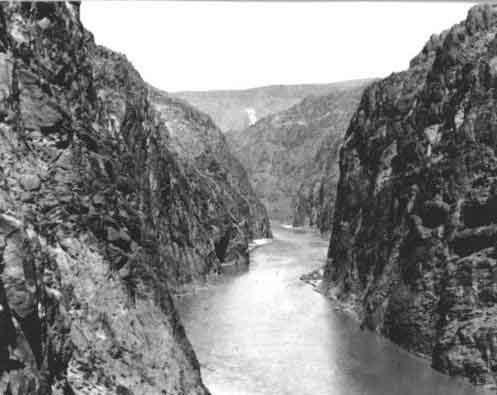
    More infrastructure coverage here.

    Take a boat tour on the first National Water Trail in the Southwest — Black Canyon Water Trail #ColoradoRiver

    Colorado River, Black Canyon back in the day, site of Hoover Dam
    Colorado River, Black Canyon back in the day, site of Hoover Dam

    From the Las Vegas Review-Journal (Henry Brean):

    The Black Canyon Water Trail, as it is now known, takes in a 30-mile stretch of the Colorado from the downstream side of Hoover Dam to the mouth of Eldorado Canyon, south of Boulder City.

    It is the first such designation of a boating trail in the Southwest and the first to traverse a desert.

    In announcing the designation Tuesday, Jewell said the scenic route through Black Canyon joins “a distinctive national network of exemplary water trails” that have won recognition since 2012 as part of a federal initiative to encourage tourism and stewardship.

    The stretch of river is already managed by the National Park Service as part of Lake Mead National Recreation Area.

    More Colorado River Basin coverage here.

    Jackson Gulch Reservoir: “The bureau used to be a friend. Not anymore.” — Dee Graf

    Jackson Gulch Dam photo via USBR
    Jackson Gulch Dam photo via USBR

    From The Mancos Times (Mary Shinn):

    The Mancos Water Conservancy District board on Thursday weighed the consequences of taking ownership of Jackson Gulch Reservoir, the dam, the canal system and the land it sits on from the federal government.

    If the district worked with the Bureau of Reclamation to take ownership, the district would have to take over all the contracting and inspections…

    The Bureau of Reclamation currently budgets $160,000 a year to manage the irrigation project, and and $150,000 a year for recreational use of the lake.

    Kennedy estimates that if the district did all the work the bureau does for irrigation and water management, it would cost $20,000 to $40,000 because the district wouldn’t have as much administrative overhead. The district doesn’t plan to cover any of Mancos’ state parks expenses if the board pursues the transfer of ownership.

    A major question the board members tried to address at the Thursday workshop was: What value does the Bureau of Reclamation add to the project?

    They determined it isn’t a reliable source of funding…

    If the district took ownership of the project, it would still be subject to some state inspections for dam safety.

    Currently, the Bureau of Reclamation does regular inspections, but the district is responsible for maintenance or replacement. For example, the district paid $3 million for the recent rehabilitation project.

    There is one exception to the maintenance rule. The Bureau of Reclamation would step in if the dam started to experience a failure. But the agency would also send the district a bill for half the cost, and it would be due in three years…

    At an initial meeting about the transfer with James Hess, a bureau representative from Washington, Hess said the transfer process can take years.

    Only 27 other water projects in the nation have been fully transferred from the federal government to a local organization.

    More Jackson Gulch Reservoir coverage here.

    COGCC halts activity at injection well; seeks additional review

    Deep injection well
    Deep injection well

    Here’s the release from the Colorado Oil and Gas Conservation Commission (Todd Hartman/Matt Lepore):

    The Colorado Oil and Gas Conservation Commission this week directed High Sierra Water Services to stop disposing wastewater into one of its Weld County injection wells.

    The company agreed to a 20-day halt to wastewater injection as a cautionary step the COGCC believes necessary to gather and further analyze more information to determine whether injection at the site is tied to recent seismic activity recorded within the general vicinity of the well.

    Ongoing monitoring by a team of University of Colorado seismologists has picked up additional evidence of low-level seismic activity near the injection site, including a 2.6-magnitude event Monday afternoon. The additional data comes after a 3.4 magnitude earthquake shook the Greeley area May 31.

    “In light of the findings of CU’s team, we think it’s important we review additional data, bring in additional expertise and closely review the history of injection at this site in order to more fully understand any potential link to seismicity and use of this disposal well,” said COGCC director Matt Lepore.

    The COGCC will undertake several actions over the shutdown period to include: evaluation of baseline, historical seismic activity; continued coordination with the CU team; coordination with the U.S. Geological Survey and Colorado Geological Survey; evaluation of other disposal wells in the area; and a detailed review of data associated with the well in question, including further examination of injection rates, pressures and volumes.

    The company immediately agreed to COGCC’s request, and shut the well down on Monday.

    From The Greeley Tribune:

    Noble Energy continued on Monday to clean up the oil spill it located Friday along the Poudre River near Windsor, according to a news release from the Colorado Department of Natural Resources.

    Noble began to dismantle a damaged tank battery Monday in preparation for soil removal, according to the release, after about 173 barrels — or about 7,500 gallons — of crude oil were found to have spilled from the tank while the Poudre River was flooding.

    On Saturday, Noble established site security, repaired the access road and had a crew of approximately 30 people using absorbent pads to clean up visible residual oil, according to the release. Soil samples were collected along the path of the release and submitted for laboratory analysis, according to the release, and the results of that analysis are still pending.

    Visual observations by Noble along the flow path indicated the oil did not seep deep into the soil, so removal of the soil was ruled out as the main way to clean up the spill, according to the release.

    Instead, a product known as Petro Green was applied to help enhance the degradation of any remaining hydrocarbons, according to the release.

    Noble also had a consultant perform a biological study on the area, according to the release, and it was determined no wildlife were impacted by the spill.

    Drought news #COdrought

    Click on a thumbnail graphic to view a gallery of drought data from the US Drought Monitor. Click here to go to the US Drought Monitor website. Here’s an excerpt:

    Summary

    For the second consecutive week, moderate to heavy rainfall brought additional drought relief from the Midwest southward across the central Plains into Texas. Meanwhile, drought conditions prevailed from California into the central and southern Rockies.

    Central Plains

    Conditions remained largely unchanged on the central High Plains during the monitoring period, as hot weather (readings as high as 100°F) offset the light to moderate showers (0.1 to 1 inch) which dotted western portions of the region. A small expansion of Extreme Drought (D3) in southwestern Kansas reflected increasingly poor vegetation health as indicated by satellite, with potential for additional degradations in this area if rain fails to materialize soon. Farther east, however, locally heavy downpours — with totals averaging 2 to locally more than 4 inches — resulted in some removal of Moderate (D1) and Severe (D2) Drought in central and southwestern Nebraska. In these areas, precipitation over the past 30 days has averaged 150 to 260 percent of normal. In Kansas, showers were mostly too light to warrant any additional improvement on top of last week’s drought reduction, though locally heavy downpours (2 to 4 inches) allowed for minor decrease of Extreme Drought (D3) in southern portions of the state.

    Midwest

    Moderate to heavy rainfall further reduced or eradicated drought but submerged low-lying fields and caused additional river flooding in western and central portions of the region. Persistent showers and thunderstorms doused areas from central Nebraska into Iowa and northern Illinois with 2 to 4 inches of rainfall, with locally higher amounts. The rain was more than sufficient to warrant additional 1-category improvements over the western half of the Corn Belt. Despite the additional heavy downpours, long-term precipitation deficits linger (less than 70 percent of normal over the past 12 months) in west-central and southeastern Iowa; consequently, a small area of Moderate Drought (with a Long Term, or “L”, designation) remained where shortfalls are most pronounced. In contrast, short-term dryness (90-day rainfall averaging 50 to 70 percent of normal) led to a small increase of Abnormal Dryness (D0) in southeastern South Dakota.

    Southern Plains and Texas

    Despite temperatures in the 90s, rainfall during the week was sufficient to warrant modest to significant reductions in drought from northern and central Oklahoma southward into Texas. Showers and thunderstorms dropped 2 to locally more than 4 inches of rain from the eastern Oklahoma panhandle southeastward into central Oklahoma and east-central Texas. In particular, there were numerous reports of more than 3 inches west of Oklahoma City, and several totals in excess of 7 inches southwest of Dallas-Fort Worth. Consequently, drought intensity declined in areas where the heaviest rain fell, although long-term impacts continue (i.e. reservoir storage and ground water supplies). Farther south, a slow-moving disturbance drifted north from northeastern Mexico along the Rio Grande River Valley, dropping moderate to excessive rainfall (2 to 5 inches, with localized amounts in excess of 8 inches) from Laredo to the western Edwards Plateau. Likewise, a separate area of showers and thunderstorms (1 to 3 inches) swept across Texas’ Trans-Pecos region later in the week. These two areas of rain resulted in notable decreases in drought intensity and coverage across southern and western Texas.

    Western U.S.

    Variable conditions in the north contrasted with ongoing drought elsewhere. In addition, the return of hot weather in California and the Southwest accelerated moisture losses and increased irrigation requirements.

    In northern portions of the region, a slow-moving Pacific storm generated locally heavy rain and mountain snow across the northern Rockies, with showers from this system (locally more than inch) spilling into northeastern drought areas of Washington. Consequently, modest reductions were made to drought intensity and coverage in the mountains and foothills of northeast Washington, where Water Year precipitation was mostly near normal (80-95 percent of normal). Appreciable rainfall bypassed southwestern portions of Columbia River Valley, where Moderate (D1) and Severe (D2) Drought were expanded to reflect poor crop conditions and much-below-normal Water Year precipitation (40-50 percent of normal). To further illustrate the drought’s impacts, the USDA-NASS reported Washington’s winter wheat slipped 1 percentage point to 27 percent poor to very poor as of June 22, with only 30 percent rated good to excellent.

    Farther south, California and the Great Basin will most likely have to wait until the 2014-15 Water Year for drought relief. In northern and central California, Exceptional Drought (D4) reflected abysmal 2013-14 Water Year precipitation totals; from northern portions of the Coastal Range to Mt. Shasta, precipitation since October 1 totaled 30 to 50 percent of normal (deficits of 16 to 32 inches). The corresponding Standardized Precipitation Indices (SPI), which helps quantify precipitation in terms of drought and historical probability, are well into the Extreme (D3) to Exceptional (D4) categories. Similar precipitation rankings (D3 or D4 equivalent) are prominent for the past Water Year from San Francisco south to Santa Barbara and east to the Sierra Nevada, including most of the San Joaquin Valley.

    In the central Rockies and Four Corners, there were no changes to this week’s drought depiction. Extreme Drought (D3) remains entrenched across west-central Arizona and along the Arizona-New Mexico border, with Water-Year precipitation in these locales totaling less than half of normal (locally below 30 percent of normal).

    Looking Ahead

    Warm, humid, and unsettled conditions will persist from the central and southern Plains to the Mid-Atlantic and Southeast Coast. Embedded within this large area of unsettled weather, the greatest potential for heavy rain will be over the Upper Midwest and northern Plains as well as the central and western Gulf Coast region. Showers are also expected across the Northwest — though the rain is expected to once again bypass primary Northwestern drought areas — and in the Northeast. The NWS 6-10 day outlook for July 1-5 calls for wetter-than-normal conditions east of the Mississippi and from the Four Corners into the central Plains as well as southern Texas. Conversely, drier-than-normal weather is expected from the Northwest east to the northern Plains. Above-normal temperatures are anticipated across much of the nation, with cooler-than-normal conditions confined to the Upper Midwest, Texas, and the coastal Pacific Northwest.